EPA Briefing March 2012 Enforcement Briefing. Gowanus Canal Superfund Site Brooklyn, NY
|
|
|
- Anabel Howard
- 5 years ago
- Views:
Transcription

1 EPA Briefing March 2012 Enforcement Briefing Gowanus Canal Superfund Site Brooklyn, NY
2 Overview: Site-specific geology and hydraulic conditions before and after the Canal was built which exacerbate contamination impacts Past and continuing sources to the Canal Infrastructure changes that have altered disposal pathways EPA s PRP search and Enforcement Actions to date Other conditions affecting the need for a cleanup Public outreach and stakeholder interaction Projected enforcement schedule Questions
3 Environmental Conditions at Canal affected by: Original geology and hydrology of the Gowanus Creek altered by development into artificial waterway followed by historic industrial use typically involving direct disposal into Canal and indirect disposal onto uplands and through sewers in volumes reduced over time by less industry, more regulation and improved infrastructure (e.g., POTWs) But Canal is still impacted by historic and continuing contamination.

4 Original condition: Tidal estuary wetlands atop deep central strata of glacial sands

5 First change: After Dutch purchase from Chief Gowane of the Canarsee/Lenape tribe, three ponds and mills were built beginning in 1645.

6 Second change: After Erie Canal grain imports make mills obsolete, NYS Legislature in 1849 authorizes canal to promote Brooklyn commerce by public and private development. 1.5 miles long, miles of side basins.

7 Timber crib bulkheads were built, then grade was raised from marsh level with fill, including dredge spoils, garbage and cinders.

8 A section of exposed timber crib bulkhead. Upland disposal and groundwater discharges can migrate through and beneath bulkheads to the Canal.

9 5th Street Basin before 1901, looking from 4th Ave. towards 3rd Ave. Bridge and Canal.

10 Same 5th Street Basin, (Reverse view looking towards 4th Ave.)
 mean more facilities were once directly on or nearer to")
11 Filled-in basins at 1 st, 5 th and 7 th Streets (hatched blue areas) mean more facilities were once directly on or nearer to Canal.

12 Gowanus Canal Sediment Layers Native Sediment Soft Sediment Surface Sediment (top 6 inches of soft sediment)


13 Era of Heavy Industry and Uncontrolled Discharges


14 A variety of upland sources existed
15 Examples of facilities which may have discharged to the Canal include: paint and ink factories chemical plants asphalt and roofing plants manufactured gas plants (MGPs) fuel terminals coal yards, including for power stations ship yards and dry docks plating, metal working and machine shops fleet vehicle service shops peak shipping 1920 s 25,000 vessels/yr

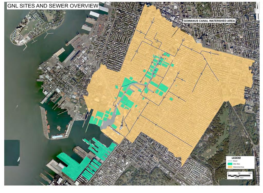
16 EPA s 2010 RI found 231 non-cso outfalls,

17 EPA found few discharges from non-cso outfalls. Most date from era of uncontrolled direct discharge.
18 History of Infrastructure 1860 Brooklyn one of first US cities with comprehensive (but untreated) sewer system. Original Canal designs for avoiding sewage buildup were not 1868 plan to divert sewage lines to the East River never implemented as areas rapidly develop around Canal, sewer system is undersized. Relief sewer lines 7 sq. mile area are run to head of Canal in an attempt to increase flow. Combined sewers only exacerbated problem. Combined outfalls included: Nevins St. (78 ), Bond St. (60 ), Douglass St. (42 ), Second Ave. (78 ), Bond St. (72 ) Sanitary sewage outfalls (12-48 ) included: Sackett, President, Carroll and Ninth Streets and Hamilton Ave.
19 1906 MIT Thesis The contents of the canal are of the vilest sort. Practically all the industrial plants discharge directly into it... [Generally] the streets which terminate at the Canal have been left unsewered. The reason given is that there was not sufficient grade to drain the sewers into the mains in the streets running parallel and on either side of the canal.

20 Flushing Tunnel and Pump Station completed, originally pumping water from head of Canal to the harbor.
21 1952: Owl s Head POTW completed, serving Park Slope area. 1960: Flushing Tunnel ceases operation. 1987: Red Hook POTW completed, reducing CSO discharges from 20 MGD to current levels 300 MGY. 1999: Flushing Tunnel re-activated, now 154 MGD from NY Harbor to Canal : Upgrades to Flushing Tunnel and other CSO improvement underway by New York City.

22

23 Pursuant to NYSDEC Consent Order, NYC s current and planned CSO upgrades will reduce discharge volume by an estimated 44%.

24 CSO and Stormwater Outfalls 92% of the watershed is served by combined sewers, 2% by storm sewers, and 6% is uncaptured flow Four outfalls account for 95% of the annual CSO discharges

25 Three Manufactured Gas Plants (MGPs) operated along the Canal for many decades.

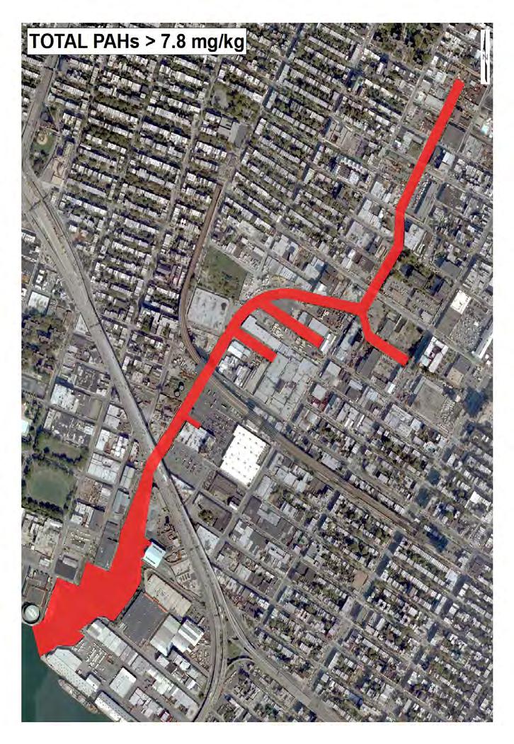
26 Citizen s Gas Work (circa 1926)

27 Coal tar upwelling often creates visible sheens

28 National Grid, successor to Brooklyn Union Gas, is remediating the Fulton, Metropolitan and Public Place MGPs under consent orders with NYSDEC.


29 Summary of Contaminant Sources Inflow from Gowanus Bay and Upper New York Bay NAPL migration, runoff, and groundwater discharge from contaminated sites Inflow from flushing tunnel Direct discharges from pipe outfalls other than CSOs or stormwater CSO discharges Atmospheric Deposition Direct discharges from historical industrial activities
30 EPA Enforcement PRP Search Status Consent Orders and Settlements to Date

31 EPA has used Sanborn fire insurance maps, sewer pre-treatment program records and other sources, including information obtained from or submitted by other parties.

32 EPA s PRP search is continuing. Please submit any information on additional possible parties.
33
34 Canal sediments contain hazardous substances, many at elevated levels, linked to PRP disposal Accumulated sediments are contaminated with a broad spectrum of co-mingled CERCLA hazardous substances, including PAHs, PCBs and metals. All of these contaminants will be addressed by the sediment remedy. PAHs and metals exceed Preliminary Remediation Goals (PRGs) in samples throughout the Canal. PCB levels in sediments throughout the Canal are above the anticipated PRG and Effects Range Median (ER-M).
35
36
37 Settlements to Date National Grid and New York City signed separate consent orders in April 2010 to assist in RI/FS process. Under these orders, National Grid and NYC have installed wells at properties associated with their facilities, performed sampling and done additional studies. EPA also issued an access UAO in 2010.
38 Chemtura Bankruptcy Settlement Chemtura Corp. (Argus Chemical Co., Witco Chemical Co., Crompton Corp.) Operated chemical facility and lab at 633 and 688 Smith Street for approximately 50 years. Filed Chapter 11 bankruptcy in EPA issued notice letter and information request. DOJ filed EPA s proof of claim. EPA entered into $3.9 million bankruptcy settlement, approved by the Court in December The settlement requires Chemtura to comply with NYSDEC orders for its Smith Street facility cleanups worth approximately $14 million.

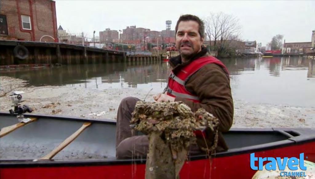
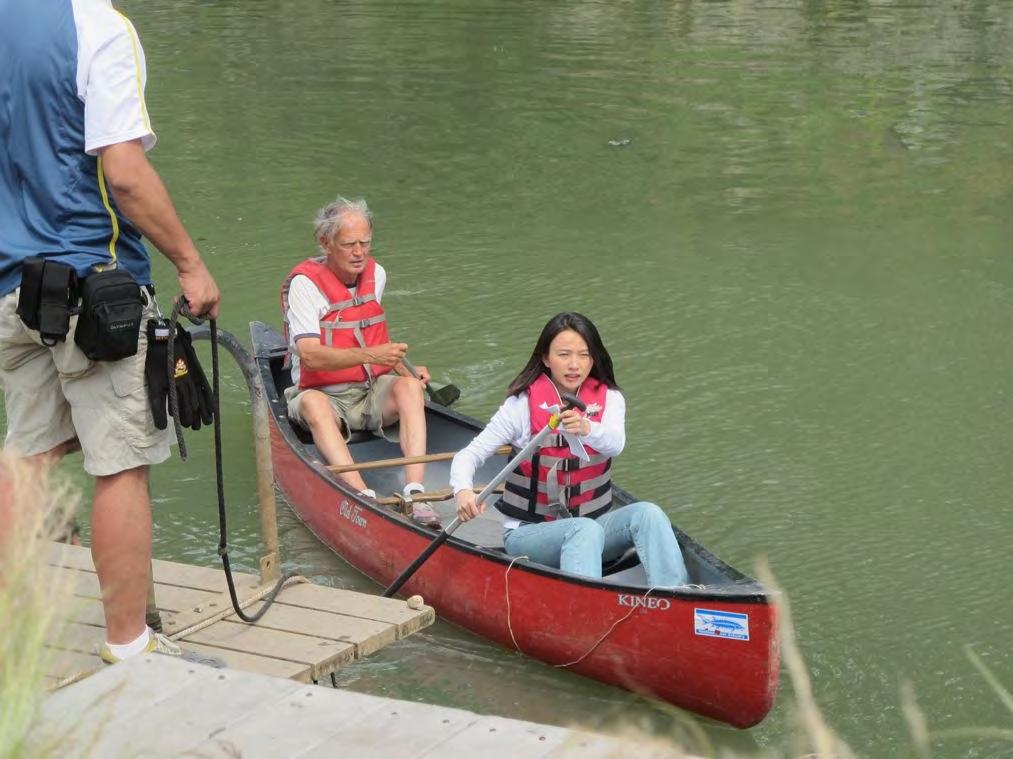
39 EPA Costs to date: approximately $10.4 million as of 1/31/2012 Cost include: Listing, enforcement, oversight and RI/FS, including contractors, laboratory analysis, payroll and indirect costs
40 Other factors affecting liability, the need for a cleanup, cleanup levels and costs Residential and commercial redevelopment and Increased recreational use, even ecotourism, despite Continued flooding and exposure risks creating other potential liabilities, such as Natural Resources Damage claims.


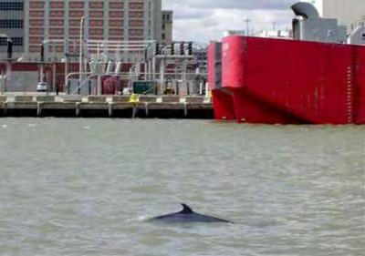
41 Ongoing re-development like these recent high-end residential condos within a block of the Canal
; broader rezoning on")
42 Canal-side residential projects planned: 3 parcels already rezoned residential (former Toll Brothers Project); broader rezoning on hold.

43 Approved Whole Foods market at 3rd Street and 3rd Ave. between 4th Street Basin and Canal

44 Gowanus Green City-supported affordable housing/mixed use project on Public Place MGP site

 and 9 th Street and")
45 Re-development planned despite flooding problems. Carroll Street (former Toll Brothers site) and 9 th Street and Canal across from Public Place.


46 Flooding extends beyond 4th Ave. (1947 and 2010). Exposure pathway for contaminated sediments.


47 Recreational uses: Boating and fishing for consumption (despite advisories)
48 Eco-tourism: Travel Channel Good Morning Japan


49 Habitat for natural resources


50 Required notice has been given to Trustees for Natural Resource Damage claims
51 Public Outreach and Stakeholder Interaction EPA s approach seeks to be as transparent and collaborative as possible in recognition of the public interest from: The Local Community Elected Officials PRP Stakeholders Business Owners and Developers Local, Regional, National and International Media EPA is proactively providing information via our webpage: our Gowanus Facebook page and a pending on-line Administrative Record.
, Technical Assistance Service for Communities (TASC) and")
52 Gowanus has the largest Superfund Community Advisory Group (CAG) in the US. EPA is providing funding for: Technical Assistance Grant (TAG), Technical Assistance Service for Communities (TASC) and Facilitation (to which National Grid has offered to contribute).
53 EPA Cleanup and Enforcement Schedules
54

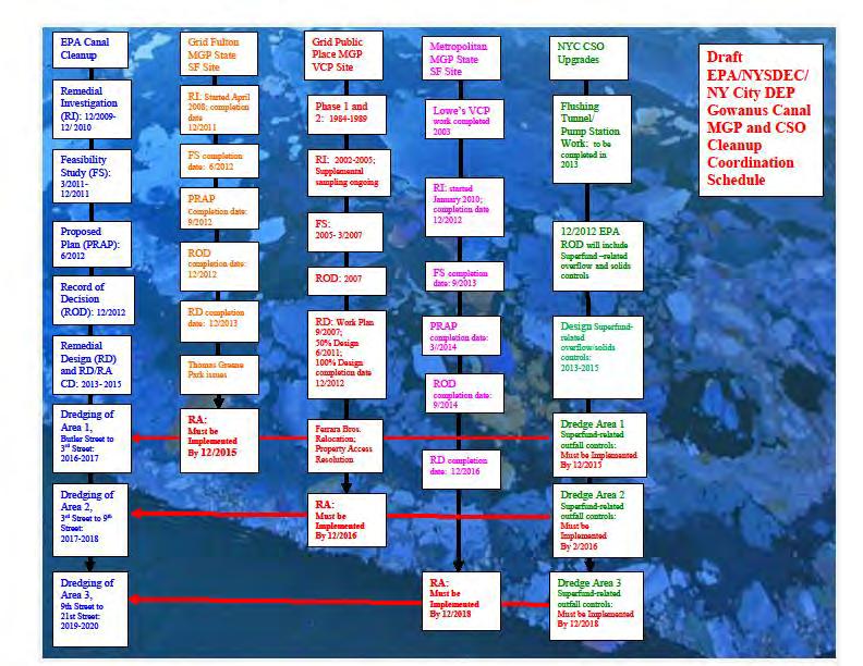
55 Remedial Investigation (RI): 12/ / 2010 Feasibility Study (FS): 3/ /2011 Proposed Plan (PRAP): 6/2012 Record of Decision (ROD): 12/2012 RI/FS AOCs April 2010 PRP Search - Ongoing PRP Briefing Invitation 1/2012 PRP Briefing 3/2012 PRN & Draft RD/RA 6/2012 Oversight 7/2012 Special Notice 1/ 2013 Gowanus Canal EPA Cleanup and Enforcement Schedule Remedial Design RD/RA Enforcement Options: RD/RA CD Amend AOCs to add RD, negotiate RA CD UAO/107 suit Dredge Area 1, Butler Street to 3 rd Street: Dredge Area 2, 3 rd Street to 9 th Street: RD/RA CD or UAO by 6/2013? RD AOC mods by 6/2013, then RA CD by 2015 Dredging of Area 3, 9th Street to 21st Street:

56 Questions?