Introduction to HEC HMS. Daene C. McKinney
|
|
|
- Ella Terry
- 5 years ago
- Views:
Transcription
1 CE 374 K Hydrology Introduction to HEC HMS Daene C. McKinney
2 Hydrologic Engineering Center U.S. Army Corps ofengineers (USACE) Hydrologic Engineering Center (HEC) Formed 1964 to institutionalize the technical expertise in hydrologic engineering L. Roy Beard founding Director (Professor Emeritus, Dept. of Civil il Engr., UT Austin) Development well known family of HEC software HEC 1 (watershed hydrology, now HEC HMS) HMS) HEC 2 (river hydraulics, now HEC RAS) HEC 3 (reservoir analysis, now HEC ResSim)
3 HEC Hydrologic Hydrologic ModelingSystem (HEC HMS) HMS) Simulation of runoff hydrographs resulting from design storms and other precipitation events Primary function quantifying rainfall losses into the soil (computing rainfall excess) converting excess rainfall to runoff routing flows Obtaining Program: p// / Data: ork/waller.zip


4 Start the Program Project Definition Screen Components: Basin Model Meteorologic Model Control Specifications


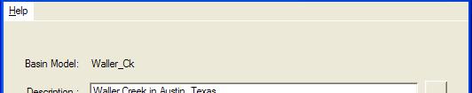
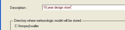
5 Import Waller Creek Model File/New Project Creates: C:\hmsproj\waller Copy: Waller_Ck.basin and Hms.map to C:\hmsproj\waller


6 Import Basin Model Component/Basin Model/Import: Import basin model file Waller_Ck.basin


7 Basin Model

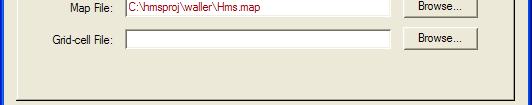
8 File/Basin Model Attributes Files tab Basin Map


9 Basin Model With Map
10 Hydrologic Elements Subbasin Outflow calculated from precipitation by subtracting losses, transforming excess precipitation and adding baseflow River Reach Inflow from other elements, Outflow computed from flow routing methods Reservoir Outflow computed tdfrom storage outflow relations lti and level water surface assumption Junction combine flows from upstream reaches and subbasins Diversion Two outlets, main and diverted Source inflow fromoutsideoutside themodeled region Sink outflow leaving the modeled region


11 Basin Model Attributes Basin Model window File/Basin Model Attributes Loss Rates rainfall losses absorbed by the ground Transform how to convert excess rainfall to direct runoff Baseflow Routing routing a hydrograph through a river reach


12 Basin Model Parameters Basin Model Screen Parameters/Loss Rate/Initial Constant Enter values initial loss constant loss rate % imperviousness
13 SCS Dimensionless Hydrograph SCS developed a parametric UH model based on averages of UHs from a large number of small agricultural watersheds in the US. A watershed area C conversion factor for unit system T p - time to peak Δt excess precip duration t lag - basin lag, time between center of rainfall excess and UH peak Given ER hyetograph h and time lag, then solve for time of UH peak, then UH peak U = C p A T p Δt T = + 2 p t lag


14 Transform Method Basin Model Screen Parameters/Transform/ SCS UH


15 Reach Routing Method Basin Model Screen Parameters/Reach/ Muskingum
16 Meteorological Model Precipitation and evapotranspiration data necessary to simulate a watershed Precipitation depth expected as function of return period and the storm duration Design Precipitation Depths for Travis County, Texas (in.) Return Period (yr) Duration (min)
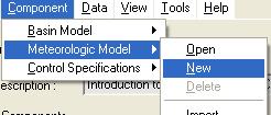
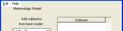


17 Meteorological Model Component/ Meteorologic Model/New


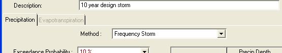
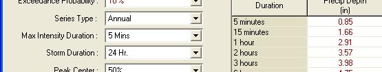

18 Method: Frequency Storm Meteorological Model
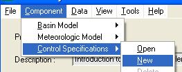
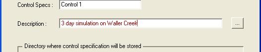

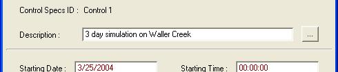

19 Control Specifications Component/ Control Specifications/New
20 Run it!