Appendix L. Drainage Report
|
|
|
- Rudolph Johnson
- 5 years ago
- Views:
Transcription

1 Appendix L Drainage Report
2 2nd Street and Pacific Coast Highway Retail Project City of Long Beach County of Los Angeles, CA DRAINAGE REPORT April 5, 2017

 751-7373 (714) 545-8883 Fax Preparation Date: April 5, 2017")
3 DRAINAGE REPORT For: 2nd Street and Pacific Coast Highway Retail Project City of Long Beach County of Los Angeles, CA Psomas Project No: 2CEN Prepared for: Centercal Properties, LLC 1600 East Franklin Avenue El Segundo, CA Project Site Location/Address: 2nd Street and Pacific Coast Highway Long Beach, CA Prepared by: PSOMAS 3 Hutton Centre Drive, Suite 200 Santa Ana, California (714) (714) Fax Preparation Date: April 5, 2017
4 TABLE OF CONTENTS 1.0 Introduction Project Background Purpose and Scope Hydrology General Approach Data Sources Watershed Characteristics Year Analysis Limitations References Appendices... 6 Appendix 1 LACDPW Hydrology Data Isohyet and Hydrologic Soil Classification Map Appendix 2 Project Site Location and Vicinity Map Appendix 3 Hydrology Calculations and Hydraulic Calculations Appendix 4 Hydrology Maps Existing Condition Interim Condition (Proposed) Ultimate Condition (Future)
5 1.0 Introduction Project Background The project site is located in the City of Long Beach at the southwest corner of the intersection of 2 nd Street and Pacific Coast Highway. The project site is approximately acres which is currently being used as a hotel with a surface parking lot. The proposed development consists of retail uses and parking structures. The proposed project will generally maintain the same drainage areas and discharge points as that of the existing condition. The drainage collected from the building roof drains and parking structures will be treated using raised filtration planter boxes which will discharge into each respective adjacent street via parkway culverts before flowing into the existing catch basins in Marina Drive and Pacific Coast Highway. The proposed project will demolish existing parking lots and buildings, and will include a storm drain relocation plan for the 36 RCP running through the site, which picks up the drainage from the east side of the project site, PCH and the adjacent property to the south. The total on-site and off-site drainage area to the existing catch basins in Marina Drive and PCH is approximately 23.8 acres, and the total area tributary to the 36 storm drain is approximately 15.3 acres in the existing condition and 13.3 acres in the proposed condition. The proposed 36 RCP storm drain line will connect into the existing 36 RCP public storm drain at the west side of the site adjacent to Marina Drive, and continue flowing southwesterly into Alamitos Bay In the existing condition, there is a large on-site grate inlet catch basin which collects surface drainage from the adjacent parking lot and building at the northwest corner of the site (approximately 2.2 acres), and connects into the 36 storm drain. However, the proposed site is not allowed to have any on-site catch basins, therefore, the northwest area of the site will instead drain into Marina Drive. Purpose and Scope The project falls under the jurisdiction of the City of Long Beach, County of Los Angeles. The purpose of this drainage concept report is: To meet City of Long Beach, County of Los Angeles, Land Development requirements in allowing final design and construction to proceed in a timely manner; To determine the proposed development s impact on existing hydrologic conditions; To provide sufficient detailed information to support detailed hydraulic design of storm drainage facilities. 2 nd Street and Pacific Coast Highway Retail Project, Long Beach, CA
6 2.0 Hydrology 2.1 General Approach The watershed of the project was identified and characterized for the existing and proposed conditions to analyze the relocated 36 RCP storm drain running through the site. The LA County computer program, HydroCalc, was used to estimate the runoff flowrate for the 50-year storm event to calculate the peak flows and times of concentration for the overland portions of the analyses (i.e. initial areas). The total flow to the 36 RCP storm drain was calculated by summing the individual 50-year flows for each subarea. These calculations are in accordance with LACDPW requirements. 2.2 Data Sources The primary source of data is from the LACDPW: Hydrology Manual (January 2006). For this project, the 50-year storm, which in Los Angeles County is defined as the Capital Flood, was used to analyze the storm drain system. 2.3 Watershed Characteristics Rainfall and soil characteristics for the 2 nd and PCH Retail Project are illustrated in the Los Alamitos quadrant of Hydrologic Map Figure LACDPW 1-H1.6 (Appendix 1). The 50-year (24-hour) rainfall isohyet nearest the project area is approximately 4.8 inches. In addition to the isohyet data, the hydrologic map shows the classification of the soil type. The project site falls within soil classification area 015 (Tujunga Fine Sandy Loam). The project on-site area to be disturbed is 10.8 acres in size. The total tributary watershed area to be studied is 23.8 acres in size. The project site is approximately 78% impervious in the existing condition, with the buildings, driveways, parking structure and sidewalks indicating the impervious areas, and turf, trees and landscaping the pervious areas. The proposed site will increase the imperviousness to approximately 85%, and will include many of the same features at the existing site, but also will include biofiltration planters, which will receive the surface runoff before it flows into the storm drain system. The treatment rates and volumes of these biofiltration BMPs are detailed and calculated in the project SUSMP. The LACDPW HydroCalc program was used to calculate the times of concentration and peak flows for existing and proposed conditions. The peak flows for each subarea were summed to determine the overall peak flow to the 36 storm drain, which is a more conservative approach than routing and confluencing the peak flows. The LA County WSPG hydraulic analysis program was used to determine the hydraulic grade line in the proposed 36 storm drain. The downstream control for the hydraulic grading 2 nd Street and Pacific Coast Highway Retail Project, Long Beach, CA
7 line calculations was taken as the soffit of the 36 storm drain pipe at the point of connection, which is at elevation 1.2 feet (i.e. approx. 1.2 feet above mean sea level / NGVD29). The hydraulic capacities of the existing 24 and 30 laterals along PCH that drain into the 36 storm drain, and the 15 storm drain lateral in Marina Drive were calculated. It was verified that the laterals along PCH have enough capacity for the 50- year flows, but the 15 lateral is deficient in capacity for both the existing and proposed condition. The drainage concept, according to the City of Long Beach, is that all of the on-site flows should discharge into the street before entering the catch basins and underground storm drain system. However, in the existing condition, a portion of onsite flow currently drains to an onsite catch basin and into the existing 36 storm drain. However, in the proposed condition, if this drainage is added to the street flow in Marina Drive, the flow to the existing catch basin and 15 lateral would be increased significantly. Instead, a portion of the site is proposed to drain into laterals directly from the BMPs and connect into the 36 storm drain to reflect the existing flow pattern, and, therefore, allow the runoff in Marina Drive to match the existing condition. The hydrology peak flow, hydraulic grade line, and pipe capacity calculations are provided in Appendix 4. The results from the 50-year storm hydrology calculations are summarized in the following table: Table 1.1: Hydrology Report Summary Existing Condition Proposed Condition Drainage area to 36 RCP storm drain being relocated through site Ac Ac 50-Year Peak Flow Rate CFS CFS Drainage area to 15 RCP storm drain in Marina Drive 8.44 Ac 7.67 Ac 50-Year Peak Flow Rate CFS CFS In conclusion, the existing storm drain being relocated through the project site can remain to be 36 RCP. 2 nd Street and Pacific Coast Highway Retail Project, Long Beach, CA
8 3.0 Limitations This report was prepared to comply with the guidelines established by the County of Los Angeles and their representatives. Evaluation of the appropriateness of these guidelines and the accuracy of the County data were beyond the scope of this work. Usage of this report is limited to address the purpose and scope previously defined by the project owner. Psomas shall not be held responsible for any unauthorized application of this report and the contents therein. The opinions represented in this report have been derived in accordance with current standards of civil engineering practice. No other warranty is expressed or implied. 4.0 References Los Angeles County Department of Public Works, LACDPW Hydrology Manual and Appendices (2006) Los Angeles County Department of Public Works, Low Impact Development Standards Manual, (February 2014) 2 nd Street and Pacific Coast Highway Retail Project, Long Beach, CA
9 5.0 Appendices Appendix 1 LACDPW Hydrology Data Isohyet and Hydrologic Soil Classification Map 2 nd Street and Pacific Coast Highway Retail Project, Long Beach, CA


10 -118º 07' 30'' 33º 52' 30'' WHITTIER 1-H DPA LONG BEACH 1-H1.5 W N S E DPA LOS ALAMITOS 50-YEAR 24-HOUR ISOHYET Project Site Miles SOIL CLASSIFICATION AREA INCHES OF RAINFALL DEBRIS POTENTIAL AREA SEAL BEACH 25-YEAR 24-HOUR ISOHYET REDUCTION FACTOR: YEAR 24-HOUR ISOHYET REDUCTION FACTOR: H º 45' 00'' ANAHEIM -118º 00' 00''
11 Appendix 2 Project Site Location and Vicinity Map 2 nd Street and Pacific Coast Highway Retail Project, Long Beach, CA


12 ALAMITOS BAY MARINA DRIVE PLANS PREPARED BY: PREPARED FOR:
13 Appendix Year Hydrology and Hydraulic Calculations 2 nd Street and Pacific Coast Highway Retail Project, Long Beach, CA
14 Project Subarea 50-YEAR, 24-HOUR PROPOSED CONDITION LACDPW HydroCalc RESULTS Area (acres) Length (ft) Slope (ft/ft) 50-Year 24-Hour Depth Imperviousness Soil Tc (min) Intensity (in/hr) Cu Cd Flow rate (cfs) Volume (ac-ft) Proposed-50YR Proposed-50YR Proposed-50YR Proposed-50YR Proposed-50YR Proposed-50YR Proposed-50YR Proposed-50YR Proposed-50YR ON-SITE TOTAL Proposed-50YR Proposed-50YR Proposed-50YR Proposed-50YR Proposed-50YR Proposed-50YR Proposed-50YR Proposed-50YR OFF-SITE TOTAL TOTAL
15 Peak Flow Hydrologic Analysis File location: M:/2CEN110300/ENGR/REPORTS/HYDR/CALCULATIONS/Hydrocalc/Proposed-50YR Report.pdf Version: HydroCalc Input Parameters Project Name Proposed-50YR Subarea ID 1 Area (ac) 1.31 Flow Path Length (ft) Flow Path Slope (vft/hft) yr Rainfall Depth (in) 4.8 Percent Impervious 0.9 Soil Type 15 Design Storm Frequency 50-yr Fire Factor 0 LID False Output Results Modeled (50-yr) Rainfall Depth (in) 4.8 Peak Intensity (in/hr) Undeveloped Runoff Coefficient (Cu) Developed Runoff Coefficient (Cd) Time of Concentration (min) 10.0 Clear Peak Flow Rate (cfs) Burned Peak Flow Rate (cfs) Hr Clear Runoff Volume (ac-ft) Hr Clear Runoff Volume (cu-ft)
16 Peak Flow Hydrologic Analysis File location: M:/2CEN110300/ENGR/REPORTS/HYDR/CALCULATIONS/Hydrocalc/Proposed-50YR Report.pdf Version: HydroCalc Input Parameters Project Name Proposed-50YR Subarea ID 2 Area (ac) 1.43 Flow Path Length (ft) Flow Path Slope (vft/hft) yr Rainfall Depth (in) 4.8 Percent Impervious 0.86 Soil Type 15 Design Storm Frequency 50-yr Fire Factor 0 LID False Output Results Modeled (50-yr) Rainfall Depth (in) 4.8 Peak Intensity (in/hr) Undeveloped Runoff Coefficient (Cu) Developed Runoff Coefficient (Cd) Time of Concentration (min) 9.0 Clear Peak Flow Rate (cfs) Burned Peak Flow Rate (cfs) Hr Clear Runoff Volume (ac-ft) Hr Clear Runoff Volume (cu-ft)
17 Peak Flow Hydrologic Analysis File location: M:/2CEN110300/ENGR/REPORTS/HYDR/CALCULATIONS/Hydrocalc/Proposed-50YR Report.pdf Version: HydroCalc Input Parameters Project Name Proposed-50YR Subarea ID 3 Area (ac) 2.08 Flow Path Length (ft) Flow Path Slope (vft/hft) yr Rainfall Depth (in) 4.8 Percent Impervious 0.82 Soil Type 15 Design Storm Frequency 50-yr Fire Factor 0 LID False Output Results Modeled (50-yr) Rainfall Depth (in) 4.8 Peak Intensity (in/hr) Undeveloped Runoff Coefficient (Cu) Developed Runoff Coefficient (Cd) Time of Concentration (min) 12.0 Clear Peak Flow Rate (cfs) Burned Peak Flow Rate (cfs) Hr Clear Runoff Volume (ac-ft) Hr Clear Runoff Volume (cu-ft)
18 Peak Flow Hydrologic Analysis File location: M:/2CEN110300/ENGR/REPORTS/HYDR/CALCULATIONS/Hydrocalc/Proposed-50YR Report.pdf Version: HydroCalc Input Parameters Project Name Proposed-50YR Subarea ID 4 Area (ac) 1.27 Flow Path Length (ft) Flow Path Slope (vft/hft) yr Rainfall Depth (in) 4.8 Percent Impervious 0.87 Soil Type 15 Design Storm Frequency 50-yr Fire Factor 0 LID False Output Results Modeled (50-yr) Rainfall Depth (in) 4.8 Peak Intensity (in/hr) Undeveloped Runoff Coefficient (Cu) Developed Runoff Coefficient (Cd) Time of Concentration (min) 10.0 Clear Peak Flow Rate (cfs) Burned Peak Flow Rate (cfs) Hr Clear Runoff Volume (ac-ft) Hr Clear Runoff Volume (cu-ft)
19 Peak Flow Hydrologic Analysis File location: M:/2CEN110300/ENGR/REPORTS/HYDR/CALCULATIONS/Hydrocalc/Proposed-50YR Report.pdf Version: HydroCalc Input Parameters Project Name Proposed-50YR Subarea ID 5 Area (ac) 1.01 Flow Path Length (ft) Flow Path Slope (vft/hft) yr Rainfall Depth (in) 4.8 Percent Impervious 0.84 Soil Type 15 Design Storm Frequency 50-yr Fire Factor 0 LID False Output Results Modeled (50-yr) Rainfall Depth (in) 4.8 Peak Intensity (in/hr) Undeveloped Runoff Coefficient (Cu) Developed Runoff Coefficient (Cd) Time of Concentration (min) 11.0 Clear Peak Flow Rate (cfs) Burned Peak Flow Rate (cfs) Hr Clear Runoff Volume (ac-ft) Hr Clear Runoff Volume (cu-ft)
20 Peak Flow Hydrologic Analysis File location: M:/2CEN110300/ENGR/REPORTS/HYDR/CALCULATIONS/Hydrocalc/Proposed-50YR Report.pdf Version: HydroCalc Input Parameters Project Name Proposed-50YR Subarea ID 6 Area (ac) 0.44 Flow Path Length (ft) Flow Path Slope (vft/hft) yr Rainfall Depth (in) 4.8 Percent Impervious 0.83 Soil Type 15 Design Storm Frequency 50-yr Fire Factor 0 LID False Output Results Modeled (50-yr) Rainfall Depth (in) 4.8 Peak Intensity (in/hr) Undeveloped Runoff Coefficient (Cu) Developed Runoff Coefficient (Cd) Time of Concentration (min) 6.0 Clear Peak Flow Rate (cfs) Burned Peak Flow Rate (cfs) Hr Clear Runoff Volume (ac-ft) Hr Clear Runoff Volume (cu-ft)
21 Peak Flow Hydrologic Analysis File location: M:/2CEN110300/ENGR/REPORTS/HYDR/CALCULATIONS/Hydrocalc/Proposed-50YR Report.pdf Version: HydroCalc Input Parameters Project Name Proposed-50YR Subarea ID 7 Area (ac) 0.79 Flow Path Length (ft) Flow Path Slope (vft/hft) yr Rainfall Depth (in) 4.8 Percent Impervious 0.84 Soil Type 15 Design Storm Frequency 50-yr Fire Factor 0 LID False Output Results Modeled (50-yr) Rainfall Depth (in) 4.8 Peak Intensity (in/hr) Undeveloped Runoff Coefficient (Cu) Developed Runoff Coefficient (Cd) Time of Concentration (min) 9.0 Clear Peak Flow Rate (cfs) Burned Peak Flow Rate (cfs) Hr Clear Runoff Volume (ac-ft) Hr Clear Runoff Volume (cu-ft)
22 Peak Flow Hydrologic Analysis File location: M:/2CEN110300/ENGR/REPORTS/HYDR/CALCULATIONS/Hydrocalc/Proposed-50YR Report.pdf Version: HydroCalc Input Parameters Project Name Proposed-50YR Subarea ID 8 Area (ac) 1.35 Flow Path Length (ft) Flow Path Slope (vft/hft) yr Rainfall Depth (in) 4.8 Percent Impervious 0.88 Soil Type 15 Design Storm Frequency 50-yr Fire Factor 0 LID False Output Results Modeled (50-yr) Rainfall Depth (in) 4.8 Peak Intensity (in/hr) Undeveloped Runoff Coefficient (Cu) Developed Runoff Coefficient (Cd) Time of Concentration (min) 8.0 Clear Peak Flow Rate (cfs) Burned Peak Flow Rate (cfs) Hr Clear Runoff Volume (ac-ft) Hr Clear Runoff Volume (cu-ft)
23 Peak Flow Hydrologic Analysis File location: M:/2CEN110300/ENGR/REPORTS/HYDR/CALCULATIONS/Hydrocalc/Proposed-50YR Report.pdf Version: HydroCalc Input Parameters Project Name Proposed-50YR Subarea ID 9 Area (ac) 1.09 Flow Path Length (ft) Flow Path Slope (vft/hft) yr Rainfall Depth (in) 4.8 Percent Impervious 0.82 Soil Type 15 Design Storm Frequency 50-yr Fire Factor 0 LID False Output Results Modeled (50-yr) Rainfall Depth (in) 4.8 Peak Intensity (in/hr) Undeveloped Runoff Coefficient (Cu) Developed Runoff Coefficient (Cd) Time of Concentration (min) 10.0 Clear Peak Flow Rate (cfs) Burned Peak Flow Rate (cfs) Hr Clear Runoff Volume (ac-ft) Hr Clear Runoff Volume (cu-ft)
24 Peak Flow Hydrologic Analysis File location: M:/2CEN110300/ENGR/REPORTS/HYDR/CALCULATIONS/Hydrocalc/Proposed-50YR Report.pdf Version: HydroCalc Input Parameters Project Name Proposed-50YR Subarea ID 20 Area (ac) 1.18 Flow Path Length (ft) Flow Path Slope (vft/hft) yr Rainfall Depth (in) 4.8 Percent Impervious 0.96 Soil Type 15 Design Storm Frequency 50-yr Fire Factor 0 LID False Output Results Modeled (50-yr) Rainfall Depth (in) 4.8 Peak Intensity (in/hr) Undeveloped Runoff Coefficient (Cu) Developed Runoff Coefficient (Cd) Time of Concentration (min) 13.0 Clear Peak Flow Rate (cfs) Burned Peak Flow Rate (cfs) Hr Clear Runoff Volume (ac-ft) Hr Clear Runoff Volume (cu-ft)
25 Peak Flow Hydrologic Analysis File location: M:/2CEN110300/ENGR/REPORTS/HYDR/CALCULATIONS/Hydrocalc/Proposed-50YR Report.pdf Version: HydroCalc Input Parameters Project Name Proposed-50YR Subarea ID 21 Area (ac) 0.53 Flow Path Length (ft) Flow Path Slope (vft/hft) yr Rainfall Depth (in) 4.8 Percent Impervious 0.93 Soil Type 15 Design Storm Frequency 50-yr Fire Factor 0 LID False Output Results Modeled (50-yr) Rainfall Depth (in) 4.8 Peak Intensity (in/hr) Undeveloped Runoff Coefficient (Cu) Developed Runoff Coefficient (Cd) Time of Concentration (min) 10.0 Clear Peak Flow Rate (cfs) Burned Peak Flow Rate (cfs) Hr Clear Runoff Volume (ac-ft) Hr Clear Runoff Volume (cu-ft)
26 Peak Flow Hydrologic Analysis File location: M:/2CEN110300/ENGR/REPORTS/HYDR/CALCULATIONS/Hydrocalc/Proposed-50YR Report.pdf Version: HydroCalc Input Parameters Project Name Proposed-50YR Subarea ID 22 Area (ac) 0.42 Flow Path Length (ft) Flow Path Slope (vft/hft) yr Rainfall Depth (in) 4.8 Percent Impervious 0.93 Soil Type 15 Design Storm Frequency 50-yr Fire Factor 0 LID False Output Results Modeled (50-yr) Rainfall Depth (in) 4.8 Peak Intensity (in/hr) Undeveloped Runoff Coefficient (Cu) Developed Runoff Coefficient (Cd) Time of Concentration (min) 9.0 Clear Peak Flow Rate (cfs) Burned Peak Flow Rate (cfs) Hr Clear Runoff Volume (ac-ft) Hr Clear Runoff Volume (cu-ft)
27 Peak Flow Hydrologic Analysis File location: M:/2CEN110300/ENGR/REPORTS/HYDR/CALCULATIONS/Hydrocalc/Proposed-50YR Report.pdf Version: HydroCalc Input Parameters Project Name Proposed-50YR Subarea ID 23 Area (ac) 0.38 Flow Path Length (ft) Flow Path Slope (vft/hft) yr Rainfall Depth (in) 4.8 Percent Impervious 0.93 Soil Type 15 Design Storm Frequency 50-yr Fire Factor 0 LID False Output Results Modeled (50-yr) Rainfall Depth (in) 4.8 Peak Intensity (in/hr) Undeveloped Runoff Coefficient (Cu) Developed Runoff Coefficient (Cd) Time of Concentration (min) 9.0 Clear Peak Flow Rate (cfs) Burned Peak Flow Rate (cfs) Hr Clear Runoff Volume (ac-ft) Hr Clear Runoff Volume (cu-ft)
28 Peak Flow Hydrologic Analysis File location: M:/2CEN110300/ENGR/REPORTS/HYDR/CALCULATIONS/Hydrocalc/Proposed-50YR Report.pdf Version: HydroCalc Input Parameters Project Name Proposed-50YR Subarea ID 24 Area (ac) 4.09 Flow Path Length (ft) Flow Path Slope (vft/hft) yr Rainfall Depth (in) 4.8 Percent Impervious 0.82 Soil Type 15 Design Storm Frequency 50-yr Fire Factor 0 LID False Output Results Modeled (50-yr) Rainfall Depth (in) 4.8 Peak Intensity (in/hr) Undeveloped Runoff Coefficient (Cu) Developed Runoff Coefficient (Cd) Time of Concentration (min) 18.0 Clear Peak Flow Rate (cfs) Burned Peak Flow Rate (cfs) Hr Clear Runoff Volume (ac-ft) Hr Clear Runoff Volume (cu-ft)
29 Peak Flow Hydrologic Analysis File location: M:/2CEN110300/ENGR/REPORTS/HYDR/CALCULATIONS/Hydrocalc/Proposed-50YR Report.pdf Version: HydroCalc Input Parameters Project Name Proposed-50YR Subarea ID 25 Area (ac) 4.39 Flow Path Length (ft) Flow Path Slope (vft/hft) yr Rainfall Depth (in) 4.8 Percent Impervious 0.9 Soil Type 15 Design Storm Frequency 50-yr Fire Factor 0 LID False Output Results Modeled (50-yr) Rainfall Depth (in) 4.8 Peak Intensity (in/hr) Undeveloped Runoff Coefficient (Cu) Developed Runoff Coefficient (Cd) Time of Concentration (min) 22.0 Clear Peak Flow Rate (cfs) Burned Peak Flow Rate (cfs) Hr Clear Runoff Volume (ac-ft) Hr Clear Runoff Volume (cu-ft)
30 Peak Flow Hydrologic Analysis File location: M:/2CEN110300/ENGR/REPORTS/HYDR/CALCULATIONS/Hydrocalc/Proposed-50YR Report.pdf Version: HydroCalc Input Parameters Project Name Proposed-50YR Subarea ID 26 Area (ac) 1.35 Flow Path Length (ft) Flow Path Slope (vft/hft) yr Rainfall Depth (in) 4.8 Percent Impervious 0.84 Soil Type 15 Design Storm Frequency 50-yr Fire Factor 0 LID False Output Results Modeled (50-yr) Rainfall Depth (in) 4.8 Peak Intensity (in/hr) Undeveloped Runoff Coefficient (Cu) Developed Runoff Coefficient (Cd) Time of Concentration (min) 19.0 Clear Peak Flow Rate (cfs) Burned Peak Flow Rate (cfs) Hr Clear Runoff Volume (ac-ft) Hr Clear Runoff Volume (cu-ft)
31 Peak Flow Hydrologic Analysis File location: M:/2CEN110300/ENGR/REPORTS/HYDR/CALCULATIONS/Hydrocalc/Proposed-50YR Report.pdf Version: HydroCalc Input Parameters Project Name Proposed-50YR Subarea ID 27 Area (ac) 0.7 Flow Path Length (ft) Flow Path Slope (vft/hft) yr Rainfall Depth (in) 4.8 Percent Impervious 0.85 Soil Type 15 Design Storm Frequency 50-yr Fire Factor 0 LID False Output Results Modeled (50-yr) Rainfall Depth (in) 4.8 Peak Intensity (in/hr) Undeveloped Runoff Coefficient (Cu) Developed Runoff Coefficient (Cd) Time of Concentration (min) 10.0 Clear Peak Flow Rate (cfs) Burned Peak Flow Rate (cfs) Hr Clear Runoff Volume (ac-ft) Hr Clear Runoff Volume (cu-ft)
32 FILE: CEN-A50.WSW W S P G W - CIVILDESIGN Version PAGE 1 Program Package Serial Number: 7081 WATER SURFACE PROFILE LISTING Date: Time: 4: 8:59 2ND STREET and PACIFIC COAST HIGHWAY PROJECT 50-YEAR, 24-HOUR PROPOSED CONDITION 36" STORM DRAIN RELOCATION ************************************************************************************************************************** ******** Invert Depth Water Q Vel Vel Energy Super Critical Flow Top Height/ Base Wt No Wth Station Elev (FT) Elev (CFS) (FPS) Head Grd.El. Elev Depth Width Dia.-FT or I.D. ZL Prs/Pip L/Elem Ch Slope SF Ave HF SE Dpth Froude N Norm Dp "N" X-Fall ZR Type Ch ********* ********* ******** ********* ********* ******* ******* ********* ******* ******** ******** ******* ******* ***** ******* PIPE PIPE PIPE PIPE PIPE PIPE PIPE PIPE PIPE
33 FILE: CEN-A50.WSW W S P G W - CIVILDESIGN Version PAGE 2 Program Package Serial Number: 7081 WATER SURFACE PROFILE LISTING Date: Time: 4: 8:59 2ND STREET and PACIFIC COAST HIGHWAY PROJECT 50-YEAR, 24-HOUR PROPOSED CONDITION 36" STORM DRAIN RELOCATION ************************************************************************************************************************** ******** Invert Depth Water Q Vel Vel Energy Super Critical Flow Top Height/ Base Wt No Wth Station Elev (FT) Elev (CFS) (FPS) Head Grd.El. Elev Depth Width Dia.-FT or I.D. ZL Prs/Pip L/Elem Ch Slope SF Ave HF SE Dpth Froude N Norm Dp "N" X-Fall ZR Type Ch ********* ********* ******** ********* ********* ******* ******* ********* ******* ******** ******** ******* ******* ***** ******* PIPE
34 STORM DRAIN PIPE FLOW CALCULATIONS 4/5/2017 2HMC SUBAREA PCH EAST LATERAL STA TO PCH EAST LATERAL STA TO PCH EAST LATERAL STA TO PCH WEST LATERAL STA TO MARINA DRIVE 15" LATERAL FLOW REGIME NORMAL FULL FULL FULL FULL DESIGN FLOW "Q " (cfs) cfs cfs 5.00 cfs 4.16 cfs cfs PIPE DIAMETER "d" (inches) 30'' 24'' 24'' 24'' 15'' PIPE MATERIAL RCP RCP RCP RCP RCP MANNINGS "n" VALUE PIPE SLOPE "S" (feet/feet) FRICTION SLOPE "S f " (feet/feet) DEPTH OF FLOW "D" (feet) 1.02' 2.00' 2.00' 2.00' 1.25' FLOW AREA "A" (square feet) 1.88 sf 3.14 sf 3.14 sf 3.14 sf 1.23 sf WETTED PERIMETER "P" 3.46' 6.28' 6.28' 6.28' 3.93' HYDRAULIC RADIUS "R" (A/P) 0.54' 0.50' 0.50' 0.50' 0.31' FLOW TOP WIDTH, T (feet) 2.46' 0.00' 0.00' 0.00' 0.00' FLOW VELOCITY "V" (feet/second) 8.97 fps 3.76 fps 1.59 fps 1.32 fps 8.41 fps VELOCITY HEAD (V 2 /2G) (feet) 1.25' 0.22' 0.04' 0.03' 1.10' SPECIFIC ENERGY (D+ V 2 /2G) (lb-ft/lb) 2.27' 2.22' 2.04' 2.03' 2.35' FLOW CAPACITY DEPTH RATIO "D/d" PIPE FLOW CAPACITY (cfs) cfs cfs cfs cfs 3.16 cfs 1 HYDRAULIC-CALCS.xls
35 Appendix 4 Hydrology Maps Existing Condition Proposed Condition 2 nd Street and Pacific Coast Highway Retail Project, Long Beach, CA


")
 (in./hr) (cfs) (min.")


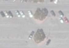


36 A=13.02 acres Q50=20.53 cfs EX. 36"SD SUBAREA AC 24" SD 30" SD SUBAREA AC 24" SD SUBAREA AC 36" SD PACIFIC COAS T SUBAREA AC SUBAREA AC SUBAREA AC SUBAREA AC TR EE T SUBAREA AC DS SUBAREA AC E. 2N SUBAREA AC SUBAREA AC SUBAREA AC 18" SD SUBAREA AC 12" SD MARINA DRIVE A=15.26 acres Q50=24.12 cfs EX. 36"SD 18" SD 50-YEAR, 24-HOUR EXISTING CONDITION TC CALCULATOR RESULTS TcArea Frequ Soil Length Slope Isohyet Intensity Flow rate Project Subarea %imp calculated Cu Cd (acres) ency Type (ft) (ft/ft) (in.) (in./hr) (cfs) (min.) Existing-50YR Existing-50YR Existing-50YR Existing-50YR Existing-50YR Existing-50YR ONSITE TOTAL Existing-50YR Existing-50YR Existing-50YR Existing-50YR Existing-50YR Existing-50YR Existing-50YR Existing-50YR OFFSITE TOTAL TOTAL Feet Tc Equation Tc=(10 )^ *(Cd *I)^ *(L)^ *(S)^ Tc=(10 )^ *(Cd *I)^ *(L)^ *(S)^ Tc=(10 )^ *(Cd *I)^ *(L)^ *(S)^ Tc=(10 )^ *(Cd *I)^ *(L)^ *(S)^ Tc=(10 )^ *(Cd *I)^ *(L)^ *(S)^ Tc=(10 )^ *(Cd *I)^ *(L)^ *(S)^ Tc=(10 )^ *(Cd *I)^ *(L)^ *(S)^ Tc=(10 )^ *(Cd *I)^ *(L)^ *(S)^ Tc=(10 )^ *(Cd *I)^ *(L)^ *(S)^ Tc=(10 )^ *(Cd *I)^ *(L)^ *(S)^ Tc=(10 )^ *(Cd *I)^ *(L)^ *(S)^ Tc=(10 )^ *(Cd *I)^ *(L)^ *(S)^ Tc=(10 )^ *(Cd *I)^ *(L)^ *(S)^ Tc=(10 )^ *(Cd *I)^ *(L)^ *(S)^ Volume (acre-ft) OPEN SPACE SUMMARY TABLE EXISTING PERVIOUS SPACE 4.2 AC EXISTING IMPERVIOUS SPACE 19.6 AC PROPOSED PERVIOUS SPACE 2.7 AC PROPOSED IMPERVIOUS SPACE 21.1 AC TOTAL AREA 23.8 AC LEGEND EXISTING HYDROLOGY BOUNDARY PROJECT BOUNDARY EXISTING STORM DRAIN FLOW PATH EXISTING OPEN SPACE 7.51 FIGURE 2 EXISTING CONDITOIN HYDROLOGY MAP 2ND AND PCH DEVELOPMENT Path: I:\ SP Marina\GIS\MXD\ EXISTING HYDROLOGY MAP.mxd HIGHWAY N. STUDEBAKE R ROAD SUBAREA AC


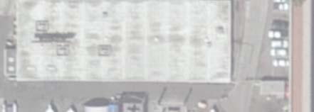
37 TRUCKS e e e ST HIGHWAY ELEV 8 e MECH A-110 CAFE RECYCLE T B-100 1,765 SF REST 3,905 SF e 1,475 SF B-152 B C-120 RESTAURANT T T 1,950 SF T UP SPPED RAMP SERV RECYCLE D-160 W FAMILY ELEV MECH 1,835 SF 1,400 SF 4,570 SF 4,080 SF 1,215 SF T D-130 D-170 RESTAURANT 1,600 SF F.F.=11.00 PAD=10.00 D-150 RESTAURANT ELEC ROOM 1,645 SF 2,105 SF UP F.F.=11.00 RESTAURANT PAD= ,095 SF F.F.=11.00M PAD=10.00 D-110 RESTAURANT ELEC ROOM 315sf 6' CORRIDOR 6' CORRIDOR 8,275 SF 45' PASEO ELEV WAITING DN 6' CORRIDOR MECH 6' CORRIDOR DN 1,240 SF ELEV E-135 UP 1,135 SF T E-132 E-108 RESTAURANT MECH SERV 1,465 SF 2,775 SF EQUIP ROOM 200sf UP E-107 UP RESTAURANT F.F.= 'x30' PAD= ,455 SF D-120 D-100 9,860 SF 12'x30' 10 E-125 E-130 1,350 SF E-120 2,735 SF E-118 3,360 SF 5,055 SF C E-110 6' CORRIDOR 10 D-180 E-100 E-102 E-105 RAMP UP A sf PV20 2,020 SF 1,875 SF 2,075 SF g SERV MECH UP 400 sf D-140 E-115 F.F.=10.50 PAD=9.50 T PV10 12'x30' C 18% (MAX.) RAMP 6' CORRIDOR EV EV EV EV EV EV g 2n PARKING STRUCTURE MAIN PLAZA UP ELEV F.F.=10.50 PAD=9.50 MALL OFFICE (1,125 SF) ds TR g 10 EV EV EV EV EV EV EV PARKING STRUCTURE SEE FIGURE 2 MALL STORAGE #2 ELEV C SF 620 SF B-115 EXIT ENTRY T B-150 PAD=10.00 UP EE 5,695 SF 8,020 SF 3,515 SF SF B-145 B-140 T 575 SF 1,295 SF B-110 T T F.F.=11.00 B-135 B-130 B-125 B-157 C-105 F.F.= ,725 SF PAD=10.00 CART B UP EV EV EV EV EV EV 1,400 SF 3,475 SF 2,555 SF F.F.=11.00 PAD=10.00 UP 2,275 SF 4,200 SF 9 F.F.=11.00 PAD=10.00 A ,005 SF 5,835 SF WHOLE FOODS 75'x 12. 5' UP UP C-100 RESTAURANT B-170 RESTAURANT T A 'x 12. 5' ELEC ROOM 1,500 SF 5,000 sf MEZZANINE EC EL OM RO g SEE FIGURE 2 UP ELEC ROOM T T T 9 10 g T YIELD NO TRUCKS NO PACIFIC COA MARINA DRIVE LEGEND LEGEND F.F.=11.00 PAD=10.00 F.F. = FINISH FLOOR PLANS PREPARED BY: PREPARED FOR: 2ND STREET and PACIFIC COAST HIGHWAY PROJECT C02.0 FINAL SCHEMATIC DESIGN PACKAGE FIGURE 4: PROPOSED CONDITION HYDROLOGY MAP 3 9