Meacham Creek Fish Habitat Enhancement: Application of the CTUIR River Vision
|
|
|
- Harvey Spencer
- 5 years ago
- Views:
Transcription


1 Meacham Creek Fish Habitat Enhancement: Application of the CTUIR River Vision Future of Our Salmon A Vision of Restoration in the Columbia River Basin June 1, 2011 James Webster Confederated Tribes of the Umatilla Indian Reservation Fisheries Habitat Program

2

3 ! 114,000 acres! Elevation! 1800 to 4500 ft! inches of ppt! Snow and rain-on-snow! Listed Fish Species! Steelhead! Bull trout! Spring chinook! TMDL - Temperature! Mixed ownership


4 Issues and Concerns Channel encroachment and simplification


5 Vegetation management and other impacts Issues and Concerns
6 Riverine Ecosystem Planning Approach Scoping Assessment Monitoring Reporting Community Needs Community/ Existing Data Condition Assessment Scientific Knowledge Monitoring Design Condition Reporting Adaptive Feedback Technical Interface Resource Priorities Prioritize Issues Collect Data Define Objectives Implement monitoring Measure Objectives Data Collection Project Project Planning Project Design Implementation
7 Meacham Watershed Assessment! To better understand ecological and hydrological conditions.! Assessment Tasks completed: 1. Identify historical watershed conditions 2. Describe current watershed conditions 3. Identify impacts to hydrological functions and processes
8 Sinuosity Changes ! Average Decrease:! Channel length -1.4 miles! Sinuosity ft/ft Andrus & Middel, 2003
9 Assessment Results! Poor channel form in specific areas! Constrained channel and disconnected floodplain! Lack of large woody debris and source! Poor riparian vegetation coverage and conditions! High water temperatures and high rate of heating
10 Limiting Factors Poor channel form Low instream habitat diversity Channel/floodplain modifications Lack of healthy riparian vegetation High stream temperatures Passage impediments Assessment Existing Data Condition Assessment Prioritize Issues Collect Data Define Objectives
11 Limiting Factors Poor channel form Low instream habitat diversity Channel/floodplain modifications Lack of healthy riparian vegetation High stream temperatures Passage impediments Restoration Actions Riparian easement Riparian planting LWD additions Natural channel design Improve instream habitat Levee removal/setback Passage barrier removal Assessment Existing Data Condition Assessment Prioritize Issues Collect Data Define Objectives
12 Assessment Existing Data Condition Assessment Prioritize Issues Collect Data Define Objectives
13 Assessment Existing Data Condition Assessment Project Objectives 1. Improve riparian conditions for vegetation 2. Increase channel/floodplain roughness elements 3. Promote and enhance hyporheic interchange 4. Restore channel sinuosity and form 5. Improve habitat conditions for key fish species 6. Maintain and improve fish passage Prioritize Issues Collect Data Define Objectives Restoration Actions Riparian conservation easement Riparian planting LWD additions Natural channel design Instream habitat structures Levee removal/setback Passage barrier removal
14 Vision Application: Fisheries Habitat Primary Touchstone Secondary Touchstone Restoration Actions Action Groups Hydrology Aquatic Biota Flow Acquisition, Restoration & Enhancement Flow Restoration Geomorphology Connectivity Riparian Veg LWD Additions Channel Design Channel Construction In-stream Structure Active Channel Construction Connectivity Geomorphology Aquatic Biota Levee Modification Levee Removal Floodplain Construction Active Floodplain Construction Migration Pathways Riparian Vegetation Geomorphology Hydrology Consv. Easement Planting Noxious Weed Removal Wetland Enhancement Floodplain Vegetation Management Aquatic Biota Geomorphology In-Stream Structure Active Channel Construction 12
15 Touchstone Correlation Examples Restoration actions are intended to directly address touchstones. "Hydrology - Increased quantity and quality through floodplain storage "Geomorphology - Channel meander development, LWD additions "Connectivity -Levee removal and floodplain activation "Riparian vegetation- Land acquisition and use changes, vegetation management "Aquatic Biota - Remove physical migration barriers
16 Assessment Existing Data Condition Assessment Project Objectives 1. Improve riparian conditions for vegetation 2. Increase channel/floodplain roughness elements 3. Promote and enhance hyporheic interchange 4. Restore channel sinuosity and form 5. Improve habitat conditions for key fish species 6. Maintain and improve fish passage Prioritize Issues Collect Data Define Objectives
17 Assessment Existing Data Condition Assessment Project Objectives 1. Improve riparian conditions for vegetation 2. Increase channel/floodplain roughness elements 3. Promote and enhance hyporheic interchange 4. Restore channel sinuosity and form 5. Improve habitat conditions for key fish species 6. Maintain and improve fish passage Monitoring Scientific Knowledge Monitoring Design Prioritize Issues Implement monitoring Collect Data Define Objectives Measurement Protocols and Methods Measure Objectives Data Collection
18
19

20

21


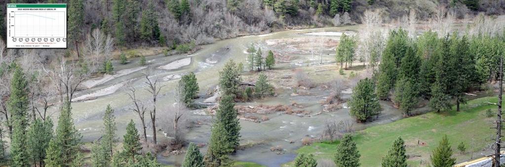
22 Meacham Creek Levee Removal


23 Vision Application!"#$%&'(&)*++ &

24 Natural Channel Design Project Reach RM
25


26
27
28
29

30
31
32

33