THE EDWARDS AQUIFER: A GLOBAL PERSPECTIVE. Philip Rykwalder
|
|
|
- Janis Wiggins
- 5 years ago
- Views:
Transcription

1 THE EDWARDS AQUIFER: A GLOBAL PERSPECTIVE Philip Rykwalder
2 GOALS Differentiate karst aquifers from sand and gravel aquifers Explain the components of a classic karst aquifer Show how unique and sensitive the Edwards Aquifer is from a caver s view Dispel myths associated with the Edwards

3 WHAT IS AN AQUIFER? Aquifer is any unit capable of storing and transmitting water in usable quantities Rock Igneous Metamorphic Sedimentary Unconsolidated sediment Sands and gravels
4 IGNEOUS AND METAMORPHIC AQUIFERS Low porosity because interlocking crystals Range of porosities; permeability low granite vs. pumice Larger bodies can have decent amounts of water


5 IGNEOUS AND METAMORPHIC AQUIFERS Thin section of granite Thin section of schist Virtually no porosity

6 Fractures can increase flow greatly in aquifers Larger bodies can be productive aquifers if fractured enough Can be productive aquifers, but highly productive sedimentary aquifers are more common than productive crystalline aquifers


7 SEDIMENTARY AQUIFERS Made of grains of other rocks Grains do not fit tightly together Pore space Space is left between the grains Mechanical filtration occurs


8 SEDIMENT POROSITY Well sorted sand Mixed sand & gravel 25-50% 20-35% Glacial till 10 20% SCALE = 0.5mm Clay 33 60% Fetter, C.W. Applied Hydrogeology Sandstone


9 SEDIMENTARY ROCK POROSITY AND PERMEABILITY ROCK POROSITY PERMEABILITY Sandstone 43% cm/d Mixed sand & gravel 33% cm/d Shale 43% 8 cm/d Karanth, K.R. Hydrogeology


10 Water follows very torturous flow paths Flow velocities on the order of cm to m/day SEDIMENTARY AQUIFER Glacial Till


11 CLASSIC AQUIFER How does all of this fit together? Generically: Sand and gravel aquifers General geology classes Water infiltrates and slowly moves down gradient Generally low flow velocities


12 REMEDIATION = POSSIBLE Flow with groundwater flow direction Contaminants travel slowly as a plume Soluble - Agricultural pollution: fertilizers Insoluble - Petroleum products


13 GROUNDWATER REMEDIATION Reactive Filter Pump and Treat
14 OVERVIEW OF CLASTIC AQUIFERS Small pores CAPABLE OF FILTERING WATER Complex flow paths through small pores yields LOW FLOW VELOCITIES What does this mean for contaminant transport? Contaminants can be removed
 Karst solutioning in a salt")
15 KARST WATERS INSTITUTE Karst: landscape formed by dissolution of soluble rocks Limestone, dolomites, salts, gypsum, quartzites, more 40% of the groundwater used in the U.S. for drinking comes from karst aquifers Common of karst: ground subsidence, sinkhole collapse, groundwater contamination, unpredictable water supply (KWI) Karst solutioning in a salt dome
16


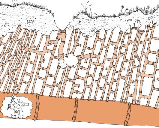
17 KARST DISSOLUTION OF EXPOSED BEDROCK Basic concept: acidic water dissolves rock Reactions are rate limited Water quickly enters ground Irregularities exploited: fractures, faults, bedding planes
18 NATURALLY OCCURING ACIDIC WATER Rain passes through the atmosphere picking up carbon dioxide Soils add more CO 2 Weak carbonic acid solution: H 2 O + CO 2 H 2 CO 3

")
19 CALCITE DISSOLUTION Limestone: (CaCO 3 ) Dolomite: CaMg(CO 3 ) 2

20 RESULTS OF KARST Aggressive water continues to dissolve once underground Water passages enlarged until conduit formation DISSOLUTION Rapid, subsurface flow via conduits

21 KARST OVERVIEW In the subsurface these conduits feed into each other; dendritic patterns common Larger conduits formed Large volumes of water transmitted with high flow velocities
22 FRACTURE CONVERGENCE

23 Veracruz, Mexico

24 Veracruz, Mexico

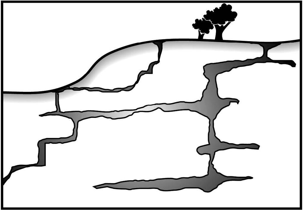
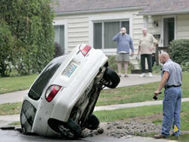
25 Void dissolved in bedrock Soil/rock collapses into underlying void Depression formed on surface. Drain may or may not be visible SINKHOLE Sinkholes indicate void space below

26 SINKHOLE Generic shape is a cone, but can be any shape Water is collected and funneled into the subsurface

27 SINKHOLES Pennyroyal Plateau, KY Guatemala

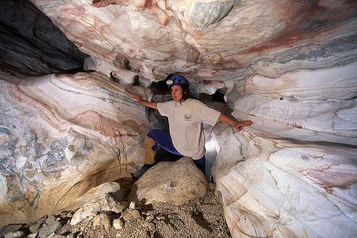
28 SINKHOLES Florida Missouri

29 Drain hole at bottom may be plugged with sediment but the connection to the subsurface is still there SINKHOLE


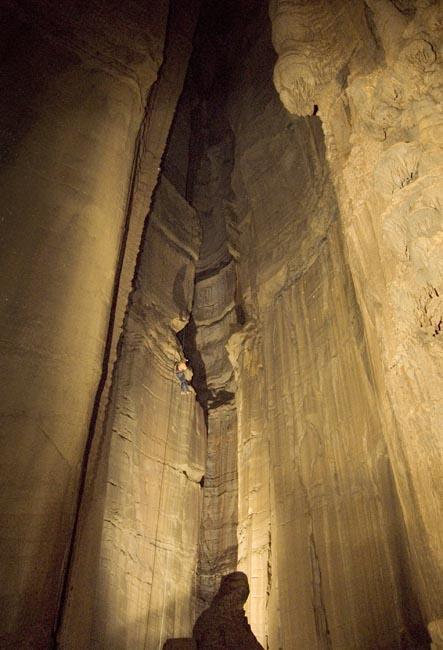
30 PIT CAVES, a.k.a. SINKHOLES Pit caves can form by collapse into underlying void Underlying void dissolves more and grows in volume Collapses again 57m shaft, Alabama 333m shaft, S.L.P., Mexico


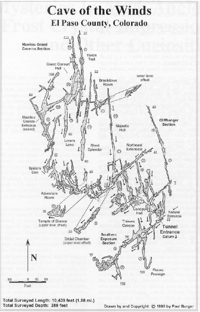
31 SINKING STREAMS Water directly recharges aquifer Represent points that are very susceptible to rapid contamination of large aquifers Seco Creek Sinkhole El Rio Caha-Bon, Guatemala
32 SOLUTIONED BEDDING PLANES


33 SOLUTIONED BEDDING PLANES Passages are often lenticular In cross-section

34 SOLUTIONED FRACTURES AND FAULTS In the subsurface passages commonly exploit fractures Joint controlled passages Tend to follow fracture pattern
35 JOINT CONTROLLED PASSAGES

36 Where the water table meets the surface SPRINGS

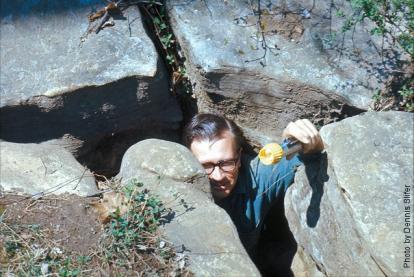
37 WHAT IS A CAVE? Solutioned void that humans can fit into Conduit or passage Entrance is where passage intersects surface How many passages do not intersect the surface?
38 CAVES WITHOUT ENTRANCES Art Palmer did a semilog regression Plotted number of entrances versus frequency If you follow the trend you see that the number of caves without entrances is very high AL had <7k known caves; Palmer s regression predicted ~100,000 caves frequency frequency
39 CAVES Allow us to see what is going on inside the rock Better view of rock Flowpaths deduced Caves tell us how the aquifer reacts to water Flood vs flow

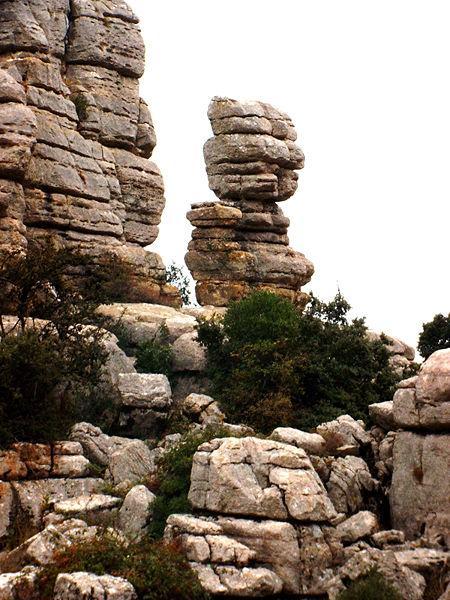
40 Cave maps offer insight through pattern recognition Dip, regional trends, faults, fractures Cave walls contain scallops and other features that indicate flow direction and velocity CAVES
41 WHAT DO THESE KARST FEATURES SHOW US? That there are many, many interconnected water carrying passages in karst aquifers Only a small portion of them are enterable Enterable passages are caves Non-enterable passages are conduits, vugs, cavities or other solutional voids smaller than people Non-enterable solution features greatly out number enterable features
42 AQUIFER COMPARISON SAND AND GRAVEL Small pore size mechanically filters Torturous flow paths slow water Contaminants don t travel far Remediation possible KARST No filtration takes place Fractures and conduits yield fast water velocities Contaminants are broadcasted over large distances Contaminants gone

43 WHY TALK ABOUT ALL THESE KARST FEATURES? To show that the Edwards Aquifer has the features of a typical karst aquifer and more that make it unique globally among karst aquifers
44 WHAT MAKES THE EDWARDS Incredibly high porosity in the Edwards Limestone Holey rocks Highly fractured and faulted rock Permeability increased UNIQUE? Results in incredibly fast flow rates

45 WHAT MAKES THE EDWARDS Long, complex flow paths Geochemical complexities; bad water line Large springs; multiple other springs Unique biota UNIQUE?

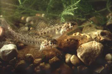
46 WHAT MAKES THE EDWARDS UNIQUE? > 1 million people depend on it for their sole source of water

47 EDWARDS AQUIFER Limestone; interbedded marls, clay layers Wikipedia describes it as one of the most prolific artesian aquifers in the world San Antonio owes its existence to the Edwards without the aquifer the city might not exist No surface water

48 EDWARDS AQUIFER The aquifer is a very mature karst system Evidence: Thousands of caves and karst features Many solutional voids in subsurface Tool drops Springs, sinkholes, etc
49 OUTWARD APPEARANCE Rock in each karst area is shaped by the rock and the amount of water it receives Every area has different look Factors: Bedding: well bedded vs thinly bedded Rock quality: pure vs impure limestone Amount of rain Contact time between rock and water
50 OUTWARD APPEARANCE The Edwards is characterized by vugs, large pores, rocks with holes, more We show off the rock s uniqueness No karst in Guatemala, Canada, Mexico, the U.S. looks or behaves like the Edwards The Edwards Aquifer is an anomaly

51 EDWARDS IS A LARGE, COMPLEX SYSTEM RECHARGE ZONE VS BASIN Basin: water in basin to spring Edwards: structurally complex; different zones
52 FRACTURE VS. MATRIX FLOW Fracture flow is rapid Matrix flow is slow Contaminants have initial pulse and then bleed out over long period of time Chemical as detected at a spring


53 Why does TX not have subsidence/ sinkhole collapse problems? Kentucky Guatemala Not enough rain Material not being dissolved fast enough Most dissolution deep in Edwards Florida
54 HOWEVER! This does not mean that central TX karst is not active!!! Major springs, thousands of active caves and other karst features No water on the surface---all funneled underground
55 ORGANISMS No other aquifer in the world has the organism diversity that the Edwards has. No other known karst system has the range of cave adapted insects, fish, and salamanders found in the Edwards.
56 HOW THE EDWARDS IS SPECIAL Very vuggy rock; extremely high porosity Fractured/faulted rock concentrates flow Very high flow velocities are the result Unique organisms

57
58 EDWARDS MTYH #1: The aquifer filters water Muddy water goes in the aquifer and clean water comes out. How can you say the aquifer does not filter?

59 FILTRATION? If I put muddy water in a glass and put the glass in a dark closet for 3 days and then remove the glass has that glass filtered? Is the water clearer? Yes. Was it filtered? No.

60 KARST AQUIFER AS A FILTER Does the Aquifer filter? NO! Suspended solids DO SETTLE OUT, but they are NOT filtered out! No size exclusion/mechanical filtration occurs Garden hose analogy It does NOT filter microorganisms, chemical pollutants Is this conduit filtering?
61 KARST AQUIFER AS A FILTER Things spilled on recharge/contributing zones jeopardize the entire aquifer Contaminants spilled on them have the potential to contaminate our sole water suppply Human activity on the these areas puts the water supply of a million people at risk Once contaminated: Where do we go for water?
62 2000 In 2000 there was a diesel spill at a quarry along I-35 Waters with high VOC levels were detected at San Marcos Springs within 1 2 days Result: Contaminant moved quickly offsite Large volumes of water affected Wells over a broad area affected
63 DANGER! HUMAN ACTIVITY OVER THE RECHARGE ZONE
64 EDWARDS MTYH #2: Protecting caves and karst features protects the aquifer The law requires me to identify and protect caves and karst features on my site that is on the recharge zone. Protecting point features is enough to protect the aquifer.

65 EDWARDS MTYH #2: Protecting features protects the aquifer Protecting features is important Where does water enter a karst aquifer? Everywhere! Not just at identifiable points

66 EDWARDS MYTH #2 How can we claim our aquifer to be protected if a handful of point features are protected? Do all the protected point features account for the volume of water coming out of the springs? NO. A great majority of karst features are mantled by soil and go unnoticed Soil mantled fracture And they go unprotected
67 KARST FLOW CHART Karst-Contaminant Flow Chart

68 These would not be protected under the Edwards Rules
69 We need to protect large areas, NOT point features
70 CONCERNS Central TX communities are aware of karst Most karst education learned through word of mouth, from tv, reading newspaper articles, etc. How many local geologists received karst training? Regulators? Policy makers?
71 CONCERNS The karst here is treated as discrete points in need of protection The entire area is susceptible and unique. We shouldn t be identifying point features to protect; we should be identifying large areas to protect. Klimchouk