Maricopa Table Grapes & Open Ground Bakersfield, California
|
|
|
- Elaine Bryan
- 5 years ago
- Views:
Transcription


1 Kern County, CA Southlake Exitus I Exitus II Maricopa Native/Grazing Exclusively Presented By: CALIFORNIA S LARGEST AG BROKERAGE FIRM CA BRE #
2 Property Overview DESCRIPTION A total of ± acres located in the early maturing south San Joaquin Valley including 260± acres of desirable varieties of table grapes and 121± acres with an extensive V-trellis system and underground irrigation lines. The remaining portions of the property include ± acres of open land with only an irrigation pump and well and 160± acres of native land without any developed water. LOCATION Southlake/Exitus I are located on the south side of Southlake Road along the east side of the Basic School Road Alignment. Exitus II is located on the south side of Copus Road, 2± miles east of Basic School Road. Maricopa Native/Grazing is located approximately 3/4 mile south of the Maricopa Highway, 1/4 mile east of the Basic School Road Alignment. PLANTINGS Autumn King, Scarlet Royal, Red Globe Table Grapes planted in 2009, 2011, Spacing is 7 x 12. PRODUCTION Available upon request by qualified buyers. WATER Wheeler Ridge-Maricopa Water Storage District. 1 well located on the Southlake ranch. Outlets located on all properties except for 160± acres of native ground. Not all parcels receive water from the district. EQUIPMENT Equipment yard on Southlake Ranch BUILDINGS None PRICE/TERMS $7,445,000 cash at the close of escrow ($8,538 per acre). The 2018 crop is negotiable. 2


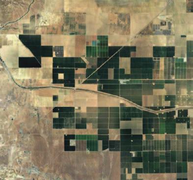


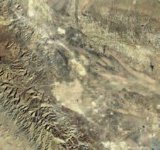
3 K E R N C O U N T Y, C A Ranch Locations Map Bakersfield Taft 99 Southlake Exitus II Exitus I Copus Rd Maricopa Hwy Maricopa Native/Grazing 3
4 Southlake/Exitus I ± Assessed Acres LOCATION LEGAL PLANTINGS Southlake/Exitus I are located on the south side of Southlake Road along the east side of the Basic School Road Alignment. Kern County APN s , 09, 10, 11 approximately ± acres. Parcel is in the process of a lot line adjustment and that will be 121± acre upon completion. Total acres including Exitus I is ± acres. Exitus I consists of 160± acres of planted table grapes: Red Globe 44± acres, planted in year average 1,195 boxes per acre Scarlet Royal 80± acres, planted in year average 1,018 boxes per acre Autumn King 36± acres, planted in year average 1,087 boxes per acre The 121± acre parcel has the trellis system and underground irrigation lines from the previously planted vineyard. WATER SOILS PRICE/TERMS The Southlake open ground does not receive any district water but is within the Wheeler Ridge-Maricopa Water Storage District. There are outlets on these parcels. The Exitus I vineyard is within the district and receives full contract water. Irrigation is provided by an outlet at the filter system and pumps from the reservoir. There is one well located on the Southlake property in the southwest corner. Cerini loam, 0 to 2 percent slopes Califax loam, 0 to 1 percent slopes Excelsior fine sandy loam, saline sodic, 0 to 1 percent slopes Southlake ± acres $1,095,000 cash at the close of escrow ($2,500 per acre). Exitus ± acres$3,152,000 cash at the close of escrow ($19,700 per acre). The 2018 crop is negotiable. Assessor s Parcel Map Southlake Proposed lot line adjustment Exitus I 4


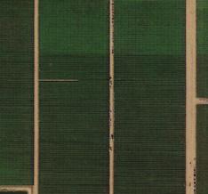
5 Photos Southlake/Exitus I 5


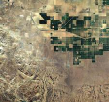
6 Planting Map Southlake/Exitus I S Lake Rd Open Ground ± Acres Open Ground 121± Acres With Trellis & Underground Drip Lines Southlake Open Ground 160± Acres Red Globes 44± Acres 20,758 vines Exitus I Autumn King 36± Acres 16,799 vines well Equipment Yard Scarlet Royal 80± Acres 36,650 vines 6

7 Soil Map Southlake/Exitus I Soil Map may not be valid at this scale. Southlake Exitus I Map unit symbol Map unit name 132 Cerini loam, 0 to 2 percent slopes 133 Calflax loam, 0 to 1 percent slopes 151 Excelsior fine sandy loam, salinesodic, 0 to 1 percent slopes

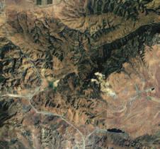
8 Exitus II LOCATION LEGAL PLANTINGS WATER SOILS PRICE/TERMS Exitus II is located on the south side of Copus Road, 2± miles east of Basic School Road. 7± miles northeast of the city of Maricopa ± assessed acres Kern County APN s: Autumn King Table Grapes planted in 2011 and The 2011 planting of 52± acres produced 1,125 boxes per acre in The 2015 planting of 58± acres will have its first crop in Wheeler Ridge-Maricopa Water Storage District. (Full contract water.) Irrigation is provided by an outlet at the filter system and pumps from the reservoir. Ceroni loam, 0 to 2 percent slopes Excelsior loam, 0 to 2 percent slopes ± Assessed Acres $3,078,000 Cash at the close of escrow ($27,000 per acre). The 2018 crop is negotiable. Assessor s Parcel Map SUBJECT 8


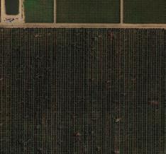
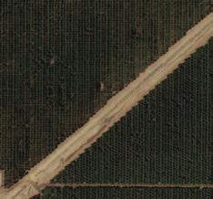
9 Photos Exitus II 9


 Kern County,")


10 K E R N C O U N T Y, C A Exitus II Planting Map Copus Rd Autumn King 52± Acres 26,161 vines Autumn King 58± Acres 29,180 vines Soil Map ' 31'' W ' 48'' W California Revised Storie Index (CA) Kern County, California, Southwest Part ' 52'' N Map unit symbol Map unit name 132 Cerini loam, 0 to 2 percent slopes 152 Excelsior loam, 0 to 2 percent slopes ' 52'' N Soil Map may not be valid at this scale. 35 5' 11'' N Map Scale: 1:8,900 if printed on A landscapereliable (11" x 8.5") sheet. All information contained herein is deemed but not guaranteed by seller nor broker and Meters should be independently buyers. We assume no liability for errors or omissions. N 0 100verified 200 by potential Feet ' 11'' N ' 31'' W ' 48'' W
11 Maricopa Native/Grazing ± Assessed Acres LOCATION Maricopa Native/Grazing is located approximately 3/4 mile south of the Maricopa Highway, 1/4 mile east of the Basic School Road Alignment. LEGAL 160± assessed acres Kern County APN s: USE Native ground/grazing. Seller has fenced off a few acres for equipment storage and grape box storage. WATER Within the Wheeler Ridge-Maricopa Water Storage District, but does not receive water. SOILS Guijarral-Klipstein complex, 2 to 5 percent slopes PRICE/TERMS $120,000 cash at the close of escrow ($750 per acre). Assessor s Parcel Map SUBJECT 11


12 Planting Map Maricopa Native/Grazing SHOP & YARD Open 160± Acres Metson Lease 12

13 Soil Map Maricopa Native/Grazing Soil Map may not be valid at this scale Map unit symbol Map unit name 192 Guijarral-Klipstein complex, 2 to 5 percent slopes 13


14 K E R N C O U N T Y, C A Delano McFarland 99 5 Wasco Shafter Bakersfield I-5 Lamont Taft Exitus I Stockton Oakland Modesto San Francisco San Jose Monterey Carmel 99 Exitus II Sacramento Woodside Arvin Southlake Merced Madera 99 Salinas I-5 Maricopa Native/Grazing Fresno 180 Lemoore Visalia US CA 1 Paso Robles 5 Bakersfield SITE US I-5 US San Bernardino Los Angeles Riverside San Diego US 10 US 8 Offices Serving California FRESNO VISALIA Fresno, CA Visalia, CA N Palm Ave, Ste S Demaree Street BAKERSFIELD 1801 Oak Street, Ste 159 Bakersfield, CA Download Our Mobile App! 14