ENVIRONMENTAL ASSESSMENT
|
|
|
- Evan Barton
- 5 years ago
- Views:
Transcription


1 ENVIRONMENTAL ASSESSMENT Duralie Extension Project SECTION 2 PROJECT DESCRIPTION GLOUCESTER COAL
2 TABLE OF CONTENTS 2 PROJECT DESCRIPTION EXISTING DURALIE COAL MINE OPERATIONS Mining Operations ROM Coal Rail Transport Existing Infrastructure Waste Rock Management Electricity Supply and Distribution DURALIE COAL MINE HISTORY COAL RESOURCE, GEOLOGICAL FEATURES AND EXPLORATION ACTIVITIES PROJECT GENERAL ARRANGEMENT PROJECT GENERAL ARRANGEMENT MINING OPERATIONS Vegetation Clearing and Soil Stripping Overburden Drill and Blast Indicative Mine Schedule Coal Mining and ROM Coal Handling Mine Development Mine Fleet ROM COAL RAIL TRANSPORT WASTE ROCK MANAGEMENT Waste Rock Quantities Waste Rock Geochemistry Emplacement Construction WATER MANAGEMENT Existing Water Management System Project Water Management System Water Consumption Irrigation System Open Pit Dewatering FINAL VOIDS INFRASTRUCTURE AND SERVICES Main Infrastructure Area Access Roads and Internal Roads Electricity Supply and Distribution Potable Water Communications WASTE MANAGEMENT Sewage Treatment and Disposal MANAGEMENT OF DANGEROUS GOODS WORKFORCE 2-26 LIST OF TABLES Table 2-1 Table 2-2 LIST OF FIGURES Indicative Mine Schedule Project Final Voids Figure 2-1 Project General Arrangement Figure 2-2 Stratigraphic Units of the Project Area Figure 2-3 Geological Cross-Section North West Figure 2-4 General Arrangement Year 1 Figure 2-5 General Arrangement Year 3 Figure 2-6 General Arrangement Year 5 Figure 2-7 General Arrangement Year 8 Figure 2-8 General Arrangement End of Project Life Figure 2-9 Open Pit and Waste Rock Emplacement Design Conceptual Cross-Section Figure 2-10 Project Water Management Schematic Figure 2-11 Project Irrigation Areas and Up-Catchment Diversions Figure 2-12 Auxiliary Dam No. 2 Conceptual Embankment Design 2-i
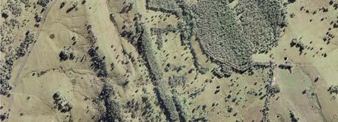
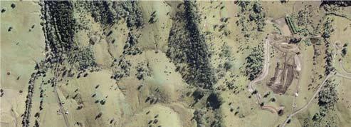
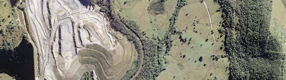
3 2 PROJECT DESCRIPTION 2.1 EXISTING DURALIE COAL MINE OPERATIONS DCPL (a wholly owned subsidiary of GCL) owns and operates the mining operations at the DCM. Coal production commenced at the DCM in 2003 with mining of ROM coal using conventional open pit mining methods. The DCM operations are supported by on-site facilities including a main infrastructure area, water management infrastructure/storages and rail infrastructure. The DCM completed and currently approved mining areas (including the approximate extent of the open pit and waste rock emplacement) are shown on Figure 2-1. The Project s approximate extent of additional surface development (including open pit, waste rock emplacement, soil stockpiles and Auxiliary Dam No. 2 embankment raise and inundation areas) is also shown on Figure 2-1. A summary of the existing operations undertaken at the DCM is provided below Mining Operations DCPL is currently conducting open pit mining at the DCM in the Weismantel Coal seam in accordance with Development Consent (DA 168/99) as modified by the NSW Minister for Planning on 28 October Further information on the history of approvals at the DCM and current approvals held by DCPL is presented in Section 2.2 and Section 6, respectively. The DCM produces up to 1.8 Mtpa of ROM coal, operating 24 hours per day. Mining Sequence and Mine Fleet The general sequence of mining at the DCM is as follows: topsoil stripping and stockpiling; removal of weathered and weak overburden by excavator; drilling and blasting of overburden 1 ; removal of general non-acid forming (NAF) overburden and trucking to the waste rock emplacement; selective mining of potentially acid forming (PAF) overburden for placement with limestone within the waste rock emplacement; selective mining of coal and haulage to the ROM pad and DCM coal handling area (including a rotary breaker); and progressive backfilling of the open pit with mined waste rock, prior to profiling and progressive rehabilitation. The currently approved mine fleet at the DCM includes three excavators, ten haul trucks, three dozers, a grader, water truck and drill. Coal Mining and Handling Mining of coal at the DCM is generally undertaken between the hours of 7.00 am and 9.00 pm. ROM coal is loaded by excavator into haul trucks from the open pit and transported to the coal handling area (including a rotary breaker), at the main infrastructure area (Figure 2-1). The bulk of the ROM coal is tipped directly into a 200 tonne (t) dump hopper. ROM coal is occasionally stored for short periods on the ROM pad for operational reasons. The capacity of the ROM coal stockpile is nominally 20,000 t. Sized ROM coal from the rotary breaker is transferred by conveyor to the 2,250 t coal loadout bin for loading into train wagons. Oversized ROM coal reject material (e.g. overburden roof rock and floor rock) from the rotary breaker is periodically trucked to the waste rock emplacement for management as PAF material. Operation of the rotary breaker and conveyor systems is generally conducted less than eight hours per day (and generally during the daytime). Further description of the mining methods and ROM coal handling at the DCM is provided in Section In accordance with DA 168/99, blasting at the DCM is undertaken between 9.00 am and 5.00 pm Monday to Saturday, inclusive. No blasting is undertaken on Sundays, public holidays, or at any other time without the written approval of the NSW Department of Environment, Climate Change and Water (DECCW). DA 168/99 also limits blasting at the DCM to be undertaken no more than two blasts per week on average over any 12 month period, without the written approval of the Director-General of the DoP. 2-1
4
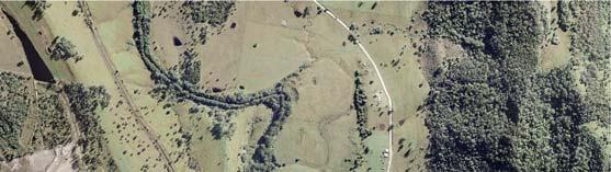
5 2.1.2 ROM Coal Rail Transport Sized ROM coal from the DCM is loaded into wagons on a dedicated train that runs between the DCM and SCM on the North Coast Railway (Figures 1-1 and 2-1). At the SCM, the coal is unloaded and processed in the SCM CHPP. Rail transportation of ROM coal from the DCM to the SCM is undertaken between 7.00 am and pm. Rail loading and transport services are provided by a rail contractor who supplies a dedicated train service and co-ordinates all loading, unloading and train movements with the Australian Rail Track Corporation (ARTC) in accordance with DA 168/ Existing Infrastructure Main Infrastructure Area The main infrastructure area is located at the end of the DCM access road off The Bucketts Way (Figure 2-1). Existing infrastructure includes the following: administration, workshop, stores and ablution buildings; heavy vehicle servicing, parking and washdown facilities; and sewage treatment facilities. Water Management Infrastructure/ Storages Existing and/or approved water management infrastructure at the DCM includes the following: Main Water Dam (MWD) and Auxiliary Dams (No. 1, No. 2 and No. 3) (Figure 2-1); Coal Shaft Creek Diversion, diversion dams and sediment dams; irrigation systems (including travelling irrigators, fixed sprays, pumps, pipelines and irrigation monitoring equipment); and open pit and sediment dam dewatering pumps and pipelines. Further description of the existing water management system at the DCM is provided in Section Rail Infrastructure Existing rail infrastructure at the DCM includes a rail siding (off the North Coast Railway), coal loadout bin (Figure 2-1) and associated conveyor systems. Other Supporting Infrastructure and Services Other existing infrastructure and services located at the DCM include: minor internal roads, haul roads and heavy vehicle hardstands; gravel pits and quarry; explosives storage; electricity transmission line (ETL), sub-station and on-site electrical distribution systems; and other ancillary infrastructure (e.g. diesel/oil tanks/storage, pumps and pipelines) Waste Rock Management The currently approved total quantity of waste rock to be removed from the DCM open pit is approximately 40 Mbcm, with the maximum quantity of waste rock mined in any one year being approximately 8.5 Mbcm. Mined waste rock is placed in the waste rock emplacement (Figure 2-1). The approved maximum height of the waste rock emplacement is RL m. Waste Rock Geochemistry A small percentage of the mined waste rock at the DCM is PAF and is managed by selective mining and management in accordance with a Potentially Acid Forming Material Management Plan (PAFMMP) (DCPL, 2003a). PAF management at the DCM includes the following components: PAF material identification and separation procedures; PAF material storage procedures; and monitoring of surface water and groundwater to determine the effectiveness of PAF material controls. 2 At the DCM, the RL (in metres) is equivalent to the Australian Height Datum (AHD) surface level (in metres). 2-3
6 PAF waste material is segregated and selectively handled. Segregation is determined in the field by the mine geologist upon consideration of the working bench height, strata dip and thickness of the PAF band. Confirmation of the thickness of the PAF band is periodically assessed by field sampling and laboratory analysis (utilising net acid generation [NAG] testing). Limestone is placed on the open pit floor and PAF waste rock emplacement lifts/faces to minimise the release of acid rock drainage (ARD) products. PAF material is stored in two distinct manners at the DCM, both in the out-of-pit waste rock emplacement and in-pit waste rock emplacement. In the out-of-pit waste rock emplacement at the DCM, the PAF material was encapsulated within constructed containment cells and capped with a clay capping layer. For in-pit waste rock emplacement, once PAF material has been placed within the open pit, a minimum 20 m layer of NAF material is placed above the emplaced PAF material. Upon final placement of sufficient NAF material to construct the design profile for the given section of the emplacement area, shaping, drainage construction, topsoil placement and revegetation is undertaken Electricity Supply and Distribution The electricity supply and distribution system at the DCM is fed by an 11 kilovolt (kv) distributor line which runs along The Bucketts Way and a spur off this line which supplies the main infrastructure area. A private substation (owned by DCM) provides an 11 kv/415 volt (V) supply which is reticulated around the site at variable voltages according to requirements. 2.2 DURALIE COAL MINE HISTORY The potential environmental impacts associated with the development of the DCM were assessed in the Duralie Coal Environmental Impact Statement (the Duralie Coal EIS) (DCPL, 1996). The Duralie Coal Project included an open pit mine, rail loop, CHPP and associated facilities. Following a Commission of Inquiry, the NSW Minister for Urban Affairs and Planning granted Development Consent for the mine in August In 1998, prior to the development of the DCM, a new Development Application was lodged with the NSW Department of Urban Affairs and Planning (DUAP) to allow DCM ROM coal to be railed to the SCM for processing in the SCM CHPP. This allowed reduction in the area required for the rail siding and negated the requirement to build a CHPP complex at the DCM. At this time, the Duralie Coal Project was also altered by reducing the area to be mined and the rate of coal production. The environmental implications of the modification were assessed via the Proposed Alterations to Duralie Coal Project Statement of Environmental Effects (Duralie SEE) (DCPL, 1998). Alterations to Stratford operational activities were also proposed to allow the acceptance of Duralie ROM coal and were assessed via the Proposed Modifications to Stratford Coal Mine Statement of Environmental Effects (Stratford Coal Pty Ltd [SCPL], 1998). The alterations to the two projects were approved in February 1999 by the NSW Minister for Urban Affairs and Planning and new Development Consents were issued for both the DCM and the SCM at this time. Coal production at the DCM commenced in In early 2003, a modification to the DCM was lodged in regard to an amendment to the DCM water management system (i.e. the Coal Shaft Creek Diversion). In August 2003, a secondary modification to the DCM was lodged with the DoP that sought to revise the alterations made in the earlier 2003 modification regarding the diversion. Both modifications (MOD i and MOD i) were approved by the NSW Minister for Planning in In early 2006, a modification to the DCM was lodged with the DoP which involved an extension of the DCM open pit and waste rock emplacement and an associated increase in the annual ROM coal production rate from 1.5 Mtpa up to 1.8 Mtpa. The environmental implications of the modification were assessed via the Duralie Extended Modification Statement of Environmental Effects (Duralie Extended SEE) (DCPL, 2006a). Duralie Extended (DA 168/99 MOD 3) was approved by the NSW Minister for Planning in July In late 2008, a modification was also lodged with the DoP that involved construction of auxiliary water storage dams. The modification (DA 168/99 MOD 4) was approved by the NSW Minister for Planning in December In June 2009, a modification to the DCM was lodged with the DoP, which involved an extension of the DCM open pit and waste rock emplacement. The environmental implications of the modification (DA 168/99 MOD 6) were assessed via the Duralie June 2009 Modification Environmental Assessment (DCPL, 2009a). Approval for the modification by the NSW Minister for Planning was granted on 28 October
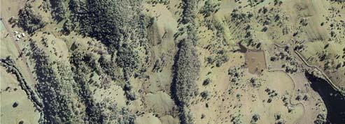
7 2.3 COAL RESOURCE, GEOLOGICAL FEATURES AND EXPLORATION ACTIVITIES The Project coal resource is located within the Permian aged Gloucester Basin in NSW. In the Project area, the DCM is located in the southern closure of the main synclinal structure of the Gloucester Basin and is associated with the coal bearing strata of the Dewrang Group. The Dewrang Group comprises three main stratigraphic units, namely: Mammy Johnsons Formation; Weismantels Formation; and Durallie Road Formation. The stratigraphic units across the Project area are shown on Figure 2-2. The Dewrang Group subcrops over a major portion of the DCM and consist of coarse and medium grained sandstones with minor siltstone, conglomerate and coal seams including the Weismantel and Clareval Seams associated with the Weismantels Formation and Durallie Road Formation, respectively. The underlying basement rocks are principally volcanics of Early Permian (i.e. Alum Mountain Volcanics) and Carboniferous age that were folded during formation of the Gloucester Basin. The Early Permian and Carboniferous volcanic rocks are typically erosion resistant and form the more prominent ridges to the east and west of the DCM (Figure 2-2). The Gloucester Basin is a fault controlled depositional trough and subsequent compression tectonics have induced folding, which has accentuated the dip of the strata and, in places, resulted in thrust faulted repetition of the stratigraphic units. The main faulting and fracturing (joints) trend from north-south, east-northeast, and west-southwest in the Project area. Generally the joint spacing in the sandstone is approximately 1 m (Kidd, 1997). The nominal coal reserve for the Project, based on the planned maximum production rate, is approximately 20.5 Mt of ROM coal. Weismantel Seam The Weismantel Seam is currently the only seam being mined at the DCM. The Weismantel Seam is generally between 10 and 12 m thick. However significant reverse faulting causes repetition of the middle and lower sections of the seam resulting in coal thicknesses of up to 20 m. The Weismantel Seam is divided into working sections on a coal quality basis. The upper 3 to 4 m is generally thermal coal and the lower 7 to 8 m is a mixture of coking coal and thermal coal. As the DCM is located at the southern closure of the regional syncline, the open pit extent to date has been located at the southern most outcrops within the axis of the syncline. The extent of the Project open pits would subsequently progress away from the axis and would be located on the western limb of the syncline. Clareval Seam The Clareval Seam was identified in late 2005 from seismic interpretation and confirmed by an exploration drilling programme. The Clareval Seam outcrops to the west of the Weismantel Seam outcrop in the Project area, and is stratigraphically situated approximately 200 m below and parallel to the Weismantel Seam. The Clareval Seam exhibits many of the same features as the Weismantel Seam in regard to coal quality trends and seam structure. In the Project area, the Clareval Seam is approximately 8 to 9 m thick, however sequences of 30 m and up to 50 m thickness are known to exist in the north-west (Figure 2-3). During the life of the Project, mine exploration activities would continue to be undertaken ahead of the open pit mining operations to investigate geological structures and seam morphology as input to detailed mine planning. Exploration activities would continue to be undertaken in accordance with the requirements of existing exploration tenements across the Project area. 2-5
8
9 WEST EAST A A 1 MLA 1 ML 1427 DU 40 DU 41 DU 46 DU 47 DU 44 DU m 53m Weismantel Seam 18.0m 30m 36m Clareval Seam Fault Fault 15m Clareval Seam Not to Scale LEGEND Overburden Thermal Coal Quality Coking Coal Quality Strata Thickness (Approximate) Source: Gloucester Coal Ltd (2007) DURALIE EXTENSION PROJECT FIGURE 2-3 Geological Cross-Section - North West DURALIE COAL GCL EA Section 2_002D
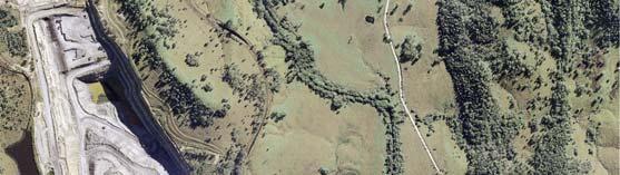
10 2.4 PROJECT GENERAL ARRANGEMENT The general arrangement of the Project has been designed to maximise the utilisation of existing infrastructure at the DCM. Project general arrangements for Years 1, 3, 5, 8 and the end of the Project life are shown on Figures 2-4 to 2-8. These general arrangements are based on planned maximum production and mine progression. The main activities associated with the development of the Project would include (Figure 2-1): continued development of open pit mining operations at the DCM to facilitate a ROM coal production rate of up to approximately 3 Mtpa, including: extension of the existing approved open pit in the Weismantel Seam to the north-west (i.e. Weismantel Extension open pit) within ML 1427 and MLA 1; and open pit mining operations in the Clareval Seam (i.e. Clareval North West open pit) within ML 1427 and MLA 1; ongoing exploration activities within existing exploration tenements; progressive backfilling of the open pits with waste rock as mining develops, and continued and expanded placement of waste rock in out-of-pit waste rock emplacements; increased ROM coal rail transport movements on the North Coast Railway between the DCM and SCM in line with increased ROM coal production; continued disposal of excess water through irrigation (including development of new irrigation areas within ML 1427 and MLA 1); raising of the existing approved Auxiliary Dam No. 2 from RL 81 m to approximately RL 100 m to provide significant additional on-site storage capacity to manage excess water on-site; progressive development of dewatering bores, pumps, dams, irrigation infrastructure and other water management equipment and structures; development of new haul roads and internal roads; upgrade of existing facilities and supporting infrastructure in line with increased ROM coal production; continued development of soil stockpiles, laydown areas and gravel/borrow pits; establishment of a permanent Coal Shaft Creek alignment adjacent to the existing DCM mining area; ongoing monitoring and rehabilitation; and other associated minor infrastructure, plant, equipment and activities. The Project would extend the life of the current operations at the DCM by approximately nine years. The mining layout and sequence shown on Figures 2-4 to 2-8 may vary to take account of localised geological features, coal market volume and quality requirements and mining economics. The detailed mining sequence over any given period would be documented in the relevant Mining Operations Plan (MOP) as required by the NSW Department of Industry and Investment (DII). Should the mining layout or sequence vary, the general arrangement (Figure 2-1) would also vary to take into consideration the Project detailed engineering design. 2.5 MINING OPERATIONS Mining operations would continue to be conducted 24 hours per day, seven days per week. Open pit mining operations would continue at the DCM with development in the Weismantel Extension open pit and Clareval North West open pit. The staging of the development of the open pits would be determined by the requirements of the coal market, product specification and/or blending requirements. As these requirements are likely to vary over the life of the Project, the development of the individual open pits and coal extraction rates may also vary Vegetation Clearing and Soil Stripping Vegetation would be progressively cleared over the life of the Project within the additional surface development areas (Figure 2-1). Specific vegetation clearance procedures (generally consistent with DCM s existing procedures) would be developed for the Project as described in Section 7 (Statement of Commitments). 2-8
11
12
13
14
15
16 Where stripped soils cannot be used directly for progressive rehabilitation, the soil would be stockpiled separately and seeded with grasses to maintain soil viability. Specific soil management, stockpiling and re-application procedures (generally consistent with DCM s existing procedures) would be developed for the Project as described in Section A dedicated fleet of dozers, excavators, haul trucks, a water cart and grader would be used for vegetation clearing and soil stripping activities Overburden Drill and Blast The method of overburden material removal at the DCM is by drill and blasting techniques. Overburden material would typically be drilled in 16 to 24 m benches. A mixture of ammonium nitrate and fuel oil (ANFO) (dry holes) and emulsion blends (wet holes) would be used at an average powder factor of approximately 0.8 kilograms per bank cubic metre (kg/bcm). Blast sizes would remain unchanged for the Project and typically range from 50,000 bank cubic metres (bcm) up to 250,000 bcm. The Project would increase the blast frequency to three blasts per week on average over a year, however the actual number of blasts in any week would be dependent on mine production. Blasting would only occur between the hours of 7.00 am and 7.00 pm, six days per week (excluding public holidays or Sundays) Indicative Mine Schedule An indicative mine schedule for the Project is provided in Table Coal Mining and ROM Coal Handling The open pit mining methods and equipment currently in use at the DCM would also be employed for the Project. Coal mining would typically involve excavators loading ROM coal to haul trucks for haulage to the ROM pad or dump hopper. Haulage of ROM coal to the dump hopper or ROM pad would utilise internal haul roads within ML 1427 and MLA 1. 1 Project Year Table 2-1 Indicative Mine Schedule Waste Rock (Mbcm) ROM Coal (Mtpa) Total Assumed Project commencement date is 1 July Approximately 1.5 Mt ROM coal is associated with the continuation of the existing/approved extent of the Weismantel open pit (as modified by the NSW Minister for Planning on 28 October 2009). Where direct feed to the dump hopper is not practicable (i.e. due to operational constraints or a requirement for blending at the SCM CHPP) coal would be placed on the ROM coal stockpile for later re-handling by front end loader. Operation of the rotary breaker at the coal handling area would continue to be operated generally less than eight hours per day (and generally during the daytime). The coal mining and ROM coal handling approach at the DCM would remain generally unchanged for the Project Mine Development The open pit development areas would involve supporting infrastructure such as haul roads, soil stockpiles, hardstands and water management structures. The mine development activities have been designed to integrate with the existing DCM operations and minimise the amount of additional infrastructure required. An overview of the constraints and design features of the two open pit areas is provided below. A conceptual cross-section of the open pit design is shown on Figure
17 WEST EAST RL 70m 8m 10m 20m 45 Overall Slope 70 RL 90m 70 Working Bench RL Om Coal Seam 30m Conceptual Cross-Section East-West through the Open Pit WEST Out-of-pit Emplacement Replaced Soil and Weathered Overburden RL 110m EAST RL 70m RL 88m NAF Waste Rock Material Post-Mine Water Table 20m 90m RL PAF Waste Rock Material (with Limestone Addition) RL Om Coal Seam Conceptual Cross-Section East-West through the Waste Rock Emplacement Source: Woodward-Clyde (1996) DURALIE EXTENSION PROJECT FIGURE 2-9 Open Pit and Waste Rock Emplacement Design - Conceptual Cross-Section DURALIE COAL GCL EA Sect 2_007E
18 Weismantel Extension Open Pit The Weismantel Extension open pit is an extension of the current open pit at the DCM and is approximately 1 km further along the strike 3 to the north and up to 400 m wide (Figures 2-4 and 2-5). Access to the Weismantel Extension open pit would be via an extension of the western haul road network. Existing quarries within ML 1427 (Figure 2-1) and adjacent to open pit mining operations would be used as a source for borrow/gravel material for haul road construction. Constraints to the Weismantel Extension open pit include the coal resource extent and strip ratios. A perimeter bund (Figures 2-5 to 2-8) would be constructed at the north-west extent of the open pit to restrict access and to screen views of the active open pit development areas from The Bucketts Way. Approximately 4 Mt of ROM coal would be mined from the Weismantel Extension open pit. Clareval North West Open Pit The Clareval North West open pit forms a strike length pit approximately 2 km long and up to 600 m wide. The Clareval North West open pit outline sub-parallels the Weismantel Extension open pit (Figures 2-5, 2-6 and 2-7). Access to the Clareval North West open pit would be via an extension to the current western haul road network, which connects to the western haul road servicing the Weismantel Extension open pit. Borrow/gravel material for haul road construction would be sourced from existing quarries and adjacent to the open pit mining operations. Similar to the Weismantel Extension open pit, constraints to the Clareval North West open pit include the coal resource extent (i.e. outcrop) to the west, private land ownership to the north and uneconomic open pit ratio limits to the east. At the widest point of the Clareval North West open pit, a significant thickening of the coal occurs associated with a smaller syncline of the main synclinal structure of the Gloucester Basin. At this location, the Clareval North West open pit and Weismantel Extension open pit intersect (Figure 2-7). Views of the active open pit development areas from The Bucketts Way would also be screened (e.g. tree plantings 4, bunding [waste rock]). Approximately 15 Mt of ROM coal would be mined from the Clareval North West open pit Mine Fleet The mine fleet for the Project would vary according to the equipment requirements associated with the DCM open pit operations. The Project mine fleet would remain largely unchanged from the existing mine fleet however some additional haul trucks and a number of smaller fleet items would be required. The additional fleet items would be of low noise emission standard (e.g. attenuated exhaust systems, all new haul trucks would be CAT 785 XQ [extra quiet] models). An indicative Project mine fleet has been assessed and is provided in the Noise and Blasting Impact Assessment (Appendix C). 2.6 ROM COAL RAIL TRANSPORT The rail transport route from the DCM to SCM is shown on Figure 1-1. In order to facilitate the increase in ROM coal production, the total capacity of the ROM coal train would be increased from approximately 2,000 t up to approximately 2,500 t. It is expected that the number of train movements would increase from approximately three movements per day to approximately four movements per day when averaged over an annual period. In the first year of the Project, the existing locomotives that service the DCM would continue to be used during the existing/approved hours (Section 2.1.2). From Year 2 (or sooner, subject to contract arrangements), the existing locomotives would be replaced by GL class locomotives (or equivalent) which are quieter than the existing DCM locomotives. Upon their introduction, the existing/approved transportation period (7.00 am to pm) would be extended to 2.00 am. This extension would facilitate improved access to the ARTC network train paths. Sunday movements would generally be restricted to daytime only. 3 In the same alignment of the geological formation. 4 Subject to landholder consent. 2-16
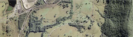
19 The existing rail infrastructure at the DCM would be suitable for the increase in train capacity and movements required for the Project without alteration. In addition, the ARTC has advised that the existing rail network would remain suitable for the proposed increase in train capacity and movements required for the Project. 2.7 WASTE ROCK MANAGEMENT Waste Rock Quantities Approximately 114 Mbcm of additional waste rock would be mined over the life of the Project (Table 2-1) Waste Rock Geochemistry Preliminary geochemical assessments have indicated the presence of PAF waste material above the Weismantel Seam and the Clareval Seam within the extent of the open pits. An assessment of the acid generating potential and metal leaching behaviour of waste rock material associated with the development of the Project is provided in the Geochemistry Assessment (Appendix I) prepared by EGi. The existing waste rock categories and management strategies (including PAF material management and limestone addition) would be used for the Project in accordance with current PAF management procedures (Section 2.1.4) Emplacement Construction Waste rock mined during the development of the open pits would be generally backfilled in the open pit voids. A conceptual cross-section of the waste rock emplacement design (including in-pit and out-of-pit emplacement) is shown on Figure 2-9. The mine plan would result in the maximum practicable portion of the waste rock being placed within the confines of the pits (Figures 2-4 to 2-8). The waste rock emplacement would be shaped by dozer prior to commencement of rehabilitation activities (i.e. re-contouring, topsoiling and revegetation). The Project would result in an extension of the existing DCM waste rock emplacement to the north-west. No change is proposed to the maximum height of the backfilled waste rock emplacement (i.e. RL 110 m). 2.8 WATER MANAGEMENT The existing water management system would be progressively augmented as water management requirements change over the life of the Project. Figure 2-10 provides a schematic of the water management system. A detailed description of the Project water management system is provided in a Surface Water Assessment (Appendix A) prepared by Gilbert & Associates Existing Water Management System The existing water management system at the DCM includes the following components: water management storages; diversion of runoff from catchment areas upstream of the mine disturbance area; runoff control on disturbed and rehabilitated areas at the mine; runoff control on infrastructure areas; sedimentation control; open pit dewatering; disposal of excess water through on-site irrigation; and sewage treatment and disposal of effluent. Water Management Storages Water stored on-site includes groundwater inflows to the open pit and incident rainfall and runoff from mine disturbance areas at the DCM. Water pumped from sumps in the open pit is stored in the MWD and Auxiliary Dam No. 1. The MWD is located to the north-west of the main infrastructure area (Figure 2-1) and has a capacity of up to approximately 1,405 megalitres (ML). Auxiliary Dam No. 1 is located upslope of the MWD (Figure 2-1) and has an approved capacity of 500 ML. The dams are also used to store water collected from selected sediment dams and runoff from the main infrastructure area. Waters pumped to the MWD are first transferred into a smaller bunded area located in the south of the MWD, adjacent to the main infrastructure area (Figure 2-1). Relative to the MWD, the water quality of the smaller bunded area is more saline and is therefore preferentially used for dust suppression on-site. Dust suppression represents the only significant water requirement at the DCM, and as a result the water balance at the DCM is generally in surplus. 2-17
20 First Flush Irrigation Protocol E LDPs15&20 (EPL 11701) R E Rail Siding Sediment Dams (RS1 & RS6) Dust Suppression of ROM Coal and Haul Roads LDPs10to14 (EPL 11701) R E Access Road Sediment Dams (SD1 to SD5) R E Auxiliary Dam No. 3 P Main Water Dam Mine Dewatering R E Weismantel Extension Open Pit (and In-pit Water Storage) G Moisture in ROM Coal To SCM LDP 27 (EPL 11701) R E Waste Rock Emplacement Sediment Dam (VC1) R E Auxiliary Dam No. 2 (Increased Capacity) G Mine Dewatering R E Clareval North West Open Pit G First Flush Irrigation Protocol R ET R ET R ET R E Auxiliary Dam No. 1 First Flush Irrigation Protocol Type I Irrigation Areas Type IV Irrigation Areas Type V Irrigation Areas (Proposed) LEGEND R ET R ET R P R Precipitation Runoff and Precipitation Type II Irrigation Areas Type III Irrigation Areas Eastern Diversion E G ET LDP Evaporation Groundwater Inflows Evapotranspiration Rainfall Runoff Licenced Discharge Points R Auxiliary Dam No. 1 and No. 2 Upstream Water Diversions R E MWD Diversion R ET Coal Shaft Creek Diversion Mammy Johnsons River Source: Gilbert & Associates (2009) DURALIE EXTENSION PROJECT FIGURE 2-10 Project Water Management Schematic DURALIE COAL GCL EA Sect 2_004F
21 Auxiliary Dams No. 2 and No. 3 were approved in December 2008 (Section 2.2) and have not yet been constructed. The dams have approved capacities of 270 ML and 110 ML, respectively. Excess water is used in controlled irrigation in accordance with the approved DCM Irrigation Management Plan (IMP) (DCPL, 2008a) and is discussed further below. Runoff Control Surface water runoff controls aim to prevent up-catchment runoff water from entering the open pit and waste rock emplacement areas. The main runoff water control structures at the DCM include the following: MWD Diversions Two extensive diversion drains located around the MWD (northern and southern drains), to the west of the open pit and waste rock emplacement (Figure 2-11). The MWD diversions intercept runoff from the catchments upstream of the MWD and divert the up-catchment runoff water to Coal Shaft Creek (northern drain) and Mammy Johnsons River (southern drain). The MWD diversion is a component of the irrigation first flush protocol and is discussed further below. Coal Shaft Creek Diversion - The diversion channel allows for the flow of up-catchment runoff reporting to Coal Shaft Creek to avoid the open pit, waste rock emplacement and infrastructure areas (Figure 2-11). Eastern Diversion A diversion drain located along the ridgeline to the east of the existing open pit to intercept runoff from the catchments upstream and divert the up-catchment runoff water to Mammy Johnsons River (Figure 2-11). Flood control embankments to prevent inundation of open pit and infrastructure areas. A culvert beneath an internal haul road crossing Coal Shaft Creek. A series of temporary northern diversion dams currently used to capture runoff from the small drainage line to the north of the Weismantel open pit extent as mining progresses, which divert water (via pumping) to the Coal Shaft Creek Diversion (Figure 2-11). Sedimentation Control Erosion and sediment control structures currently in use at the DCM include: five access road sediment dams; two rail siding sediment dams; and one waste rock emplacement sediment dam. Open Pit Dewatering Water reporting to the open pit is pumped via in-pit sumps to the MWD. DCPL holds an existing Bore Licence (20BL168404) issued by the DECCW, that allows for up to 300 ML of groundwater to be extracted in any 12 month period. On-site Irrigation System An on-site irrigation system of pumps, piping and water distribution equipment is used to supply water from the MWD to the DCM irrigation areas, and comprises the following: five electrically powered centrifugal pumps; nine travelling irrigators, each delivering some 18 litres per second (L/sec) of water; and approximately 200 fixed sprays. Operation of the irrigation areas is managed within ML 1427 in accordance with the IMP (DCPL, 2008a). Five irrigation areas are currently operated/approved, including: Type I Irrigation areas located between the MWD diversions and the water storage inundation area of the MWD. Type II Irrigation areas located upslope of the MWD diversions within ML Type III Irrigation areas located upslope of the northern extent of the Weismantel open pit, including the upper reaches of Coal Shaft Creek. Type IV Irrigation areas located on partially rehabilitated and rehabilitated areas of the waste rock emplacement. Type V Irrigation areas located on inactive (but not yet topsoiled or rehabilitated) areas of the waste rock emplacement. A mixture of pasture, woodland and cropping occurs within the irrigation areas. 2-19
22
23 First Flush Protocol The IMP (DCPL, 2008a) includes a first flush protocol. The first flush protocol is designed to collect initial (or first flush ) rainfall runoff from Type II and Type III irrigation areas following prolonged dry spells when this runoff would be expected to contain some salt loads as a result of irrigation. Sensors measuring electrical conductivity (EC) have been installed in the MWD diversion southern and northern drains (Figure 2-11) to monitor runoff from the Type II irrigation areas. The first flush system for the Type II irrigation areas generally operates as follows: When EC readings in the MWD diversion drain sumps are equal to or greater than 1,326 microsiemens per centimetre (μs/cm), or if the EC reading at Site 11 in the Mammy Johnsons River (approximately 3 km south of the confluence with Coal Shaft Creek) is equal to or greater than 400 μs/cm, motorised butterfly valves in pipelines at the downstream end of the MWD diversion northern and southern drains open, directing runoff from the irrigation areas to the MWD. When the EC readings in the MWD diversion drain sumps are below 1,326 μs/cm and the EC reading in the Mammy Johnsons River (at Site 11) is below 400 μs/cm, the valves close, allowing the runoff in the MWD diversion to report to the Coal Shaft Creek Diversion and Mammy Johnsons River downstream of the DCM. A field EC meter is used following rainfall events for checking EC levels in the northern diversion dam as part of the first flush system for Type III irrigation areas. The first flush system for the Type III irrigation areas generally operates the same as the Type II irrigation areas, as described below: When the EC reading in the northern diversion dam is equal to or greater than 1,326 μs/cm, a valve in the base of the diversion dam is opened, directing runoff from the irrigation areas to the Weismantel open pit sumps where it is then pumped to the MWD. When the EC reading in the northern diversion dam is below 1,326 μs/cm, the EC reading in the Mammy Johnsons River (at Site 11) is above 400 μs/cm and the northern diversion dam is not full (i.e. there is a low risk of spill to the Coal Shaft Creek Diversion), no action is taken and the EC levels are checked following the next rainfall event. When the EC reading in the northern diversion dam is below 1,326 μs/cm, the EC reading in the Mammy Johnsons River (at Site 11) is above 400 μs/cm and the northern diversion dam is near capacity (i.e. there is a high risk of spill to the Coal Shaft Creek Diversion), a valve in the base of the diversion dam is opened, directing runoff from the irrigation areas to the Weismantel open pit sumps where it is then pumped to the MWD. When the EC reading in the northern diversion dam is below 1,326 μs/cm and the EC reading in the Mammy Johnsons River (at Site 11) is below 400 μs/cm, the water contained in the northern diversion dam is pumped to the Coal Shaft Creek Diversion. The DCM is subject to an existing Environment Protection Licence (EPL) 11701, issued by the DECCW. The EPL include conditions pertaining to environmental monitoring, noise and blasting limits Project Water Management System The Project water management system would generally be based on the existing water management system (Figure 2-10). The Project water management system would control waters generated from surface development areas while minimising the capture of surface water runoff by diverting upslope water around such areas. The water management system would include a combination of permanent structures that may continue to operate post-closure and temporary structures that would only be required until the completion of rehabilitation works (e.g. sediment control structures). Upgrades and augmentations to the existing water management system would be undertaken as required over the life of the Project (e.g. progressive installation of up-catchment diversion drains and sediment dams) to continue to increase the efficiency of water use, minimise volume of waters entering the water management system and prevent the requirement for off-site water releases. In particular, the embankment of Auxiliary Dam No. 2 would be raised from RL 81 m to approximately RL 100 m, for the storage and management of water on-site (Figure 2-12). 2-21
24 Upstream Upstream Batter to be Topsoiled and Grassed Earthen m Clay Fill 3.0m (min) m RL Subexcavation to Expose Competent Subgrade Downstream Batter to be Topsoiled and Grassed Downstream Existing Surface Profile Metres Source: Duralie Coal (2008) DURALIE EXTENSION PROJECT FIGURE 2-12 Fill Earthen Fill Cut Off Key (Extended to Intersect Rock Horizon) GCL EA Sect 2_009E Auxiliary Dam No. 2 Conceptual Cross-Section Auxiliary Dam No. 2 Conceptual Embankment Design DURALIE COAL
25 The dam would be designed with a capacity of approximately 2,870 ML and would inundate approximately 29 hectares (ha) when full (including the existing approved Auxiliary Dam No. 2 and MWD diversion dam as shown on Figure 2-1). DCPL would obtain relevant approvals from the NSW Dams Safety Committee (DSC) for Auxiliary Dam No. 2. In addition, following cessation of mining in the Weismantel Extension open pit, the resulting final void would be used as part of the Project water management system. The storage capacity of the Weismantel Extension final void has been estimated at 1,900 ML (Appendix A). A predictive assessment of the performance of the Project water supply system (including the predicted site water management system for a range of different climatic scenarios) is presented in Appendix A. Diversion of Runoff from Upstream Sources Temporary and permanent upslope diversion bunds/drains and temporary interception dams would continue to be constructed over the life of the Project, to divert runoff from undisturbed areas around the open pits and waste rock emplacement. The Project surface water management system would include continued diversion of runoff via the Coal Shaft Creek Diversion (Figures 2-4 to 2-8). Permanent upslope diversion bunds/drains would remain around final voids. Isolation bunds would be constructed around the perimeter of any significant areas disturbed by mining to collect and convey drainage from these areas to containment storages. Upslope diversion works would be designed in consultation with the DECCW. The design capacity of these upslope diversion works would depend on: the size of the upslope catchment; the design life of the upslope diversion; and the potential consequences of a breach. Dependent on the above, the design capacity would range from the peak flow generated by the 1 in 2 year average recurrence interval (ARI) event through to that generated by the 1 in 100 year ARI event. Upslope diversions would be designed to be stable (non-eroding) at the design flows. Stabilisation of the upslope diversion works would be achieved by design of appropriate channel cross-sections and gradients and the use of channel lining with grass or rock fill. Sediment Control The eastern toe of the backfilled waste rock emplacement would be designed to abut the Tombstone Hill ridgeline (Figures 2-4 to 2-8). Sediment dams would be constructed on the eastern flank of the Tombstone Hill ridgeline for sediment control whilst the eastern waste rock emplacement batters are undergoing rehabilitation/revegetation. System Inflows Water removed from the open pits at the DCM would continue to be contained in one or more water supply storages (Section 2.8.1) for use in dust suppression and controlled irrigation (Section 2.8.4). The open pits would become sinks for incident rainfall, infiltration through mine waste rock emplacements and rainfall runoff. Sumps would be excavated in the floor of the active open pits as part of routine mining operations to facilitate efficient dewatering operations and to minimise interruption to mining. Surface runoff from mine waste rock emplacements (prior to rehabilitation) would be intercepted and diverted to containment storages for re-use in the water management system. Coal Shaft Creek Re-establishment The final alignment of Coal Shaft Creek would comprise a reworked section of the existing Coal Shaft Creek Diversion channel, a drop-down section outside the in-pit waste rock emplacement, and a section constructed over the in-pit waste rock emplacement at the southern end of the Weismantel open pit extent. Meandering of the creek within the reconstructed corridor would replicate the original meandering geometry. Further details on the final design of the Coal Shaft Creek re-establishment (including details on the environmental, hydrological, and geomorphic consideration of the proposed final alignment of Coal Shaft Creek) are provided in Appendix A Water Consumption Water would be required for washdown of mobile equipment and dust suppression on haul roads and at the coal handling area (e.g. ROM coal stockpiles and conveyor systems). Some water would also be used for fire fighting and other minor non-potable water uses. 2-23
26 The water consumption requirements and water balance of the system would fluctuate with climatic conditions and as the extent of the mining operation changes over time Irrigation System The Project would involve continued utilisation of the approved DCM irrigation areas (Figure 2-11), as well as the development of new irrigation areas. A minimum of approximately 300 ha would be irrigated as part of the Project as shown on Figure Areas within the major surface development area (i.e. areas ahead of the advancing open pit and on available waste rock emplacement areas) would be irrigated in addition to the approximate 300 ha (Figure 2-11). The development and operation of new irrigation areas would be similar to current irrigation management measures, including the continued implementation of the first flush protocol (Section 2.8.1) with operational augmentations as required. The irrigation system would also include pump back systems for new irrigation areas for implementation of the first flush protocol as shown on Figure The irrigation system for the Project is described further in Appendix A. Irrigation may be expanded into new areas adjacent to the DCM in the future, subject to separate approvals Open Pit Dewatering Excavation of the open pits would form a sink in the groundwater system towards which groundwater would flow. Whilst groundwater inflows are predicted to only be small (Appendix B), sumps would be excavated in the floor of active open pits to manage the inflows. Water that accumulates in the open pit sumps would be used for dust suppression over Project haul roads and active waste rock emplacement surfaces and/or would be transferred to the MWD. Where the potential for initially high groundwater inflows is identified during the life of the Project, advance dewatering may be conducted using temporary bores ahead of the open pit mining operation. 2.9 FINAL VOIDS At the cessation of mining, final voids would remain in the Clareval North West open pit and Weismantel Extension open pit (Figure 2-8). The approximate depths and areas of final voids are provided in Table 2-2. Table 2-2 Project Final Voids Final Void Depth (m) Area (ha) Clareval North West Open Pit Weismantel Extension Open Pit Source: Appendix A The surface catchment of the final voids would be reduced to a practicable minimum by maximising backfilling to the natural surface and the use of upslope diversions and contour drains around their perimeter. A final void water balance has been prepared for the end of the Project life and is presented in Appendix A INFRASTRUCTURE AND SERVICES The existing infrastructure and services at the DCM would continue to be utilised throughout the life of the Project, with minor additions, upgrades and maintenance works Main Infrastructure Area The existing administration offices, buildings, workshops, stores and ablution facilities at the DCM main infrastructure area would continue to be used with some minor upgrades during the life of the Project Access Roads and Internal Roads The existing access road off The Bucketts Way would remain the primary site access (Figure 2-1). The entire length of Cheerup Road and approximately 1 km of Durallie Road (within MLA 1) (Figure 2-4) would be closed in accordance with the requirements of the Great Lakes Council (GLC). Whilst operational, both roads would be used intermittently by DCPL employees to access the north-west of the Project area. 2-24