OP Council Resolution June 16, Planning and Development Services
|
|
|
- Hope Griffith
- 5 years ago
- Views:
Transcription


1 OP Council Resolution June 16, 2008 Planning and Development Services
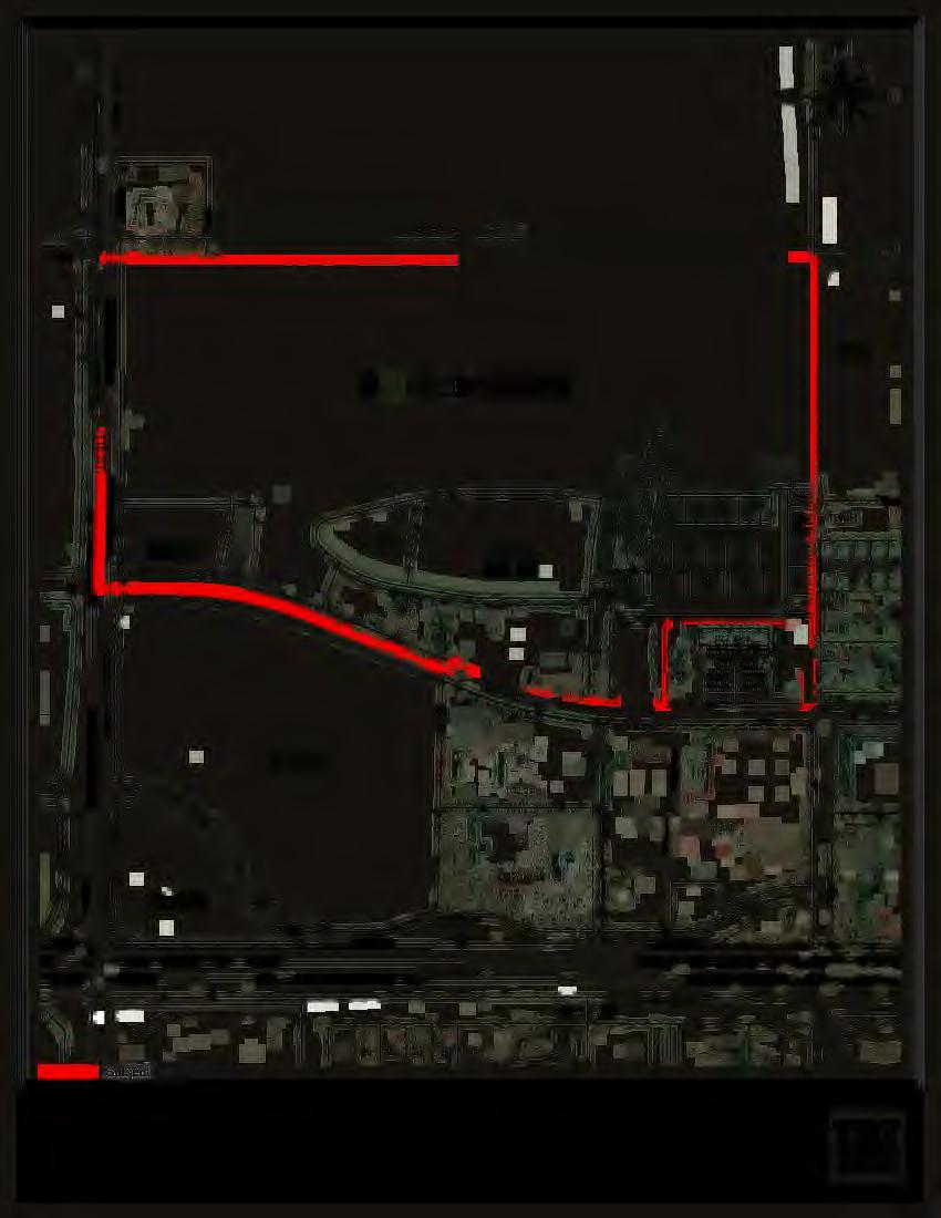
2 Westgate East OP 1. NTRODUCTON Purpose of the Plan Plan Area Location Ownership and Dispositions Policy and Regulatory Context Site Characteristics DEVELOPMENT PLAN Plan Objectives Development Concept General Residential Development Open Space Commercial Development NFRASTRUCTURE Transportation Network Circulation Access SERVCNG General Water Supply Sanitary Sewer Stormwater Shallow Utilities MPLEMENTATON Phasing Statutory Plan Amendments Proposed Land Use and Zoning... 7 The City of Grande Prairie Page i
3 Westgate East OP APPEND A: APPEND B: Land Use Summary Population and Student Generation LST OF EHBTS Exhibit 1.0 Location Plan Amended OP-07-06A, October 15, 2012 Exhibit 2.0 Ownership Plan Amended OP-07-06A, October 15, 2012 Exhibit 3.0 Area Structure Plan Amended OP-07-06A, October 15, 2012 Exhibit 4.0 Topography Amended OP-07-06A, October 15, 2012 Exhibit 5.0 Aerial Photo Amended OP-07-06A, October 15, 2012 Exhibit 6.0 Existing Land Use Amended OP-07-06A, October 15, 2012 Exhibit 7.0 Development Concept Amended OP-07-06B, September 22, 2014 Exhibit 8.0 Open Space Plan Amended OP-07-06A, October 15, 2012 Exhibit 9.0 Transportation Plan Amended OP-07-06B, September 22, 2014 Exhibit 10.0 Watermain Services Amended OP-07-06A, October 15, 2012 Exhibit 11.0 Sanitary Sewer Servicing Amended OP-07-06A, October 15, 2012 Exhibit 12.0 Storm Sewer Servicing Amended OP-07-06A, October 15, 2012 Exhibit 13.0 Phasing Plan Amended OP-07-06A, October 15, 2012 Exhibit 14.0 Outline and Land Use Plan Amended OP-07-06B, September 22, 2014 Exhibit 15.0 Proposed Zoning Amended OP-07-06B, September 22, 2014 Exhibit 16.0 Preliminary Lotting Plan Amended OP-07-06B, September 22, 2014 The City of Grande Prairie Page ii
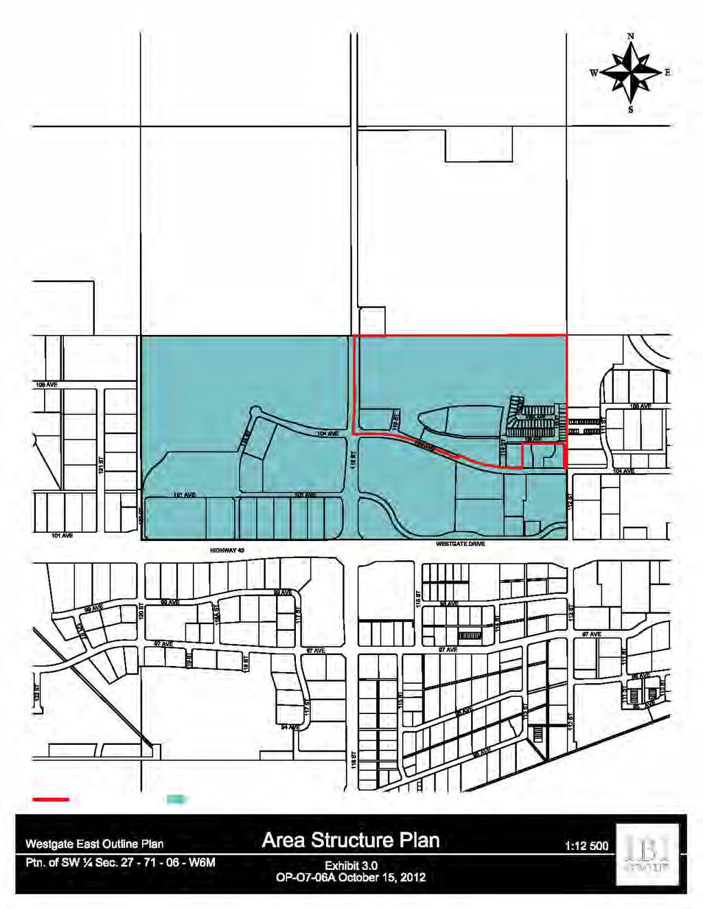
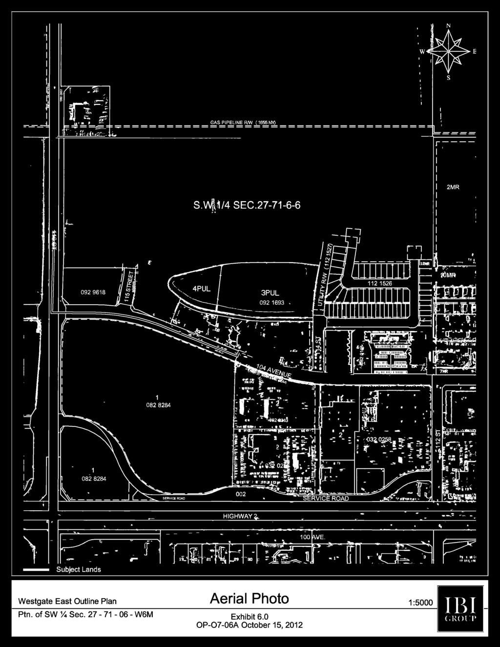
4 Westgate East OP 1. NTRODUCTON 1.1 Purpose of the Plan The Westgate East Outline Plan (OP) has been prepared on behalf of the owner of the subject lands to provide a detailed framework for the future development of lands in west Grande Prairie for residential and commercial uses. This OP has been prepared in accordance with Policy of the City of Grande Prairie Municipal Development Plan. As required by this policy, the plan addresses the following: physical features and development constraints; future land use and development concept, including lot layout; proposed transportation network, including the approximate alignment of future arterial, collector and local roads; proposed servicing to the area; and intended phasing of development. 1.2 Plan Area Location This OP applies to hectares (88.37 acres) of land that is bounded to the south by 104 Avenue, to the east by 112 Street and the Gateway Area Structure Plan (ASP) (community park, multi-family residential and commercial uses), to the west by 116 Street, and to the north by the Northwest ASP (future residential and commercial uses). Other parcels within the Westgate ASP and adjacent to the subject site have recently been developed for multi-family and commercial uses. These are lands south of 104 Avenue which have previously been zoned, and now being further developed. n addition there is an existing multi-family residential subdivision and development north of 104 Avenue. As a result they have been excluded from this OP. Exhibit 1.0 illustrates the general site context within the overall City. 1.3 Ownership and Dispositions The plan area consists of hectares (88.37 acres) of land as noted in Table 1. There has been a previous subdivision north of 104 Avenue which accommodates existing multi-family development; however this is excluded from the OP area. There is an Airport Regulations caveat on title, which will result in developments on the subject land being reviewed by NAVCAN/Transport Canada Aerodrome Safety. Based on Grande Prairie Airport Zoning Regulations, buildings above a prescribed height (approximately ten storeys) are not permitted. n addition, certain land uses which may adversely affect airport operations (i.e. creating dust or smoke, attracting birds) may be The City of Grande Prairie Page 1
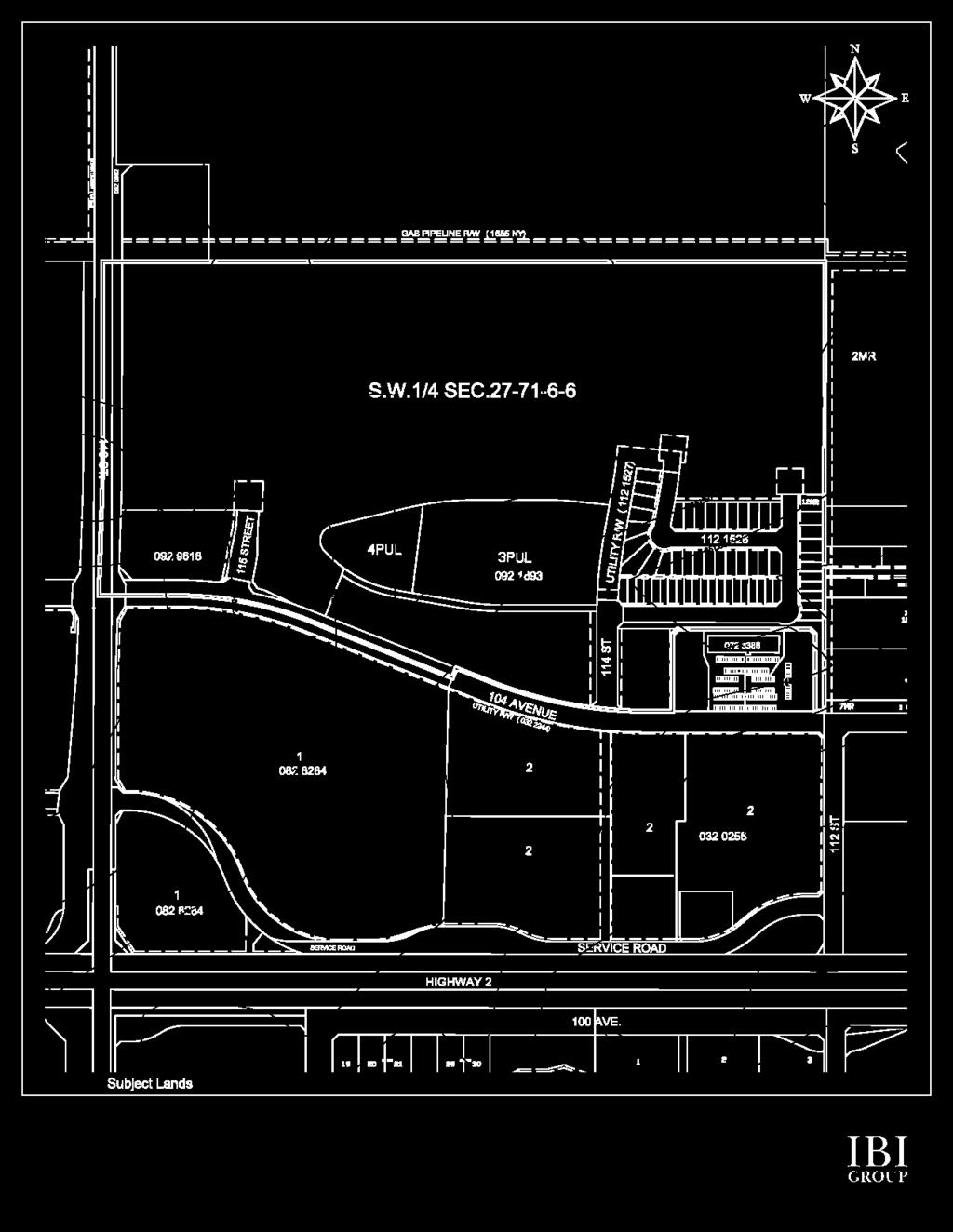
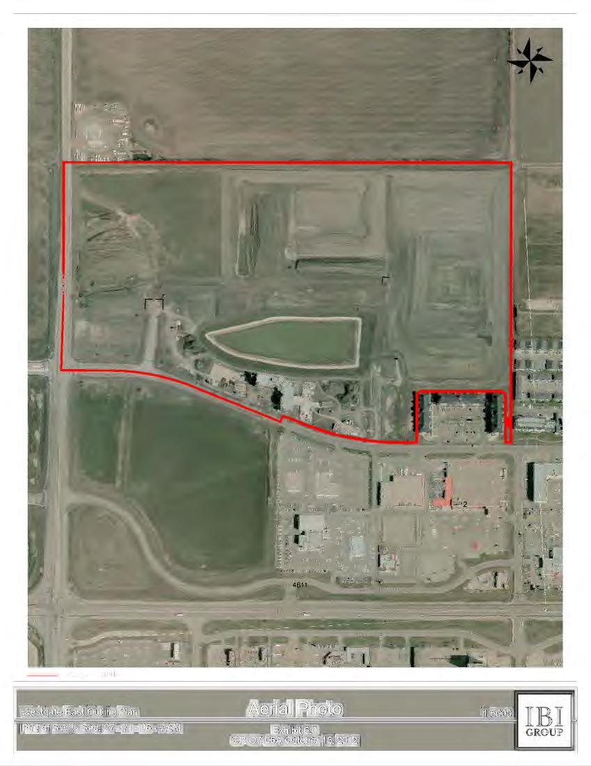
5 Westgate East OP incompatible. The entire area included in the OP is owned by Alberta Ltd. Exhibit 2.0 illustrates the ownership. TABLE 1 Plan Area Composition Legal Owner Area SW 1/4, Section 27, Twp. 71, Range 6, West of 6 Meridian Alberta Ltd ha 1.4 Policy and Regulatory Context The Westgate East OP is contained within the recent Westgate ASP (2007), in which the subject lands are located. The majority of the plan area is currently designated Arterial Commercial (CA), Medium Density Residential (RM), Low Density Residential (RS) and Combined Density Residential (RC), while the balance remains Urban Reserve. This OP will result in some changes to the residential zoning. The previous subdivision application, reflecting the 1999 West Highway 43 ASP has since elapsed. This ASP has been replaced by the 2007 Westgate ASP. The ASP boundary is illustrated in Exhibit 3.0. Exhibit 4.0 illustrates the area land use/zoning adjacent to and in close proximity to the subject site. 1.5 Site Characteristics As illustrated in Exhibit 5.0 the OP area is virtually level, with a slight gradient of about two metres from north/northwest to south/southeast. The site, as illustrated in Exhibit 6.0 is largely utilized for agricultural purposes. The existing temporary storm water management facility (pond), based on the 1999 ASP, is adjacent to 104 Avenue and has already been graded and dug out. The soils have been formed on three to four metres of silty clay lacustrine materials overlying glacial till. The physical characteristics of the site do not present any limitations to development. 2. DEVELOPMENT PLAN 2.1 Plan Objectives The Westgate East OP is intended to achieve the following objectives: 1. to provide an overall framework for future residential, arterial commercial and open space in this northwest portion of the City that is compatible with existing and proposed development on adjacent lands; 2. to provide for the development of an attractive, quality residential neighbourhood that meets the current/future needs of the market; 3. to provide for the development of arterial commercial development which respects the future role of 116 Street as a major transportation corridor and gateway to the City; The City of Grande Prairie Page 2
6 Westgate East OP 4. to develop a safe and efficient transportation network that meets the needs of passenger vehicles, pedestrians and cyclists, and is appropriately linked to future residential and commercial areas to the north and east; 5. to provide an open space system which serves as a focal point to the neighbourhood community and is linked to the overall City system; 6. to incorporate flexibility for future subdivision; and 7. to develop an efficient municipal servicing and phasing system for the plan area. Various strategic land use design considerations were developed in preparation of the plan to ensure that a flexible, high quality residential and commercial development is created, which meets present and future site considerations. They are as follows: Overall Urban Design Mixed Density Pedestrian Friendly Transit Accessible Traffic Flow Sustainable Community Environmentally Friendly 2.2 Development Concept GENERAL The proposed land use concept for the Westgate East OP is illustrated in Exhibit 7.0, and a summary of land uses is provided in Table A in the Appendix. The net developable area available is approximately hectares (88.37 acres). t is proposed that the plan area be developed for low, medium and high density residential, together with arterial commercial uses. The tables in Appendix A and B summarize population and student generation. For the purposes of this OP a shadow plan lot layout for single family and commercial uses has been overlayed (see Exhibit 16.0 in Section 5.3) to illustrate subdivision potential RESDENTAL DEVELOPMENT The largest general land use category in the plan area is low density single-family/semi-detached areas, totalling approximately 8.22 hectares (20.31 acres). This is followed by medium density multifamily (duplex, semi-detached, apartment and row housing) residential development, totalling approximately 5.04 hectares (12.45 acres) in area. Finally, there is high density (low to medium rise apartments) residential, totalling 3.59 hectares (8.86 acres). Restrictive covenants shall be registered The City of Grande Prairie Page 3
7 Westgate East OP on the titles of the lots subject to Land Use Bylaw C limiting residential dwelling development to single detached dwellings. Amended OP-07-06B September 22, 2014 t is the intent of the developer to provide for a variety of multi-family housing types, together with single-family housing, in order to maximize market opportunities and take advantage of unique development opportunities that the site affords. This is to be achieved through the use of a wide range of land use zoning districts as discussed later in Section 4.3. Higher density development will provide a transition of land use and density to the commercial lands on the west side of the plan area, for the overall residential community. As a result, density will gradually decrease from west to east in the plan area. The residential development will maximize the open space features in the plan area by orienting multi-family as well as single-family housing around them. The development concept will also feature a series of smaller cells, which will enhance a higher quality atmosphere to the community by providing smaller, more distinctive neighbourhoods. This will also have the benefit of interspersing the different housing types throughout the development, creating a truly mixed community. There will be a combination of rear lane and street access housing, although rear lanes will only be used in some of the mixed low/medium density areas. The use of rear lane access will allow for higher quality streetscape treatment in neighbourhoods. As illustrated in Table 1, it is anticipated that an estimated total of 945 units will be accommodated in the plan area. This will comprise a low density area of 147 single family/duplex units (RG, RR and RS) predominantly located in the eastern and north central portion of the plan area. Secondly, there are 91 medium density townhouse/semi-detached and duplex units (RC) predominantly in the central portion of the plan area and generally north of the storm pond (serving as a neighbourhood focal point and amenity feature) or serving to blend with the low density area and the existing multi-family site. Thirdly, there are three medium density multi-family (low rise apartments and townhouses, RM) sites adjacent to the storm pond and on the north/south collector road, comprising approximately 264 units. Finally, there are two large high density sites, comprising 443 apartment units (RH) in the westerly portion of the plan area which serve as a buffer/transition between the commercial area and the remainder of the residential community. n total, all of the above units will generate approximately 1,828 residents. This equates to an average residential density of units and 83 persons per net developable hectare (13.10 units and 34 persons per acre) OPEN SPACE The following is a detailed breakdown of municipal reserve allocation in the plan area. There is a total of 2.51 hectares (6.18 acres) of allocated MR. t should be noted that this exceeds the 1.86 hectares owing on the plan area, based on previous submission of the quarter section. As a result, MR will be taken as a combination of land and 0.65 hectares from the SE Quarter Section 28, Township 71, Range 6, W6M. Exhibit 8.0 highlights the open space system. A 1.15 hectare (2.84 acre) parcel of land is located in the northeast portion of the plan area to accommodate a neighbourhood park. The park is located in a manner which will provide access to and connection with the future community park in the adjacent Gateway area. The park configuration will provide the City with flexibility for future use (i.e. accommodate one sports field). The park also has adequate road access and frontage, to meet city requirements. Part of the secondary trail system will be incorporated into the park, thereby enhancing the connection to Gateway Park. The City of Grande Prairie Page 4
8 Westgate East OP A 0.97 hectare (2.40 acre) parcel of land is located in the west-central portion of the plan area to accommodate a smaller neighbourhood. The park is located adjacent to the storm pond and a minor collector road. Part of the secondary trail system will be incorporated into the park. This will include a trail around the storm water pond hectares (0.30 acres) comprising a linear connecting area between the easterly neighbourhood park and the central portion of the plan area (including the pond and regional trail system) and a single connecting pathway between the residential area and the Gateway Community Park to the east. The latter will provide access to and road frontage for park users hectares (0.64 acres) comprising two buffer strips between the north and east boundaries of the existing multi-family site. As such it may serve as a north/south trail link to 104 Avenue, and an east/west trail link to 114 Street. Both of these links shall be landscaped. As per the Parks Master Plan, 104 Avenue, 116 Street and the easterly north/south collector road will function as components of the City s secondary trail system. n addition to these north/south trails will be incorporated into the two north/south collectors. A second east/west trail will utilize the east/west collector road, the neighbourhood parks and linear MR, thereby providing a connection to the Gateway Community Park. For connectivity purposes, pedestrian controlled road crossings at collector roads may be utilized COMMERCAL DEVELOPMENT An approximate 4.75 hectare (11.74 acres) parcel of land adjacent to 116 Street will be for arterial/highway commercial uses. t is anticipated that the parcel will accommodate multiple users. Parcel sizes will be determined at the time of subdivision and will be dictated by market needs. t is anticipated that there may be several lots of similar size, of approximately ± 1hectare. Access to the parcel and individual lots will be from an adjacent north/south collector road extending north from 104 Avenue. 3. NFRASTRUCTURE 3.1 Transportation Network CRCULATON As illustrated in Exhibit 9.0, the plan area is served by the future arterial roadway (116 Street) on the west boundary and a major collector (104 Avenue) along the south boundary. According to the City s Transportation Master Plan, 116 Street will ultimately be developed to a six-lane divided standard. 104 Avenue has been partially constructed from the southeast boundary of the plan area, providing access to the existing adjacent multi-family and commercial development. Ultimately, 104 Avenue will be constructed to a two-lane standard. n order to accommodate the eventual upgrading of 116 Street and construction of the remaining portion of 104 Avenue, lands along the west and south boundaries of the plan area have been set aside for widening. A north/south collector road will connect the residential portion of the plan area with future residential lands to the north. Along this residential road housing will back onto the roadway, and will be provided with uniform fencing and landscaping. This is consistent with the network established in the Northwest Transportation Study. Another north/south collector road will connect to 104 Avenue and allow for connection to future commercial development north of the plan area. This road will function as a service road access for the commercial development adjacent to 116 Street and as a buffer between the commercial and residential areas. The Traffic Design Report addresses the future The City of Grande Prairie Page 5
9 Westgate East OP potential need for a controlled intersection where this road connects with 104 Avenue. Future traffic volumes will dictate the need, and volumes will vary depending on the types of commercial uses developed. An east/west minor collector road will connect this road to the residential area. A series of local roads within the residential area will be designed to minimize through traffic, create a sense of smaller neighbourhoods, provide indirect access to the Community Park, and connect to the two north/south collector roads and 104 Avenue. Rear lanes will be used for some RC housing and will only connect to local roads ACCESS As discussed in the ASP, no direct access to the commercial area from 116 Street will be permitted. Access to individual parcels will be from the north/south collector road separating the commercial and residential areas. Also, there will be no direct access to the residential uses adjacent to 104 Avenue, with the possible exception of the two medium density sites at the intersection of 104 Avenue and the north/south collector road. Access and accommodation for pedestrians and cyclists is provided through the development of an asphalt trail around the storm water ponds and neighbourhood parks, and concrete sidewalks on all collector and local residential roads. 4. SERVCNG 4.1 General Detailed design reports supporting the following servicing concepts form part of the submission and have been reviewed, and have the support of administration as part of the ongoing approval process. 4.2 Water Supply The water distribution concept for the development is illustrated in Exhibit 10.0 There is an existing water main within 104 Avenue located along the south boundary of the outline plan; an existing main is also located within the service road adjacent to Highway 43, south of the outline plan area. Existing stubs installed within the 116 Street corridor will connect water mains to the adjacent lands. Water mains will also be extended along the two north/south collector roads within the plan area, and will ultimately provide service to adjacent lands to the north. A water connection within 116 Street between the 104 Avenue and the service road water mains has been installed to complete a looped system. Additional detailed information pertaining to the water distribution/fire system is outlined in the design report for water. 4.3 Sanitary Sewer The sanitary sewer concept for the development is illustrated in Exhibit There is an existing 375mm sanitary trunk line within the Highway 43 corridor; additionally a sanitary line is located within 104 Avenue. The plan area will be serviced by the system along 104 Avenue. This sanitary system ultimately discharges to the 108 Street trunk main. Service to adjacent lands to the north will be via extension of 116 Street trunk outside of this plan area. For the CA and RH sites a method of sanitary servicing acceptable to the City and Aquatera is required due to the limitations that exist downstream off-site. Options to explore include on-site storage facilities, off-site storage facilities and/or flow monitoring and calibration of the sanitary model to confirm capacity. At the time The City of Grande Prairie Page 6
10 Westgate East OP of subdivision and servicing agreement, caveats may be placed on certain properties explaining the requirements. 4.4 Storm Water As illustrated in Exhibit 12.0 the plan area will have one centrally located storm water management facility. This facility will accept major and minor storm water events and will serve as an amenity feature for the community. A series of existing and future storm mains will be used to carry storm water to the central management facility. Some commercial developments will be required to have on-site retention. Additional detailed information pertaining to the storm water management system is outlined in the design reports. 4.5 Shallow Utilities All shallow utilities (natural gas, power, cable and telecommunications) are to be extended into the area by individual utility providers as required to service the new development. n accordance with City of Grande Prairie policy, all overhead lines will be installed underground at the Developers expense. 5. MPLEMENTATON 5.1 Phasing A tentative phasing plan for the residential lands is provided in Exhibit t is intended that development of these lands will generally occur from south to north and east to west. This will be consistent with servicing potential and will maximize marketing opportunities of the development. The initial development of the first residential phase is expected to proceed on the basis of upgrades to the existing storm water pond; however the new pond will be constructed as part of Phase 1A. All of the residential phases will tie into services extending north from 104 Avenue. The commercial lands have been identified as a separate short-term phase since development will be conditional on tie-in to sanitary service to the west of 116 Street (as development proceeds). 5.2 Statutory Plan Amendments The Westgate ASP was approved in November The OP is consistent with the development framework established in the ASP. Any changes to the OP may require an amendment to the ASP. 5.3 Proposed Land Use and Zoning Exhibit 14.0 illustrates land uses and summarizes statistics for the OP area. Proposed zoning for the plan area is identified in Exhibit n general, the easterly portion of the plan area (east of the north/south collector road) is slated for a mix of large lot, street access single-family (Restricted Residential RR), street access semi-detached (General Residential RG), street access duplexes (Low Density Residential RS) and a single small low-rise apartment site (Medium Density Residential RM). n this area the RM sites will be located adjacent to the collector road. An RS area and RM site will be adjacent to and blend with the existing multi-family development. n this eastern portion single-family and multi-family housing will be adjacent to and take advantage of the open space amenity features. The City of Grande Prairie Page 7
11 Westgate East OP The central portion of the residential area will be a mix of rear lane and street access row housing, duplexes and semi-detached housing (Combined Density Residential RC and General Residential RG). t will also feature some higher quality row housing and two low-rise apartment sites (both Medium Density Residential RM) adjacent to the storm water pond/open space amenity feature. The apartment sites will be located adjacent to 104 Avenue, providing a transition from commercial development south of 104 Avenue. The westerly portion of the residential area will comprise two apartment sites (High Density Residential RH), serving as a transition to the commercial area. Through this area a collector road will connect the residential and commercial areas. The commercial area adjacent to 116 Street will be zoned Arterial Commercial (CA). Exhibit 16.0 illustrates a preliminary lotting plan for the low density single family and commercial land uses. The City of Grande Prairie Page 8
12 Appendix A Land Use Summary Land Use Area (ha) Percent Total Land Area Net Developable Area Residential Single-Family Detached (RS) Semi-Detached (RG) Duplex (RS) Semi-Detached/Duplex/Multi-Attached (RC) Multi-Attached/Apartment (RM) Apartment (RH) Open Space Neighbourhood Park/Connecting Pathways Commercial Roads Arterial Road Collector Roads Local Roads Lanes Utilities Storm Pond and Public Utility Lots (PUL) Amended OP-07-06B September 22, 2014
13 Westgate East OP Appendix B Population and Student Generation Total Net Developable Residential Area Low Density (RR, RG, RS) Medium Density (RC, RM) High Density (RH) ha 8.22 ha 5.04 ha 3.59 ha Total Residential Units 896 Low Density ( upha) 164 Medium Density ( upha) 287 High Density ( upha) 445 Total Population Public School Students Grades K Grades Catholic School Students Grades K-9 93 Grades Based on 3.2 persons per unit for low density, 2.5 persons per unit for RC portion of medium density and an average of 1.6 persons per unit for RM portion of medium/high density and RH high density. 2 Based on 2005 City student generation assumptions Amended OP-07-06B September 22, 2014


14 N _.../""-L _j.a&.i; f T 'f '! T T

15 N s = = = = = = = = = = = OASPPaiNERW 1!11115~ = = = = = = = = = = = = = = = = = r--- 2MR S.W.1/4 SEC ta 2 2 t; ~ HGHWAY2 B GROUP
16


17 DC CA DC Subject Lands 18 Arterial Commercial G Direct Control H ndustrial Business General ndustrial Heavy ndustrial PS RC RL Public Service Combined Density Residential Low Density Residential RM RR UR Medium Density Residential Restricted Residential Urban Reserve B GROUP
18
19 B GROUP
20 Subject Lands Major Road Network Arterical Commercial (CA) General Residential (RG) Combined Density Residential (RC) Low Density Residential (RL) Medium Density Residential (RM) High Density Residential (RH) Public Utility Lot (PUL) Municipal Reserve (MR) Westgate East Outline Plan Ptn. of SW ¼ Sec W6M Development Concept Exhibit 7.0 OP-07-06B 1: September OP-07.dwg Source:

 Common Trails 2... -~ ~ 'T' 8!")
21 ---- ===========~~1~Y ==== N s 2 MR J PUL 49 Subject Lands D Municipal Reserve (MR) D Public Utility Lot (PUL) Common Trails ~ ~ 'T' 8!tl B GROUP
22 Temporary Turn Around Temporary Turn Around Subject Lands Bus Route Proposed Sidewalks Common Trails 116 Street Major Collector Local Residential Lanes Westgate East Outline Plan Ptn. of SW ¼ Sec W6M Transportation/Transit Plan Exhibit 9.0 OP-07-06B 1: September OP-07.dwg Source:

23 : ---- ~ N / F =====F= -F==========='!f!.PUN1851lNY =======: ========= =~ ~~.R ASCW ~...-=" ' j l ~" MR J PUL a' ~! F===~------~~ : 12 4 Proposed Watermain B GROUP


24 : ---- ~ N / F =====F= - ~ ===========f!!.pun1851lny =======: ========= =~ ~~.R ASCW ~...-=" '- J PUL ~ Existing Sanitary Sewer Proposed Sanitary Sewer D Q4~~ ~ ~.~~~-L ~~==~ - Parcels that require storage solutions Optional Sanitary Sewer ~ 2 49 B GROUP

25 ---- ===========~~1~Y ==== N s 2 MR J PUL \.o 1~1 1~1 1~1 49 1;1 ~ 1 1 F ~ PLAN Oi5202!8 ~ - 4 ~ ::r B 2 l<n 8,~.,1.!:::::! - "'' B GROUP


26 ---- ===========~~1~Y ==== -- 28= N / s 2 MR J PUL ll D Phase 1A D Phase 1 B D Phase1C D Phase2A 4 D ~~ Phase2B 2 PLAN Oi5202!8 - ~ ::r l<n ~.!:::::! 8.,1 - "'' B GROUP

27 design by: drawn by: date: JMB BD JAN NORTH revision/addition no. by date Revisions to Outline Plan 1 BD 08/30/2007 Revisions to Outline Plan 2 BD 10/29/2007 Submission 3 BD 11/2007 Outline Plan Comments Revisions 4 BD 04/2008 Amended zoning RR to RL 5 AD 08/2012 Revisions to Outline Plan 6 GN 08/21/2014 Temporary Turn Around RG ±1.26 ha (±3.11ac) Temporary Turn Around RL ±1.36 ha (±3.36 ac) RG ±0.31 ha (±0.77 ac) RL ±0.48 ha (±1.18 ac) RH ±2.18 ha (±5.38 ac) RC ±0.72 ha (±1.78 ac) RC ±0.33 ha (±0.81 ac) RC ±0.33 ha (±0.81 ac) RG ±0.31 ha (±0.77 ac) RL ±0.80 ha (±1.98 ac) outline plan statistics: Site Area (Gross Area) ha ± ac ± Portion of 104 Avenue 0.44 ha ± 1.07 ac ± 116 Street 0.85 ha ± 2.09 ac ± CA ±4.75 ha (±11.74 ac) RC ±0.20 ha (±.49 ac) RG ±0.61 ha (±1.50 ac) RG ±0.55 ha (±1.37 ac) RL ±0.37 ha (±0.90 ac) Gross Developable Area ha ± ac ± Gross Developable Area ha ± ac ± Less: Regional Land Uses 4.75 ha ± ac ± Gross Residential Area ha ± ac ± General Residential (RG) Combined Density Residential (RC) Low Density Residential (RL) Medium Density Residential (RM) High Density Residential (RH) 3.02 ha ± 2.64 ha ± 4.04 ha ± 3.56 ha ± 3.59 ha ± 7.50 ac ± 6.52 ac ± 9.98 ac ± 8.81 ac ± 8.86 ac ± Ptn. of SW ¼ Sec W6M OUTLNE PLAN # LAND USE PLAN # BYLAW # RH ±1.41 ha (±3.48 ac) MR ±0.56 ha (±1.38 ac) PUL ±0.03 ha (±0.09 ac) MR ±0.41 ha (±1.02 ac) RM ±1.11 ha (±2.74 ac) PUL ±3.16 ha (±7.82 ac) PUL ±0.05 ha (±0.12 ac) RM ±0.72 ha (±1.78 ac) RM ±1.15 ha (±2.85 ac) MR ±0.06 ha (±0.13 ac) PUL ±0.01 ha (±0.03 ac) RM ±0.58 ha RL ±0.61 ha (±1.50 ac) RG ±0.86 ha (±2.14 ac) MR ±1.15 ha (±2.84 ac) RG ±0.44 ha (±1.10 ac) MR ±0.26 ha (±0.64 ac) MR ±0.06 ha (±0.14 ac) RL ±0.17 ha (±0.42 ac) RL ±0.25 ha (±0.61 ac) Regional Land Use Areas of Public Dedication Roads 116 Street 104 Ave (ncluding Road Widening) Major Collector Local Residential Lane Total Roads Open Space Areas Total PS Public Utility Lot (PUL) Municipal Reserve (MR) density: General Residential (RG) Site Area: 3.02 ha ± 7.50 ac ± Number of Units (10 upa) Combined Density Residential (RC) Site Area: 2.64 ha ± 6.52 ac ± Number of Units (14 upa) Low Density Residential (RL) Site Area: 4.04 ha ± 9.98 ac ± Number of Units (12 upa) Medium Density Residential (RM) Site Area: 3.56 ha ± 8.81 ac ± Number of Units (30 upa) High Density Residential (RH) Site Area: 3.59 ha ± 8.86 ac ± Number of Units (50 upa) Density Arterial Commercial (CA) Total Number of Units ha ± (76.63 ac ±) 4.75 ha ± 0.85 ha ± 0.58 ha ± 3.12 ha ± 3.69 ha ± 0.18 ha ± 8.42 ha ± 3.25 ha ± 2.50 ha ± 2.50 ha ± ± 75 Lots ± 91 Units ± 120 Units ± 264 Units ± 443 Units ± 993 Units ac ± 2.09 ac ± 1.42 ac ± 7.71 ac ± 9.12 ac ± 0.44 ac ± ac ± 8.06 ac ± 6.15 ac ± 6.15 ac ± ± upha ± upa x x x Site Boundary Proposed Sidewalk Existing Land Use Common Trails Access (±1.44 ac) land use redesignation: RC to RM 0.94 ha ± 2.33 ac ± RC to MR 0.10 ha ± 0.24 ac ± RC to Undesignated Roads 0.40 ha ± 0.98 ac ± RL to RL 1.25 ha ± 3.11 ac ± RL to RG 1.31 ha ± 3.23 ac ± RL to RC 0.10 ha ± 0.26 ac ± GRANDE PRARE LANDS RL to RM 2.35 ha ± 5.81 ac ± RL to MR 1.64 ha ± 4.04 ac ± RL to PUL 2.98 ha ± 7.35 ac ± RL to Undesignated Roads 2.24 ha ± 5.53 ac ± Exhibit 14 UR to RL 1.84 ha ± 4.53 ac ± UR to RG 1.71 ha ± 4.27 ac ± UR to RC 2.54 ha ± 6.26 ac ± UR to RM 1.21 ha ± 3.00 ac ± UR to RH 3.59 ha ± 8.86 ac ± UR to CA 4.75 ha ± ac ± UR to MR 0.76 ha ± 1.87 ac ± UR to PUL 0.27 ha ± 0.71 ac ± UR to Undesignated Roads/Lanes 5.78 ha ± ac ± Total ha ± ac ± OUTLNE & LAND USE PLAN OP-07-06B September CO Exhibit :3000
28 RG RC RC RG RL RL CA RH RC RG RL RM RG RH RL RG RM RM RL Subject Lands CA - Arterical Commercial RG - General Residential RC - Combined Density Residential RL - Low Density Residential RM - Medium Density Residential RH - High Density Residential PUL - Public Utility Lot Westgate East Outline Plan Ptn. of SW ¼ Sec W6M Proposed Zoning Exhibit 15.0 OP-07-06B 1: September OP-07.dwg Source:
29 Temporary Turn Around Temporary Turn Around Subject Lands Westgate East Outline Plan Ptn. of SW ¼ Sec W6M Preliminary Lotting Plan for Single Family Land Uses Exhibit 16.0 OP-07-06B 1: September OP-07.dwg Source: