CONCEPTUAL MODELS AIMING TO PROTECT FROM PESTICIDE CONTAMINATION DRINKING WATER PRODUCTION FROM GROUNDWATER
|
|
|
- Brendan Pope
- 5 years ago
- Views:
Transcription
1 CONCEPTUAL MODELS AIMING TO PROTECT FROM PESTICIDE CONTAMINATION DRINKING WATER PRODUCTION FROM GROUNDWATER Engida ZA Hydrogeology Sub Process Manager Water Works Design and Supervision Enterprise WATER WORKS DESIGN AND SUPERVISION ENTERPRISE P. O. Box 2561, Addis Ababa Ethiopia Tel: (251) / Fax: (251)
2 INTRODUCTION In Ethiopia groundwater is the main source of drinking water More than 90% of the rural water supply source and about 40% of the major towns of the country get their water supply sources from groundwater i.e. Some of the regional state towns like, Mekele, Diredawa, Dessie, Bahir Dar, Harar,etc get their water supply from groundwater (Bore holes and springs), Even Addis Ababa water supply source is currently more than 40% from groundwater at present and the role could be more in the future. 2
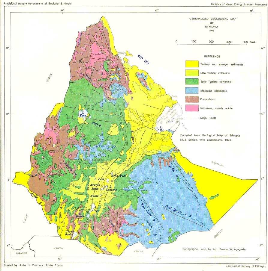
3 HYDROGEOLOGY OF ETHIOPIA Groundwater occurrence, distribution, depth and movement in Ethiopia are very complex and heterogeneous due to the topographical, geological and climatological factors. Generally, groundwater distribution is a function of rainfall, topography and geological formation. The main aquifer systems in Ethiopia are (figure 1): 1. The alluvial deposits: About 20 % of the area of the country (Rift valley and outer low lands). In these formations the groundwater depth varies from artesian to >230 m. In some part of these formation the groundwater could be under a threat of pesticide pollution, where there are mechanized farms and the shallow and sand and gravel aquifers are venerable to pollution ALLUVIAL 3

4 Artesian well in alluvial aquifer at Raya valley Q=12 l/s 4
5 HYDROGEOLOGY OF ETHIOPIA 2. About 60% of the surface area of the country (central, most of the northern part and south west of Ethiopia) is composed of volcanic and metamorphic rocks, where groundwater is localized within joints, fractures and weathered portions. The groundwater depth from artesian flow to 162 meters with an average depth not less than 20 meters. Residual soil dominantly clay thickness more than 3 meters overlies it and makes it less venerable to pesticide contamination of the groundwater. VOLCANIC 5

6 Artesian well in volcanic aquifer near Addis Q =115 l/s 6
7 HYDROGEOLOGY OF ETHIOPIA 3. About 22 % of the surface area of the country (part of north and south east of Ethiopia) is composed of consolidated sedimentary deposit and the groundwater depth varies from 2 to 120 meters. These rocks in some parts of the country are karstified and highly venerable to pesticide contamination 7
8 8
9 ASSESMENT OF PESITICIDE CONTAMINATION OF GROUNDWATER GENERAL Pesticide are mainly organic compounds and can be divided into ionic and non-ionic (Vrba and Romjin, 1986) Ionic are more soluble than non-ionic Pesticide in solution may be fixed in the soil or unsaturated zone by soil organisms and adsorption to organic matter or clays. They can be broken down by chemical and biological degradation under the influence of microorganism. 9
10 ASSESMENT OF PESITICIDE CONTAMINATION OF GROUNDWATER IN ETHIOPIA GENERAL These possibilities has made the impression that pesticide may not be a threat to groundwater However, this is not true when the groundwater is highly vulnerable to pollution The magnitude of the threat of pesticide to groundwater depends on a) the properties of the pesticide residue, b) the frequency and rate of rainfall or irrigation, c) the soil or unsaturated zone properties, d) the volume and the state (liquid or solid) of the pesticide e) the persistence of the pesticide applied. 10
11 ASSESMENT OF PESITICIDE CONTAMINATION OF GROUNDWATER IN ETHIOPIA PESTICIDE CONTAMINATION The major causes for pesticide contamination of groundwater sources of drinking water in Ethiopia could be Pathways through the body of the aquifer (unsaturated zone which depends on the venerability of the aquifer) and the well located within a farm area or nearby the farm Pathways resulting from poor well design and construction and its deterioration with time and its location with respect to farm area and its topographic location with respect to the farm area. Distance from the farm area. Pollution assessment is proposed to be carried as the following flow chart 11
12 Polluted surface water Polluted surface water Poor grouting Unsaturated zone permeable Unsaturated zone impermeable aquifer aquifer 1. Pollution due to vun. aquifer 2. Pollution due to poor construction or management of the well Possible major causes for pesticide contamination of groundwater sources of drinking water in Ethiopia 12
13 Farm areas pesticide applied Identify well location on Google earth relative to Farm area Prepare groundwatercharacterize the soil level depth map From soil maps Characterize the Unsaturated zone From well logs is the ground water level depth shallow? Is the soil and the unsaturated zone permeable? Is the well is found in farm area? Is the well properly constructed? Collect water sample for analysis Proposed methodology to collect water samples 13
14 Application of Proposed methodology to assess pesticide groundwater pollution in Ethiopian rift valley A sample area is selected to develop a methodology between Nazareth (Adama) and Lake Ziway in the rift valley (figure below) The available drinking water bore holes data are collected The groundwater level depth map of the selected map is prepared (figure). The most venerable areas are where the groundwater is shallow less than 10m and meters. 14
15 LA KE SEASO NALLY FLODE D Gonder %U Bahr Dar %U %U Mekele Dese %U Location map of sample site #S Welkite Jimma #S #S #S Addis Abeba Nazret #S %U Awassa Shashemene Dire Dawa %U Jijiga #S Harer #S 15
16 GROUNDWATER LEVEL DEPTH MAP OF THE SAMPLE AREA IN THE RIFT VALLEY Nazret %U Lake Ziway LEGEND Bore holes Roads Lakes Groundwater level depth map in meters <10 m Lake Shala N m m m m >150 m Meters Sample Site in the rift valley 16
17 Proposed methodology to assess pesticide groundwater pollution in Ethiopian rift valley Based on the groundwater level map bore holes with shallow groundwater level depth (< 10m and 10-20m are selected) (Table 1). The soil map of the area showed that the soil is silt loam (moderate permeability) In order to check where these bore holes are located i.e. in farm areas, nearby a farm or outside (far from farm areas) they bore holes are plotted on goggle earth and the distance from the farm area can be measured easily (images below) For example BH-3 and BH-2 are located near Wonji Sugar state (about 6,000 ha) and where pesticide is applied. The other wells are located near small farms <3ha. 17
18 Table 1 Sample wells in the rift Valley with shallow groundwater depth INDEX Coordinates in UTM Zone 37 adindan X Y Z Well depth, m Ground water level depth, m BH Distance from farm area, m Soil/ unsaturated zone Farm area Possibility of Risk of pesiticide contamination Silt loam (moderate permeability) Small farms <3ha Minimum Remar k BH ditto Mechanized farm >6000ha high sample BH ditto Mechanized farm >6000ha high sample BH no farm area ditto Small farms <3ha Minimum BH ditto Small farms <3ha Minimum BH ditto Small farms <3ha Minimum BH ditto Small farms <3ha Minimum BH ditto Small farms <3ha Minimum BH ditto Small farms <3ha Minimum BH ditto Small farms <3ha Minimum BH ditto Small farms <3ha Minimum BH ditto Small farms <3ha Minimum BH ditto Small farms <3ha Minimum BH ditto Small farms <3ha Minimum 18

19 Wonji sugar estate Farm area 19

20 Farm area 20

21 Farm area 21

22 Farm area Farm area 22
23 Scenarios of protecting drinking water from groundwater The following scenarios are considered A) Is currently the groundwater is polluted by pesticides at mechanized farm areas, where the groundwater is shallow and the soil is silt loam or permeable? For example: check water samples from BH-2 and BH-3 B) is the groundwater venerable If more pesticide is applied? C) Is the groundwater is naturally protected? D) Type of pesticide used currently and their impact on the groundwater and select type of pesticide to be used in the future to minimize the risk of groundwater pollution 23
24 scenario 1. Alluvial aquifers- at the rift margin (HD & SW) 2. Alluvial aquifer along small rivers (mainly hand dug wells are drilled) 3. Volcanic aquifers of shallow wells 4. Fractured basement rocks of shallow wells 5. Fractured aquifer of sedimentary aquifers- in most cases overlain by alluvial and volcanic formations 24
25 Scenarios 1. Alluvial aquifers- at the rift margin Runoff Sand & gravel Water level 25
26 scenario. Alluvial aquifer along small rivers (most hand dug wells are drilled) WL River Alluvial aquifer Volcanic rocks 26
27 Thank You! 27