Distribution of Elevation Zones in the Study Area ANF-2-1
|
|
|
- Archibald Park
- 5 years ago
- Views:
Transcription
1 Annex-Figures
2

3 Annex-F Distribution of Elevation Zones in the Study Area ANF-2-1


4 Annex-F Distribution of Slope Category in the Study Area ANF-2-2

5 Annex-F Principal Sub-basins in the Study Area ANF-2-3
6 Pasac R. Bamban R. Baliwag R RCH01 Talavera R Rio Chico R PAM01 PAM02 Calumpit Massim R. San Miguel R. PAM03 PAM04 PAM Tabualing R. Cabu R. Digmala R. Masiway PAM06 Dam Pantabangan Dam 25.4 Penaranda R PEN Coronell R Sumacbao R. COR01 Angat R. Note: Number shows distance in km from downstream end of a river. Source: JICA Study Team Annex-F Schematic River System in Pampanga Main River System PAM01 less than 1/10,000 PAM02 1/10,000-1/5,000 PAM03 1/5,000-1/2,500 PAM04 1/2,500-1/1,000 PAM05 1/1,000-1/400 PAN01 more than 1/ Bamban R. Elevation Elevation (m) (m San Miguel R. Massim R. Baliwag R. Tabualing R. Penaranda R. Sumacbao R. Cabu R. Digmala R. Rio Chico R. incl. Talavera R. Pantabangan Dam Masiway Dam Coronell R. Pampanga R Distance (km) Source: JICA Study Team Annex-F Longitudinal Profile of the Main Rivers in Pampanga Main River System ANF-2-4
7 Pampanga R. Bagbag R. Bayabas R Labangan Floodway Angat R. Bustos Weir 0 Ipo Dam Angat Dam Angat R ANG01 ANG02 ANG03 Note: Number shows distance in km from downstream end of a river. Source: JICA Study Team Annex-F Schematic River System in Angat River System ANG01 less than 1/2,000 ANG02 1/,2000-1/300 ANG03 more than 1/300 Elevation Elevation (m) Bayabas R. Angat R Labangan Floodway Conf. with Bagbag River Bustos Weir Ipo Dam Angat Dam Distance (km) Source: JICA Study Team Annex-F Longitudinal Profile of the Main Rivers in Angat River System ANF-2-5
8 Gumain R. Porac R. Pasig-Potrero R. PAS Abacan R Guagua R. 8.1 San Fernando R Pasac R Manapi Mesapinit R Bebe-San Esteban Cutoff Channel Pampanga R. Note: Number shows distance in km from downstream end of a river. Source: JICA Study Team Annex-F Schematic River System in Pasac River System /25 1/50 1/100 Porac R. Gumain R. Guagua R. incl. Pasig-Potrero R Elevation (m) Pasac R. incl. Abacan R Distance (km) Source: JICA Study Team Annex-F Longitudinal Profile of the Main Rivers in Pasac River System ANF-2-6
9 ANF-2-7 Annex-F Location of Meteorological Stations
10 Annual precipitation (mm) Cabanatuan Science Garden Infanta Iba Source: JICA Study Team based on PAGASA data Annex-F Change in Annual Total Precipitation at Key Stations ANF-2-8

11 Type Type Type Annex-F Climate Zones ANF-2-9


12 Annex-F Spatial Distribution of Annual Total Precipitation ANF-2-10


13 Annex-F Spatial Distribution of Precipitation in Dry Season ANF-2-11


14 Annex-F Spatial Distribution of Precipitation in Wet Season ANF-2-12

15 2.1 Hydrology Annex-F Location of Hydrometric Stations ANF-2-13
16 Angat Dam Catchment q (m 3 /s/km 2 ) ,000 4,000 6,000 8,000 10,000 A (km 2 ) Angat Dam Catchment q (m 3 /s/km 2 ) ,000 4,000 6,000 8,000 10,000 A (km 2 ) Source: JICA Study Team Annex-F Specific Discharge ANF-2-14
17 Angat Dam Catchment C(-) ,000 4,000 6,000 8,000 10,000 A (km 2 ) Angat Dam Catchment C(-) ,000 4,000 6,000 8,000 10,000 A (km 2 ) Source: JICA Study Team Annex-F Runoff Rate ANF-2-15


18 2.2 Geology Annex-F Geological Map ANF-2-16

19 2.3 Hydrogeology Annex-F Hydrogeology Map ANF-2-17

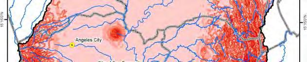
20 2.10 Annex-F Flood Area in Typhoon Marce, August 2004 ANF-2-18

21 Annex-F Population Density of Each of Municipalities in the Study Area ANF-3-1

22 Annex-F Land Cover in the Study Area ANF-3-2

23 Annex-F Location of Water Permits for Surface Water ANF-3-3

24 Annex-F Location of Water Permits for Groundwater ANF-3-4
 Delineation and Titling in")
25 Annex-F Status of AD/AL (Ancestral Land) Delineation and Titling in and around the Study Area as of March 9, 2010 ANF-3-5
26
27 Angat storage dam Effective storage volume = 850MCM Angat Inflow 1) Self-catchment Qin=59.3m 3 /s (1,869MCM/y) (observed average in ) 2) Umiray trans-basin Qin=11.7m 3 /s(370mcm/y) (observed average in , ) ANG0203 Catchment of Angat storage dam A=546km 2 Umiray R. Intake3-Sumag R. (not yet completed) Intake2-Alia R. (not yet completed) Main tunnel Intake1-Umiray R. To Bustos dam ANG03 A 3 T_UMI03 T_UMI02 A 2 Angat R. A 1 To MWSS Ipo dam ANG0204 T_UMI01 Catchment of diversion point of Umiray trans-basin A=161km 2 A 1=130km 2 A 2=6km 2 A 3=25km 2 W N E S 0 5 km Angat dam Surcharge volume Flood control volume EL 219m (V eff =894MCM) 42MCM EL 210m (Wet season) (V eff =696MCM) Conservation volume 490MCM (Domestic & Irrigation & Power) 156MCM EL 180m (lower limit of operation of main power unit) (Veff=206MCM) EL 212m (Dry season) (V eff =738MCM) 532MCM 206MCM EL 160m (Veff=0MCM) H=131m Supplied either by main turbine or through Ipo dam Supplied only through Ipo dam Dead volume Source: JICA Study Team Annex-F Location and Dimension of Angat Storage Dam ANF-4-1
28 Catchment of diversion point of Casecnan trans-basin A=570km 2 Abaca Casecnan R. CH0104 Catchment of Pantabangan storage dam + Masiway dam A=869km 2 Pantabangan storage dam Effective storage volume = 2,775MCM PAN01 T_CAS Denip Pantabangan Inflow 1) Self-catchment +Aurola trans-basin Qin=38.4m 3 /s (1,195MCM/y) (observed average in ) 2) Casecnan trans-basin Qin=23.8m 3 /s(752mcm/y) (observed average in ) N Masiway dam PAM0503 Catchment of diversion point of Aurola trans-basin A=68km 2 T_AUR W Aurola trans-basin channel S E 0 5 km PAM0502 Diayo Canili Aguang R. Pampanga R. PAM0501 Rizal dam To Bongabon dam Pantabangan dam Surcharge volume EL 230m (V eff =2,775MCM) 688MCM Flood control volume 330MCM EL 216m (Wet season) EL 221m (Dry season) (V eff =2,087MCM) (V eff =1,757MCM) Conservation volume (Irrigation & Power) 1,757MCM 2,087MCM H=107m EL 170m (Veff=0MCM) Dead volume (225MCM) Source: JICA Study Team Annex-F Location and Dimension of Pantabangan Storage Dam ANF-4-2

29 Annex-F Location of Proposed Large Storage Dam Sites ANF-4-3


30 Annex-F Location Map of Existing NIS ANF-4-4
31 Tarlac River Taris Dam O'Donnel River TASMORIS (4,200ha) Smoris Dam Chico River UPRIIS Div-V (16,879ha) UPRIIS Div-I (4,120ha) UPRIIS Div-I (16,400ha) Talavera River Talavera Dam Super Diversion Canal UPRIIS Div-II (22,591ha) UPRIIS Div-III (25,881ha) Pantabangan Dam Masiway Dam Rizal Dam Bongabon (Atate) Dam Aulo Dam Aulo SRIP (810ha) Aulo River Penaranda Dam Penaranda River UPRIIS Div-IV (19,924ha) Cong Dadong Dam PDRIS (6,604ha) Porlac River Porlac Dam Solib Dam Gumain Dam Porlac RIS (1,458ha) Gumain River Gumain RIS (1,629ha) Pampanga River Angat River AMRIS Right Bank (16,663ha) AMRIS Left Bank (10,128ha) Bustos Dam Maasim River Angat Dam Manila bay Source : JICA Study Team Annex-F Schematic Flow Diagram of Existing NIS ANF-4-5


32 Annex-F Location Map of CIS ANF-4-6


33 Annex-F Location Map of Small Scale Irrigations under BSWM ANF-4-7


34 Annex-F Location Map of Projected NIS ANF-4-8
35 Tarlac River Taris Dam O'Donnel River TASMORIS (39,150ha) Smoris Dam Balog-Balog Dam Chico River UPRIIS Div-V (37,200ha) UPRIIS Div-I (4,120ha) UPRIIS Div-I (16,400ha) Super Diversion Canal Talavera River Talavera Dam UPRIIS Div-II (22,591ha) UPRIIS Div-III (25,881ha) Pantabangan Dam Masiway Dam Rizal Dam Bongabon (Atate) Dam Aulo Dam Balintingon (14,900ha) Aulo SRIP (810ha) Aulo River Penaranda Dam Diversion Dam Balintingon Dam Penaranda River UPRIIS Div-IV (19,924ha) Cong Dadong Dam PDRIS (6,604ha) Porlac River Porlac Dam Solib Dam Gumain Reservoir Porlac- Gumain (16,750ha) Pampanga River AMRIS Right Bank (16,663ha) Bustos Dam Maasim River Angat Dam Gumain Dam Gumain River Angat River AMRIS Left Bank (10,128ha) Manila bay Existing Dam Proposed Dam Source : JICA Study Team Annex-F Schematic Flow Diagram of Projected NIS ANF-4-9

36 Annex-F Present Coverage of Water Supply Facilities for Access to Safe Drinking Water ANF-4-10

37 Annex-F Present Coverage of Level 3 Water Supply Facilities with Safe Water Access ANF-4-11


38 Annex-F Present Coverage of Sanitary Toilet ANF-4-12
39 Angat river Release to Bustos 1- HPP (Main Unit) Main Pipe Angat Storage Dam To Bustos dam Main Unit (200MW) Auxiliary Unit (46MW) Release to Ipo 1- HPP (Auxiliary Unit) 2- Bypass 3- Lower discharge pipe 4- Spillway N Ipo dam W E S 0 1 km To MWSS Pantabangan Storage Dam Casecnan Hydropower plant (150MW) Casecnan trans-basin tunnel Power house-1 (100MW) PAM0503 N W E Masiway dam Power house-2 (12MW) 0 1 km S Pampanga river Source: JICA Study Team Annex-F Existing Hydropower Plants in the Study Area ANF-4-13


40 Annex-F Completed Major Flood and Sediment Disaster Prevention Works ANF-4-14

41 Annex-F Hydrological Gauging and Repeater Stations for Completed and On-going Flood Forecasting and Warning System in Pampanga River Basin ANF-4-15
42 Arayat-Apalit-Masantol (Existing) Abacan River Eastern Megadike Drainage Improvement for San Fernando River (PHUMP Phase IV) Pampanga River Gumain River Western Megadike Pasig-Potrero River Porac River Transverese Dike San Fernando River Setback Levee ANF-4-16 LEGEND Boundary of Study Area River Porac-Gumain River Channel Excavation / Dredging (PHUMP Phase III) G. S. O. Road Tail Road Widening of Third River Channel (PHUMP Phase IV) Widening/Construction of Levee for Pmapanga River (PDDP FC Phase III) Widening/Construction of Levee for Bagbag River (PDDP FC Phase II) Widening/Construction of Levee for Angat River (PDDP FC Phase II) Road Completed Flood Mitigation Project On-going and Proposed Flood Mitigation Project Construction of Porac-Gumain Diversion Channel (PHUMP Phase III) Pasac River Bebe San Easterban Short Cut Channel Excavation of Pasac River (PHUMP Phase IV) Pampanga River Labangan Floodway Widening/Construction of Levee for Pmapanga River (PDDP FC Phase II) Widening/Construction of Levee for Pmapanga River (PDDP FC Phase I) Completed Angat River Hagonoy-Calumpit-Plaridel Levee (Existing) Widening/Construction of Levee for Labangan Floodway (PDDP FC Phase II) Manila Bay Annex-F On-going and Proposed Structural Flood Mitigation Works in Pampanga River Basin
43 .1.3Institutional-Setup for Water Resources Management T Legislative Arrangements 5.2 Present Organization Setup Policy Making & Planning NEDA Coordination / Regulation NWRB Members DENR NEDA DOF DOJ DOH NHRC Exec. Dir., NWRB ANF-5-1 Water Quality & Sanitation EMB DOH BRL EHS LGUs MWSS LWUA-WDs Irrigation Watershed Management FMB BSWM NIA NPC PAWB Hydro Power Integrated Area Development LLDA RDCs BOI PEZA RBCO Water Supply Data Collection NWRB BRS NAMRIALWUA MGBPAGASA MWSS NIA Flood Management Research DOST-PCAFNRRD ERDB Fisheries & Recreation Cloud Seeding PAF BSWM Ports & Navigation NIA DA BSWM DOEPSALM NPC PEMC NAPC-WASCO DOF-CDA DBP DAR DPWHMWSS LWUA-WDs PTAHUDCC DILG-PMO PEZALGU s DPWH-PMO OCD-NDCC PAGASA MMDA BFAR PTA PPA Source: Philippine Water Supply Sector Road Map, p.19, modified by JICA study Annex-F Functional Chart of Water Related Agencies in the Philippines
44 OFFICE OF THE PRESIDENT DBM Budgeting ANF-5-2 DOF Funding NEDA Planning Water Users NWRB Water Rights & Regulation of CPC Holders FMB PAWB DENR Environment & Watershed ERDB MGB RENRO EMB DILG DOH DPWH DA Regional Offices PLG OO MLG OO CLG OO PMO LWUA Urban Water Districts Regional Health Office Provincial Hospital Regional Office District Engineer s Office Provincial Infrastructures (Roads, Utilities, Flood Control, Irrigation, etc.) PMO MWSS Concessionaries in Metro Manila DOE NIA NPC NEA Regional Irrigation Office Hydropower Dam Office Communal Irrigation System PENRO CENRO Municipal/ City LGUs LGU Owned/ Operated LGUs Water Supply Providers Provincial Health Office Rural Health Office Irrigation Management Office (IMO) Function of Local Government Sanitation & Water Quality Control Annex-F Functional Relationship among Central Government Agencies and Local Governments Source; JICA Study Team
45 ANF-5-3 Annex-F Organizational Chart of Province of Pampanga
46 1. File Application With Documents 2. Agriculture Purpose Hydropower Industrial Purpose Domestic Purpose Recreational Fisheries Purpose Drainage Purpose Determine Compliance w/ requirements 9. Technical Appraisal by Deputized Agencies 14. Technical Evaluation by NWRB staff ANF-5-4 Posting of Application Yes Obtain clearance From other agencies Is source from Groundwater? Issue Permit to Drill 15. NWRB staff recommended To the Board Is there Protest? No Yes 13. Submit well data to NWRB 16. Board Decides Hearings Adjudication/ Decision by the Board Yes In favor of No Applicant? Return Application Papers No 17. Approved? 18. Yes Issue Water Permit Annex-F Flowchart for Processing of Water Permit Application Source: NWRB
47 Board of Director Office of Executive Director (8/9) Policy and Program Division ( 22 / 26 ) Water Right Division ( 13 / 18 ) Water Utilities Division (12/15) Monitoring and Enforcement Division (18 /25 ) Administrative and Financial Division ( 30 / 33 ) Policy and Formulation Section Permit Section Registration and Licensing Section Operation and Monitoring Section General Service Section Program Evaluation and Coordination Complaint and Investigation Section Water Rate Regulation System Water Meter Calibration Section Personnel and Records Section Water Resources Assessment and Section Evaluation Section Litigation and Adjudication System Enforcement Section Budget and Accounting Section Water Resources Information Section Litigation and Adjudication Section Systems and Accounts Section Evaluation Section Collection and Disbursement Section Note: Values in ( ) indicate staff number/position. Policy and Program WaterRight Water Utilities Monitoring and Enforcement Administrative and Financial Engineer Special investigator Planning officer Development management officer Instrument technician Information analyst Statistician Economist Financial analyst Regulation officer Attorney Administrative Total (95+8=103) Annex-F Organization Chart of Present NWRB as of March 2009 Source: NWRB ANF-5-5
48 Source: Proposal to DBM, NWRB Annex-F NWRB s Proposed Organizational Structure as of March 2009 ANF-5-6
49 NWRB BOARD Office of the Executive Director Office of the Deputy Executive Director Financial & Administrative Office Human Resources Management & Records Section Finance Section Treasury Section General Services Section Office of the Executive Director/Deputy Exec. Director Staff Management Information System Staff Internal Audit Staff Public Affairs Information Staff ANF-5-7 Legal & Adjudication Service Policy, Coordination & Integration Service River Basin Development Resource Regulation Service Economic Regulation Service Legal Division Adjudication Division Policy and Program Water Rights Standards & Technical Division Division Division Compliance Division Regulation Division Note: Note: Policy River Basin Permit Standards Registration & Composed of pool Composed of pool Formulation Institutional Section Monitoring Licensing of lawyers, of lawyers, LLB Section Development Technical Section Section LLB graduates and graduates and Section Program Evaluation Reservoir Technical stenographers stenographers Evaluation & River Basin Project Section Regulation and Operations Coordination Planning & Assessment & Monitoring Section Section Implementation Water Pricing Section Consumer Affairs Section Section Project and Compliance Section Management Section River Basin Capacity Dev't Section Technical Investigation & Enforcement Section Financial Regulation Division Financial Monitoring Section Tariff Regulation Section Annex-F NWRB's Proposed Organizational Structure, September 2010
50

51 Annex-F Land Classification vs. Land Cover Over Forest Lands in the Study Area 2005 ANF-6-1

52 Annex-F Evaluation of Groundwater Usage Condition in Present Condition (2008) ANF-6-2
53 Annex-F Evaluation of Groundwater Usage Condition in Future Condition (2025) ANF-6-3
54
55 All provincial governors and city mayors, mayors of municipalities designated as provincial capitals, and mayors of municipalities designated as regional center; All presidents of the provincial league of mayors RDC III Full Council Secretary The Regional Directors of agencies represented in the National Economic and Development Authority Board (NEDA, DAR, DA, DBM, DENR, DOF, DFA, DOH, DILG, DOLE, DPWH, DOST, DTI, DOTC, BSP) and the Regional Directors of DECs, DSWD and DOT. Private Sector Public Sector Accredited private sector based in the region Accredited NGOs based in the region members LGUs: The provinces of Tarlac, Nueva Ecija, Pampanga, Zambales, Bulacan and Bataan, and the cities of Angeles, Cabanatuan, Olongapo, Palayan and San Jose (Nueva Ecija) with San Fernando, Pampanga as the Regional Center. Regional Line Agencies (RLAs): NEDA, DTI, DA, DAR, DENR, DPWH, DepEd, TESDA, NIA RDC III Full Council Executive Committee SECCOMs Advisory Committee 4.3 SC: Sectoral Committee DA: Development Administration ED: Economic Development ID: Infrastructure Development SD. Social Development Annex-F Sectoral Committees SCDA SCED SCID SCSD Special Committees RGC-MC 4.4 RPMC 4.8 RKCG 4.5 RSCC 4.9 RLUC 4.6 PDAC 4.10 RPC 4.7 RGC-MC: Regional Government Center Management Committee RKCG: Regional KALAHI Convergence Group RLUC: Regional Land Use Committee RPC: Regional Productivity Committee RPMC: Regional Project Monitoring Committee RSCC: Regional Statistical Coordination Committee PDAC: Project Development Assistance Committee Source: Handbook of the Regional Development Council III (RDC III) Central Luzon Region, Revised August 2006, p26 & pp Task Forces Balik MacArthur Solid Waste Mgmt Organization Structure of Regional Development Council of Region III ANF-12-1
56 NWRB DENR Secretary Undersecretary Assistant Secretary for RBO Executive Director RBCO FMB (Forest Management Bureau) LMB (Land Management Bureau) MGB (Mine and Geosciences Bureau) PAWB (Protected Areas and Wildlife Bureau) ERDB (Ecosystems Research and Development Bureau) EMB (Environmental Management Bureau) Region I Region II Region III Regional Executive Director NCR Region IV-A Manila Bay RBCO Region XIII ANF-12-2 FMB EMB MGB PAWB (satellite) FMB EMB MGB PAWB LMB ERDB RBCO - PMO (satellite) RBO RBO River Basin Site Coordination Committee RBCO - PMO RBCO: Manila Bay Site Coordination Committee Chairman RBO RBO DENR DPWH DILG DA Pampanga (Proposed) Source: RBCO-DENR, January 2010 NIA Annex-F RBO under of RBCO and Satellite RBCO, Manila Bay Site Coordination Committee
57 Regional Development Council (RDC) III SCID SCSD SCED SCDA River Basins Committee River Basins Committee (Chair: Provincial Governor Members: Provincial governors, Regional Directors of the Technical Secretariat, NGOs, Pos, Private Sector, etc.) Technical Secretariat (NEDA, DENR, NWRB, DPWH, DOH, etc.) Provincial River Basin Sub-committees Policy-making & Investment Coordination Provincial River Basin Sub-committees The relationship of the RDC III RBC vis-à-vis the regular frontline agencies Roles & Functions: Policy coordination & Decision-making body in the region: Formulation of development plans & Investment Programs; Project monitoring; Budgeting & investment programming Policy & Coordination Secretariat (NEDA III) Seccoms Regional Development Council (RDC) III River Basins Committee Roles & Functions: Formulation of agency plans and programs; Implementation of plans and programs LGUs RLAs Executing Units GOCCs Annex-F Proposed creation of a Committee on River Basins under the Regional Development Council (RDC) III ANF-12-3
58 Pampanga River Basin Council (PRBC) Executive Committee (EC) Financial and Administrative Office Secretariat TWG for monitoring water rights regulation and enforcement (surface water and groundwater) Chair NWRB Co-Chair a representative of LGUs TWG for monitoring water quality, ecosystems and sanitation Chair DENR Co-chair a representative of LGUs TWG for monitoring watershed and forest management Chair DENR Co-chair a representative of LGUs TWG for monitoring O&M of river facilities for flood control Chair DPWH Co-chair a representative of LGUs TWG for collecting O&M costs for the council, river facilities and monitoring facilities Chair DBM Co-chair a representative of LGUs Note: PRBC and EC are multi-sectoral, led by the Chair, a representative of LGUs in Region III. A representative of PRBC or EC is elected by the member of PRBC and EC respectively Source: JICA Study Team Annex-F Independent Pampanga River Basin Council ANF-12-4
59 NWRB DENR RBCO Other Agencies DPWH Policy, Coordination & Integration Service Policy & Program Division River Basin Development Division Office of the Executive Director Deputy Executive Director Resource Regulation Service Water Rights Division Standards Compliance Division Economic Regulatory Service Technical Regulation Division Financial Regulation Division FMB Regional Office Regional Office District Engineer s Office PMO (LGUs) ANF-12-5 Direct Issue of Water Permit NIA, LLDA, Selected WDs, Selected RBOs (deputize water permit acceptance and monitoring) Alternative-1 Alternative-2: Deputize water Permit acceptance & monitoring RBO Pampanga (Proposed) O&M of River facilities (Alternative-2) Manila Bay Site Coordination Committee RDC Region III Provincial Infrastructures (Roads, Utilities, flood control, Irrigation, etc.) O&M of River Facilities (Alternative-1) Source: JICA Study Team Annex-F Position of NWRB for Water Rights Regulation among RBCO and RBO
60