PRE-FEASIBILTY REPORT
|
|
|
- Sabrina Riley
- 5 years ago
- Views:
Transcription
1 2016 PRE-FEASIBILTY REPORT (TOWARDS GETTING TOR) OF M/s. SHANMUGA MINERALS Silica Sand Mine, Extent: Ac (or) Ha Sy.No.38/P, Siddavaram (V), Kota (M) SPSR Nellore District, A.P PREPARED BY H.O: Block-B, B-1, IDA, Autonagar, Visakhapatnam Ph: , Tel/Fax: , Ph: QCI NABET Accredited & Recognized by MOE&F, New Delhi
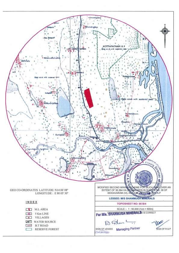
2 EXECUTIVE SUMMARY 1.0 INTRODUCTION M/s. Shanmuga Minerals proposes to silica sand from an approved Mining Lease area extending over Acres which is located in Survey No: 38/P, Siddavaram (V), Kota (M), SPSR Nellore Dist., A.P. The proposed capacity is 70,000 TPA. The area is situated at a distance of 1.5 km from Siddavaram Village. 1.2 SALIENT FEATURES OF THE PROJECT The mine lease area falls under the Toposheet No. 66 B/4 bearing following Toposheet details: Toposheet No: 66 B/4 M/s Shanmuga Minerals Geo Co-ordinates (Source: Approved Mining Plan) Point North East 1 14º º º º º º º º º º Nellore the district headquarters is 39 kms away from the area. The nearest railway station is Gudur which is at 26.5 km from the mine lease area. The nearest airport is Tirupati Air Port at 89.4 kms from the mining site.
3 1.3 Details about Project Site Nature of the project Capacity Location of the project District & State Mandal Village Land Availability General climatic conditions Maximum Temperature Minimum Temperature Annual average rain fall Predominant wind direction General location details Nearest Village Nearest city & Dist. HQ Nearest railway station Nearest Airport Archaeological/Historically important site Sensitive places Sanctuaries/National parks Mining of Silica Sand M/s. Shanmuga Minerals 70,000 TPA Nellore District, Andhra Pradesh Kota Siddavaram Acres (or) Ha 47 0 C 28 0 C 800 mm SW to NE & SE-NW Siddavaram 1.50 km from the mining site Kota at 8.6 km from the mining site. Gudur Railway station at 26.5 km from the mining site. Tirupati Airport at 89.4 km from the mine site. None within 10 km radius Hospitals and schools are available at 1.0 km from the mining site None within 10 km radius
4 1.4 INTRODUCTION OF THE PROJECT/BACKGROUND INFORMATION Identification of project and project proponent. In case of mining project, a copy of mining lease/letter of intent should be given. Details of Project Proponent: The M/s. Shanmuga Minerals is a silica sand mine in the state of Andhra Pradesh Table: 1.1 Description of Project Proponent Address of the lessee M/s. Shanmuga Minerals, D. Dhruvakumar Reddy, Managing Partner S/o D.Rajagopal Reddy Siddavaram Village, Kota Mandal, SPSR Nellore District, Andhra Pradesh Ph: Address of Mine Sy.No.38/P, Siddavaram (V), Kota (M), SPSR Nellore District. 1.5 Brief Description of nature of the project Mining lease was granted in favour of M. Vivekananda Reddy, over an extent of Ha. or Acres for a period of 20 years vide G.O. 213 dated The mining lease was executed vide proceedings no. 382/M/2002 dated by ADMG Nellore for 20 years from to The mining lease was transferred to M/s Shanmuga minerals vide Proceedings No.382/MI/2002,dt: of the ADM&G, Nellore. The mining plan was approved under letter No.37919/MP-II/03 dt. February 2004 by the Dept. of Mines and Geology, Hyderabad for 5 years from to The first scheme of mining was approved vide letter No. 3520/MS/NLR/2012 dated for a period last 2 years period ending ( ) as the first three years was lapsed in 5 years period from to
 vide letter no. 1344/MS/NLR/2014 dated 15.10.2014 by the JDM&G O/o DM&G Hyderabad. As per the guidelines of the Asst.")

5 The second scheme of mining was approved for the period of 5 years for the year to (ending ) vide letter no. 1344/MS/NLR/2014 dated by the JDM&G O/o DM&G Hyderabad. As per the guidelines of the Asst. Director, Mines & Geology, Nellore Vide Notice No.2634/NGT/2015 dated to be followed by the mining lease holders in kota & Chillakur Mandal of Nellore District the modified mining plan approved vide Lr.No.87/MMS/NLR/2016 dated GOOGLE MAP T O P O
6 TOPO MAP
7 1.1 Need for the project and its importance to the country and or region. In the present scenario, the silica sand has good market in the country for domestic consumption. 1.2 Demand-supply Gap. There is a demand of Silica Sand and is ever growing with the growth of industrial sector in the country. The requirement of the mineral is always found high in adjoining areas 1.3 Imports V/s Indigenous production Silica sand mined from the proposed project will neither be exported nor imported. It is an indigenous production and will be supplied within the country. 1.4 Export Possibility No export. 1.5 Domestic/ Export Markets The mineral is used for mainly glass industry. The sub-grade generated can be on longer run utilized for blending with high grade material to bring it down to a required grade. 1.6 Employment generation (Direct and Indirect due to the project) The proposed project will generate direct employment to 64 people of the poorest section of the society, while benefitting more than 100 people indirectly.
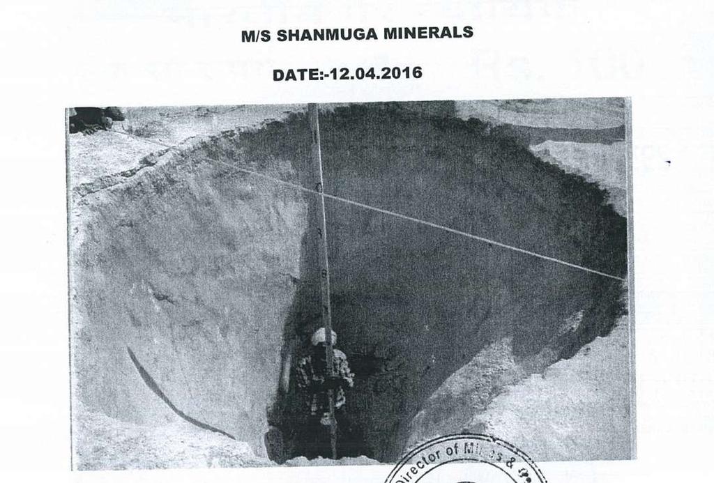
8 2.0 PROJECT DESCRIPTION 3.1 Type of project including interlinked and interdependent projects, if any The proposed mining project is mining of Silica sand is manual. The mining of silica sand is done manually and is transported through vehicles. It is done by making benches with a height of 2.5 m. 3.2 Location The mining area is located in Sy. No. 38/P, Siddavaram Village of Kota Mandal at SPSR Nellore District, Andhra Pradesh. The mine lease area falls under the Toposheet No. 66 B/ Details of alternate sites considered The mineral is site specific, hence there are no alternative sites considered. Mining activities are carried out based on local geology and availability of the mineral. 3.4 Reserves Calculation: The reserves are arrived in the cross sectional method. For this purpose the cross sections are drawn at an interval of 60 and the areas of cross sections are utilized for multiplying with the area of influence. The volumes thus arrived and their category is given below. DETAILS OF CROSS-SECTION WISE/GRADE WISE INSITU ORE RESERVES ESTIMATION Cross Section Average Sectional area in Cross Section influence (M) Volume in m 3 (Silica Sand) Specific Gravity Tonnage in MT (Silica Sand) m 2 (Silica Sand) A-A B-B C-C D-D E-E F-F G-G H-H I-I
9 J-J K-K L-L M-M N-N O-O P-P Q-Q Total 11,16, Size or magnitude of operation The proposed mine has lease over an area of Ac (or) ha. The total extractable material would be approx. 70,000 T per annum (Max) 3.6 Project description with process details The process in the Mines involves digging of loose sand with excavators, loading the Silica Sand in the trucks and sending the sand to the destination of customers. The average size of the machines for digging and loading is 2 M 3 bucket capacity and the average capacity of trucks used is 17 Tons. 3.7 Raw Material Required Along With Estimated Quantity, Likely Source, Marketing Area of Final Product/S, Mode of Transport of Raw Material and Finished Product For the project operations i.e. for individual mining operations there is no need of any raw material in the process. However need of diesel, oils, and spares are envisaged. 3.8 Resource optimization/ recycling and reuse. The entire Silica Sand produced is more or less completely utilized. In some rare conditions the quality of sand excavated does not match with the customer s requirement and in such cases the sand is separately dumped and is blended with high grade material. Thus the question of recycling and reuse does not arise in this kind of operations.
10 3.9 Availability of water its source, energy/ power requirement and source Water Requirement Water requirement is for sprinkling on roads, for washing machines during maintenance, for human consumption (Both wash water and drinking), and for plantation watering. From the table we can notice that the availability is from the local old pits and also from nearby villages. Total Length of travel of common road = 450 m Average width of road = 6m Total area in Sq.Mts = 2700 m 2 Water needed for one round of lit per sq.m = 9450 lit Total water needed for 2 rounds of sprinkling = lit or 19.0 KLD Number of tankers needed for common road alone per day = 4 TABLE-10 : Fresh Water Requirement & Wastewater generation Purpose Fresh Water Waste Water Domestic 3.0 KLD 2.4 KLD Dust Suppression 19.0 KLD 0 KLD Greenbelt Development 3.0 KLD 0 KLD TOTAL 25.0 KLD 2.4 KLD 3.10 Quantity of wastes to be generated (liquid and solid) and scheme for their management/ disposal Solid Waste Generation & its Disposal In the Mines there is no waste generation from the Silica Sand produced. Though quantity of 2% is reflected as waste, the same is used for blending with high grade material. Thus the waste management is not envisaged Liquid Effluent 2.4 KLD of domestic effluent will be generated at the mine site. Domestic Waste Water generated will be send to septic tank followed by soak pit
11 4. SITE ANALYSIS 4.1 Connectivity The mining lease area is approachable by road from Nellore Via. Gudur, Kota and Siddavaram. It is situated at North West side of Siddavaram road at a distance of 2.5 kms Nearest Railway Station The nearest rail head is Gudur Railway station at a distance of 26.5 km from the mine location Nearest Airport The nearest airport facility is available at Tirupati Airport which is about 89.4 km away from mine Nearest Highway Nearest National Highway-45 which is about 25.2 km from the mining site. 4.2 Land form, land use and land ownership Land form: The sand dunes form in different shapes and sizes, formed by interaction with the flow of air or water. Most kinds of dunes are longer on the windward side where the sand is pushed up the dune and have a shorter "slip face" in the lee of the wind. The valley or trough between dunes is called a slack. A "dune field" is an area covered by extensive sand dunes. The present landform is full of sand dunes and the Silica Sand is mineralized in the entire area in the form of sand dunes. These dunes do not have any dip or strike. These are outcome of Marine Tidal action (Deposition) over prolonged periods. The geological feasibility of the material is generally effected due to contaminations if any, major structural disturbances if any, or any other factors that are geological in nature and detrimental to the operations. In the present case the reserves are geologically feasible as these do not have any shortcomings of above geological nature. Land use: The entire land is used in the following manner. The information provided is taken from the approved mining plans.
12 M/s Shanmuga Minerals Land use pattern: Land use pattern Area in Ha Working Pit Waste Dumps 0.29 Building, Mill and Ore 0.02 Stacks Road ways 1.75 Mineral Stacking 0.20 Greenbelt 0.09 Land ownership: The entire land in the mine is Government land only. 4.3 Topography The physiography of the area is flat sand bearing terrain with very less number of small bushes and shrubs. The height of the dunes existing in the area varies from M from the ground level. The dunes are very less in number, the area is almost flat with slant topography. The height increases towards west from eastern side. The mining lease area is located 8.5 km due west of the shoreline at an elevation of +11m. 4.4 Existing land use pattern During the ensuing scheme period an area of Ac (or) Ha of land will only 10 percent will be used for site services and rest will be mined systematically as per mine plan. 4.5 Existing infrastructure The infrastructure is temporary in nature; the roads will be shifted from time to time within mining lease as per the location of the excavation. The permanent road, electric lines, telephone lines not belonging to the lessee are far away. 4.6 Soil classification The district is characterized by coastal alluvial soil all along the coast, mixed red and black soil around Somasila and lateritic soil to the north and south of Gudur. The deltaic alluvial soil is seen west of Udayagiri and red sandy soil is seen southwest of Kavali. Geo-technically the area is demarcated into five engineering provinces based on bearing capacity / compressive strength and foundation characteristics of the rocks units. They
13 are Basement crystallines with compressive strength of kg/cm 2, Younger sedimentary rocks with medium to very high compressive strength kg/cm 2 and Laterite and lateritic soil with low to medium compressive strength and fair foundation characteristics. On the other hand deltaic / costal sediment and alluvium have low compressive strength (1-2 Kg/cm 2 ) and poor foundation characteristics. 4.7 Climatic data from secondary sources CLIMATE & RAINFALL The mining lease area experience semi arid climatic conditions. The area experience 800 mm average annual rainfall during August November months. The day temperature varies 28 o C in winter to 47 o C in summer season. The general wind direction is SW to NE & SE-NW. 4.8 Social infrastructure available All the social infrastructure facilities like hospitals, schools, colleges etc are available nearby villages, Kota Mandal headquarters. 5. PLANNING BRIEF 5.1 Planning concept (Type of industries, facilities, transportation etc) Town and Country Planning/Development authority Classification. The concept of planning in the present context is limited to the environmental protection planning as the entire concept of the mine is for assessing the possible damage to the environment and evolve the mitigation measures. The planning that is given below, briefly describes the resource requirement for environmental impact assessment and planning for mitigation/reduction of damage done/ may be done due to mining. 5.2 Population projection The project will employ nearly 64 workers from nearby villages. Thus, there will not be any increase in population due to the project. 5.3 Land use planning Land use planning explained under Existing Land Use Pattern.
14 5.4 Assessment of Infrastructure Demand (Physical and Social) Safety equipments, small rest shelter and first aid facilities will be made available for the workers in the mine lease area. 5.5 Amenities/facilities The following facilities will be extended by the mine management: i. Direct and indirect Employment. ii. Arrangement for safe and healthy working conditions. iii. Provision of drinking water. iv. Conducting medical camps for workers and nearby villagers at regular intervals. 6. PROPOSED INFRASTRUCTURE 6.1 Industrial area (Processing Area) No mineral processing will be carried out in the mine lease area. After excavation, the silica sand will be dispatched as per orders. 6.2 Residential area (Non Processing Area) The mine workers will be hired from nearby villages, so residential areas will not be made. 6.3 Green belt Plantation will be made over an area of 0.09 ha in the present scheme period. 6.4 Connectivity The mining lease area is approachable by road from Nellore Via. Gudur, Kota and Siddavaram. It is situated at North West side of Siddavaram road at a distance of 2.5 kms. 6.5 Drinking Water Management Water Requirement for drinking purpose is 3.0 KLD which will be supplied by water drums.
15 6.6 Sewerage System Domestic waste water generated will be send to septic tank followed by soak pit. 6.7 Industrial Waste Management Not applicable 6.8 Solid Waste management As such there will not be any waste from the individual waste due to production. 6.9 Power Requirement & Supply/ Source NA 7 REHABILITATION AND RESETTLEMENT (R&R) PLAN 7.1 Policy to be adopted (Central/State) in respect of the project affected persons including home oustees, land oustees and landless laborers (a brief outline to be given) No human settlements are existing in the ML area and no humans will be displaced from the area so the proposed project does not involve any rehabilitation and resettlement. 8. PROJECT SCHEDULE & COST ESTIMATES 8.1 Likely date of start of construction and likely date of completion (Time schedule for the project to be given) The project will commence once Environmental Clearance and other necessary certificates are obtained from the respective departments. 8.2 Estimated project cost along with analysis in terms of economic viability of the project. The Total cost of project would be around Rs. 1.0 Crores EMP Budget : 10.0 Lakhs
16 9. ANALYSIS OF PROPOSAL (Final recommendations) 9.1 Agriculture is the most important profession of the people living in the village besides involving themselves in mining activity. The present mining activity will not cause any additional impact on the socio-economics of the persons in the vicinity. Socio-economic condition of area will improve as mining activity will create additional employment for the local habitants raising their socioeconomic status. Significant contribution will be made towards education, medical facilities and cultural aspects. Mining will create awareness amongst the people for education and general upliftment particularly in the women folk. 10. MACHINERY DETAILS: Total Production projected per year = 70,000 Tons Daily production with 250 days production in a year = 280 Tons Number of trips of tippers plying per T/Tipper = 16 For AHD of 3.5km one side, one tipper makes 2 trips/hr In a day for 6 operating hours one tipper makes 12 trips Number of tipper needed = 1 Number of excavators needed = 1 Front end loaders for dressing and other works = 1 Water sprinklers needed = 1 Apart from the above machines that ply on the roads light vehicles and other outside services vehicles traffic has to be taken into account. SI.No Mine Lease Area Total Common Road Travelling Tonnage Travelling Dust Generated * Ha 1171 m 280 Tons/Day 181 g/day * Dust generated during sand handling, transfer & storage is g/kg of dried sand (Ref. USEPA AP-42). Thus dust can be further brought down with water sprinkling.
17 11. ENVIRONMENTAL IMPACT ASSESSMENT: 11.1 Land Degradation: Land Degraded by pits own an area of m 2 as follow the land degraded by mean of dumps own an area of 2970m 2 of the ML area. These pits will be the store houses of fresh water and will serve as reservoirs and when the tidal action is severe they may get filled eventually Air Quality: There will not be any additional change in the air quality with the proposed modifications in the mining scheme/plan. This is due to the reason that there will not be any additional machinery used for the proposed changes Water Regime: Spring Channels (Locally termed as Duruvus) do not exist in the area, which area fluctuating on seasonal basis. Although there will be effect on the spring channels due to conventional mining, there will be no major effect on them with the guidelines issued on the methodology of mining. As the modifications to mining plan/scheme are made by following guidelines, there will be no effect on the system of sona channels Noise Levels: There is no noise generation except while transporting of the production/dispatch of mineral from mine to destination Vibration Levels: No vibrations of notable level will be generated as there is no drilling and blasting Socio Economics: The mining lease area is surrounded by 5 villages within a distance of 5 km. Agriculture is the most important profession of the people living in the village besides involving themselves in mining activity. The present mining activity will not cause any additional impact on the socioeconomics of the persons in the vicinity.
18 Feasibility analysis: The feasibility approach applicable for individual mine is reproduced here. 11. Mining and geological feasibility: Category of Deposit as per UNFC guidelines these reserves can be rated as III for the following reasons. Geological axis: A) Geological Survey A topographical survey with total station was carried out in the total mine area. The boundary pillars of independent Mines were demarcated in the mine. A topographical map is prepared in 1: 1,000 scale and all the surface features like position of existing pit, ramps, approach roads, office, contours etc., are shown. The Geological map does not contain any notable features as the entire area is covered with sand only. There are no surface exposures to be marked on the geological plan. However important ecological features like dunal springs, and Sona Channels are marked on the mapped drawing wherever they are observed. B) Geochemical Survey This site does not need any geochemical survey and hence is not carried out. C) Geophysical Survey The entire material that is proposed for mining is lying within 3.5 to 2.5 meters from the surface. It is also physically visible and thus does not need any geophysical survey for truth establishment. D) DTH Drilling and Core Drilling The entire material that is under proposal for mining is on the top of the surface only with the first 3 to 5 meters. This does not need any additional establishment of the deposit properties. Thus the DTH drilling and Core drilling is not needed in this project. With the above exploration conducted in this mining lease area, it is classified under G1 axis and thus the geological parameter as 1.
19 E) Mining feasibility/ Mineability The deposit is feasible technically for mining operations. The operations do not present any technical difficulty in planning, transport, stability or other technical factors. Thus the area is mineable and is thus feasible from mining point of view. ***********

20