Public Meeting, November 3, /3/11
|
|
|
- Evangeline King
- 5 years ago
- Views:
Transcription


1 Public Meeting, November 3,


2 Power Resources needs, direction, investigations Projects Selection Projects Engineering Environmental Baseline existing environment, anticipated impacts and PM&Es Licensing Process FERC regulations, public participation Questions 2
3
4 Created in 1936 by a majority vote of the people for the purpose of providing water utility service, and in 1949 for electric utility service Serve Snohomish County and Camano Island 325,000 electrical customers and 20, water customers Three Elected Commissioners Public, non-profit, rate-funded 4
5 Integrated Resource Planning (IRP) Adopted August 2010 covers the 13-year period from expected 169aMW load growth target goal of 126 amw of new cost-effective energy efficiency Need for renewable resources for load that exceeds aggressive conservation effort 80% load from BPA Largest customer 5
6 Climate Change, March 2007 future growth through all cost effective conservation and a diverse mix of renewable energy resources Policy focus local l opportunities i minimize transmission losses minimize environmental impacts promote local economic development and education. 6


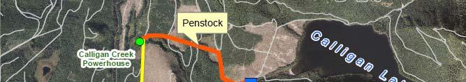
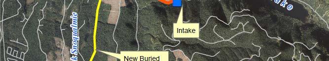
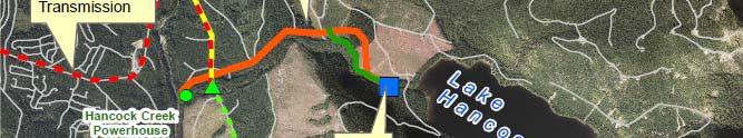
7 Tidal Geothermal Wind Solar Pumped Storage Biomass/biogas Hydrogen based energy storage system Pipeline hydro Low impact hydroelectric 7
8 Why Low Impact Hydroelectric? Clean, reliable, non-greenhouse gas emitting resource Energy production matches District s peak load Hydro assets have a year life Cost/MWh is very competitive Existing staff expertise 8
9 Criteria: 4 county area Whatcom, Skagit, Snohomish h and King Upstream of a barrier to anadromous fish Outside Federal Wilderness areas Outside Federal Wild and Scenic River designation i Prior Environmental Impact Statements indicated no major environmental issues No known n geological hazards ards or unstable areas that would preclude construction Location in close proximity to an existing transmission system No known issues that would preclude advancing project to evaluation stage 9
10 Results: Initially 140 sites identified; 18 met District criteria Met with Federal/State Agencies, NGOs and Tulalip Tribes on 18 possible short-listed sites Reduced to 3 potential top-sites based on input Hancock Creek & Calligan Creek Projects (King County), Sunset Falls (Snohomish h County) 10
11


12 No major issues identified that would preclude development Previously licensed so a lot of information exists Hydrology indicates winter production which matches demand Located near existing i transmission i lines Good construction access Natural anadromous barrier Recent informal discussions with agencies and tribes have been positive 12
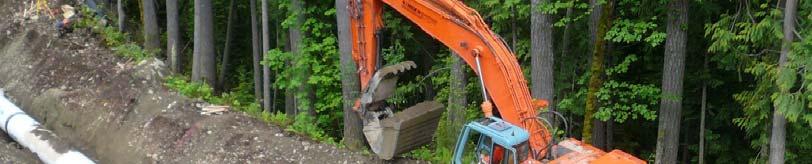
13 1980s-1990s Resource Studies Fisheries, terrestrial Cultural Geotechnical Instream flow, hydrology Water quality 1993 Licensed with FERC Received most permits Sold to another company Terminated in 2004 due to lack of construction 13


14 North Fork Snoqualmie River Above Snoqualmie Falls Located ~8-10 miles north of North Bend Surrounded by Hancock Forestry lands About 1-hour drive from Jackson Powerhouse Calligan Hancock 14
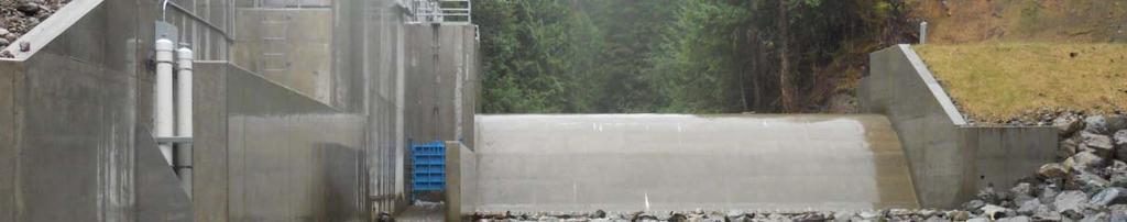
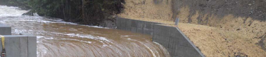
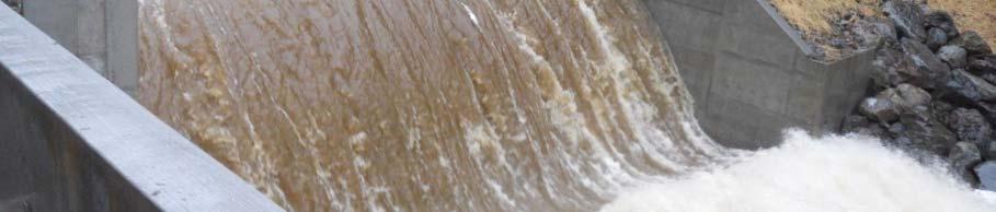
15 Each Project: Run-of-the-river Small impoundment but no reservoir Will not change lake level Diversion weir to pass large flows and sediment Downstream fish passage Intake, penstock and powerhouse on same side of creek 6 MW name plate capacity (~4,500 homes annually) 15
16


17 3-Projects developed together Black Creek built in
18 18
19 19
20 8-ft tall, designed to overtop frequently Small pool, won t back-up to lake level No active-storage t Instream flow release 20
21 21

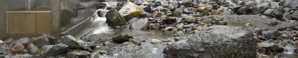


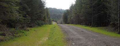
22 Minimum flows & downstream fish passage 22
23 Steel or HDPE Steep gradient Auto-shutdown Alternative alignment being considered to avoid deep trenching 23
24 24


25 Buried penstock and fiber/power Temporary impacts Restored postinstall 25


26 26
27 27


28 Natural colors & non-glare materials Returns water to stream & prevents erosion Add picture of tailrace 28
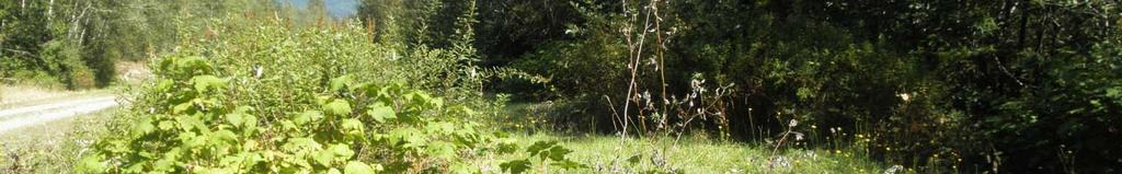
29 Buried transmission Existing road corridor Tie-in to existing switching vault 29
30


31 Environment as it exists today Essentially the same for both Projects; differences will be identified ifi d in the presentation 31
32 Geotechnical Land survey, LiDAR Sediment transport Monitoring of resident trout populations Development of species habitat preference curves Instream flow and physical habitat modeling Timing of trout spawning and fry emergence Water quality Cover type mapping Plants, noxious weeds Critical areas Cultural 32
33 Calligan: steep slopes, stable, springs 33
34 Hancock: steep slopes, stable at repose angle 34
35 Proposed PM&Es: Additional geotechnical study in process for Hancock Creek & Calligan Creek intake LIDAR allows updated analysis of landslide hazard Steep slopes will be evaluated by geologist BMPs will be in place for all earth-moving Timing of work per requirements 35
36 Baseline Environment Vegetation Within active tree farm managed primarily for Douglas Fir. Special status species and noxious weed surveys were conducted in summer 2011 and will be completed in spring Critical i Areas Studies were conducted d in summer 2011 and will be used to avoid or minimize impacts and help determine PM&Es. 36
37 37
38 38
39 Baseline Environment Wildlife Typical of managed forests in Western Washington black-tailed deer, black bear, Douglas squirrel, etc. Not in critical habitats and no Federally listed species are documented in Project Boundaries. No State endangered or threatened species are documented in the Project Boundary. State Sensitive common loons have been documented adjacent to Project Boundaries. 39
40 Proposed PM&Es Construction Limit ground clearing and vegetation removal to only necessary areas for Project construction and operation. Bury penstock and transmission lines Design to avoid wetlands and riparian areas to extent feasible. Revegetate disturbed d soils within the season per Erosion and Sediment Control Plan. Operation Develop a Wildlife Habitat Management Plan to include: Revegetation with shrubs, forbs and grasses beneficial to wildlife, mitigation for lost habitat, monitoring. 40
41 Baseline Environment General Area Extensive opportunities in and adjacent to the Project Vicinity. Project Boundaries Low-impact activities per 2004 Conservation Easement between King County and Hancock Forest Management. Access permits required for vehicular access to Snoqualmie Forest lands, and for hunting, fishing and gathering firewood. No access permit required for access via hiking, bicycling, or horse-back riding. 41
42 Proposed PM&Es Minimal recreation use within the Project Boundaries because: within active tree farm with restricted access limited acreage of the Projects project facilities and steep slopes not suited for recreational development. Operation District will allow access along the penstock route consistent with HFM s Access Program. 42


43 Baseline Environment No anadromous fish Upstream of Snoqualmie Falls Resident Fish Trout (rainbow, cutthroat, brook) Low densities Habitat High gradient, bedrock & boulder substrate Numerous falls and barriers to upstream migration Predominantly angular substrate in lower gradient areas with limited suitable spawning gravel No NMFS/USFWS critical habitats 43


44 Proposed PM&Es Design Self-cleaning screens Downstream passage Sluice gate Flow continuation Operation Minimum instream flows Project downramping rates Trout monitoring
45 Baseline Environment General Area Traditional territory of Snoqualmie Indians Hops farming Prospecting Logging Project APE Hancock: Log skidder (base) for pulling donkey engine; not eligible for listing on National Register No historic properties identified in 1990s or 2011 studies 45
46 Proposed PM&Es Unanticipated Discovery Plan Process for identifying the resource Historic Properties Management Plan will be developed if historic properties identified in future 46
47
48 Separate projects Will likely hold meetings at the same time for efficiency i Will likely file documents with the FERC at the same time 48
49 Federal Energy Regulatory Commission (FERC) Construction ti and operation approval needed d Traditional Licensing Process (18 CFR 4) requires stakeholder consultation Multi-year process Preliminary Permits Effective April 1, 2011 (Calligan); May 1, 2011 (Hancock) 3 years to file License Application Must file progress reports every 6 months Preliminary Application Document Filed September 9, 2011 Identifies the existing information 49
50 50
51 51
52 Public comment opportunities through FERC process Public comment opportunities through Resource groups Meetings Study results Stakeholder mailing lists FERC esubscription District - djpresler@snopud.com 52
53
54 Scott D. Spahr, Engineering Manager Project Manager Kim D. Moore, Assistant General Manager Project Sponsor Keith M. Binkley, Natural Resources Manager Fish Biologist Lead Karen L. Bedrossian, Sr. Environmental Coordinator Terrestrial Biologist and Recreation Lead Dawn J. Presler, Sr. Environmental Coordinator Licensing Coordinator and Cultural Lead