Growth in the Fresno Metro Area
|
|
|
- Rosanna Peters
- 5 years ago
- Views:
Transcription


1 1 Growth in the Fresno Metro Area 2


2 A Unique Opportunity Meeting City and Regional Challenges SEGA 9,000 Acres 3 A Unique Planning Process Measuring Up to the Challenge Modeling the Impacts of Different Futures 4


3 Measuring Up to Sustainability Comparing Alternatives with Relevant Measures Environmental Sustainability 5 Measuring Up to Sustainability Comparing Alternatives with Relevant Measures Community Sustainability 6


4 Measuring Up to Sustainability Comparing Alternatives with Relevant Measures Fiscal & Economic Sustainability 7 Measuring Up to Sustainability Comparing Alternatives with Relevant Measures Regional Sustainability 8

5 Measuring Up to Sustainability SEGA s Role in Meeting Fresno 2025 Targets Transit: within mile of every resident Mobile Emissions: reduce by 50% Air Quality: meet standards by 2015 Commute Trips: reduce SOV by 20% Greenhouse Gas: reduce emissions by 25% Water Demand: reduce use and increase recycling 9 The SEGA Alternatives 10


6 Principles Diversity & Balance Human & Pedestrian Scale Conservation & Restoration Connections & Interdependence 11 Comparing 3 Futures Trend/ 2025 General Plan+ Design Alternatives 12
7 Comparing 3 Futures 1 Trend/ General Plan+ Inside SEGA (9,000 Acres) Homes Jobs Land Area Outside SEGA 17,900 29,600 9,300 Acres 2 Design Alternative 43,800 35,500-3 Design Alternative 42,900 36, Alternative 1 Trend/2025 General Plan+ 17,900 Homes 29,600 Jobs 14


8 Alternative 1 15 Alternative 1 9,300 Additiona l Acres of Farmland 16
9 Alternative 2 Design Alternative 43,800 Homes 35,500 Jobs 17 Alternative 3 Design Alternative 42,900 Homes 36,000 Jobs 18

10 Alternative 2 Key Components 19 Alternative 2 Key Components Open Space 20

11 Alternative 2 Key Components Major Transportation Corridors 21 Alternative 2 Key Components Major Centers 22
12 Alternative 2 Key Components Employment Areas 23 Alternative 2 Key Components Neighborhood Centers and Schools 24

13 Alternative 2 Key Components Residential Neighborhood s 25 Alternative 2 Key Components Rural Residential 26
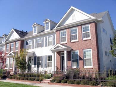
14 Alternative 2 Key Components Rural Cluster 27 Neighborhoods Rich Variety Mixed Residential Neighborhood Residential Rural Residential Rural Cluster 28


15 Neighborhoods Rich Variety Mixed Residential 29 30


16 31 Neighborhoods Rich Variety Neighborhood Residential 32


17 33 34

18 Neighborhoods Rich Variety Rural Residential 35 Rural Residential 36


19 Neighborhoods Rich Variety Rural Cluster 37 Rural Cluster Maintaining Open Space & Viable Farmland 38


20 Centers Regional Center Community Centers Neighborhood Centers 39 Regional Center 11,700 27% 14,100 40% 40


21 41 42


22 43 Community Centers 26,500 61% 12,100 34% 44


23 45 46


24 47 48


25 Neighborhood Centers 36,900 84% 25,000 71% 49 50


26 51 52


27 53 Walking Distance to Centers 54
 92% of Total Homes 73% of")


28 Walking Distance to Centers ALL CENTERS 10 Min (1/2 Mile) 92% of Total Homes 73% of Total Jobs 55 Housing Choice Meeting Diverse Housing Needs Singles living alone Other Households Married couples without children Married couples with children 56
 11,400 lbs 6,900 lbs 6,700")
29 Housing Choice Housing Types 45% 45% 85% 57 Housing Choice More Sustainable Options Annual Energy Use, Water Use, and GHG Emissions (per Household) Single Family Townhome Multifamily Electricity 8,600 kwh 4,500 kwh 5,100 kwh Natural Gas 510 therms 340 therms 300 therms Water 180,000 gal 98,000 gal 82,000 gal GHG (CO 2 ) 11,400 lbs 6,900 lbs 6,700 lbs 58


30 Housing Choice Energy and Water Use Annual HomeEnergy Use per Household $2,900 Annual Water Use per Household $720 $1,800 $1,800 $280 $ Housing Choice Greenhouse Gas Emissions Annual GHGs from Home Energy Use per Capita 60
31 Transportation Bringing it All Together 61 Transportation Bringing it All Together Transit Boulevards 62

32 Transportation Bringing it All Together Avenues 63 Transportation Bringing it All Together Connectors 64
33 Transportation Bringing it All Together Neighborhood Streets 65 Transportation Bringing it All Together Bike/Pedestrian Trails 66

34 Transportation Bringing it All Together Bike Boulevards 67 Comparing the Networks Alternative 1 Alternative 2 68


35 Comparing the Networks Alternative 1 Alternative 2 Estimated Roadway Cost: $15,700 per HH Estimated Roadway Cost: $6,800 per HH 69 Comparing the Networks Alternative 1 Alternative 2 Estimated Roadway Cost: $15,700 per HH Estimated Roadway Cost: $6,800 per HH $686 Million * $296 Million * Cost to supply roads for Alt 2 housing and jobs totals (additional 9,300 acres of land) 70

36 Annual Per Household Driving Miles 26,000 Miles Miles of Travel in Congestion 10,800 Miles 11,000 Miles 71 Annual Per Household Driving Time 32 Days 780hours 14 Days 14 Days 340 hours 340 hours 72


37 Daily Walk, Bike, and Transit Trips 65,000 70,000 9% 10% of all trips 15,500 3% 5% 5% 73 Pollutant Emissions from Transportation Annual Air Pollution per Household 1,500 Annual GHG Emissions per Capita
38 Annual Household Transportation Costs $12,700 $5,300 $5, Annual Household Transportation and Housing Costs $16,300 Fuel and Maintenance Water, Electricity, Gas $7,300 $7,400 76

39 Greenhouse Gas Emissions From Buildings and Transportation Annual Per Capita 14.5 MT 6.5 MT 6.6 MT 77 Energy Use & Cost From Buildings and Transportation Annual Per Household $8,000 $3,900 $3,900 78

40 Open Space 79 Open Space Green Corridors & Neighborhood Parks 80
41 Open Space Schools 81 Open Space Rural Cluster 82

42 Open Space Bike/Pedestrian Trails 83 Multiple Roles of Open Space 84


43 Recreation 85 Trails and Connections 86


44 Green Infrastructure 87 Green Infrastructure 88


45 Community Farming 89 Community Farming 90


46 Access to Open Space Open Space per 1,000 Population 12 Acres 12 Acres 4 Acres 91 How Will We Grow? Trend/ 2025 General Plan+ Design Alternatives 92

47 A Modified Version of Alt. 2 was approved by the City Council 93 Activity Centers and Intensity Corridors Places where significant human activity occurs, such as urban living and working, shopping, recreating and other elements of vibrant urban life Intensity Corridors are areas where the highest densities of transportation activity occur 94

48 95 96


49 Existing Condition Apache Boulevard & Smith Street Tempe, Arizona Existing conditions CD+A and UA Light Rail & Street Improvements Apache Boulevard & Smith Street Tempe, Arizona Public improvements CD+A and UA

50 Light Rail & Transit-oriented Mixed Use Apache Boulevard & Smith Street Tempe, Arizona Conceptual private development CD+A and UA SB 375 Another Step Toward Climate-Sparing Strategy with Multiple Payoffs The Broader Context Global Warming and Climate Change perspectives, studies, strategies, policy development, investment, and market actions have evolved rapidly to encompass and interconnect a broad context that includes: Energy Security Pollution and Air Quality Smart Land Use and Transportation Systems Water Quantity and Quality Food Security Economic Competitiveness and Green Jobs Fiscal Sustainability Human Well-Being and Healthcare Costs And more... To be outlined at the end of this Workshop 100
51 SB 375 Another Step Toward Climate-Sparing Strategy with Multiple Payoffs Background SB 375 is a part of the comprehensive implementation of AB AB 32 is California s Global Warming Solutions Act of 2006 AB 32 requires the State of California to reduce greenhouse gas (GHG) emissions to 1990 levels no later than 2020 SB 375 Signed by Gov. Scwarzenegger on September 30, Provides a means for achieving AB 32 goals from cars and light trucks 101 SB 375 Another Step Toward Climate-Sparing Strategy with Multiple Payoffs Key SB 375 Components Include: Regional Green House Gas (GHG) Emissions Targets Traffic Models to Account for Land Use Relationships Regional Transportation Plans to include Sustainable Communities Strategy (SCS) Housing Needs Allocations and Rezoning Requirements New CEQA Limitation for Certain Residential Projects and for Transit Priority Projects 102

52 SB 375 Another Step Toward Climate-Sparing Strategy with Multiple Payoffs SB 375 Impacts and Planning Implications for Fresno (Continued) Some of the Estimated and Proposed SEGA Plan Per Household Metrics versus Fresno Growth Trend: GHGs from 14.5 metric tons to 5.7 tons = 60% Annual Reduction Air Pollution from 1,600 lbs to 800 lbs = 50% Annual Reduction* Zero Net Clean Energy/Efficiencies = 50% Annual Lower Use & Costs Water (Pending DPU Studies) = SEGA Site Goals are 50% Daily Use Reduction by 2025 and 75% Daily Use Reduction by 2050 Affordability as Measured by Reduced Annual Transportation and Household Maintenance Costs for Energy and Water = 50% Reduction * Should be a higher reduction as originally estimated by Calthorpe Assoc. in preferred alternative development Recalibrated measurement tool used in EIR will tell. 103 Existing Condition East 14 th Street San Leandro, California CD+A and UA


53 Street Improvements & Infill Townhomes East 14 th Street San Leandro, California CD+A and UA Street Improvements & Infill Mixed Use East 14 th Street San Leandro, California CD+A and UA

54 Center and Corridor Types Community & Regional Centers mixed use areas of retail, entertainment, office, residential, and other uses vary in terms of intensity of use and the reach of their market area 108 CD+A and UA


55 Center and Corridor Types Community & Regional Centers mixed use areas of retail, entertainment, office, residential, and other uses vary in terms of intensity of use and the reach of their market area 109 CD+A and UA Center and Corridor Types Community & Regional Centers mixed use areas of retail, entertainment, office, residential, and other uses vary in terms of intensity of use and the reach of their market area CD+A and UA 110

56 Center and Corridor Types Community & Regional Centers mixed use areas of retail, entertainment, office, residential, and other uses vary in terms of intensity of use and the reach of their market area CD+A and UA

57 Center and Corridor Types District & Regional Employment Centers mixed use areas focusing on employment uses, some support retail and service uses, and possibly some workforce-oriented homes vary in terms of intensity and the range from which they will attract employees CD+A and UA 113 Center and Corridor Types District & Regional Employment Centers mixed use areas focusing on employment uses, some support retail and service uses, and possibly some workforce-oriented homes vary in terms of intensity and the range from which they will attract employees CD+A and UA 114

58 Center and Corridor Types District & Regional Employment Centers mixed use areas focusing on employment uses, some support retail and service uses, and possibly some workforce-oriented homes vary in terms of intensity and the range from which they will attract employees CD+A and UA 115 Metro Rural Loop is an innovative regional land use and economic development Approach. It would directly and efficiently link the majority of 30 incorporated cities in Fresno, Kings, Madera, and Tulare counties creating the basis for economic growth. The Loop would define one of the most significant, sustainable and effective smart-growth-oriented regional metropolitan areas in the State of California. A system of region-connecting, high-capacity, multimodal transportation corridors supported by regional land use policies that lead the development of transit-oriented bands and nodes of global quality industry, commerce, residential, public, and recreational open spaces along corridors. Metro Rural Loop transportation corridors would offer a transit-focused combination of light-rail transit (LRT), goods movement rail, bus rapid transit (BRT), dedicated truck lanes, and other modes that sustain regional mobility, and connect SMART, compact, walkable centers and villages. 116


59


60


61


62


63 Conceptual High Speed Rail Station 125 Existing Condition Berkmar Road and US29 Albemarle County, Virginia 126 CD+A and UA


64 Initial Multimodal Street & Pedestrian Bridge Berkmar Road and US29 Albemarle County, Virginia 127 CD+A and UA Initial Multimodal Street & Infill Mixed Use Berkmar Road and US29 Albemarle County, Virginia 128 CD+A and UA

65 Multimodal Street & Infill Mixed Use Berkmar Road and US29 Albemarle County, Virginia 129 CD+A and UA Public Transportation Infrastructure & Bus Rapid Transit Systems Exclusive Right Of Way As Fast As Light Rail Rail Like Stations Fewer Stops Traffic Signal Priority Frequent Service High Reliability Premium Service 130


66


67


68


69


70 139 Existing Conditions Hydraulic Road Charlottesville, Virginia CD+A and UA 140


71 Multimodal Avenue & Infill Commercial Hydraulic Road Charlottesville, Virginia CD+A and UA 141 Main Street & Infill Mixed Use Hydraulic Road Charlottesville, Virginia CD+A and UA 142


72 Existing Conditions US 29 near Hydraulic Road Albemarle County, Virginia CD+A and UA 143 Underpass & Infill Commercial US 29 near Hydraulic Road Albemarle County, Virginia CD+A and UA 144

73 Multi-way Boulevard & Infill Mixed Use US 29 near Hydraulic Road Albemarle County, Virginia CD+A and UA
74 Sustainable Fresno Renewable Energy Project Design, Grant Seeking, Permitting, Deployment & Management Support Green Building, Zoning, & Form- Based Codes, Resource Efficient Land Use Plans & Policies, & Permit Streamlining Metro Scale Energy & Water Efficiency Education, Auditing & Retrofit Programs Green Economy Jobs & Contractor Training with Fresno Workforce Connection, Business, Labor & Community Interagency, Business, Labor, & Community Partnerships for Alignment of Goals, Strategies & Implementation Sustainable Fresno Website Tools - Education - Standards - Measurement - Reporting - Accountability Sustainable Fresno Revolving Loan Bank for Metro Scale Energy & Water Efficiency Improvement Financing Sustainable Fresno Surcharge PLUS Energy & Water Urban Growth Capacity Reservations 147