Conversion of irrigated agricultural land in the Intermountain West to non-agricultural uses: consequences for water management and hydrology
|
|
|
- Annabella Hawkins
- 5 years ago
- Views:
Transcription
1 Conversion of irrigated agricultural land in the Intermountain West to non-agricultural uses: consequences for water management and hydrology Rob Van Kirk, Humboldt State University, Project Director Brian Apple, Humboldt State University Jason Barnes, Humboldt State University J. Mark Baker, Humboldt State University Yvonne Everett, Humboldt State University Brad Finney, Humboldt State University Lora Liegel, Humboldt State University Veronica Orosz, Humboldt State University Kimberly Peterson, Humboldt State University Kim Ragotzkie, Henry s Fork Foundation Dale Swensen, Fremont-Madison Irrigation District Amy Verbeten, Friends of the Teton River USDA/NOAA National Water Conference 2012
2 Study area Objectives Methods Results Conclusions Outreach Outline

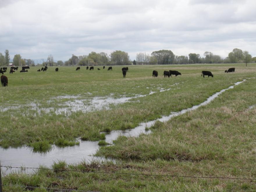
3 Study watershed: Henry s Fork Snake River, Idaho and Wyoming

4 Area: 3,250 sq. mi Min. elevation: 4,820 ft. Max. elevation: 11,400 ft. Mean ann. precip.: 28.2 inches Forested area: 36.7% Agricultural land: 20.9% Canal-served irrigated area: 250,000 acres in Fremont- Madison Irrigation District Primary crops: small grains, potatoes, hay, pasture, oilseeds
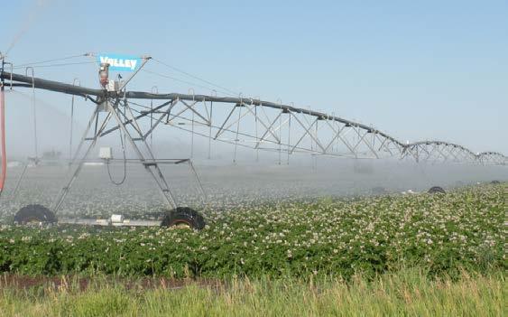


5 Irrigation water management
6 Conversion of land use from agriculture to non-agriculture Cumulative area (acres) 30,000 25,000 20,000 15,000 10,000 5,000 Fremont County Madison County Teton County Year Cumulative area of subdivisions platted in agricultural areas
7 Project Objectives 1. Model ground and surface flow under historic, current and future land/water use scenarios. 2. Identify factors that determine water use on formerly irrigated land. 3. Develop strategies to increase water availability for agriculture while enhancing ecological benefits. 4. Provide information on hydrology and water use to decision-makers and stakeholders. 5. Train an interdisciplinary team of graduate students.


8 Methods Spatial analysis of land use, canal system, water rights Field measurements of canal and stream channel losses/gains Groundwater-surface water modeling Statistical analysis of water use Interviews with water users/stakeholders and managers/planners Review, guidance, and endorsement from Henry s Fork Watershed Council from proposal through outreach stages (4 years)
9 Results: Surface irrigation budget 1.0% Mean Annual Water Budget for Surface Irrigation System Canal & sprinkler evaporation: 11,936 a-f 48.8% 23.8% 5.9% Crop ET: 278,076 a-f Surface return flow: 68,940 a-f Return to streams via GW: 239,994 a-f Outflow from basin as GW: 571,099 a-f 20.5% Total diversion: 1,170,045 a-f/year
10 Results: Recharge to shallow aquifers Mean Annual Shallow Groundwater Recharge in Valley Areas 29% 24% Direct Precipitation: 291,032 a-f Stream Channel Seepage: 110,984 a-f 9% Canal Seepage: 464,508 a-f Irrigation Application Seepage: 346,587 a-f 38% Total Recharge: 1,213,112 a-f/year
11 Diversion (acre-feet) 1,600,000 1,400,000 1,200,000 1,000, , , , ,000 Results: Total Diversion Application Seepage Crop ET Canal Seepage Evaporative Loss Surface Return Year
12 Results: Observed well level 4820 Water Table Height (ft) /1/ /1/ /1/ /1/ /1/ /1/2001
13 Results: River Reach Gains ,000 Annual reach gain (acre-feet) 500, , , , , ,000 Teton and HF St. A to Rexburg HF Ashton to St. A Year
14 Results: Modeled Teton River Flow

15 Results: Land Use Conversion 5% of irrigable land has been subdivided Most has occurred on canalirrigated land Development has fragmented canal systems
16 Results: growing-season water use Application (ft) St. Anthony Rexburg Driggs St. A. Lawn Rex. Lawn Driggs Lawn St. A. Crop Rex. Crop Driggs Crop Subdivision use: 95% CI Growing season net ET, Conclusion: per-acre consumption in new subdivisions not statistically different from agricultural use or from ET demand


17 Results: Water use on developed land Surface water rights are not always transferred with land. New residents may not know they have surface water shares. Developers do not build infrastructure to use existing canal system. All developments use groundwater for domestic supply. Small farmer-run canal companies not equipped to handle large numbers of new, small-acreage users. Developments use more groundwater but recharge less than traditional irrigation.
18 Conclusions Traditional irrigation: consumptively uses relatively little water is largest source of aquifer recharge has created/enhanced wetlands and late-season/winter flow Reduction in diversion has : decreased groundwater levels decreased return flow, particularly late in the summer Changes are good for some resources and users, bad for others Development has: decreased use of canal system increased use of groundwater WE RECOMMEND: increased coordination between land-use planning and water resources planning/management.

19 Outreach in Watershed 9 Watershed Council meetings Presentations to county P&Z commissions and other groups Booklet (reviewed and endorsed by Watershed Council)

20