Update on MWRD Stormwater Master Planning Process January 4, 2019
|
|
|
- Arron French
- 5 years ago
- Views:
Transcription

1 Update on MWRD Stormwater Master Planning Process January 4,
2 Meeting Agenda 1. Introducing Stormwater Master Planning (SMP) Program 2. Core Concepts for Stormwater Master Planning 3. Data Analysis & Study Area Selection Process 4. Questionnaire for Municipal Staff 5. Next Steps and Timeline 2

3 Introduction: Riverine vs. Urban Flooding Riverine flooding occurs when excess run-off causes a natural drainage-way (river, creek, etc.) to exceed its capacity. These areas are identified as flood hazards by FEMA.

4 Introduction: Riverine vs. Urban Flooding
5 Stormwater Management Program Phase I Projects Identified from the DWPs to address overbank flooding riverine flooding Phase II Projects Working with local communities and agencies to address local drainage problems. Stormwater Masterplans Investigate urban flooding issues and evaluate potential green and gray infrastructure solutions The authority for general supervision of stormwater management in Cook County was conveyed to the District by the Illinois State legislature. Detail Watershed Plans (DWPs) completed for the 6 major watersheds of Cook County: Cal-Sag Channel, Little Calumet River, Lower Des Plaines, North Branch of the Chicago River, Poplar Creek, and Upper Salt Creek. District s authority was amended to allow for flood-prone property acquisition and to plan, implement, finance, and operate local stormwater management projects. 4

6 Introduction: Stormwater Masterplan Pilots Pilot study areas identified by four Councils of Government and the City of Chicago Study areas comprised of both separate or combined sewer areas Goal: identify flooding solutions to protect structures in storms up to a 100-year event

7 Let s design a flood control solution that will maximize local assets and spur economic development.
8 Key Findings The investment required to provide 100-year level of protection utilizing traditional grey, green or even hybrid grey and green public infrastructure is exorbitant Private property interventions can provide cost effective means for addressing flooding Efficiencies in construction should be leveraged through coordination with other infrastructure improvements such as transportation or other utilities Need to adopt a holistic approach in developing stormwater solutions that engages key partners and other stakeholders in the planning and implementation process. Prioritizing Master Planning throughout the county based on flood risk, targeting areas in need of planning resources. 8
9 Moving Forward after Pilot SMPs Evaluate Master Planning needs throughout county Develop adaptive approach, centered on managing local stormwater issues with multidisciplined teams Leverage and build upon work of others Develop a repeatable process Create actionable plans Teams focused on separate and combined areas 9
10 Program Outcomes Program Outcomes Safety Natural Systems Efficient Land Use Organizational Capacity Empower Communities to Reduce Flooding Collaboration Economic Opportunity Recreation Resiliency 10
11 Program Timeline & Scope Collect Data Define Study Areas Prioritize Areas Identify Core Concepts Write Guidance Document ISP ISP ISP SMP SMP SMP Community Implementation 11


12 Core Concepts for SMPs What is a core concept? Suite of common elements for consideration Why include them? Standardization Encourage outside of the box thinking 12


13 Core Concepts for SMPs Redevelopment/Economic Development Maximize stormwater management opportunities Stormwater Parks could provide incredible asset to community, adding needed open space to many neighborhoods Vacant lots and abandoned buildings reduce quality of life and property values, discourage investment, and stress budgets Cook County Assessor 1. Permeable pavement 2. Native plantings Evapotranspiration AECOM


14 Core Concepts for SMPs Technology and Innovation Real time controls - actively manage and monitor stormwater infrastructure, maximize storage Optimization - leverage analytical tools to evaluate and identify optimized solution 14


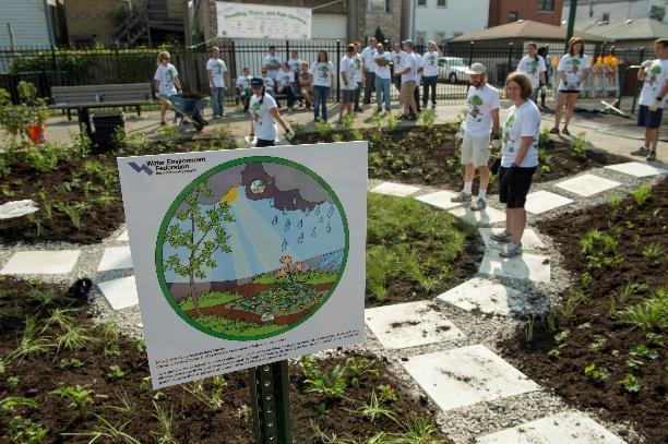
15 Core Concepts for SMPs Green Infrastructure Integrate green infrastructure as component of stormwater management infrastructure cwp.org 15


16 Core Concepts for SMPs Programs and Policy Adopt policies and foster programs to enhance flood reduction efforts VJ Killian 16


17 Core Concepts for SMPs Maximize Infrastructure Opportunities Modify existing infrastructure to fully utilize available and/or under-utilized capacity (wet bottom ponds, storm sewers, MWRDGC reservoirs) Look for regional storage opportunities Rethink roadway design Add stormwater improvements to capital projects. Photo credit: Journal-topics.com, February


18 Core Concepts for SMPs Land Use & Planning Balanced land use development Land use efficiency Mid and higher density developments Strong links to infrastructure Glenview Glenview 18


19 Data Analysis & Study Area Selection Process Primary goal is to address urban flooding in Cook County Teams tasked with dividing and prioritizing the County into study areas Aspects of prioritization process differ in Separate Sewer (SSA) and Combined Sewer Area (CSA) Reasons include: Available data sets Root causes of flooding (overland flow vs. sewer backups) 19


20 Data Analysis & Study Area Selection Process The Preliminary Research: Identify readily available data Compile an integrated database Create intuitive visuals and evaluate data Follow adaptive management strategy Perform a gap analysis Identify Appropriate Evaluation Criteria Stormwater & flooding criteria Socio-economic criteria Effective composite commercial and industrial property tax 2014, courtesy of CMAP 20


21 Data Examples: Data Analysis & Study Area Selection Process CMAP (Leverage ON TO 2050 ) Land use inventory & Land cover Flood Susceptibility Index Economically disconnected areas and disinvested areas Municipal capacity: EAV/Tax Capacity Parks & Open Space City of Chicago & Municipal Data Sewer infrastructure data Drainage areas/catchments Flood problem areas/311 call data Stormwater modeling data Prior studies & identified projects 21

22 Data Analysis & Study Area Selection Process Selection process is data driven Repeatable framework: Identify flood risk areas Identify socio-economic opportunities Evaluation Prioritization process is expected to evolve throughout this program based on: Additional data Municipal questionnaire 22

23 Draft Questionnaire for Municipal Staff Intent of Questionnaire is to determine: Location, frequency and severity of flood problems Whether flooding and flood solutions are an important need in the community Other top community needs If planning or engineering efforts have already been made to address stormwater issues 23
24 Draft Questionnaire for Municipal Staff Two-Part Questionnaire Part 1: General Questions Survey Monkey online Hard copy 24

25 Draft Questionnaire for Municipal Staff Two-Part Questionnaire Part 2: Show locations of flooding on a map Interactive ArcGIS tool online Hard copy 25

26 Draft Questionnaire for Municipal Staff Questionnaires will be sent to Village / City Administrators and Township contacts Distribution via , using CMAP list 26
27 Next Steps Program Management Teams: Complete six ISPs by spring 2019 Finalize municipal questionnaire distribute early 19 Collect municipal data and reprioritize areas to select second round for study Prepare Request for Proposals (RFPs) based on the first six ISPs Separate Sewer Areas Richard Fisher (312) Combined Sewer Areas Brian Wawczak (312)
 751-5479 Edward Jankun, P.E. Assistant Civil Engineer MWRDGC 111 E. Erie Street Chicago, IL 60643 JankunE1@mwrd.")
28 Questions? Richard Fisher, P.E., CFM Senior Civil Engineer MWRDGC 111 E. Erie Street Chicago, IL (312) Edward Jankun, P.E. Assistant Civil Engineer MWRDGC 111 E. Erie Street Chicago, IL (312)