working together Managing Our Shared Waters The North Western International River Basin District December 2008
|
|
|
- Felicia McBride
- 5 years ago
- Views:
Transcription


1 working together Managing Our Shared Waters The North Western International River Basin District December 28 1

2 Consultation Draft River Basin Management Plan North Western International River Basin District This document forms part of the draft River Basin Management Plan for the North Western International River Basin District. This draft plan has been issued for public consultation in accordance with the requirements of the EU Water Framework Directive. The North Western International River Basin District lies partly in Ireland 1 and partly in Northern Ireland. The Water Framework Directive requires that, in cross-border River Basin Districts, Member States must coordinate their activities with the aim of producing a single management plan covering the entire district. The North Western International River Basin District Management Plan has four components: This document Working Together which describes the coordination that has taken place between the two jurisdictions and the commitment to future coordination. It focuses on the status of the shared waters (those water bodies which lie along the border), the future environmental objectives for these waters and the measures proposed to achieve these objectives. It also provides a summary of the whole international district s status, objectives and measures. The draft plan summary documents which contain more focussed information on the assessments and proposals for status, objectives and measures for each jurisdiction. Electronic information systems which provide access to the status, objectives and measures for each individual waterbody. An extensive range of background documents which have contributed to the development of the plans including technical studies of key water issues, details of monitoring programmes and classification of waters, environmental objectives and programmes of measures. (Other items covered in the background documents include the registers of protected areas, economics, climate change, Strategic Environmental Assessment, links to plans and programmes, and a list of the District s authorities and stakeholders). The documents and electronic information are accessible on & Getting involved Public consultation on the Draft River Basin Management Plan will be open until 22 June 29. Comments, views and suggestions on it are welcomed and will be taken into consideration when finalising the River Basin Management Plan before 22 December 29. Contact details for the consultation process may be found in the draft plan summary documents for the relevant juridiction. 1 * In this document Ireland refers to the Republic of Ireland 1


3 Contents Consultation on the Draft River Basin Management Plan for the North Western International Page 1 River Basin District The Water Framework Directive Page 2 The International River Basin Districts Page 3 The North Western IRBD: a brief overview Page 5 Coordination so far Page 7 The status of our shared waters Page 9 The objectives and measures for our shared waters Page 11 Continuing coordination Page 15 Appendix: Summary of the Status and Objectives for the whole North Western International River Basin Page 18 District The Water Framework Directive The EU Water Framework Directive, which came into force on 22 December 2, aims to promote common approaches, standards and measures for water management on a systematic and comparable basis throughout the European Union. It establishes a new, integrated approach to the protection, improvement and sustainable use of Europe s rivers, canals, lakes, reservoirs, wetlands, transitional waters (estuaries), coastal waters and groundwaters. These waters are to be managed on the basis of natural geographical areas called river basin districts, with a management plan to be prepared for each district. These plans will set out the environmental objectives for the district and the measures that will be required in order to achieve the objectives. Within the European Union, many river basin districts are shared by Member States; these cross-border districts are called International River Basin Districts. The Water Framework Directive requires Member States to coordinate their efforts in these districts with the aim of producing a single management plan covering the entire district. On the island of Ireland, a total of eight river basin districts have been identified. One of these is entirely in Northern Ireland, four are entirely in Ireland and three are International River Basin Districts. The North Western district is one of the cross-border districts and this document forms part of the draft management plan for the North Western International River Basin District. Prior to the introduction of this Directive, there had already been a tradition of coordination in relation to the protection of our water resources. In 23, the first steps in the coordinated implementation of the Directive included the identification and delineation of the river basin districts on the island of Ireland. Since 23, substantial coordination of effort between the two jurisdictions has accompanied every stage of the Directive s implementation. The publication of this joint Working Together document marks a further important step in this process. It identifies the work already done and underlines the common commitment to implement plans to protect and conserve the island s shared waters. 2
4 The need for coordination The Directive requires Member States to coordinate their efforts in relation to international river basin districts with the aim of producing a single management plan. The Directive also makes it clear that individual Member States carry full responsibility for ensuring implementation of all aspects of the Directive in their national territory, including any part of an International River Basin District that lies within their national territory. On the island of Ireland: substantial areas lie within cross-border river basins; some waters in each jurisdiction flow into or through the other jurisdiction; the rivers and lakes of the island of Ireland are designated as being within a single eco-region (eco-region 17) requiring a high degree of coordination between the authorities in both jurisdictions, to ensure consistent management of the entire aquatic environment; all coastal and transitional waters surrounding the island of Ireland are also included in one eco-region (eco-region 1) and their management must be closely coordinated. What this document covers This document begins by describing the three International River Basin Districts on the island of Ireland. After a brief discussion of the features of this North Western International River Basin District, there is an account of the coordination between the authorities in Ireland and Northern Ireland. That process has led to the production of this and other documents as part of the implementation of the Water Framework Directive. There follows a short account of the status of our shared waters which lie along the border. From the current status, this document moves on to the future objectives, and to the measures that will be required in order to achieve these objectives in our shared waters. These measures include full and coordinated implementation of 11 key EU Directives, other stipulated (mandatory) measures and whatever supplementary measures may also be necessary. The document ends with a short section on the continuing process of coordinating activity and with a summary of the status and objectives for the whole international river basin district. More detail on the whole district s waters is contained in the draft plan summary documents which cover each of the jurisdictions. The International River Basin Districts As Map 1 shows, there are three International River Basin Districts on the island of Ireland: the North Western International River Basin District, including the Erne and Foyle river basins, together with the basins of Lough Melvin, Bradoge river, Lough Swilly and related small coastal river basins in west County Donegal the Neagh Bann International River Basin District, including the Lough Neagh and River Bann basins as well as river basins draining to the outer estuarine limits of Dundalk Bay (Rivers Fane, Castletown, Cully Water, Kilcurry, Ballymascanlan and Flurry) and Carlingford Lough (Newry River) the Shannon International River Basin District, including the Shannon river basin, which drains the midlands of Ireland and also a small portion of County Fermanagh in Northern Ireland, together with small coastal river basins in counties Clare and Kerry. Only a very small portion of the Shannon international district lies in Northern Ireland. Consequently the drafting of the plan for the Shannon District has been led by the authorities in Ireland. Full consultation has been maintained with the authorities in Northern Ireland, who are represented on the Shannon District s Steering Group. A tradition of coordination has been maintained for many years in relation to cross-border water quality management. Before the introduction of the Water Framework Directive, this coordination was less structured and formalised, but it included arrangements on notification of and responses to pollution incidents. During the early 199s water quality management strategies were jointly developed for the Foyle and Erne catchments. The principal areas of cooperation in the development of the River Basin Management Plans are shown in tabular form under the heading Coordination so far. So far, the responsible government authorities in both jurisdictions have maintained a high level of coordination and have successfully met all the Directive s early milestones. 3
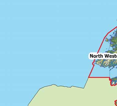

5 Map 1 International River Basin Districts 4

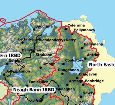
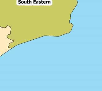
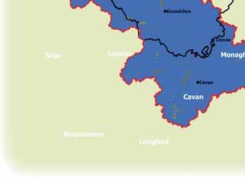
6 The North Western IRBD: a brief overview The North Western International River Basin District is a cross-border area: 7,4 km 2 is in Ireland and 4,9 km 2 in Northern Ireland. It takes in all of County Donegal, large parts of Fermanagh, Cavan, Londonderry, Monaghan and Tyrone, significant areas of Leitrim and Longford and a small portion of Sligo. It is bounded to the north and west by the Atlantic Ocean, to the south by the Western District and Shannon International District and to the east by the Neagh Bann International District. The climate is temperate; annual rainfall is about 1 mm in the low-lying areas but exceeds 2 mm in the Donegal uplands. People The District, which is home to less than half a million people, has a low average population density; less than 2% of the land is urbanised, with many people living in small villages or single dwellings. Most of the main urban areas are located beside rivers: Ballybofey, Cavan Town, Londonderry/Derry, Donegal Town, Enniskillen, Letterkenny and Strabane. Map 2 The North Western International River Basin District 5

7 The fertile soils of the Foyle and Erne basins support beef, dairy, sheep and pig farming as well as crop cultivation. Further west, the landscape is mountainous with many coniferous forest plantations and some sheep and cattle grazing. The spectacular coastline, the surfing beaches and the remote beauty spots attract many tourists. Waters Surface waters The District has both lowland rivers (wide valleys, slow flows) and upland rivers (steep valleys, flash flows). The main rivers are the Foyle (draining much of the mountain regions of Donegal and the Sperrins), the Erne (draining parts of Cavan, Fermanagh and Monaghan) and the Swilly. The two main lakes are Upper Lough Erne (3 km 2 ) and Lower Lough Erne (1 km 2 ); the District also includes Lough Macnean (5 km 2 ) and Lough Melvin (22 km 2 ). The 2,5 km 2 of marine waters are mostly off County Donegal but include small sections of the Leitrim and Sligo coastlines. Major features include many islands, headlands and inlets, Donegal Bay and the Erne, Swilly and Foyle estuaries. Groundwaters In the south of the District, including the area around the Lough Erne system, permeable rocks and soils allow groundwater to be stored in underground aquifers, but elsewhere the rocks and soils hinder water seepage, so aquifers are small. Heavily modified waters Some surface waters in the District have been substantially changed for such uses as navigation (for example ports), water storage, public drinking water supply, flood defence or land drainage. Such waters are described as heavily modified. Lough Salt, Loughs Nacung, Dunlewy and Assaroe, stretches of the River Erne, River Skegoe and Killybegs harbour are heavily modified. Other waters are man-made (artificial): they include the Clady headrace and Shannon Erne waterway. The benefits from such modifications need to be retained, and consequently such waters are subject to a different set of environmental objectives. Protected areas While all of our waters are important, some areas require greater protection because they contain sensitive habitats or wildlife species. Other areas are protected because of their beneficial uses or the need to protect human health: these areas include drinking water sources, shellfish growing areas and bathing areas. All of the areas requiring special protection in the North Western District have been identified, mapped and listed in a register of protected areas. The drinking water sources include Gartan Lough and Lower Lough Erne; the shellfish waters include Mulroy Bay and parts of Lough Foyle; the bathing waters include Murvagh and Benone beaches. Nutrient-sensitive areas include Killybegs Harbour and Upper Lough Erne and Special Areas of Conservation and Special Protection Areas include Lough Melvin and the River Foyle and tributaries. Table 1 identifies the number of water bodies of different surface water and groundwater categories within the district. Shared water bodies lie along the border between Ireland and Northern Ireland. These, along with water bodies that lie entirely within Ireland or Northern Ireland, comprise the whole International River Basin District. Table 1 North Western International River Basin District: shared waterbodies Waterbody Shared Waterbodies Number of Waterbodies Northern Ireland Waterbodies Ireland Waterbodies Rivers/Canals Lakes/Reservoirs Estuaries (transitional) Coastal waters Groundwater Total 6
8 Coordination so far The primary means of co-ordination is through the North-South Water Framework Directive Coordination Group, which is supported by a number of technical working groups with representatives from the implementing authorities in Ireland and Northern Ireland. Table 2 presents the principal areas of cooperation in the development of the River Basin Management Plans Table 2 Coordination so far Date WFD requirements Implementation: Ireland Implementation: Northern Ireland 2 Directive enters into force n/a na 23 Directive to be transposed into national law Water Policy Regulations (SI 722 of 23, subsequently amended by SI 413 of 25 and SI 219 of 28); requirement to consult with Northern Ireland authorities included Water Environment (WFD) Regulations (Northern Ireland) 23 (SR No. 544); requirement to consult with Ireland authorities included International River Basin Districts and River Basin Districts to be identified Joint consultation document Managing our Shared Waters identified IRBDs and set out the administrative arrangements Competent authorities to be identified Listed in regulations Listed in regulations 24 Characterisation of surface and groundwaters to be completed Submitted to European Commission in 25 Submitted to European Commission in 25 Both jurisdictions used the same systems for characterising groundwaters, transitional waters and coastal waters. Both used the RIVTYPE system, developed in Ireland, for rivers and lakes. A joint identification code, recognising both jurisdictions, was used for cross-border shared waters. Impacts of human activity (industry, farming etc) to be identified Submitted to European Commission in 25 Submitted to European Commission in 25 Common risk assessment methodologies and rules developed by eco-region Technical Advisory Groups were applied. A joint working group ensured consistency. Results for shared waters were reviewed; most assessments were similar with some variations due to differences in national datasets; overall the process was well harmonised. A single characterisation report was prepared for each IRBD. Results from both jurisdictions are available on WISE (Water Information System for Europe). Economic analysis of water use to be completed Baseline submitted to European Commission in 25 Baseline submitted to European Commission in 25 Consultation between the two jurisdictions. Some differences in availability of economic data and in extent of cost recovery. Difficult to harmonise baseline economic information; consultations on economic analysis continue. Location and boundaries of water bodies to be identified Submitted to European Commission in 25 Submitted to European Commission in 25 The authorities consulted each other on the boundaries before reporting. Reference conditions for water status to be defined Submitted to European Commission in 25 Submitted to European Commission in 25 The authorities consulted each other on the conditions before reporting. Register of protected areas to be established Submitted to European Commission in 25 Submitted to European Commission in 25 The authorities consulted each other on the registers before reporting. There is a high level of consistency in the approaches but with some differences stemming from historic decisions. Since then conservation authorities (Natural Heritage and National Parks and Wildlife Service) have been harmonising the registers, producing a joint electronic map of protected areas and progressing joint studies. 7
9 26 Environmental monitoring to be established and operational to ensure comprehensive view of water quality in each River Basin District Monitoring programmes designed, consulted on and implemented by end-26 Monitoring programmes designed, consulted on and implemented by end-26 Both jurisdictions monitor groundwater sites and transitional and coastal waters, as well as representative sites on crossborder rivers and lakes. Joint programmes, set up through the NS Share study, monitor dangerous substances and biological status. Scientists across Europe have collaborated on the development of compatible water classification systems; Ireland and the UK are in the same geographical intercalibration groups. The authorities in Ireland and Northern Ireland are also cooperating, through the eco-region s Technical Advisory Groups, on harmonising water status systems. Maps of monitoring networks for both jurisdictions are available on WISE. Work programme for production of River Basin Management Plans for each River Basin District to be published Published in 26 Published in 26 The two environment departments consulted each other on the draft work programmes. Both work programmes confirmed that coordinated action in shared waters would include production of a single report on significant water management issues for each international river basin district. Public Participation Ongoing coordination arrangements regarding public participation include reciprocal invites to attend meetings of the formal stakeholder groups in Northern Ireland and the Advisory Councils in Ireland. 27 Interim overview of the significant water management issues for each River Basin District to be published Published June 27 Published June 27 The authorities in both jurisdictions agreed a common timeframe and report content. For each international river basin district, a single report on significant water management issues was produced; stakeholders and authorities groups were asked to help identify the key issues and views were gathered at public workshops in the following six months. A strategic environmental assessment scoping study and subsequent consultations were undertaken, based on the single Significant Water Management Issues report for the international river basin districts. Ongoing coordination arrangements regarding public participation include reciprocal invites to attend meetings of the formal stakeholder groups in Northern Ireland and the Advisory Councils in Ireland. 28 This document forms part of the Draft River Basin Management Plan to be published for public consultation by December 28 Draft management plans to be published for public consultation in December 28 Draft management plans to be published for public consultation in December 28 The authorities have developed guidelines on coordinating implementation of river basin management plans. Representatives from environmental agencies in both jurisdictions were involved in steering groups to share knowledge, aiming for consistency in method and approach. North South Technical Advisory Groups applied the classification systems to determine the status of waters, with the results being reviewed by officials in both jurisdictions. Consultations on objective setting for international waters continued during 27 and 28, including shared technical studies of objectives for heavily modified waters and protected areas. For the draft plans, the authorities in both jurisdictions agreed to use a common template. This component of the Draft River Basin Management Plan describes collaboration to date and the commitment to future coordination of implementation. Detailed information on status, objectives and measures is presented separately, to allow focused consultations, in draft plan summary documents for each jurisdiction. An electronic information system covering the status, objectives and measures for each waterbody and background documents are available on websites. It has been necessary to carry out a Strategic Environmental Assessment of the draft plans and programmes of measures. A single collaborative strategic environmental assessment has been commissioned to cover both jurisdictions. During 28 an environmental report was produced for each of the island s eight national and international river basin management plans and their associated programmes of measures. 8

10 The status of our shared waters In accordance with the Water Framework Directive, classification schemes identify status classes, which indicate how much human activity has impacted on waters. Surface waters have been classified according to their ecological status and chemical status; and groundwaters on a system that combines chemical and quantitative status. Surface waters are classified as high, good, moderate, poor or bad. Groundwaters are classified as good or poor. The status of our shared surface waters and groundwaters is summarised in Table 3 and Table 4 and presented in Map 3 and Map 4. Table 3 Surface water status in the North Western District s shared waters Surface Water Category High Good Moderate Poor Bad Rivers and canals (number) (1) 2. (12) 23.5 (29) 56.9 (4) 7.8 (5) 9.8 Lakes and reservoirs (km 2 ) (67) 1 Estuaries (km 2 ) (34) 1 Coastal (km 2 ) (166) 1 Table 4 Groundwater status in the North Western District s shared waters Groundwater Good Poor Chemical Status (km 2 ) Quantitative Status (km 2 ) Combined Status (km 2 ) (4,249) 1 (4,249) 1 (4,249) 1 Protected areas While all of our waters are important, some areas require greater protection because they contain rare and vulnerable habitats or wildlife. Other areas require special protection because of their beneficial use or the need to protect human health. These include drinking water sources, shellfish growing areas and bathing areas. There are 186 protected areas amongst the shared waters of the North Western International River Basin District. They include the River Foyle and tributaries, Lough Melvin, Upper Lough Erne, Foyle Estuary and Lough Foyle. 9

11 High Status Good Status Moderate Status Poor Status Bad Status Map 3 Shared waterbody surface water status in the North Western International River Basin District Good Status Poor Status Map 4 Shared waterbody groundwater status in the North Western International River Basin District Protect Restore Map 5 Shared waterbody surface water overall objectives in the North Western International River Basin District Protect Restore Map 6 Shared waterbody groundwater overall objectives in the North Western International River Basin District 1
12 The objectives and measures for our shared waters Environmental objectives define what it is proposed to achieve by implementing the river basin management plan and measures are the methods used to pursue these objectives. Objectives The core objectives are: achieve protected areas objectives prevent deterioration restore good status reduce chemical pollution. In general, the aim is to achieve these core objectives by 215. In certain instances alternative objectives may be set, for example where it is not possible to achieve good status by 215 due to technical, economic, environmental or recovery constraints. Improvements may be phased over further river basin planning cycles if these constraints mean we can t meet objectives within the first river basin planning cycle. The core objectives have been translated into detailed and specific objectives for each of our shared surface waters and groundwaters (Map 5 and Map 6). Table 5 shows when we expect to achieve those detailed objectives: Table 5 Rivers and Canals (number) Objective Achieved 27 (13) 25.5% Objective Achieved 215 (41) 8.5% Objective Achieved 221 (51) 1% Objective Achieved 227 (51) 1% Less Stringent Objective objective timescale beyond 227 Timescale for achieving surface water and groundwater objectives in our shared waters Lakes and Reservoirs (km 2 ) % (67) 1% (67) 1% (67) 1% Estuaries (km 2 ) % % (34) 1% (34) 1% All objectives have to be reviewed every six years as part of the river basin planning cycle. % Coastal Waters (km 2 ) % % (166) 1% (166) 1% Timescale for achieving surface water and groundwater objectives in our shared waters Groundwaters (km 2 ) These charts show the improvements we expect in each category of waters over three cycles of the river basin district planning process. GES or GEP means good ecological status or good ecological potential, in other words compliant with the Water Framework Directive. The standard of good ecological potential is applied to artificial and heavily modified waters (such as canals and reservoirs) where the benefits to humans need to be retained. LSO means less stringent objective, which means that the waters won t achieve good status or good potential before 227. % % % (4,249) 1% (4,249) 1% (4,249) 1% (4,249) 1% % 11
13 1% Rivers and Canals (number) 8% 6% 4% 2% % GES or GEP 27 GES or GEP 215 GES or GEP 221 GES or GEP 227 LSO 1% Lakes and Reservoirs (km 2 ) 8% 6% 4% 2% % GES or GEP 27 GES or GEP 215 GES or GEP 221 GES or GEP 227 LSO 1% Estuaries (km 2 ) 8% 6% 4% 2% % GES or GEP 27 GES or GEP 215 GES or GEP 221 GES or GEP 227 LSO 1% Coastal Waters (km 2 ) 8% 6% 4% 2% % GES or GEP 27 GES or GEP 215 GES or GEP 221 GES or GEP 227 LSO 1% Groundwaters (km 2 ) 8% 6% 4% 2% % GES or GEP 27 GES or GEP 215 GES or GEP 221 GES or GEP 227 LSO 12
14 Measures The measures used to achieve the objectives for our waters fall into three categories: the implementation of 11 key directives specified under the Water Framework Directive. These directives have already been transposed into domestic legislation in both Ireland and Northern Ireland the implementation of other stipulated measures required by the Water Framework Directive. Again domestic legislation has been or will be made in both Ireland and Northern Ireland to address these stipulated measures: for example both jurisdictions will introduce new legislation requiring establishment of inventories of emissions, discharges and losses of priority substances the use of additional or supplementary measures. Basic measures The first two categories are referred to as basic measures. They are: The 11 key EU Directives Other stipulated measures Bathing waters Cost recovery for water use Birds Promotion of efficient and sustainable water use Habitats Protection of drinking water sources Drinking waters Control of abstraction and impoundment Major accidents Control of point source discharges Environmental impact assessment Control of diffuse source discharges Sewage sludge Authorisation of discharges to groundwaters Urban wastewater treatment Control of priority substances Plant protection products Controls on physical modifications to surface waters Nitrates Controls on other activities impacting on water status Integrated pollution prevention control Prevention or reduction of the impact of accidental pollution incidents Additional or Supplementary measures A range of possible additional or supplementary measures has been identified by a series of technical studies in both Ireland and Northern Ireland. Some are already being taken: they include farm based environmental protection schemes and implementation of a suite of forestry good practice guidelines. Other possible measures are codes of practice, voluntary agreements, demand reduction and rehabilitation programmes and legal, administrative and economic instruments. Additional or supplementary measures range from reducing the pressure at source, through remediation by technical or engineering solutions, to relocation of the pressure. They have to be technically feasible; the combination of supplementary measures must be the most cost-effective and the cost of these combinations of measures must not be significantly 13
15 greater than the benefits gained. The impacts of the supplementary measures on the wider environment have to be considered, through Strategic Environmental Assessment, to ensure that they are sustainable. Examples of additional or supplementary measures that are under consideration in both Ireland and Northern Ireland include: Pressure and Sector Possible measure Urbanisation and Wastewater (Ireland) Urban Development, Collection and Treatment of Sewage (Northern Ireland) Identify and address areas where there are potential constraints on development associated with insufficient capacity at treatment plants. Industrial Discharges (Ireland) Industry and other businesses (Northern Ireland) Introduce codes of practice for potentially polluting industrial discharges. Agriculture (Ireland & Northern Ireland) Increase participation in agri-environment / rural environmental protection schemes, particularly in priority catchments. Forestry (Ireland & Northern Ireland) Introduce more stringent actions for the most sensitive areas, when scientific evaluation establishes a need. Wastewater from Unsewered Properties (Ireland) Collection and Treatment of Sewage (Northern Ireland) Change current policy and guidance to improve existing controls on septic tanks and modify development control and enforcement practices to reflect restrictions in identified priority areas. Physical Modifications (Ireland) Freshwater and Marine Morphology (Northern Ireland) Investigate channelisation remediation schemes, such as reconstruction of pools, substrate enhancement, removal of hard bank reinforcement or revetment and replacement with soft engineering solutions. Abstractions (Ireland) Abstraction and flow regulation (Northern Ireland) Manage water demand through measures such as: implementing water conservation programmes, supporting voluntary initiatives (such as water conservation and rainwater harvesting schemes) and reducing leakage and unaccounted-for water in distribution systems. Both jurisdictions are also proposing educational programmes, measures to target local issues (such as the presence of invasive alien species) and other research programmes as additional or supplementary measures in support of the Water Framework Directive. The full suite of proposed additional or supplementary measures is set out in the detailed draft plan summary documents for each of the two jurisdictions. 14


16 Continuing coordination There is still important work to be done before the final plans can be completed. Authorities in both jurisdictions will continue to coordinate their activities with the aim of producing a single management plan for each of the cross-border river basin districts. Coordinating with other plans and programmes It will be necessary to integrate and coordinate river basin management plans with plans and programmes in other relevant policy areas, both at national level and for shared waters. The plans and programmes include: Habitat and Species Protection Plans under the Habitats Directive Water Services Strategic Plans (Ireland) or Northern Ireland Water (NIW) investment programmes the Nitrates Action Programmes, already closely aligned in both jurisdictions Strategic National Development Plans and related Local Plans. The development of new plans and programmes will also be coordinated. For example, under Ireland s new Surface Water Environmental Quality Objectives Regulations, implementation committees are to develop river basin district pollution reduction programmes. Under these regulations public authorities must consult, cooperate and liaise with other public authorities within the river basin district and, where appropriate, with the competent authorities in Northern Ireland. Assessing regulatory impacts The Water Framework Directive requires a range of regulatory controls (for example authorisation of direct discharges to water, abstractions and physical modifications) to give legal effect to measures. Any significant regulatory proposals in either jurisdiction require regulatory impact assessment to evaluate whether new regulations will have the desired impact or will have undesirable side-effects or unforeseen extra costs. Such assessment also helps to clarify the cost of enforcement of the regulation. The introduction of new regulatory controls will also be coordinated between authorities in the two jurisdictions where appropriate. Implementing the management plans In Northern Ireland, implementation of each plan will be coordinated by the Department of the Environment and the Northern Ireland Environment Agency, through the Interdepartmental Working Group, which includes the four main government departments responsible for implementing the plan. In Ireland, implementation of the plans will be coordinated by the Department of the Environment, Heritage and Local Government, working together with the local authorities, the Environmental Protection Agency, and other relevant public authorities. Donegal and Monaghan County Councils, the respective lead local authorities for the North Western and Neagh Bann international districts, will be assisted in the development of River Basin Management Plans by a project funded by the Department of the Environment, Heritage and Local Government. The North South Water Framework Directive Coordination Group will continue to oversee the ongoing coordination between the authorities in the two jurisdictions during the implementation of the management plans. Future coordination efforts are outlined in Table 6. Consideration will be given to further enhancing coordination arrangements to support implementation of measures in the District s shared waters. 15


17 Table 6 Future coordination 29 River Basin Management Plans to be finalised and published The North South Ministerial Council confirmed in October 27 that implementation of the Water Framework Directive in both jurisdictions would be carried forward with the aim of producing a single river basin management plan for each of the International River Basin Districts. These plans are to be adopted by December 29. During 29 the strategic environmental assessment process will continue with consultations and preparation of a single environmental statement to accompany the final river basin management plan for each district. Programmes of measures to be established in each River Basin District to meet environmental objectives Preparation of the draft programmes of measures has revealed some differences in existing legislative and implementation systems. Further harmonisation will be achieved through future review of supporting plans and programmes. 21 Water pricing policies to be in place Coordination will be advanced under the remit of the North South Water Framework Directive Coordination Group. 212 Programmes of measures to be fully operational Coordination will be advanced under the remit of the North South Water Framework Directive Coordination Group. Progress to be monitored Interim progress reports will be prepared on implementation of planned programmes of measures. 215 Main environmental objectives to be met River Basin Management Plans to be reviewed and updated 221 Second six-year planning cycle ends River Basin Management Plans to be reviewed and updated 227 Third six-year planning cycle ends River Basin Management Plans to be reviewed and updated 16
18
19 appendix Summary of the Status and Objectives for the whole North Western International River Basin District 18

20 Current status The status of our surface waters and groundwaters in the whole international District is summarised in Tables 7 and 8 and Maps 7 and 8, which include all the district s waters: those in Ireland, those in Northern Ireland and all shared waters. Table 7 Surface water status in the whole North Western International District Surface Water Category High Good Moderate Poor Bad Yet to be Determined Rivers and canals (number) (61) 7. (283) 32.7 (342) 39.5 (165) 19.1 (1) 1.2 (5).6 Lakes and reservoirs (km 2 ) (9.5) 3.4 (28.8) 1.2 (227.4) 8.6 (13.5) 4.9 (3.1) 1.1 Estuaries (km 2 ) (11.5) 8.7 (12.5) 91.2 (.2).1 Coastal (km 2 ) (239.) 1.7 (212.5) 9.5 (1,778.5) 79.8 Table 8 Groundwater status in the whole North Western International District Groundwater Good Poor Chemical Status (km 2 ) Quantitative Status (km 2 ) Combined Status (km 2 ) Protected areas (12,77) 1 (12,77) 1 (12,77) 1 There are 186 protected areas amongst the shared waters of the North Western International River Basin District. In the whole District there are 477 protected areas. These include drinking water sources such as Gartan Lough and Lower Lough Erne, shellfish waters such as Mulroy Bay and parts of Lough Foyle, bathing waters such as Murvagh and Benone beaches, nutrient sensitive areas such as Killybegs Harbour and Upper Lough Erne and Special Areas of Conservation and Special Protection Areas such As Lough Melvin and River Foyle and Tributaries. 19


21 High Status Good Status Moderate Status Poor Status Bad Status Map 7 Surface water status in the North Western International River Basin District Good Status Poor Status Map 8 Groundwater status in the North Western International River Basin District Protect Restore Map 9 Surface water overall objectives in the North Western International River Basin District Protect Restore Map 1 Groundwater overall objectives in the North Western International River Basin District 2

22 Objectives The detailed objectives for the surface waters and groundwaters in the whole international District are summarised in Table 9 and Maps 9 and 1. This is when we expect to achieve those objectives: Table 9 Timescale for achieving surface water and groundwater objectives in the whole North Western International District Rivers and Canals (Number) Lakes and Reservoirs (km 2 ) Estuaries (km 2 ) Coastal Waters (km 2 ) Groundwaters (km 2 ) Objective Achieved 27 (344) 39.7% (38.25) 13.6% (11.52) 8.5% (239) 1.7% (12,77) 1% Objective Achieved 215 (772) 89.1% (16.65) 37.8% (97.52) 71.6% (285.75) 12.8% (12,77) 1% Objective Achieved 221 (864) 99.8% (282.25) 1% (136.) 99.9% (451.45) 2.2% (12,77) 1% Objective Achieved 227 (865) 99.9% (282.25) 1% (136.) 99.9% (451.45) 2.2% (12,77) 1% Less Stringent Objective objective timescale beyond 227 % % % % % To be determined (1).1% % (.17).1% (1,778.54) 79.8% % Timescale for achieving surface water and groundwater objectives in the whole North Western International District s waters The charts opposite show the improvements we expect in each category of waters over three cycles of the river basin district planning process. GES or GEP means good ecological status or good ecological potential, in other words compliant with the Water Framework Directive. The standard of good ecological potential is applied to artificial and heavily modified waters (such as canals and reservoirs) where the benefits to humans need to be retained. LSO means less stringent objective, which means that the waters won t achieve good status or good potential before
23 1% 8% 6% 4% 2% Rivers and Canals (number).1% of rivers and canals are unclassified % GES or GEP 27 GES or GEP 215 GES or GEP 221 GES or GEP 227 LSO 1% Lakes and Reservoirs (km 2 ) 8% 6% 4% 2% % GES or GEP 27 GES or GEP 215 GES or GEP 221 GES or GEP 227 LSO 1% 8% 6% 4% 2% Estuaries (km 2 ).1% of estuaries are unclassified % GES or GEP 27 GES or GEP 215 GES or GEP 221 GES or GEP 227 LSO 1% 8% 6% 4% 2% Coastal Waters (km 2 ) 79.8% of coastal waters are unclassified % GES or GEP 27 GES or GEP 215 GES or GEP 221 GES or GEP 227 LSO 1% Groundwaters (km 2 ) 8% 6% 4% 2% % GES or GEP 27 GES or GEP 215 GES or GEP 221 GES or GEP 227 LSO

24 ISBN Donegal County Council Cavan County Council Monaghan County Council Leitrim County Council Longford County Council Sligo County Council