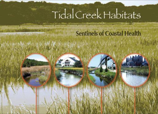
Tidal Creek Ecosystems: Sentinel Habitats for Assessing and Predicting the Consequences of Coastal Development and Climate Change
|
|
|
- Colin Logan
- 5 years ago
- Views:
Transcription


1 Tidal Creek Ecosystems: Sentinel Habitats for Assessing and Predicting the Consequences of Coastal Development and Climate Change Denise Sanger 1,2, Anne Blair 1 1 Center of Excellence in Oceans and Human Health at Hollings Marine Laboratory and 2 S.C. Sea Grant Consortium
2 Objectives of Presentation Provide a synthesis of the impacts of coastal development on coastal ecosystems and the humans that live in them. Provide a case study highlighting a current modeling effort ultimately predicting the impacts of changes in climate and the level of urbanization. Changes in precipitation and soil saturation


3 Tidal Creeks Sampled Over 55 Tidal Creeks Representing Forested, Suburban, and Urban Land Uses


4 Creek Continuum A Creek Lengths 1A 850 m 1B 850 m 2A 6400 m 2B 4600 m m A B B
5
6 Population Density (ind hec -1 ) Intertidal Subtidal R² = 0.90* R² = 0.82* Impervious Cover (%)


7 Forested Watershed Rainfall Evapotranspiration Developed Watershed Rainfall Evapotranspiration Stormwater Runoff Subsurface flow Stormwater Runoff Subsurface flow Groundwater recharge Groundwater recharge
8 Modeled Runoff Volume More rainfall is converted to stormwater runoff in developed watersheds Runoff Volume (mm) % 50% 27% Forested Suburban Urban Watershed Present scenario 24-hr 4.5-in storm event, average runoff conditions
9 Projecting Impact of Climate Change Runoff Volume (mm) % 65% 42% Forested Suburban Urban Watershed Present scenario 24-hr 4.5-in storm event, average runoff conditions Climate Center of scenario Excellence 12-hr for Oceans 5.2-in and storm Human event, Health semi-saturated the Hollings Marine runoff Laboratory conditions
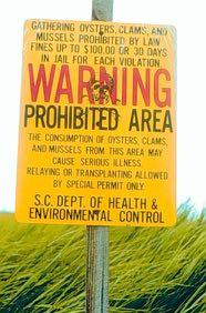
10 Water Pathogens vs Impervious Cover FC (log CFU 100 ml -1 ) ENT (log CFU 100 ml -1 ) Interitdal Subtidal R 2 = 0.33* R 2 = 0.03 R 2 = 0.64* R 2 = 0.24* F+ (log PFU 100 ml -1 ) F- (log PFU 100 ml -1 ) 3 2 R 2 = 0.40* 1 R 2 = 0.26* R 2 = 0.31* 2 1 R 2 = 0.27* Impervious Cover (%) Impervious Cover (%)

11
12


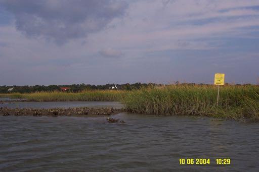
13 Charleston Flood Prone Areas Center of Post Excellence and Courier for Oceans and Human Health at the Hollings Marine Laboratory
14
15

 from surface")


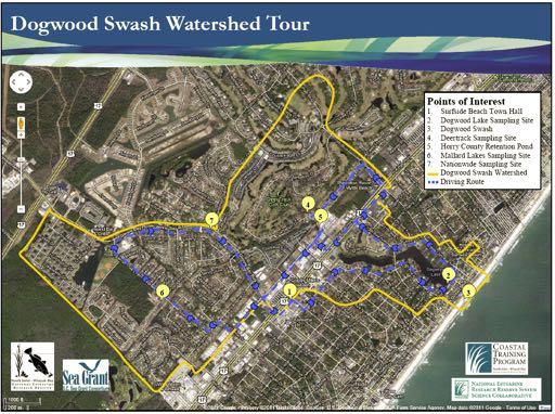
16 Leveraging a NOAA/UNH Science Collaborative Project PI Erik Smith Model the loading of Enterococci (indicator bacteria) from surface water discharges along the Grand Strand and relate the findings to the SCDHEC Beach Monitoring Program. Withers Swash, Myrtle Beach Dogwood Swash, Surfside Beach


17 Grand Strand Swashes White Point Singleton Bear Branch Cane Patch Deep Head Midway Withers 13 th Ave. S Myrtle Beaver Dam Creek Ocean Lakes 16 th Ave N. Watersheds are undergoing Dogwood QA/QC Center of Surfside Excellence for Oceans and Human Health at the Hollings Marine Laboratory Floral
18
19 Loading Event Load = Concentration * Volume Measure concentration in runoff and instream 2 swashes 6 runoff and 2 instream Historical data in runoff and instream Model volume Current land use Potential to add climate and development change scenarios
20 Prediction Schematic Imper. cover (%) (a) Watershed Attributes ENT (log (x+1) (c) Bacterial Indicators 0 Basins Impervious cover (%) (b) Hydrographic Characteristics (d) Prediction of Load Runoff (m 3 /s/km 2 ) Urban Suburban Forested Load (colonies) Time (h) 0 Basins

21 Relating Runoff to Beach Monitoring Schematic of relating land sources to beach monitoring
22 Projecting impact of climate change Modeled climate scenario for current and built development levels shows increases in runoff far exceeding precipitation increase Runoff Volume (m 3 ) Thousands Village Creek watershed 630 ha Undeveloped - forested 538K 420K 351K 357K 248K 192K 634K 465K Watershed Impervious Cover Percent Present scenario 24-hr 4.5-in storm event, average runoff conditions Climate scenario 12-hr 5.2-in storm event, semi-saturated runoff conditions
23 Interactions/Partnerships North Inlet-Winyah Bay NERR USC Local Municipalities Planning and Stormwater SCDHEC EQC (WQ, Beach Monitoring, Watershed Planning) SCDHEC OCRM SCDNR
24 Needs for Addressing Problem Good climate scenarios Precipitation patterns Sea level rise and potential impacts on soil saturation Assumption that the concentration will stay the same which don t know Time to commit to collaboration
25 Questions