Grecile Christopher R. Damo
|
|
|
- Marianna Hancock
- 5 years ago
- Views:
Transcription
 Community Based Flood Warning and Flood Hazard Mapping in Camiguin Island, Philippines February 07 to 09, 2007 Presented by: Grecile Christopher R.")
1 REPUBLIC OF THE PHILIPPINES International Centre for Water Hazard and Risk Management (ICHARM) Public Works Research Institute (PWRI) And in cooperation with Japan International Cooperation Agency (JICA) Community Based Flood Warning and Flood Hazard Mapping in Camiguin Island, Philippines February 07 to 09, 2007 Presented by: Grecile Christopher R. Damo Civil Engineer/Researcher Department of Public Works and Highways PROJECT MANAGEMENT OFFICE FLOOD CONTROL AND SABO ENGINEERING CENTER

2 Source: reports.org

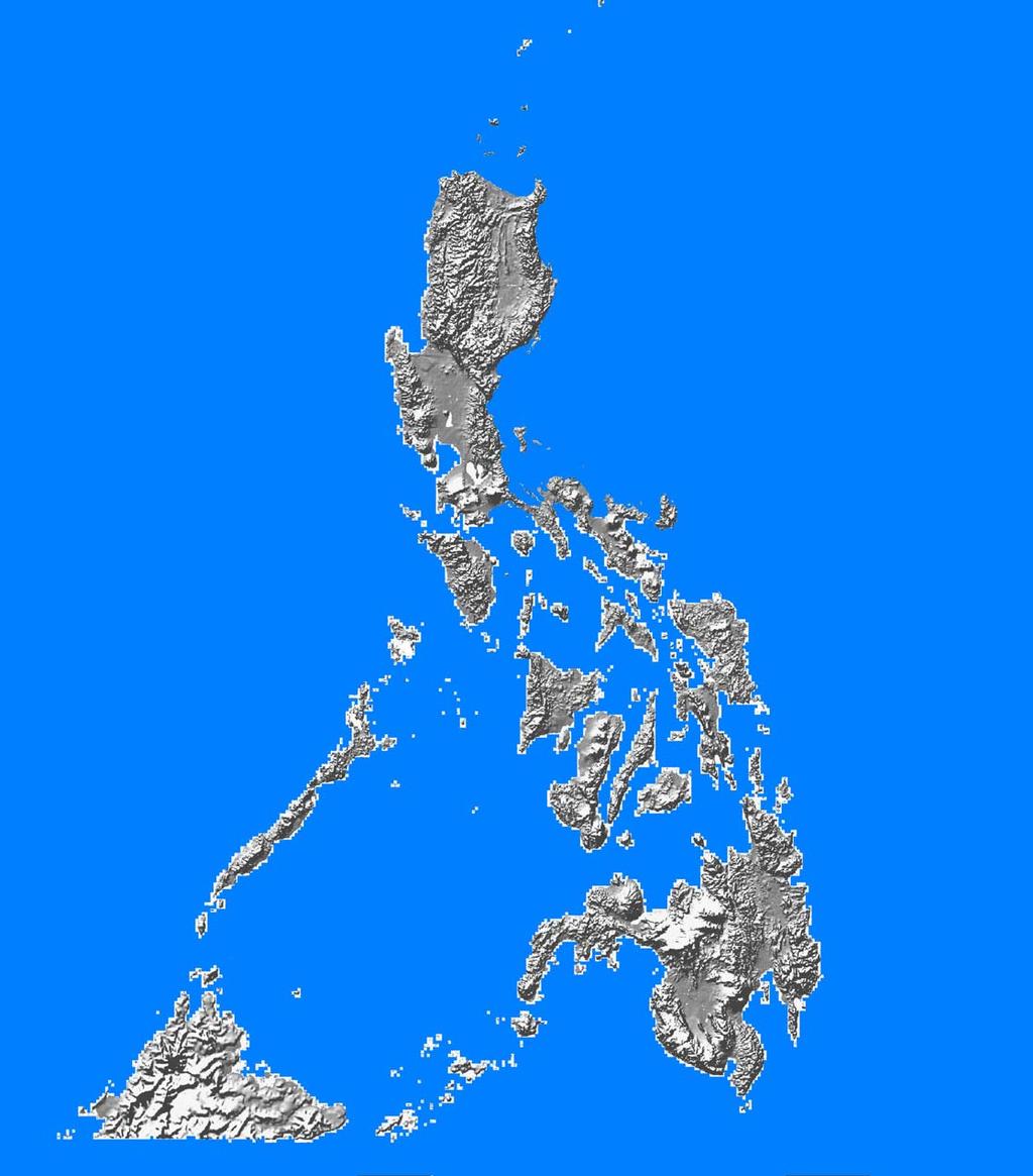
3 - Just above the equator - 7,107 islands - Dry and wet season - Average Annual Rainfall 2,360 mm - Tropical Climate - 20 Typhoons - Fault System - Active Volcano Principal River Basins - 18 Major River Basins
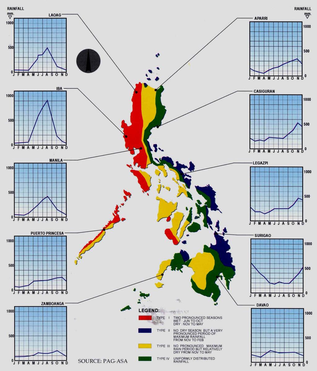

4 Climatological Regions of the Philippines


5 Probable Typhoon Tracks MAY FEBRUARY Very Frequent 32% Northern and Central Luzon NOVEMBER OCTOBER Frequent 16% DECEMBER MARCH SEPTEMBER AUGUST JULY JUNE Southern Luzon Frequent 19% JANUARY Northern Visayas Less Frequent 7% APRIL Southern Visayas and Northern Mindanao Rare 1% Mindanao Island Source: Study for the Preparation of Flood Control Manual for DPWH TSG, 2003
6 Contents Problems and Issues on the Government of the Philippines Warning and Evacuation Non-structural measures for future implementation JICA Study on Nationwide Flood Risk Assessment for Department of Public Works and Highways (DPWH) Community Based Flood Hazard Mapping Camiguin Non-Structural Measure (Ungaged River Basin and Community Based)
7 Disaster Management: Disaster Coordinating Council NDCC National Disaster Coordinating Council RDCC 17 Regional DCC PDCC 80 Provincial DCC CDCC 113 City DCC MDCC 1,496 Municipal DCC BDCC 41,956 Barangay DCC
8 Flood Management NDCC is the highest policy making, coordinating & supervising body at national level. All Cabinet Secretaries are members of NDCC Office of the Civil Defense - Secretariat
9 Flow Chart of Data Dissemination Warning and Evacuation
10 PAGASA NDCC Forecast & Warning RDCC MDCC BDCC BDCC BDCC BDCC BDCC BDCC PDCC MDCC BDCC BDCC BDCC BDCC CDCC BDCC BDCC BDCC
11 PAGASA NDCC TRI-MEDIA RDCC MDCC BDCC BDCC BDCC BDCC BDCC BDCC PDCC MDCC BDCC BDCC BDCC BDCC CDCC BDCC BDCC BDCC
12 PAGASA NDCC PRESIDENT MDCC BDCC BDCC BDCC BDCC BDCC BDCC RDCC PDCC MDCC BDCC BDCC BDCC BDCC State of Calamity CDCC BDCC BDCC BDCC
13 Why still many casualties? Anilao River Malbasag River Ormoc, Leyte Flashflood (Nov. 5, 1991)

14
15 Lack of Structural and Non-Structural Measures and Preparedness

16 Why still many casualties? People took refuge in a concrete house Southern Leyte December 2003


17 Why still many casualties? Debris flow/alluvial Fan Deposition in Aurora Province (Dec. 3, 2004)


18 Why still many casualties? Source: Ninfa Z. Bito Many people died when they took refuge here Quezon Province Flash Floods and Debris (Dec. 3, 2004)


19 Metro Manila
20 Topographical Location Wrong perception of safe evacuation No clear evacuation area

21 Why still many casualties? Southern Leyte in February 2006

22 Why still many casualties? Southern Leyte in February 2006
23 Lack of technical people with knowledge and capability in investigating high risk areas (mechanism of disasters) The community/people always blame the logging operations for the disasters and the investigation will stop there

24 Why still many casualties? Bicol Disaster November 29, 2006


25 Why still many casualties? Bicol Disaster November 29, 2006
26 Structural Measures gave a wrong impression of safety Residents did not evacuate because they felt they are safer in their concrete houses Some doesn t want to leave their properties Budget for the Warning System
27 Study on Nationwide Flood Risk Assessment and Flood Mitigation Plan for the Selected Areas of the Philippines A technical assistance from the Government of Japan Started: September 2006 Finish: March 2008 Objectives: - To select prioritized areas based on the flood risk assessment and to prepare flood mitigation plans for the selected areas and to conduct transfer of technology to DPWH during the course of the study
28 Study on Nationwide Flood Risk Assessment and Flood Mitigation Plan for the Selected Areas of the Philippines Present Progress: Data gathering, site survey, investigation and confirmation of the actual site problems The Government of the Philippines already started the Multi-hazard Mapping under the fundings of UNDP the outputs will be utilized in the future for the flood hazard mapping and evacuation route in the high risk areas


29 Community based Non-Structural Disaster Prevention Measures for Province of Camiguin, Philippines Camiguin is an island volcano located at the Southern part of the Philippines


30 Camiguin Island
31 Objectives of Project Strengthen disaster prevention capacities of PDCC/MDCC/BDCC Increase the local people s awareness of disaster prevention Establish simple and effective disaster prevention method
32 Activities Prepare hazard map Develop debris flow warning criteria and warning system Increase public awareness on debris flow, flash flood and flood prevention measures

33 Community Based Hazard Map
34 Flood Flash Flood Debris Flow
35 Warning System To establish Monitoring system Decision-making system Communication system

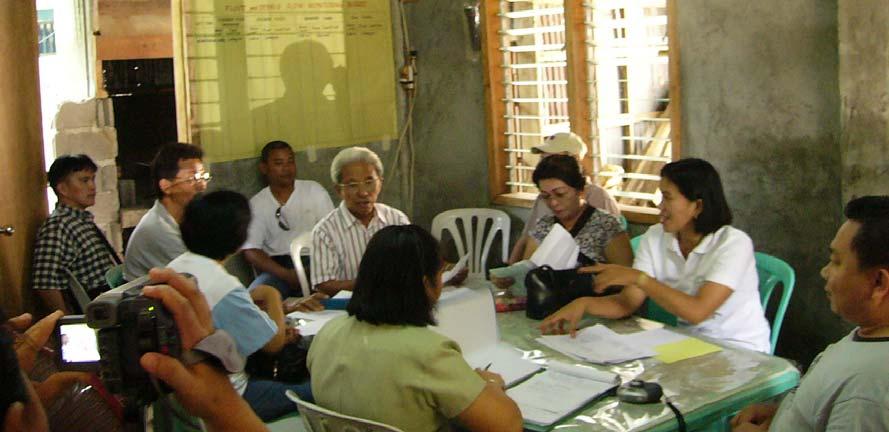
36 Monitoring The Standard 8-inch Rain Gauge non-recording type components: - Measuring Stick 60 cm long - Overflow Can - Collector Funnel - Measuring Tube - Stand Rainfall observation
37 Since the project cannot provide the standard rain gauge for all the high risk Barangays Improvised rainfall measurement The improvised bucket has been measured and calibrated so that when water reached a point there will be a corresponding value which is the same of that 8 inch standard rain fall gauge

38 Monitoring Water level monitoring
39 Communication System Special Forecast from PAGASA Fax Message PDCC Fax Message Rainfall Observation MDCC Rainfall Observation VHF Radio Message Observations of River Conditions Color Force of flow Sound Presence of dislodged vegetation Debris movement Water level BDCC Bandillo, house to house, megaphone with siren, church bells COMMUNITY
40 Decision making Warning Levels Rainfall Cumulative Warning Stage Intensity Rainfall Level Alert 1 Monitoring Start rainfall measurement 2 Preparatory 20mm/h 60mm 3 Evacuate 30mm/h 100mm 4
41 Public Awareness Component To enhance and strengthen enforcement of public awareness of disaster prevention through community and participatory approaches.


42 Warning Church Bell or Badillo is being use for alarming the Town folks and nearby Barangays.. This will give an alert that people should evacuate. Small and hand held sirens are used by the barangays heads


43 Training of Trainers


44 Community Dialogues


45 Table Top Exercise


46 Evacuation Drill
47 Conclusion Simple countermeasures are effective for a small community to understand and to sustain Through participatory approach the end-users recognized the problems and its benefits Regular monitoring of the island s s activities and drills should be carried out Community based non-structural measures can save a lot of lives.
48 Thank You Very Much Domo Arigato Gusaimashita Maraming Salamat Po Department of Public Works and Highways Project Management Office Flood Control and Sabo Engineering Center Napindan Hydraulic Control Structure Compound, Lopez Jaena Street corner E. Santos Avenue Barangay Sta. Rosa, Pasig City, 1600 Philippines
49 Thank You Very Much Domo Arigato Gusaimashita Maraming Salamat Po Department of Public Works and Highways Project Management Office Flood Control and Sabo Engineering Center Napindan Hydraulic Control Structure Compound, Lopez Jaena Street corner E. Santos Avenue Barangay Sta. Rosa, Pasig City, 1600 Philippines
50 Thank You Very Much Domo Arigato Gusaimashita Maraming Salamat Po Department of Public Works and Highways Project Management Office Flood Control and Sabo Engineering Center Napindan Hydraulic Control Structure Compound, Lopez Jaena Street corner E. Santos Avenue Barangay Sta. Rosa, Pasig City, 1600 Philippines

51 Thank You Very Much Domo Arigato Gusaimashita Maraming Salamat Po Department of Public Works and Highways Project Management Office Flood Control and Sabo Engineering Center Napindan Hydraulic Control Structure Compound, Lopez Jaena Street corner E. Santos Avenue Barangay Sta. Rosa, Pasig City, 1600 Philippines

52 LILOAN, CATARMAN Barangay Spot Map Evacuation Areas R2 R3 R1

53 Creek from Binangwan Falls POBLACION, SAGAY Barangay Spot Map Tayong Spring Pomonglo Spring Gym K a y K a Kalye Peligro l y e

54 SOUTH POBLACION, GUINSILIBAN Barangay Spot Map

55 South Poblacion, Guinsiliban Barangay Spot Map

56 TUPSAN, Mambajao Barangay Spot Map R2 R R1

57 TUPSAN, Mambajao Barangay Hazard Map Aboitiz Chapel Puting Balas

58 BAYLAO, MAMBAJAO Barangay Spot Map

59 Hubangon,Mahinog Barangay Hazard Map