A Roadmap for the Scientific Assessment of Maryland s Coastal Plain Groundwater Resources
|
|
|
- Amelia Dalton
- 5 years ago
- Views:
Transcription

1 A Roadmap for the Scientific Assessment of Maryland s Coastal Plain Groundwater Resources David W. Bolton Maryland Geological Survey Robert J. Shedlock U.S. Geological Survey James M. Gerhart U.S. Geological Survey Emery T. Cleaves Maryland Geological Survey
2 Why a Comprehensive Assessment? Better evaluation of cumulative withdrawals on regional potentiometric surface Current data often fragmented, in many locations Ground-water management levels exceeded in some areas MDE needs comprehensive management tools that will help them allocate ground water in a scientifically sound manner, in a regional context
3 Declining Water Levels in Southern Maryland 100 WATER LEVEL (FEET BELOW LAND SURFACE) SM Df 71 Aquia Formation Well location
4
5 Science Plan for the Management of Maryland s Coastal Plain Aquifers Purpose: To provide a comprehensive road map that will guide the activities necessary for the development of appropriate groundwater management tools Principal contributors: U.S. Geological Survey Maryland Geological Survey Maryland Department of the Environment Science Plan to be completed in Spring 2006

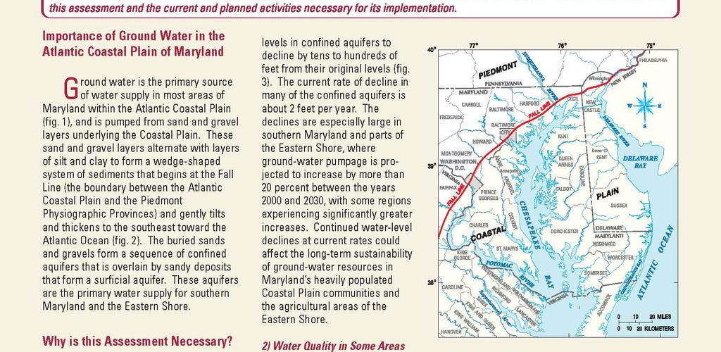
6 Approximate Extent of Study Area Maryland Coastal Plain Aquifer System Study
7 Science Plan Goals Hydrogeologic framework and aquifer properties Regional groundwater flow system and water budget Groundwater quality Enhancement of monitor networks Management tools for groundwater allocation
8 Science Goal 1: Hydrogeologic Framework and Aquifer Properties Geometry of aquifers and confining units, including thicknesses and areal extents Distribution of aquifer and confining-unit hydraulic properties Good start on this from past work, but gaps still exist, and new data and new concepts are available now
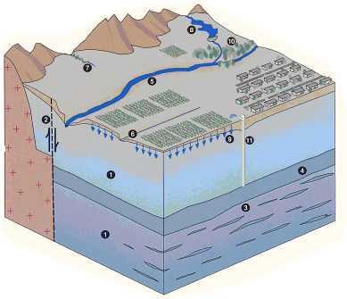
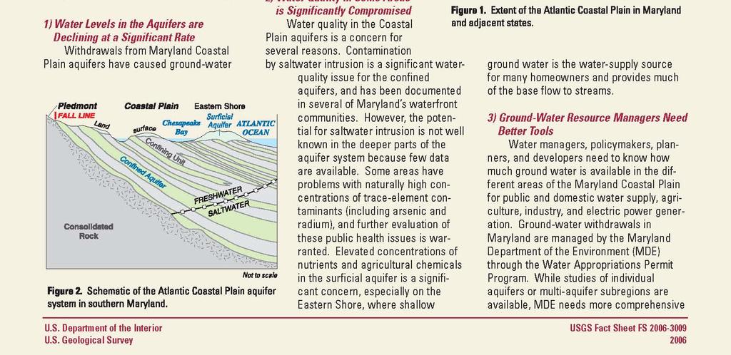
9 Maryland s Major Coastal Plain Aquifers Fall Line Chesapeake Bay Surficial Aquifer Columbia Atlantic Ocean Confining Unit Patuxe nt Aquia Piney Point Magothy Ch esapeake Group Patapsco Consolidated Rock FRESHWATER SALTWATER Not to scale
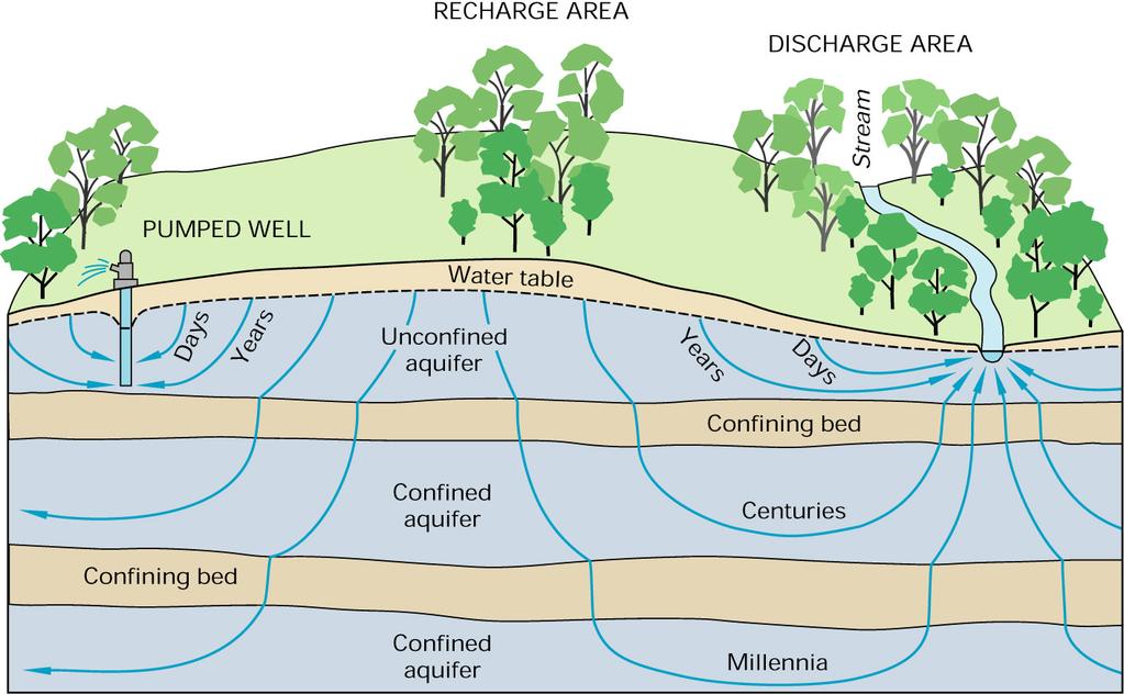
10 Science Goal 2: Regional Ground-Water Flow System and Water Budget Ground-water flow directions and velocities Sources and sinks of ground water for each major aquifer, and how they change with pumpage Recharge and leakage studies Pumpage data management Regional ground water flow model, with local grid refinements and optimization capability
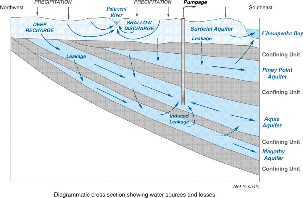
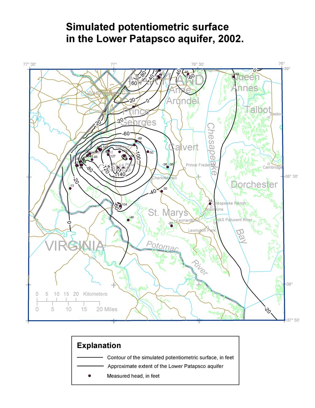
11 Ground-Water Flow System
12
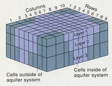
13 Ground-Water Flow Model

14 Nested Models at Different Scales
15 Science Goal 3: Water Quality in the Major Coastal Plain Aquifers Need Suitability for water use Delineation of contaminated areas Data in different databases, formats Proposed study activities Map distribution of regulated constituents Assess potential for saltwater/brackish water intrusion Develop conceptual framework for geochemical evolution Evaluate water-quality monitoring needs

16 Regional groundwater quality issues Radon Radium Arsenic Brackish-water intrusion
17 Science Goal 4: Enhancement of Monitoring Networks Ground-water levels in surficial and confined aquifers Streamflow in surficial aquifer Water quality in major aquifers Important for tracking trends and for calibrating models Monitoring networks good in certain areas and aquifers, but especially weak on Eastern Shore
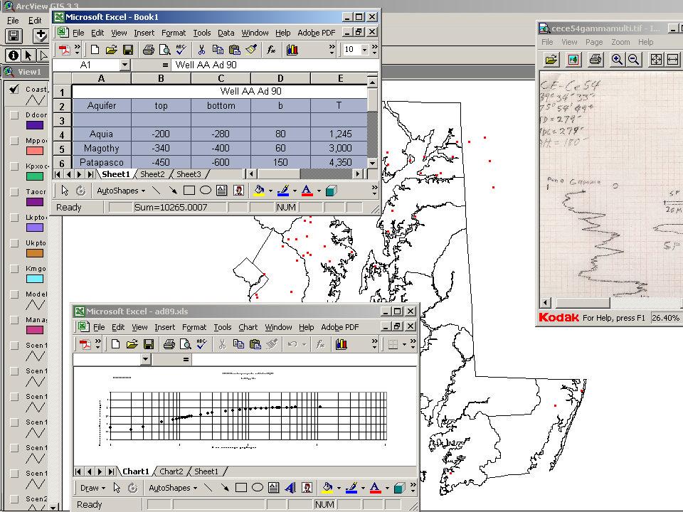
18 Science Goal 5: Management Tools for Ground-Water Allocation Web-Based Aquifer Information System Ground-water flow models at different scales Optimization models at local/subregional scales Solute-transport models for selected quality issues Decision-support system to integrate data and models into web-based GIS format that can be queried to evaluate ground-water development options
19 Coastal Plain Aquifer Information System Hydrologic Data Information Ground-water levels Streamflow Pumpage Water quality Geophysical logs Relevant State policies Ground-water permits Allocation processes Development plans Appropriations WebWeb-Based User Interface Hydrologic Models Hydrologic Analyses Ground-water flow Optimization Solute transport Aquifer tests Recharge estimates Ground-water/surfacewater interactions Water budgets
20

21 General Approach for Optimization Modeling
22 Implementation Plans Phase I, Getting Started and Building Partnerships Phase II, Filling in the Gaps and Building the Resource Management Tools Phase III, Using the Tools to Manage and Optimize the Resource Develop an aquifer information system Develop and test groundwater computer flow model Develop optimization model Refine the aquifer framework Simulate flow system and conduct field studies of recharge and leakage Determine management criteria Identify information gaps Develop plans for addressing gaps Build partnerships and inform public Enhance ground-water and streamflow monitoring networks Link flow and optimization models to create management model Conduct water-quality studies Test water-management scenarios Inform partners and stakeholders
23