Nuriootpa (Sturt Highway Service Centre) DPA The Barossa Council Appendices. Appendix C - Herriot Consulting Engineering Assessment
|
|
|
- Erik Haynes
- 5 years ago
- Views:
Transcription
1 Nuriootpa (Sturt Highway Service Centre) DPA The Barossa Council Appendices Appendix C - Herriot Consulting Engineering Assessment

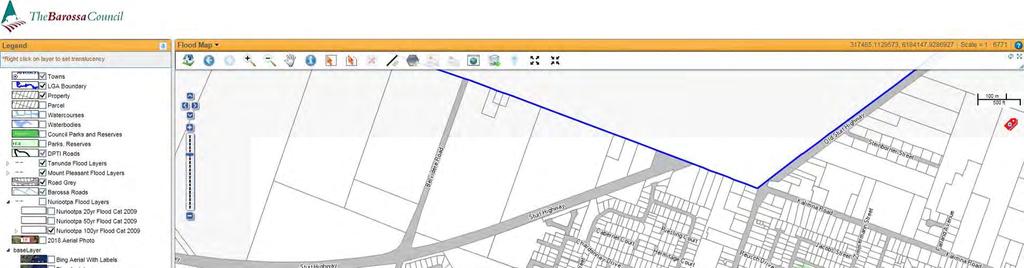
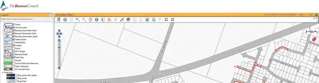
2 4th May 2018 C Rocland Estate Lot 147 Sturt Highway, Nuriootpa SA 5355 Attention: Mr. Franc Rocca Dear Franc, RE: Lot 147 Sturt Highway, Nuriootpa Service Station Stormwater Runoff, Quality Management Report, & Common Effluent Management Report 1. Introduction & Stormwater Catchment Description Rocland Estate is situated on the corner of Sturt Highway & Belvidere Road. The site is currently developed in the North Western portion of the site. The proposed serviced station is to be located over the Eastern side of the site comprising approximately 2Ha in size. This area, currently vegetated with grape vines, has been surveyed by Alexander & Symonds and is grading West to East towards a 1200x300 box culvert crossing under Belvidere Road. Review of council data, & aerial topography suggests flows continue via roadside swale 500m East to the Sturt Highway Culvert Rd crossing and then South via watercourse into the township. The aim of the stormwater management system described here and detailed on drawing Sheets C1 & C2 inclusive is to safely capture and convey stormwater flows from the proposed development to existing Council infrastructure at an acceptable flow rate which will not have a detriment on the downstream system, cause flooding to adjacent properties, and not exceed the predevelopment flows from the site. Modelling of the capacity of the stormwater drainage system has been undertaken using the Rational Method to design both the minor and major drainage systems (20yr ARI, & 100yr ARI) as well as the detention sizing to restrict outflows to suitable levels. The area modelled covers the extent of development shown in the associate drawing Sheet C1-Stormwater Management Plan, and there is no upstream external catchment to be considered for potential overland flow based on review of the existing survey and council flood mapping which indicates no inundation to the area. The preliminary civil design has been provided based on the concept layout by McIntyre and Cross Architects. The proposed development consists of a mixed use development forming a Service Station Convenience store, petrol bowsers, restaurant, truck & car parking, and picnic area including waste dump point. Council Standards and Requirements for the Design, Construction and Development of Infrastructure Assets has been reviewed in relation to the particular development and the site requirements set-out by council include the following: - Site Discharge will be required as per section 8.2 o The maximum point discharge to kerb and gutter up to a 10yr ARI event shall be 12L/s; 100yr ARI event shall be 20L/s. - Detention will be required as per section 8.7 Commercial development o Detention shall be provided to limit the 100yr ARI post-development discharge to the 20yr ARI predevelopment discharge from the site or as required by section 8.2 (Site Discharge), whichever is the lesser. The existing Council infrastructure drainage system adjacent the site consists of a swale with a Box Culvert drainage pipe crossing Belvidere Road. The proposed outfall pipe shall be directed to the local underground drainage system adjacent the site. 1
3 2. Stormwater Quality Improvement The EPA requires this development to have a full retention Class 1 oil separator with alarm and to direct all runoff from the hardstand area to this separator. It is proposed to have all stormwater runoff from the hardstand and forecourt area to be directed to the Class 1 SPEL Puraceptor (with an alarm) which has a capacity to hold a fuel spill with an emergency drainage outlet cut-off in the event of a spill. The size of this unit will be determined on final design, capable of holding the design target fuel spill to be advised. This separator is approved by EPA to discharge treated water to the stormwater system. 3. Design Hydrology/Rainfall Data: Design Storms for use in DRAINS of 20yr ARI & 100yr ARI were adopted for the Minor and Major Stormwater Systems respectively. Duration & Intensity data was obtained from the Bureau of Meteorology s Rainfall IFD Data System, and the concept modelled using the Rational Method. It should be noted that this is a concept design and any final working drawing for building rules approval would undertake review via the DRAINS modelling program for final sizing of all parameters. These were assessed with a wide range of storm durations from 5 minutes to 4 hours to determine the critical duration for design. Modelling Assumptions & Methodology: Consideration has been given to stormwater management for the entire site as it is not intended to be constructed as separate stages rather than comprising a single system. Key modelling assumptions & methodology was used are as follows; Predevelopment flows calculated based upon a runoff coefficient of C20=0.1. Developed allotment were calculated as 94.5% impervious area, with the entire area directly connected to either the surface water or roof stormwater system as appropriate. Minor System infrastructure to convey up to the 100yr ARI critical storm with a restricted outlet by way of pump within the detention tank to limit outflows to the predevelopment 20yr ARI levels. This is to discharge to the swale adjacent the site in Belvidere Road with no overland flows leaving the site. 4. Modelling Results Post Site Development Discharge (PSD): Based upon the modelling undertaken and the methodology described above, the following peak flow rates were observed at the outfall location: PSD20yr: 20L/s total pump rate to Swale Maximum allowable of 20L/s. The flow to be dissipated with scour protection or the like to ensure velocity is minimised. Actual 20yr ARI predevelopment flow is 45L/s. PSD100yr: 20L/s total pump rate to Swale 20L/s allowable peak flow based on 20yr ARI ARI Maximum flow rate. 565,000L u/g detention volume required. 180min critical storm duration for storage, no overland flow exiting the site. 2
4 5. Stormwater Conclusion The above stormwater management strategy, detention measures and water sensitive urban design elements ensure the proposed development will have minimum impact upon neighbouring land and infrastructure around the site. Proposed as part of the system are the following: Internal drainage system to a minimum 100yr ARI capacity, safely conveying flows within the site. Detention tank to limit the 100yr ARI to runoff equivalent to a 20yr ARI predevelopment runoff via pumped discharge. Class 1 device to protect waterways of containment spill. Utilisation of the existing outfall point to Belvidere Road. Whilst a design solution is achievable with the detention tank volume nominated, further investigation is ongoing as to alternate stormwater discharge locations. This includes recycling the water to other locations via the Barossa Valley Irrigation Scheme (BIL water) or pumped to an offsite storage Dam storage. Generally the outflows predicted by the Rational method modelling of the catchment appear typical for the catchment size and composition. The proposed underground drainage network is able to deal with these effectively and the major drainage system adequately conveys the 100yr ARI without producing unsafe flows. Stormwater quality requirements for pollutant reduction are achieved. 6. Common Effluent Review of the Township Common Effluent Scheme (CWMS mapping) indicates no CWMS main or connection adjacent the site. It is proposed to service the site from the existing main located in Drinkwater Crescent as shown on Sheet C2- Wastewater Management Plan. The Council As Constructed and current survey have been analysed for local reticulation information, and the selected flushing point on Sheet C2 shall provide suitable depth and gradient for the main extension. Loadings of the main are to be determined on final design of services. The main extension design and internal waste design will be in accordance with SA Health LGA Septic Tank Drainage Scheme Design Criteria. The system design to reflect the public dump point, any requirement for grease arrestors, and the ultimate sizing of the septic tank. Should you have any questions or require any clarification, please do not hesitate to contact the undersigned. Yours faithfully JOHN TAGLIENTI HERRIOT CONSULTING Attachments: * Drawing Sheets C1-C2 incl. * EPA letter of compliance SPEL Puraceptor * Bureau of Meteorology IFD Rosewater * Local Water Course Mapping * Council Flood Mapping * Drinkwater Cr Common Effluent As Constructed 3
5

6 [ Local Watercourse km Stormwater Nodes Stormwater Drains Water Courses Disclaimer: The information provided above is not represented to be accurate, current or complete at the time of printing this report. The Government of South Australia accepts no liability for the use of this data, or any reliance placed on it. Data A ttribution: May 2, 2018

7

8
9
10 TBM: PSM (UNDERLID) E: N: EL: m J.T J.T 1/154 Fullarton Road Rose Park SA 5067 P: E: W: herriot.com.au A ISSUED FOR APPROVAL J.T 4/05/18 A.L MAY 2018
11 TBM: PSM (UNDERLID) E: N: EL: m J.T J.T 1/154 Fullarton Road Rose Park SA 5067 P: E: W: herriot.com.au A ISSUED FOR APPROVAL J.T 4/05/18 A.L MAY 2018
12 Appendix D - Sonus Acoustic Assessment Nuriootpa (Sturt Highway Service Centre) DPA The Barossa Council Appendices
13 sonus. Access Planning (SA) Pty Ltd 235 Henley Beach Road TORRENSVILLE SA 5031 S5611C1 Attention: David Hutchison 13 April 2018 Dear David, SERVICE CENTRE STURT HIGHWAY NURIOOTPA - DEVELOPMENT PLAN AMENDMENT NOISE FROM VEHICLES A Statement of Intent (SOI) for The Barossa Council's Nuriootpa (Sturt Highway Service Centre) Development Plan Amendment has been issued to the Environment Protection Authority (EPA) for comment. The following comment related to noise was provided by the EPA: Interface between land uses The affected area is located in the northern side of the Sturt Highway, Nuriootpa west of Belvedere Road. Land on the southern side of the Sturt Highway and opposite the affected area is zoned for residential development. The envisaged Highway Service Centre has the potential to generate the following noise and air emissions: Noise from vehicles (including heavy vehicles) moving onsite As noted by the EPA, the proposed location of the service centre is separated from residences by Sturt Highway, which has a 110km/hr speed limit at this location. The noise associated with a vehicle travelling at 110km/hr is higher than the noise of a vehicle travelling at a lower speed and further away. Therefore, in such a circumstance, the noise from vehicles on the site cannot have a detrimental impact on the amenity at the residences in the vicinity. To confirm the comparison, the noise from vehicles on Sturt Highway was measured at the location of the residential property boundaries on Wednesday 11 April, 2018 at approximately 9:30pm. The typical level of noise (L Amax ) from a passby was 73 db(a) for a truck and 65 db(a) for a car. This compares with the highest predicted noise (L Amax ) from a vehicle travelling on site of 57 db(a) for a truck and 52 db(a) for a car. A comparison of the average noise (L Aeq ) from vehicles on site will also be significantly lower than the average noise from vehicles on Sturt Highway. The analysis has demonstrated that the noise from vehicles (including heavy vehicles) moving on the proposed site will not have a detrimental impact on the amenity of residences on the opposite side of Sturt Highway. Sonus Pty Ltd 17 Ruthven Avenue ADELAIDE SA

14 SERVICE CENTRE STURT HIGHWAY NURIOOTPA - DEVELOPMENT PLAN AMENDMENT NOISE FROM VEHICLES 13 April 2018 sonus. Page 2 of 2 If you have any questions or require clarification, please call me. Yours faithfully Sonus Pty Ltd Chris Turnbull Principal ct@sonus.com.au