The Iowa Flood Center
|
|
|
- Kory Curtis
- 5 years ago
- Views:
Transcription

1 Serving Iowans with innovative tools & reliable information The Iowa Flood Center Breanna Shea Communications Specialist, Iowa Flood Center University of Iowa 1

2 2

3 3 Cedar Rapids, June 2008

4 Coralville 4 Reservoir, June 2008

5 5 Colfax, IA

6 Little Cedar 6 Mitchell County, 2013

7 7 Akron, Iowa 2014

8 8 Greene, IA 2016

9 Sutliff Bridge, September 2016 Photo Courtesy: David Herwaldt

10 10 Upper Wapsipinicon River

11 Louisa 11 County, September 2018

12 12

13 Trends show more floods in recent decades


14 Trends show more frequent floods and heavy rainfall Increased flooding Increased heavy rainfall An in increase in frequency, not magnitude, of flood events is detectable from observational records.

15 15

16

17 2018 Rainfall Second wettest year on record Statewide average precipitation was 10 in. above normal 27 counties in northern Iowa experienced their wettest year Third wettest fall on record 17


18 18
 Total: $13.")
19 Direct Property Losses from Flooding ( ) Total: $13.5 billion 19
 Total: $4.")

20 Direct Crop Losses from Flooding ( ) Total: $4.5 billion The cost of doing nothing is not zero. IFC Research Engineer, Antonio Arenas 20


21 IIHR Hydroscience & Engineering Celebrating 100 years of expertise in 2020! About Program Overview Resources News & Events Contact Us IIHR is a unit of the University of Iowa s College of Engineering. At IIHR, students, faculty members, and research engineers work together to understand and manage one of the world s greatest resources water. 21

22 Iowa Flood Center Serving Iowans since 2009 Thanks to our legislators, IFC is the only academic research center across the country devoted solely to floods. IFCs innovative tools and reliable information helps Iowans understand flood risks, prepare, and mitigate for future flood events. 22

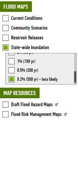
23 23

24 Find YOUR Watershed! 24

25 Find YOUR stream sensor! Since 2009, the IFC has deployed over 250 stream sensors across the state that monitor river levels every 15 minutes. 25


26


27 27

28 Flood Alerts & Forecasts for 1,000 locations 28


29 26 Community Inundation Maps! 29

30 30

31 The stream gauge sensors are very helpful to fill in the gaps where USGS gauges don t exist Inundation maps have proven to be invaluable Justin Gehrts, KCRG 31

32 Statewide Flood Inundation Maps 32

33 What s your flood risk? 33

34 IFIS Publicly Available Since 2011 Nearly 3 million page views! Over 150,000 visitors during the 2018 fall flooding Average visit duration: ~18 minutes


35 A vision for a more resilient Iowa The Iowa Watershed Approach Iowans working together to reduce flooding, improve water quality, and build resilient communities! 35
 to 13 states in response to flood mitigation efforts Iowa received the largest grant of $84.")
36 A vision for a more resilient Iowa The Iowa Watershed Approach IWA Built off the Framework of Iowa Watersheds Project ( ) August 2010, HUD announces $312M for Disaster Recovery Enhancement Fund (DREF) to 13 states in response to flood mitigation efforts Iowa received the largest grant of $84.1M of CDBG funds $10M allocated to watershed demonstration projects directed toward flood damage reduction and educational programming $8.8M set aside for watershed demonstration projects overseen by the Iowa Flood Center $800K was used to establish the first WMAs in Iowa 36

37 A vision for a more resilient Iowa The Iowa Watershed Approach National Disaster Resilience Competition ( ) Funder: US Dept. of Housing and Urban Development, in collaboration with the Rockefeller Foundation Funding level: $1B; CDBG; Superstorm Sandy Out of 14 applicants, Iowa received the 4 th largest grant award totaling $96,887,177 Applicant: State of Iowa, Iowa Economic Development Authority (IEDA) Iowa Watershed Approach program developed by IFC in consultation with many, many partners 37

38 A vision for a more resilient Iowa The Iowa Watershed Approach IWA Program Description Establish a WMA Develop a hydrologic assessment and watershed plan Deploy monitoring equipment Work with project coordinators and volunteer landowners to implement projects that reduce the magnitude of downstream flooding and improve water quality Assess project benefits based on monitoring and modeling data 38


39 A vision for a more resilient Iowa The Iowa Watershed Approach Kickoff meeting follow-up Hydrologic Assessment Iowa s Flood Hydrology & Water Quality Conditions in each IWA Watershed Hydrology Geology & Soils Topography Land Use Instrumentation/Data Records BMPs: Existing vs. Potential Hydrologic Model Watershed Scenarios Ex. row crop to tall-grass prairie, row crop using cover crop, distributed ponds/wetlands 39
 to estimate watershed responses to rainfall events Modeler breaks the watershed down into manageable and")
 to assess model performance Quantify the impact of existing and potential BMPs Documentation 40")
40 A vision for a more resilient Iowa The Iowa Watershed Approach Kickoff meeting follow-up Modeling Develop and run watershed-scale hydrologic models (PIHM) to estimate watershed responses to rainfall events Modeler breaks the watershed down into manageable and representative user defined areas Simulate a hydrologic process using a physically-based approach Compare simulated results to observed hydrologic time series (e.g. streamflow) to assess model performance Quantify the impact of existing and potential BMPs Documentation 40
 Iowa Nutrient Research and Education Council http://www.gis.iastate.")
41 A vision for a more resilient Iowa The Iowa Watershed Approach Iowa BMP Mapping Project Iowa State University Iowa Department of Natural Resources Iowa Department of Agriculture and Land Stewardship National Laboratory for Agriculture and the Environment Iowa Nutrient Research Center (ISU) Iowa Nutrient Research and Education Council 41
 42 http://northcentralwater.")
42 A vision for a more resilient Iowa The Iowa Watershed Approach Agricultural Conservation Planning Framework (ACPF) 42


43 A vision for a more resilient Iowa The Iowa Watershed Approach BMP Mapping + ACPF Grassed Waterways Distance (miles) Existing ACPF 62.0 Potential


44 A vision for a more resilient Iowa The Iowa Watershed Approach Implement Flood-Mitigation Projects Soap Creek Pond Structure from IWP 44

45 A vision for a more resilient Iowa The Iowa Watershed Approach Priority subwatersheds Soap Creek Pond Structure from IWP 45


46 A vision for a more resilient Iowa The Iowa Watershed Approach Case Study: Soap Creek Watershed 1986 Formation of Soap Creek Watershed Board 28E 1988 Study identifies 154 project locations to reduce flooding watershed projects complete 46

47 A vision for a more resilient Iowa The Iowa Watershed Approach Partnerships support the IWA! North Raccoon WMC group photo 47

48 2018 Outreach Participated in over 75 events, conferences, and meetings Traveled over 11,000 miles reaching all parts of the state 48

49 49 From , average about 40 outreach events/yr. Over 30% of outreach events are STEM related reaching k- 12 students


50


51 Currently there is only one state that has taken the step that I hope our state will take to seriously address this floodwater problem that we must tackle. That state is Iowa. South Carolina Gov. Henry McMaster 51


52 Thank You!


53 Serving Iowans with innovative tools & reliable information The Iowa Flood Center Iowa Flood Center The University of Iowa 100 C. Maxwell Stanley Hydraulics Laboratory Iowa City, IA