Is it time for us to go to fully integrated models for stream-aquifer management?
|
|
|
- Blanche Parrish
- 5 years ago
- Views:
Transcription


1 Is it time for us to go to fully integrated models for stream-aquifer management? Tissa H. Illangasekare, PhD, PE, P.Hyd, BCEE,DWRE AMAX Distinguished Chair and Professor of Civil and Environmental Engineering and Director, Center for Experimental Study of Subsurface Environmental Processes (CESEP) Colorado School of Mines Robert Prucha, PhD, PE Integrated Hydro Systems Golden, Colorado Colorado Aquifer Management: Groundwater and river flow connection Denver, Colorado November 28, 2012
 Question: Are the current modeling methods truly capture all aspects of groundwater and river connections to accretion and depletion?")
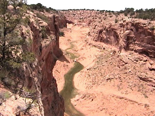
2 Streamflow Depletion by Wells Understanding and Managing the Effects of Groundwater Pumping on Streamflow By Paul M. Barlow and Stanley A. Leake (USGS Circular 1376) Question: Are the current modeling methods truly capture all aspects of groundwater and river connections to accretion and depletion? Braided channel of the Platte River, Nebraska.


3 Challenges in Hydrology: Processes across Interfaces at multiple scales Subsurface processes occur at pore scale and questions are asked at larger scales Land/ Atmosphere Water/air Water/NAPL Saturated/un saturated River/Aquifer Land/Oceans Darcy Medal Lecture, European Geological Union, 2012, Vienna, Austria


4 Energy and Mass Transfer Processes in Hydrologic Systems Atmospheric Boundary Layer Evaporation Subsurface Accretion and depletion Surface

5 OUTLINE Background and history Modeling methods What are integrated models? Predicting extreme events Unsaturated zone effects Feed back effects and de-coupling Calibration and effective parameters Example- Integrated Model
6 BACKGROUND My own work in early as a PhD student at CSU Illangasekare, T.H., 1978, Influence Coefficient Generator Suitable for Stream-Aquifer Management, PhD Dissertation, Colorado State University. Coupled model to simulate dynamics of stream-aquifer interactions Based on linear systems (response functions). Linearized 2-d groundwater flow equation. Linear system of river reaches (Muskingum routing) Early use of finite elements method.
 Pump to capacity (2) Line canals (3) Increase irrigation efficiency (4)")
7 South Platte River-Aquifer Simulator Compared four drought mitigation strategies: (1) Pump to capacity (2) Line canals (3) Increase irrigation efficiency (4) Combination

")

 Constant pumping Q w")


8 Analytical solutions for simplified systems Glover analytical solution Jenkin s Stream depletion factor (SDF) Systems parameters Streamflow-depletion Response-time factor (units of time) Constant pumping Q w Infinity Fully penetrating river with full connection Confined Fully penetrating well Q r Homogeneous & isotropic Constant Transmissivity (T=Kb) both time and space

9 Numerical Models Irregular geometry of lateral and vertical boundaries Irregular geometry of streams, rivers, and other surface-water features. Non-uniform (heterogeneous) aquifer properties. Complex, time-varying pumping schedules at multiple wells or well fields pumping within a basin. Nonlinearities, such as boundary conditions and aquifer properties that change with changes in groundwater levels.
b s s b Time (1) Substantial changes in drawdown corresponding changes in transmissivity, (2) Aquifer getting hydraulically disconnected with river.")
10 Drawdown (s) Superposition Methods Simple Analytical solutions Linear superposition /response function Complex numerical models Pumping =2Q s T(x,y) s T(x,y) S s x x y y t Q s Pumping =Q T(x,y) K(x,y)b s s b Time (1) Substantial changes in drawdown corresponding changes in transmissivity, (2) Aquifer getting hydraulically disconnected with river. (3) Water levels below the evapotranspiration extinction depth so that ET ceases, (4) Drying up a reach of a stream


11 What are integrated models? Channel flow Evapotranspiration Precipitation Irrigation recharge Unsaturated zone flow Overland flow Saturated zone Return flow Bedrock
12 What are the prediction errors when the model is used out side the range of calibration? Slope= dh/dl>0 Q r Gaining river (accretion) Q r (K eff,w p ) dh dl Slope= dh/dl<0 Loosing river (depletion) Q r


13 Parameter Sensitivity High Flow Low Flow Q r (K eff,w p ) dh dl High Flow Determined during calibration Low Flow
14 Role of Unsaturated Zone in Stream Depletion
15 Unsaturated zone processes Unsaturated zone processes are important in arid and semi-arid settings (low flow and high flow) Infiltration from irrigation, canal seepage and stream losses are controlled by unsaturated zone processes. Unsaturated processes zone parameters are not included and calibrated in currently used modeling tools.

16 Feed back to the river Pumping at the well located 300 feet from the stream at a rate of 1.0 million gallons per day causes induced infiltration of streamflow. More than 80 percent of the induced streamflow in captured by the well, but some of the induced streamflow returns to the stream through a zone of induced throughflow (Newsom and Wilson, 1988; model results from Barlow, 1997).

17 Well pumping distributed stream response Q r /Q p Reach 1 Reach 3 Reach 2 Q p Time
18 Feed back to the river Reach 3 Reach 1 Reach 2 Reach 2 Reach 1 Reach 3


19 Limitations of de-coupling Stream flow model s r Q r S r Aquifer model Q r The stream stage and the water table drawdown are solved separately Feed back processes are modeled iteratively Parameter for coupling calibrated (e.g. conductance or stream transmissivity) Calibrated parameter does not capture extreme events (e.g, low or high flow)


20 Effects of local hydrolgeology Slope= dh/dl>0 Q r K 1 K 2 K 1 K 2 Q r (K eff,w p ) dh dl K eff K 1 K 2 K 1 K 2 When K 1 >>>K 2 K eff K 2
 The calibrated parameters depends on the period chosen and the flow conditions extreme events, low flow, climate change). P. M. Barlow and S. A.")
21 Calibration limitations Without pumping With pumping Stream flow is controlled by many combination of factors (natural flow, diversions,..) The calibrated parameters depends on the period chosen and the flow conditions extreme events, low flow, climate change). P. M. Barlow and S. A. Leake (USGS Circular 1376)

22 Capturing spatial variability through effective parameters Size of the grid determines how the processes are captured Effective parameters depend on the grid size Results of the local-scale simulations show an increase in discharge of 10 to 103% compared to the regional-scale simulations. Regional model grid = 500 m Local-scale model grid = 100 m (points)
23 A case for integrated models Limitations of decoupling Role of unsaturated zone Local hydrogeology in the river Calibration limitations- temporal variability extreme events- climate change Scale- capturing spatial variability through effective parameters


24 Example Site Wide Water Balance Study at Rocky Flats Water Balance Model Boundary - IA A-B Pond Model Boundary SWWB Model Boundary
.")
25 Example A fully integrated, hydrologic, groundwater-surface water flow model of the Mokolo River catchment in South Africa. The modeling tool chosen for this study was the MIKE SHE/Mike11 framework developed by Danish Hydraulic Institute (DHI). The model will be used to provide critical inputs to a research project related to determining sustainable environmental flows in South African non-perennial rivers. Mokolo River catchment (red) is part of the Limpopo River basin (blue). The Limpopo River drains to the Indian Ocean to the east of the Mokolo River. The Mokolo Riv-er catchment is about 8437 km2.

26 Integrated Model Date Needs
 and subsurface flows (saturated and unsaturated zone) Climate River flow hydraulics Overland Flow Subsurface Unsaturated Zone Flow Subsurface Saturated Zone Flow")
27 Example Code: MIKE SHE A physically-based, spatiallydistributed, finite difference, hydrologic code that simulates fully coupled flows including surface flows (over-land flow, channelized flow) and subsurface flows (saturated and unsaturated zone) Climate River flow hydraulics Overland Flow Subsurface Unsaturated Zone Flow Subsurface Saturated Zone Flow Irrigation
, flow duration, groundwater baseflow (end of non-rainy season), average and transient groundwater levels (wet/dry season, areas/rates of spring discharge, and gaining/losing")
28 Integrated Model Calibration Attempted to reproduce a range of system responses, including: timing/duration of no-flow along gauged streams (dry periods), duration and magnitude of stream flows (low and high flow periods), flow duration, groundwater baseflow (end of non-rainy season), average and transient groundwater levels (wet/dry season, areas/rates of spring discharge, and gaining/losing reaches along the Mokolo and tributaries.
29 Observations and Conclusions Currently used models and methods have limitations with respect to handle complex dynamic interactions and feed back. Critical unsaturated zone processes are not fully accounted for. Calibration limitations and inability to predict extreme events. Vegetation dynamics are not captured well. The calibration does not capture the interactive processes. Critical when water quality has to be incorporated New technologies for data acquisition methods available for real-time simulations using integrated models.