WATCHIC LAKE 2018 WATER QUALITY REPORT
|
|
|
- Bonnie Pitts
- 5 years ago
- Views:
Transcription


1 WATCHIC LAKE 2018 WATER QUALITY REPORT February 2019

2 WATCHIC LAKE 2018 WATER QUALITY REPORT FEBRUARY 2019 PREPARED BY: FB Environmental Associates 97A Exchange Street, Suite 305 Portland, Maine PREPARED FOR: Watchic Lake Association Contact: Paul McNulty, President Special thanks to Dave Bradbury for volunteering his time and boat for the 2018 sampling season and Cathy Watson for her unprecedented volunteer effort to maintain the long-term dataset at Watchic Lake. FB Environmental Associates ii
3 2018 DATA SUMMARY Watchic Lake Trophic state indicators (total phosphorus, chlorophyll-a, and water clarity) showed that water quality in Watchic Lake remains overall very good. Low oxygen (< 5 ppm) in the summer months continues to make the bottom waters of the lake unsuitable habitat for aquatic life that have historically been an important natural and recreational asset to the lake (e.g., smelt). This oxygen depletion is caused by the decomposition of organic matter (i.e., dead algae and plant matter) that has settled on the lake bottom. Low oxygen can cause a chemical reaction that releases phosphorus back into the water column to fuel more algae growth (thus generating a positive feedback to eutrophication). While it is difficult to remedy what has already been done, the best way to combat future worsening of oxygen depletion in Watchic Lake is to limit the amount of nutrient input to the lake and streams. ph in the lake is within the acceptable range for aquatic life, but low alkalinity is classified as highly sensitive, meaning that the lake is not well-buffered against environmental factors that may cause significant changes in ph. Since these levels are natural, no action is needed until there is a discernable degrading trend. Tributaries Both streams exhibited low fecal indicator bacteria (E. coli) counts. Nutrients (nitrogen and/or phosphorus) were elevated in both streams, indicating human pollution from septic systems, fertilizers, surface runoff, etc. Page Brook showed higher nitrogen and phosphorus. An analysis of land use may help determine differences in nutrient sources draining to each stream. Both streams experienced low oxygen and low ph, which can negatively impact the growth and reproductive health of aquatic life. Low oxygen (particularly in Page Brook) and low ph can be the result of natural or human sources, but are likely from human sources considering the elevated nutrient levels measured in the streams. The main concern at Watchic Lake is the low dissolved oxygen in the bottom waters. Low oxygen conditions can release nutrients (phosphorus) attached to sediments on the lake bottom. Adding phosphorus to the lake can stimulate excessive algal growth. High phosphorus in both of the inlet streams suggests that there is also phosphorus entering the lake from the surrounding watershed. Both low oxygen and high productivity can be dangerous for aquatic organisms and fish. While water quality is good today, Watchic Lake remains at risk over the long term. Property owners and other stakeholders must continue to work to address these risks, to avoid algae blooms, excessive plant growth, and uncontrolled shoreline erosion. FB Environmental Associates iii
4 TABLE OF CONTENTS 2018 DATA SUMMARY... iii Watchic Lake... iii Tributaries... iii BACKGROUND AND METHODS... 5 Data Gaps WATER QUALITY MONITORING RESULTS... 9 Weather... 9 Watchic Lake... 9 Trophic State Indicators... 9 Dissolved Oxygen & Temperature Chemical Parameters Tributaries Paine Brook Page Brook HISTORICAL DATA SUMMARY Background & Purpose Weather Trophic State Indicators Continuous Data Key Observations RECOMMENDATIONS Future Monitoring Recommendations for Lake Users REFERENCES GLOSSARY OF KEY TERMS Bold text represents terms available in the glossary. FB Environmental Associates iv
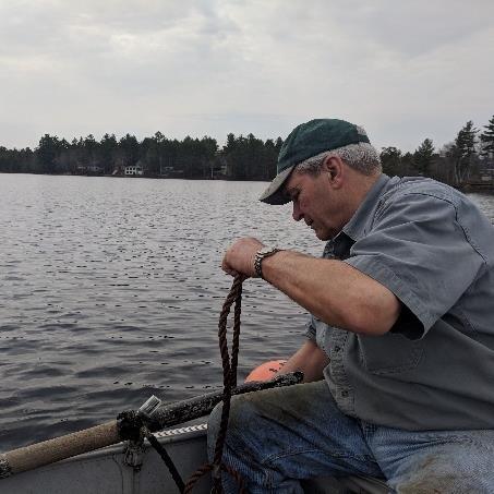
5 BACKGROUND AND METHODS This report documents the results of water quality monitoring conducted at Watchic Lake by FB Environmental Associates (FBE) and Watchic Lake Association (WLA) volunteers in Sampling at the deep spot of Watchic Lake was completed on four dates in 2018 (6/13/18, 7/16/18, 8/16/18, 9/13/18). Samples were also collected from Page Brook and Paine Brook, tributaries to the lake. Tributary sampling stations are located far enough upstream from their outlet to the lake to minimize the impact of any mixing with lake water (Figure 1, p.8). FBE trained WLA volunteer Cathy Watson on sampling methods and data logger maintenance during the 6/13/18 sampling event and provided oversight and guidance during the 7/16/18 sampling event. Cathy performed sampling and data logger maintenance independently during the 8/16/18 and 9/13/18 sampling events. In addition to FBE s on-site training, Cathy received formal training and certification from Lake Stewards of Maine (formerly the Maine Volunteer Lake Monitoring Program) in spring For deep spot lake monitoring at Watchic Lake, FBE and WLA volunteers David Bradbury and Cathy Watson collected temperature and dissolved oxygen profiles, Secchi disk transparency readings, and integrated epilimnetic cores (i.e., cores of water taken from the surface of the lake to the upper part of the thermocline as a representative average of lake water quality). Water samples were analyzed for trophic state indicators (total phosphorus and chlorophyll-a) and chemical parameters (total alkalinity, ph, color, total nitrogen, and total organic carbon). Trophic state indicators (water quality, total phosphorus, and chlorophyll-a) are indicators of biological productivity and help determine the extent and effect of eutrophication in lakes. In addition to the four sampling dates, FBE and WLA volunteers collected water clarity and dissolved oxygen profiles on 5/3/18, 6/27/18, 7/2/18, 10/14/18, 10/15/18, and 10/29/18. For tributary monitoring, two tributaries (Page and Paine Brooks) were sampled for dissolved oxygen, temperature, total phosphorus, ph, E.coli, and total nitrogen. For continuous logger monitoring, FBE and WLA retrieved the winter buoy system with temperature pendants only and re-deployed the full summer buoy with Onset HOBO continuous logging devices for temperature and dissolved oxygen. The summer buoy system was deployed on 5/3/18 and was transitioned back to its winter design by WLA on 10/29/18. Sampling was conducted in accordance with standard methods and procedures for lake monitoring established by the Maine Department of Environmental Protection (Maine DEP), the US Environmental Protection Agency (USEPA), and Lake Stewards of Maine. Samples were analyzed for total phosphorus, total nitrogen, total organic carbon, chlorophyll-a, total alkalinity, ph, color, and E. coli (tributaries only) at the Health and Environmental Testing Lab (HETL) in Augusta, ME. In 2018, samples were analyzed for total nitrogen (TN) and total organic carbon (TOC) instead of total dissolved nitrogen (TDN) and dissolved organic carbon (DOC) as in previous years. WLA made this change at the advisement of FBE as TN and TOC FB Environmental Associates 5

6 capture both particulate nitrogen and carbon and represent a more comprehensive understanding of available nutrients. It is important to note that particulate nitrogen and carbon in lakes most-likely represents a small fraction of available nutrients and thus, can be compared to previous years with caution. Three Onset HOBO U-26 Dissolved Oxygen loggers were deployed at 2, 5, and 11 meters below the surface at the deep spot of Watchic Lake, recording dissolved oxygen and temperature at 15-minute intervals continuously from 5/3/18 to 10/29/18. These depths equate to critical layers in the water column, which becomes thermally-stratified in summer. Onset HOBO temperature pendants were also deployed at 1, 3, 4, 6, 7, 8, 9, and 10 meters at the deep spot, recording temperature at 15-minute intervals continuously from 5/3/18 onward (moved from their winter position). The loggers were cleaned and downloaded during each sampling event. Logger data presented in the report shows interpolated data for the entire water column using R statistical programming. These data will serve as a baseline for future comparisons of water quality to assess long-term changes in temperature and dissolved oxygen. Until more data are collected over the next few years to begin to account for interannual variability, no major conclusions or analyses can be made on this limited dataset aside from general patterns. This is discussed more in the Historical Data Summary section. Throughout the document, all precipitation and wind gust data were obtained from wunderground station at the Portland International Airport. Air temperature data is from the barometric pressure logger on the east side of Watchic Lake. Recorded ice-out in 2018 was on 4/22/18 1. The Watchic Lake outlet dam was closed on 4/15/18 and by 5/11/18 was within two inches of its full level. The lake level was stable by 5/23/18. In the fall, Dave Bradbury opened the dam to its first position on 10/8/18. He returned on 10/26/18 and opened the gate to its full position at which time the lake had reached twelve inches below full pond. It is estimated that it reached its stable winter water level five to seven days later. In the winter, the lake typically fluctuates between 24 and 30 inches below full pond. A loon on the hunt, fall Loons require clear water to visually hunt their prey. Photo Credit: Patty Taylor, WLA. During the 2018 Loon Count survey conducted by Maine Audubon, Watchic Lake reported 12 adult loons and two chicks 2. Local residents observed two established pairs on the lake one pair had two chicks. 1 Data from Lake Stewards of Maine, recorded by Eileen Burnell. 2 Data available from Maine Audubon, available here: FB Environmental Associates 6
7 Unfortunately, the male partner in the other pair was killed on 5/20/18 by a propeller strike. Loons move around in the first two to three years of their life before settling in a territory, possibly accounting for the other adult loons counted during the one-day Audubon survey. Lake users should continue to care for loons and enjoy their beauty, but be sure to respect their proper space. See the WLA webpage for more details. Data Gaps The following bulleted list contains data gaps in the 2018 continuous dataset and the reason for the missing data. Temperature data at meter 9 from 8/16/18 8/20/18; error in shuttle download. All data from meters 7, 8, 9, 10, and 11 from 8/20/18 8/21/18; tangled line in redeployment shifted loggers to the incorrect position in the profile. The line was corrected on 8/21/18. All temperature pendant data from 10/14/18 10/15/18; removed for battery replacement. FB Environmental Associates 7
 and the")
8 FIGURE 1. Map of Watchic Lake, including the two tributary sites (orange) and the deep spot sampling location (pink). FB Environmental Associates 8
9 Precipitation (in) 2018 WATER QUALITY MONITORING RESULTS Weather Weather is one of the major factors influencing interannual variability in lake water quality. Abnormally-dry summer conditions reduce the amount of sediment and nutrient-laden runoff to the lake, resulting in improved water quality (e.g., deeper water clarity, lower phosphorus, and lower chlorophyll-a or algae). Conversely, wetter years transport more material from the landscape to the lake, resulting in degraded water quality experienced more rain in the late summer months (September-October) with a relatively dry early spring. Total precipitation in 2018 was 22.3 inches (Figure 2). Watchic Lake TROPHIC STATE INDICATORS Water clarity, total phosphorus, and chlorophyll-a are trophic state indicators, or indicators of biological productivity in lake ecosystems. The combination of these parameters helps determine the extent and effect of eutrophication in lakes, such as Watchic Lake, and help signal changes in lake water quality over time. Watchic Lake is classified as a mesotrophic lake due to reduced water clarity between 4-8 meters, moderate phosphorus ( ppb), chlorophyll-a (1.5-7 ppb), and plant growth, and occasional to frequent oxygen depletion in bottom waters Monthly Precipitation (Summer 2018) 2018 May 0.79 June 3.33 July 3.59 August 3.83 September 5.78 October 4.94 FIGURE 2. Summer (May-October) 2018 monthly precipitation amounts. Data sourced from wunderground Portland International Jetport station. Measuring water clarity is one of the most useful ways for determining if a lake is changing from year to year. Changes in water clarity may be due to a change in the amount and composition of algal communities or the amount of dissolved or particulate materials in a lake. Such changes are likely the result of human disturbance or other impacts to the lake s watershed. Water clarity varies widely in Maine lakes, ranging from 0.5 to 15.5 meters, with an average of 4.81 meters 3. Generally, water clarity of 2 meters or less indicates a water quality problem and a higher potential for severe algae blooms. In 2018, water clarity at Watchic Lake fell between the Maine DEP mesotrophic water clarity acceptable range of 4-8 meters for all readings (Figure 3). One secchi disk transparency reading (5/3/18) approaches 3 Data accessed from Lake Stewards of Maine. Confirmed accurate through 2017 (n=1,440) data not yet available. FB Environmental Associates 9
10 5/3/18 5/17/18 5/31/18 6/14/18 6/28/18 7/12/18 7/26/18 8/9/18 8/23/18 9/6/18 9/20/18 10/4/18 10/18/18 Secchi Depth (meters) the acceptable range limit of 4 meters at 4.40 m, likely due to mixing during stratification development. Maximum secchi disk transparency midsummer (7/16/18) reaches beyond the range of 8 meters at 8.88 m FIGURE 3. Water clarity measured using Secchi disk and scope in Readings were collected by FBE on 5/3/18 and 6/13/18. All other readings were taken by WLA/Maine Lake Steward volunteers. Data were sent in January 2019 to the Maine DEP for quality control review. DISSOLVED OXYGEN & TEMPERATURE A common problem in Maine lakes is the depletion of dissolved oxygen (DO) in the deepest part of lakes throughout the summer months. This occurs when thermal stratification prevents warmer, oxygenated surface waters from mixing with cooler, oxygen-depleted (from chemical and biological processes) bottom waters in the lake. Dissolved oxygen levels below 5 ppm (and water temperature above 24 C) can stress and reduce habitat for cold-water fish and other sensitive aquatic organisms. In addition, anoxia (low dissolved oxygen) at lake bottom can result in the release of sediment-bound phosphorus (otherwise known as internal phosphorus loading), which becomes a readily available food source for algae. While thermal stratification and depletion of oxygen in bottom waters is a natural phenomenon, it is important to keep tracking these parameters to make sure the extent and duration of low oxygen does not change drastically because of human disturbance. DEP Mesotrophic Water Clarity Acceptable Range 4-8m One secchi disk transparency reading in 2018 was shallow at 4.40 m, though still within the acceptable range of 4-8 m, indicating that materials in the water (sediment, algae) were reducing visibility in the lake. Low May precipitation suggests that this could be a result of natural mixing prior to stratification. In 2018, a dissolved oxygen and temperature profile was taken at the deep spot ten times over the course of the summer season; by FBE staff on 5/3/18 and 6/13/18 and by state-certified WLA volunteers 4 on 6/27/18, 7/2/18, 7/16/18, 8/16/18, 9/13/18, 10/14/18, 10/15/18, and 10/29/18 (Figure 4). Dissolved oxygen and temperature were also collected continuously from May-October using Onset HOBO loggers (Figures 5-6). Watchic Lake has exhibited severe DO depletion at the deep spot over all three years of monitoring. Dissolved oxygen at 11 meters below the surface (1 meter above the bottom) rapidly declined to zero by 4 Cathy Watson was present for all volunteer profile readings; Eileen Burnell was present for the 9/13/18 profile. Eileen and David Burnell took additional profiles that have been submitted to the state for QAQC and will be available on the Lake Stewards of Maine webpage when QAQC is complete. FB Environmental Associates 10
11 late June and remained there until fall turnover in mid-october. On August 9, dissolved oxygen at 5 meters reaches its summer minimum of <4 ppm in the early morning hours. Dissolved oxygen <5 ppm frequently occurs below 6-8 meters depth from July through early October. Temperature data showed that the onset of stratification occurred on 5/2/18. The water column continued to stratify with warm surface waters reaching a maximum of 30.6 C on 7/5/18. Consistent with previous years, when compared to the interpolated dissolved oxygen value, there were limited cold-water/highoxygen refuges for sensitive aquatic species survival in August and September. These areas were limited to between 5 and 7 meters in the late summer months. Fall turnover occurred rapidly mid-day on 10/18/18, with a relatively uniform temperature profile of approximately 13 C. Concurrently, dissolved oxygen at 11 meters exhibits a rapid rise from 0 ppm at 10:30 AM to a value consistently above 8 ppm by 2:00 PM. Lake profiles showed thermal stratification of the lake in early summer and subsequent oxygen depletion in bottom waters. FIGURE temperature (left) and dissolved oxygen (right) profiles for the deep spot of Watchic Lake. Displayed profiles represent the average monthly readings at each depth from FBE and WLA volunteers. Dissolved oxygen depletion at the bottom of the lake is evident as early as the June sampling (dropping below 5 ppm at 9 meters). In July - Sept, dissolved oxygen is below 5 ppm around 7 meters and in October, average dissolved oxygen reaches zero below 7 meters. FB Environmental Associates 11

12 The 2-meter logger remains higher in oxygen because of regular exchange with atmospheric oxygen. Larger daily swings in oxygen in late August at 5 meters was likely a result of increased algae growth and productivity. The 11- meter logger showed rapid oxygen depletion to zero by late June. FIGURE 5. Daily maximum wind gust (top) and dissolved oxygen (middle) and temperature (bottom) readings taken every 15-min during the summer at various depths at the deep spot of Watchic Lake. Fall turnover is stark; occurring over just a few hours on 10/18/18. A concurrent increase in oxygen can be seen in the figure above. FB Environmental Associates 12
 Interpolation of temperature can be completed at a finer scale because of high frequency of loggers in the profile (at each meter between 1 and 11-meters).")
13 ) FIGURE 6. (top) Interpolation of dissolved oxygen using the 2-meter, 5-meter, and 11-meter loggers. (bottom) Interpolation of temperature can be completed at a finer scale because of high frequency of loggers in the profile (at each meter between 1 and 11-meters). Red coloring represents low oxygen or warm surface areas in the lake. Compared to previous years, DO and temperature throughout the lake water column in 2018 offer a slightly larger area of refuge with cool waters and available oxygen, however, this area continues to be limited in Watchic Lake. FB Environmental Associates 13

. This means that the lake is more susceptible to changes in ph. Average ph in 2018 fell within the optimal range at 6.8. In 2018, color in Watchic Lake ranged from 11.")
14 Dave Bradbury holding one of the Onset HOBO dissolved oxygen loggers deployed at the deep spot of Watchic Lake (left). Temperature pendants being deployed (right). The buoy is seen in the background. Photo Credit: FBE, 5/3/18. CHEMICAL PARAMETERS Typical of granite-dominated landscapes in New Hampshire and Maine, alkalinity in Watchic Lake is classified as highly sensitive, historically ranging from 5-9 ppm and stable in 2018 at 7 ppm (Table 1). This means that the lake is more susceptible to changes in ph. Average ph in 2018 fell within the optimal range at 6.8. In 2018, color in Watchic Lake ranged from 11.5 to 19 PCU, with an average of 15 PCU. Lower precipitation in 2018 most likely accounted for the low mean annual color in 2018 (15 PCU) (and even lower mean annual color in 2016 at 12.8 PCU) compared to mean annual color in 2017 (21.1 PCU). Low precipitation limits runoff and mobilization of materials from the watershed. Chlorophyll-a was stable in 2018, with an average of 3.3 ppb over the season, just over what is generally seen in low productivity lakes in Maine (< 1.5 ppb). Total phosphorus was stable at 8 ppb in June, July, and August but dropped to 5 ppb in September. In Maine, lakes with total phosphorus between 4.5 and 20 ppb, such as Watchic Lake, generally have moderate levels of productivity (>20 ppb can result in high productivity). However, Watchic Lake is vulnerable to increases in phosphorus because of low dissolved oxygen that can release phosphorus bound to sediments, as well as high levels of phosphorus entering the lake through the two tributaries (see Table 2 in the following section). As phosphorus is generally the limiting nutrient in lake systems, nitrogen is often overlooked. However, it is an essential nutrient and can play a critical role in lakes, particularly in lakes not limited by phosphorus because of anthropogenic inputs. Average total nitrogen in 2018 was 0.31 ppm in June and July and 0.21 ppm in August and September, consistent with total dissolved nitrogen (TDN) levels in Organic carbon in lakes is largely derived from terrestrial sources, linking lakes to their surrounding watershed. Organic carbon is not only a carbon source for plankton, it also delivers lignins and tannins that are brown in color. These colored compounds can alter the transparency of lakes and therefore the penetration of sunlight, playing a complex yet important role in lake productivity (Strock et al. 2017). Recent FB Environmental Associates 14
15 studies are showing increases in dissolved organic carbon across Maine Lakes, likely as a result of recovery from acid rain, increased organic matter production from climate change, and changes in precipitation and temperature. In 2018, we measured total organic carbon (TOC; dissolved and particulate), however, the contracting laboratory inadvertently analyzed for dissolved organic carbon (DOC) in August and September. The dissolved fraction represents the organic compounds responsible for changes in color lakes and in Maine, less than 5 ppm DOC is considered low. All readings at Watchic Lake in 2018 were below this threshold, even those containing particulate compounds in TOC. This likely means that the role of organic carbon in lake water clarity is low. It is important to note that in these low DOC systems, small magnitude increases in DOC can cause significant changes on the system. TABLE water quality monitoring results for the deep spot of Watchic Lake. Station Date Sampled Station Core Depth (m) Bottom (ft) ph Color (PCU) Chl-a (ppb) Alk. (ppm) TP (ppb) TOC (ppm) TN (ppm) Watchic Lake /13/ /16/ /16/ na * 9/13/ na *Average of duplicate samples Highlighted values represent samples that were inadvertently analyzed for dissolved organic carbon by the testing laboratory. This occurred on two sampling events: 8/16/18 and 9/13/18. Average TOC was not calculated because of this error. Total Nitrogen values calculated using total kjeldahl nitrogen (TKN) result + Nitrite/Nitrate result. Nitrite/Nitrate was below detection limit (0.01 ppm) in July, August, and September. Half the detection limit was used in the summation for TN. Tributaries PAINE BROOK Temperature in Paine Brook for the 2018 sampling season averaged 15.5 C with a maximum of 17.5 C on 8/16/18, and a minimum of 13.4 C on 6/13/18. Dissolved oxygen dropped below the 7.0 ppm Class B criterion (7 ppm/75% saturation) on 7/16/18 and 8/16/18. ph in Paine Brook averaged 6.0 for the 2018 sampling season, below the recommended optimal range. No individual E. coli sample or the geometric mean of multiple E. coli samples in Paine Brook measured above the Class B state criteria of 236 col/100ml or 64 col/100ml, respectively. Total phosphorus and total nitrogen were elevated during all sampling events (Table 2). PAGE BROOK Temperature in Page Brook was slightly warmer than Paine Brook, with an average temperature of 17.3 C, a maximum temperature of 21.4 C (7/16/18), and a minimum of 14.2 C (9/13/18); Page Brook was warmer than Paine Brook on 6/13/18, likely due to a more open canopy that quickly filled in and shaded Page Brook in the late summer months. Lower temperatures in August and September in Page Brook could be intensified by extensive duckweed cover. Dissolved oxygen concentration and percent saturation did not FB Environmental Associates 15
16 meet the 7.0 ppm and 75% Class B criteria, respectively, for all four sampling events. ph at Page Brook fell below the optimal range with a geometric mean of 5.8 and a minimum of 5.3 on 9/13/18. We hypothesize that this low ph on 9/13/18 could be a result of a rain event on 9/11/18 (>2 ), that delivered lower-acidity rain water and groundwater to the lake. E. coli did not exceed the single-sample or geometric mean criteria for Class B streams. Total phosphorus and total nitrogen were elevated during all sampling events (Table 2). TABLE water quality monitoring results for Watchic Lake tributaries. Date Site Code Temp ( C) DO (mg/l) DO Sat. (%) ph E. coli (per 100 ml) TP (ppb) TN (ppm) Paine Brook 6/13/18 PN /16/18 PN /16/18 PN /13/18 PN Average Page Brook 6/13/18 PG /16/18 PG /16/18 PG /13/18 PG Average State Criteria/EPA Guidelines for Class B Freshwater Streams in Ecoregion VIII < 24 > 7.0 > 75 < 8.0; > 6.5 < 64 (geo) / 236 (single) col/100ml < 10 < 0.38 Red text indicates results that do not meet the state criteria and/or EPA guidelines for Class B freshwater streams in ecoregion VIII (listed in the row above). DO = dissolved oxygen; DO Sat. = dissolved oxygen saturation; TP = total phosphorus; TN = total nitrogen Total Nitrogen values calculated using total kjeldahl nitrogen (TKN) result + Nitrite/Nitrate result. FB Environmental Associates 16

17 HISTORICAL DATA SUMMARY Background & Purpose With the guidance of FBE, WLA has been monitoring Watchic Lake continuously since The conceptual diagram below summarizes the available data by season obtained through the monitoring program. Finescale, continuous lake data can provide a thorough understanding of critical lake processes that can influence water quality. The purpose of the following section is to provide the WLA with an update on the current available data to date. These multi-year continuous datasets can provide interannual comparisons of lake properties such as the timing of spring and fall turnover and the extent and duration of maximum and minimum temperature and dissolved oxygen in the water column. If continued, this dataset could provide a broader-scale understanding of the influences of climate change and anthropogenic development on lake health. SPRING SUMMER FALL WINTER Maine has experienced some of the earliest recorded ice-out (or ice-off) dates in the last decade compared to the last century. In other lake systems, particularly in temperate and Arctic regions, earlier ice-out has been shown to correspond with increasing algae growth (Beyene & Jain 2015). Scientists are increasingly recognizing the relationship between winter lake properties and growing season water quality; however, historical winter data are limited and improving long-term under-ice water quality datasets is critical. In 2017, FBE and WLA noted that the temperature pendants were designed to withstand and operate in winter temperatures. Therefore, the project team saw no reason to remove the temperature loggers from the lake during the winter, and instead, noted that this provided a window into winter lake dynamics at Watchic Lake that could inform or aid in interpretation of summer monitoring data. Specifically, high frequency annual temperature data allows us to identify the exact duration of stratification and mixing events. The timing and length of these events may be a driver of dissolved oxygen minimums in the summer (Hodgkins 2002). FB Environmental Associates 17
18 The purpose of this section of the report is to provide an update on what we have learned across three years of monitoring at Watchic Lake and to demonstrate the importance of long-term monitoring. In addition to the interannual comparisons noted in this section, long-term monitoring across decades can be linked to weather patterns and climate change. For example, in 2017 we saw low dissolved oxygen occur at shallower depths compared to 2016 and With continued monitoring we can identify these events as early warning signals of degradation or recovery of DO in the lake. Weather Historical weather data is only presented for 2016 forward to serve as a reference for analysis of the continuous logger data. Precipitation across the summer season (May October) was highest in 2017, with 35.8 inches of total precipitation (Figure 7). In contrast, 2016 was the driest year, with inches of total precipitation. Compared to the summer of 2017, precipitation in 2018 summer months (May- October) was lower in all months except July and September experienced a wet spring (May-June) and fall (October). Consistently across the three years of monitoring, increased precipitation and surface runoff resulted in lower oxygen and degraded trophic state indicators, most likely due to higher nutrient inputs in stormwater. The contrast of a dry year (2016) against a wet year (2017) is an excellent comparison for assessing water quality response to weather in Watchic Lake. Trophic State Indicators FIGURE 7. Cumulative monthly precipitation from May through October in 2016, 2017, and Total annual precipitation is listed to the right of each year in the legend. Trophic state indicators (water clarity, total phosphorus, and chlorophyll-a) from the past three years indicate that Watchic Lake is within the acceptable range for water quality in mesotrophic lakes (Figure 8, Lake Stewards of Maine/Maine DEP). Historical water clarity data in the lake beginning in 1974 shows variability between 4 and 7 meters (Figure 10). Mann Kendall trend tests showed no significant changes in water clarity over time. However, it should be noted that between 2006 and 2015 there was unusual stability in readings at about 4 meters. These data were not checked for quality control by the Maine DEP and were not included in the trend analysis. Improved water clarity, total phosphorus, and chlorophyll-a in 2018 compared to 2017 was likely due to drier conditions in 2018 that reduced runoff from the landscape to the FB Environmental Associates 18
, chlorophyll-a (CHL- A), and water clarity (SECCHI) from 2016-2018.")
19 lake. This is even more evident when comparing to 2016 when trophic state indicators exhibited the best water quality of the three years. FIGURE 8. Trophic state indicators total phosphorus (TP), chlorophyll-a (CHL- A), and water clarity (SECCHI) from Black dotted lines represent the upper and lower thresholds for each parameter that classify the lake as mesotrophic. Epicore total phosphorus and chlorophyll-a concentrations in 2018 were 8.0 ppb and 3.0 ppb, respectively (Figure 9, 10). Mann Kendall trend tests showed no significant changes in total phosphorus or chlorophylla. Historical gaps in data make it difficult to discern trends, highlighting the need to continue monitoring at the deep spot. Historical bottom grabs for total phosphorus have remained relatively higher than epicore or surface grabs for total phosphorus and suggests that Watchic Lake experiences moderate to high internal phosphorus loading (Figure 9). Phosphorus that settles on lake bottom sediments can be released back into the water column during periods of low oxygen in summer. The released phosphorus can serve as fuel for algae blooms, representing a significant risk to Watchic Lake. Historical ph has ranged from 5.9 to 7.0 with an average of 6.5 (Figure 11b). Some years showed ph below the optimal lower range of 6.5, including both 2016 and 2017, which may adversely impact aquatic life in Watchic Lake. This is exaggerated by the low alkalinity at Watchic due to the granite-dominated landscape, making Watchic Lake vulnerable to changes in ph (Figure 11a). Most years showed color below 25 PCU, indicating that Watchic Lake is a non-colored waterbody (Figure 11c). Mann-Kendall trend tests were performed on all parameters with more than 10 years of data. No statistically-significant improving or degrading trends were found. FB Environmental Associates 19
20 Concentration (ppb) Secchi Disk Depth (m) Median Total Phosphorus (ppb) Because of low dissolved oxygen and elevated phosphorus at lake bottom, Watchic Lake is at risk for recycling of legacy phosphorus in bottom sediments from historical land use activities. 5 0 Epilimnetic Core Surface Grab Bottom Grab Individual points are connected with a line across years. Points without a connecting line represent missing years of data collection. FIGURE 9. Historical median annual total phosphorus collected at the Watchic Lake deep spot. The newly re-established baseline water quality monitoring program (since 2016) collects integrated epilimnetic core (epicore) samples for total phosphorus. These epicore samples are collected from the entire epilimnion from the surface to the top of the thermocline to better represent average biological and chemical conditions in Watchic Lake. No statistically-significant trends were found. Historical bottom grab phosphorus was consistently higher than epicore phosphorus, indicating that internal loading of phosphorus at Watchic Lake is likely a significant source of phosphorus The water quality of Watchic Lake in recent years is generally very good Median Total Phosphorus Mean Chlorophyll-a Mean Water Clarity FIGURE 10. Watchic Lake mean annual water clarity and median annual total phosphorus and chlorophyll-a for epicore samples only. No statistically-significant trends were found. FB Environmental Associates 20

 alkalinity, (b) ph, and (c) color at the deep spot of Watchic Lake.")
21 a Typical of granitedominated landscapes in NH and ME, alkalinity in Watchic Lake is classified as highly sensitive. This means that the lake is more susceptible to changes in ph. Since these levels are natural, no action is needed until there is a discernable degrading trend. b Mean annual ph in 2018 was higher than in the previous two years. Some years show ph below the optimal range, which may adversely impact aquatic life in Watchic Lake. c Most years show color below 25 PCU, indicating that Watchic Lake is a non-colored waterbody. FIGURE 11. Mean annual values for chemical parameters (a) alkalinity, (b) ph, and (c) color at the deep spot of Watchic Lake. With alkalinity in the highly-sensitive range, Watchic Lake continues to be at risk for chronic and/or episodically-low ph. FB Environmental Associates 21
 were removed as the loggers cannot withstand the winter lake temperatures.")

22 DAM RELEASE Continuous Data Beginning in the fall of 2017, WLA chose to leave the temperature pendants in the lake through the winter season. The three dissolved oxygen loggers SUMMER WINTER (at 2, 5, and 11 meters) were removed as the loggers cannot withstand the winter lake temperatures. The remaining eight temperature pendants were re-deployed on the winter buoy configuration shown in Figure 12. To avoid possible freezing, the string of temperature pendants was deployed with an anchor to secure the line to the bottom of the lake. Therefore, the winter buoy configuration did not change with changes in relative surface water level. To merge the winter and summer continuous data, we used the lake level depth at the time of deployment and retrieval to identify the approximate logger depth from the surface of the lake at that time. This calculated depth was used to represent the approximate location of each temperature pendant in the water column throughout the winter season. Please note that these depths do not change with lake level and therefore, represent an approximated depth from the lake surface throughout the winter months. Due to abnormally-warm fall weather and a heavy wind storm in late October, fall turnover in 2017 occurred on 10/31/17, later than in 2016 (10/23/16) or 2018 (10/18/18) (see Figure 13 on the following page). However, Table 3 below shows that in the last three years, the duration of stratification is relatively similar shifting either earlier in the spring, or later in the fall. Figure 13 on the following page, displays the continuous temperature data and identifies the onset of spring stratification and fall turnover from May 2017 Oct TABLE 3. Dates of the onset of spring stratification, fall turnover, and duration of stratification in 2016, 2017, and Ice-out and ice-in dates compiled by Lake Stewards of Maine from WLA volunteers. YEAR ICE-OUT ICE-IN FIGURE 12. Conceptual diagram of the summer and winter buoy configurations deployed at the deep spot of Watchic Lake. ONSET OF STRATIFICATION DATE OF FALL TURNOVER DAYS OF STRATIFICATION /13/16 Not Recorded 5/10/16 10/23/ days /15/17 12/15/17 5/17/17 10/31/ days /22/18 12/13/18 5/2/18 10/18/ days FB Environmental Associates 22

23 FIGURE 13. Interpolated temperature data plotted continuously from May of 2017 through November of 2018 at 15-minute intervals. FB Environmental Associates 23
24 Smoothed curves showing dissolved oxygen at each depth in 2016, 2017, and 2018 (Figure 14) can provide interannual comparisons in dissolved oxygen trends. For example, the onset of stratification occurred earlier in the season (5/2/18) and subsequently, the DO at 11-meters reached zero earlier in the season. Additionally, the severity of DO depletion at 5-meters in 2017 is evident compared to 2016 and The lake saw brief recovery at 5-meters in early September (around day of year 250 based on the Julian Calendar) due to a large storm event, however, DO again fell below 2016 and 2018 levels later in the fall. FIGURE 14. Lowess smoothing (locally weighted scatterplot smoothing) for the 2-, 5-, and 11-meter dissolved oxygen data in 2016, 2017, and FB Environmental Associates 24
25 Key Observations Watchic Lake water quality has remained overall good from Trophic indicators were within the acceptable range for water quality of a mesotrophic lake for all three years. o Consistent with historical observations of lakes across Maine, water quality data in Watchic Lake from suggests that the lake is susceptible to changes in total annual precipitation. While surface temperature and oxygen are relatively similar across the three years, inter-annual differences are noticed from the thermocline to the lake bottom. o The wettest year (2017) experienced low oxygen shallower in the lake profile compared to the driest year (2016). Despite changes in the onset of spring and fall stratification, the duration of stratification remained relatively stable across the three years of sampling. Fall wind events can play a critical role in the timing of fall turnover. Fall turnover often occurs rapidly over just a few hours. Subsequent years of winter temperature data may allow us to draw connections between winter data and summer data. Persistent oxygen depletion in bottom waters throughout can stress organisms and release phosphorus from bottom sediments. RECOMMENDATIONS Future Monitoring While the water quality of Watchic Lake and its tributaries is generally good, these waterbodies are sensitive to change. Continuing to monitor Watchic Lake and the two tributaries will help WLA better understand long and short-term variations in lake chemistry and take action to remediate any degrading trends in water quality to ensure similar enjoyment of these water resources by future generations. In the spring of 2019, FBE will be working with the WLA to develop a lake protection plan that follows Maine DEP guidelines. This is a great opportunity to prioritize future monitoring at Watchic Lake and to conduct a detailed survey of nonpoint source pollution in the watershed. The following provides additional recommendations for future monitoring of Watchic Lake and streams that expand the baseline monitoring program: Expand the number of state certified volunteer monitors on Watchic Lake. Collect bottom grab samples of phosphorus in August and September to monitor and quantify the impact of internal phosphorus loading because of low oxygen conditions. Resume winter epicore sampling of key parameters to compliment the winter temperature dataset. We recommend sampling at a minimum for chlorophyll-a, nitrogen, phosphorus, organic carbon. Consider deploying data loggers in the streams to capture continuous water quality information on specific conductivity, dissolved oxygen, temperature, ph, and flow. FB Environmental Associates 25
26 Conduct stream macroinvertebrate analysis to determine macroinvertebrate richness and abundance during stream baseflow periods (late August - late September). This monitoring will provide baseline data for these streams, and can be replicated on a five-year (or more) cycle. Recommendations for Lake Users Avoid using fertilizers, herbicides, and pesticides within 150 feet of lake, ponds, and streams. Leave duff and grass clippings; minimize lawn area and cut grass to 3 inches. Pump septic system every 3-5 years and keep leachfield clear of trees. Inspect systems more than 20 years old. Reduce household chemical and P-based product use. Wash car and boat in area where runoff is absorbed into the ground. Become LakeSmart by controlling phosphorus-laden sediment in runoff with best management practices (BMPs). Use oil-absorbing pillow or bilge snakes to prevent pollutants from entering the lake via inboard motors. Store gas and oil in approved secondary containers and dispose at local repair shops. Clean fluid leaks with cat litter. Remove fishing line from water and use lead-free lures. Dispose of pet waste in trash or toilet. FB Environmental Associates 26
27 REFERENCES Beyene, M.T. & S. Jain (2015). Wintertime weather-climate variability and its links to early spring ice-out in Maine lakes. Limnology & Oceanography, 60, doi: 10/1002/Ino Hodgkins, G.A., James, I.C. and T.G. Huntington (2002). Historical changes in lake ice-out dates as indicators of climate change in New England, International Journal of Climatology, 22, Doi: 10/1002/joc.857. Strock, K.E., N. Theordore, W.G. Gawley, A.C. Ellsworth, and J.E. Saros (2017). Increasing dissolved organic carbon concentrations in northern boreal lakes: Implications for lake water transparency and thermal structure. Biogeosciences, 122, doi: /2017JG WLA (2018). Loon Found Dead on Lake. Retrieved January 7, 2018, from the Watchic Lake Association (WLA) Web site: For more information, please visit FB Environmental Associates 27
28 GLOSSARY OF KEY TERMS Chlorophyll-a (Chl-a): A measurement of the green pigment found in plants, including microscopic plants like algae. It is used as an estimate of algae biomass; higher Chl-a equates to greater amount of algae in the lake. Color: A measure of the influence of suspended and dissolved particles in water from weathered geologic material, vegetation cover, and land use activity. Colored lakes (>25 PCU) can have reduced water clarity and increased phosphorus concentrations. Dissolved Oxygen: The concentration of oxygen dissolved in water. Adequate oxygen is critical to the healthy metabolism of many creatures that reside in the water. DO levels in lake water are influenced by a number of factors, including water temperature, amount of algae and other plants in the water, and the amount of nutrients and organic matter that flow into the waterbody from the watershed. DO concentrations may change dramatically with lake depth. Oxygen is produced in the top portion of a lake (where sunlight drives photosynthesis), and oxygen is consumed near the bottom of a lake (where organic matter accumulates and decomposes). Epilimnion: The top layer of lake water that is directly affected by seasonal air temperature and wind. This layer is well oxygenated by wind and wave action during summer. It extends to 5-7 meters below the surface in Watchic Lake. Escherichia coli (E. coli): An indicator of harmful pathogens from fecal contamination that can derive from a number of mammalian sources, including human, canine, and wildlife. Eutrophication: Process by which lakes become more productive over time. Lakes with high productivity have high levels of phosphorus and chlorophyll-a, low water clarity, and abundant biomass with significant accumulation of organic matter on lake bottom. Eutrophic lakes are susceptible to algae blooms and severe oxygen depletion in the hypolimnion. Lakes naturally become more productive or age over thousands of years. In recent geologic time, however, humans have enhanced the rate of enrichment and lake productivity, speeding up this natural process to tens or hundreds of years. Fall Turnover: the process of complete lake mixing when cooling surface waters become denser and sink, forcing lighter, less-dense water to the surface. This process is critical for the natural exchange of oxygen and nutrients between surface and bottom layers in the lake. Hypolimnion: the bottom-most layer of the lake. It experiences periods of low oxygen during stratification and is devoid of sunlight for photosynthesis. Watchic Lake experiences low oxygen in summer from 7 meters to the bottom at 12 meters. Integrated Epilimnetic Core: A water sample that is taken with a long tube to determine average nutrient concentration from the lake surface to the top of the thermocline. ph: The standard measure of the acidity or alkalinity of a solution on a scale of Most aquatic species require a ph between 6.5 and 8. As the ph of a lake declines, particularly below 6, the reproductive capacity of fish populations can be greatly impacted as the availability of nutrients and metals changes. ph is influenced by bedrock, acid rain or snow deposition, wastewater discharge, and natural carbon dioxide fluctuations. FB Environmental Associates 28
29 GLOSSARY OF KEY TERMS (CONTINUED) Secchi Disk Transparency (SDT) or Water Clarity: A vertical measure of water transparency (ability of light to penetrate water) obtained by lowering a black and white disk into the water until it is no longer visible. Measuring water clarity is one of the most useful ways to show whether a lake is changing from year to year. Changes in water clarity may be due to increased or decreased algae growth or the amount of dissolved or particulate materials in a lake, resulting from human disturbance or other impacts. Spring Turnover: the process of complete lake mixing following ice-out when surface waters are exposed to wind action, bringing oxygen to the bottom and nutrients to the top of the water column. Summer Stratification: the development of a thermal barrier that separates warm surface waters from dense, cool bottom waters. Without oxygen replenishment from the surface, bottom-dwelling organisms rapidly consume oxygen throughout the summer and early fall. Thermocline: the markedly cooler, dynamic middle layer of rapidly changing water temperature. The top of this layer is distinguished by at least a degree Celsius drop per meter of depth. Total Alkalinity: A measure of the buffering capacity of a lake (i.e., the capacity of water to neutralize acids). The buffering capacity or the concentration of bicarbonate, carbonate, and hydroxide ions in water, is largely determined by the geology of soils and rocks surrounding the lake. Total alkalinity above 20 ppm buffers against drastic changes in ph that could impact aquatic plants and animals. Total Phosphorus (TP): The total concentration of phosphorus found in water, including organic and inorganic forms. Phosphorus is one of the limiting nutrients needed for plant growth; as phosphorus increases, the amount of algae generally increases. Humans can add excess phosphorus to a lake through stormwater runoff, lawn or garden fertilizers, and leaky or poorly-maintained septic systems. Trophic State Indicators: Are indicators of biological productivity in lake ecosystems, including water clarity, total phosphorus, and chlorophyll-a. The combination of these parameters helps determine the extent and effect of eutrophication in lakes, and helps signal changes in lake water quality over time. Watershed: An area of land that drains water to the outlet of a stream, river, or lake. Winter Stratification: the development of a physical ice barrier and snowpack layer that limit the exchange of oxygen and nutrients between surface and bottom waters. A layer of ice forms at the lake surface, protecting waters below from frigid temperatures and wind storms. Cold winters with significant snowpack can block sunlight and limit photosynthesis that would otherwise replenish the lake with oxygen throughout the winter. FB Environmental Associates 29