Shorelines and. Chapter 6. Natural Heritage
|
|
|
- Ursula Willa Shields
- 5 years ago
- Views:
Transcription

1 Shorelines and Chapter 6 Natural Heritage


2 Context Natural heritage refers generally to terrestrial, wetland and aquatic features (e.g., woodlands, wetlands, and streams) and their functions (e.g., wildlife habitat, shoreline stabilization). The promotion and protection of the ecological health of the Lake Simcoe shoreline and the watershed s natural heritage are important in order to foster a resilient, adaptable, and sustainable watershed. Natural heritage features are vital components of the ecosystem in and of themselves and are closely linked to other elements such as water quality and quantity. Healthy natural heritage features help to regulate water quality and quantity by preventing erosion, stabilizing shorelines, filtering contaminants, and retaining carbon, nutrients, and sediments. The Lake Simcoe shoreline and other natural heritage and hydrologic features in the watershed also provide many cultural, social and economic benefits through recreation and tourism, and the sustainable harvest of natural products. Currently, the loss and/or degradation of natural heritage features present a challenge in the Undisturbed shoreline Lake Simcoe watershed. Threats to natural heritage features can lead to drastic and detrimental changes, potentially reducing the quality of natural heritage features and their functional role in the overall health of the watershed. Climate change can also directly and indirectly impact natural areas and shorelines. Climate change can influence the frequency, intensity, extent and magnitude of existing problems and cause impacts to natural areas and shorelines such as: drought and flooding; change in species composition; interference or alteration of biological events such as migration and breeding; shifts or loss of biodiversity within woodlands, riparian areas and wetlands; unknown impacts to wetland functions; and Typical forest ecology in watershed changes to forest cover and ecosystem functions in the watershed. Lake Simcoe Protection Plan 43
3 The Lake Simcoe watershed is covered by three main provincial plans or policy statements that address some of the issues relating to the protection of the Lake Simcoe shoreline and key natural heritage and key hydrological features. Both the Greenbelt Plan and the Oak Ridges Moraine Conservation Plan have some similar objectives to the Lake Simcoe Protection Plan, but these Plans do not cover the entire watershed. The remainder of the watershed is covered by the Provincial Policy Statement (PPS); however, it is not as prescriptive in the treatment of the shoreline and natural heritage features. Other legislation, regulations and policies govern certain activities associated with the shoreline and natural heritage features. For instance, the Public Lands Act controls activities and uses of Crown land including the bed of the lake. Through the Conservation Authorities Act Section 28 (1) Regulations (i.e. Development, Interference with Wetlands and Alterations to Shorelines and Watercourses Regulations) the conservation authorities regulate, through a permitting process, development and development-related activities in rivers, stream valleys, wetlands, shorelines and hazardous lands Policies inthe Lake Simcoe Watershed Greenbelt PlanArea Oak Ridges Moraine Conservation Plan Area Lake Simcoe Thorah Island Kempenfelt Bay Georgina Island Fox Island Snake Island Cook's Bay Data Sources: Land Information Ontario (LIO) Warehouse Lake Simcoe Region Conservation Authority December Km ± Map of existing Provincial Plans applicable to the Lake Simcoe watershed 44 Lake Simcoe Protection Plan
4 (associated with flooding, erosion, dynamic beaches or unstable soil or bedrock) and the straightening, changing, diverting or interfering in any way with the existing channel of a river, creek, stream, watercourse or for changing or interfering in any way with a wetland. This Plan would promote a consistent approach to the protection, enhancement or restoration of the Lake Simcoe shoreline and of key natural heritage and hydrologic features throughout the watershed. It would focus on protecting, improving, or restoring those features considered most critical to the overall health of the watershed and address activities in those areas that are considered of particular concern. In this chapter, some of the policies are only applied to areas of the watershed that are outside of the Greenbelt Plan and Oak Ridges Moraine Conservation Plan. The reason for this is to avoid duplication as these plans provide similar protections to those provided by the policies in this chapter. Protecting or restoring the Lake Simcoe shoreline, including both aquatic and terrestrial areas associated with the shoreline, is given particular importance in this Plan. The Lake Simcoe Science Advisory Committee, in their report dated October 27, 2008, summarizes the scientific literature and importance of these areas. This report indicates that natural shoreline areas perform multiple functions, including control of run-off and associated nutrients and other pollutants, stabilizing shorelines from erosion, conserving habitats for a disproportionately high number of aquatic and terrestrial species, regulating temperature and microclimate, screening noise and wind, preserving the aesthetic appeal of the landscape and providing recreational opportunities. This Plan seeks to protect or restore vegetated buffer zones along the lakes and streams. This will be achieved both through the policies identified in this chapter and through the implementation of the relevant stewardship policies in the Plan. This Plan restricts alteration of the shoreline and areas near the shore, and also restricts buildings, structures and other development in these areas. An ecologically healthy Lake Simcoe shoreline and natural heritage system will improve water quality and will better equip the watershed to endure ongoing and future challenges such as invasive species, climate change, and land use change. Key Facts Overall, 47 percent of the Lake Simcoe watershed s land area (approximately 2800 square kilometres) is currently agricultural. Developed lands, non-agricultural lands and roads make up an estimated 18 percent. While approximately 35 percent of the Lake Simcoe watershed is under natural cover (woodlands and wetlands), much of it exists in a fragmented state and the quality of these as habitats for sensitive elements of biodiversity has not been assessed. The distribution of natural cover varies across the watershed with a low of 9 percent in the Keswick Creeks subwatershed to a high of 55 percent in the Carthew Bay Creeks subwatershed. Although most of the shoreline has been developed, some areas remain in a relatively natural state, mostly in the northeast sector of the lake. Activities such as clearing natural vegetation along the shore and building concrete docks and walls referred to as shoreline hardening have disrupted ecologically and hydrologically important linkages between the land and water. Lake Simcoe Protection Plan 45
5 Targets: No further loss of natural shorelines on Lake Simcoe Achieve a greater proportion of natural vegetative cover in large high quality patches Achieve a minimum 40 percent high quality natural vegetative cover in the watershed Achieve protection of wetlands Achieve naturalized riparian areas on Lake Simcoe and along streams Restore natural areas or features Achieve increased ecological health based on the status of indicator species and maintenance of natural biodiversity Indicators: Change over time in the proportion of land in wetland, forested valleyland, natural riparian and upland forest taking into account habitat quality The degree of fragmentation of wetland, forested valleyland, riparian and upland forest The integrity of natural shoreline, i.e. the amount of shoreline that is either undeveloped or maintained in a naturalized state Change over time in the status of key biological indicators, including species of conservation concern Integrity of significant recharge areas Policies: Lake Simcoe Shoreline The loss of natural shoreline areas along Lake Simcoe has impaired the shoreline s ability to perform multiple functions, including control of run-off and associated nutrients and other pollutants, stabilizing shorelines from erosion and conserving habitats. The following policies apply to Lake Simcoe s shoreline. 6.1-DP Subject to the other policies of the Plan, development or site alteration outside of existing settlement areas is not permitted in Lake Simcoe and within a related vegetation protection zone referred to in policy 6.2, except in relation to the following: a. Forest, fish, and wildlife management; b. Stewardship, conservation, restoration and remediation undertakings; c. Existing uses as set out in policy 6.45; d. Flood or erosion control projects but only if they have been demonstrated to be necessary in the public interest after all alternatives have been considered; e. Retrofits of existing stormwater management works (i.e. improving the provision of stormwater services to existing development in the watershed where no feasible alternative exists) but does not include the establishment of new stormwater management works; 46 Lake Simcoe Protection Plan
6 f. Infrastructure, but only if the need for the project has been demonstrated through an Environmental Assessment or other similar environmental approval and there is no reasonable alternative; and g. Low-intensity recreational uses including access to the Lake that require very little terrain or vegetation modification and few, if any, buildings or structures, including but not limited to the following: i. non-motorized trail use; ii. natural heritage appreciation; iii. unserviced camping on public and institutional land; and iv. accessory uses to existing buildings or structures. 6.2-DP 6.3-DP 6.4-DP The minimum vegetation protection zone in a shoreline built-up area is 30 metres from the Lake Simcoe shoreline, or larger if determined appropriate by an evaluation required by policy 6.3. The vegetation protection zone for the remaining Lake Simcoe shoreline, outside of existing settlement areas and outside of shoreline built-up areas, is 100 metres from the Lake Simcoe shoreline. Within shoreline built-up areas, an application for development or site alteration within 120 metres of the Lake Simcoe shoreline shall be accompanied by a natural heritage evaluation that satisfies the requirements of policy 6.26, unless the development or site alteration is for a purpose specified by policy 6.1. Subject to the other policies in this Plan, structures shall only be permitted in a vegetation protection zone along the Lake Simcoe shoreline if: a. there is no alternative but to place the structure in this area and the area occupied by such structures is minimized; b. the ecological function of the vegetation protection zone is maintained; and c. pervious materials and designs are used to the extent feasible. 6.5-DP 6.6-DP 6.7-DP Outside of existing settlement areas, a proposal for development or site alteration within 240 metres of the Lake Simcoe shoreline must demonstrate that the development or site alteration will maintain and, to the extent feasible, enhance or restore functional wildlife movement corridors between any key natural heritage feature or key hydrologic features identified in policies 6.21 and 6.22 that is located along the Lake Simcoe shoreline and from the Lake Simcoe shoreline to another key natural heritage feature or key hydrologic feature within 240 metres of the Lake Simcoe shoreline. Subject to the other policies in this Plan, a shoreline built-up area may only be expanded to provide for minor rounding out of the area, and only in accordance with provincial plans and the PPS. Significant alteration of the shore of Lake Simcoe or the shore of a fresh water estuary of a stream connected to Lake Simcoe is not permitted unless the significant alteration is for the purpose of stabilizing, protecting, restoring or rehabilitating the shore or the alteration will be undertaken by a public body and the project is consistent with the objectives of this Plan. A significant alteration of the shoreline includes any alteration that has an adverse effect on the ecological functions of the shoreline. Lake Simcoe Protection Plan 47
7 Policies Applying to Both Lake Simcoe and Streams Alterations to the Lake Simcoe shoreline as well as to permanent and intermittent streams has resulted in fragmentation of natural areas, degradation of water quality and negative impacts to fish and wildlife habitat. The following policies apply to Lake Simcoe s shoreline and to the streams within the watershed. 6.8-DP 6.9-DP No structures, including boathouses, shall be permitted in Lake Simcoe, other lakes or in a permanent or intermittent stream if the structure impedes the natural flow of water along the shoreline or in the stream, if the structure is intended to be used as a dwelling, or if the structure or its construction harmfully alters fish habitat. This policy does not prohibit drainage works such as those permitted under the Drainage Act, those required for infrastructure or those structures required for the purposes of stewardship, conservation, restoration or remediation undertakings. The alteration of the shore of Lake Simcoe, other lakes or any permanent or intermittent stream for the purpose of establishing or altering drainage works such as those works under the Drainage Act, infrastructure or for stabilization, erosion control or protection purposes shall only be permitted if it is demonstrated that natural shoreline treatments (e.g. planting of natural vegetation, bioengineering) that maintain the natural contour of the shoreline will be used where practical, and a vegetative riparian area will be established to the extent feasible. In relation of such works, lands used for agricultural purposes do not require the establishment of a vegetative riparian area if the land is, and will continue to be, used for agricultural purposes DP Where, in accordance with the policies of the Plan, development or site alteration is permitted within 120 metres of the Lake Simcoe shoreline, other lakes in the Lake Simcoe watershed, or any permanent or intermittent stream or a wetland, the development or site alteration should be integrated with and should not constrain ongoing or planned stewardship and remediation efforts DP Where, in accordance with the policies of this Plan, a proposal for development or site alteration is permitted within 30 metres of the Lake Simcoe shoreline, other lakes in the Lake Simcoe watershed, or a permanent or intermittent stream or wetland outside of settlement areas and the Greenbelt area and Oak Ridges Moraine area, the proposal for development or site alteration shall comply with the following where applicable: a. maintain, and where possible, increase or improve fish habitat in the Lake, stream or wetland, and any adjacent riparian areas; b. to the extent possible, enhance the ecological features and functions associated with the Lake, stream or wetland; c. minimize erosion, sedimentation, and the introduction of excessive nutrients or other pollutants and utilize planning, design, and construction practices that maintain and improve water quality; and d. integrate landscaping and habitat restoration into the design of the proposal to enhance the ability of native plants and animals to use the area as both wildlife habitat and a movement corridor SA Within three years of the date the Plan comes into effect, the MNR, MOE and the LSRCA, in collaboration with the First Nations and Métis communities, other ministries and municipalities 48 Lake Simcoe Protection Plan
8 will develop a shoreline management strategy that, for various reaches of the shoreline, identifies ecological values, best management practices, standards, guidelines, and priority areas for restoration, securement and acquisition DP Upon completion of the shoreline management strategy, municipal official plans shall be amended to ensure they are consistent with the recommendations of the strategy SA Public bodies are encouraged to actively re-naturalize public areas adjacent to shorelines and streams to a minimum of 30 metres where practical and feasible SA Through the implementation of the stewardship, education and outreach policies ( ) owners of existing cottages and residences will be encouraged to re-naturalize shorelines and areas adjacent to streams up to 30 metres where practical and feasible. Proposed Shoreline Regulation Under the Lake Simcoe Protection Act, 2008 the government may make regulations to regulate or prohibit activities that may adversely affect the ecological health of the Lake Simcoe watershed. The following policies provide direction for proposed regulations SA Within one year of the date the Plan comes into effect, the MOE, in collaboration with the MNR, other ministries and regulatory agencies will release for consultation proposed draft regulations under section 26 of the Lake Simcoe Protection Act, 2008 based on further advice from the Lake Simcoe Science Committee. These regulations will build on and are not intended to duplicate existing legislation and regulations that apply to the shoreline areas including the Conservation Authorities Act, Lakes and Rivers Improvement Act and the Public Lands Act SA The area to which the shoreline regulation proposed under policy 6.16 would apply includes the littoral zone, the riparian area, on-land areas beyond riparian areas and wetlands where an activity may affect ecological functions. This regulated area must be described in the Plan once the regulation is made SA The proposed regulation under policy 6.16 may address the following: a. the use of fertilizer use for non agricultural lands such that the water quality of lakes and streams is not affected; b. activities that contribute to the spread of invasive species; c. peat extraction in all wetlands in the watershed; d. the filling or draining of existing wetlands except as related to mineral aggregate operations or existing settlement areas where the regulation would only apply to those wetlands of provincial significance, and in relation to existing agricultural operations (e.g. Holland Marsh); e. removal of vegetation and coarse woody debris would not be permitted within shoreline areas, with some exceptions, to protect existing natural areas adjacent to shorelines and to retain vegetated buffers consistent with those required by development or site alteration policies (e.g. 30 metre minimum vegetation protection zone on either side of a permanent or intermittent stream); and f. other issues identified through research and consultations. Lake Simcoe Protection Plan 49
9 6.19-SA Within one year of the date the Plan comes into effect, the LSRCA and MNR will delineate the areas outside of its jurisdiction, but within the Lake Simcoe watershed, for the purpose of consistently applying Ontario Regulation 179/06 (Lake Simcoe Region Conservation Authority: Regulation of Development, Interference with Wetlands and Alterations to Shorelines and Watercourses) made under section 28 of Conservation Authorities Act to development along watercourses within the Lake Simcoe Watershed. Within this same period, the LSRCA and MNR will prepare a regulation to include these areas within the regulated area. Key Natural Heritage and Key Hydrologic Features Key natural heritage and key hydrologic features contribute to the ecological health of the watershed. The following policies apply to key natural heritage and key hydrologic features DP Policies apply to those areas outside of existing settlement areas and outside of the Greenbelt area and Oak Ridges Moraine area DP Key natural heritage features are wetlands, significant woodlands, significant valleylands, and natural areas abutting Lake Simcoe DP Key hydrologic features are wetlands, permanent and intermittent streams, and lakes other than Lake Simcoe DP Development or site alteration is not permitted within a key natural heritage feature, a key hydrologic feature and within a related vegetation protection zone referred to in policy 6.24, except in relation to the following: a. Forest, fish, and wildlife management; b. Stewardship, conservation, restoration and remediation undertakings; c. Existing uses as specified in policy 6.45; d. Flood or erosion control projects but only if the projects have been demonstrated to be necessary in the public interest after all alternatives have been considered; e. Retrofits of existing stormwater management works (i.e. improving the provision of stormwater services to existing development in the watershed where no feasible alternative exists)but not new stormwater management works; f. New mineral aggregate operations and wayside pits and quarries pursuant to policies ; g. Infrastructure, but only if the need for the project has been demonstrated through an Environmental Assessment of other similar environmental approval and there is no reasonable alternative; and h. Low-intensity recreational uses that require very little terrain or vegetation modification and few, if any, buildings or structures, including but not limited to the following: i. non-motorized trail use; ii. natural heritage appreciation; iii. unserviced camping on public and institutional land; and iv. accessory uses to existing buildings or structures. 50 Lake Simcoe Protection Plan
10 6.24-DP The minimum vegetation protection zone for all key natural heritage features and key hydrologic features is the area within 30 metres of the key natural heritage feature and key hydrologic feature, or larger if determined appropriate by an evaluation required by policy DP An application for development or site alteration within 120 metres of a key natural heritage feature or key hydrologic feature shall be accompanied by a natural heritage evaluation meeting the requirements of policy 6.26, unless the development or site alteration is for a purpose specified by policy DP A natural heritage evaluation referred to in policies 6.3 and 6.25 shall be carried out in accordance with guidelines developed by the MNR and shall: a. demonstrate that the development or site alteration applied for will have no adverse effects on the key natural heritage feature, key hydrologic feature, Lake Simcoe and its associated vegetation protection zone, or on the related ecological functions; b. identify planning, design and construction practices that will maintain and, where feasible, improve or restore the health, diversity and size of the key natural heritage feature or key hydrologic feature and its connectivity with other key natural heritage features or key hydrologic features as well as connectivity and linkages to natural heritage systems identified in Provincial Plans or by municipalities, the LSRCA or MNR; c. demonstrate how connectivity within and between key natural heritage features and key hydrologic features will be maintained and, where possible, improved or restored before, during and after construction to allow for the effective dispersal and movement of plants and animals; d. determine if the minimum vegetation protection zone is sufficient to protect the ecological functions of the feature and the area being evaluated, in particular where this feature or area is adjacent to a coldwater stream, headwaters, freshwater estuaries, steep slope or is acting as or has been identified as a wildlife corridor to ensure that the area will continue to effectively act and function as a wildlife corridor; e. determine if the minimum vegetation protection zone is sufficient to protect areas adjacent to existing features that would be appropriate for restoration or renaturalization to enhance the ecological functioning of that feature, such as lands that provide for rounding out or filling of gaps in significant woodlands; and f. if the minimum vegetation protection zone is not sufficient to protect the function of the feature or protect opportunities for feature enhancement, specify the dimensions of the required vegetation protection zone DP A proposal for new development or site alteration within 120 metres of the Lake Simcoe shoreline, a key natural heritage feature or a key hydrologic feature shall provide for the establishment and maintenance of natural self-sustaining vegetation to the extent and width of the associated vegetation protection zone required by the policies in this Chapter, except in relation to uses and structures in the vegetation protection zone that are permitted by the policies of this Chapter. Lake Simcoe Protection Plan 51
11 6.28-DP Where, through an application for development or site alteration, a buffer or vegetation protection zone is required to be established as a result of the application of the policies in this Plan, the buffer or vegetation protection zone shall be composed of and maintained as natural self-sustaining vegetation DP If the natural self-sustaining vegetation is removed along the Lake Simcoe shoreline, from a key natural heritage feature, a key hydrologic feature or from any related vegetation protection zone, as a result of any development or site alteration permitted under policies 6.1, 6.23, 6.43 and 6.45, the natural self sustaining vegetation shall be re-established to the extent feasible following completion of that activity SA Within one year of the date the Plan comes into effect the MNR, in collaboration with the LSRCA, MOE and other ministries will further define the key natural heritage and key hydrologic features as described in policies 6.21 and SA Within one year of the date the Plan comes into effect, the MNR and the MOE, in collaboration with other ministries, the First Nations and Métis communities and the LSRCA, will map natural areas abutting Lake Simcoe as described in policy Settlement Areas Settlement areas are urban areas and rural settlement areas (e.g. cities, towns, villages and hamlets) where development is concentrated and lands are designated in municipal official plans for development over the long term. The following policies apply to those settlement areas designated in official plans as they existed on the date the Plan came into effect and to settlement area expansions DP Policies apply to existing settlement areas and areas of Lake Simcoe adjacent to these lands, including the littoral zone, and these areas are not subject to policies , 6.5, 6.11 and policies DP An application for development or site alteration shall, where applicable: a. increase or improve fish habitat in streams, lakes and wetlands, and any adjacent riparian areas; b. include landscaping and habitat restoration that increase the ability of native plants and animals to use valleylands or riparian areas as wildlife habitat and movement corridors; c. seek to avoid, minimize and/or mitigate impacts associated with the quality and quantity of urban run-off into receiving streams, lakes and wetlands; and d. establish or increase the extent and width of a vegetation protection zone adjacent to Lake Simcoe to a minimum of 30 metres where feasible DP Where, through an application for development or site alteration, a buffer is required to be established as a result of the application of the PPS, the buffer shall be composed of and maintained as natural self-sustaining vegetation DP For greater certainty, where lands have been incorporated into a settlement area after the effective date of the Plan, an application for development or site alteration within those lands are subject to the policies in this Chapter other than policies 6.32 to Lake Simcoe Protection Plan
12 Recharge Areas The following policies are intended to build on the policies and efforts associated with the PPS and drinking water source protection through the Clean Water Act, 2006 to help identify and protect significant groundwater recharge areas DP A significant groundwater recharge area is an area identified, a. as a significant groundwater recharge area by any public body for the purposes of implementing the PPS; b. as a significant groundwater recharge area in the assessment report required under the Clean Water Act, 2006 for the Lake Simcoe and Couchiching/Black River Source Protection Area; or c. by the LSRCA in partnership with MOE and MNR as an ecologically significant groundwater recharge area in accordance with the guidelines developed under policy SA MOE and MNR, in collaboration with LSRCA, municipalities and other ministries will develop guidance associated with protecting, improving or restoring significant groundwater recharge areas, including defining ecologically-significant groundwater recharge areas DP Once identified, municipalities shall incorporate significant groundwater recharge areas into their official plans together with policies to protect, improve or restore the quality and quantity of groundwater in these areas and the function of the recharge areas DP Outside of the Oak Ridges Moraine area, urban settlement area expansions should avoid significant groundwater recharge areas DP Outside of the Oak Ridges Moraine area, an application for major development within a significant groundwater recharge area shall be accompanied by an environmental impact study that demonstrates that the quality and quantity of groundwater in these areas and the function of the recharge areas will be protected, improved or restored. Mineral Aggregate Operations and Wayside Pits and Quarries The following policies apply to applications for new mineral aggregate operations and wayside pits and quarries DP Policies apply to applications for new mineral aggregate operations and wayside pits and quarries that are outside of the Greenbelt area and the Oak Ridges Moraine area DP No new mineral aggregate operations and no wayside pits and quarries, or any ancillary or accessory use thereto shall be permitted in the following key natural heritage features and key hydrologic features: a. significant wetlands; b. significant habitat of endangered species and threatened species; and c. significant woodlands unless the woodland is occupied by young plantation or early successional habitat (as defined by the MNR). Lake Simcoe Protection Plan 53
13 6.43-DP An application for a new mineral aggregate operation or a new wayside pit or quarry may only be permitted in a key natural heritage feature, a key hydrologic feature or its related vegetation protection zone, other than a feature mentioned in policy 6.42, where the application demonstrates the following: a. the health, diversity and size of these key natural heritage features will be maintained or restored and, to the extent possible, improved to promote a net gain of ecological health; and b. any permitted extraction of mineral aggregates that occurs in a feature will be completed, and the area will be rehabilitated, as early as possible in the life of the operation DP Every application for a new mineral aggregate operation must demonstrate: a. how the connectivity between key natural heritage features and key hydrologic features will be maintained before, during and after the extraction of mineral aggregates; and b. how the operator could immediately replace or restore any habitat that would be lost from the site with equivalent habitat on another part of the site or on adjacent lands. Existing Uses The following policies apply to existing uses, accessory uses and structures DP Where a policy in this Chapter permits development or site alteration in relation to existing uses, the following policies apply: a. All existing uses lawfully used for such purposes on the day before the Lake Simcoe Protection Plan comes into force are permitted; b. The construction of a building on an existing lot of record is permitted, provided it was zoned for such as of the date the Plan comes into effect, or where an application for an amendment to a zoning by-law is required as a condition of a severance granted prior the date this Plan comes into effect; c. The development permitted in b., expansion to existing buildings or structures, accessory structures and uses, and conversions of legally existing uses which bring the use more into conformity with this Plan are permitted subject to a demonstration that the use does not expand into a key natural heritage feature, a key hydrologic feature and any minimum vegetation protection zone associated with a feature or the Lake Simcoe shoreline, unless there is no alternative in which case any expansion shall be limited in scope and kept within close geographical proximity to the existing structure; d. The expansion to existing agricultural buildings and structures, residential dwellings and accessory uses to both, may be considered within a key natural heritage feature, a key hydrologic feature, and any minimum vegetation protection zone associated with these features or the Lake Simcoe shoreline, if it is demonstrated that: i. there is no alternative to the expansion or alteration and the expansion or alteration is directed away from the feature and vegetation protection zone to the maximum extent possible, and, 54 Lake Simcoe Protection Plan
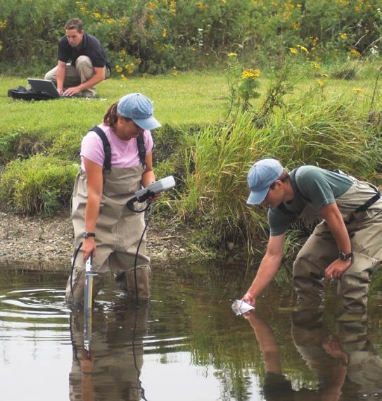
14 ii. the impact of the expansion or alteration on the feature and its functions is minimized to the maximum extent possible. e. Expansion, maintenance or replacement of existing infrastructure is permitted. Site Alteration and Tree Cutting Bylaws The following policy provides direction for the development of a template for tree cutting and site alteration bylaws by the provincial government SA Within two years of the date the Plan comes into effect, the MNR and MOE, in consultation with other ministries, municipalities and the LSRCA will lead the development of a template for municipal site alteration and tree cutting bylaws within the watershed as related to natural heritage features including wetlands and woodlands, and following development will encourage implementation of such a bylaw. Natural Areas Protection, Improvement and Enhancement The following policies set out direction for the provincial government to take a strategic approach to stewardship, restoration and/or enhancement of natural areas, including monitoring of these efforts using an adaptive management approach SA Within two years of the date the Plan comes into effect, the MNR and the LSRCA in collaboration with MOE other Ministries, the First Nations and Métis communities and municipalities, will delineate priority areas for riparian area restoration and other areas to focus natural heritage protection, improvement, restoration, securement and enhancement efforts including the definition or delineation of important corridors and linkages. The delineation will build on existing natural heritage systems identified by the Province, the LSRCA and municipalities within the Lake Simcoe watershed and identified anchor sites (high quality connected natural features) to support the development of a comprehensive stewardship strategy throughout the watershed SA Within two years of the date the Plan comes into effect, the MNR in collaboration with the LSRCA, First Nations and Métis communities, will identify and map areas of high quality natural cover that are 25 hectares or greater SA Within one year of the date the Plan comes into effect, the MNR, the MOE, and the LSRCA, in collaboration with the First Nations and Métis communities, and other ministries, will identify stressed subwatersheds or portions of stressed subwatersheds M Within one year of the date the Plan comes into effect, the MNR, the LSRCA and the MOE will develop a monitoring program in relation to the targets and indicators associated with natural heritage and hydrologic features and areas. The monitoring program shall be based on an adaptive management approach and may be altered from time to time to respond to changing environmental conditions (including climate change), new information and to changing management needs. The components of the monitoring program may include monitoring changes in the proportion of natural cover in the watershed, for example as a result of the implementation of the Plan policies including stewardship initiatives, and monitoring biological indicators that provide inference on the ecological health of the Lake Simcoe watershed. Once the monitoring program is developed, the MNR, LSRCA and MOE shall implement the program. Lake Simcoe Protection Plan 55


15 Other Threats Chapter 7 and Activities


16 Newly Introduced Invasive Species Context Many aquatic and terrestrial species within the Lake Simcoe ecosystem are newly introduced to the lake or the watershed. To be considered invasive species, however, they would have to be species that are not native to the Lake Simcoe watershed, that are spread by human activity and that threaten the environment, economy or society. The spread of invasive species causes a reduction in abundance of native species, is a leading cause of species becoming at risk of extinction and disrupts nutrient and energy cycles. Native coldwater fish species are particularly at risk from an invasion by non-native species. Invasive species can also have a significant impact to the economy, including loss of revenue related to natural resources, as well as increased costs for monitoring and for maintaining facilities. Most invasive species are introduced unintentionally, often due to a lack of public awareness about the environmental damage they cause. Aquatic species may arrive in the Lake Simcoe watershed attached to boats, boat trailers, fishing gear used in other waters or moving through the Trent-Severn Waterway, via the release or escape of live bait fish captured outside the watershed, by escaping from holding ponds in the floodplain, and due to people emptying the contents of aquariums into natural waterways. Terrestrial species including plants, animals, insects and diseases may be introduced through ornamental gardening, by moving firewood (e.g., emerald ash borer) or through the transfer of seeds in the treads of hiking boots and bicycle tires. Once they become established, invasive species are difficult and costly to eradicate. When prevention fails, early detection is extremely important Hogweed Zebra mussels Rusty Crayfish Lake Simcoe Protection Plan 57
17 so that steps can be taken to understand their potential impact, eradicate or contain the invasive species, or mitigate its impacts. Local watershed monitoring programs are well established and have a record of early detection when it comes to aquatic invaders. Similarly, regular aquatic monitoring programs (including fish diseases) exist in adjacent watersheds and the Great Lakes. On the other hand, there is very limited monitoring in place for terrestrial invaders and consequently little is known about their incidence, distribution or impact in the Lake Simcoe watershed. The range of invasive species continues to expand and this expansion may increase with climate change. In addition, the introduction and spread of invasive species will probably have a greater threat in Ontario as Ontario makes up a significant portion of Canada s population (39%). In Canada the estimated annual cumulative lost revenue caused by the impacts of only 16 invasive species in its forests, fields and waters is estimated to be between 13.3 to 34.5 billion dollars. Policies and programs are emerging at local, provincial and federal levels to help manage the threat from invasive species. At the present time however, the regulatory tools available for controlling high-risk human pathways are limited in scope. In the interim, in collaboration with stakeholders and partner organizations, the Plan would focus on policies and programs for both terrestrial and aquatic species: using public education, outreach and stewardship to prevent the introduction of new invasive species; evaluating and mitigating the potential high-risk pathways; building a more coordinated and comprehensive approach for monitoring and responding to invasive species in the Lake Simcoe watershed; and using available regulatory tools to address high-risk pathways. The use of live bait has a long history in the tradition of fishing. It is important to generations of anglers and provides benefits to the local economy. Baitfish are managed as a sustainable resource. However, angler use and movement of live bait is considered to pose a high risk to the introduction of invasive species: A number of species have been introduced to Lake Simcoe that were present in Lake Erie and it is suspected movement of live bait introduced these species to Lake Simcoe; Surveys show that a high percentage of anglers purchase their bait, move it long distances, and more than 20% release it into the lake where they are fishing at the end of the day despite the fact that it is illegal.; A number of initiatives (regulatory and best management practices) have been implemented province-wide to reduce the risk of movement of invasive species in the commercial harvest and sale of live bait. To date, although there has been extensive effort to raise awareness in the angling community, little has been done to restrict the movement of live bait by anglers. Through the Plan, a regulatory proposal will be developed to help prevent the introduction of new invasive species into the Lake Simcoe watershed through angler movement of live bait. Also, the policies 6.16 and 6.17 in Chapter 6 of the Plan, Shorelines and Natural Heritage identify the development of a regulation pursuant to Section 26 of the Lake Simcoe Protection Act, 2008 that may include measures to control the spread of invasive species. 58 Lake Simcoe Protection Plan
18 Key Facts Invasive species known to be in Lake Simcoe and their date of introduction: common carp 1896 spiny water flea 1993 rainbow smelt 1962 bluegill 2000 Eurasian watermilfoil 1984 quagga mussel 2004 curly-leaf pondweed rusty crayfish 2004 black crappie 1987 zebra mussel early 1990s Eurasian amphipod, Echinogammarus ischus pre-2005 round goby 2006 Records of when terrestrial invaders arrived and their distribution are sparse largely due to limited monitoring and reporting. Terrestrial invasive species known to be in the Lake Simcoe watershed include, Giant hogweed, Japanese knotweed, Dog-strangling vine, Garlic Mustard and Common reed. These species can cause damaging effects to natural heritage features, species biodiversity and may indirectly affect water quality through their impact on watershed vegetation. 34 percent of vascular plants found in Ontario are introduced. In less than 10 years, zebra mussels have significantly reduced the natural populations of mussels and clams in Lake Simcoe and have had a broad system-wide impact, affecting many other species. Next to habitat loss, invasive species are the leading cause of species becoming at risk of extinction. Some of the more common pathways include recreational boating, aquarium, water garden and horticulture trades, live food fish trade, and movement of live bait for fishing. Since the opening of the St. Lawrence Seaway in 1959, ballast water discharge has accounted for 65% of species introduced to the Great Lakes. The risk of introduction has been greatly reduced by recent regulations enacted by Transport Canada in 2006 and the U.S. and Canadian St. Lawrence Seaway Commissions in 2008 requiring all vessels to exchange ballast water on the open ocean so that the salt water kills freshwater organisms in the tanks. Compliance monitoring is done on 100% of ships to ensure that no ship is allowed to enter the Great Lakes without adequate precautions being taken. The bait industry supports implementation of Hazard Analysis and Critical Control Point training for all harvesters and dealers to ensure that actions are identified at critical control points to prevent the spread of invasive species. Hazard Analysis and Critical Control Point plans are approved by MNR and license conditions applied accordingly for all commercial bait operators. Since 1992, MNR and the Ontario Federation of Anglers and Hunters (OFAH) have worked in partnership to raise awareness and monitor the distribution of invasive species. A toll-free hotline to access information and report sightings, school curriculum activities, interactive website ( displays and presentations at events, and volunteer monitoring programs are just some of the effective initiatives undertaken. Through this partnership, over 300 partners have become involved in the program. Lake Simcoe Protection Plan 59
19 Target: Prevent new invasive species Indicator: Presence of newly introduced species Policies: 7.1-SA 7.2-SA 7.3-SA The MNR in partnership and collaboration with other ministries, the First Nations and Métis communities, the OFAH, the LSRCA and other stakeholders will deliver information and education programs annually for the general public and key stakeholders on how to prevent the spread of, and how to detect, aquatic and terrestrial invasive species. Some of the more common pathways include recreational boating, aquarium, water garden and horticulture trades, live food fish trade, and movement of live bait for fishing. Stewardship actions which help identify and respond to invasive species will be incorporated into broader stewardship programming developed under this Plan and into existing stewardship initiatives. Within two years of the date the Plan comes into effect, the MNR, and the OFAH, and LSRCA, in collaboration with the First Nations and Métis communities, local tourism organizations and fishing-related businesses, will conduct a community based social marketing project. The project will identify effective methods to engage stakeholders for the purpose of modifying their behaviour to reduce the introduction and spread of invasive species in the Lake Simcoe watershed. Within three years of the date the Plan comes into effect, the MNR, in collaboration with First Nations and Métis communities, and with angler organizations, the commercial bait industry and other stakeholder interests, will develop a regulatory proposal that would require anglers who are fishing with live bait in the Lake Simcoe watershed to only use live bait caught in the watershed. The regulatory proposal would be subject to public consultation before MNR proceeds with the proposal and makes a recommendation to the Federal Government to consider a regulation under the Federal Fisheries Act 1. The regulatory approach would help to mitigate the risk of invasive species entering the watershed. In developing the regulatory proposal, consideration will be given to matters, including: a. new science related to invasive species and pathways; b. types of live bait used (e.g. bait fish, leeches); c. sustainability of bait resources; and d. simplicity, effectiveness, communication and enforcement. 1 This proposed regulation would fall under provincial and federal laws. 60 Lake Simcoe Protection Plan
20 7.4-SA 7.5-SA 7.6-SA 7.7-SA 7.8-SA 7.9-SA 7.10-M Within one year of the date of the Plan comes into effect, the MNR will develop a prioritized watch list of aquatic and terrestrial invasive species (including fish and wildlife diseases and insect pests) likely to be introduced to the Lake Simcoe watershed. And, within five years of the date the Plan comes into effect, the MNR in collaboration with other public bodies will develop and implement response plans to invasive species present in the watershed and on the watch list. The compilation of the watch list and the preparation of the response plans will be risk-based with response plans for highest priority species being prepared first. Response plans will identify the resource requirements, partnership roles and funding mechanisms to implement the plans. The watch list and the response plans will be updated from time to time. Within two years of the date the Plan comes into effect, the MNR will work with Parks Canada and other public bodies to complete a study to evaluate the potential risk of movement of invasive species through the Trent-Severn Waterway resulting from natural dispersal and boat traffic. The MNR will release to the public a summary of the study s findings. Within two years of the date the Plan comes into effect, the MNR will evaluate and report on the extent of the live food fish trade in the Lake Simcoe watershed and, if warranted, evaluate the level of risk associated with the practice and determine appropriate management options. Within six years of the date the Plan comes into effect, the MNR in collaboration with the LSRCA will evaluate and report on the level of risk related to ponds in the floodplain contributing to the spread of invasive species, including baitfish holding ponds, private water gardens, and holding ponds associated with the water garden trade that may be holding fish, plants and invertebrates. If the identified risk warrants further action, in subsequent years the MNR will develop a facility risk assessment/security policy. Commencing in the third year of the Plan, the MNR, in partnership with the OFAH will develop and implement a three-year mobile boat wash program to increase awareness of best management practices for boaters and encourage improved behaviour by boaters. The MNR will annually review existing provincial science funding programs and partnerships to identify opportunities for research funding and partnerships that will help improve knowledge related to the impact and control of invasive species in the Lake Simcoe watershed. Within the first year of the Plan, the MNR, in collaboration with other ministries, the First Nations and Métis communities, the LSRCA, the OFAH and other NGOs, shall develop and implement an annual monitoring program for terrestrial invasive species (including pests/ wildlife diseases) in the Lake Simcoe watershed that will facilitate early detection and response and help inform and adapt public education, outreach, and stewardship programming. Lake Simcoe Protection Plan 61


21 Climate Change Context As a result of global warming and climate change, scientists predict that average temperatures in southern Ontario could rise by as much as two to four degrees Celsius over the next 40 years. Climate change is expected to influence, directly and indirectly, all elements of the Lake Simcoe watershed, including water quality and quantity, aquatic ecosystems, and natural areas and shorelines. In fact, studies have already indicated that climate change has shortened the duration of ice cover on the lake. This has in turn shortened the ice fishing season, a major winter recreational activity. That said, the specific effects of climate change remain uncertain, particularly at the local level. How Lake Simcoe will be affected and how it will respond is not well understood. The Plan builds on work already underway. A number of existing tools and mechanisms provide for action on climate change in the Lake Simcoe watershed and Ontario more broadly - many of these are articulated in the Province s Climate Change Action Plan. Mitigation Ontario s Climate Change Action Plan - Creating Our Sustainable Future sets out Ontario s aggressive targets for reducing greenhouse gas emissions by 6 per cent below 1990 levels by 2014; 15 per cent below 1990 levels by 2020; and 80 per cent below 1990 levels by The Action Plan outlines key initiatives to meet these targets, including ongoing investments in public transit, phasing out coal-fired power generation, promoting renewable energy, funds to attract green investments and jobs to Ontario, and protecting green space like the boreal forest and Ontario s Greenbelt. Global Effects of Climate Change. Intergovernmental Panel on Climate Change 2007 Adaptation Ontario is also preparing for the impacts of climate change. The Expert Panel on Climate Change Adaptation was appointed by the Minister of the Environment in December 2007 to help the Ontario government, municipalities and Ontarians prepare and plan for the impacts of climate change in areas such as public health, environment, infrastructure and the economy. 62 Lake Simcoe Protection Plan
22 One of the most fundamental and sustainable ways to prepare for a changing climate is to protect the natural resilience of the entire Lake Simcoe ecosystem upon which residents and businesses depend to improve its capacity to naturally adapt. Risk assessment and adaptation planning are critical actions for enhancing the watershed s capacity to naturally adapt to future changes in climate. As a first step, a Lake Simcoe climate change adaptation strategy will help identify the impacts of a changing climate on the watershed and identify opportunities for adaptation. Climate change can influence the magnitude of existing problems. Some examples of potential impacts are cited below: Area of Plan Potential Climate Change Impact Aquatic Life (Chapter 3) Water Quality (Chapter 4) Water Quantity (Chapter 5) Shorelines and Natural Heritage (Chapter 6) Change in water temperature and supply impacting coldwater fishery and habitat Change in the seasonal thermal stratification of the lake Change in the amount of dissolved oxygen impacting aquatic life Reduced ice cover over shallow waters where fish spawn would expose their eggs to destructive wind and wave action Loss of seasonal access to fish and wildlife species (e.g. duration of the ice fishing season) Periodic failures of sewage and flood control infrastructure Increase in phosphorus loading Increased concentration of contaminants Increase in wind and flood transportation of nutrients, sediments and contaminants Drinking water supply, odour and taste problems, as water intakes are subject to weed and algae concentrations Demand for water potentially exceeding supply in some areas Changes in ice cover affecting evaporation, lake levels, shoreline erosion, precipitation, seasonality, and lake-effect snow Reduction in ground water flows Variation in stream flow regimes and lake levels affect fish, wildlife, aquatic habitats and sediment deposition Shift or loss of biodiversity within woodlands, riparian zones and wetlands Unknown impacts to wetlands and their functions Change to forest cover and ecosystem functions in watershed Extreme water events causing drought and flooding, risk of fire Change in ecosystem composition Non-Native Invasive Species (Chapter 7) Change in temperatures, creating environment where invasive species may thrive thereby increasing their presence, abundance and distribution Increase in aquatic plant growth Recreational Activities (Chapter 7) Aesthetic quality of the beaches may be compromised by declining water quality Change in timing of seasons for recreational activities (e.g., ice fishing, swimming) Lake Simcoe Protection Plan 63
23 In addition to the policies outlined in this Chapter, other policies designed to protect the natural resilience of the ecosystem and to assist with climate change adaptation are incorporated throughout the Plan. These include: Developing Aquatic/Fish Community Objectives for Lake Simcoe and its tributaries. These objectives will be used to increase the resilience of Lake Simcoe s aquatic community to impacts of climate change (see Aquatic Life, Policy 3.1); Conducting research projects on the aquatic communities of Lake Simcoe and its tributaries. The focus of the research will be on filling knowledge gaps and include an evaluation of the impacts of climate change on the fish community (see Aquatic Life, Policy 3.5); Committing municipalities to prepare and implement comprehensive stormwater management master plans which will consider the potential impacts of climate change on the effectiveness of the stormwater management works (see Water Quality, Policy 4.5); Promoting, conducting and supporting water quality scientific research projects that build on existing research and monitoring programs, identify emerging issues, and support the overall adaptive management principle. Research will include the assessment of the impacts associated with climate change, and other emerging issues (see Water Quality, Policy 4.23); Requiring municipalities to prepare water conservation and efficiency plans that consider the potential impacts of climate change (see Water Quantity, Policy 5.3); and Implementing a monitoring program in relation to the targets and indicators associated with natural features and areas. The monitoring plan will also gather information on species that are influenced by climate change (see Shorelines and Natural Heritage, Policy 6.50). Key Facts Climate change models analyze historic patterns and project significant changes in future climate. There are signs that changes are already underway including more frequent extreme weather, high-velocity wind events, and changes in snowfall patterns and ice-cover on lakes. On Lake Simcoe, delayed freeze-up and earlier ice-off dates have occurred over the past five decades. In the winter of , a reduction of ice on Lake Simcoe led to the cancellation of the Canadian Ice Fishing Championship and significant loss to the local economy. Loss of vegetation cover and milder temperatures may encourage pathogens, which are more common further south, such as Lyme disease (deer ticks), West Nile virus (mosquito), and epidemic typhus (tick). It is hypothesized that warming may exacerbate the bioaccumulation of contaminants in lake trout based on a study of 23 North American lakes, including Lake Simcoe. 64 Lake Simcoe Protection Plan
24 Indicators: Meteorological data (e.g. temperature, ice cover, snow cover) Lake thermal structure and heat budget Lake hydrodynamics River hydrology Timing of seasonal processes like fish spawning Policies: 7.11-SA Within two years of the date the Plan comes into effect, the MOE, in collaboration with the MNR, the MAFRA, the First Nations and Métis communities, the LSRCA, municipalities, and interested academic institutions, will develop a climate change adaptation strategy for the Lake Simcoe watershed. The climate change adaptation strategy will identify key recommended adaptation actions needed to increase the resiliency of the Lake Simcoe watershed to the impacts of climate change; identify roles and responsibilities for relevant parties; and identify potential amendments to the Plan to ensure the recommended actions are undertaken. As new information becomes available, the strategy will be amended, as necessary. To support the development and implementation of the strategy, at a minimum, the following tasks will be undertaken by the MOE and collaborators specified above: a. assess and evaluate the risk of climate change impacts on the watershed; b. promote, conduct and support additional research to better understand the impacts of climate change in the watershed, including impacts on wetlands, aquatic life, terrestrial species and ecosystems, headwaters, conservation of life cycles, groundwater temperature, and water table levels; c. develop an integrated climate change monitoring program to inform decision making and model the impacts of climate change on the watershed; and d. begin the development of climate change adaptation plans and promote the building of a Lake Simcoe watershed community of practice in adaptation planning. Lake Simcoe Protection Plan 65


25 Recreational Activities Context Swimming, camping, fishing, boating, golfing and snowmobiling are just a few activities enjoyed on and around Lake Simcoe. As the population in southern Ontario continues to grow, demand for these activities will increase. Recreational activities have the potential to impact water quality, water quantity, aquatic life and the spread of invasive species. A major challenge for the Lake Simcoe area is how to continue to provide quality recreational opportunities while minimizing congestion, conflicts between different uses and users, and impacts to the natural environment. Furthermore, climate change could, in future years, also effect our recreational use of the lake, for example, reduced ice cover due to increased temperatures could mean less time available for ice fishing. There are other challenges. For example, discharges from recreational boats can adversely affect the lake and its tributaries. Recreation facilities, such as marinas and golf courses, also have the potential to impact the lake through accidental spills or stormwater runoff. Recreational activities on the lake Among the programs already in place to help Clean water is our future manage these threats is the Clean Marine Program, which aims to reduce pollution from boating activities through voluntary initiatives taken by boaters, marinas, and manufacturers and distributors of marine products. Golf courses in the area can participate in the Audubon Cooperative Sanctuary System, a program that helps golf courses protect the environment. This Plan supports and builds on these initiatives as it works toward achieving environmentally sustainable recreational practices in the Lake Simcoe watershed. 66 Lake Simcoe Protection Plan
26 Moving forward, it is important to ensure that people continue to have access to recreation sites around Lake Simcoe. Among other benefits, it is expected that fostering sustainable, low-impact opportunities to enjoy the lake would encourage more people to value it and, ultimately, increase the number of people engaged in lake stewardship. These policies should be read with other policies in the Plan that have matters pertaining to recreational practices. A number of these other policies can provide linkages and direction for the protection and support of recreational and tourism activities, uses and developments within the Lake Simcoe watershed. Key Facts The frequency and duration of public beach closures have increased since In addition to the permanent residents in the area, there are more than 12,000 cottages on the lake, increasing the population by 50,000 during the summer months. Recreational activities are estimated to inject more than $200 million annually into the local economy. Lake Simcoe is the most intensively fished inland lake in the province. In 2005, anglers spent over 700,000 hours ice fishing on Lake Simcoe from the end of January to the middle of March. Ontario Parks, a branch within the Ministry of Natural Resources is an example of how the Province is already undertaking work to improve the management, protection and planning of provincially significant elements of the natural and cultural landscape of Ontario. The Ministry of Natural Resources mandate includes the management and protection of Ontario s protected areas system. There are five provincial parks within the Lake Simcoe watershed. Sibbald Point, Mara, and McRae Point (e.g., recreation class parks with beaches and campgrounds) and Holland Landing Prairie and Duclos Point (e.g., nature reserve class parks, established to represent and protect distinctive natural habitats and landforms). The Provincial Parks and Conservation Reserves Act includes objectives for protection, outdoor recreation, heritage appreciation and research. It also states the maintenance of ecological integrity is the first priority in the planning and management of Ontario s provincial parks and conservation reserves. Accordingly, provincial parks contribute to the objectives of the Plan. Lake Simcoe Protection Plan 67
27 Policies: 7.12-SA Beginning within one year of the date the Plan comes into effect, the Province, in collaboration with municipalities, recreation and tourism industry and related associations will develop a multi-seasonal recreational strategy for the Lake Simcoe watershed to improve conditions for environmentally sustainable recreation by: a) measuring sustainability with recreational activities that will contribute to an improved quality of life and the preservation of the ecosystem; and b) considering a review of relevant recreational plans, where applicable. The strategy will identify key recommended actions while considering, at a minimum, the environmental impacts of recreational activities (e.g., boating) that may impair the ecological health of Lake Simcoe; issues related to public access sites (e.g., quality of sites, affordability, public stewardship opportunities, available parking); and identifying priority areas (e.g., waterfronts, potential public land acquisitions, cultural and historical sites). The strategy will identify potential amendments to the Plan to ensure the recommended actions are undertaken and completed by Lake Simcoe Protection Plan
28 7.13-HR When approving a development along the Lake Simcoe shoreline, municipalities shall ensure that public access to the Lake is maintained HR Where, in accordance with the policies of the Plan, development and site alteration is permitted within 120 metres of the Lake Simcoe shoreline or a permanent or intermittent stream or a wetland, the development or site alteration will be integrated with existing or proposed parks and trails to the extent feasible SA The MTR, MOE, MNR, MHP and other ministries will continue to promote sustainable recreation and tourism practices to help protect the ecological and cultural heritage of the Lake Simcoe watershed SA Owners and operators of marinas, golf courses and other recreational businesses in collaboration with recreational associations should develop and implement programs that promote best management practices and sector-led initiatives to help protect and restore the ecological integrity of Lake Simcoe and its watershed SA MOE with the support of interested recreational associations, municipalities and other partners will monitor and promote environmental certification for marinas, golf courses and other recreational businesses. Lake Simcoe Protection Plan 69
29 Chapter 8 Implementation


30 CONTEXT This Plan would affect decisions and defines a wide range of actions that would help to protect and improve the ecological health of the Lake Simcoe watershed. For the Plan to be implemented successfully, ongoing coordination and collaboration amongst many organizations and communities is required. This chapter outlines the overarching policies and approaches that would guide the implementation of the policies described in the preceding chapters. These include: prioritizing actions, coordinating analyses, developing targets, and managing on a multi-scale sub-watershed basis; working with existing stewardship partners and enhancing opportunities for community-wide involvement and participation; using research, monitoring and reporting to ensure the Plan is based on best available science; working together in a coordinated and collaborative fashion with all levels of government, non-governmental organizations, First Nations and Métis communities, the private sector, and citizens; Collaboration and teamwork considering opportunities to engage First Nations and Métis communities at all stages of Plan implementation and developing engagement processes in collaboration with First Nations and Métis community partners; developing clear fiscal tools and financial resources to support implementation of the Plan; and Stewardship Rangers in action on the Holland Marsh embracing an adaptive management approach and amending the Plan over time. Each of these is discussed in more detail below. Lake Simcoe Protection Plan 71
31 Subwatershed Evaluations Managing on a watershed basis makes sense because watersheds are ecologically-relevant boundaries for managing human activities and resources. Watersheds and subwatersheds can be defined at various scales depending on environmental considerations and specific management requirements. For instance, some policies and management actions may apply across an entire watershed, whereas others may be specific to the needs and priorities of a particular subwatershed. Subwatershed evaluations will reflect the goals, objectives and targets of the Lake Simcoe Protection Plan and will be tailored to subwatershed needs and local issues. These evaluations will provide more detailed guidance for area-specific hydrologic and natural heritage resource planning and management. A subwatershed approach will also help determine and define priority areas within the Lake Simcoe watershed, which may need immediate action. This subwatershed approach will be critical to prioritizing initial actions, developing focused action plans, monitoring and evaluating results to ensure plans are updated to reflect new science, information and experience with implementation. 8.1-SA Within one year of the date the Plan comes into effect, the MOE and LSRCA in collaboration with other ministries, the First Nations and Métis communities, watershed municipalities, the Lake Simcoe Coordinating Committee and the Lake Simcoe Science Committee will develop guidelines to provide direction on: a. identifying sub-lake areas and subwatersheds of the Lake Simcoe watershed and determining which sub-lake areas and subwatersheds are of priority; b. preparing subwatershed evaluations including, where appropriate, developing subwatershed-specific targets and recommending actions that need to be taken within subwatersheds in relation to: i. the phosphorus reduction strategy (Chapter 4), ii. stormwater management master plans, including consideration of the amount of impervious surfaces within subwatersheds (Chapter 4), iii. water budgets (Chapter 5), iv. instream flow regime targets (Chapter 5), v. preventing invasive species and mitigating the impacts of existing invasive species (Chapter 7), vi. natural heritage restoration and enhancement (Chapter 6), vii. increasing public access (Chapter 7), and viii. climate change impacts and adaptation (Chapter 7); c. monitoring and reporting in relation to subwatershed targets that may be established; and d. consultation to be undertaken during the preparation of the subwatershed evaluations. 8.2-SA In developing the guidance outlined in 8.1, the partners identified above will develop approaches to undertake the subwatershed evaluations in a way that builds upon and integrates with source protection plans required under the Clean Water Act, 2006, as well as relevant work of the LSRCA and watershed municipalities. 72 Lake Simcoe Protection Plan
32 MUSKOKA LAKES Lake Simcoe Subwatersheds GEORGIAN BAY GRAVENHURST MINDEN HILLS Legend Major Road Watercourse Lake Simcoe Drainage Basin Boundary SEVERN Published June 2008 Queen's TAY Printer for Ontario Printed in Ontario, Canada KAWARTHA LAKES I.R. Lake Couchiching Talbot River RAMARA ORILLIA KAWARTHA LAKES Ramara Creeks Oro North Creeks OROMEDONTE Hawkestone Creek Carthew Bay Creeks Oro South Creeks Lake Simcoe Talbot Creeks Thorah Island SPRINGWATER Whites Creek Lake Simcoe Subwatersheds Name Barrie Creeks Beaver River Beaverton Creeks Black River Carthew Bay Creeks East Holland Barrie Creeks BARRIE Innisfil Creeks Hewitts Creek Lovers Creek Fox Island Fox Island Beaverton Creeks Georgina Island Georgina Creeks Georgina Island Hawkestone Creek BROCK Jacksons Point Creeks Snake Island Georgina Creeks Hewitts Creek Beaver River Innisfil Creeks Jacksons Point Creeks Keswick Creeks Lovers Creek Maskinonge GEORGINA Oro North Creeks Oro South Creeks ESSA INNISFIL Cook's Bay Maskinonge Keswick Creeks Pefferlaw Brook Black River Ramara Creeks Snake Island Lake Scugog Talbot Creeks Talbot River - LSEMS Talbot River - LSRCA Uxbridge Brook EAST GWILLIMBURY BRADFORDWEST GWILLIMBURY Thorah Island Uxbridge Brook West Holland Whites Creek UXBRIDGE SCUGOG Pefferlaw Brook NEW TECUMSETH NEWMARKET West Holland East Holland CLARINGTON WHITCHURCHSTOUFFVILLE AURORA KING OSHAWA RICHMOND HILL WHITBY MARKHAM CALEDON VAUGHAN Kilometres AJAX PICKERING Example of subwatersheds Lake Simcoe Protection Plan 73

33 8.3-SA 8.4-DP Within five years of the date the Plan comes into effect, the LSRCA in partnership with municipalities and in collaboration with the MOE, MNR, and MAFRA will develop and complete subwatershed evaluations for priority subwatersheds. Municipal official plans shall be amended to ensure that they are consistent with the recommendations of the subwatershed evaluations. Stewardship, Education and Outreach In the Lake Simcoe watershed, it is recognized that all segments of the community are responsible for environmental impacts on the Lake, and that protection of the lake and its watershed is a shared responsibility. Stewardship, education and outreach are essential tools that will assist in achieving the Plan s objectives. They provide mechanisms for connecting directly with rural, agricultural, urban and shoreline residents, governments, industries and business interests in the watershed. The tools of stewardship help us to better understand our cumulative influences on the Lake Simcoe watershed, and encourage everyone to voluntarily engage in responsible and sustainable actions. The scientific results of stewardship can be a challenge to measure accurately, but collective, voluntary actions speak to the human element of the Plan s priorities and polices requiring action and effort, or changes in behaviour, including those that affect aquatic life, water quality, water quantity, shorelines and natural heritage, and other threats (e.g., invasive species and climate change) and activities. Building on the Plan s adaptive management approach, the stewardship policies will build on past efforts and will Shoreline stewardship project promote priority actions, while focusing on partnerships and collaboration, and will evolve over time as more is learned, accomplishments are made, and new priorities emerge. Stewardship programs will support positive actions. They help to address specific threats facing the Lake Simcoe watershed and encourage a strong land and water ethic. Education and outreach programs connect the environmental, economic, social and scientific aspects of stewardship and help to improve community acceptance and encourage positive changes in people s behaviour. They can include demonstration projects that showcase innovative approaches and the beneficial results of stewardship actions, and pilot projects to test and support innovations in sector-specific technology. Community-based monitoring programs can help to increase citizen awareness and involvement while contributing to improved knowledge of the watershed and its ecological conditions. The extent to which stewardship organizations and programs can make a difference is enhanced when they partner in areas of mutual interest. Collaboration and networking between community partners, governments, industries, landowners and residents can help to identify watershed-wide stewardship priorities, reduce duplication, enhance program delivery and build a strong and holistic stewardship approach to the entire Lake Simcoe watershed community. The Plan presents three main areas in which stewardship, education and outreach activities would be concentrated: 74 Lake Simcoe Protection Plan

34 1) Lake Simcoe Stewardship Network/ Alliance The province is committed to supporting the establishment of a Lake Simcoe Stewardship Network/Alliance that will have broad representation from local and regional community groups, governments, First Nations and Métis communities, the LSRCA, businesses and industries, and members of the agricultural, rural, and urban communities. The Network/ Alliance will offer a community-based Farming is an integral part of the watershed partnership forum for these organizations and partners to network, build capacity, coordinate activities and leverage additional resources for stewardship programs and activities that will help to achieve the environmental protection and restoration objectives of the Plan. As a body, it will strive to: provide a forum to help identify stewardship priorities and coordinate efforts; facilitate regular information sharing throughout the watershed; enhance collaboration, technology transfer, accountability and reporting; increase efficiencies in cost-sharing, communication and co-marketing while recognizing individual partner roles, strengths and successes; offer input into subwatershed stewardship planning and programming; enhance stewardship opportunities in all sectors of the watershed community; and champion key new initiatives, technologies and best management practices, including new social marketing initiatives; urban and youth outreach. 2) Agricultural Stewardship Farmers have a well established history of stewardship, and will continue to build on past efforts to implement best management practices while adapting and innovating as new information becomes available. In the Lake Simcoe watershed, agricultural lands, particularly polders such as the Holland Marsh, encompass some of the most productive agricultural areas in the province. With their proximity to large urban markets, the watershed s agricultural lands represent essential food production areas. To date, the Federal-Provincial Environmental Farm Plan Program (administered by the Ontario Federation of Agriculture on behalf of the Ontario Farm Environmental Coalition) has established a comprehensive framework for education and engagement of agricultural producers in voluntary best management practices. These efforts have been supported and augmented by numerous others, including the LSRCA (e.g. the Landowner Environmental Assistance Program), Ontario Stewardship, and many community-based groups. The Plan will build on these successes. To increase and promote stewardship actions that help to reduce environmental risks associated with raising livestock and growing crops in the Lake Simcoe watershed, programs to help farmers with the cost of implementing measures will be encouraged. Some examples of best management practices that will continue to be encouraged include restricting livestock access to watercourses; establishing vegetated buffers along lake and tributary shorelines; improving Lake Simcoe Protection Plan 75
35 on-farm storage and handling of petroleum products, pesticides, manure and fertilizer; modifying tillage practices to reduce soil erosion and run off; and using nutrients, such as phosphorus more effectively. To take action in priority areas, enhanced cost-share opportunities will be developed with community partners, and provincial and federal agencies. The Plan provides opportunities for technical knowledge transfer through demonstration projects and pilots; supports innovative best management practice approaches; and fosters science and performance evaluation. It is the intent of the Province to provide enhanced funding to leverage the existing Environmental Farm Plan Program and address priority issues in the watershed. In addition, the government will collaborate with other funding and stewardship programs in the watershed to ensure that efficiencies are realized and improved outcomes are delivered. 3) Stewardship for Non-Agricultural Landowners, Residents and the Broader Community For many years throughout rural and urban areas of the watershed, numerous organizations, community groups and individuals have been actively engaged in environmental restoration activities, along with stewardship and education programs to protect and improve the health and natural heritage of Lake Simcoe and its watershed. 8.5-SA 8.6-SA The Plan supports the development of a Community Stewardship Program that will parallel the cost-shared educational and incentive-based approach of the Environmental Farm Plan Program, and builds on existing community-wide programs and activities. The initial goal is to encourage non-farm landowners and residents in rural and urban areas of the watershed to engage in activities that protect and improve water quality and quantity, aquatic habitat, natural heritage features and prevent or respond to invasive species. The program will focus on a range of potential actions, from simple behavioural changes to on-the-ground restoration projects. The program will enhance partnerships among existing stewardship organizations, with a view to streamlining and increasing program accessibility and funding for non-farm landowners and residents. As the program evolves, its focus will extend to stewardship, education and outreach to the urban public and recreational and industrial sectors. Community-based monitoring and innovations will offer all citizens an opportunity to participate in protecting the lake and its watershed. In particular, educational programs that engage youth in stewardship activities will be strongly encouraged. The goal of the following stewardship policies is to promote voluntary actions that improve watershed conditions. Priorities and specific actions will be reported, reviewed and adapted over time as needed to support ongoing implementation of the Plan. Within one year of the date the Plan comes into effect, the MNR and other ministries, in collaboration with the First Nations and Métis communities, municipalities, the LSRCA, and other stewardship partners, will establish a broad-based, watershed-wide stewardship network/alliance. The network/alliance will strengthen the strategic focus of stewardship programs and activities and enhance collaboration among landowners, agencies, industry, and citizen/community organizations to support implementation of the Plan. The MNR and the MAFRA, in collaboration with municipalities, the LSRCA, the First Nations and Métis communities, and other stewardship partners, will develop a structured educational and incentive-based stewardship program for rural and urban (non-farm) landowners in the watershed to promote the adoption of best management practices that support implementation of the Plan. 76 Lake Simcoe Protection Plan
36 8.7-SA 8.8-SA 8.9-SA The MAFRA, in consultation with the MNR, the LSRCA and agricultural organizations, will continue to develop and implement broad-based agri-environmental stewardship programs to promote the adoption of best management practices to support Plan priorities, including phosphorus load reduction, and riparian, soil and water management. The MAFRA, in consultation with the MNR, the LSRCA and other agricultural organizations, will promote the development and implementation of best management practices, demonstration and pilot projects focused on innovation and technology advancement as a means of supporting agricultural stewardship activities. Within three years of the date the Plan takes effect, and based on the results of other agri-environmental stewardship initiatives and scientific work completed in the watershed, the MAFRA and its stewardship partners will reassess stewardship programming, and modify as necessary, to address priority needs in the watershed SA Based on the findings of the study identified in policy 4.16, 4.17, the MAFRA and its stewardship partners, in consultation with key stakeholders, will determine the need for additional or modified stewardship and best management practice measures to reduce phosphorus loadings and wind-borne erosion from agricultural activities in the Lake Simcoe watershed SA The MOE, in consultation with industries, businesses, the development community, municipalities and other community organizations, will review operational, building and development standards and best management practices. Innovative design elements, for example, site-level storm water controls such as rain barrels or permeable pavements, and other site-specific options for stewardship will be encouraged. Research, Monitoring and Reporting To remain effective over time, the Plan must be adaptive to what is learned from ongoing scientific research and monitoring in the watershed. This Plan provides for a number of key research and monitoring actions. Collectively, these actions will help to improve our understanding of how the Lake Simcoe watershed functions and increase our ability to detect changes in the natural environment. Scientific research and monitoring will also inform the adaptive management approach used in the Plan by providing the information necessary to review and evaluate the effectiveness of Plan policies and targets. The Plan adopts a precautionary approach and prescribes action using the best available scientific information with the understanding that there are current gaps in our knowledge of the lake and its watershed. To begin to address these knowledge gaps and to reduce the uncertainty around current information, the Plan provides for research initiatives that will cover a range of key Lake Simcoe watershed issues, including water quality and quantity, aquatic life and habitat, invasive species and climate change. These research initiatives will inform the implementation of current policies and help direct future amendments to the Plan. Research will be coordinated by the MOE, the MNR and the LSRCA, in collaboration with the Lake Simcoe Coordinating Committee, the Lake Simcoe Science Committee, the First Nations and Métis communities and other relevant agencies. Key research initiatives in the Plan include: conducting research projects on the aquatic communities of Lake Simcoe and its tributaries (see Chapter 3 Aquatic Life); promoting, conducting and supporting scientific water quality research projects (see Chapter 4 Water Quality); completing Tier 2 water budgets for all stressed subwatersheds (see Chapter 5 Water Quantity); Lake Simcoe Protection Plan 77
37 developing and implementing a monitoring program and support research, in relation to the targets and indicators associated with natural heritage and hydrologic features and areas (see Chapter 6 Shorelines and Natural Heritage); identifying opportunities for research funding and partnerships that will help improve knowledge related to the impact and control of invasive species and specific study initiatives to evaluate invasive species pathways and social marketing methods (see Chapter 7 Newly Introduced Invasive Species); identifying areas for research on the impact of climate change in the watershed (see Chapter 7 Climate Change); preparing a comprehensive recreation strategy for Lake Simcoe (see Chapter 7 Recreational Activities); completing subwatershed evaluations for priority subwatersheds (see Chapter 8 Subwatershed Evaluations); promoting the development of best management practices demonstration and pilot projects focused on innovation and technology advancement as a means of supporting agricultural stewardship (see Chapter 8 Stewardship); and reviewing operational, building and development measures, including best management practices (see Chapter 8 Stewardship). The partners will also collaborate to design and implement a comprehensive monitoring strategy for the Lake Simcoe watershed. The Plan also provides for the development of new, or the enhancement of existing monitoring programs needed to fill current monitoring gaps. A comprehensive coordination strategy will help to ensure that required data are available in a suitable format and that monitoring efforts are not being duplicated. The results of the above-mentioned scientific research and monitoring initiatives will be reported periodically by the MOE and the partner ministries. At least once every five years, the MOE in partnership with other ministries will produce a report that describes the results of monitoring programs as well as the extent to which the objectives of the Plan are being achieved. Also, when requested by the Minister, the Lake Simcoe Science Committee may provide advice on the design and implementation of monitoring programs. The MOE, in partnership with other ministries, will also monitor the implementation of the Plan, including reviewing the performance of the Plan s policies concurrent with any review of this Plan SA Every two years, the MOE, MNR, MAFRA and the LSRCA will organize an event or events that focus on scientific monitoring and research related to the protection of the ecological health of Lake Simcoe and its watershed. The event will facilitate the transfer of scientific information and knowledge and coordinate monitoring and research activities among watershed partners to promote the efficient use of resources and funds. Coordination, Public Engagement and Aboriginal Community Engagement In designing the proposed coordination framework, the Province considered what it heard in response to its March 2008 discussion paper, as well as the earlier recommendations of the LSEMS Steering Committee and Working Group s 2007 recommendations on governance. Input was also received from the Lake Simcoe Stakeholder Advisory Committee. 78 Lake Simcoe Protection Plan
38 Primary among the advice given was that a new decision-making body should not be created. There was also considerable support for a greater role for community partners in the protection of Lake Simcoe, in recognition of the fact that no one agency can do everything that needs to be done. Involvement of community partners in implementation would also provide opportunities for greater collaboration and information sharing as well as ensure a higher degree of transparency. In addition, community partners and the public indicated that they supported a leadership role for the Province. The proposed coordination framework is consistent with the advice that was received. Provincial Leadership: The Province will play a lead role in developing and coordinating implementation of the Lake Simcoe Protection Act, 2008, and the Plan. The MOE has established a new Lake Simcoe Project team for this purpose. One of its primary functions is to facilitate the establishment of collaborative partnerships for implementation, with opportunities for public involvement. Engaging First Nations and Métis communities, municipalities, the public and with all stakeholders is an integral part of implementing the Plan. Another key function of the project team is to provide initial organizational support to two new committees, the Lake Simcoe Science Committee and the Lake Simcoe Coordinating Committee. In addition there are a number of policies and programs that will be led by the Project team and/or the other ministry partners. The MOE Lake Simcoe Project team will be the primary point of public contact for initial implementation of the Plan. However, it should be noted, the interests of the Province are also represented and supported by the MOE District and field offices in Barrie and Newmarket, MNR District offices in Midhurst and Aurora, the Lake Simcoe Fisheries Assessment Unit in Sutton and an MAFRA field office in Midhurst, all located within the watershed. In addition, numerous other corporate ministry units (e.g., aboriginal affairs, science, research, monitoring, policy, programs, standards, approvals, compliance and enforcement) from various ministries support the ongoing implementation of the Plan. How Will The Public Be Assured That the Plan Is Being Implemented? For each policy in the Plan, one or more public bodies are ultimately responsible for its implementation. The Minister of Environment, however, is ultimately responsible for ensuring that the Plan is being implemented and determining whether the Plan is achieving its objectives. To measure progress toward implementation, the Minister is required by the legislation to provide progress reports that describe the results of implementation of the Plan and the extent to which the objectives of the Plan are being achieved. These reports will be posted on the Environmental Bill of Rights Registry. The Lake Simcoe Coordinating Committee also provides advice on implementation and whether the Plan is meeting its objectives. Embracing an adaptive management approach, the Plan will be amended if necessary to reflect areas for improving enforcement capabilities and to ensure policies are implemented appropriately. Implementation of the Lake Simcoe Protection Plan will build on the protections for the Lake Simcoe watershed that are provided by other provincial plans, and provincial legislation, including the Clean Water Act, 2006 the Conservation Authorities Act, the Ontario Water Resources Act and the Planning Act. The intent of the Lake Simcoe Protection Act, 2008 is to ensure consistent land use and environmental policies are applied throughout the Lake Simcoe watershed, building on existing protections and avoiding duplication wherever possible. Advisory Committees under Lake Simcoe Protection Act, 2008 The Lake Simcoe Protection Act, 2008 establishes two advisory committees: the Lake Simcoe Science Committee and, the Lake Simcoe Coordinating Committee. Lake Simcoe Protection Plan 79
39 Under the Act, the Lieutenant Governor in Council appoints the members of the committees after considering recommendations of the Minister. The functions of these advisory committees, as set out in the Act, are described below. The Minister is also authorized to specify additional functions for each advisory committee. (1) Lake Simcoe Science Committee The Lake Simcoe Science Committee, composed of scientific experts in watershed protection issues, is responsible for reviewing the environmental conditions of the watershed and to advise on the: ecological health of the Lake Simcoe watershed; current and potential significant threats to the ecological health of the Lake Simcoe watershed and potential strategies to deal with these threats; scientific research that is needed to support the implementation of the Plan; and When requested by the Minister to provide advice on: design and implementation of monitoring programs to monitor whether the Plan is meeting its objectives; proposed amendments to the plan; and proposed regulations made under the Lake Simcoe Protection Act, 2008 and under subsection 75(1.7) of the Ontario Water Resources Act. This committee could also be asked by the Minister to assess whether a proposed amendment to the Plan is consistent with the precautionary principle and, if not, whether the proposed amendment should be modified to achieve consistency. While the Act does not specify criteria for membership on the Lake Simcoe Science Committee, members for the committee will be selected based on their relevant expertise. (2) Lake Simcoe Coordinating Committee The functions of the Lake Simcoe Coordinating Committee includes, among others: providing advice to the Minister on the implementation of the Plan; providing advice to the Minister on any issues or problems related to the implementation of the Plan; providing advice to the Minister on the types of measures that could be taken to deal with the threats to the ecological health of the Lake Simcoe Watershed, identified by the Lake Simcoe Science Committee, including policies that could be included in the Plan, or regulations that could be made under an Act; and assisting the Minister and other public bodies to monitor progress on the implementation of the Plan. Under the Act, the Lieutenant Governor in Council appoints the members of the committee after considering recommendations of the Minister. The Act specifies that the Lake Simcoe Coordinating Committee be comprised of representatives drawn from across the watershed including persons representing municipalities, Aboriginal communities, the LSRCA, the Province, the agricultural, commercial and industrial sectors of the watershed s economy including small businesses, interest groups, environmental organizations, and the public. 80 Lake Simcoe Protection Plan
40 (3) Operation of Committees Public bodies responsible for implementing SA (strategic action) policies set out in the Plan would be responsible for working with the chair of each committee to ensure that, where appropriate, the advice of the committees is obtained in a timely manner and to provide progress updates from time to time. In relation to SA policies that do not have a specified timeframe, lead public bodies will work through the coordinating committee to establish an implementation strategy for those policies. The Minister may set the practices and procedures of the committees. It is recognized that the committees may need additional support. For example, a working group currently exists with members from agencies and ministries that coordinates water quality monitoring in the watershed. Building on these alliances amongst organizations that conduct these functions in the watershed would ensure effective collaboration and efficient use of resources. Benefits from these alliances include improved information management, communications, public education, outreach, research, stewardship and monitoring. Another example of a critical alliance to foster between the advisory committees and key organizations includes that with the Lake Simcoe Fisheries Stakeholder Committee and the proposed Lake Simcoe stewardship network/alliance, to be established as per Policy 8.5. Public Engagement The Plan will be informed by the best available science and the advice of those who live, work, invest and play in the Lake Simcoe watershed as they plan for a healthy future for Lake Simcoe. Collaboration with the public, Aboriginal communities and community partners throughout plan implementation, reviews and amendments will be important to guide the implementation of the Plan. Numerous policies will require the engagement and consultation of public, First Nations and Métis communities, and community partners including, the development of the Phosphorus Reduction Strategy; the development of a shoreline regulation and shoreline management strategy; and the development of a climate change adaptation strategy for the watershed. The Act also requires that significant amendments to the Plan be posted on the Environmental Bill of Rights Registry allowing the public to comment on them and provide critical advice to the government. Aboriginal Community Engagement In 2007, the MNR created a Lake Simcoe Fisheries Stakeholder Committee to promote, implement and communicate fisheries stewardship initiatives and to provide advice and recommendations on topics related to fisheries management on Lake Simcoe, Lake Couchiching and their watersheds. Membership on the committee represents the diverse interests in the fishery resources of Lake Simcoe. The Plan recognizes the contributions made by First Nations and Métis communities to protect the health of the lake and the special relationship that the Chippewas of Georgina Island First Nation have with Lake Simcoe. The Chippewas of Georgina Island First Nation have been an active participant in the LSEMS for many years. The Plan anticipates that Aboriginal communities will maintain an active interest and participation with the design, development and implementation of protection initiatives and the Plan provides for ongoing opportunities for Aboriginal communities with cultural, heritage or economic links to Lake Simcoe to continue to collaborate on the design, development and implementation of programs and initiatives to protect the lake. Numerous policies in the Plan recognize the need and desire for key implementing bodies to actively engage Aboriginal communities. The Province is committed to ensuring that Aboriginal communities have the necessary support to respond to and participate in engagement opportunities related to the design and development of Lake Simcoe protection initiatives. Lake Simcoe Protection Plan 81
41 Financing Strategy All stakeholders have recognized that sustained funding is needed to implement the Plan. Given the costs of implementation, the Plan incorporates innovative funding mechanisms, while relying on cost sharing, partnerships and building on existing program funding. The Plan reflects the following principles with respect to financing: diverse sources will be considered to reduce dependence on a single source; innovative financing tools will be promoted (i.e. public and private sector partnerships, water quality trading, etc); the priorities of the Plan must be reflected in financing approaches; environmental, economic and social sustainability will be considered; the role of municipalities, including continued responsibility for water and wastewater services is recognized; flexibility is needed to deal with emerging commitments and priorities over time; the evaluation of the options will take risk into consideration; and financing strategies must be clearly understood by the public. Although there are significant costs associated with implementing the Plan, there are also tremendous ecological and economic benefits. A recent study shows that the benefits provided by the Lake Simcoe watershed ecosystem are, at a minimum, worth $975 million per year 2. These benefits include carbon storage, water quality, flood control, waste treatment, clean air, as well as tourism and recreational opportunities. Implementation of the Plan will be based on funding priority actions which are most critical to achieving the targets and objectives set out in the Plan. Wherever possible, cost-effective solutions will be employed. It is recognized that not everything can be done at once and that implementation will need to be phased-in over several years. Building on an adaptive management approach, actions will have built-in flexibility with a range of key partners and financing mechanisms identified. Partnership Approach to Financing Implementation of the Plan The funding approach to support the implementation of the Plan is based on partnerships, where no one organization will have to bear the burden of all costs. The Plan recognizes opportunities within existing programs, which already have committed funding and resources to support actions. Infrastructure requirements, such as stormwater management and sewage treatment upgrades, may be funded through cost-shared programs. Partners providing either financial or human resources include: The Province has taken a leadership role in terms of both coordinating Plan implementation and funding key actions that are needed to deliver on policies in the Plan. The Province s operating funding commitment will focus primarily on supporting the operational requirements of Plan implementation, including: assisting farmers and rural landowners to manage non-point phosphorus by encouraging best management practices that reduce environmental impacts; 2 David Suzuki Foundation and the Lake Simcoe Region Conservation Authority released the report Hidden wealth revealed in Ontario s Greenbelt: The Lake Simcoe Watershed - Lake Simcoe Basin s Natural Capital: The Value of the Watershed s Ecosystem Services, June Lake Simcoe Protection Plan
42 supporting scientific research and monitoring, including promoting and conducting scientific water quality research projects, developing the phosphorus reduction strategy and developing and implementing a monitoring program; and coordinating the implementation of the Plan including supporting the two committees and dedicating staff in the Lake Simcoe Project team. The federal government has put in place the Lake Simcoe Clean-up Fund which provides support to priority projects aimed at reducing phosphorus, rehabilitate habitats to achieve nutrient reductions, and enhance research and monitoring capacity deemed essential for the restoration of Lake Simcoe and its watershed. Municipalities will continue to be responsible for water and wastewater infrastructure upgrades and investments. Aboriginal communities provide conservation efforts and actions in the watershed. The LSRCA s ongoing funding commitment supports the protection of natural resources in the Lake Simcoe watershed through partnerships with the community and government. Work of environmental NGOs throughout the watershed which promote the protection, conservation and restoration of the watershed. Contributions of volunteers, who have in the past and will continue to dedicate their time and resources to protecting and restoring the ecological health of the Lake Simcoe watershed. Stewardship, best management practices and actions being promoted and implemented by the development community, private industry and the agricultural sector. Moving Forward The Plan promotes innovative approaches such as water quality trading. The Province will conduct a feasibility study to serve as a basis for moving forward with a regulation to establish a water quality trading program in the Lake Simcoe watershed. Water quality trading is a market-based approach that sets a limit on pollutants and allows those that have a high abatement cost to fund activities that reduce pollutants in other areas of the watershed at a lower cost. In the end, the same or a greater amount of pollution reduction is achieved at a lower total cost. Water quality trading has been successfully implemented in Pennsylvania, Virginia, Connecticut and parts of Ontario to address excessive nutrient loadings. As various partners take responsibility for implementing policies, funding sources and the actual costs of implementation will become clearer. As the Plan is implemented, the Province will amend the Plan and the financing strategy to include these details. Funding sources and priority of actions for the implementation of the Plan will be further informed by the work and advice of the Lake Simcoe Coordinating Committee and the technical and scientific advice of the Lake Simcoe Science Committee. The Plan includes targets and timeframes for action. The public can refer to these to gain a better understanding of how funding for actions is being employed. Public reporting will also provide a critical link for communicating how funds are being spent to protect and restore the ecological health of the Lake Simcoe watershed. Lake Simcoe Protection Plan 83
43 Plan Amendments Recognizing that this Plan is intended to adapt to new science and new information, provision is provided within the Act to amend the Plan. A proposal to amend this Plan could arise in many ways including: as a result of the Plan review that is to take place at minimum every ten years, in response to monitoring reports, and in response to advice from the Lake Simcoe Coordinating Committee or the Lake Simcoe Science Committee. The Act requires that when a Plan amendment is proposed, that it be posted on the Environmental Bill of Rights registry and that notice be provided. This will allow for municipalities, First Nations and Métis communities, stakeholders and the public to be involved in changes to the Plan and will give the government opportunity to consider their critical advice. To facilitate awareness and implementation of amendments, to the extent practical, the MOE will attempt to make or propose amendments to this Plan such that several amendments take place at once, not individually or in close succession Pursuant to paragraph 10 of subsection 5 (2) of the Act, the following types of Plan amendments may be approved by the Minister of the Environment: Amendments to SA policies and M policies (policies that relate to strategic actions and policies that relate to monitoring); Amendments to HR policies (policies that require applicable decisions to have regard to the policy); Amendments to DP policies (policies that require applicable decisions to conform to the policy), but only for the following purposes: a. to clarify the meaning of a policy, b. to ensure a policy is consistent or does not conflict with other policies in the Plan or with another provincial plan or the PPS, c. to ensure a policy is consistent with or does not conflict with an assessment report and source protection plan submitted under the Clean Water Act, 2006 for the Lake Simcoe and Couchiching/Black River Source Protection Area; and Altering the other content of the Plan described in subsection 5 (1) of the Act, including the financial strategy, an indicator or a definition, but does not include: a. a target under paragraph 4 of subsection 5 (2) of the Act, b. a description of the areas to which regulations made under section 26 may apply, specified under paragraph 10 of subsection 5 (2), and c. a policy under paragraph 10 of subsection 5 (2) of the Act that describes the type of amendments to the Plan that the Minister is authorized to approve. For greater certainty, the Minister s authority to approve an amendment to the content of the Plan that is specified in this provision includes the authority to approve the removal or addition to that content. The Minister may also cause an error in the Plan of a clerical, typographical or grammatical nature to be corrected. 84 Lake Simcoe Protection Plan
44 APPENDIX Schedule of Applicable Policies Policies listed are applicable to a decision if an x is marked in the row associated with the policy in the column associated with a type of decision. Decisions must conform with DP policies and have regard to HR policies 3. Summary of Effect of Designated Policies (DP) by Reference Number Policy # Planning Act Condominium Act Ontario Water Resources Act S. 53 (Sewage Works) Approvals Permission under the Conservation Authorities Act Public Lands Act Lakes and Rivers Improvement Act Approvals 1.1-DP x x x x x x 4.1-DP 4.2-DP 4.3-DP 4.4-DP 4.7-DP x x 4.8-DP x x 4.9-DP 4.10-DP 4.11-DP 4.15-DP x x x x 4.20-DP x x x x x x x x 4.21-HR x x x 5.6-DP x x 6.1-DP x x x x 6.2-DP x x x x 6.3-DP x x 6.4-DP x x x x 6.5-DP x x 6.6-DP x x 6.7-DP x x x x x 6.8-DP x x x x x 6.9-DP x x x x 6.10-DP x x x x 6.11-DP x x x x 6.13-DP x 6.20-DP x x x x 6.21-DP x x x x 6.22-DP x x x x 6.23-DP x x x x 6.24-DP x x x x 6.25-DP x x 6.26-DP x x 6.27-DP x x x 6.28-DP x x x 3 A DP or HR policy affects how a decision-making authority is exercised; it cannot alter the scope of that authority. For more information, please see Chapter 1, Legal Effect of the Plan under the Lake Simcoe Protection Act, Lake Simcoe Protection Plan 85
45 Summary of Effect of Designated Policies (DP) by Reference Number (continued) Policy # Planning Act Condominium Act Ontario Water Resources Act S. 53 (Sewage Works) Approvals Permission under the Conservation Authorities Act Public Lands Act 6.29-DP x x x x 6.32-DP x x x x 6.33-DP x x x x 6.34-DP x x 6.35-DP x x x x 6.36-DP x x 6.38-DP 6.39-DP x x 6.40-DP x x 6.41-DP 6.42-DP 6.43-DP 6.44-DP x x x x 6.45-DP x x x x 7.13-HR x x x x 7.14-HR x x x x 8.4-DP x Lakes and Rivers Improvement Act Approvals 86 Lake Simcoe Protection Plan
46 Glossary Adverse effect means any impairment, disruption, destruction or harmful alteration. (ORMCP) Agricultural uses means the growing of crops, including nursery and horticultural crops; raising livestock; raising of other animals for food, fur or fibre, including poultry and fish; aquaculture; apiaries; agro-forestry; maple syrup production; and associated on-farm buildings and structures, including accommodation for full-time farm labour when the size and nature of the operation requires additional employment. (Provincial Policy Statement, 2005) Agricultural-related use means those farm-related commercial and industrial uses that are small-scale and directly related to a farm operation, and are required in close proximity to the farm operation. (Provincial Policy Statement, 2005) Average Concentration Limit means the effluent concentration of a contaminant set out in a sewage treatment plant approval that shall not be exceeded by the owner for any specified period in time. Benthic means bottom dwelling organisms that are used as indicators of environmental conditions. Biodiversity means the variability among living organisms from all sources, including inter alia, terrestrial, marine and other aquatic ecosystems and the ecological complexes of which they are a part; this includes diversity within species, between species and of ecosystems Bioengineering means a natural engineering technique for bank stabilization that incorporates the use of native plants together with natural materials (logs, live stakes, live brush bundles, etc.) to increase slope stability. Connectivity means the degree to which key natural heritage features or key hydrologic features are connected to one another by links such as plant and animal movement corridors, hydrologic and nutrient cycling, genetic transfer, and energy flow through food webs. (Greenbelt Plan) Development means the creation of a new lot, a change in land use, or the construction of buildings and structures, any of which require approval under the Planning Act, the Public Lands Act, the Conservation Authorities Act, or that are subject to the Environmental Assessment Act, but does not include, a. the construction of facilities for transportation, infrastructure and utilities used by a public body; b. activities or works under the Drainage Act; or c. the carrying out of agricultural practices on land that was being used for agricultural uses on the date the Plan came into effect. Director means a Director appointed under section 5 of the Ontario Water Resources Act. Dissolved oxygen as it relates to the target of 7 mg/l, means the late summer, volume weighted, hypolimnetic dissolved oxygen concentration of 7 mg/l in Lake Simcoe. Lake Simcoe Protection Plan 87
47 Ecological integrity which includes hydrological integrity, means the condition of ecosystems in which, a. the structure, composition and function of the ecosystems are unimpaired by stresses from human activity, b. natural ecological processes are intact and self-sustaining, and c. the ecosystems evolve naturally. (ORMCP) Ecological functions means the natural processes, products or services that living and non-living environments provide or perform within or between species, ecosystems and landscapes, including hydrological functions and biological, physical, chemical and socio-economic interactions. (ORMCP) Enhanced protection level means the level of protection for stormwater management works specified in Chapter 3 of the MOE s Stormwater Management Planning and Design Manual, 2003 that corresponds to the end-of-pipe storage volumes required for the long-term average removal of 80% of suspended solids. Environmentally sustainable recreation means an environmentally and socially responsible form of recreation which focuses on the intrinsic attractions of the natural and cultural environment and minimizes the impacts on ecosystems and the human community, while providing economic benefits for all on a sustained rather than short-term basis. Existing settlement areas are settlement areas that are designated in an official plan on the date the Plan comes into effect. Existing uses means uses legally established prior to the date that the Lake Simcoe Protection Plan came into force. Existing agricultural accessory buildings and structures including farm dwellings can expand on the same lot subject to the provisions of the municipal zoning by-law. (Greenbelt Plan) Fish habitat As defined in the Fisheries Act, c. F-14, means spawning grounds and nursery, rearing, food supply, and migration areas on which fish depend directly or indirectly in order to carry out their life processes. (PPS, 2005) General Regulation means Ontario Regulation 219/09 that is made under the Lake Simcoe Protection Act, 2008 High quality with respect to natural cover means that the cover demonstrates a number of characteristics that influence the functional ability of a feature such as shape, age, structure and area of cover. Hypolimnion or hypolimnetic means the cold lower layer of water below the thermocline in a stratified lake. Lake stratification generally sets up in the spring and lasts until early fall when the lake becomes fully mixed. The temperature of this lower layer of cold water is generally uniform and does not mix with the shallower warmer surface water during the summer and early fall. Indicators are scientific variables (things that scientist measure) that help to simplify large amounts of complex information. They are a guide used to determine if environmental quality or health is good or bad, e.g. dissolved oxygen and phosphorous concentrations are often used to characterize and communicate the condition or health of a lake to the public (adapted from Lake Simcoe Science Advisory Committee report). 88 Lake Simcoe Protection Plan
48 Infrastructure means physical structures (facilities or corridors) that form the foundation for development or resource use. Infrastructure includes: sewage and water systems, sewage treatment systems, waste management systems, electric power generation and transmission including renewable energy systems, communications/telecommunications, transit and transportation corridors and facilities, oil and gas pipelines and associated facilities, but does not include community infrastructure as defined by the Growth Plan for the Greater Golden Horseshoe, (Greenbelt Plan) Integrated treatment train approach refers to a planned sequence of methods of controlling stormwater and keeping its impact to a minimum by techniques including, but not limited to: source controls, such as green roofs; lot-level controls such as rain gardens; conveyance controls such as grassed swales; and end-of-pipe controls such as wet ponds at the final discharge stage. Intermittent streams means stream-related watercourses that contain water or are dry at times of the year that are more or less predictable, generally flowing during wet seasons of the year but not the entire year, and where the water table is above the stream bottom during parts of the year. (Greenbelt Plan) Invasive species means species of plants, animals, and micro-organisms introduced by human action outside their natural past or present distribution whose introduction or spread threatens the environment, the economy, or society. Invasive species watch list means a list of invasive species that have high potential to be introduced to the watershed so should be watched for through general observation and more organized monitoring initiatives. Lakes means any inland body of standing water, usually fresh water, larger than a pool or pond or a body of water filling a depression in the earth s surface. (Greenbelt Plan) Lake Simcoe Coordinating Committee means the committee established in Section 19 of the Lake Simcoe Protection Act, Lake Simcoe Science Committee means the committee established in Section 18 of the Lake Simcoe Protection Act, Lake Simcoe Science Advisory Committee and Lake Simcoe Stakeholder Advisory Committee mean the temporary committees established to assist in developing the Lake Simcoe Protection Act, 2008 and the initial Lake Simcoe Protection Plan. Lake Simcoe shoreline means the mark made by the action of water under natural conditions on the shore or bank of Lake Simcoe which action is so common and usual and so long continued that it has created a difference between the character of the vegetation or soil on one side of the mark and the character of the vegetation or soil on the other side of the mark. Lake Simcoe Protection Plan 89
49 Lake Simcoe watershed means, a. Lake Simcoe and the part of Ontario, the water of which drains into Lake Simcoe, or b. If the boundaries of the area described by clause (a) are described more specifically in regulations, the area within those boundaries (Lake Simcoe Protection Act, 2008). Littoral Zone means the area of shallow water in a lake that extends from the shoreline lakeward to the limit occupancy of rooted aquatic plants. Major development means development consisting of: a. the creation of four or more lots; b. the construction of a building or buildings within a ground floor area of 500 m 2 or more,; or c. the establishment of a major recreational use. (ORMCP) Major recreational use means recreational uses that require large-scale modification of terrain, vegetation, or both and usually also require large-scale buildings or structures, including but not limited to the following: a. golf courses; b. serviced playing fields; c. serviced campgrounds; and d. ski hills. (Greenbelt Plan) Mineral aggregate operation means: a. An operation, other than wayside pits and quarries, conducted under a licence or permit under the Aggregate Resources Act, or successors thereto; and b. Associated facilities used in extraction, transport, beneficiation, processing or recycling of mineral aggregate resources and derived products such as asphalt and concrete, or the production of secondary related products. (Greenbelt Plan) Municipal sewage treatment plant means a sewage treatment plant owned by a municipality or part of a municipal responsibility agreement. Natural self sustaining vegetation means self sustaining vegetation dominated by native plant species. (ORMCP) Non-municipal sewage treatment plant means a sewage treatment plant that is not owned by a municipality or part of a municipal responsibility agreement. On-site sewage system means a sewage system to which the Building Code Act, 1992 applies. Partial services means: a. municipal sewage services or private communal sewage services and individual on-site water services; or b. municipal water services or private communal water services and individual on-site sewage services. (Provincial Policy Statement, 2005) 90 Lake Simcoe Protection Plan
50 Permanent stream means a stream that continually flows in an average year. (Greenbelt Plan) Priority stormwater management works means stormwater management works that satisfy criteria established by the Ministry of Environment as may be amended from time to time. Such criteria may identify works based on a range of matters including, the size and type of development serviced by the works, the location of the works, any relevant subwatershed evaluations or stormwater management master plans, if available and the results of the phosphorous reduction strategy. Primary production dynamics means the production of organic compounds from atmospheric or aquatic carbon dioxide, principally through the process of photosynthesis. Rated Capacity means the average daily flow for which a sewage treatment plant is approved to handle. Recreational activities means the types of land and water based activities that residents and tourists partake in at one s own leisure for personal growth and development. Redevelopment means the creation of new units, uses or lots on previously developed land in existing communities, including brownfield sites. (PPS, 2005) Renewable energy systems means the production of electrical power from an energy source that is renewed by natural processes including but not limited to wind, water, biomass resource or product or solar and geothermal energy. (PPS, 2005) Riparian area means the area of land adjacent to a stream, river, lake or wetland. Settlement areas means urban areas and rural settlement areas within municipalities (such as cities, towns, villages and hamlets) where: a. development is concentrated and which have a mix of land uses; and b. lands have been designated in an official plan for development over the long term planning horizon provided for in the Provincial Policy Statement, Where there are no lands that have been designated over the long-term, the settlement area may be no larger than the area where development is concentrated. (Growth Plan) Sewage includes drainage, stormwater, commercial wastes and industrial wastes and such other matter or substance as is specified by the regulations under the Ontario Water Resources Act. (OWRA) Sewage treatment plant means a sewage works for which an approval is required under section 53 of the Ontario Water Resources Act and that, a. treats sewage from one or more buildings within the meaning of the Building Code Act, 1992,; b. disposes of the treated sewage in a surface water body in the Lake Simcoe watershed,; and c. phosphorus is present in the treated sewage. Sewage Works means any works for the collection, transmission, treatment and disposal of sewage or any part of such works, but does not include plumbing to which the Building Code Act, 1992 applies. (OWRA) Lake Simcoe Protection Plan 91
51 Shoreline built-up areas : means shoreline areas outside of settlement areas that are: a. built-up areas where development is concentrated; or b. lands which have been designated in municipal official plans and zoned in municipal zoning by-laws for concentrated development, as of the date this Plan came into effect. Significant means: a. In regard to wetlands, an area identified as provincially significant by the Ontario Ministry of Natural Resources using evaluation procedures established by the Province, as amended from time to time; b. In regard to the habitat of endangered species and, threatened species, means the habitat, as approved by the Ontario Ministry of Natural Resources, that is necessary for the maintenance, survival, and/or the recovery of naturally occurring or reintroduced populations of endangered species or, threatened species, and where those areas of occurrence are occupied or habitually occupied by the species during all or any part(s) of its life cycle; c. In regard to woodlands, an area which is ecologically important in terms of features such as species composition, age of trees and stand history; functionally important due to its contribution to the broader landscape because of its location, size or due to the amount of forest cover in the planning area; or economically important due to site quality, species composition, or past management history. The Province (Ministry of Natural Resources) identifies criteria relating to the forgoing (Greenbelt Plan); and d. In regard to valleylands, ecological important in terms of features, functions, representation or amount, and contributing to the quality and diversity of an identifiable geographic area or natural heritage system. The Province (Ministry of Natural Resources) identifies criteria relating to the forgoing (Greenbelt Plan). Site alteration means activities such as filling, grading and excavation that would change the landform and natural vegetative characteristics of land, but does not include: a. The construction of facilities for transportation, infrastructure and utilities uses by a public body; b. Activities or works under the Drainage Act; or c. The carrying out of agricultural practices on land that was being used for agricultural uses on the date the Plan came into effect. (Greenbelt Plan) Stormwater management works means sewage works for which an approval is required under section 53 of the Ontario Water Resources Act and which is designed to manage stormwater. Subsurface sewage works means a sewage works that disposes of sewage from one or more buildings within the meaning of the Building Code Act, 1992, does not dispose of sewage to a surface water body and for which an approval is required under section 53 of the Ontario Water Resources Act by virtue of subsection 53 (6.1) of the Act. Tier 2 water budget means a water budget developed using computer based three dimensional groundwater flow models and computer based continuous surface water flow models to assess groundwater flows and levels, surface water flows and levels, and the interactions between them. (Director s technical rules made under the Clean Water Act, 2006) 92 Lake Simcoe Protection Plan
52 Valleyland means a natural area that occurs in a valley or other landform depression that has water flowing through or standing for some period of the year (ORMCP). Water quality trading means an approach to achieving water quality targets or objectives in which a point source may offset with or purchase pollutant reduction credits from another point source or non-point source in a defined geographic area (e.g. the same watershed) which can then be used to meet the point source s discharge requirements for the same pollutant. Water quality trading will be further defined by regulation (rules, requirements, conditions, etc.) if enabled through regulation. Wetland means land such as a swamp, marsh, bog or fen (not including land that is being used for agricultural purposes and no longer exhibits wetland characteristics) that, a. is seasonally or permanently covered by shallow water or has the water table close to or at the surface; b. has hydric soils and vegetation dominated by hydrophytic or water-tolerant plants; and c. has been further identified, by the Ministry of Natural Resources or by any other person, according to evaluation procedures established by the Ministry of Natural Resources, as amended from time to time (ORMCP). Wildlife habitat means land that, a. is an area where plants, animals and other organisms live or have the potential to live and find adequate amounts of food, water, shelter and space to sustain their population, including an area where a species concentrates at a vulnerable point in its annual or life cycle and an area that is important to a migratory or non-migratory species; and b. has been further identified, by the Ministry of Natural Resources or by any other person, according to evaluation procedures established by the Ministry of Natural Resources, as amended from time to time (ORMCP) Woodland means a treed area, woodlot or forested area, other than a cultivated fruit or nut orchard or a plantation established for the purpose of producing Christmas trees (ORMCP). Lake Simcoe Protection Plan 93
53 List of Acronyms DFO DP EFP LSEMS LSRCA M MEI MMAH MHP MNR MOE MTR NGO OFAH MAFRA ORMCP OWRA PPS SA Department of Fisheries and Oceans Designated Policies Environmental Farm Plans Lake Simcoe Environmental Management Strategy Lake Simcoe Region Conservation Authority Monitoring (policies) Ministry of Energy and Infrastructure (formerly MPIR Ministry of Public Infrastructure Renewal) Ministry of Municipal Affairs and Housing Ministry of Health Promotion Ministry of Natural Resources Ministry of the Environment Ministry of Tourism Non-government organizations Ontario Federation of Anglers and Hunters Ministry of Agriculture, Food and Rural Affairs Oak Ridges Moraine Conservation Plan Ontario Water Resources Act Provincial Policy Statement Strategic Actions (policies) 94 Lake Simcoe Protection Plan

54 Get Involved Protecting Lake Simcoe is a partnership among all of us. You can contact: Lake Simcoe Project Team Ministry of the Environment 55 St. Clair Ave. West, 7th floor Toronto, ON M4V 2Y7 Tel: or Fax: protectlakesimcoe@ontario.ca Website: For more information contact the Public Information Centre toll free number at , or in Toronto Lake Simcoe Protection Plan 95

55 Lake Simcoe Protection Plan