Climate Change Adaptation for Natural Resources in the North Atlantic Region
|
|
|
- Basil Quentin Neal
- 5 years ago
- Views:
Transcription
1 Climate Change Adaptation for Natural Resources in the North Atlantic Region Andrew Milliken North Atlantic Landscape Conservation Coordinator U.S. Fish and Wildlife Service Preparing New Jersey for Climate Change: A Workshop for Decision Makers, November 29, 2011

2 Climate Change Adaptation for Natural Resources Landscape Conservation Cooperatives Background and purpose What is going on nationally and regionally How we need to address adaptation Multiple scales Incorporating all major stressors Science and tools useful for making good conservation decisions Examples of science and tools that are being developed

3 U.S. Fish and Wildlife Service Climate Change Strategic Plan Focus on Adaptation Landscape scale partnerships


4 Landscape Conservation Cooperatives: Geographic Areas
5 Landscape Conservation Cooperatives in the Northeast Region Northeast Region LCCs Two in New Jersey North Atlantic Appalachian Appalachian Eastern Tallgrass Prairie and Big Rivers North Atlantic South Atlantic Miles Upper Midwest and Great Lakes


6 North Atlantic LCC - Mission The North Atlantic Landscape Conservation Cooperative provides a partnership in which the conservation community works together to address increasing land use pressures and widespread resource threats and uncertainties amplified by a rapidly changing climate. The partners and partnerships in the cooperative address these regional threats and uncertainties by agreeing on common goals and jointly developing the scientific information and tools needed to prioritize and guide more effective conservation actions by partners toward those goals.

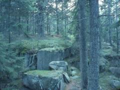
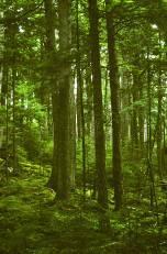
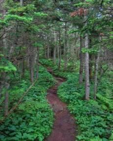
7 Mapping Northeast Terrestrial Habitats Based on NatureServe Ecological Systems
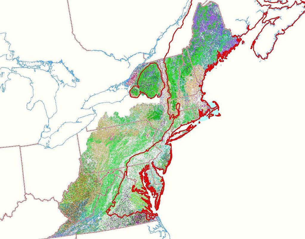
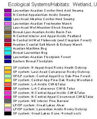
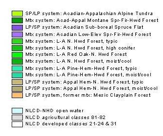
8 Terrestrial Habitats
 To Very low gradient, calcareous, warm Great River (5_1_3_3)")
9 Northeast Aquatic Habitat Classification and Map This simplified map groups them into 96 types. From Very high gradient, acidic, cold headwater creek (1a_6_1_1) To Very low gradient, calcareous, warm Great River (5_1_3_3) Code = Size, Gradient, Geo, Temp

10 Vulnerabilities to Climate Change of Northeastern Fish and Wildlife Habitats A expert-driven predictive model of habitat vulnerability has been built This model will be consistently applied to selected habitats across the Northeast Results will provide basis for mapping geographical variation in vulnerability


11 Connectivity: Network Connectivity Flow Concentration Areas Based on circuit theory and McRae s circuitscape

12 Human Population Density by County

13 Northeast Region Urban Growth Regional Plan Association, 2011


14 Purpose & Need Approach Applications Outlook Designing Sustainable Landscapes for Wildlife Decision-Support Tools for Conservation


15 Purpose & Need Approach Applications Outlook In the face of major threats the objective is to maximize the quantity, quality, and connectivity of habitats and ecological systems, subject to the real world socio-economic constraints of development Protect, manage & restore habitat in the right places Design landscapes to ensure connectivity Minimize forces of habitat degradation

16 Purpose & Need Approach Applications Outlook Utilizing complementary fineand coarse-filtered approaches Fine filter Coarse filter
 and natural disturbances (e.g., fire) Projected min January temp, Kennebec watershed, SRES A2 scenario")
17 Purpose & Need Approach Applications Outlook Landscape change models Now building a landscape change model to predict changes in ecological integrity and habitat capability driven by urban growth, climate change and other anthropogenic (e.g. timber harvest) and natural disturbances (e.g., fire) Projected min January temp, Kennebec watershed, SRES A2 scenario


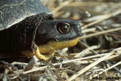
18 Purpose & Need Approach Applications Outlook Model outcomes: Strategies for maximizing habitat and integrity Top 20% (plus buffer) wood turtle habitat Top 20% ecological integrity
19 Threats to Aquatic Systems and Species Habitat fragmentation Isolated populations Water withdrawals Seasonal effects of stream flow Land use/land change Riparian buffer, impervious surfaces Climate change Air temperature and precipitation affecting: Stream flow and temperature Interactions


20 Piping plover habitat and sea level rise Understand impacts of sea level rise on beach habitats (sea level rise models) Relate these changes to plover populations (locally and regionally) (plover species habitat models) Inform current and near-term decisions regarding coastal stabilization (scenarios)

21 Science Translation Science and tools at scale and in format that is useful to managers Guidance to increase understanding and use
22 Adaptation Planning and Actions for Natural Resources Local and state scales informed by regional scale Plan for systems, habitats and species Incorporate multiple drivers (e.g. climate change and urban growth) Science and tools developed and available to managers Goal: landscapes that sustain natural resources and human uses in the future


23 Thank You North Atlantic LCC Appalachian LCC
Science Plan. Executive Summary. Introduction
 Science Plan Executive Summary This Science Plan will establish and define the focus of the Peninsular Florida Landscape Conservation Cooperative (PFLCC) science investments. The data and products derived
Water and Watersheds. Data Maps Action
 Water and Watersheds Data Maps Action What is the Wildlife Action Plan? Restore rare wildlife and habitats. Keep common species common. 2015 Revision: Partners in Conservation Science 2015 Revision Data
A Freshwater Blueprint for Maritime Canada
 A Freshwater Blueprint for Maritime Canada Union of Nova Scotia Municipalities (UNSM) November 8 th, 2017 William Millar Aquatic Conservation Biologist william.millar@natureconservancy.ca Craig Smith Conservation
North Atlantic Landscape Conservation Cooperative Conservation Science Strategic Plan
 North Atlantic Landscape Conservation Cooperative Conservation Science Strategic Plan I. Background, Goals, Objectives and Strategies A. Purpose The purpose of this strategic plan is to articulate a vision,
Climate Vulnerability Assessment Habitats and Species
 Climate Vulnerability Assessment Habitats and Species Clean Water and Climate Adaptation Summit 2010 Minnesota Landscape Arboretum Ann Pierce MNDNR Climate Change Adaptation IPCC: Adjustment in natural
Introduction Vision, Mission and Goals... 3
 Table of Contents Introduction... 2 Vision, Mission and Goals... 3 Partnership Development and Operations... 4 Steering Committee... 5 Technical Committee... 6 Staff... 6 Table 1. Full and Part- time Staff
North Atlantic Landscape Conservation Cooperative
 North LCC North Landscape Conservation Cooperative North Landscape Conservation Cooperative 2012 Highlights About NALCC Our Vision Landscapes that sustain our natural resources and cultural heritage maintained
Subtitle E Delaware River Basin Conservation
 S. 612 144 (b) LIABILITY. The Department of the Interior shall not be liable for the failure to carry out any obligation or activity authorized by this subtitle if adequate appropriations are not provided
Climate Change Impacts of Most Concern for CB Agreement Goal & Outcome Attainment
 Climate Change Impacts of Most Concern for CB Agreement Goal & Outcome Attainment Zoë P. Johnson, Climate Change Coordinator Chesapeake Bay Program STAC Workshop March 7-8, 2016 Climate Change: Real Consequences
How Much Habitat Is Enough? How Much Disturbance is Too Much?
 How Much Habitat Is Enough? How Much Disturbance is Too Much? Jocelyn Sherwood Canadian Wildlife Service - Ontario January 27 th, 2017 Page 2 April 19, 2017 Page 3 April 19, 2017 Grasslands Forest Wetlands
Climate Change: Impacts, Monitoring, and Solutions
 Climate Change: Impacts, Monitoring, and Solutions 1 Responding to Climate Change 1. Projections/Impacts 2. Adaptation and Resiliency 3. Monitoring 4. What about emissions? 2 Native trout and salmon are
Biodiversity Conservation and Climate Change
 Biodiversity Conservation and Climate Change Dr. Patrick Doran, The Nature Conservancy in Michigan. Climate Change: Challenges to Biodiversity Conservation. Chris Hoving, Michigan Department of Natural
Cannon River One Watershed, One Plan. POLICY COMMITTEE MEETING January 10, 2018 Rice County Government Center Faribault, MN
 Cannon River One, One Plan POLICY COMMITTEE MEETING January 10, 2018 Rice County Government Center Faribault, MN TASK Task 1. Aggregate Existing Physical & Spatial Data 1A. Create project maps 1B. Meeting
Partnership for Gulf Coast Land Conservation Annual Meeting August 21, 2012
 Gulf Landscape Conservation Cooperatives NOAA Office of Ocean & Coastal Resource Management NOAA Southern Region Climate Services Partnership for Gulf Coast Land Conservation Annual Meeting August 21,
INTERIOR S PLAN FOR A COORDINATED, SCIENCE-BASED RESPONSE TO CLIMATE CHANGE IMPACTS ON OUR LAND, WATER, and WILDLIFE RESOURCES
 U.S. Department of the Interior INTERIOR S PLAN FOR A COORDINATED, SCIENCE-BASED RESPONSE TO CLIMATE CHANGE IMPACTS ON OUR LAND, WATER, and WILDLIFE RESOURCES SUMMARY Climate change is driving rapid and
How Much Habitat is Enough?
 How Much Habitat is Enough? Canadian Wildlife Service 2017 Third Edition Page 2 April 19, 2017 Grasslands Forest Wetlands Riparian & Watershed Page 3 April 19, 2017 Significant impairment in stream At
Estuary Habitat Restoration STRATEGY 2012
 Estuary Habitat Restoration STRATEGY 2012 INTRODUCTION The Estuary Restoration Act of 2000 (ERA), as amended, (title I of Pub. L. 106 457) fosters a collaborative and comprehensive process among federal
1. Overview of National and Regional Priorities National Priorities
 Atlantic Canada Regional Priority Statement 2014-2015 Habitat Stewardship Program for Species at Risk (HSP) Aboriginal Fund for Species at Risk (AFSAR) 1. Overview of National and Regional Priorities 1.1
Chris S. Pease U.S. Fish and Wildlife Service Gulf Coast Ecosystem Restoration Task Force
 --to build upon Gulf coast geographies to link protected lands and waters, working landscapes, and other open spaces that conserve ecosystem processes and provide associated connections and services to
awetlands aprairie aforests ahabitat for Fish, Game & Wildlife
 Rec. H1 priority land habitats pp. 63-67 Priority areas identified in integrated mapping assessing critical land habitat and threats to habitat pp.33-63 o Mapping is scalable for use in localized areas
Beverly. Produced in This report and associated map provide information about important sites for biodiversity conservation in your area.
 CONSERVING THE BIODIVERSITY OF MASSACHUSETTS IN A CHANGING WORLD Beverly Produced in 2012 This report and associated map provide information about important sites for biodiversity conservation in your
Landscape Conservation Design in the Connecticut River Watershed: A Pilot Project
 Landscape Conservation Design in the Connecticut River Watershed: A Pilot Project Nancy McGarigal, Natural Resource Planner National Wildlife Refuge System Scott Schwenk, Science Coordinator North Atlantic
Limitations and Caveats of Alberta s Fish Sustainability Index (FSI)
") Limitations and Caveats of Alberta s Fish Sustainability Index (FSI) 05/08/2014 Suggested citation: MacPherson, L. 2014. Limitations and Caveats of Alberta s Fish Sustainability Index (FSI). Environment
Limitations and Caveats of Alberta s Fish Sustainability Index (FSI) 05/08/2014 Suggested citation: MacPherson, L. 2014. Limitations and Caveats of Alberta s Fish Sustainability Index (FSI). Environment
Watershed Management in Alberta Green Area
 Watershed Management in Alberta Green Area John Diiwu Alberta Outline What is the green area? Key land use activities Need for watershed management Some provincial policies Need for information and tools
Rouge River Watershed
 Rouge River Watershed Scenario Modelling and Analysis Report Executive Summary INTRODUCTION EXECUTIVE SUMMARY The Toronto and Region Conservation Authority (TRCA) and the Rouge Park Alliance, in cooperation
Healthy Watersheds Assessment. Potomac Watersheds in West Virginia
 Healthy Watersheds Assessment Potomac Watersheds in West Virginia Watershed Assessment - Goals Develop metrics to measure current condition/function & threats Rank watersheds for restoration & protection
Dakota County Soil and Water Conservation District. Strategic Plan
 Dakota County Soil and Water Conservation District Strategic Plan Adopted September 6, 2012 Goals and Objectives In March of 2012 the Dakota County Soil and Water Conservation District (District) Board
Mobile Bay National Estuary Program Protecting Alabama s Most Valuable Resource
 Mobile Bay National Estuary Program Protecting Alabama s Most Valuable Resource Roberta Swann, Director Mobile Bay National Estuary Program March 21, 2018 Regional Response Team The Mobile Bay Watershed
Newtown Creek. Restoration Ecology. February 6, 2014 John McLaughlin Director, Office of Ecological Services
 Newtown Creek Restoration Ecology February 6, 2014 John McLaughlin Director, Office of Ecological Services Office of Ecological Services Mission Statement Statement To protect and improve the ecological
Forestland Stewards 2018 Grant Slate
 NFWF CONTACT Jonathan Scott Program Director, Southern Forests jonathan.scott@nfwf.org 202-595-2609 Red-cockaded woodpecker Credit: Mary Snieckus ABOUT NFWF The National Fish and Wildlife Foundation (NFWF)
WASA Quiz Review. Chapter 2
 WASA Quiz Review Chapter 2 Question#1 What is surface runoff? part of the water cycle that flows over land as surface water instead of being absorbed into groundwater or evaporating Question #2 What are
Mohawk River Basin Research Initiative
 Mohawk River Basin Research Initiative 2014-2016 In 2009 the New York Ocean and Great Lakes Ecosystem Council issued a report entitled Our Waters, Our Communities, Our Futures which recommended an ecosystem-based
Measuring Ecological Integrity Across Jurisdictions and Scale
 Measuring Ecological Integrity Across Jurisdictions and Scale Jimmy Kagan OSU PSU UO PCAST highlighted the need to coordinate cross-scale and cross agency collaboration in monitoring for biodiversity.
CLIMATE CHANGE UNCERTAINTY IS NOT A PRIMARY IMPEDIMENT TO STREAM CONSERVATION
 1 CLIMATE CHANGE UNCERTAINTY IS NOT A PRIMARY IMPEDIMENT TO STREAM CONSERVATION Evan Grant USGS Patuxent Wildlife Research Center SO Conte Anadromous Fish Research Lab NECSC 17 May 2017 Rachel Katz, Allison
Grand Traverse Bay Watershed Protection Plan:
 Grand Traverse Bay Watershed Protection Plan: An Overview Sarah U Ren Program Director The Watershed Center 231-935-1514, suren@gtbay.org What is a Watershed? A watershed is an area of land that captures
Rogue Basin Ecological Integrity Assessment and Climate Change Management Interactions
 Rogue Basin Ecological Integrity Assessment and Climate Change Management Interactions Jimmy Kagan OSU PSU UO Ecological Integrity Measures (by area) Land management status Landscape features Habitat characteristics
Implications of Climate Change for Coldwater Habitat and Brook Trout in Pennsylvania
 Implications of Climate Change for Coldwater Habitat and Brook Trout in Pennsylvania Jefferson Tyrell Deweber Pennsylvania Cooperative Fish/Wildlife Research Unit Pennsylvania State University Tyler Wagner
Maps to Help You Protect and Manage Lands: The Revised Wildlife Action Plan Maps. Emily Preston, Wildlife Biologist Katie Callahan, GIS specialist
 Maps to Help You Protect and Manage Lands: The Revised Wildlife Action Plan Maps Emily Preston, Wildlife Biologist Katie Callahan, GIS specialist What is the Wildlife Action Plan? Restore rare wildlife
NATIONAL STREAM AND AQUATIC ECOLOGY CENTER
 NATIONAL STREAM AND AQUATIC ECOLOGY CENTER The National Stream and Aquatic Ecology Center is a technology transfer unit of the National Forest System (NFS) Watershed, Fish, Wildlife, Air and Rare Plants
A modelling framework to predict relative effects of forest management strategies on coastal stream channel morphology and fish habitat
 A modelling framework to predict relative effects of forest management strategies on coastal stream channel morphology and fish habitat by FRANK STEFAN PETER HEINZELMANN A THESIS SUBMITTED IN PARTIAL FULFILLMENT
Washington Department of Fish and Wildlife Climate Change Adaptation. Lynn Helbrecht Climate Change Coordinator
 Washington Department of Fish and Wildlife Climate Change Adaptation Lynn Helbrecht Climate Change Coordinator Washington Department of Fish and Wildlife Policy framework for adaptation Governors Executive
Buffers improve water quality
 Buffers improve water quality Recently, the MPCA had a request asking if we could see a difference in water quality in streams from sites where there are buffers compared to sites without buffers. We looked
West Virginia Watershed Assessment Pilot Project Outline & Assessment Methodology March 2012
 Introduction The West Virginia Watershed Assessment Pilot Project was developed to define the methodology and identify the information and tools necessary to meet the project objectives stated below. The
Aquatic Resource Mitigation Fund
 Aquatic Resource Mitigation Fund Lori Sommer- Mitigation Program Coordinator Land Resource Management Program NH Department of Environmental Services PRESENTATION OVERVIEW Brief overview on mitigation
Chapter Three: Discussion and Conclusion. 3.1 Introduction/Overview. 3.2 Countywide Stream Assessment
 3.1 Introduction/Overview The objective of this study was to develop a stream prioritization tool that evaluates stream reaches in terms of the potential water quality improvements that could be achieved
2013 Water and Watershed Conference Plymouth State University March 22, Chris Skoglund
 New Hampshire s Watersheds at a Crossroads Coordinating a Response to Climate Change, Population Growth and Land-Use Change Using the DPSIR Model 2013 Water and Watershed Conference Plymouth State University
Riparian Areas. 101 An overview. Prepared by: Jacque Sorensen, M.Sc. TRU Department of Natural Resource Sciences
 Riparian Areas 101 An overview Prepared by: Jacque Sorensen, M.Sc. TRU Department of Natural Resource Sciences February 11, 2015 Presented for the Gardom Lake Planning Committee Today s focus Riparian
Clean Water Act Basics: An Overview of Core Programs. Merritt Frey Habitat Program Director River Network
 Clean Water Act Basics: An Overview of Core Programs Merritt Frey Habitat Program Director 801-486-1224 mfrey@rivernetwork.org AGENDA Introduction History of Act Goals of Act Act & Jordan Resources Why
Goose Creek Watershed Assessment Summary October 2003
 Goose Creek Watershed Assessment Summary October 2003 The Goose Creek Watershed The Goose Creek watershed is 385 square miles, covering nearly half of Loudoun County and one-quarter of Fauquier County
A Geospatial Coastal Resilience Assessment for the Contiguous U.S.
 A Geospatial Coastal Resilience Assessment for the Contiguous U.S. Greg Dobson, Ian Johnson, Kim Rhodes UNC Asheville s NEMAC Mandy Chesnutt National Fish and Wildlife Foundation NFWF Greg Dobson gdobson@unca.edu
INDIAN CREEK WATERSHED PLAN EXECUTIVE SUMMARY
 INDIAN CREEK WATERSHED PLAN EXECUTIVE SUMMARY The Indian Creek Watershed covers a 38 square mile area in southern Lake County, Illinois that drains 24,116 acres before discharging into the Des Plaines
Session I: Introduction
 STAC Workshop M O N I T O R I N G A N D A S S E S S I N G I M P A C T S O F C H A N G E S I N W E A T H E R P A T T E R N S A N D E X T R E M E E V E N T S O N B M P S I T I N G A N D D E S I G N Session
Charter: Great Lakes Region Aquatic Habitat Connectivity Collaborative
 Charter: Great Lakes Region Aquatic Habitat Connectivity Collaborative Preamble Aquatic Habitat Connectivity The nature and extent of habitat connectivity is a key contributor to biodiversity conservation
Angela Larsen Community Resilience Manager
 Angela Larsen Community Resilience Manager 5 Year Goal Community Networks Three Community Networks that share common stressors and landscapes are linked through a planning and public engagement process
TAC CHARRETTE WORKBOOK Ecosystem Management and Sustainable Forestry Practices
 For Discussion Purposes TAC CHARRETTE WORKBOOK Ecosystem Management and Sustainable Forestry Practices NEW JERSEY HIGHLANDS COUNCIL March 28, 2006 1 Overview of RMP Goals and Structure NEW JERSEY HIGHLANDS
Flow-Based Surrogate TMDLs, A Case Study in Ohio
 Lower Grand River TMDL January 2012 This fact sheet describes the characteristics of a good surrogate total maximum daily load (TMDL) and the factors that should be considered when selecting a surrogate
Capacity Building Through the Watershed Approach
 Capacity Building Through the Watershed Approach Mississippi Department of Environmental Quality (MDEQ) and US Environmental Protection Agency, Region 4 (USEPA, R4) MDEQ Process 1. Develop water quality
STRATEGIC PLAN Jug Bay Wetlands Sanctuary STRATEGIC PLAN
 2015-2020 Jug Bay Wetlands Sanctuary STRATEGIC PLAN 0 JUG BAY WETLANDS SANCTUARY http://www.jugbay.org/ 1 INTRODUCTION Natural habitats at local, state, national and international levels are threatened
Habitat GIT Fish Passage, Brook Trout, Cosatal Habitats STAC Workshop (Mike Slattery)
") Update: Fish Passage Workgroup, Habitat GIT Background The fish passage workgroup is part of the Habitat Goal Implementation Team. Fish Passage Outcome: During the period of 2011-2025, restore historical
Update: Fish Passage Workgroup, Habitat GIT Background The fish passage workgroup is part of the Habitat Goal Implementation Team. Fish Passage Outcome: During the period of 2011-2025, restore historical
Protecting and Restoring Habitat (Fact Sheet)
") University of Southern Maine USM Digital Commons Publications Casco Bay Estuary Partnership (CBEP) 2014 Protecting and Restoring Habitat (Fact Sheet) Casco Bay Estuary Partnership Follow this and additional
University of Southern Maine USM Digital Commons Publications Casco Bay Estuary Partnership (CBEP) 2014 Protecting and Restoring Habitat (Fact Sheet) Casco Bay Estuary Partnership Follow this and additional
The Monongahela National Forest
 The Monongahela National Forest ~ 1 million acres High elevation Location of headwater streams for millions in the East Rain shadow effect The Allegheny Front Sedimentary geology and acidic environments
New Hampshire s Wildlife Habitat Conditions
 CHAPTER THREE New Hampshire s Wildlife Habitat Conditions Abstract Wildlife habitat condition was assessed for all 27 habitat types. NHFG developed a methodology to assess the relative ecological condition
The Eastern Region s Approach to Climate Change Response and the Performance Scorecard
 The Eastern Region s Approach to Climate Change Response and the Performance Scorecard September 2011 The mission of the Forest Service is to sustain the health, diversity, and productivity of the Nation
Prioritizing Climate Change Impacts and Action Strategies
 Prioritizing Climate Change Impacts and Action Strategies Chesapeake Bay Program STAC December 8, 2015 2014 Chesapeake Bay Agreement CLIMATE RESILIENCY GOAL: Increase the resiliency of the Chesapeake Bay
Prepared by: Jason A. Coombs. Keith H. Nislow
 Riparian Prioritization and Status Assessment for Climate Change Resilience of Coldwater Stream Habitats within the Appalachian and Northeastern Regions Prepared by: Jason A. Coombs Keith H. Nislow University
SURFACE WATER HYDROLOGY AND HYDRAULICS SECTION
 SURFACE WATER HYDROLOGY AND HYDRAULICS SECTION The mission of the Surface Water Hydrology and Hydraulics section is to generate historical and spatial scientific data, investigate and understand watershed
Southern California River and Stream Habitats
 Southern California River and Stream Habitats Climate Change Adaptation Actions Summary An Important Note About this Document: This document represents an initial effort to identify adaptation actions
Don t Mow. Let it Grow!
 Don t Mow. Let it Grow! The Science Behind the Need for Riparian Buffer Protection. Chelsea Walker, WCD Watershed Specialist chelsea@wcdpa.com 724-837-5271 What is a Riparian Buffer? A riparian buffer
Stormwater Management Tools: Real-Life Solutions for a Resilient Community Riparian Corridor Protection
 Stormwater Management Tools: Real-Life Solutions for a Resilient Community Riparian Corridor Protection Montgomery County Planning Commission October 24, 2013 Eric Jarrell, Assistant Section Chief, Community
Mukwonago River Watershed Protection Plan Recommendations & Implementation Update Friends of Mukwonago River March 16, 2013 Mukwonago, WI
 Mukwonago River Watershed Protection Plan Recommendations & Implementation Update Friends of Mukwonago River March 16, 2013 Mukwonago, WI Thomas M. Slawski, Principal Specialist Biologist Southeastern
Texas Riparian & Stream Ecosystem Training
 Texas Riparian & Stream Ecosystem Training Clare Entwistle; Nikki Dictson; Dr. Fouad Jaber; Destiny Russell; Nathan Glavy Texas Water Resources Institute Threats to Riparian Areas Riparian degradation
The North Atlantic Aquatic Connectivity Collaborative (NAACC)
") The North Atlantic Aquatic Connectivity Collaborative (NAACC) Evaluating Road-Stream Crossings Across a Thirteen-State Region Jessie Levine September 14, 2016 NETWC Scale of the Problem Data on 9,064 crossings
The North Atlantic Aquatic Connectivity Collaborative (NAACC) Evaluating Road-Stream Crossings Across a Thirteen-State Region Jessie Levine September 14, 2016 NETWC Scale of the Problem Data on 9,064 crossings
CWS Landscape Conservation Guidance and Planning. Graham Bryan CWS-ON September 16 th, 2016 Bracebridge
 CWS Landscape Conservation Guidance and Planning Graham Bryan CWS-ON September 16 th, 2016 Bracebridge Canadian Wildlife Service Part of Environment & Climate Change Canada CWS is responsible for wildlife
Maria W. Merrill Florida Fish and Wildlife Conservation Commission Aquatic Habitat Conservation and Restoration Section April 12, 2013
 Maria W. Merrill Florida Fish and Wildlife Conservation Commission Aquatic Habitat Conservation and Restoration Section April 12, 2013 Focus Region 16 Coastal counties from Perdido Key east to Anclote
Draft National Rivers and Stream Assessment. Overview and Key Findings NRSA 2008/09
 Draft National Rivers and Stream Assessment Overview and Key Findings NRSA 2008/09 1 Outline of Presentation Background on the National Aquatic Resource Surveys NRSA Design and Indicators Key Findings
Climate Change Adaptation: Great Lakes region examples
 Climate Change Adaptation: Great Lakes region examples Kimberly Hall kimberly_hall@tnc.org Credits: IPCC 2007, Photos Photography Plus, Julie Craves Mark Godfrey October 21, 2010 Freshwater Future CC Workshop,
WV WATERSHED ASSESSMENT PILOT PROJECT. Gauley River Kent Mason
 WV WATERSHED ASSESSMENT PILOT PROJECT Gauley River Kent Mason Expert Workshop #2, Round 2 Capitol Conference Center, Charleston. January 8 & 9, 2013 Workshop Outline Day 1 Project Background & Methodology
Unify efforts to address water resources for the Big Sky area and surrounding zone of influence in three co-equal water resources focus areas:
 EXECUTIVE SUMMARY The Big Sky Sustainable Water Solutions Forum (Water Forum) is a community-based, collaborative approach building a unified vision for future Big Sky water resources management to maintain
Applying Ecosystem Services to Collaborative Forest Management Elk River Public Meeting
 Applying Ecosystem Services to Collaborative Forest Management Elk River Public Meeting Nikola Smith Ecologist and Ecosystem Services Specialist U.S. Forest Service Port Orford City Hall February 2, 2017
Priorities & Metrics Workgroup Proposed Vision, Mission, Goals, Objectives, and Targets
 Priorities & Workgroup Proposed Vision, Mission, Goals, Objectives, and November 28, 2012 Vision: An integrated, balanced, and consensus-based approach to ensuring the long-term sustainability of the Region
Pacific Lamprey Conservation Initiative- Focus on Willamette Subregion
 Pacific Lamprey Conservation Initiative- Focus on Willamette Subregion Christina Luzier and Howard Schaller Columbia River Fisheries Program Office US Fish & Wildlife Service Global Distribution Historically
C. Staffing Needs Approximately 150 staff days TSA #3 staff time will also be utilized.
 2017 Annual Plan I. Introduction The purpose of this annual plan is to detail work items that will be completed in 2017. The annual plan will provide a tool for SWCD staff and supervisors to evaluate program
Texas Riparian & Stream Ecosystem Training Program Update
 Texas Riparian & Stream Ecosystem Training Program Update Clare Entwistle; Nikki Dictson; Dr. Fouad Jaber; Destiny Russell; Nathan Glavy Texas Water Resources Institute Threats to Riparian Areas Riparian
2.4 Floodplain Restoration Principles
 Floodplain Restoration Principles 2.4 Floodplain Restoration Principles Anthropogenic alternation of river corridors and floodplains significantly modified the structure and function of landscapes and
ANCR INDIVIDUAL RESPONSES SUMMARY: 2/11/04 WATER RESOURCES GOALS AND OBJECTIVES
 ANCR INDIVIDUAL RESPONSES SUMMARY: 2/11/04 WATER RESOURCES GOALS AND OBJECTIVES Goal 1: Protect the health and safety of the Dane County population. a. Prevent development that may have an adverse effect
Lessons Learned from Vulnerability Assessments for Ecosystembased. Adaptation for terrestrial, marine and coastal regions: The CI experience
 Lessons Learned from Vulnerability Assessments for Ecosystembased Adaptation for terrestrial, marine and coastal regions: The CI experience Shyla Raghav Ravic Nijbroek x: 4.36, y:.18 Photo 2 5.51 x 10.31
Sustainable Fisheries GIT: Fish Habitat
 Quarterly Progress Meeting - May 2017 Chesapeake Bay Program Science. Restoration Partnership. Sustainable Fisheries GIT: Fish Habitat Bruce Vogt, NOAA and Sustainable Fisheries GIT Coordinator Gina Hunt,
Riparian Restoration on California's Coast November 3, Reach scale
 Research and Adaptive Management Research approaches in stream corridor assessment and restoration Integral to all components Recognition of uncertainty Commitment to monitor and learn Willingness to adjust
Peninsular Florida Landscape Conservation Cooperative. Priority Resources Web Workshop March 22, 2016
 Peninsular Florida Landscape Cooperative Priority Resources Web Workshop March 22, 2016 Why are we here today? The goals of these workshops are to: Review the draft PFLCC priority resources with a broad
Climate Change and Aquatic Genetic Resources for Food and Agriculture: State of Knowledge, Risks and Opportunities. Roger Pullin and Patrick White
 Climate Change and Aquatic Genetic Resources for Food and Agriculture: State of Knowledge, Risks and Opportunities Roger Pullin and Patrick White And they call this planet Earth? 24 27 October 2007 WAS
Primer introduction to watershed management Plan Process highlight the major steps of plan development Project types look at some examples of common
 1 Primer introduction to watershed management Plan Process highlight the major steps of plan development Project types look at some examples of common projects Plan Organization how to read the plan Next
CERP System Status Reports The Evolution from
 CERP System Status Reports The Evolution from 2006-2009 Eliza Hines 22 July 2009 Everglades Restoration Comprehensive Everglades Restoration Plan (CERP) 18,000 sq mile ecosystem Everglades & South Florida
CHESAPEAKE BAY COMPREHENSIVE WATER RESOURCES AND RESTORATION PLAN. Update to Chesapeake Bay Program Management Board June 14, 2018
 CHESAPEAKE BAY COMPREHENSIVE WATER RESOURCES AND 255 255 255 237 237 237 0 0 0 217 217 217 163 163 163 200 200 200 131 132 122 239 65 53 80 119 27 RESTORATION PLAN 110 135 120 252 174.59 112 92 56 62 102
A Review of Landscape and Riparian Disturbances to Stream Ecosystems with emphasis on the North Shore of Lake Superior
 A Review of Landscape and Riparian Disturbances to Stream Ecosystems with emphasis on the North Shore of Lake Superior Gerald Jerry Niemi CWE-NRRI Sr. Res. Assoc. Biology - Professor U of Minnesota-Duluth
Sustainable Water Resource Practices
 Sustainable Water Resource Practices This section is related to and shoudl be read in conjunction with the Land Use Element, and Conservation Element. Implementing sustainable water resource practices
Habitat Grant Projects Clinton River Watershed
 Habitat Grant Projects Clinton River Watershed L Y N N E S E Y M O U R E N V I R O N M E N T A L E N G I N E E R O F F I C E O F T H E M A C O M B C O U N T Y P U B L I C W O R K S C O M M I S S I O N
TORCH LAKE TOWNSHIP WATER QUALITY ACTION PLAN
 TORCH LAKE TOWNSHIP WATER QUALITY ACTION PLAN Elk-River-Chain-of-Lakes Gaps Analysis Project The Watershed Center Grand Traverse Bay Tip of the Mitt Watershed Council Michigan Department of Natural Resources
Adapting to Climate Change in Western National Forests
 Adapting to Climate Change in Western National Forests David L. Peterson 1, Jessica E. Halofsky 2, Natalie Little 3 ¹USDA Forest Service, Pacific Northwest Research Station ²University of Washington, School
Adapting to a Changing Climate:
 Adapting to a Changing Climate: Risks & Opportunities for the Upper Delaware Region A collaborative effort of: The Common Waters Partnership (http://www.commonwatersfund.org/partners) The Pinchot Institute
CHESAPEAKE BAY COMPREHENSIVE WATER RESOURCES AND RESTORATION PLAN. Habitat GIT Meeting 9 May 2017
 CHESAPEAKE BAY COMPREHENSIVE WATER RESOURCES AND 255 255 255 237 237 237 0 0 0 217 217 217 163 163 163 200 200 200 131 132 122 239 65 53 80 119 27 RESTORATION PLAN 110 135 120 252 174.59 112 92 56 62 102