STATE DISASTER MANAGEMENT PLAN PUNJAB
|
|
|
- Elfrieda Winifred Little
- 6 years ago
- Views:
Transcription
1 STATE DISASTER MANAGEMENT PLAN PUNJAB DEPARTMENT OF REVENUE, REHABILITATION AND DISASTER MANAGEMENT GOVERNMENT OF PUNJAB Draft Punjab State Disaster Management Plan 1

2 FOREWARD Different parts of Punjab are vulnerable to the natural calamities like Flood, Earthquake, Drought and Embankment Erosion. In fact there are multiple High Risk Multi Hazard Zones. Apart from these natural hazards there are chances of man-made disasters like fires, industrial accidents, terrorist attacks etc. Punjab has twenty two districts covering 79 Tehsils, 143 blocks, 12,278 villages, 143 towns and 14 cities of Punjab. The total area of the state is 50,362 square kilometers and the population is 2,77,04,236 (Census, 2011). This State DM Plan, Punjab, has been prepared in the context of natural and man-made disasters. This Plan should be useful to tackle the multi-hazard vulnerabilities and should be based on the factors like ever-growing population, the vast disparities of income, rapid urbanization, increasing industrialization, development within high risk zones, environmental degradation, climate change, state and national security, economy and sustainable development. The objective of the State Disaster Management Plan, Punjab is to facilitate execution of activities for prevention and preparedness, search and rescue operations, coordination, and community awareness and involvement. In preparing the Plan, the existing system has been studied; the prevailing documents and various stakeholders were consulted. The framework of the plan is based on the paradigm shift in Disaster Management from a relief centric approach to a regime that anticipates the importance of preparedness, prevention and mitigation. On the other hand, it outlines the functions of the principal agencies and clearly demarcates roles for; before, during and after a disaster. Such clarity will act as a framework for each line-departments and district authority to prepare their own plans, promoting efficiency and teamwork. In the process, it is my fervent hope that the plan achieves its main objective to ensure the safety and well being of the citizens of Punjab. By mainstreaming disaster risk reduction into developmental work and ensuring that the community remains the most important stakeholder, i hope this plan will be helpful in promoting a culture of prevention and preparedness at all levels. A.R. Talwar Financial Commissioner, Revenue, Punjab Draft Punjab State Disaster Management Plan 2
3 ACKNOWLEDGEMENT The Punjab State Disaster Management Plan has been formulated for the Government of Punjab, State Disaster Management Authority. It seeks to provide a comprehensive approach to disaster risk Management in the State. I take this opportunity to thank Dr. Adapa Karthik, IAS, Jt. Secretary-cum-Director Disaster Management, Govt. of Punjab, for giving me the responsibility to prepare the State Disaster Management Plan Throughout the process his guidance, co-operation and suggestions helped me a lot. I also extend my thanks to, Mr. G.S. Sidhu, IAS, Secretary Revenue, Government of Punjab. Rinkal Mahajan Project Officer UNDP-DRR Project Draft Punjab State Disaster Management Plan 3
4 CONTENTS Chapter 1 Introduction State Profile Physical Location Geological and Geographical Data of Punjab Land Use & Land Cover in Different Socio-Cultural Zones Climate and Rainfall River System & Dams Administrative Structure 1.2 State Disaster Management Plan Paradigm Shift in Disaster Management National Vision The role of the state Disaster Management Authority (SDMA)/State Executive Committee (SEC) and the State Departments Purpose of Plan Key Objectives State Plan Approach Chapter II Hazard, Risk and Vulnerability Assessment Hazard, Risk and Vulnerability Assessment 2.2 HAZARDS HYDROLOGICAL I. Flood II. Water Logging III. Drought IV. Desertification V. Soil Erosion GEOLOGICAL I. Earthquake DISEASES, EPIDEMICS, PANDEMICS I. Cancer ACCIDENTS I. Road Accident II. Rail Accident ATMOSPHERIC I. Hailstorm Draft Punjab State Disaster Management Plan 4
5 II. Gale III. Lightning IV. Squall V. Thunderstorm VI. Heat Wave VII. Cold Wave VIII. Cyclones/Wind Storms IX. Dustorm EXPLOSIONS AND LEAKS I. Chemical/Industrial disasters FIRE I. Structure Fire II. Crop Fire OTHER HAZARDS I. Terrorist Activities II. Riots III. War IV. Soil Pollution V. Drug Addiction VI. Water Pollution VII. Air pollution 2.3 VULNERABILITY I. Socio-Economic Vulnerability II. Physical Vulnerability CHAPTER III DISASTER PREPAREDNESS AND MITIGATION PLAN Introduction 3.2 Disaster Preparedness Important Components of Preparedness Plan Components of Community Preparedness Plan Components of Administrative Preparedness 3.3 Preparedness Plan for Punjab Establishment of State Emergency Operation Centre (SEOC) Preparation of Resource Inventory Reliable Communication Systems Preparation of a Response Plan Training and Capacity Building Community Awareness and Community Preparedness Planning Capacity Building of Community Task forces Simulation Exercises 3.4 Disaster Mitigation 3.5 Structural Mitigation Measures Draft Punjab State Disaster Management Plan 5
6 3.5.1 Retrofitting Earth Quake Resistant Construction Afforestation Multipurpose Dams Watershed Management Embankments Improvement in Drainage efficiency Desiltation of Stream Beds Check on the Encroachments Check on the Disposal Improving the Capacities of Bridges/Aqueducts Intra and Inter-State Coordination Water Harvesting Measures Other Structural Measure 3.6 Non-Structural Measures Preparedness Methodology Sensitization/Awareness Campaigns Training and Capacity Building Enforcing Existing Codes and Laws Flood Plain Zoning Flood Proofing Flood Fighting 3.7 Early Warning and Dissemination System Dissemination of Warning Communication and Warning Current communication System Proposed Communication System Communication Procedures shall be established by the entity and regularly exercised to support the program Alert Procedure Emergency Communications and Warning Protocols System of Flood Warning Signals in Punjab Chapter IV Mainstreaming Concerns into Developmental Plans/Programmes/Projects Concept on Mainstreaming 4.2 Following Project/Programmes are taken by the State of Punjab National Disaster Communication Network (NDCN) National Earthquake Risk Management Programme Approved Master Plans 4.3 Inclusion of Disaster Risk Reduction (DRR) in Development Planning Draft Punjab State Disaster Management Plan 6
7 Chapter V RESPONSE PLAN.154 I. Institutional Mechanism 5.1 National Level Mechanism 5.2 State Level Mechanism State Disaster Management Authority The State Executive Committee (SEC) Technical Committee(s) The State Emergency Operations Centre District Disaster Management Authority District Disaster Management Advisory Committee (s) District Emergency Operation Centre Tehsil/sub Tehsil/Block Disaster Management Committee Gram Panchayat/Village Disaster Management Committee II. Response Management Arrangements Command Control Coordination Incident Controller Incident Management System (IMS) Co-ordination Role of the State Relief Commissioner & District Collector Principal Role of Emergency Response Co-ordinators (SRC & DRC) Field Emergency Response Co-ordinator Block/Municipal Emergency Response Co-ordinator District Emergency Response Coordinator Additional Objectives for Emergency Response Co-ordinators 5.4 Step-up Arrangements Resourcing Co-ordination Procedures Information Management Post-operational Debriefing Media Liaison 5.5 Emergency Relief Requesting Emergency Relief Block/Municipal Level: (Coordinator Block/G.P./Municipal Councils) 5.6 Evacuation Legal and Operational Considerations Evacuation Process State Emergency Operations Centre (SEOC) Incident Command System Draft Punjab State Disaster Management Plan 7
8 5.7 Response Activities Warning Role of State Govt. in L2 disaster No Warning De-Warning 5.8 Response Planning Location of the meeting Arrival Point 5.9 State Disaster Quick Response Mechanism Quick Response Teams Essential Communication Links at the State EOC Tasks for internal functions at EOC Checklist for EOC set-up Checklist for each ESF desk Continued Response Deactivation and Documentation Chapter VI STATE DISASTER RECOVERY PLAN Introduction 6.2 Definitions of Recovery 6.3 Recovery from Disasters 6.4 Need for Outside Assistance 6.5 Recovery as a Developmental Process 6.6. The Recovery Process 6.7 Physical and Technical Aspect of Recovery 6.8 Social or Community Aspect of Recovery 6.9 Dispersed Population Events 6.10 Recovery Management Priorities 6.11 Co-ordinating Agency for Recovery 6.12 Principles of Recovery 6.13 Management Principles for Recovery 6.14 Interface with Response Activities 6.15 Recovery and Prevention 6.16 Recovery Management and the Community 6.17 Recovery Management at Block/Panchayat Samity/Municipal Level (Block/Panchayat Samity Municipal Responsibilities) 6.18 Role of District Recovery Co-ordinators 6.19 Recovery Management at State Level 6.20 Funding 6.21 Monitoring & Minimum Standards Chapter VII FINANCIAL ARRANGEMENTS.198 Draft Punjab State Disaster Management Plan 8
9 7.1 By State Government 7.2 By Ministries and Departments of Government of India and State Government 7.3 Thirteenth Finance Commission 7.4 Implementation of recommendation of 13 th Finance Commission Annual Work Plan 7.5 Annual Work Plan Chapter VIII REVEIW AND UPDATAION OF PLAN State Disaster Management Authority 8.2 State Plan 8.3 District Disaster Management Authority 8.4 District Plan 8.5 Responsibilities of departments of the State Government 8.6 Disaster management plan of departments of State 8.7 Guidelines would be adhered to while updating the State Disaster Management Plan 8.8 Some of the priority areas which need immediate attention or updating from time to time 8.9 Schedule and Format for updating Action Taken Reports Chapter IX COORDINATION AND IMPLEMENTATION DISSEMINATION OF THE PLAN Plan Evaluation 9.2 Post-Disaster Evaluation 9.3 Coordination with DDMA s 9.4 State Disaster Management Authority 9.5 District Disaster Management Authority 9.6 Plans by different authorities at district level and their implementation Standard Operating Procedure for Emergency Support Functions (ESF) ESF 1- Communication ESF 2- Law and Order ESF 3- Search and Rescue Operations ESF 4- Evacuation ESF 5- Food ESF 6- Medical Response and Trauma Counselling ESF 7- Equipments Support - Debris & Road Clearance ESF 8- Shelter ESF 9- Water ESF 10- Electricity ESF 11- Transportation ESF 12- Help Lines and Information Dissemination Follow-Up Actions Draft Punjab State Disaster Management Plan 9
10 Department Specific Action Plans ANNEXURES 1. Action Plan for Floods 2. Action Plan for Earthquakes 3. Revised List Of Items And Norms Of Assistance From Calamity Relief Fund (CRF) And National Calamity Contingency Fund (NCCF) For The Period (MHA Letter No /2007-Ndm-I Dated The 27 th June, 2007, Modified Vide Latter No /2009-Ndm-I Dated 31 st July 2009) 4. Role of State Government Departments / Agencies in Disaster Management 5. List of Important Telephone Numbers 6. Resource Inventory of Floods 7. List of NGOs LIST OF TABLES Table 1: Demographic Data of Punjab State Table 2: Area (ha) under different land use/land cover categories in different sociocultural zones of Punjab Table 3: Geographical area, number of villages and blocks in different districts of Punjab Table 4: Disasters Identified By The High Powered Committee Of Government Of India (1999) Table 5: Seasonality of Hazards of Punjab State Table 6: Measure of Likelihood Table 7: Details each level of risk rating with a description of how these ratings should be interpreted Table 8: No. of villages/towns affected, human lives and Cattle lost due to floods during the Rainy Season in Punjab Table 9: Districts coming under Moderate and Low damage risk zones Table 10: No. of Cancer Patients Table 11: House to House Survey 2009 Table 12: Road Accidents in Punjab Table 13: Hailstorms in Punjab Table 14: GALE in Punjab Table 15: Lightning in Punjab Table 16: SQUALL in Punjab Table 17: Thunderstorm in Punjab Table 18: Cold wave in Punjab Table 19: Duststorm in Punjab Draft Punjab State Disaster Management Plan 10
11 Table 20: Industrial Disasters in Punjab Table 21: Maximum Accidental Hazard Units in Punjab Table 22: Border Area in Punjab Table 23: Terrorist Violence in Patiala District Table 24: Heavy Metals and their Pathological Effects on Man Table 25: Diseases due to Water Pollution Table 26: Status of Water Quality of River Satluj ( ) Table 27: Status of Water Quality of River Beas & Ravi ( ) Table 28: Status of Water Quality of River Beas & Ravi ( ) Table 29: Status of Water Quality of River Ghaggar ( ) Table 30: Status of Air Polluting Industries of Punjab Table 31: Major Socio-economic Indicators of the State Table 32: Condition of Census Houses Used as Residence and Residence-Cum-Other Use Table 33: Physical Vulnerability of Punjab State Table 34: Distribution of Households Living in Census Houses by Predominant Material of Roof Table 35: Distribution of Households Living in Census Houses by Predominant Material of Wall Table 36: Total Slum population in Punjab Table 37: Multi-Hazard Prone Districts in Punjab Table 38: Previous Trainings by the Punjab Government Table 39: Training Venues for Flood Rescue Training Table 40: Community Preparedness Strategies Table 41: Nodal Agencies Table 42: System Of Flood Warning Signals Table 43: Blocks covered under Border Area Development Programme Table 44: Distribution of Rs. 126 Cr ACA in Border Blocks Table 45: Punjab State Allocations of Grants in Aid Table 46: Punjab State Allocations of Grants in Aid for revamping of Civil Defence Table 47: Punjab state Allocation of Grants in Aid Table 48: State Disaster Management Authority Table 49: State Executive Committee Table 50: District Disaster Management Authority Table 51: List of ESF and desk officers Table 52: 5 Targets Containing Different Activities Draft Punjab State Disaster Management Plan 11
12 EXECUTIVE SUMMARY Although common man is not so familiar with the term disaster management; they are much aware of certain phenomenon like Earthquake, Landslide, and Cyclone and now even Tsunami. Since time immemorial India is highly prone to natural calamities. Today, from Kanyakumari to Himalayas, India doesn t have any region exempted from one or another kind of disaster. According to recent study, 65 per cent of Indian landmass is highly prone to earthquakes; whereas, 12 per cent is submerged under water annually (Ministry of Home Affairs. The unanswered question, today, is how to tackle such disasters. Punjab is situated in the northwest India. The Indian state borders the Pakistani province of Punjab to the west, Jammu and Kashmir to the north, Himachal Pradesh to the northeast, Chandigarh to the east, Haryana to the south and southeast and Rajasthan to the southwest. The total area of the state is 50,362 square kilometres. The population is 2,77,04,236 (Census, 2011). The State Disaster Management Plan for Punjab is a combination of modern participatory approach. This document contains Nine Chapters and seven annexure and additional information. Certain most important concepts and approaches like significance of a State Disaster Management Plan of Punjab as well as detailed profile of the district are coming in the first chapters. The vulnerability and hazard situation and capacity available to face a disaster are elaborately described in the second chapter. Punjab is vulnerable to 21 types of hazards out of 33 identified by the High Powered Committee (HPC) of Government of India into 5 Draft Punjab State Disaster Management Plan 12
13 sub-groups. Apart to identified hazard by HPC, state has high impact of Groundwater and Surface water Pollution, depletion of groundwater level and cancer epidemic which needs to be addressed as hazard A major part of geographical area of the state is prone to floods although substantial part has been protected through flood control measures. The Water table is rising in South-western districts of the state due to limited or non-extraction of groundwater because of blackish/saline quality, which makes it unfit for domestic, irrigation and other purposes which causes water logging. Punjab has experienced drought due to inadequate rain in Monsoon. The State was experienced drought in 1978, 1979, 1985, 1987, 2002 and 2004, both in rural and urban areas. In 1987, a major drought was experienced in the State but in 2002, the intensity of the drought has made the situation much more acute and has broken the back of the farming community. The State Government declared all the 17 districts in the State as drought affected. A United Nations Development Programme (UNDP) report states that about 12% of Punjab state suffers from the threat of desertification. The Punjab is facing very serious problem of soil erosion by water. It is serious menace in the Shivaliks and Kandi region, along the river courses, streams and choes and in the south western arid and hot region. In this seismic zoning map, most of the area of Punjab State lies in Zone III and IV. However, northern boundary of Punjab State with Himachal Pradesh is in close proximity to Zone V. According to the Building Material & Draft Punjab State Disaster Management Plan 13
14 Technology Promotion Council, 1997, 48.6% area of the state is vulnerable to Intensity VIII and 45.6% area to Intensity VII. A house to house survey was conducted by the Health Department. The prevalence of cancer in Punjab as per survey is per lakh population whereas the prevalence in India is 125 per lakh, for example in Muktsar district between 2001 and 2009, 1,074 people died of cancer In June 2010, studies carried out amongst mentally retarded children in the Malwa region of Punjab, revealed 87% of children below 12 years and 82% beyond that age having uranium levels high enough to cause diseases. Road Accidents are increasing day-by-day in the Punjab. In persons were killed in road accident whereas 3668 persons were killed in 2009 in Punjab. Three rail accidents witnessed in Punjab which are Khanna rail accident in which 212 persons were killed, Sarai Banjara rail disaster in which 46 persons were killed and Ladhowal rail disaster in which 39 people lost their lives. Occasionally Punjab witnesses hailstorms which cause huge damages to the standing crops, Gales, Lightening, Squall, Thunderstorm, Heat Wave, Cold Wave, Dustorm etc. Punjab is also prone to industrial disasters. In people lost their lives in industrial disasters whereas 14 were lost in There are 60 Maximum Accident Hazard Units are found in Punjab. Punjab also witnessed structure and crop fires. Punjab has 553 KM long International border with Pakistan with 4 districts of Amritsar, Ferozepur (Fazilka is separated and become Draft Punjab State Disaster Management Plan 14
15 another district of Punjab), Tarn Taran (this district was created in April 2006) and Gurdaspur abutting the International border. Punjab has witnessed Operation Blue star riots in which 83 army personnel were killed and 249 injured while insurgent casualties were 493 killed and 86 injured, Operation Black Thunder in which 42 persons were killed. Punjab s grievous drug problem was revealed recently in a report by Guru Nanak University in Punjab s largest city, Amritsar, which declared that some 73.5 per cent of the state s youth between 16 and 35 years were confirmed drug addicts. Punjab Pollution Board has identified water polluting industries in the state under the provision of Water and Air Acts. In June 2010, studies carried out amongst mentally retarded children in the Malwa region of Punjab, revealed 87% of children below 12 years and 82% beyond that age having uranium levels high enough to cause diseases. Mitigation and Preparedness Plan: The State Plan for preparedness and mitigation attempts to protect the lives and properties of the people of Punjab from potentially devastating hazards. Structural Mitigation and Non-Structural Mitigation measures are suggested in the preparedness and mitigation plan. Structural mitigation includes retrofitting, afforestation, multi-purpose dams, watershed management, and improvement in drainage efficiency, desiltation of stream beds, check on encroachment, and check on disposal, improving the Capacities of Bridges/Aqueducts, intra and inter- State Coordination, water harvesting measures, etc. Non- Structural Mitigation includes Sensitization/Awareness Campaigns, Training and Capacity Building, Flood Plain zoning, Flood Proofing, Flood Fighting, Early Warning and Dissemination System, etc. Draft Punjab State Disaster Management Plan 15
16 Response Plan: It includes institutional mechanism, State Emergency Operations Centre (SEOC), Incident Command System, response activities, warning systems, Role of State Govt. in L2 disaster, State Disaster Quick Response Mechanism, etc. Recovery Plan: It includes Recovery from Disasters, Recovery as a Developmental Process, Recovery Process, Interface with Response Activities, Recovery and Prevention. In the end, Implementation of recommendation of 13th Finance Commission and Annual Work Plan are also explained. Review and Updation of Plan, Coordination, Implementation and Dissemination of the Plan is also discussed in the end. The efforts to prepare a document like this -The State Disaster Management Plan for Punjab- received inspiration from such a scenario. The objective of this document is to introduce the unique and tested method of disaster management in district Patiala. Replacing the well-known traditional methods of disaster management, one has Patiala. Replacing the well-known traditional methods of disaster management, one has to embrace decentralized efforts and people s participation. Also there are 12 Emergency Support Functions with one nodal agency and a couple of supporting agencies to look after disaster management, in the new set up. This Plan has been prepared as per the guidance provided by the National Disaster Management Authority and mandates the roles and functions to be played by the State Disaster Management Authority, State Executive Committee and State government Line Departments. Disaster management, by its very nature, requires a multi-disciplinary approach hence; a strong coordination mechanism forms the core of successful Disaster Management. Draft Punjab State Disaster Management Plan 16
17 This Plan outlines the functions of the principal Agencies like SDMA, SEC, State Relief Commissioner, and at district level the DDMA and role of Responsible Officers (DC/DM) and onsite response. The Punjab State Disaster Management Authority (PSDMA) and SEC will be supported by the line departments. However the functions listed out for the line departments are mandatory to comply with. As such, each line department and district authority s requisite to prepare their own disaster management plan in alignment with State plan. This Plan may be reviewed annually by the SEC to ensure all activities and information is updated. Regular training of relevant department officials should be carried out to ensure compliance and quick response during disaster situations. The Plan has been structured for easy understanding and clear demarcation of roles and responsibilities for scenarios before, during and after disasters. Past experience has shown that each disaster situation throws up a new set of challenges which the government has to deal with. It is therefore impractical to go to each spectrum in anticipating every possible situation. The Plan adopts a comprehensive approach to prepare the State Machinery to tackle any Disaster like situation i.e. Earthquake, Drought, Floods/Flash floods, Urban and Rural Fire, etc. The State Disaster Management Plan is a combination of modern participatory approach. This document has been designed in two volumes in which the first volume contains Nine Chapters where as the second volume is dedicated for annexure and additional information. It is hoped that the Plan serves the purpose for which it is designed, to ensure safety and well being of the citizens of Punjab. September 2011 Draft Punjab State Disaster Management Plan 17
18 Chapter I INTRODUCTION 1.1 STATE PROFILE Physical Location Punjab is situated in the northwest India. The Indian state borders the Pakistani province of Punjab to the west, Jammu and Kashmir to the north, Himachal Pradesh to the northeast, Chandigarh to the east, Haryana to the south and southeast and Rajasthan to the southwest. The total area of the state is 50,362 square kilometers. The population is 2,77,04,236 (Census, 2011). Punjab's capital is Chandigarh, which is administered separately as a Union Territory since it is also the capital of neighboring Haryana. Other major cities of Punjab include Mohali, Ludhiana, Amritsar, Patiala and Jalandhar Geological and Geographical Data of Punjab The total geographical area of the state is 50,362 sq. kms Demographic Profile As per Census 2011, Punjab has a total population of 2,77,04,236 out of which 1,46,34,819 are males and 1,30,69,417 are females. It constitutes 2.29% of total population of India. Population density of Punjab is 550 persons per sq.km. Other key demographic data is as given in Table 1. Regions The area of Punjab can be divided into three regions which are the following: Malwa is a region of Punjab and parts of Haryana between the Sutlej and Yamuna rivers. People of Malwa are known for being great fighters, and warriors. The Malwa area makes up majority of the Punjab region consisting 11 districts. Cities such as Ludhiana, Patiala, Bhatinda and Mohali located in the Malwa region Majha is a historical region of the Indian Punjab comprising the modern Draft Punjab State Disaster Management Plan 18


19 districts of Amritsar, Gurdaspur and Tarn Taran. It lies between two of the five great rivers of the Punjab: the Ravi and the Sutlej. Doaba is the region of Indian Punjab surrounded by the rivers Beas and Sutlej. The name "Doaba" literally translates to "land of two rivers" ("Do" two, "Ab" river; Punjabi). It is one of the most fertile regions of the world, and was the centre of the Green Revolution in India. To this day, it remains one of the largest per capita producers of wheat in the world. The biggest cities in Doaba are Jalandhar, Hoshiarpur, Adampur, Nawansher and Phagwara. Table 1: Demographic Data of Punjab State Draft Punjab State Disaster Management Plan 19

20 Physiography Physiography refers to the study of physical features of the area and their relationship with one another including the factors and processes responsible for the evolution of landforms. The state of Punjab forms a part of Indo-Gangetic alluvial plain and is composed of sediments of Shiwalik hills and Himalayas brought down and laid by the rivers of Indus system. The exact depth of the alluvium has not been ascertained, though it varies from a few metres to over 2000 metres. The state can be divided into the following major physiographic units: a. Siwalik hills b. Piedmont plain c. Alluvial plain Draft Punjab State Disaster Management Plan 20
21 d. Sand dunes e. Flood plain f. Palaeochannels The Siwalik hills in the north-east are steeply sloping. Number of choes originate in the Shiwalik zone and drain the excess storm water. The Shiwalik hills occupy nearly 2.6 per cent area of the state and cover sizeable area of Gurdaspur, Hoshiarpur, S.B.S. Nagar, Rupnagar and S.A.S Nagar districts of the state. The hills have dense to open scrub forest. The piedmont area forms a transitional zone between the Shiwalik hills and alluvial terraces. It is about 10 to 15 km wide and comprises of Gurdaspur, Hoshiarpur, S.B.S. Nagar, Rupnagar and S.A.S Nagar districts. The elevation of this zone varies from 300 to 375 m above MSL. The piedmont area is gently sloping to undulating and is dissected by number of seasonal rivulets (choes) which transport storm water with sediments from their catchment. The coarsest of these sediments are deposited in the form of alluvial fans at the foot hills and finer fractions are deposited aling the choes within the piedmont area. The sand dunes are low ridges along the present and old courses of rivers and choes. They are formed as a result of reworking of sand bar deposits of rivers. The deposits are sandy in texture and dominated by quartz and feldspar minerals. The sand dunes covered nearly 9.0 per cent area of the state during 1987, however, as a result of levelling and clearing by the farmers in the recent past, the area of sand dunes has been reduced to barely 0.56 per cent during The areas in and around the sand dunes are moderately sloping whereas interdunal areas are nearly level to gently sloping. The alluvial plain/terraces are the old flood plains of the rivers, the remnants of which lie above the level of the present river beds. They are separated from flood plains at their bases by broken chains of sand dunes and cliffs. The deposits of terraces vary with respect to texture, depth of carbonate leaching and translocation of other mobile soil constituents. Some parts of these terraces are affected by water logging and/or salinity and alkalinity. The unit occupies nearly 76.9 percent of the total geographical area of the state. Three major alluvial plains/ terraces are recognised in the state. They are popularity known as Uppar-Bari Doab covering most parts of Tarn Taran, Amritsar and Gurdaspur districts. Bist Doab covering area between Beas and Satluj rivers and Malwa plain, area south of river Satluj. The flood plains of Ravi, Beas, Satluj and Ghaggar rivers and many seasonal rivulets cover nearly 10.0 per cent area of the state. The flood plain soils are young and stratified without appreciable alteration of sediments. The continuous erosion cum deposition keeps the soils young as time becomes a limiting factor for the consolidation of sediments into pedogenic horizons. Draft Punjab State Disaster Management Plan 21


22 The palaeochannels are believed to be the remanants of the old active channels. The origin of these channels may be due to the frequent changes in the courses of Ravi, Beas, Satluj and Ghaggar rivers and their tributaries, which became defunct and silted up. These areas occupy a low-lying topographic position on the landscape. Draft Punjab State Disaster Management Plan 22
23 1.1.3 Land Use & Land Cover in Different Socio-Cultural Zones Land use/land cover information is essential input for rational land use planning and environmental conservation. The land use statistics in three major socio-cultural zones of Punjab is presented in the following Table:- Table 2: Area (ha) under different land use/land cover categories in different socio-cultural zones of Punjab Land use/land cover categories Upper Bari and Bist Doab Plain Satluj and Ghaggar (Malwa) Plain Built-up Land Urban (2.25) (3.00) Industrial (0.09) (0.20) Rural (3.66) (4.46) Sub total (i) (6.00) (7.67) Agricultural Crop land (82.64) Land (85.33) Fallow (0.04) (0.04) Orchards (0.13) (0.01) Plantations (0.56) (0.20) Sub total (ii) (83.38) (85.59) Forests Dense (5.12) (2.39) Open (0.32) (0.14) Scrub (0.12) (0.16) Sub total (iii) (5.57) (2.70) Wastelands Salt affected (0.08) (0.10) Gullied/Ravinous (0.22) (0.27) Land with/ (1.20) without scrub (1.20) South-West Zone Punjab State (0.98) (2.14) (0.06) (0.12) (2.80) (3.69) ) (5.95) (91.07) (86.09) (0.51) (0.18) (0.25) (0.13) (0.35) (0.37) (92.18) (86.77) (0.25) (2.71) (0.25) (0.23) (0.06) (0.12) (0.56) (3.06) (0.27) (0.14) (0.17) (0.10) (0.87) Draft Punjab State Disaster Management Plan 23
24 Sand dunes/ Sandy area (0.01) (0.25) (1.54) (0.55) Mining/ Industrial ( (0.30) (0.14) (0.20) Sub total (iv) (1.66) (2.12) (2.06) (1.94) Water Bodies River/ Drains (2.21) (1.30) (0.42) (1.36) Canals (0.21) (0.43) (0.46) (0.36) Ponds (0.08) (0.15) (0.14) (0.12) Reservoirs (0.12) (0.03) (0.01) (0.05) Sub total (v) (2.62) (1.91) (1.03) (1.90) Wetlands Marshy/Swampy (0.48) (0.02) ) (0.20) Waterlogged (0.30) (0.01) (0.26) (0.18) Sub total (vi) (0.78) (0.02) (0.33) (0.38) Grand Total (Sub total i+ii+iii+iv+v+vi) Draft Punjab State Disaster Management Plan 24

25 1.1.4 Climate and Rainfall The climate of Punjab is mainly influenced by the Himalayas in the north and the Thar Desert in the south and south-west. The periodic circulation of the moist air masses from the south-east and north-western sectors decides the occurrence of two wet periods each followed by a dry period. The presence of Himalayas in the north greatly modifies the temperature. As the distance from the Himalayas increases the temperature also increases, whereas rainfall decreases. In general, summers are hot and winters are cool. The state experiences three distinct seasons, the hot season from April to June, the rainy season from July to September and the winter season extending from October Draft Punjab State Disaster Management Plan 25
26 to March. The highest temperature (between 44.2 and 44.7 C) in the state is recorded in the month of June and the lowest (between 0 and 2.2 C) in December. The mean annual rainfall is 705 mm, which varies from 1200 mm at Pathankot to less than 300 mm at Abohar, representing wettest and driest stations, respectively. The major part of the rainfall occurs between the months of July and September, and is essential for growing Kharif crops and subsequent sowing of rabi crops. Hence the climate of the state is dominantly, semi-arid and monsoonic type. The soil moisture regimes are udic, ustic and aridic and the soil temperature regime is mainly hyperthermic. Temperature: Day temperatures are more or less uniform over the plains except during winter and monsoon season. In general the night temperature is lower in higher altitudes except during the post monsoon when they are more or less uniform. June is the hottest month with mean maximum temperature of 41 0 C in plains and with 2 to 5 0 lower temperatures at elevated places. Highest temperature recorded in the plains is January is the coldest month with mean minimum temperature for the state on a whole is C, varying from 4 0 to 5 0 C in the west to 6 0 to 7 0 C in the east. Both maximum and minimum temperature rise from January till June. Rainfall: State receives about mm of average annual rainfall. 75% of which is received during monsoon months from July to Sept. July and August are rainiest months. Rainfall in the state varies from 26 cm in extreme southwest parts to 72 cm in extreme southern parts and varies from 42 cm in southern parts to 13.5 cm over northern parts. Districts north of Gurdaspur constitute the area of maximum rainfall and districts southwest of Ferozepur receive minimum amount of rainfall. These districts represent lowest and highest rainfall in the state River System & Dams: Rivers of Punjab There are three perennial rivers namely rivers Ravi, Beas & Sutlej and one non-perennial river namely River Ghaggar in the State. Besides several Choes, Nadies & Khads also traverse the Sub mountainous & alluvial plains before outfalling into Parent River. Multipurpose storage reservoirs stand constructed on River Sutlej at Bhakra, River Beas at Pong and Ranjit Sagar Dam on river Ravi. Due to construction of Dams on the three rivers, the menace of flash floods has been considerably reduced but flash floods are still experienced in river Ghaggar due to non-construction of dam on this river. The Drainage Administration is entrusted with the work of maintenance and repair of 1800 Km. long Flood Protection Embankments (Dhusis), 3800 No. River Training Works & Km long Drainage system. Draft Punjab State Disaster Management Plan 26

27 Health: Punjab has 507 Ayurvedic dispensaries, 5 ten beded, Ayurvedic Hospitals, 17 Ayurvedic Swasth Kendras situated in the mainly far flung rural areas. There is govt. central Ayurvedic pharmacy, Patiala which manufactures and supplies the medicines to the State dispensaries and hospitals. At present, there are 107 Government Homeopathic Dispensaries in the State of Punjab. In each dispensary one Homeopathic Medical officers, one Dispenser and one Class-IV employee is working. In addition to this 98 Dispensaries are functioning in CHCs under National Rural Health Mission Scheme, in these dispensaries only Homoeopathic Medical Officer has been posted. Draft Punjab State Disaster Management Plan 27

28 Health Institutions Education: Draft Punjab State Disaster Management Plan 28
29 Nearly 360,000 students join the state s primary schools every year. The average radius covered by schools is 0.8 km in urban areas. The state has six universities, 233 graduate colleges and 20,776 schools (2006). The Punjab University is more than 100 years old and is well regarded, globally. In case of any disaster the educational institute can function as centers for temporary accommodations and can also be used for distribution of relief material. These institutes can impart training to manpower involved in the activities of disaster management. Also instructions provided to students studying in various schools can reach a large number of homes. Roads and Bridges: Road Network The state is well connected to its four neighbouring states and the rest of India through 11 National Highways (NH). The state highways account for about 2.2 per cent of the total national highway network in India Administrative Set-Up Punjab has twenty two districts each under the administrative control of a District Collector. The districts are subdivided into 79 Tehsils, which are under the administrative control of a Tehsildar. Each Tehsil consists of blocks which are total 143 in number. The blocks consist of revenue villages and the total number of revenue villages in the state is 12,278. Apart from these there are 22 Zila Parishads, 136 Municipal Committees and 22 Improvement Trusts looking after 143 towns and 14 cities of Punjab. Fig 2.2 and Table 2.1 gives the administrative subdivisions of Punjab. Table 3: Geographical area, number of villages and blocks in different districts of Punjab District Area (sq kms) No. of Tehsils No. of Sub- Tehsils Amritsar Barnala Bathinda Faridkot Fatehgarh Sahib Ludhiana Mansa Moga Muktsar SBS Nagar Patiala Draft Punjab State Disaster Management Plan 29

30 Rupnagar Sangrur SAS Nagar Tarn Taran Firozpur Fazilka Gurdaspur Hoshiarpur Jalandhar Kapurthala Pathankot State Disaster Management Plan Draft Punjab State Disaster Management Plan 30
31 1.2.1 Paradigm Shift in Disaster Management From a response and relief-centric approach to a proactive and comprehensive mindset towards DM covering all aspects from prevention, mitigation, preparedness to rehabilitation, reconstruction and recovery It also provides: The creation of a policy, legal and institutional framework, backed by effective Statutory and financial support The mainstreaming of multi-sectoral DM concerns into the developmental process and mitigation measures through projects. A continuous and integrated process of planning, organising, coordinating and implementing policies and plans in a holistic, community based participatory, inclusive and sustainable development National Vision The national vision is to build a safer and disaster resilient India by developing a holistic, proactive, multi-disaster and technology driven strategy for DM. This will be achieved through a culture of prevention, mitigation and preparedness to reduce the impact of disasters on people. The entire process will centre stage the community and will be provided momentum and sustenance through the collective efforts of all government agencies supported by Non-Governmental Organisations (NGOs) The role of state Disaster Management Authority (SDMA)/ State Executive Committee (SEC) and the State Departments According to Section 23 of the DM Act 2005, this states that there shall be a DM plan for every state. It outlines the broad coverage of the plan as well as the requirements of consultation in the preparation of the state plans. It also provides for annual review and updating of the state plan, and enjoins upon the state governments to make provisions for financing the activities to be carried out under the state plans. It provides for the departments of the state governments to draw up their own plans in accordance with the state plan Purpose of Plan To respond promptly in a coordinated manner in a disaster like situation, it is mandatory to mitigate the potential impact of disasters in order to save lives of Draft Punjab State Disaster Management Plan 31
32 people and property in Punjab Key Objectives The aim of the state plan is to ensure that the following components of Disaster Management (DM) are addressed to facilitate planning, preparedness, operational, coordination and community participation. Flowing from the national vision and the aforementioned approach, the objectives & guiding principles for the plan formulation are: - Promoting a culture of prevention and preparedness by ensuring that DM receives the highest priority at all levels. - Ensuring that community is the most important stakeholder in the DM process. - Encouraging mitigation measures based on state-of-the-art technology and environmental sustainability. - Mainstreaming DM concerns into the developmental planning process. - Developing contemporary forecasting and early warning systems backed by responsive and fail-safe communications and Information Technology (IT) support. - Promoting a productive partnership with the media to create awareness and contributing towards capacity development. - Ensuring efficient response and relief with a caring approach towards the needs of the vulnerable sections of the society. - Undertaking reconstruction as an opportunity to build disaster resilient structures and habitat. - Undertaking recovery to bring back the community to a better and safer level than the pre- disaster stage State Disaster Management Plan: An Approach Till recently, the approach to Disaster Management has been reactive and relief centric. A paradigm shift has now taken place at the national level from the relief centric syndrome to holistic and integrated approach with emphasis on prevention, mitigation and preparedness. These efforts are aimed to conserve developmental gains as also minimize losses to lives, livelihood and property. A typical Disaster Management continuum as shown below, comprising of six elements i.e., Prevention, Mitigation and Preparedness in pre-disaster phase, and Response, Rehabilitation and Reconstruction in post-disaster phase, defines the complete Draft Punjab State Disaster Management Plan 32
33 approach to Disaster Management. For efficient execution of the State Disaster Management Plan, the Plan has been organized as per these four stages of the Disaster Cycle. DISASTER MANAGEMENT CYCLE DISASTER MANAGEMENT PRE-DISASTER PHASE Mitigation (Risk Assessment/ Prevention) Hazard Mapping /Risk and Vulnerability Assessment/Structural and Non Structural Measures Preparedness Contingency Planning/ Warning and Evacuation/ Consolidated Preparation for next Disaster EMERGENCY PHASE Rescue Measures Provision for Search, Rescue and First Aid Immediate Relief Food, Water & Cloth; Shelter and Medical Care Assessment Survey Economic damage, Death toll, etc. POST- DISASTER STAGE Rehabilitation Restoration of basic services and functions Reconstruction Full resumption of services plus all preventive measures Fig. No.1 Disaster Management Cycle CHAPTER-II HAZARD, RISK AND VULNERABILITY ASSESSMENT Draft Punjab State Disaster Management Plan 33
34 INTRODUCTION The State of Punjab suffers mainly from two natural hazards, namely, flood and earthquakes, of which floods have quite a high frequency of occurrence, whereas earthquakes of M > 5.0 have a moderate frequency within and close to the boundary of the State. Theoretically risk is said to be the product of hazard and vulnerability of that region. In Disaster Management, risk is measured in terms of expected loss of human lives, loss of capital, property like agricultural land, roads, structures, livestock etc. Hazard is potentially a damaging physical event, phenomenon or human activity that may cause the loss of life or injury, property damage, social and economic disruption or environmental degradation. Hazards can include latent conditions that may represent future threats and can have different origins: natural (geological, hydro meteorological and biological) or induced by human processes (environmental degradation and technological hazards). Hazards can be single, sequential or combined in their origin and effects. Each hazard is characterized by its location, intensity, frequency and probability. Vulnerability is the internal weakness of a system from external threats and in disaster perspective it is the conditions determined by physical, social, economic, and environmental factors or processes, which increase the susceptibility of a community to the impact of hazards. It is the degree of loss (from 0 to 100 per cent) resulting from a potentially damaging phenomenon. It is the degree to which a person, system or unit is likely to experience harm due to exposure to perturbations or stresses. Risk is the probability of harmful consequences, or expected losses (deaths, injuries, property, livelihoods, economic activity disrupted or environment damaged) resulting from interactions between natural or human-induced hazards and vulnerable conditions. A hazard becomes a disaster only when it affects human settlements and causes loss of life and damage to property. In order to reduce the impact of such events Draft Punjab State Disaster Management Plan 34
35 through mitigation efforts, it is necessary to understand how such hazards become disasters. The extent of vulnerability of the area, people and property to a hazard or the probability of its occurrence defines the extent of risk. Vulnerability analysis and risk assessment therefore are essential forerunners for evolving appropriate preventive measures and mitigation strategies. The process of conducting a risk analysis is based on a review of both the technical features of hazards such as their location, intensity, frequency and probability; and also the analysis of the physical, social, economic and environmental dimensions of vulnerability and exposure, Punjab is vulnerable to 21 types of hazards out of 33 identified by the High Powered Committee (HPC) of Government of India into 5 sub-groups. Apart to identified hazard by HPC, state has high impact of Groundwater and Surface water Pollution, depletion of groundwater level and cancer epidemic which needs to be addressed as hazard. : Table 4: DISASTERS IDENTIFIED BY THE HIGH POWERED COMMITTEE OF GOVERNMENT OF INDIA (1999) Draft Punjab State Disaster Management Plan 35
36 I Water and Climate related disasters Floods and Drainage Management Cyclones Tornadoes and Hurricanes Hailstorm Cloud Burst Heat Wave and Cold Wave Snow Avalanches Droughts Sea Erosion Thunder and Lighting II Geologically related disasters Landslides and Mudflows Earthquakes Dam Failures / Dam Bursts Mine Fires III Chemical, Industrial and Nuclear related disasters Chemical and Industrial Disasters Nuclear Disasters IV Accident related disasters Forest Fires Urban Fires Mine Flooding Oil Spill Major Building Collapse Serial Bomb Blasts Festival Disasters and Fires Electrical Disasters and Fires Air, Road and Rail Accidents Boat Capsizing Village Fire V Biologically related disasters Biological Disaster and Epidemics Pest Attacks Cattle Epidemics Food Poisoning Source: A Report from HPC, GOI in 1999 Disaster in Punjab State Seasonality of hazards Draft Punjab State Disaster Management Plan 36
37 Table 5: Seasonality of Hazards of Punjab State Type of Jan Apr Jul Oct Hazards Feb May Aug Nov Mar Jun Sep Dec H C A I H C A I H C A I H C A I Flood Earthquak e Hailstorm Windstorm Heatstroke No government has unlimited resources allowing them to plan for every hazard event possible, therefore some form of ranking is required when deciding which hazards are most important to plan for. Based on the aggregation in the Risk Matrix, 21hazards are identified that could affect the State of Punjab. This assessment identifies the risk that each hazard presents to the Punjab State, thereby allowing to plan for mitigation, response, and recovery efficiently within budgetary and other constraints. Based on the information, it has assigned each hazard with a rating of high, moderate, low or very low, though this assessment did not find any hazards with a rating of very high in the State of Punjab. The results of this assessment identify that flooding, road accident and cancer hazards as high risk. The Risk Matrix on the following page shows the relative ranking of all hazards analyzed. HAZARD RISK MATRIX Draft Punjab State Disaster Management Plan 37
38 VERY LOW LOW MODERATE HIIGH Heat Wave, Cold Wave, Water Logging, Hailstorm, Dustorm Industrial Accident, Drug Addiction Flood, Road Accident, Cancer Thunderstorm, Earthquake, Squall, Gale, Lightening Water / Air/ Soil Contamination Rail Accidents Riots, War SEVERITY Fig. No.2 Hazard and Risk Matrix 2.1 Hazard, Risk and Vulnerability Assessment Draft Punjab State Disaster Management Plan 38
39 Considering hazards alone may lead to a skewed set of priorities for action. It is equally important to consider the severity of possible impacts from the hazard as well as the frequency or likelihood of a hazard event occurring. The combination of severity and likelihood is termed the level of risk. In determining the severity of a hazard event, a community s vulnerability must be examined. Likelihood reflects the frequency of occurrence for a particular hazard event and can range from rare events occurring every 200 years to more frequent events, which usually have a high number of recorded incidents or anecdotal evidence. For example, a community located on a floodplain is more vulnerable than a similar community built outside the floodplain and if that community may have areas with a high proportion of elderly or disabled residents, thereby increasing the vulnerability of the community. A Hazard, Risk and Vulnerability Assessment examine the hazards that may impact a community and the risk that each hazard event poses to the community as a whole and to vulnerable elements of the community. Factors considered in developing a list of hazards for the Punjab State includes: Demographics Geography Industries and other technologies Transportation modes and routes Weather and climate Based on aggregation seen in the Risk Matrix, it has been identified 33 hazards that could affect the State of Punjab. Details regarding the measure of likelihood are seen in Table 1. Table 6: Measure of Likelihood Measures of Likelihood Return Period (yrs) Score Frequent or Very Likely Every Every 1-3 yrs 5 Moderate or Likely Every Every 4-10 yrs 4 Occasional, Slight Chance Every Every yrs 3 Unlikely, Improbable Every Every yrs 2 Highly Unlikely, Rare Event Every Every yrs 1 Table 7: Details each level of risk rating with a description of how these ratings should be interpreted Draft Punjab State Disaster Management Plan 39
40 RISK RATING INTERPRETATION These risks are low. Implementation of mitigation measures will enhance emergency preparedness, but it is of less urgency than the following hazards. These risks are moderate. These hazards have intermediate levels of frequency and severity. Hazards classified as moderate are more urgent than low risk hazards and are often commonplace concerns. Given this, moderate level hazards should be addressed with an appropriate level of urgency. These risks are low. Implementation of mitigation measures will enhance emergency preparedness, but it is of less urgency than the following hazards. These risks are low. Implementation of mitigation measures will enhance emergency preparedness, but it is of less urgency than the following hazards. 2.2 HAZARDS This HRVA is designed to provide an assessment of the hazards that may present risks to the State of Punjab. These hazards may require site support through the Emergency Coordination Centre Hydrological (i) Flood A major part of geographical area of the state is prone to floods although substantial part has been protected through flood control measures. Nevertheless, the protected area also faces risk, although in reduced magnitude, because of possibility of flood in case of failure of protection works. The district wise damage risk tables show high to very high from flood to a large number of houses and medium risks to many houses in the protected area from the consideration of possibility of failure of flood control works in extreme floods. As per records, about 62,000 houses are damaged due to floods annually on an average. Draft Punjab State Disaster Management Plan 40
41 The maximum damage of houses was reported in floods of A gist of flood damage scenario in the state as per available record is shown in Table 37. Apart from the State Govt., Bhakra Beas Management Board is the focal organisation in-charge of management of flood related aspects in the state. Detailed study of flood problem of particular areas, drainage problem and systematic maintenance of embankments are some vital aspects for disaster mitigation in the state. Many flood control works including embankments have been constructed in the state. Possibility of failure of the works at vulnerable points is a major consideration for flood disaster mitigation. Also house constructions should follow the Guidelines and the settlement planning should be based on Land Use Zoning Guidelines. Record to Previous Floods In the state records, no major disaster has been mentioned for the last 25 years, except a war of 1971 with Pakistan and another flood occurred in the 1987s leading to massive loss of property. Table 8: No. of villages/towns affected, human lives and Cattle lost due to floods during the Rainy Season in Punjab Year No. of Villages/ Area affected Population affected Human lives Cattle heads Damage caused % of damaged Value of crops Hou (Priv Draft Punjab State Disaster Management Plan 41
42 town in sq. lost lost to area area to damaged No. affected kms (No.) under crops (hects) total cropped area (Rs. 000) Draft Punjab State Disaster Management Plan 42
43 Source: Economic Advisor of Punjab Amongst all the natural disasters afflicting the State, floods are the most frequent and devastating. Almost 80% of the annual rainfall is concentrated over a short monsoon period of 3 months. In Punjab, damages due to floods are caused mainly by the river Ravi, Sutlej and Ghaggar, which have a common delta where floodwaters intermingle, and, when in spate simultaneously, wreaks considerable havoc. The problem is further accentuated when flood synchronises with high tide. The silt deposited constantly Draft Punjab State Disaster Management Plan 43
44 by these rivers in the delta area raises the bed levels and the rivers often overflow their banks or break through new channels causing heavy damages. Following figure shows the Digital Elevation Model of Punjab. It shows that elevation of Punjab State decreases from North-East to South-West. Draft Punjab State Disaster Management Plan 44

45 Draft Punjab State Disaster Management Plan 45
46 The various factors which contribute to the high degree of vulnerability and damages in the State during floods are: a) Nearly 80% of the rainfall in the State occurs within 3 months, which also coincide with the main cropping season; b) Increased encroachment in the flood plains because of comparatively better livelihood opportunities and development are important contributors to the increased vulnerability to flood. c) Poor socio-economic condition of the majority living in the flood plains, and the local economy being primarily dependent on the monsoon paddy. d) Poor infrastructure and weak mud houses. e) Very little or no forest cover in the flood prone areas. The rivers posing flood problem in the state are Beas, Sutlej, Ravi and to some extent Ghaggar as shown in the Flood Hazard Map. Although flood problem in the three rivers named first have been largely mitigated through construction of reservoirs and embankments, flood risk due to high releases from reservoirs and breach in embankment persists. Considerable damage also occurs by a number of choes (Hill torrents) flooding Hoshiarpur, Jalandhar, Kapurthala and Rup Nagar districts. The main problem during the monsoon (flood period) is drainage congestion and water logging. The water logging problem in predominant in Firozpur, Bathinda and Sangrur districts. Intense rainfall, inadequate drainage system and lack of proper maintenance of flood control and other works (embankments, drainage system, cross drainage works) often accentuate the flood situation in the state. The vulnerability of the State to floods is given in the map below. Draft Punjab State Disaster Management Plan 46


47 Draft Punjab State Disaster Management Plan 47
48 ii) Water Logging: The Water table is rising in South-western districts of the state due to limited or non-extraction of groundwater because of blackish/saline quality, which makes it unfit for domestic, irrigation and other purposes. This has caused waterlogging in some parts of this area. In the Nineteen Fifties, the sub-soil water level in the South Western districts, mainly in the Muktsar, Malout and Abohar tracts, was about 33 meters below ground level. After the construction of twin canals i.e. Rajasthan Canal feeder and Sirhind Canal feeder, in addition to Abohar Branch and Bikaner Canal, the sub-soil water level started rising at the rate of 0.2 metre to 1.0 metre annually. The area has witnesses a rise in water level upto 22 meter in the last 25 years. The main reason of water logging is non-extraction of underground water, which is blackish/ saline. The topography of the entire area of Muktsar and Malout, which is saucer shape and impedes surface drainage system both natural and artificial, the constant seepage from the twin canals and return flow from canal irrigation, are some of the other contributory factors towards creating water logging problem. The Water table is rising in south-western Districts of the state due to limited or non-extraction of groundwater because of blackish/saline quality, which makes it unfit for domestic, irrigation and other purposes. This has caused waterlogging problem in Kahnuwan Bet Area in district Gurdaspur, Chamkaur Sahib and Sri Anandpur Sahib block in district Ropar. iii) Drought State of Punjab includes lack of potable water for residents and crop failure due to lack of water for irrigation. Secondary impacts include damage to the agriculture and tourism sectors of the economy. Punjab have experienced drought due to inadequate rain in Monsoon. The State was experienced drought in 1978, 1979, 1985, 1987, 2002 and 2004, both in rural and urban areas. In 1987, a major drought was experienced in the State but in 2002, the intensity of the drought has made the situation much more acute and has broken the back of the farming community. The State Government declared all the 17 districts in the State as drought affected. The primary causes of drought include low rainfall or inadequate snow pack the preceding winter. However, other factors may also contribute to drought conditions including land degradation and an increase in water demand. An increase in water demand may be a result of increased population or industry, but can also result from water used for fire fighting. Technological failure of human-built water supply systems can also lead to droughtlike conditions, though this is often of a localized nature. Draft Punjab State Disaster Management Plan 48
49 The Intergovernmental Panel on Climate Change (IPCC, 2001) climate models incorporate scenarios of possible future states of the global climate. The most common scenarios are based on a range of socioeconomic assumptions (e.g. future global population and Gross Domestic Product). The models project global temperature increases ranging from 1.4 ºC to 5.8 ºC by 2100 (relative to 1990), accompanied by changes in precipitation and other aspects of the climate system. In British Columbia, the average annual temperature may increase by 1 ºC to 4 ºC, with more dramatic effects in the northern portion of the province than in the southern. Even a seemingly minor increase in average annual temperature can have significant impacts on weather patterns, plant species distribution, and animal migrations, for example. These changes can impact tourism, agriculture, municipal and agricultural water supplies, forestry, and other industries. iv) Desertification Desertification is a process whereby the productivity of the land declines because of deforestation, over-cultivation, drought, over-grazing, poor irrigation methods, salinization, soil erosion and changes in rainfall patterns. Desertification is a longterm process in terms of its development and impacts but its consequences are drought, famine and dying animals. A United Nations Development Programme (UNDP) report states that about 12% of Punjab state suffers from the threat of desertification. Today, India and Pakistan both face the threat of desertification in the semi-arid zone of Punjab. Land has been intensively cultivated under the Green Revolution at the expense of grazing and traditional fallow periods. The desertification of Punjab is proceeding (and will increase with climate change) due to the excessive use of fertilizers and improper irrigation techniques without proper long-term soil conservation strategy. Draft Punjab State Disaster Management Plan 49
 Soil Erosion Soil erosion is the removal of the topsoil layer or soil particles by physical or human activities. This is a result of the absence of vegetative cover and moisture.")
50 Above map shows the long term water level fluctuations of Punjab State. Drought hazard increases due to the fall of water level. v) Soil Erosion Soil erosion is the removal of the topsoil layer or soil particles by physical or human activities. This is a result of the absence of vegetative cover and moisture. Intensive cultivation, deforestation and destruction of the natural vegetation by grazing or other means will increase soil erosion. It is estimated that 3,000 hectares of cultivated land are lost to erosion in Punjab province annually. The Kandi tract in Rupnagar district of Punjab state has undulating topography, inadequate ground water, steep slopes, bare land surfaces and, thus, severe Draft Punjab State Disaster Management Plan 50
51 problems of soil erosion. Soil erosion can result in landslides, flash floods and the silting of water channels and dams downstream. Status of Soil Erosion: The Punjab is facing very serious problem of soil erosion by water. It is serious menace in the Shivaliks and Kandi region, along the river courses, streams and choes and in the south western arid and hot region. It is more prevalent in Gurdaspur, Nawashehar, Hoshiarpur and Ropar districts of north-eastern of Punjab where water erosion by various choes and streams is much more and is aggravated by the loose structure and softness of rocks, steep slopes, deforestation overgrazing and various cultural and economic activities of man. In sub-mountain region of Punjab, runoff is one of the major modes of escape of rainwater received in the area. Studies in the area have indicated that runoff during the monsoon period varies between 24 and 36 percent, whereas annual loss of rainwater varies between 26 and 42 per cent. As far as individual storms are concerned, the runoff varies from none to as high as 80 per cent. The peak runoff rates recorded in the area are sufficient to cause flash floods. The runoff carries along with it upper fertile soil rich in applied nutrients, thereby decreasing productivity of the soil. The whole Kandi region have been rendered infertile and dissected and are prone to flooding by hundreds of choes that transverse the districts of Hoshiarpur, Gurdaspur, Nawashehar and Ropar from Shiavilks to the flat alluvial plains. It covers nearly 11% area of the state. As per Central Water Commission (2003), 9140 sq km area in the state is prone to water erosion. Effects Of Soil Erosion Soil erosion by various factors causes wide range of problem in land management and water bodies. About 60 percent of soil that is washed away ends up in rivers, streams and lakes, making waterways more prone to flooding and to contamination from soil's fertilizers and pesticides. Soil erosion also reduces the ability of soil to store water and support plant growth, thereby reducing its ability to support biodiversity. Erosion promotes critical losses of water, nutrients, soil organic matter and soil biota, harming forests, rangeland and natural ecosystems. Erosion increases the amount of dust carried by wind, which not only acts as an abrasive and air pollutant but also carries about 20 human infectious disease organisms, including anthrax and tuberculosis (Lang, Susan S.,March 20, 2006). The most important effect of soil erosion is the loss of top soil thus converting otherwise productive soils into shallow soils which is one of the major factors of low and unstable crop yields in the rain-fed semi-arid to sub-humid tropics of India. Draft Punjab State Disaster Management Plan 51
52 There are vast areas of degraded common grazing lands, uncultivable waste lands and degraded forests that pose a serious threat to adjoining productive crop land GEOLOGICAL I. Earthquake Based on tectonic features and records of past earthquakes, a seismic zoning map of India has been prepared by a committee of experts under the auspices of Bureau of Indian Standard (BIS Code: IS: 1893: Part I 2002). In this seismic zoning map, most of the area of Punjab State lies in Zone III and IV. However, northern boundary of Punjab State with Himachal Pradesh is in close proximity to Zone V. The Zone III and IV are broadly associated with a seismic intensity VII and VIII on MMI scale respectively. It may be mentioned that the seismic intensity VII on the MMI scale corresponds to horizontal ground acceleration range of cm / sec 2 or an average acceleration of 67 cm / sec 2 in any direction and the seismic intensity VIII on MMI scale corresponds to horizontal ground acceleration range of cm / sec 2 or an average acceleration of 172 cm / sec 2 in any direction. The ground acceleration and hence seismic intensity of an earthquake at a place depends on the magnitude of an earthquake, distance from the focus, duration of earthquake, characteristics of underlying soil and its damping characteristics. Generally, the damage to the buildings founded on sandy soil will be higher than that in similar type of buildings having their foundation on hard bedrock. Also, the damage will be higher for higher magnitude and long duration earthquakes, less epicentral distance, soft soil conditions and areas with high liquefaction potential. Draft Punjab State Disaster Management Plan 52

53 Source: BMPTC Draft Punjab State Disaster Management Plan 53
54 From the earthquake hazard map given in the above, it is seen that about 50 percent of the area of the state in the north, consisting of Amritsar, Gurdaspur, Hoshiarpur, Jalandhar, Kapurthala, Ludhiana, Patiala and Rup Nagar districts is liable to MSK Intensity VIII and about 45 percent could have Intensity VII. An earthquake of M 5.5 occurred in Kapurthala district in 1952 and much larger earthquakes of M 7.0 to 8.0 have occurred in Himachal Pradesh at about 50 to 60 km from the State boundary, which could cause moderate to heavy damage in the districts of Gurdaspur, Amritsar and Hoshiarpur. Earthquakes of M > 5.0 that are known to have occurred in and around the State are listed in the following table:- Punjab is one of the richer states of the country. As such large majority of the housing is constructed under burnt bricks (placed in Category B) and only small percent are kucha with clay mud or unburnt brick walls (placed in Category A), as summarised below:- % Area of state in intensity VIII = 48.6 % Area of state in intensity VII = 45.6 Total housing units (2001 census) = 5,967,467 % of Category B units = 89.3 % of Category A units = 6.4 Now the Category A housing (built with clay walls or stone laid in mud mortar) are so weak that they would collapse completely in an Intensity VIII shock, and will be destroyed with partial collapse even in Intensity VII earthquake. On the other hand Category B (burnt brick) houses built using mud mortar will suffer severe damage with partial collapse under Intensity VIII, but only moderate damage if built in 1:6 cement-sand mortar. Under Intensity VII, Category B housing will suffer cracking, minor to wider, depending on the quality of mortar. Under collapsing condition of the houses, people and cattle can be buried and killed. For a feel of the Intensities it may be mentioned that Intensity VIII was reached in Latur earthquake of 1993 in which about 9000 human lives were lost due to the collapse of stone houses with heavy flat roofs; and Intensity VII occurred in the Jabalpur earthquake of History of Earthquakes in Punjab The state of Punjab hence falls in a region of moderate to high seismic hazard, as per the 2002 Bureau of Indian Standards (BIS) map. Historically, parts of this state have experienced seismic activity in the M range. Instrumentally recorded data on earthquakes shows that most of the area of Punjab State lies in a seismically active region which has been affected by moderate to great earthquakes in the past. The prominent amongst them are: (i) Kangra earthquake of 4th April 1905 (M: 8.0): At least 28,000 people were killed in the Kangra-Dharamsala region of Himachal Pradesh. Damage and casualties also occurred in adjoining parts of Punjab including in the cities of Amritsar, Lahore, Jalandhar, Ludhiana and Sialkot. Draft Punjab State Disaster Management Plan 54
55 (ii) (iii) (iv) (v) (vi) Dharamshala earthquake of 26th April 1986: The epicenter was close to Kandi area of Punjab and due to this earthquake six people were reported killed, thirty injured and 85% of the houses were reported damaged in Dharmasala area. This earthquake was also followed by a number of aftershocks. Uttarkashi earthquake of 21st October 1991 (M: 6.8): Between 750 to 2000 people killed in the Gharwal region. It was also felt very strongly in Uttar Pradesh, Chandigarh, Delhi, Haryana and Punjab. Some minor damage was reported in Chandigarh and New Delhi. Chamoli earthquake of 29th March 1999 (M: 6.5): The epicenter was Near Gopeshwar (Chamoli), Uttaranchal. 115 people killed in the Gharwal region. The quake was felt very strongly in Uttar Pradesh, Chandigarh, Delhi and Haryana. In Haryana, one person was killed in the city of Ambala and 2 at Nakodar in the neighbouring state of Punjab. Minor damage to buildings in New Delhi, most significantly in Patparganj. Minor damage also reported from Chandigarh. Pakistan earthquake of 8th October 2005 (M: 7.6): A major earthquake struck the India-Pakistan border on the morning of 8 October It had a magnitude of Mw=7.6 and was felt strongly in much of Pakistan, northern India and eastern Afghanistan. The earthquake resulted in more than 80,000 deaths in northern Pakistan and adjoining parts of Jammu & Kashmir, India and is by far one of the deadliest in the sub-continent. At least 10 people also died in other parts of north India (including 2 in Punjab) and 4 in Afghanistan due to this earthquake. Tremors from the earthquake were felt more than a thousand kilometres away in the Indian states of Gujarat, Madhya Pradesh and Uttar Pradesh. Punjab earthquake of 14th March 2010 (M: 4.5): A light earthquake occurred in northern Punjab along the Punjab-Himachal Pradesh border on 14 March 2010 at 12:23 PM local time in India. It had a magnitude of Mb=4.5 and was felt over a wide area due to its depth. Besides the above noteworthy earthquakes, many other significant earthquakes from IMD catalogue occurred in the region bounded by latitude N and longitude E (covering Punjab and nearby areas) till date. Some of them could have been experienced in Punjab region. The occurrence of earthquakes in the region is attributed mainly to the chief tectonic features in Himalayas such as the Main Boundary Thrust (MBT), the Main Central Thrust (MCT) and Himalayan Frontal Thrust. These are locally termed as the Jwalamukhi Thrust, the Reasi Thrust, the Murree Thrust, the Panjal Thrust, the Zanskar Thrust etc. The other tectonic features of importance in the region are Kallar Kasar thrust, Salt Range thrust, Drang thrust, Ropar Fault and Sunder Nagar Fault. From the available geological Draft Punjab State Disaster Management Plan 55
56 and seismological evidence, it is seen that these faults have been active in the past. According to the theory of plate tectonics, the area lies near the boundary of Indian and Eurasian plates along which there is a wide zone of deformation due to cracking and splintering of the lithosphere and is characterized by single dominant direction of underthrusting. Geophysical data in and around Himalayas have shown that the Indian plate is moving North-North -Eastwards at a rate of about 5 cm. per year and colliding with Eurasian plate due to which stresses are accumulating in the region. The accumulated stress is occasionally released in the form of earthquakes along various segments of Himalayan arc. Presently, there is no scientific technique available anywhere in the world to predict occurrence of earthquakes with reasonable degree of accuracy with regard to space, time and magnitude. It is, therefore suggested that appropriate steps may be taken to ensure that the dwellings and other structures in the region are designed and constructed as per guidelines laid down by Bureau of Indian Standards (BIS) to minimize the losses caused by earthquakes. The choice of seismic factor to be adopted for designing and engineering the structures depends on horizontal ground acceleration and various other factors including type of structures, the ground conditions and also importance of structures. For important and critical structures, site specific spectral studies have to be carried out before assessing the seismic design parameters. SIGNIFICANT EARTHQUAKES IN PUNJAB As far as earthquake history is concerned the last earthquake to hit Punjab was in 1905 kangra (Himachal Pradesh). Its magnitude is 7.8 and it caused damage in cities like Amritsar, Jalandhar, Tarantaran etc. Many famous buildings sufer damages because of this highly intense earthquake.tall structures in amritsar such as minarets of the sheikh Din mosque, the Clock Tower were badly damaged. The 1999 chamoli earthquake affects Nakodar (SW of Jalandhar). A number of houses in northern Punjab have collapsed. Two deaths were reported. One building collapses in Gurdaspur and six in amritsar. Fires were also reported from Amritsar. April Kangra (Himachal Pradesh), Mw 7.8 IST/ 00:50 UTC, 3230 N E. The feadliest earthquake to date in the Punjab Himalayas. Close to 30,000 were killed in the kangra Valley and the adjoining parts of northern Indian and Pakistan. Shocks from the temblor were experienced as far as Puri, on the Mahanadi Delta in Punjab. Damage from the quake extended into many parts of the Punjab. 14 October North of Ferozpur (Indo-Pakistan Border Region), 5.2 Mb (USCGS) 00:36:34.0 UTC, N, E, 44 kms depth. 21 October Near Pilang (Uttarkashi district), Mw 6.8 (NEIC) 21:23:14 UTC/ 02:53:14 IST, N, E. Between 750 to 2000 people killed in the Gharwal region. It was also felt very strongly in Uttar Pradesh, Chandigarh, Punjab, Haryana and Punjab. Some minor damages was reported in Chandigarh and New Punjab. Draft Punjab State Disaster Management Plan 56
57 17 October North of Jalandhar, Gurdaspur district (Punjab), 5.1 Ms (EDIC) 17:36:31.0 UTC, N,, E, 38 kms depth 29 March Near Gopeahwar (Chamoli District) Mw 6.5 (HRV) 19:05:11 UTc, N, E. 115 people killed in the Gharwal region. The quke was felt very strongly in Uttar Pradesh, Chandigarh, Punjab and haryana. In Haryana, one person killed in the city of Ambala and 2 at Nakodar in the neighbouring state of Punjab. Minor damage to buildings in New Punjab, most significantly in Patparganj. Minor damage also reported from Chandigarh. Table 9: Districts coming under Moderate and Low damage risk zones Districts coming Under Moderate Risk Zones Firozpur, Fazilka, Faridkot, Moga, Muktsar, Bathinda, Mansa, Sangrur and Patiala Districts coming Under Low damage Risk Zones Amritsar, Tarn Taran, Kapurthala, Gurdaspur, Pathankot, Jalandhar, Hoshiarpur, Ludhiana, Nawanshehar, Rupnagar and Fatehgarh Sahib Following Map shows the Earthquake Epicentres in Punjab Draft Punjab State Disaster Management Plan 57
58 Source: Department Management of Revenue, Rehabilitation and Disaster Above map shows the list of Earthquakes from IMD Catalogue occurring between Lat to Deg. N and Long to Deg. E (Covering Punjab State) for the period upto January Draft Punjab State Disaster Management Plan 58
59 II. DISEASES, EPIDEMICS, PANDEMICS Cancer Recent times have seen an increase in the incidence of cancer. This is mainly attributed to urbanization, industrialization, lifestyle changes, population growth and increased life span. In India, the life expectancy at birth has steadily risen from 45 years in 1971 to 62 years in 1991, indicating a shift in the demographic profile. It is estimated that life expectancy of the Indian population will increase to 70 years by This has caused a paradigm shift in the disease pattern from communicable diseases to non-communicable diseases like cancer, diabetes and hypertension. Among men, lung, esophagus, stomach, oral and pharyngeal cancers are more prevalent, while in women; cancers of cervix and breast are most common, followed by those of stomach and esophagus. Punjab A survey was conducted by the Health Department in June 2005 in 4 districts of Muktsar, Bathinda, Faridkot and Mansa to know the number of cancer patients in these districts. The results of the survey are:- Table 10: No. of Cancer Patients S. No. District Population No. of cancer No. of cancer patients patients per lakh population 1 Muktsar Bathinda Faridkot Mansa Source: Health and Family Welfare A house to house survey was conducted by the Health Department. The prevalence of cancer in Punjab as per survey is per lakh population whereas the prevalence in India is 125 per lakh. Draft Punjab State Disaster Management Plan 59
60 Table 11: HOUSE TO HOUSE SURVEY 2009 S.No. DISTRICT POPULATION NO. OF PREVALANCE (PER CASES LAC POPULATION) 1 Amritsar Barnala Bathinda Faridkot Fatehgarh Sahib Ferozpur Gurdaspur Hoshiarpur Jalandhar Kapurthala Ludhiana Muktsar Moga Mansa SBS Nagar Patiala Ropar SAS Nagar Sangrur Tarn-Taran Total Source: Health and Family Welfare ACCIDENTS I. Road Accidents The figures of road accidents indicate rising trend in Punjab. The figures are however not complete since each and every accident case is not reported at the police stations. Thus, the actual number or road accident cases may be still higher. Draft Punjab State Disaster Management Plan 60
61 Except for the observance of the Traffic Week in the first week of January every year in the State, there is very little regular and sustained campaigns to prevent and reduce the road accidents. Table 12: Road Accidents in Punjab Year Accidents Vehicles Involved Persons Killed Persons Injured Source: Director General of Police Crime, Punjab II. Rail Accident a. Khanna Rail Disaster The Khanna rail disaster occurred on November 26, 1998 near Khanna on the Khanna-Ludhiana section of India's Northern Railway in Punjab, at 03:15 when the Calcutta-bound Jammu Tawi-Sealdah Express collided with six derailed coaches of the Amritsar-bound "Frontier Mail" which were lying in its path. At least 212 were killed in total the trains were estimated to be carrying 2,500 passengers. The initial derailment was caused by a broken rail. b. Sarai Banjara Rail Disaster The Sarai Banjara rail disaster occurred on 2 December 2000, when a derailed freight train crossed onto the opposite track early in the morning in Punjab, India. A passenger train coming the other direction hit the freight train head on at speed, killing 46 people and injuring at least 150. c. Ladhowal rail disaster The Ladhowal rail disaster on 15 May 2003, was an flash fire which began at 4am on the Frontier Mail train service in India, and engulfed three carriages before it could be extinguished. 39 people lost their lives and another 15 were hospitalized with severe burns. Draft Punjab State Disaster Management Plan 61
62 The train service from Mumbai to Amritsar, had just passed the station at Ludhiana and was approaching Ladhowal, travelling at over 100km/h. Eyewitness A. D. Singh reported that he had seen the fire begin as a result of a dropped cigarette, whilst Safi Pitoliwali claims he saw electrical wiring in the toilet of the fourth carriage catch alight, but what ever the cause, the speed of the train combined with the open windows during the Indian summer to create an inferno, as air carried the fire back through three carriages in a massive burst of flame. When emergency services did arrive, there was no water available due to a local drought, so the wreckage had to be left to burn itself out ATMOSPHERIC There have been occasional incidents of thunderstorms, lightening, squall, gale and hailstorms resulting in damages of property, crops, livestock and human lives. Most important aspect for tacking this kind of disaster will be to ensure immediate first aid to the affected population and then to shift them to the nearest hospitals. In case of localized fire generally local people come to extend help to immediately control it. I. Hailstorm Hailstorms consist of precipitation in the form of balls or irregular lumps of ice formed when updrafts in thunderclouds carry raindrops into extremely cold areas of the atmosphere. Slight hailstorm is sparse usually small in size and often mixed with rain. Moderate hailstorm is abundant enough to whiten the ground. The heavy hailstorm includes at least a proportion of large stones. Punjab state often gets affected by moderate to heavy hailstorms. In the past such hailstorms have often affected the standing crops, trees, vehicular traffic, telecommunication services etc. Hailstorms in Punjab Slight: Sparse, usually small in size and often mixed with rain. Moderate : Fall abundant enough to whiten the ground. Heavy: Includes at least a proportion of large stones. Table 13: Hailstorms in Punjab S.No Date/period City/Area Intensity Extent of damage March Gurdaspur, Moderate Standing crops badly damaged. Draft Punjab State Disaster Management Plan 62
63 1990 Hoshiarpur & Kapurthala Dec. Ferozepur Moderate Crops damaged at Moga Feb Bathinda Moderate Crop worth several lakhs of rupees damaged May 1994 Amritsar Heavy i)hailstones weighing 20 gms reported. ii)extensive damage to mango grovesreported May 1994 Chandigarh Moderate 300 Kikkar trees uprooted Feb Jalandhar Heavy Vehicular traffic disrupted in Jalandhar city Feb Chandigarh Moderate Telecommunication services disrupted Mar Punjab Moderate Standing crops damaged Apr Mansa & Moga Moderate Wheat crop badly damaged Apr Patiala Heavy Huge damage to standing crop reported Apr Patiala Heavy do Apr Parts of Punjab Heavy i)standing crops badly damaged. State & ii)tv antennas and trees uprooted. Chandigarh(U.T) Apr Chandigarh(UT), Moderate Wheat piled up in Mandis damaged. Patiala & Sangrur Source: - Indian Meterological Department, New Delhi. II. GALE CRITERIA Strong: Wind Speed 75 Kmph. Table 14: GALE in Punjab S.No Date/period City/Area Intensity Casualities Extent of damage May Sangrur Strong 5 persons died 7 injured Source: - Indian Meterological Department, New Delhi. III. LIGHTNING Table 15: Lightning in Punjab S.No Date/period City/Area Intensity Casualities Extent of damage Draft Punjab State Disaster Management Plan 63
64 1. 15 May Jun 1996 Chandigarh Jalandhar One person died. One person died at Phagwara July 2000 Telecom services disrupted and T.V sets damaged in Mushkabad near Samrala Source: - Indian Meterological Department, New Delhi. IV. SQUALL CRITERIA Moderate: Surface Wind Speed (in gusts) upto 80 Kmph Severe : Surface Wind Speed (in gusts) more than 80 Kmph. Table 16: SQUALL in Punjab S.No Date/period City/Area Intensity Casualities Extent of damage Mar Bathinda & Severe Hundreds of villages of Ferozepur Abohar block in Ferozepur and Malout and Lambi block in Bathinda district affected May 1990 Chandigarh Severe Extensive damage to crop (105 Kmph) reported. Large no. of trees/electric and telecommunication poles uprooted May 2000 Gurdaspur Severe 2 persons died under an uprooted tree. Source: - Indian Meterological Department, New Delhi. V. THUNDERSTORM CRITERIA Draft Punjab State Disaster Management Plan 64
65 Moderate: Loud peals of thunder with frequent lightning flashes, moderate to heavy rains and maximum wind speed 29 to 74 Kmph. Severe: Continuous thunder and lightning, heavy rains and Maximum wind speed 75 Kmph. Table 17: Thunderstorm in Punjab S.No Date/period City/Area Intensity Causalities Extent of damage June 1991 Chandigarh Severe 2 children died i. Roof tops of large no. of jhuggies either blown off or damaged. ii large no. of birds perished. iii. Large no. of trees uprooted distrupting power supply and telecommunication services Jan 1996 Chandigarh Moderate Telephone and electric services disrupted March Punjab(Entire Moderate Standing crops badly damaged State) 4. 5 May 2000 Ludhiana, Moga & Severe Two women i)rabi crop adversely affected. many parts of Punjab and Chandigarh(U.T) May 2000 Gurdaspur Severe Two persons died under an uprooted tree June 2000 Bathinda Moderate i)paddy & Cotton crop on 2000 acres of land damaged due to inundation. ii)several trees uprooted June 2000 Ferozepur Severe Two persons died and five other injured as they buried under a shed at Govindpur June 2000 Chandigarh Moderate Many trees uprooted in Palsora and adjoining Mohali and in Sec-31 of the city. Source: - Indian Meteorological Department, New Delhi. VI. Heat Wave Draft Punjab State Disaster Management Plan 65
66 Climatic changes, decrease in tree cover, depletion of ground water resources and increase in day temperature especially in the months of May and June, have made majority of the districts of the state vulnerable to heat wave. As per the data available, temperature in this state during the month of May and June goes as high as about 45 degree centigrade. The heat wave condition in Punjab is becoming increasingly prominent and regular. However, the main risk due to heat wave is heat stroke. The main causal factor was identified as lack of awareness and not following certain does and don ts during heat wave conditions. Though extensive awareness campaigns has reduced large number of fatalities, poor socio-economic conditions lack of enforcement and adoption of working conditions during the summer months and continuing weak facilities to treat heatstroke patients in most PHCs remain the main risks of heat wave. The State has had past histories of vulnerable to hail storms, thunder and lighting deaths or injury nearly every year. Cold wave: When normal minimum temperature is less than 100 C, cold wave is said to be a condition when night temperature is 3-40C below normal. In such situation a severe cold wave is a condition in which night temperature is 50C or more below normal. When normal minimum temperature is more than 100 C, cold wave is said to be a condition when night temperature is 5-60C below normal. In such situation a severe cold wave is a condition in which night temperature is 70C or more below normal. Punjab has experienced cold waves and severe cold waves many times in the past. Cold wave on 02nd January 1990 is worth mention which took toll of 2 persons from Hosiarpur. Table 18: Cold wave in Punjab Sr.No Date/Period Area Causalities 1 2 Jan/ 1990 Hoshiarpur 2 persons dead Source: - Indian Meteorological Department, New Delhi. VII. Cyclones/Wind Storms Draft Punjab State Disaster Management Plan 66
67 So far as wind hazard is concerned, the design wind speed in almost the whole state is 47 m/s (169 km/h) which could only occasionally be reached in what is called Andhi. In such events, weakly built huts of thatch, sheets etc. and those with sloping roofs such as using thatch and tiles and A.C. sheet and corrugated Galvanized Iron (C.G.I.) sheet roofs which are not fully anchored and integrated will suffer damage. The damages occurring in Andhis is again of localised nature and does not result in a disaster to the State. But it will be useful to adopt the wind resistant construction guidelines and implement them for minimising wind damage. A moderate dust storm is called to a condition in which wind speed is between 39 to 74 kmph and horizontal visibility is up to 500 meters. A heavy dust storm is a condition when wind speed is 75 kmph and horizontal visibility is up to 50 meters. Punjab was badly hit by dust storms during the months from May to July of year Chandigarh was severely affected alongwith districts of Roopnagar, Ferozpur, Bathinda, Jalandhar, Muktasar, Patiala and Ludhiana. The dust storms occurred on 5 different dates and took a toll of 8 lives. Significant losses were caused to the houses, telecom services, trees, electric poles etc. apart from this Punjab experienced Gale with wind speed 75 kmph on 12th May 1999 at Sangrur. In this gale 5 persons died and 7 others got injured. VIII. DUSTSTORM Table 19: Duststorm in Punjab S.No. Date/ Period Area Affected Intensity Casualties Extent of damage 1 27 May, i)chandigarh Moderate 1 person i)a few trees uprooted died ii)tin sheets of a few shops blew off. ii)roop Nagar Severe A few houses damaged. 2 persons 2 2 June, June, Jan., July, 2000 died. Ferozepur Severe Several trees, electricpoles uprooted and many roof tops blown off. i)bathinda ii)jalandhar iii)muktsar iv)chandigarh Severe Severe Severe Severe 1 person died. 2 children died. 2 children died. Hundreds of trees uprooted and power supply broke down Patiala One telecom tower affected. Ludhiana Telecom services disrupted and T.V sets Draft Punjab State Disaster Management Plan 67

68 damaged in Mushkabad near Samrala. Source: - Indian Meterological Department, New Delhi. PUNJAB Wind Hazard Map Source: BMPTC EXPLOSIONS AND LEAKS I. Chemical/Industrial disasters: Draft Punjab State Disaster Management Plan 68
69 Over the years, there is substantial increase in industrial activities in the State. Many industries in the state store handle and process large volume of hazardous chemicals. This has caused potential threat to the employees, general public and environment in general. Table 20: Industrial Disasters in Punjab Year Fatal (Death) Non-Fatal (Injuries) Directorate of Factories, Punjab The industries, which are handling hazardous chemicals, are known as Major Accident Hazard (MAH) units. Many technological accidents have occurred in the state as well as in the country damaging lives and properties. Some areas in the state have been identified having cluster of industries handling hazardous chemicals and pose chemical and industrial disaster. List of districts with type of hazards is given in the Table below. Table 21: Maximum Accidental Hazard Units in Punjab SR. No. Name of Factory and Address District 1 M/s. Escorts, Bahadurgarh Patiala 2 M/s. Siel Chemical Complex, Rajpura Patiala 3 M/s. I.O.C. Ltd. (L.P.G. Bottling Plant) Nabha Patiala 4 M/s. V.K. Plasticizers, Rajpura Patiala 5 M/s. Flow Well Plast Chem. (p) Ltd., Rajpura Patiala 6 M/s. Super Shine Plasticizers, Rajpura Patiala 7 M/s. Swastik Polymers, Rajpura Patiala 8 M/s. Ajanta chemicals, Rajpura Patiala 9 M/s. Shivam Petro Products, Rajpura Patiala 10 M/s. Shiva Enterprises, Rajpura Patiala 11 M/s. Bharat Petroleum Corpn. Ltd., Lalru Mohali Draft Punjab State Disaster Management Plan 69
70 12 M/s. H.P.L. chemicals Ltd., Dera Bassi (New Mohali Name High Polymers Labs Ltd) 13 M/s. Simar Parafins Ltd., Dera Bassi Mohali 14 M/s. Rattan Plasticizers, Lalru (New Name M/s. Mohali Bromose Organics Ltd. Lalru) 15 M/s. Simar Plasticizers, Lahru Mohali 16 M/s. Nihon Chemical Ltd., Kurali Mohali 17 M/s. Nahar Industries Ltd., Lalru Mohali 18 M/s. budhi Raja Polymers Pvt. Ltd., Dera Bassi Mohali 19 M/s. V.S. Polymers Pvt. Ltd., Dera Bassi Mohali 20 M/s. National Chemical Industries, Dera Bassi Mohali 21 M/s. Ashoka Chemical Industries, Dera Bassi Mohali 22 M/s. N.F.Lts. Naya Nangal Ropar 23 M/s. Punjab Alkalles & Chemicals Ltd., Naya Ropar Nangal 24 M/s. Phillips India Ltd.(Formely M/s. Pb. Anand Ropar Lamps Ltd.) Mohali 25 M/s. J.C.T. electronics Ltd., Mohali Ropar 26 M/s. Jai Parabolic Springs Ltd., Mohali Ropar 27 M/s. Guru Gobind Singh Super Thermal Plant, Ropar Ghanauli 28 M/s. Ajay Electrical Industries Ltd., Mohali Ropar 29 M/s. N.F. Ltd., Bathinda Bathinda 30 M/s. B.P.C. Ltd., Bathinda Bathinda 31 M/s. Hemkunt Gases Pvt, Ltd., Bathinda Bathinda 32 M/s. H.P.C. Ltd., Phoos Mandi Mansa Road, Bathinda Bathinda 33 M/s. I.O.C. Ltd., Phoos Mandi Bathinda Bathinda 34 M/s. Guru Hargobind Thermal Plant, Lehra Bathinda Muhobat 35 M/s. Bharat Petroleum Corp. Ltd. (LPG Bottling Bathinda Draft Punjab State Disaster Management Plan 70
71 Plant) Bathinda 36 M/s. Indian Acrylics Ltd., Bhawanigarh Sangrur 37 M/s. I.O.C. Ltd. (Bulk Depot), Sangrur Sangrur 38 M/s. Shreyans Paper Mills Ltd., Sangrur 39 M/s. Hindustan Petroleum Corp. Ltd Jind Road, Sangrur Sangrur 40 M/s. Bharat Petroleum Corp. Ltd Jind Road, Sangrur Sangrur 41 M/s. I.B.P. Terminal (Bulk Depot) Sangrur Sangrur 42 M/s. Abhishek Industries (Paper & Chem. Div.) Sangrur (Varinder Agro Chemicals), Barnala 43 M/s. H.P.C. Ltd., Hoshiarpur (LPG Bottling Hoshiarpur Plant) 44 M/s. A.B.C. (Paper Div), Sailakhurd Hoshiarpur 45 M/s. Mukerian Paper Ltd., Mukerian Hoshiarpur 46 M/s. H.P.C. Ltd. (Bulk Depot), Hoshiarpur Hoshiarpur 47 M/s. Mahavir Spinning Mills Ltd., Gassed Hoshiarpur Mercerised Yarn Unit, Phagwara Road, Hoshiarpur 48 M/s. I.O.C. Ltd., (L.P.G.), Jalandhar Jalandhar 49 M/s. I.O.C. Ltd., (Pipeline Div.), Jalandhar Jalandhar 50 M/s. B.P.C. Ltd., (Bulk Depot), Jalandhar Jalandhar 51 M/s. Rail Coach Factory, Kapurthala Kapurthala 52 M/s. J.C.T. Mills Ltd., Phagwara Kapurthala 53 M/s. Shreyans Industries Ltd., Banah Nawanshehar 54 M/s. D.C.M. Engg. Products, Asron Nawanshehar 55 M/s. Setia Paper Mills, Mukatsar Mukatsar 56 M/s. I.O.C. Ltd., Pathankot Gurdaspur 57 M/s. I.O.C. Ltd., Amritsar Amritsar 58 M/s. Batra Brothers. Ludhiana Ludhiana 59 M/s. Aar Kay Petro(P) Ltd., Ludhiana Ludhiana Draft Punjab State Disaster Management Plan 71
72 60 M/s. Upper India Sttel Mfg. and Engg. Co. (P) Ltd., Ludhiana Ludhiana Around 2 lakhs small scale industries and 562 large and medium scale industries are functioning in the state with total production of over Rs. 570 billion industries have been identified as hazardous waste generating industries by Punjab Pollution Control Board (as on ). The total hazardous waste generated from these industries is tons per annum (TPA) out of which TPA is recyclable, TPA is incinerable and TPA is storable. All the major industries which generate incinerable hazardous waste have installed captive incinerators in their premises FIRE I. Structure Fire A structure fire occurs in residential, commercial, or industrial buildings or structures. Fires can be ignited by a number of causes, such as faulty electrical wiring, cooking and heating equipment, and cigarettes. In some cases, fires may also be ignited intentionally. Structure fires are a reality within any Electoral Area in the State of Punjab and have the capacity to spread quickly to adjoining structures. II. Crop Fire Punjab occupies less than two percent of the area of the country, and yet it produces about two-thirds of the food grains in India. Wheat and rice are the two most commonly grown food crops. Farmers use fire to clear fields and get them ready for new plantings. Crop residues become a soil-fertilizing ash, and burning destroys some crop pests. Although the fires are not necessarily immediately hazardous, such widespread burning can have a strong impact on weather, climate, human health, and natural resources. A plume of haze flows southeastward, along the path of the Ganges River, which is hidden from view. Although some of the haze is probably smoke from the fires, urban pollution is a major problem in this part of India. Several large cities are found here, including Delhi, India, where soot from diesel cars is a major (and still increasing) source of air pollution. Other images of the haze can be found in a related Natural Hazards event, Haze along the Himalaya. Draft Punjab State Disaster Management Plan 72
 image from the Aqua satellite on November 3, actively burning fires are marked with red dots. 2.2.7 OTHER HAZARDS Draft Punjab State Disaster Management Plan 73")
73 At the base of the Himalaya Mountains in north-western India, the annual agricultural fire season was underway in the states of Punjab (closest to Pakistan) and Haryana (to the southeast) in early November In this Moderate Resolution Imaging Spectroradiometer (MODIS) image from the Aqua satellite on November 3, actively burning fires are marked with red dots OTHER HAZARDS Draft Punjab State Disaster Management Plan 73
74 I. TERRORIST ACTIVITIES a. WAR Punjab has 553 KM long International border with Pakistan with 4 districts of Amritsar, Ferozepur (Fazilka is separated and become another district of Punjab), Taran Taran (this district was created in April 2006) and Gurdaspur abutting the International border. The following 19 blocks (Attari block included in ) with area of sq.km are being covered under Border Area in Punjab:- Table 22: Border Area in Punjab Gurdaspur: Kalanaur, Dera Baba Nanak, Narot Jaimal Singh, Bamial, Dina Nagar, Dorangla, Gurdaspur. Amritsar : Ajnala, Chogawan and Attari Tarn Taran: Gandiwind, Bhikhiwind and Valtoha Ferozepur: Problem Ferozepur, Guru Harsahai, Jalalabad, Fazilka,, Khuian Sarvar & Mamdot i) The Border districts have suffered a lot and lagged behind due to their proximity to the border, 3 wars with Pakistan and long spell of cross border terrorism. ii) Farmers living in Border areas face acute hardships as they can not cultivate tall crops. The problems are compounded by inadequate accessing facilities to the farmers after the erection of fencing alongwith International border. iii) Rivers Ravi and Sutlej and number of choes and distributaries are passing through the border Districts of Gurdaspur and Ferozepur respectively causing damage to the crops particularly during the rainy season. iv) Border areas lack basic amenities of Education, Health, Sanitation, Transportation, Roads etc. The lack of environment for development of Industries and Marketing infrastructure has further accentuated the problems of the local population. b. BLASTS AND SHOOT OUTS Punjab State is prone to terrorist activities form the Pakistan and China which results loss of lives and property. Following table shows the terrorist activities: Table 23: Terrorist Violence in Patiala District S.No. Date of Incident Place Killed Injured Type Facts Draft Punjab State Disaster Management Plan 74
75 1 17/04/91 Patiala 8 4 Shoot Out Seven security officers and a civilian were killed and four injured while going towards a liqour vend in Samana, where the terrorists had opened fire. 2 18/04/91 Wadali Ala Singh 5 2 Shoot Out Terrrorists shot dead five persons and injured two in a shoot out in village Wadali Ala Singh. 3 23/10/91 Shatrana 5 Nil Bomb Blast Five innocent persons were killed in this ghastly blast. 4 17/01/92 Chakala Bazaar 7 19 Bomb Blast When people were shopping in this bazaar, a powerful bomb exploded killing seven and injuring 19 others. 5 15/04/92 Palheri 4 Nil Shoot Out 6 27/05/92 Patiala 2 Nil Shoot Out 7 31/05/92 Mandoli 4 1 Shoot Out The terrorists killed four persons including two officers of Irrigation Department and a contractor while they were performing their duties on Narwana Branch of canal near village Palheri. Sh. M.L. Manchanda, Assistant Director of All India Radio was among the two persons killed by the militants. Four security officials belonging to Haryana State were killed and a civilian injured in this shoot out. 8 09/03/92 Kartarpur Momian 4 Nil Shoot Out The terrorists shot dead four persons at village Kartarpur Momian. 9 09/08/92 Bakhat garh 14 Nil Shoot Out The terrorists shot dead fourteen persons, all Draft Punjab State Disaster Management Plan 75
76 relatives of police officials at village Bakhatgarh /07/92 Bujrak 5 2 Shoot Out 11 31/01/93 Rajpura 1 Nil Shoot Out 12 14/12/97 Patiala 2 Nil Shoot Out Terrorists shot dead five persons belonging to a minority community and injured two in a shoot out. Terrorists shot dead Bhola Nath, a Press Reporter of Jagbani (Hind Samachar Group) near Pancharange Chowk, Rajpura Town. Two senior police officers II. RIOTS a. Operation Blue star June 1984 was an Indian military operation, ordered by Indira Gandhi, then Prime Minister of India, under the pretext of removing Sikh separatists from the Golden Temple in Amritsar. The Sikhs, led by Sant Jarnail Singh Bhindranwale, were accused of amassing weapons in the Sikh temple. On 3 June, a 36-hour curfew was imposed on the state of Punjab with all methods of communication and public travel suspended. Electricity supplies were also interrupted, creating a total blackout and cutting off the state from the rest of India and the world. Complete censorship was enforced on the news media. After a 24 hour firefight, the army finally wrested control of the temple complex. According to Indian Government sources, 83 army personnel were killed and 249 injured while insurgent casualties were 493 killed and 86 injured. Unofficial figures go well into the thousands. Along with insurgents, many innocent worshipers were caught in the crossfire. The estimates of innocent people killed in the operation range from a few hundred of people. Effect of Operation Blue star Draft Punjab State Disaster Management Plan 76
77 On 31 October 1984, the Prime Minister of India, Indira Gandhi was gunned down by her two Sikh bodyguards. In the wake of Indira Gandhi's assassination, rioting mobs allegedly led by Congress leaders, who are still facing the court cases, rampaged through the streets of Delhi and other parts of India over the next few days, killing several thousand Sikhs. b. Operation Black Thunder Operation Black Thunder is the name given to two operations that took place in India in the late 1980s to flush out remaining Sikh extremists from the Golden Temple using 'Black Cat' commandos of the National Security Guards. Like Operation Blue Star, these attacks were on Khalistani militants who were using the Golden Temple in Amritsar, Punjab as a base. Operation Black Thunder I The first Operation Black Thunder took place on 30 April About 300 National Security Guards commandos stormed the Golden Temple along with 700 Border Security Force troops and captured about 300 separatists. Only 1 person was killed and 2 were injured. The operation, which lasted eight hours, was approved by then Chief minister of Punjab Surjit Singh Barnala of Shiromani Akali Dal. Operation Black Thunder II (sometimes just referred to as Operation Black Thunder) began on 9 May 1988 in Amritsar and ended with the surrender of the militants on 18 May. The operation was commanded by Kanwar Pal Singh Gill who was the DGP of Punjab Police. Snipers were used in this operation. Compared to Operation Blue Star, little damage was inflicted on the Golden Temple. In what was reported as a successful operation, around 200 millitants surrendered, 41 were killed. Gill stated that he did not want to repeat the mistakes made by the Indian army during Operation Blue Star. This operation was described as a severe setback to the Khalistan movement. In contrast to prior operations, minimum force was used under full public scrutiny. It is remembered for the free access the news media was provided unlike during Operation Blue Star. The day after the militants surrendered nine reporters were allowed into the Temple complex. Kirtan was resumed at the Golden Temple on 23 May 1988 after a two week break during this operation. c. Sikh leader s murder sparks riots in Punjab Tuesday, 26 May 2009 Draft Punjab State Disaster Management Plan 77
78 At least 16 people were wounded on Sunday when six armed men attacked two preachers visiting from India with a gun and knives during a ceremony in a Vienna gurudwara. Guru Sant Rama Nand, 57, died in the night after an emergency operation, police said. The second, Guru Sant Niranjan Dass, 68, is in a stable condition.both had suffered bullet wounds. Four of the attackers were severely wounded, two of them life-threatening, when they were overpowered by worshippers. The other two were only lightly wounded and are in police detention. The Guru who died was said to be from the Dera Sach Khand, a religious sect which draws large support from the Dalit community and is considered separate from mainstream Sikhism. III. Drug Addiction Punjab teeters on edge of crisis as 70% fall into drug addiction Punjab is teetering on the edge of an extraordinary human crisis, with an inordinately large number of youngsters hooked on to marijuana, opium and heroin, in addition to imbibing a range of prescriptive tablets, says Raj Pal Meena, head of the state s Anti-Narcotics Task Force (ANTF). Punjab s grievous drug problem was revealed recently in a report by Guru Nanak University in Punjab s largest city, Amritsar, which declared that some 73.5 per cent of the state s youth between 16 and 35 years were confirmed drug addicts. The study said young people in villages were more prone to drug abuse, and attributed this to high unemployment, social tensions and easily available narcotics. Drug addiction touching alarming level: Survey According to a Punjab Government survey, 66 per cent of the school-going students in the state consume gutkha or tobacco; every third male and every tenth female student has taken drugs on one pretext or the other and seven out of 10 collegegoing students abuse one or the other drug. These disturbing details were submitted by Harjit Singh, Secretary, Department of Social Security and Women & Child Development, Chandigarh, in reply to a petition filed by some to drug rehabilitation centres before the Punjab and Haryana High Court. The report was prepared after a study in eight districts Jalandhar, Kapurthala, Hoshiarpur, Amritsar, Ferozepore, Ludhiana, Muktsar and Gurdaspur. Secretary of the department, Mr R.L. Kalsia, told that in Majha area, narcotics was being used rampantly, while in Doaba belt, the most common form of addiction were tranquillisers. He added that the addicts used a variety of drugs which included raw opium, smack, heroin, synthetic drugs like morphine, pethidine, codeine and psychotropic substances like diazepam. Draft Punjab State Disaster Management Plan 78
79 The secretary claimed that the Chief Minister, Captain Amarinder Singh, had taken the findings of the survey seriously and had instructed the departments concerned to create awareness against rampant drug abuse. An amount of Rs 1 crore had been sanctioned for the purpose. IV. Water Pollution in Punjab In Punjab, following are the causes of water pollution: Rapid increase in population Urbanization, Industrialization Agricultural practices The above stated sources have heavily polluted the fresh water resources of Punjab, both in physico-chemical and biological terms. The industrial, domestic and agricultural wastes accumulate in the aquatic ecosystems and then enter the primary, secondary and tertiary webs of the food chain. As wastes move along the food chain, these get magnified. Industrial Waste water Pollution: Organic and toxic wastes from industries cause water pollution. Punjab Pollution Board has identified water polluting industries in the state under the provision of Water and Air Acts. Major Water Polluting Industries in Punjab Further, Punjab Pollution Control Board has classified water polluting industries under Red (highly polluting) and Green Category (moderately, mild or non-polluting). There are 8182 industries under Red Category and 5249 industries Green Category (Statistical Abstract of Punjab, 2007). Municipal /Waste Water Pollution: Untreated domestic and industrial effluent when discharged into the environment, find there way into the streams, nallahs and choes. These Nullahs further fall into rivers. Punjab Pollution Control Board carried out a study of various drains/ nullahas during the year of 2006, which falls in to the river Ghaggar. The pollution load of municipal wastewater varies from drain to drain depending upon the nature of municipal discharge. The water quality studies carried out by PPCB (2006), for some streams, nallahs and choes are as follows: Sukhna Choe: The value of BOD and COD of the water flowing in Sukhna Choe indicate that there concentration was found as 8 and 40 mg/l, respectively. The concentration of chloride, sulphate sodium and potassium was observed as 96, 40, 70 and 21 mg/l, respectively. The value of calcium and magnesium were estimated as and 50 mg/l, respectively; where as the concentration of zinc and lead was found to be as 0.2 and 0.04 mg/l, respectively. The reasons for high Draft Punjab State Disaster Management Plan 79
80 values of all parameters may probably be due to sewage brought by the choe of various residential settlements along or nearby Sukhna choe. Dhankansu Nallah: The effluent flowing in the Dhankansu nallah was found contained BOD and COD as 135 and 228 mg/l, respectively. The reason for high values of substrate (organic matter) in the effluent may be probably due to discharge of domestic effluent. The mortality rate of fish was observed as 100% in 100% effluent after 96 hrs, which indicated that very low level of DO due to discharge of untreated sewage in to the Dhankansu nallah. Patiala Nadi :The wastewater samples collected from Patiala Nadi just before its confluence with river Ghaggar indicate the value of BOD, COD, sodium, sulphate, chloride and TSS as 160, 320, 188, 44, 140 and 28 mg/l, respectively. The value was zinc was found to be mg/l. The reasons for high values of various parameters may be due to the fact that Patiala Nadi mainly carries sewage of Patiala city. Drain at Sardulagarh Town: First drain of Sardulgarh town which carrying sewage/ sullage of sardulgarh indicate the values of BOD, COD, TSS, TDS, chloride, sulphate, sodium, potassium, TKN, calcium, magnesium, phosphate, zinc, lead and copper were observed to be as 90, 188, 142, 1299, 118, 120, 136, 49, 37, 290, 110, 14, 0.09, ND and 0.06 mg/l, respectively. These results indicates that the sewage of Nagar Panchayat, Sardulgarh requires treatment before it discharge in to river Ghaggar. Waste water also contains pathogens to pose serious risk to human health. Table 24: Heavy Metals and their Pathological Effects on Man METALS Mercury Lead Arsenic Cadmium Copper Barium Zinc PATHOLOGICAL EFFECTS Abdominal pain, headache, diarrhea, hemolysis, chest pain. Anemia, vomiting, loss of appetite, convulsions, damage of brain, liver & kidney. Disturbed peripheral circulation, metal disturbance, liver cirrhosis, hyper kurtosis, lung cancer, ulcers in gastrointestinal tract, kidney damage. Diarrhea, growth retardation, bone deformation, kidney damage, testicular atrophy, anemia, injury of central nervous system and liver, hypertension. Hyper tension, uremia, coma, sporadic fever Excessive salivation, vomiting, diarrhea, paralysis, colic pain Vomiting, renal damage, cramps Draft Punjab State Disaster Management Plan 80
81 Selenium Chromium (Hexavalent) Damage of liver, kidney and spleen, fever, nervousness, vomiting, low blood pressure, blindness, and even death Nephritis gastro intestinal ulceration, diseases in central nervous system, cancer, Cobalt Diarrhea, low blood pressure, lung irrigation, bone deformities, paralysis Source: An Atlas: Surface water, Industrial and Municipal Pollution in Punjab (2008), Impact of Water Pollution Water pollution affects ground water and surface water resources. This harms human health and natural environment in various ways: Release of hot water from industries into water bodies increases temperature resulting in decrease of dissolved oxygen content. This adversely effects aquatic life. Turbidity due to suspended solids makes the water unfit for drinking and industrial use. High turbidity shortens filter runs at water purification plants and silt up impoundment. This can reduce the photosynthetic activity thus affecting oxygenation in the water bodies. High conductivity results in the scaling of pipes and containers and increases pumping costs. High phosphates in water bodies result in eutrophication and hence cause degeneration of water bodies. Increased nitrates in drinking water can lead to methemoglobinaemea (Blue baby) and cause cellular anoxia. High concentration of ammonia is harmful to most fish species. Such pollutants also impart an unpleasant odour and impair taste of water. Sodium and magnesium sulphate have a laxative effect and can cause Crown Corrosion of sewers. Organochlorines, pesticides and insecticides are highly persistent and pass through food chains resulting in bioaccumulation. This not only harms aquatic life but is also harmful for humans and cattle as they affect body tissues (especially kidney) or can be carcinogenic. Heavy metals have mutagenic and carcinogenic effects. Salts of arsenic, lead, etc. also make water poisonous. Excessive faecal coliform in water can cause several diseases, a few of which are enumerated below: Table 25: Diseases due to Water Pollution Disease Type of Symptoms and Comments Organism Cholera Bacteria Severe vomiting, diarrhoea and dehydration, often fatal if untreated. Typhoid Bacteria Severe vomiting, diarrohea inflammation instestine, enlarged spleen-often fatal if Draft Punjab State Disaster Management Plan 81
82 untreated Bacterial Bacteria Diarrhoea dysentery Para-typhoid Bacteria Severe vomiting, diarrhoea Infectious hepatitis Virus Yellow jaundiced skin, enlarged live, vomiting and abdominal pain-often permanent liver damage Amoebic dysentery Protozoa Diarrhoea, possibility prolonged Source: Tiwana et al., 2005 WATER QUALITY OF RIVER SATLUJ Many important towns like Nangal, Ropar, Ludhiana, Jalandhar and Ferozepur are situated along this river. PPCB is monitoring the quality of the river for physicochemical parameters at 15 locations under the scheme. Parameters (BOD, COD, DO and feacal coliform) indicate that the water quality is poor downstream Ludhiana upto Harike. At Nangal (upstream area) is good with sufficient dissolved oxygen. The water quality can be designated as B category. As the river flows downwards, its quality degrades due to addition of pollutants and the quality category becomes C (it can be used for drinking only after conventional treatment and disinfection). It is also not fit for bathing. The quality further degrades to D category, as Budha Nallah from Ludhiana disposes industrial wastewaters and domestic sewage into the river. Table 26: Status of Water Quality of River Satluj ( ) Sampling Points BOD (mg/l) COD (mg/l) DO (mg/l) Coliform MPN/100 ml Satluj at 100 Mts B U/S of Headwork Nangal Satluj at D/S NFL B Satluj at 100Mts B D/S Nangal Satluj at D/S C Kiratpur Sahib Satluj atu/s C Water Class as D.B.U. classification Draft Punjab State Disaster Management Plan 82
83 Headworks Ropar Satluj at 1 Km D/S Rishab Papers C Satluj at U/S Budha D Nala Upper Satluj at 100 Mts D D/S Budha Nala confluence/ Ludhiana Satluj at Boat D Bridge, Dharamkot Nakadar Road, Jalandhar Satluj at D/S East D Bein Satluj at Bridge D Harike Harike lake at C Harike Harike Lake D/S C from canal U/S Husaniwala C H.W. Firozpur D/S Husaniwala a H.W. Firozpur C Source: Statistical Abstract of Punjab, 2007 WATER QUALITY OF RIVER BEAS The important towns situated along the banks of river Beas are Talwara, Mukerian and Beas town. The variations in major physico-chemical parameters of river Beas have been depicted. Data indicates that the quality of water of river Beas when it enters Punjab at Talwara is class B ). The river has sufficiently high dissolved oxygen content (7.6 mg/l) and 88/100ml of coliform at this point. The quality of water remains so till it receives effluents and sewage from Beas at Gurudaspur and Mukerian town where it drops down generally to class C. Further downstream, the water quality deteriorates due to discharge of industrial effluents and sewage from Goindwal town and industrial complex. Table 27: Status of Water Quality of River Beas & Ravi ( ) Name of River Sampling Points BOD (mg/l) COD (mg/l) DO (mg/l) Coliform MPN/100 Water Class as D.B.U. Draft Punjab State Disaster Management Plan 83
84 Beas Ravi ml classification Beas at Talwara B H.W. U/S Pathankot B D/S Pathankot B Beas at Mirthal C Bridge Gurdaspur Beas at 1 Km. D/S C of effluent discharge at Mukerian Beas at G.T. road C under bridge near Kapurthala Punjab Beas at U/S C Goindwal Beas at C Mts.D/S industrial discharge point Goindwal Beas at Harike C Ravi at U/S of B Modhopur H.W. (Gurdaspur) Source: Statistical Abstract of Punjab, 2007 WATER QUALITY OF RIVER RAVI There is only one sampling station U/S Madhopur Head Works, Gurdaspur on this river. The variations in physico-chemical parameters of river Ravi have been depicted. The water quality of the river is more or less similar along its entire length. The water quality predominately conforms to B class as per designated best use classification of CPCB. The physico-chemical analysis of water at Madhopur suggests that the water is clean and almost free from pollution. The river water has 7.7 mg/l of DO and 966/100 ml of coliform. Water Quality of River Ravi Table 28: Status of Water Quality of River Beas & Ravi ( ) Name of River Sampling Points BOD (mg/l) COD (mg/l) DO (mg/l) Coliform MPN/100 Water Class as D.B.U. Draft Punjab State Disaster Management Plan 84
85 Beas Ravi ml classification Beas at Talwara B H.W. U/S Pathankot B D/S Pathankot B Beas at Mirthal C Bridge Gurdaspur Beas at 1 Km. D/S C of effluent discharge at Mukerian Beas at G.T. road C under bridge near Kapurthala Punjab Beas at U/S C Goindwal Beas at 100 Mts.D/S C industrial discharge point Goindwal Beas at Harike C Ravi at U/S of B Modhopur H.W. (Gurdaspur) Source: Statistical Abstract of Punjab, 2007 WATER QUALITY OF RIVER GHAGGAR This river is a predominantly monsoonal stream. There are 12 sampling locations on the river. The water quality at all the sampling location is belongs to D category excluding Mubarakpur Rest house at Patiala (category D ). The BOD, COD and Coliform MPN values are very high and are depicted. These issues, if unattended, will pose major problems to provide safe drinking water during 21st century especially in S.W. parts of the state where drinking water supply is canal based. Table 29: Status of Water Quality of River Ghaggar ( ) Sampling Points BOD (mg/l) COD (mg/l) DO (mg/l) Coliform MPN/100 ml Water Class as D.B.U. Draft Punjab State Disaster Management Plan 85
86 classification Ghaggar at Mubarakpur C Rest House (at Patiala) Ghaggar near D Bhankarpur, Dera Bassi D/S Chhatbir D U/S Jharmal Nadi D D/S Jharmal Nadi D U/S Dhakansu Nallah D D/S Dhakansu Nallah D Ghaggar at Ratanheri D/S of Patiala Nadi after confluence D Ghaggar at 100 Mts. D/S D confluence with river Khanauri Ghaggar at Moonak D U/S Sardulgarh D D/S Sardulgarh D Source: Statistical Abstract of Punjab, 2007 GROUND WATER QUALITY Groundwater is the primary source of drinking water for more than 95% of the population in Punjab. Groundwater in the central districts (Kapurthala, Jalandhar, Ludhiana, Patiala and Sangrur) is getting depleted at cm/year (Planning Commision, Government of India, ). Further, as per studies conducted by various workers on heavy metal contamination in ground water of Punjab due to industrial and agricultural activities especially in few cities. Selenium Contamination in Ground Water Selenium ranging from 2.5 to 69.5 mg/l has been reported in the ground water of several villages in districts Nawanshahr & Hoshiarpur (Panam, Nazarpur, Simbli, Barwa, Jampur, Menhdpur, Rakkara, Dhahan and Bhano Majra) and in Kandi area as shown in Fig. below. Further, the maximum permissible limit of 10 mg/l for drinking water was exceeded by 11.1% in tube well samples whereas the maximum permissible limit of 20 mg/l for irrigation water was exceeded by 4.4% sample as reported in joint studies conducted by PAU and PSCST (Dhillon, et al., 2004, unpublished). Draft Punjab State Disaster Management Plan 86

87 Fig. No. 3 Frequency distribution of Selenium Concentration in Underground Waters located in Seleniferous Region of Punjab Fluoride contamination in Ground Water: Fluoride is known to contaminate groundwater reserves globally. Sporadic incidence of high fluoride content in groundwater has been reported from India. As per Ministry of Water Resources, Government of India, thirteen states in India have been identified as fluorosis affected due to presence of natural fluoride bearing minerals in subsoils. Punjab (Bhatinda & Sangrur), is one of them (Tiwana et al., 2005). Further, the fluoride content in groundwater (about 1.5 mg/l) has also been reported in Bhatinda, Patiala, Faridkot, Mukatsar and Mansa. The maximum value of fluoride 22.6 mg/l has been reported in Kachi Khanauri in Sangrur district. (Source: Central Groundwater Regulation and Management Department, 2008as cited in Arsenic contamination in Ground Water: Arsenic contamination has been reported by the following studies: Deep-water tube wells used for domestic water supply for urban population located in Amritsar has shown the arsenic concentration ranging from 3.8 to 19.1 ppb with mean value of 9.8 ppb (Hundal et al., 2008). Further, arsenic content in hand pump water is reported varying from 9 to 85 ppb with a mean value of 29.5 ppb. According to the safe limit of 54% and 97%, water samples collected from deep water tube wells and hand pumps, respectively, were not fit for human consumption. Arsenic content in canal water varied from 0.3 to 8.8 ppb with a mean value of 2.89 ppb (Hundal et al., 2008). The problem is more severe at several sites in South West districts of Punjab where the arsenic concentration exceeded more than folds of the WHO safe limits. In this region, Department of Sanitary and Public Health preferred to supply canal Draft Punjab State Disaster Management Plan 87
88 water to urban population due to brackish under ground water which is usually unfit for human consumption (Hundal et al.,) Uranium poisoning in Punjab In June 2010, studies carried out amongst mentally retarded children in the Malwa region of Punjab, revealed 87% of children below 12 years and 82% beyond that age having uranium levels high enough to cause diseases. Causes an investigation carried out by the observer newspaper, in 2009, revealed the possible that cause of contamination of soil and ground water in Malwa region of Punjab, to be the fly ash from coal burnt at thermal power plants, which contains high levels of uranium and ash as the region has state's two biggest coal-fired power stations. IV. Air pollution In Punjab there are basically three types of air pollution: 1. Industrial Pollution 2. Vehicular Pollution 3. Noise Pollution 1. Industrial Pollution Modernization and progress have led to air getting more and more polluted over the years. The major factors responsible for industrial air pollution are thermal power plants, cement, steel, refineries, petro-chemicals, and mines and other factors, which indirectly responsible for air pollution and associated with industrial growth are vehicles, over population and urbanization. In Punjab the total number of industries has increased tremendously over the past 20 years. The industries contributing to air pollution mostly use coal or rice husk as fuel. Together these contribute to suspended particulates, oxides of nitrogen and sulfur, organic compounds and other pollutants in the air. Table 30: Status of Air Polluting Industries of Punjab Years arge & Medium (No. of Units) With APCD Without APCD Small Scale Industries (No. of Units) With APCD Without APCD Red Categories (No. of units) Orange Green Draft Punjab State Disaster Management Plan 88
89 Source: Punjab Pollution Control Board as cited in Statistical Abstract of Punjab, 2007, 2008 & 2009 Punjab is also vulnerable to Vehicular and Noise Pollution. 2.3 VULNERABILITY I. Socio-Economic Vulnerability Socio-economic vulnerability of Punjab can be understood, first, as a group of characteristics and tools that the state possesses. In this sense, we can call socioeconomic vulnerability the endogenous inability of the state to face shocks. This endogenous inability is a function of risk exposure and other socio-economic factors. The socio-economic vulnerability, more specifically, is the result of the risk exposure of the Punjab state, coupled with the people s socioeconomic characteristics and their ability to adequately respond to shocks so as to avoid declines below a certain benchmark of well-being. Socioeconomic vulnerability is also the susceptibility of an economic agent to absorb external shocks (hazards) negatively, given its assets possession and entitlements system (coping capacity), as well as its implemented risk management and protection measures (adaptive capacity). Though being poor does not necessarily imply being vulnerable, but poverty makes individuals relatively more vulnerable to a given hazard. Adverse economic conditions make individuals less able to invest in all items, including those to manage risk and increase disaster protection. The developing countries have historically been more severely damaged as compared to developed countries Various indicators of socio-economic vulnerability are poverty, illiteracy, unemployment, inaccessibility to physical and social infrastructure, unawareness, lack of community participation in the development process and other social and economic issues. Table 31: Major Socio-economic Indicators of the State Sl. Particulars Units/ Magnitude No. 1. Geographical Area 50,362 km 2 Draft Punjab State Disaster Management Plan 89
90 2. Demography Men Women Total Population Density Sex ratio (female per 000 Males) Child Sex ratio: (0-6) age group Decennial growth rate %SC Population %of Urban population % of Rural population Total literacy rate Male literacy rate Female literacy rate SC literacy rate Disabled Population % of Disabled population to total population 1,46,350,00 (2011) 1,30,690,00 (2011) 2,77,040,00 (2011) 550 (per sq km) (2011) 893 (2011) 846 (2011) 13.73% ( ) 28.9% (2001) 33.92% (2001) (2001) (2011) (2011) (2011) 56.2% 4, 24, Economics Per-capita income % of people living below poverty line 4. Health Infant Mortality rate Rural Infant Mortality Rate Urban Infant Mortality Rate Birth rate Rural Birth rate Urban Birth Rate Rs (at current prices) Rs (at constant prices) 5.20% ( ) (2009) Draft Punjab State Disaster Management Plan 90
91 death rate Rural Death rate Urban Death rate Population served per Sub-center Population served per SHCs/Rural Dispensaries/Clinics Population served per PHCs Population served per CHC 5. Agriculture Total cropped area Net area sown Area sown more than once Cropping intensity 6. Infrastructure Length of National Highway Length of State & Express Highways Length of major & other district roads Railway length Percentage of villages electrified Number of Post offices Number of Police Station/ Police Posts Number of Printing Presses Number of Rest Houses Number of Milk Plants Number of Telephone Connections Number of Telephone centers (exchanges) Number of Market Committees) 7. Employment Main workers Marginal workers ,000 10,000 30, , thousand Hec. ( ) 4171 thousand Hec thousand Hec. 190% 1557 kms 2166 kms 5139 kms 2,098 kms 100% Lacs Lacs Draft Punjab State Disaster Management Plan 91
92 Non-workers Cultivators Agricultural laborers Lacs Lacs Lacs II. Physical Vulnerability Physical vulnerability is determined by the aspects such as population, remoteness of a settlement, the site, design and materials used for housing and critical infrastructure. Physical features in a community, such as insufficient basic infrastructure, especially water supply and sanitation, as well as inadequate health care facilities and supplies, are also expressions of increased vulnerability. Physical factors to be considered for vulnerability assessment include the variables directly or indirectly related to the location and nature of the built environment. In case of natural hazards physical factors have direct impact on the structures and further define the vulnerability of the physical structures. Houses condition in the State House is one of the important basic needs of human being. Condition of houses became very important indicator for determining physical vulnerability because week buildings are very much prone to damage. Table 32: Condition of Census Houses Used as Residence and Residence-Cum-Other Use Total % Rural % Urban % Total Good Livable Dilapidated According to Census of India Those houses which do not require any repairs and in good condition may be considered as 'Good' Draft Punjab State Disaster Management Plan 92
93 Those houses which are showing signs of decay or those breaking down and require major repairs or those houses decayed or ruined and are far from being in conditions that can be restored or repaired may be considered as 'Dilapidated' Those houses which require minor repairs may be considered as 'Livable' According to Vulnerability Atlas of India, made by Building Material and Technology Promotion Council, physical vulnerability of Punjab State is shown in below Table:- Wall/ Roof Wall A1-Mud & Unburnt Brick wall Table 33: Physical Vulnerability of Punjab State Census Houses Level of Risk under No. Of Houses % EQ Zone Wind velocity m/s Flood prone area in % V IV III II 55 & & Area in % Area in % Rural 305, Urban 67, Total 372, H M L H M VH A2-Stone wall Rural Urban Total H M L M L VH Total Category - A B- Burnt Bricks Wall Rural Urban Total M L VL M L H/M Total Category - B C1- Concrete Wall Rural Urban Total L VL VL VL VL L/VL Draft Punjab State Disaster Management Plan 93
94 C2- Wood Wall Rural Urban Total L VL VL H M H Total Category - C X- Other Materials Rural Urban Total VL VL VL H M VH Total Category - X Roof R1-Light Weight Sloping Roof Rural Urban Total Promotion Council, 2006 M L VL VH H VH R2-Heavy Weight Rural Sloping Roof 6 Urban Total M L VL M L H 9 3 R3- Flat Roof Rural Urban Total Damage risk as per that for the Wall supporting it 3 Total Buildings 5,967,476 Source: Vulnerability Atlas of India, made by Building Material and Technology VULNERABILITY OF CRITICAL INFRASTRUCTURE TO NATURAL HAZARDS Table 34: Distribution of Households Living in Census Houses by Predominant Material of Roof Total % Rural % Urban % Total Grass, Thatch, Bamboo, Wood, Mud, etc Draft Punjab State Disaster Management Plan 94
95 Plastic, Polythene Tiles Slate G.I., Metal, Asbestos sheets Brick Stone Concrete Any other material Census of India, 2001 Table 35: Distribution of Households Living in Census Houses by Predominant Material of Wall Total % Rural % Urban % Total Grass, Thatch, Bamboo, Wood, Mud, etc. Plastic, Polythene Tiles Slate G.I., Metal, Asbestos sheets Brick Stone Concrete Any other material Census of India, 2001 Slum Urban population in Punjab is estimated to have reached nine million by the year 2001, with two cities- Amritsar and Ludhiana figuring in the million plus cities. Draft Punjab State Disaster Management Plan 95
96 Punjab has the highest per capita income in the country, despite that; one fourth of the urban population in the state resides in slums. The existing studies indicate that emergence of slums in Punjab is essentially the:- 1. Product of demographic growth in the cities. 2. Inability to meet the housing demands. 3. Existing urban land policies which prohibit the access of the poor to the urban land market. Table 36: Total Slum population in Punjab S No. State / UT Total Slum population Persons Males Females 1 Punjab 1,159, , ,235 Census of India, 2011 According to the Building Material & Technology Promotion Council, 1997, 48.6% area of the state is vulnerable to Intensity VIII and 45.6% area to Intensity VII. Following table shows the multi-hazard prone districts of Punjab: Table 37: Multi-Hazard Prone Districts in Punjab District Name Percent area under EQ Intensity, M.S.K. Percent area Flood Prone IX or more VIII VII Unprotected Protected Amritsar Bathinda Faridkot Firozpur Gurdaspur Hoshiarpur Jalandhar Kapurthala Ludhiana Patiala Rup Nagar Draft Punjab State Disaster Management Plan 96
97 Sangrur Source: Building Material & Technology Promotion Council, 1997 CHAPTER III DISASTER PREPAREDNESS AND MITIGATION PLAN 3.1 Introduction The State Plan for preparedness and mitigation attempts to protect the lives and properties of the people of Punjab from potentially devastating hazards. The initiatives under this plan lay down certain objectives and suggest definitive strategies leading to the achievement of goals in a set time frame. The ultimate goal for the Government of Punjab with respect to various hazards is to have prepared communities in a way that when the hazards strike, there is little or no loss of life; least number of injuries and the losses to property and infrastructure are not critical. Each element in this plan has a specific role and significant contribution towards the end target of a safer Punjab. All the elements attend to a distinct but interrelated with the area of concern. The plan rests on the conviction that well defined strategies, goals and end targets with identified players, roles and responsibilities are the precursors of successful implementation of any project. The strategies for hazard loss reduction aim at reducing losses in the event of a future occurrence of a hazard. Mitigation measures need to be considered in land use and site planning activities. Necessary mitigation measures need to be built into the design and costing of development projects. Draft Punjab State Disaster Management Plan 97
98 3.2 Disaster Preparedness Preparedness and focuses on plans to respond to a disaster threat or occurrence. It takes into account an estimation of emergency needs and identifies the resources to meet these needs. It also involves preparation of well-designed plans to structure the entire post-disaster response, and familiarising the stakeholders, particularly the communities through training and simulation exercises. Preparedness has to be supported by the necessary legislation means a readiness to cope with disasters or similar emergencies which cannot be avoided. The first objective of preparedness is to reduce the disaster impact through appropriate actions and improve the capacity of those who are likely to be affected most (that is, marginalised, poor and handicapped) to get maximum benefit out of relief. The second is to ensure that ongoing development continues to improve the capacities and the capabilities of the system to strengthen preparedness efforts at community level. Finally, it guides reconstruction so as to ensure reduction in vulnerability. The best examples of preparedness activities are the development of local warning and community evacuation plans through community education, evolving local response structures such as Community based Disaster Management Teams (DMT) and administrative preparedness by way of stockpiling of supplies; developing emergency plans for rescue and relief. Since disasters affect economic and social processes, preparedness and mitigation must emphasise the socioeconomic rather than just the physical aspects. If disasters demonstrate the vulnerability of the social system, then any policy for disaster management must include the potential reduction of such vulnerability Important Components of Preparedness Plan Generally community preparedness depends upon following four major components: 1. Population characteristics (number of children, squatter settlement etc) Draft Punjab State Disaster Management Plan 98
99 2. Building and critical infrastructure such as road, drinking water, communication network, health and sanitation 3. Physical environment 4. Social environment (social groups) In view of these components risk assessment study has been conducted and identified that Punjab is densely built and consists of a high number of urban population. Any major flood, earthquake or fire/chemical explosion can affect district very badly. Although various steps have been taken by the Punjab Government but still a high degree of awareness and training is required to lay down an organization system within communities. Looking at the complexity of repose mechanism during disasters two sets of components have been studied to prepare this plan i.e. components of community preparedness and administrative response Components of Community Preparedness Plan Several previous attempts have been made by researchers to measure community preparedness within various indicators. Some of the important components of measuring preparedness are given below (refer fig 1) Physical Safety: i.e. how safe community members are in view of the physical danger from these hazards? The parameters essentially tries to measure how effective structural mitigation measures are e.g. resistance of building structures for earthquakes, availability of safe shelters and its capacity etc. Hazard awareness i.e. awareness level about hazards which have a reasonably higher probability of occurrence Organization preparedness i.e. how far the community is organized to face a disaster i.e. existence of committee at community level, task forces, volunteers of civil defence and other local volunteers, trained disaster management teams and community disaster management plan etc Draft Punjab State Disaster Management Plan 99
100 Infrastructure and services which tries to measure current state of these services and how well restoring critical services as and when disruptions occur Recovery ability i.e. ability of the community members to recover from the impact of the hazard Physical environment i.e. state of environment to face hazards e.g. Condition of sub-surface aquifers and vegetation etc Social capital i.e. degree to which social networking and cooperation exists among community members Psychological preparedness i.e. how safe and prepared do community members feel in view of these hazards Cultural capital i.e. cultural richness such as existence, recognition and use of traditional mechanism to cope with such disasters Household preparedness i.e. preparedness at a house hold members Components of Administrative Preparedness Administrative preparedness is also an important component which helps in reducing relief and response time in a disaster situation. Preparedness plan is based on below-given components 1. Operation readiness of facilities, equipments and stores in advance. 2. Maintaining response inventory of equipments and materials required for response. 3. Assignment of responsibilities to agencies and organizations. 4. Management training of crisis group members, desk officers and officers of respective departments likely to be assigned management duties. 5. Specialized trainings of district disaster committee members, officials, community organizations through seminars and workshop. 6. Training of taskforces. 7. Raising community awareness. 8. Improving response mechanism through conducting practice drills etc. 9. Annual updating of State, District and community level plans. Draft Punjab State Disaster Management Plan 100
101 3.3 Preparedness Plan for Punjab Based on above-mentioned components following arrangements are required to enhance State level preparedness level Establishment of State Emergency Operation Centre (SEOC): To ensure coordination within State, district and local authorities, SEOC plays a very important role. Directing the operations at the affected site, the need for coordination at the district headquarter and the need for interaction with the state government to meet the conflicting demand at the time of disaster are the responsibilities of the Divisional/Deputy Commissioner and his team members. State/ District SEOC helps Incident Management Team to meet these conflicting demands. Keeping this in view, Punjab has identified 2 State level Emergency Operations Centres and nine Emergency Operations Centres for all the districts. At present, these Operations Centres are temporarily running in all the Districts and State but there is a plan for further strengthening the SEOC building with equipments, manpower and other facilities. Below, important activities of SEOC have been described. (a) Normal Time Activities of Emergency Operations Centre Ensure warning and communication systems are in working conditions Collect and compile of district-wise information related to hazards, resources, trained manpower etc. Conduct district, sub-division and community level mock drills Generate coordination within Community, District and State level departments Monitor and evaluate community (Residential colonies, schools, hospitals, institutions, business establishments) level disaster management plans Develop a status report of preparedness and mitigation activities under the plan Allocate tasks to the different resource organizations and decisions making Draft Punjab State Disaster Management Plan 101
102 related to resource management Review and update response strategy Supply of information to the state government (b) Facilities with EOC Presently, the Emergency Operations Centres in districts and state are equipped with computer related facilities. In future, EOC would include a well-designed control room with workstation, wire-less communication, hotlines and intercoms etc. Following other facilities will be made available within the EOC: A databank of resources, action plans, state and district disaster management plans, community preparedness plans would be maintained at EOC Maps indicating vulnerable areas, identified shelters, communication link system with state government and inter and intra district departments would strengthened Inventory of manpower resources with address, telephone numbers of key contact persons has been maintained EOC will have provision of desk arrangements in advance Frequently required important phone numbers would be displayed on the walls so that they can be referred. Other phones and addresses would be kept under a easy-retrieval and cross-referring system Reconstruction/ Retrofitting of building will be done so that it can remain operational during disaster also. EOC will be made operational for 24 hours with the help of Police, Fire and Home Guard Department (c) Communication Room (Main Message Room) The police wireless system should be in contact with EOC. In addition to that following facilities would be available in the communication room: - Telephones, fax and intercoms units for contact within the Commissioner - Civil wireless network (up to tehsildar level-suggested) Draft Punjab State Disaster Management Plan 102
103 - One computer with internet and printer facility and photocopying machine - Help lines numbers will be setup for emergency related queries (d) Transport Facility A jeep with wireless communication may be assigned to the EOC for normal times. Additional vehicles may be requisitioned during the emergency. (e) EOC Staffing/Manning EOC Manning of EOC is required for making EOC operational during and post disaster situation. district there would be a need of keeping adequate staff. There is a need of regular staff, staff-on requirement and staff-on disaster duty. Regular staff is required to manning communication room on 24 hours. Staff on call can be acquired immediately on requirement. Two officers of the rank of DC/ADM can be appointed during emergency. Staff on disaster duty can be appointed by Deputy Commissioner. This staff can be drawn from the various government departments. (f) Desk arrangement In case of emergency Incident Commander/Deputy Commissioner and other team members would be present round the clock in the office in EOC. Senior officers should be appointed in the capacity of desk officers for maintaining coordination for Emergency Support Functions Preparation of Resource Inventory In a scenario of total damage due to disasters like earthquake, all communication system disrupts and disaster managers become armless in fighting the calamity. To overcome such obstacle, Government of India has developed disaster management portals which facilitate the disaster managers and administrates to track down resource stocks in the country or at least in the neighbouring area. This Website, called basically intended to gather data from the government resources. Data are collected from local units and line departments and Draft Punjab State Disaster Management Plan 103
104 uploaded by the District Administration after verification and scrutiny. Each government department in the district shall take part in updating this portal regularly. They shall give information on fresh procurement of equipments, manpower and technologies to the Emergency Operation Centre, Patiala in the prescribed format at least biannually Reliable Communication Systems Punjab has well-established communication system but yet disasters like earthquakes has witnessed partial or total collapse of general communication system which delays flow of information from the disaster site consequently resulting delays in relief operations. Therefore, establishment of reliable communication also plays a very crucial role. Till now, Police Communication System has been found most suitable to rely upon. The plan also seeks for installation of satellite phones and HAM equipments in the EOC for strengthened communication system in all nine district offices and state headquarter office. Training to volunteers of home guards would be provided in HAM operations Preparation of a Response Plan One of the important tasks during preparedness phase is formulation of a response plan. It basically helps in quick mobilization of manpower, resources and in performing various duties. The response plan explains a hierarchal system of Emergency Response Functions in-term of tasks and assigned responsibilities to different agencies. It also lay down an Incident Command System under the directions of Deputy Commissioner of every district or divisional Commissioner (depending upon the extent of disaster). This whole exercise will help in reducing confusions and result in prompt and coordinated response. Activation of trigger mechanism by Incident Commander, Functioning of EOC and Response of Emergency Support Functions can be tested every year for resolving perplexity Draft Punjab State Disaster Management Plan 104
105 occurring during actual scenario. Broad details of response plan have been included in the Chapter Training and Capacity Building Disaster Management is a multi-organizational effort requires training on execution and coordination related subjects. Therefore wide ranges of trainings related to management and planning skills are highly required for potential officers in order to equip them for specialized disaster-related tasks. Training requirements are likely to comprise of core activities of emergency management such as Incident Command System, Emergency Response Functions, basic management skills and specialized training on search and rescue, first aid etc. Persons to be trained shall be: Government Officers at par with the rank requirement under Incident Command System Team leaders and members of Emergency Support functions Quick Response Teams at headquarter and field level Community level taskforces including Volunteers, NGOs and home guard volunteers, school and college students, NCC and NSS scouts and NYKS etc Punjab Government has conducted 7 training programmes and total persons are trained which is given in Annexure V. Punjab State Disaster Management Authority shall continue organizing several seminars and workshops with the help of various research institutions, Civil Defence and Home Guard, Fire fighting department, Health departments etc. A record of trained manpower shall be maintained by each department and their representation shall be noticed during mock-drill. CAPACITY BUILDING Draft Punjab State Disaster Management Plan 105
106 The Department has the funds from XIII FC for training and capacity buildings. The Department has made the Annual Work Plans for the XIII FC funds for the years , , , and These Annual Work Plans are given as Annexure V. The proposals from different departments for training and capacity building would be reviewed and sponsored from XIII FC Funds or the State Disaster Response Fund. Formation of State Disaster Response Force (SDRF) As per section 44 of the Disaster Management Act 2005, GoI has constituted NDRF [National Disaster Response Force], a battalion of which has been stationed at Bhatinda. The Act envisages creation of SDRF on the analogy of NDRF. The meeting of State Executive Committee held on has approved AWP 2011 under which there is proposal to create State Disaster Response Force taking 50 personnel including 10 as leave/ training reserves to be supported from 13 th Finance Commission s Capacity Building Programme for 4 years and to be under the administrative control of Director, Disaster Management, Punjab and under the supervision of Director General, Home Guard. The budget for the salaries of these personnel would be incurred by the Department of Disaster Management, Punjab. The responsibility to select the candidates is to be given to C- PYTE and the authority for the same shall be granted / forwarded through Principal Secretary, Employment Generation and Training, Punjab. Organization Structure The Department of Civil Defence will appoint from amongst their staff a Company Commander rank Officer and 2 nd Officer in Command to head the SDRF. The Department of Civil Defence will prepare this force on the lines of National Disaster Response Force [NDRF]. They will coordinate with the training agencies, conduct training in their own institute and ensure that the force is available for operational purposes within six months from the date of joining. Table 38: Previous Trainings by the Punjab Government Draft Punjab State Disaster Management Plan 106
107 Sr. Name of Organization Year Number of Number of Trainee No. Trainings 1. 4 State Resource Training engineers and 86 Institute:- architects attended Giani Zail Singh College of engineer and technology, Bathinda Training on Earthquake Resistant Building Design and Technology Guru Nanak Dev Engineer College, Ludhiana Dr. Ambedkar National Institute of Technology, Jalandhar Thapar Institute of Engineer & Technology, Patiala 2. Strategic Safety Services Districts persons attended Pvt Ltd. 130 Training Community Based Disaster 3. Pahal NGO District 16 Training Programme 4. Surjit Sharma Districts 40 Training 5. Mahatma Gandhi State Institute of Public Administration, Punjab 6. Police, Home Guards, Civil Defense Personnel Management Training 2011 persons attended Community Based Disaster Management 800 persons attended Community Based Disaster Management persons attended Community Based Disaster Management Training, 8 School/ 3 day/school Sep-Oct 2010 One month training for 23 Master Trainers of Punjab Police for disaster management at NISA Hyderabad. These trainers will be deployed in the four Training Institutes of Police viz. Philaur, Jalandhar; Jahankhelan, Hoshiyarpur; Ladakothi, Sangrur and Bahadurgarh, Patiala, to further train the forces. 7. NDRF/ Civil Defense Districts 30 Volunteers of NSS, Draft Punjab State Disaster Management Plan completed NCC, NYK are 107 being trained 11 left(7 Days Training Programme
108 ) Total Person Trained Equipment The equipment needed by the SDRF would be provided by the Department of Disaster Management, Punjab. The Department would also buy a Truck and a Bus for the transportation of the SDRF personnel. District Disaster Response Force/ Master Trainers for Communities The department is conducting the process of formulating Disaster Response Force in all the 20 districts of Punjab. The district disaster response force would be fully trained and fully equipped Teams who can serve as master trainers for communities during peace times. The districts are in the process of identifying a team of 30 Volunteers interested, able youth who are partly employed or unemployed from Nehru Yuva Kendra/C-PYTE etc. who can be trained and those found good can be designated as District Disaster Response Force [DDRF]. These persons would be in-charge of handling the rescue equipment placed in the districts. These persons would be imparted basic training in flood rescue, first aid and dos and don ts during fire accidents and earthquakes. So, 3 types of trainings, would be conducted first flood rescue training through NDRF or Civil Defence, Secondly 3 days First Aid Training through St. John Ambulance and District Red Cross Society and Third is one day training on Dos and Don ts during Earthquake, Fire and other disasters. All the districts have volunteered to provide 30 persons. The training venues for flood rescue training are as follows: Table 39: Training Venues for Flood Rescue Training Draft Punjab State Disaster Management Plan 108
109 SN Venue Agency Districts 1. Harike Wet Lands NDRF Ferozepur, Amritsar, Tarn Taran, Gurdaspur, Moga, Fatehgarh Sahib, Faridkot 2. Beas River NDRF Hoshiarpur 3. NDRF Bathinda NDRF Mansa, Barnala, Sangrur, Bathinda, Muktsar 4. Kanjli Wet Lands NDRF Kapurthala 5. Sutlej Phillaur NDRF Jalandhar, Ludhiana 6. Sutlej Head Works NDRF Roopnagar, SBS Nagar 7. Sukhna Lake, Civil Patiala, SAS Nagar, Chandigarh Defence The training of District Disaster Response force has already been conducted for two districts. The department plans to conduct trainings of all the 20 district disaster response teams by October Purchase of Equipment The Department plans to procure inflatable lighting towers for effective night time operations. These inflatable lighting towers have inbuilt Genset and can operate for 10 hours. It is proposed to buy one for each district and two for State Disaster Response Force (22 in total). The Department is processing the purchase of 22 motor bikes loaded with Water Mist Foam Fire Extinguishers. These motor bikes would be used to reach the narrow lanes of Punjab where fire brigade vehicles can not reach. Out of these 22 Draft Punjab State Disaster Management Plan 109
110 motorbikes 20 would be provided to the DDMA (1 each for each district) and the rest 2 motor bikes would be provided for the SDRF. The Department plans to buy three Aerial Ladders for search and rescue operations in Punjab. These aerial ladder would be one each for the districts Ludhiana, Amritsar and Jalandhar. The first aerial ladder would be purchased soon and based on its performance the next two aerial ladders would be purchased. Besides the department has identified some other search and rescue equipment to be purchased like lifting bags to lift any collapsed structure including overturned vehicles where space is not available to use other equipment. Apart from these the Department is also in the process of purchasing 4 Inflamable Boats, 100 Life Jackets with reflectors, 16 Life Buoys, 2 Water Rescue Rockets, 16 Ropes (ordinary 15 m Length), 2 Temporary Shelters and Diving Kits Community Awareness and Community Preparedness Planning The hazard and risk analysis of the state indicates that there is a high need of community awareness through public awareness programmes on the following themes of disaster: - Types of disasters and basic do s and don ts - Post disaster epidemic problems - Construction and retrofitting techniques for disaster resistant buildings - Communication of possible risk based vulnerable areas in the district - Evacuation related schemes and community preparedness problems - Non-structural mitigation measures Volunteers and social organizations shall also play a vital role in spreading mass Draft Punjab State Disaster Management Plan 110
111 scale community awareness. Media shall also play an important role in raising awareness and educating people. Punjab Government shall develop large scale Information Communication and Education material in the form of booklets, handbooks, manuals, posters and flyers etc. These documents shall be distributed in all the offices, schools, institutions and residential colonies. Community Disaster Management Planning is one of the vital components of community preparedness. It involves all important parameters related to hazard awareness, evacuation planning, and preparation of resource inventory, formation of community level taskforces and committees which will enhance capacities in communities in combating a disaster in a predefined manner. District authorities shall keep on fostering community planning exercises in local areas. District administration has also been imparting trainings to the communities with the help of Civil Defence and Home Guards, Nehru Yuva Kendra Sangthan, St. John Ambulance Brigade, Indian Red Cross Society and NGOs etc. Yet more steps required to be undertaken for encouraging community based disaster management planning initiative (refer Table 5.1) Capacity Building of Community Task forces District administration, Medical officers, Trained volunteers, Punjab fire Services, Civil Defence and Home Guard volunteers, NYKS etc. are responsible for building capacities of community taskforces in search and rescue, fire-fighting, warning dissemination, first-aid and damage assessment etc. District level Medical Officer shall organize seminars for training taskforces and volunteers in basic first-aid with the help of Civil Defence & Home Guard. Punjab Fire Service along with Civil Defence & Home Guard shall impart training on search and rescue and fire fighting. Draft Punjab State Disaster Management Plan 111
112 3.3.8 Simulation Exercises To encourage participation in a coordinated manner simulation exercises on various disasters are very important. These exercises help in institutional building at various levels. Mock-exercises shall be promoted at state, district and community level. Those community members have completed their disaster management plans and have constituted several taskforces shall conduct regular mock-drills. At least two mock-drills shall be conducted by community representatives to improve and update plan. Smilarly, once State response plan is ready, mock-drills shall be organized by State Government. Mock exercises help in improving response time and also test reliability. Therefore at least one mock-drill shall be arranged involving all required agencies. These drills will also help in updating the response plans. Punjab Disaster Management Authority/ District Disaster Management Committee are responsible to conduct yearly mock drills and update plans. Table 40: Community Preparedness Strategies S. No. Tasks Mode of Conduct Nodal Agencies 1 Information Through Nukaad Nataks, Film District Dissemination of Shows, Rallies, Media, Administration various hazards and Newspaper Media, Posters their precautionary and Pamphlets, Groups measures (do s and discussions and workshops don ts). Also, etc. preparation of community based disaster management plans shall be promoted in these area First priority shall be given to the schools, industrial Supporting Agencies Civil Defence and Home guards volunteers, Nehru Yuva Kendra Sangthan (NYKS), Residential Welfare Associations (RWAs), Market trade Union (MTAs), Rotary Clubs, Non Government Organizations (NGOs), Schools and colleges volunteers, NSS, Draft Punjab State Disaster Management Plan 112
113 S. No. Tasks Mode of Conduct Nodal Agencies clusters, Market Trade Associations and Residential areas, slums and resettlement colonies etc living in the densely populated areas. Supporting Agencies NCC etc. Second Priority shall be given to the communities living in the outer part 2 Formation of Community Based Disaster Management Committees and Taskforces 3 Capacity Building of Community Members 4 Training to the taskforces and committee members First-Aid and Trauma Counseling Search and rescue and firefighting Warning Dissemination etc. 5 Post disaster epidemic problems 6 Trainings for construction of seismic resistant buildings and Through community level meetings Through mock-drills, preparation of community plans, trainings and workshops on disaster specific topics Training and workshops Seminars and community meetings Showing Films, videos, distributing posters and brochures, reading materials, etc in trainings and District Administration District Administration Revenue Department along with Health, Police and Fire Departments Health Department Revenue Department Representatives of RWAs and MTAs Members, Local Volunteers etc. CD & HG, Local NGOs, NYKs, St. John Ambulance, C.A.T.S etc. CD & HG, St. John Ambulance and CATS and NGOs Local health departments and NGOs MCD, PWD, Private Contractors and NGOs etc Draft Punjab State Disaster Management Plan 113
114 S. No. Tasks Mode of Conduct Nodal Agencies retrofitting of the workshops or any other buildings. community gathering Target groups are contractors, masons, engineers, architects and local communities (especially those who are taking loans for building constructions and provided assistance under Indira Awas Yojana and other developmental programmes) 7 Orientation/Training of government and non-government officers and various other stakeholders Organizing State level sensitization programmes in their roles in disaster management State Nodal Agency/Punjab Disaster Management Authority Supporting Agencies DHS, social Welfare Department, Fire Department, Research/Academic Institutions like IIT Kanpur and roorkee, School of Planning and Architecture, Punjab College of Engineering, Punjab University etc. 8 Establishment and Strengthening of Emergency Operation Centres 9 Response Planning and Simulation Exercises Construction/Restrengthening of the building for EOC, Manning of EOC, Strengthening of EOC with equipments and IT facilties Based on Incident Command System and emergency Support Functions Developing Partnership with various public support units and private agencies Punjab Disaster Management Authority Punjab Disaster Management Authority/ District Authority Funds of United Nations Development Programme Draft Punjab State Disaster Management Plan 114
115 S. No. Tasks Mode of Conduct Nodal Agencies Organising mock-drills exercises at state/district level 3.4 Disaster Mitigation Supporting Agencies Disaster mitigation focuses on the hazard that causes the disaster and tries to eliminate or drastically reduce its direct effects. The best example of mitigation is the construction of dams to prevent floods or coordination of release of water from various irrigation dams to avoid flooding in the downstream areas. Other examples include strengthening buildings to make them earthquake resistant, planting of crops that are less affected by disasters, controlling land-use patterns to restrict development in high-risk areas and diversification of economic activities to act as insurance to offset losses in different sectors. A mitigation strategy however, cannot be successful unless it has the backing and support of all concerned the administrative machinery, the research institutions, the non-officials and the community. So, it also becomes imperative to have built-in institutional arrangements and/or legislative backing to oversee the mitigation strategy over a period of time. The main elements of mitigation strategy which can further broadly divided into non-structural and structural mitigation measures are: (iii) Risk Assessment and Vulnerability Analysis (iv) Applied Research and Technology Transfer (v) Public Awareness and Training (vi) Institutional Mechanisms (vii) Incentives and Resources for Mitigation (viii) Land Use Planning and Regulations A better disaster management with minimum vulnerability is possible only by means of preparedness and mitigation measures. Maximum the disaster preparedness, minimum the vulnerability. Neither a disaster can be prevented nor diverted to any other place. The only possible thing is to minimize the effect. Draft Punjab State Disaster Management Plan 115
116 The changing concept of disaster management has taken its birth. Today there is a paradigm shift in the approach to disaster management from a culture of relief and rehabilitation to that of preparedness and mitigation. In Punjab State, there shall be two approaches in disaster mitigation viz. structural mitigation and non-structural mitigation. 3.5 STRUCTURAL MITIGATION MEASURES It is immensely pivotal for the planning community to respond towards disaster management positively. Urban disaster management is intimately connected to the wholesome process of urban development and therefore needs a sincere incorporation in the development planning itself. The industrial relocation/location, unauthorized-regularization issue, slumming, over densification and continuous influx of population to State are some of the open concerns and that besides a planning challenge it is a concern for disaster management. The state shall take steps for structural mitigation of disaster management. The departments that are associated with development of residential and commercial plots shall strict the NOC norms. The Building codes shall be strictly enforced in the state. Only seismically oriented engineers, contractors and masons shall be given certificates for multi story constructions and real estates. Simultaneously retrofitting is to be promoted with the expert advice. The possible two structural measures for disaster protection are Retrofitting of the existing building and Earth Quake Resistant new construction Retrofitting For an existing building, Retrofitting or Seismic Strengthening is the only solution to make it disaster resistant. In Punjab State, all lifeline buildings such as major hospitals, Schools with large space for storage, state administration offices and other vital installations shall be retrofitted in the first phase. In the second phase all other significant buildings shall be given priority for seismic strengthening. Before carrying retrofitting, a panel of experts shall be approached for assessing the structure and to suggest the type of retrofitting required Earth Quake Resistant Construction Promotion of Earth quake Resistant construction mainly includes construction safety, quality control and inspection. In the previous decades, there were no specific guidelines on EQ resistant constructions and seismic strengthening. Due to the very fact, most of the buildings till 1990s were built without any safety measures. But in the present scenario, there are building byelaws and guidelines. Civic Bodies like MC, PUDA, and PWD in the state shall try to enforce these laws. Draft Punjab State Disaster Management Plan 116
117 All construction except load bearing buildings up to 3 storeys shall be carried out under the supervision of the Construction Engineer on Record or Construction Management Agency on Record for various seismic zones. They shall be given a certificate based on the norms on completion of the construction. All the constructions for high-rise buildings higher than seven story s, public buildings, and special structures shall be carried out under quality inspection programme prepared and implemented under the Quality Auditor on Record or Quality auditor agency on Record in Seismic Zones IV and V. SDMA shall look in to this aspect and ensure that such prerequisites are completed and observed by the concerned agencies and construction engineers. Illegal constructions, Encroachments, unapproved additions, alterations etc of residential buildings and conversion of residential building in to commercial purpose etc shall be checked by the State Administration with strict measures. These unauthorized activities may lead to disasters in that particular area Afforestation The first and foremost step to control flood is to look into the basic causes of inundation. It is rather obvious that the root cause behind the high surface runoff resulting in floods in high intensity of rainfall. Man can not interfere with rainfall but he can delay and reduce the surface runoff. This can be done through the large scale reforestation and afforestation in the catchment areas of the river Ghaggar, Sutlej, Ravi and Beas and its tributaries. Thich vegetal cover will intercept the raindrops and will encourage more infiltration of water resulting into the reduction of the amount of runoff in river Ghaggar and its tributaries. It will also reduce the soils erosion and siltation of the water reservoirs and beds of the streams Multipurpose Dams The state of Punjab has four major rivers namely Sutlej, Ravi, Beas and Ghaggar. The rivers like Beas, Ravi and Sutlej have been channelized and multipurpose dams have been constructed on them except river Ghaggar. That s why area along river Ghaggar is more prone to floods. After the construction of reservoirs on these rivers of Punjab it has been proved that reservoirs can moderate the intensity of the floods. The cost of providing storage for flood management is always very high but the water stored for flood management is always very high but the water stored can be put to various uses such as irrigation, production of hydroelectricity etc. that can provide higher direct and indirect returns to meet that cost. The Punjab State has only seasonal streams but discharge in these streams is considerable to create devastations during the monsoon. So to control high volume of water during flood stage storage of reservoir is proposed at Ghaggar River at Chandi Mandir near Panchkula. Haryana government has also identified this site for the construction of a dam on river Ghaggar but the proposal is still enclosed in the files. Draft Punjab State Disaster Management Plan 117
118 The construction of dams has mitigated the flood problem to a large extent. However the tributaries of the rivers downstream of the dams which bring in heavy discharges, like river ujh and bastanta Nallah outfall in river ravi. Various beins outfall in river beas and siswan, swan nadies outfall into river Sutlej results into floods in case of flash floods in these tributaries Watershed Management Three small storage reservoirs are also suggested to be constructed on Tangri Nadi and river Markanda near village Jatwar, village Mulana and village Nurpur of the district Ambala respectively and their water should be diverted towards river Yamuna as the water of Patiali Rao is diverted to river Satluj through Jainta Devi Ki Rao and Siswan Nadi. Before constructing these structures a proper watershed management programme should be designed. A detailed study is also recommended for the identification of other minor watershed in the Punjab state. Timely cleaning, de-silting and deepening of natural water reservoir and drainage channels (both urban and rural) must be taken up Embankments Embankments confine the flood flows and prevent spilling thereby reducing the incidences of flooding and associated damages. These are the oldest, the cheapest, the quickest and most popular methods of flood protection. This method of flood protection is also being adopted in the Punjab State. As in the Punjab State embankments are protecting the Punjab State. However, the embankments also aggravate the problems of floods if, they are not maintained properly and looked after but if they are supplemented with the reservoir then these embankments are very effective and can easily contain the residual floods. Dhussi bunds constructed after the provision of reservoir on river Sutlej are protecting a large area in Punjab floods. Therefore, proper embankments should also be constructed in the Patiala District on river Ghaggar and its tributaries after providing reservoirs. A few to mention here are embankments on both sides of Ghaggar River in Patiala District. Embankments on the left bank of river Ghaggar from village Bhankarpur upto village Manauli in Dera Bassi block are also suggested. Patiala District comes in their way. Apart from the construction of the embankments, maintenance, strengthening and proper care of the embankments should be taken on priority basis year. Proper inlets should be provided at a distance of 2 kilometers on each and every embankment to take in the rainwater from outside of the embankment. These inlets should be provided with proper sluice gates which prevent the back flow of water. Otherwise breaches in embankments can cause much more damages. The main advantage of embankments is their flexibility to protect either a specific site or a larger area however; they can be sustained only if they are properly and subsequently maintained adequately. Draft Punjab State Disaster Management Plan 118
119 3.5.7 Improvement in Drainage efficiency The drainage efficiency of the streams can be improved by the removal of meanders and sinuosity in the channel. Sharp meanders in river Ghaggar, near village Maru in Bhunarheri block should be removed immediately to improve the smooth flow of water. Similarly, channels of Patiala Nadi particularly, downstream of Patiala city and Tangri Nadi in Bhunarheri block in the Patiala District are also very sinuous. These sections of the channels must be made straight for the free flow of monsoon water Desiltation of Stream Beds The stream in the Punjab State should be desilted properly before the onset of monsoons every year. The weeds, shrubs, water hyacinth plant and silt should be removed properly especially from the beds of the rivers in Punjab State. Every year even the drainage department claims the removal of weeds and desiltation but it is done only in files and not on the ground. The amount sanctioned should be spent properly so, that these streams can carry their discharge within their banks Check on the Encroachments The administration must put check on the encroachments of the channels. Small rivulets like Sukhmana Choe, a tributary of Patiala Nadi and Tolewali Choe and Umla Nala tributaries of Tangri Nadi should also be restored. The encroachments along the Choti Nadi, Ganda Nala and Patiala Nadi in Patiala city particularly between the Patiala Nadi and Urban Estate, Phase-II must be checked. The people should be prohibited from constructing houses or other establishments in the low lying area along the Nadi. These encroachments also create hindrances in the flood management programmes like functioning of draglines, as desilting of Choti Nadi is not possible due to the encroachment carried out right upto the bed. Revival of these channels will be very helpful in carrying the high floodwater thus, saving the areas from any kind of devastations Check on the Disposal The discharge of polluted sewer waste and industrial waste in the streams should also be checked because, such pollutants increase Biological Oxygen Demand (BOD) and Chemical Oxygen Demand (COD) and cause eutrophication which checks the flow of water. The drainage department is liberal in granting permission to the industry to dispose off the effluents in the streams. The only condition imposed is that BOD of the effluents should not exceed 30 milligram per liter. The check is imposed on the basis of a conditions set by Central Pollution Control Board. As per Central Pollution Control Board, the BOD level of effluents for surface drainage should not exceed 30 milligrams per litre because in perennial stream adequate Draft Punjab State Disaster Management Plan 119
120 dilution is available and this amount of BOD will not change the character of the stream. But the discharge conditions of the rivers in the Punjab State are exactly opposite. The river is neither perennial nor is any kind of dilution is available (Pollution Control Board, 2002). So the disposal of the untreated sewerage and industrial waste should not be permitted in the streams to check eutrophication Improving the Capacities of Bridges/Aqueducts The capacities of bridges and waterways under railways and roads should be reviewed and updated. Such a review is very essential because lot of changes have taken place in the catchment areas of the streams after their construction. The deficiency should be removed. The road bridge on Pachis Dara near village Suron should be widened. Similarly, Dakala Road Bridge, Daulatpur Bridge, Daroli Road Bridge on Patiala Nadi near village Daroli should be made adequate for smooth flow of water. In general the capacity of the bridges should be increased downstream of all the streams of the Patiala District as the amount of discharge increases downstream. The problem of floods in the Patiala District is difficult to be managed without concentrating on Satluj Yamuna Link Canal. The breaches occurred due to the faulty design (across the slope) and incomplete aqueducts without maintenance are playing destructive role during the monsoon period. The aqueducts under Narwana branch canal and Satluj Yamuna Link Canal are not only inadequate in number but also small in size to allow the free flow of water. Moreover, the capacity of these aqueducts is further reduced by accumulation of silt and wild growth that is seldom removed. Since, these canals are aligned across the slope therefore, proper location, adequate size and proper functioning of these aqueducts can save the area from seasonal flooding. These aqueducts should be redesigned taking into account the discharge of high floodwater like the flood of July 2010, particularly near village Lachru Khurd. Similarly, the aqueduct under Bhakra Main Line Canal crossing river Ghaggar at Khanouri should be widened as early as possible. The capacity of the present aqueduct is 15,000 cusecs, which is insufficient against the abnormal flow during monsoon. The widening and regular desiltation of this aqueduct will definitely save a large area of Patran block from annual devastations Intra and Inter-State Coordination The measures suggested above to solve the problem of floods in the Patiala District will remain ineffective unless there is cooperation from the adjacent state of Haryana. Therefore, unless adequate flood management measures are carried out by the Haryana state the problem of flood in the Patiala District. However, a dam proposed by Haryana government near Panchkula if constructed will certainly provide relief from floods in the Patiala District. But it may create problem of water utilization as both the Punjab and Rajasthan are also the beneficiaries of Ghaggar water. Draft Punjab State Disaster Management Plan 120
121 Therefore, an inter-state board may be constituted under the direction of Central Government to carry out intensive watershed management in catchment area of river Ghaggar and its tributaries not only to solve the problem of floods but also for proper utilization of water that creates miseries in one part or the year after year. Apart from inter-state cooperation inter-district understanding is also very essential because, the flood protective measures adopted by Patiala district administration and Sangrur district administration emerge as bone of contention between the two administrations as, the flood protective measures taken by one district may enhance the problem of flood in other district Water Harvesting Measures The present study is not only confined to save the Patiala District from floods but is also an effort made to suggest some measures to utilize the surface flow through different harvesting measures. Apart from the watershed management measures discussed above certain local level measures to utilize the available water are also suggested as under:- a) Water Harvesting Tank Many small seasonal streams descending from the Shiwalik hills create the problem of flash floods in the foothill areas. These streams gradually disappear after traversing a few kilometers distance from the hills. The speed of water in these streams is always so high that they wash away anything that comes in their way. Thus apart from creating flood hazard large amounts of water also go waste. It is therefore, suggested that water harvesting tanks should be constructed to collect the water of these streams. Mangat, H.S. (1994) has suggested these water harvesting tanks will not only save the Patiala District from the fury of floods but they will also provide irrigation, improve sub-soil recharge and enhance the possibility of aqua culture in agriculturally backward areas of the district. Afforestation and construction of check dams in the catchment areas is also suggested. b) Injection Wells To improve the subsoil water table, injection wells should be constructed along the streams and canals. Ground water cell of Patiala district had already experienced this process along Bhakra Main Line Canal at village Dhaneta of Samana block. The department has constructed four injection wells with a capacity of 10 liter per second each and operated in the winter season, when when surplus water is available in Bhakhra Main Line Canal. They have observed 10 per cent less fall of water level in the year 2002 than in the previous years, in that area. So such injection wells should be constructed along all the Ghaggar river in the Patiala District. To check the problem of sedimentation, small tanks Draft Punjab State Disaster Management Plan 121
122 should also be constructed before the injection wells apart from the already suggested measures watershed management Other Structural Measure: 1. Revival of Bhupindera Sagar Lake The lake Bhupindera Sagar created by Jhambo Wali Choe near town Patran must be restored not only to protect a vast area of Patran block from floods but also to restore the disappeared wetland biodiversity. Revival of Bhupindera Sagar lake is very difficult and costly also. But nothing is costlier than human life and annual devastations suffered by the people of this area. The state government has been spending crores of rupees on flood protective measures like embankments etc. apart from providing compensation every year in this area since the disappearance of lake Bhupindera sagar. Being a depression no other flood protecting measure will be effective. This lake will also be helpful in recharging the ground water, which has gone down considerably after disappearance. 2. Revival of Village Ponds Encroachments and extinction of village ponds in the Patiala District should also be checked at the earliest. Effort should be made for their revival as these can contain considerable amount of rain water which otherwise will be available for inundation. The water in these ponds can be utilized for different purposes. Apart from this village panchayats can earn a good amount by raising fish in these ponds and the amount earned can be spent on the developmental projects of the villages. 3. Changing Crop Pattern also added to floods: Earlier the people in the surrounding areas use to sow one crop only. The level of X-drainage works were decided in such a way that it helped for the irrigation of barani crops. The cross drainage work was kept at higher elevation to achieve spreading of flood water on upstream to benefit the barani crops and altered the flow on d/s. Now after green revolution the cropping pattern has changed with double and even triple crops. The spreading of water, which was a necessity at the time of construction of cross drainage works, now causes damage to the crops. Previous boon has been turned to devastation. 4. Need for repair of SYL and new structures on SYL: It is necessary to strengthen the embankments of Pachisdhara Nallah, strengthen the banks of SYL. Construction of new syphons on SYL canal e.g. upstream Banur Rajpura Road etc. Cleaning and repair of already constructed cross drainage works. Complete the 3 abandoned cross drainage works of SYL canal. It would be worth mentioning here that Government of Haryana is not maintaining the Draft Punjab State Disaster Management Plan 122
123 capacity of SYL in its territory which adversely effects the flood situation in Haryana. Due to decrease in capacity of canal in Haryana, the flood water overtops and causes breaches in Haryana. 5. Situation around Narwana Branch: Similar situation is observed at siphon of Narwana Branch. During the recent rains, the flood water overtopped SYL canal and thus about 6500 cusecs flowed to Haryana after causing floods in villages upstream of SYL canal. Similarly, about 80,000 cs of discharge upstream of siphon of Narwana Branch caused floods in Punjab villages. Since the capacity of the siphon at Narwana Branch is 50,000 cs. and discharge was of higher magnitude, it caused breach in Mehdudan Bundh and also caused breach in SYL canal. On that day, even flood water over topped Narwana Branch at RD but for a short duration and because of the vigil of the field staff the mishap at this site was averted. As such it is proposed to construct two additional cross drainage works at RD and RD of Narwana Branch 6. Hansi Butana canal should be dismantled. 7. Weighted discharge should be established for which Ghaggar section is to be designed. It should not be less than 50,000 cusecs. Accordingly channelization of river Ghaggar shall be done in the entire length of River Ghaggar upto Sardulgarh in State of Punjab and also further in the portion falling in the Haryana Territory. The proposal shall be got cleared from Ghaggar standing committee. 8. Channelization and increase in capacity of Ghaggar in the State of Punjab and also further in the portion falling in Haryana. The Channelization and increase in capacity shall enable more water to be carried through the cunnettee and prevent sheet flow in the adjoining areas out side the cunnettee thus preventing floods. 9. Providing one way valve at outfall end of tributaries of River Ghaggar. 10.Utilizing accumulated water along Canal for irrigation. 11.Construction of regulating gate at outfall Sekhupura adaltiwala drain out fall into Tangri Nadi is required. It will prevent the back flow of water during high flood and prevent the submergence of the area. 12.Water logging:- There is a necessity of rehabilitation of 57 No. drains and construction of 20 No. V.R. Bridges on these drains in Kahnuwan Bet Area, rehabilitation of 12 No. drains of Chamkaur Sahib Block and rehabilitation of 3 No. drains in Sri Anandpur Sahib Block. 13.Constructing various flood protection works to check land erosion for the safety of village Abadies and other strategic defence installation along river Ravi in district Gurdaspur: In Gurdaspur district, the main problem is the erosion of berms of the River on both sides due to meandering of the river flow. Due to paucity of funds in the state the required flood protection works for proper canalizing/taming the river current are not being done. With the result massive erosion is taking place during every flood season causing severe damages to agriculture land in side thr river bandhs Draft Punjab State Disaster Management Plan 123
124 and river flow is coming closer to Dhusi Bandh. Large chunk of agriculture land washed away. At such sides river flow has become a threat to life and property of near by villages causing fear in the mind of people. If the tendency of river is not checked at this site river may after damaging the FPE will start flow through Naumnai Nallah which flows very close to river ravi. There are number of alarming site created during the past floods which are given in the Annexure A.Due to direct hit of river water in various complexes. A spurs, studs and reventment etc. are required to be provided and some of the existing works damaged due to their proper function during previous floods are needed to be restored. The scheme is located on left and right bank of river ravi in district Gurdaspur district in the state of Punjab. 14.Construction and Strengthening Flood Protection Works on river Sutlej in District Ferozpur & Tarn Taran: The main problem is the flood water of river Sutlej which flows through out of the length of Tarn Taran & Ferozpur district. Due to paucity of funds in the state the required flood protection works for proper canalizing/ taming the river current are not being done, with the result massive erosion is taking place during every flood season, causing severe damage to the agriculture land inside the river bandhs, and river flows is coming closer to the bandhs which cause erosion to Bandhs and river berms. At such sites flows has become threat to the life and property of the nearby village, causing a fear in the mind of the people. There are number of alarming sites created during the past floods where a low discharge to the tune of to cusecs can create breach in the bandhs. During the recent flood season of 2008, the discharge of only 1,10,000 cusecs D/s Ropar Headwork s in river Sutlej has created no. of breaches in Jalandhar districts and in Ferozpur district and made numbers of sites vulnerable which may likely to breach even with low discharge. Hence it can be easily observed about the fate of the state suring the high discharge of to cusecs in river Sutlej. The position of existing bandhs is miserable due to wear and tear during the past decade. There is no work to maintain their design parameters due to paucity of funds. These bandhs are required to be restored along with the flood protection works. The scheme is located on left and right bank of river Sutlej in district Firozpur district in the state of Punjab. 15.Construction of flood protection works along river Sutlej from RD mtr of 1-R bandh, R.D mtr of 2-R bandh and R.D mtr of 3-R bandh and Gidderpindi extension bandh Rd 0 to 6098 mtr and RD mtr of 3-L bandh, mtr of 4-L bandh and mtr of 5-L bandh (D/S of Ropar Head Works to U/s Harike Head Works) in district Shaheed Bhagat Singh Nagar (Nawanshehar), Jalandhar, Kapurthala and Ludhiana: The main problem is the erosion of berms of the river on both sides due to meandering of the river flow. Due to paucity of funds in the state, the required Flood protection works for proper canalizing/taming of the river current are not being done, with the result massive erosion is taking place during every flood Draft Punjab State Disaster Management Plan 124
125 season, causing severe damage to the agriculture land inside the river bandhs, and at many places has eroded the bandh, and some breaches have occurred in the past years. At such sites river flow has become a threat to the life & property of the nearby villages, causing a fear in the mind of people. There are number of sites with alarming situation created during the past floods where even a low discharge to the tune of to cusecs breach in the bandhs. During the recent Flood season of 2008, the discharge of only 1,10,000 cusecs D/S Ropar Headworks in River Sutlej has created 3 No. beaches in Jalandhar & Ferozpur districts and made number of sites vulnerable which are likely to breach even with low discharge. During the flood season of 2010, even a low discharge of to cusecs D/S Ropar which has run for almost 40 days has caused extensive damage to the flood protection works i.e. stud, spur and eroded the main bandh at no. of places. Due to continuous low and medium discharge from the Bhakhra Reservoir of the meandering action continuously changed the course of the river at many places which causes severe damage to the bandh. A number of breaches had occurred in the bandh at no. of sites which were saved by construction of ring bandh. Hence the fate of state can be easily be gauged during the high discharge of to cusecs in river Sutlej. The positions of existing bandhs are miserable due to wear & tear during the past decade. In the past no works has been executed to maintain their design parameters due to paucity of funds. These bands are required to be restored along with the flood protection works. The scheme is located on left and right bank of river Sutlej in district Shaheed Bhagat Singh Nagar, Jalandhar, Kapurthala & Ludhiana district in the state of Punjab. 16.Construction of flood protection works along left and right side of river beas in district Gurdaspur, Hoshiarpur, Kapurthala: The main problem is the erosion of berm of the river on both sides due to meandering of the river flow. Due to paucity of funds in the state the required Flood Protection Works for proper canalizing/taming the river current are not being done, with the result massive erosion is taking place during every flood season, causing severe damage to the agriculture land. River flow is coming closer to the bandhs. At such sites river flow has becomes a threat to the life & property of nearby villages, causing a fear in the mind of people. During the recent flood season of 2008 discharge of about cusecs has passed due to which sharp loops have been developed at different sites on left and right side of river beas. To avoid further advancement of loops and to control erosion, flood protection works such as A/spurs, spurs, studs and reventment are required. The scheme is located on left and right bank of river Beas in district Gurdaspur, Hoshiarpur and Kapurthala. 17.Natural water retention Basins: Construction and protection of all the flood protection embankments, ring bunds and other bunds. Dams and levees can also be constructed which can be used as temporarily storing space which reduces the chances of lower plains getting flooded. Draft Punjab State Disaster Management Plan 125
126 18. Buildings on elevated area: The buildings in flood prone areas should be constructed on an elevated area and if necessary on stilts and platform. However, complete flood control in terms of structural methods of flood protection are neither economically viable nor these are environment friendly. Therefore, nonstructural methods are becoming popular in mitigating flood disaster. 3.6 NON-STRUCTURAL MEASURES The non structural mitigation is basically framed in such a way that the whole population of the state will be sensitized on disaster management and their capacity is developed to cope up with a hazardous situation Preparedness Methodology Instead of waiting for a disaster to occur and then to manage it, this concept envisages to make people part of the management process. The plan contains a series of measures for preparedness in schools, colleges, hospitals, and all other vital institutions and ultimately the community itself. In a disaster management cycle, preparedness shall be the first step. People of a given area have to be guided to prepare their own coping mechanism. For this the plan various activities and reach out to the local level. The SDMA shall suggest apt and proper methodology for preparedness on regular basis Sensitization/Awareness Campaigns The state administration must reach out to the local residents and general public of the state with various level sensitization programmes. Sensitization programmes shall be conducted for schools, hospitals, colleges, communities, policy makers and all other specific sectors including rickshaw pullers. Awareness on multi hazards and dos and don ts to solve it are most import and basic for a human being to save him/herself. Disaster strikes everywhere everyone irrespective of land, caste, creed, color, people, and gender. The basic information shall be given in forms of booklets reading materials, audiovisual material etc. The broad objectives of such programmes shall be as follows: 1. To bring awareness about disasters among the inmates of all institutions and residents of all communities in Patiala. 2. To pave way for strict enforcement of building rules in construction departments and contractors. 3. Preparation of Building Evacuation Plans and training the general public on basics of self defence thereby building capacities of school authorities and saving lives in the event of an Earthquake or Fire accidents or any other disaster. 4. To sensitize officers from the state Administration, Ministry of Education, Ministry of Disaster Management, Patiala Police, GTB Hospital, Patiala Fire Service and all other parallel agencies. Draft Punjab State Disaster Management Plan 126
127 Different methods and techniques shall be utilized to spread awareness on disaster in the state. Some sample techniques and methods are listed below: Public meetings and loud speaker announcements Group meetings of RWAs and other logical units Wall painting in the communities Distribution of reading materials to the general public Distribution of posters and other Information Education and Communication (IEC) materials to children and community people Street plays, documentaries and films on the subject Use of electronic media, especially cable channels Quiz-painting competitions, special types of books, etc for students Any other means the DDMC feels apt and proper Training and Capacity Building A series of training programmes shall be organized for specialized groups like, community level office bearers, teachers and principals, doctors and engineers, architects and masons and builders and contractors etc. All walks of people shall be trained. This can even be on construction of buildings and other structures earth quake resistant. Training Programmes The annual work plan mainly consists of widespread training and awareness generation programmes in all the state of Punjab. The Information Education and Communication projects (IEC) to be thus undertaken by Government of Punjab are described in the subsequent sections. Community Training Programmes The Department of revenue Rehabilitation and Disaster Management plans to carry out total 1600 Community Training programmes in the state of Punjab till March The department would conduct 80 community training programmes in each of the 20 districts. The District Disaster response Force would carry out these trainings with the assistance from local NGOs, CBOs, individuals etc. The staff at the district EOCs would coordinate the conduct of these training and the district administration would be responsible for providing necessary support. Details of community training programmes to be carried out are given as Annexure VIII. College Training Programmes The Department of Revenue Rehabilitation and Disaster Management plans to carry out total 1600 Training programmes in the colleges/educational institutes in the Draft Punjab State Disaster Management Plan 127
128 state of Punjab till March The department would conduct 80 such training programmes in each of the 20 districts. The District Disaster response Force would carry out these trainings with the assistance from local NGOs, CBOs, individuals etc. The staff at the district EOCs would coordinate the conduct of these training and the district administration would be responsible for providing necessary support. Details of College training programmes to be carried out are given as Annexure XVIII. Train the Trainer Model for Schools The Department of Revenue Rehabilitation and Disaster Management intends to conduct programmes for train the trainer model for schools in Punjab. One such programme would be carried out in each of seven flood prone districts viz. Patiala, Sangrur, Mansa, Ludhiana, Amritsar, Jalandhar and Moga. A programme would be conducted for 4 teachers each from 10 schools. Out of these 4 teachers one would be Physical Trainer, one would be Geography Teacher and the rest two would be other active teachers of the school. At least one teacher would be female from each school. The 40 teachers thus gathered would be given three days training on life savings and Disaster Management. The teachers are then expected to impart the acquired trainings to the students of their respective schools which will be monitored by the EOC coordinators of the districts through the Principal. A budget of 80,000 per training programme is allocated which includes Honorarium, Training Material, Lunches, Tea, Travelling and lodging expenses of trainers and others Enforcing Existing Codes and Laws Lists of codes are already in place to monitor the construction practices in the state. Bureau of India Standards, national Building codes of India and subsequent amendments in various acts provides sufficient legal protection to the enforcing agencies for safe construction practices. In the Punjab State, the major government bodies undertaking construction and grant permission to the private players viz. MCP, PWD, DDA and Irrigation and Flood Control Department shall ensure that structural safety measures are followed well. In the state the following general structural safety codes shall be followed strictly: 1. IS: 456:2000 Code of Practice for Plain and Reinforce Concrete 2. IS: Code of Practice for General Construction in Steel 3. IS: Code of Practice for Use of Cold Formal Light Gauge Steel Structural members in General Building Construction 4. IS: 875 (Part-2): Design Loads (other than Earth Quake) for Building and Structures, Part 2 Imposed Loads. Draft Punjab State Disaster Management Plan 128
129 5. IS: 875 (Part-3): Design Loads (other than Earth Quake) for Building and Structures, Part 3 Wind Loads. 6. IS: 875 (Part-4): Design Loads (other than Earth Quake) for Building and Structures, Part 4 Snow Loads. 7. IS: 875 (Part-5): Design Loads (other than Earth Quake) for Building and Structures, Part 5 Special Loads and Load Combination. 8. IS: 883:1966 Code of Practice for Design of Structural Timber in Building 9. IS 1904:1987 Code of Practice for Structural Safety of Buildings: Foundation 10. IS: 1905:1987 Code of Practice for Structural Safety of Buildings: Masonry Walls 11. IS: 2911 (Part 1) section 1: 1979 Code of Practice for Design and Construction of Pile Foundation Section 1 Part 1: Section 2 Based Cast-in-situ Piles Part 1: Section 3 Driven Pre Cast Concrete Piles Part 1: Section 4 Based Pre Cast Concrete Piles Part 2: Timber Piles Part 3: Under Reamed Piles Part 4: Load Test on Piles Besides the DDMC shall take appropriate decisions to enforce Codes for Earth Quake Protection, Wind Storm protection, etc Flood Plain Zoning Flood plain zoning, which places restrictions on the use of land on flood plains, can reduce the cost of flood damage. Local governments may pass laws that prevent uncontrolled building or development on flood plains to limit flood risks and to protect nearby property. Landowners in areas that adopt local ordinances or laws to limit development on flood plains can purchase flood insurance to help cover the cost of damage from floods. Flood plain zoning if carried out will also help in reducing the expenditure on various structural measures to be adopted for flood management. There is no flood plain zoning done in the State of Punjab Flood Proofing Such measures help greatly in mitigation of disasters to the population in flood prone area. It is essential combination of structural change and emergency action without evacuation. A program of the flood proofing provides the raised platforms as flood shelter for human beings and cattle, through raising the public utility installations above flood levels. There is no flood plain proofing done in the State of Punjab Flood Fighting On receipt of flood forecasts, the flood forecasting stations (agencies) disseminate flood warnings to the officials concerned and the people of the affected area, to take necessary precautionary measures, like strengthening of the flood Draft Punjab State Disaster Management Plan 129
130 protection and mitigation works, evacuation of people to safer places, etc. The essential material is stocked in advance at appropriate places and measures for distribution of supplies are initiated to mitigate the miseries. Every one or two years Punjab State is prone to floods. There is a need of flood fighting but it is not done in the Punjab State. 3.7 Early Warning and Dissemination System In most disaster situations, the experience has shown that loss of life and property could be significantly reduced because of preparedness measures and appropriate warning systems. The importance of warning systems therefore hardly needs any emphasis. Indiscriminate warnings may result in non-responsiveness of the people. It is therefore necessary that with respect to every disaster a responsible officer is designated to issue the warnings. Alert/Warning indicates the onset of a disaster for which a warning system is essential. This system may range from alarms (e.g., for fires), sirens (e.g., for industrial accidents) to public announcements through radio, television etc. (e.g., for cyclones, floods). Other traditional modes of communication (e.g. beating of drums, ringing of bells, hoisting of flags) are also used in inaccessible areas. The district administration is the prime agency responsible for issuing the disaster warning. Additionally the technical agencies authorized to issue warning will also communicate the same to the District Control Room and in case are mentioned below. Table 41: Nodal Agencies Disaster Nodal Agencies Earthquakes IMD Meteorological Department, Irrigation Floods Department Epidemics Public Health Department Road Accidents Police Industrial and Chemical Accidents Industry, Police Fires Fire Brigade, Police Dissemination of Warning Communities in disaster prone areas are made aware of the warning systems. All warning systems and technologies are maintained in working condition and checked regularly. Alternate warning systems must be kept in readiness in case of technical failure (e.g., power failure). Draft Punjab State Disaster Management Plan 130
131 Only the designated agencies/officers will issue the warning. All available warning systems should be used. The warning should to the extent possible be clear about the severity, the time frame, area that may be affected. Warning statements should be conveyed in a simple, direct and nontechnical language, and incorporate day-to-day usage patterns. The do s and don ts should be clearly communicated to the community to ensure an appropriate responses. Warning statements should not evoke curiosity or panic behavior. This should be in a professional language devoid of emotions. Rumor control mechanisms should be activated. All relevant agencies and organizations should be alerted. Wherever possible, assistance of community leaders and organized groups should be sought in explaining the threat. Once a warning is issued, it should be followed-up by subsequent warnings in order to keep the people informed of the latest situations. When the disaster threat tiding away, an all clear signal must be given Communication and Warning Current communication System At present, there is no separate and independent communication network for Disaster Management in the state. After renaming and reorganization of the Department of Relief to that of Disaster Management, the prevailing and conventional communication network is being used along with other State Government Departments. Existing communication network systems are PSTN, CELLULAR NETWORK & Broad- Band network from State level to Gram Panchayat level. WBSWAN system VSAT network system is available from State Government level to Central Government. At present the existing system of receiving and conveying the cyclone warning system and other natural hazard reports are originated from the Indian Meteorological Department (IMD) and then it is conveyed simultaneously to State Disaster Management department, concerning District and Zilla Parishad authorities and to the AIR & electronic (TV channels) and non-electronic media(newspaper). Existing communication network systems are being used for this whole activity. The Government administration and media depend on the existing telecommunication network. The population of the affected areas is dependent only on radio & TV broadcast Proposed Communication System Draft Punjab State Disaster Management Plan 131
132 Apart from contingency planning, sustainable development process can mitigate the hardships faced by the people due to disasters. This can be done through various structural and non structural measures. Structural measures include strengthening of embankments, anti-erosion work, village-raising, channel improvement through desiltation, removal of obstacles from the drainage channels and reservoirs, etc. Of the Non-structural methods, improved Communication System is a must. Communication plays a vital role in the matter of rescue and relief operations in all disasters. We should take steps to connect all the Gram Panchayats with subdivisional and district headquarters so that the District Magistrates receiving any information of natural calamities, should be ideally communicated immediately to the Principal Secretary, Department of Disaster Management and ensure rescue /relief operation as early as possible. The proposed Central Communication Network for Disaster Management will connect the State Emergency Operation Centre (SEOC), District Emergency Operation Centre (DEOC) and Block Emergency Operation Centre (BEOC). SEOC will be connected to the DEOC and DEOC will be connected to the BEOC through PSTN/CELLULAR/WBSWAN/VSAT as part of the said communication network. The other technologies like INMARSAT, HAM radio, Loudspeakers, World Space Radio Receiver (WSRR) system at different levels with fixed, nomadic and mobile communication equipment shall also be considered. In case, when the existing communication system breaks down due to natural hazards (like, Tropical Cyclone), a Rapidly Deployable Communication system shall be required for proper Disaster Management, which may includes various wireless communication technologies like Wi-Fi, Wi-Max, etc. and the available existing network will be used wherever possible. This network component shall be divided into four network zones namely Frontier, Access, Backhaul, and Backbone. Frontier network zones is the nearest reachable location from the core of disaster zone. Using nomadic wireless communication components and mobile handheld devices disaster related data shall be collected and transmitted via Wireless mesh network to a Local information Repository. This mesh network along with Local information Repository shall be called ACCESS Network. A copy of the received information in the Local information Repository shall be transmitted to the Central Information Repository partly via a long range communication link using WiMax /WiFi link with High Gain antennas (the Backhaul Network) and partly via existing communication network like (Cellular/ WBSWAN/PSTN/ VSAT) (Backbone Network, Backhaul network will merge to it). The received information at the Central Information Repository can further be divided to different departmental Network via Internet/ LAN/WBSWAN. Also INMARSAT terminals can be used at disaster site. Draft Punjab State Disaster Management Plan 132
133 Following is the complete network architecture in picture: Draft Punjab State Disaster Management Plan 133
134 3.7.3 Communication Procedures shall be established by the entity and regularly exercised to support the program. The following communication facilities should available in the control room of EOC. Telephones. Intercom units for contact within control room. Police Wireless Civil Wireless VSAT connection to the Divisional Commissioners and Collectors with video-conferencing facilities Hotline One Mobile with the Relief Commissioner Networking of Computers One PC with printer Photocopying machine Television unit There should be phones, i.e. intercom, STD phone, EPBX extension, hotline etc., of different colors, and with distinct rings, to enable them to be distinguished from each other. The color codes for the telephone instruments should displayed on the display board. An emergency light, fire extinguishers, and a generator for the computer and fax machine should be provided in the control room. During Disaster Hotlines from EOC should connected to Divisional Commissioner/s of the affected district/s District Collector/s of the affected district/s Superintendent of Police of the affected district/s Each of the workstation should have an independent phone with STD facility intercom units for contact within control room. hotline connection for all Branch/Nodal officers to their respective departments/agencies. Central secretarial facility for all Branch/Nodal officers should be provided in the EOC. A car with wireless communication should be assigned to EOC. Information on additional vehicles requisitioned for the emergency should available with Logistics branch. As you will see, the EOC is equipped with number of devices and instruments which are crucial for establishing rapid contact and communication and getting feedback from the disaster site. Draft Punjab State Disaster Management Plan 134
135 It is therefore important that all the instruments and devices are in good working condition all the time. To ensure this regular maintenance is being undertaken by competent technical personnel through a contractual arrangement. The EDP Manager is responsible for ensuring renewal of maintenance contracts and attending to maintenance requirements. All requirements regarding maintenance must therefore be reported to EDP Manager. Establish communication links with Appropriate central government departments, agencies and institutions such as railways, defense services, IMD. Police, fire brigade, PWD, MSEB, Irrigation, MWSSB, and all other State department. Private donors Alert Procedure The entity shall develop and maintain the capability to alert officials and emergency response personnel. Establish an on-going VSAT, wireless communication and hotline contact with the Divisional Commissioner, and Collector so that warning message should flow between state, district, and block rapidly. Any warning or alert received from any agency which is competent to issue such warning, or on the basis of reports from Divisional Commissioner/District Collector of the occurrence of a disaster, all community preparedness measures including counter -disaster measures will be put into operation. The Chief Secretary/Relief Commissioner will assume the role of the Chief of Operations for Disaster Management. In most disaster situations, the experience has shown that loss of life and property could be significantly reduced because of preparedness measures and appropriate warning systems. The importance of warning systems therefore hardly needs any emphasis. Indiscriminate warnings may result in non-responsiveness of the people. It is therefore necessary that with respect to every disaster a responsible officer is designated to issue the warnings. Alert/Warning indicates the onset of a disaster for which a warning system is essential. This system may range from alarms (e.g., for fires), sirens (e.g., for industrial accidents) to public announcements through radio, television etc. (e.g., for cyclones, floods). Other traditional modes of communication (e.g. beating of drums, ringing of bells, hoisting of flags) are also used in inaccessible areas. Draft Punjab State Disaster Management Plan 135
136 The occurrence of the disaster will be communicated to Governor Chief Minister Finance Minister Minister-in-charge of Disaster Management MPs and MLAs from affected areas PMO Cabinet Secretary Secretary, Home Secretary, Border Management Joint Secretary, NDMA, Ministry of Home Affairs, GOI Emergency Communications and Warning Protocols Emergency communications and warning protocols, systems, processes, and procedures shall be developed, periodically tested, and used to alert people potentially impacted by an actual or impending emergency. For efficient management of disaster different communication protocols should be developed. For this satellite communication is a best way to provide communication. Advantages of communications satellites are the inherent broadcast capability, high bandwidth, reliability and flexibility in network expansion. Small transportable terminals can be made operational very quickly. Recent developments in communications and computer technology allow to provide low-cost equipment. Communications satellites can play an important role in case of emergencies or natural disasters. The combination of satellite communications and navigation can support new services for emergency teams. Satellites can be a vital communications element in case of emergencies or natural disasters. The transfer of remote sensing and meteorological images, aerial photographs and situation maps can be carried out at high speed. In parallel, voice (telephony) and videoconferencing services may be utilized by decision makers. Furthermore, the emergency teams get connection to the Internet as well as Intranets to access databases, which are vital for their work. This implies that the satellite network and its terrestrial tails should ideally all support the Internet protocol suite. Data services, these days, are by definition using the internet protocols (IP). Telephony is supported by voice over IP (VoIP), video services are also provided on top of IP. Effective communication system is essential for proper management of disaster. It will give on one hand the warnings which will reach the target group at regular intervals with minimum time delay, at times on real time basis, On the other hand it will be in use during disaster and post disaster rescue and relief operations and during non-disaster period. There should be disaster Communication Network connecting the SEOC, DEOCs and BEOCs for all the elements of the Programme like Risk Assessment, Planning, Incident Prevention, Mitigation and management, Crisis Communication, Public Information and Warning Dissemination. Using effective and well managed communication system multiple organization like various Government Organizations, NGOs can communicate to each other and respond quickly depending upon the situation. Draft Punjab State Disaster Management Plan 136
137 Flood Warning Flood warning is also essential task of the civil administration responsible for rescue, evacuation and relief operation. The proper flood warning can reduce the damages and losses upto considerable extent. In Punjab State flood warning is done through loudspeakers by the Sarpanch and/or patwari of the villages. Sarpanch receives warning about the floods before 3 or 4 hours from the government when water is discharged into the floods. These are issued for different areas mostly by the Central water Commission/ Meteorological department and by the State Irrigation/ Flood Department. However, an effective Warning System is one that can release warning in advance, i.e. 72hrs, 48hrs and 24hrs. It can change the existing scenario substantially and render informed decision making in adopting proper measures towards disaster preparedness, mitigation, control, planning and management. This kind of advance warning can help the authorities for better flood preparedness and also effective flood mitigation. Therefore, initiatives have to be taken to modernize the operation of Flood Forecasting & Warning by adopting the state of art technology and integrating it into the forecast and warning dissemination process Flood Forecasting in Punjab Arrangements are made with the Local Office of the Meteorological department, Govt. of India, for weather forecast report. These reports will be conveyed to the SEs of Drainage Administration through the Sinchai Bhawan Control room for the safety of the embankment/dhussies. The present level of Bhakra Dam, Pong Dam, RSD Dam as on are ft.(maximum level ft.), ft.( ft.), and mt.( mt.) respectively. The maximum water level attained during September, 2009 at Bhakra Dam, Pong Dam and Ranjit Sagar Dam was ', ' and mtr. respectively. It is apprehended that these dams are likely to be get filled up due to the snow melting in the catchment area of said dams and accordingly the releases on downstream of dams may take place during coming rainy season. Warning System from Bhakra and Pong Reservoir in the Case of Floods/ Rains RIVER SUTLEJ Following norms are maintained for the issue of flood warning as per standing instructions issued by the Executive Engineer, Regulation, Irrigation Branch Head Office, Chandigarh (Punjab) :- Bhakra Beas management Board will issue flood warning to police wireless station at Nangal when the releases below Nangal Dam exceed 50,000 cusecs and through their own wireless systems to Chief Engineer, Drainage, Chandigarh. Executive Engineer, Head Works, Ropar will convey warnings to the concerned District Civil authorities and officers of the Drainage organizations whenever the releases D/s Ropar exceed 80,000 cusecs (revised limit). Draft Punjab State Disaster Management Plan 137
138 There are four hill torrents which outfall into river Sutlej D/s Nangal Dam. Two of these i.e. Swan and Sirsa outfall U/s Ropar Head Works. During the Flood Season, additional wireless sets will be installed at following sites:- i) Sirsa On Nangal Hydel Channel Crossing Sirsa, Nadi. ii) Siswan Nadi and Will be manned by deputing men at both sites but Budki Nadi wireless set will be installed at Budki site where Accommodation is available. iii) Swan Near Una. If the discharge in these rivulets exceeds cs. A 2-hourly message conveying the flood will be issued to Director, W.Regulation, B.B.M.B., Nangal through wireless by the following officers:- Sirsa and Swan Nadies, J.E. Drainage of Water Management Sub Division No.II of Water management Investigation Division, Ropar. Flood warning shall also be issued from Phillaur Railway Bridge through the existing police wireless set of the concerned District Civil Administration to Irrigation and Drainage Officers concerned for advance information whenever the flood exceeds 1,00,000 cusecs. The flood subsides below the limit stated above. However, in case of high flood, warning will also be sent to the Financial Commissioner Revenue, Secretary to Govt. Punjab Irrigation Department, Chandigarh and Commissioners of Divisions. RIVER BEAS Information regarding water level, inflow and outflow at Pong Dam is received at the Sinchai Bhawan Control Room from the B.B.M.B Authorities, and is included in the daily flood report sent to the State Flood Control Room. The D/s site at Naushera Mirthal and Dhilwan are manned by the staff of the Executive Engineer, Discharge Division, Mohali who also sends the information to the Sinchai Bhawan Control Room. System of Flood Warning Signals In Punjab Flood protection Embankments have been constructed along major rivers, choes and nadies with a total length of about 1800 Kms in the state. The embankments are designed for flood discharge of a specified return period (as per Rashtriya Barh Ayog a return period of 1 in 25 years as recommended keeping in view the high investment cost for higher return periods). The embankments are liable to be overtopped during exceptionally high floods. The embankments are liable to damage due to change in river course where the water current suddenly changes direction. In such cases breaches can occur causing flooding of area adjoining the embankments. As such, flood warnings have to be issued to all areas along with the rivers, near the affected embankments. A system of warning signals to be followed in case of floods in Punjab State, predetermined gauge/discharge sites is proposed. Three categories of warnings signals are proposed to be issued by the District Authorities after they receive information of the Drainage Administration at Divisional level or directly from the authorized officer. These signals can also be given as per local conditions in case of threatened isolated reaches. Draft Punjab State Disaster Management Plan 138
139 Table 42: System of Flood Warning Signals BLUE Signal Start of Low flood range Issue of alert YELLOW Signal Start of Medium flood range Ready for evacuation RED Signal Start of High flood range Immediate evacuation The red signal has to be given after assessment of the threat to the embankments and trend of the inflow flood i.e. whether rising or falling. The signal for immediate evacuation by the District Authorities is to confirmed from the State Flood Control Room. Details of various control points in various reaches on different rivers are given below:- Table 43: Control Stations RIVERS/REACH CONTROL STATION DISCHARGE/GAUGE LIMITS RIVER SUTELJ Ropar Head Works Low 80,000-1,40,000 Med. 1,40,000-2,00,000 High 2,00,000 and above 2. Railway Bridge,Phillaur Low 1,00,000-1,50, Harike Head Works Med. 1,50,000-2,00,000 High 2,00,000 and above Low 50,000-2,00, Ferozepur Head Works Med. 2,00,000-3,00,000 High 3,00,000 and above Low 50,000-1,50,000 Med. 1,50,000-2,25,000 High 2,25,000 and above RIVER BEAS Naushera Mirthal Low 80,000-1,50,000 Med. 1,50,000-2,25,000 High 2,25,000 and above 2. Dhillwan Low 1,50,000-2,00,000 Med. 2,00,000-3,00,000 High 3,00,000 and above RIVER RAVI 1. Madhopur Head Works Low 30,000-60,000 Med. 60,000-1,00,000 High 1,00,000 and above RIVER GHAGGAR PATIALA KI RAO Bhankarpur 2. BML Xing 3. Crossing with Narwana Branch Road Bridge on Rajpura Patiala Highway Low 21,000-31,500 Med. 31,500-42,000 High 42,000 and above Low 10,000-14,999 Med. 15,000-19,999 High 20,000 and above Low 21,000-31,500 Med. 31,500-42,000 High 42,000 and above Low Gauge upto 7.10 Med. Gauge upto 8.5 High 10 and above Draft Punjab State Disaster Management Plan 139
140 Chapter IV Mainstreaming Concerns into Developmental Plans/Programmes/Projects 4.1 Concept on Mainstreaming Disaster impacts considerably all the sectors of development and thus results in a serious social and economic setback to the development. On the other hand, the process of development, and the kind of development choices made in many countries, sometimes creates disaster risks. The intricate relationship between disaster and development is outlined in the following Table. Table 44: Relationship between Disaster And Development Disaster limits development Development causes disaster risk Development reduces disaster risk Economic Development Destruction of fixed assets. Loss of production capacity, market access or material inputs. Damage to transport, Communications or energy infrastructure. Erosion of livelihoods, savings and physical capital. Unsustainable development practices that create wealth for some at the expense of unsafe working or living conditions for others or degrade the environment. Access to adequate drinking water, food, waste management and a secure dwelling increases people s resiliency. Trade and technology can reduce poverty. Investing in financial mechanisms and social security can cushion against vulnerability. Social Development Destruction of health or education infrastructure and personnel. Death, disablement or migration of key social actors leading to an erosion of social capital. Development paths generating cultural norms that promote social isolation or political exclusion. Building community cohesion, recognising excluded individuals or social groups(such as women), and providing opportunities for greater involvement in decisionmaking, enhanced educational and health capacity increases resiliency. Further, mainstreaming is a cross-cutting issue which requires political commitment, public understanding, scientific knowledge and know-how, responsible risk sensitive development planning and practice, a people-centred early warning system and disaster response mechanisms. In addition, safeguarding human rights and integrating gender concerns are central to achieving mainstreaming concepts at the local and national level. Because disaster risks impact multi- sectoral development activities (such as education, health, environment, governance, employment and livelihoods) they influence development gains. So an assessment of the extent to which these social domains consider natural or human-induced factors of risks (existing and prospective) in the conceptualization and implementation of programmes, is crucial. This also means that development programmes need to assess whether a development project could cause/increase Draft Punjab State Disaster Management Plan 140
141 risk of any kind of disaster in future and if necessary identify/introduce countermeasures for risk control. There is an emerging consensus that the key to achieving sustained reductions in disaster losses lies in factoring risk considerations into both development and postdisaster recovery activities. Managing risks could become a means of reducing future disaster risks through corrective development planning which ensures, through measures such as land-use planning, building controls and others, that development activity does not generate new risks. The economic development which has a spin of effect on housing, education, nutrition, health etc does help vulnerability reduction, however, there is always the danger that unplanned growth of human settlements and unhindered exploitation of natural resources especially would create new risks in the long run. Therefore mainstreaming disaster risk reduction in development would be one of the most challenging tasks of development planning in the coming years. Innovative tools and methodologies have to be developed to ensure that development does not create new disasters and that risks of disasters created by unplanned developments in the past are reduced in the future. These tools have to be tested, further adapted according to the local needs, capacities and resources and applied in a systematic and sustainable manner through a participatory process. a) Identification of development induced disasters It is a well known fact that inappropriate development processes are contributing to risk accumulation. There are many examples demonstrating how economic growth and social improvement lead to increase in disaster risk. Rapid urbanisation is an example. The growth of informal settlements and inner city slums, whether fuelled by international migration or internal migration from smaller urban settlements or the countryside, has led to the growth of unstable living environments. These settlements are often located along flood plains or adjacent to noxious or dangerous industrial or transport facilities. One such development has led to increase in risk due to floods in state. This is true in other cities and towns as well and in rapidly expanding small- and medium-sized urban centres. When population expands faster than the capacity of urban authorities or the private sector to supply housing or basic infrastructure, risk in informal settlements can accumulate quickly. Third, in cities with transient or migrant populations, social and economic networks tend to be loose. Many people, especially minority or groups of low social status, can become socially excluded and politically marginalised, leading to a lack of access to resources and increased vulnerability. b) Developing guidelines on mainstreaming All development projects should have mandatory guideline to address how exactly it is going to implement DRR in terms of social and physical vulnerability. Risk can be reduced by making efforts wherein either the vulnerability or exposure is reduced. Risk can also be reduced by reducing the hazard probability. Similarly, the poverty alleviation or education programme can also reduce the social vulnerability, thus reducing overall disaster risk. Similarly limiting development is high risk area, it is possible to reduce exposure, and thus overall risk is reduced. Draft Punjab State Disaster Management Plan 141
142 c) Develop sector specific guidelines on mainstreaming It is necessary that appropriate strategy is developed to mainstream DRR into following specific sectors with clear cut guidelines and objectives. Some of the suggestive sectoral guidelines could be as under: Infrastructure: Public Works, Roads and Construction Promote use of hazard risk information in land-use planning and zoning regulations. Conduct disaster risk impact assessments as part of the planning process before the construction of new roads or bridges. Housing: Urban and Rural Housing Development Encourage use of hazard-resilient designs (e.g. flood proofing, or seismic safety) in rural housing programmes in hazard-prone areas. Promote utilisation of national building codes that have special provisions for enhanced design standards for buildings in areas affected by natural disasters. Ensure compliance and enforcement of local building laws requiring prescribed standards under natural building codes in urban hazard-prone areas. Health To promote programmes to identify hospitals and health facilities that are located in hazard-prone areas, analyse their internal and external vulnerability during emergencies, and increase the hazard resilience of these hospitals through Safe Hospital programme. To prepare and implement a Hospital Preparedness Plan for all such health facilities. Agriculture To promote effective programs of contingency crop planning to deal with year to year climate variations. To promote effective programs of crop diversification including the use of hazard resistant crops, to deal with shifts in climate patterns. To ensure sustainable livelihoods in areas of recurrent climate risks (i.e. arid and semi-arid zones, flood and cyclone prone areas) by promoting supplementary income generation from off-farm (e.g. animal husbandry) and non-farm activities (e.g. handicrafts). To promote effective insurance and credit schemes to compensate for agricultural related damage and losses to livelihoods due to natural hazards. Education To incorporate DRR modules into the school curriculum. To construct all new schools located in hazard-prone areas to higher standards of hazard resilience as has been attempted in Kashmir and Bhuj region under Safe School programme. Draft Punjab State Disaster Management Plan 142
143 To add features in schools in hazard prone areas for use as emergency shelters such as facilities for water, sanitation and cooking as envisaged in coastal areas as possible cyclone shelters. Financial Services To incorporate provisions in micro-financing schemes to have flexible repayments schedules that can be activated in the event of recipients being affected by natural disasters. To encourage the financial services sectors and local capital markets to develop schemes for financing disaster risk reduction measures. d) Carrying out of cross-sectoral risk analysis Cross -sectoral risk analysis needs to be carried out at national, local as well as regional level. Ongoing schemes across the sectors should be critically revisited and wherever possible the development aspects of these schemes should be integrated for a better result. This should be done in a futuristic mode with immediate medium and long terms planning. For example, if a hydroelectric project is being implemented, attempts must be made to assess the change in the hydrological regime and it impacts on soil erosion. This would require a multidisciplinary approach across sectors. f) Creating techno-legal regime for mainstreaming It is necessary that appropriate techno- legal mechanism is developed to implement the regulations made with respect to DRR strategy. There may be a statutory organisation responsible for the undertaking assessment on compliance and implementation on ground. For example, the hydro-projects have a mandatory provision of afforestation and it is imperative that it is implemented on ground and proper assessment is done with respect to its positive impact. h) Private-Public Partnership: In the present scenario, it is visualized that more and more unorganized and organized private sectors would play major role in developmental activities. It is important to foster collaboration with private sector in a Public-Private partnership to address the implementation of DRR in development initiative. This partnership could play a key role in communication, infrastructure, market, health and many others areas. Recently, a leading software industry in Hyderabad has demonstrated a disaster response system for the citizens of the city which is operational 24/7 and is fully endorsed by government. i) Research and development: It is one of the major elements of mainstreaming disaster mitigation/reduction into development. R&D capacity in earthquake, flood, drought, climate change, industrial, nuclear disasters and many other fields must identify areas and strategies how to identify risk at early stage in a holistic manner and minimize it by suitably integrating mitigation measures in to development model. Various professional scientific organizations must reorient their programme to support the safe developmental needs. For example the road development agencies, must take into account the present requirement of mass transport and suggest suitable Draft Punjab State Disaster Management Plan 143
144 infrastructure which is viable and environmentally sustainable. a) Awareness generation, training and capacity building: It is important to make aware all stake holders about the coupling of disaster and development. It must be understood and communicated that there exist a mechanism by which development can be implemented with DRR provisions. This awareness will lead to public demand for disaster audit and in turn will ensure sustainable development. It is important to note that awareness development must be initiated at all levels starting from school curricula to basic training in safe construction to advance project management. Capacity building through education, training and mid career intervention using on campus as well as off campus model must be implemented for quickly covering large manpower base. Building on capacities that deal with existing disaster risk is an effective way to generate capacity to deal with future risk arising out of new context which is often not visualised. b) Recognition of best efforts: Recognition of efforts is one of the best incentives that promotes and attracts many to emulate the good practice in implementing DRR in development. It also acts as stimulant for the recipients to carry on the good work and innovate ways the efforts will have far reaching results across the society. Numerous such examples can be cited from drought management and poverty alleviation programmes that are being implemented in western part of India and have received international accolades. 4.2 Following Project/Programmes are taken by the State of Punjab National Disaster Communication Network (NDCN) Aims and objectives of the Project: Communication & IT support is absolutely basic to disaster management. In fact communications are the first causality during disaster. Vertical as also horizontal communications support need considerable infrastructure for routine functioning and during live disaster management. NDMA requires dedicated Communication & IT support for proactive disaster support functions including for early warning & forecasting. The support has to be Converged (Voice, Video& Data), Adequate as also Responsive. It also has to be multilayered-both for command & control as also for execution and early warning/forecasting. Component-wise activities indicating structural and non-structural measures (e.g. Infrastructure, Equipments and Stores, Capacity Building, etc): The key components are as under i. Basic network including Standby; satellite based. Draft Punjab State Disaster Management Plan 144
145 ii. Network Control Centres. iii. Mob equipment for NDRF. iv. Equipment for Emergency Operations Centres at National, State & District levels National Earthquake Risk Management Programme A National Core Group for Earthquake Disaster Mitigation has been formed by the MHA (Ministry of Home Affairs) to advise on various tasks associated with earthquake risk reduction. A National Earthquake Vulnerability Reduction Programme has been launched by MHA together with United Nations Development Programme (UNDP) in 37 cities of the country: these cities have been chosen on the basis of seismic zone (zone III and above) and population (more than 500,000). A comprehensive National Programme on Earthquake Engineering Education (NPEEE) has been launched by the Ministry of Human Resource Development of the Government of India. The project envisages eight premier institutes of technology (the seven Indian Institutes of Technology and the Indian Institute of Science Bangalore) to act as resource institutes.the project includes components such as short-term (one- to four-week) and medium-term (one semester) training programmes for faculty members within the country, international exposure to faculty members, development of resource materials and teaching aids, development of library and laboratory resources, and organisation of conferences and workshops. Complete details of the programme are available at the NPEEE web site ( The programme started in April 2003 initially for three years with a budget of about Rs million (about US$ 3 million). The Programme has made considerable progress in less than one year. Bureau of Indian Standards (BIS) in India is responsible for developing various standards related to wide ranging products and services, including all sectors of civil engineering. The country has a number of seismic codes: IS: Indian Standard Criteria for Earthquake Resistant Design of Structures IS: Indian Standard Code of Practice for Earthquake Resistant Design and Construction of Buildings IS: Indian Standard Guidelines for Improving Earthquake Resistance of Earthen Buildings IS: Indian Standard Guidelines for Improving Earthquake Resistance of Low Strength Masonry Buildings IS: Indian Standard Code of Practice for Ductile Detailing of Reinforced Concrete Structures Subjected to Seismic Forces IS: Indian Standard Guidelines for Repair and Seismic Strengthening of Buildings. Of these, the code IS:1893 is the main code. Draft Punjab State Disaster Management Plan 145
146 URBAN EARTHQUAKE VULNERABILITY REDUCTION PROJECT The GoI-UNDP Disaster Risk Management Programme is a national initiative to reduce vulnerabilities of communities in some of the most hazard prone districts of India (169 districts and 17 states). The Programme ( ) aims to contribute to the social and economic development goals of the National and State Governments, enable them to minimise losses to development gains and to reduce their vulnerability to natural disasters. The programme relies upon a community based approach to disaster management, and seeks to build capacities of communities, government functionaries at all levels, and other stake-holders in disaster management, at all levels, in an organised manner. Please refer to the programme document or for details on the objectives, spread, activities, etc. The Ministry of Home Affairs is the executing agency with UNDP Country Office support for implementation. 1. Border Area Development Programme Border Area Development Programme has been started by the Government of India with the twin objectives of balanced development of sensitive border areas through adequate provision of infrastructure facilities and promotion of sense of security amongst the local population. Coverage-Border Area Development Programme Punjab has 553 KM long International border with Pakistan with 4 districts of Amritsar, Ferozepur, Taran Taran (this district was created in April 2006) and Gurdaspur abutting the International border. The following 19 blocks (Attari block included in ) with area of sq. km are being covered under Border Area Development Programme:- Table 43: Blocks covered under Border Area Development Programme Gurdaspur: Kalanaur, Dera Baba Nanak, Narot Jaimal Singh, Bamial, Dina Nagar, Dorangla, Gurdaspur. Amritsar : Ajnala, Chogawan and Attari Tarn Taran: Gandiwind, Bhikhiwind and Valtoha Ferozepur: Ferozepur, Guru Harsahai, Jalalabad, Fazilka,, Khuian Sarvar & Mamdot Funding - Border Area Development Programme The Border Area Development Programme is a 100% centrally funded Area Programme. Funds are provided to the States as Special Central Assistance for execution of approved schemes on a 100% grant basis and allocated amongst the seventeen beneficiary States on the basis of (i) length of international border (ii) population of border blocks and (iii) area of border blocks. Each of these criteria is given equal weightage. The border block is the spatial unit for the programme and all schemes are implemented within the border blocks only. The funds received from Govt. of India are allocated among the four border districts of Amritsar, Gurdaspur, TarnTaran and Ferozepur on the basis of criteria adopted by Govt. of India for distribution of funds amongst Border States. Draft Punjab State Disaster Management Plan 146
147 Table 44: Distribution of Rs. 126 Cr ACA in Border Blocks Sr. No. Year District selected for the distribution of funds Amritsar,Gurdaspur, Ferozepur Amritsar, Gurdaspur, Ferozepur Amritsar, Gurdaspur, Ferozepur, Taran Tarn Amritsar, Gurdaspur, Ferozepur, Taran Tarn Amritsar, Gurdaspur, Ferozepur, Taran Tarn Amritsar, Gurdaspur, Ferozepur, Taran Tarn Amritsar, Gurdaspur, Ferozepur, Taran Tarn Strengthening of Fire and Emergency Services A Scheme for Strengthening of Fire and Emergency Services in the country was launched in 2009 with an outlay of Rs. 200 crores, ( ). The Punjab state allocation of funds for conducting activities under the scheme is given in the following table:- Table 45: Punjab State Allocations of Grants in Aid (Rs. in lakh) State Centre Allocation State Government Contribution Punjab Revamping of Civil Defence Setup: The Government of India has launched a Centrally Sponsored Scheme in April 2009 with an outlay of Rs. 100 crore during the 11 th Five Year Plan for revamping of Civil Defence setup in the country ( ). The Punjab state allocations of funds for conducting the above stated activities are given in the following Table: Table 46: Punjab State Allocations of Grants in Aid for revamping of Civil Defence (Rs. in lakh) State Centre Allocation State Government Contribution Punjab Approved Master Plans Urban areas in past have not received much attention in terms of their planning, development and management despite the fact that cities and economic development are inextricably linked. Because of high productivity of urban areas, economic development activities get located in cities. Accordingly, it is desirable Draft Punjab State Disaster Management Plan 147
148 that human settlements are provided with necessary planning and development inputs so that their orderly growth and development is ensured. This would also be necessary for ensuring efficient functioning of human settlements for improving their productivity and for providing desirable quality of life to its residents in order to cater to their economic, physical and metaphysical needs. The urban development strategy for any state thus assumes importance for not only its economic emancipation but also its physical well-being. The real challenge before the planning and development of towns/cities is to have balanced development in all spheres of urban life: physical, social and economic in a comprehensive manner. There is need to make urban transition efficient, equitable and cost effective by making policies and bringing out new projects/schemes. For this preparation of Master Plan becomes the guiding principle for wiping out the deficits in urban infrastructure, mining the problems and exploring the potentials of the city. In order to ensure a planned future expansion and to prevent mushrooming of unplanned construction in Punjab, the state government is deliberating over to design the master plan for 30 towns. Following are the approved master plans of Punjab: 1.1. GMADA (Greater Mohali Area Development Authority) Dera Bassi Banur Mullanpur S.A.S Nagar Zirakpur GMADA Regional Plan Mandigobind garh Kharar 1.2. GLADA (Patiala Development Authority) Khanna Ludhiana Baghapurana 1.3. BDA (Bathinda Development Authority) Abohar Bathinda Raman Mandi Kotakpura Plan 1.4. ADA (Amritsra Development Authority) Amritsar Rayya Sri Hargobindpur Govindwal Master Plan Tarntaran 1.5. JDA (Jalandhar Development Authority) Jalandhar Draft Punjab State Disaster Management Plan 148
149 Hoshiarpur Sultanpur 1.6. PDA (Patiala Development Authority) Patiala Sangrur Plan 1.7. PUDA (Punjab Urban Development Authority) 2. DHUD (Department Housing and Urban Development) 4.2 Inclusion of Disaster Risk Reduction (DRR) in Development Planning The current level of urbanization is likely to increase. Urbanization is inevitable and growing at a fast pace, urban settlements are bound to be confronted with problems of greater magnitude in terms of shelter options, cramped living spaces, problems of transportation, access to facilities, services etc and above all, climate change, mainstreaming Disaster Risk Reduction (DRR) issues in Development Plans etc are to be interlinked vertically and horizontally for fail safe infrastructures in Punjab. The Major challenges which need to be addressed are as follows: Technical: Microzonation Risk Identification & Assessment Vulnerability Assessment Regulatory: Development Law Apartment/Real Estate Law Building Bylaws Building Inspection and compliance of BIS Retrofitting methodologies Soil Improvement measures Activities required to be taken up as DRR initiatives A. Hazard Specific 1. Mapping hazard prone areas to an appropriate scale in respect of earthquake, floods, landslides, coastal inundation etc 2. Assign appropriate land uses with low intensity of development Draft Punjab State Disaster Management Plan 149
150 3. Devise appropriate zoning 4. Implementation and enforcement of zoning regulations and building bye laws SDMA Further, State TCPDs /UDDs/ULBs must focus on Vulnerability Assessment of buildings Categorization of Buildings i.e. high/ very high risk Feasibility study for retrofitting of residential and lifeline buildings Prepare a Framework for Re Development Urban Planning Specific Development Control Regulation issues Externally Aided Schemes UNDP-GOI Disaster Risk Reduction Programme A programme with external aid from United Nations Development Program (UNDP) known as GOI-UNDP is being implemented by NDMA with an outlay of USD 12.6 million (approximately Rs. 63 crore) and by MHA with an outlay of USD 7.4 million (Rs. 37 crore) for the period of The Joint Secretary, Ministry of Home Affairs is the National programme Director for URR component and Joint Secretary, NDMA is the National Programme Director for DRR component. The programme is being implemented in all the states. Following table shows the Punjab state allocation of grants in aid: Table 47: Punjab state Allocation of Grants in Aid (Rs. in lakh) State Allocation for DRR Allocation for URR Punjab Draft Punjab State Disaster Management Plan 150
151 Chapter V RESPONSE PLAN I. INSTITUTIONAL MECHANISM Although the primary responsibility of disaster management is of the State Governments, the Central Government plays a key role in providing financial and logistic help to the states in tackling both natural and human induced disasters. Till the recent past, India had an entirely different mechanism for disaster management. 5.1 NATIONAL LEVEL MECHANISM The administration of natural disaster management is the responsibility of the Ministry of Home Affairs, where as certain disasters such as chemical and biological disasters as well as aviation disasters are dealt by the concerned Ministries. The elaborate structural framework in national level is given broadly for understanding National Crisis Management Committee Cabinet Secretary, who is the highest executive officer, heads the National Crisis Management Committee (NCMC). Secretaries of all concerned Ministries/ Departments as well as Organizations are members of the Committee. The NCMC gives direction to the Crisis Management Group as deemed necessary. The NCMC gives directions to any Ministries/Departments/ Organizations for specific action needed for meeting the Crisis situation National Crisis Management Group The Central Relief Commissioner in the Ministry of home Affairs is the Chairman of the Crisis management Group, which consist of nodal officers from concerned Ministries. The CMGs function includes reviewing every year contingency plans formulated by various Ministries/Departments/ Organizations in their respective sectors. The other functions include: 1. To review measures required dealing with natural disaster. 2. Coordinate activities of Central Ministries and state Governments in relation to disaster preparedness and relief 3. To obtain information from the nodal officers on measures relating to the above. Draft Punjab State Disaster Management Plan 151
152 5.1.3 National Disaster Management Authority For better coordination of disaster management in national level, National Disaster Management Authority (NDMA) is being constituted. This is a multi disciplinary body with nodal officers from all concerned departments/ministries/ organizations. Apart from these developments, the government of India has its national Contingency Action Plan prepared by the nodal ministry of disaster management. Also a National Emergency Operation Centre (NEOC) has been started functioning in the Ministry of Home Affairs with all sophisticated equipments and most modern technologies for disaster management. Management of disasters at various levels in India National Nodal Ministries State Relief & Rehabilitation Department/ Department of Disaster Management District Office of the District Magistrate Block Office of the panchayat samiti Village Village Disaster Management Committee Fig. No. 4 Management of disasters at various levels in India NATIONAL DISATER RESPONSE FORCE Constitution and role of NDRF: The National Disaster Response Force (NDRF) has been constituted under Section 44 of the DM Act, 2005 by upgradation/conversion of eight standard battalions of Central Para Military Forces i.e. two battalions each from Border Security Force (BSF), Indo- Tibetan Border Police (ITBP), Central Industrial Security Force (CISF) and Central Reserve Police Force (CPRF) to build them up as a specialist force to respond to disaster or disaster like situations. 7 th NDRF Battalion is placed in Bathinda in Punjab. It consists of 1149 personnel organised in 18 teams comprising of 45 personnel, who are being equipped and trained for rendering effective response to any threatening disaster situation or disaster. Draft Punjab State Disaster Management Plan 152
153 5.2 STATE LEVEL MECHANISM The State Government has adopted the Disaster Management Act as enacted by the Govt. of India to provide effective management for disaster State Disaster Management Authority As per clause b of sub-section (2) of Section 14 of the Disaster Management Act. 2005, the Punjab Disaster Management Authority under the chairperson of the Honourable Chief minister was constituted on 22 nd /24 th February, 2006 with the following persons as member of the SDMA: Table 48: State Disaster Management Authority 1. Honourable Chief Minister Ex-Officio Chairperson 2. Hon ble Revenue Minister Ex-Officio Vice-Chairperson 3. Principal Secretary, Home Member 4. Principal Secretary, Finance Member 5. Principal Secretary, Local Government Member 6. Financial Commissioner, Revenue Member 7. P.S.C.M Member 8. Chief Town Planner, Punjab Member G.O.C. in Chief, Western Command or any other Army Officer not below the rank of Major 9. General Member The State Disaster Management Authority (SDMA) has the mandate to lay down the state policies and approval of State Disaster Management Plan, with the assistance of SEC. As stated in the Disaster Management Act 2005, the State DM Authority has the following roles and responsibilities: 1. Lay down the State disaster management policy 2. Approve the State Plan in accordance with the guidelines laid down by the National Authority. 3. Lay down guidelines to be followed by the departments of the State Government for the purpose of coordination and integration measures for prevention of disasters and mitigation in their development plans and projects and provide necessary technical assistance therefore; 4. Coordinate the implementation of State Plan at State and District level 5. Recommend provision of funds for mitigation and preparedness measures 6. Review the development plans of different departments of the State and ensure that prevention and mitigation measures like earthquake resistance structures are built at least for life line structures. 7. Review the measures being taken for mitigation, capacity building and preparedness by the departments of the State Government and issue Draft Punjab State Disaster Management Plan 153
154 such guidelines as may be necessary The State Executive Committee (SEC) As per sub-section (1) of section 20 of the Disaster Management Act, 2005, the State Executive Committee under the chairperson of Chief Secretary was constituted by the Government of Punjab on 22 nd /24 th February, 2006 with the following persons as member of the committee: Table 49: State Executive Committee S.No. Officials Designation 1 Chief Secretary Ex-Officio Chairman 2 Financial Commissioner, Revenue Member 3 Principal Secretary (Home) Member 4 Principal Secretary (Finance) Member 5 Principal Secretary (Local Government) Member As per the Disaster Management Act 2005, the State Executive Committee may discharge following functions: 1. Coordinate and monitor the implementation of the National Policy, the National Plan and State plan. 2. Examine the vulnerability of different parts of the State to different forms of disasters and specify measures to be taken for their prevention or mitigation. 3. Preparation of State disaster management plans. 4. Monitor the implementation of State Disaster Management Plan (SDMP) and Crisis Management Plan (CMP) prepared by the line departments of the State Government and District Authorities. 5. Monitor the implementation of the guidelines laid down by the State Authority for integrating the measures for prevention of disasters and mitigation by the departments in their development plans and projects. 6. Evaluate preparedness at all government or non-governmental levels to responds to any threatening disaster situation or disaster and give directions, where necessary, for enhancing such preparedness. 7. Coordinate response in the event of any threatening disaster situation or disaster; 8. Give directions to line Departments of the government of the state or any other authority or body in the State regarding actions to be taken in response to any threatening disaster situation; 9. Promote general education, awareness and community training and to conduct regular Mock drills to test the plan in regard to the forms of disasters to which different parts of the State are vulnerable and the measures that may be taken by such community to prevent the disaster, mitigate and respond to such disaster; Draft Punjab State Disaster Management Plan 154
155 10.Advise, assist and coordinate the activities of the Departments of the Government of the State, District Authorities statutory bodies and other governmental and non-governmental organizations engaged in disaster management.; 11.Provide necessary technical assistance or give advice to District Authorities an local authorities for carrying out their functions effectively; 12.Advise the State Government regarding all financial matters in relation to disaster management Technical Committee(s) Under sub-section (1) of Section 21 of the Disaster Management Act, 2005, the SEC will constitute the Technical Committee (s) for efficient discharge of its functions. The Technical Committee(s) will be appointed by the SEC. It will comprise disaster management experts, professionals and NGO field practitioners. They will be responsible for ensuring community participation in the disaster management activities. They will also advise the SEC on implementation of activities at State level State Crisis Management Group The State Crisis Management Group s function includes reviewing every year contingency plans formulated by various Ministries/Departments/ Organizations in their respective sectors. The other functions include: 1. To review measures required dealing with natural disaster. 2. Coordinate activities of state Governments and districts in relation to disaster preparedness and relief 3. To obtain information from the nodal officers on measures relating to the above. Draft Punjab State Disaster Management Plan 155
156 State Disaster Management Authority (SDMA) Relief Commissioner/ FC Revenue Nodal Department State Executive Committee (SEC) State Emergency Operation Centre (SEOC) SEOC In charge (Special/ Additional/ Deputy Secretary) Supporting Staff District Emergency Operation Centre (DEOC) District Disaster Management Authority (Chairperson-DC) Incident Commander (ADC/ ADM) District DM Technical /Advisory Committee(s) Sub Divisional Emergency Operation Centre (DEOC) Tehsildar/Sub- Tehsil/Block Emergency Operation Centre (DEOC) Sub Divisional Disaster Management Committee/ Incident Response Team (IRT)-SDM Tehsil/ Sub Tehsil /Block/IRT Disaster Management Committee PRI s/ ULB s/irt / EDU Institutions/Unit level Draft Punjab State Disaster Management Plan 156
157 5.2.5 State Working Groups A couple of working groups are constituted in state level in line with the national set up. These working groups are given with particular responsibilities and they are the core group of such functions. Besides, there is an Emergency operation Centre at the state level to coordinate and perform disaster management activities in a disaster situation as well as in the preparatory stage. State Disaster Response Team: It is proposed to raise a State disaster response team to be stationed at central location so that these team alongwith resources can reach the site of disaster in shortest possible time. This team will be under the administrative control of Director, DM and operational control of Department of Civil Defence and Home Guards. On the lines of NDRF, they will be imparted trainings in Medical First Responders, Flood Control, Search and Rescue etc. During peace times, they will assist in imparting trainings to general public. The manpower to be either recruited afresh or taken on deputation with the Department of Civil Defence from amongst the newly recruited constables of Punjab Police. PS Home has been requested to confirm if the second option is possible. Decision in this matter may kindly be taken. Civil Defence: The Civil Defence Policy of the GOI until 1962 was confined to making the states and UTs conscious of the need of civil protection measures and to keep in readiness civil protection plans for major cities and towns under the Emergency Relief Organization (ERO) scheme. The Civil Defence Organization is raised only in such areas and zones which are considered vulnerable to enemy attacks. During times of war and emergencies, the Civil Defence organisation has the vital role of guarding the hinterland, supporting the armed forces, mobilizing the citizens and helping civil administration for saving life and property, minimizing damage, maintaining continuity in production centres and raising public morale. The concept of Civil Defence over the years has shifted from management of damage against conventional weapons to also include threat perceptions against nuclear weapons, biological and chemical warfare and environmental disasters. Fire Services: Fire services are mandate of the Municiapal Bodies as estimated in item 7 of Schedule 12 under Article 243W of the constitution. The structure across is not uniform. Presently Fire prevention and Fire Fighting Services are organized by the concerned States and UTs. Ministry of Home Affairs, Govt. of India, renders technical advice to the States and UTs and Central Ministries on Fire Protection, Fire Prevention and Fire Legislation. Fire Services in Punjab is under the Municipal Corporations. Home Guard: The role of Home Guard is to serve as an auxiliary to the police in the maintenance of law and order, internal security and help the community in any kind of emergency such as air-raids, fire, cyclone, earthquake, epidemic, etc. They are also expected to help the police in maintenance of communal harmony, assist the administration in protecting weaker sections, participate in socio-economic and welfare activities and perform Civil Defence duties. Border Wing, Home Guard serves as an auxiliary to the Border Security Force. Punjab has 6 battalions of Border Wing Home Guards for preventing infiltration on the international border. 157

158 STATE GOVERNMENT CHIEF SECRETARY STATE CRISIS MANAGEMENT GROUP RELIEF COMMISSIONER EMERGENCY OPERATION CENTRE REVENUE AGRICULTURE FOREST POWER EDUCATION HOME DIVISIONAL COMMISSIONER TRANS PORT HEAL TH OTHER DEPARTMENTS NGOs POLICE DISTRICT MAGISTRATS SUB- DIVISIONAL MAGISTRAT S TEHSILD ARS PATWA RI CIVIL DEFENSE HOME GUARDS The State Emergency Operations Centre The State Emergency Operations Centre (SEOC) will be hub of all the activities related with disaster response in the State. SEOC is discussed later District Disaster Management Authority The District Disaster Management Authority (DDMA) will act as the district planning; coordinating and monitoring body in accordance with the guidelines laid down by the State Authority. As per Section 25 of the DM Act 05, A DDMA for every district in the State of Punjab has also been constituted, consisting of the following members: Table 50: District Disaster Management Authority S.No. Officials Designation 1. Deputy Commissioner Ex-Officio Chairperson 2. Chairperson of the Zila Parishad Co-Chairperson 158
159 3. President of Mayor of the ULB at District Headquarters Co-Chairperson 4. Senior Superintendent of Police Member 5. Chief Medical Officer Member 6. Superintending engineer (PWD) Member 7. District Food Supplies and Controller Member Additional Deputy Commissioner 8. (General) C.E.O.-cum-Member District Disaster Management Advisory Committee (s) District level Disaster Management Advisory Committee(s) will be appointed by the District Disaster Management Authority to take advice on various subject specific fields within the overall context of disaster management. The committee will comprise disaster management experts, which may from government departments, research institutes or NGO s District Emergency Operation Centre The District Emergency Operation Centre (DEOC) will be hub of all the activities related with disaster response in the District. It will coordinate and communicate upward and down ward communication with regard to emergency response Tehsil/sub Tehsil/Block Disaster Management Committee Subject to the directions of the District Authority, the Tehsil/Sub Tehsil/block disaster management committee will be responsible for the development and implementation of block level disaster management plans Gram Panchayat/Village Disaster Management Committee Subject to the directions of the District Authority, the Gram Panchayat Disaster Management committees will be responsible for the development and implementation of GP level disaster management plans. The response plan has been subdivided into the following sectionsa) Response Management Arrangements b) State Disaster Response Plan c) Emergency Support Functions Village Level DM Teams: The village level DM Teams of 20 volunteers of each village is planned to be trained on all types of Disasters and improvisations. They will be trained on temporary flood protection jobs as well. Proposed Composition of Village teams Drivers owning tractors- 4 Electricians- 2 Plumbers- 1 Para medical individual- 2 (Preferably one lady) Individual having net knowledge- 1 Male (Individuals between 18 to 45 years- 8 Females (between 18 to 40 yrs)
160 II. Response Management Arrangements The response management task is to optimise the outputs, given the resource constraints. Response management is based on the three key management tasks of command, control and coordination. These roles and responsibilities are defined as follows: Command Command depicts the hierarchical managerial order. It elucidates the type and amount of resources that would be handled at different levels in the performance of that organisation s roles and tasks. Command structure will be decided as per the rules within an agency/department Control Control provides the direction for best possible utilisation of resources and most advantageous deployment of manpower. Control system will be developed on the basis of laid down policy of the Govt Coordination Coordination involves the bringing together of agencies and elements to ensure effective response to emergencies. It is primarily concerned with the systematic acquisition and application of resources (agencies, personnel and equipment) in accordance with the requirements imposed by emergencies. Co-ordination aims at bringing out synergy in operation. The command, control and co-ordination functions are demonstrated in the Figure given below. 160
161 Response Co-ordinator Other agencies and resources CO-ORDINATION CONTROL Incident Controller Agency Commander Agency Commander Agency Commander C O M M A N D Supervising Personnel C O M M A N D Supervising Personnel C O M M A N D Supervising Personnel Operational Personnel Operational Personnel Operational Personnel EMERGENCY Emergency Response Management Arrangements Demonstrating the Tasks of Command, Control and Coordination Incident Controller Incident Controller is the officer with overall responsibility for emergency response operations. The incident controller will normally be appointed by the control agency, but can also be appointed by the SRC or DRC (the District Collector) if the circumstances so require Emergency Management Team (EMT) The emergency management team will consist of the incident controller, the support agency commanders (or their representatives) and the emergency response co-ordinator (or representative). The EMT exists when two or more agencies combine or work in co-operation to respond to an emergency. 161
162 Once the control strategy has been determined by the incident controller (in consultation with support agency commanders), the commanders implement the strategy through their respective command structures. The emergency response co-ordinator s role in the team is to ensure a co-ordinated multi-agency response, and to provide for the systematic acquisition and utilization of the required resources Incident Management System (IMS) This is a system used by the EMT in fulfilling its role. An IMS lays down a set of flexible set of rules and a dynamic methodology, which can accommodate escalation or changes in the severity of any emergency. The system will be established by the control agency and will involve use of personnel for the various functions which may need to be individually managed in dealing with the event, such as operations, planning, logistics (in conjunction with the emergency response co-ordinator), finance and administration. Each response agency will draw up an operational management system to assist in carrying out its role. The important aspect is that they all provide an effective interface between co-operating agencies, when necessary Co-ordination Role of the State Relief Commissioner & District Collector Emergency response co-ordinators will be responsible for ensuring the co-ordination of the activities of agencies having roles or responsibilities in response to emergencies, with the exception of emergencies involving defence force vessels or aircraft Principal Role of Emergency Response Co-ordinators (SRC & DRC) The principal role of emergency response co-ordinators is to: Ensure that the appropriate control and support agencies have been identified and will be responding for the emergency management; Ensure that effective control has been established in responding to an emergency; Ensure effective co-ordination of resources and services; In the event of uncertainty, determine which agency is to perform its statutory response role within a district or other specified area, where more than one agency is empowered to perform that role; Arrange for the provision of resources requested by control and support agencies; Review and dispatch situation reports; Ensure that consideration has been given to: Alerting the public to existing and potential dangers arising from a serious emergency direct or through the media; Any need for evacuation. Advise recovery agencies of the emergency Field Emergency Response Co-ordinator The field emergency response co-ordinator will be an experienced person designated by SRC, DRC, BDO, etc. at the scene of an emergency. The response roles, responsibilities and duties of the field emergency response co-ordinator are to: 162
163 Ensure that the necessary control and support agencies are in position or have been notified of the emergency and are responding. Liaise with all agencies at scene. Ensure an incident controller has been identified, and liaise directly with that person, in order to be satisfied that the emergency is being responded to efficiently and effectively. Arrange for meeting the requests for provision of resources to the control/support agencies by: Ensure provision of available resources from within the Gram Panchayat, Block, Municipality District; or mobilise additional resources through the Gram Panchayat, Block, Municipality, District emergency response co-ordinators. Provide situation reports to the Block, Municipality and District emergency response co-ordinators. Ensure that consideration has been given to: Alerting the public to existing and potential dangers arising from a serious emergency; The need for evacuation; Public information; Traffic management, including access/egress for emergency response vehicles. Make necessary arrangements at the scene for media in accordance with direction from the incident controller. Advise recovery agencies of the emergency situation Block/Municipal Emergency Response Co-ordinator The District Response Coordinator will appoint for each Block or Municipality, the B.D.O. or the Chief Executive of the Municipality as the Emergency Response Coordinator. The, responsibilities and duties of the Block or Municipality Coordinator will be to: Ensure that immediate relief provisions are available and their movement activated in the event of an emergency Ensure activation of the Block/Municipality Emergency Operation Centre Regularly apprise the District Collector if the emergency, cannot be controlled within his/her resources. Advise recovery agencies of the emergency District Emergency Response Coordinator The District Collector will be the District Response Coordinator. The response roles, responsibilities and duties of the District Response Coordinator are: Responsible to the SRC for the effective coordination of resources or services within the District as per the provisions of the ORC. In the event of uncertainty, determine which agency is to perform its statutory response role within the District or within a specified area of the District, where more than one agency/department is empowered to perform that role. 163
164 Ensure that an effective control structure has been established by the control agency in responding to an emergency. Obtain and forward regular advice regarding the potential of an emergency, which, is not under substantial control of the control agency. In an emergency, arrange to provide requested resources to the control/support agencies from: Within the District Outside the District through the SRC Monitor the provision of emergency relief and supply Review and dispatch situation reports to the SRC Ensure that consideration has been given to: Alert the public to existing and potential dangers arising from serious emergency The need for evacuation Other public information Additional Objectives for Emergency Response Co-ordinators To ensure that the role of emergency response co-ordinator is effectively performed, the following objectives will be adhered to: Provision of medical treatment / first aid. Notification of hospital(s). Registration of persons evacuated or otherwise affected. Provision of relief needs of evacuees, control and support agencies where necessary. In consultation with the control agency, assess need for declaration of an emergency area. Maintenance of order around the emergency site. Fact gathering for inquests or judicial inquiries. Notification of relevant government and non-government agencies. Co-operation with all participating departments/agencies and authorities. Maintenance of proper records. Bringing relevant matters to the notice of the appropriate agencies/authorities for action. 5.4 Step-up Arrangements Resourcing A three-tiered framework (block/municipal, district and State) exists for implementing response to emergencies. Response arrangements are designed to assess an emergency, and to provide for the graduated marshalling and utilisation of the resources required to deal with it in accordance with the emergency response plan and the plans of participating agencies. At the blocks/municipal/gram panchayat levels, resources owned or under the control of the G.P, block or municipal council will be used to supplement those of the control and support agencies. As the effects of the emergency escalate, or the resource requirements are in excess of what is available locally, district, State and external resources will be explored. 164
165 5.4.2 Co-ordination At the district level, the inter-agency response management structure involves the co-ordination of resources to support operations which cannot be resourced locally, or which extend over more than one block or municipality. The highest level of operational co-ordination and support takes place at State level. It is at this level that resource support from other States, Central Government and/or the other agencies is assessed and requested Procedures Where an agency/department requires resources beyond its own capacity to satisfactorily complete a task, it will request for assistance as appropriate: If at the local level, from the B.D.O. or Municipal Executive Officer. If the request cannot be satisfied at the local level, then via the BDO/Municipality to the District Collector If the request cannot be satisfied at District level, then request will be made to the State Emergency Response Coordination Centre for additional support (for L2 level disasters). If a request cannot be satisfied from resources within the State it will be referred to the SRC as the State Emergency Response Coordinator to seek Central Government or external assistance (For L3 level disasters) Information Management The objective of information management is to provide the right information to the right person at the right time in the right format. During emergency response activities information is needed by all participating agencies, persons affected and the wider community. But the requirement of information by the different groups could be different. Processing of the sea of data in to the right kind of information will be an important task while managing an emergency Post-operational Debriefing The block, municipal or district emergency response co-ordinator is responsible for convening a debriefing conference as soon as practicable after cessation of response activities. All agencies that participated in those activities will be represented with a view to assessing the adequacy of the response and to recommend any changes to the relevant plan(s) Media Liaison Media management during a disaster is an important aspect. The incident controller will ensure that up-to-date and accurate information is made available. A clearly defined area, as close as practicable to the incident, should be established as a media centre. If the control agency is not equipped, or is otherwise unable to deal directly with the media, the assistance of the State may be requested. 5.5 Emergency Relief This section covers the provision of emergency relief to persons affected by, or responding to, an emergency. 165
166 5.5.1 Requesting Emergency Relief Control and Support Agencies Control and support agencies that have the capacity to provide emergency relief functions for their own personnel (i.e. food relief, first aid, health care) will use their own resources before requesting emergency relief from the state emergency relief system. Support to the Community Requests for emergency relief will, in the first instance, be directed to the block, municipal council or the Gram Panchayat via the Block or Municipal Emergency Response Coordinator Block/Municipal Level: (Coordinator Block/G.P./Municipal Councils) Local Councils or Emergency Response Committees will be responsible for coordinating emergency relief at the local level. The relief function roles and the nominated primary agencies for food relief, emergency relief centres and material needs at the local level will be designated in the G.P., Block or Municipal Emergency Management Plan. Should the event exceed the capacity of the council/committee to perform this function, the G.P., Block or Municipal Emergency Response Coordinator, through the District Collector will arrange for the State or District Authorities to assume coordination. The local committee/council, to ensure a smooth transition of responsibility, will notify the District and State Authorities as soon as it becomes apparent an event will exceed their capacity. 5.6 Evacuation Legal and Operational Considerations The response agencies will make an assessment of the situation and will recommend evacuation and assist evacuation of affected people through a safe and efficient evacuation process. The decision to recommend that people evacuate rests with the control agency, in conjunction with police and other expert advice, unless time constraints prevent this consultation. Once the decision is made, police and the local administration are responsible for carrying out the evacuation process Evacuation Process Evacuated people are taken or directed to a place of relative safety, usually to a shelter or an emergency relief centre, which might have been identified in the relevant G.P., Block or municipal emergency management plans. Tehsildars will be responsible to ensure the registration of the evacuated people. Emergency relief will be provided to evacuees as needed. They will remain at the centre or in other emergency shelters until the danger is over and it will be safe for them to return home. The evacuation process includes the returning of evacuees to their homes. In situations when evacuated persons must remain away from home for an extended period, temporary accommodation may be necessary. This will be managed under the recovery arrangements. Emergency Response Arrangements: The control rooms at various levels will be modernised and upgraded to act as an Emergency Operation Centre with facilities for Emergency 166
167 Response Coordination where the designated Emergency Nodal Officer and other response agencies representatives can operate jointly in times of emergency to ensure effective coordination. The State Government can hire the services of an architect for designing the layout of the EOC where all the ESFs will be located during Emergencies and will have the following facilities: (a) Conference Hall; (b) Press Room (c) Work Stations for ESFs (d) Dormitories (e) Television, Film & LCD Screening Rooms, (f) Video Conferencing facilities with Emergency Electric Generators, UPS System, Dual Decoders, Stock room, Network Control Room, Studio and pantry for food and drinking water facilities. All EOC facilities will be made disaster resistant. The proposed arrangements for effective response and inter-agency coordination are given below. However, till such systems are not put in place, the existing control rooms will act as the main hub for response activities State Emergency Operations Centre (SEOC) EOC is an offsite facility which will be functioning from the State / District headquarters and which is actually an augmented control room having communication facilities and space to accommodate the various ESFs emergency supports functions. It is a combination of various line departments of Government and other agencies, whose services are generally required during incident response, It will allow all collaborating agencies and departments inside and outside EOC environment to share information, make decisions, activate plans, deploy IRTs, perform and log all necessary response and relief activities and make the EOC effective. EOC Norms It will have: a. One Sr. Administrative Officer as EOC in-charge having experience in DM with required assistants; b. Representation of all concerned line departments with authority to quickly mobilize their resources; c. Adequate space with proper infrastructure to accommodate the participating agencies and departments; d. Communication facilities with last mile connectivity; e. A vehicle mounted with HF, VHF and satellite telephone for deployment in the affected site to provide immediate connectivity with the headquarters and ICP; f. A representative of central teams (NDRF, Armed Forces) whenever they are deployed to integrate their resources, expertise and to resolve conflicts that may arise during the response effort; g. Provision and plan for dovetailing the NDRF, Armed Forces communication capabilities with the local communication set up. There will be proper plan 167
168 so that all are able to connect with each other in case of large scale disasters or failure of the local communication systems; h. Map depicting affected site, resources deployed, facilities established like Incident Command Post, Staging Area, Incident Base, Camp, Relief Camp, Helibase, Helipad, etc. i. DM plans of all line departments; j. DM plans of the State and the District; Directories with contact details of all emergency services and nodal officers; Connectivity with all District headquarters and police stations; Database of NGOs working in different geographical areas; Demographic details of the State and Districts; k. Online / Web based DSS with the availability of at least the following components: Standardization of Command Structure with the details of the earmarked and Trained personnel in IRS; Proactive planning facilities; Comprehensive resource management system; Geographic Information System (GIS) for decision support; and Modelling capability for predicting casualties and resources for large scale incidents including CBRN emergencies. m. Socio-economic, demographic and land use planning; m Resource inventories of all line departments and connectivity with database of India Disaster Resource Network (IDRN) India Disaster Knowledge Network (IDKN) and Corporate Disaster Resource Network (CDRN); and Incident Response Team (IRT) The ROs of the State and Districts will constitute IRTs from among officers at the State and District level respectively. The members of IRTs will be properly trained and sensitised regarding their roles during the pre-disaster phase itself. Selection of different section chiefs will be guided by the nature and type of disaster. The headquarters IRT will provide continuous support to the on-scene IRT(s) and if required join them or take over response on the directions of the RO. Incident Response System (IRS) - Facilities For effective response the following facilities may be required to be established depending on the needs of the incidents, the length and time the facilities are needed to be used, the cost to establish it and prevailing weather conditions etc. Incident Command Post (ICP) The ICP is the location at which the primary command functions are performed. The IC will be located at the ICP. There will only be one ICP for each incident. This also applies to situations with multi-agencies or multi 168
169 jurisdictional incidents operating under a single or Unified command. The ICP can be located with other incident facilities like Incident Base..The ICP may be located at Headquarters of various levels of administration of State (State, District, Sub-Division, Tehsil / Block). In case of total destruction or reasons of non availability of any other space, the ICP may be located in a vehicle, trailer or tent. It should however have adequate lighting, effective communication system and other such facilities so that one can function effectively. Deployment of IRT Some of the natural hazards have a well established early warning system. States and Districts also have a functional 24 x 7 EOC / Control Room. On receipt of information regarding the impending disaster, the EOC will inform the RO, who in turn will activate the required IRT and mobilize resources. The scale of their deployment will depend on the magnitude of the incident. At times the information about an incident may be received only on its occurrence without any warning. In such cases the local IRT (District, Sub-Division, Tehsil / Block) as the case may be, will respond and inform the higher authority and if required seek reinforcement and guidance. Standard Operating Procedures The Standard operating procedure (SOP) is the set of routine activities to be followed by the staff at the E.O.C. (Emergency Operation Centre i.e. Control Room of the district Administration/State Administration etc. for observation, evaluation, Confirmation and dissemination of bulletins. The SOPs are emergency procedures, where the activities of a specific situation are described in a clear, logical, sequential and methodical manner. Hence activities in the emergency plan or DDMPs include evacuation, search and rescue, relief, rehabilitation reconstruction resettlement text food, water, clothing, medical first aid, sanitation, disposal of dead bodies carcasses, sanitation, etc. The objectives of the SOP are (a) To provide, in a concise and convenient form, a list of major executive actions involved in responding to natural disasters and necessary measures for preparedness, response and relief required to be taken; (b) To ensure that all concerned Ministries, Departments and Organisations of the Government of India, State Governments and District Administrations know the precise measures required of them at each stage of the process and also to ensure that all actions are closely and continuously coordinated; and (c) To indicate various actions this would be required by the State Governments/UT Administrations within their sphere of responsibilities so that they may prepare and review the Contingency Action Plans accordingly. EMERGENCY OPERATIONS CENTRES (EOCs): Emergency Operation Centres/Control rooms will be set up at National, State and district levels with requisite facilities. The EOCs/Control Rooms already in 169
170 existence at these levels will be suitably upgraded. Objectives of the Emergency Operations Centre The EOCs/Control Rooms at National, State and District levels will be the nerve centre for coordination and management of disasters. The objectives of the EOCs shall be to provide centralized direction and control of any or all of the following functions: Receive and process disaster alerts and warnings from nodal agencies and other sources and communicate the same to all designated authorities. Monitor emergency operations Facilitate Coordination among primary and secondary ESF Ministry/Departments/Agencies. Requisitioning additional resources during the disaster phase Issuing disaster/incident specific information and instructions specific to all concerned; Consolidation, analysis, and dissemination of damage, loss and needs assessment data; Forwarding of consolidated reports to all designated authorities. Location of EOC The EOC will be set up at a suitable location and the building should be disaster proof so as to withstand the impact of disasters and remain functional during the emergency phase. Communication Network of EOCs Under the National Communication Plan being implemented by the Government of India, the EOCs at all the three levels shall have a fail proof communication network with triple redundancy of NICNET of NIC, POLNET of Police and SPACENET of ISRO in addition to the terrestrial and satellite based communication to ensure voice, data and video transfer. Under the network, he EOCs/Control Rooms of all the States will be directly connected with the NEOC/ Control Room of MHA at the National level. The district EOCs/ Control Rooms will be connected with the respective State EOCs/Control Room. All these control rooms will function on 24x7 basis and will be functional round the year. Suitable personnel will be selected and imparted training in the operation of Control Rooms will be posted to man these EOCs/Control Rooms. SEOC and DEOC State Governments and District Administration shall set up State Emergency Operation Centre and District Emergency Operation Centres and provide adequate manpower for manning them on 24x7 basis round the year and arrange training for the EOC Staff on EOC operations. State Governments and District Administration shall develop SOP/ Protocol for activation of SEOCs and DEOCs during emergency/disasters Equipment Requirements 170
171 The SEOC will need to operate round the clock, and may itself be subjected to adverse conditions due to the impact of disaster. It needs to be equipped with the following hardware and software for its efficient functioning: 1. Resource Inventories and databank of maps and plans at block, district and state level on a GIS platform for quick retrieval and analysis. 2. State-of-art communication equipment for staying linked with the Chief Secretary s office, headquarters of line departments, district collectors, field teams, media, and national and international support agencies. 3. A mobile command vehicle with communication equipment. 4. Workstations and communication lines for all representatives of the line ministries. 5. Radios and television sets tuned to different news channels and coverage. 6. Video conferencing facility. 7. Projection equipment and screens. 8. Emergency power backup. 9. Stock of drinking water, food, medicines, bedding and essential items required for personnel manning the SEOC for long time durations Incident Command System ICS is an effective model for centralized management. It can clearly define staff roles and responsibilities and lines of communications. In the ICS model the base of operations for response to a disaster (incident) is the Command centre Incident Command-Upon activation of the Plan, the Incident Commander will establish the Command Centre and initiate ICS. The layout of the Incident Command System with concerned staff is given in the chart below: 171
172 OVERALL COMMAND Flow Chart (EOC and ICS) Incident Command System Incident Commander Information Officer Safety Officer Intra-agency Coordination Officer Operation Planning Logistics Finance and Administration Chief Response Teams Single Resources Transport Networks and Requirements Resource Requirements Situation Reports Demobilisation Documentation Service Branch Support Branch Cost Unit Procurement Unit 172
173 CONSTANT and OPERATIONAL all year round SEOC Relief Commissioner EOC District Collector Composition of SEOC State Relief Commissioner ESF Heads Logistics Officer Finance Officer Security Officer Liaison Officer (Volunteer/Inter agency) Doctor, Public Information Officer Composition of EOC District District Chief In charge Assigned by State Extension ESF Heads (14) Logistics Officer Finance Officer Security Officer Doctor Variable according to Intensity and Need Incident Commands headed by experienced personnel (State Level) are placed at local site operation levels to facilitate quick and spot decisions. The number of incident Commands depends on severity of disaster. Incident Incident Incident Composition - Incident Commander- Appointed by State/District/Block - Information Officer - Safety Officer - Intra agency Coord. Off. - Operations Officer - Planning Officer - Logistics Officer - Finance Officer - Operation Team Damage Assessment Search and Rescue Medical Assistance Donation Management Restoration-each ESF Relief Camps Team 173
174 5.6.6 Emergency Support Functions (ESFs): The emergency support functions deals with the first response whenever a disaster strikes. The major areas where strengthening of ESFs is required is given in the chart below Table 51: List of ESF and desk officers Nos. Emergency Support Functions Desk Officers 1 Communication Special Relief Commissioner 2 Law and Order Home Department 3 Search And Rescue Punjab Police 4 Evacuation Punjab Police 5 Food Food & Civil Supplies 6 Medical Response And Trauma Counselling 174 Department Of Health And Family Welfare (DOH) / Directorate Of Health Services (DHS) 7 Equipments Support - Debris & Road Clearance Department Of Food And Civil Supplies 8 Shelter PUDA 9 Water Department Of Water Supply 10 Electricity P.S.E.B 11 Transportation Department Of Transport 12 Help Lines and Information Dissemination State Department of Revenue For the emergency response at the national level and to respond to emergencies that cannot be handled by the State authorities, the State and Central Governments will form a number of self-sufficient agency/agencies that gets into actions without waiting for any notification. The dependence of these agencies on local resources will be minimal. The assumption, as the definition of disaster enunciates, is that the normal systems have collapsed and the situation is beyond the control of local society. The first 72 hours are the most crucial in any emergency, because average human beings can withstand most dangers up to a maximum of 72 hours. Therefore, apart from the State Response Arrangements, the State and Central Governments will have to create quick response teams that can spring into action the moment any emergency strikes. 5.7 Response Activities Warning Most of the disasters could be predicted and the community likely to be affected forewarned about any impending disaster through a proper warning mechanism. Floods, droughts, heat and cold waves, pest attacks, epidemics, industrial and chemical disasters are some of the disasters for which adequate warning could be given. On receipt of warning, the District/block level machinery and the concerned departments at the State level will be systematically activated for response measures at the earliest:
175 Concerned officers in Revenue, Public Health, veterinary, Police, Electric, Telecom, RWSS, RD, R&B, Irrigation, PHD, PWD, Civil Supply, departments, important CBOs/ NGOs, Elected Representatives, etc. will be alerted. It will be ensured that all officers remain in headquarters until the situation gets back to normal. Warning to people through the Govt. field functionaries will be disseminated. This system of alert may range from alarms (fires), sirens (industrial disaster), to public announcement systems like radio, television, loud speakers, hoisting of flags and traditional systems i.e., beating of drums and bells, blowing of conch shells etc. (Cyclones, floods). Once the warning is issued, it will be followed up with subsequent warnings in order to keep the people informed of the latest situation. Arrangements for generators, radios, batteries, extra vehicles, Satellite telephones to meet emergency situation will be made Adequate fuel for generators and vehicles will be arranged Godowns for storage of relief materials and parking places for trucks carrying relief materials will be inspected Logbook for recording chronological sequence of events will be prepared Availability of food and kerosene at block head quarters, storage agents and other inaccessible pockets will be checked Stock pilling of relief materials/ ORS packets at strategic points will be ensured. Private stockists/ wholesalers and godowns will be directed to remain open till the situation gets back to normal Availability of sand bags will be checked (for anticipated floods) A rapid assessment of the medicines, bleaching powders and halogen tables will be made and if necessary, more will be requisitioned immediately Start movement of medicines to hospitals, other points lacking adequate stock Assessment of relief materials required will be made Location of sites for operation camps will be identified Adequate number of small and big vehicles will be immediately requisitioned and kept in readiness Position of boats already deployed will be assessed and if necessary additional boats will be requisitioned If needed all the educational institutions will be closed Assessment of vaccines and fodder stock available with the veterinary department will be made Lat-long book will be kept handy for identifying the probable air dropping zones advance list of villages where air dropping may be needed will be made Civil society organisations will be alerted and a plan of action for working in coordination with Govt. functionaries will be drawn up. Concerned departments will be directed to get ready with emergency tool kits and necessary manpower Sufficient number of generators will be hired and fuel for running those will be stored Regular contact with all control rooms will be maintained Spare copies of block maps will be kept ready 175
176 After quick review of the preparations taken, emergency meeting of important officials and non-govt. agencies will be convened and clear instructions will be given about their expected role Necessary arrangements for evacuation will be made All search and rescue agencies and volunteers will be alerted An Incident Commander (nodal officer) will be designated Movement of trains, vehicles, etc., will be stopped depending on the expected intensity of the emergency Warning System: Advanced technology like, remote sensing, GIS, etc, have made predictions about imminent disasters, especially for weather and climate related ones more precise and reliable. It will be ensured that the state of the art technology will be used for predictions. Increasing number of warning dissemination centres (for e.g., CWDS, Flood monitoring stations) will be located at critical points Regular and improved networking amongst all communication agencies and the response agencies will be ensured Warning dissemination will be taken up at the earliest in vulnerable pockets in local languages/ dialects with clear advice of what the people should do before the impending emergency- whether they should stay indoors, get ready to evacuate or evacuate. Tracking and information about the increasing intensity or its deactivation will be monitored Role of State Govt. in L2 disaster Once the disaster is declared, as L2 the State Government will: Maintain close contact with the areas/districts likely to be affected Review the preparedness measures/ arrangements Identify key access routes, godowns for storage of relief Review existing stock position of relief materials, deployment of search and rescue, medical teams evacuation arrangements in areas/districts which are likely to be affected Liaison with the centre to provide special air and rail transport, if necessary Review the measures taken to protect vital installations Make advance arrangement to send relief materials to affected areas Make advance arrangement to deploy specialised team (Medical, Search & Rescue and army) (These activities, however, will be in support of the District initiatives and their requirements of assistance.) No Warning In case of no warning, the activities and inventories maintained during the L0 stage will be operational. Disasters for which warning is not possible include earthquakes, tornado, flash floods, hurricanes, dam bursts, thunder and lightning, fire chemical and industrial disasters, nuclear disasters, all accident related disasters and food poisoning. 176
177 5.7.4 De-Warning In case the disaster does not occur as predicted, the Indian Meteorological Department issues a de-warning. The de-warning by IMD will initiate the following: Dissemination of De-warnings by respective districts and blocks EOC will start functioning for L0 activities again The specialised teams (defence/search and rescue/medical) shall also return to L0 activities Material resources will be returned/stored back 5.8 RESPONSE PLANNING Planning of the operations will be done quickly and at regular intervals. To mobilise resources at the State level, the daily stocktaking will be taken in a meeting of the departmental secretaries under the chairmanship of the Chief Secretary. All planning aspects will be taken care of by this committee and execution of these will be undertaken by the SRC. Once the alert stage has been activated, within the first two hours of the disaster event the Special Relief Commissioner s office or the Emergency Operation Centre will be responsible for holding a meeting of the Coordinating Officer of each ESF. They will meet as and when needed, under the leadership of the SRC, and be responsible for the following during the course of this meeting: Review of the situation and of submission of detailed reports to Government with recommendations Ensure that the officers of concerned departments immediately inspect the affected area and take appropriate protective and restorative action within the ambit of their budgetary provisions as considered necessary Review the actions taken for clearance of roads for movement of traffic, rescue of and relief to the marooned people, disposal of dead bodies and carcasses, restoration of communication, power and drinking water Damage assessment and submission of preliminary and final damage reports of the circumstance as well as loss sustained Arrange for reconnaissance flights and army assistance Review and document the resources (manpower and material) support that has already been dispatched to the affected area Address response issues and problems that require State level decisions or policy direction. Take decisions on more resources and relief material that may be required Location of the meeting The meeting will be held in the SRC office. The first meeting will be held within two/three hours of the event parallel to the other activities that have been initiated at the declaration of L2. The following activities will be initiated parallel to the SRC meeting: Briefing of officers of the concerned Departments. Departure of first assessment team. 177
178 Departure of first search and rescue team with army personnel, if required Aerial survey of damage Arrival Point Material/Manpower Flow chart of Information and Arrival Centres The response activities require active and effective coordination of ground operations. The traffic junctions such as airports, railway stations and bus terminals will establish Information and Arrival Centres which will be the key points for arrival and dispatch of relief materials and rescue workers. The incoming assets from within and outside the State will be clearly allotted and assigned to disaster sites with the help of various information centres. This information centre will function at the State level and therefore will be accountable for all international aid and related formalities. Arrival point: The transport junctions where relief materials as well as manpower can be collected for response activities. It could be the airport or railway stations. Information and briefing desk: The people / agencies will be briefed of the status of disaster, the most affected areas and the key agencies and personnel in the affected District(s). It will also coordinate and handle the relief material received from National and International agencies as a priority task. Storage: Storage facility at the arrival point where material is categorised and if needed, packed for dispatch. Briefing cell: This cell will give specific briefing for different types of field workers. Donation management cell: The donations from other states and international agencies are packed and accounted for further distribution. Point of departure: Material and manpower are dispatched according to the requirements issued by the EOC at the centres. 178
179 ARRIVAL POINT AT STATE Information and briefing desk External aid teams & experts Search and rescue teams Medical assistance teams Storage of rescue and relief equipment, other equipment and donations Briefing Donation management cell Point of Departure This Emergency Operations Centre (EOC) will be activated at the discretion of the SRC based on the resource available and the magnitude of the particular disaster. A similar information centre is also required at the District level where all the relief and other facilities can be directed to the affected areas directly according to the needs of the incident commanders and the District EOC. 5.9 State Disaster Quick Response Mechanism Declaration of L2 The declaration of the L2 will be done after the event has occurred by the Special Relief Commissioner in consultation with the State Natural Calamity Committee. Factors taken into considerations for the declaration of L2: Parameters set by designated technical authority Capacity of Districts to manage the disaster independently The Chief Secretary will head the first assessment team and the SRC will be primarily responsible for coordination of response activities at the State level and will have the discretion to chose the members for the first assessment team Before a delegation of the first assessment team leaves for the site the following will be done Official declaration of L2 Meeting of the State Natural Calamity Committee Arranging for all required inventories from the concerned Departments Official appointment of all nodal officers for each ESF Activation of Emergency Operations Centre (EOC) at State Appraisal of situation to the State cabinet Identify the nodal transport points for the affected Districts 179
180 5.9.1 Quick Response Teams The State, and especially the vulnerable districts, will set up well-trained teams for responding to disasters. The magnitude might be so large that medical and other response teams will be required even before any initial assessment. However, a quick assessment for further planning is also required. Therefore, the response teams can be divided into two sections: Assessment Teams Response Teams Action Plan for First 24 hours First assessment team will be constituted, which will mainly comprise of senior officers who will be required to make a first/preliminary assessment of damage. Items required by the first assessment team are: Survival kit Formats for First Assessment Media Release Assessment Report, which will contain Geographic estimate of damage area (administrative units and divisions) Estimated total population affected Worst affected areas Areas currently inaccessible Injury and fatality report, Lists of damaged infrastructure, buildings, health facilities, water sanitation, crop agriculture, Assessment of secondary threats Resource needs for response operations Priority needs (search and rescue, clothing, food items with quantity and specifications, cattle feeds and fodder, Sanitation, Health, Education, Crop/agriculture, Infrastructure) Task at hand: Assessment of the situation Preparation of report(s) of assessment as per a given format Media release Base Report after First Assessment After the first assessment team has prepared the preliminary report, the EOC and the State Natural Calamity Committee will re-assess the situation at the site for taking further action. The first assessment team report will include the following: Extent of damage in terms of: Geographical area (administrative units and divisions) Expected affected population and effect on population (primary affected persons, dead, injured missing, homeless, displace, orphans, destitute, traumatised population, children under five, pregnant women, lactating mothers, Districts/Areas worst affected Damage to infrastructure according to each ESF 180
181 Buildings (Major damaged/destruction and minor Infrastructure (road damaged/destroyed, bridge, communication network, electricity network, telecom network Health Facilities (Infrastructure damage, condition of equipments, staffs affected, availability of medicines/drugs, vaccination/immunisation, major health problems Water Sanitation (Availability of safe drinking water and sanitation facilities, environmental sanitation, stock of disinfectants, condition of water supply system, repair status of water supply system, portable water system Crop/ Agriculture (crop damage, livestock loss, health services for livestock, cattle feed/fodder availability, damage to agricultural infrastructures) Food/nutrition (adequate availability of food for family, relief, PDS, Community Kitchen, requirement of baby food Secondary threats (potential hazardous sites, epidemics etc.) Logistic and Distributions System (Availability of storage facilities, means of transportation, availability of fuel, distribution of criteria) Priority needs (needs of search and rescue, need for team/ boats/special equipments and shelter) Clothing (children clothing, adult clothing, winter clothing) Food items (type of food, baby food, specialised food, cattle feed and fodder) Sanitation (portable water, chlorine powder and disinfectants, manpower for repair of drinking water points and disinfections of water bodies Health (medical staff, drugs, IV fluids, ORS, equipment, Mobile unit, Immunization vaccine, Cold chain system0 Education (infrastructure both temporary and permanent, teacher kits, reading materials) Crop/agriculture (need of seeds, fertilisers, pesticides, implements) Equipments and manpower required for restoration of infrastructures Report by the Collectors of the affected Districts Operational access points Areas still under high risk (cut off, after shocks) Condition of the Government buildings and communication infrastructure in the affected areas/districts Action to be taken within hours Reinforce rescue operations through dispatch of relief material and trained human resource assistance Strengthen communication and coordination with the affected areas Accept relief and assistance from outside Arrange for easy distribution of the relief / assistance Convene situation-update meetings at regular intervals for close coordination and immediate relief response Send out additional search and Rescue and medical first Response teams 181
182 Deactivate response and relief operation and resume L0 activities Once the situation is under control of the District the response mechanism at the State level will be deactivated, step by step, in coordination with the District. Send out deactivation notification to all concerned departments Send out State team for taking stock and documentation of resources used and other preparedness activities during the alert and initial quick response phase Essential Communication Links at the State EOC The EOC at State level will have communication links with the following: Crisis District EOC Crisis Block EOC All concerned Departments Information and arrival point at the State Information and arrival point at the affected Districts Within the hours the EOC at the State and District will be jointly involved in the following Set up information desks at critical locations Send specialised teams to priority areas Identify location of international and other agencies to set up their site offices Establishment of communication with the district and block and ensuring regular flow of information Tasks for internal functions at EOC Determine policies during disaster and post disaster period Adjudicate conflicting, claims and /or request for emergency personnel, equipment, and other resources Designate responsibilities and duties, as necessary to maintain the optimal use of national resources Provide operating units with requested resources for sustained operations Maintain documentation of resource allocation and availability Checklist for EOC set-up: Minimum standards handbook of layout and dimensions, equipments, etc Hotlines, V-sat and wireless communications will be established at the EOC Regular staffing, staff on call and staff on Disaster duties (incident commanders, Sector/ESF experts/esf commanders Checklist for each ESF desk: Matrix or primary and secondary functions of each ESF Do s and don ts to be followed during disaster times in EOC Schedule for regular staff Schedule for staff on call Schedule for staff on disaster duty 182
183 Databank of maps and plans at district, state Hardware GIS software State of the art communication equipment Inventories related to all ESFs and relief materials Continued Response The response and rescue operations continue till the local administration is able to take full charge of the situation Deactivation and Documentation The State EOC will deactivate and discontinue emergency response operations and undertake detailed documentation of activities and other LO activities. 183
184 Chapter VI STATE DISASTER RECOVERY PLAN Introduction Disasters can and do destroy property, adversely affect the livelihood of people, undo development initiatives and damage public infrastructure and facilities. Immediate relief to affected people is addressed by arrangements under the State Emergency Response Plan. But the affected people and the communities often require support, both in tangible and intangible form, to regain normalcy and start life afresh from where it got disrupted. Each disaster could be considered as an opportunity to reinforce the resilience of the communities and the resistance of the infrastructure, so that adversity of the future disasters could be minimized. The stakeholders in disaster management are: (a) the Community, (b) the Government, (c) the Voluntary organizations and (d) the funding agencies. All these stakeholders play specific roles at different stages of disasters, viz., (a) before a disaster, (b) during the disaster, (c) immediately after the disaster and (d) thereafter. While all the stakeholders do have some role or other to play in all the four stages the role of the community is most pronounced in all the stages, particularly during and immediately after a disaster they have to meet the challenges on their own. The community during a disaster has a shared responsibility of providing physical and psychological support to each individual, particularly to the vulnerable sections. The State Disaster Recovery Plan places the affected community as the focus of recovery management and provides a structure for the management of all the inputs into the recovery process in a way that is appropriate to the needs of the community. Activation of arrangements under the recovery plan does not require the activation of any other disaster management arrangements. Activation of arrangements set up under this plan can occur whenever they are necessary to assist people affected by a disaster. Chapter 8 of this Plan describes the recovery roles and responsibilities of government departments and should be read in conjunction with this part. The recovery plan applies to all types and scales of emergencies and also to organizations having roles in the recovery from disasters, whether listed in this manual or not. 6.2 Definitions of Recovery Recovery is an enabling and supportive process that allows individuals, families and communities to attain a proper level of functioning through the provision of information, specialist services and resources. Recovery includes all aspects of mitigation and also incorporates the continuation of the enabling process, which assists the affected persons and their families not only to overcome their losses, but also to achieve a proper and effective way to continue various functions of their lives. 184
185 The Recovery process is therefore a long-terms process in which everyone has a role the Government including the self-government institutions, the NGOs, and especially the affected people, their families and the community. 6.3 Recovery from Disasters An emergency may be localised in its effects such as in a single house fire or a road or train accident, or it may have much more widespread consequences, as in the case of a major cyclone or flood. There may be a need for community support, whether the cause is natural or man-made. The capacity of people to recover from a disaster using their own resources varies, depending on the circumstances of the disaster as well as on the nature of their community. Repeated occurrence of disasters, on one hand, has fortified the coping mechanism of the communities, but on the other, has trapped them in a vicious cycle socio-economic vulnerability. It is required to take up long-term disaster proofing measures to enable the communities to get out of the vicious circle and minimize their vulnerability. Assistance provided will be adapted to meet the basic needs of those affected, with a focus on the most vulnerable sections of the people. This requires sensitivity and extensive consultation with the affected people and communities. Assistance may include material aid, temporary accommodation, financial assistance, counselling and personal services, information and community support and can come from a range of sources. 6.4 Need for Outside Assistance The physical and emotional effects of an emergency are likely to diminish the recovery capacity of individuals, families and communities. But the underlying principles of providing assistance would be to build the capacities of the people to enable them restore and sustain their livelihood and just not give it as charity. 6.5 Recovery as a Developmental Process Experience demonstrates that recovery is best achieved when affected communities exercise a high degree of self-determination. It should be seen as a developmental process through which communities attain a proper level of functioning rather than merely returning to a previous level of functioning. The recovery process may be: Complex: people and communities have a variety of needs, which require numerous recovery measures involving a wide range of agencies, Dynamic: needs are constantly changing, as difficulties are overcome and new issues arise, Protracted: the full recovery process may take several years. 185
186 6.6 The Recovery Process There are two interrelated aspects of losses caused by disasters: The physical and technical aspects, which includes destruction of property, and the social or community aspect, which includes personal suffering, community disruption, loss of community amenities as well as economic and commercial losses. The recovery process consists of a range of activities. It is important to acknowledge that these are not phases or stages of recovery, in that they are not necessarily sequential, i.e. one activity following another. They can take place simultaneously. 6.7 Physical and Technical Aspect of Recovery This aspect of the recovery process covers two types of activities: Restoration activities comprise repair of public utilities, housing, etc. and re-establishment of the means of livelihood, farming and industrial activities/enterprises. Reconstruction activities include replacing buildings and other capital infrastructure. These activities may continue for months or even years. 6.8 Social or Community Aspect of Recovery This aspect of the recovery process incorporates: An initial period of high activity during which immediate individual and community needs are met. During this period special social or community support activity may be forthcoming to complement or supplement existing community arrangements. It may also involve the establishment of temporary social and administrative structures, setting priorities for medium and long-term recovery and the provision of additional personnel and resources. A period, during which developmental strategies are implemented, monitored and adapted to changing needs. This process may extend for many months after the event and involves the provision of economic and capital resources. Reconstruction, following a disaster, is an important part of the recovery process. However, exclusive focus on physical reconstruction can retard the recovery of affected communities, particularly if they are not involved in a meaningful way in the management process and have not been consulted about the process or nature of their own recovery. Recovery involves much more than replacing what was destroyed and rehabilitating individuals. It also involves a complex social process, which involves the whole community, and is best achieved when the affected communities exercise a high degree of self-determination. Recovery should be regarded as a developmental, rather than merely as a remedial process. 6.9 Dispersed Population Events 186
187 The affected population may originate from a number of different areas and communities (for example in the case of a train accident). Where the affected people are dispersed, and there is no distinct geographic area, which has suffered losses, assistance with recovery may be provided by agencies as extensions of their normal programmes. Special arrangements may need to be put in place for delivering services equitably and efficiently to dispersed populations. The concept of a community recovery committee may be useful under such circumstances Recovery Management Priorities The manner in which both physical and social recovery activities are carried out may have a critical impact on the affected population. Activities, which are provided without proper consultation and recognition of community needs and priorities, may actually hinder recovery. This plan sets out mechanisms to ensure that recovery management recognises community needs Co-ordinating Agency for Recovery For restoration of public infrastructure the primary responsibility will vest with the concerned Govt. departments. For livelihood restoration and social security the Block will be the nodal agency. Social Capital Restoration programmes will be executed through NGOs and CBOs. SDMA will be in over all charge of identifying, formulating, monitoring and co-ordinating the Recovery Activities. The deputy commissioner will be responsible for facilitating and monitoring of the works at the district level Principles of Recovery Agencies responsible for recovery management will be encouraged to incorporate the following principles into their recovery plans. (a) Recovery from a disaster is an enabling and supportive process that allows individuals, families and communities to attain a proper level of functioning through the provision of information, specialist services and resources. (b) The process has to be properly planned, clearly understood and effectively executed by recovery agencies, response agencies and the community. For this purpose requisite training need be imparted to the community and the people executing it. (c) Recovery management arrangements are most effective when the complexities and dynamics of recovery processes are properly recognised and are dovetailed in to the changing needs of affected individuals, families and groups within the community. (d) Evolution of the recovery process with the participation of the community and with use of local resources and expertise is best suited for over all community development. (e) Recovery management is most effective when agencies providing services in health, education, social welfare sectors play a major role in all levels of key decision making. 187
188 (f) For holistic recovery environmental, social and psychological recovery processes should be integrated with infrastructural and economic recovery. (g) Recovery process is more effective when the plan is comprehensive, executed at the earliest and as per the planned time schedule and the distribution is equitable Management Principles for Recovery Recovery management should aim at bringing coordination and co-operation among participating agencies should be adaptable to a wide range of situations, and preferably, based on previous experiences. Management of the recovery process involves two areas of management: firstly, management by each agency of its own services and programs; and, secondly, co-ordination across agencies to ensure that all services are provided equitably and efficiently. The recovery plan should be: (a) practical, (b) cost effective, (c) sensitive to community needs, (d) conforming to the socio-political environment, (e) situation specific (f) location specific (g) acknowledge the dignity and identity of the target group (h) as far as possible, conforming to the management and administrative principles generally followed by the agencies involved in the process (i) transparent and having measurable performance indicators (j) aimed at equitable and fair distribution of outputs Interface with Response Activities Though distinct, response and recovery activities could run concurrently. Recovery activities should begin as early as possible without waiting for the response activities to cease. There may be occasions when there is overlap between response and recovery activities, for example, when an agency has responsibilities in both areas, or where response and recovery agencies both require access to the same limited resources. In such situation, planning should address potential difficulties and divided responsibilities. Resolution should occur by negotiation between response and recovery co-ordinators. Where compromise is not possible, precedence should be given to the response requirements Recovery and Prevention The objective of the recovery activities should be, not only, restoration to predisaster stage, but also, to incorporate disaster-proofing to minimise vulnerability in future Recovery Management and the Community 188
189 The recovery process is usually most effective if the affected community is able to participate in the management of programmes and resources made available to it. It will be encouraged to establish of community recovery committees, which will include representatives of the affected community with the following in view. reinforce the local and community orientation of recovery management, and the role of panchayat samity, block or municipal councils; Proper recognition of the common interests of people in affected communities; Ensure fair, equitable and efficient application of recovery resources and services; Minimise management complexity, duplication and inconsistency of approach arising from overlapping or multiple recovery agency boundaries; Provide a basis for the identification of individual and community needs and prioritisation and monitoring of the recovery process; Allow early identification of needs, which cannot be met from within the community, and for obtaining effective support from district and State levels. Committee membership should include representatives of: Block, Panchayat Samity, Gram Panchayat or municipal council(s); Government agencies; Community groups; Non-government agencies; Members of affected communities, with women representatives and representation from various castes, ethnic groups, occupational groups, etc. Each affected community has unique needs and circumstances, and the composition of each committee should reflect those needs and circumstances. In a more complex setting, perhaps in a large urban area, or one with a variety of special needs groups, it may be necessary to set up a recovery committee structure with sub-committees focusing on particular issues reporting to the principal community recovery committee. Guidelines on the composition and appointment of community recovery committees should be addressed through the district recovery and block, panchayat samity or municipal disaster management planning processes. PSDMA shall facilitate the formation of and provide support to community recovery committees. Tasks of the community recovery committee will include: Monitor the progress of recovery in the affected community; 189
190 Identify community needs and resource requirements and make recommendations to appropriate recovery agencies, blocks, municipal councils and the recovery managers; Liaise, consult and negotiate, on behalf of affected communities, with recovery agencies, government departments, block, panchayat samities or municipal councils; Liaise with district administration. Undertake specific recovery activities as determined by the circumstances and the committee. In performance of these tasks, the committee will have direct access to the designated block or panchayat samity or municipality official, who can access resources under the district recovery planning arrangements Recovery Management at Block/Panchayat Samity/Municipal Level (Block/Panchayat Samity Municipal Responsibilities) The disaster management plans of Block, Panchayat or Municipal Councils will include recovery management. The gram panchayat, block or municipal council is often the first point of contact for people requiring assistance. Gram Panchayats, Blocks or Municipal Councils should, therefore, be able to provide information about available services or further points of contact. In addition, the local units will be expected to provide assistance within their means. This may involve existing services, such as public health and emergency relief, temporary housing, etc., as well as the provision of extra services, if required Role of District Recovery Co-ordinators The District Collector will designate an officer as District Recovery Co-ordinator. The role of the District Recovery Co-ordinator will be to: Generally oversee the management of the recovery process; Assist agencies, blocks, panchayat samities and municipal councils in providing services effectively, minimising overlap and duplication; Ensure that an assessment of needs is conducted; and, where possible, ensure appropriate services are provided Recovery Management at State Level SDMA will be in charge of recovery management at State level. Its overall responsibility will be: Develop policy issues on recovery management Conceive and solicit programmes from Govt. departments, District administration and NGOs. Prioritise projects Decide on the terms and conditions of execution Mobilize resource for operations Liaise and co-ordinate with the implementing agencies; Facilitate and Monitor operations 190
191 Suggest norms for the recovery projects at GP and Block level Represent the Government in the affected community Present the interests, concerns and needs of affected communities to the State Government; Support the local management of recovery by ensuring State co-ordination of resources from all sources; 6.20 Funding The financing of Recovery activities will be explored from the following sources: From budgetary provisions for recovery plans and programmes in normal developmental activities; at State, District and GP level Calamity Relief Fund National Calamity Contingency Fund Prime Minister s Relief Fund Chief Minister s Relief Fund Special programmes of Govt. of India Loans and assistance from national and international funding agencies 6.21 Monitoring & Minimum Standards Monitoring and evaluation will be done with a view to ensure That the outputs have incorporated disaster proofing measures for risk reduction Monitoring at different stages of the process Enforce the adopted quality regime Solicit feedback from the target groups Transparency of operations Accountability The main thrust of the Recovery Plan will be to ensure total risk management while enabling the process of recovery through active community participation. 191
192 Chapter VII FINANCIAL ARRANGEMENTS 7.1 BY STATE GOVERNMENT: As Stated in the section (48) of the DM Act 2005, the State Government shall establish for the purposes of the Act the following funds: a) State Disaster Response Fund: This fund will be constituted and made available to the SEC for meeting the expenses for emergency response, relief and rehabilitation. b) District Disaster Response fund: This fund will be constituted and made available to the District Disaster Management Authority for meeting the expenses for emergency response, relief and rehabilitation. c) State Disaster Mitigation Fund: This fund will be constituted and made available to the SEC for meeting the expenses on mitigation activities. d) District Disaster Mitigation Fund This fund will be constituted and made available to the District Disaster Management Authority for meeting the expenses on mitigation activities. 7.2 By Ministries and Departments of Government of India and State Government: As per the section (49) of the Disaster Management Act, 2005, the every ministry or department of government of India and the state government shall make provisions in their annual budget for carrying out the activities and programs set out in their disaster management plans. According to the recommendations of the 13 th Finance Commission, money from the Calamity Relief Fund (CRF) is provided for providing emergency relief to the calamity hit populace. Both the Central and State Governments contribute to this fund at a ratio of 75:25. Grants recommended by 13 th Finance Commission for The 13 th Finance Commission has recommended grants of Rs crore for the State for the year The grants recommended are:- 1. Disaster Relief Fund: The 13 th FC has recommended grant of Rs crore for Disaster Relief Fund of the State (National Calamity Grant) for the year The State share is Rs crore. The State Revenue Department was requested to ensure the provision of atleast of Rs crore for (RE) and Rs crore in (BE). 2. Capacity Building: The 13 th Finance Commission has recommended the grant of Rs crore for the year Capacity Building. The SSR 192
193 informed that the revenue department has prepared detailed plan. The CS directed the SSR that scheme for capacity building should, interalia, include mobile no s and other details of key officials and members of the society of flood prone districts in the state. 7.3 THIRTEENTH FINANCE COMMISSION: The Thirteenth Finance Commission allotted grant to the state during the fiscal cycle of for taking up activities for building capacity in the administrative machinery for better handling of disaster risk response and for preparation of District and State level Disaster Management Plans (DMPS) as envisaged in the Disaster Management Act(2005). NCCF merged into the NDR Fund and the CRF into the SDR Fund of the respective States. As per Commission s recommendation, the contribution to the SDR Fund should be shared between the Centre and States in the ratio of 75:25 for general category States and 90:10 for special category States And the provisions relating to the Disaster Management (DM) Act may be reviewed and setting up of these funds left to the discretion of the individual States. 7.4 Implementation of recommendation of 13 th Finance Commission. 5 targets containing different activities have been proposed. Table 52: 5 Targets Containing Different Activities Targets Activities Total Amount Target 1 Formation of district and state team for disaster Rs. 85 lacs response. Funds for recruitment of 20 personnel in 20 districts to work on district/block. Village DM plan and 2 State level for coordination of all activities. Travelling and other administrative expenditure of district team. Purchase of computer and other infrastructure cost (desktop, table, printer, scanner and internet connectivity and stationary expenses. Target 2 Regarding preparation of DM plan at state, Rs. 64 lacs district, block and village level costing Target 3 Regarding hazard, risk and vulnerability Rs crore assessment with the cost Target 4 Regarding training and capacity building of the state Target 5 Regarding procurement infrastructure Rs. 50 lac knowledge management costing Grand 4,96,60,000 Total This matter has been discussed with the Finance department to know whether we have to create new Sub Head of expenditure under Major Head 2245 for getting the grant released from Finance Department. 193
194 7.5 Annual Work Plan 1. It is proposed to have district emergency response centres. They will respond and disseminate information to various agencies and co-ordinate the response activities. They will be manned by 4 Software and GIS professionals who will prepare district level information data base during peacetime. These centres will pass on the information such as map of area, agencies likely to be involved in rescue, their contact information, record of relief material being dispatched including what type of material. After the disaster these centres will prepare analysis reports for loss and compensation assessment. For this aspect response centres at 10 districts in first phase have been proposed including one at HQ which shall be manned 24 X 7 during emergencies. In case of disaster, these teams shall man and co-ordinate the activities of disaster teams but otherwise they will prepare GIS for their district including layer of information required during disaster. 2. It is proposed to raise a State disaster response team to be stationed at central location so that these team alongwith resources can reach the site of disaster in shortest possible time. This team will be under the administrative control of Director, DM and operational control of Deptt of Civil Defense and Home Gaurds. On the lines of NDRF, they will be imparted trainings in Medical First Responders, Flood Control, Search and Rescue etc. During peace times, they will assist in imparting trainings to general public. The manpower to be either recruited afresh or taken on deputation with the Department of Civil Defense from amongst the newly recruited constables of Punjab Police. PS Home has been requested to confirm if the second option is possible. Decision in this matter may kindly be taken. 3. The village level DM Teams of 20 volunteers of each village is planned to be trained on all types of Disasters and improvisations. They will be trained on temporary flood protection jobs as well. Volunteers shall be paid honorarium of RS. 500 at the end of year and Rs. 100/- for two trainings per year as planned. No of days when their services are used during the disaster these volunteers shall be deployed and shall be paid as per local rates for skilled labour from the State Disaster Response Fund [SDRF]. Individuals who shall be using their tractor for these response operations shall be paid towards the cost of diesel from SDRF. 194
195 Proposed Composition of Village teams Drivers owning tractors- 4 Electricians- 2 Plumbers- 1 Para medical individual- 2 (Preferably one lady) Individual having net knowledge- 1 Male (Individuals between 18 to 45 years- 8 Females (between 18 to 40 yrs) Media plays a major role in dissemination of information. So it is proposed to recruit one Media Manager for the State headquarter, who will move on site during any disaster. In peace time, he will work towards preparation and distribution of IEC material like leaflets, calendars, documentaries, websites etc. 5. Workshops for stakeholders, doctors, army, civil defence and NGOs on DM. 6. Procurement of essential equipment for search and rescue. The relief is provided as per the fixed scale by the government. Revised List of Items and Norms of Assistance From Calamity Relief Fund (CRF) And National Calamity Contingency Fund (NCCF) For The Period (MHA Letter No /2007-Ndm-I Dated The 27 th June, 2007, Modified Vide Latter No /2009-Ndm-I Dated 31 st July 2009) which is explained in Annexure
196 PART III Cross Cutting Issues 196
197 Chapter VIII REVIEW AND UPDATION OF PLAN The state disaster management plan is a living document and the SEC will update it every year taking into consideration: The resource requirements Updates on human resources Technology to be used Coordination issues 8.1 State Disaster Management Authority: - State Authority shall have the responsibility for laying down policies and plans for disaster management in the State. 1. Review the development plans of the different departments of the State and ensure that prevention and mitigation measures are integrated. Therein 2. Review the measures being taken for mitigation, capacity building and preparedness by the departments of the Government of the State and issue such guidelines as may be necessary. 3. lay down, review and update State level response plans and guidelines and ensure that the district level plans are prepared, reviewed and updated. 8.2 State Plan The State Plan shall be reviewed and updated annually. 8.3 District Disaster Management Authority 1. Review the state of capabilities for responding to any disaster or threatening disaster situation in the district and give directions to the relevant departments or authorities at the district level for their upgradation as may be necessary; 2. Review the preparedness measures and give directions to the concerned departments at the district level or other concerned authorities where necessary for bringing the preparedness measures to the levels required for responding effectively to any disaster or threatening disaster situation; 3. Set up, maintain, review and upgrade the mechanism for early warnings and dissemination of proper information to public; 4. Prepare, review and update district level response plan and guidelines; 5. Review development plans prepared by the Departments of the Government at the district level, statutory authorities or local authorities with a view to make necessary provisions therein for prevention of disaster or mitigation; 6. The District Authority shall, review from time to time, the implementation of the Plan and issue such instructions to different departments of the Government in the district as it may deem necessary for the implementation thereof. 197
198 8.4 District Plan The District Plan shall be reviewed and updated annually Plans by different authorities at district level and their implementation: Every office of the Government of India and of the State Government at the district level and the local authorities shall, subject to the supervision of the District Authority, 8.5 Responsibilities of departments of the State Government-It shall be the responsibility of every department of the Government of a State to:- Review the enactments administered by it, its policies, rules and regulations with a view to incorporate therein the provisions necessary for prevention of disasters, mitigation or preparedness; 8.6 Disaster management plan of departments of State:- Every department of the State Government, in conformity with the guidelines laid down by the State Authority, shall- Annually review and update the plan referred to in clause (a); and 8.7 The following guidelines would be adhered to while updating the State Disaster Management Plan: A system would be in place to update the plan on an annual basis to ensure that the items requiring updating are considered and are current. This will involve: Submission of annually updated disaster management plans by all the DDMA s to SEC. Copies of the received updated plans from the districts to be given to the Technical committees, which will be formed as sub-committees of the SEC for review and suggestions. Final annual meeting to be organized by the SEC, which will be participated by SEC members, Technical Committee members and all chairpersons of the district DDMA s. The updated plan will be placed before SDMA for approval. When an amendment is made to a plan, the amendment date would be noted on the updated page of the plan. Copies of the amendments made and approved by the SDMA needs to be circulated to all the concerned government departments and agencies. All the disaster management liaison officials in every agency would be designated to ensure that all plan-holders are notified of changes as soon as possible. 8.8 Some of the priority areas which need immediate attention or updating from time to time are: Preparation of district, block, municipality and Gram Panchayat plans (based on village as the unit of planning) 198
199 Preparation of Standard Operation Procedures and field manuals Preparation of handbooks and checklists for prevention, preparedness, response, mitigation activities Review existing developmental schemes/ projects and incorporate disaster management principle in all schemes and all plans Ensuring sensitivity and incorporation of environment, gender, ethnicity, vulnerability of socio-economically disadvantaged groups (Children, elders and the physically challenged), food and income security, disaster proofing measure in all development, response and recovery plans Modernisation of existing control rooms and strengthening of infrastructure in disaster prone areas keeping in mind the vulnerability to different hazards Preparation and updating technical and quality control aspects of all civil constructions and non civil installations based on review of past disasters Prepare Block level GIS maps giving location of all items/information required for response and recovery measures Setting up of State-of-art EOCs at State, District, Block and other strategic points. Updating of existing Laws, Rules and Codes for better administration of relief and recovery measures to the affected people during and after a disaster. The activities and responsibilities of each ESF and detailed disaster-specific modules are some of the priority areas that will be further looked into for finetuning the Response and Recovery plans. This Plan incorporates many new concepts and has tried to build these concepts into the existing framework and functioning of the State Government. The response to a disaster requires indigenous systems as well as effective planning and preparedness strategies. Since the damage and effect of the disasters are so extreme, in case of a response situation, multiple players have to effectively coordinate and communicate with each other for a quick and efficient recovery and control over the emergency situation. However, both the response and recovery measures require detailed and unique planning and implementation strategy from all the stakeholders keeping in mind the local economic, social and cultural variables. 199
200 8.9 Schedule and Format for updating Action Taken Reports DISTRICT BLOCK EVENT DATE TIME METEROL OGICAL REPORT LINE DEPARTMENT REPORT ACCOUNT OF LOSS IN TERMS OF LIFE, LIVELIHOOD, INFRASTRUCT URE ACTIO N TAKEN The above schedule is included for submitting Action Taken Reports at prescribed periodicity, confirming that their components have been duly updated. 200
201 9.1 Plan Evaluation Chapter IX COORDINATION, IMPLEMENTATION AND DISSEMINATION OF THE PLAN The responsibility for dissemination of the plan will be with the SEC. The SEC should also involve state-level NGOs in preparing suitable public awareness material to be distributed to the public. The State DMP must be disseminated at three levels; National disaster Management Authority (NDMA), multilateral agencies (aid agencies), state line departments and defence services. To the district authorities, government departments, NGOs and other agencies and institutions within the state and Through mass media to the general public. The content of the plan should be explained through well designed and focused awareness programmes. The awareness programmes should be prepared in the local language to ensure widespread dissemination. Media should be extensively used for public awareness programs. These will include newspapers TV Local cable networks Radio Publicity material Schools, colleges and other public institutions should be specifically targeted. The purpose of evaluation of the state plan is to determine The adequacy of resources Coordination between various agencies Community participation Partnership with NGOs The plan will be updated when shortcomings are observed in Organizational structures Available technology Response mechanism following reports on drills or exercises; 9.2 Post-Disaster Evaluation A post-disaster evaluation should be done after the withdrawal of relief and rehabilitation activities in order to assess The nature of state intervention and support, Suitability of the organization structure, Institutional arrangements, Adequacy of Operating Procedures, monitoring mechanisms, Information tools, Equipment, Communication system, etc. 201
202 The impact studies on the above operations for long-term preventive and mitigation efforts are to be undertaken. Evaluation exercises may be undertaken to understand the perceptions about disaster response in terms of Adequacy of training Alert and warning systems Control room functions Communication plans Security Containment Recovery procedures Monitoring The evaluation will be done by SEC. 9.3 Coordination with District Disaster Management Authorities SEC CS SEC Member-1 SEC Member-2 SEC Member-3 SEC Member-4 SEC Member-5 Information Flow DDMA-1 DDMA-2 DDMA-3 DDMA-4 DDMA-5 DDMA-22 Above flow chart shows the coordination of SEC and District Disaster Management Authorities. SEC members will take information from the DDMA and vice-versa and then give this information to the CS and then to the SEC. 202
203 9.4 State Disaster Management Authority coordinate the implementation of the State Plan; State Executive Committee Make a policy environment so that Disaster Risk Reduction strategies and practices can be implemented. coordinate and monitor the implementation of the State Plan and the State Policy; monitor the implementation of disaster management plans prepared by the departments of the Government of the State and District Authorities; monitor the implementation of the guidelines laid down by the State Authority for integrating of measures for prevention of disasters and mitigation by the departments in their development plans and projects 9.5 District Disaster Management Authority coordinate and monitor the implementation of the State Policy, State Plan and District Plan; monitor the implementation of disaster management plans prepared by the Departments of the Government at the district level; lay down guidelines to be followed by the Departments of the Government at the district level for purposes of integration of measures for prevention of disasters and mitigation in their development plans and projects and provide necessary technical assistance therefore; monitor the implementation of measures referred to in the above clause; The District Authority shall, review from time to time, the implementation of the Plan and issue such instructions to different departments of the Government in the district as it may deem necessary for the implementation thereof. 9.6 Plans by different authorities at district level and their implementation Every office of the Government of India and of the State Government at the district level and the local authorities shall, subject to the supervision of the District Authority, - (a) Prepare a disaster management plan setting out the following, namely:- (i) Provisions for prevention and mitigation measures as provided for in the District Plan and as is assigned to the department or agency concerned; 203
204 (ii) Provisions for taking measures relating to capacity-building and preparedness as laid down in the District Plan; (iii) The response plans and procedures, in the event of, any threatening disaster situation or disaster; (b) coordinate the preparation and the implementation of its plan with those of the other organisations at the district level including local authority, communities and other stakeholders; (c) Regularly review and update the plan; and (d) Submit a copy of its disaster management plan, and of any amendment thereto, to the District Authority. Responsibilities of departments of the State Government Make provision for resources in consultation with the State Authority for the implementation of the District Plan by its authorities at the district level; Disaster management plan of Departments of State Every department of the State Government shall furnish an implementation status report to the State Executive Committee regarding the implementation of the disaster management plan. As disasters affect to the whole society, therefore, to implement the plan, vertical and horizontal linkages are required between Government Departments, NGOs, CBOs and local bodies and scientific and technical institutions. The State Disaster Management Committee have been constituted with Departments of Home, Transport, Health & Family, Agriculture, Food & Supplies, Science & Technology, Irrigation & Waterways, Public Works Department, Municipal Affairs, Urban Development, Public Health & Engineering, Animal Husbandry, Power, Fisheries, Forest, Finance, Panchayat & Rural Development, Environment & Pollution Control Board, Housing, Women-Child Development- Social Welfare, Punjab Municipal Corporation, DG & IG Police, IAF, BSF, GSI, Indian Oil Corporation. NGOs like Indian Red Cross Society, St. John Ambulance and other scheduled NGOs and CBOs also take active part right from mitigation, preparedness to rescue, rehabilitation programmes. There lies the need of co-operation and coordination both vertically and horizontally. 204
205 ANNEXURES 205
206 ANNEXURE 1 ACTION PLAN FOR FLOODS INTRODUCTION There are three perennial rivers namely rivers Ravi, Beas & Sutlej and one non-perennial river namely River Ghaggar in the State. Besides several Choes, Nadies & Khads also traverse the Sub mountainous & alluvial plains before outfalling into Parent River. Multipurpose storage reservoirs stand constructed on River Sutlej at Bhakra, River Beas at Pong and Ranjit Sagar Dam on river Ravi. Due to construction of Dams on the three rivers, the menace of flash floods has been considerably reduced but flash floods are still experienced in river Ghaggar due to non-construction of dam on this river. The Drainage Administration is entrusted with the work of maintenance and repair of 1800 Km. long Flood Protection Embankments (Dhusis), 3800 No. River Training Works & Km long Drainage system. RIVER RAVI River Ravi has its origin and catchment area in Himachal Pradesh and enter Punjab just upstream of Ranjit Sagar Dam. Ever since the signing of Indus water treaty of 1960 the waters of river Beas and Sutlej could only be harnessed and resultant construction of Ranjit Sagar Dam thereby reducing floods to large extent. River Ravi flows almost along Indo-Pak Border and traverses through the districts of Gurdaspur and Amritsar. Although the Ranjit Sagar Dam has been completed and chances of floods in River Ravi have consequently been reduced to some extent, but the areas downstream of the outfall of River Ujh and Jalalia and other natural Streams on the right side from Jammu and Kashmir, still continue to suffer flood damages as these two rivers are natural high velocity flashy torrents. River Ravi causes lot of destruction in Punjab area in Narot Jaimal Singh block on its right side in Districts Gurdaspur and other cropped area and culturable land on the left side in Districts Gurdaspur and Amritsar. The Vital Defence installations like BOP s Border Fencing, Border Lighting etc. are located on Flood Protection Embankments along the river. There is constant requirement of Flood Protection Remedial Works so that the river flow is maintained away from the embankment. Besides, the Natural slope of the terrain being north west to south east the Pakistan is at an advantageous position and the river training works are executed with a motive to deflect the river towards Indian territory. The fertile lands and abadies of villages are prone to flooding, as any breach in the embankment can change the course of river. The Financial assistance from Govt. of India for taking up flood protection Works on river Ravi has to be liberal and manifold. RIVER SUTLEJ River Sutlej originates from Mansarovar and has its catchment in Himachal Pradesh. It is 75% snow fed and 25% rain fed. It was dammed in sixties. Although the flood potential of this river has decreased from its pre-dam stage of 7 to 8 Km. of river bed to 2 to 3 Km. 206
207 in the post-dam stage with the construction of embankments on both sides, yet with the contribution of high floods from Swan, Sirsa, Budki Nadies and other drains and Nallahs in the downstream of the Bhakra Dam, the flood intensity in the River Sutlej can increase to an extent of 3,50,000 cusecs even when there are zero releases from the Bhakra spill way. The high and especially low flood discharges cause heavy damage to cropped area and culturable land on both sides along flood protection embankments, throughout its length from Ropar to the Indo-Pak Border (in District Ferozepur). The Districts affected are Nawanshehar, Jalandhar, Kapurthala on the right side and Ropar, Ludhiana, Moga and Ferozepur on the lift side. After construction of earthen embankments on both sides, more than One lac. Acres of agricultural land has been reclaimed. In order to protect this land, Flood Protection Works need to be executed on regular basis. The entire reclaimed land (in a length of 400 Km) which has been put to agricultural use and habituated areas are continuously affected due to meandering action of the river. It is worth mentioning that all the land in river bed itself (except under Flood Protection Embankments) is privately owned by local farmers and any damage or erosion of their culturable land hurts them a lot, being their only source of livelihood. It is for this reason that these farmers look forward to Financial institutions, State/Central Govt. to help them from flood damages by construction of flood protection works along the rivers when they enter the alluvial plains of the state. RIVER BEAS River Beas has its origin in the upstream mountainous areas of Manali in Himachal Pradesh and is mainly rainfed. This river has been dammed since seventies, thereby reducing the floods devastation in the downstream areas of Districts Hoshiarpur, Gurdaspur, Kapurthala, Amritsar and Taran Taran. But Soan Khad, River Chakki, Langerpur Group of Choes etc. outfall into River Beas downstream of the Pong Dam. These flashy torrents sometimes carry high floods during monsoon with heavy rainfall in their catchments areas. This river has isolated flood protection embankments on right side in District Gurdaspur and on left side in District Kapurthala (there being a Dhaya on the right side, a natural high edge upto about 30 feet height), before it joins river Sutlej on its right side just upstream of Harike Head Works (Amritsar-Ferozepur Highway). The river with a length of 180 Km. in the State causes damage/erosion to the fertile land (cropped area). There is always a persistent danger of flooding/land erosion along the river which has to be tackled on priority. RIVER GHAGGAR River Ghaggar is a non-perennial Inter-State River, emanating from the lower Himalayas near Dharampur to Dagshai in Himachal Pradesh, flowing through the Shivaliks in Haryana State and entering Punjab near Mubarkpur in the Dera Bassi 207
208 Block of District Patiala. The river after entering the plains flows in a criss-cross manner, till it reaches Rajasthan, where it disperses in Sandy dunes. Till date, no dam has been constructed on the river due to a variety of reasons. The River Ghaggar and its Tributaries cause damage frequently to the agricultural lands as also to hebetated areas. The carrying capacity of the river within cut section is about cusecs whereas flood discharge upto more than 1.00 lacs cusecs often pass through the river. Thus fertile land on other sides is adversely affected during floods. There has been flooding of vast tracts of land along River Ghaggar in the Districts of Patiala, Sangrur and Mansa. There is a potential obstruction to the free flow of river caused by SYL Canal, Bhakra Main Line and Bhakra Main Branch. The Drainage Crossing under these canals needs remodeling. The total length of river in Punjab is 165 Km. HISTORY OF FLOODS Year No. of Area Population Human Cattle Damage % of Value of Villages/ affected affected lives heads caused damaged crops town in sq. lost lost to area area to damaged affected kms (No.) under crops total cropped (Rs. 000) (hects) area
209
210 LIST OF VULNERABLE SITES Name of river/choe/ Nallah/drain Vulnerable reach/site rd & name Village likely to be affected Tehsil District JALANDHAR DRAINAGE CIRCLE, JALANDHAR Sutlej (Right Side) Rail Majra (1000- Tajowal, Rail Majra Balachaur Nawanshehar 9000/1-R) Pragpur Complex Mutton, Mander, Balachaur Nawanshehar ( ) Pragpur etc. Dugri Complex Dugri, Mahmoodpur, Balachaur Nawanshehar ( ) Thathal, Garion Bet Dhangerpur Complex ( )Malikpur Aulipura Buraj Chak, Kangan bet, Chak Illahi Baksh and Malikpur Balachaur Nawanshehar Tajowal,Manadala Complex Kanon Complex RD Mirjapur Complex RD Talwandi Sabo/ Lallewal RD Jhugian Begowal, Burj Tehsal Dass RD Sholley Bazar complex ( ) Meowal Mau Sahib Complex ( /2-R) Sangowal (Phillaur) Complex ( /3-R) Mandala, Mehandipur, Kalan, Shamspur, Chandi etc. Balachaur Nawanshehar Saidpur, Hussaainpur, Nijatpur, Shekh Majara Balachaur Nawanshehar Mirjapur, Bairsale, Balachaur Nawanshehar Ratnana, Ibrahimpur Talwandi Sabo etc. Balachaur Nawanshehar Jhugian Balachaur Nawanshehar Begowal, Burj Tehal Dass, Panderawal Sholey bazaar, Fatehpur, Achan Chak, Phillaur Town etc. Meowal, Mau Sahib Bhollewal Phillaur Phillaur Phillaur Jalandhar Jalandhar Jalandhar Sangowal Kallan Phillaur Jalandhar Gadra Bhoda Gadra Bhoda, Kaiwia, Phillaur Jalandhar 210
211 Name of river/choe/ Nallah/drain Sutlej (Left Side) Vulnerable reach/site rd & name Complex ( ) Sangowal (Nakodar) Complex ( /3-R) Lohgarh Complex ( ) Khera Fauja Singh Complex ( ) Danewal Complex ( ) Thamuwal Complex Rajewal Complex ( ) Pipli Miani Complex ( ) Ismailpur Complex ( ) Bhanewal Complex ( & ) Shergarh complex ( /3-L) Dhullewal Complex ( /3-L) Mikkowal Complex ( ) Issampur complex ( ) Ghumana Complex ( ) Mand Chotta complex ( /3-L) Mattewara Complex ( ) Rour Complex ( ) Village likely to be affected Dhagara Sangowal,Jhugian, Nakodar Mahdepur 211 Tehsil Nakodar District Jalandhar Lohgarh, Adarman, Nakodar Jalandhar Parjian Khaira Fauja Singh Nakodar Jalandhar Danewal, Baupur etc. Nakodar Jalandhar Thamuwal, Bheopur, Shallapur Shahkot Jalandhar Thamuwal, Bheopur, Shahkot Jalandhar Shallapur, Rampur etc. Rame Chak, Rajewal and Shahkot Jalandhar Talwandi Bhotian Ismailpur, Fatahpur etc. Shahkot Jalandhar Chak wadala, Mandiala Chhanna Shergarh, Khanpur, Sherpur, Burj, Riar Majri etc. Mand, Dhullewal, Dulatpur, Issapur, Ramgarh, Khanpur, Ghumana etc. Badhowal, Jassowal, Panj Garian, Ghumana, Issapur etc. Badhowal, Jassowal, Panj Garian, Ghumana, Issapur etc. Mahal-Ghumana, Tuajh, Mand Udhowal, Ghumana, Satiana, Ghumana etc. Mand Chotta, Geonowal, Baniwal, Kadiana, Machhian Kalan. Mattewara, Burj Mattewara, Rour, Ballipur, Meowal Rour, Sashali, Gaddapur, Gaunsgarh, Habass, Mangli, Tanda Shahkot Shahkot Shahkot Shahkot Shahkot Shahkot Shahkot Shahkot Shahkot Jalandhar Ludhiana Ludhiana Ludhiana Ludhiana Ludhiana Ludhiana Ludhiana Ludhiana Bount Complex Bount, Chuharwal, Shahkot Ludhiana
212 Name of river/choe/ Nallah/drain Vulnerable reach/site rd & name Village likely to be affected ( ) Sattowal, Dharri, Sujatwala, Kanjja, Seera, Bajrha etc. Jamalpur Lilly Complex ( ) Seed Farm Complex No.1 ( ) Seed Farm Complex No.2 ( ) Razapur Complex ( ) Khera bet Complex ( ) Mannewal Complex ( ) Talwandi Complex ( ) Rampur Complex (0-2500/5-L) Huzara Complex ( /5-L) Madhepur Complex ( /5-L) River Beas Bein Bandh ( , & ) Mirthal to Begpur Mand Kulla Complex ( , U/s Dhilwan) Mand Chakaki Complex ( ) Dhilwan Complex ( ) Talwandi, Fatehpur, Bahadur Ke, Jamalpur Lilly etc. Central State Seed Farm Ladduwal, Razapur etc. Seed Farm,Noorpur, Bagga kalan etc. Razapur, Noorpur, Khera Bet, Gorsian, Burj Khanpur, Gaunspur etc. Khera Bet, Gorsian, Burj, Lambra, Noorpur, Salimpur etc. Mannewal, Ghamnewal, Talwandi, Habhrara erc. Talwandi, Ahliwal, Ghamnewal, Habhara etc. Kot Manna, Bhandari, Rampur, Ahliwal. Huzzara, Biharipur, Bhainni Arian, Gagkalan etc. Madhepur, Salampura, Sidhwan Bet, Bhaini Arian, Perjian etc. Passi, Bet-Aki-Tunde Rajpur and Safderpur, Kawanwali, Khole, Gosian Chak, Lalewal, Midhian etc. Motla, Haller, Janardhan, Khollian, Mehtabpur, Miani, Naushehra, Tigger, Mirpur, Chakwal, Dhanya, Himatpur, Terkiana, Nai Chak, Bhikhowal, Begpur etc. Mand Kula, Nangal Lubana, Chaugawan, Raipur Arian. Mand Chakoki- Mansoorwal, Batala, Majaffarpur etc. 212 Tehsil Shahkot Shahkot Shahkot Shahkot Shahkot Shahkot Shahkot Shahkot Shahkot Shahkot Dasuya Mukerian Bholath Bholath District Ludhiana Ludhiana Ludhiana Ludhiana Ludhiana Ludhiana Ludhiana Ludhiana Ludhiana Ludhiana Hoshiarpur Hoshiarpur Kapurthala Kapurthala Dhilwan Magewal Bholath Kapurthala
213 Name of river/choe/ Nallah/drain Vulnerable reach/site rd & name Kishan Singh Wala Complex ( ) Advance Bundh-I ( ) Advance Bandh-II (Talwandi Chaudharian) F.P.Bandh D/s Dhilwan ( ) Village likely to be affected Desal, Sabka Mand Desal, Puh Mandi and Amritpur Channa Sher Singh, Channa Ujjagar Singh, Talwandi Chaudharian, Chuladha Passan etc. Chak Hazara, Kabirpur, Lakhwarian Tehsil Bholath Sultanpur Sultanpur District Kapurthala Kapurthala Kapurthala RD Chak Hazara, etc Sultanpur Kapurthala West Bein RD R/S Ahli Kalan, Alluwal Sultanpur Kapurthala RD L/S Bharuana Sultanpur Kapurthala Gidderpindi Extn.bandh ( ) East Bein RD R/S Tibbi, Tikkia Sultanpur Kapurthala Lohian, Gidderpindi, Mandiala etc. Shahkot Jalandhar RD L/S Nasrala Choe & (Left & Right side) U/S City bridge L/s RD R/s RD D/S City bridge L/s RD R/s RD MehLanali Choe D/s L/s Railway X- ing RD U/s Badla Bridge L/s RD U/s Badla Bridge R/s RD U/s Badla Bridge R/s RD D/s Badla Bridge R/s RD D/s Badla Bridge R/s D/s Badla Bridge R/s L/s RD Mundi Sheharian, Mundi Chollian, Mundi Kassu Daroli Kalan, Khiala, Kalra, Ucha Dhinga 213 Shahkot Shahkot Jalandhar Jalandhar Purani Passi, Satwal, Bassi Gulam Hussaian, Sukhiabad. Shahkot Hoshiarpur Dgana Kalan, Dogana Shahkot Hoshiarpur Khurd, Khalwana, Taragarh, Badial, Hargarh, Taragarh, Talwandi etc. Meghowal Shahkot Hoshiarpur Patti Shahkot Hoshiarpur Harmoya Shahkot Hoshiarpur Rajpur Rhyian, Badla Rajpur Bhyian Badla Harts, Shahkot Hoshiarpur Mukhliana Doraha
214 Name of river/choe/ Nallah/drain Mehangarwal Choe Vulnerable reach/site rd & name /R/L /R/L Village likely to be affected Chak Gujran, Kailan, Khude, Takhni, Hariana Town., Tehsil Shahkot District Hoshiarpur Dadianaq, Sherpur Shahkot Hoshiarpur & Shahkot Hoshiarpur Arniala Choe , Begpur, Lambea, Bariana, Kangri, Manak Kheri, Khanpur sahota Sarhala Mundian etc. Barota, Arniala, Hussianpur Bassi Saincha, Bhagowal Nai Bassi, Bassi Ballo etc. Shahkot Hoshiarpur Gambowal Choe 0- Gambowal Shahkot Hoshiarpur Gangian Choe Badal Shahkot Hoshiarpur FEROZEPUR DRAINAGE CIRCLE, FEROZEPUR River Sutlej Gidderpindi Complex ( Advance Bandh) RD (FPE Bandh) Mano Machi Complex) RD Advance Bandh Ruknewala Complex) RD Advance bandh RD and of retired bandh Gatta Badshah Complex RD FPE bandh D/s Harike Head Works MuthianWala Complex opp. RD FPE band D/s Harike Head Works BOP Muhammadiwala and Kassoke complex Advance bandh RD U/s Hussianiwala H/Works Chak Khana,Barah Suleman, Bundala, Bhogewala Chak Khana,Barah Suleman, Bundala, Bhogewala Bhupwala, Mehmoodwala Ruknewala Kalan, Bhutti Wala Dhindsa, Gatta Badshah, Fatehgarh Sabhran Hamidwala, Usmanwala, Nizam Wala Palla Megha, Nihal Wala, Dul Chike, Langiana 214 Ferozepur Ferozepur Ferozepur Ferozepur Ferozepur Ferozepur Ferozepur Site Near BOP Palla Megha, Nihal Ferozepur
215 Name of river/choe/ Nallah/drain Vulnerable reach/site rd & name Muhammadiwala Site Near BOP Kassoke DT Mal Complex FPE bandh RD BOP Joginder & Gazni wala complex Site Near BOP Joginder Site Near BOP Gazniwala Chak Bamniwala Complex L bandh Sherewala complex L bandh Sanghera Complex of Gidderpindi bandh AMRITSAR AMRITSAR DRAINAGE CIRCLE, AMRITSAR Village likely to be affected Wala, Dul Chike, Langiana Palla Megha, Nihal Wala, Dul Chike, Langiana Done Telu Mal, Gandu Killan, Hithar. Gatti Matter, Raoke Hithar Gatti Matter, Raoke Hithar Chak Singh Pura, Chamb, Bijapur Manzali, Rehrwan, Said Jalal Milak Kangan, Madarpur, Boghewala Tehsil District Ferozepur Ferozepur Ferozepur Ferozepur Moga Moga Moga River Beas Ring Bund RD U/s Railway X- ing Dera Baba Jaimal Singh Complex. Verowal bund reach RD on R/s Goindwal Singh bund RD Flood protection embankment on R/s Fatta Kulla Bahadurpur Rajoa Fattu Barkat Aulakha Fattu Barkat Fattu Barkat Chichian Talwandi opp. RD Chichian Talwandi enclosure bandh Bianpur Gulleria RD Kishanpura RD Chita Sher Budha Theh, Waraich, Dera Baba Jaimal Singh 215 Baba Bakala Amritsar Verowal, Hansalwali, Khadur Sahib Amritsar Keri Bodal and Othian Goindwal Sahib Khadur Sahib Amritsar Gurdaspur Gurdaspur Gurdaspur Gurdaspur Gurdaspur Gurdaspur Gurdaspur Gurdaspur Gurdaspur
216 Name of river/choe/ Nallah/drain River Sutlej Vulnerable reach/site rd & name Rampur Talwara Samrai U/s Shri Hargobindpur Bridge Ganduwal RD FPE D/s Harike Head Works RD FPE on R/s D/s Harike H/Works RD , FPE & spurs, studs D/s Patti Nallah RD Dhaya Village likely to be affected Bhu, Kutiwala and Harike 216 Tehsil Patti District Gurdaspur Amritsar Sabraon, Kulewal, Bhoor, Hithar, Gadaike, Dhalake Patti Amritsar Ram Singh Wala, Sitto Patti Amritsar Mehandipur Patti Amritsar Bund River Ravi RD R/s Gurdaspur FPE works Narot spur Gogran Chak Hari Rai and Maksoospur RD R/s Advance bandh opp. RD R/s opp. RD FPE works Gajju Jagir above Trimmu Road. Tarpur complex Makaura Pattan Puthia bandh and Nam Nehar bandh Kiri Mehra and Kathlour Spur RD 8000 FPE above RD (Chauntra complex) Spur RD FPE above DBN RD and ) Main FPE from RD Rosse complex RD Adhian Complex Bharial R/s River Jallalia River Ujh Protection works on Mutthi Masaal Bharwan & Ram Kelwan FPE works U/s village Samrala Manwal Gurdaspur Gurdaspur
217 Name of river/choe/ Nallah/drain River Chakki River Ghaggar Vulnerable reach/site rd & name Bhakri spur & Paharipur Tash Pattan, Kajle Bharial Narainpur to Saili Kullian (R/s), Nangal Bhur to Abadgarh (L/s) PATIALA DRAINAGE CIRCLE Sirhind Choe Baharpur Singh Wala Drain Bhagwan Pura Link Drain Village likely to be affected Surjan, Bheni, Honda, Bushera, Malror Shaib, Mandvi,Andana, Nawan Gaon Hotipur, Rasaulii, Kangthala,.Segra, Taipur, Gurunanakpura etc. Dharamgarh, Sataouj, Jakhepal, Bass Jhokebas, Dhaliwalbas, Humblebas, Ghassiwala, Rattangarh, Sunam, Sheron. Tibbi etc. Chathe Nakte Sunam, Mehlan Mard Khera, Illwal, Kheri Kularan, Balwar, Gharachon, Ghabdon, Kalaudi, Sajuma,Gaggarpur Longowal Benra, Dhura, Saron, Chaunda, Amargarh, Issi etc Sharon Kaulsari, Cheema Meemsa Bhawanpura etc. 217 Tehsil District Gurdaspur Gurdaspur Dhanula Drain Dhanuala Drain Zoo bandh Chatt Bir Zoo Patiala River Ghaggar RD Village Mubarkpur Village Mubarkpur Patiala Village Bhankarpur Village Bhankarpur Patiala Village Site Village Nanheri Patiala Bhagna Nadi RD Patiala Right Ghaggar Bund RD Banur Drain RD RD RD RD RD RD RD RD Basma, Tepla, Rajgarh Basma, Tepla, Rajgarh Basma, Tepla, Rajgarh, Jhajon, Budhanpur, Nagla Banur Mulka Banur Mulka Banur Mulka Banur Mulka Rajpura Rajpura Patiala Patiala Tangri Nadi Khallon Patiala Patiala
218 Name of river/choe/ Nallah/drain (Khallon Band) Urmla Nadi Vulnerable reach/site rd & name (Sarangpur Spur) L.M.B(Nr.Br.) RD RD RD RD Dhakansu Bandh/Nallah Pachisdara Nallah/Bandh Tangri Nadi Markanda Ghaggar Patiala Nadi RD Village likely to be affected Tehsil District Sarangpur Patiala Patiala Kamakpur Kapuri Rampur Rampur Shamdoo, Mehtabgarh Jan, Jansui, Nepran, Rajpura City Patiala Rajpura Patiala Patiala Rajpura Patiala Left Tangri Bandh RD 38-42, 15-18, 43-52, , RD Right Tangri Bandh RD 13-15, , RD 32-35, RD 57400, RD Right Markanda bandh RD 12-15, Left Marginal Bandh RD 57400, RD 64, RD 91900, RD Ring Bandh Maru, Shankargiri Colony, Devigarh, Vill Hadana Ist Defence bandh RD 10-13, 17-22, 37-38, Iind Defence Bandh RD 30500, 26 and Jhamboki Bandh RD Katauli, Auhjan, RattaKhera, Khansa, Mohalgarh Rurkee, Rohar, Dudhan, Adaltiwala, Alipur, Maghar, Shaib Kharabgarh, Dodhpur, Bihipur and Budhmopur Arnetu, Urlana, Parta, Majri, Dabankerli, Maru, Devigarh, Handna Dudhansadhan Dudhansadhan Dudhansadhan Samana Patiala Patiala Patiala Patiala Patiala City Patiala Mansa Ghaggar 460 U/s of old stud Ahlupur Sardulgarh Mansa near village Ahlupur Ghaggar 418 D/s of old stud Ahlupur Sardulgarh Mansa near village Ahlupur Ghaggar L/s Opp. Villa Dhigana Sardulgarh Mansa Dhiggana Ghaggar Chandpur Bandh Chandpur Falls Haryana Mansa State Gorkhnath Bhudlada Mansa Sirhind Choe U/s & D/s at V.R Bridge RD Borwal Bhudlada Mansa 218
219 CONTINGENCY PLAN FOR FLOODS Each district of Punjab State has made Contingency plans for floods in which flood protection and drainage system, flood causes and intensity, flood prone areas, flood protection works, flood preparedness, etc is explained. SEARCH AND RESCUE TEAMS The local community in the affected neighbourhood is always the first responder after a disaster. Experience has shown that over 80 per-cent of search and rescue is carried out by the local community before the intervention of the state machinery and specialised search and rescue teams. Thus, the Department of Revenue, Rehabilitation and Disaster management, Punjab is conducting the Flood Rescue and First-Aid Trainings to the 30 volunteers in each district of Punjab, who are trained through National Disaster Response Force, Bathinda, Civil Defence Training Institute, Mohali and Indian Red Cross Society, Punjab. Those found good can be designated as District Disaster Response Force [DDRF]. The district disaster response force would be fully trained and fully equipped Teams who can serve as master trainers for communities during peace times. PRE-FLOOD ARRANGEMENTS: This is the most important stage of action. The collector or the emergency officer so allotted shall himself look to these arrangements in the month of July to September. The following aspects need his attention: Covering a meeting of the State level committee on Natural calamities in the month of July to September to review the precautionary measures taken or proposed to be taken against the possible flood. Functioning of the control room. Closure of past breaches in river and canal embankments and guarding of weak points Communication of gauge readings and preparation of maps and charts. Dissemination of weather reports and flood bulletins issued by the meteorological Centre and central flood forecasting Division at Bhubaneswar. Deployment of boats at strategic points. Use of powerboats. Installation of temporary police outposts, wireless stations and temporary telephones in flood prone areas. Arrangement for keeping telephone and telegraph lines in order. To estimate food reserves available (including unharvested crops) Storage of foodstuff in interior vulnerable strategic and key areas. 219
220 Arrangement of dry foodstuff and other necessaries of life. Arrangement for keeping drainage system clean to avoid blockage of water flow. Agricultural measures. Health measures. Selection of flood shelters. Mock-drill for the taskforce as well as for the people in severe flood-prone area. Review of pre-flood arrangements. Look into proper and timely dissemination of flood warning. After receiving warning signal, quick arrangement for evacuation to a safer place. Crisis Management Procedure ARRANGEMENTS DURING FLOOD: Relief parties for relief and rescue operations maybe sent out. Emergent relief and shelter to the people in distress may be provided. Daily reporting of the flood situation. To maintain law and order to prevent looting and crime this could add to the miseries of the victims and cause further damage. To organize and distribute food. Provision of tent or tarpaulin as temporary shelter. Accommodating groups of homeless people in community building such as schools. Medical assistance. Clearance and access - To clear roads, rail tracks etc in order to allow access for rescue and relief teams in the immediate vicinity of the disaster struck area. Temporary subsistence supplied such as clothing, cooking utensils etc, so as to enable victims to subsist temporarily in their own area. Public information- To keep the stricken community informed on what they should do, especially in terms of self-help. To prevent wild speculation and rumours concerning the future situation that may lead to unnecessary fear and mental stress to the people. POST-ARRANGEMENTS OF FLOOD: Disposal of dead bodies and carcasses. Restoration of communication and power supply. Provision of safe drinking water. Making urgent repair to some buildings Land use control planning. Construction of reservoirs, dams, dykes, alternative drainage sources. Construction of structures over silts, elevated drainage sources. Assessment of damage. Grow plants and trees near the banks of water sources like pond, river etc. 220
221 Sr. No. Encourage people to build houses on raised mounds and not on frequently submerging areas. FLOOD LEVELS IN PUNJAB Particulars 15/08/ Level of reservoir in comparison to last year 1. DAMS (a) Bhakra Level (Max ft. Min 1462 ft.) Inflow (cs) Release (cs) (b) Pong Level (Max ft Min ft.) Inflow Release (c) Ranjit Sagar Dam Level (Max. 527,91 mt Min mt) Inflow Release 2. HEAD WORKS (a) Nangal (Sutlej) D/s Discharge (b) (c) (d) (e) (i) (a) (ii) (a) (b) (iii) (a) (iv) (a) (b) (c) Ropar (Sutlej) D/s Discharge Harike (Sutlej) D/s Discharge Hussainiwala (Sutlej) D/s Discharge Madhopur (Ravi) D/s Dicharge Cs Cs Cs 752 Cs Cs Cs 3. DISCHARGE SITES RAVI Dharamkot Cs. BEAS Naushera Mirthal Cs. Dhilwan Cs. 221 Remarks (-0.41 ft) Low flood lac Med. Flood lac High Flood > 1.5 lac Low flood lac Med. Flood lac High Flood > 1.5 lac (-4.46) mt (Permissible level mt.) Cs. Low flood lac Med. Flood lac High Flood > 1.5 lac Cs. Low flood lac Med. Flood lac High Flood > 2.0 lac Cs. Low flood lac Med. Flood lac High Flood > 3.0 lac Cs. Low flood lac Med. Flood lac SUTLEJ Phillaur Cs. GHAGGAR Bhankarpur Narwana Branch Xing RD B.M.L Xing RD 460 High Flood > 2.25 lac Lkg Cs. Low flood lac Med. Flood lac High Flood > 1.0 lac 541 NR NIL 1095 Cs. Nil 2300 Cs. Low flood lac Med. Flood lac High Flood > 3.00 lac Low flood lac Med. Flood lac High Flood > 2.00 lac Low flood lac Med. Flood lac High Flood > 0.42 lac
222 (v) (a) (b) (c) (d) (Khanauri) HARYANA Markanda at Jhansa Tangri at Jansui Sirsa Swan NR NR NR Nil 1180 Cs. 795 Cs. Low flood lac Med. Flood lac High Flood > 0.20 lac Cs- Cusecs NR- Not received Lkg- Leakage EVACUATION PLAN Evacuation of human population and livestock is the only prescribed means to save them from the fury of floods. Evacuation of flood affected communities can be one of the most difficult response operations, especially, when it involves large population. Evacuation needs to be carried out as a precautionary measures based on warning indicators, prior to impact, in order to protect flood-threatened persons from the full effects of the disasters. Evacuation may also be necessary after the area has been flooded in order to move persons from a flood-affected area to safer and better surroundings. TRAVELLING TIME OF WATER RELATES TO VARIOUS RIVERS BHAKRA DAM AT VARIOUS SITES a. SUTLEJ Sr. No. Distance (Area) Distance (in kms) Time (in hours) 1 From Bhakra Dam to Un-canalized Ropar Head Works 2 Ropar Head Works to Canalized Phillaur 3 Phillaur to Harike Canalized Barrage (Pattan) 4 Harike Barrage to Suleman Head km Canalized 67 km Un-canalized 5 Total distance from Bhakra Dam to Suleman Head b. BEAS Beas maximum Discharge 1988 Dhilwan= 3.90 lacs cusecs Beas maximum Discharge Dhilwan= 0.87 lacs cusecs Sr. No. Distance (Area) Distance (in kms) Time (in hours) 1 Beas kund to Talwara Dam 251 kms 2 Pong Dam to Shahnehar 5 kms 1.50 hrs Barrage 3 Shahnehar Barrage to Mirthal 32 kms 6 hrs 222
223 (G.T. Road) 4 Mirthal (G.T. Road to 16 kms 3 hrs Nashahra Paattan) (Mukerian Bridge) 5 Mukerian Bridge to Shri 30 kms 6 hrs Hargobindpur 6 Shri Hargobindpur Bridge to 24 kms 5 hrs Dhilwan 7 Dhilwan to Alikalan 46 kms 9.50 hrs 8 Alikalan to Harike Head 10 kms 4 hrs Works Total 163 kms 35 hrs c. GHAGGAR Sr. No. Distance (Area) Distance Time (in hours) (in kms) 1 From Bhankarpur to 52 kms 9 hrs Narwana Branch 2 From Narwana Branch to Khanauri 90 kms 24 hrs 3 From Khanauri to Sardulgarh 94 kms 39 hrs Total 236 kms 72 hrs d. RAVI Sr. No. Distance (Area) Distance Time (in hours) (in kms) 1 Madhopur to Border of 103 kms 21 hrs Gurdaspur district 2 Border of Gurdaspur district 100 kms 20 hrs to Pakistan area Total 203 kms 41 hrs Standard Operating Procedures for emergency search and rescue, evacuation, relief, medical response and trauma counselling, debris clearance, communication, water supply, electricity, transportation and Help Lines and Information Dissemination are developed and integrated within the framework of the ICS. 223

224 Pedestal Buildings on stilts or on a platform Construction in a flood prone area Buildings on elevated area: The buildings in flood prone areas should be constructed on an elevated area and if necessary on stilts and platform. Following are the evacuation maps of each district of Punjab which shows the minimum possible routes during the disasters. 224
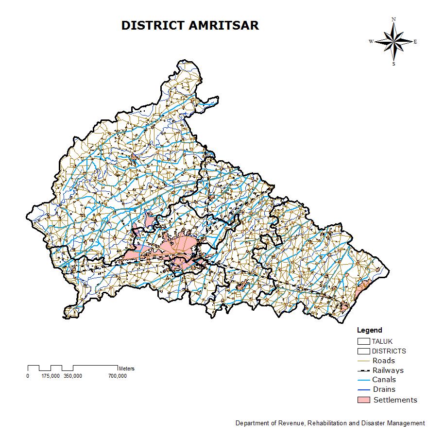
225 225
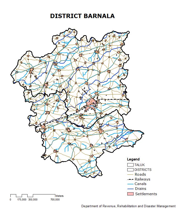
226 226
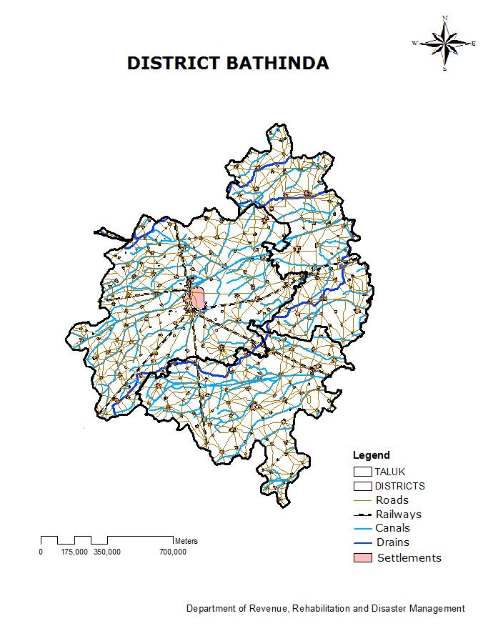
227 227
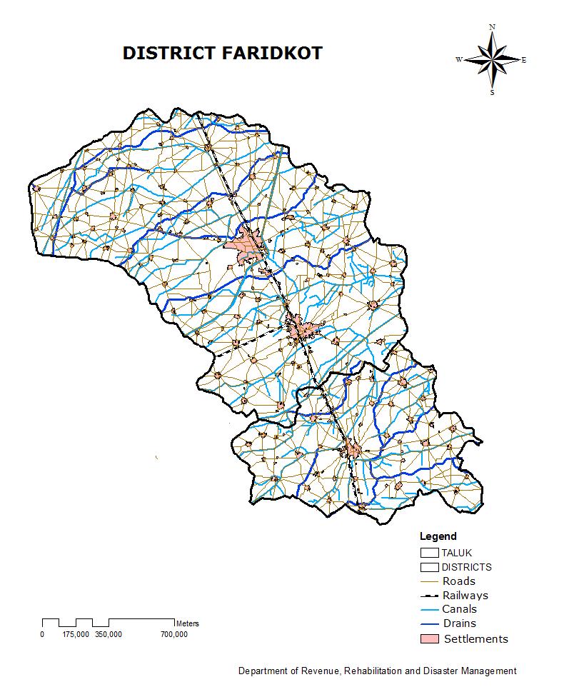
228 228
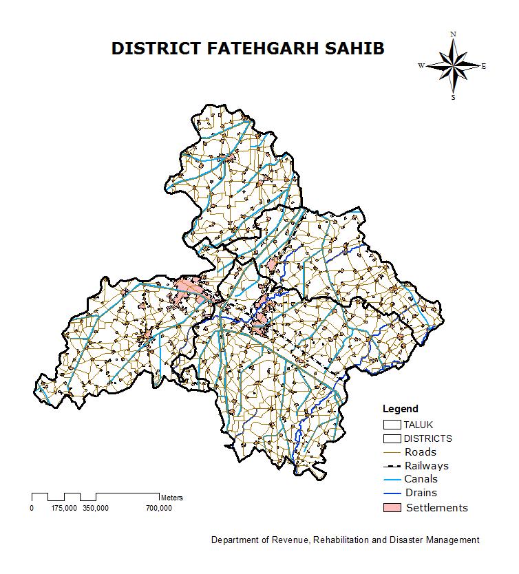
229 229
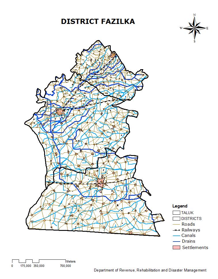
230 230
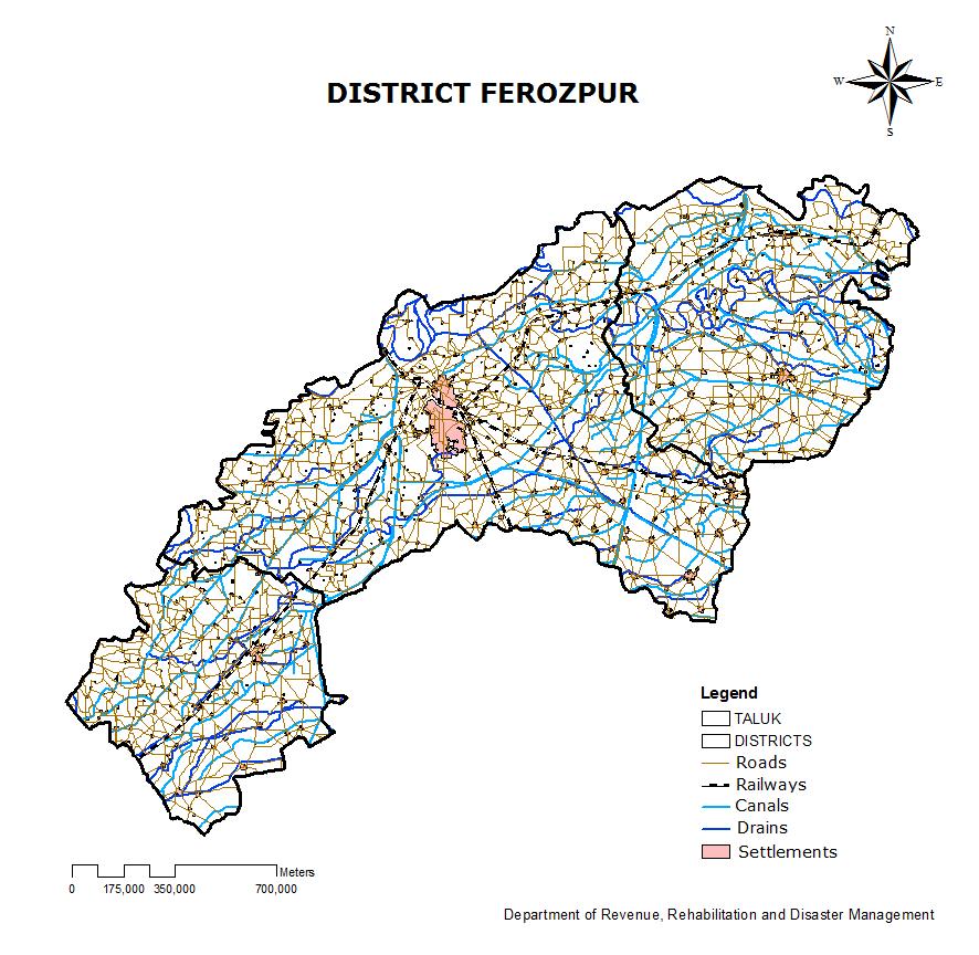
231 231
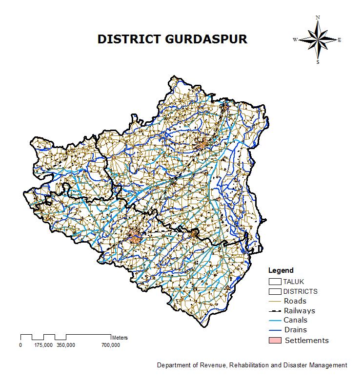
232 232
233 233
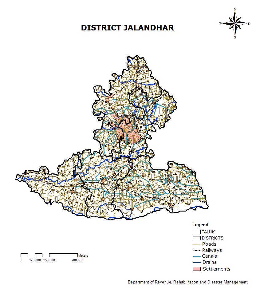
234 234
235 235
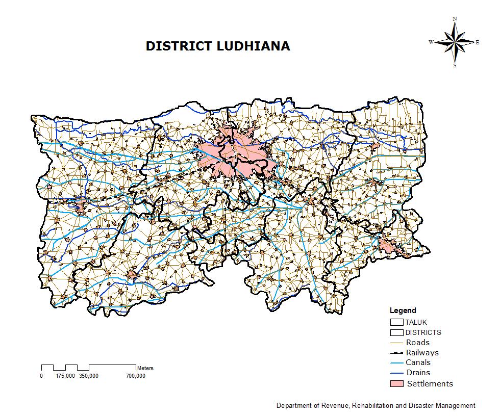
236 236
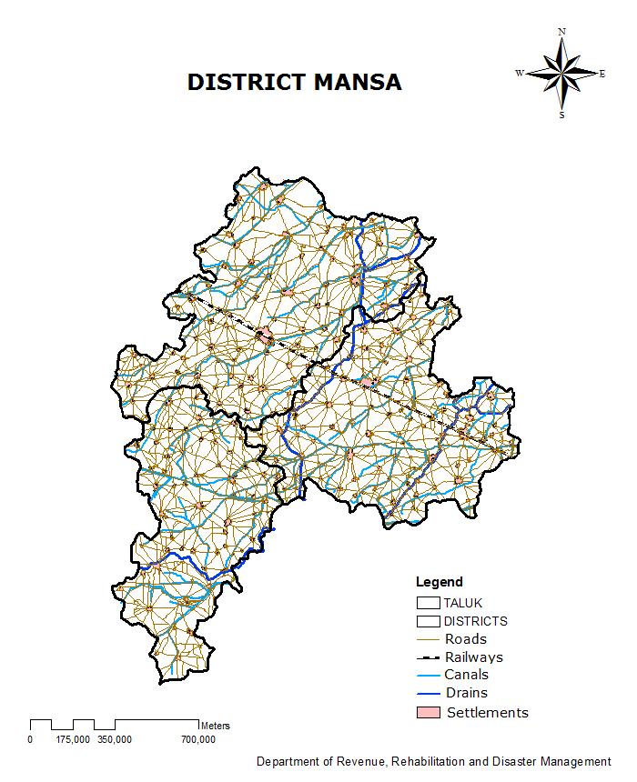
237 237
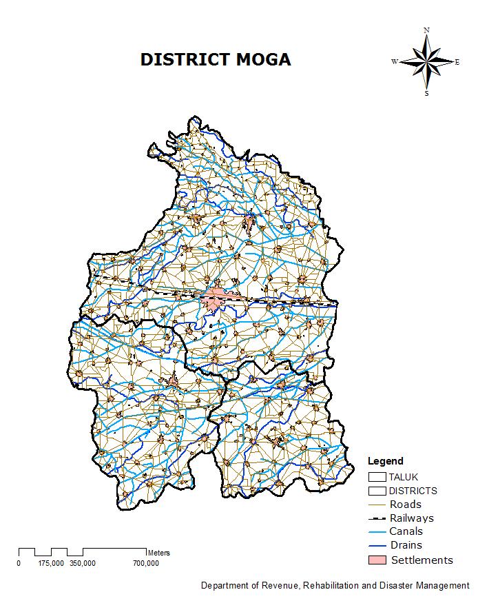
238 238
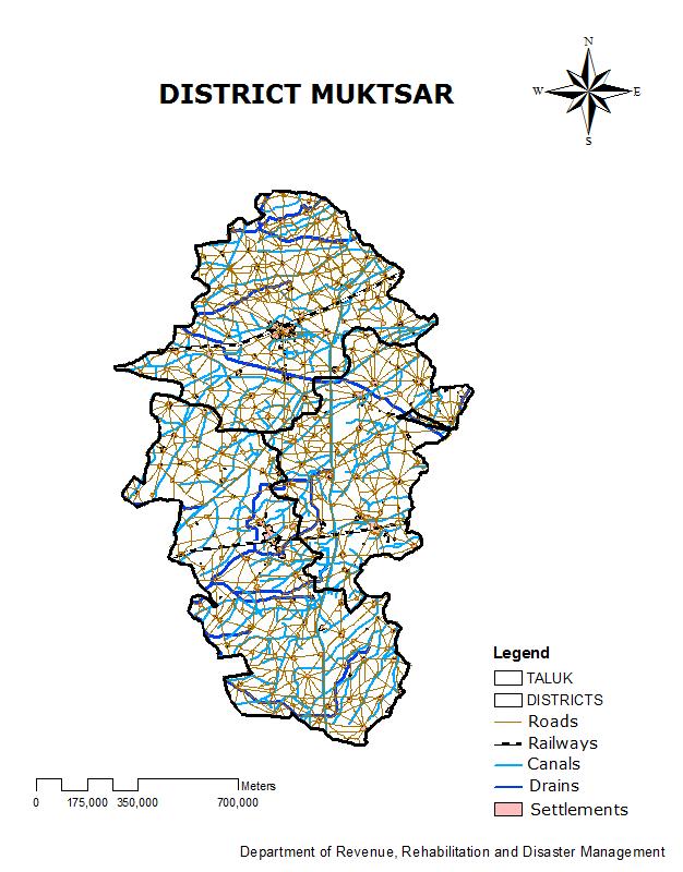
239 239
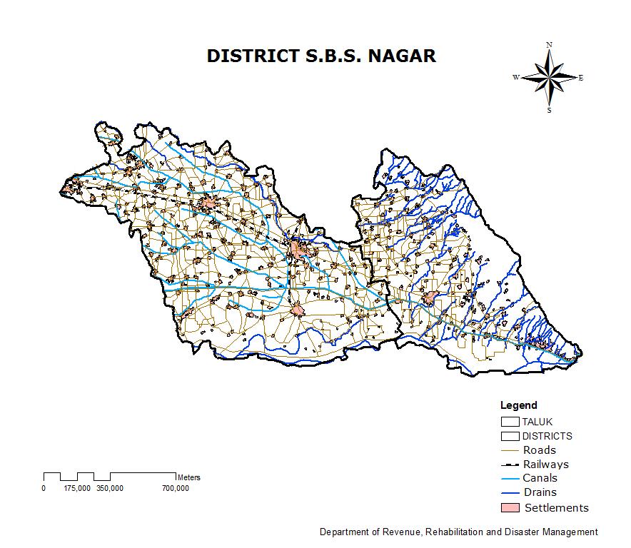
240 240
241 241
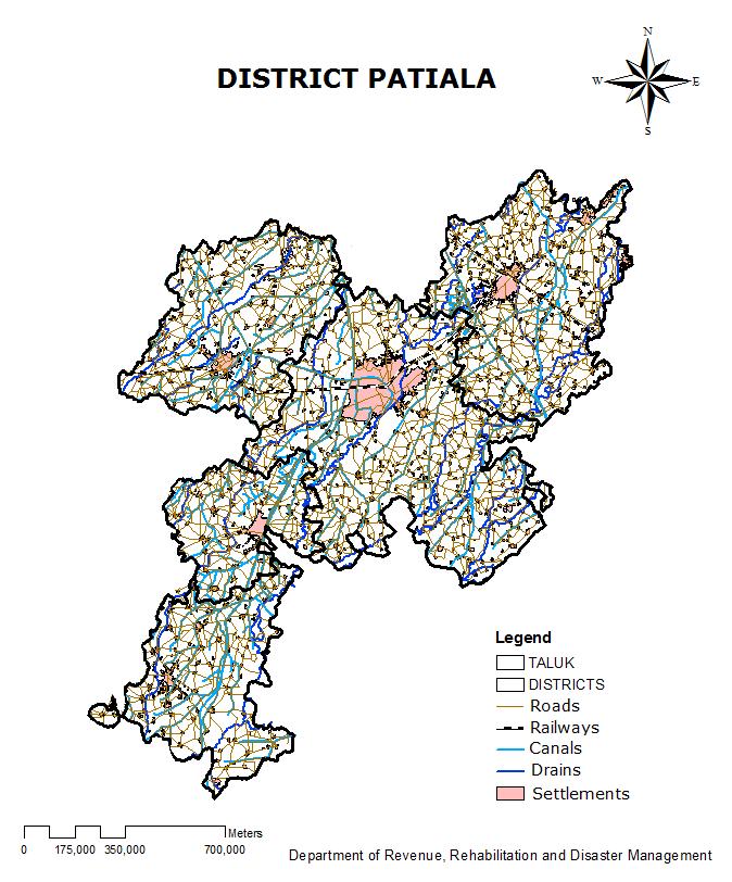
242 242
243 243
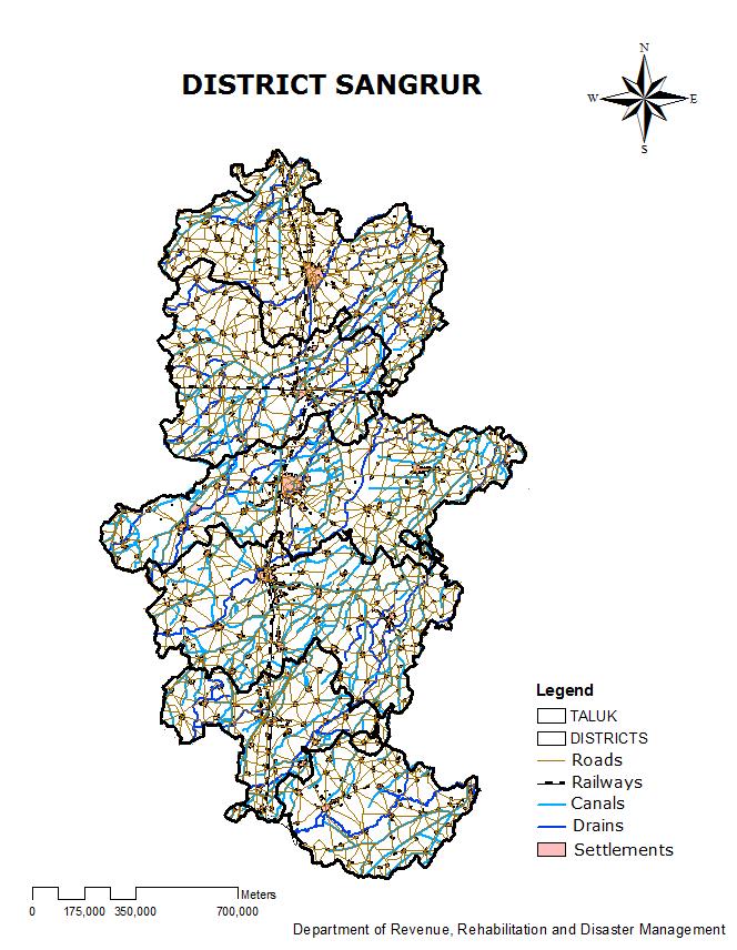
244 244
245 245
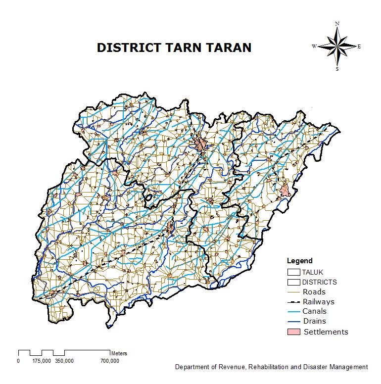
246 246
CHAPTER 4 LAND USE PATTERNS AND CHANGES THEREIN. Land use means utilization of land in a particular area. Land use
 CHAPTER 4 LAND USE PATTERNS AND CHANGES THEREIN Land use means utilization of land in a particular area. Land use pattern includes types of land and how much land is being utilized under different uses.
International Workshop On. Connecting Emergency Preparedness and Response With Sustainable Development Through Reinforced Operational Capacities
 International Workshop On Climate Change, Environmental Degradation and Migration Connecting Emergency Preparedness and Response With Sustainable Development Through Reinforced Operational Capacities By:
MANAGING AND REDUCING SOCIAL VULNERABILITY IN THE CONTEXT OF FLOOD RISKS IN MUMBAI
 MANAGING AND REDUCING SOCIAL VULNERABILITY IN THE CONTEXT OF FLOOD RISKS IN MUMBAI S. S. Shinde Jt. Municipal Commissioner Municipal Corporation of Greater Mumbai HAZARDS THAT HAVE IMPACTED OR CAN POTENTIALLY
In the name of Allah - The most Beneficent & Merciful
 In the name of Allah - The most Beneficent & Merciful GOVERNMENT OF PAKISTAN INDUS RIVER SYSTEM AUTHORITY PRESENTATION ON WATER RELATED DISASTER AND ITS MANAGEMENT IN PAKISTAN AN ASSESMENT OF WATER RELATED
Issues Options and Strategies for Flood Management : Shifts in approaches for flood Management in Bangladesh
 Issues Options and Strategies for Flood Management : Shifts in approaches for flood Management in Bangladesh Ainun Nishat and Raquibul Amin Bangladesh Country Office Flooding: disaster or fact of life?
Sri Lanka Country Presentation
 Regional Capacity Development Workshop: Mainstreaming DRR in Sustainable Development Planning 13-16 September 2016 New Delhi, India Sri Lanka Country Presentation S S Miyanawala Secretary Ministry of Disaster
FIJI NATIONAL DISASTER MANAGEMENT OFFICE CSO DRM NADI WORKSHOP 13 TH NOVEMBER,2013
 FIJI NATIONAL DISASTER MANAGEMENT OFFICE CSO DRM NADI WORKSHOP 13 TH NOVEMBER,2013 FIJI Once known as the Cannibal Isles, because of its ferocious natives. Fiji comprises of about 322 islands and only
A threat to humans and what they value: life, well-being, material goods, and environment.
 Hazard Risk Analysis Overview and Instructions What is a Hazard? Types of Hazards Why is Understanding Hazards Important? Hazard Risk Assessment Instructions What is a Hazard? A hazard can best be described
Hazard Risk Assessment Overview and Instructions
 Overview and Instructions What is a Hazards Types of Hazards Why is Understanding Hazards Important Hazard Risk Assessment Instructions What is a Hazard? A hazard can best be described as: A threat to
Climate change Adaptation in South Asia
 Climate change Adaptation in South Asia SREEJA NAIR TERI South Asia Climate Change Focal Points and Experts Consultation Meeting, Thimphu, 16-17 November 2011 Global mean temperatures rising faster with
Provincial Disaster Risk Management Planning Guidelines
 Provincial Disaster Risk Management Planning GUIDELINES JULY 2007 Sindh AJK NWFP Balochistan Northern Area Punjab National Disaster Management Authority 1. Introduction The Provincial Disaster Management
Disaster Management in Agriculture
 Disaster Management in Agriculture Disaster Management in Agriculture Introduction Human vulnerability to disasters is an age-old phenomenon. Disasters play havoc with people s lives. Their aftermath results
To The Relief Commissioner/Secretary, Department of Disaster Management, (All States/ UTs)
") To The Relief Commissioner/Secretary, Department of Disaster Management, (All States/ UTs) Relief Commissioners Conference 26 th May, 2011 F.No.32-4/2011-NDM-I Government of India Ministry of Home Affairs
To The Relief Commissioner/Secretary, Department of Disaster Management, (All States/ UTs) Relief Commissioners Conference 26 th May, 2011 F.No.32-4/2011-NDM-I Government of India Ministry of Home Affairs
CHAPTER 6 DELIMITATION OF CROP DIVERSIFICATION REGIONS AND CHANGES THEREIN. Concept of crop diversification means competition among various
 CHAPTER 6 DELIMITATION OF CROP DIVERSIFICATION REGIONS AND CHANGES THEREIN Concept of crop diversification means competition among various grown crops for space in a given region. It also means raising
Sourav Chakrabortty, CSO, India
 Sourav Chakrabortty, CSO, India 1 Intergovernmental Panel for Climate Change (IPCC) defines climate change as a statistically significant variation in either the mean state of the climate or in its variability,
Geospatial Situational Analysis of Flood in Asam and Challenges
 Geospatial Situational Analysis of Flood in Asam and Challenges Dr.Mukta Girdhar, Assistant Professor, GGSIP University New Delhi Word Limit of the Paper should not be more than 3000 Words = 7/8 Pages)
Initiative for Disaster Reduction through ODA
 Initiative for Disaster Reduction through ODA January 18, 2005 Government of Japan Ⅰ Japan s basic position on disaster reduction The disaster caused by the major earthquake off the coast of Sumatra and
Chapter 13 of Agenda 21
 Chapter 13 of Agenda 21 What is Agenda 21? Agenda 21 is the global plan of action that was adopted at the United Nations Conference on Environment and Development (UNCED) held in Rio de Janeiro, Brazil,
National Dairy Development Board. Dairying In. Punjab. A Statistical Profile 2014
 Dairying In National Dairy Development Board Punjab A Statistical Profile 2014 PUNJAB Formation of districts: Census 1991 to 2011 Foreword In this compilation of the statistical profile of the dairy sector
Roadmap toward Effective Flood Hazard Map in Lampang Thailand. JICA region-focused training course on flood hazard mapping JFY 2005
 Roadmap toward Effective Flood Hazard Map in Lampang Thailand JICA region-focused training course on flood hazard mapping JFY 2005 Prepared by MR. SOMCHIT AMNATSAN Chief of Water Planning and Solution
DISASTER RISK REDUCTION
 DISASTER RISK REDUCTION CONCEPTS AND MEASURES Session 3 Training Module on Climate Change considerations in the coastal zone and Disaster Risk Reduction MFF Regional Training Course Semarang, Indonesia
Gross Addition to Working Age Population-Supply (Lakhs) Gross Addition to Labour Force Supply (Lakhs)
 Gross Addition to Labour Force Supply (Lakhs)") 1. Executive Summary National Skill Development Corporation (NSDC) had mandated KPMG Advisory Services Pvt Ltd to undertake a District-level Skill Gap Study of the state of Punjab, involving various Departments
1. Executive Summary National Skill Development Corporation (NSDC) had mandated KPMG Advisory Services Pvt Ltd to undertake a District-level Skill Gap Study of the state of Punjab, involving various Departments
Pilot Application of East Asia s Climate Resilient Cities Primer in Selected MENA Cities
 Pilot Application of East Asia s Climate Resilient Cities Primer in Selected MENA Cities WB and UNISDR joint exercise Presented by Asmita Tiwari Disaster Risk Management Specialist World Bank Outline:
Development of Irrigation and Its Impact on Agriculture in Punjab: to
 IOSR Journal of Agriculture and Veterinary Science (IOSR-JAVS) e-issn: 2319-2380, p-issn: 2319-2372. Volume 10, Issue 6 Ver. II (June. 2017), PP 57-63 www.iosrjournals.org Development of Irrigation and
Syrian Arab Republic. National progress report on the implementation of the Hyogo Framework for Action. Name of focal point : Engineer Erfan Ali
 Syrian Arab Republic National progress report on the implementation of the Hyogo Framework for Action Name of focal point : Engineer Erfan Ali Organization : Ministry of Local Administration and Environment
NATURAL DISASTER INDIA
 NATURAL DISASTER FLOODS OF SEPTEMBER & OCTOBER 2009 INDIA Outline of Damage Outline of Disaster Risk Management implemented Issues faced and lessons learnt in Disaster Risk Management What were successful
1. INTRODUCTION 3. DISATER RISK REDUCTION & RELIEF 4. DISASTER POLICY & MANAGEMENT 5. INSTITUTIONAL & ORGANIZATION 6. FLOOD DISASTER IN BENGAWAN SOLO
 OUTLINE FLOOD RISK MANAGEMENT IN ASIA : INDONESIA EXPERIENCES 1. INTRODUCTION Ir. Hartanto, Dipl.HE & Sudarsono, ATP.CES. Directorate of Operation and Maintenance 2012 JSCE Annual Meeting Nagoya DIRECTORATE
Thematic Track Concept Note: Resilient Pacific Island Countries: Issues and Challenges
 India-Pacific Islands Sustainable Development Conference Furthering the FIPIC Agenda through Sustainability Initiatives May 25 26, 2017 Grand Pacific Hotel, Suva, Fiji Thematic Track Concept Note: Resilient
: ENVIRONMENTAL SCIENCE AND DISASTER MANAGEMENT COURSE CODE : 3001 COURSE CATEGORY : P PERIODS/ WEEK : 3 PERIODS/ SEMESTER : 45 CREDIT : 3
 COURSE TITLE : ENVIRONMENTAL SCIENCE AND DISASTER MANAGEMENT COURSE CODE : 3001 COURSE CATEGORY : P PERIODS/ WEEK : 3 PERIODS/ SEMESTER : 45 CREDIT : 3 TIME SCHEDULE MODULE TOPICS PERIODS 1 Renewable and
DISASTER MANAGEMENT AND DATA NEEDS IN NIGERIA
 DISASTER MANAGEMENT AND DATA NEEDS IN NIGERIA Nigeria is located between 4 N and 14 N of the equator. The western frontiers runs from 3 E and the eastern reaches nearly 15 E of the meridian. It is bounded
REMOTE SENSING AND GIS FOR INTEGRATED LAND MANAGEMENT: CASE OF INDIA
 REMOTE SENSING AND GIS FOR INTEGRATED LAND MANAGEMENT: CASE OF INDIA R.B.Singh and Dilip Kumar Department of Geography Delhi School of Economics University of Delhi Delhi-110007, India E-mail:rbsgeo@hotmail.com
Concept Note of National Platform for Disaster Risk Reduction <<ARNAP>> Foundation in the Republic of Armenia
 Concept Note of National Platform for Disaster Risk Reduction Foundation in the Republic of Armenia 1. The need for establishment of DRR system and DRR National Platform Armenia is at high risk
Disaster Reduction Programme in Myanmar
 Disaster Reduction Programme in Myanmar Dr. Toe Toe Win Associate Professor Civil Engineering Department Yangon Technological University Yangon Union of Myanmar Myanmar Overview The Union of Myanmar is
Turks and Caicos Islands
 Turks and Caicos Islands National progress report on the implementation of the Hyogo Framework for Action (2009-2011) - interim Name of focal point : Jamell Robinson Organization : Department of Disaster
Title Action Plan toward Effective Flood Hazard Mapping in My Country
 Title Action Plan toward Effective Flood Hazard Mapping in My Country JICA region focused training course on flood hazard mapping Sep 2006 LAI TUAN ANH Division of Geodesy Department of Planning and Management
Natural Hazard Preparedness and Mitigation in India
 Missouri University of Science and Technology Scholars' Mine Forum for Promotion of Soil Dynamics in India 2013 - First Meeting Dec 21st Natural Hazard Preparedness and Mitigation in India T. N. Gupta
Soil and Water Conservation/ Watershed Management
 Vandna B.Tech., 6 th Semester Department of Civil Engineering JNGEC Sundernagar, Mandi (H.P.) 175018 ABSTRACT The watershed is a geographical area through which water flows in the form of streams, rivers,
Turks and Caicos Islands
 Turks and Caicos Islands National progress report on the implementation of the Hyogo Framework for Action (2009-2011) Name of focal point : Jamell Robinson Organization : Department of Disaster Management
Byblos, Lebanon. Local progress report on the implementation of the Hyogo Framework for Action (First Cycle)
") Byblos, Lebanon Local progress report on the implementation of the Hyogo Framework for Action (First Cycle) Name of focal point: Organization: Title/Position: Tony Sfeir Byblos Municipality Municipal member
Byblos, Lebanon Local progress report on the implementation of the Hyogo Framework for Action (First Cycle) Name of focal point: Organization: Title/Position: Tony Sfeir Byblos Municipality Municipal member
Climate Change Risk Assessment: Concept & approaches
 Climate Change Risk Assessment: Concept & approaches Suppakorn Chinvanno Southeast Asia START Regional Center Topics Introduction to Climate and change Common misconception in climate change risk assessment
ISASTER RISK REDUCTION EFFORTS IN ZIMBABWE
 D ISASTER RISK REDUCTION EFFORTS IN ZIMBABWE GOVERNANCE - POLITICAL COMMITMENT AND INSTITUTIONAL ASPECTS In Zimbabwe, political will is amply demonstrated by the existence of the legal enabling statute,
Climate Change Challenges faced by Agriculture in Punjab
 Climate Change Challenges faced by Agriculture in Punjab Dr. M. Mohsin Iqbal and Dr. Arshad M. Khan Global Change Impact Studies Centre (GCISC), Islamabad Seminar on Impacts of Climate Change on Agriculture
In The Name Of God. Present By : Iranmanesh Majid
 In The Name Of God Regional Workshop On Geo-referenced Disaster Risk Management System for south and south-west Asia and Central Asia 10-12 July 2012 Kathmandu -Nepal Present By : Iranmanesh Majid Director
Climate Change Country Profile: Viet Nam
 Climate Change Country Profile: Viet Nam 1. Country description 1.1 Geography Located in South-East Asia Borders China, Lao People s Democratic Republic, Cambodia and East Sea Coastline: 3260 km Total
Participatory risk assessment and monitoring
 Integrated Local Risk Management Participatory risk assessment and monitoring (Draft 19.06.09) Guidelines for baseline assessment and monitoring 1 Strengths and limits of ILRM and its participatory risk
SOIL & WATER CONSERVATION DEPARTMENT, GOVERNMENT OF JAMMU & KASHMIR
 SOIL & WATER CONSERVATION DEPARTMENT, GOVERNMENT OF JAMMU & KASHMIR SOIL & WATER CONSERVTION COMPLEX (bhumi wa jal sanrakhsha bhawan) Haft Chinar, Srinagar-190008 Camp Bikram Chowk Jammu- 180002 Phone:
Earthquakes, River Floods, Landslides, landslides dam burst, Coastal Erosions, Tsunami
 PAPUA NEW GUINEA I. Natural hazards in PAPUA NEW GUINEA 1.1 Natural hazards likely to affect the country Earthquakes, River Floods, Landslides, landslides dam burst, Coastal Erosions, Tsunami 1.2 Recent
REMOTE SENSING AND GIS APPLICATIONS IN FLOOD MANAGEMENT
 REMOTE SENSING AND GIS APPLICATIONS IN FLOOD MANAGEMENT R.K.Khanna C.K.Agrawal Pravin Kumar Chief Engineer Director Deputy Director Central Water Commission New Delhi 1.0 INTRODUCTION Floods are among
The State of the World s Land and Water Resources for Food and Agriculture. FAO Regional Office for Asia and the Pacific
 The State of the World s Land and Water Resources for Food and Agriculture FAO Regional Office for Asia and the Pacific Resources availability land and water availability in high income countries land
CCA-DRR integration Mainstreaming into Developmental Plans: Sub-national Initiatives
 CCA-DRR integration Mainstreaming into Developmental Plans: Sub-national Initiatives Dr. Anil Gupta Head, Division of Policy Planning, Head Training & Capacity Development, National Institute of Disaster
SECTOR ASSESSMENT (SUMMARY): AGRICULTURE, NATURAL RESOURCES, and RUDAL DEVELOPMENT. 1. Sector Performance, Problems, and Opportunities
: AGRICULTURE, NATURAL RESOURCES, and RUDAL DEVELOPMENT. 1. Sector Performance, Problems, and Opportunities") Pehur High Level Canal Extension Project (RRP PAK 47024) SECTOR ASSESSMENT (SUMMARY): AGRICULTURE, NATURAL RESOURCES, and RUDAL DEVELOPMENT Sector Road Map 1. Sector Performance, Problems, and Opportunities
Pehur High Level Canal Extension Project (RRP PAK 47024) SECTOR ASSESSMENT (SUMMARY): AGRICULTURE, NATURAL RESOURCES, and RUDAL DEVELOPMENT Sector Road Map 1. Sector Performance, Problems, and Opportunities
Agricultural Planning through Prediction of Rainfall Characteristics for Bilaspur Region of Chhattisgarh Plain in India
 6 Agricultural Planning through Prediction of Rainfall Characteristics for Bilaspur Region of Chhattisgarh Plain in India B. L. Sinha, Assistant Professor (Soil and Water Engineering), BRSM College of
Bau-Bau, Indonesia. Local progress report on the implementation of the Hyogo Framework for Action ( )
") Bau-Bau, Indonesia Local progress report on the implementation of the Hyogo Framework for Action (2013-2014) Name of focal point: Yusniar Nurdin Organization: BNPB Title/Position: Technical Support Consultant
Bau-Bau, Indonesia Local progress report on the implementation of the Hyogo Framework for Action (2013-2014) Name of focal point: Yusniar Nurdin Organization: BNPB Title/Position: Technical Support Consultant
All Hazards (EOP) Emergency Operations Plan (Basic)
 Emergency Operations Plan (Basic)") Chatham County, NC All Hazards (EOP) Emergency Operations Plan (Basic) Janet Scott Director, Emergency Operations Last Revised: January, 2016 Page 1 I. FOREWORD The Chatham County Emergency Operations
Chatham County, NC All Hazards (EOP) Emergency Operations Plan (Basic) Janet Scott Director, Emergency Operations Last Revised: January, 2016 Page 1 I. FOREWORD The Chatham County Emergency Operations
Information on national contact and provider of info:
 Information on national contact and provider of info: Name: B.O. Swai Position: Director Organization, Disaster Management Department Address: Prime Minister s Office, P.O. Box 3021 DAR ES SALAAM Country
N. VINOD CHANDRA MENON Founder Member National Disaster Management Authority (NDMA) Government of India
 Government of India") N. VINOD CHANDRA MENON Founder Member National Disaster Management Authority (NDMA) Government of India Earthquake Urban Flooding Cyclone in Coastal Cities Tsunami in Coastal Cities Epidemics: Dengue,
N. VINOD CHANDRA MENON Founder Member National Disaster Management Authority (NDMA) Government of India Earthquake Urban Flooding Cyclone in Coastal Cities Tsunami in Coastal Cities Epidemics: Dengue,
ITC initiated a community-led water conservation initiative in Munger district of Bihar, titled- Water
 Request for Proposal on Assessment of Impact of Ahar Pynes (Traditional Water Harvesting Structures) Rehabilitation in Bihar Last date for submission of proposals: 15 th February, 2019 I. Introduction
Understanding Drought: A Case Study of India
 Understanding Drought: A Case Study of India SVRK Prabhakar Climate Policy Researcher, Climate Policy Project Institute for Global Environmental Strategies, Hayama, Japan prabhakar@iges.or.jp, sivapuram.prabhakar@gmail.com
Madhya Pradesh State Water Policy, 2003
 Madhya Pradesh State Water Policy, 2003 This document is available at ielrc.org/content/e0307.pdf For further information, visit www.ielrc.org Note: This document is put online by the International Environmental
Basic Emergency Response Plan
 City of Greater Sudbury Basic Emergency Response Plan For Public Release November 7, 2006 Table of Contents 1.0 Introduction... 1 2.0 Purpose... 2 3.0 Scope... 2 4.0 Legal Authorities... 3 4.1 Provincial
7. NATURAL HAZARDS 7.1 SECTION INTRODUCTION
 7. NATURAL HAZARDS 7.1 SECTION INTRODUCTION 7.1.1 The Resource Management Act empowers Council to control any actual or potential effects of the use, development, or protection of land for the purpose
Your Excellency Yingluck Shinawatra, Prime Minister of the Kingdom of Thailand. Excellencies, Heads of Delegations, Ladies and Gentlemen,
 Statement by H.E. Mr. Susil Premajayantha Minister of Environment and Renewable Energy of the Democratic Socialist Republic of Sri Lanka delivering on the occasion of the 2 nd Asia-Pacific Water Summit
Nearly one-quarter of the population lives on less than USD 1 per day
 Nearly one-quarter of the population lives on less than USD 1 per day 32 Nepal Background Nepal suffers from chronic food insecurity, severe and recurrent natural disasters, poor health and sanitation
Indigenous and Northern Affairs Canada (INAC) National On-reserve Emergency Management Plan
 National On-reserve Emergency Management Plan") Indigenous and Northern Affairs Canada (INAC) National On-reserve Emergency Management Plan Contents INAC SECTION 1: INTRODUCTION... 3 1.1 Authorities and Legislation... 3 1.2 Whole-of-Government Approach
Indigenous and Northern Affairs Canada (INAC) National On-reserve Emergency Management Plan Contents INAC SECTION 1: INTRODUCTION... 3 1.1 Authorities and Legislation... 3 1.2 Whole-of-Government Approach
SHIFTING PARADAIGM OF JAPANESE ASSISTANCE IN DISASTER RISK MANAGEMENT IN THE PHILIPPINES
 SHIFTING PARADAIGM OF JAPANESE ASSISTANCE IN DISASTER RISK MANAGEMENT IN THE PHILIPPINES Mikio Ishiwatari Japan International Cooperation Agency 5-25 Niban-cho, Chiyoda-ku, Tokyo 102-8012 Japan ishiwatarimikio@yahoo.co.jp
Urban resilience planning approaches: Gorakhpur and Guwahati cities
 Urban resilience planning approaches: Gorakhpur and Guwahati cities Pune 19 th May, 2015 Raina Singh Associate Fellow, Sustainable Habitat Division, TERI Urban resilience planning - Why and How? Urbanization
Mournag, Tunisia. Local progress report on the implementation of the Hyogo Framework for Action ( )
") Mournag, Tunisia Local progress report on the implementation of the Hyogo Framework for Action (2013-2014) Name of focal point: Kamal Alelwy Organization: La ville de Mournag Title/Position: Secretary
Mournag, Tunisia Local progress report on the implementation of the Hyogo Framework for Action (2013-2014) Name of focal point: Kamal Alelwy Organization: La ville de Mournag Title/Position: Secretary
What Are Goals, Objectives and Actions
 The overall purpose of this Plan is to reduce future life and property losses caused by hazard events before they occur by the identification of appropriate Actions that are implemented during the five-year
Partha J Das Water Climate and Hazard Programme AARANYAK Guwahati Cell:
 Conflicts over water induced hazards and their management: Perspectives from Assam Training Workshop on Understanding and Resolving Water Conflicts in NE India) Organised by Forum for Policy Dialogue on
VIET NAM LOSSES CAUSED BY TYPICAL DISASTERS FROM 1978 TO 2005 TYPICAL DISASTERS IN VIET NAM ECONOMIC LOSS RECORDED FROM
 VIET NAM Việt Nam is located at the Southeast of Asia, with 333. km 2 of the total natural area and 32km of coastline. Population: 84 million (24 s statistics) Population density: 226 capitas/km2 Urban
Quetta, Pakistan. Local progress report on the implementation of the 10 Essentials for Making Cities Resilient (First Cycle)
") Quetta, Pakistan Local progress report on the implementation of the 10 Essentials for Making Cities Resilient (First Cycle) Name of focal point: Habib Mughal Organization: UN-HABITAT - Pakistan Title/Position:
Quetta, Pakistan Local progress report on the implementation of the 10 Essentials for Making Cities Resilient (First Cycle) Name of focal point: Habib Mughal Organization: UN-HABITAT - Pakistan Title/Position:
Lao People Democratic Republic
 Lao People Democratic Republic Disaster Management in Lao PDR Introduction Country Profile Natural and Man-made Disaster in Lao PDR Disaster and the Impacts Disaster Management in Lao PDR 1 LAOS AND ITS
DISASTER MANAGEMENT SET UP IN INDIA
 DISASTER MANAGEMENT SET UP IN INDIA WHAT IS DISASTER? As per clause 2 (d) of the Indian Disaster Management Act, 2005 defines disaster as a catastrophe, mishap, calamity or grave occurrence affecting any
STUDIES ON ASSESSMENT OF VULNERABILITY TO DROUGHT
 STUDIES ON ASSESSMENT OF VULNERABILITY TO DROUGHT By Dr Rakesh Kumar Scientist F & Head Surface water Hydrology Division NATIONAL INSTITUTE OF HYDROLOGY, ROORKEE-247667, INDIA HYDROLOGIC EXTREMES: Two
Good Practices in Addressing Climate Change Adaptation Deficits due to Extreme Climate Events Perspectives from Asia. Ramasamy Selvaraju
 Good Practices in Addressing Climate Change Adaptation Deficits due to Extreme Climate Events Perspectives from Asia Ramasamy Selvaraju Hazard and Vulnerability Asian region accounts for 40% of the total
LEAD Pakistan. Managing Reduction in Water Flows in the Indus River System The Emerging role of IRSA. Managing Shared Basins: October 19 th, 2017
 LEAD Pakistan Managing Shared Basins: Managing Reduction in Water Flows in the Indus River System The Emerging role of IRSA October 19 th, 2017 Speaker Profile Engr. Shafqat Masood Water Resources Expert
(1) Bridge, Road and Railway (Adaptation Project) (2) Bridge, Road and Railway (BAU Development with Adaptation Options)
 Bridge, Road and Railway (Adaptation Project) (2) Bridge, Road and Railway (BAU Development with Adaptation Options)") Sub-sector Guideline: (1) Bridge, Road and Railway (Adaptation Project) (2) Bridge, Road and Railway (BAU Development with Adaptation Options) Basic Concept A. General Concept Climate change will increase
Sub-sector Guideline: (1) Bridge, Road and Railway (Adaptation Project) (2) Bridge, Road and Railway (BAU Development with Adaptation Options) Basic Concept A. General Concept Climate change will increase
ACTION PLAN TOWARD EFFECTIVE FLOOD HAZARD MAPPING IN CAMBODIA
 CONCLUDING REPORT On ACTION PLAN TOWARD EFFECTIVE FLOOD HAZARD MAPPING IN CAMBODIA Prepared by: HORN SOVANNA Chief Office of Hydrology Works Department of Hydrology and River Works (DHRW) Ministry of Water
3. Present Situation of Environmental Problems
 3. Present Situation of Environmental Problems 3.1 Natural Environment The goals, issues and programmes regarding the natural environment of the Ten Year Perspective Development Plan 2001-2011 are shown
Greening Rural Development in India
 Greening Rural Development in India UNDP s report shows that greening the Government s rural development schemes will have positive economic impact because greening will: contribute to inclusive local
Forest Resources. Unit III Population & Natural Resources
 Forest Resources Unit III Population & Natural Resources Topics Forest resources Forest resources-indian Scenario Functions of forests Importance of forests Ecological and Economical Importance Types of
Disasters/ Natural Hazards and Protected Area Management Challenges and Opportunities in Nepal
 Asia Park Congress Workshop 1: Natural Disasters and Protected Areas Sendai, Japan 14-17 November 2013 Disasters/ Natural Hazards and Protected Area Management Challenges and Opportunities in Nepal Yam
Department of Economics Environmental Economics Unit School of Economics and Commercial Law. Göteborg University, Box 640
 Department of Economics Environmental Economics Unit School of Economics and Commercial Law Göteborg University * 060315 Policy brief: Climate change and implications for Bangladesh - Input to discussion
Cambridge International Examinations Cambridge Ordinary Level
 Cambridge International Examinations Cambridge Ordinary Level *3133260056* PAKISTAN STUDIES 2059/02 Paper 2 The Environment of Pakistan October/November 2017 1 hour 30 minutes Candidates answer on the
Evidence of global warming
 INTRODUCTION Climate Change can be attributed directly or indirectly to human activities (e.g. through burning fossil fuels, deforestation, reforestation, urbanization, desertification) that alters the
Adaptation Strategy of the Slovak Republic on Adverse Impacts of Climate Change Overview: Executive Summary
 Adaptation Strategy of the Slovak Republic on Adverse Impacts of Climate Change Overview: Executive Summary Ministry of Environment of the Slovak Republic December 2016 Climate change has caused a wide
DEPARTMENT OF SOCIAL FORESTRY REVISED ANNUAL PLAN & DRAFT ANNUAL PLAN
 1 DEPARTMENT OF SOCIAL FORESTRY REVISED ANNUAL PLAN 2011-12 & DRAFT ANNUAL PLAN 2012-13 Forest wealth has always played a pivotal role in the economy of every country. The State of Jammu & Kashmir is situated
People Perception about Climate Change and
 People Perception about Climate Change and Adaptation in the Arid Region of Pakistan Saif Ullah Khan Prof. Dr. Mahmood-Ul Ul-Hasan Prof. Dr. Muhammad Aslam Khan Institute of Geography, Urban & Regional
8 MANAGING THE EFFECTS OF NATURAL HAZARDS
 8 MANAGING THE EFFECTS OF NATURAL HAZARDS 8.1 RESOURCE MANAGEMENT ACT OBLIGATIONS 8.1.1 A natural hazard is defined under Section 2 as being Any atmospheric or earth or water related occurrence (including
The approach to managing natural hazards in this Plan is to: set out a clear regional framework for natural hazard management,
 9 Natural Hazards 9.1 Scope and Background This chapter establishes an overall framework for natural hazard management under the RMA. It also sets out the division of responsibilities between the Regional
Kane County Natural Hazards Mitigation Committee
 Kane County Natural Hazards Mitigation Committee Annual Report For 2004 TO: Members of the Kane County Board FROM: Kane County Natural Hazards Mitigation Committee SUBJECT: Annual Report for 2004 Date:
Progress in implementation of Hyogo Framework For Action. India
 Progress in implementation of Hyogo Framework For Action India Suchitra Goswami Deputy Secretary Ministry Of Home Affairs Government of India New Delhi 13 th November,2008. Hyogo Framework of Action 2005-2015
CLIMATE CHANGE ASSESSMENT (SUMMARY)
") Chongqing Longxi River Basin Integrated Flood and Environmental Risk Management Project (RRP PRC 51005) CLIMATE CHANGE ASSESSMENT (SUMMARY) I. Basic Project Information Project Title: Chongqing Longxi
Chongqing Longxi River Basin Integrated Flood and Environmental Risk Management Project (RRP PRC 51005) CLIMATE CHANGE ASSESSMENT (SUMMARY) I. Basic Project Information Project Title: Chongqing Longxi
WATER RESOURCES SHORT ANSWER TYPE QUESTIONS [3 MARKS]
![WATER RESOURCES SHORT ANSWER TYPE QUESTIONS [3 MARKS]](/thumbs/81/83970391.jpg "WATER RESOURCES SHORT ANSWER TYPE QUESTIONS [3 MARKS]") WATER RESOURCES SHT ANSWER TYPE QUESTIONS [3 MARKS] 1. Which multipurpose project is built on River Satluj How this project has led to the development of the country? The multipurpose project built over
WATER RESOURCES SHT ANSWER TYPE QUESTIONS [3 MARKS] 1. Which multipurpose project is built on River Satluj How this project has led to the development of the country? The multipurpose project built over
Preparing for Severe Weather Events
 Preparing for Severe Weather Events Presented to the Building Municipal Resilience in Central Ontario Conference May 21, 2015 Barney Owens, Director, Response Section Office of the Fire Marshal and Emergency
Pilot Scheme to Improve the Resilience of Rural Communities to Climate Change in Yemen (IRRCCC) Concept Note
 Concept Note") Republic of Yemen Pilot Scheme to Improve the Resilience of Rural Communities to Climate Change in Yemen (IRRCCC) Concept Note Pilot Program for Climate Resilience - Yemen - Strategic Program for Climate
Republic of Yemen Pilot Scheme to Improve the Resilience of Rural Communities to Climate Change in Yemen (IRRCCC) Concept Note Pilot Program for Climate Resilience - Yemen - Strategic Program for Climate
Vaglio di Basilicata, Italy
 Vaglio di Basilicata, Italy Local progress report on the implementation of the Hyogo Framework for Action (2013-2014) Mayor: Giancarlo Tamburrino Name of focal point: Giancarlo Tamburrino Organization:
Climate Change, Climate variability and Water Management
 Climate Change, Climate variability and Water Management Ainun Nishat Ph.D. Country Representative, Bangladesh IUCN, the International Union for Conservation of Nature From Water and Climate Change: IPCC
AIACC Regional Study AS07: Southeast Asia Regional Vulnerability to Changing Water Resource and Extreme Hydrological Events due to Climate Change
 AIACC Regional Study AS07: Southeast Asia Regional Vulnerability to Changing Water Resource and Extreme Hydrological Events due to Climate Change Progress report: period mid-year 2003 Brief Summary: In
Cause damage to - Negatively affect - Affect all the primary resources e.g. -
 Affect all the primary resources e.g. - Land Water Biomass Air As a consequence of such Natural Hazard, all developmental processes get impeded Cause damage to - Agriculture / Fisheries, etc. Population