INTEGRATION OF THE LOCAL MITIGATION STRATEGY INTO THE LOCAL COMPREHENSIVE PLAN. ExecutiveSumary
|
|
|
- Corey Harvey
- 6 years ago
- Views:
Transcription
1
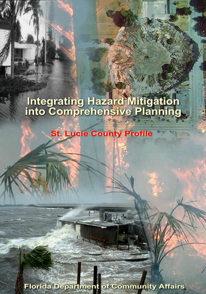
2 ExecutiveSumary The experiences of the 2004 and 2005 hurricane seasons epitomize the importance of better integrating hazard mitigation activities into local comprehensive planning. In the fall of 2004, residents all over the state experienced significant damages from Hurricanes Charley, Frances, Jeanne, and Ivan as a result of winds, tornadoes, surge, and/or flooding. But this was not the only time we have experienced natural disasters, nor will it be the last. In 1992, Hurricane Andrew devastated South Florida. In 1998 and 1999, most counties in Florida experienced wildfires. In some cases, despite firefighters' best efforts, fires advanced through neighborhoods and homes were lost. Every year in Central Florida, new sinkholes emerge, swallowing homes and damaging infrastructure. The cost of recovery for these various disasters ranges from hundreds of thousands to billions of dollars, significantly taxing local, State, and federal financial sources. Losses covered through federal funding as a result of the 2004 hurricanes alone could reach as high as $7 billion. Worst of all, however, are the many lives that, directly or indirectly, are lost due to natural disasters. It is imperative that we reduce the human and financial costs of natural disasters. Through better integration of natural hazard considerations into local comprehensive planning, we can build safer communities. This St. Lucie County Profile has been prepared as part of a statewide effort by the Florida Department of Community Affairs to guide local governments in integrating hazard mitigation principles into local Comprehensive Plans. Information provided in this profile will enable planners to (1) convey St. Lucie County s existing and potential risk to identified hazards; (2) assess how well local hazard mitigation principles have been incorporated into the County s Comprehensive Plan; (3) provide recommendations on how hazard mitigation can be better integrated into the Comprehensive Plan; and (4) determine if any enhancements could be made to the Local Mitigation Strategy (LMS) to better support comprehensive planning. Best available statewide level data are provided to convey exposure and risk as well as illustrate the vulnerability assessment component of the integration process. In this profile, we present an argument for why hazard mitigation needs to be a part of comprehensive planning through an examination of population growth, the hazards that put the County at risk, the special needs population and structures that could be affected by these hazards, and the distribution of existing and future land uses in different hazard areas. We hope that this analysis will serve as an example of the issues each jurisdiction should consider as they update their plans to include hazard mitigation. The profile also contains a review of the LMS and the Comprehensive Plan. Based on the analysis and review, we were able to develop specific options for the County on how to incorporate more hazard mitigation into the Comprehensive Plan and how to enhance the LMS so that it is also a better tool for local planners. During our review, we found that St. Lucie County had many strengths regarding hazard mitigation in both its LMS and Comprehensive Plan, and these are outlined in the profile. There are always ways to further strengthen such plans, however, and the following is a summary of some of the options that would enable the County to do so. GENERAL RECOMMENDATIONS The Comprehensive Plan can include criteria in the 5-year schedule of Capital Improvement Projects to prioritize projects that are hazard mitigation initiatives in the LMS. The County could include a policy in the Comprehensive Plan that supports the retrofit and/or relocation of public structures at risk from natural hazards, much like Objective 1.3 of the LMS. Draft 6/13/2006 FLORIDA DEPARTMENT OF COMMUNITY AFFAIRS ii
3 The County could create an LMS objective, similar to Policy of the Coastal Management Element, that promotes coordination and cooperation with emergency management officials when making land use decisions, capital improvements, and creating other planning initiatives. Emergency managers could help planners incorporate hazard mitigation into planning programs and governing documents, ultimately which could be implemented prior to development. Such an objective would strengthen the LMS and support Objective 3.1 and 5.2. The County could strengthen Policy of the Coastal Management Element, which states, "The Recovery Task Force shall review all interagency hazard mitigation reports as they are produced and make recommendations for amendments to the comprehensive plan accordingly." The policy can be strengthened by directly stating support for the maintenance of and adherence to the LMS and the CEMP. Coastal Hazards The Comprehensive Plan can include a goal that aims to promote hazard mitigation information to the public and to County personnel. There were no existing Comprehensive Plan goals, objectives, or policies found during this review that support the dissemination of hazard mitigation information about tropical storms or wildfires. However, LMS Objective 1.7 promotes public awareness of hazards and their impacts. Polices could promote the creation of a hazard awareness program that addresses evacuation, sheltering, building techniques to reduce hazards, wildfire safety information, and many other hazard mitigation issues that could help prevent loss of life and property. Also, the County could add a policy that promotes the education of county officials and supports the integration of hazard mitigation "culture" into the every-day jobs of county workers. Adding such a policy framework into the Comprehensive Plan can help keep hazard mitigation at the forefront of County efforts. While there are many strong hazard mitigation policies in the Comprehensive Plan that address intergovernmental issues, support the regional evacuation plan, and require development and redevelopment to address evacuations, the County could reanalyze and possibly amend Policy of the Coastal Management Element. The policy currently reads, "The County shall maintain the worst case 22.5 hour hurricane evacuation time. This could be changed to, "The County shall continue to maintain or improve hurricane evacuations times, with a maximum allowable clearance time of 12 hours." Currently, the County has evacuation times of 9 hours for a Category 3 and higher hurricanes, which is good, and far below the 22.5 hours Policy uses as a benchmark. Setting a maximum evacuation time to maintain is a strong mitigation policy especially as development occurs, but if the clearance time is set too high then it allows for more development to occur before safe evacuation has been provided. Maintaining evacuation times also supports Policy of the Coastal Management Element, which requires structural transportation improvements to maintain sufficient evacuation routes. The Comprehensive Plan currently has strong goals that address emergency shelters. The Comprehensive Plan could include a policy that aims to meet shelter demand in accordance with State Shelter Plan or local projections. Also, the LMS could include a similar objective. Wildfire Hazards Currently, there are no policies that directly address wildfires in the Comprehensive Plan. The LMS states wildfires are of particular concern in the county, especially around Port St. Lucie. As development is likely to occur in St. Lucie County, it may encroach on Draft 6/13/2006 FLORIDA DEPARTMENT OF COMMUNITY AFFAIRS iii
4 wildfire prone lands, as shown on the maps in Attachment C. The County could add policies in the Comprehensive Plan that address this hazard prior to development. For instance, development approval in high-risk wildfire areas could be contingent on the use of firewise design concepts such as defensible buffers and clustering of homes to distance them from neighboring wildfire fuels. Conservation easements can be required to have a wildfire fuel maintenance plan to make sure they don t become overgrown in the future and a hazard to nearby homes. Finally, the County could explore the adoption of a firewise building code for at-risk zones that may reduce wildfire risk to structures. The County could create an educational program that provides information about wildfire mitigation strategies and Firewise Communities to the public. They could also encourage the removal of wildfire fuel sources near structures by designating wildfire cleanup days before the start of the major wildfire season in spring. A special yard waste pickup could be scheduled, yard tools could be loaned, and volunteer groups could assist those who need help. This would also serve as preparation for the upcoming hurricane season. Sinkhole Hazards There are two relatively small areas at risk from sinkholes as shown in the maps in Attachment D. The County can restrict or regulate development through overlay zones or preservation districts in these high-risk, karst- sensitive areas. This is considered a best management practice from Protecting Florida's Communities (FDCA, 2005b). Since In karst-sensitive areas, the County could instead require a geotechnical evaluation be made prior to development approval so that appropriate mitigation techniques can be taken. Draft 6/13/2006 FLORIDA DEPARTMENT OF COMMUNITY AFFAIRS iv
5 TableofContents Executive Summary... ii 1. County Overview Hazard Vulnerability Existing Mitigation Measures Comprehensive Plan Review Recommendations Sources Attachments... Attachment A: Maps of the Existing and Future Land Uses within the Coastal Hazard Zone and the Hurricane Vulnerability Zone... A-1 Attachment B: Maps of the Existing and Future Land Uses within the 100-year Floodplain... B-1 Attachment C: Maps of the Existing and Future Land Uses within Wildfire Susceptible Areas... C-1 Attachment D: Maps of the Existing and Future Land Uses within Potential Sinkhole Hazard Areas... D-1 Attachment E: St. Lucie County Local Mitigation Strategy Goals and Objectives... E-1 Attachment F: St. Lucie County Comprehensive Plan Excerpts Related to Hazard Mitigation... F-1 Draft 6/13/2006 FLORIDA DEPARTMENT OF COMMUNITY AFFAIRS v
. There are three incorporated municipalities within the County, and these are listed in Table 1.")
6 1.CountyOverview Geography and Jurisdictions St. Lucie County is located along the eastern coast of Central Florida. It covers a total of 572 square miles with an average population density of people per square mile (U.S. Census, 2000). There are three incorporated municipalities within the County, and these are listed in Table 1.1. Population and Demographics Official 2004 population estimates for all jurisdictions within St. Lucie County as well as the percent change in population from the 2000 U.S. Census are presented in Table 1.1. The most current estimated countywide population of St. Lucie County is 226,216 people (University of Florida, Bureau of Economic and Business Research, 2004). The most populated city in St. Lucie County is Port St. Lucie and it contains 50.9% of the countywide population. Still, 31.6% of the countywide population lives in the unincorporated portion of the County. Between 1990 and 2000, St. Lucie County as a whole had a growth rate of 28.3%, which was greater than the statewide growth rate of 23.5% in those 10 years. Jurisdiction Table 1.1 Population Estimates by Jurisdiction Population, Census 2000 Population Estimate, 2004 % Change, % of Total Population (2004) UNINCORPORATED 65,806 71, % 31.6% Ft. Pierce 37,516 39, % 17.3% Port St. Lucie 88, , % 50.9% St. Lucie Village % 0.3% Countywide Total 192, , % 100.0% Source: University of Florida, Bureau of Economic and Business Research, According to the University of Florida, Bureau of Economic and Business Research (2004), St. Lucie County s population is projected to grow tremendously for the next 25 years, reaching 339,900 people by the year Figure 1.1 illustrates medium population projections for St. Lucie County based on 2004 calculations. Figure 1.1 Medium Population Projections for St. Lucie County, , , ,000 Population 200, , ,000 50, Year Source: University of Florida, Bureau of Economic and Business Research, Draft 6/13/2006 FLORIDA DEPARTMENT OF COMMUNITY AFFAIRS 1
7 Of particular concern within St. Lucie County s population are those persons with special needs and/or limited resources such as the elderly, disabled, low-income, or language-isolated residents. According to the 2000 U.S. Census, 22.7% of St. Lucie County residents are listed as 65 years old or over, 23.4% are listed as having a disability, 13.4% are listed as below poverty, and 13.8% live in a home with a primary language other than English. 2.HazardVulnerability Hazards Identification The following are natural hazards that pose a risk to the County as identified in the County s Local Mitigation Strategy (LMS): floods, hurricanes/tropical storms, tornados, severe thunderstorms / lightning, drought, temperature extremes, muck fires, wildfires/urban interface fires, and erosion. The LMS prioritized these hazards and included a discussion of the probability of the hazard affecting the County. Hurricanes/ tropical storms and floods were given the highest priority with severe thunderstorms, drought, temperature extremes and erosion given moderate priority. Notably, the LMS does not identify sinkholes as a hazard the County faces. The County experiences flooding on a regular basis from severe thunderstorms and tropical storms. Since 1886, 51 storms of hurricane intensity have passed within 125 miles of St. Lucie County. In 1999, Port St. Lucie was declared a federal disaster due to hurricane Irene, which caused more than $100,000 in flood damages. Fort Pierce is especially prone to flooding due to the low-lying riverfront areas near the Fort Pierce Inlet. Inland areas around St. Lucie River face similar flooding concerns. The county is particularly prone to crop damage. Tropical storm Mitch caused $200,000 in crop damage in the county. In 1999, wildfire destroyed 54 homes and damaged 74 others in Port St. Lucie, causing an estimated $5,066,776 in damages. (St. Lucie County. 2004) Hazards Analysis The following analysis looks at four major hazard types: hurricanes and tropical storms (specifically surge), flooding, sinkholes, and wildfire. All of the information in this section, except the evacuation and shelter estimates, was obtained through the online Mapping for Emergency Management, Parallel Hazard Information System (MEMPHIS). MEMPHIS was designed to provide a variety of hazard related data in support of the Florida Local Mitigation Strategy DMA2K revision project. It was created by Kinetic Analysis Corporation under contract with the Florida Department of Community Affairs (FDCA). Estimated exposure values were determined using the Category 3 Maxima Scenario for storm surge, the Federal Emergency Management Agency's (FEMA s) designated 100-year flood zones (A, AE, V, VE, AO, 100 IC, IN, AH), levels of concern 5 through 9 for wildfire, and high through adjacent risk zones for sinkholes. Storm surge exposure data are a subset of flood exposure, therefore the storm surge results are also included in the flood results. For more details on a particular hazard or an explanation of the MEMPHIS methodology, consult the MEMPHIS Web site ( or your countywide LMS. Existing Population at Risk Table 2.1 presents the estimated countywide population at risk from hazards, as well as a breakdown of the sensitive needs populations at risk. The first column in the table summarizes the residents of St. Lucie County that live within FEMA Flood Insurance Rate Map zones that signify special flood hazard areas. According to these maps, 9.5% of the population, or 21,400 people, are within the 100-year flood zone. Also 12,997 people are at risk from coastal surge. A majority of those at risk of flooding are either elderly and/or disabled. These special-needs citizens require extra planning by local governments to ensure their safety. In St. Lucie County, sinkholes are a minor risk and only 1.3% of the population is within a high-adjacent risk sinkhole Draft 6/13/2006 FLORIDA DEPARTMENT OF COMMUNITY AFFAIRS 2
8 zone. Wildfire is a major hazard of concern in the county, with 26.5% of the population living in medium to high-risk wildfire zones. Thirty-six percent of those at risk from wildfire are disabled, making a quick evacuation difficult. An estimated 12,997 people would be at risk from surge due to a Category 3 hurricane. Local emergency management officials likely would recommend that all of these residents at risk from surge evacuate or go to a County shelter. Table 2.1 Estimated Number of Persons at Risk from Selected Hazards Population Flood Sinkhole (highadjacent risk) Wildfire (medium-high risk) Surge Minority 1, , Over 65 7, ,262 6,217 Disabled 8, ,665 4,808 Poverty 2, ,651 1,213 Language Isolated Single Parent Countywide Total 21,400 2,960 59,866 12,997 Source: Florida Department of Community Affairs, 2005a. Evacuation and Shelters As discussed in the previous sections, population growth in St. Lucie County has been intense, and this trend is projected to continue. As the population increases in the future, the demand for shelter space and the length of time it takes to evacuate the County is only going to increase. Currently, evacuation clearance times for St. Lucie County are estimated to be 9 hours for Category 3, 4 and 5 hurricanes, as shown in Table 2.2. These data were derived from 11 regional Hurricane Evacuation Studies that have been produced by FEMA, the U.S. Army Corps of Engineers, and Florida Regional Planning Councils. The study dates range from 1995 to 2004 and are updated on a rotating basis. According to Rule 9J-5, counties must maintain or reduce hurricane evacuation times. Some experts have suggested that counties should try to achieve 12 hours or less clearance time for a Category 3 hurricane. This is due to the limited amount of time between the National Hurricane Center issuing a hurricane warning and when the tropical stormforce winds make landfall. St. Lucie County is able to meet this recommendation for now, but with continued growth and the limited road network of the region, it will be difficult to maintain this evacuation time. Additionally, storm events requiring evacuation typically impact larger areas, often forcing multiple counties to issue evacuation orders and placing a greater number of evacuees on the major roadways, further hindering evacuation progress. Thus, it is important to not only consider evacuation times for St. Lucie County, but also for other counties in the region as shown in Table 2.2. Table 2.2 County Evacuation Clearance Times in Hours (High Tourist Occupancy, Medium Response) County Hurricane Category Indian River Martin Okeechobee St. Lucie Note: Best available data as of 7/05 Source: State of Florida, 2005 (some counties may be in the process of determining new clearance times) Draft 6/13/2006 FLORIDA DEPARTMENT OF COMMUNITY AFFAIRS 3
9 Coupled with evacuation is the need to provide shelters. If adequate space can be provided in safe shelters for St. Lucie County residents, then this could be a partial solution to the everincreasing clearance times for evacuation. Currently, the State Shelter Plan reports that there is space for 4,297 people in the County s shelters, and there are 2,365 more people that will need sheltering in the case of a Category 5 hurricane. It is projected that by 2009 the deficit will increase to 3,283 people in need of space (FDCA, 2004). The County will need to address this deficiency but might also try to decrease the demand for public shelters by encouraging new homes to be built with safe rooms if they are outside of flood and surge zones. Residents who are further inland in the County and not in a flood zone could shelter in place if they had a safe room that could withstand hurricane-force winds. Safe rooms could at least be a last option for residents who cannot evacuate in time, especially in the case of a tornado. Existing Built Environment While the concern for human life is always of utmost importance in preparing for a natural disaster, there also are large economic impacts to local communities, regions, and even the State when property damages are incurred. To be truly sustainable in the face of natural hazards, we must work to protect the residents and also to limit, as much as possible, property losses that slow down a community s ability to recover from a disaster. Table 2.3 presents estimates of the number of buildings in St. Lucie County by structure type that are at risk from each of the four hazards being analyzed. Flooding presents the largest risk to property in the County, with 48,872 structures within a flood zone. A majority of those structures are single-family and mobile homes. Mobile homes are at considerable risk from flooding since these structures often sustain irreversible damage when flooded. There are also 10,733 multi-family homes at risk from flooding. According to the latest National Flood Insurance Program Repetitive Loss Properties list, there are 54 homes in unincorporated St. Lucie County that have had flood damage multiple times and received insurance payments but have not remedied the recurring problem. There also are 11,256 structures at risk from surge, as shown in Table 2.3. Table 2.3 shows 849 structures within high to adjacent risk sinkhole areas. Of those, 832 are single-family homes. Single-family homes are most at risk from wildfire also, with 71% of the total 24,039 structures at risk being single-family units. Table 2.3 Estimated Number of Structures at Risk from Selected Hazards Structure Type Flood Sinkhole (highadjacent risk) Wildfire (medium- high risk) Surge Single-Family Homes 16, ,092 1,927 Mobile Homes 15, ,893 2,140 Multi-Family Homes 10, ,172 6,854 Commercial 3, Agriculture 2, Gov./Institutional Total 48, ,039 11,256 Source: Florida Department of Community Affairs, 2005a. In addition to understanding exposure, risk assessment results must also be considered for prioritizing and implementing hazard mitigation measures. The risk assessment takes into account not only the people and property in a hazard area, but also the probability of occurrence that is necessary to understand the impacts to people and property. Although people and property are exposed to hazards, losses can be greatly reduced through building practices, land use, and structural hazard mitigation measures. The next section of this report examines the Draft 6/13/2006 FLORIDA DEPARTMENT OF COMMUNITY AFFAIRS 4
10 existing and future land use acreage in hazard areas. This information can be useful in considering where to implement risk reducing comprehensive planning measures. Analysis of Current and Future Vulnerability The previous hazards analysis section discussed population and existing structures at risk from flooding, sinkholes, wildfire, and surge according to MEMPHIS estimates. This section demonstrates the County s vulnerabilities to these hazards spatially and in relation to existing and future land uses. The following maps of existing land use within hazard areas are based on the 2005 geographic information system (GIS) shapefiles from the County Property Appraiser s Office. Maps of future land uses in hazard areas were developed using the St. Lucie County future land use map obtained February In Attachment A, four maps show the existing and future land uses within the coastal hazard zone (Category 1 storm surge zone) and the hurricane vulnerability zone (Category 1 evacuation zone). The CHZ is located along the entire coast of St. Lucie County, as well as all of the barrier islands and the Port St. Lucie inlet. This land is prime real estate and is largely developed. Out of the 11,836.9 acres classified as the CHZ, 4,349.1 acres are currently vacant, as shown in Table 2.4. All but 98.1 acres have designated future uses that allow development (Table 2.5). Approximately 3,277.3 vacant acres are designated as future residential uses, although some only allow low densities. Most of the remaining vacant acreage is designated as transportation and utility uses. Table 2.4 shows there are currently 4,544.7 acres in the CHZ used as parks, conservation land, and golf courses. Table 2.5 shows open space within the CHZ could be reduced to 3,628.1 acres while no land is designated for agricultural uses. The HVZ is only about 900 acres larger than the CHZ and, therefore, shows a similar conversion from existing to future land uses. In Attachment B, two maps present the existing and future land uses within a 100-year flood zone. The flood zones generally are located in the same areas as the CHZ and the HVZ. More of the mainland between Fort Pierce and Port St. Lucie is within the flood zone, as is much of the land adjacent to the St. Lucie River and the estuaries in the developed area along Route 70. There is a strip of the 100-year flood zone parallel to Route 1 near St. Lucie Village. Table 2.4 shows there are 20,703.1 flood-prone acres in the county. Currently, 7,726.8 acres are used as parks, conservation areas, and golf courses while 5,435.0 acres are vacant. Additionally, 4,415.1 acres are used for agricultural purposes. Table 2.5 shows agricultural uses will be allowed on 3,767.3 acres of land while 6,574.2 acres are designated for conservation purposes. Together only 50.0% of the flood zone is designated for future uses that significantly limit development. Out of the existing 17,576.9 vacant acres, 72.2% is designated for future residential development. In Attachment C, maps present the land uses associated with high-risk wildfire zones. Wildfire susceptible areas are located sporadically throughout the eastern half of the county, particularly in between I-95 and Florida s Turnpike around Port St. Lucie. This wildfire susceptible area is located within densely developed residential areas and surrounded by farmlands to the west and south. Much of the vacant land in the wildfire susceptible areas is located adjacent to existing development, and is designated residential for future land uses. Vacant residential lots cause a wildland urban intermix zone if the vegetative fuels on the lots are not maintained. This situation allowed the 1999 Port St. Lucie fire to burn so many houses. The current low density and sporadic development pattern in some portions of the wildfire hazard areas near Route 68, westward from Fort Pierce, should be addressed, since this type of development provides enormous amounts of wildfire fuel to burn very quickly, often overcoming residences with little defensible space. Finally, as Table 2.4 and 2.5 show, much of the 13,682.8 acres of wildfire prone area that is currently vacant or in agricultural use is designated as future residential use. The County and municipalities can help reduce the loss of live and property by taking measures to address wildfire threats prior to development. Development patterns should be phased and firewise design such as clustering and defensible buffers can be utilized. Draft 6/13/2006 FLORIDA DEPARTMENT OF COMMUNITY AFFAIRS 5
11 Attachment D includes maps of potential sinkhole areas in the County. Sinkhole areas are found on the northern county border near I-95 and St. James Drive. These susceptible areas are currently residential. The vacant land adjacent to the existing development in the hazard zone is designated for residential use, as shown in Table 2.5. Table 2.4 Total Unincorporated Acres in Hazard Areas by Existing Land Use Category Existing Land Use Category Agriculture Attractions, Stadiums, Lodging Places of Worship Commercial Coastal Hazard Zone Hurricane Vulnerability Zone Flood Zones Wildfire Susceptible Areas Potential Sinkhole Areas Acres , , % Acres % Acres % Acres % Government, Institutional, Acres Hospitals, Education % Industrial Acres % Parks, Conservation Areas, Golf Acres 4, , , , Courses % Residential Group Quarters, Acres Nursing Homes % Residential Multi-Family Acres % Residential Mobile Home, or Acres Commercial Parking Lot % Residential Single-Family Acres 1, , , , % Submerged Lands (Water Acres Bodies) % Transportation, Communication, Acres Rights-of-Way % Utility Plants and Lines, Solid Acres Waste Disposal % Vacant Acres 4, , , , % Total Acres Acres 11, , , , % Draft 6/13/2006 FLORIDA DEPARTMENT OF COMMUNITY AFFAIRS 6
12 Table 2.5 Total and Undeveloped Acres in Hazard Areas by Future Land Use Category for the Unincorporated County Future Land Use Category Coastal Hazard Zone Hurricane Vulnerability Zone Flood Zones Wildfire Susceptible Areas Potential Sinkhole Areas Total Undev. Total Undev. Total Undev. Total Undev. Total Undev. Agricultural - 2.5, Acres :2.5 du/ac % Agricultural - 5, 1:5 Acres , , du/ac % Commercial Conservation-Public Historic Industrial Acres % Acres 3, , , , % Acres % Acres % Mixed Use, 1:5 to Acres :1 du/ac % Public Facilities Acres % Residential Acres 1, , , , Conservation, 1:5 du/ac % Residential Estate, Acres , :1 du/ac % Residential High, 15:1 Acres du/ac % Residential Medium, Acres :1 du/ac % Residential Suburban, Acres 1, , , , :1 du/ac % Residential Urban, 5:1 Acres 2, , , , , , du/ac % Right-of-Way Acres % Special District, 1:5 to Acres :1 du/ac % Submerged Land Transportation/Utilities Unknown Total Acres % Acres % Acres % Acres 11, , , , , , , , % Draft 6/13/2006 FLORIDA DEPARTMENT OF COMMUNITY AFFAIRS 7
13 Table 2.6 presents the total numbers of acres in a hazard zone in St. Lucie County s incorporated areas and how many of those acres are currently undeveloped. All three municipalities are particularly subject to flood and hurricane hazards due to their proximity to the coast or to the St. Lucie River. None of the municipalities contain sinkhole susceptible areas. Port St. Lucie contains the majority of all municipal acres at risk with an exceptional amount of the wildfire susceptible acres. All of the municipalities have vacant land within each of the hazard zones, providing an opportunity to address mitigation issues prior to development. Table 2.6 Total and Vacant Incorporated Acres in Hazard Areas Jurisdiction Coastal Hazard Zone Hurricane Vulnerability Zone Flood Zones Wildfire Susceptible Areas Sinkhole Susceptible Areas Total Vacant Total Vacant Total Vacant Total Vacant Total Vacant Fort Pierce Acres 1, , , % Port St. Lucie Acres 4, , , , , , , , % St. Lucie Acres Village % Total Acres Acres 6, , , , , , , , % ExistingMitigationMeasures Local Mitigation Strategy The LMS is an ideal repository for all hazard mitigation analyses, policies, programs, and projects for the County and its municipalities due to its multi-jurisdictional and intergovernmental nature. The LMS identifies hazard mitigation needs in a community and structural or non-structural initiatives that can be employed to reduce community vulnerability. Communities can further reduce their vulnerability to natural hazards by integrating the LMS analyses and mitigation objectives into their Comprehensive Plans. An LMS prepared pursuant to the State s 1998 guidelines has three substantive components (FDCA, 2005b): Hazard Identification and Vulnerability Assessment (HIVA). This section identifies a community s vulnerability to natural hazards. Under Florida rules, the HIVA is required to include, at a minimum, an evaluation of the vulnerability of structures, infrastructure, special risk populations, environmental resources, and the economy to any hazard the community is susceptible to. According to FEMA, LMSs revised pursuant to the Disaster Mitigation Act of 2000 (DMA 2000) criteria must include maps and descriptions of the areas that would be affected by each hazard, information on previous events, and estimates of future probabilities. Vulnerability should be assessed for the types and numbers of exposed buildings, infrastructure, and critical facilities with estimates of potential monetary losses. Plan updates will be required to assess the vulnerability of future growth and development. Guiding Principles. This section lists and assesses the community s existing hazard mitigation policies and programs and their impacts on community vulnerability. The Draft 6/13/2006 FLORIDA DEPARTMENT OF COMMUNITY AFFAIRS 8
14 Guiding Principles typically contain a list of existing policies from the community s Comprehensive Plan and local ordinances that govern or are related to hazard mitigation. Coastal counties frequently include policies from their Post-Disaster Redevelopment Plans (PDRPs). Mitigation Initiatives. This component identifies and prioritizes structural and non-structural initiatives that can reduce hazards vulnerability. Proposals for amendments to Comprehensive Plans, land development regulations, and building codes are often included. Structural projects typically address public facilities and infrastructure, and buyouts of private structures that are repetitively damaged by flood. Many of these qualify as capital improvement projects based on the magnitude of their costs and may also be included in the capital improvements elements of the Counties and Cities Comprehensive Plans. The LMS Goals and Objectives will guide the priority of the mitigation initiatives. The St. Lucie County LMS (adopted in 2004) was used as a source of information in developing this profile and was also reviewed for any enhancements that could be made to allow better integration with other plans, particularly the local Comprehensive Plans. Hazard Identification and Vulnerability Assessment This section of the LMS was briefly reviewed for its ability to provide hazard data that can support comprehensive planning. The Hazard Identification, Vulnerability, and Risk section of the LMS includes a detailed definition, vulnerability assessment, historical account, and risk assessment for 13 natural hazards, 7 technological hazards, and 6 societal hazards. The vulnerability analysis includes several different levels or categories of disasters for each natural hazard as well as projections of potential losses that would result from each. Analysis is also provided for each of the cities in a similar fashion. Specific areas known to be flood prone are listed down to the road segment location. Also included are projections of the number of people that could be affected by each type and level of natural disaster. Although there is a brief discussion of nursing homes and critical facilities in Section 2.8, the LMS could include more analysis involving the risk of people with special needs, particularly in a spatial sense. Also, a detailed risk assessment of other critical facilities was not found in the LMS during this review. Guiding Principles The St. Lucie LMS lists policies from other plans that relate to hazard mitigation in its Appendix A. Section 3 of the LMS includes a discussion of the relevance of each of the County s Comprehensive Plan Elements in regards to hazard mitigation. Also, there is a long list of federal, state, and local government agencies and departments, as well as private sector organizations and non-profit organizations in this section. Also included is a discussion about the resources available through each organization and the organization s role in the LMS process and the hazard mitigation strategy. Finally, this section includes an intergovernmental coordination piece that integrates the governing plans and documents for each of the St. Lucie municipalities. LMS Goals and Objectives The LMS Goals and Objectives can be found in Attachment E. The following is a summary of how well the LMS has addressed mitigation issues that coincide with planning concerns. The LMS contains 5 goals and 23 objectives. These goals and objectives employ a number of structural and nonstructural approaches to address hazard mitigation issues. Objective 1.2 promotes the retrofit of repetitive loss properties while Objective 1.3 promotes the retrofit of new critical facilities. Protecting structures prior to a disaster can help reduce loss of property and possibly the loss of life. Evacuation routes and shelters are also addressed. Draft 6/13/2006 FLORIDA DEPARTMENT OF COMMUNITY AFFAIRS 9
15 A non-structural strategy to hazard mitigation is presented in several objectives. They promote the dissemination of public information about hazards but also about disaster-resistant communities. St. Lucie LMS objectives also show the connection between protecting the natural functions of the environment and mitigating natural hazards. Addressing the restoration and protection of the environment may help produce a more sustainable community and reduce irreversible damage. The LMS goals and objectives also give guidance to planners and emergency managers. Objective 1.8 calls for the evaluation of codes and ordinances in respect to hazard mitigation policies. A post disaster redevelopment plan is mentioned in several objectives, as is an emergency management plan. Objective 3.5 promotes the use of GIS in hazard analysis. Finally, Objective 3.1 mandates that local planning and development matters address hazard mitigation. Addressing hazard mitigation prior to development is often the most cost-effective approach to hazard mitigation. Comprehensive Emergency Management Plan The Mitigation Annex of the 2003 St. Lucie County CEMP was reviewed for consistency with the other plans and evaluated in its effectiveness as a tool for planners. The Annex does a fair job of summarizing the responsibilities of hazard mitigation among the different agencies and organizations within the County. It does not, however, give a list of pre-disaster mitigation responsibilities in which planners can participate. It does support the LMS and the Comprehensive Plan and point to the analysis and policies used to create the hazard mitigation strategy for the county. It also describes the functions of a post-disaster team. Post-Disaster Redevelopment Plan A PDRP for St. Lucie County was not available for review at the time this profile was drafted. If St. Lucie County has a current PDRP, this will be obtained and reviewed for the final version of this document. National Flood Insurance Program/Community Rating System St. Lucie County, Fort Pierce, Port St. Lucie, and St. Lucie Village are all participating communities in the National Flood Insurance Program. In addition, St. Lucie County, Fort Pierce, and Port St. Lucie participate in the Community Rating System and all have a current class of 8. St. Lucie Village is currently applying for CRS status. 4.ComprehensivePlanReview St. Lucie County s Comprehensive Plan (revised in 2004) was reviewed in order to see what the County has already done to integrate their LMS policies, and hazard mitigation in general, into their planning process. A list of the goals, objectives, and policies currently in the plan that contribute to hazard mitigation is found in Attachment F. Coastal Hazards St. Lucie County's Comprehensive Plan has many policies considered to be best management practices for mitigating hurricane and coastal surge impacts. There are several policies that deal with evacuation needs, including road improvements and maintenance of evacuation routes. Coordination with the local and regional evacuation plans is also supported. The Comprehensive Plan also requires adequate space in public shelters and requires manufactured home parks to provide onsite shelter capable of holding all park residents. There are also several policies referring to the Coastal High Hazard Area (CHHA). The County must relocate or replace infrastructure in the CHHA, and all public expenditures in the CHHA are to be limited. The Draft 6/13/2006 FLORIDA DEPARTMENT OF COMMUNITY AFFAIRS 10
16 County also employs many policies that address the natural environment and capitalize on the benefits provided by wetlands, vegetation, and beach and dune systems. Policies promote the strengthening of environmental laws that restrict development that causes adverse impacts to coastal resources. Also, the County requires abidance of the Coastal Construction Control Code that includes setbacks, structure elevations, and materials requirements. Flooding Hazards Flooding was addressed in the Comprehensive Plan in multiple policies. There were many policies for protecting or limiting densities in floodplains and wetlands. The County has several policies that regulate new construction to be compliant with the County Floodplain Standards. Policies also require clustering of structures on parcels with land within the 100-year floodplain. The County promotes the acquisition of environmentally sensitive lands and gives priority to those lands with wetlands. Policies also mention the use of wetland restoration and mitigation to counter the effects of development. TDR, setbacks, NFIP standards, buffers, and conservation programs are also used to regulate areas subject to periodic or seasonal flooding. The comprehensive plan also maintains an inventory of flood-prone areas and flood complaints. Wildfire Hazards There were no policies in the Comprehensive Plan that related to wildfire hazards. An objective to conserve fresh water supplies indirectly relates to having sufficient water to put out a wildfire. Several policies also promote the eradication of invasive and nuisance vegetation, which could reduce the amount of burnable fuel in the event of a wildfire. Sinkhole Hazards No policies were found during this review that directly related to sinkhole hazards. There was a policy aimed at conserving land for groundwater recharge. This policy contributes to mitigating sinkholes by decreasing the probability of human-induced sinkholes, which can occur from changes in the water level of the aquifer in karst areas that are already susceptible to sinkhole activity. Other policies require soil analysis during site plan review. Other Hazard Mitigation Policies There were several policies that referenced hazard mitigation in other plans, such as coordinating with the regional evacuation plan and the LMS. There was also one policy that referred to the need to educate the public on emergency preparedness. There were a few policies that referred to developing a post-disaster plan and redevelopment regulations. 5.Recomendations For the LMS to be effective in the decision-making process of growth management, its objectives and policies must be integrated into the Comprehensive Plan. The Plan is the legal basis for all local land use decisions made. If hazard mitigation is to be accomplished beyond the occasional drainage project, these hazards must be addressed in comprehensive planning, where development can be limited or regulated in high-risk hazard areas just as sensitive environments are routinely protected through growth management policies. Mitigation of hazards is considerably easier and less expensive if done when raw land is being converted into development. Retrofitting structure and public facilities after they have been built is significantly more expensive. However, if older neighborhoods or communities are scheduled to be revitalized or redeveloped, hazard mitigation needs to be an aspect considered and integrated into the project prior to the time of development approval. Draft 6/13/2006 FLORIDA DEPARTMENT OF COMMUNITY AFFAIRS 11
17 St. Lucie County has begun this process of integrating hazard mitigation throughout its Plan s elements. The prior section summarized how the major hazards for the County have been for the most part well-addressed. There is, however, still some disconnection between the LMS objectives and initiatives, and the policies in the Comprehensive Plan. By tightening the connection between these documents, the County will find it easier to implement hazard mitigation, and there will be higher awareness of these issues within more departments of the County government. In the final draft of this profile, Table 5.1 will present options for further integration as well as the basis for the recommendations that are presented in the Executive Summary. NOTE: The recommendations set out in this profile are only suggestions. Through the workshop process and contact with the local governments, the goal of this project is to result in specific recommendations tailored and acceptable to each county. While the profile addresses hurricanes, flooding, wildfire, and sinkholes, the County should consider other hazards, if appropriate, such as tornadoes and soil subsidence, during the update of the local Comprehensive Plan. Draft 6/13/2006 FLORIDA DEPARTMENT OF COMMUNITY AFFAIRS 12
18 6.Sources Florida Department of Community Affairs Statewide Emergency Shelter Plan. Tallahassee, FL. Florida Department of Community Affairs. 2005a. Mapping for Emergency Management, Parallel Hazard Information System. Tallahassee, FL. Florida Department of Community Affairs. 2005b. Protecting Florida s Communities: Land Use Planning Strategies and Best Development Practices for Minimizing Vulnerability to Flooding and Coastal Storms. Tallahassee, FL. St. Lucie County St. Lucie County Comprehensive Plan. St. Lucie County St. Lucie County Unified Local Mitigation Strategy. St. Lucie County Comprehensive Emergency Management Plan. State of Florida Hurricane Evacuation Study Database. Florida Department of Community Affairs, Division of Emergency Management. University of Florida, Bureau of Economic and Business Research Florida Statistical Abstract. Gainesville, FL. U.S. Census Bureau State & County Quickfacts. Retrieved in 2005 from Draft 6/13/2006 FLORIDA DEPARTMENT OF COMMUNITY AFFAIRS 13
19 AtachmentA MapsoftheExistingandFutureLandUseswithinthe CoastalHazardZoneandtheHuricaneVulnerabilityZone 6/13/2006 FLORIDA DEPARTMENT OF COMMUNITY AFFAIRS A-1
20 AtachmentB MapsoftheExistingandFutureLandUses withinthe10-yearflodplain 6/13/2006 FLORIDA DEPARTMENT OF COMMUNITY AFFAIRS B-1
21 AtachmentC MapsoftheExistingandFutureLandUses withinwildfiresusceptibleareas 6/13/2006 FLORIDA DEPARTMENT OF COMMUNITY AFFAIRS C-1
22 AtachmentD MapsoftheExistingandFutureLandUses withinpotentialsinkholehazardareas 6/13/2006 FLORIDA DEPARTMENT OF COMMUNITY AFFAIRS D-1

23 Attachment E St. Lucie County Local Mitigation Strategy Goals and Objectives 6/13/2006 FLORIDA DEPARTMENT OF COMMUNITY AFFAIRS E-1

24 6/13/2006 FLORIDA DEPARTMENT OF COMMUNITY AFFAIRS E-2
INTEGRATION OF THE LOCAL MITIGATION STRATEGY INTO THE LOCAL COMPREHENSIVE PLAN. Executive Summary
 Executive Summary The experiences of the 2004 hurricane season epitomize the importance of better integrating hazard mitigation activities into local comprehensive planning. Last fall, residents all over
INTEGRATION OF THE LOCAL MITIGATION STRATEGY INTO THE LOCAL COMPREHENSIVE PLAN. Executive Summary
 Executive Summary The experiences of the 2004 Hurricane Season epitomize the importance of better integrating hazard mitigation activities into local comprehensive planning. Last fall, residents from all
INTEGRATION OF THE LOCAL MITIGATION STRATEGY INTO THE LOCAL COMPREHENSIVE PLAN. Executive Summary
 Executive Summary The experiences of the 2004 hurricane season epitomize the importance of better integrating hazard mitigation activities into local comprehensive planning. Last fall, residents all over
INTEGRATION OF THE LOCAL MITIGATION STRATEGY INTO THE LOCAL COMPREHENSIVE PLAN. ExecutiveSumary
 ExecutiveSumary The experiences of the 2004 and 2005 hurricane seasons epitomize the importance of better integrating hazard mitigation activities into local comprehensive planning. In the fall of 2004,
INTEGRATION OF THE LOCAL MITIGATION STRATEGY INTO THE LOCAL COMPREHENSIVE PLAN. ExecutiveSumary
 ExecutiveSumary The experiences of the 2004 hurricane season epitomize the importance of better integrating hazard mitigation activities into local comprehensive planning. That fall, residents all over
INTEGRATION OF THE LOCAL MITIGATION STRATEGY INTO THE LOCAL COMPREHENSIVE PLAN. Executive Summary
 Executive Summary The experiences of the 2004 hurricane season epitomize the importance of better integrating hazard mitigation activities into local comprehensive planning. That fall, residents all over
INTEGRATION OF THE LOCAL MITIGATION STRATEGY INTO THE LOCAL COMPREHENSIVE PLAN. ExecutiveSumary
 ExecutiveSumary The experiences of the 2004 hurricane season epitomize the importance of better integrating hazard mitigation activities into local comprehensive planning. Last fall, residents all over
INTEGRATION OF THE LOCAL MITIGATION STRATEGY INTO THE LOCAL COMPREHENSIVE PLAN. Executive Summary
 Executive Summary The experiences of the 2005 hurricane season epitomize the importance of better integrating hazard mitigation activities into local comprehensive planning. In the fall of 2005, residents
INTEGRATION OF THE LOCAL MITIGATION STRATEGY INTO THE LOCAL COMPREHENSIVE PLAN COLLIER COUNTY PROFILE. Executive Summary
 Executive Summary The experiences of the 2004 Hurricane Season epitomize the importance of better integrating hazard mitigation activities into local comprehensive planning. Last fall, residents from all
INTEGRATION OF THE LOCAL MITIGATION STRATEGY INTO THE LOCAL COMPREHENSIVE PLAN SARASOTA COUNTY PROFILE. Executive Summary
 Executive Summary The experiences of the 2004 Hurricane Season epitomize the importance of better integrating hazard mitigation activities into local comprehensive planning. Last fall, residents from all
INTEGRATION OF THE LOCAL MITIGATION STRATEGY INTO THE LOCAL COMPREHENSIVE PLAN HERNANDO COUNTY PROFILE. Executive Summary
 Executive Summary The experiences of the 2004 Hurricane Season epitomize the importance of better integrating hazard mitigation activities into local comprehensive planning. Residents from all over the
INTEGRATION OF THE LOCAL MITIGATION STRATEGY INTO THE LOCAL COMPREHENSIVE PLAN
 SEMINOLE COUNTY The 2004 hurricane season underscores the importance of better integrating hazard mitigation activities and local comprehensive planning. This past fall, Floridians experienced significant
INTEGRATING HAZARD MITIGATION INTO COMPREHENSIVE PLANNING THE GLADES COMMUNITIES OF PALM BEACH COUNTY, FL
 INTEGRATING HAZARD MITIGATION INTO COMPREHENSIVE PLANNING THE GLADES COMMUNITIES OF PALM BEACH COUNTY, FL THE CITY OF BELLE GLADE January 15, 2007 Executive Summary The experiences of the 2004 and 2005
INTEGRATION OF THE LOCAL MITIGATION STRATEGY INTO THE LOCAL COMPREHENSIVE PLAN
 ORANGE COUNTY The 2004 Hurricane Season underscores the importance of better integrating hazard mitigation activities and local comprehensive planning. This past fall, Floridians experienced significant
Hazard Mitigation Strategies to Reduce Damages from Disasters. Jennifer Z. Carver, AICP May 2007 Florida Department of Community Affairs
 Hazard Mitigation Strategies to Reduce Damages from Disasters Jennifer Z. Carver, AICP May 2007 Florida Department of Community Affairs Florida s s Hazards Flooding Coastal Zone Karst/Sinkholes Wildfires
EXHIBIT # ATTACHMENT #
 EXHIBIT # ATTACHMENT # Proposed Text Amendment to the Broward County Land Use Plan II. GOALS, OBJECTIVES AND POLICIES SMART GROWTH, AND GREEN/ENERGY EFFICIENT AND SUSTAINABLE LAND USE PATTERNS GOAL A.00.00
EXHIBIT # ATTACHMENT #
 EXHIBIT # ATTACHMENT # Proposed Text Amendment to the Broward County Land Use Plan II. GOALS, OBJECTIVES AND POLICIES SMART GROWTH AND GREEN/ENERGY EFFICIENT AND SUSTAINABLE LAND USE PATTERNS GOAL A.00.00
Climate Smart Resiliency Plans, Policies, and Projects Improvement Plan for: The Town of Caroline
 Climate Smart Resiliency Plans, Policies, and Projects Improvement Plan for: The Town of Caroline Overview This document should serve as a supplement to the Climate Smart Resiliency Planning Evaluation
2006 EVALUATION AND APPRAISAL REPORT
 EVALUATION OF MAJOR ISSUES 2.1 DISASTER MITIGATION AND RECOVERY 2006 EVALUATION AND APPRAISAL REPORT Disaster Mitigation: The County will assess whether provisions of the Comprehensive Plan have been successful
SECTION VIII PLAN MAINTENANCE AND EVALUATION
 SECTION VIII PLAN MAINTENANCE AND EVALUATION 44 Code of Federal Regulations 44 CFR 201.6(c)(4)(i): A section describing the method and schedule of monitoring, evaluating, and updating the mitigation plan
Work Group Discussion Guidance
 Infrastructure Work Group Discussion Guidance Lead Work Group Member: Agency or Department: Additional Departments/Organizations Identified Please list any contact information for the departments or organizations
TREASURE COAST REGIONAL PLANNING COUNCIL M E M O R A N D U M. To: Council Members AGENDA ITEM 3E
 TREASURE COAST REGIONAL PLANNING COUNCIL M E M O R A N D U M To: Council Members AGENDA ITEM 3E From: Date: Subject: Staff May 19, 2017 Council Meeting Local Government Comprehensive Plan Review Draft
Appendix IV Village of Bald Head Island Hazard Mitigation Plan. Mitigation Strategy
 Appendix IV Island Hazard Mitigation Plan Mitigation Strategy This section of the Plan summarizes study conclusions, outlines community goals and objectives, and describes the action plan to reduce vulnerability
Proactive Planning for Resilient Coasts Lessons for North Texas
 Proactive Planning for Resilient Coasts Lessons for North Texas Kimberly M. Miller, Senior Planner & Operations Manager, Allen Engineering and Science Overview of Today s Program 1. Planning for Coastal
SECTION 5 - VULNERABILITY ASSESSMENT. 5.1 Overview
 SECTION 5 - VULNERABILITY ASSESSMENT 5.1 Overview A Vulnerability Assessment is performed to determine the impact that hazards have on the built environment and how they can affect the safety of the residents.
MECKLENBURG COUNTY HAZARD MITIGATION PLAN
 MECKLENBURG COUNTY HAZARD MITIGATION PLAN 2010 Plan Update Adopted By: Mecklenburg County City of Charlotte Town of Cornelius Town of Davidson Town of Huntersville Town of Matthews Town of Mint Hill Town
Vulnerability Assessment
 Brief coastal vulnerability assessment for the City of Cocoa Beach, conducted utilizing available NOAA and UF GeoPlan tools. Vulnerability Assessment City of Cocoa Beach East Central Florida Regional Planning
Infrastructure Element
 Infrastructure Element 1 2 3 4 5 6 7 8 9 10 11 12 13 14 15 16 17 18 19 20 21 22 23 24 25 26 27 28 29 30 31 32 33 34 35 36 37 38 39 40 41 42 43 44 45 INFRASTRUCTURE ELEMENT GOAL 1: To provide for environmentally
ANNEX M: HAMILTON CREEK METROPOLITAN DISTRICT
 ANNEX M: HAMILTON CREEK METROPOLITAN DISTRICT M.1 Community Profile (HCMD) is a special district in Summit County. The District operates under the direction of a five person, elected Board of Directors.
INTERGOVERNMENTAL COORDINATION ELEMENT GOALS, OBJECTIVES, AND POLICIES
 INTERGOVERNMENTAL COORDINATION ELEMENT GOALS, OBJECTIVES, AND POLICIES Goal 8 To provide accessible, effective and frequent intergovernmental opportunities to achieve consistency among all government agencies
TOWN OF KILL DEVIL HILLS, NORTH CAROLINA ANNUAL PROGRESS REPORT ON ADOPTED HAZARD MUTIGATION PLAN COMMUNITY #
 TOWN OF KILL DEVIL HILLS, NORTH CAROLINA ANNUAL PROGRESS REPORT ON ADOPTED HAZARD MUTIGATION PLAN COMMUNITY # 375353 Since the last application for continued participation in the Community Rating System
State Mitigation Planning Key Topics Bulletins: Mitigation Strategy
 State Mitigation Planning Key Topics Bulletins: Mitigation Strategy October 2016 TABLE OF CONTENTS INTRODUCTION... 2 MITIGATION STRATEGY OVERVIEW... 3 STEPS TO DEVELOP THE STATE MITIGATION STRATEGY...
CHAPTER 3. PLANNING BASIC: LAND USE PLANNING AND ZONING
 CHAPTER 3. PLANNING Communities use planning to direct development and public projects and ensure their land use regulations (zoning) meet the community s needs. When done correctly, planning can prevent
FUTURE LAND USE ELEMENT
 FUTURE LAND USE ELEMENT 0 GOALS, OBJECTIVES AND POLICIES GOAL 1: ENSURE THAT FUTURE DEVELOPMENT AND REDEVELOPMENT OF THE CITY ACCOMMODATES THE PROJECTED POPULATION PROMOTING DEVELOPMENT PATTERNS WHICH
SECTION 6: MITIGATION STRATEGIES
 SECTION 6: MITIGATION STRATEGIES This section presents mitigation actions for Onondaga County to reduce potential exposure and losses identified as concerns in the Risk Assessment portion of this plan.
GOAL 1: To preserve, restore, and enhance coastal resources to maximize public use and assure their future ecological benefit.
 GOALS, OBJECTIVES, AND POLICIES GOAL 1: To preserve, restore, and enhance coastal resources to maximize public use and assure their future ecological benefit. Objective 1.1: To maintain and upgrade the
SAFETY AND NOISE 9. Safety and Noise
 SAFETY AND NOISE 9 9 Safety and Noise Safety is a basic human need and is required for a community to thrive. The goals and policies in this element are designed to protect and enhance public health and
Table G - 7. Mitigation Actions Identified for Implementation by the City of Eyota ( ) (From Olmsted County Master Mitigation Action Chart)
 (From Olmsted County Master Mitigation Action Chart)") Multi-Hazard Plan, 2017 Table G - 7. Actions Identified for by the City of () (From Master Action Chart) City of Action Comments on 1 All- Hazards Preparedness & Response Support Identify and map locations
Multi-Hazard Plan, 2017 Table G - 7. Actions Identified for by the City of () (From Master Action Chart) City of Action Comments on 1 All- Hazards Preparedness & Response Support Identify and map locations
WHAT DO YOU NEED TO KNOW ABOUT HAZARDS IN YOUR COMMUNITY
 WHAT DO YOU NEED TO KNOW ABOUT HAZARDS IN YOUR COMMUNITY R. JOSH HUMAN, DIRECTOR UNIVERSITY OF LOUISVILLE CENTER FOR HAZARDS RESEARCH AND POLICY DEVELOPMENT Presentation Outline Introduction Hazards Overview
ACKNOWLEDGEMENTS. Sincerely, Executive Director and Staff. Rockingham Planning Commission. 156 Water Street Exeter, NH (603)
") ACKNOWLEDGEMENTS The gratefully acknowledges the participation of coastal New Hampshire municipalities in the preparation of this report: City of Portsmouth Town of New Castle Town of Rye Town of North
ACKNOWLEDGEMENTS The gratefully acknowledges the participation of coastal New Hampshire municipalities in the preparation of this report: City of Portsmouth Town of New Castle Town of Rye Town of North
Indian River County Unified Local Mitigation Strategy
 Indian River County Unified Local Mitigation Strategy (Approved June 2015) Indian River County City of Fellsmere Town of Indian River Shores Town of Orchid City of Sebastian i City of Vero Beach TABLE
Kane County Natural Hazards Mitigation Committee
 Kane County Natural Hazards Mitigation Committee Annual Report For 2004 TO: Members of the Kane County Board FROM: Kane County Natural Hazards Mitigation Committee SUBJECT: Annual Report for 2004 Date:
Climate Change, Conservation and Coastlines Critical Concerns in South Florida?
 Climate Change, Conservation and Coastlines Critical Concerns in South Florida? Contents Greenhouse gas emissions Climate Challenges Interrelated Impacts Concepts for the Comprehensive Plan Dr. Ana Puszkin-Chevlin
Clay Macon. Kickoff Meeting. January 6, Peeks Creek Landslide, Macon County, NC Photo Source: Wikipedia
 Clay Macon Regional Hazard Mitigation Plan Kickoff Meeting January 6, 2015 Peeks Creek Landslide, Macon County, NC Photo Source: Wikipedia Handouts Agenda Presentation Slides Data Collection Tools Public
Southeastern Wisconsin Regional Planning Commission (SEWRPC) SEWRPC: Hazard Mitigation Planning
 SEWRPC: Hazard Mitigation Planning") OZAUKEE COUNTY HAZARD MITIGATION PLAN UPDATE KICK OFF MEETING February 13, 2018 Southeastern Wisconsin Regional Planning Commission (SEWRPC) 1960 Kenosha, Milwaukee, Ozaukee, Racine, Walworth, Washington,
OZAUKEE COUNTY HAZARD MITIGATION PLAN UPDATE KICK OFF MEETING February 13, 2018 Southeastern Wisconsin Regional Planning Commission (SEWRPC) 1960 Kenosha, Milwaukee, Ozaukee, Racine, Walworth, Washington,
Chapter 7 Risk and Vulnerability Analysis
 Chapter 7 Risk and Vulnerability Analysis Hazard Ranking Methodology After a thorough review of the community profile, a county hazard ranking was completed using a three-step process. The first step was
Baldwin County, Alabama
 2015 Baldwin County, Alabama Multi-Hazard Mitigation Plan II. A multi-jurisdiction plan City of Bay Minette City of Daphne Town of Elberta City of Fairhope City of Foley City of Gulf Shores Town of Loxley
Mitigation Plan Mission, Goals and Action Items
 Section 4: Mitigation Plan Mission, Goals and Action Items Introduction... 2 Mission... 2 Mitigation Plan Goals... 2 Natural Hazard Mitigation Plan Action Items... 3 Coordinating Organization... 4 Partner
Mitigation for Emergency Managers. Mitigation for Emergency Managers
 Unit 1: Course Introduction Administrative Information Emergency procedures Mobile devices Breaks Questions Course materials Receiving credit Evaluation forms Action item list 3 Emergency Management Mission
Fires Urban and Rural (Wildfires)
") Fires and Rural () General A National Fire Protection Administration (NFPA) 2013 Report, U.S. Fire Experience by Region cites 2007-2011 Annual Averages. For the Northeast, which includes Pennsylvania,
Fires and Rural () General A National Fire Protection Administration (NFPA) 2013 Report, U.S. Fire Experience by Region cites 2007-2011 Annual Averages. For the Northeast, which includes Pennsylvania,
Joseph E. Boxhorn, Ph.D., Senior Planner Southeastern Wisconsin Regional Planning Commission
 1976 Washington County Ice Storm # 237316 Joseph E. Boxhorn, Ph.D., Senior Planner Southeastern Wisconsin Regional Planning Commission 1940 Slinger Flooding Plan Documentation 1981 West Bend Tornado SEWRPC
Appendix C Risk Assessment Methods
 Appendix C Risk Assessment Methods The following section outlines the specific methods, data, and values used to evaluate wildfire risk in Lane County. Identifying the Wildland Urban Interface Risk The
3.1 Problem Statements, Goals, Objectives and Action Items
 3.0 Mitigation Plan Hazard mitigation planning is the coordination of actions taken to reduce injuries, deaths, property damage, economic losses, and degradation of natural resources due to natural or
Section 11: Urban and Wildland Fires
 Section 11: Urban and Wildland Fires Contents Why Urban and Wildland Fires Are a Threat...11-1 Hazard Profile...11-4 History of Major Urban Fires...11-5 Location of Hazardous Areas...11-6 People and Property
HAZARD MITIGATION PLANNING
 HAZARD MITIGATION PLANNING October 5, 2016 Joseph Boxhorn, Ph.D., Senior Planner Southeastern Wisconsin Regional Planning Commission DOCS #232977 What is Mitigation? Mitigation is any sustained action
Handout #1 Draft Action Plan City of Los Angeles Floodplain Management Plan 2015 Update
 P-1 Maintain the City Tsunami Response Plan Annex and community education effort and participate in the Los Angeles County Operational Area Tsunami Mitigation Task Force. EMD, HD General, HD Low. Work
Executive Summary. San Marcos Pass - Eastern Goleta Valley Mountainous Communities Community Wildfire Protection Plan
 Executive Summary San Marcos Pass - Eastern Goleta Valley Mountainous Communities Community Wildfire Protection Plan The San Marcos Pass and Eastern Goleta Valley (SMP/EGV) Mountainous Communities Community
Collaboration: Sea Level Marin Adaptation Response Team Phase II
 Collaboration: Sea Level Marin Adaptation Response Team Phase II 2018-2020 Scope of Work Background Climate experts estimate that by 2100, sea level could rise by up to 70 inches, though recent projections
Sea Level Rise Impacts on Municipal Stormwater Systems in Hampton Roads
 VIRGINIA D.C. MARYLAND CHAPTER Sea Level Rise Impacts on Municipal Stormwater Systems in Hampton Roads Presentation at the APWA Mid-Atlantic Chapter May Regional Conference Virginia Beach, Virginia May
DRAINAGE AND NATURAL AQUIFER GROUNDWATER RECHARGE ELEMENT
 Goal 7.0. To optimize integrated stormwater management in order to reduce damage and impacts from sea level rise and flooding, promotes recharge to the Surficial Aquifer System (SAS), improve and protect
APPENDIX 5: PIONEER/VOLCANO PLAN- NING UNIT COMMUNITY FEATURES
 APPENDIX 5: PIONEER/VOLCANO PLAN- NING UNIT COMMUNITY FEATURES CONTENTS Pioneer/Volcano Community Features... 102 5.1. Social and Political Setting... 102 5.1.1. Cultural Resources... 102 5.1.2. Population
Natural Hazards Mitigation Plan Kankakee County, Illinois Executive Summary
 1. Introduction Natural Hazards Mitigation Plan Kankakee County, Illinois Executive Summary Kankakee County s first Natural Hazards Mitigation Plan was adopted by the Kankakee County Board on October 11,
EXECUTIVE SUMMARY. The criteria are divided into three major parts:
 EXECUTIVE SUMMARY These planning criteria are arranged to provide guidance for the development, review and capability demonstration of Local Comprehensive Emergency Management Plans (CEMPs). It is designed
S o u t h o l d
 Introduction S o u t h o l d 2 0 2 0 The New Comprehensive Plan for the Town of Southold Natural Hazards Draft (7/30/13) The Town of Southold is subject to natural hazards that can imperil human lives,
Environmental Protection Update Stormwater and Floodplain. February 2, 2017
 Environmental Protection Update Stormwater and Floodplain Glen Behrend, P.E. 2017 GA Zoning Conference February 2, 2017 INTRODUCTION Today s discussion: Stormwater Overview Stormwater and Smart Growth
issue number 10 practice safe growth audits
 zoning Practice october 2009 AMERICAN Planning association issue number 10 practice safe growth audits 10 Safe Growth Audits By David R. Godschalk, faicp As communities grow and develop, they may become
CLIMATE RESILIENCE FOR ALBERTA MUNICIPALITIES
 CLIMATE RESILIENCE FOR ALBERTA MUNICIPALITIES INTRODUCTION On March 11 in Edmonton and March 14 in Calgary the Municipal Climate Change Action Centre (MCCAC) and C-3 hosted Climate Resilience for Alberta
Natural Hazards, Climate Change & DCR. DCR s 2018 vulnerability assessment survey for the State Hazard Mitigation & Climate Adaptation Plan
 Natural Hazards, Climate Change & DCR DCR s 2018 vulnerability assessment survey for the State Hazard Mitigation & Climate Adaptation Plan What is climate change? A statistically significant variation
Door County Hazard Mitigation Plan Chapter 3: Mitigation Strategies DRAFT September 24, 2015
 Door County Hazard Mitigation Plan Chapter 3: Mitigation Strategies DRAFT September 24, 2015 DRAFT Door County Hazard Mitigation Plan Chapter 3: Mitigation Strategies DRAFT September 24, 2015 1 INTRODUCTION
IDENTIFYING YOUR COMMUNITY S VULNERABILITY HOTSPOT
 IDENTIFYING YOUR COMMUNITY S VULNERABILITY HOTSPOT Identifying and mapping vulnerable areas in your community can reveal highly vulnerable hotspots. Vulnerability hotspots are exposed to hazards, and have
March Step ONE: Determine whether the action is located in a 100-year floodplain (or a 500-year floodplain for critical actions) or wetland
 or wetland") Floodplain 8-Step Process in accordance with Executive Order 11988: Floodplain Management New Jersey Economic Development Authority Neighborhood and Community Revitalization (NCR) Program Borough of Carlstadt
Floodplain 8-Step Process in accordance with Executive Order 11988: Floodplain Management New Jersey Economic Development Authority Neighborhood and Community Revitalization (NCR) Program Borough of Carlstadt
NORTHAMPTON COUNTY MITIGATION STRATEGIES
 Eastern Shore of Virginia Hazard Mitigation Plan NORTHAMPTON COUNTY MITIGATION STRATEGIES Northampton County is the southernmost county on the Eastern Shore of Virginia. There are 6 towns within the county.
Hazard Mitigation: Integrating Best Practices into Planning
 University of New Orleans ScholarWorks@UNO Exec_BR 2011 Presentations - Disaster Resilient Communities: A State-Level Executive Program in Resilience and Risk Management Conferences and Workshops 6-24-2011
Houston-Galveston Area Regional Hazard Mitigation Plan. Initial Planning Workshop
 Houston-Galveston Area Regional Hazard Mitigation Plan Initial Planning Workshop Overview Project Approach Hazard Identification and Risk Assessment Capability Assessment Policy Development and Project
Rocky Hill. Challenges
 Rocky Hill Rocky Hill is located in the southern portion of the Capitol Region. Its land area covers 13.9 square miles with an estimated 2010 Census population of 19,703. Elevation in Rocky Hill ranges
Welcome and Introductions Project Overview Draft Plan Review
 Public Review of Draft Plan September 20, 2016 Welcome and Introductions Project Overview Draft Plan Review Planning Process Risk Assessment Capability Assessment Mitigation Strategy Plan Maintenance Planning
21st International Conference of The Coastal Society GLOBAL SEA LEVEL RISE: POLICY AND PLANNING IMPLICATIONS FOR HAWAII S COASTAL COMMUNITIES
 21st International Conference of The Coastal Society GLOBAL SEA LEVEL RISE: POLICY AND PLANNING IMPLICATIONS FOR HAWAII S COASTAL COMMUNITIES Dolan Eversole, University of Hawaii Sea Grant College Program
REGIONAL PUBLIC MEETING February 22, 2018, East Haven, CT. South Central Regional Multi-Jurisdiction Hazard Mitigation Plan Update
 REGIONAL PUBLIC MEETING February 22, 2018, East Haven, CT South Central Regional Multi-Jurisdiction Hazard Mitigation Plan Update 1 AGENDA Hazard Mitigation Planning Benefits of a FEMA Approved Mitigation
HAZARD MITIGATION PLAN ANNEX FOR VOLUNTOWN, CONNECTICUT. An Annex of the Southeastern Connecticut Regional Hazard Mitigation Plan
 HAZARD MITIGATION PLAN ANNEX FOR VOLUNTOWN, CONNECTICUT An Annex of the Southeastern Connecticut Regional Hazard Mitigation Plan PREPARED FOR: Southeastern Connecticut Council of Governments DATE: June
MARION COUNTY COMPREHENSIVE PLAN 2035
 GOALS, OBJECTIVES AND POLICIES GOAL 1: To provide adequate stormwater management, afford reasonable protection from flooding, and protect the quality of surface water and groundwater in Marion County.
No Adverse Impact Floodplain Management
 No Adverse Impact Floodplain Management June 6, 2013 Beth Lucas, Senior Planner Broome County Planning No Adverse Impact Developed by Association of State Floodplain Managers Purposes: Address the shortcomings
11. Planning and Growth Management
 11. Planning and Growth Management Tony A. Arrant INTRODUCTION The State of Florida has one of the most comprehensive and progressive land use planning programs in the country. The authority and responsibility
Climate Change Resilience Vision 3. Targeted Redevelopment Vision 8. World-Class Natural Resource Protection and Enhancement Vision
 HIGHLIGHTED REGIONAL ISSUES JUNE 2017 Climate Change Resilience Vision 3 Targeted Redevelopment Vision 8 Multi-Modal Vision 12 World-Class Natural Resource Protection and Enhancement Vision 16 Affordable
HAZARD MITIGATION PLANNING
 HAZARD MITIGATION PLANNING April 22, 2015 Joseph Boxhorn, Ph.D., Senior Planner Southeastern Wisconsin Regional Planning Commission Katie Sommers, CFM, State Hazard Mitigation Officer Wisconsin Division
NORTHAMPTON COUNTY MITIGATION STRATEGIES
 Eastern Shore of Virginia Hazard Mitigation Plan NORTHAMPTON COUNTY MITIGATION STRATEGIES Northampton County is the southernmost county on the Eastern Shore of Virginia. There are 6 towns within the county.
Mitigation Strategy. 5.1 Mitigation Goals and Objectives
 The mitigation goals, objectives, and strategies outlined below were developed by both the steering committee and working groups. Prior to beginning the working group meetings, the steering committee reviewed
CLINTON COUNTY HAZARD MITIGATION PLAN
 CLINTON COUNTY HAZARD MITIGATION PLAN PREPARED FOR CLINTON COUNTY DEPARTMENT OF EMERGENCY SERVICES 22 CREE DRIVE LOCK HAVEN, PA 17745 PREPARED BY THE CLINTON COUNTY HAZARD MITIGATION TEAM Executive Summary
TREASURE COAST REGIONAL PLANNING COUNCIL M E M O R A N D U M
 TREASURE COAST REGIONAL PLANNING COUNCIL M E M O R A N D U M To: Council Members AGENDA ITEM 5H From: Date: Subject: Staff July 16, 2010 Council Meeting Local Government Comprehensive Plan Review Draft
EXECUTIVE OFFICE OF THE GOVERNOR
 EXECUTIVE OFFICE OF THE GOVERNOR STATE REPORT OF FINDINGS AND RECOMMENDATIONS FOR THE TREASURE COAST REGIONAL PLANNING COUNCIL'S STRATEGIC REGIONAL POLICY PLAN OCTOBER 23, 1995 INTRODUCTION The State Report
MEMORANDUM AGENDA ITEM #4b
 South Florida Regional Planning Council MEMORANDUM AGENDA ITEM #4b DATE: AUGUST 3, 2009 TO: FROM: SUBJECT: EXECUTIVE COMMITTEE STAFF CITY OF CORAL GABLES PROPOSED COMPREHENSIVE PLAN AMENDMENT Introduction
SECTION 6: MITIGATION STRATEGY
 SECTION 6: MITIGATION STRATEGY This section describes the process by which the Lehigh Valley Steering Committee and municipal planning partnership performed the update to the county and local mitigation
3.12 PUBLIC SAFETY AND HAZARDOUS MATERIALS
 3.12 PUBLIC SAFETY AND HAZARDOUS MATERIALS This section evaluates the potential impacts of the proposed project on public safety and hazardous materials. The public safety concerns related to the project
DRAFT Coastal Resiliency Technical Bulletin Page 1
 DRAFT Coastal Resiliency Technical Bulletin This guidance is intended to clarify how the Coastal Resiliency Goal and Objectives of the Regional Policy Plan (RPP) are to be applied and interpreted in Cape
STORMWATER MANAGEMENT GOALS, OBJECTIVES, AND POLICIES
 STORMWATER MANAGEMENT GOALS, OBJECTIVES, AND POLICIES GOAL 1: The City of North Port shall provide a stormwater management system which protects real and personal properties, preserves natural resources,
CHNEP/SWFRPC Climate Ready Programs
 CHNEP/SWFRPC Climate Ready Programs Southwest Florida is currently experiencing climate change. The natural setting of southwest Florida coupled with extensive overinvestment in the areas closest to the
8 MANAGING THE EFFECTS OF NATURAL HAZARDS
 8 MANAGING THE EFFECTS OF NATURAL HAZARDS 8.1 RESOURCE MANAGEMENT ACT OBLIGATIONS 8.1.1 A natural hazard is defined under Section 2 as being Any atmospheric or earth or water related occurrence (including
Comprehensive Plan Update - Stormwater Management Section Planning Commission Workshop: November 10, 2014
 Comprehensive Plan Update - Stormwater Management Section Planning Commission Workshop: November 10, 2014 Application type Agency Review Comments Applicable Plan Sections Staff Planner Staff Recommendation
TREASURE COAST REGIONAL PLANNING COUNCIL M E M O R A N D U M. To: Council Members AGENDA ITEM 8F
 TREASURE COAST REGIONAL PLANNING COUNCIL M E M O R A N D U M To: Council Members AGENDA ITEM 8F From: Date: Subject: Staff July 18, 2014 Council Meeting Local Government Comprehensive Plan Review Draft
7. NATURAL HAZARDS 7.1 SECTION INTRODUCTION
 7. NATURAL HAZARDS 7.1 SECTION INTRODUCTION 7.1.1 The Resource Management Act empowers Council to control any actual or potential effects of the use, development, or protection of land for the purpose