Notice of Availability of an Environmental Assessment Worksheet (EAW)
|
|
|
- Cleopatra Hunter
- 6 years ago
- Views:
Transcription

1 Public Comment Information EAW Public comment period begins: November 9, 2015 EAW Public comment period ends: December 9, 2015 Notice published in the EQB Monitor: November 9, 2015 Facility Specific Information Facility name and location: Minnesota Municipal Power Agency Shakopee Distributed Generation Facility Southeast Quarter of Northeast Quarter Section 8 Township 115 North, Range 22 West Shakopee, Minnesota MPCA Contact Information Notice of Availability of an Environmental Assessment Worksheet (EAW) Minnesota Municipal Power Agency Shakopee Distributed Generation Facility Facility contact: Anna Harmon, Project Manager MMPA/Avant 220 South Sixth Street, Suite 1300 Minneapolis, MN Phone: Fax: anna.harmon@avantenergy.com Doc Type: Public Notice MPCA EAW contact person: Nancy Drach, Planner Principal MPCA Environmental Review Resource Management and Assistance Division 520 Lafayette Road North St. Paul, MN Phone: Fax: nancy.drach@state.mn.us Admin. Staff phone: General Information The Minnesota Pollution Control Agency (MPCA) is distributing this Environmental Assessment Worksheet (EAW) for a 30-day review and comment period pursuant to the Environmental Quality Board (EQB) rules. The MPCA uses the EAW and any comments received to evaluate the potential for significant environmental effects from the project and decide on the need for an Environmental Impact Statement (EIS). An electronic version of the EAW is available on the MPCA Environmental Review webpage at If you would like a copy of the EAW or have any questions on the EAW, contact the appropriate person(s) listed above. Description of Proposed Project The Minnesota Municipal Power Agency (Proposer) is proposing to build, own, and operate a new electric generating energy station (Project) in the city of Shakopee (City), Minnesota. See Attachments 1 and 2. This new electric generating station is to be known as the Shakopee Distributed Generation (SDG) Facility (SDG Facility). The Proposer, a municipal power agency, provides wholesale electrical generation and transmission service to 12 municipally-owned member utilities. The Project includes installation of five megawatt (MW) Wartsila reciprocating natural gas-fired electrical generating units (which consists of both the engines and generators, and is also known as gensets) in a new building, for a total capacity of up to megawatts. The SDG Facility will also include air quality controls - post-combustion catalytic controls (selective catalytic reduction and catalytic oxidation). Liquefied natural gas (LNG) will be used as a limited back up. The SDG Facility will interconnect to the City s Dean Lake Substation at a distribution level voltage. p-ear2-93a TTY or Available in alternative formats i-admin /2/14 Page 1 of 2
2 A copy of the Notice of Availability and the EAW can be found on the MPCA website at the following address: Written comments on the EAW must be received by the MPCA EAW contact person within the comment period listed above. NOTE: All comment letters are public documents and will be part of the official public record for this project. Need for an EIS The MPCA Commissioner will make a final decision on the need for an EIS after the end of the comment period TTY or Available in alternative formats i-admin /2/14 Page 2 of 2
3 July 2013 version ENVIRONMENTAL ASSESSMENT WORKSHEET This Environmental Assessment Worksheet (EAW) form and EAW Guidelines are available at the Environmental Quality Board s website at: The EAW form provides information about a project that may have the potential for significant environmental effects. The EAW Guidelines provide additional detail and resources for completing the EAW form. Cumulative potential effects can either be addressed under each applicable EAW Item, or can be addresses collectively under EAW Item 19. Note to reviewers: Comments must be submitted to the RGU during the 30-day comment period following notice of the EAW in the EQB Monitor. Comments should address the accuracy and completeness of information, potential impacts that warrant further investigation and the need for an EIS. 1. Project Title: Minnesota Municipal Power Agency - Shakopee Distributed Generation Facility 2. Proposer: Minnesota Municipal Power Agency 3. RGU: Minnesota Pollution Control Agency Contact person: Anna Harmon Contact person: Nancy Drach Title: Project Manager Title: Project Manager Address: 220 South Sixth Street, Suite 1300 Address: 520 Lafayette Road North City, State, ZIP: Minneapolis, MN City, State, ZIP: St. Paul, MN Phone: Phone: Fax: Fax: anna.harmon@avantenergy.com nancy.drach@state.mn.us 4. Reason for EAW Preparation: (check one) Required: oeis Scoping X Mandatory EAW Discretionary: o Citizen Petition o RGU Discretion o Proposer Initiated If EAW or EIS is mandatory give EQB rule category subpart number(s) and name(s): The mandatory categories listed below requires the preparation of this EAW: Minn. R , subp. 3 for construction of an electric power generating plant and associated facilities designed for or capable of operating at a capacity of between 25 megawatts and 50 megawatts; the Environmental Quality Board (EQB) is the Responsible Governmental Unit (RGU). Minn. R , subp. 15 for construction of a stationary source facility that generates a combined 100,000 tons or more per year or modification of a stationary source facility that increases generation by a combined 100,000 tons or more per year of greenhouse gas emisions, after installation of air pollution control equipment, expressed as carbon dioxide equivalents; the Minnesota Pollution Control Agency (MPCA) is the RGU. p-ear1-04 TDD (for hearing and speech impaired only): Printed on recycled paper containing 30% fibers from paper recycled by consumers
4 The MPCA is preparing the EAW because of MPCA s expertise in electric generating decisions, past history of working on this project, and authority over MPCA air permit approvals. 5. Project Location: County: Scott County City/Township: Shakopee PLS Location (¼, ¼, Section, Township, Range): SE ¼, NE ¼, Section 8, T 115 N, R 22 West Watershed (81 major watershed scale): GPS Coordinates: Latitude: 44 degrees 47 1 N Longitude: 93 degrees W Tax Parcel Number: At a minimum attach each of the following to the EAW: Attachment 1 Project Location Map Attachment 2 - U.S. Geological Survey (USGS) 7.5 minute, 1:24,000 scale map indicating project Boundary Attachment 3 Project Site Plan Attachment 4 3-Dimensional Model of Project (SDG Facility) Attachment 5 Distributed Generation Process Flow Attachment 6 Project Site Current Land Cover Attachment 7 Project Site Future Land Cover Attachment 8 Regional Land Cover Attachment 9 Existing Zoning Map Attachment 10 City Future Land Use/Zoning Map Attachment 11 Project Site Topography Attachment 12 Project Site Surface Geology Investigation Map Attachment 13 Geologic Cross Section Attachment 14 Soil Type Map Attachment 15 Map of Site Water Resources Attachment 16 Aerial Well Map and Logs Attachment 17 Utilities Near Project Site Attachment 18 April Results of Minnesota Historical Society Archaeological, Historical, Architectural Resources 6. Project Description: a. Provide the brief project summary to be published in the EQB Monitor, (approximately 50 words). The Minnesota Municipal Power Agency (MMPA and Proposer) is proposing to build, own and operate a new electric generating energy station (Project) in the city of Shakopee (City), Minnesota. See Attachments 1 and 2. This new electric generating station is to be known as the Shakopee Distributed Generation (SDG) Facility (SDG Facility). The Proposer, a municipal power agency, provides wholesale electrical generation and transmission service to twelve municipally-owned member utilities. The Project includes installation of five megawatt (MW) Wartsila reciprocating natural gas-fired electrical generating units (which consists of both the engines and generators, and are also known as gensets) in a new building, for a total capacity of up to megawatts. The SDG Facility will also include air quality controls - post-combustion catalytic controls p-ear1-04 TDD (for hearing and speech impaired only): Printed on recycled paper containing 30% fibers from paper recycled by consumers
5 (selective catalytic reduction and catalytic oxidation). Liquefied natural gas (LNG) will be used as a limited back up. The SDG Facility will interconnect to the City s Dean Lake Substation at a distribution level voltage. b. Give a complete description of the proposed project and related new construction, including infrastructure needs. If the project is an expansion include a description of the existing facility. Emphasize: 1) construction, operation methods and features that will cause physical manipulation of the environment or will produce wastes, 2) modifications to existing equipment or industrial processes, 3) significant demolition, removal or remodeling of existing structures, and 4) timing and duration of construction activities. MMPA Background The Proposer is a municipal power agency organized under Minnesota Statutes 453. The Proposer is comprised of and owned by twelve member cities: Anoka, Arlington, Brownton, Buffalo, Chaska, East Grand Forks, Elk River, Le Sueur, North St. Paul, Olivia, Shakopee, and Winthrop. The Proposer is responsible for providing the communities wholesale electricity and does so through Proposerowned central generating facilities, Proposer-owned distributed generation facilities, and electric purchases, which are made primarily from the Midcontinent Independent System Operator (MISO). The Proposer charges each of its members the same rates based on its total costs. The member communities in turn deliver and sell the electricity to residential and business customers in their communities. General Description of Distributed Generation Traditional transmission level generation facilities generate and distribute electricity at a wholesale rate through electrical marketplaces such as the MISO. Distributed generation facilities differ from typical transmission level generation facilities as they generate and distribute electricity close to the electrical load and off-set the need to purchase electricity through the electrical marketplace. Project Components and Structural Features The Proposer will construct the SDG Facility, a road, and a process equipment yard on approximately 1.9 acres of a 6.0 acre land parcel owned by the Proposer. The SDG Facility Building footprint includes an Engine Hall to house the engines paired with generators (also known as gensets), an administrative services area, and an electrical service area. See Attachment 6 - Current Land Cover, to see the Project land parcel as it currently exists, and refer to Attachment 7 - Future Land Cover for a view of the proposed SDG Facility on the Project land parcel. The SDG Facility layout is shown in more detail on Attachment 3 Site Plan. The SDG Facility will consist of the following major components: A building (SDG Facility Building) that is comprised of the Engine Hall to house the gensets, Administrative Services, and the Electrical Services (5) MW Wartsila reciprocating natural gas-fired electrical generating units (engines and accompanying generators) (5) Post-combustion Catalytic Controls selective catalytic reduction (SCR) and catalytic oxidation (5) Exhaust Stacks Radiators Pipe Racks Shakopee Distributed Generation Environmental Assessment Shakopee, Scott County, Minnesota 3 Worksheet
6 (3) Oil Storage Tanks (1) Urea Tank (1) Hot Water Storage Tank (1) Liquefied Natural Gas Horizontal Storage Tank (1) Liquefied Natural Gas Vaporizer (1) Transformer (1) Black start generator The Proposer has designed the front of the SDG Facility Building to face northwest, and public access to the SDG Facility is limited to the entrance of the SDG Facility Building. The Proposer will locate the process equipment in an equipment yard behind (southeast) the SDG Facility Building, and enclosing the equipment yard with fencing to secure the SDG Facility Building and Project site. The Proposer will construct a paved road providing access to the SDG Facility Building and equipment, and landscape the Project site with existing and new trees to visually screen the equipment and tanks located outside at the SDG Facility. Anticipated Land Disturbance Activity The location of the proposed 6.0 acre Project site is shown in Attachment 1 - Project Location and Attachment 2 U.S. Geological Survey Quadrangle Map. The largest land disturbance by the Proposer is anticipated to occur during excavation for the SDG Facility Building, and grading of the Project roadway. The Proposer s construction process is estimated to take approximately 12 months. After construction is complete, no additional land disturbance during the operating process is expected. The Proposer s contractors will deliver large equipment to the Project site via tractor trailers which will be off-loaded and set utilizing motorized cranes. The Proposer will use approximately three acres across Vierling Drive for temporary parking and construction trailers during construction. The Proposer has also designated the northeast area of the Project site as a temporary laydown area, to temporarily store building materials, facility equipment, construction equipment, and construction supplies. Construction Activities The Proposer will construct the SDG Facility Building which includes the Engine Hall, Administrative Services, and Electrical Services. See Attachment 4 3D Model SDG Building. The Engine Hall is housing the five gensets and associated indoor process equipment. The Administrative Services space contains the control room, lobby, and a second floor observation area. The Electrical Services space is housing the medium voltage switchgear room, low voltage switchgear room, restrooms, storage area, and the compressor room. The Proposer will use a variety of construction methods to support the different uses and functions of the interior spaces of the SDG Facility Building. The Proposer will use concrete block and metal wall panels for the construction of the SDG Facility. Concrete block in the Engine Hall will help mitigate sound from the genset operation. The Proposer will construct concrete foundations for the building and under the gensets. Stone and a textured metal wall panel will clad the SDG Facility. Shakopee Distributed Generation Environmental Assessment Shakopee, Scott County, Minnesota 4 Worksheet
7 The Proposer will construct: A pitched roof for the Engine Hall with a 40 foot (ʹ) -6ʺ ridge height, and a flat roof on the north and south side with a wall height of 14ʹ-0ʺ. The Administrative Services section of the SDG Building will have a pitched roof with a 29ʹ-0ʺ ridge height, and the Electrical Services section of the SDG Building will have a flat roof with a wall height of 15ʹ-0.ʺ Five exhaust stacks for venting air emissions. Each exhaust stack is approximately 4 in diameter with the top of the stacks 75 above grade. Radiators with the tops located approximately 19 above grade. An above-ground LNG horizontal storage tank that is approximately 13 in diameter by 142 in length, with the top located approximately 14 above grade. A hot water tank that is approximately 36 tall and 33 in diameter. Concrete foundations for the equipment, including tanks, stacks, and radiators. Containment for the LNG tank and associated equipment will be cast-in-place concrete wall with a washed stone bottom. A cast-in-place concrete basins as containment for the process equipment tanks and unloading area for trucks. See Item 12 of this EAW for more detail on containment. Electrical Generation Equipment The Proposer will install: Five natural gas-fired reciprocating internal combustion engines. Engines will be Warsila model 20V34SG, which are spark-ignited, medium-speed engines with a 4-stroke lean-burn design that run off of natural gas. Each will be paired with a three phase 13.8 kilovolt synchronous design generator, within the Engine Hall of the SDG Building. The five gensets will have auxiliary equipment associated with the installation. Each of the SDG Facility s five gensets has a gross maximum electrical generation of MW. The total electrical output for the SDG Facility is MW. The Proposer expects the SDG Facility to operate 2,190 hours per year. Radiators located outside the SDG Facility building to cool the engines. The SDG Facility will capture waste heat that is typically sent to radiators through a closed loop system, and store it in the form of hot water in an outdoor aboveground storage tank. The Proposer will use the stored heat to heat the SDG Facility and to vaporize liquefied natural gas as a backup form of fuel when needed. The Proposer will vent the exhaust gasses generated at the SDG Facility through emission control equipment to the five stacks constructed adjacent to the SDG Facility Building. A flow diagram of the distributed generation process with all major equipment is provided in Attachment 5-Distributed Generation Process Flow Diagram. Air Emissions Control Equipment When burned, natural gas emits less air emissions than other fossil fuels. However, exhaust emissions formed during the combustion process are still the primary environmental concerns for the SDG Facility. The Proposer indicates the SDG Facility will generate the following primary pollutants: be nitrogen oxides (NO X ), carbon monoxide (CO), volatile organic compounds (VOC), hazardous air pollutants (HAPs), particulate matter (PM), and carbon dioxide (CO 2 ). The SDG Facility is utilizing post-combustion catalytic controls to reduce the emission rates of NO X, CO, VOCs, and HAPs. Shakopee Distributed Generation Environmental Assessment Shakopee, Scott County, Minnesota 5 Worksheet
8 Fuel Supply The Proposer will use natural gas as the primary fuel for the SDG Facility. Centerpoint Energy will construct and operate a gas meter station and gas service on the Project site. The natural gas fuel supply that will be supplied for the SDG Facility through gas lines is interruptible. This means that Centerpoint Energy can curtail the natural gas supply to the SDG Facility when Centerpoint Energy s distribution system cannot handle the demand, or when Centerpoint Energy does not have natural gas available to meet the SDG Facility s load. Curtailment most commonly occurs when natural gas demand is at its peak, which typically occurs during the coldest weather, when natural gas is used for heating. On average, curtailment is expected to occur 10 days per year. During that time, the Proposer will use LNG as a back-up fuel for genset operation. LNG is natural gas in its liquid state, which occurs at approximately -259 degrees Fahrenheit. The Proposer will purchase LNG, truck the LNG to the SDG Facility, and store it in an aboveground tank until needed, at which time the Proposer will vaporize the LNG to gas form using hot water from the onsite hot water storage tank. The Proposer will need two LNG tank loads per day the SDG Facility is using LNG. The Proposer will construct the LNG storage tank approximately 80 feet away from the SDG Facility, in a steel, double-walled, insulated tank that features a highly safe and stable design that is capable of withstanding cryogenic temperatures. Based on the National Fire Protection Association (NFPA), NFPA 59A: Standard for the Production, Storage, and Handling of Liquefied Natural Gas, chapter 13 Requirements for Stationary Applications Using ASME Containers, there will be 100% containment surrounding the storage tank in the form of concrete walls. The vaporized LNG provides the same output efficiency as natural gas. In addition, while running on LNG, the same parametric and postcombustion catalytic emission controls will be in place. Electric Delivery The Proposer will construct underground distribution voltage feeders to connect the SDG Facility to the City-owned Dean Lake Substation. The Proposer s contractor will install electrical conduit using horizontal directional drilling along the north side of Eagle Creek Boulevard at Highway 169. The City is adding a third distribution transformer to the Dean Lake Substation. The City s Dean Lake switching arrangements allow up to three generators to connect to any one of the three transformers. The City-owned Dean Lake Substation can be viewed in more detail in Attachment 17 - Utilities near the Distributed Generation Site. Infrastructure Currently, no city utilities are connected to the Project site. City water and sewer service currently extends along Vierling Drive, and will be tied into the Project site from the west. An electrical contractor will connect the electric services directly from the SDG Facility to the City-owned Dean Lake Substation located to the southeast, and another contractor will tie the Project site to existing gas lines extending along Eagle Creek Boulevard. Workers or others driving to the SDG Facility are going to access the SDG Facility from Vierling Drive, which interconnects between Eagle Creek Boulevard and Canterbury Access Road/12 th Avenue East, with a vehicle exit on Eagle Creek Boulevard. Water Use and Wastewater The Proposer needs minimal water during operation of the SDG Facility after the initial fill of the hot water storage tank that is part of the SDG Facility s closed-loop hot water system. The Proposer will Shakopee Distributed Generation Environmental Assessment Shakopee, Scott County, Minnesota 6 Worksheet
9 obtain water for the Project by connecting the SDG Facility to the existing City water supply line located in the street. The Proposer will obtain make-up water, in order to replace water that has evaporated or is lost during maintenance. The Proposer will also use water for sanitary sewer facilities and water fixtures, as well as periodic cleaning of the gensets and SDG Facility. The Proposer expects that given the periodic usage, low demand, and low staffing of the SDG Facility, water use at the SDG Facility is limited. See Item 11 of this EAW for more detail on water usage. The Proposer expects minimal generation of sanitary wastewater as the SDG Facility is minimally staffed (one employee). The Proposer will construct a sewer collection line that connects and conveys wastewater to the City s sewer collection system. The Proposer will construct floor drains in the SDG Building, Engine Hall and drains in the outdoor tank containment areas to route industrial wastewater discharges from the SDG Facility through an installed on-site oil/water separator then on to the City s sewer collection system. The City s sanitary sewer collection system routes all waste to the Metropolitan Council Environmental Services (MCES) Blue Lake Wastewater Treatment Facility. Chemical Use The Proposer will use the following common chemicals in the operation of the SDG Facility: urea, lubricant oil, propylene glycol, water treatment, and LNG. The Proposer will contain all chemicals in accordance with all applicable safety and environmental standards. Additional details on chemical use and precaution measures taken can be found in Item 12 of this EAW. Timeline The Proposer will start construction after completion of the environmental review process and receipt of all required permits and approvals, possibly in early The Proposer expects the construction period to last approximately 12 months. Excavation for foundations will be completed first. The building and equipment foundations will be completed before major process equipment arrives on the Project site. The planned in-service date may occur in early c. Project magnitude: Total Project Acreage Entire Project Land Parcel: 6 acres Developed Project Site: 1.9 Acres Linear project length Developed Project Site: 275 x 260 Number and type of residential units None Commercial building area (in square feet) None Industrial building area (in square feet) 1 st Floor: 13,200 square feet (sf) 2 nd Floor: 1,200 sf Total building Area: 14,400 sf Industrial Only: 11,200 sf Institutional building area (in square feet) None Other uses specify (in square feet) Administrative Building: 3,200 sf Structure height(s) Engine Hall peak: 40-6 Engine Hall North and South Sides: 14-0 Electrical Services Peak: 15-0 Exhaust Stacks: 75-0 d. Explain the project purpose; if the project will be carried out by a governmental unit, explain the need for the project and identify its beneficiaries. Shakopee Distributed Generation Environmental Assessment Shakopee, Scott County, Minnesota 7 Worksheet
10 The Proposer s SDG Facility is providing expanded electricity supply to the City s Municipal Utilities, which in turn provides electricity to residential, industrial, and commercial users of the City s Municipal Utilities. The SDG Facility also aids in the control of electricity costs to the Proposer s member communities who are charged the same rate. Distributed generation of electricity aids in avoiding a lengthy and costly transmission process. Distributed generation of electricity also provides greater flexibility to respond to changes in market and demand conditions than larger electricity generation facilities. The SDG Facility will support the Proposer s increasing capacity requirements due to member demand growth, and the addition of Elk River Municipal Utilities. e. Are future stages of this development including development on any other property planned or likely to happen? o Yes X No If yes, briefly describe future stages, relationship to present project, timeline and plans for environmental review. f. Is this project a subsequent stage of an earlier project? o Yes X No If yes, briefly describe the past development, timeline and any past environmental review. 7. Cover Types: Estimate the acreage of the site with each of the following cover types before and after development: Before After Before After Wetlands 0 0 Lawn/landscaping Deep water/streams 0 0 Impervious Surface Wooded/forest Stormwater Pond 0 0 Brush/Grassland 0 0 Other (Washed stone surface) Cropland 0 0 TOTAL Permits and Approvals Required: List all known local, state and federal permits, approvals, certifications and financial assistance for the project. Include modifications of any existing permits, governmental review of plans and all direct and indirect forms of public financial assistance including bond guarantees, Tax Increment Financing and infrastructure. All of these final decisions are prohibited until all appropriate environmental review has been completed. See Minnesota Rules, Chapter Unit of government Type of application Status MPCA Air Emissions Permit Acid Rain New Unit Exemption General National Pollutant Discharge Elimination System (NPDES)/State Disposal System (SDS) Construction Stormwater Permit (CSW) Submitted Submitted To be submitted City of Shakopee Conditional Use Permit Foundation and Building Permits Connection to Sewer Collection To be submitted To be submitted To be submitted MCES Discharge to MCES Blue Lake Facility To be submitted, if applicable Shakopee Distributed Generation Environmental Assessment Shakopee, Scott County, Minnesota 8 Worksheet
11 Minnesota State Archaeologist/State Historic Preservation Office (SHPO) Minnesota Department of Natural Resources (MDNR) Minnesota Department of Public Safety Minnesota Department of Transportation (MNDOT) Federal Aviation Administration Archaeological and Historic Database Review Natural Heritage Information System Database Review State Fire Protection Permit Highway Access Permit Oversize and Overweight Permits Notice of Proposed Construction or Alteration Completed Completed To be submitted To be submitted To be submitted Completed 9. Land Use: a. Describe: i. Existing land use of the site as well as areas adjacent to and near the site, including parks, trails, prime or unique farmlands. The Project site is located approximately a quarter mile north of Highway 169. The Project site is currently unused and maintained with turf grass, and a grove of trees located in the southeast corner. Attachment 6 - Current Land Cover shows the existing Project site. Following are current land uses around the Project site: A business complex to the east Residential areas south and southwest, with the closest residential property line approximately 320 feet southwest Unused land maintained with turf grass to the west A horse track (Canterbury Park) to the north An existing trail parallel to and along the north side of Eagle Creek Boulevard See Attachment 8 - Regional Land Cover, for additional details of the area surrounding the Project site. There are no existing parks or conservation lands on or adjacent to the Project site. The Proposer indicated the Project does not affect the existing Minnesota Valley State Trail, which parallels the Minnesota River, and is located over a mile north of the Project site. The Proposer s consultant conducted soil mapping investigations, with results indicating prime farmland at the Project site. The City has zoned the land use for the area, including the Project site, as major recreation. Attachment 9 Existing Zoning Map, shows the current zoning for the Project site as well as surrounding land areas. MPCA, the Proposer, and the City consider it unlikely the Project site would be used as farmland in the future. ii. Plans. Describe planned land use as identified in comprehensive plan (if available) and any other applicable plan for land use, water, or resources management by a local, regional, state, or federal agency. The City s 2030 Comprehensive Plan includes existing land use, proposed future land use, water supply, natural resources, parks, and trails. Attachment 10 - Proposed Land Use Map for the Shakopee 2030 Comprehensive Plan, shows proposed land use for the Project site to be entertainment. Property to the northwest, north, and east of the Project site is zoned Shakopee Distributed Generation Environmental Assessment Shakopee, Scott County, Minnesota 9 Worksheet
12 as entertainment", to the south as medium density residential, and to the west as medium density residential and single family residential, with a small pocket of institutional zoning. Based on the City s future planned land uses, the property line of the nearest residence will not change. iii. Zoning, including special districts or overlays such as shoreland, floodplain, wild and scenic rivers, critical area, agricultural preserves, etc. The City s current zoning plan designates the proposed Project site as major recreation, and future zoning as entertainment. As noted, Attachment 9 - Existing Zoning Map, shows current zoning, and Attachment 10 - Proposed Land Use Map for the Shakopee Comprehensive Plan, shows the City s proposed future zoning. The Proposer is applying for a City Conditional Use Permit for the Project. The Project site does not include any critical areas, wild and scenic rivers, floodplains, or shoreland. There are no MDNR or national wetlands present on the Project site. According to the U.S. Fish and Wildlife Service, National Wetlands Inventory, there is a Freshwater Emergent Wetland located southeast of the Project site, as well as freshwater emergent wetlands northeast and northwest of the Project site, and on the north side of 12 th Avenue East. Seagate Technology owns a stormwater pond located immediately east of the northern portion of the Project site and west of Seagate Technology. See Attachment 15 Map of Site Water Resources. b. Discuss the project s compatibility with nearby land uses, zoning, and plans listed in Item 9a above, concentrating on implications for environmental effects. The City s Ordinance No. 909 includes power generation facilities as a conditional use in areas zoned as major recreation. The Project is located in an area that is currently zoned as major recreation. As noted in 9.a.iii., the Proposer is applying for a required City Conditional Use Permit from the City s Planning Commission. The only natural feature at the Project site is an area of wooded trees along the southeast boundary. To the extent possible, the Proposer will minimize disturbance of this existing area, including maintaining several of the trees for use as a visual screen. The Project site is located near a suburban area and is covered by turf grass. Properties immediately surrounding the Project site are not used for agriculture, and not zoned for agriculture now or in the future. c. Identify measures incorporated into the proposed project to mitigate any potential incompatibility as discussed in Item 9b above. The Proposer will visually screen the SDG Facility with existing and new trees to enhance aesthetic compatibility with neighboring land uses. Further mitigation measures are discussed in Visual, Air, Noise, and Transportation EAW items. Shakopee Distributed Generation Environmental Assessment Shakopee, Scott County, Minnesota 10 Worksheet
13 10. Geology, Soils and Topography/Land Forms: a. Geology - Describe the geology underlying the project area and identify and map any susceptible geologic features such as sinkholes, shallow limestone formations, unconfined/shallow aquifers, or karst conditions. Discuss any limitations of these features for the project and any effects the project could have on these features. Identify any project designs or mitigation measures to address effects to geologic features. The surface geology of Scott County 1 is dominated by deposits of the last glacial advance that reached as far as Des Moines, Iowa, and hence is known as the Des Moines lobe glacier. This glacier overrode deposits of an earlier glacier that advanced out of the Lake Superior basin. The deposits from each of these glaciers are distinguished by the bedrock that the glaciers flowed over, incorporated, and eventually transported. Des Moines lobe till typically contains carbonate and shale, and is clay-rich and dark gray except where it has been oxidized to yellowish brown. Superior deposits tend to be red and much coarser. See Attachment 12 - Surface Geology Investigation Map and Attachment 13 - Geologic Cross Section for details. As the glaciers melted, the water formed the prehistoric Glacial River Warren, which cut the broad valley now occupied by the Minnesota River. As the valley was gradually formed by the Glacial River Warren, terrace deposits were left behind. These terraces are underlain by sand/gravelly sand, which covers earlier glacial deposits or bedrock. The Project site is located on the upper part of the Gray Cloud Terrace, which begins at feet above mean sea level (msl) and extends to an elevation of approximately 820 feet msl where it transitions to the upper Langdon Terrace. The upper Gray Cloud Terrace is relatively thin, with bedrock located approximately 10 feet below the ground surface. Wells drilled just east of the site encountered 2 to 8 feet of soil over bedrock. This bedrock is comprised of nearly flat lying Paleozoic sediments. The uppermost bedrock unit is the Prairie du Chien Group which is made up primarily of dolomite, with some sandstone and shale. While there are some dissolution features in the carbonaceous Prairie du Chien, it is not known to be karstic in this area. The Prairie du Chien Group along with the underlying bedrock unit, the Jordan Sandstone, is the most heavily used aquifer in the Twin Cities Metro Area. Other bedrock aquifers exist at greater depths. Most of the area water wells (discussed in item 11a) are finished in the Jordan sandstone with open-hole sections more than 200 feet below grade, and static water levels ranging from 80 to 100 feet below grade. Groundwater in this area discharges to the Minnesota River, north of the Project site. Groundwater flow is generally south to north, except where influenced by high capacity pumping, such as for city wells or quarries. There are no indications of the presence of shallow isolated perched groundwater being present at the SDG Facility Project site. MPCA staff reviewed County and Regional Geology data (retrieved through and found no data indicating Karst on the Project site. Given the geology described above and a Project site investigation conducted by one of the Proposer s consultants, the MPCA does not expect the 1 Setterholm, D.R.. (2006). C-17 Geologic atlas of Scott County, Minnesota. Minnesota Geological Survey. Retrieved from the University of Minnesota Digital Conservancy, Shakopee Distributed Generation Environmental Assessment Shakopee, Scott County, Minnesota 11 Worksheet
14 Project to be located in an area with susceptible geologic features such as sinkholes, shallow limestone formations, unconfined/shallow aquifers, or karst conditions, nor are they expected to cause any limitations for the Project. b. Soils and topography - Describe the soils on the site, giving NRCS (SCS) classifications and descriptions, including limitations of soils. Describe topography, any special site conditions relating to erosion potential, soil stability or other soils limitations, such as steep slopes, highly permeable soils. Provide estimated volume and acreage of soil excavation and/or grading. Discuss impacts from project activities (distinguish between construction and operational activities) related to soils and topography. Identify measures during and after project construction to address soil limitations including stabilization, soil corrections or other measures. Erosion/sedimentation control related to stormwater runoff should be addressed in response to Item 11.b.ii. No steep slopes or highly erodible soils exist at the Project site. The elevation at the Project site currently varies from approximately 748 feet mean sea level (msl) to approximately 755 feet msl. The SDG Facility Engine Hall floor elevation is at approximately 755 feet msl. The Project site includes grading of approximately 2.9 acres and excavation of approximately 8,000 cubic yards of soil. When possible, The Proposer will use the excavated soil for site grading. The Proposer will use erosion prevention and sediment control best management practices (BMPs) most appropriate for the Project site during construction, and will permanently stabilize the site with vegetation after construction. According to the U.S. Department of Agriculture Natural Resource Conservation Service (NRCS) Soil Survey Geographic database 2, the soils on the Project site consist primarily of Dakota loam (Dakota loam, 0 to 2 percent slopes and Dakota loam, 2 to 6 percent slopes, moderately eroded) and Copaston silt loam (Copaston silt loam, 0 to 2 percent slopes), with a unit identified as stony land present on the southwest portion of the Project site. See Attachment 14 Soil type Map. Soil drainage categories range from Type A soils that tend to be sandy with good drainage, to Type D soils that tend to be clayey with poor drainage. Most of the Project area is underlain by Type B soils (Dakota loam). The Copaston silt loam is rated D, and the stony ground is unrated. MPCA and the Proposer do not expect operation of the SDG Facility to cause erosion or sedimentation, and no control measures are anticipated to be necessary. 11. Water Resources: a. Describe surface water and groundwater features on or near the site in a.i. and a.ii. below. i. Surface water - lakes, streams, wetlands, intermittent channels, and county/judicial ditches. Include any special designations such as public waters, trout stream/lake, wildlife lakes, migratory waterfowl feeding/resting lake, and outstanding resource value water. Include water quality impairments or special designations listed on the current MPCA 303d Impaired Waters List that are within 1 mile of the project. Include DNR Public Waters Inventory number(s), if any. Attachment 15 - Map of Site Water Resources shows hydrologic features in the vicinity of the Project site. The location of the proposed Project does not coincide with any National Wetland Inventory wetlands or Public Waters Inventory (PWI) watercourses. 2 Shakopee Distributed Generation Environmental Assessment Shakopee, Scott County, Minnesota 12 Worksheet
15 Dean Lake (PWI number ), located approximately 1.1 miles to the east of the Project site, is listed on the MPCA s 303d Impaired Waters List for nutrient/eutrophication biological indicators which limits aquatic recreation uses. During construction or operation, the Proposer does not expect: 1) the SDG Facility to exacerbate impairment of this waterbody as the Project will not withdraw from or discharge to Dean Lake, 2) the Project to have detrimental impacts on the quality of stormwater runoff from the Project site. ii. Groundwater aquifers, springs, seeps. Include: 1) depth to groundwater; 2) if project is within a Minnesota Department of Health wellhead protection area; 3) identification of any onsite and/or nearby wells, including unique numbers and well logs if available. If there are no wells known on site or nearby, explain the methodology used to determine this. There are no existing or proposed wells within the Project boundary. Both the Proposer and MPCA staff reviewed the Minnesota County Well Index (CWI) to determine the onsite and nearby well locations. The Project is not located within a Minnesota Department of Health wellhead protection area. CWI well locations in proximity of the Project Facility boundary are shown on Attachment 16 - Map of Area Wells. CWI well records in the vicinity, appended to Attachment 16, indicate a depth to groundwater ranging from 80 to 100 feet. b. Describe effects from project activities on water resources and measures to minimize or mitigate the effects in Item b.i. through Item b.iv. below. i. Wastewater - For each of the following, describe the sources, quantities and composition of all sanitary, municipal/domestic and industrial wastewater produced or treated at the site. 1) If the wastewater discharge is to a publicly owned treatment facility, identify any pretreatment measures and the ability of the facility to handle the added water and waste loadings, including any effects on, or required expansion of, municipal wastewater infrastructure. The SDG Facility operating process generates minimal wastewater. However, the Proposer has included restrooms and running water within the SDG Facility design. Sanitary waste will be discharged to the City s sewer collection system and routed to the MCES Blue Lake Wastewater Treatment Facility (WWTF). Industrial wastewater will first go through an oil/water separator, then discharge to the City s sewer collection system. The Project will result in minimal additional sanitary wastewater from the estimated one employee needed for operation of the SDG Facility, and therefore will have negligible effects on the City s sewer collection system and MCES Blue Lake WWTF. There are additional waste streams at the Facility. Periodic wash down inside the SDG Facility engine area will result in washwater that will flow through open floor drains within the Engine Hall, into the oil/water separator, then be routed to the City s sewer collection system for disposal at the MCES Blue Lake WWTF. The outdoor tank secondary containment systems and the truck unloading area will have drains that will remain valved and locked. Periodically, precipitation and Shakopee Distributed Generation Environmental Assessment Shakopee, Scott County, Minnesota 13 Worksheet
16 washwater at secondary containment and truck unloading areas will be routed to the oil/water separator, then to the City s sewer collection system and on to the MCES Blue Lake WWTF. However, this will only occur after the SDG Facility Operator checks water quality before the valves will be manually opened. If/when a spill were to occur in these areas, the spilled material will be pumped out of the containment and unloading areas by contracted pump and haul trucks, and hauled for proper disposal of the spill materials. The exhaust stacks and air emission control equipment areas (SCR and catalytic oxidation) will also have open drain areas. The open drain areas for the exhaust stacks will only drain the exhaust stacks if there is precipitation and the SDG Facility is not in operation. Otherwise the operating stacks will maintain velocity such that precipitation will not collect in the stacks. Any water draining through the exhaust stack drains and air emission control equipment drains will be directed to the SDG Facility oil/water separator, then on to the City sewer collection system and to MCES Blue Lake Facility for final disposal. 2) If the wastewater discharge is to a subsurface sewage treatment systems (SSTS), describe the system used, the design flow, and suitability of site conditions for such a system. Not applicable. 3) If the wastewater discharge is to surface water, identify the wastewater treatment methods and identify discharge points and proposed effluent limitations to mitigate impacts. Discuss any effects to surface or groundwater from wastewater discharges. Not applicable. ii. Stormwater - Describe the quantity and quality of stormwater runoff at the site prior to and post construction. Include the routes and receiving water bodies for runoff from the site (major downstream water bodies as well as the immediate receiving waters). Discuss any environmental effects from stormwater discharges. Describe stormwater pollution prevention plans including temporary and permanent runoff controls and potential BMP site locations to manage or treat stormwater runoff. Identify specific erosion control, sedimentation control or stabilization measures to address soil limitations during and after project construction. Currently, the Project site is a flat, mowed grass area with an upland woodlot area on the southeast portion of the Project site. Run off is primarily flowing overland to the east where a natural swale routes the runoff to the north to one of Seagate Technology s stormwater ponds located on the west side of the Seagate Technology facilities (immediately east of the northern portion of existing Project site). The remaining portions of the existing Project site flow overland to Vierling Drive and 12th Avenue and into the City s storm sewer system. The City s storm sewer system also discharges into the same Seagate Technology stormwater pond. The City s storm sewer system is operated under a Municipal Separate Storm Sewer System permit (MS400120). Shakopee Distributed Generation Environmental Assessment Shakopee, Scott County, Minnesota 14 Worksheet
17 Because construction work will exceed one acre, construction coverage under the MPCA s NPDES/SDS CSW General Permit is required. Of the existing 6 acres of pervious surface, the Project replaces approximately 0.9 acres with impervious surface, and 0.8 acres with a washed stone surface. The Proposer will construct a permanent stormwater management system to meet post construction NPDES/SDS CSW General Permit requirements. Permanent stormwater treatment and treat 1 of runoff over the newly created impervious surfaces, and meet pre-construction runoff rates for the 2-, 10- and 100-year, 24-hour rainfall events. The permanent stormwater treatment system will control runoff volume by utilizing oversized perforated infiltration pipes and drainage swales. Existing subsoil medial will be used to infiltrate water. Overland flow from unaltered land and large event overflow will discharge to the City s storm sewer system and finally into Seagate Technology s stormwater pond, shown as a freshwater pond on the northeast edge of the Proposer s site in Attachment 15. The SDG Facility does not have any significant materials stored outside and there are no significant exposed operational activities that could impact stormwater. As a result, the Proposer does not expect the SDG Facility to have detrimental impacts on the quality of stormwater runoff. One NPDES/SDS CSW General Permit requirement is to prepare a stormwater pollution prevention plan (SWPPP) that specifies which temporary and permanent stormwater BMPs will be used such as: erosion control mat, straw check dams, bio rolls, silt fence, sediment ponds and seeding/mulching. iii. Water appropriation - Describe if the project proposes to appropriate surface or groundwater (including dewatering). Describe the source, quantity, duration, use and purpose of the water use and if a DNR water appropriation permit is required. Describe any well abandonment. If connecting to an existing municipal water supply, identify the wells to be used as a water source and any effects on, or required expansion of, municipal water infrastructure. Discuss environmental effects from water appropriation, including an assessment of the water resources available for appropriation. Identify any measures to avoid, minimize, or mitigate environmental effects from the water appropriation. Groundwater production wells or MDNR water appropriations approvals are not needed for the project. The Proposer will connect the SDG Facility to the City s water supply to fill hot water tanks and use as make-up water for the closed-loop hot water system as needed to replace the water that evaporates and is lost during maintenance. The Proposer estimates one gallon per minute is needed as make-up water which amounts to an annual average of 131,400 gallons, or maximum annual water use of 525,600 gallons. Water use will also be for periodically wash down of generators, and for SDG Facility faucets and restrooms, and for fire water supply. Shakopee Distributed Generation Environmental Assessment Shakopee, Scott County, Minnesota 15 Worksheet
18 iv. Surface Waters a) Wetlands - Describe any anticipated physical effects or alterations to wetland features such as draining, filling, permanent inundation, dredging and vegetative removal. Discuss direct and indirect environmental effects from physical modification of wetlands, including the anticipated effects that any proposed wetland alterations may have to the host watershed. Identify measures to avoid (e.g., available alternatives that were considered), minimize, or mitigate environmental effects to wetlands. Discuss whether any required compensatory wetland mitigation for unavoidable wetland impacts will occur in the same minor or major watershed, and identify those probable locations. The Project does not involve any physical modification to wetlands. b) Other surface waters- Describe any anticipated physical effects or alterations to surface water features (lakes, streams, ponds, intermittent channels, county/judicial ditches) such as draining, filling, permanent inundation, dredging, diking, stream diversion, impoundment, aquatic plant removal and riparian alteration. Discuss direct and indirect environmental effects from physical modification of water features. Identify measures to avoid, minimize, or mitigate environmental effects to surface water features, including in-water Best Management Practices that are proposed to avoid or minimize turbidity/ sedimentation while physically altering the water features. Discuss how the project will change the number or type of watercraft on any water body, including current and projected watercraft usage. The Project does not involve any physical modifications to surface waters. 12. Contamination/Hazardous Materials/Wastes: a. Pre-project site conditions - Describe existing contamination or potential environmental hazards on or in close proximity to the project site such as soil or ground water contamination, abandoned dumps, closed landfills, existing or abandoned storage tanks, and hazardous liquid or gas pipelines. Discuss any potential environmental effects from preproject site conditions that would be caused or exacerbated by project construction and operation. Identify measures to avoid, minimize or mitigate adverse effects from existing contamination or potential environmental hazards. Include development of a Contingency Plan or Response Action Plan. The Proposer does not know of any existing contamination or potential environmental hazards on or in close proximity to the Project site. The Proposer and MPCA staff conducted a search of the MPCA website What s In My Neighborhood ( and found no information showing soil or water contamination, abandoned storage tanks, hazardous liquids, or gas pipelines at the Project site. Therefore, the Project construction or operation is not expected to cause or exacerbate environmental concerns due to pre-existing contamination. Shakopee Distributed Generation Environmental Assessment Shakopee, Scott County, Minnesota 16 Worksheet
19 b. Project related generation/storage of solid wastes - Describe solid wastes generated/stored during construction and/or operation of the project. Indicate method of disposal. Discuss potential environmental effects from solid waste handling, storage and disposal. Identify measures to avoid, minimize or mitigate adverse effects from the generation/storage of solid waste including source reduction and recycling. The Project construction will generate solid waste such as concrete and packing materials. However, the Proposer s contractors will recycle, reuse and dispose of such materials at a licensed landfill. Likewise, the SDG Facility will generate office wastes such as waste paper and packaging material that will also be managed appropriately. c. Project related use/storage of hazardous materials - Describe chemicals/hazardous materials used/stored during construction and/or operation of the project including method of storage. Indicate the number, location and size of any above or below ground tanks to store petroleum or other materials. Discuss potential environmental effects from accidental spill or release of hazardous materials. Identify measures to avoid, minimize or mitigate adverse effects from the use/storage of chemicals/hazardous materials including source reduction and recycling. Include development of a spill prevention plan. Liquefied Natural Gas The Proposer will store LNG at the SDG Facility to serve as a backup fuel during natural gas curtailment. The horizontal aboveground LNG tank is designed to store 99,000 gallons. The LNG tank is located adjacent to the SDG Facility building. See Attachment 3 - Site Plan for the tank location. If an accidental spill of LNG occurred, the primary health hazards are to those in the immediate vicinity of a spill and include freezing, asphyxiation, and fires. The LNG tank will be set back behind the SDG Facility and property line with an enclosed fence to limit public exposure. The boiling point of LNG is -259 degrees Fahrenheit, so a spill would ultimately result in the liquid changing to a vapor. As the LNG vaporizes, it freezes the ground that it contacts and causes atmospheric moisture to condense, resulting in a visible cloud. Because LNG vaporizes at atmospheric temperature and pressure, no residues are left in the soils it contacts. 3 In addition, natural gas is lighter than air so under normal atmospheric conditions, the vapor would immediately rise. The vapor cloud can ignite if an ignition source is present; however, this would be an unlikely occurrence because there is a limited range of vapor concentrations where this occurs and minimum setbacks to ignition sources are included in the design. If it does not ignite, the natural gas vapors, which are primarily methane, a greenhouse gas would be released into the atmosphere. The inner LNG tank wall is a steel pressure vessel that is wrapped in insulation and enclosed in a leak-tight steel jacket. The tank is fit with fail-safe, auto shut-off valves. In addition, in the unlikely event of a spill a cast-in-place concrete containment wall around the tank is designed to contain the volume of the LNG until it vaporizes. The containment wall limits the rate of vaporization, which in turn reduces the size of the vapor cloud. The LNG containment structure 3 Shakopee Distributed Generation Environmental Assessment Shakopee, Scott County, Minnesota 17 Worksheet
20 edges are offset from the property line by a minimum of 100 feet to provide sufficient distance for vapor dispersion in the event of a spill. The Proposer will require BMPs to be followed so that any possible ignition sources are a minimum of 25 feet from the containment area. Lastly, the Project design includes a separate cast-in-place concrete containment basin for delivery trucks during unloading. The design of the containment and minimum offsets is in accordance with NFPA 59A: Standard for the Production, Storage, and Handling of Liquefied Natural Gas. Chemicals Associated with Process Equipment The Proposer will store the following chemicals on-site in aboveground tanks for use in process equipment: Maintenance water tank unit (glycol/water) (1) 1,080 gallon tank inside SDG Facility Urea (1) 27,000 gallon tank behind the SDG Facility building Clean lube oil tank (1) 5,200 gallon tank behind the SDG Facility building Service lube oil tank (1) 1,800 gallon tank behind the SDG Facility building Used lube oil tank (1) 1,800 gallon tank behind the SDG Facility building See Attachment 3 for the outdoor storage tank locations. The Proposer will use: 1) propylene glycol mixed with water in a closed-loop system for maintaining engine temperatures, 2) urea as a reactant in selective catalytic reduction to lower NO X emissions, and 3) lube oil to lubricate and cool the engines. The Proposer selected: 1) propylene glycol instead of ethylene glycol because it is considerably less toxic. According to the U.S. Food and Drug Administration propylene glycol is generally recognized as safe and it breaks down within several days to a week if it enters the soil, 4 2) urea because it can be used as a fertilizer and is ultimately biodegradable. It also has low acute toxicity to organisms. 5 However, Lube oil does not dissipate quickly and has the potential to pollute the soil and water, thereby threatening the drinking water supply and living organisms. Therefore, to mitigate potential contamination from spills, the Proposer is locating the urea and lube oil tanks in cast-in-place concrete basins to contain the volume of the tanks and requiring proper staff training and tank maintenance. Trucks delivering these chemicals will be unloaded in a cast-in-place concrete basin designed to contain the entire volume of the truck in the event of a spill. The containment basins have a valve in the bottom which is closed under normal operating conditions, and a SDG Facility operator must manually open the valve in order for the containment basin to drain. If there is a chemical spill, the Proposer would pump the contents of the containment basin to a truck for off-site transport and disposal. After a rain event or wash-down, if the contents of the basin are deemed clean by the operator, the operator will open the valve to drain the fluid to an oil/water separator. The oil/water separator will remove soil, urea, glycol, and residues prior to sending the fluid to the City s sewer collection system disposal at the MCES Blue Lake WWTF. Trench drains Shakopee Distributed Generation Environmental Assessment Shakopee, Scott County, Minnesota 18 Worksheet
21 in the SDG Facility Engine hall and exhaust stack will drain fluids to the oil/water separator, discharge to the City s sewer collection system and then to the MCES Blue Lake WWTF. Spill Prevention Control and Countermeasure Plan (SPCCP) The Project is designed to avoid, minimize, or mitigate adverse effects from the use of the abovementioned chemicals and LNG. In addition, staff training, maintenance procedures, operations manuals, and emergency procedures will be conducted in accordance with National Fire Protection Association s NFPA 59A: Standard for the Production, Storage, and Handling of Liquefied Natural Gas. Oil pollution prevention is designed in accordance with 40 Code of Federal Regulations, Part 112. The Proposer will finalize the SPCCP during the design and commissioning of the Project for use during SDG Facility operation. d. Project related generation/storage of hazardous wastes - Describe hazardous wastes generated/stored during construction and/or operation of the project. Indicate method of disposal. Discuss potential environmental effects from hazardous waste handling, storage, and disposal. Identify measures to avoid, minimize or mitigate adverse effects from the generation/storage of hazardous waste including source reduction and recycling. The SDG Facility s pollution control equipment (SCR and catalytic oxidation, see Item 16 of this EAW) will utilize purchased catalysts to aid in the removal of hazardous air pollutants from the SDG Facility s exhaust air gases. Periodic replacement of the catalysts is required by the Proposer. Spent catalysts are considered a hazardous waste to be minimally handled (not stored) and disposed of by a licensed outside contractor. The Proposer s contractor will be responsible for removing, hauling, and disposing of the catalyst according to state and federal hazardous waste regulations. 13. Fish, Wildlife, Plant Communities, and Sensitive Ecological Resources (rare features): a. Describe fish and wildlife resources as well as habitats and vegetation on or in near the site. Barr Engineering Company, the Proposer s consultant for some aspects of the Project, has a license agreement (LA-674) with the MDNR to access the Natural Heritage Information System (NHIS) database. Barr queried the NHIS database in April of Barr Engineering s review of the NHIS database found that fish and wildlife resources are not abundant within the proposed Project site, or within the immediate vicinity of the Project. Native plant communities expected to be found in the Project site would be those typical of the Big Woods subsection of the Minnesota and northeast Iowa Moraines Section of the Eastern Broadleaf Forest Province; however, Barr Engineering s review of the NHIS databased found the Project site and surrounding landscape are heavily developed, with no extant native plant communities remaining. A high-quality wildlife resource, a mixed emergent marsh, is located approximately one mile east of the Project area at Dean Lake. The two primary landscape cover types in the Project area are upland woodlots and mowed grass. Both are likely utilized by commonly-occurring habitat generalists. Species likely to occur within the woodlots and mowed areas, include migratory songbirds, small mammals (primarily rodents), and to a lesser extent, medium to large mammals such as raccoons, skunks, and white-tailed deer. Shakopee Distributed Generation Environmental Assessment Shakopee, Scott County, Minnesota 19 Worksheet
22 b. Describe rare features such as state-listed (endangered, threatened or special concern) species, native plant communities, Minnesota County Biological Survey Sites of Biodiversity Significance, and other sensitive ecological resources on or within close proximity to the site. Provide the license agreement number (LA-674) and/or correspondence number (ERDB ) from which the data were obtained and attach the Natural Heritage letter from the DNR. Indicate if any additional habitat or species survey work has been conducted within the site and describe the results. According to the consultant s query of NHIS database, no Minnesota endangered or threatened species have been documented within one mile of the Project site boundaries; however, the query identified one species of special concern; Hill s thistle (Cirsium pumilum) within one mile of the Project site. The Project site itself does not provide suitable habitat for the Hill s thistle. The U.S. Fish and Wildlife Service (USFWS) State and County Distribution List website shows one listed species as occurring in Scott County. This is the northern long-eared bat (Myotis septentrionalis), which is listed as a federally-threatened species and a state special concern species. The consultant contacted the USFWS in June The USFWS indicated that no known roosts or hibernacula are located in Scott County. According to GIS data the consultant obtained from MDNR, a Minnesota County Biological Survey Site with high biodiversity significance is present one mile east of the Project site on the periphery of Dean Lake. This is the high-quality mixed emergent marsh referenced in Question 13a. However, the MPCA and Proposer do not expect the Project construction or operation to impact this marsh, because of its location. Because of the results of the consultant s query, the Proposer and consultant did not conduct additional onsite habitat or species survey work within the Project site. c. Discuss how the identified fish, wildlife, plant communities, rare features and ecosystems may be affected by the project. Include a discussion on introduction and spread of invasive species from the project construction and operation. Separately discuss effects to known threatened and endangered species. The Proposer does not believe the Project will adversely affect existing wildlife and plant communities because of the highly-developed conditions present on the Project site. All of the wildlife species that would be expected to utilize the existing Project site are habitat generalists and would not be adversely impacted by the loss of resources at the Project site. The Proposer is minimizing tree removal by planting new trees as a part of Project landscaping. The Scott County Noxious Weed Program identifies 12 prohibited or restricted noxious weeds. The Proposer will controlling the introduction of invasive species through the use of construction BMPs and will revegetating the pervious portions of the Project area following construction. The Proposer and MPCA do not expect the Project to result in adverse impacts to stateprotected resources. This is due to the lack of suitable habitat and absence of rare species recorded within, and in the vicinity of, the Project area. No vital habitat is being lost as a result of the Project. The Project has a low profile compared to the surrounding landscape and therefore, will not have landscape-level impacts on movement corridors, flyways, or migration Shakopee Distributed Generation Environmental Assessment Shakopee, Scott County, Minnesota 20 Worksheet
23 routes. Also, the Project does not contribute to landscape-level habitat fragmentation. This is due to the heavily developed surroundings, and the existing high degree of fragmentation and edge habitats. Northern long-eared bat habitat can be classified as trees measuring at least three inches in diameter with peeling bark or crevices. It is not known whether trees fitting this description are present on site. However, as noted above, no known roosts or hibernacula are located in Scott County. d. Identify measures that will be taken to avoid, minimize, or mitigate adverse effects to fish, wildlife, plant communities, and sensitive ecological resources. Although very little habitat and ecological resources are present on the Project site, the Proposer is retaining, to the extent practicable existing suitable native vegetative cover such as deciduous trees. The Proposer is removing trees only after consultation with USFWS regarding northern long-eared bat habitat. In addition, the Proposer is conducting a nesting bird survey prior to clearing trees or clearing trees outside of the migratory bird nesting season. Through these measures, the Proposer and MPCA do not expect direct adverse impacts as result of the Project. 14. Historic Properties: Describe any historic structures, archeological sites, and/or traditional cultural properties on or in close proximity to the site. Include: 1) historic designations, 2) known artifact areas, and 3) architectural features. Attach letter received from the State Historic Preservation Office. Discuss any anticipated effects to historic properties during project construction and operation. Identify measures that will be taken to avoid, minimize, or mitigate adverse effects to historic properties. The Proposer obtained a Minnesota State Historical Society/State Historic Preservation Office (MHS/SHPO) data search for historic designations, known artifact areas, or architectural features on or in close proximity to the Project site. None were found. See Attachment 18 April 13, 2015 MHS/SHPO Results. 15. Visual: Describe any scenic views or vistas on or near the project site. Describe any project related visual effects such as vapor plumes or glare from intense lights. Discuss the potential visual effects from the project. Identify any measures to avoid, minimize, or mitigate visual effects. The SDG Facility Building has a façade design that is designed to fit into the surrounding community large decorative windows, neutral colors, and accent stone. As a result, the SDG Facility Building does not resemble a typical industrial process or power plant. See Attachment 4-3D Model. The Proposer has lowered the design heights of the SDG Facility and other structures at the Project site to the extent possible while maintaining required clearances for the electricity generation process equipment. The five exhaust stacks are visible from all sides of the Project site, including from Highway 169; however, the height of the exhaust stacks were based on equipment specifications and control of air emissions. There may be a visible water vapor plume from the SDG Facility exhaust stacks under certain atmospheric conditions, but these plumes are expected to be relatively small, and dissipate quickly. Shakopee Distributed Generation Environmental Assessment Shakopee, Scott County, Minnesota 21 Worksheet
24 The landscaping design for the Project includes visual screening of equipment such as use of an existing wooded/forested buffer area along with new trees to screen the Project site from the southeast (Eagle Creek Boulevard and the adjacent property. See Attachment 7 - Future Land Cover. The existing Project site elevation is flat. The elevation of the parcel generally slopes down from west to east, and ranges from approximately 755 feet above msl to approximately 748 above msl. Mitigation of Visual Effects The Project site does not have any adjacent or surrounding scenic views or vistas. The Project was designed so that visual impacts surrounding the Project site are minimized. The SDG Facility Building has been designed to be aesthetically pleasing and is placed in the foreground of the Project site while the process equipment yard which includes stacks, radiators, and storage tanks, is placed behind the SDG Facility Building. Existing trees on the southeast corner of the Project site will be kept wherever possible to provide a buffer between the adjacent properties. Landscaping on the southwest, northwest, and northeast sides of the Project site will be used to screen the operation, process equipment yard, and LNG tank. The SDG Facility will be set back from the road on the northeast side of the Project site, which runs along 12 th Avenue East. Low level lighting for access and security at the Project site is planned. Stack or strobe lighting is not required by the Federal Aviation Administration. 16. Air: a. Stationary source emissions - Describe the type, sources, quantities and compositions of any emissions from stationary sources such as boilers or exhaust stacks. Include any hazardous air pollutants, criteria pollutants, and any greenhouse gases. Discuss effects to air quality including any sensitive receptors, human health or applicable regulatory criteria. Include a discussion of any methods used assess the project s effect on air quality and the results of that assessment. Identify pollution control equipment and other measures that will be taken to avoid, minimize, or mitigate adverse effects from stationary source emissions. Emission Sources The SDG Facility will generate air emissions by operating five gensets. The Proposer will use a black start generator only to start the SDG Facility if an area-wide blackout occurs. The MPCA considers this generator an infrequent air emission source. The Proposer considers the emissions from the SDG Facility black start generator be insignificant in comparison to the emissions from the five gensets. The Proposer will test the black start generator using BMPs such as not conducting tests in the afternoon or on days with air quality advisories. Because the black start generator emissions are minimal, mitigation measures and modeling efforts focused on the SDG Facility genset emissions only. Emissions of Concern Six criteria pollutants have been named under the Clean Air Act (42 U.S.C et seq. (1970)): carbon monoxide, ozone, lead, sulfur oxides, nitrogen oxides, and particulate matter. Greenhouse gases include carbon dioxide, methane, and nitrous oxide. Emissions from the gensets will include nitrogen oxides (NO X ), carbon monoxide (CO), volatile organic compounds (VOC), carbon dioxide (CO 2 ), particulate matter (PM), sulfur oxides (SO X ), and hazardous air pollutants (HAPs). Shakopee Distributed Generation Environmental Assessment Shakopee, Scott County, Minnesota 22 Worksheet
25 NO X and CO 2 form during combustion and CO and VOCs are byproducts of incomplete combustion. PM is present in the emissions due to noncombustible trace constituents in the fuel, incomplete combustion, and poor air-fuel mixing. SO X form during combustion; however, they are relatively low because only trace amounts of sulfur compounds are found in natural gas. Air Emission Permitting The Proposer has applied for an individual total facility state permit. The SDG Facility is achieving emission reductions through controls, permit conditions and limits. The Proposer is taking the following air permit emission limits: 1.7 pounds (lbs)/hour (hr) NO x per engine: 4.1 lbs/hr CO per engine; 4.1 lb/hr VOC per engine. As a result, the SDG Facility is not considered a major source under federal New Source Review requirements. The Proposer has designed the SDG Facility to burn natural gas which emits less air emissions than other fossil fuels. 6 Post-catalytic, operational, and maintenance controls will be used to further mitigate emissions. The SDG Facility air emissions are exhausted through the SDG Facility s five exhaust stacks. The property line of the nearest residence is approximately 380 feet southwest of the SDG Facility s five exhaust stacks. The Proposer will install air pollution control equipment (SCR and catalytic oxidation) on each of the five engine exhaust systems to reduce the emissions. SCR is a post-combustion catalytic control that mitigates NO X emissions. During SCR, urea is injected into the gas stream and reacts with the NO X emissions to form diatomic nitrogen (N 2 ) and water (H 2 O). By keeping the correct temperature range, particularly for engines operating at constant loads, the SCR system can achieve approximately 95% reduction of NO X emissions. Catalytic oxidation technology, a postcombustion catalytic control, will mitigate CO, HAPs, and VOC emissions. With catalytic oxidation, the emissions undergo a chemical reaction in the presence of a catalyst to form CO 2 and H 2 O. This control is approximately 92% effective at reducing the CO emissions. The Proposer is further mitigating SDG Facility air emissions through operational and maintenance controls such as: 1) operating at a leaner air-fuel ratio (an excess of air for combustion) to control NOx emissions. This lowers the combustion temperature, which mitigates the most common forms of NO X emissions that occur at maximum combustion temperatures. 2) ensuring proper air-fuel mixing and adjusting the five engine s fuel systems to reduce VOC emissions. 3) conducting regular maintenance checks, cross checking and adjusting air-fuel ratios to reduce PM emissions. 4) controlling the engine cylinders separately to allow for individual engine optimization. Fugitive dust, created by wind or man s activity, is not an air quality concern. However, the Proposer will pave all roads to limit fugitive dust generation from vehicle traffic. The Proposer will also install a washed stone material at the process equipment yard which generates little to 6 Shakopee Distributed Generation Environmental Assessment Shakopee, Scott County, Minnesota 23 Worksheet
26 no dust. The equipment yard will not receive traffic and is designed to properly drain in accordance with Minnesota stormwater requirements. Potential to Emit (PTE) The SDG Facility emissions are regulated by the Clean Air Act which is designed to protect public health and public welfare from widespread air pollutants. Under the Federal Clean Air Act (FCAA), the U.S. Environmental Protection Agency (EPA) established National Ambient Air Quality Standards (NAAQS) for stationary and mobile air emission sources to control the emissions of harmful air pollutants. Per the FCAA and Minnesota state law (Stat ), the Proposer is required to obtain a state air emission permit from the MPCA for the SDG Facility. The Proposer has submitted the SDG Facility air emission permit application to the MPCA which reviews air pollutant types and quantities emitted from the SDG facility during operation. From the air emission permit application, Table 16-1 below describes the SDG Facility s projected emission rates with air pollution control equipment. The Project s PTE emission rates will remain below the state regulated air emissions limits 7 and comply with state and federal standards. Greenhouse Gas (GHG) Emissions The SDG Facility will emit GHG from the combustion of fossil fuels. Table 16-1 below also summarizes the total tons per year CO 2 e. The SDG Facility s five engines will burn natural gas to produce fewer GHG emissions compared to other solid fuels such as coal. The EPA has issued a memorandum dated July 24, 2014, that states GHGs may not be treated as an air pollutant for purposes of determining if a source is a major source and required to obtain a Prevention of Significant Deterioration or Federal Title V Permit. Table 16-1: PTE Emission Rates Pollutant SDG Facility PTE Emissions with Air Maximum Individual State Permit Pollution Controls (tons/yr) Emissions (tons/yr) 8 PM PM PM SO NO X VOC CO Highest Single HAP Total HAP CO 2 e* 258,383 [1] [1] Per EPA memo issued on July 24, 2014, greenhouse gases (CO 2 e) may not be treated as an air pollutant for purposes of determining if a source is a major source and required to obtain a Prevention of Significant Deterioration or Title V permit *CO 2 e means carbon dioxide equivalent, which represents how much warming potential a pollutant has in relation to carbon dioxide. Each GHG pollutant is scaled to CO 2e and then summed to represent a facility s total CO 2 e. Air Quality Impacts Shakopee Distributed Generation Environmental Assessment Shakopee, Scott County, Minnesota 24 Worksheet
27 The EPA established ambient air quality standards for certain pollutants, called National Ambient Air Quality Standards (NAAQS). The standards represent the allowable amount of pollution per volume of air and are set to protect public health and the environment. No facility may cause or contribute to violations of these standards. Often air dispersion modeling is done to predict a facility s compliance with the standards. The EPA developed, validated, and approved AERMOD for air dispersion modeling. The Proposer conducted air dispersion modeling using AERMOD software to evaluate cumulative potential effects on air quality in the region. Based on the AERMOD dispersion modeling, the SDG Facility demonstrated compliance with the NAAQS. Modeling was conducted according to a modeling protocol approved by the MPCA on July 7, The EPA established Significant Impact Levels (SILs) for criteria pollutants with a NAAQS at typically 4-6% of NAAQS depending on the pollutant. SILs are a non-regulatory threshold and only used for evaluating the significance of an emission source or sources. Applying worst-case hourly emissions allowed by the MPCA air permit to predict potential pollution levels in the air, pollutants with predicted levels below the EPA s SIL are screened out from further refined modeling as insignificant contributions. See Table 16-2 for the results of the Proposer s SIL modeling. Table 16-2: SIL Only Modeling Results Pollutant Averaging Period Total SDG Modeled Concentration (μg/m 3 ) SIL [1] (μg/m 3 ) SDG Concentration as Percentage (%) of SIL [1][2] NO 2 1-hr Annual hr SO 2 3-hr hr Annual hr Annual hr Annual CO 1-hr hr [1] The SIL is defined as a de minimus threshold at which a source is presumed to not cause or contribute to an exceedance of a National Ambient Air Quality Standard. [2] If SDG modeled concentration is greater than 100% of the SIL, further modeling is required to assess impacts. Shakopee Distributed Generation Environmental Assessment Shakopee, Scott County, Minnesota 25 Worksheet
28 Because the SIL was exceeded for PM hr, the Proposer conducted refined air dispersion modeling for that criteria pollutant. Refined air dispersion modeling includes emissions from the Project, the Facility, nearby sources and a background concentration. The Proposer s refined modeling results predicted maximum modeled concentration did not exceed the EPA standard for PM 2.5 annual averaging period (Table 16.3). The PM hr results exceeded the EPA standard (Table 16-3); because of this, MPCA required the Proposer to do a culpability analysis on the PM hr averaging period. A culpability analysis breaks out the contributions to a modeled exceedance by each individual emissions source. If the sum of the contributions from Project s emissions sources is below the SIL, then the Project is determined to not be a culpable source to the modeled exceedance. The Proposer s culpability analysis demonstrated that the Project contributed μg/m3 to the predicted exceedances, below the SIL of 1.2 μg/m 3 ; therefore, the SDG Facility is not a culpable source. These findings support the Proposer and MPCA staff conclusions that the Project s cumulative air emissions do not have the potential for significant environmental effects on ambient air. The modeling exercise conducted here measures cumulative predicted air concentrations. The MPCA must apply four criteria to determine whether a project s cumulative potential effects have the potential for significant environmental effects under Minnesota Rule , subp. 7.B: Whether the cumulative potential effect is significant Whether the contribution from the project is significant when viewed in connection with other contributions to the cumulative potential effect The degree to which the project complies with approved mitigation measures specifically designed to address the cumulative potential effect The efforts of the proposer to minimize the contributions from the project While the total cumulative modeled effect of PM2.5 emissions exceeds the NAAQS, the contribution from the Project alone is well below the SIL. In addition, the Proposer made the choice to install natural gas generators rather than diesel or fuel oil generators, which minimizes emissions. Table 16-3: NAAQS Modeling Results Pollutant Averaging Period NAAQS [3] (μg/m 3 ) Total Modeled Concentration (μg/m 3 ) [1][2] Percent of NAAQS [3] (%) PM hr PM 2.5 Annual [1] PM hr is the 5-year average of H8H concentrations. [2] Includes SDG Facility, nearby sources, and background. [3] National Ambient Air Quality Standards established by the Environmental Protection Agency Shakopee Distributed Generation Environmental Assessment Shakopee, Scott County, Minnesota 26 Worksheet
29 Table 16-4: National Ambient Air Quality Standards (NAAQS) Culpability Modeling Results Pollutant Averaging Period NAAQS [4] (μg/m 3 ) Total Modeled Concentration (μg/m 3 ) [1][3] Percent of NAAQS [4] (%) SIL (μg/m 3 ) SDG Facility Contribution to Maximum Receptor Concentration (μg/m 3 ) [2] PM hr [1] PM hr is the 5-year average of H8H concentrations. [2] The proposed SDG Facility contribution was analyzed for each modeled PM 2.5 NAAQS exceedance at every receptor that was greater than the SIL in the SDG Facility-only modeling. The H9H-H35H results were analyzed in addition to the H8H results. The proposed SDG Facility was not found to cause or contribute to any NAAQS exceedance at a level greater than the applicable SIL. [3] Includes SDG Facility, nearby sources, and background. [4] National Ambient Air Quality Standards established by the U.S. Environmental Protection Agency In addition to dispersion modeling for the SDG Facility, the Proposer evaluated acute and chronic (non-cancer) toxicity and cancer risk associated with HAPs and VOCs using the MPCA s Risk Assessment Screening Spreadsheet (RASS). The RASS is a conservative screening technique to determine if further in-depth study is required. Relative health risks for each pollutant are determined based on benchmark toxicity and cancer risk factors. Results are further condensed to develop a cumulative Hazard Index for non-cancer risks and an aggregate cancer risk for the proposed project. The Hazard Index is compared against a factor of 1, while cancer risk is compared against a benchmark of 1x10⁻⁵, or an increased chance of 1 in 100,000 residents. The RASS indicated, and MPCA staff concurred, the SDG Facility does not present a level of risk that warrants further study. A summary of the results is provided in Table Table 16-5: Summary of Risk Assessment Screening Spreadsheet (RASS) Total Multipathway Screening Farmer Urban Urban Resident Farmer Resident Noncancer Non-cancer Cancer cancer Gardener Gardener Non- Cancer Cancer SDG Project Index/Risk 0.2 1x x x10-5 Guidance Level 1 1x x x10-5 Meets Guidance Level Yes Yes Yes Yes Yes Yes New Unit Exemption from Federal Acid Rain Program Utilities and other facilities which combust fossil fuel and generate electricity for wholesale or retail sale may be subject to acid rain program requirements, including the requirement to hold an acid rain permit under 40 Code of Federal Regulations (CFR) Part 72. However, new engines with an electricity generating capacity not greater than 25 MW, and that burn only fuels with sulfur content of 0.05 percent or less by weight may be exempted from acid rain requirements. Shakopee Distributed Generation Environmental Assessment Shakopee, Scott County, Minnesota 27 Worksheet
30 The MPCA has determined the SDG Facility qualifies for this exemption. The Proposer has applied for a new unit exemption for each of its five gensets. When approved, the SDG Facility will be exempt from the Acid Rain requirements under federal Title IV. b. Vehicle emissions - Describe the effect of the project s traffic generation on air emissions. Discuss the project s vehicle-related emissions effect on air quality. Identify measures (e.g. traffic operational improvements, diesel idling minimization plan) that will be taken to minimize or mitigate vehicle-related emissions. The roads in close proximity to the SDG Facility are Highway 169, Eagle Creek Blvd., Canterbury Road South, and Vierling Drive East. See Attachments 10 and 11 for Project site and nearby roads. According to information the Proposer obtained from the Minnesota Department of Transportation (MnDOT), these roads have averaged annual daily traffic (AADT) volumes of 40,500, 9,600, 18,300, and 3,050 vehicles respectfully th Avenue East is just to the north of the site, but MnDOT did not have a traffic volume for this road. Based on the proposed SDG Facility design and operation requirements the anticipated AADT is 3.5 (vehicles), which MnDOT considers a negligible increase in traffic on the surrounding roads. Therefore, the Proposer and MPCA staff does not expect a statistically significant decrease in air quality due to vehicle emissions. Additionally, as parking capacity will not exceed 2,000 parking spaces, an air quality analysis is not necessary as per the EAW guidelines. At the peak of construction at the Project site, the Proposer expects up to 100 construction vehicles per day at the Project site. As this is for a limited period of time, the Proposer does expect the vehicles emissions to cause long term or significant air quality impacts. c. Dust and odors - Describe sources, characteristics, duration, quantities, and intensity of dust and odors generated during project construction and operation. (Fugitive dust may be discussed under item 16a). Discuss the effect of dust and odors in the vicinity of the project including nearby sensitive receptors and quality of life. Identify measures that will be taken to minimize or mitigate the effects of dust and odors. Construction of the Project will generate dust from site excavation, grading, and building construction. The Proposer will use dust suppression techniques such as wetting disturbed areas and reestablishing vegetation after completing construction. However, the Proposer does not anticipate operation of the SDG Facility will generate dust as the both the entrance road to the SDG Facility, and road surrounding the equipment yard and building (for accessing tanks and equipment) are paved. Further, the Proposer does not anticipate construction or operation of the Project to generate strong odors. Genset operations at the SDG Facility are located within the enclosed Engine Hall of the SDG Facility. 9 Shakopee Distributed Generation Environmental Assessment Shakopee, Scott County, Minnesota 28 Worksheet
31 17. Noise: Describe sources, characteristics, duration, quantities, and intensity of noise generated during project construction and operation. Discuss the effect of noise in the vicinity of the project including 1) existing noise levels/sources in the area, 2) nearby sensitive receptors, 3) conformance to state noise standards, and 4) quality of life. Identify measures that will be taken to minimize or mitigate the effects of noise. Minnesota and City Noise Standards The intensity of sound waves produces a sound pressure level that is commonly measured in decibels (dba). An increase of 3 dba is the threshold at which a person can perceive a difference in sound and 5 dba is a noticeable difference in sound. The doubling of an existing sound energy results in a 3 dba increase in the noise level. For example, if the background noise level is 50 dba and a 50 dba source is added, the resulting noise intensity is 53 dba. Noise standards have been established by the MPCA, Minn. R. pt , subp. 2. Section of the City s code also provides noise standards that correspond to the Minnesota noise standards. The standards are classified by the frequency that a noise occurs during a one hour period. L 10 means the sound level is exceeded 10% of the time during a one hour survey and L 50 means the sound level is exceeded 50% of the time during a one hour survey. In addition, there are daytime and nighttime standards, with daytime defined between 7:00 am and 10:00 pm and nighttime defined between 10:00 pm and 7:00 am. The standards divide land into noise area classifications according to the land activities at the receptor. The Minnesota noise standards for a source are shown below in Table Table 17-1: Minnesota Noise Standards Noise Area Classification Minnesota Noise Standard, dba [1] Daytime Nighttime L 50 L 10 L 50 L 10 1 Residential Commercial/Amusements/ Recreational Activities 3 Industrial/Race tracks/ Agricultural [1] Highlighted cells indicate noise standards used for the SDG facility The neighboring residences of the Project are a part of noise area Classification 1 and the nearest residential property line is located to the southwest approximately 310 feet away from the radiators and approximately 320 feet from the Engine Hall. The Proposer has designed the SDG Facility, and is going to be operating the SDG Facility so the Minnesota noise standard of 50 dba is met at the nearest residential property line. The properties to the northwest (undeveloped land), north (horse track), and east (utility and commercial) are currently zoned as major recreation. The City s future zoning plans show the area will be zoned as entertainment. The zoning and existing property uses for the northwest, northeast, and east properties of the Project fall into noise area Classification 2 that has a threshold of 65 dba. The east property boundary is approximately 50 feet away from the radiators and approximately 190 feet away from the SDG Facility Engine Hall. See Attachment 8 Regional Land Cover for the layout of the Project in relation to the adjacent property boundaries. Shakopee Distributed Generation Environmental Assessment Shakopee, Scott County, Minnesota 29 Worksheet
32 Construction of the Project is going to generate temporary noise because of typical construction activities (vehicles delivering materials, vehicles working on site preparation, and building and equipment). The Proposer expects construction to last approximately 12 months with increased noise in the immediate Project area. Construction activities are going to occur during days and hours that meet the City s hourly restrictions on construction activities in order to mitigate noise and satisfy the City s requirements. 10 Operation of the SDG Facility will likely create noise, primarily from the natural gas-fired gensets and radiators. While the SDG Facility is designed to operate any time of day and the gensets are designed for up to 24-hour per day operation, the Proposer will typically operate them for approximately 6 hours a day. Gensets will be located within the SDG Facility building, specifically within the Engine Hall, and the radiators will be located in the SDG Facility s equipment yard, behind the SDG Facility. The SDG Facility, when operating will produce a low-level, sustained noise level in a steady and continuous matter when operating. Therefore the L 50 nighttime standards are the limiting noise level for all operating cases at the SDG Facility, and will not be exceeded. Currently, the primary noise at the Project site is due to the nearby horse track and surrounding highways and roads. Canterbury Park horse track is approximately 450 feet to the north and Highway 169 is approximately a quarter mile to the south. Noise Modeling Predicted Project Noise HDR Engineering, another consultant, conducted noise modeling of the Project site, including the SDG Facility building and outside equipment, using acoustic modeling software and standard International Organization for Standardization methods. The results of this modeling show the Project demonstrated compliance with state and local standards with the noise levels during daytime and nighttime hours at the residential property lines less than 50 dba and at the remaining property boundaries less than 65 dba. The Project conforms to Minnesota and City noise standards. The Project is sited near existing noise sources such that the addition of the SDG Facility should not affect quality of life for surrounding noise sensitive receptors. Mitigation of Noise The Project layout is designed to mitigate the noise intensity. The Proposer will enclose the gensets within the Engine Hall, and install concrete block and insulation to control sound levels. Design of the Project site also places the primary noise sources behind the SDG Facility building. In addition, ultra-low noise radiators, silencers on the exhaust stacks and dampers on the ventilation fans and engine air intakes will mitigate noise. The Proposer expects some noise from worker vehicle traffic arriving and leaving the SDG Facility. However, this is minimal as there is only one employee operating the SDG Facility. Truck traffic for maintenance and deliveries is expected to be minimal. The Proposer expects peak truck traffic when LNG trucks enter the site and refill the LNG tank, occurring on average 10 days per year. When the SDG Facility is operating on LNG, it is expected that two LNG trucks are needed to re-supply the LNG 10 Shakopee Distributed Generation Environmental Assessment Shakopee, Scott County, Minnesota 30 Worksheet
33 used in a day. The supply logistics are such that a maximum of four LNG trucks can service the SDG Facility in a day. See EAW Item 18 for more details on traffic. 18. Transportation: a. Describe traffic-related aspects of project construction and operation. Include: 1) existing and proposed additional parking spaces, 2) estimated total average daily traffic generated, 3) estimated maximum peak hour traffic generated and time of occurrence, 4) indicate source of trip generation rates used in the estimates, and 5) availability of transit and/or other alternative transportation modes. Construction of the Project requires onsite labor forces, with personal vehicles as their primary mode of transportation to the Project site. There are currently no parking spaces at the Project site. The Proposer will construct paved parking, with at least three parking spaces, at the southwest side of the SDG Facility. One operator is expected to run the electrical generation at the SDG Facility. The Proposer anticipates additional truck traffic for maintenance and deliveries of lube oil, urea, glycol, and LNG; on average approximately five vehicles per week. This volume will fluctuate based on chemical needs and deliveries with heavier truck traffic during the winter months because of LNG deliveries. AADT volume generated by the SDG facility is estimated to be 1.5 for maintenance and delivery vehicles and 2 for facility staff. Due to small traffic volumes, the Proposer is not required to conduct calculation of peak trip generation rates. During construction of the Project, the Proposer expects up to 100 worker vehicles per day during the peak of construction. This increases traffic in the area of the Project by a minimal amount, but is temporary. Due to the location of the Project site and the contents of deliveries, there are not alternative transportation modes available. b. Discuss the effect on traffic congestion on affected roads and describe any traffic improvements necessary. The analysis must discuss the project s impact on the regional transportation system. If the peak hour traffic generated exceeds 250 vehicles or the total daily trips exceeds 2,500, a traffic impact study must be prepared as part of the EAW. Use the format and procedures described in the Minnesota Department of Transportation s Access Management Manual, Chapter 5 (available at: or a similar local guidance. A temporary increase in worker vehicle traffic during construction of the Project is expected. According to MnDOT, Highway 169, Eagle Creek Blvd., Canterbury Road South, and Vierling Drive East, have AADT volumes of 40,550; 9,600; 18,300; and 3,050 vehicles respectfully th Avenue East is just to the north of the Project site, but MnDOT did not have a traffic volume for this road. According to the City s 2030 Comprehensive Transportation Plan, the roadways 11 Shakopee Distributed Generation Environmental Assessment Shakopee, Scott County, Minnesota 31 Worksheet
34 surrounding the Project site are not considered congested. 12 Once constructed and operating, the SDG Facility is expected to generate an AADT of 3.5. The Proposer and MPCA do not anticipate this small increase in traffic from the SDG Facility will result in measurable congestion or delay times such that traffic improvements to the regional transportation system are necessary. A traffic impact study was not prepared because less than 250 vehicles during peak traffic hours and less than 2,500 total daily trips are expected. c. Identify measures that will be taken to minimize or mitigate project related transportation effects. The Proposer is not required to propose traffic improvements or other mitigation measures with this Project. 19. Cumulative Potential Effects: (Preparers can leave this item blank if cumulative potential effects are addressed under the applicable EAW Items) a. Describe the geographic scales and timeframes of the project related environmental effects that could combine with other environmental effects resulting in cumulative potential effects. Minn. R and require that the MPCA consider the "cumulative potential effects of related or anticipated future projects" when determining the need for an Environmental Impact Statement. Cumulative potential effects result when impacts associated with the Project superimposed on, or added to, impacts associated with past, present, or reasonably foreseeable future projects within the area affected by the Project. Analysis of cumulative potential effects accounts for the possibility that when added together, the minor impacts of many separate projects could result in significant effects. This cumulative potential effect analysis considers expected resources impacted by the Project and assesses past, present, and reasonably foreseeable projects to identify any geographic and temporal overlap in impacts. The Project s main potential cumulative environmental effects include an increase in air emissions associated with operation of the SDG Facility. Other potential environmental effects from the Project include minor impacts to stormwater and transportation. The environmentally relevant area for evaluating cumulative potential effects varies in size depending on the types of resources and potential impacts considered. The timeframe of potential impacts from the Project ranges from short-term temporary construction-related impacts (expected to last up to 12 months) on noise levels, stormwater, air quality and traffic, to Project life potential impacts to noise levels, stormwater, air quality and traffic. Table 19-1 provides a summary of these variables Shakopee Distributed Generation Environmental Assessment Shakopee, Scott County, Minnesota 32 Worksheet
35 Table Table of timescale and geographic area of potential impacts Resource/Impact Timescale Geographic area of impact Nature/Extent of impacts Construction Noise Short term, temporary Immediate Project vicinity and slightly beyond Minor Operational Noise Long term, Project life Immediate Project vicinity and slightly beyond Minor; managed via implementation of noise controls Construction Stormwater Short term, temporary Immediate Project vicinity and slightly beyond Minor; managed via implementation of BMPs Operational Stormwater Long term, Project life Immediate Project vicinity and slightly beyond Minor; managed via implementation of BMPs Construction Air Quality Short term, temporary Immediate Project vicinity and slightly beyond Minor; fugitive dust; managed via implementation of BMPs Operational Air Quality Long term, Project life Immediate Project vicinity and beyond Minor; managed via air permit conditions/limits Construction Traffic Short term, temporary Immediate Project vicinity and slightly beyond Minor Operational Traffic Long term, Project life Immediate Project vicinity and slightly beyond Minor b. Describe any reasonably foreseeable future projects (for which a basis of expectation has been laid) that may interact with environmental effects of the proposed project within the geographic scales and timeframes identified above. In order to address the cumulative potential effects of related or anticipated future projects this review also includes other future projects. In general, the City is growing and seeing new development. The Proposer and MPCA are not aware of any specific active projects near the proposed SDG Facility. The Project site lies within an area currently zoned for major recreation, but with additional designated conditional uses for the area. However, at this time, no reasonably foreseeable future projects exist. The Proposer does not plan to expand the Project, nor is the Project a subsequent phase of a previous project. c. Discuss the nature of the cumulative potential effects and summarize any other available information relevant to determining whether there is potential for significant environmental effects due to these cumulative effects. The cumulative potential effects analysis assesses the degree to which past, present, and reasonably foreseeable future projects may have an impact on the same resources potentially affected by the Project. The analysis that follows identifies where overlap in the same geographic area and over the same timescales may result in some degree of cumulative impacts on these resources. The MPCA s analysis below indicates some minor cumulative potential effect for noise, stormwater, traffic, and air quality does exist. Shakopee Distributed Generation Environmental Assessment Shakopee, Scott County, Minnesota 33 Worksheet
36 Noise Construction of the Project will generate some noise, but the MPCA does not expect this noise to overlap with construction of any other project in the near vicinity. Operation of the SDG Facility will generate some noise; however, the MPCA expects it to be in compliance with Minnesota standards. The Proposer is mitigating noise impacts by installing: 1) engines and auxiliary equipment inside a concrete block and metal panel building, 2) engine exhaust silencers, and 3) ultra-low noise radiators. Based on the noise investigation as described in Item 17 of this EAW, the MPCA expects that the anticipated increase in noise levels, which meet noise standards, will not result in significant cumulative potential effects. Stormwater The MPCA does not expect the construction of the Project to overlap with construction of any other project in the near vicinity. Erosion prevention and sediment control BMPs will be used to manage stormwater impacts from the Project. The MPCA expects the projected rate of stormwater runoff to be less than the undeveloped land. The MPCA believes that the anticipated change in stormwater runoff quality does not result in significant cumulative potential effects. Traffic Construction of the Project will result in some increased, but temporary, traffic. Operation of the SDG Facility will result in a negligible amount increase in traffic. Therefore, the MPCA expects the anticipated increase in traffic levels will not result in significant cumulative potential effects. Air Quality Construction of the Project will generate a small amount of fugitive dust emissions, but will not expect to overlap with construction of any other project in the near vicinity. Operation of the SDG Facility will generate air emissions. MPCA expects the primary source of emissions to be the five reciprocating engines. The Proposer conducted air dispersion modeling to evaluate cumulative effects specifically for this EAW. This evaluation considered background conditions and the Project impacts. For each pollutant, the SIL plus monitored ambient background is less than 90% of the NAAQS. The MPCA expects that the anticipated increase in air emissions does not result in significant cumulative potential effects. Modeling demonstrated Project impacts below the SIL for all pollutants, except for PM hr. The Proposer then performed refined air dispersion modeling which included the SDG Facility, nearby sources and background levels for PM hr. The PM 2.5 refined modeling demonstration showed values exceeding the standard. Therefore, the Proposer completed a culpability analysis using the cumulative effect criteria in Minn. R subp. 7.B. to determine culpability. The culpability analysis breaks out the contributions to a modeled exceedance by each individual emissions source. If the sum of the contributions from Project s emissions sources is below the SIL then the Project is determined to not be a culpable source to the modeled Shakopee Distributed Generation Environmental Assessment Shakopee, Scott County, Minnesota 34 Worksheet
37


38 Hennepin Hennepin County County Eden Prairie Eden Prairie Chanhassen Chanhassen Carver Carver County County Property Line Property Line nnesota River Minnesota River Site Location Location ^ _ ProjectArea Area Project Scott Scott County County Shakopee Shakopee Dean Lake Substation Barr Footer: ArcGIS 10.3, :05 File: I:\Projects\23\27\1393\Maps\Basemaps\ProjectLocation.mxd User: jrv Barr Footer: ArcGIS 10.3, :05 File: I:\Projects\23\27\1393\Maps\Basemaps\ProjectLocation.mxd User: jrv ± , , ,500 1,500 Feet Feet Attachment 1 PROJECT LOCATION Project Location Map PROJECT LOCATION Avant Energy Avant Energy Scott County, Minnesota Scott County, Minnesota Shakopee Distributed Generation Prior Lake Prior Lake MMPA ATTACHMENT 1 ATTACHMENT 1 Shakopee, Minnesota

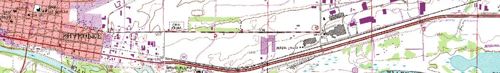
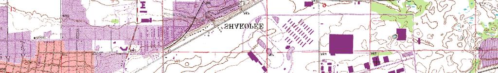
39 Property Line Barr Footer: ArcGIS 10.3, :07 File: I:\Projects\23\27\1393\Maps\Reports\EAW\USGS.mxd User: mjw Dean Lake Substation ± 1, ,900 Feet Attachment 2 USGS QUAD MAP Shakopee Distributed Generation MMPA Shakopee, Minnesota
40 ENGINE HALL FLAT ROOF ENGINE HALL FENCE SCR/CO CATALYST ADMINISTRATIVE SERVICES ELECTRICAL SERVICES EXHAUST STACKS BLACK START UNIT INTERCONNECT ELECTRICAL STATION TRANSFORMER PUMP SHELTER LNG CONTAINMENT LNG TANK LNG PUMP SHELTER GATE TRUCK UNLOADING CONTAINMENT RADIATORS UREA TANK LUBE OIL TANKS EQUIPMENT BUILDING HOT WATER TANK Scale 1 = 80-0 FENCE FENCE Attachment 3 Site Plan Shakopee Distributed Generation MMPA Shakopee, Minnesota


41 Not to Scale Attachment 4 3D Model Shakopee Distributed Generation MMPA Shakopee, Minnesota
42 LNG Storage Tank 99,000 Gals. LDC Natural Gas Natural Gas NG Blower/Storage LNG Vaporization & Forwarding LNG & Chemical Unloading Containment Combustion Air Bridge Crane Engine Hall Ventilation Air Hot Water Storage Tank Engine Hall Ventilation Air Gen (Typ) Spark Ignited, Lean Burn Engines (Typ ) CO/SCR Stakk HEX Not to Scale Compressed Air Supply Pkg. Starting Air Urea Tank Instrument Air Radiators Fresh Oil Tank Waste Oil Tank MMPA Distributed Generation Program Preliminary Process Flow Diagram December 4, 2014 Attachment 5 Distributed Generation Process Flow Diagram Shakopee Distributed Generation MMPA Shakopee, Minnesota
43 Project Location Lawn / Landscaping 4.4 Acres Not to Scale Wooded/Forest 1.6 Acres Attachment 6 Current Land Cover Shakopee Distributed Generation MMPA Shakopee, Minnesota

44 Project Location Lawn/Landscaping 2.9 Acres Impervious Surface.9 Acres Washed Stone Surface.8 Acres Not to Scale Wooded/Forest 1.4 Acres Attachment 7 Future Land Cover Shakopee Distributed Generation MMPA Shakopee, Minnesota
 Single Family Detached Single Family")


45 Property Line Land Use ( Metropolitan Council) Single Family Detached Single Family Attached Retail and Other Commercial Mixed Use Industrial Industrial and Utility Institutional Park, Recreational or Preserve Major Highway Agricultural Undeveloped Barr Footer: ArcGIS 10.3, :14 File: I:\Projects\23\27\1393\Maps\Reports\EAW\RegionalLandCover.mxd User: mjw Data Source: MPCA, Metropolitan Council (MetroGIS) Dean Lake Substation ± Feet Attachment 8 Regional Land Cover Shakopee Distributed Generation MMPA Shakopee, Minnesota

46 Project Location AG- Agricultural Preservation B1- Highway Business RR- Rural Residential R1B - Urban Residential MR- Major Recreation R2- Medium Density Residential R3 - Multiple Family Residential PRD-Planned Res. District L1, Light Industry Not to Scale Dean Lake Substation Attachment 9 Existing Zoning Map Shakopee Distributed Generation *Source: City of Shakopee Existing Zoning Plan MMPA Shakopee, Minnesota
 Park Institutional Mixed use Entertainment Medium Density Residential Buisness Park High Density Residential Not to Scale Dean Lake Substation Attachment 10 Proposed Land Use")
47 Project Location Commercial Single Family Res.(3-5 Unites / Acre) Park Institutional Mixed use Entertainment Medium Density Residential Buisness Park High Density Residential Not to Scale Dean Lake Substation Attachment 10 Proposed Land Use Map for the Shakopee 2030 Comprehensive Plan Shakopee Distributed Generation *Source: City of Shakopee 2030 Comprehensive Plan MMPA Shakopee, Minnesota


48 Foot Contour 10-Foot Contour Property Line Property Line Foot Contour 2-Foot Contour Barr Footer: ArcGIS 10.3, :27 File: I:\Projects\23\27\1393\Maps\Reports\EAW\SiteTopography.mxd User : mjw Barr Footer: ArcGIS 10.3, :27 File: I:\Projects\23\27\1393\Maps\Reports\EAW\SiteTopography.mxd User : mjw Dean Lake Substation ± Feet Feet Attachment 11 SITE TOPOGRAPHY Site Topography SITE TOPOGRAPHY Avant AvantEnergy Energy Scott ScottCounty, County,Minnesota Minnesota Shakopee Distributed Generation MMPA ATTACHMENT 10 ATTACHMENT 10 Shakopee, Minnesota


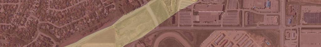
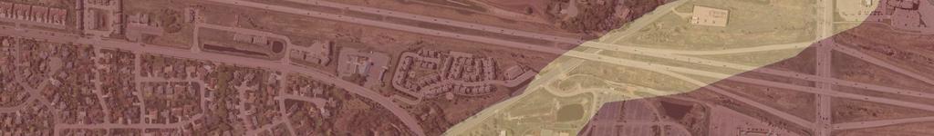
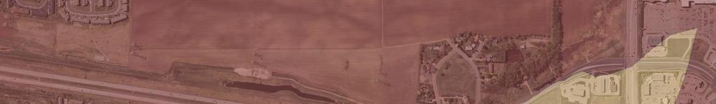
49 Property Line Quaternary Geology Qtl, Qtg, Qtr -- Alluvial terrace deposit Qtgr, Qtsr -- Terrace, within 10ft of bdr Qtg Qtgr Barr Footer: ArcGIS 10.3, :27 File: I:\Projects\23\27\1393\Maps\Reports\EAW\SurfaceGeology.mxd User: mjw Qtl Dean Lake Substation ± Feet Attachment 12 Surface Geology Investigation Map Shakopee Distributed Generation MMPA Shakopee, Minnesota


50 A' Barr Footer: ArcGIS 10.3, :12 File: I:\Projects\23\27\1393\Maps\Basemaps\Cross-Section.mxd User: mjw Op B' ,600 Feet B Site A Sand and Gravel Clay, Sand, Gravel (Till?) OP-- Bedrock/Prairie du Chien Group Clay Property Line Bedrock Geology Op -- Prairie du Chien Group: Finely crystalline dolostone, sandstone, and shale that subcrops as a relatively flat, buried plateau. The unit is 140 to 190 feet (43 to 58 meters) ± Attachment 13 Geologic Cross Section Shakopee Distributed Generation MMPA Shakopee, Minnesota


51 CdA HdA HdA Map Unit Name Property Line CdA -- Copaston silt loam DbA DaB, DaA, DaB2 -- Dakota loam DbA, DbB, DbB2, DbC2 -- Dickman sandy loam HeA HdC2 TbB DaA DbA HdB HdA EaA -- Estherville loam and sandy loam Gp -- Pits, gravel Salida gravelly sandy loam, 0 to 6 percent slopes CdA HeB, HdB2, HeB2, HeA -- Sparta sand Sc -- Stony land HeA Ta -- Terrace escarpments EaA Sc TcA, TbB -- Terril loam EbB HeA CdA Water WaA -- Waukegan silt loam HeB2 Ta Sc Barr Footer: ArcGIS 10.3, :42 File: I:\Projects\23\27\1393\Maps\Reports\EAW\SoilTypeMap.mxd User: mjw DbB2 DaA DaB2 DaB2 HeA W WaA WaA EaA EaB2 HeA DbC2 DaB DbA HeB HdB2 DbB2 DaA DaA TbB Dean Lake Substation DbA DaB2 EaA HeB2 DbB2 Gp Sc WaA ± Feet Attachment 14 Soil Type Map Shakopee Distributed Generation MMPA Shakopee, Minnesota


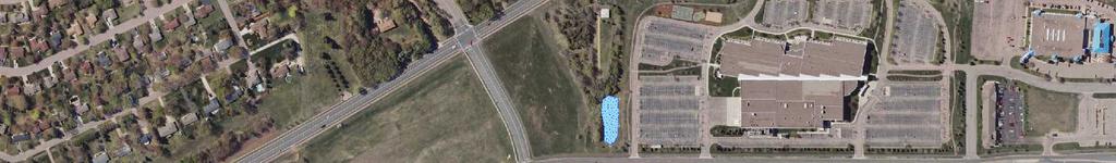
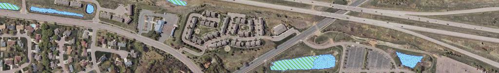
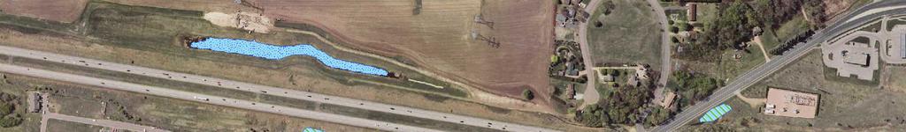
52 Property Line Public Water Inventory Watercourses.lyr Freshwater Emergent Wetland Freshwater Pond Barr Footer: ArcGIS , :29 File: I:\Projects\23\27\1393\Maps\Reports\EAW\MapOfSiteWaterResources.mxd User: mjw Dean Lake Substation ± Feet Attachment 15 Map of Site Water Resources Shakopee Distributed Generation MMPA Shakopee, Minnesota


53 !> !>!> CWI Wells Within One Mile Property Line!> Cross-Section One Mile Buffer!> !> A Barr Footer: ArcGIS 10.3, :02 File: I:\Projects\23\27\1393\Maps\Reports\EAW\CWI_Wells.mxd User: mjw!>!> !> !> !> !>!>!> !>!>!>!>!>!>!>!>!> !>!> !>!>!>!>!>!> Dean Lake Substation B ± 1, ,200 Feet Attachment 16 Map of Area Wells Shakopee Distributed Generation MMPA Shakopee, Minnesota
54
55
56
57
58
59
60
61
62
63
64
65
66
67
68
69
70
71
72
73
74
75
76
77
78
79
80
81
 Electrical Distribution Lines (Existing) Sanitary Sewer (Existing)")

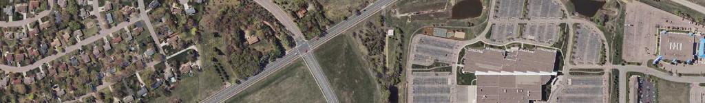
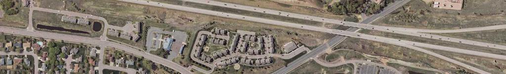
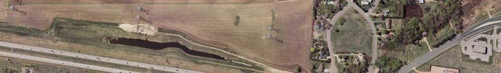
82 Property Line Electric Transmission Line!!! 116kV - 500kV (Existing) Electrical Distribution Lines (Existing) Sanitary Sewer (Existing) Stormwater (Existing) Water (Existing) Proposed Interconnection Barr Footer: ArcGIS 10.3, :50 File: I:\Projects\23\27\1393\Maps\Reports\EAW\Utilities.mxd User: mjw ter: ArcGIS 10.3, :50 File: I:\Projects\23\27\1393\Maps\Reports\EAW\Utilities.mxd User: mjw!!!!!!!!!!!!!!!!!!!!!!!!!!!!!!!!!!!!!!!!!!!!!!!!!!!!!!! Dean Lake Substation!!!!!!!!!!!!!!!!!!!!!!!!!!!!!!!!!!!!!!!!!!!!!!!!!!!!!!!!!!!!!!!!!!!!!!!!!!!!!!!!!!!!!!!!!!!!!!!!!!!!!!!!!!!!!!!!!!!!!!!!!!!!!!!!!!!!!!!!!!!!!!!!!!!!!!!! Attachment 17 Utilities Near the Distributed Generation Site UTILITIES NEAR THE DISTRIBUTED Shakopee GENERATION Distributed Generation SITE Avant Energy MMPA Scott Shakopee, County, Minnesota Minnesota!!!!!!!!!!!!!!!!!!!!!!!!!!!!!!!!!!!!!!!!!!!!!!!!!!!!!!!!!!!!!!!!!!!!!!!!!!!!! ± Feet ATTACHMENT 17!!!!!!
Environmental Information Worksheet
 Environmental Information Worksheet Water System Owner (Attach additional sheets if necessary) Needs and Alternatives Provide a brief narrative that describes: Current drinking water system needs. Project
Appendix A. Environmental Assessment Worksheet (EAW) EA Reference Table and EA Form
 EA Reference Table and EA Form") Appendix A. Environmental Assessment Worksheet (EAW) EA Reference Table and EA Form NORTHERN LIGHTS EXPRESS Northern Lights Express Passenger Rail Project from Minneapolis to Duluth, Minnesota Tier 2 Project
Appendix A. Environmental Assessment Worksheet (EAW) EA Reference Table and EA Form NORTHERN LIGHTS EXPRESS Northern Lights Express Passenger Rail Project from Minneapolis to Duluth, Minnesota Tier 2 Project
STATE OF MINNESOTA MINNESOTA POLLUTION CONTROL AGENCY FINDINGS OF FACT
 STATE OF MINNESOTA MINNESOTA POLLUTION CONTROL AGENCY IN THE MATTER OF THE DECISION ON THE NEED FOR AN ENVIRONMENTAL IMPACT STATEMENT FOR THE PROPOSED METROPOLITAN COUNCIL ENVIRONMENTAL SERVICES ST. LOUIS
STATE OF MINNESOTA MINNESOTA POLLUTION CONTROL AGENCY
 p-ear2-75b STATE OF MINNESOTA MINNESOTA POLLUTION CONTROL AGENCY IN THE MATTER OF THE DECISION ON THE NEED FOR AN ENVIRONMENTAL IMPACT STATEMENT FOR THE PROPOSED SOUTHERN MINNESOTA MUNICIPAL POWER AGENCY
STATE OF MINNESOTA MINNESOTA POLLUTION CONTROL AGENCY FINDINGS OF FACT
 p-ear2-44b STATE OF MINNESOTA MINNESOTA POLLUTION CONTROL AGENCY IN THE MATTER OF THE DECISION ON THE NEED FOR AN ENVIRONMENTAL IMPACT STATEMENT FOR THE PROPOSED RANDY S SANITATION TRANSFER FACILITY PROPOSED
STATE OF MINNESOTA MINNESOTA POLLUTION CONTROL AGENCY FINDINGS OF FACT
 STATE OF MINNESOTA MINNESOTA POLLUTION CONTROL AGENCY IN THE MATTER OF THE DECISION ON THE NEED FOR AN ENVIRONMENTAL IMPACT STATEMENT FOR THE PROPOSED EAGLE BEND WASTEWATER TREATMENT FACILITY IMPROVEMENTS
STATE OF MINNESOTA MINNESOTA POLLUTION CONTROL AGENCY FINDINGS OF FACT
 STATE OF MINNESOTA MINNESOTA POLLUTION CONTROL AGENCY IN THE MATTER OF THE DECISION ON THE NEED FOR AN ENVIRONMENTAL IMPACT STATEMENT FOR THE PROPOSED WAHKON WASTEWATER TREATMENT FACILITY EXPANSION MILLE
STATE OF MINNESOTA MINNESOTA POLLUTION CONTROL AGENCY FINDINGS OF FACT FACILITY HISTORY
 STATE OF MINNESOTA MINNESOTA POLLUTION CONTROL AGENCY IN THE MATTER OF THE DECISION ON THE NEED FOR AN ENVIRONMENTAL IMPACT STATEMENT FOR THE PROPOSED HOWARD LAKE WASTEWATER TREATMENT IMPROVEMENTS PROJECT
1. Project title NMCWD Eden Prairie Lakes Water Quality Improvement Project, NW and SW Anderson Lakes Drawdown
 Version 2/99 editorial corrections May, 05 ENVIRONMENTAL ASSESSMENT WORKSHEET Note to preparers: This form and EAW Guidelines are available at http://www.eqb.state.mn.us. The Environmental Assessment Worksheet
STATE OF MINNESOTA MINNESOTA POLLUTION CONTROL AGENCY FINDINGS OF FACT
 STATE OF MINNESOTA MINNESOTA POLLUTION CONTROL AGENCY IN THE MATTER OF THE DECISION ON THE NEED FOR AN ENVIRONMENTAL IMPACT STATEMENT FOR THE PROPOSED LESTER PRAIRIE WASTEWATER TREATMENT FACILITY EXPANSION
STATE OF MINNESOTA MINNESOTA POLLUTION CONTROL AGENCY FINDINGS OF FACT
 STATE OF MINNESOTA MINNESOTA POLLUTION CONTROL AGENCY IN THE MATTER OF THE DECISION ON THE NEED FOR AN ENVIRONMENTAL IMPACT STATEMENT FOR THE PROPOSED FLINT HILLS RESOURCES, LP - ULTRA LOW SULFUR DIESEL
STATE OF MINNESOTA MINNESOTA POLLUTION CONTROL AGENCY FINDINGS OF FACT. St. Francis Wastewater Treatment Facility Project Description
 p-ear2-78b STATE OF MINNESOTA MINNESOTA POLLUTION CONTROL AGENCY IN THE MATTER OF THE DECISION ON THE NEED FOR AN ENVIRONMENTAL IMPACT STATEMENT FOR THE PROPOSED ST. FRANCIS WASTEWATER TREATMENT FACILITY
Minnesota EAW Supplement
 Appendix I: Minnesota EAW Supplement Lower Pool 2 Channel Management Study: Boulanger Bend to Lock and Dam No. 2 Minnesota EAW Item Identification A supplement prepared for the Minnesota DNR to identify
ENVIRONMENTAL ASSESSMENT WORKSHEET
 ENVIRONMENTAL ASSESSMENT WORKSHEET Note to reviewers: The Worksheet (EAW) provides information about a project that may have the potential for significant environmental effects. This EAW was prepared by
STATE OF MINNESOTA MINNESOTA POLLUTION CONTROL AGENCY FINDINGS OF FACT
 STATE OF MINNESOTA MINNESOTA POLLUTION CONTROL AGENCY IN THE MATTER OF THE DECISION ON THE NEED FOR AN ENVIRONMENTAL IMPACT STATEMENT FOR THE PROPOSED LONSDALE WASTEWATER TREATMENT FACILITY EXPANSION,
STATE OF MINNESOTA MINNESOTA POLLUTION CONTROL AGENCY
 STATE OF MINNESOTA MINNESOTA POLLUTION CONTROL AGENCY In the Matter of the Decision on the Need for an Environmental Impact Statement for the Proposed Remer Wastewater Treatment Facility Expansion FINDINGS
STATE OF MINNESOTA MINNESOTA POLLUTION CONTROL AGENCY FINDINGS OF FACT. Project Description
 p-ear2-46b STATE OF MINNESOTA MINNESOTA POLLUTION CONTROL AGENCY IN THE MATTER OF THE DECISION ON THE NEED FOR AN ENVIRONMENTAL IMPACT STATEMENT FOR THE PROPOSED SHAMROCK RECYCLING AND TRANSFER STATION
STATE OF MINNESOTA MINNESOTA POLLUTION CONTROL AGENCY FINDINGS OF FACT
 STATE OF MINNESOTA MINNESOTA POLLUTION CONTROL AGENCY IN THE MATTER OF THE DECISION ON THE NEED FOR AN ENVIRONMENTAL IMPACT STATEMENT FOR THE PROPOSED NEW FASHION PORK, ENGELKES SITE NOBLES COUNTY WORTHINGTON,
STATE OF MINNESOTA MINNESOTA POLLUTION CONTROL AGENCY FINDINGS OF FACT
 p-ear2-20b STATE OF MINNESOTA MINNESOTA POLLUTION CONTROL AGENCY IN THE MATTER OF THE DECISION ON THE NEED FOR AN ENVIRONMENTAL IMPACT STATEMENT FOR THE PROPOSED LONG PRAIRIE MUNICIPAL WASTEWATER TREATMENT
MINNEHAHA CREEK WATERSHED DISTRICT BOARD OF MANAGERS REVISIONS PURSUANT TO MINNESOTA STATUTES 103D.341. Adopted April 24, 2014 Effective June 6, 2014
 MINNEHAHA CREEK WATERSHED DISTRICT BOARD OF MANAGERS REVISIONS PURSUANT TO MINNESOTA STATUTES 103D.341 Adopted April 24, 2014 Effective June 6, 2014 EROSION CONTROL RULE 1. POLICY. It is the policy of
STATE OF MINNESOTA MINNESOTA POLLUTION CONTROL AGENCY FINDINGS OF FACT. Project Description
 STATE OF MINNESOTA MINNESOTA POLLUTION CONTROL AGENCY IN THE MATTER OF THE DECISION ON THE NEED FOR AN ENVIRONMENTAL IMPACT STATEMENT FOR THE PROPOSED STEMMER RIDGE ROAD TRUNK SANITARY SEWER EXTENSION
COON CREEK WATERSHED DISTRICT PERMIT REVIEW. Spring Lake Park Schools Westwood Middle School st Avenue NE, Spring Lake Park, MN 55432
 PAN 16-112, Westwood Middle School, Page 1 of 6 COON CREEK WATERSHED DISTRICT PERMIT REVIEW MEETING DATE: August 22, 2016 AGENDA NUMBER: 10 FILE NUMBER: 16-112 ITEM: Westwood Middle School RECOMMENDATION:
Notice of Availability of an Environmental Assessment Worksheet (EAW) City of Morgan Construction of Wastewater Stabilization Pond Facility
 City of Morgan Construction of Wastewater Stabilization Pond Facility") Notice of Availability of an Environmental Assessment Worksheet (EAW) City of Morgan Construction of Wastewater Stabilization Pond Facility Doc Type: Public Notice Public Comment Information EAW Public
Notice of Availability of an Environmental Assessment Worksheet (EAW) City of Morgan Construction of Wastewater Stabilization Pond Facility Doc Type: Public Notice Public Comment Information EAW Public
Shakopee, Minnesota St. Paul, Minnesota Citizen Petition
 ENVIRONMENTAL ASSESSMENT WORKSHEET Note to reviewers: The Environmental Assessment Worksheet (EAW) provides information about a project that may have the potential for significant environmental effects.
FINDINGS OF FACT And CONCLUSIONS
 FINDINGS OF FACT And CONCLUSIONS SOUTHWEST RECONNECTION PROJECT Highway 61/101 Flood Mitigation State Project No. 1009-24 and State Aid Project No. 010-661-002 Prepared for: Carver County September 2013
Building Better Storm Water Quality
 Building Better Storm Water Quality s Storm Water Pollution Prevention Guidelines for Development Construction Projects City of El Segundo 350 Main Street (310) 524-2380 El Segundo, California 90245 Introduction
COON CREEK WATERSHED DISTRICT PERMIT REVIEW Mississippi Dr Coon Rapids, MN SQ FT Residence on 0.64 Acre Lot
 17-082 Van Sloun Residence, Page 1 of 5 COON CREEK WATERSHED DISTRICT PERMIT REVIEW MEETING DATE: May 8, 2017 AGENDA NUMBER: 17 FILE NUMBER: 17-082 ITEM: Van Sloun Residence RECOMMENDATION: Approve with
SOUTH ST. LOUIS SOIL AND WATER CONSERVATION DISTRICT FINDINGS OF FACT
 SOUTH ST. LOUIS SOIL AND WATER CONSERVATION DISTRICT RECORD OF DECISION In the Matter of the Determination of the Need for an Environmental Impact Statement for the Sargent Creek Channel and Floodplain
Notice of Availability of an Environmental Assessment Worksheet (EAW) Mankato Solid Waste Transfer Station
 Mankato Solid Waste Transfer Station") Public comment information EAW public comment period begins: May 21, 2018 EAW public comment period ends: 4:30 p.m. on June 20, 2018 Notice published in the EQB Monitor: May 21, 2018 Permit public comment
Public comment information EAW public comment period begins: May 21, 2018 EAW public comment period ends: 4:30 p.m. on June 20, 2018 Notice published in the EQB Monitor: May 21, 2018 Permit public comment
STATE OF MINNESOTA MINNESOTA POLLUTION CONTROL AGENCY FINDINGS OF FACT
 STATE OF MINNESOTA MINNESOTA POLLUTION CONTROL AGENCY IN THE MATTER OF THE DECISION ON THE NEED FOR AN ENVIRONMENTAL IMPACT STATEMENT FOR THE PROPOSED FLINT HILLS RESOURCES, LP MARSHALL TANK FARM EXPANSION
ENVIRONMENTAL ASSESSMENT WORKSHEET
 ENVIRONMENTAL ASSESSMENT WORKSHEET Note to reviewers: The Environmental Assessment Worksheet (EAW) provides information about a project that may have the potential for significant environmental effects.
Appendix A Stormwater Site Plan Report Short Form
 Appendix A Stormwater Site Plan Report Short Form The Stormwater Site Plan Report Short Form may be used for projects that trigger only Minimum Requirements #1-#5. These projects typically fall within
SECTION V CHAPTER 12 STORMWATER POLLUTION PREVENTION POLICY
 1. PURPOSE: SECTION V CHAPTER 12 STORMWATER POLLUTION PREVENTION POLICY The purpose of this policy is to establish procedures to facilitate compliance with federal, state and local stormwater regulations
Review Zone Application for D&R Canal Commission Decision
 Review Zone Application for D&R Canal Commission Decision MEETING DATE: January 18, 2017 DRCC #: 16-3020C Latest Submission Received: January 10, 2016 Applicant: PVP Franklin, LLC 769 Northfield Avenue,
COON CREEK WATERSHED DISTRICT PERMIT REVIEW. KTJ 314, LLC Blaine, MN 55449
 18-118 ABRA Auto Body, Page 1 of 8 COON CREEK WATERSHED DISTRICT PERMIT REVIEW MEETING DATE: August 13, 2018 AGENDA NUMBER: 14 FILE NUMBER: 18-118 ITEM: ABRA Auto Body RECOMMENDATION: Approve with 6 Stipulations
Nonmetallic Mining Reclamation & Operation Plan. Amendment No. 1 (Includes modifications for Wash Plant construction) DRAFT
 DRAFT") Nonmetallic Mining Reclamation & Operation Plan Amendment No. 1 (Includes modifications for Wash Plant construction) Mondovi Mine Town of Mondovi, Wisconsin Prepared for: Buffalo White Sand, LLC PO Box
Nonmetallic Mining Reclamation & Operation Plan Amendment No. 1 (Includes modifications for Wash Plant construction) Mondovi Mine Town of Mondovi, Wisconsin Prepared for: Buffalo White Sand, LLC PO Box
STATE OF MINNESOTA MINNESOTA POLLUTION CONTROL AGENCY FINDINGS OF FACT
 p-ear2-68b STATE OF MINNESOTA MINNESOTA POLLUTION CONTROL AGENCY IN THE MATTER OF THE DECISION ON THE NEED FOR AN ENVIRONMENTAL IMPACT STATEMENT FOR THE PROPOSED PIRKL GAS, INC. PROPANE STORAGE EXPANSION
Characteristics of Land Resources
 Chapter Chapter 1 Characteristics of Land Resources The geology, soils and topography of Woodford County T he geology, soils and topography of an area are important to the community planning process for
ENVIRONMENTAL ASSESSMENT WORKSHEET
 ENVIRONMENTAL ASSESSMENT WORKSHEET Note to reviewers: The Environmental Assessment Worksheet (EAW) provides information about a project that may have the potential for significant environmental effects.
Stormwater Erosion Control & Post-Construction Plans (Stormwater Quality Plans)
") Stormwater Erosion Control & Post-Construction Plans (Stormwater Quality Plans) Allen County Stormwater Plan Submittal Checklist The following items must be provided when applying for an Allen County Stormwater
Stormwater Erosion Control & Post-Construction Plans (Stormwater Quality Plans) Allen County Stormwater Plan Submittal Checklist The following items must be provided when applying for an Allen County Stormwater
STATE OF MINNESOTA MINNESOTA POLLUTION CONTROL AGENCY FINDINGS OF FACT
 STATE OF MINNESOTA MINNESOTA POLLUTION CONTROL AGENCY IN THE MATTER OF THE DECISION ON THE NEED FOR AN ENVIRONMENTAL IMPACT STATEMENT FOR THE PROPOSED AHRENDT BROTHERS CATTLE EXPANSION PROJECT MOUND TOWNSHIP,
EROSION CONTROL AND GRADING PERMIT APPLICATION
 EROSION CONTROL AND GRADING PERMIT APPLICATION COMMUNITY DEVELOPMENT DEPARTMENT 1735 MONTGOMERY STREET OROVILLE, CA 95965 530-538-2420 FAX (530) 5382426 www.cityoforoville.org APPLICATION DATE PERMIT FEE
Site-Specific PM 10 Ambient Air Monitoring Plan
 Site-Specific PM 10 Ambient Air Monitoring Plan Great Plains Sand Processing Facility Wenck File #2771-01 Prepared for: GREAT PLAINS SAND, LLC 15870 Johnson Memorial Drive Jordan, MN 55352 February 2012
NOTICE OF PREPARATION OF AN ENVIRONMENTAL IMPACT REPORT
 Date: September 18, 2017 NOTICE OF PREPARATION OF AN ENVIRONMENTAL IMPACT REPORT To: Agencies and Interested Parties Lead Agency: Sacramento Municipal Utility District 6201 S Street, MS H201 Sacramento,
City of Duluth, the New UDC and Stormwater
 City of Duluth, the New UDC and Stormwater Tom Johnson, PE City of Duluth - Public Works Project Engineer, Utilities - Stormwater Stormwater Challenges Topography (proximity to lake) High Quality Streams
COON CREEK WATERSHED DISTRICT PERMIT REVIEW
 16-054 Woodland Creek Wetland Banking Restoration Project, Page 1 of 6 COON CREEK WATERSHED DISTRICT PERMIT REVIEW MEETING DATE: August 22, 2016 AGENDA NUMBER: 11 FILE NUMBER: 16-054 ITEM: Woodland Creek
COON CREEK WATERSHED DISTRICT PERMIT REVIEW th Ave NE Ham Lake, MN 55304
 18-151 Meyer Garage, Page 1 of 5 COON CREEK WATERSHED DISTRICT PERMIT REVIEW MEETING DATE: January 28, 2019 AGENDA NUMBER: 9 FILE NUMBER: 18-151 ITEM: Meyer Garage RECOMMENDATION: Approve with 2 Stipulations
Outfall at Lagoon between Lake of the Isles and Lake Calhoun
 Outfall at Lagoon between Lake of the Isles and Lake Calhoun Prepared for City of Minneapolis April 17, 2013 4700 West 77 th Street Minneapolis, MN 55435-4803 Phone: (952) 832-2600 Fax: (952) 832-2601
Phase II: Proposed (regulated) Impervious in disturbed area (ac) Long Lake Existing Impervious in disturbed area (ac)
 Impervious in disturbed area (ac) Long Lake Existing Impervious in disturbed area (ac)") Permit Application No.: 17-181 Rules: Erosion Control, Wetland Protection, and Waterbody Crossings & Structures Applicant: Hennepin County Received: 4/27/17 Project: CSAH 112 Phase II Complete: 9/5/17
Permit Application No.: 17-181 Rules: Erosion Control, Wetland Protection, and Waterbody Crossings & Structures Applicant: Hennepin County Received: 4/27/17 Project: CSAH 112 Phase II Complete: 9/5/17
COON CREEK WATERSHED DISTRICT PERMIT REVIEW th Lane NE East Bethel, MN 55005
 18-115 South Terrace Cove, Page 1 of 6 COON CREEK WATERSHED DISTRICT PERMIT REVIEW MEETING DATE: July 23, 2018 AGENDA NUMBER: 8 FILE NUMBER: 18-115 ITEM: South Terrace Cove RECOMMENDATION: Approve with
STATE OF MINNESOTA MINNESOTA POLLUTION CONTROL AGENCY FINDINGS OF FACT
 STATE OF MINNESOTA MINNESOTA POLLUTION CONTROL AGENCY IN THE MATTER OF THE DECISION ON THE NEED FOR AN ENVIRONMENTAL IMPACT STATEMENT FOR THE PROPOSED PJM PORK, INC. SWINE FEEDLOT EXPANSION PROJECT COURTLAND
A. PROJECT LOCATION. B. PERMITTEE (Responsible party for day to day supervision and control of the MANAGMENT PLAN)
") Narrative Report Information Worksheet City and County of Denver, Demolition and Construction Activities Stormwater Management Plan (SWMP) Revised 2/12/2013 as entry form A. PROJECT LOCATION Name of Project
Narrative Report Information Worksheet City and County of Denver, Demolition and Construction Activities Stormwater Management Plan (SWMP) Revised 2/12/2013 as entry form A. PROJECT LOCATION Name of Project
Environmental Resource Inventories. What are ERIs? Significance of information How to use them
 Environmental Resource Inventories What are ERIs? Significance of information How to use them Environmental Resource Inventory - ERI Compiled by the environmental commission Information about the natural
Surface Water Management
 Surface Water Management Figure 7: Examples of Nonpoint Source Pollution The water quality leaving the metropolitan area is as good as the water quality entering the metropolitan area, and in compliance
Carpinteria Valley Water District Carpinteria Advanced Purification Project
 NOTICE OF PREPARATION AND SCOPING MEETING Carpinteria Valley Water District Carpinteria Advanced Purification Project TO: Agencies, Organizations, and Interested Parties DATE: January 7, 2019 SUBJECT:
Instructions for Notice of Ground Disturbance Form:
 Instructions for Notice of Ground Disturbance Form: Prior to beginning any ground disturbance activity or finalizing your storm water plan, submit a completed 2 page Notice of Ground Disturbance Form to
Technical Data
 4906-17-05 Technical Data (A) PROJECT AREA SITE have occurred in this section. (1) Geography and Topography have occurred in this section. (2) Aerial Photography have occurred in this section. (3) Site
TABLE OF CONTENTS 4.17 UTILITIES AND SERVICE SYSTEMS...
 TABLE OF CONTENTS 4.17 UTILITIES AND SERVICE SYSTEMS... 4.17-1 4.17.0 Introduction... 4.17-1 4.17.1 Methodology... 4.17-2 4.17.2 Existing Conditions... 4.17-2 4.17.3 Impacts... 4.17-4 4.17.4 Applicant-Proposed
PERMIT APPLICATION FEES Fees must be paid at time of application
 Permits SEPA Checklist Permit # Staff use Governmental agencies use this checklist to help determine whether the environmental impacts of your proposal are significant. This information is also helpful
INCOMPLETE APPLICATION WILL NOT BE ACCEPTED.
 CITY OF PORT ORCHARD Permit Center Office located at 720 Prospect Street Mailing address: 216 Prospect Street Port Orchard, WA 98366 (360) 874-5533 permitcenter@cityofportorchard.us SEPA ENVIRONMENTAL
Town of Friday Harbor PO Box 219 / Friday Harbor / WA / (360) / fax (360) /
 / fax (360) /") Town of Friday Harbor PO Box 219 / Friday Harbor / WA / 98250 (360) 378-2810 / fax (360) 378-5339 / www.fridayharbor.org LAND CLEARING, GRADING, OR FILLING PERMIT APPLICATION APPLICATION DATE GRD No. APPLICANT/FRANCHISE
Town of Friday Harbor PO Box 219 / Friday Harbor / WA / 98250 (360) 378-2810 / fax (360) 378-5339 / www.fridayharbor.org LAND CLEARING, GRADING, OR FILLING PERMIT APPLICATION APPLICATION DATE GRD No. APPLICANT/FRANCHISE
STATE OF MINNESOTA MINNESOTA POLLUTION CONTROL AGENCY FINDINGS OF FACT
 STATE OF MINNESOTA MINNESOTA POLLUTION CONTROL AGENCY IN THE MATTER OF THE DECISION ON THE NEED FOR AN ENVIRONMENTAL IMPACT STATEMENT FOR THE PROPOSED ASMUS EGG FARMS INC FEEDLOT EXPANSION ALFSBORG TOWNSHIP
STATE OF MINNESOTA MINNESOTA POLLUTION CONTROL AGENCY FINDINGS OF FACT
 STATE OF MINNESOTA MINNESOTA POLLUTION CONTROL AGENCY IN THE MATTER OF THE DECISION ON THE NEED FOR AN ENVIRONMENTAL IMPACT STATEMENT FOR THE PROPOSED ROYALTON WASTEWATER TREATMENT FACILITY EXPANSION ROYALTON
Alternative EAW Form for Animal Feedlots ENVIRONMENTAL ASSESSMENT WORKSHEET
 Alternative EAW Form for Animal Feedlots ENVIRONMENTAL ASSESSMENT WORKSHEET Note to reviewers: The Worksheet (EAW) provides information about a project that may have the potential for significant environmental
KANKAKEE COUNTY PLANNING DEPARTMENT APPLICATION FOR CLASS I & II GRADING AND DRAINAGE/STOMRWATER PERMIT APPLICATION
 KANKAKEE COUNTY PLANNING DEPARTMENT APPLICATION FOR CLASS I & II GRADING AND DRAINAGE/STOMRWATER PERMIT APPLICATION Michael J. Van Mill, AICP Planning Director 189 East Court Street Kankakee, IL 60901
Memorandum. Creekside Woods I & II Plymouth, MN BCWMC Summary: General Background & Comments. Floodplain
 Memorandum To: Bassett Creek Watershed Management Commission BCWMC June 15, 2017 Meeting Agenda Project: 23270051 2017 2128 4F Creekside Woods I & II Plymouth, MN BCWMC 2017-21 Summary: Proposed Work:
ENVIRONMENTAL CHECKLIST (WAC )
") Fee: $400.00 Date Fee Paid: Received by: 186 Iron Horse Court, Suite 101, Yakima WA 98901 Phone: (509) 834-2050 Fax: (509) 834-2060 Website: http://www.yakimacleanair.org ENVIRONMENTAL CHECKLIST (WAC 197-11-960)
Fee: $400.00 Date Fee Paid: Received by: 186 Iron Horse Court, Suite 101, Yakima WA 98901 Phone: (509) 834-2050 Fax: (509) 834-2060 Website: http://www.yakimacleanair.org ENVIRONMENTAL CHECKLIST (WAC 197-11-960)
2. DEFINITIONS. American Association of State Highway and Transportation Officials.
 2. DEFINITIONS 2.010 Definitions [See Amendment 2] In addition to words and terms that may be defined elsewhere in this manual, the following words and terms shall have the meanings defined below: AASHTO:
Charter Township of Garfield Grand Traverse County
 Charter Township of Garfield Grand Traverse County 3848 VETERANS DRIVE TRAVERSE CITY, MICHIGAN 49684 PH: (231) 941-1620 FAX: (231) 941-1588 SPECIAL USE PERMIT APPLICATION APPLICANT INFORMATION Name: Address:
Single Family Residential Construction Erosion/Sediment Control Standards
 Single Family Residential Construction Erosion/Sediment Control Standards Introduction: This booklet contains standard plans and procedures sufficient for typical building construction. It is not intended
Silverdale Water District 2018 Environmental Checklist
 PURPOSE OF THE CHECKLIST: Project Name: Construction Agreement No.: Applicant: Abbreviated Legal Description: Assessor s Tax Parcel ID No.: Please read the following carefully before filling out the checklist.
STATE OF MINNESOTA MINNESOTA POLLUTION CONTROL AGENCY FINDINGS OF FACT
 ATTACHMENT 1 STATE OF MINNESOTA MINNESOTA POLLUTION CONTROL AGENCY IN THE MATTER OF THE DETERMINATION OF ADEQUACY OF THE ENVIRONMENTAL IMPACT STATEMENT FOR THE OLMSTED WASTE-TO-ENERGY FACILITY: MUNICIPAL
STATE OF MINNESOTA MINNESOTA POLLUTION CONTROL AGENCY FINDINGS OF FACT. Project Description
 STATE OF MINNESOTA MINNESOTA POLLUTION CONTROL AGENCY IN THE MATTER OF THE DECISION ON THE NEED FOR AN ENVIRONMENTAL IMPACT STATEMENT FOR THE PROPOSED STROBEL FARMS JUNGBLOET SITE & BUECKSLER SITE BLUE
Application fee: $ payable to Stevens County Land Services A completed environmental checklist Any other supplemental information.
 SEPA CHECKLIST FOR ENVIRONMENTAL REVIEW STEVENS COUNTY LAND SERVICES PLANNING DIVISION Street Address: 260 S. Oak Courthouse Annex, Colville, WA Mailing Address: 215 S. Oak Courthouse Annex, Colville,
APPENDIX H: SFEIS FLOODPLAIN IMPACT ANALYSIS SECTION
 TH 36/STH 64 St. Croix River Crossing 2005 Water Resources Preliminary Design Report APPENDIX H: SFEIS FLOODPLAIN IMPACT ANALYSIS SECTION within the project area. Other methods of attaining this reduction
CITY OF ST. MICHAEL WRIGHT COUNTY, MINNESOTA ORDINANCE NO THE CITY COUNCIL OF THE CITY OF ST. MICHAEL HEREBY ORDAINS:
 CITY OF ST. MICHAEL WRIGHT COUNTY, MINNESOTA ORDINANCE NO. 1507 AN ORDINANCE AMENDING SECTION 155.073 OF THE ST. MICHAEL CODE TO ADD DEFINITIONS FOR SOLAR ENERGY SYSTEMS, AND ADD COMMUNITY SOLAR GARDEN
If you have any questions on the EAW, please contact Lynne Kolze of my staff at (651)
") August 3, 2001 TO: RE: INTERESTED PARTIES City of Delavan Sewage Collection and Wastewater Enclosed is the (EAW) for the proposed City of Delavan Sewage Collection and Wastewater, Faribault County. The
August 3, 2001 TO: RE: INTERESTED PARTIES City of Delavan Sewage Collection and Wastewater Enclosed is the (EAW) for the proposed City of Delavan Sewage Collection and Wastewater, Faribault County. The
SEPA Environmental Checklist
 Purpose of the Checklist: The State Environmental Policy Act (SEPA), chapter 43.21 RCW, requires all governmental agencies, including the City of Ferndale to consider the environmental impacts of a proposal
ENVIRONMENTAL CHECKLIST
 City of Hoquiam Planning and Building Division 609 8 th St. Hoquiam, WA 98550-3522 Tel: 360-532-5700 ext. 211, Fax: 360-538-0938 Website: www.cityofhoquiam.com ENVIRONMENTAL CHECKLIST Purpose of checklist:
STATE OF MINNESOTA MINNESOTA POLLUTION CONTROL AGENCY FINDINGS OF FACT
 p-ear2-59b STATE OF MINNESOTA MINNESOTA POLLUTION CONTROL AGENCY IN THE MATTER OF THE DECISION ON THE NEED FOR AN ENVIRONMENTAL IMPACT STATEMENT FOR THE PROPOSED HEARTLAND HUTTERIAN BRETHREN, INC. FEEDLOT
E. STORMWATER MANAGEMENT
 E. STORMWATER MANAGEMENT 1. Existing Conditions The Project Site is located within the Lower Hudson Watershed. According to the New York State Department of Environmental Conservation (NYSDEC), Lower Hudson
STATE OF MINNESOTA MINNESOTA POLLUTION CONTROL AGENCY FINDINGS OF FACT
 STATE OF MINNESOTA MINNESOTA POLLUTION CONTROL AGENCY IN THE MATTER OF THE DECISION ON THE NEED FOR AN ENVIRONMENTAL IMPACT STATEMENT FOR THE PROPOSED PLAINVIEW ELGIN WASTEWATER TREATMENT FACILITY IMPROVEMENTS
Please note that comment letters submitted to the MPCA do become public documents and will be part of the official public record for this project.
 March 14, 2003 TO: INTERESTED PARTIES RE: Enclosed is the Worksheet (EAW) for the proposed SKB Rosemount Industrial Waste Facility, Dakota County. The EAW was prepared by the Minnesota Pollution Control
TO INTERESTED PARTIES: RE: Chippewa Valley Ethanol Company Expansion
 TO INTERESTED PARTIES: RE: The Minnesota Pollution Control Agency (MPCA) has approved the,, and Order for the Environmental Assessment Worksheet (EAW) on the proposed Project, Swift County. The Findings
STATE OF MINNESOTA MINNESOTA POLLUTION CONTROL AGENCY
 p-ear2-80b STATE OF MINNESOTA MINNESOTA POLLUTION CONTROL AGENCY IN THE MATTER OF THE DECISION ON THE NEED FOR AN ENVIRONMENTAL IMPACT STATEMENT FOR THE PROPOSED REG ALBERT LEA, LLC PROJECT FREEBORN COUNTY
Project Priority List scoring worksheet - stormwater Guidance document
 www.pca.state.mn.us Project Priority List scoring worksheet - stormwater Guidance document PLEASE NOTE: THE MINNESOTA STATE FISCAL YEAR IS FROM JULY 1 JUNE 30 The first step towards receiving either a
STATE OF MINNESOTA MINNESOTA POLLUTION CONTROL AGENCY FINDINGS OF FACT
 STATE OF MINNESOTA MINNESOTA POLLUTION CONTROL AGENCY IN THE MATTER OF THE DECISION ON THE NEED FOR AN ENVIRONMENTAL IMPACT STATEMENT FOR THE PROPOSED ELK RIVER LANDFILL INTERNAL COMBUSTION ENGINE GENERATOR
Notice of Availability of an Environmental Assessment Worksheet (EAW)
") Public comment information EAW public comment period begins: January 7, 2019 EAW public comment period ends: 4:30 p.m. on February 6, 2019 Notice published in the EQB Monitor: January 7, 2019 Notice of
Public comment information EAW public comment period begins: January 7, 2019 EAW public comment period ends: 4:30 p.m. on February 6, 2019 Notice published in the EQB Monitor: January 7, 2019 Notice of
Storm Water Pollution Prevention Plan (SWP3) Checklist
 Checklist") . Summit Soil and Water Conservation District Storm Water Pollution Prevention Plan (SWP3) Checklist Modified from the Ohio EPA SWP3 Checklist (Revised January 2017) SITE NAME: REVIEWER: DATE RECEIVED:
. Summit Soil and Water Conservation District Storm Water Pollution Prevention Plan (SWP3) Checklist Modified from the Ohio EPA SWP3 Checklist (Revised January 2017) SITE NAME: REVIEWER: DATE RECEIVED:
Notice of Availability of an Environmental Assessment Worksheet (EAW) Jordan SW Interceptor
 Jordan SW Interceptor") Public Comment Information EAW Public comment period begins: December 26, 2016 EAW Public comment period ends: 4:30 p.m. on January 25, 2017 Notice published in the EQB Monitor: December 26, 2016 Notice
Public Comment Information EAW Public comment period begins: December 26, 2016 EAW Public comment period ends: 4:30 p.m. on January 25, 2017 Notice published in the EQB Monitor: December 26, 2016 Notice
CORNERSTONE RIVER VALLEY VILLAGE FILING NO. 1 STORMWATER MANAGEMENT PLAN
 CORNERSTONE RIVER VALLEY VILLAGE FILING NO. 1 STORMWATER MANAGEMENT PLAN SITUATED IN THE SW ¼ OF SECTION 18, T.2S., R.67W., OF THE 6 TH P.M. COUNTY OF ADAMS, STATE OF COLORADO PREPARED FOR: Thornton Cornerstone
TES Industrial Development SW ¼ SEC Lacombe County Outline Plan
 TES Industrial Development Lacombe County Outline Plan 112849297 June 2012 am v:\1128\active\112849297\07_reports_studies\rpt_tes_20120508.doc i Table of Contents 1.0 INTRODUCTION... 1 1.1 PURPOSE... 1
1006 UTILITIES, STREET LIGHTS, WATER SUPPLY, SEWAGE DISPOSAL, SURFACE WATER MANAGEMENT, AND EROSION CONTROL
 1006 UTILITIES, STREET LIGHTS, WATER SUPPLY, SEWAGE DISPOSAL, SURFACE WATER MANAGEMENT, AND EROSION CONTROL 1006.01 GENERAL STANDARDS A. The location, design, installation, and maintenance of all utility
E & S Plan Approved. Not required but may be a municipal requirement** Not required but may be a. municipal. requirement** Not required but may be a
 Disturbed Area 0-5000 Sq. ft 5000 Sq. ft to less than 1 acre 1 to
Typical Local Erosion Control Requirements (Storm Water Management Authority, Inc.)
") Module 2: Selection of Controls and Site Planning for Construction Site Erosion Prevention Robert Pitt Department of Civil, Construction, and Environmental Engineering University of Alabama Tuscaloosa,
Module 2: Selection of Controls and Site Planning for Construction Site Erosion Prevention Robert Pitt Department of Civil, Construction, and Environmental Engineering University of Alabama Tuscaloosa,
Chapter 8: Water Supply & Sanitary Systems
 Chapter 8: Water Supply & Sanitary Systems Manage, Treat & Reserve Comprehensive Plan 2040 2 8. WATER SUPPLY & SANITARY SYSTEM INTRODUCTION This chapter of the City of Lauderdale s 2040 Comprehensive Plan
CLEARWATER TOWNSHIP WATER QUALITY ACTION PLAN
 CLEARWATER TOWNSHIP WATER QUALITY ACTION PLAN Elk-River-Chain-of-Lakes Gaps Analysis Project The Watershed Center Grand Traverse Bay Michigan Department of Environmental Quality July 2011 Purpose The Grand
SUDAS Revision Submittal Form
 SUDAS Revision Submittal Form Status Date: As of 3/15/2018 Topic: General Permit No. 2 updates Manual: Design Manual Location: Sections 7A-1 and 7B-1 Requested Revision: Section 7A-1 (General Information),
FINDINGS OF FACT and CONCLUSIONS
 FINDINGS OF FACT and CONCLUSIONS I-694/ I-494/ I-94 Interchange Improvements State Project No. 8286-81 Prepared by: Minnesota Department of Transportation July, 2018 CONTENTS STATEMENT OF ISSUE... 2 ADMINISTRATIVE
2. Proposer: Dominium Management 3. RGU City of Minnetonka
 July 2013 version ENVIRONMENTAL ASSESSMENT WORKSHEET This Environmental Assessment Worksheet (EAW) form and EAW Guidelines are available at the Environmental Quality Board s website at: http://www.eqb.state.mn.us/envrevguidancedocuments.htm.