Estimated Calibration Parameters in SWAT Model for Andean Watersheds
|
|
|
- Marjory Crawford
- 6 years ago
- Views:
Transcription

1 Estimated Calibration Parameters in SWAT Model for Andean Watersheds Jefferson Valencia Gómez Decision and Policy Analysis July 18 th, 2013
2 Ecosystem Services Team Marcela Quintero Ecologist, Soil and Water Scientist Natalia Uribe GIS Expert and Hydrological modeler Jefferson Valencia GIS expert and Hydrological modeler
3 Objectives To summarize research findings in the calibration process for the simulation of six basins hydrology in the Andean region. To provide information about what the common parameters of the calibration process are and the likely range of parameters values for this region.

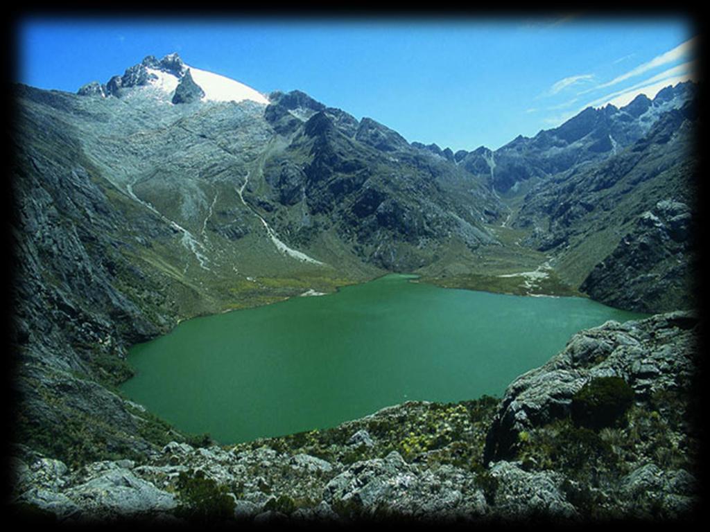
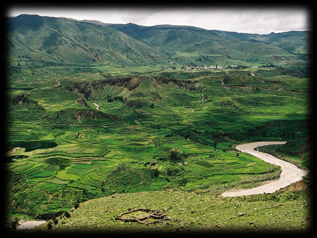
4 Localization of the Studied Basins Riogrande II Fúquene Guavio Fraile Quijos Cañete SWAT 2005


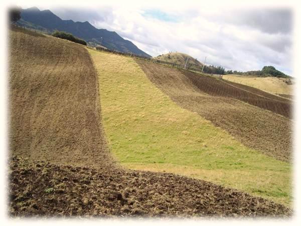
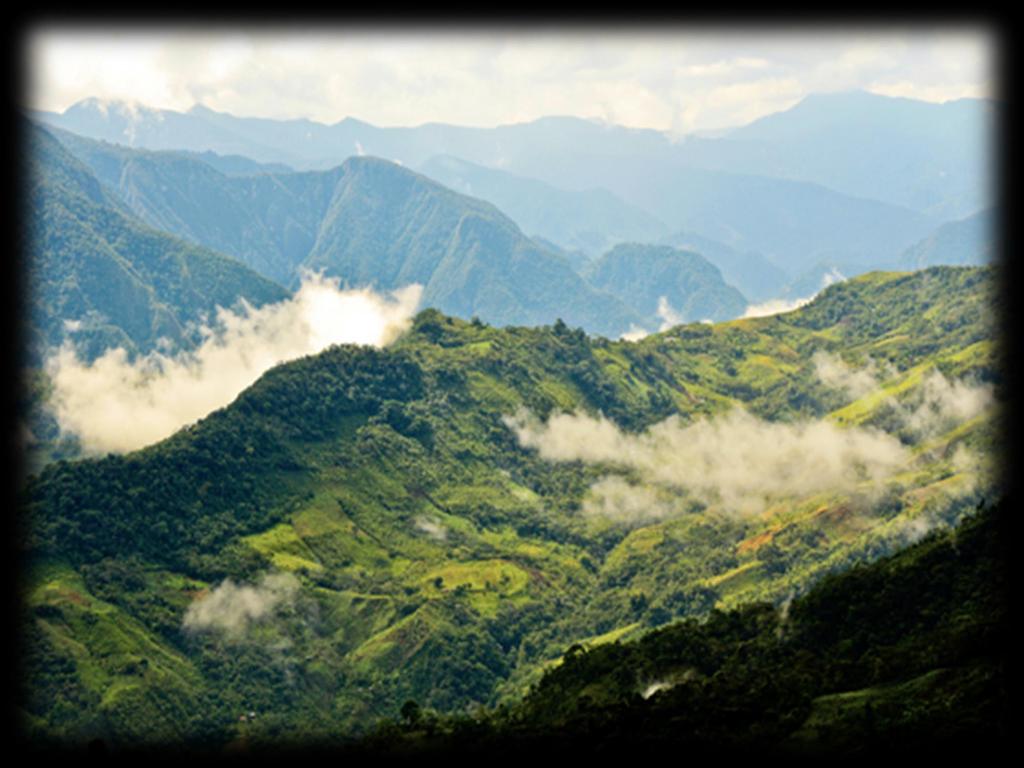
5 Andean Basins Characteristics Andean watersheds are characterized by significant landscape diversity in terms of soil type, land use and relief. These factors, when combined with changes in climate along the altitudinal gradient, create different hydrological responses within the same basin. This diversity presents difficulties for hydrological models aimed at simulating streamflow behavior.
6
7
8
9
10 Description of the Study Areas Country Watershed Area a (Km 2 ) Mean precipitation b (mm) Number of sub-basins Elevation range (msl) Land use c (%) Fraile SUGC (45) BROM (18) MESQ (18) SWRN (13) RYEG (2) Colombia Fuquene RYEG (56) APPL (11) POTA (10) PINE (7) FESC (5) Guavio RNGB (29) FRSF (16) FESP (15) FRST (15) RYEG (9) Riogrande II RYEG (62) RYEE (16) MESQ (10) PINP (6) FESC (4) Ecuador Quijos FRST (29) PAST (24) WPAS (21) MESQ (11) SWRN (10) Perú Cañete MESQ (29) RYEG (19) RNGB (18) FESC (14) BLUG (13) a Modeled area b Average annual basin value c Extracted from USGS land use database, homologated or adjusted using dominant land use for each basin. APPL: Fruits and permanent crops, BLUG: Grassland/Tundra, BROM: Vegetation in high zone, FESC: Puna grassland, FESP: Paramo and subparamo vegetation, FRCB: Deciduous and subdeciduous forest, FRSF: Fragmented forest, FRST: Forest-Mixed, MESQ: Shrub and/or herbaceous vegetation associations, OAKB: Oak forest, PAST: Clean pasture, PINE: Planted forest, PINP: Pinus patula, POTA: Potato, RNGB: Sparsely vegetated areas, RYEE: Weedy grasses, RYEG: Patterns of permanent crops and pastures, SIDM: Induced pasture, SPAS: Cultivated pasture, SUGC: Sugarcane, SWRN: Patterns of permanent crops, pastures and natural areas, WATR: Water, WPAS: Winter Pasture
11 Spatial Input Data Used in Each Basin Data type Description Watersheds Fraile Fuquene Guavio Riogrande II Quijos (Ec) Cañete (Pe) Topography map Land use map Soils map Resolution 30m 30m 10m 12.5m 90m 90m Source CVC CAR CORPOGUAVIO EPM SRTM-CIAT SRTM-CIAT Scale 1: : : : : : Source IGAC IGAC IGAC IGAC Ecobona IGN Scale 1: : : : : : Source CVC-IGAC IGAC IGAC IGAC INIAP ONERN-CORLIMA Weather No. Stations Source CVC- IDEAM SCS-CN method Surface runoff Hargreaves method Potential evapotranspiration 50 and 100 Ha Threshold for the delineation of basins 5 ranges Slope CAR-IDEAM IDEAM EPM - IDEAM INAMHI SENAMHI
12 Characteristics of the Catchment Area for Calibration Process Watersheds Sub-basin used for calibration Area a Km 2 % Simulation period b No. months simulated No. months with observed streamflow data Fraile Jan-91 - Dec Fuquene Jan-01 - Dec Guavio Jan-95 - Dec Riogrande II Jan-96 - Dec Quijos (Ec) Jan-93 - Dec Cañete (Pe) Jan-92 - Jul a Calibrated area and percentage of the total area of the watershed b This period doesn't include warm up period
13 Parameters Modified in the Calibration Process Name Definition Range SWAT Deafault Value Fraile Fuquene Guavio Riogrande II SHALLST.gw Initial depth of water in the shallow aquifer [mm] GW_DELAY.gw Groundwater delay [days] ALPHA_BF.gw Baseflow alpha factor [days] GWQMIN.gw Threshold water depth in the shallow aquifer for flow [mm] REVAPMN.gw Threshold water depth in the shallow aquifer for "revap" [mm] RCHRG_DP.gw Deep aquifer percolation fraction GWHT.gw Initial groundwater height [m] GW_SPYLD.gw Specific yield of the shallow aquifer [m 3 /m 3 ] ESCO.hru Soil evaporation compensation factor EPCO.hru Plant uptake compensation factor SLSUBBSN.hru Average slope length [m] Changes for HRU -9** SLOPE.hru Average slope steepness [m/m] Changes for HRU +20%** TIMP.bsn Snow pack temperature lag factor SMFMX.bsn Melt factor for snow on June 21 [mm H2O/ C-day] SMFMN.bsn Melt factor for snow on December 21 [mm H2O/ C-day] SFTMP.bsn Snowfall temperature [ C] SMTMP.bsn Snow melt base temperature [ C] ESCO.bsn Soil evaporation compensation factor FFCB.bsn Initial soil water storage expressed as a fraction of field capacity water content Quijos (Ec) Cañete (Pe) SURLAG.bsn Surface runoff lag time [days] SOL_AWC.sol Available water capacity [mm H20/mm soil] 0-1 Changes for Soil +14.4% CH_N2.rte Manning's nvalue for main channel CN2.mgt Initial SCS CN II value Changes for HRU -19% PLAPS.sub Precipitation lapse rate [mm/km] TLAPS.sub Temperature lapse rate [ C/km] BLAI.crop.dat Maximum potential leaf area index Changes for Crop 3* *Just modified to Paramo vegetation (FESP) **Parameters modified to subbasins 1-9
14 Parameters Modified in the Calibration Process Name Definition Range SWAT Default Value Fraile Fuquene Guavio Riogrande II Quijos (Ec) Cañete (Pe) SHALLST.gw Initial depth of water in the shallow aquifer [mm] GW_DELAY.gw Groundwater delay [days] ALPHA_BF.gw Baseflow alpha factor [days] GWQMIN.gw Threshold water depth in the shallow aquifer for flow [mm] REVAPMN.gw Threshold water depth in the shallow aquifer for "revap" [mm] RCHRG_DP.gw Deep aquifer percolation fraction GWHT.gw Initial groundwater height [m] GW_SPYLD.gw Specific yield of the shallow aquifer [m3/m3]
15 Parameters Modified in the Calibration Process Name Definition Range SWAT Default Value Fraile Fuquene ESCO.hru Soil evaporation compensation factor EPCO.hru Plant uptake compensation factor Guavio Riogrande II SLSUBBSN.hru Average slope length [m] Changes for HRU -9** SLOPE.hru Average slope steepness [m/m] Changes for HRU +20%** TIMP.bsn Snow pack temperature lag factor SMFMX.bsn Melt factor for snow on June 21 [mm H2O/ C-day] SMFMN.bsn Melt factor for snow on December 21 [mm H2O/ C-day] SFTMP.bsn Snowfall temperature [ C] SMTMP.bsn Snow melt base temperature [ C] ESCO.bsn Soil evaporation compensation factor FFCB.bsn Initial soil water storage expressed as a fraction of field capacity water content Quijos (Ec) Cañete (Pe) SURLAG.bsn Surface runoff lag time [days] SOL_AWC.sol Available water capacity [mm H20/mm soil] 0-1 Changes for Soil +14.4% CH_N2.rte Manning's nvalue for main channel CN2.mgt Initial SCS CN II value Changes for HRU -19% PLAPS.sub Precipitation lapse rate [mm/km] TLAPS.sub Temperature lapse rate [ C/km] BLAI.crop.dat Maximum potential leaf area index Changes for Crop 3* *Just modified to Paramo vegetation (FESP) **Parameters modified to subbasins 1-9
16 Model Performance Evaluation Fraile Fuquene Guavio Riogrande II
17 Model Performance Evaluation Quijos (Ec) Cañete (Pe) Watersheds Calibration period Validation period NSE d RMSE MAE NSE d RMSE MAE Fraile Fuquene Guavio Riogrande II Quijos (Ec) Cañete (Pe) NSE: Nash-Sutcliffe coefficient of efficiency. From - to 1, being 1 the optimal value. A value of 0.5 is acceptable. d: Index of agreement. Varies between 0 and 1, being 1 perfect agreement, 0 no agreement at all. RMSE: Root mean square error MAE: Mean absolute error
18 Results Range of input values to SWAT for aquifer parameters in the Andes basins: Name Definition Range SWAT Default Value Proposed Range SHALLST.gw Initial depth of water in the shallow aquifer [mm] GW_DELAY.gw Groundwater delay [days] ALPHA_BF.gw Baseflow alpha factor [days] GWQMIN.gw Threshold water depth in the shallow aquifer for flow [mm] REVAPMN.gw Threshold water depth in the shallow aquifer for "revap" [mm] RCHRG_DP.gw Deep aquifer percolation fraction GWHT.gw Initial groundwater height [m] GW_SPYLD.gw Specific yield of the shallow aquifer [m 3 /m 3 ]
19 Conclusions Most of the parameters that need to be often adjusted are those associated with the simulating of water movement in the shallow or unconfined aquifers, surface runoff and snow melting (when applicable). The final values for those parameters related to aquifers are in a range that should be used as a reference for future applications of the SWAT model in the region. These parameters correspond to those related with processes and basins characteristics that are not well studied and understood in the Andes.
20 Thanks for your attention Jefferson Valencia Gómez
The implications of SWAT parameter equifinality on climate change projections
 The implications of SWAT parameter equifinality on climate change projections Darren L. Ficklin Department of Geography, Indiana University, dficklin@indiana.edu Bradley L. Barnhart U.S. EPA, Corvallis,
Effects of land use change on the water resources of the Basoda basin using the SWAT model
 INDIAN INSTITUTE OF TECHNOLOGY ROORKEE Effects of land use change on the water resources of the Basoda basin using the SWAT model By Santosh S. Palmate* 1 (Ph.D. Student) Paul D. Wagner 2 (Postdoctoral
Application of a Basin Scale Hydrological Model for Characterizing flow and Drought Trend
 Application of a Basin Scale Hydrological Model for Characterizing flow and Drought Trend 20 July 2012 International SWAT conference, Delhi INDIA TIPAPORN HOMDEE 1 Ph.D candidate Prof. KOBKIAT PONGPUT
Improved Lower Mekong River Basin Hydrological Decision Making Using NASA Satellite-based Earth Observation Systems
 Improved Lower Mekong River Basin Hydrological Decision Making Using NASA Satellite-based Earth Observation Systems Ibrahim Mohammed Ibrahim.mohammed@nasa.gov John Bolten R. Srinivasan Venkat Lakshmi AGU
Malfunctioning of streamgauge stations in the Chanza and Arochete rivers (Huelva, Spain) detected from hydrological modeling with SWAT.
 detected from hydrological modeling with SWAT.") Malfunctioning of streamgauge stations in the Chanza and Arochete rivers (Huelva, Spain) detected from hydrological modeling with SWAT. L. Galván, M. Olías and A. Van Griensven Introduction The Odiel river
Malfunctioning of streamgauge stations in the Chanza and Arochete rivers (Huelva, Spain) detected from hydrological modeling with SWAT. L. Galván, M. Olías and A. Van Griensven Introduction The Odiel river
SWAT modelling approach to assess the impacts of Best Management Practices (BMPs) in a potato crop by Natalia Uribe
 in a potato crop by Natalia Uribe") International SWAT conference June 28-30, Warsaw (Poland) 2017 SWAT modelling approach to assess the impacts of Best Management Practices (BMPs) in a potato crop by Natalia Uribe Dr. Marcela Quintero;
International SWAT conference June 28-30, Warsaw (Poland) 2017 SWAT modelling approach to assess the impacts of Best Management Practices (BMPs) in a potato crop by Natalia Uribe Dr. Marcela Quintero;
Impact of precipitation and temperature on hydrological responses in the Ethiopian Highlands
 Impact of precipitation and temperature on hydrological responses in the Ethiopian Highlands Tatenda Lemann, 1,2,3 Vincent Roth, 1,2,3 Gete Zeleke, 1,3 1 Centre for Development and Environment (CDE), University
A comparison study of multi-gage and single-gage calibration of the SWAT model for runoff simulation in Qingjiang river basin
 A comparison study of multi-gage and single-gage calibration of the SWAT model for runoff simulation in Qingjiang river basin Dan YU, Xiaohua DONG, Lei LI, Sanhong SONG, Zhixiang LV and Ji LIU China Three
Assessing the impact of projected climate changes on small coastal basins of the Western US
 Assessing the impact of projected climate changes on small coastal basins of the Western US William Burke Dr. Darren Ficklin Dept. of Geography, Indiana University Introduction How will climate change
Farzad Emami Manfred Koch
 Modeling the Projected Impact of Climate Change on Boukan Dam Inflow and Water Availability in the Zarrine River Basin of Iran SWAT 2017 WARSAW Conference Farzad Emami Manfred Koch Institut für Geotechnik
Farzad Emami Manfred Koch
 Modeling the Projected Impact of Climate Change on Boukan Dam Inflow and Water Availability in the Zarrine River Basin of Iran SWAT 2017 WARSAW Conference Farzad Emami Manfred Koch Institut für Geotechnik
Lanie A. Alejo & Victor B. Ella* University of the Philippines Los Baños. *presenter
 ASSESSING THE IMPACTS OF CLIMATE CHANGE ON DEPENDABLE FLOW AND POTENTIAL IRRIGABLE AREA USING THE SWAT MODEL: THE CASE OF MAASIN RIVER WATERSHED IN LAGUNA, PHILIPPINES Lanie A. Alejo & Victor B. Ella*
Hamid R. Solaymani. A.K.Gosain
 Motivation An integrated management plan is required to prevent the negative impacts of climate change on social- economic and environment aspects Each of these segments is expected to be strongly impacted
Assessment of sediment and carbon flux in a tropical watershed: the Red River study case (China and Vietnam)
") Assessment of sediment and carbon flux in a tropical watershed: the Red River study case (China and Vietnam) Xi WEI Supervisors: Sabine SAUVAGE, Jose-Miguel SANCHEZ-PEREZ, Thi Phuong Quynh LE 2 th September
Assessment of sediment and carbon flux in a tropical watershed: the Red River study case (China and Vietnam) Xi WEI Supervisors: Sabine SAUVAGE, Jose-Miguel SANCHEZ-PEREZ, Thi Phuong Quynh LE 2 th September
IMPROVEMENT AND APPLICATION OF THE MODEL FOR PREDICTING PESTICIDE TRANSPORT: A CASE STUDY OF THE SAKURA RIVER WATERSHED
 SWAT 2018 / VUB-Brussels, Belgium IMPROVEMENT AND APPLICATION OF THE PCPF-1@SWAT2012 MODEL FOR PREDICTING PESTICIDE TRANSPORT: A CASE STUDY OF THE SAKURA RIVER WATERSHED GLOBAL SUSTAINABLE RICE PRODUCTION
Evaluation of land use, land management and soil conservation strategies to reduce non-point source pollution loads in the Three Gorges Region, China
 Photo: A. Strehmel Christian-Albrechts-University, Kiel Institute for Natural Resources Conservation Evaluation of land use, land management and soil conservation strategies to reduce non-point source
Comparative analysis of SWAT model with Coupled SWAT-MODFLOW model for Gibbs Farm Watershed in Georgia
 2018 SWAT INTERNATIONAL CONFERENCE, JAN 10-12, CHENNAI 1 Comparative analysis of SWAT model with Coupled SWAT-MODFLOW model for Gibbs Farm Watershed in Georgia Presented By K.Sangeetha B.Narasimhan D.D.Bosch
Jian Liu, Tamie L. Veith, Amy S. Collick, Peter J. A. Kleinman, Douglas B. Beegle, and Ray B.
 Jian Liu, Tamie L. Veith, Amy S. Collick, Peter J. A. Kleinman, Douglas B. Beegle, and Ray B. Bryant Seasonal manure application timing and storage effects on field and watershed level phosphorus losses
Comparative hydrology using the SWAT model in Pernambuco State watersheds, Northeast of Brazil for SUPer system development
 Comparative hydrology using the SWAT model in Pernambuco State watersheds, Northeast of Brazil for SUPer system development Andrade, CWL; Montenegro, SMGL; Fontes Júnior, RVP; Miranda, RQ; Ferreira, OS;
Modelling of the Hydrology, Soil Erosion and Sediment transport processes in the Lake Tana Catchments of Blue Nile River Basin, Ethiopia
 Modelling of the Hydrology, Soil Erosion and Sediment transport processes in the Lake Tana Catchments of Blue Nile River Basin, Ethiopia Combining Field Data, Mathematical Models and Geographic Information
soil losses in a small rainfed catchment with Mediterranean
 Using SWAT to predict climate change effects on runoff and soil losses in a small rainfed catchment with Mediterranean climate of NE Spain Ramos MC, Martínez-Casasnovas JA Department of Environment and
Parameter Calibration of SWAT Hydrology and Water Quality Focusing on Long-term Drought Periods
 2017 SWAT June 28-30, 2017 Centrum Wodne SGGW, Warsaw, Poland Theme I3 Environmental Applications Room: Assembly Hall 2 2017 International SWAT Conference Parameter Calibration of SWAT Hydrology and Water
Evaluation of Swat for Modelling the Water Balance and Water Yield in Yerrakalva River Basin, A.P. National Institute of Hydrology, Roorkee
 Evaluation of Swat for Modelling the Water Balance and Water Yield in Yerrakalva River Basin, A.P. By Dr. J.V. Tyagi Dr. Y.R.S. Rao National Institute of Hydrology, Roorkee INTRODUCTION Knowledge of water
Simulating Thermal Stress in Rhode Island Coldwater Fish Habitat Using SWAT
 University of Rhode Island DigitalCommons@URI Open Access Master's Theses 2017 Simulating Thermal Stress in Rhode Island Coldwater Fish Habitat Using SWAT Britta Marie Chambers University of Rhode Island,
The Spatial Analysis between SWAT Simulated Soil Moisture, and MODIS LST and NDVI Products
 Konkuk University, Seoul, South Korea The Spatial Analysis between SWAT Simulated Soil Moisture, and MODIS LST and NDVI Products Geun Ae PARK Post-doctoral Researcher, Dept. of Civil and Environmental
APPLICATION OF SWAT MODEL TO THE STUDY AREA
 CHAPTER 5 APPLICATION OF SWAT MODEL TO THE STUDY 5.1 Introduction The Meenachil river basin suffers from water shortage during the six non-monsoon months of the year. The available land and water resources
Analyzing water resources in a monsoon-driven environment an example from the Indian Western Ghats
 Analyzing water resources in a monsoon-driven environment an example from the Indian Western Ghats 1, Shamita Kumar 2, Peter Fiener 1 and Karl Schneider 1 1,,, Germany 2 Institute of Environment Education
L. BOITHIAS, D. d A. BRESSIANI, S. SAUVAGE, K.C. ABBASPOUR, R. SRINIVASAN, W. LUDWIG, E. RICHARD, J.-M. SANCHEZ-PEREZ
 Application of the SWAT model to Mediterranean flash floods Does the use of fine climate stations grid and sub-basins delineation improve the modelling of river discharge and sediments fluxes at hourly
EVALUATION OF ArcSWAT MODEL FOR STREAMFLOW SIMULATION
 EVALUATION OF ArcSWAT MODEL FOR STREAMFLOW SIMULATION 212 International SWAT Conference By Arbind K. Verma 1 and Madan K.Jha 2 1. Assistant Professor, SASRD, Nagaland University, Ngaland (India) 2. Professor,
Turbidity Monitoring Under Ice Cover in NYC DEP
 Turbidity Monitoring Under Ice Cover in NYC DEP Reducing equifinality by using spatial wetness information and reducing complexity in the SWAT-Hillslope model Linh Hoang 1,2, Elliot M. Schneiderman 2,
Evaluation of future climate change impacts on hydrologic processes in the Peruvian Altiplano region using SWAT
 Evaluation of future climate change impacts on hydrologic processes in the Peruvian Altiplano region using SWAT Carlos Antonio Fernández-palomino (cafpxl@gmail.com) 1,2 ; Fred F. Hattermann 1 ; Waldo S
Water Resources Status in Danube River Basin. SWAT Conference_ Spain, Toledo June 2011
 Water Resources Status in Danube River Basin SWAT Conference_ Spain, Toledo June 2011 Objectives Objectives Building and calibratîng a hydrologic model of Danube Basin Using SWAT and SWAT CUP Quantifying
Columbia, Missouri. Contents
 Supplemental Material to Accompany: Long-term Agro-ecosystem Research in the Central Mississippi River Basin, USA - SWAT Simulation of Flow and Water Quality in the Goodwater Creek Experimental Watershed
Estimation of transported pollutant load in Ardila catchment using the SWAT model
 June 15-17 Estimation of transported pollutant load in Ardila catchment using the SWAT model 1 Engineering Department Polytechnic Institute of Beja 2 Section of Environmental and Energy Technical University
Hydrological Modeling of Upper Tapi River Sub- Basin, India using QSWAT Model and SUFI2 Algorithm
 SWAT International Conference, IIT Chennai, India 10-1212 January 2018 Hydrological Modeling of Upper Tapi River Sub- Basin, India using QSWAT Model and SUFI2 Algorithm Priyamitra Munoth Dept. of Civil
Calibrating the Soquel-Aptos PRMS Model to Streamflow Data Using PEST
 Calibrating the Soquel-Aptos PRMS Model to Streamflow Data Using PEST Cameron Tana Georgina King HydroMetrics Water Resources Inc. California Water Environmental and Modeling Forum 2015 Annual Meeting
Estimation of Actual Evapotranspiration at Regional Annual scale using SWAT
 Estimation of Actual Evapotranspiration at Regional Annual scale using SWAT Azizallah Izady Ph.D student of Water Resources Engineering Department of Water Engineering, Faculty of Agriculture, Ferdowsi
Application of SWAT for Water Quality Modeling of the Caddo Lake Watershed, TX
 Application of SWAT for Water Quality Modeling of the Caddo Lake Watershed, TX Kendra Riebschleager, M.S., E.I.T. August 5, 2009 Espey Consultants, Inc. 3809 S. 2 nd Street, B-300 Austin, TX 78704 512.326.5659
Danielle A. Bressiani 1,2 ; R. Srinivasan 2, & E. M. Mendiondo 1
 2014 International SWAT Conference Pernambuco, Brazil Danielle A. Bressiani 1,2 ; R. Srinivasan 2, & E. M. Mendiondo 1 1 Engineering School of São Carlos, University of São Paulo 2 Spatial Science Laboratory,
M.L. Kavvas, Z. Q. Chen, M. Anderson, L. Liang, N. Ohara Hydrologic Research Laboratory, Civil and Environmental Engineering, UC Davis
 Assessment of the Restoration Activities on Water Balance and Water Quality at Last Chance Creek Watershed Using Watershed Environmental Hydrology (WEHY) Model M.L. Kavvas, Z. Q. Chen, M. Anderson, L.
The effects of the short-term Brazilian sugarcane expansion in stream flow: Monte Mor basin case study
 The effects of the short-term Brazilian sugarcane expansion in stream flow: Monte Mor basin case study Hernandes, TAD; Scarpare, FV; Seabra, JEA; Duft, DG; Picoli, MCA; Walter, A Overview 12,000,000 10,000,000
Regional Seminar on SWAT, SANREM Book Launch and SWAT Workshop, Bogor, Indonesia (SWAT School of Bogor) June 27-29, 2012
 June 27-29, 2012") Regional Seminar on SWAT, SANREM Book Launch and SWAT Workshop, Bogor, Indonesia (SWAT School of Bogor) June 27-29, 2012 Introduction Objectives SWAT application Results Acknowledgements 2 Bi Doup - Núi
Regional Seminar on SWAT, SANREM Book Launch and SWAT Workshop, Bogor, Indonesia (SWAT School of Bogor) June 27-29, 2012 Introduction Objectives SWAT application Results Acknowledgements 2 Bi Doup - Núi
Joint Research Centre (JRC)
") Joint Research Centre (JRC) Marco Pastori and Faycal Bouraoui IES - Institute for Environment and Sustainability Ispra - Italy http://ies.jrc.ec.europa.eu/ http://www.jrc.ec.europa.eu/ CONTENT Introduction
Joint Research Centre (JRC) Marco Pastori and Faycal Bouraoui IES - Institute for Environment and Sustainability Ispra - Italy http://ies.jrc.ec.europa.eu/ http://www.jrc.ec.europa.eu/ CONTENT Introduction
Simulation of stream discharge from an agroforestry catchment in NW Spain using the SWAT model
 Simulation of stream discharge from an agroforestry catchment in NW Spain using the SWAT model Rodríguez-Blanco, M.L. 1, 2, Taboada-Castro, M.M. 1, Arias, R. 1, Taboada-Castro, M.T. 1, Nunes, J.P. 2, Rial-Rivas,
SWAT application to simulate the impact of soil conservation measurements on soil and nutrient losses in a small basin with mechanised vineyards
 Soil loss prediction using SWAT in a small ungaged catchment Soil loss prediction using SWAT in a small ungaged catchment with Mediterranean climate and vines as the main land use Ramos MC & Martínez-Casasnovas
Parallelizing SWAT Calibration in Windows using SUFI2 Program,
 Parallelizing SWAT Calibration in Windows using SUFI2 Program, Lessons learned from Black Sea Catchment study Elham Rouholahnejad elham.rouholahnejad@eawag.ch 2012 International SWAT Conference July 16-20,
M.L. Kavvas, Z. Q. Chen, M. Anderson, L. Liang, N. Ohara Hydrologic Research Laboratory, Civil and Environmental Engineering, UC Davis
 Assessment of the Restoration Activities on Water Balance and Water Quality at Last Chance Creek Watershed Using Watershed Environmental Hydrology (WEHY) Model M.L. Kavvas, Z. Q. Chen, M. Anderson, L.
Modeling Climate Change Impacts On Water Balance Components Of The Mackinaw River Watershed, Central Illinois
 Illinois State University ISU ReD: Research and edata Theses and Dissertations 4-4-2018 Modeling Climate Change Impacts On Water Balance Components Of The Mackinaw River Watershed, Central Illinois Joseph
SWAT modeling of Arroyo Colorado watershed
 SWAT modeling of Arroyo Colorado watershed Narayanan Kannan Texas AgriLife Research (Texas A&M University System) Temple Need for the project Arroyo Colorado failed to meet Texas water quality standards
Modelling the impact of land use change on the water balance in the Xiangxi Catchment (Three Gorges Region, China) using SWAT
 using SWAT") Modelling the impact of land use change on the water balance in the Xiangxi Catchment (Three Gorges Region, China) using SWAT K. Bieger, B. Schmalz, Q. Cai, N. Fohrer 2010 International SWAT Conference
Modelling the impact of land use change on the water balance in the Xiangxi Catchment (Three Gorges Region, China) using SWAT K. Bieger, B. Schmalz, Q. Cai, N. Fohrer 2010 International SWAT Conference
The Fourth Assessment of the Intergovernmental
 Hydrologic Characterization of the Koshi Basin and the Impact of Climate Change Luna Bharati, Pabitra Gurung and Priyantha Jayakody Luna Bharati Pabitra Gurung Priyantha Jayakody Abstract: Assessment of
Application of Soil and Water Assessment Tools Model for Runoff Estimation
 American Journal of Applied Sciences 8 (5): 486-494, 2011 ISSN 1546-9239 2010 Science Publications Application of Soil and Water Assessment Tools Model for Runoff Estimation 1 M. Hosseini, 1 M.S.M. Amin,
Calibration and Validation of Swat Model for Kunthipuzha Basin Using SUFI-2 Algorithm
 International Journal of Current Microbiology and Applied Sciences ISSN: 2319-7706 Volume 7 Number 01 (2018) Journal homepage: http://www.ijcmas.com Original Research Article https://doi.org/10.20546/ijcmas.2018.701.260
Modeling wheat yield gaps in European Russia using the SWAT model SWAT conference July
 Modeling wheat yield gaps in European Russia using the SWAT model SWAT conference 13 17 19 July Schierhorn, Florian Faramarzi, Monireh Prishchepov, Alexander V. Koch, Friedrich Müller, Daniel Rising demand
Study of Hydrology based on Climate Changes Simulation Using SWAT Model At Jatiluhur Reservoir Catchment Area
 Study of Hydrology based on Climate Changes Simulation Using SWAT Model At Jatiluhur Reservoir Catchment Area Budi Darmawan Supatmanto 1, Sri Malahayati Yusuf 2, Florentinus Heru Widodo 1, Tri Handoko
Mapping Groundwater Recharge Rates Under Multiple Future Climate Scenarios in Southwest Michigan
 http://mi.water.usgs.gov/reports/images/cover_med01_4227.jpg Mapping Groundwater Recharge Rates Under Multiple Future Climate Scenarios in Southwest Michigan Glenn O Neil Institute of Water Research Michigan
Evaluation of Mixed Forest Evapotranspiration and Soil Moisture using Measured and SWAT Simulated Results in a Hillslope Watershed
 KONKUK UNIVERSITY Evaluation of Mixed Forest Evapotranspiration and Soil Moisture using Measured and SWAT Simulated Results in a Hillslope Watershed 5 August 2010 JOH, Hyung-Kyung Graduate Student LEE,
Application of the SWAT Model to the Hii River Basin, Shimane Prefecture, Japan
 Application of the SWAT Model to the Hii River Basin, Shimane Prefecture, Japan H. Somura, I. Takeda, Y. Mori Shimane University D. Hoffman Blackland Research and Extension Center J. Arnold Grassland Soil
Institute of Water and Flood Management, BUET, Dhaka. *Corresponding Author, >
 ID: WRE 002 HYDROLOGICAL MODELING FOR THE SEMI UNGAUGED BRAHMAPUTRA RIVER BASIN USING SWAT MODEL S. Paul 1*, A.S. Islam 1, M. A. Hasan 1, G. M.T. Islam 1 & S. K. Bala 1 1 Institute of Water and Flood Management,
Lecture 9A: Drainage Basins
 GEOG415 Lecture 9A: Drainage Basins 9-1 Drainage basin (watershed, catchment) -Drains surfacewater to a common outlet Drainage divide - how is it defined? Scale effects? - Represents a hydrologic cycle
APPLICATION OF THE SWAT (SOIL AND WATER ASSESSMENT TOOL) MODEL IN THE RONNEA CATCHMENT OF SWEDEN
 MODEL IN THE RONNEA CATCHMENT OF SWEDEN") Global NEST Journal, Vol 7, No 3, pp 5-57, 5 Copyright 5 Global NEST Printed in Greece. All rights reserved APPLICATION OF THE SWAT (SOIL AND WATER ASSESSMENT TOOL) MODEL IN THE RONNEA CATCHMENT OF SWEDEN
Global NEST Journal, Vol 7, No 3, pp 5-57, 5 Copyright 5 Global NEST Printed in Greece. All rights reserved APPLICATION OF THE SWAT (SOIL AND WATER ASSESSMENT TOOL) MODEL IN THE RONNEA CATCHMENT OF SWEDEN
Hydrological And Water Quality Modeling For Alternative Scenarios In A Semi-arid Catchment
 Hydrological And Water Quality Modeling For Alternative Scenarios In A Semi-arid Catchment AZIZ ABOUABDILLAH, ANTONIO LO PORTO METIER Final Conference: Brussels, Belgium-4-6 November 2009 Outline Problem
Development of Urban Modeling Tools in SWAT
 29 International SWAT conference August 5-7 Boulder, CO Development of Urban Modeling Tools in SWAT J. Jeong, N. Kannan, J. G. Arnold, R. Glick, L. Gosselink, R. Srinivasan LOGO Tasks in urban SWAT project
Assessment of land-use change on streamflow using GIS, remote sensing and a physically-based model, SWAT
 doi:10.5194/piahs-364-38-2014 38 Evolving Water Resources Systems: Understanding, Predicting and Managing Water Society Interactions Proceedings of ICWRS2014, Bologna, Italy, June 2014 (IAHS Publ. 364,
Modeling streamflow and sediment using SWAT in Ethiopian Highlands
 September, 2016 Int J Agric & Biol Eng Open Access at http://www.ijabe.org Vol. 9 No.5 51 Modeling streamflow and sediment using SWAT in Ethiopian Highlands Hailu Kendie Addis 1,2*, Stefan Strohmeier 3,
TECHNICAL NOTE: ESTIMATION OF FRESH WATER INFLOW TO BAYS FROM GAGED AND UNGAGED WATERSHEDS. T. Lee, R. Srinivasan, J. Moon, N.
 TECHNICAL NOTE: ESTIMATION OF FRESH WATER INFLOW TO BAYS FROM GAGED AND UNGAGED WATERSHEDS T. Lee, R. Srinivasan, J. Moon, N. Omani ABSTRACT. The long term estimation of fresh water inflow to coastal bays
Calibration of a Field-Scale Soil and Water Assessment Tool (SWAT) Model with Field Placement of Best Management Practices in Alger Creek, Michigan
 Model with Field Placement of Best Management Practices in Alger Creek, Michigan") Article Calibration of a Field-Scale Soil and Water Assessment Tool (SWAT) Model with Field Placement of Best Management Practices in Alger Creek, Michigan Katherine R. Merriman 1, *, Amy M. Russell 1,
Article Calibration of a Field-Scale Soil and Water Assessment Tool (SWAT) Model with Field Placement of Best Management Practices in Alger Creek, Michigan Katherine R. Merriman 1, *, Amy M. Russell 1,
Proceedings of ASCE- Environment and Water Resources Institute Conference 2009
 Proceedings of ASCE- Environment and Water Resources Institute Conference 2009 A comparison of a SWAT model for the Cannonsville Watershed with and without Variable Source Area Hydrology Josh Woodbury
Regionalization of SWAT Model Parameters for Use in Ungauged Watersheds
 Water 21, 2, 849-871; doi:1.339/w24849 OPEN ACCESS water ISSN 273-4441 www.mdpi.com/journal/water Article Regionalization of SWAT Model Parameters for Use in Ungauged Watersheds Margaret W. Gitau 1, *and
Calibration and sensitivity analysis of SWAT for a small forested catchment, northcentral
 Calibration and sensitivity analysis of SWAT for a small forested catchment, northcentral Portugal Rial-Rivas, M.E. 1 ; Santos, J. 1 ;Bernard-Jannin L. 1 ; Boulet, A.K. 1 ; Coelho, C.O.A. 1 ; Ferreira,
Using SWAT to understand the eco-hydrological response to droughts of a dry Mediterranean agro-forested catchment, southern Portugal
 GOVERNMENT OF THE PORTUGUESE REPUBLIC 213 International SWAT Conference & Workshops - Toulouse, France July 15-19, 213, Toulouse Using SWAT to understand the eco-hydrological response to droughts of a
Agricultural drought analysis in the Arrecife basin (Pampas region, Argentina) using the SWAT model
 using the SWAT model") Agricultural drought analysis in the Arrecife basin (Pampas region, Argentina) using the SWAT model Mag. Sofia B. Havrylenko, Dr. José María Bodoque del Pozo, Mag. Graciela V. Zucarelli, Ph. Dr. Pablo
Agricultural drought analysis in the Arrecife basin (Pampas region, Argentina) using the SWAT model Mag. Sofia B. Havrylenko, Dr. José María Bodoque del Pozo, Mag. Graciela V. Zucarelli, Ph. Dr. Pablo
USING ARCSWAT TO EVALUATE EFFECTS OF LAND USE CHANGE ON WATER QUALITY. Adam Gold Geog 591
 USING ARCSWAT TO EVALUATE EFFECTS OF LAND USE CHANGE ON WATER QUALITY Adam Gold Geog 591 Introduction The Soil and Water Assessment Tool (SWAT) is a hydrologic transport model with an objective to predict
SNAMP water research. Topics covered
 SNAMP water research SNAMP water team UC Merced Topics covered Objectives, goals & overview What & why the water component of SNAMP Pre-treatment Observations Water Quality Water Quantity Modeling & Scenarios:
Hydrologic assessment in a Brazilian forest watershed using SWAT model
 2014 International SWAT Conference Porto de Galinhas, Brazil Hydrologic assessment in a Brazilian forest watershed using SWAT model Nadia Bernardi Bonumá; C. W. Corseuil; C. G. Rossi; M. Kobiyama; P R.
Watershed Modeling of Haw River Basin using SWAT for Hydrology, Water Quality and Climate Change Study
 Watershed Modeling of Haw River Basin using SWAT for Hydrology, Water Quality and Climate Change Study Somsubhra Chattopadhyay, Graduate Student Manoj K. Jha, Assistant Professor Civil Engineering Department
R. Srinivasan, J.H. Jacobs, J.W. Stuth, J. Angerer, R. Kaithio and N. Clarke
 Impacts of reforestation policy and agro-forestry technology on the environment and food security in the Upper Tana river basin of Kenya R. Srinivasan, J.H. Jacobs, J.W. Stuth, J. Angerer, R. Kaithio and
Influence of evapotranspiration estimates on the water balance of sugarcane cropping system in the Hawaiian island of Maui
 Influence of evapotranspiration estimates on the water balance of sugarcane cropping system in the Hawaiian island of Maui Javier Osorio, Jaehak Jeong & Jeff Arnold Presented by: Allan Jones 2013 International
Cost-effective Allocation of Conservation Practices using Genetic Algorithm with SWAT
 Cost-effective Allocation of Conservation Practices using Genetic Algorithm with SWAT Manoj Jha Sergey Rabotyagov Philip W. Gassman Hongli Feng Todd Campbell Iowa State University, Ames, Iowa, USA Raccoon
Effects of climate, objective function and sample size on global sensitivity in a SWAT Model
 21st International Congress on Modelling and Simulation, Gold Coast, Australia, 29 Nov to 4 Dec 2015 www.mssanz.org.au/modsim2015 Effects of climate, objective function and sample size on global sensitivity
Modeling the production of multiple ecosystems services from agricultural and forest landscape in Rhode Island
 Modeling the production of multiple ecosystems services from agricultural and forest landscape in Rhode Island Tingting Liu a, Nathaniel H. Merrill a, Arthur J. Gold b, Dorothy Q. Kellogg b and Emi Uchida
Utilization of the SWAT Model and Remote Sensing to Demonstrate the Effects of Shrub Encroachment on a Small Watershed
 Utilization of the SWAT Model and Remote Sensing to Demonstrate the Effects of Shrub Encroachment on a Small Watershed Jason Afinowicz Department of Biological and Agricultural Engineering Texas A&M University
Outline. Remote Sensing, GIS & DEM for Hydrological Modeling (AV-SWAT) Role of Remote Sensing in Watershed & Water Quality Models
 Role of Remote Sensing in Watershed & Water Quality Models") Remote Sensing, GIS & DEM for Hydrological Modeling (AV-SWAT) Prof. D. Nagesh Kumar Dept. of Civil Engg. Indian Institute of Science Bangalore 6 12 1 Outline Geographic Information System (GIS) Digital
Remote Sensing, GIS & DEM for Hydrological Modeling (AV-SWAT) Prof. D. Nagesh Kumar Dept. of Civil Engg. Indian Institute of Science Bangalore 6 12 1 Outline Geographic Information System (GIS) Digital
UNCERTAINTY ISSUES IN SWAT MODEL CALIBRATION AT CIRASEA WATERSHED, INDONESIA.
 UNCERTAINTY ISSUES IN SWAT MODEL CALIBRATION AT CIRASEA WATERSHED, INDONESIA. Sri Malahayati Yusuf 1 Kukuh Murtilaksono 2 1 PhD Student of Watershed Management Major, Bogor Agricultural University 2 Department
IMPACT OF LAND USE/COVER CHANGES ON STREAMFLOW:
 IMPACT OF LAND USE/COVER CHANGES ON STREAMFLOW: THE CASE OF HARE RIVER WATERSHED, ETHIOPIA Kassa Tadele and Gerd Foerch University of Siegen July 06, 2007 Presentation outline 1. Introduction Study area
Afternoon Lecture Outline. Northern Prairie Hydrology
 Afternoon Lecture Outline 1. Northern Prairies watershed hydrology 2. Solute mass balance in lakes and ponds 3. Simple mass balance simulation using MS Excel 4. Effects of sediment-water exchange on lake
Afternoon Lecture Outline. Northern Prairie Hydrology
 Afternoon Lecture Outline 1. Northern Prairies watershed hydrology 2. Solute mass balance in lakes and ponds 3. Simple mass balance simulation using MS Excel 4. Effects of sediment-water exchange on lake
Federal University of Pernambuco
 Federal University of Pernambuco Application of SWAT model for streamflow simulation in the Una River Basin, Northeast of Brazil José Guimarães de Carvalho Neto Adviser: Suzana Montenegro Co-Adviser: Richarde
Hydrological modeling of a catchment using SWAT model in the upper blue Nile Basin of Ethiopia
 E3 Journal of Environmental Research and Management Vol. 5(5). pp. 87-91, May, 1 Available online http://www.e3journals.org ISSN 11-766 E3 Journals 1 Full Length Research Paper Hydrological modeling of
Using Information from Data Rich Sites to Improve Prediction at Data Limited Sites
 Using Information from Data Rich Sites to Improve Prediction at Data Limited Sites A Challenge for Hydrologic Prediction from Mountain Basins: DANNY MARKS Northwest Watershed Research Center USDA-Agricultural
Effect of forest management on water yields & other ecosystem services in Sierra Nevada forests UCB/UC Merced/UCANR project
 Effect of forest management on water yields & other ecosystem services in Sierra Nevada forests UCB/UC Merced/UCANR project Some motivating points Water is the highest-value ecosystem service associated
EFFECTS OF WATERSHED TOPOGRAPHY, SOILS, LAND USE, AND CLIMATE ON BASEFLOW HYDROLOGY IN HUMID REGIONS: A REVIEW
 PROGRESS IN PHYSICAL GEOGRAPHY EFFECTS OF WATERSHED TOPOGRAPHY, SOILS, LAND USE, AND CLIMATE ON BASEFLOW HYDROLOGY IN HUMID REGIONS: A REVIEW KATIE PRICE 2011 Presented by: Jordan Martin Article Overview
Establishing a Physically-based Representation of Groundwater Re-evaporation Parameter in SWAT
 Establishing a Physically-based Representation of Groundwater Re-evaporation Parameter in SWAT Wu, Y., J. Chen and A.W. Jayawardena Department of Civil Engineering, The University of Hong Kong, Pokfulam
Implications of Climate-Driven Variability and Trends for the Hydrologic Assessment of the Reynolds Creek Experimental Watershed, Idaho
 Boise State University ScholarWorks Civil Engineering Faculty Publications and Presentations Department of Civil Engineering 5-1-2010 Implications of Climate-Driven Variability and Trends for the Hydrologic
Rapid National Model Assessments to Support US Conservation Policy Planning Mike White
 Rapid National Model Assessments to Support US Conservation Policy Planning Mike White USDA-ARS Grassland, Soil and Water Research Laboratory, Temple, TX 1 Topics Current National Assessments Future National
Analysis of Runoff Impact by Land Use Change Scenarios in an Urbanizing Watershed Using SWAT Model
 2012 SWAT International Conference Analysis of Runoff Impact by Land Use Change Scenarios in an Urbanizing Watershed Using SWAT Model July 20, 2012 YU, Young-Seok* Graduate Student KIM, Sang-Ho / LEE,
Majid Fereidoon Prof. Manfred Koch
 An integrated MODSIM- PSO Model for optimal Multi-Crop Planning in the agricultural Areas of the Karkheh River Basin, Iran, under the Impacts of Climate Change Majid Fereidoon Prof. Manfred Koch Contents
Application the SWAT model for Extreme Urban Flash Floods in Seoul
 Application the SWAT model for Extreme Urban Flash Floods in Seoul 18 July 2013 International SWAT Conference, Toulouse, France Hyung Kyung Joh / Researcher / Weather Information Service Engine Division
Prairie Hydrological Model Study Progress Report, April 2008
 Prairie Hydrological Model Study Progress Report, April 2008 Centre for Hydrology Report No. 3. J. Pomeroy, C. Westbrook, X. Fang, A. Minke, X. Guo, Centre for Hydrology University of Saskatchewan 117
Land use update function in SWAT application in two macro watersheds in Brazil
 Department of Landscape Ecology Land use update function in SWAT application in two macro watersheds in Brazil GABRIELE LAMPARTER, RODOLFO NOBREGA, KRISTOF KOVACS, GERHARD GEROLD UNIVERSITY OF GÖTTINGEN