Mark Twain Lake Water Control Manual Update
|
|
|
- Hortense Willis
- 6 years ago
- Views:
Transcription


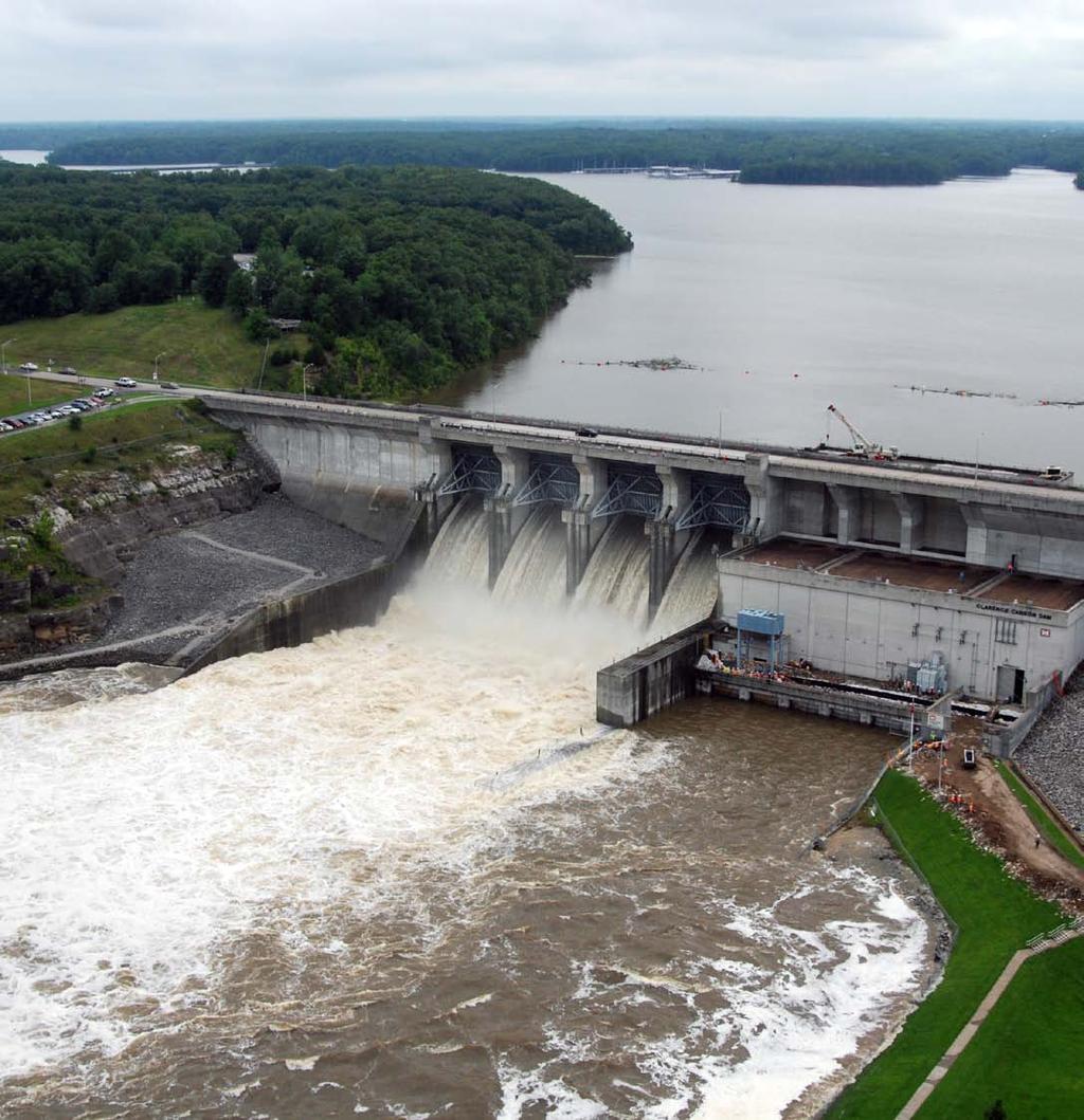
1 Mark Twain Lake Water Control Manual Update Joan Stemler St. Louis District Water Control US Army Corps of Engineers

2 WATER CONTOL PLAN Overall Objectives Project Purposes Flood Control Hydroelectric Power Generation Water Supply Fish and Wildlife Recreation Incidental Benefits to Mississippi River
3 General Objectives/Overall Plan General Objectives. Mark Twain Lake is a flood control reservoir with multiple purposes. The purposes include hydroelectric power generation, water supply, fish and wildlife and recreation. There are also incidental benefits to Mississippi River navigation. The pool at elevation feet NGVD retains one hundred percent of available flood control storage and one hundred percent of the joint-use storage for the other project purposes, namely hydroelectric power generation, water supply, fish and wildlife and recreation.
4 General Objectives/Overall Plan 1. Growing Season. Growing season typically is considered from April 1 st to October 31 st, but may vary depending on seasonal conditions. Growing season shall be complete when a significant amount of crops have been harvested as determined by consultation with local farming interests. Downstream conditions should be evaluated to determine the maximum release that would be non-damaging. Releases are limited to 10,000 cfs, based on downstream conditions. The maximum release will be restricted to 6,000 cfs if the stage of the Mississippi River at Louisiana and/or St. Louis is at or forecast to be at or above flood stage below elevation feet NGVD. Releases will be reduced to 2,000 cfs 24- hrs prior to crest on the Mississippi River and may be increased 24-hrs after crest.
5 General Objectives/Overall Plan For pool elevations exceeding feet NGVD, maximum releases become 12,000 cfs, based on downstream conditions. 2. Dormant Season. Dormant season shall be considered to exist from November 1 st to March 31 st, but may vary based on seasonal conditions. During this period, the release rate may reach the maximum of 12,000 cfs independent of pool elevations.
6 Flood Control Objective. The objective of flood control is flood damage reduction downstream of the project. Flood damage reduction benefits extend along both the Salt River and the Mississippi River downstream of the project. During the growing season (April 1 st to October 31 st ), the release will normally be 10,000 cfs or less (based on downstream conditions) until elevation feet NGVD is exceeded. The growing season typically is considered from April 1 st to October 31 st, but may vary depending on seasonal conditions. Growing season shall be complete when a significant amount of crops have been harvested as determined by consultation with local farming interests. Releases may be restricted because of flooding on the Lower Salt River or on the Mississippi River at Louisiana and/or St. Louis, Missouri.
7 Flood Control Lower Zone of Flood Control Pool (Elevation ft NGVD). Seasonal channel capacities, prevailing flow and forecast stages downstream of the Reregulation Dam are considered when operating in this zone. (a) The maximum release rate from the Reregulation Pool is 12,000 cfs during the dormant season (November 1 st to April 1 st ). (b) During crop season, the release rate from the Reregulation Pool will normally vary less than 10,000 cfs, based on downstream conditions. The nature of hydroelectric power generation is such that the release rate from Cannon Dam will normally vary between 0 cfs and 12,000 cfs. The maximum release will be restricted to 6,000 cfs if the stage of the Mississippi River at Louisiana and/or St. Louis is at or forecast to be at or above flood stage. Releases will be reduced to 2,000 cfs 24-hrs prior to crest on the Mississippi River and may be increased 24-hrs after crest.
8 Flood Control Upper Zone of Flood Control Pool (Elevation ft NGVD). Seasonal channel capacities, prevailing flow and forecast stages downstream of the Reregulation Dam are considered when operating in this zone. (a) The maximum release rate from the Reregulation Pool is 12,000 cfs during the dormant season (November 1 st to April 1 st ). (b) During crop season, the release rate from the Reregulation Pool may be increased to 12,000 cfs, based on downstream conditions. The nature of hydroelectric power generation is such that the release rate from Cannon Dam will normally vary between 0 cfs and 12,000 cfs.
9 Flood Control Surcharge Pool (Above Elevation feet NGVD). The minimum release from Mark Twain Lake is 12,000 cfs. If the inflow rate is greater than 12,000 cfs, PLATE 5-5 should be used in order to determine the appropriate release rate from Mark Twain Lake. PLATE 5-5 contains the surcharge pool regulation curves for the surcharge pool release rate. (a) If Mark Twain Lake pool elevation is forecast (water on ground) to reach surcharge pool, the discharge may be determined from the surcharge pool regulation curves (PLATE 5-5).
10 Hydroelectric Power Objective. The objective is to obtain the maximum amount of power generation revenue the project is capable of producing in conjunction with other project purposes. General Regulation Procedure. When within the joint-use pool, hydroelectric power production will be scheduled so as to meet the needs of SWPA. Normal lake drawdown within the joint-use pool as the result of power production will be limited to 2.0 feet per calendar week (i.e., Sunday through Saturday) and 4.0 feet per month (i.e., any consecutive four calendar week period) during May through October. During the remainder of the year, normal lake drawdown will be limited to 2.0 feet per week with no monthly maximum. Care will be taken to meet the power needs of SWPA everyday, but final control always rests with the Regulating Office. The need may exist to curtail hydroelectric power production on an immediate basis for downstream conditions. Cannon Dam Power Plant was designed to produce 58,000 KW of electrical power (installed capacity) as a peaking plant.
11 Water Supply Objective. The State of Missouri and the Federal Government have negotiated the water supply contracts which are shown in EXHIBIT C. Regulation Procedure. The State of Missouri shall provide a letter of request to the Finance Office for water to be taken from the State water supply account. All water taken directly from either Mark Twain Lake or the Reregulation Pool will be metered and a monthly accounting will be forwarded to the Finance Office. The Finance Office will maintain records of joint-use storage water released from the project for water supply, in addition to the metered readings.
12 Water Quality a. Objective. The objective is to ensure that the quality of water released from the Reregulation Pool meets the State of Missouri standards under 10 CSR (4)(J) Dissolved Oxygen. This regulation states that waters of the state of Missouri must maintain a level of 5 mg/l dissolved oxygen. b. Regulation Procedure. In coordination between the Water Quality Office and the Water Control Office, tainter gate releases from Mark Twain Lake may be required in order to improve downstream water quality conditions. These decisions will be based upon dissolved oxygen data collection real-time within the Reregulation Pool, located at the Reregulation Pool stream gage. If the dissolved oxygen levels drop below the 5 mg/l criteria based on 10 CSR , subsection (4) part J Dissolved Oxygen, the preferred method of releases into the Reregulation Pool would be discharging water through the tainter gates.
13 Fish Spawn Current WCM wording: The objective is to enhance fish and wildlife habitat to as great an extent as possible without conflicting with the achievement of other project purposes. The pool elevation of Mark Twain Lake will be regulated whenever possible so as to minimize the amount of fluctuation during the period of time when fish are spawning. Proposed Alternatives Fish Spawn up to pool elevation: thru 615.0
14 Fish Spawn Comment 1 Comment 2 In regard to the Mark Twain Lake Water Control Manual Update, we noticed a proposed change in pool elevation for Fish Spawn between 23 April and 1 May - 15 June. Our understanding of this proposed alternative would require a constant or slightly rising pool elevation up to feet above mean sea level. It is our understanding of the Profile of Water Storage at Clarence Cannon Dam and Mark Twain Lake, that the Top of the joint-use pool is 606. Joint-use storage being: Power Water supply Recreation Fish and wildlife Inactive storage. Storage between 606 Top of the joint-use pool and 638 Top of flood control pool is for flood control storage. Therefore, the consensus is that the maintenance/raising of the pool elevation above 606 Top of joint-use pool for any use other than flood storage would greatly endanger, if not, significantly increase the risk of inadequate flood storage during the crop season. As we discussed last week, please consider increasing the maximum elevation during the fish spawn period to 615 for about a 21 day period during the last two weeks of May, 1 st week of June. Also, could you consider and include some language about managing for an extended (100 days?) period of higher elevation (at least 615) during mid April through late July one of every four years.
15 Fish Spawn Comment 3 Comment 4 When the dam was conceived its primary purpose was flood control, but the cost could be better justified for multi use as electric generation and recreation. It is difficult to balance these competing needs; however, one must be cognizant that the primary purpose is flood control. The fish spawn in the lake is incidental to flood control and must not be allowed to interfere with that purpose. Both purposes can be served only if maintaining a constant pool or rising elevation provides an elevation is 606 feet. Spring time flood pool should have no allocation to fish spawn. This letter is in regards to the Missouri Department of Conservation (MDOC) request to raise the level of Mark Twain Lake. We feel going from 606 to 613, during the growing season, would negatively effect flood control in the Salt River basin. As they (MDOC) currently have control of the pool from to 606 for wildlife, fish spawn, ect., we feel anything over 606 would be better suited for flood control. Thank you for your attention to this matter.
16 Fish Spawn Fish Spawn Elevations within the Flood Control Pool at other St. Louis District Projects Lake Shelbyville (5.6%) Equivalent to at Mark Twain Lake Carlyle Lake (7.5%) Equivalent to at Mark Twain Lake
17 Fish Spawn Flood Control Utilization at Mark Twain Lake % % % % % % % %
18 Fish Spawn Flood Control Utilization at Mark Twain Lake For Elevations 608 thru ft of storage = 0.2 of runoff For example: 2 of rainfall with 50% runoff = 1 of runoff = 5 ft of flood control storage Flood Storage available below Elevation Inches of Runoff
19 Fish Spawn Years of spawn out of 101 yr Preferred Plan w/o to Days 0% 51% 56% 58% 64% 66% 69% 70%
20 Fish and Wildlife Objective. The objective is to enhance fish and wildlife habitat to as great an extent as possible without conflicting with the achievement of other project purposes. The Water Control Office coordinates with the Missouri Department of Conservation and the Mark Twain Lake Project Office to provide optimum fish spawning conditions each Spring and enhance waterfowl habitat. Regulation. The pool elevation of Mark Twain Lake will be regulated from April 23 rd to June 15 th whenever possible so as to minimize the amount of fluctuation during spawn. This effort is in coordination with SWPA, COE and Missouri Department of Conservation. The Chief of Water Control Operations, taking into account all project purposes, hydrologic conditions and weather forecasts may attempt to moderate pool fluctuations during critical fish spawn when the pool elevation is feet NGVD or below coordinated with Missouri Department of Conservation and Mark Twain Lake personnel.
21 Recreation Objective. The objective is to provide the best possible water conditions to support recreational activities such as boating, swimming, fishing, hunting, camping, etc., consistent with the procedures outlined in Recreational areas are located on the shoreline of Mark Twain Lake's l8,600-acre jointuse pool. These areas are operated by the COE, the Missouri State Park Board and concessionaires. Regulation Procedure. Fluctuations within the joint-use pool, feet NGVD, are limited to 2.0 feet per week and 4.0 feet per month in order to enhance recreation during May 1 st through October 31 st. Little regulation can be done within the Reregulation Pool to enhance recreation. Within the Reregulation Pool, large pool fluctuations and high flow velocities can be expected during power generation at Cannon Dam.
22 Incidental Benefits to the Mississippi River Objective and Regulation Procedure. The navigation project purpose assigned to Clarence Cannon Dam and Mark Twain Lake is achieved incidentally on the Mississippi River during low-flow periods by the release of water for non-consumptive water supply, for water quality enhancement, for improvement of downstream fisheries, and for hydroelectric power generation.
23 ??? Questions???
OSAGE RIVER BASIN OPERATIONS WATER MANAGEMENT
 OSAGE RIVER BASIN OPERATIONS WATER MANAGEMENT An Overview of Basin Operations Water Management Section Hydrologic Engineering Branch Kansas City District Northwestern Division US Army Corps of Engineers
VII - WATER CONTROL PLAN
 VII - WATER CONTROL PLAN 7-01. General Objectives. Regulation of Saylorville Lake in conjunction with Lake Red Rock provides flood control benefits along both the Des Moines and Mississippi Rivers. Additionally,
LAKE SHELBYVILLE MASTER PLAN KASKASKIA RIVER WATERSHED SHELBYVILLE ILLLINOIS
 LAKE SHELBYVILLE MASTER PLAN KASKASKIA RIVER WATERSHED SHELBYVILLE ILLLINOIS 1.1. PROJECT AUTHORIZATION CHAPTER 1 - INTRODUCTION Federal laws provide that land and water areas of Department of the Army
Chapter VII. Falls Lake Project -- Water Control Plan
 Chapter VII. Falls Lake Project -- Water Control Plan (This January 2000 revision incorporates approved structural and guide curve changes made at Falls Dam per 1994 EA/1995 FONSI to address storage shortage.)
Lake Texoma Water Management Frequently Asked Questions (FAQs)
") Lake Texoma Water Management Frequently Asked Questions (FAQs) Q1: Why is Lake Texoma so low? A1: A combination of factors is contributing to the current lake level. Even though there was substantial rainfall
Lake Texoma Water Management Frequently Asked Questions (FAQs) Q1: Why is Lake Texoma so low? A1: A combination of factors is contributing to the current lake level. Even though there was substantial rainfall
Missouri River Basin Water Management
 Missouri River Basin Water Management US Army Corps of Engineers Low Water Update November 20, 2012 Jody Farhat, P.E. Chief, Missouri River Basin Water Management US Army Corps of Engineers Missouri River
EXHIBIT B PLANT OPERATION AND RESOURCES UTILIZATION
 EXHIBIT B PLANT OPERATION AND RESOURCES UTILIZATION TABLE OF CONTENTS PAGE LIST OF FIGURES... i 1.0 PLANT OPERATION AND RESOURCES UTILIZATION... 1 1.1 PLANT OPERATION... 1 1.1.1 Adverse Flow... 1 1.1.2
DES MOINES RIVER RESERVOIRS WATER CONTROL PLAN UPDATES IOWA ASCE WATER RESOURCES DESIGN CONFERENCE
 DES MOINES RIVER RESERVOIRS WATER CONTROL PLAN UPDATES 237 237 237 217 217 217 200 200 200 0 0 0 163 163 163 131 132 122 80 119 27 252 174.59 110 135 120 112 92 56 IOWA ASCE WATER RESOURCES DESIGN CONFERENCE
Welcome STEP 1: STEP 2: STEP 3:
 Welcome Displays are placed around the room. Each display focuses on federally authorized project purposes and particular issues related to the draft Alabama, Coosa, and Tallapoosa River Basin (ACT) Master
Reservoir Drought Operations
 Reservoir Drought Operations Kevin J. Landwehr, P.E., D.WRE Chief, Hydrology and Hydraulics Branch 4 March 2013 Purpose Awareness of Drought Contingency Plans 2012/13 Reservoir Operations Drought Management
WATER CONTROL PLAN FOR JOHN H. KERR DAM AND RESERVOIR REVISED JUNE 2016
 WATER CONTROL PLAN FOR JOHN H. KERR DAM AND RESERVOIR REVISED JUNE 2016 WATER CONTROL PLAN FOR JOHN H. KERR DAM AND RESERVOIR A. INTRODUCTION The water control plan for John H. Kerr Dam and Reservoir describes
2017 Lake Hartwell Association
 2017 Lake Hartwell Association By Stan Simpson Water Manager/Civil Engineer Savannah District 14 October 2017 Trusted Partners Delivering Value, Today and Tomorrow CHARLESTON JACKSONVILLE MOBILE SAVANNAH
Status Report. Work to Date on the Development of the VARQ Flood Control Operation at Libby Dam and Hungry Horse Dam. January 1999.
 Status Report Work to Date on the Development of the VARQ Flood Control Operation at Libby Dam and Hungry Horse Dam January 1999 Section 3 29 JULY 1998 Prepared by U. S. Army Corps of Engineers Seattle
Appendix I. Dworshak Operations
 Appendix I Dworshak Operations I. Introduction The 2008 Biological Opinion requires annual progress reports that describe actions taken to implement certain reasonable and prudent actions (RPA) for the
JUVENILE SALMON MIGRATION SECTION 5. blank page
 blank page FISH AND WILDLIFE PROGRAM 5-16 September 13, 1995 SECTION 5 JUVENILE SALMON MIGRATION temperature improvement measures contained in this program will have a substantial impact on the operations
Missouri River Basin Water Management
 Missouri River Basin Water Management Spring 2011 Public Meetings April 12 th 11:00 a.m. Nebraska City, NE April 12 th 7:00 p.m. Fort Peck, MT April 13 th 1:00 p.m. Bismarck, ND April 13 th 7:00 p.m. Pierre,
16 September Water Management Wilmington District. US Army Corps of Engineers BUILDING STRONG
 FALLS LAKE OPERATIONS UNRBA Board Meeting 16 September 2015 Water Management Wilmington District US Army Corps of Engineers Wilmington District 2 Water Management Mission 24/365 Operate Wilmington District
EXHIBIT B PROJECT OPERATIONS
 EXHIBIT B PROJECT OPERATIONS HOLT HYDROELECTRIC PROJECT FERC NO. 2203 DRAFT LICENSE APPLICATION Alabama Power Company Birmingham, Alabama Prepared by: July 2012 EXHIBIT B PROJECT OPERATIONS HOLT HYDROELECTRIC
Summary of Flow and Water Quality Conditions Willamette Basin Science Review February 4-6, 2014
 Summary of Flow and Water Quality Conditions Willamette Basin Science Review February 4-6, 2014 Prepared by: U.S. Army Corps of Engineers, Portland District, January 2014 The following document summarizes
7.9 Lake Whitney Reallocation
 7.9 Lake Whitney Reallocation 7.9.1 Description of Option Lake Whitney is a major impoundment located on the Brazos River approximately 30 miles north of the City of Waco in Hill and Bosque Counties. The
LITTLE ROCK DISTRICT CORPS OF ENGINEERS WATER SUPPLY
 US Army Corps of Engineers LITTLE ROCK DISTRICT CORPS OF ENGINEERS WATER SUPPLY One Corps Serving The Army and the Nation Storage at Existing Lakes Basic Authority Water Supply Act of 1958 The Corps can
Water Supply Reallocation Workshop
 Water Supply Reallocation Workshop Determining Yield and Storage Requirement June 2, 2009 Tulsa, OK James Hathorn, Jr Redistribution of Water The function of a reservoir system is to redistribute the natural
Office, District Engineer, Seattle District, Corps of Engineers, 4735 East Marginal Way, Seattle 4, Washington
 800.2251 (Seattle Power Proj- Skagit River) 56 MPSGP Subject: Flood Control Requirement and Operating Procedure for Ross Reservoir, Skagit River, Wash. RHG/bg 4th Ind. 14 AUG 1953 13 August 1953 Office,
OVERVIEW OF RESERVOIR OPERATIONS AND FLOOD RISK MANAGEMENT
 OVERVIEW OF RESERVOIR OPERATIONS AND FLOOD RISK MANAGEMENT 255 255 255 237 237 237 0 0 0 217 217 217 163 163 163 200 200 200 COLUMBIA RIVER BASIN 131 132 122 239 65 53 80 119 27 110 135 120 252 174.59
MISSOURI RIVER BASIN WATER MANAGEMENT SPRING 2018 PUBLIC MEETINGS
 MISSOURI RIVER BASIN WATER MANAGEMENT SPRING 2018 PUBLIC MEETINGS April 17 th 10:00 a.m. Smithville, MO April 17 th 4:00 p.m. Omaha, NE April 18 th 10:00 a.m. Pierre, SD April 18 th 6:00 p.m. Bismarck,
PARR. PARR HYDROELECTRIC PROJECT PARR HYDRO DEVELOPMENT & FAIRFIELD PUMPED STORAGE FACILITY DEVELOPMENT FERC PROJECT No SC JANUARY 2013
 PARR HYDROELECTRIC PROJECT PARR HYDRO DEVELOPMENT & FAIRFIELD PUMPED STORAGE FACILITY DEVELOPMENT FERC PROJECT No. 1894 - SC JANUARY 2013 PARR Relicensing Project PARR AND FAIRFIELD LOCATIONS FFPS PARR
ROGUE BASIN PROJECT CONSERVATION RELEASE SEASON OPERATING PLAN WATER YEAR 2018
 ROGUE BASIN PROJECT CONSERVATION RELEASE SEASON OPERATING PLAN WATER YEAR 2018 1. General Operational planning for the conservation release season for the Rogue Basin Project begins with the January forecast
Warm Springs Hydro LLC 5203 South 11 th East Idaho Falls, ID
 Warm Springs Hydro LLC 5203 South 11 th East Idaho Falls, ID 83404 208-522-8069 ted@tsorenson.net September 26, 2013 Elizabeth A.O. Moats Oregon Department of Fish and Wildlife 107 20 th Street La Grande,
Spring Forecast Based Operations, Folsom Dam, California
 Spring Forecast Based Operations, Folsom Dam, California Paul E. Pugner, P.E. Chief, Water Management Section Sacramento District U.S. Army 1325 J Street, Room 1126 Sacramento, CA 95814-2922 Tel: (916)
Albuquerque District
 Albuquerque District Rio Grande Reservoir Symposium Federal Perspective Upper Rio Grande Operations Model and URWOPS Update April Sanders Project Manager 1 Why are we doing this? Upper Rio Grandè Basin
Forecast Informed Reservoir Operations for Groundwater Recharge Prado Dam
 Forecast Informed Reservoir Operations for Groundwater Recharge Prado Dam Greg Woodside Orange County Water District Bridging the Gap Conference January 29, 2019 Anaheim Army Corps of Engineers & OCWD
Missouri River Basin Water Management
 Missouri River Basin Water Management Spring 2015 Public Meetings April 7 th April 7 th April 8 th April 9 th April 9 th 11:00 a.m. 6:00 p.m. 11:00 a.m. 11:00 a.m. 6:00 p.m. Pierre, SD Bismarck, ND Fort
KANSAS CITY DISTRICT. Clinton Lake s Role in the Wakarusa Watershed. Samantha Jones, Park Manager Clinton & Hillsdale Lakes 5 November 2014
 KANSAS CITY DISTRICT Clinton Lake s Role in the Wakarusa Watershed Samantha Jones, Park Manager Clinton & Hillsdale Lakes 5 November 2014 US Army Corps of Engineers Clinton Lake Basic Information History/Purpose
Managing Idaho Power Company s Hydro Projects During Drought Conditions The Benefits of Communication and Collaboration
 Managing Idaho Power Company s Hydro Projects During Drought Conditions The Benefits of Communication and Collaboration Kresta Davis-Butts Northwest Hydroelectric Association Fall Workshop October 15,
Current Water Management Practices for Kerr Reservoir
 Current Water Management Practices for Kerr Reservoir Ashley Hatchell Water Management Lake Gaston Association Monthly Meeting 03 February 2016 US Army Corps of Engineers Outline and Goals for Today s
2. CURRENT AND ALTERNATIVE WATER CONTROL PLANS
 2. CURRENT AND ALTERNATIVE WATER CONTROL PLANS This chapter describes the current Water Control Plan (CWCP) for operation of the Mainstem Reservoir System (Section 2.1) and the process of developing and
MARK TWAIN LAKE WATER QUALITY REPORT. for
 MARK TWAIN LAKE WATER QUALITY REPORT for 1997 U.S. ARMY CORPS OF ENGINEERS, ST. LOUIS DISTRICT ENVIRONMENTAL QUALITY SECTION - Water Quality Ted Postol, Section Chief Tori Foerste, Environmental Engineer
CORPS OF ENGINEERS. Water Resource Activities in the ACF Basin May 18, 2007
 CORPS OF ENGINEERS Water Resource Activities in the ACF Basin May 18, 2007 Mobile District River Basins Water Management Staff Supervisory Hydraulic Engineer 4 Hydraulic Engineers 1 Engineer/Co-op (Vacant)
Missouri River Main Stem Reservoirs Annual Operating Plan. Missouri River Basin. Garrison North. Dakota. Oahe Big Bend. South.
 US Army Corps of Engineers Northwestern Division Missouri River Basin Water Management Division AOP 2000-2001 Missouri River Main Stem Reservoirs 2000-2001 Annual Operating Plan Missouri River Basin Fort
CARLYLE LAKE ASSOCIATION
 CARLYLE LAKE ASSOCIATION Who We Are: The Carlyle Lake Association (CLA) is An organization of citizens (stakeholders) working for the betterment of Carlyle Lake. The lake has become a treasured resource
Albeni Falls Operations Meeting 2015
 Albeni Falls Operations Meeting 2015 Katherine Rowden NWS Joel Fenolio Corps of Engineers Trevor Dowden BPA Ford Elsaesser - POBC Agenda Introductions) Weather and Streamflow predictions Winter 2015 Operations
Analysis of Proposed Water Sale Agreement Between Sabine River Authority, State of Louisiana and Toledo Bend Partners, LP
 Analysis of Proposed Water Sale Agreement Between Sabine River Authority, State of Louisiana and Toledo Bend Partners, LP Pursuant to La. R.S. 38:2325(16), the Sabine River Authority of Louisiana ( SRA-LA
WEST POINT PERTINENT DATA. GENERAL Location (damsite) Troup County GA, Chambers County AL, miles above mouth of Chattahoochee River
 Troup County GA, Chambers County AL, miles above mouth of Chattahoochee River") WEST POINT PERTINENT DATA GENERAL Location (damsite) Troup County GA, Chambers County AL, miles above mouth of Chattahoochee River 201.4 Drainage area, Buford Dam to West Point Dam, square miles 2,406
WEST POINT PERTINENT DATA GENERAL Location (damsite) Troup County GA, Chambers County AL, miles above mouth of Chattahoochee River 201.4 Drainage area, Buford Dam to West Point Dam, square miles 2,406
Old Document: Appendices 18 pages (1.84 MB) 8/9/13 5:22:06 PM -07'00'
 8/9/13 5:22:06 PM -07'00'") Summary 8/9/13 4:23:09 PM -07'00' Differences exist between documents. New Document: FinalEIS 58 pages (2.05 MB) 8/9/13 5:22:16 PM -07'00' Used to display results. Old Document: Appendices 18 pages (1.84
Summary 8/9/13 4:23:09 PM -07'00' Differences exist between documents. New Document: FinalEIS 58 pages (2.05 MB) 8/9/13 5:22:16 PM -07'00' Used to display results. Old Document: Appendices 18 pages (1.84
Webinar for the Natural Floodplain Function Alliance 18 November 2013
 Moving toward Floodplain Restoration at Scale on the Illinois River and Upper Mississippi Basin: Valuing Ecosystem Services, Demonstrating Flood Reduction, and Policy Implications Webinar for the Natural
Missouri River Basin Water Management Spring 2013 Public Meetings
 Missouri River Basin Water Management Spring 2013 Public Meetings April 8 th April 9 th April 9 th April 10 th April 11 th 7:00 p.m. 11:00 a.m. 7:00 p.m. 11:00 a.m. 11:00 a.m. Nebraska City, NE Fort Peck,
Columbia River Treaty
 Columbia River Treaty 2014/2024 Review United States Entity Supplemental Report Appendix A September 2010 United States Entity APPENDIX A U.S. ENTITY SUPPLEMENTAL STUDIES METHODOLOGY TABLE OF CONTENTS
An Investigation into the 2012 drought on Apalachicola River. Steve Leitman, Bill Pine and Greg Kiker
 An Investigation into the 2012 drought on Apalachicola River Steve Leitman, Bill Pine and Greg Kiker Apalachicola-Chattahoochee-Flint (ACF) River basin 20,400 sq. mi. One of the most actively disputed
olumbia River Treaty The Columbia by Steve Oliver, Vice President, Generation Asset Management, Bonneville Power Administration 16 Oct
 The Columbia by Steve Oliver, Vice President, Generation Asset Management, Bonneville Power Administration 16 Oct 2006 1 Presentation Outline Geography of the Pacific Northwest Bonneville Power Administration
Columbia River Drainage
 Columbia River Spring/Summer Run-Off Conditions and Operations for Legislative Council on River Governance August 21, 2012 Boise, Idaho Rick Pendergrass Manager, Power & Operations Planning Bonneville
Water Resource Management in the Ukiah Valley
 Water Resource Management in the Ukiah Valley Tamara Alaniz General Manager Mendocino County Russian River Flood Control & Water Conservation Improvement District Ukiah Valley Setting Agriculture dominates
Elko Project Water Use Plan. Revised for Acceptance by the Comptroller of Water Rights
 Elko Project Water Use Plan Revised for Acceptance by the Comptroller of Water Rights 7 April 2005 B Elko Project Water Use Plan Revised for Acceptance by the Comptroller of Water Rights Elko Project
RECORD OF DECISION MISSOURI RIVER MASTER WATER CONTROL MANUAL REVIEW AND UPDATE
 RECORD OF DECISION MISSOURI RIVER MASTER WATER CONTROL MANUAL REVIEW AND UPDATE I have reviewed the Missouri River Master Water Control Manual Review and Update Final Environmental Impact Statement (FEIS),
Sovereign Lands and Great Salt Lake
 Sovereign Lands and Great Salt Lake The Living Lake - Charles Uibel Laura Ault Sovereign Lands Program Manager Division of Forestry, Fire and State Lands What are Sovereign Lands? Lakebeds and riverbeds
I. INTRODUCTION PURPOSE BASIN DESCRIPTION WATER RESOURCES DEVELOPMENT TYPES OF RESERVOIR PROJECTS ANNUAL REGULATION CYCLE
 I. INTRODUCTION PURPOSE BASIN DESCRIPTION WATER RESOURCES DEVELOPMENT TYPES OF RESERVOIR PROJECTS ANNUAL REGULATION CYCLE A. PURPOSE This document reports on the activities of concerned governmental agencies
Project Information. Pursuant to Section 404 of the Clean Water Act (33 U.S. Code 1344), notice is hereby given that
, notice is hereby given that") US ARMY Corps Of Engineers Little Rock District JOINT PUBLIC NOTICE CORPS OF ENGINEERS STATE OF MISSOURI Application Number: SWL 2013-00260 Date: April 15, 2014 Comments Due: May 6, 2014 TO WHOM IT MAY
US ARMY Corps Of Engineers Little Rock District JOINT PUBLIC NOTICE CORPS OF ENGINEERS STATE OF MISSOURI Application Number: SWL 2013-00260 Date: April 15, 2014 Comments Due: May 6, 2014 TO WHOM IT MAY
John H. Kerr Dam and Reservoir Virginia and North Carolina (Section 216)
") John H. Kerr Dam and Reservoir Virginia and North Carolina (Section 216) Wilmington District, Corps of Engineers Stakeholder Update Presentation January 24, 2014 Authorized under Section 216 of Public
John H. Kerr Dam and Reservoir Virginia and North Carolina (Section 216) Wilmington District, Corps of Engineers Stakeholder Update Presentation January 24, 2014 Authorized under Section 216 of Public
Water Management Under Severe Storm Conditions in Central and South Florida
 Water Management Under Severe Storm Conditions in Central and South Florida Chandra S. S. Pathak, Ph.D., P.E. Severe Storm Prediction and Global Climate Impact in the Gulf Coast Conference October 29 to
PROGRAMMATIC ENVIRONMENTAL IMPACT STATEMENT
 PROGRAMMATIC ENVIRONMENTAL IMPACT STATEMENT Tennessee Valley Authority Reservoir Operations Study Record of Decision May 2004 Lead Agency: Tennessee Valley Authority In cooperation with U.S. Army Corps
Glades Reservoir Draft Environmental Impact Statement
 Glades Reservoir Draft Environmental Impact Statement Chapter 4 Environmental Consequences October 2015 4 ENVIRONMENTAL CONSEQUENCES 4.1 INTRODUCTION 4-1 4.1.1 Types and Definitions of Impacts 4-1 4.1.2
PARR HYDROELECTRIC PROJECT PARR HYDRO DEVELOPMENT & FAIRFIELD PUMPED STORAGE FACILITY DEVELOPMENT FERC PROJECT No SC SEPTEMBER 19, 2012
 PARR HYDROELECTRIC PROJECT PARR HYDRO DEVELOPMENT & FAIRFIELD PUMPED STORAGE FACILITY DEVELOPMENT FERC PROJECT No. 1894 - SC SEPTEMBER 19, 2012 PARR AND FAIRFIELD LOCATIONS Lockhart Neal Shoals Monticello
TABLE OF CONTENTS. List of Tables List of Plates. Previously Issued Design Memoranda
 TABLE OF CONTENTS Title List of Tables List of Plates Preface Previously Issued Design Memoranda Page v vi vii viii Section I Introduction 1-01. Authorization 1-1 1-02. Project Purposes 1-2 1-03. Purpose
Camp Far West Hydroelectric Project Relicensing
 Camp Far West Hydroelectric Project Relicensing Water Operations Model FERC Project No. 2997 July 16, 2018 Overview Project and South Sutter Water District overview Operations model Overview Model Updates
DROUGHT CONTINGENCY PLAN SUMMARY
 May 01, 2014 DROUGHT CONTINGENCY PLAN SUMMARY CANYON RESERVOIR Canyon Reservoir 8,200 surface acres -- Impounds 378,852 acre feet Conservation Pool Between 800 mean sea level (msl) and elevation of 909
Maintaining Water Supply Resilience in Extreme Times
 Maintaining Water Supply Resilience in Extreme Times Presented to the Western Coalition of Arid States June 20, 2018 Presentation Outline: Snapshot of Reclamation Offices West-wide Precipitation and Storage
Glades Reservoir Environmental Impact Statement (EIS)
") Glades Reservoir Environmental Impact Statement (EIS) Permit Application #SAS-2007-00388 Public Scoping Meeting Proposed Operational Plan/Scenarios March 2012 Glades Reservoir Environmental Impact Statement
Glades Reservoir Environmental Impact Statement (EIS) Permit Application #SAS-2007-00388 Public Scoping Meeting Proposed Operational Plan/Scenarios March 2012 Glades Reservoir Environmental Impact Statement
Smithville Lake 2000 Water Quality Report
 Smithville Lake 2 Water Quality Report 1. General. a. Project location. The dam is located at river mile 12.9 on the Little Platte River, a tributary of the Platte River. The drainage area above the dam
Exploring the Possibilities At Prado Dam
 Exploring the Possibilities At Prado Dam Greg Woodside, P.G., C.HG. Executive Director of Planning & Natural Resources December 5, 2017 The Orange County groundwater basin lies at the base of the Santa
U.S. Army Corps of Engineers Reservoir Operations Maria Placht, Institute for Water Resources, USACE 49
 U.S. Army Corps of Engineers Reservoir Operations Maria Placht, Institute for Water Resources, USACE 49 Context The U.S. Army Corps of Engineers (the Corps) is responsible for a variety of water resourcerelated
ND Detention Project Development Update
 ND Detention Project Development Update Upper Red River Basin Halstad, MN = 8 Upstream Subwatersheds Fargo, ND = 3 Upstream Subwatersheds Halstad, MN Fargo, ND Wild Rice Otter Tail Bois de Sioux Upstream
Canadian Entity s Preliminary View of Columbia River Treaty Post-2024 Called Upon Procedures. BC Hydro and Power Authority
 Canadian Entity s Preliminary View of Columbia River Treaty Post-2024 Called Upon Procedures BC Hydro and Power Authority February 14, 2013 1 1.0 Introduction Under the Columbia River Treaty (Treaty),
U.S. Army Corps of Engineers and RiverWare. Fort Worth District Building Strong!
 U.S. Army Corps of Engineers and RiverWare USACE Overview 38 district/division offices for civil works for water resources and environmental 37,000 employees $5 billion annual civil works mission Military
WATER CONTROL MANUAL
 Mobile District WATER CONTROL MANUAL APPENDIX E WEST POINT DAM AND LAKE CHATTAHOOCHEE RIVER, GEORGIA AND ALABAMA U.S. ARMY CORPS OF ENGINEERS MOBILE DISTRICT MOBILE, ALABAMA JUNE 97 Revised August 98 and
TOLEDO BEND PROJECT FERC NO DRAFT LICENSE APPLICATION EXHIBIT E - ENVIRONMENTAL EXHIBIT 2.0 PROPOSED ACTION AND ALTERNATIVES
 TOLEDO BEND PROJECT FERC NO. 2305 DRAFT LICENSE APPLICATION EXHIBIT E - ENVIRONMENTAL EXHIBIT 2.0 PROPOSED ACTION AND ALTERNATIVES May 2011 Copyright 2011.Sabine River Authority of Texas and Sabine River
Columbia Basin Operations and Flood Risk Management
 Columbia Basin Operations and Flood Risk Management Julie Ammann, PE Chief, Reservoir Control Center Northwestern Division USACE US Army Corps of Engineers BUILDING STRONG The Columbia River Basin Drainage
Available Yield from Reallocation in Federal Reservoirs Excluding Lake Aquilla. The USACE study evaluated four alternatives for each reservoir:
 4B.18 4B.18.1 BRA Reservoirs Excluding Lake Aquilla 1 4B.18.1.1 Description of Option 2 Reservoirs owned by the United States Army Corps of Engineers (USACE) typically serve multiple functions, including
Overview of Columbia Basin Water Management
 Overview of Columbia Basin Water Management Walla Walla District and Portland District Navigation Meeting Port of Morrow SAGE Center Karl Kanbergs, acting RCC Chief Columbia Basin Water Management May
Water Supply Board Briefing. Water Operations Department March 22, 2016
 Water Supply Board Briefing Water Operations Department March 22, 2016 Water Supply Briefing California Water Supply District Water Supply Water Supply Projections Water Supply Schedule 2 California Water
Ocklawaha River Restoration as Mitigation
 Ocklawaha River Restoration as Mitigation Dredging Will Further Harm the St. Johns Salinity = Farther Upstream Impacting Wetlands Damaging Submerged Grasses Further Stressing Trees Altering Dissolved Oxygen
HYDRAULIC CONNECTIVITY (HC) ENGINEERING & HYDRAULICS PERSPECTIVES
 ENGINEERING & HYDRAULICS PERSPECTIVES") HYDRAULIC CONNECTIVITY (HC) ENGINEERING & HYDRAULICS PERSPECTIVES Presented at the UMRR HREP Team Meeting September 28, 2016 Jon Hendrickson Regional Technical Specialist, Eco-Hydraulics & WQ USACE, Mississippi
HYDRAULIC CONNECTIVITY (HC) ENGINEERING & HYDRAULICS PERSPECTIVES Presented at the UMRR HREP Team Meeting September 28, 2016 Jon Hendrickson Regional Technical Specialist, Eco-Hydraulics & WQ USACE, Mississippi
Appendix I R. L. Harris Dam and Lake. R. L. Harris Dam and Lake
 Appendix I R. L. Harris Dam and Lake R. L. Harris Dam and Lake ii NOTICE TO USERS OF THIS MANUAL Regulations specify that this Water Control Manual be published in a hard copy binder with loose-leaf form,
Green River Basin Plan Executive Summary
 Green River Basin Plan Executive Summary December 2010 Prepared for: Wyoming Water Development Commission Basin Planning Program Prepared by: WWC Engineering AECOM ERO Resources Corp. Table of Contents
5SECTION IX - FACILITY LOAD AND OTHER DESIGN CRITERIA
 4 5SECTION IX - FACILITY LOAD AND OTHER DESIGN CRITERIA 9.01 SITING All proposed structures will be located above the 638 feet NGVD flood pool. Site selection will be based on environmental concerns including
JUNE 2014 LAW REVIEW FEDERAL FLOOD CONTROL IMMUNITY SLIPPERY WHEN WET
 FEDERAL FLOOD CONTROL IMMUNITY SLIPPERY WHEN WET James C. Kozlowski, J.D., Ph.D. 2014 James C. Kozlowski The U.S. Army Corps of Engineers (Corps) is the largest provider of water-based outdoor recreation
Columbia River Operations Summary
 Columbia River Operations Summary Spring 2018 Seven Mile Reservoir. Photo by Megan Chadwick. This publication provides an overview of BC Hydro s operations on the Columbia River. At 2,000 kilometres long,
Background and History of Water Management of Okanagan Lake and River
 Background and History of Water Management of Okanagan Lake and River Prepared by: B.J. Symonds, P. Eng. Water Management Ministry of Environment, Lands and Parks Penticton, BC Since the early 1900 s people
2 USCID/EWRI Conference
 1 X 2 USCID/EWRI Conference x Water Quality of Surface Irrigation Returns in Southern Idaho Clarence W. Robison 1 Richard G. Allen 2 Richard Merkle 3 ABSTRACT The Clean Water Act and Safe Drinking Water
Harry S Truman Reservoir 1999 Water Quality Report
 Harry S Truman Reservoir 999 Water Quality Report. General. a. Project location. Truman Dam is located approximately. miles northwest of Warsaw, Missouri, at river mile. on the Osage River, a tributary
APPENDIX III Hydrologic and Hydraulic Evaluations
 APPENDI III Hydrologic and Hydraulic Evaluations Hydrologic and Hydraulic Analysis Related to Compliance Requirements South Fly Ash Pond, Boiler Slag Pond and Clearwater Pond Kyger Creek Power Plant, Gallia
COON CREEK WATERSHED DISTRICT PERMIT REVIEW Mississippi Dr Coon Rapids, MN SQ FT Residence on 0.64 Acre Lot
 17-082 Van Sloun Residence, Page 1 of 5 COON CREEK WATERSHED DISTRICT PERMIT REVIEW MEETING DATE: May 8, 2017 AGENDA NUMBER: 17 FILE NUMBER: 17-082 ITEM: Van Sloun Residence RECOMMENDATION: Approve with
Ponds. Pond A water impoundment made by excavating a pit, or constructing a dam or an embankment.
 POND SITE SELECTION AND CONSTRUCTION Uses, Planning, & Design David Krietemeyer Area Engineer USDA-NRCS June 20, 2008 Uses Considerations for Location of Commonly Used Terms Pond A water impoundment made
CESAM-PD-EI 1. INTRODUCTION:
 SUPPLEMENTAL ENVIRONMENTAL ASSESSMENT MODIFICATIONS TO THE INTERIM OPERATIONS PLAN FOR SUPPORT OF ENDANGERED AND THREATENED SPECIES AND TEMPORARY WAIVER FROM ACF WATER CONTROL PLAN JIM WOODRUFF DAM GADSDEN
Cokato Lake (86-263) Wright County. Hydrologic Investigation
 Wright County. Hydrologic Investigation") Cokato Lake (86-263) Wright County Hydrologic Investigation April 14, 2005 Cokato Lake (86-263) Wright County Hydrologic Investigation April 14, 2005 Problem Statement In recent years, heavy rainfall has
Cokato Lake (86-263) Wright County Hydrologic Investigation April 14, 2005 Cokato Lake (86-263) Wright County Hydrologic Investigation April 14, 2005 Problem Statement In recent years, heavy rainfall has
Oregon Administrative Rules Oregon Department of Fish and Wildlife
 DIVISION 400 INSTREAM WATER RIGHTS 635-400-0000 Purpose (1) These rules set the policy, procedures, criteria, standards, including flow methodologies, and definitions for instream water right applications
Klamath Hydroelectric Project Interim Measure 11 Study Activities for 2018
 Introduction Final Study Plan, Part 2 Klamath Hydroelectric Project Interim Measure 11 Study Activities for 2018 July 17, 2018 The Klamath Hydroelectric Settlement Agreement (KHSA; as amended on April
Chehalis Basin Strategy Programmatic SEPA Draft EIS
 Chehalis Basin Strategy Programmatic SEPA Draft EIS History of Flooding I-5 closed in 1990, 1996, 2007, 2009 Five largest flood events occurred since 1986 2 History of Habitat Degradation Harvest has been
Manhattan Levee Section 216 Feasibility Study Public Workshop 17Apr13 Manhattan Kansas
 Manhattan Levee Section 216 Feasibility Study Public Workshop 17Apr13 Manhattan Kansas Tuttle Creek Dam and Lake Kansas City District Project Development Team Manhattan, KS US Army Corps of Engineers 1
ALABAMA-COOSA-TALLAPOOSA RIVER BASIN WATER CONTROL MANUAL
 ALABAMA-COOSA-TALLAPOOSA RIVER BASIN WATER CONTROL MANUAL APPENDIX D H. NEELY HENRY DAM AND LAKE (ALABAMA POWER COMPANY) COOSA RIVER, ALABAMA U.S. ARMY CORPS OF ENGINEERS SOUTH ATLANTIC DIVISION MOBILE
Thermal and Bioenergetics Modeling For Balancing Energy and Environment
 Thermal and Bioenergetics Modeling For Balancing Energy and Environment Gary E. 1, M. ASCE John Stark 2 George Robbins 3, M. ASCE Bethel Herrold 4 Abstract Dynamic thermal and bioenergetics models were
PUBLIC NOTICE. Town of Beech Mountain Mr. Tim Holloman 503 Beech Mtn. Parkway Banner Elk, North Carolina 28604
 US Army Corps Of Engineers Wilmington District PUBLIC NOTICE Issue Date: April 9, 2019 Comment Deadline: April 23, 2019 Corps Action ID Number: SAW-2018-02144 The Wilmington District, Corps of Engineers