6. Socio-Economic Environment
|
|
|
- Doris Lynne Booth
- 6 years ago
- Views:
Transcription
1 6. Socio-Economic Environment The functions of this section are to describe the existing socio-economic environmental values of the area which may be affected by the proposed project, to assess the potential impact of the proposed development on those environmental values and to develop mitigation measures to minimise those impacts. 6.1 Land Use Description of General Land Use Blythdale Substation Site The site has been previously cleared for agriculture and other rural purposes (including grazing), but the site does not include any current cropping land. A substation on this site would not have any impact on the existing surrounding land uses and enable grazing to continue on the remainder of the property. The location of the proposed substation has been chosen with consideration to avoid the need for the high voltage connection to traverse and alienate good quality agricultural land immediately to the north of the gas hub compressor station. By locating Blythdale substation to the south east of the compressor station a connection can be made to the high voltage transmission line from the Yuleba North Substation that avoids direct impacts on the adjacent cropping land. Fairview South Substation Site The site has been historically used for grazing, however with the intense development of the Fairview Gas Fields in the last decade, grazing in the local area has been scaled back and limited regrowth has occurred in some areas. At present, the proposed Fairview South substation site has been cleared historically for cattle but now has limited regrowth comprising mostly ironbark. The development of Fairview South substation will have no impacts on existing or proposed future rural land uses. The site has been chosen in consultation with Santos GLNG to minimise potential conflict with the construction and operation of gas field infrastructure. Fairview Substation Site The Fairview site has been extensively developed for the Fairview Gas Field and grazing has been discontinued in the immediate area. The current land use is gas field development and operation. The substation location was selected in consultation with Santos GLNG to limit potential impacts on gas field infrastructure. The proposed substation would not have any direct impacts on land use and enable grazing/agriculture to continue on the balance of the property should that be relevant. 82
2 6.1.2 Mining Blythdale Substation Site Blythdale substation will be located on Lot 94/95 WV456. These lots are freehold, with existing mining/petroleum tenements overlying the property. These are: Petroleum Lease (PL 314), granted, expires 26 June 2041 and the holder is Santos QNT Pty Ltd. Exploration Permit Coal (1763), granted, expires 10 November 2014 and the holder is Wanbei Coal Electricity Mining (Australia) Pty Ltd. Exploration Permit Mineral (19039), granted, expires 26 June 2015 and the holder is Mining Investments Four Pty Ltd. The granted petroleum lease overrides the exploration permits for the duration of the PL tenure. The holder of PL 314 (Santos GLNG) has indicated they will allow designation of a substation site. Fairview South Substation Site The Fairview South substation site is on Lot 8 AB200. This lot is freehold, with existing mining/petroleum tenements overlying the property. These are: Petroleum Lease (100), granted, expires 15 December 2033 and the holder is Santos Toga Pty Ltd. Exploration Permit Coal (1110), granted, expires 27 May 2013 and the holder is Tilox Resources Pty Ltd. The granted petroleum lease (PL 100) overrides the exploration permits for the duration of the PL tenure. The holder of PL 100 will allow designation of a substation site. Fairview Substation Site The Fairview substation site is on Lot 5 WT217 is freehold land with three mining and/or exploration tenures over the site. They include: Petroleum Lease (91), granted, expires 29 November 2029 and the holder is Santos Toga Pty Ltd. Exploration Permit Coal (1110), granted, expires 27 May 2013 and the holder is Tilox Resources Pty Ltd. Additionally, there are four pipeline licences in the immediate vicinity comprising; PPL 30 (Jemena Queensland Gas Pipeline (1) Ltd). This is only current operational pipeline; PPL 147 (Fairview Pipeline Pty Ltd), status unknown; PPL 76 (Santos Toga Pty Ltd), status is progressing; and PPL 92 (Santos Toga Pty Ltd), status unknown. The granted petroleum lease (PL 91) overrides the exploration permits for the duration of the PL tenure. The holder of PL 91 has indicated that they allow designation of a substation site and necessary transmission infrastructure. 83
3 6.1.3 Other Rural Land Use Blythdale Substation Site The property on which the Blythdale substation is proposed to be located is not identified as Good Quality Agriculture Land (GQAL) in the Bungil Shire Planning Scheme. The site has previously been used for grazing and some cropping. However, with the acquisition of these properties to support the development of the Roma East gas field these land uses have ceased (or will shortly cease) and the construction and operation of the substations will not further alienate any rural lands uses. Fairview South Substation Site Five percent of Lot 8 AB200, within which the Fairview South substation will be located, is mapped as GQAL under the Taroom Shire Council Planning Scheme. The Taroom Shire Council Planning Scheme maps the GQAL as Class C. Class C is suitable for grazing high quality pastures were ground disturbance is possible. This area of GQAL is situated to the east of the proposed substation and will not be affected by the construction and operation of the substation. Fairview Substation Site The proposed Fairview substation site is located in Lot 5 WT217, which is partially mapped as GQAL in the Bungil Shire Planning Scheme. The site has been developed for the Fairview Gas Field and as a result agricultural land uses have either ceased or are reduced. Therefore the proposed substation would not have any impact on GQAL land Description of Land Tenure The tenure for the proposed substation sites is entirely freehold (refer to Figure 12, Figure 13 and Figure 14 for Blythdale, Fairview South and Fairview respectively). The construction and operation of the proposed substations will be localised to their specific sites, hence will not have an impact to its corresponding adjacent lands Description of the State Stock Route Network The administration and management of the stock route network is shared between the local government and DNRM. Stock routes are divided into four classifications for operational and management purposes based upon permit data and average use over a five year period. The substations do not traverse any roads or designated State Stock Routes Potential Impacts Substations can generally be constructed and operated in a rural environment without impacting on land use to any significant extent due to their small development footprint by comparison with other major infrastructure projects. The immediate area of the substations and access roads may result in alienation of some lands uses, but the majority of rural land uses, excepting for some intensive horticultural cropping operations, may be continued up to the boundaries of the substation development envelopment. The proposed substation sites are not envisaged to have an impact on the current or future land use in their corresponding area. All the substations are being located in areas that are being intensively developed for gas field infrastructure and this has effectively alienated the area about the gas hub compressor stations from further rural lands uses. 84
4 The nature of likely impacts on other land uses, particularly during construction, is generally minor, temporary and reversible. Potential impacts upon land uses are primarily related to temporary limitations on land use activities during construction, such as impacts on local roads and tracks Mitigation Measures Impacts that will occur will be mitigated through a program of consultation with the landholder and stakeholders to determine agreed times and locations for land use activities to occur. Appropriate hygiene measures for weed management will be implemented for this project in consultation with landholders/stakeholders. Weed management will be driven by the Pest Management Plan and will include the construction of both permanent and temporary wash-down facilities at locations to be determined in final consultation with landholders/stakeholders prior to construction. The EMP (Appendix D) lists those elements related to weed management to be implemented for this project. Powerlink and/or its contractors carry out a dial before you dig search and other services surveys before commencement of construction activities, to prevent direct damage to any known underground services. As the project area is within generally remote areas away from settlements the risks of direct impacts on utility services and infrastructure for any local government and state government utilities are very low. 85

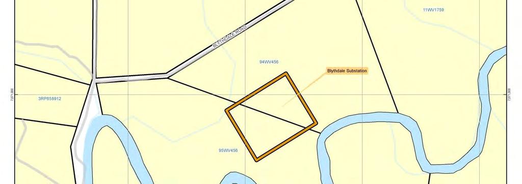
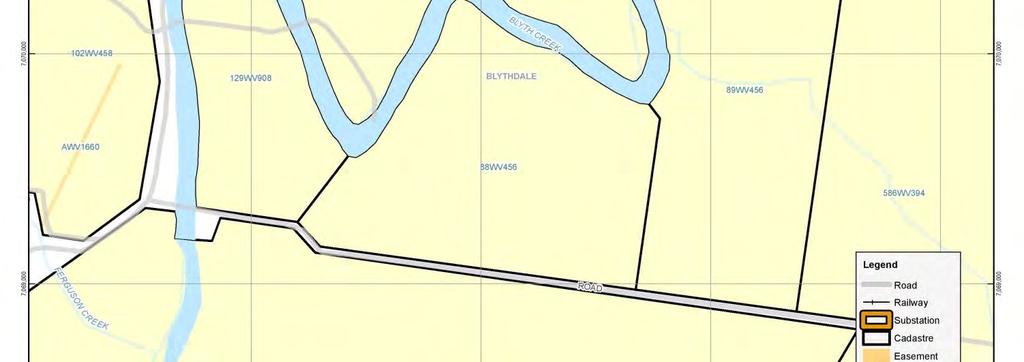
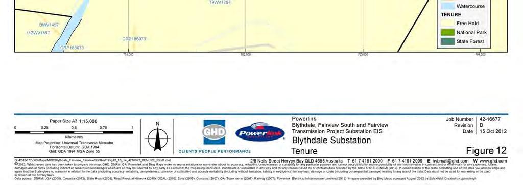
5 Figure 12: Blythdale Substation Tenure 86


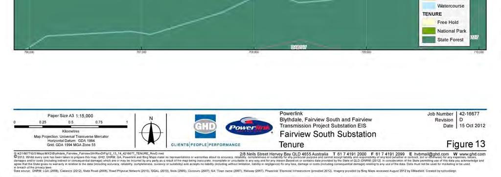
6 Figure 13: Fairview South Substation Tenure 87

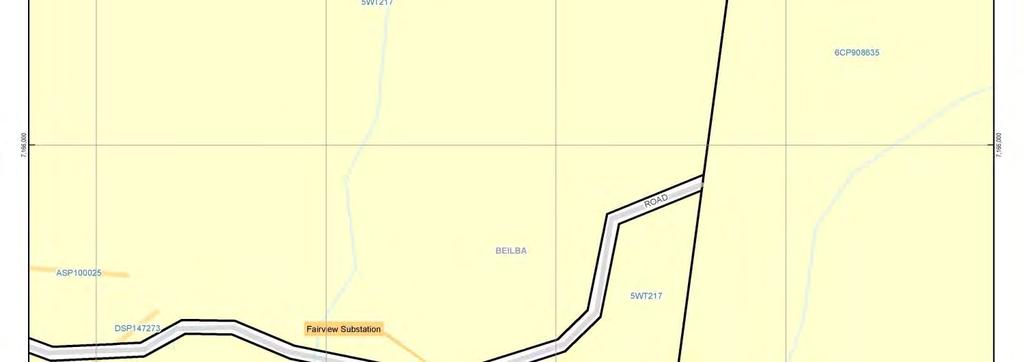
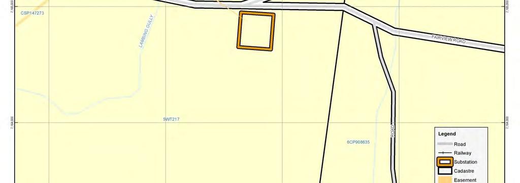
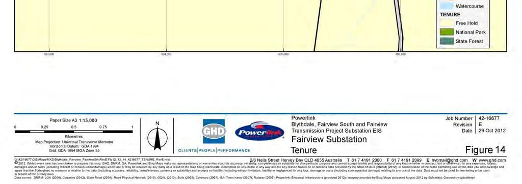
7 Figure 14: Fairview Substation Tenure 88
8 6.2 Socio-Economic Issues Local Demographic Profile The main source of population demographic information for the region is Census data from the Office of Economic and Statistical Research (OESR). The most recent Census data collected for Maranoa Regional Council was conducted in 2011, with Census data available for Banana Shire Council being from A summary of the available demographic information for the regional council involved in this EIS is provided below. The Blythdale and Fairview substation sites are within the Maranoa Regional Council. Data from the 2011 Census shows that the population in the region was estimated to be 13,423 people with a projection between 13,621 and 14,502 people by Fairview South substation is within the Banana Shire Regional Council, which has a population of 15,634 people and a projection of 15,987 by The region is projected to have an average annual growth rate of 0.3 percent. Main occupation in the region is classified as being managers, labourers, technicians and trades workers, and machinery operators and drivers with main employment being classified as agriculture, forestry and fishing and mining Potential Impacts and Management Strategies The need for increasing the amount of electricity supplied to the area is highlighted by the slow but steady increase in population and the large growth in the mining sector. By extending the high voltage electricity network to the area, and to specific mining projects, Powerlink can support the growth of both regions and indirectly provide a range of jobs and other services. For example, by supplying these substations to Santos GLNG, Powerlink enables the gas fields to continue and expand its operations. This would provide direct employment opportunities for the mine and indirect employment for the associated services (e.g. food outlets and construction) Workers Accommodation Construction work is carried out by suitably qualified contractors under the supervision of Powerlink staff. Up to 30 contract and Powerlink personnel will be used for the substations construction. They will only be required for the construction phase after which the substations will be managed remotely. It is expected that existing construction camps and accommodation will service the needs of the construction workforce, not all of whom will be engaged simultaneously. However, owing to current shortage of accommodation in the project area, work/accommodation camps may be required to be established in the field (these camps will be considered at a later date and are not considered in this EIS). Should accommodation camps be required the proposed locations, impacts and mitigation measures will be discussed with the relevant council and/or statutory department. Powerlink and the Contractor are proposing to utilise specialist accommodation providers who are familiar with the statutory requirements of work camps. Powerlink is currently in the pre-planning and negotiating phase in regards to camps that are already established in the project area and requirements of additional camps. It should be noted that approvals for new accommodation/construction camps will be sought through the planning provisions of the Maranoa Regional Council or Banana Shire Council via a Development Application (DA) and not through the Community Infrastructure Designation (CID) process. 89
9 6.2.4 Consultation and Community Engagement Consultation and community engagement for this project follow those requirements as described in Guidelines about Environmental Assessment and Public Consultation Procedures for Designating Land for Community Infrastructure Schedule 5 Powerlink Manual dated December 2006 by the Department of Local Government, Planning, Sport and Recreation. Initial community notification and information about the project was circulated via a project newsletter and introductory letter to the stakeholders in July Following this formal written advice, individual consultation with affected stakeholders, including local government, government agencies, local elected representatives and affected landholders, was undertaken between July 2012 and September During this period all stakeholders/landholders were engaged in direct meetings, either at offices on their properties, to introduce and discuss the project, identify issues specific to their property, electorate or statutory obligations, and to set the framework to undertake the EIS for the project. The stakeholders (affected parties) are identified in the Consultation Report (Appendix H). Further information is supplied in Appendix H. 6.3 Noise and Vibration Description of Environmental Values Noise within the proposed substation sites is currently commensurate with a rural environment with light local traffic and other traffic associated with the nearby roads (Blythdale Road, Baroondah Road and Fairview Road). There are, however, a number of future planned and initiated point sources, including construction and operation of gas hub compressor stations for the Santos GLNG gas fields. The proposed substation energised high voltage conductors and bus bars may exhibit corona. Corona is the term applied to the electrical discharge that can occur due to an intense localised electric field adjacent to an energised part. Energised surfaces, such as conductors, are surrounded by regions of high field strength causing ionisation of the air. The corona effect is caused by minor electrical discharge from the conductors into the ionised air and is strongest during we weather. Substations typically will emit a hum when operational which is typical operation noise associated with infrastructure. The nearest residences to the proposed substation sites that could be affected are located at: 600m from the proposed Blythdale substation; >5km from the proposed Fairview South substation; and 2km from the proposed Fairview substation. In general, the proposed substation sites are located in rural areas, with low levels of background noise. Construction noises will be temporary during daylight hours only. Sources will include machinery and vehicle noise. 90
10 6.3.2 Potential Impacts Construction activities will involve the movement of equipment, construction and personnel. The surrounding land use is rural and the substation sites do not impinge on urban residential areas. Noise generated during construction will be temporary and will occur during daylight hours only. Noise impacts may be in the form of heavy vehicle and machinery movements and general personnel presence. Corona effects are relatively small in fair weather but can become significant under some conditions. One potential impact of corona effect is audible noise characterised by a crackling sound that is normally heard during light rainfall and humid conditions as a consequence of water droplets mixing with dust on the conductor itself creating a migrating electricity leakage path. Audible noise from corona is dependent on weather and distance from the conductor and is typically below 55 db(a). None of the nearby residences will be directly affected by construction or operation/maintenance of the substations as there is sufficient distance and vegetation between them to minimise potential impacts Mitigation Measures The Environmental Work Plans (prepared prior to construction) will illustrate the access routes to the substation sites. The draft EMP (refer to Appendix D) details mitigation measures to control noise emissions, such as restrictions on vehicle speeds and work hours, the regular maintenance of machinery, and the fitting of noise suppression devices. Any construction activities identified as causing unreasonable noise and a possibility of nuisance will be timed to the mutual agreement of both construction management and the nearest residences to ensure that essential livelihood operations (such as moving cattle or harvesting) are able to be undertaken when necessary. The audible crackling sound from the substations will only occur under certain meteorological conditions, and may be masked by wind, topography, and other activities adjacent the site. 6.4 Health and Safety Safety All relevant Workplace Health and Safety measures will be adopted throughout the course of construction, operation and maintenance of the substations through the development and implementation of Workplace Health and Safety Plans. These plans will be prepared and implemented before an activity commences. The draft EMP (Appendix D) provides details of environmental safety issues. The on-site storage and use of hazardous substances will be managed through the EMP and handling of these substances will be as per specific Material Safety Data Sheets. During operation of the substations, Powerlink has a statutory obligation to keep safe electrical clearances as set out in Schedule 2 of the Electrical Safety Regulations Fire hazards (bushfires) pose a potential risk to construction and maintenance personnel. The existing maintenance track and road networks provide sufficient access for emergency response vehicles to fire hazard areas, and similarly allow for the safe withdrawal of construction and maintenance personnel should bushfires threaten their position. Powerlink will implement Emergency Response Plans, including Bush Fire Mitigation Plans, as per SPP 1/03 and emergency planning and response procedures in consultation with state and regional emergency service providers. 91
11 Safety risks exist during the construction phase when there will be vehicle movements along the road network accessing the substation sites. Vehicle movement on access roads may create safety hazards in relation to dust, size of vehicles, speeding and road and road furniture degradation (such as bridges, culverts, causeways etc.). On local property access roads specific road safety measures will be implemented appropriate to the specific risks identified for each property and road. These may include advising the affected parties of the major movements, restricting heavy construction vehicle movements during school bus run hours (applicable only to Blythdale and The Bend Road near the Blythdale substation), dust suppression, lowered and monitored speed limits, and reinforcement and upgrade of existing road furniture, including signage, guide posts, and increased load capacity grids Electric and Magnetic Fields Powerlink Queensland is a Member of the Energy Networks Association (ENA), the peak national body representing gas and electricity distribution businesses throughout Australia. As a member, Powerlink is an active participant in ENA asset management policy issues such as electric and magnetic fields and consequently subscribes to these policies. Adverse health effects from EMFs have not been established, and there remains a lack of scientific consensus about whether or not they occur. Because of this lack of scientific consensus, the question as to whether EMFs can cause adverse health effects is important. In consideration of this issue, the ENA has adopted a series of policy positions which includes the adoption of prudent measures in the design and operation of electricity generation, transmission and distribution systems. Prudence embraces a range of actions which it is sensible to take, having regard to the current state of scientific uncertainty. These include monitoring and sponsoring research, review of policies in light of research findings, providing awareness training for electricity industry staff, communication of information with the community, measuring field levels and practicing prudent avoidance when designing and siting new transmission and substation facilities. Powerlink has complied with the above in considering the potential impact of EMF to landholders nearest the substation sites. Substation development envelopes are designed such that the EMF at the edge of the boundary is within a range that may be found in the average Australian household. The Australian Radiation Protection and Nuclear Safety Agency (a Commonwealth government agency) provides guidelines and methodologies in assessing field strengths and their likely potential impact (Australian Radiation Protection and Nuclear Safety Agency 2002), and also provides details of typical EMF fields that are found in the home and are likely to be experienced in proximity to the substations. Typical values in the average Australian household are presented in Table 12 (as sourced from the Australian Radiation Protection and Nuclear Safety Agency 2011, Fact Sheet 21). Table 12 Appliance Household appliances and the typical range of EMF measurements Range of Measurements (mg) Electric stove 2-30 Refrigerator 2-5 Electric kettle 2-10 Toaster
12 Appliance Range of Measurements (mg) Television Personal computer 2-20 Electric blanket 5-30 Hair dryer Pedestal fan By comparison, the typical field strength experienced at the edge of a substation is usually in the range of measurements between 2 50mG. 6.5 Landscape Character Landscape The substation sites are in a predominantly rural setting with the nearest towns as follows: Roma approximately 25km away from the proposed Blythdale substation; Injune approximately 65km from the proposed Fairview South substation and 55km from the proposed Fairview substation; and Taroom approximately 80km away from the proposed Fairview South substation. These towns, being a large distance from the proposed substations, will not be affected. The majority of the landscape has been historically cleared for grazing and is being intensively developed for infrastructure associated with the gas hub compressor station and other gas field infrastructure Visual Amenity Visual amenity can be described as comprising two elements: a near field view, comprising the immediate and permanent amenity as visible from a fixed point (e.g. residences); and a far field view, comprising a more transient visual impact from a further distance (e.g. seen from a vehicle at a road crossing point). The severity of the impact depends on the proximity to the subject (in this instance the substation structures) and the amount of time that the structures are visible. Blythdale Substation Site There are four homesteads within the vicinity (5km radius) of the proposed Blythdale substation site. The residences include: One on the adjacent lot to the substation 600m to the north west of the substation site (owned by Santos GLNG); The opposite side of the Blythdale Road (1km north west of the proposed site and owned by Santos GLNG); 2.8km to the north east of the proposed site; and Approximately 4km to the west. 93
13 There are no homesteads that will be directly impacted by the substation construction and operation. The Blythdale substation will be visible from the homestead on the adjacent property. This homestead is part of the gas hub compressor station infrastructure development area and is owned by Santos GLNG. The substation is approximately 200m from Blythdale Road. The Blythdale Road reserve is vegetated, and the trees will partially shield the substation from the view of passing motorists. The road is a minor rural access road, and is being upgraded by Santos for access to the gas field developments. Fairview South Substation Site There are no homesteads within the vicinity (5km radius) of the proposed site. Baroondah Road is used only for property and gas field access, and all other access roads/tracks are only to support gas field development. The Fairview South substation will not be visible to general traffic, residents or the public in general and has no local visual amenity. Fairview Substation Site There are no adjacent homesteads to the site. The nearest permanent residences are greater than 1.5km from the site and will not be affected by visual amenity. There are currently three old homesteads that have been bought by Santos and converted for gas field uses, with one of the old homesteads used by care takers. These are located 2km east of the proposed substation site. The Fairview homestead will not be impacted on by the substation construction and operation. The proposed Fairview substation would not be visible from the homestead except when driving past on Fairview Road. Fairview Road is not a public road, and has been closed to general public access owing to security requirements for the operation and development of the gas field. Subsequently there are no public view sheds of the substation site. 6.6 Transport Infrastructure, Traffic and Amenity Blythdale Substation Sites The area about the gas hub compressor station is adjacent to rural roads with access via The Bend Road and Blythdale Road. Both roads are compacted gravel roads, however are in the process of being upgraded by Santos to enable use by heavy machinery and vehicles associated with the gas field development. These roads will be suitable for access to and construction of the substation. Any further investigations, such as an Environmental Management Plan should indicate whether works may be required on the road to ensure suitable access is maintained to the substation. Fairview South Substation Site The Fairview South substation is to be located 3.1km south of Baroondah Road (private access road), approximately 6km west of Injune Road in an area previously cleared for pasture. There are further access tracks in the area that are currently being used for the development of the adjacent gas field. These access roads are being upgraded to enable large machinery associated with the development of the gas field to access construction sites. This includes road construction to a standard to enable semitrailers to access these areas. 94
14 Site access will be via Baroondah Road and utilise existing gas field access roads. Baroondah Road is a compacted gravel road and should be suitable for access to and construction of the substation. The road will be developed to a standard to ensure that heavy machinery can access the site for the construction of the gas hub compressor station and it would be envisaged that the subsequent access would also be suitable for the substation construction in the same area. Fairview Substation Site The proposed Fairview substation site is located adjacent to and to the south of Fairview Road (a private property access road) in an area previously cleared for grazing. There is a network of access tracks and roads in the area that are used for the development of the Fairview gas field and construction is advancing for the gas hub compressor station. Site access would be possible via Fairview Road and by utilising existing gas field access tracks. Fairview Road is a compacted gravel road and should be suitable for access to and construction of the substation. Further investigations should indicate whether works may be required on the road to ensure suitable access is maintained to the substation. 6.7 Non-Indigenous Cultural Heritage Non-Indigenous cultural heritage and areas of State significance are listed on the Queensland Heritage Register pursuant to the Queensland Heritage Act No registered sites were identified within or adjacent to the proposed substation sites from the register and databases. Commonwealth (non-indigenous) cultural heritage includes listings under the: Australian Heritage Council Act Environment and Heritage Legislation Amendment Act (No. 1) Australian Heritage Council (Consequential and Transitional Provisions) Act No sites were identified under the registers and databases of the above as occurring within or adjacent to the proposed substation sites. No places or areas of non-indigenous cultural heritage at either a State or Commonwealth level will be impacted by this project. 6.8 Aboriginal Cultural Heritage Aboriginal Cultural Heritage may be recorded under the Commonwealth Aboriginal and Torres Strait Island Heritage Protection Act 1984 and/or Register of the National Estate and the National Heritage List. In Queensland Aboriginal Cultural Heritage is included (in part and where not confidential) on the Cultural Heritage Register. All significant Aboriginal cultural heritage in Queensland is protected under the Aboriginal Cultural Heritage Act Under the legislation those responsible for carrying out an activity must take all reasonable and practical measures to ensure the activity does not harm Aboriginal Cultural Heritage No Indigenous cultural heritage sites were identified in the proposed substation sites in the desktop searches undertaken for this EIS. However, there is general potential for material to be identified in the Fairview and Fairview South substation site, as there are numerous records in the surrounding vicinity for such material. 95
15 Any unexpected Aboriginal cultural heritage, which may occur in the proposed substation sites, is protected under the terms of the Aboriginal Cultural Heritage Act 2003 even if there are no records recorded in an official register and whether or not they are located in, on or under private land. In general, if compliance with the Queensland Aboriginal Cultural Heritage Act is achieved, a proponent will also have complied with the Aboriginal and Torres Strait Island Heritage Protection Act. Powerlink will be undertaking Cultural Heritage studies external to this current report. 96
2. Project Justification and Feasible Alternatives
 2. Project Justification and Feasible Alternatives 2.1 Project Justification Energy intensive industries associated with the coal and gas sectors in the Surat region continue to drive electricity demand
Jemena Northern Gas Pipeline Pty Ltd
 Jemena Northern Gas Pipeline Pty Ltd Northern Gas Pipeline Draft Environmental Impact Statement CHAPTER 4 STAKEHOLDER ENGAGEMENT Public August 2016 Contents 4. Stakeholder Engagement... 4-1 4.1 Introduction...
6 IMPACT ASSESSMENT METHOD
 6 IMPACT ASSESSMENT METHOD ENTER HERE BACK TO CONTENTS 6 Impact Assessment Method This chapter outlines the methods employed within the EIS specialist technical studies to undertake an assessment of potential
GLNG PROJECT - ENVIRONMENTAL IMPACT STATEMENT
 6 J:\Jobs\42626220\07 Deliverables\EIS\FINAL for Public Release\6. Values and Management of Impacts\6-8 Air Quality\06 08 Air Quality (Section 6.8) FINAL PUBLIC track.doc GLNG Project - Environmental Impact
ARROW BOWEN PIPELINE PROJECT
 ARROW BOWEN PIPELINE PROJECT APPENDIX A7 REGULATORY APPROVALS Arrow Bowen Pipeline Project Arrow Bowen Pipeline Project THIS PAGE INTENTIONALLY LEFT BLANK APPENDIX A9: REGULATORY APPROVALS Approval / permit
Native Title Act 1993
 APPENDIX A2: Regulatory approvals Table 1: Regulatory approvals Approval / permit type Commonwealth approvals Permission to intervene in matters where traditional cultural heritage interests are considered
Annex F Scoping Checklist
 Scoping Checklist Table F1: Scoping Checklist Table. Questions to be considered in Scoping /? Which Characteristics of the Project 1. Will construction, operation or decommissioning of the Project involve
Adani Appendix E11 Indigenous Social and Economic Impact Assessment
 Adani Appendix E11 Indigenous Social and Economic Impact Assessment Terminal 0 Environmental Impact Statement Abbot Point Coal Terminal 0 EIS Adani ADANI ABBOT POINT TERMINAL PTY LTD ABBOT BPOINT COAL
Environmental Risk Analysis
 Appendix 10 11 12 13 14 15 16 17 18 191 Groundwater Controlled UHSA Air Agricultural Historic EIS Preliminary Environmental Blasting Quality Surface Secretary s Noise Statement Aboriginal Economic Action
FACT SHEET Land and Property
 FACT SHEET Land and Property Introduction Glencore Coal Assets Australia (GCAA) is part of the broader Glencore group, one of the world s largest global diversified natural resource companies. GCAA is
Santos Gas Field Development Project (GFD Project)
") Santos Gas Field Development Project (GFD Project) EPBC Approval No. 2012 / 6615 Annual Environmental Return 2017 Santos Ltd l 2017 GFD Project AER (2012/6615) l February 2018 Page 1 of 17 Introduction
Santos Gas Field Development Project (GFD Project) EPBC Approval No. 2012 / 6615 Annual Environmental Return 2017 Santos Ltd l 2017 GFD Project AER (2012/6615) l February 2018 Page 1 of 17 Introduction
H28. Special Purpose Quarry Zone
 H28. Special Purpose Quarry Zone H28.1. Zone description Mineral resources are important to Auckland s economy and development. The Special Purpose Quarry Zone provides for significant mineral extraction
GUIDELINES FOR CONTRACTOR ENVIRONMENTAL MANAGEMENT PLANS CS-ENV-08
 CS ENERGY PROCEDURE FOR GUIDELINES FOR CONTRACTOR ENVIRONMENTAL MANAGEMENT PLANS CS-ENV-08 Responsible Officer: Manager Environment Approved: Executive General Manager Asset Strategy DOCUMENT HISTORY Date
10 Network Utilities Introduction Kaipara District Council Engineering Standards Resource Management Act 1991 Requirements
 10 Network Utilities [ENV-2011-AKL-000250 Meridian Energy Ltd. renewable energy resources] 10.1 Introduction The Kaipara District provides for a range of important local and regional strategic assets including
Murra Warra Wind Farm Project Environmental Management Plan
 1. Introduction This (EMP) covers the pre-construction, construction, operation and decommissioning phases for the Murra Warra Wind Farm Project. RES Australia recognises the importance of reducing human
COMMUNITY ACHIEVING. Stakeholder engagement POWERLINK ANNUAL REPORT 2011/12 COMMUNITY
 43 Senior Project Manager Andrew Owen (right) speaking with community members. ACHIEVING community engagement on 14 environmental impact assessments for major transmission projects engaged with diverse
Report for Agenda Item: 2
 QLDC Council 28 September 2017 Department: Planning & Development Report for Agenda Item: 2 Stage 2 Proposed District Plan Notification Purpose The purpose of this paper is to present those parts of Stage
D26. National Grid Corridor Overlay
 D26. National Grid Corridor Overlay D26.1. Overlay description The National Grid is important to the social and economic well-being of Aucklanders and New Zealanders. All infrastructure owned or operated
Environmental Impact Statement Surat Gas Project
 2. PROJECT APPROVALS This chapter details the principal approvals required by Arrow to construct, operate and decommission the including the role that the environmental impact statement (EIS) plays within
This Chapter contains rules managing land uses in the Main Rural Zone. The boundaries of this zone are shown on the Planning Maps.
 Chapter 34 MAIN RURAL ZONE RULES INTRODUCTION This Chapter contains rules managing land uses in the. The boundaries of this zone are shown on the Planning Maps. All rules apply throughout the unless otherwise
5 EIS Waste Management
 5 5 J:\Jobs\42626440\6 Deliv\GLNG EIS Supplement Final for Stakeholder Release\0. EIS Responses\Part 2 05 \Part 2_05 _Final.doc GLNG Project - Environmental Impact Statement Supplement GLNG PROJECT - ENVIRONMENTAL
CONCLUSIONS 14 CONTENTS
 CONTENTS Introduction... 14-1 Traffic... 14-1 Air Quality... 14-1 Noise and Vibration... 14-2 Geology and Hydrology... 14-2 Landscape and Visual... 14-3 Ecology... 14-4 Cultural Heritage... 14-4 Population
POLLUTION INCIDENT RESPONSE MANAGEMENT PLAN (PIRMP)
") Established 1907 POLLUTION INCIDENT RESPONSE MANAGEMENT PLAN (PIRMP) DATE: JULY 2018 Version Date Section Modified 1 July 2018 All Reason for Modification Original Management Plan Review Team MCC Environmental,
Established 1907 POLLUTION INCIDENT RESPONSE MANAGEMENT PLAN (PIRMP) DATE: JULY 2018 Version Date Section Modified 1 July 2018 All Reason for Modification Original Management Plan Review Team MCC Environmental,
Santoy 8 Satellite Mine at the Seabee Gold Mine. Technical Review Comments. on the. Environmental Impact Statement.
 Environmental Impact Assessment Technical Review Comments on the Environmental Impact Statement as submitted by Claude Resources Inc. Saskatchewan Ministry of Environment December, 2009 1. INTRODUCTION
5 SCOPE OF THE ENVIRONMENTAL IMPACT ASSESSMENT. The scope of the EIA falls under three broad categories:
 5 SCOPE OF THE ENVIRONMENTAL IMPACT ASSESSMENT 5.1 INTRODUCTION The scope of the EIA falls under three broad categories: technical scope; spatial scope; and temporal scope. The scoping process for the
10.1 OBJECTIVES. Note: Refer to Section 6 for Issues, Methods of Implementation, and Environmental Results Anticipated.
 SECTION 10 : RURAL SETTLEMENTS Note: Refer to Section 6 for Issues, Methods of Implementation, and Environmental Results Anticipated. 10.1 OBJECTIVES The objectives contained in this section are specific
Caval Ridge Mine Change Request 8 Accommodation Village Condition Changes
 Caval Ridge Mine Change Request 8 Accommodation Village Condition Changes 31 May 2013 Contents Executive Summary... 3 1 Introduction... 5 1.1 Project Background... 6 1.1.1 Bowen Basin Coal Growth Project...
D26. National Grid Corridor Overlay
 D26. National Grid Corridor Overlay D26.1. Overlay description The National Grid is important to the social and economic well-being of Aucklanders and New Zealanders. All infrastructure owned or operated
ULDA Decision Notice
 ULDA Decision Notice Site Address Bowen St, Roma Real property description Lot 143 AP15786 Type of approval UDA development approval subject to conditions Aspects of development Reconfiguring a Lot with
Rural Living Environment
 1 RLE.1 Rural Living Environment RLE.1.1 Description & Expectations The Rural Living Environment (RLE) covers rural areas within the District that are either already characterised by lifestyle activities
ABEL UNDERGROUND MINE: ABORIGINAL HERITAGE MANAGEMENT PLAN
 ABEL UNDERGROUND MINE: ABORIGINAL HERITAGE MANAGEMENT PLAN FINAL VERSION 1.0 DONALDSON COAL Pty Limited PO Box 2275 Greenhills NSW 2323 16 November 2007 TABLE OF CONTENTS 1 INTRODUCTION... 2 2 ABORIGINAL
URBAN SETTLEMENT ZONE - RULES
 URBAN SETTLEMENT ZONE - RULES.1 Rule Statement The following rules, shall apply to all land shown as being within the Urban Settlement Zone in the District Plan Maps. These rules shall be read in conjunction
This summary and the Report subsequently inform the recommended mitigation contained in Section 28 and will inform the Project conditions.
 18. Air The Project Air quality team prepared an Air Quality Assessment Report for the Project, which is included in Volume 3 (Part 1). The Report provides an assessment of air quality effects associated
RPE.3.4. Rural Production Environment. Index. RPE.1.1 Description and Expectations
 RPE.1 Index RPE.1 RPE.1.1 RPE.1.2 RPE.1.3 RPE.1.4 RPE.2 RPE.2.1 RPE.2.2 RPE.2.3 RPE.3 Landuse Description and Expectations Objectives Policies Guidance Note Eligibility Rules Notification Rules Discretionary
National Policy Statement on Electricity Transmission. Implementation Guidance for Local Authorities
 National Policy Statement on Electricity Transmission Implementation Guidance for Local Authorities Acknowledgements Thank you to Local Government New Zealand, Transpower New Zealand Ltd, Boffa Miskell,
Submission by Transpower New Zealand Ltd on the PROPOSED SOUTHLAND DISTRICT PLAN February 2013
 Submission by Transpower New Zealand Ltd on the PROPOSED SOUTHLAND DISTRICT PLAN 2012 February 2013 ADDRESS FOR SERVICE Jane West Senior Planner Golder Associates (NZ) Ltd 132 Tuam Street (PO Box 2281)
STATE SIGNIFICANT DEVELOPMENT ASSESSMENT Metz Solar Farm (SSD 7931)
") STATE SIGNIFICANT DEVELOPMENT ASSESSMENT Metz Solar Farm (SSD 7931) 1. BACKGROUND Infinergy Pacific (the Applicant) proposes to develop a new 100 megawatt (MW) solar farm near Armidale in the Armidale
STATE SIGNIFICANT DEVELOPMENT ASSESSMENT Metz Solar Farm (SSD 7931) 1. BACKGROUND Infinergy Pacific (the Applicant) proposes to develop a new 100 megawatt (MW) solar farm near Armidale in the Armidale
ANNEXE 2: THE TERMS OF REFERENCE FOR ESIA AND RAP. 1. Objectives. The aim of the study is to achieve the following objectives:
 ANNEXE 2: THE TERMS OF REFERENCE FOR ESIA AND RAP 1. Objectives The aim of the study is to achieve the following objectives: Review of existing EIA and RAP reports on sections of the line which are not
Emergency Management Guidelines For Wind Energy Facilities. Emergency Management Guidelines for Wind Energy Facilities
 Emergency Management Guidelines For Wind Energy Facilities Emergency Management Guidelines for Wind Energy Facilities MAY 2015 Emergency Management Guidelines For Wind Energy Facilities 1 Emergency Management
TABLE OF CONTENTS. Atlas-Campaspe Mineral Sands Project Environmental Impact Statement
 TABLE OF CONTENTS 1 INTRODUCTION 1-1 1.1 PROJECT OVERVIEW 1-1 1.1.1 Purpose of this Report 1-1 1.1.2 Project Summary 1-1 1.1.3 Land Tenure, Development Application Area, Tenements and Zoning 1-7 1.1.4
ULDA Decision Notice
 ULDA Decision Notice Site Address Bowen St, Roma Real property description Lot 142 SP250497 Type of approval UDA development approval subject to conditions Aspects of development Reconfiguring a Lot with
Section 3. Legislative Framework and Impact Assessment Process
 Section 3 Legislative Framework and Impact Assessment Process 22 Cameco Australia Pty Ltd 3. Legislative Framework and Impact Assessment Process 3.1 Key Legislative Requirements The Project requires environmental
6. CONCLUSIONS AND RECOMMENDATIONS
 Environmental Impact Assessment Report: Proposed third 400 kv Transmission line between Poseidon and Grassridge, Eastern Cape and Extension to Grassridge 6. CONCLUSIONS AND RECOMMENDATIONS This Environmental
Appendix G Revised commitments
 Appendix G Revised commitments April 2014 s The table below provides a summary of all commitments identified in the NGBR Project Environmental Impact Statement (EIS) and Additional information to the Environmental
14 INFRASTRUCTURE, TELECOMMUNICATIONS & SHADOW FLICKER
 Knockskae Wind Farm Environmental Statement Volume 2 Main Report 14-1 14 INFRASTRUCTURE, TELECOMMUNICATIONS & SHADOW FLICKER 14.1 Introduction 14.1.1 This Chapter has been prepared by. It identifies and
Chapter 22 Conclusion and recommendations
 Chapter 22 Conclusion and recommendations November 2013 Table of contents 22. Conclusion and recommendations... 22-1 22.1 Purpose of this chapter... 22-1 22.2 Rationale for NGBR Project... 22-1 22.3 Economic
NTW.1 Network Utilities
 NTW.1 Network Utilities NOTE: The following provisions apply district wide in addition to any other provisions in this Plan applicable to the same areas or site. Index NTW.1 Network Utilities NTW.1.1 NTW.1.2
Section 3.19 Indigenous Cultural Heritage
 Section 3.19 Indigenous Cultural Heritage Terminal 0 Environmental Impact Statement Abbot Point Coal Terminal 0 EIS Adani 3.19 Indigenous Cultural Heritage In accordance with the Project guidelines, the
Environmental Management Plan
 Environmental Management Plan EMP for the Stage 1 Construction and Operation of the Trainers Allotment Area at the Pakenham Racecourse located at Nar Nar Goon / Longwarry Road, Tynong Pty Ltd abn: 44 706
PART 2 Tabs EIS General Comments
 EIS ES1 J:\Jobs\42626440\6 Deliv\GLNG EIS Supplement Final for Stakeholder Release\0. EIS Responses\Part 2 00a EIS \Part_2_00a EIS _Final.doc GLNG Project - Environmental Impact Statement Supplement GLNG
22.1 ISSUES OBJECTIVES POLICIES RULES PERFORMANCE STANDARDS 10
 22 NETWORK UTILITIES 22.1 ISSUES 3 22.2 OBJECTIVES 4 22.3 POLICIES 4 22.4 RULES 6 22.5 PERFORMANCE STANDARDS 10 Whanganui District Plan (15 January 2018) Chapter 22 Network Utilities 22-1 22 NETWORK UTILITIES
1 Introduction 1-1. Project Need and Objectives
 Introduction 1 CONTENTS 1 Introduction 1-1 1.1 1.1 Introduction Introduction 1-1 1-1 1.2 1.2 Project Overview Project Overview 1-1 1-1 1.3 1.3 Project Site Project Site 1-1 1-1 1.4 1.4 The Proponent The
Clyde Street Remediation Project The Project Location
 The Project Location The Project Site Who is Jemena? Jemena is an Australian infrastructure company that builds, owns and manages a combination of major electricity, gas and water assets in Australia.
RURAL CONSERVATION ZONE
 Chapter 37 RURAL CONSERVATION ZONE INTRODUCTION This Chapter contains rules managing land uses in the. The boundaries of this zone are shown on the Planning Maps. All rules apply throughout the unless
Planning Approval Consistency Assessment Form
 Integrated Management System Planning Approval Consistency Assessment Form SM ES-FT-414 Sydney Metro Integrated Management System (IMS) Assessment Name: Prepared by: Prepared for: Assessment number: Status:
Auckland Unitary Plan Operative in part 1
 Designation Schedule - New Zealand Refining Company Number Purpose 6500 Operation, maintenance and repair, upgrade and renewal of the existing petroleum transmission pipeline and ancillary facilities...
Traffic Management Plan. Environmental Management and Monitoring Program. Appendix VI
 Traffic Management Plan Environmental Management and Monitoring Program Appendix VI Gunlake Quarries December 2009 Olsen Consulting Group Pty Ltd 6/25 Victoria Street WOLLONGONG 2500 PO Box 353 FIGTREE
Rural Production Environment (RPE)
") 1 RPE.1 Rural Production Environment (RPE) RPE.1.1 Description & Expectations The Rural Production Environment (RPE) encompasses a large area of the Whangarei District. The Environment hosts a wide range
1 RPE.1 Rural Production Environment (RPE) RPE.1.1 Description & Expectations The Rural Production Environment (RPE) encompasses a large area of the Whangarei District. The Environment hosts a wide range
V: PROJECT SCOPING & METHODOLOGY
 V: PROJECT SCOPING & METHODOLOGY 5.0 INTRODUCTION The scoping exercise is carried out to define the focus and scope of the EIA Study. The scoping exercise is required to understand the type of activities
REPORT. Cardinia Shire Council Pakenham East Precinct Structure Plan (PSP) AS Safety Management Study Workshop and Report
 AS Safety Management Study Workshop and Report") REPORT Cardinia Shire Council Pakenham East Precinct Structure Plan (PSP) AS 2885.1 Safety Management Study Workshop and Report Document No LDP.2373-RP-R-0001 Rev Date Custodian Checked Approved 1.0 17/05/18
REPORT Cardinia Shire Council Pakenham East Precinct Structure Plan (PSP) AS 2885.1 Safety Management Study Workshop and Report Document No LDP.2373-RP-R-0001 Rev Date Custodian Checked Approved 1.0 17/05/18
White Rock Wind Farm. Traffic and Transport Impact Assessment
 White Rock Wind Farm Traffic and Transport Impact Assessment November 2010 Page 2 of 19 Contents 1. Introduction...3 1.1 Project location...3 1.2 Project description...3 2. Key Issues and their Assessment...4
Victorian Temporary Standby Emergency Power Supply
 Victorian Temporary Standby Emergency Power Supply Community Presentation Morwell, Victoria January 2018 Introduction Temporary standby emergency power supply is needed to help meet Victoria s power needs
EIS TABLE OF CONTENTS
 EIS TABLE OF CONTENTS GLOSSARY OF TERMS... GL-1 Glossary and Abbreviations... GL-1 Units... GL-14 EXECUTIVE SUMMARY... ES-1 INTRODUCTION... ES-1 PROJECT PROPONENTS... ES-1 LOCATION... ES-1 PROJECT DESCRIPTION...
Albany Plantation Forest Company PLANTATION MANAGEMENT PLAN
 Albany Plantation Forest Company PLANTATION MANAGEMENT PLAN Approved by: Toshimizu (Tom) Okada Director / Chief Operating Officer Date: 3 rd August 2017 Albany Plantation Forest Company PLANTATION MANAGEMENT
The Standard Criteria, current as of November 2013, as defined in Schedule 4 of the EP Act are as follows:
 STANDARD CRITERIA The Taroborah Coal Mine Project (the Project) has been assessed against the relevant aspects of the Standard Criteria outlined in the Environmental Protection Act 1994 (EP Act). Particular
APPENDIX 2 DUST AND NOISE MONITORING AND MANAGEMENT PROGRAMMES
 APPENDIX 2 DUST AND NOISE MONITORING AND MANAGEMENT PROGRAMMES KALGOORLIE CONSOLIDATED GOLD MINES PTY LTD REVISED DUST MONITORING AND MANAGEMENT PROGRAMME JUNE 2004 INTRODUCTION As part of the approval
EXCAVATION PROCEDURE
 TABLE OF CONTENTS 1 PREFACE... 3 2 OBJECTIVE... 3 3 SCOPE... 3 4 RELATED DOCUMENTS... 3 5 PURPOSE... 3 6 PPA EXCAVATION PERMIT FORM... 4 6.1 THE EXCAVATION PERMIT FORM.... 4 6.2 WHERE TO OBTAIN THE EXCAVATION
NETWORK UTILITIES. Chapter 17. Network Utilities
 Chapter 17 Network Utilities PROPOSEDDRAFT ŌPŌTIKI DISTRICT PLAN 2016 17. NETWORK UTILITIES 17.1 RESOURCE MANAGEMENT ISSUES 1. Regionally significant infrastructure and network utilities are physical resources
19. INTERACTION OF IMPACTS
 19. INTERACTION OF IMPACTS 19.1 INTRODUCTION In addition to the requirement to describe the likely significant effects of the proposed development on the different elements of the environment, it is also
Consent Steps Assessing the Application and Assessment of Environmental Effects
 2017 Consent Steps Assessing the Application and Assessment of Environmental Effects Assessing the Application and Assessment of Environmental Effects This guidance has been updated to include the changes
Section 75J of the Environmental Planning & Assessment Act 1979
 Project Approval Section 75J of the Environmental Planning & Assessment Act 1979 I approve the project application referred to in schedule 1, subject to the conditions in schedule 2. These conditions are
SUBMISSION NUMBER 13 SUNWATER BYERWEN COAL PTY LTD BYERWEN COAL PROJECT
 SUBMISSION NUMBER 13 SUNWATER BYERWEN COAL PTY LTD BYERWEN COAL PROJECT AIEIS for the 13. SUBMISSION NUMBER 13 SUNWATER 13.1 Issue Number 13.1 Section 3.2 of the Byerwen Coal project Terms of Reference
Draft State Planning Policy Road and Rail Noise
 Submission December 2017 Draft State Planning Policy 5.4 - Road and Rail Noise Submission to the Western Australian Planning Commission Contact Caroline Cherry C.Cherry@cmewa.com The Chamber of Minerals
19. ROADS AND TRANSPORT
 19. ROADS AND TRANSPORT This section provides a summary of the road and transport values within and surrounding the project development area and an assessment of the potential for these values to be affected
Traffic Management Plan
 Parkes PV power plant Traffic Management Plan Doc ID: PL-HS-02 Rev No.: 1 Rev Date: 10/02/2017 Prepared By: Benoit Arsac Construction Manager BYCA Reviewed by: Philippe Nguyen Senior Project Manager BYCA
Chapter 14 Overall Project Assessment
 Chapter 14 Overall Project Assessment TABLE OF CONTENTS 14 OVERALL PROJECT ASSESSMENT... 14-1 14.1 Introduction... 14-1 14.2 Development of the ESIA... 14-1 14.2.1 Adopted Process... 14-1 14.2.2 Challenges
Network Utilities. Amendment 3: New Chapter. 1 Introduction
 Amendment 3: New Chapter NU Network Utilities 1 Introduction 1.1 This chapter outlines the provisions of the District Plan that relate to network utilities within Porirua City. Network utilities provide
No significant construction or operational vibration impacts are expected.
 8 NOISE AND VIBRATION 8.1 SUMMARY OF RESIDUAL IMPACTS impacts for the construction and operation of the proposed CCGT power plant development are expected as these will be mitigated through design and
Arrow Energy. Surat development update. December 2017
 Surat development update December 2017 Why we are here today Arrow has agreed one of the largest gas supply deals on Australia s east coast: - 27-year deal between Arrow and QCLNG to commercialise the
RURAL LIVING AREAS Rural Living Areas Rural Lifestyle and Rural Residential 8.1 Issues, Objectives and Policies
 . Rural Living Areas Rural Lifestyle and Rural Residential.1 Issues, Objectives and Policies.1.1 Resource Management Issues Discussion of additional relevant issues is found in the following Parts of the
Ipswich City Council PLANNING SCHEME FACT SHEET NO. 4
 Ipswich City Council PLANNING SCHEME FACT SHEET NO. 4 Vegetation Management 1. Introduction This Fact Sheet is one of a series which deals with planning scheme related information. This Fact Sheet deals
NOISE MANAGEMENT STRATEGY
 NOISE MANAGEMENT STRATEGY For Boggabri Tarrawonga Maules Creek Complex M A Y 2017 Idemitsu Australia Resources Pty Limited Boggabri Coal Operations Pty Ltd Whitehaven Coal Limited Tarrawonga Coal Pty Ltd,
Impacts of Dredging and Reclamation on Noise and Amenity
 Section 9.5 Impacts of Dredging and Reclamation on Noise and Amenity Section 9.5.1 Management Goals for Noise and Amenity The management goals for noise and vibration are to: Minimise the noise associated
Arrow Update. Arrow Research. Groundwater monitoring and modelling. Demonstrations at Theten. Arrow Update. Domestic gas expansion activities
 Arrow appreciates the importance of groundwater for agricultural and domestic use, and the concern of potential impacts of coal seam gas development on water quality and supply. Groundwater monitoring
13 Land Use Activities and Indigenous Biological Diversity
 13 Land Use Activities and Indigenous Biological Diversity 13.1 Land Use Activities 13.1.1 Objectives Objective 13-1: Accelerated erosion* - regulation of vegetation clearance*, land disturbance*, forestry*
BENGALLA Mining Company. Contamination Assessment
 BENGALLA Mining Company U Contamination Assessment U CONTINUATION OF BENGALLA MINE PRELIMINARY CONTAMINATION ASSESSMENT Prepared by: HANSEN BAILEY 6 / 127 129 John Street SINGLETON NSW 2330 July 2013 For:
PART A INTRODUCTION TO THE AEIS 1. PURPOSE OF THE ADDITIONAL
 PART A INTRODUCTION TO THE AEIS 1. PURPOSE OF THE ADDITIONAL information to the environmental impact statement 1 1.1. Consultation process since release of the EIS 1 2. ANALYSIS OF SUBMISSIONS 4 2.1. Number
APPENDIX 11. Bushfire Threat Assessment
 APPENDIX 11 Bushfire Threat Assessment Orica Mining Services Lot 2 DP 809377 George Booth Drive, Richmond Vale, NSW, 2327 Proposed Ammonium Nitrate Emulsion Production Facility Bushfire Threat Assessment
Viridor Waste Management. Proposed Development of an In-Vessel Composting Facility. Land at Exide Batteries, Salford Road, Bolton
 Viridor Waste Management Proposed Development of an In-Vessel Composting Facility Land at Exide Batteries, Salford Road, Bolton Non-Technical Summary January 2009 Introduction Viridor Waste Management
Electricity Safety (Electric Line Clearance) Regulations 2010
 Regulations 2010") Version No. 001 Electricity Safety (Electric Line Clearance) Regulations 2010 Version as at 29 June 2010 TABLE OF PROVISIONS Regulation Page 1 Objectives 1 2 Authorising provisions 1 3 Commencement 2 4
Version No. 001 Electricity Safety (Electric Line Clearance) Regulations 2010 Version as at 29 June 2010 TABLE OF PROVISIONS Regulation Page 1 Objectives 1 2 Authorising provisions 1 3 Commencement 2 4
6 SUMMARY OF CUMULATIVE AND INDIRECT EFFECTS 6.1 INTRODUCTION
 6 SUMMARY OF CUMULATIVE AND INDIRECT EFFECTS 6.1 INTRODUCTION Cumulative and indirect effects result from the combined impacts of multiple projects / plans. Their consideration is important as the impacts
Irish Water VARTRY WATER SUPPLY UPGRADE PROJECT. EIS Screening Report
 Irish Water VARTRY WATER SUPPLY UPGRADE PROJECT IRISH WATER Vartry Water Supply Upgrade Project Environmental Impact Assessment Screening Report Nicholas O Dwyer Ltd Consulting Engineers Nutgrove Office
DRAFT Agricultural Impact Assessment (AIA) Guidelines
 Guidelines") DRAFT Agricultural Impact Assessment (AIA) Guidelines November 7, 2011 Legislative & Planning Services Sustainable Communities. Economic Opportunities. Transparent Government. Prepared with the assistance
DRAFT Agricultural Impact Assessment (AIA) Guidelines November 7, 2011 Legislative & Planning Services Sustainable Communities. Economic Opportunities. Transparent Government. Prepared with the assistance
Sydney Port Botany Terminal 3 Project Out of Hours Works Protocol
 1/11 Terms and Definitions The following terms, abbreviations and definitions are used in this plan: Terms Explanation SPBT3 Sydney Port Botany Terminal 3 CEMP EM EPA ERAP OEH PAH OOHWP EIS MCoA Distribution
Environmental Impact Statement. Avoca Tank Project
 ABN 88 100 095 494 Environmental Impact Statement for the Avoca Tank Project Prepared by: R.W. CORKERY & CO. PTY. LIMITED July 2014 This page has intentionally been left blank ABN 88 100 095 494 Environmental
Tullynahaw Wind Energy Project County Roscommon ENVIRONMENTAL IMPACT STATEMENT
 HIBERNIAN WIND POWER LIMITED Tullynahaw Wind Energy Project County Roscommon ENVIRONMENTAL IMPACT STATEMENT NON-TECHNICAL SUMMARY September 2003 Report P04E311A-R2 Stephen Court, 18/21 St. Stephen's Green,
A684 Bedale, Aiskew and Leeming Bar Bypass Environmental Statement. Non Technical Summary. Business and Environmental Services
 A684 Bedale, Aiskew and Leeming Bar Bypass Environmental Statement Non Technical Summary Business and Environmental Services A responsive County Council providing excellent and efficient local services
Papua New Guinea LNG Project. Environmental and Social Management Plan Appendix 11: Reinstatement Management Plan PGGP-EH-SPENV
 Esso Highlands Limited Papua New Guinea LNG Project Environmental and Social Management Plan Appendix 11: PGGP-EH-SPENV-000018-013 LNG Project Page 2 of 13 CONTENTS 1.0 Objectives... 3 2.0 Legal and Other
Enabling Works Fox Primary School, Kensignton, London. Presentation for Drop-in Session for Fox Primary School Staff & Parents
 Enabling Works Fox Primary School, Kensignton, London Presentation for Drop-in Session for Fox Primary School Staff & Parents Presentation Contents 1. Who s Who 2. Where are the works to be undertaken
Community Update. Draft. North-South 400kV Interconnection Development. Application for Planning Approval to An Bord Pleanála
 North-South 400kV Interconnection Development Draft Community Update Part Funded by the EU-TEN-E Initiative Application for Planning Approval to An Bord Pleanála Project Background The North-South 400kV