FINDINGS: Olsson used a three-step analysis strategy to develop a benefit cost ratio that would indicate the relative feasibility of this project.
|
|
|
- Doris Gibson
- 6 years ago
- Views:
Transcription

1
2 EXECUTIVE SUMMARY FINDINGS: Based on the results of this feasibility study, the Platte Republican Diversion Project would be cost-effective. With minimal improvements to the channel, and the existing bridge and culverts along Turkey Creek, diverting unallocated flows of up to 100 cfs from the Platte River basin could provide substantial benefits to the Republican River basin without negatively impacting Turkey Creek. The water resources of the Platte and Republican Rivers have been extensively developed in part through the construction of many large reservoirs and canal delivery systems. This development has drastically altered the occurrence of surface water in both timing and location within each basin. The proximity of canals on the south side of the Platte River relative to tributaries to the Republican River now presents a golden opportunity. While the Platte River basin has had incredible flows the past few years, the water supplies remain relatively low in the Republican River basin. This feasibility study looks at diverting excess flows from the Platte River basin into the Republican River via Turkey Creek. Olsson used a three-step analysis strategy to develop a benefit cost ratio that would indicate the relative feasibility of this project. 1. The first step involved conducting a geomorphologic field analysis, an environmental assessment, and obtaining survey data to use during the analysis. 2. The second step involved creating a surface water hydraulic model for Turkey Creek. This model was used along with the information developed as part of step one to develop a list of improvements that are needed in order to protect or replace existing structures and mitigate against potential erosion that might occur along Turkey Creek under prolonged periods of higher flows resulting from the diversion project. 3. From the list of improvements, a cost of the project was developed for several different alternatives. A benefit cost ratio for the project was developed using information from the previous costs of providing equivalent benefits to streamflow in the Republican River basin by alternative means. Given the favorable Benefit Cost Ratios, the Platte Republican Diversion project has great potential to provide needed additional flow into the Republican River basin when excess water is available in the Platte River. ii
3 TABLE OF CONTENTS EXECUTIVE SUMMARY... ii 1.0 INTRODUCTION REVIEW AND ANALYSIS OF EXISTING CONDITIONS OF TURKEY CREEK Existing Characteristics Hydrology Hydraulics Geomorphology Environmental Evaluation Existing Conditions Conclusion PROPOSED IMPROVEMENTS Overview of Improvements Channel Improvements Improvements to Existing Structures BENEFIT-COST ANALYSIS Overview Costs of Diversion Project Benefits Alternative Costs Range of Cost for the Projects and Associated Benefits SUMMARY AND CONCLUSIONS APPENDIX A EXHIBITS APPENDIX B GEOMOROPHOGOLY REPORT APPENDIX C ENVIRONMENTAL REPORT iii
4 LIST OF TABLES Table 1. Turkey Creek Structures Current Conditions Table 2. Turkey Creek Structures - Estimated Costs for Erosion Repair Table 3. Turkey Creek Structures Improvements for 40 cfs Table 4. Turkey Creek Structures Improvements for 100 cfs Table 5. Estimated Project Costs Diverting 40 cfs with Pipe Installation in Upper Section Table 6. Estimated Project Costs Diverting 40 cfs with Grading in Upper Section Table 7. Estimated Project Costs Diverting 100 cfs with Pipe Installation in Upper Section Table 8. Estimated Project Costs Diverting 100 cfs with Grading in Upper Section Table 9. Estimated Project Costs 4 Alternatives Table 10. Potential Acre-Feet Available to Divert Table 11. Potential Acre-Feet Available to Divert during September through April Table 12. Computation of Average Annual Delivery Cost for LRNRD for water from N-CORPE Table 13. Potential Annual Cost 40 cfs Table 14. Potential Annual Cost 100 cfs Table 15. Benefit-Cost Ratios in Comparison to Project Alternative iv
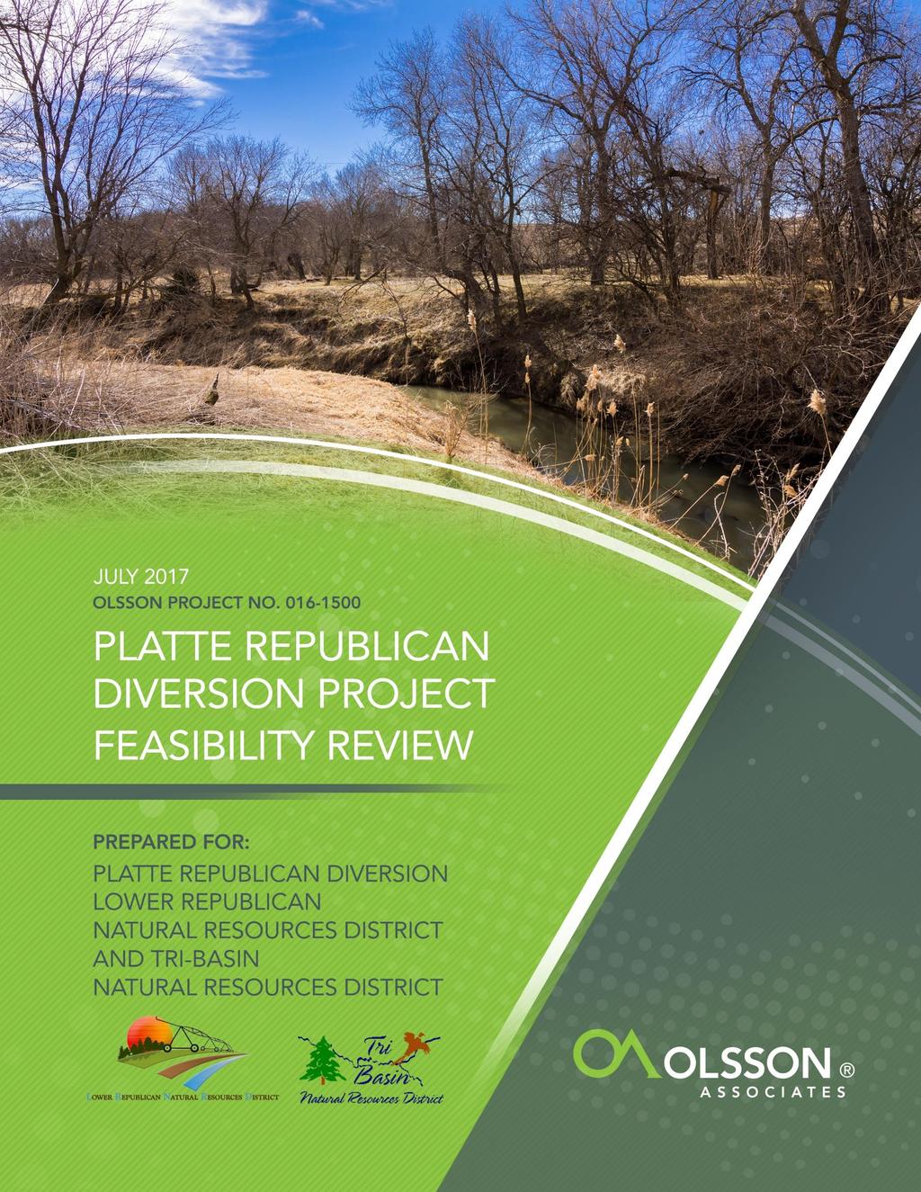
5 1.0 INTRODUCTION This report documents the preliminary results of the feasibility review of the Platte Republican Diversion project in Gosper and Furnas counties, Nebraska. The feasibility review was conducted on behalf of the Lower Republican Natural Resources District (LRNRD) and the Tri-Basin Natural Resources District (TBNRD). The purpose of the proposed Platte Republican Diversion project is to divert unallocated flows from the Platte River to the Republican River via Turkey Creek. The purpose of the feasibility review is to determine impacts of diverting these unallocated flows into Turkey Creek, to develop a benefit-cost analysis for the project, and to provide additional guidance on the feasibility of the project. Turkey Creek is a tributary to the Republican River and generally runs north to south starting approximately 4 miles east of Elwood, Nebraska. It empties into the Republican River between Edison and Oxford, Nebraska. The upper 4 to 5 miles of Turkey Creek runs through canyon areas and many stretches do not have a fully defined bed and bank. This upper section does have a fairly defined stream centerline, but the overall capacity of the creek in this section is less than the capacity of the creek in the middle and lower sections. The upper section of Turkey Creek also includes several farm ponds that currently retain a portion of the flow along Turkey Creek. The middle and lower portions of Turkey Creek have fully defined beds and banks that carry base flow. The primary land use for the adjacent properties to Turkey Creek are either pastures or farmland. There are times during the year when the Platte River has potential excess flows that are not allocated or appropriated for downstream uses. Currently, these flows continue on down the Platte River past the proposed diversion point. Excess flows in the Platte River will be used to help augment flows in the Republican River through Turkey Creek with a direct beneficial use to the state of Nebraska s interstate compact obligations, using publicly owned existing infrastructure. Other beneficial uses include groundwater recharge, and potential recreational benefits at Harlan County Lake. 1


6 2.0 REVIEW AND ANALYSIS OF EXISTING CONDITIONS OF TURKEY CREEK 2.1 Existing Characteristics Topographic Summary of the Project Area The uppermost portions of the Turkey Creek watershed lack a Turkey Creek can be divided into three distinct flow reaches defined channel, with runoff based on channel capacity and characteristics. occurring through canyons as sheet flow. At approximately 5 miles downstream near Drive 432A, the creek and its tributaries have a fully defined bed and bank with a visible flowline. The eastern branch of Turkey Creek and the main channel of Turkey Creek, the portions of the watershed that will need to transmit the diverted water, can be divided into three distinct flow reaches based on channel capacity. Exhibit A in Appendix A is an overall map of the project reaches. The upper section consists of the first 3,000 feet of eastern branch of Turkey Creek. It Upper Section of Project Area. has a fairly steep slope for the entire length, which will generate higher velocities during flow events, significantly increasing the potential for erosion. It has a fairly defined centerline however lacks a channel bed, banks, and cross-sectional area to contain flows. Any runoff generated by rainfall events flows overland as sheet flow through this area. With no defined channel the flow is not contained and the upper section has an existing capacity of zero (0) cubic feet per second (cfs). The middle section consists of approximately the next 5 miles of eastern branch of Turkey Creek. It has a defined channel, but has a more limited capacity and is generally steeper relative to the lower section. This middle section has a general top of bank capacity of ranging from 100 cfs at the beginning of the section to 650 cfs just north of Drive 432A. The capacity slowly increases as you progress downstream. Middle Section of Project Area. Several farms ponds along Turkey Creek in the upper/middle section affect flow downstream. 2
7 The remainder of Turkey Creek is referred to as the lower section. This section has a well-defined channel with higher channel capacities. There is a steady base flow during the majority of the year, and this section can handle the majority of larger storm events. The general top-of-bank capacity is 885 cfs for this portion of Turkey Creek. 2.2 Hydrology A hydrologic analysis was completed along the entire project length to determine the typical flows that have historically occurred in Turkey Lower Section of Project Area. Creek. It is important to establish the baseline conditions so that these baseline conditions can be considered relative to the conditions that will occur when diverted flows are added to the creek. This will help separate existing erosional conditions from potential new erosion concerns when designing channel improvements. The project length was separated into different drainage areas to correctly determine typical flows from upstream to downstream along the creek. Exhibit B in the Appendix A shows the drainage areas as they were delineated. Drainage areas 1 and 2 are in the previously defined upper section, drainage areas 3 through 6 are in the middle section, and drainage areas 7 through 25 are in the lower section. The upper section was divided into two areas to more accurately reflect flows in that section. Downstream of the upper section, drainage areas were separated and delineated according to drainage structures or roadway crossings. A separate drainage area was developed for each structure and peak flows were calculated. Below the uppermost drainage area, the peak flows are combined to reflect a total flow in Turkey Creek at that location. Two different hydrologic methods were utilized to calculate peak flows along Turkey Creek. The method chosen was based on the size of each drainage area being analyzed. The first method, Technical Release 55 (TR-55), is a simplified procedure to calculate storm runoff volume, peak rate of discharge, and hydrographs for small watersheds and was used for drainage areas under 5 square miles. The second method, which involved using selected Regional Regression Equations, was used for the drainage areas greater than 5 square miles. Because of a flatter slope and larger flow area, the peak flows actually decrease somewhat toward the downstream areas of Turkey Creek. Peak flows for the 2-year, 10-year, 25-year, 50-year, and 100-year events were calculated. Exhibit C in Appendix A shows the peak flows that were calculated for each drainage area and the cumulative flows along Turkey Creek. 2.3 Hydraulics Next, the hydraulic characteristics of Turkey Creek were modeled using HEC-RAS 4.0. The HEC-RAS program was developed by the Hydrologic Engineering Center and is designed to model one-dimensional 3
8 steady flow, one and two-dimensional unsteady flow, sediment transport/mobile bed conditions, and water temperature / water quality conditions. Input data for the HEC-RAS model included the hydrologic information discussed above, LiDAR and survey data to represent the channel shape and the topography, and channel and overbank roughness coefficients. The one-dimensional steady flow model was utilized for this project. The current conditions of Turkey Creek were analyzed to establish the existing water surface elevations along the project length. Each existing drainage structure was also analyzed as part of this modeling effort. 2.4 Geomorphology A geomorphologic analysis was performed along the entire project length. Soil samples, stream measurements, erosion areas, and other pertinent information were collected during the site visit and used during the analysis. The full geomorphology report is included in Appendix B for reference. The general purpose of the geomorphology study was to determine what would be the potential impact of adding the diverted flows into Turkey Creek for an extended length of time. Flow rates of 40 cfs and 100 cfs were both analyzed for their impacts and length of time that the diverted flows could realistically be diverted into Turkey Creek without causing erosion issues. General findings from this analysis conclude that the upper section would require extensive grading to create a defined channel area or installation of a pipe to handle the new flows. Without a newly created channel, either flow amount would have a highly erosive effect on the existing ground creating large areas of erosion. The middle and lower sections of Turkey Creek have enough existing capacity to handle 40 cfs of flow during certain times of the year. If the diverted flow of 40 cfs is allowed down Turkey Creek during the months of September through April, the existing creek conditions appear to be sufficient to handle the additional flows. If diverted flows of 100 cfs are introduced into Turkey Creek during the same months, the number of continuous days in a row will need to be monitored. Based off existing conditions and capacity it is recommended that a flow of 100 cfs only be diverted into Turkey Creek for a maximum of 5 continuous days before reducing the diversion of excess flows. Longer periods of the diverted flow of 100 cfs would begin to affect the stability of Turkey Creek and could begin to cause sloughing along the banks and headcutting to the existing flowline. Therefore, it is recommended that the diverted flows be stopped for at least 7 days after the 5 days of continuous 100 cfs of flow. The final recommendation for this will be determined during final design. 2.5 Environmental Evaluation A full wetland delineation was completed along the project reach to determine the extent of existing wetlands. A memo, site map, and wetland map of each drainage structure are included in Appendix C for reference. The location of the existing wetlands will be taken into account during final design. Erosion control measures and proposed grading will be designed to avoid affecting existing wetlands and the creek. If the U.S. Army Corps of Engineers (USACE) requires a Clean Water Act (CWA) Section 404 permit, it is anticipated that a nationwide permit will be obtainable. The Section 404 permit program regulates the construction activities that take place in waters of the U.S. including wetlands. 4
9 Existing Condition Information Generally, the current condition of Turkey Creek is stable and it can handle typical flows that occur each year. However, if a consistent 40 to 100 cfs is going to be introduced into the system, some improvements must be made to allow Turkey Creek to maintain its current integrity. 2.6 Existing Conditions Conclusion During large storm events in the upper section, the terrain of the large canyon areas allows the water to spread out and continue to flow downstream without causing issues to the surrounding properties. The middle and lower sections of Turkey Creek have enough capacity to handle the 100-year flood event without overtopping the banks. The existing bridges can also handle up to a 100-year storm event without overtopping. In the vicinity of some of the existing drainage structures there is bank erosion. Left unchecked, this erosion could potentially undermine the structures. Table 1, below, lists each of the existing structure and indicates if it is already in need of repairs due to erosion. The recommended actions are listed with the anticipated size of the erosion repair needed. A large erosion repair size is approximately 150 tons of riprap, medium repair is 75 tons of riprap, and small repair is 25 tons of riprap. The cost associated with these repairs are listed in Table 1 and Table 2 below and are not included as part of the project costs because the erosion at these structures will need to be addressed regardless of whether or not the excess flows are diverted into Turkey Creek. All existing structures require some erosion repair be completed. Generally, the current condition of Turkey Creek is stable and it can handle typical flows that occur each year. However, if a consistent 40 to 100 cfs is going to be introduced into the system, some improvements must be made to allow Turkey Creek to maintain its current integrity. Table 1. Turkey Creek Structures Current Conditions Drainage Area Number Structure Existing Size Recommended Actions Cost 7 County Road Culvert Small Erosion Repair $2,000 8 Private Drive 432a 1 span - 20 wide Small Erosion Repair $2,000 9 County Road 737 Triple 9 x 10 Box Culverts Small Erosion Repair $2, County Road Culvert Small Erosion Repair $2, Field Access 96 Culvert Small Erosion Repair $2, Private Drive Culvert Medium Erosion Repair $6, County Road span - 85 wide Large Erosion Repair $12, County Road span - 55 wide Small Erosion Repair $2, County Road span 90 wide Medium Erosion Repair $6,000 5
10 16 County Road span 60 wide Small Erosion Repair $2, County Road span 100 wide Large Erosion Repair $12, County Road 431/725 3 span 100 wide Medium Erosion Repair $6,000 None County Road span 40 wide Large Erosion Repair $12, Highway 6 4 span 190 wide Large Erosion Repair $12, County Road span 45 wide Small Erosion Repair $2, County Road span 125 wide Large Erosion Repair $12, BNSF 1 span 55 wide Large Erosion Repair $12, Highway span 105 wide Large Erosion Repair $12, County Road span 85 wide Medium Erosion Repair $6, Field Access Twin 60 Culverts Small Erosion Repair $2, Field Crossing 36 Culvert Medium Erosion Repair $6,000 Table 2 Turkey Creek Structures - Estimated Costs for Erosion Repair Construction Item Quantity Unit Price Total Price Small Erosion Protection 9 Each $2,000/Each $18,000 Medium Erosion Protection 5 Each $6,000/Each $30,000 Large Erosion Protection 7 Each $12,000/Each $84,000 Estimated Total Erosion Repair Costs $132,000 6

11 3.0 PROPOSED IMPROVEMENTS 3.1 Overview of Improvements The geomorphologic analysis was used to help determine whether the existing creek would be able to handle the diverted flows or whether improvements will be needed. The potential areas of concerns observed during the geomorphologic field investigation and analysis were reviewed and focused on during the conceptual design. The proposed improvements that would be Turkey Creek required as part of the Platte Republican Diversion project are separated into two main categories. The first type of improvement includes modifications to the existing creek channel so that it will handle the diverted flows without causing additional erosion. The second type of improvements includes modifications to existing structures including bridges, culverts, and farm ponds so that they will not be impacted by the diverted flows. Two different diverted flow values (40 cfs and 100 cfs) were analyzed in the HEC-RAS model to determine how the existing channel and proposed improvements in the upper section would handle the diverted flows over an extended period of time. 3.2 Channel Improvements Because of the significantly greater channel slopes, the initial focus with regard to channel improvements was in the upper section - the first 3,000 feet of the east branch of Turkey Creek. The existing creek crosssection and slope are not equipped to handle the diverted flows without causing erosion along the existing flow path. A new, larger and more defined typical section will need to be established for the upper section to increase capacity and minimize the potential for erosion from the diverted flows. It is also important that the channel slope in the upper section be reduced to decrease the velocity and in turn minimize potential erosion. A series of grade control structures will need to be installed in the upper 3000-foot section to create a more stable slope. Exhibit D in Appendix A shows the proposed profile along Turkey Creek for this section. The proposed grade control structures can be constructed out of riprap, sheet pile or lumber. The proposed grade structures would include a 4-foot drop on the downstream side of the structure to allow a 1 percent slope to be established for the first 3,000 feet of Turkey Creek. A 1 percent slope is stable and would minimize the erosion that otherwise might occur during the introduction of diverted flows. Another improvement option for the upper section would be to install a new underground polyvinyl chloride (PVC) pipe for the entire 3,000-foot length instead of grading a defined creek channel. The new pipe would need to be in the range of 36-inches diameter to 48-inches diameter in size. The actual pipe size would be determined during final design. A smaller pipe could be utilized with a steeper slope while a larger pipe would be needed with a flatter slope. 7
12 The middle section of Turkey Creek (approximately the next 5 miles) has an intermittently defined channel with varying capacity. Some grading would need to be completed along this section to increase the capacity to handle up to a 100 cfs without causing headcutting or incising of the existing creek. Total regrading of Turkey Creek would not be necessary, but rather would consist of widening of the existing channel in some areas to allow the diverted flows to stay within the banks. The rest of Turkey Creek s cross-section downstream of the first 5 miles currently has sufficient capacity to handle the diverted flows along with the current base flow that Turkey Creek carries, which is approximately 12 cfs. No substantial improvements are anticipated along this stretch. There may be some minor grading that occurs along this section to repair large areas of erosion that have occurred over time. Any minor grading will take place above the ordinary high water mark (OHWM) so as to minimize any impacts to the existing stream and allow a Nationwide Section 404 permit to be obtained if needed. 3.3 Improvements to Existing Structures The second category of proposed improvements deals with the existing structures and erosion control measures that need to be installed at each drainage structure location. As indicated above, many of the existing drainage structures at the upstream face have erosion issues that need to be addressed regardless of whether the diverted flows are introduced into Turkey Creek. If measures are not taken to control erosion in these areas erosion will continue to expand and may eventually compromise bridge abutments or cause failure along roadway embankments. It is proposed that riprap will be installed at the upstream face to provide protection either at bridge abutments or the inlets of culverts. The cost of these improvements are separate from the estimated project costs. There are additional improvements to these existing structures that would be recommended in order to accommodate the introduction of diverted flows into the creek. Table 3 and 4 below lists the additional improvements anticipated for each drainage structure for both 40 cfs and 100 cfs starting at the upstream end of the project and continuing downstream along Turkey Creek. The erosion protection improvements are listed as large, medium and small. This refers to the anticipated amounts of riprap that may have to be installed at each location. A large amount is approximately 150 tons of riprap, medium is 75 tons of riprap, and small is 25 tons of riprap. This erosion protection is in addition to the riprap that will need to be placed at the structures due to existing erosion issues. Tables 3 and 4 below list the total number of erosion protection improvements and their associated costs. The additional riprap reflects the protection needed due to the diverted flows into Turkey Creek. A few existing drainage structures will overtop during a flow of 40 cfs or 100 cfs. Currently, it is anticipated that four drainage structures will need to replaced, or upsized or that an additional culvert will need to be added to handle the diverted flows. 8
13 Table 3 Turkey Creek Structures at 40 cfs - Estimated Costs for Erosion Repair Construction Item Quantity Unit Price Total Price Small Erosion Protection 2 Each $2,000/Each $4,000 Medium Erosion Protection 14 Each $6,000/Each $84,000 Large Erosion Protection 5 Each $12,000/Each $60,000 Estimated Total Erosion Repair Costs $148,000 Table 4 Turkey Creek Structures at 100 cfs - Estimated Costs for Erosion Repair Construction Item Quantity Unit Price Total Price Small Erosion Protection 2 Each $2,000/Each $4,000 Medium Erosion Protection 14 Each $6,000/Each $84,000 Large Erosion Protection 5 Each $12,000/Each $60,000 Estimated Total Erosion Repair Costs $148,000 The existing farm ponds will also need some improvements to handle the diverted flows. Either new overflow structures or additional pipes will need to be constructed at each farm pond location to allow the diverted flow to travel downstream instead of creating additional ponding areas and erosion along the farm pond embankment. These improvements could also include some riprap or other method of erosion control to protect the existing embankment. 4.0 BENEFIT-COST ANALYSIS 4.1 Overview A benefit-cost analysis (BCA) was completed for this project to determine the economic feasibility and potential benefit to the TBNRD, LRNRD and the residents of these two natural resources districts. In this analysis, the cost of designing, constructing, and maintaining the project is compared to the potential benefits or cost savings that it may provide by contrasting these costs with the costs of several previous efforts to reduce consumptive use and/or increase streamflows in the Republican River basin. 4.2 Costs of Diversion Project Based on the recommended described above and the improvements listed in Tables 3-4, estimated construction costs have been generated for the following improvements to Turkey Creek: 1) Additional improvements needed to handle 40 cfs of diverted flows under two options: a. Pipe installation in upper section (Table 5) 9
14 b. Grading improvements in upper section (Table 6) 2) Additional improvements need to handle 100 cfs of diverted flows under two options: a. Pipe installation in upper section (Table 7) b. Grading improvements in upper section (Table 8) The three major costs for this project are the grading along the creek, pipe installation and erosion control measures. The majority of the grading will be completed in the upper section to create a larger and defined, stable channel. An estimated unit price of $10 per cubic yard (CY) of earthwork was used to develop the cost for grading. If it is determined that the excavated material can be spoiled onsite, then a lower unit price may be realized for this project. Installing a new pipe in the upper section (instead of grading a larger creek section) is also analyzed as part of an estimated project cost. An average cost of $65 per linear foot was used for the pipe for the 40 cfs option and an average cost of $90 per linear foot was used for the pipe for the 100 cfs option. Installing erosion control measures at the upstream face of the existing structures will be the other major project cost. It has been estimated that each structure will have a cost in the range of $2,000 - $12,000, depending on the magnitude of measures required to accommodate the diverted flows. These erosion control measures are in addition to the erosion repair improvements listed in tables 1-2. The grade control structures needed to create a more stable slope in the upper reach of the project have been estimated at $10,000 for each structure. The four existing drainage structures that cross the stream cannot handle the diverted flows without overtopping; the cost of dealing with this issue are estimated at $10,000 per structure for 40 cfs and $15,000 per structure for 100 cfs. Three well-defined field drives in the upper section will each need a culvert crossing installed along with the proposed channel improvements. Those culvert crossings are estimated to be $5,000 each for 40 cfs and $7,500 each for 100 cfs. The last construction cost is associated with the existing farm ponds. The farm pond improvements are estimated to be $7,500 per pond for 40cfs and $10,000 per pond for 100 cfs. The anticipated construction cost of the diversion structure from Canal E-65 into Turkey Creek is also included at a cost of $315,000. All unit prices are based on past construction costs on prior projects and the Nebraska Department of Road s Average Unit Price Summaries. 10
15 Table 5 Estimated Project Costs Diverting 40 cfs with Pipe Installation in Upper Section Construction Item Quantity Unit Price Total Price Mobilization 1 Each $50,000/Each $50,000 Pipe Installation 3,000 LF $65/LF $195,000 Small Erosion Protection 2 Each $2,000/Each $4,000 Medium Erosion Protection 14 Each $6,000/Each $84,000 Large Erosion Protection 5 Each $12,000/Each $60,000 Grade Control Structures 9 Each $10,000/Each $90,000 New Drainage Structures 4 Each $10,000/Each $40,000 New Culvert Crossings 3 Each $5,000/Each $15,000 Farm Pond Improvements 7 Each $7,500/Each $52,500 Contingency (30%) $175,000 Estimated Total Construction Cost $765,500 Engineering Fees $235,000 Construction Observation (10% of Construction Cost) $76,550 Diversion Structure 1 Each $315,000/Each $315,000 Estimated Total Project Cost $1,392,050 11
16 Table 6 Estimated Project Costs Diverting 40 cfs with Grading in Upper Section Construction Item Quantity Unit Price Total Price Mobilization 1 Each $80,000/Each $80,000 Earthwork 45,000 CY $10/CY $450,000 Small Erosion Protection 2 Each $2,000/Each $4,000 Medium Erosion Protection 14 Each $6,000/Each $84,000 Large Erosion Protection 5 Each $12,000/Each $60,000 Grade Control Structures 9 Each $10,000/Each $90,000 New Drainage Structures 4 Each $10,000/Each $40,000 New Culvert Crossings 3 Each $5,000/Each $15,000 Farm Pond Improvements 7 Each $7,500/Each $52,500 Contingency (30%) $260,000 Estimated Total Construction Cost $1,135,500 Engineering Fees $235,000 Construction Observation (10% of Construction Cost) $115,000 Diversion Structure 1 Each $315,000/Each $315,000 Estimated Total Project Cost $1,800,500 12
17 Table 7 Estimated Project Costs Diverting 100 cfs with Pipe Installation in Upper Section Construction Item Quantity Unit Price Total Price Mobilization 1 Each $65,000/Each $65,000 Pipe Installation 3,000 LF $90/LF $270,000 Small Erosion Protection 2 Each $2,000/Each $4,000 Medium Erosion Protection 14 Each $6,000/Each $84,000 Large Erosion Protection 5 Each $12,000/Each $60,000 Grade Control Structures 9 Each $10,000/Each $90,000 New Drainage Structures 4 Each $15,000/Each $60,000 New Culvert Crossings 3 Each $7,500/Each $22,500 Farm Pond Improvements 7 Each $10,000/Each $70,000 Contingency (30%) $220,000 Estimated Total Construction Cost $945,500 Engineering Fees $235,000 Construction Observation (10% of Construction Cost) $95,000 Diversion Structure 1 Each $315,000/Each $315,000 Estimated Total Project Cost $1,590,500 13
18 Table 8 Estimated Project Costs Diverting 100 cfs with Grading in Upper Section Construction Item Quantity Unit Price Total Price Mobilization 1 Each $85,000/Each $85,000 Earthwork 45,000 CY $10/CY $450,000 Small Erosion Protection 2 Each $2,000/Each $4,000 Medium Erosion Protection 14 Each $6,000/Each $84,000 Large Erosion Protection 5 Each $12,000/Each $60,000 Grade Control Structures 9 Each $10,000/Each $90,000 New Drainage Structures 4 Each $15,000/Each $60,000 New Culvert Crossings 3 Each $7,500/Each $22,500 Farm Pond Improvements 7 Each $10,000/Each $70,000 Contingency (30%) $275,000 Estimated Total Construction Cost $1,200,500 Engineering Fees $235,000 Construction Observation (10% of Construction Cost) $120,000 Diversion Structure 1 Each $315,000/Each $315,000 Estimated Total Project Cost $1,870,500 The estimated total construction costs are listed below in Table 9 and are based on the preliminary analysis and design. Two costs are given for the 40 cfs option, and two costs are given for the 100 cfs option. All the construction costs currently have a 30 percent contingency fee included in the total and the estimated costs would be refined during final design. Table 9 also lists estimated total project costs when incorporating the estimated cost for final design and construction observation. Project land rights acquisition costs have not been estimated as part of project development costs. The sponsors anticipate acquiring easements from landowners without compensation. 14
19 Table 9 Estimated Project Costs Project Option Estimated Construction Cost Estimated Total Project Cost 40 cfs with Pipe Option $756,500 $1,392, cfs with Grading Option $1,135,500 $1,800, cfs with Pipe Option $945,500 $1,590, cfs with Grading Option $1,200,500 $1,870, Benefits The benefits of the project are generally related to improving water supply conditions in the Republican River. Water use is limited in the Republican River basin (Basin) due to the Republican River Compact (Compact). Nebraska is allocated a certain percentage of the Basins water supply, which varies from year to year based on climatic conditions. During many previous dry years, Nebraska has used more than its allocation of water. Excess flows from the Platte River would be used to offset any potential overuse in the future, reducing or eliminating the cost of other management actions that might be needed. The Nebraska Department of Natural Resources (NeDNR) has studied the potential amounts of water that may be available from the Platte River for this project. This evaluation involved a comparison of the historic Platte River streamflows against all currently existing demands to this water to compute flows in excess of current demands. Other agencies, including the Platte River Recovery Implementation Program (PRRIP) are evaluating projects that could affect the future occurrence and availability of excess flows in the Platte River. The water that may be available for this project would be water diverted into the Tri- County Supply Canal for use in generating hydropower and which would otherwise be returned to the Platte River at the J2 return. When there are excess flows downstream of the J2 return (as measured at the Overton gage), some of this water can be retained in the canals and delivered for other purposes, such as to supply water to this diversion project. Data from the NeDNR study from the Overton gage for the years 2000 to 2008 were used to estimate the excess flows that may be available to divert into Turkey Creek during a given year and to calculate the actual water the project could provide based on several assumed capacity limitations. These years were chosen because it was a dry period in which Nebraska could have potentially benefited from the diversion of water into the basin by assisting the state with Compact compliance. Exhibit E in Appendix A is a spreadsheet that shows the total monthly excess flows available in the Platte River basin during 2000 to It also contains the amount of water that would be able to be diverted into Turkey Creek based on a project capacity of either 40 cfs or 100 cfs. However, this analysis does not take into account future needs of these excess flows for projects in the Platte River Basin designed to meet the PRRIP goals as well as goals and objectives of the Platte Basin integrated management plans. With assistance from the Executive Directors Office of the PRRIP (J. Farnsworth, personal communication, 15
20 June 6, 2017), this evaluation was revised and updated through 2016 to take into account future needs in the Platte Basin and additional potential benefits that could have been realized during more recent years. The estimate for future needs in the Platte is up to 1,000 cfs of additional diversions. Table 10 below shows the average annual amount of water that would be available to divert from the Platte River basin during these years with and without an assumed increased use of 1,000 cfs, for a project capacity of 40 cfs and 100 cfs. Table 10 Potential Acre-Feet Available to Divert YEAR Without additional 1,000 cfs With additional 1,000 cfs 40 cfs 100 cfs 40 cfs 100 cfs One additional factor needs to be taken into account, which is the extent to which water was actually needed in the Republican River Basin during these years. During , the Republican River Basin NRDs pumped approximately 132,000 acre-feet of groundwater into Republican River tributaries from the Rock Creek and Nebraska Cooperative Platte Republican Enhancement Projects in order to ensure that Nebraska complied with the Republican River Compact during those years. Table 11 presents the total available excess flow that could have been diverted from the Platte Basin into the Republican Basin during As it is unclear when the Platte Basin will have the infrastructure in place to create an additional 1,000 cfs of diversions in the Platte Basin, the potential benefits of the project when similar years recur in the future is estimated to be between approximately 30,000 and 130,000 acre-feet (139,590 capped at the approximate need for water during ) depending on the capacity of the final diversion project. 16
21 Table 11 Potential Acre-Feet Available to Divert during September through April Design Option Without Additional 1,000 cfs With Additional 1,000 cfs 40 cfs 57,303 acre-feet 30,670 acre-feet 100 cfs 139,590 acre-feet 74,824 acre-feet 4.4 Alternative Costs There are several metrics available to assess the cost to Nebraska to offset any water use in excess of its allocation that may occur in the future. While Nebraska was ordered by the U.S. Supreme Court to pay Kansas $5.5 million for its over use of approximately 70,000 acre-feet of water during , the Court made it clear that the cost of a future violation would likely be significantly greater, so using this value as a metric would likely undervalue the benefits of a transfer of water into the Basin from the Platte River. Another available metric would be the costs of previous actions taken by the state and the natural resources districts (NRDs) to reduce consumptive uses of water in an effort to maintain compliance with the Compact. From 2006 to 2008, surface water was leased from irrigation districts in the basin to assist with compliance with the Republican River Compact (Compact). The state and the local NRDs paid $18,722,500, which resulted in a reduction of consumptive use of 51,614 acre-feet, which equates to $362 per acre-feet of water. This value will be used to assign a benefit to the potential volumes of water that could be delivered from this project during future dry years. Another available metric would be to utilize the cost associated with the Nebraska Cooperative Republican Platte Enhancement (N-CORPE) project for the LRNRD. The N-CORPE project provides construction costs and delivery costs for water which can be related to this project to develop potential benefit. These costs are summarized in Table 12. Based on these costs, and an assumed average annual delivery of 3,750 acrefeet, the annual delivery cost for water from N-CORPE is $ per acre-foot, or $195,000 per year. The annual delivery cost for the surface water option and the N-CORPE option will be used to calculate a range of benefit-cost ratios below. 17
22 Table 12 Computation of Average Annual Delivery Cost for LRNRD for water from N-CORPE Cost Items Cost to LRNRD Capitol Cost (including interest) $41,360, Cost per year - 50 years $827, Average Annual Capacity 3,750 Annual Cost per AF capacity $ Water Delivery Cost $52.00 Cost per AF $ Based on this per acre-foot cost of water, the Diversion project would have provided benefits in the range of $15 to $36 million dollars during and would provide benefits in the range of $8 million to $20 million during similar years in the future, even after the additional 1,000 cfs of diversion in the Platte River Basin has begun occurring. 4.5 Range of Cost for the Projects and Associated Benefits The average cost per acre-foot for the alternative sources of water evaluated above are next used to calculate a range of benefit-cost ratios for the Platte Republican Diversion project. Table 13 and Table 14 compute the total delivery costs for the project based on the construction costs presented above and an assumed value of $44.35 acre-foot for the water delivery. Table 13 Potential Annual Cost 40 cfs Cost Items PRD Project Pipe Option PRD Project Grading Option Capitol Cost $1,392, $1,800, Cost per year - 50 years $27, $36, Average Annual Supply* 977 acre-feet 977 acre-feet Annual Capital Cost per AF $28.50 $36.86 Water Delivery Cost $44.35 $44.35 Total Cost per AF $72.85 $81.21 *20% of 4,885 acre-feet from Table 11 to adjust for benefits in 2 out of 10 years 18
23 Table 14 Potential Annual Cost 100 cfs Cost Items PRD Project Pipe Option PRD Project Grading Option Capitol Cost $1,590, $1,870, Cost per year - 50 years $31, $37, Average Annual Supply* 1,969 acre-feet 1,969 acre-feet Annual Cost per AF capacity $16.16 $19.00 Water Delivery Cost $44.35 $44.35 Total Cost per AF $60.51 $63.35 *20% of 9,846 acre-feet from Table 11 to adjust for benefits in 2 out of 10 years So the annual cost per acre-foot of water delivered by the Platte Diversion Project would range from $60 to $82, depending on the construction option and the ultimate capacity of the project. Table 15 presents the total cost of the water that would have been available during if the project had been in place and had purchased the total available supply given the capacity limitations. The difference between the two columns represent the significantly greater amount of water that would have been purchased based on actual availability in and what could be purchased during similar years in the future after the 1,000 cfs of Platte Basin diversions in factored in.. Table 15 Cost of Water Volumes available During in Comparison to Project Alternative Design Alternative Without additional 1,000 cfs With additional 1,000 cfs 40 cfs pipe $4,200,000 $2,240, cfs grading $4,600,000 $2.500, cfs pipe* $8,400,000 $4,500, cfs grading* $8,900,000 $4,800,000 *Benefit-Cost Analysis for 100 cfs option is slightly inflated. In reality the 100 cfs flows can only be diverted into Turkey Creek for 5 days at a time and not for the entire length of time it is available. Given the potential benefits noted above, and regardless of whether the Platte River Basin had been using an additional 1,000 cfs during , if the project had been in place at the beginning and 2013 and had accessed all available water, it would have paid for itself three to four times over by the end of
24 5.0 SUMMARY AND CONCLUSIONS Based on the preliminary feasibility analysis completed for the Platte Republican Diversion project, the benefit-cost analysis clearly shows the project would provide a significant benefit over the lifetime of the project given the assumptions made for availability of excess flows from the Platte River. With creek improvements in the upper section and erosion control measures at each drainage structure and farm ponds, Turkey Creek will be able to handle diverted flows up to 100 cfs for the designated periods of time without negatively affecting the surrounding land or causing any significant erosion to the existing creek system. 20
25 APPENDIX A EXHIBITS Exhibit A Turkey Creek Map Exhibit B East Branch Turkey Creek Drainage Area Map Exhibit C Turkey Creek Regression Exhibit D Upper Reach Channel Profile of Turkey Creek Exhibit E Available Flows 21
26 APPENDIX B GEOMORPHOLOGY REPORT 22
27 APPENDIX C ENVIRONMENTAL REPORTS 23
Jacobi, Toombs, and Lanz, Inc.
 Area 5: Blackiston Mill Road at Dead Man's Hollow Flooding Assessment Jacobi, Toombs, and Lanz, Inc. This document summarizes an assessment of drainage and flooding concerns and provides recommendations
4. Present Activities and Roles
 4. Present Activities and Roles The present missions, authorities, activities and roles of the various agencies involved with flood protection, floodplain management and flood-damage reduction are identified
TABLE OF CONTENTS. 1.0 Background Watershed Description Hydrology - HEC-HMS Models Hydraulics - HEC-RAS Models...
 TABLE OF CONTENTS 1.0 Background... 1 2.0 Watershed Description... 1 3.0 Hydrology - HEC-HMS Models... 2 3.1 Hydrologic Approach... 2 3.2 Drainage Areas... 2 3.3 Curve Numbers... 2 3.4 Lag Times... 3 3.5
WAVERLY FLOODPLAIN BACKGROUND INFORMATION
 WAVERLY FLOODPLAIN BACKGROUND INFORMATION Who designates the floodplains in Waverly? The Federal Emergency Management Agency (FEMA) is responsible for delineating floodplains. The floodplain FEMA uses
UPRR criteria for sizing waterway openings under bridges and through culverts are as follows:
 UNION PACIFIC RAILROAD SCOPE OF HYDROLOGIC/HYDRAULIC DESIGN ENGINEERING AND PERMITTING SERVICES FOR SIZING WATERWAY OPENINGS AT NEW AND REPLACEMENT STRICTURES These flood passage criteria were developed
DRAINAGE STUDY CROWS LANDING INDUSTRIAL BUSINESS PARK. Stanislaus County. Prepared by:
 DRAINAGE STUDY FOR CROWS LANDING INDUSTRIAL BUSINESS PARK Stanislaus County Prepared by: March, 2017 Revised November, 2017 Table of Contents EXECUTIVE SUMMARY... 1 1. INTRODUCTION... 2 2. HYDROLOGY...
DRAINAGE STUDY PHASE 2 REPORT HORRY COUNTY STORMWATER DEPARTMENT HIGHWAY 9 & 57 HORRY COUNTY, SC PREPARED FOR: APRIL 07, 2016 J
 DRAINAGE STUDY PHASE 2 REPORT FOR: HIGHWAY 9 & 57 HORRY COUNTY, SC PREPARED FOR: HORRY COUNTY STORMWATER DEPARTMENT APRIL 07, 2016 Prepared by: Savannah, GA Charleston, SC Myrtle Beach, SC Brunswick, GA
PEARCE CREEK CONFINED DISPOSAL AREA MODIFICATION
 US Army Corps of Engineers Philadelphia District PEARCE CREEK CONFINED DISPOSAL AREA MODIFICATION CECIL COUNTY MARYLAND STORMWATER MANAGEMENT PLAN NARRATIVE INITIAL SUBMISSION JUNE 2014 1 PEARCE CREEK
Ponds. Pond A water impoundment made by excavating a pit, or constructing a dam or an embankment.
 POND SITE SELECTION AND CONSTRUCTION Uses, Planning, & Design David Krietemeyer Area Engineer USDA-NRCS June 20, 2008 Uses Considerations for Location of Commonly Used Terms Pond A water impoundment made
Stormwater Management Studies PDS Engineering Services Division ES Policy # 3-01
 Stormwater Management Studies PDS Engineering Services Division Revised Date: 2/28/08 INTRODUCTION The City of Overland Park requires submission of a stormwater management study as part of the development
SECTION III: WATERSHED TECHNICAL ANALYSIS
 Trout Creek Watershed Stormwater Management Plan SECTION III: WATERSHED TECHNICAL ANALYSIS A. Watershed Modeling An initial step this study of the Trout Creek watershed was the selection of a stormwater
Chapter 6 Erosion & Stormwater Study Team
 Chapter 6 Erosion & Stormwater Study Team Objective How do we stabilize the Las Vegas Wash environment to most effectively reduce erosion and enhance wetlands? Introduction The Las Vegas Wash (Wash) has
3.3 Acceptable Downstream Conditions
 iswm TM Criteria Manual - = Not typically used or able to meet design criterion. 1 = The application and performance of proprietary commercial devices and systems must be provided by the manufacturer and
Chapter 4. Drainage Report and Construction Drawing Submittal Requirements
 4.0 Introduction The requirements presented in this section shall be used to aid the design engineer or applicant in the preparation of drainage reports, drainage studies, and construction drawings for
Appendix B Stormwater Site Plan Submittal Requirements Checklist
 Stormwater Site Plan Submittal Requirements Checklist The Submittal Requirements Checklist is intended to aid the design engineer in preparing a Stormwater Site Plan. All items included in the following
DICKINSON BAYOU WATERSHED STEERING COMMITTEE FINAL MEMBER CRITERIA COMPARISON
 DICKINSON BAYOU WATERSHED STEERING COMMITTEE FINAL MEMBER CRITERIA COMPARISON May 25, 2006 INTRODUCTION The Dickinson Bayou Watershed covers approximately 95.5 square miles and stretches from western Brazoria
E. STORMWATER MANAGEMENT
 E. STORMWATER MANAGEMENT 1. Existing Conditions The Project Site is located within the Lower Hudson Watershed. According to the New York State Department of Environmental Conservation (NYSDEC), Lower Hudson
Prepared for: City of Jeffersonville. November Prepared by
 JEFFERSONVILLE STORMWATER MASTER PLAN HYDRAULICS APPENDIX JEFFERSONVILLE, INDIANA Prepared for: City of Jeffersonville November 2011 Prepared by Christopher B. Burke Engineering, Ltd. 115 W. Washington
Pajaro River Watershed Flood Prevention Authority. Phase 3 and 4a. Pajaro River Watershed Study
 Pajaro River Watershed Flood Prevention Authority Phase 3 and 4a FEBRUARY 2005 Funding for this project has been provided in full or in part through a contract with the SWRCB pursuant to the Costa-Machado
STORM DRAINAGE DESIGN MANUAL
 Appendix I STORM DRAINAGE DESIGN MANUAL by: SUNGATE DESIGN GROUP, P.A. GEN ERAL DESIGN STAN DARDS AN D POLICIES 1. STREET AND LOCAL DRAINAGE Discharge estimates for specified design storms shall be calculated
Stormwater Local Design Manual For Houston County, Georgia
 Stormwater Local Design Manual For Houston County, Georgia Adopted November 15, 2005 TABLE OF CONTENTS 1. FORWARD... 1 2. GENERAL LEVEL OF SERVICE STANDARDS... 2 2.1. DETENTION REQUIREMENTS... 2 2.1.1.
III. INVENTORY OF EXISTING FACILITIES
 III. INVENTORY OF EXISTING FACILITIES Within the Growth Management Boundary, the existing storm drainage facilities are largely associated with development that has historically occurred in the ten drainage
Appendix D - Evaluation of Interim Solutions
 Appendix D - Evaluation of Interim Solutions D.1 Introduction The implementation of long-term improvements is projected to take 5 to 8 years. To reduce the number of years of flooding impacts, the partner
APPENDIX A. Hydraulic Investigations: Cascade Mall at Burlington
 APPENDIX A m SUMMARY REPORT FOR E.I.S. Hydraulic Investigations: Cascade Mall at Burlington July 12, 1982 John E. Norman, P.E. 14779 Northeast 32nd, #A201 Bellevue, WA 98007 (206) 882-1767 92 General A
Appendix C, Attachment 4 June 11, Diversion Channel Outlet Hydraulic Modeling RAS and ADH
 Diversion Channel Outlet Hydraulic Modeling RAS and ADH 11 June 2012 1 Contents Introduction... 3 HEC-RAS modeling of Outlet... 3 Transition Structure Geometry... 3 ADH Modeling of Outlet and Floodplain...
LAKE COUNTY HYDROLOGY DESIGN STANDARDS
 LAKE COUNTY HYDROLOGY DESIGN STANDARDS Lake County Department of Public Works Water Resources Division 255 N. Forbes Street Lakeport, CA 95453 (707)263-2341 Adopted June 22, 1999 These Standards provide
APPENDIX G DIVERSION AND PELICAN LAKE CUTOFF CHANNELS HYRAULICS AND BRIDGE TECHNICAL MEMORANDUM
 APPENDIX G DIVERSION AND PELICAN LAKE CUTOFF CHANNELS HYRAULICS AND BRIDGE TECHNICAL MEMORANDUM To: File Memo From: Matt Redington, P.E. Project: Watertown South Connector CC: Date: March 6, 2007; revised
Appendix A Stormwater Site Plan Report Short Form
 Appendix A Stormwater Site Plan Report Short Form The Stormwater Site Plan Report Short Form may be used for projects that trigger only Minimum Requirements #1-#5. These projects typically fall within
CLAY STREET BRIDGE REPLACEMENT
 HYDROLOGY /HYDRAULICS REPORT. EL DORADO COUNTY CLAY STREET BRIDGE REPLACEMENT Prepared by: Joseph Domenichelli Domenichelli & Associates 1107 Investment Blvd., Suite 145 El Dorado Hills, California 95762
City of Katy Flood Protection Study (Meeting 3 of 3) October 23, 2017
 October 23, 2017") City of Katy Flood Protection Study (Meeting 3 of 3) October 23, 2017 Phasing of Meetings April Meeting May Meeting October Review of Tax Day Storm Event and Immediate Actions Taken By City Review of Coordination
City of Katy Flood Protection Study (Meeting 3 of 3) October 23, 2017 Phasing of Meetings April Meeting May Meeting October Review of Tax Day Storm Event and Immediate Actions Taken By City Review of Coordination
Technical Memorandum
 Tucson Office 3031 West Ina Road Tucson, AZ 85741 Tel 520.297.7723 Fax 520.297.7724 www.tetratech.com Technical Memorandum To: Kathy Arnold From: Greg Hemmen, P.E. Company: Rosemont Copper Company Date:
NEW CASTLE CONSERVATION DISTRICT. through. (Name of Municipality) PLAN REVIEW APPLICATION DRAINAGE, STORMWATER MANAGEMENT, EROSION & SEDIMENT CONTROL
 PLAN REVIEW APPLICATION DRAINAGE, STORMWATER MANAGEMENT, EROSION & SEDIMENT CONTROL") NEW CASTLE CONSERVATION DISTRICT through (Name of Municipality) PLAN REVIEW APPLICATION DRAINAGE, STORMWATER MANAGEMENT, EROSION & SEDIMENT CONTROL Office use only: Received by Municipality: Received by
NEW CASTLE CONSERVATION DISTRICT through (Name of Municipality) PLAN REVIEW APPLICATION DRAINAGE, STORMWATER MANAGEMENT, EROSION & SEDIMENT CONTROL Office use only: Received by Municipality: Received by
SECONDARY WETLAND IMPACTS ANALYSIS
 SECONDARY WETLAND IMPACTS ANALYSIS USACE File. SWG-2012-00153 During the development of the Grand Parkway (State Highway 99) Segments H and I-1 from United States Highway 59/Interstate Highway 69 N to
Warner Robins Stormwater Local Design Manual
 Warner Robins Stormwater Local Design Manual Prepared for Houston County City of Warner Robins City of Perry City of Centerville May 17, 2005 Version 4 (As presented with adopted Stormwater Ordinance)
Appendix Q Draft Location Hydraulic Study Report For the State Route 32 Widening Between Fir Street and Yosemite Drive at Dead Horse Slough and South
 Appendix Q Draft Location Hydraulic Study Report For the State Route 32 Widening Between Fir Street and Yosemite Drive at Dead Horse Slough and South Fork Dead Horse Slough in the, California Draft Location
12 DRAINAGE General Administrative Requirements Standards
 12 DRAINAGE 12.1 General The Design-Builder shall conduct all Work necessary to meet the requirements associated with drainage, including culverts, bridge hydraulics, roadway ditches, and closed storm
Project Drainage Report
 Design Manual Chapter 2 - Stormwater 2A - General Information 2A-4 Project Drainage Report A. Purpose The purpose of the project drainage report is to identify and propose specific solutions to stormwater
Local Stormwater Design Manual. City of Fairburn
 APPENDIX D LOCAL STORMWATER DESIGN MANUAL Local Stormwater Design Manual City of Fairburn May 2008 TABLE OF CONTENTS 1. FORWARD... 1 2. GENERAL LEVEL OF SERVICE STANDARDS... 2 2.1. DETENTION REQUIREMENTS...
SAW MILL RIVER DAYLIGHTING ANALYSIS AT RIVER PARK CENTER
 SAW MILL RIVER DAYLIGHTING ANALYSIS AT RIVER PARK CENTER Prepared for: Struever Fidelco Cappelli LLC McLaren Project No. 6 August 28 TABLE OF CONTENTS. INTRODUCTION 2. SAW MILL RIVER: FEMA STUDY... 2..
Airport Master Plan. Floodplain Report. Prepared by: Prepared for: Illinois Department of Transportation
 Airport Master Plan Floodplain Report Prepared by: Prepared for: Illinois Department of Transportation July 10, 2013 Table of Contents Topic Page Number Cover Sheet... Cover Sheet Table of Contents...
OFFICE OF STRUCTURES MANUAL ON HYDROLOGIC AND HYDRAULIC DESIGN CHAPTER 3 POLICY AND PROCEDURES
 OFFICE OF STRUCTURES MANUAL ON HYDROLOGIC AND HYDRAULIC DESIGN CHAPTER 3 POLICY AND PROCEDURES April 28, 2016 Table of Contents 3.1 Introduction... 2 3.1.1 Purpose of Chapter 3... 2 3.1.2 Policy vs. Design
Suggested Stormwater Management Practices For Individual House Lots
 Suggested Stormwater Management Practices For Individual House Lots These practices are necessary to satisfy the water quantity and water quality criteria of the Rappahannock Stormwater Ordinance. These
TABLE OF CONTENTS PART III - MINIMUM DESIGN STANDARDS Section 105 DRAINAGE SYSTEM DESIGN SPECIFICATIONS AND SCOPE 105.1
 TABLE OF CONTENTS PART III - MINIMUM DESIGN STANDARDS Section 105 DRAINAGE SYSTEM DESIGN SECTION TITLE PAGE 105.1. SPECIFICATIONS AND SCOPE 105.1 105.2. METHODS OF ANALYSIS 105.1 105.2.1. Rational Method
CUYAHOGA COUNTY ENGINEER
 CUYAHOGA COUNTY ENGINEER DRAINAGE MANUAL Supplement to O.D.O.T. LOCATION and DESIGN MANUAL, Volume 2, Drainage Design, Section 1000 and 1100 May 28, 2010 Revisions to the July 29, 2009 edition are noted
State Standard. for. Stormwater Detention/Retention
 ARIZONA DEPARTMENT OF WATER RESOURCES FLOOD MITIGATION SECTION State Standard for Stormwater Detention/Retention Under the authority outlined in ARS 48-3605(a) the Director of the Arizona Department of
Cherokee County Future Conditions Floodplain Development
 TECHNICAL MEMORANDUM Cherokee County Future Conditions Floodplain Development Prepared for: Prepared by: Geoff Morton, P.E., County Engineer Cherokee County Richard Greuel, P.E.,, Inc. Richard Taylor,
Upper Lightning Lake Water Level Management Environmental Assessment Worksheet. Attachment D Design Report for Upper Lightning Lake
 Upper Lightning Lake Water Level Management Environmental Assessment Worksheet Attachment D Design Report for Upper Lightning Lake DESIGN REPORT for Upper Lightning Lake Wetland Enhancement MN-332-2 I
Section 6: Stormwater Improvements
 Section 6: Stormwater Improvements A major objective of this study was to identify opportunities for improvements to address the widespread water quality impairments caused by stormwater runoff in the
MIDAS CREEK PROJECT. FINAL DESIGN REPORT SKR Hydrotech 4/11/2012
 2012 MIDAS CREEK PROJECT FINAL DESIGN REPORT SKR Hydrotech 4/11/2012 Executive Summary... 1 Section 1 Introduction... 1 Background Information... 1 Purpose of Study... 1 Scope of Work... 1 Section 2 Description
MODEL Stormwater Local Design Manual. City of Centerville
 MODEL Stormwater Local Design Manual City of Centerville Adopted December 6, 2005 TABLE OF CONTENTS 1. FORWARD... 1 2. GENERAL LEVEL OF SERVICE STANDARDS... 1 2.1. DETENTION REQUIREMENTS... 1 2.1.1. Discharge
Hey and Associates, Inc.
 Hey and Associates, Inc. Table 1: 100-Year Study Existing Conditions Discharges and Elevations vs. FIS Results Location Existing FIS Q (cfs) Existing FIS Elevation Existing XP- SWMM Q (cfs) Existing XP-SWMM
The Beckett s Run Experience. Fort Wayne, Indiana
 The Beckett s Run Experience Fort Wayne, Indiana Introductions Charlie Cochran City of Fort Wayne, Wet Weather Storm & Sewer Engineering Jason Durr, PE Christopher B. Burke Engineering, LLC 2 A Little
This is a digital document from the collections of the Wyoming Water Resources Data System (WRDS) Library.
 Library.") This is a digital document from the collections of the Wyoming Water Resources Data System (WRDS) Library. For additional information about this document and the document conversion process, please contact
This is a digital document from the collections of the Wyoming Water Resources Data System (WRDS) Library. For additional information about this document and the document conversion process, please contact
SECTION IV WATERSHED TECHNICAL ANALYSIS
 A. Watershed Modeling SECTION IV WATERSHED TECHNICAL ANALYSIS An initial step in the preparation of this stormwater management plan was the selection of a stormwater simulation model to be utilized. It
Municipal Stormwater Ordinances Summary Table
 APPENDIX F Municipal Ordinances Summary Table Municipality Abington Bryn Athyn Borough Hatboro Borough Ordinance, SALDO Runoff equals pre post Erosion Sediment Control Water Quality Requirements Any which
Shingle Creek Watershed Management Commission Wetland 639W Outlet Modifications Summary Feasibility Report
 Shingle Creek Watershed Management Commission Wetland 639W Outlet Modifications Summary Feasibility Report The proposed project is the modification of the outlet of Wetland 27-0639W to reduce phosphorus
2. DEFINITIONS. American Association of State Highway and Transportation Officials.
 2. DEFINITIONS 2.010 Definitions [See Amendment 2] In addition to words and terms that may be defined elsewhere in this manual, the following words and terms shall have the meanings defined below: AASHTO:
Calculating System Development Charges for Stormwater Facilities
 Calculating System Development Charges for Stormwater Facilities Arthur C. Nelson Reprinted with permission from Nelson, Arthur C. 1995. System Development Charges for Water, Wastewater, and Stormwater
WHETSTONE RIVER RESTORATION PROJECT - ADDENDUM
 DRAFT WHETSTONE RIVER RESTORATION PROJECT - ADDENDUM Upper Minnesota Watershed District February 2, 2015 I hereby certify that this plan, specification, or report was prepared by me or under my direct
AGRICULTURAL DRAINAGE
 AGRICULTURAL DRAINAGE ARCHITECTURE + ENGINEERING + True Expertise + Sustainable Solutions ENVIRONMENTAL + PLANNING Facing the Challenges Together With over 40 years of experience, ISG is focused on improving
PRELIMINARY DRAINAGE REPORT FOR THE EDI MASTER PLAN
 PRELIMINARY DRAINAGE REPORT FOR THE EDI MASTER PLAN April 5, 2015 Wayne W. Chang, MS, PE 46548 Chang Civil Engineering Hydrology Hydraulics Sedimentation P.O. Box 9496 Rancho Santa Fe, CA 92067 (858) 692-0760
CONSTRUCTION PLAN CHECKLIST
 CONSTRUCTION PLAN CHECKLIST The design engineer is responsible for ensuring that plans submitted for city review are in accordance with this checklist. It is requested that the executed checklist be submitted
Hydrology and Flooding
 Hydrology and Flooding Background The 1996 flood Between February 4, 1996 and February 9, 1996 the Nehalem reporting station received 28.9 inches of rain. Approximately 14 inches fell in one 48 hour period.
Report. Inflow Design Flood Control System Plan Belle River Power Plant East China, Michigan. DTE Energy Company One Energy Plaza, Detroit, MI
 Report Inflow Design Flood Control System Plan Belle River Power Plant East China, Michigan DTE Energy Company One Energy Plaza, Detroit, MI October 14, 2016 NTH Project No. 62-160047-04 NTH Consultants,
PRELIMINARY DRAINAGE STUDY
 PRELIMINARY DRAINAGE STUDY For 34 th & J Residences 3402 J St. San Diego, CA 92102 A.P.N 545-250-08 Prepared By: Kenneth J. Discenza, P.E. Site Design Associates, Inc. 1016 Broadway, Suite A El Cajon,
Technical Memorandum No River Geometry
 Pajaro River Watershed Study in association with Technical Memorandum No. 1.2.5 River Geometry Task: Collection and Analysis of River Geometry Data To: PRWFPA Staff Working Group Prepared by: J. Schaaf
V. DRAINAGE IMPROVEMENTS
 V. DRAINAGE IMPROVEMENTS 5.1 Formulation of Drainage Improvements As indicated in Chapter 4, following the completion of the hydrologic analysis associated with future land use conditions, drainage improvements
Chapter 6. Hydrology. 6.0 Introduction. 6.1 Design Rainfall
 6.0 Introduction This chapter summarizes methodology for determining rainfall and runoff information for the design of stormwater management facilities in the City. The methodology is based on the procedures
MINNEHAHA COUNTY HIGHWAY DEPARTMENT CULVERT REPLACEMENT REQUEST FORM
 MINNEHAHA COUNTY HIGHWAY DEPARTMENT CULVERT REPLACEMENT REQUEST FORM Instructions & Background Information (This page to be completed by Township personnel) The purpose of this form is to provide a means
Prepared for Urban Drainage and Flood Control District
 BERM FAILURE TECHNICAL ANALYSES SOUTH PLATTE GRAVEL PIT EVALUATION CRITERIA Prepared for Urban Drainage and Flood Control District Wright Water Engineers, Inc. January 2013 121-030.000 TABLE OF CONTENTS
INFLOW DESIGN FLOOD CONTROL SYSTEM PLAN 40 C.F.R. PART PLANT YATES ASH POND 3 (AP-3) GEORGIA POWER COMPANY
 GEORGIA POWER COMPANY") INFLOW DESIGN FLOOD CONTROL SYSTEM PLAN 40 C.F.R. PART 257.82 PLANT YATES ASH POND 3 (AP-3) GEORGIA POWER COMPANY EPA s Disposal of Coal Combustion Residuals from Electric Utilities Final Rule (40 C.F.R.
INFLOW DESIGN FLOOD CONTROL SYSTEM PLAN 40 C.F.R. PART 257.82 PLANT YATES ASH POND 3 (AP-3) GEORGIA POWER COMPANY EPA s Disposal of Coal Combustion Residuals from Electric Utilities Final Rule (40 C.F.R.
APPENDIX E APPENDIX E ESTIMATING RUNOFF FOR SMALL WATERSHEDS
 APPENDIX E ESTIMATING RUNOFF FOR SMALL WATERSHEDS March 18, 2003 This page left blank intentionally. March 18, 2003 TABLES Table E.1 Table E.2 Return Frequencies for Roadway Drainage Design Rational Method
CITY OF LEBANON CITY WIDE DRAINAGE EVALUATION EXECUTIVE SUMMARY
 CITY OF LEBANON CITY WIDE DRAINAGE EVALUATION EXECUTIVE SUMMARY Introduction Neel-Schaffer performed an engineering evaluation of drainage issues and flooding concerns within the City of Lebanon (City)
Project Information. Pursuant to Section 404 of the Clean Water Act (33 U.S. Code 1344), notice is hereby given that
, notice is hereby given that") US ARMY Corps Of Engineers Little Rock District JOINT PUBLIC NOTICE CORPS OF ENGINEERS STATE OF MISSOURI Application Number: SWL 2013-00260 Date: April 15, 2014 Comments Due: May 6, 2014 TO WHOM IT MAY
US ARMY Corps Of Engineers Little Rock District JOINT PUBLIC NOTICE CORPS OF ENGINEERS STATE OF MISSOURI Application Number: SWL 2013-00260 Date: April 15, 2014 Comments Due: May 6, 2014 TO WHOM IT MAY
APPENDIX 4 ARROYO MODELING
 APPENDIX 4 ARROYO MODELING The existing HEC-HMS model can serve as a baseline for further development and analysis of major arroyos in the city. The model would need to be updated and expanded to consider
DIVISION 5 STORM DRAINAGE CRITERIA
 DIVISION 5 STORM DRAINAGE CRITERIA Section 5.01 GENERAL The following storm drainage design criteria shall apply to all storm drainage designs in the City. Additional design criteria are specified in the
INDIAN CREEK WATERSHED PLAN EXECUTIVE SUMMARY
 INDIAN CREEK WATERSHED PLAN EXECUTIVE SUMMARY The Indian Creek Watershed covers a 38 square mile area in southern Lake County, Illinois that drains 24,116 acres before discharging into the Des Plaines
Drainage Criteria Manual Review
 City of Colorado Springs Stormwater Management Assessment and Standards Development Drainage Criteria Manual Review March 8, 2013 Springsgov.com/City Agencies/Stormwater/Stormwater Engineering/ Stormwater
RETENTION BASIN EXAMPLE
 -7 Given: Total Tributary Area = 7.5 ac o Tributary Area within Existing R/W = 5.8 ac o Tributary Area, Impervious, Outside of R/W = 0.0 ac o Tributary Area, Pervious, Outside of R/W = 1.7 ac o Tributary
Ash Hollow Dry Dam Table of Contents
 Ash Hollow Dry Dam Table of Contents Page No. Executive Summary... ES 1 SECTION 1 Project Background & Purpose... 1 1.1 Introduction... 1 1.2 Purpose... 1 Figure 1-1 FEMA Regulatory Floodplain... 2 Figure
AGRICULTURAL DRAINAGE
 AGRICULTURAL DRAINAGE ARCHITECTURE + ENGINEERING + ENVIRONMENTAL + PLANNING True Expertise + Sustainable Solutions Facing the Challenges Together With over 40 years of experience, ISG is focused on improving
Introduction to Storm Sewer Design
 A SunCam online continuing education course Introduction to Storm Sewer Design by David F. Carter Introduction Storm sewer systems are vital in collection and conveyance of stormwater from the upstream
Case Studies in Hazard Class Reductions Implementation of NY s Guidance for Dam Hazard Classification
 Case Studies in Hazard Class Reductions Implementation of NY s Guidance for Dam Hazard Classification Gregory J Daviero, PhD, PE, Principal Kevin Ruswick, PE, CFM, Associate May 2, 2014 Schnabel Engineering
ENGINEERING REPORT. Blair Lane to Blairmont Drive Drainage Improvements. PREPARED FOR: City of Lebanon Engineering Department
 engineers planners surveyors environmental scientists landscape architects ENGINEERING REPORT Blair Lane to Blairmont Drive Drainage Improvements PREPARED FOR: City of Lebanon Engineering Department PREPARED
Beaver Brook Flood Study
 Alternatives Analysis Beaver Brook Flood Study Pelham, New Hampshire PREPARED FOR Town of Pelham 6 Village Green Pelham, NH 03076 PREPARED BY 101 Walnut Street PO Box 9151 Watertown, MA 02471 617.924.1770
Drainage Report. New Braunfels Municipal Airport. Master Plan Update 2005
 Drainage Report Master Plan Update 2005 General The Texas Department of Transportation (TxDOT), Aviation Division, retained the consulting engineering team of Parkhill, Smith & Cooper, Inc. (PSC), to prepare
TECHNICAL MEMORANDUM Summerhill Rd Texarkana, Texas fax
 TECHNICAL MEMORANDUM 5930 Summerhill Rd Texarkana, Texas 75503 903 838 8533 fax 903 832 4700 TO: Becky Griffith, Jon Jarvis FROM Spandana Tummuri SUBJECT: Technical Memorandum on IP Analysis PROJECT: Sulphur
STORM DRAINS AND IRRIGATION
 TABLE OF CONTENTS PART III - MINIMUM DESIGN STANDARDS Section 105 STORM DRAINS AND IRRIGATION 105.1. STORM DRAINS... 105.1 105.2. METHODS OF ANALYSIS... 105.1 105.2.1. Rational Method... 105.1 105.2.2.
This is a digital document from the collections of the Wyoming Water Resources Data System (WRDS) Library.
 Library.") This is a digital document from the collections of the Wyoming Water Resources Data System (WRDS) Library. For additional information about this document and the document conversion process, please contact
This is a digital document from the collections of the Wyoming Water Resources Data System (WRDS) Library. For additional information about this document and the document conversion process, please contact
Engineering Report Preliminary Floodplain Study. Executive Summary
 Executive Summary Engineering Report Preliminary Floodplain Study The Federal Emergency Management Agency (FEMA) has updated the Flood Insurance Rate Maps (FIRM) for Finney County, including the City of
Hydrologic Characteristics of the Owens River Basin below the Upper Owens River
 Appendix T. Hydrologic Characteristics of the Owens River Basin below the Upper Owens River The hydrology of Mono Basin is described in detail in Chapter 3A. This appendix describes the Owens River basin
STORAGE BASIN AND PUMPING PLANT DESIGN (G 500)
") TABLE OF CONTENTS STORAGE BASIN AND PUMPING PLANT DESIGN (G 500) SECTION NO. SUBJECT DATE G 510 BASIC DESIGN DATA G 511 Types of Storage and Pumping Systems G 512 Extent of Design " G 513 Design Criteria
TABLE OF CONTENTS STORAGE BASIN AND PUMPING PLANT DESIGN (G 500) SECTION NO. SUBJECT DATE G 510 BASIC DESIGN DATA G 511 Types of Storage and Pumping Systems G 512 Extent of Design " G 513 Design Criteria
Old Mill School Stream Restoration
 Project Overview This conceptual plan restores and stabilizes two consecutive reaches of a highly incised and unstable stream and reconnects them with the floodplain. The restoration reaches are part of
Report. Inflow Design Flood Control System Plan St. Clair Power Plant St. Clair, Michigan. DTE Energy Company One Energy Plaza, Detroit, MI
 Report Inflow Design Flood Control System Plan St. Clair Power Plant St. Clair, Michigan DTE Energy Company One Energy Plaza, Detroit, MI October 14, 2016 NTH Project No. 62-160047-04 NTH Consultants,
CRYSTAL LAKE FLOODING STUDY EXECUTIVE SUMMARY
 Project #08223 CRYSTAL LAKE FLOODING STUDY EXECUTIVE SUMMARY PREPARED FOR: City of Crystal Lake 100 West Woodstock Street Crystal Lake, Illinois 60014 FEBRUARY 11, 2009 26575 W. COMMERCE DRIVE, SUITE 601,
IDEM Wetlands and Streams Regulatory Overview. An overview of IDEM permitting for work in Waters of the State
 IDEM Wetlands and Streams Regulatory Overview An overview of IDEM permitting for work in Waters of the State Who Has Jurisdiction? Adjacent wetland: USACE & IDEM Stream > 1 sq. mile drainage: IDNR, USACE
Larimer County Land Use Code Section 5.8: Rural Land Use Process
 Larimer County Land Use Code Section 5.8: Rural Land Use Process 5.8.6 PRINCIPLES D. Development Standards 3. Engineering Standards and Guidelines for Roads and Drainage The following Standards and Guidelines
DRAFT. Technical Memorandum. Whitney Road Drainage & Safety Enhancements Phase III Hydraulic Update. Prepared For:
 DRAFT Technical Memorandum Whitney Road Drainage & Safety Enhancements Phase III Hydraulic Update Prepared For: Pinellas County Department of Environment and Infrastructure Division of Engineering and
Public Works and Engineering
 6.C Exhibit Incorporated in 1909 Public Works and Engineering Committee Report To: From: Mayor and Board of Trustees Bill Emmerich For Village Board Meeting of: November 27, 2017 Subject: Division and
This is a digital document from the collections of the Wyoming Water Resources Data System (WRDS) Library.
 Library.") This is a digital document from the collections of the Wyoming Water Resources Data System (WRDS) Library. For additional information about this document and the document conversion process, please contact
This is a digital document from the collections of the Wyoming Water Resources Data System (WRDS) Library. For additional information about this document and the document conversion process, please contact