State of the Valley Report
|
|
|
- Alexander Booker
- 6 years ago
- Views:
Transcription


1 State of the Valley Report An overview of the characteristics and trends of natural resources in the San Joaquin Valley s rural spaces, with an eye on resource sustainability for the future


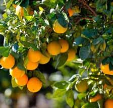
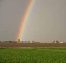
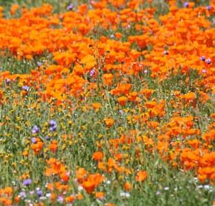
2 Aerial view of the San Joaquin Valley, Patrick Huber The San Joaquin Valley is the nation s leading producer of oranges, stock photography State of the Valley Report,

3 Executive Summary The San Joaquin Valley of California is one of the world s most productive agricultural regions, is a vital link in California s complex water delivery and transportation systems, and provides important habitat to protect biodiversity. Growth, development patterns, and climate, however, pose ongoing challenges to this unique region. The San Joaquin Valley The San Joaquin Valley Greenprint was created as a voluntary, stakeholder-driven project to help the eight counties of the San Joaquin Valley create long-term environmental and economic sustainability in the face of these challenges. It serves as a resource that can inform land use and resource management decisions in the Valley, emphasizing the importance of crafting regional solutions because economic and environmental challenges and decisions cross jurisdictional boundaries. The SJV Greenprint can be used by Valley planners and decision-makers; local, state, and federal resource managers; and the general public to answer questions like: How can we optimize the contributions of agriculture, water and ecological resources to the economy and quality of life in the Valley through regional planning? Where are the most strategic locations for groundwater recharge and storage, and what management may be needed to maintain those for such purposes? And, how can we minimize flood damage and utilize excess water from flood years in times of drought? How can we identify locations for urban growth while protecting economic and natural resources like prime farmland, oil, minerals, timber, and fisheries? Where can we restore biodiversity and connect wildlife habitats, while also achieving other land use benefits like riverside parks for recreation? The SJV Greenprint has compiled and evaluated a large collection of publicly funded maps and data that portray the Valley s water, agricultural, and ecological resources to create a single repository of information. The maps are publicly available through a single point of access, the SJV Greenprint website (sjvgreenprint.ice.ucdavis.edu), which provides an interactive mapping portal to create maps and explore conflicts and solutions related to the Valley s natural resources and non-urban spaces. This report uses the collected maps to tell the story of the San Joaquin Valley, a unique, geographically-large, resource-rich, and growing region that faces both challenges and opportunities with impacts ranging from local to national significance. The report provides baseline information on the current conditions and trends of natural resources on the valley floor Water, Agriculture, Biodiversity, and Energy. The map and data collection span the full extent of the eight San Joaquin Valley counties Kern, Tulare, Kings, Fresno, Madera, Merced, Stanislaus, and San Joaquin Counties. Water is the first of resource 2 sjvgreenprint.ice.ucdavis.edu

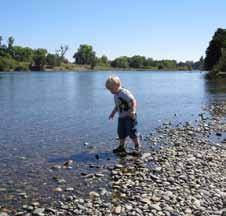
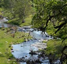
4 chapter because it is essential to the other resources the project analyzed. Agriculture, as the dominant driver of the region s economy is next, followed by Biodiversity the native environmental richness of the Valley and last but not least, Energy, as a significant economic and environmental factor for the Valley. Groundwater basins of the Valley Water Water is the foundation of the San Joaquin Valley s economy and quality of life: farming, ranching, urban users, industry, and natural ecosystems all depend upon water. But like much of California, the San Joaquin Valley faces a supply and demand challenge. Though much of the Valley s water is collected and stored in the Sierra Nevada Mountains, significant portions are also imported through a complex system of state and federal surface water channels and pumped from underground aquifers (also known as groundwater basins). Characteristics and trends of the Valley s water include: Water is a central resource management challenge in the San Joaquin Valley. Across the Valley, agriculture is the single largest water user, accounting for 72.5% of all water applied in 2010, followed by environmental uses (21.8%) and urban uses (5.7%). Of the total water applied in 2010 that was not reusable, agriculture represented 85.2%, environment 11%, and urban 3.9%. Sources of water for the Valley vary from year to year based on precipitation totals and the availability of stored water (both reservoirs and banked groundwater). The region s surface water resources are highly regulated and virtually all surface water is already claimed. Groundwater is loosely regulated, compared with surface water. Based on recent DWR data, groundwater levels in some portions of the Valley are more than 100 feet lower than they were between 1990 and Groundwater pumping is leading to land subsidence across the valley floor. A recent report identified areas with subsidence approaching one foot per year Land subsidence threatens major infrastructure such as canals, roadways, and rail lines and reduces the ability of aquifers to recharge. Large portions of the Valley have high nitrate levels in the aquifers that provide drinking water, posing potentially significant human health consequences. As groundwater levels decline, irrigation wells draw from deeper aquifers that may be more saline, leading to potential soil salinization issues. Source: DWR Note: Shades of blue represent individual groundwater basins Potential groundwater recharge areas overlapping prime agricultural land Groundwater recharge Prime farmland Overlap Source: DOC FMMP and California Water Institute, CSU Fresno State of the Valley Report,
.")
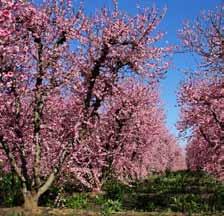
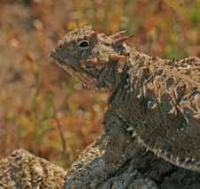
5 Walnut orchard, John Greening Agriculture The San Joaquin Valley contains some of the richest agricultural lands in the world. Seven out of the ten most productive agricultural counties in the United States are located in the San Joaquin Valley, including the top three (Fresno, Tulare, and Kern Counties, respectively). This remarkable productivity results from the intersection of superior soils, plentiful sun, limited frost danger, favorable winter cooling patterns, and investments in infrastructure that provide water across an otherwise dry landscape. Some of the trends and pressures facing Valley agriculture include: In 2012, the San Joaquin Valley s total agricultural market value was $24.2 billion (2013 inflationadjusted terms) or 56% of the State s agricultural market value. Agricultural revenues across the Valley grew almost 50% (from $16.2 billion to $24.2 billion, 2013 dollars) between 2002 and Valley counties are nationally-leading producers of almonds, pistachios, oranges, tomatoes, grapes, cotton, and milk/dairy production. The Valley s shift to permanent crops (orchards and vineyards) has increased the region s agricultural revenues, but reduced flexibility to respond to drought. Virtually the entire valley floor can support commercial agriculture million acres (60%) of the Valley s land area is in agricultural use. Important farmland makes up 5.6 million acres (32%) of the Valley s total land area. Grazing lands occupy most of the foothills surrounding the valley floor. Most of the Valley s cities are surrounded by highquality farmland. Approximately 740,000 acres of the San Joaquin Valley in 2010 are defined as urban and built-up and rural residential; formerly high-quality agricultural soils, this represents a conversion of about 12% of the Valley s potential important farmland since the establishment of these cities. Almost 25% of urban and built-up land use is new since Almost 50% of the region s potential groundwater recharge areas are also prime agricultural land. Biodiversity Historic vegetation and landcover maps of the San Joaquin Valley floor in 1850 cover 7,660,484 acres. They show that about 62% of the region was in grasslands, 38% of the region was in wetlands, water, or riparian habitats, and 20% was covered by Alkali scrub. About 69% of the valley floor has been brought into agricultural production, used for urban purposes, or committed to other human use, including energy production. Conservation of the highlands is fairly well established, which permits the continued delivery of water as an ecosystem benefit to the valley floor. The valley floor contains many species that are legally protected and that are in danger of extinction. Land conversion since 1850 occupies about 69% of the valley floor, with the largest unconverted lands being annual grasslands used for grazing. Overall, for the region, there are 3,043 plant species and 499 vertebrate species; which include 66 stateand federally-listed threatened or endangered species. The forested and alpine lands of the Sierra Nevada are the water towers of the region, supplying both surface water and groundwater, an essential ecosystem service for the region. 4 sjvgreenprint.ice.ucdavis.edu


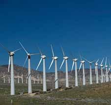
6 Comparison of landcover patterns: 1850 (left) and 2002 (right) Source: Central Valley Historic Mapping Project, Chico State, 2003 (left) and Fire and Resource Assessment Program, 2002 (right) Over 38% of all vernal pools in the region have been destroyed, and 8% are classed as degraded. Better quality vegetation maps are needed for large parts of the valley floor and foothills, particularly for riparian vegetation to properly ascertain the extent of native vegetation and habitats. Energy The San Joaquin Valley is a center for both energy production and transmission in California. More than 250 power generation facilities make their home in the Valley, though the majority of electricity production in the Valley comes from conventional oil/gas. Renewable energy sources such as wind and solar, however, are on the rise and could prove to be a significant economic driver for the region. Some of the trends defining and shaping energy resources in the Valley include: The Valley has more than 63,000 active oil and gas wells, with the majority located in Kern County. The San Joaquin Valley accounts for 80% of the State s oil production (6% nationally), valued at approximately $16.4 billion (2012) natural gas production was worth approximately $480 million. Almost 90% of the active wells are on vacant or disturbed land, much of which would otherwise be grazing land. Hydraulic fracturing in California uses an average of about 164,000 gallons of water per well. Wind power is the second largest energy source generated by the Valley (3,650 MW), followed closely by hydropower (3,600 MW). Most of the Valley s wind is generated in the Tehachapi (3,000 MW). The San Joaquin Valley has 27 major active solar generation facilities, capable of producing almost 500 MW. Fresno County has more solar power plants (12) than State of the Valley Report,


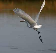
7 any other county, but Kern County can produce almost as much power from its three larger plants. Energy groups have mapped many suitable solar and wind power generation sites for future development in the Valley. Next Steps The completion of this report and the full launch of the SJV Greenprint website signal the close of the first phase of the San Joaquin Valley Greenprint. To date, the Greenprint team has consulted with more than 400 individuals and experts to gather information that has shaped the process and the ultimate presentation of the materials. The data and maps, publicly accessible, provide current and comprehensive information to aid in understanding the status of the Valley s resources, how these interrelate with one another, and how they intersect with local and regional planning. Tulare County orange orchard, John Greening As the Valley faces increasingly tough resource management questions in the face of growth and limited resource challenges, the SJV Greenprint provides a regional tool to find multiplebenefit solutions, reduce conflict, and achieve an economically and environmentally sustainable future for the Valley, as a whole. Looking ahead, the next phase of the project will focus on applications of the data and maps. The Greenprint s next steps will include the following tasks: Outreach to increase awareness of the Greenprint resources, especially to the eight counties, and to present the trends and conditions in the Valley that the mapping and analysis are suggesting, including the challenges and opportunities. Pilot projects to incorporate Greenprint map resources into local land use planning that provide real world utility and value. Look for opportunities to align the Greenprint with State and Federal initiatives to enhance relevance and secure resources for an ongoing Greenprint resource mapping program (e.g. Central Valley Ag Plus, AB 32 Five-year Roadmap). Review and document existing policies, programs and implementation tools in use in the Valley. Identify conflicts in regulations, policies, or government actions. Identify strategies and tools help the Valley achieve economic growth and resource sustainability. Additional mapping and analysis identify shortfalls or gaps, provide training to access and interpret maps, update and incorporate new maps as information becomes available. Publish a guide for resource management to provide a range of specific policies and implementation tools that governments, businesses and communities can self-select to address their economic and resource objectives. Friant-Kern Canal, John Greening White egret on restored wetlands, Steve Laymon 6 sjvgreenprint.ice.ucdavis.edu

8 The State of the Valley report is a final deliverable for the first phase of the San Joaquin Valley Greenprint. The project is funded by a grant from the California Strategic Growth Council and managed by the San Joaquin Valley Greenprint Steering Committee, with support provided by a team of consultants. The full report and data catalog can be accessed online at: sjvgreenprint.ice.ucdavis.edu
State of the Valley Report
 State of the Valley Report An overview of the characteristics and trends of natural resources in the San Joaquin Valley s rural spaces, with an eye on resource sustainability for the future Acknowledgments
SAN JOAQUIN VALLEY GREENPRINT
 SAN JOAQUIN VALLEY GREENPRINT Clark Thompson, Fresno COG clarkt@fresnocog.org (559) 233 4148 x203 Nathaniel Roth, UC Davis (530) 754 6212 neroth@ucdavis.edu Jim Thorne, UC Davis (530) 752 4389 jhthorne@ucdavis.edu
The Future of Irrigated Agriculture: Where's the Water?
 The Future of Irrigated Agriculture: Where's the Water? California Colloquium on Water UC Berkley February 9 th 2010 David F. Zoldoske, Director Center for Irrigation Technology California State University,
San Joaquin Valley Greenprint
 San Joaquin Valley Greenprint A voluntary, stakeholder-driven project that provides agricultural, water, and environmental leaders with improved planning data and fosters regional collaboration on strategies
Scientific overview of climate change impacts and adaptation priorities in the Central Valley, and links to research Presentation to California
 Central Valley, and links to research Presentation to California Senate Environmental Quality Committee September 22, 2015 Merced, CA Roger Bales, Professor of Engineering & Director of the Sierra Nevada
4.2.3 Regulatory Setting
 4.2.3 Regulatory Setting Federal State Farmland Protection Policy Act (7 U.S.C. Section 4201) The purpose of the Farmland Protection Policy Act (FPPA) is to minimize the extent to which federal programs
Myths and Facts about a Drought Year in the San Joaquin Valley
 Myths and Facts about a Drought Year in the San Joaquin Valley 2013 has been the driest year on record in California and Southern Oregon. In the San Joaquin Valley, Hanford, California, got only 1.99 inches
Drought and California
 Drought and California Jay Lund Director, Center for Watershed Sciences Professor, Civil and Environmental Engineering University of California, Davis CaliforniaWaterBlog.com What people know Main Points
Kern Water Bank. Kern Water Bank Authority
 Kern Water Bank Kern Water Bank Authority THE KERN WATER BANK Ensuring a Reliable Water Supply to the Southern San Joaquin Valley Providing for Exceptional Upland and Riparian Habitat Kern Water Bank Authority
3.2 Agricultural and Forestry Resources
 3.2 This section describes the regulatory and environmental setting for agricultural and forestry resources in the program and project areas. It also describes impacts on these resources that could result
What is Coyote Valley?
 What is Coyote Valley? Coyote Valley is located just south of urban San Jose and north of Morgan Hill. It lies between the Santa Cruz Mountains to the west and the Diablo Range to the east. Tulare Hill
Loss of Central Valley Vernal Pools
 Summary Report Loss of Central Valley Vernal Pools Land Conversion, Mitigation Requirements, and Preserve Effectiveness Prepared for: Prepared by: With Assistance from: Vollmar Consulting and Robert F.
California s s Water Supplies and Uses
 California s s Water Supplies and Uses Presented to Delta Stewardship Council Presented by Joe Grindstaff September 21 1 Place to Place: Most precipitation falls in the mountains in the north and east
19 STUDY AREA 19: DURHAM PENTZ/HIGHWAY 99
 19 Study Area 19, Durham Pentz/Highway 99, consists of 389 acres located adjacent to and south of Study Area 15, at the intersection of Durham-Pentz Road and Highway 99. The study area is currently undeveloped,
Report. Environmental Water Demands. Butte County Department of Water and Resource Conservation Integrated Water Resources Plan.
 Report Butte County Department of Water and Resource Conservation Integrated Water Resources Plan s June 2004 s Section 1 - Introduction 1.1 Project Description This project is a preliminary investigation
Madera Irrigation District Water Supply Enhancement Project
 Madera Irrigation District Water Supply Enhancement Project Madera County Board of Supervisors Project Summary and Status March 29, 2011 1 Agenda MID Water Supply Enhancement Project Introductions Project
21 Century Colorado River Budget
 21 Century Colorado River Budget st s for the Colorado River Basin in FY18 T he Colorado River is one of the great icons of the American West, and a fundamental resource for the nation. It is a foundation
For Sale. Exclusively Presented By: PEARSON REALTY
 For Sale R iver R anch 900 Shares Lemoore Water Stock 1,180± Acres Drip Irrigation System 465± Acres Mature Pomegranates on Drip 715± Acres Tomatoes on Drip 960± Acres Tile Drain Kings River Frontage Exclusively
Sustainable Ag Lands Conservation (SALC) Stakeholder Kickoff Meeting Agenda (Meeting #1) 1) Welcome and Introductions (10 min)
 Stakeholder Kickoff Meeting Agenda (Meeting #1) 1) Welcome and Introductions (10 min)") Sustainable Ag Lands Conservation (SALC) Stakeholder Kickoff Meeting Agenda (Meeting #1) Thursday, April 28, 2016 10:00 am to Noon Development Services Training Room 7 County Center Drive, Oroville AGENDA
Sustainable Ag Lands Conservation (SALC) Stakeholder Kickoff Meeting Agenda (Meeting #1) Thursday, April 28, 2016 10:00 am to Noon Development Services Training Room 7 County Center Drive, Oroville AGENDA
4.2 AGRICULTURAL RESOURCES
 4.2.1 Summary 4.2 AGRICULTURAL RESOURCES Table 4.2-1 summarizes the identified environmental impacts, proposed mitigation measures, and residual impacts of the proposed project with regard to agricultural
WORK COMPLETED TO DATE
 2018 Merced SWRP/IRWMP Update Regional Advisory Committee Meeting #3 August 30, 2018 Presenters: Leslie Dumas woodardcurran.com WORK COMPLETED TO DATE Work to Date Held RAC meetings (May 24 th ; June 27
Water Education Foundation Briefing Water Year 2016: San Joaquin Valley Groundwater Conditions
 Groundwater in Fractured Rock Aquifers Well Location, Yield, and Sustainability Water Education Foundation Briefing Water Year 2016: San Joaquin Valley Groundwater Conditions John Kirk, PG, CEG, CHG Engineering
Section 3 Current and Future Water Demand
 Understanding the magnitude and location of future water demands, and any potential changes from existing water demands, allows the County to develop recommendations that will meet or manage demands for
AGRICULTURAL LAND AND PRODUCTION
 IV.12 AGRICULTURAL LAND AND PRODUCTION The analysis in this chapter addresses potential impacts to agricultural resources from adoption and implementation of the Desert Renewable Energy Conservation Plan
Welcome VISION STATEMENT
 1 Welcome PowerButte is Butte County s innovative initiative to encourage the use of solar power to generate a sustainable energy supply. Over the past few years, solar facility development has been increasing
Woodlake General Plan Draft Environmental Impact Report
 5.0 UNAVOIDABLE ADVERSE ENVIRONMENTAL EFFECTS The following potential adverse environmental effects appear to be unavoidable if the Woodlake General Plan is implemented, even if certain mitigation measures
Questions and Answers about the Water Supply and Water Quality bond act for the November, 2018 ballot. Updated November 17, 2017
 Questions and Answers about the Water Supply and Water Quality bond act for the November, 2018 ballot. Updated November 17, 2017 What is the need for more State investment in water resources? What is the
Executive Summary. TCAG 2014 Regional Transportation Plan
 Executive Summary TCAG 2014 Regional Transportation Plan About Tulare County Tulare County is located in California's San Joaquin Valley (SJV)[Figure 1-1]. Tulare County is bordered by Inyo County to the
Western Governors Association Policy Resolution Western Agriculture A. BACKGROUND
 Western Governors Association Policy Resolution 2017-09 Western Agriculture A. BACKGROUND 1. Agriculture and forestry in the western states and territories are significantly different than in other regions
Technical Memorandum
 Specialists in Agricultural Water Management Serving Stewards of Western Water since 1993 To: From: Technical Memorandum Butte County Department of Water and Resource Conservation Davids Engineering Date:
ENVIRONMENTAL STEWARDSHIP AND THE 2020 PROJECT
 UNIVERSITY OF CALIFORNIA, MERCED ENVIRONMENTAL PLANNING UPDATE ENVIRONMENTAL STEWARDSHIP AND THE 2020 PROJECT Physical and Environmental Planning University of California, Merced 5200 N. Lake Road Merced,
WATER RESOURCE PROGRAM
 SOUTH PLATTE WATER RESOURCE PROGRAM Establishing a lasting legacy of abundant clean water for waterfowl, wildlife and people Water is an essential resource for life and good health. It is vitally important
5. OTHER CEQA CONSIDERATIONS
 5. OTHER CEQA CONSIDERATIONS Cumulative Impacts CEQA requires the analysis of impacts due to cumulative development that would occur independent of, but during the same timeframe as, the project under
Strong site and year specific needs, particularly driven by annual systems Well drained, <1200 m, over diverse soil types
 California s grasslands span over 10% of CA s land area (5,640,400 ha). The grasslands are also a key understory component of California s woodlands and coastal scrub, so grassland species cover at least
The Lund Ranch. 1,354.1 Ac. Farm Ground The Lund Ranch Tracy, CA. Schuil & Associates
 The Lund Ranch 1,354.1 Ac. Farm Ground The Lund Ranch Tracy, CA Schuil & Associates 559-734-1700 www.schuil.com CalDRE: 00845607 Listing The Lund Ranch Price: $22,342,560 Location: Size: The historic Lund
A Retrospective Estimate of the Economic Impacts of Reduced Water Supplies to the San Joaquin Valley in 2009
 A Retrospective Estimate of the Economic Impacts of Reduced Water Supplies to the San Joaquin Valley in 2009 By Jeffrey Michael, Richard Howitt, Josué Medellín-Azuara, and Duncan MacEwan 1 September 28,
About Almonds and Water
 About Almonds and Water Who We Are Multigenerational, family farmers are at the heart of California s Almond community. About California Almond Farms More than 90% family farms 6,800 almond growers 105
Amador Water Agency 2015 Urban Water Management Plan Revised Public Draft. Climate Change Vulnerability Assessment
 Amador Water Agency 2015 Urban Water Management Plan Revised Public Draft Climate Change Vulnerability Assessment Appendix Q June 2016 Technical Memorandum AWA UWMP 2015 Update Subject: Prepared For: Prepared
Figure 1 Kings Basin
 Case Study: Lower Kings Basin Cone of Depression The area covered by the lower Kings Basin includes the lands located in the western portion of the Kings Basin including the small communities of Raisin
Home to about 56 million people, the Southwest includes Nevada, Arizona, New Mexico, Utah, Colorado and most of California.
 Climate change in the U.S. Southwest U.S. Environmental Protection Agency Overview The Southwest is the hottest and driest region in the nation. Extending from the Pacific Ocean east to the Rocky Mountains
April 5th Meeting Agenda
 Pend Oreille County Voluntary Stewardship Program April 5th Meeting Agenda Welcome and Meeting Overview Follow up from last Work Group meeting Review details in Sections 2 and 3 prepared since last meeting
3. AFFECTED ENVIRONMENT
 3. AFFECTED ENVIRONMENT This chapter presents a general description of the physical environment of the project area and vicinity. The existing condition of resources sets the baseline against which the
Jose Gutierrez - Chief Operating Officer. Water Education Foundation, April 4,2019
 Jose Gutierrez - Chief Operating Officer Water Education Foundation, April 4,2019 Presentation Overview Who We Are CVP South of Delta Allocation Groundwater Conditions Sustainable Groundwater Management
6 AGRICULTURAL AND FORESTRY RESOURCES
 6 AGRICULTURAL AND FORESTRY RESOURCES This chapter provides an evaluation of the potential environmental effects of implementing the proposed 2030 Merced County General Plan (2030 General Plan) on agricultural
Ecology and Conservation of California's Coastal Freshwater Wetlands An Introduciton to the diversity of coastal freshwater wetlands Lorraine Parsons
 California s Coastal Freshwater Wetlands Lorraine Parsons Point Reyes Station, Calif. Habitat Definition Holland - e.g., Coastal and Valley Freshwater Marsh Cowardin Classification Wetlands are lands transitional
Jordan River Basin. Planning for the Future. Salt Lake County Watershed Symposium (August 11, 2011) Todd Stonely Utah Division of Water Resources
 Todd Stonely Utah Division of Water Resources") Jordan River Basin Planning for the Future Todd Stonely Utah Division of Water Resources Salt Lake County Watershed Symposium (August 11, 2011) 8/12/2011 Jordan River Basin Planning for the Future Slide
Jordan River Basin Planning for the Future Todd Stonely Utah Division of Water Resources Salt Lake County Watershed Symposium (August 11, 2011) 8/12/2011 Jordan River Basin Planning for the Future Slide
6 AGRICULTURAL AND FORESTRY RESOURCES
 6 AGRICULTURAL AND FORESTRY RESOURCES This chapter provides an evaluation of the potential environmental effects of implementing the proposed 2030 Merced County General Plan (2030 General Plan) on agricultural
BIG CHICO CREEK WATERSHED ALLIANCE
 BIG CHICO CREEK WATERSHED ALLIANCE Input for County Integrated Water Resources Plan I Description of Organization Contact Person: Susan Strachan, Chair P.O. Box 461 Chico, CA 95928 (530) 894-1308 Website:
SACOG Board of Directors
 SACOG Board of Directors Item #15-4-7 Consent April 9, 2015 Approve Support for H.R. 1060 (Sacramento Valley Water Storage and Restoration Act of 2015) Issue: Should SACOG support H.R. 1060, the Sacramento
Chapter 13: Wildlife and Vegetation
 Chapter 13: Wildlife and Vegetation Introduction and Setting Nevada County contains an extremely wide range of plants, animals and habitat types. With topographic elevations ranging from 300 feet in the
STATE OF THE HEMET/SAN JACINTO BASINS
 STATE OF THE HEMET/SAN JACINTO BASINS WHITE PAPER Submitted to the Eastern Municipal Water District Board of Directors, December 13, 2000 INTRODUCTION The following staff report recommends that Eastern
In Hot Water: Climate and Water in the West
 In Hot Water: Climate and Water in the West Pacific Gas and Electric San Francisco, CA March 25, 2008 Barry Nelson Western Water Project Natural Resources Defense Council San Francisco, CA 1 In Hot Water
THE SUSTAINABLE GROUNDWATER MANAGEMENT ACT OF 2014 SGMA
 THE SUSTAINABLE GROUNDWATER MANAGEMENT ACT OF 2014 SGMA . CHOWCHILLA SUBBASIN FOUR LOCAL AGENCIES FORMED GSAs Chowchilla Water District Madera County Merced County Triangle T Water District CHOWCHILLA
Poso Creek. Integrated Regional Water Management Plan
 Poso Creek Integrated Regional Water Management Plan Adopted July 2007 Poso Creek IRWMP Regional Management Group and Region The Poso Creek Regional Management Group (Regional Management Group) comprises
Emissions Inventory Data
 Emissions Inventory Data This document supplements the AB 170 Requirements for General Plans guidance document prepared by the District in April 2009. The report describing local air quality conditions
P.O. Box 216 Frazier Park, CA 93225
 Tejon Ranch Conservancy P.O. Box 216 Frazier Park, CA 93225 January 23, 2009 Ms. Amy Burgard Group Project Coordinator Bren School of Environmental Science & Management 2510 Bren Hall UC Santa Barbara,
Section 5 Packages. 5.1 Package Development Problem Statements A 5-1
 5.1 Package Development Each of the options presented in Section 4 was conceived to serve one or more purposes. No single option, however, is capable of addressing all of the County s water management
Regulatory Report LGSEC Quarterly Meeting
 Regulatory Report LGSEC Quarterly Meeting Jody London July 16, 2015 jody_london_consulting@earthlink.net 510-459-0667 Today s Report CPUC CEC Governor s Goals Legislation 2 Energy Efficiency (R.13-11-005)
Appendix A. Ambient Air Quality Data Ozone Plan
 Appendix A Ambient Air Quality Data This page intentionally blank. A.1 INTRODUCTION This Appendix includes more ambient air quality data and analysis for 8-hour ozone. A.2 AMBIENT AIR QUALITY DATA Table
4.2 AGRICULTURE AND FORESTRY
 4.2 AGRICULTURE AND FORESTRY This section evaluates impacts on agricultural and forestry resources from implementation of the proposed Specific Plan. Specifically, this section addresses consistency with
4.3 GROUNDWATER Impact Issues and Evaluation Criteria
 4.3 GROUNDWATER 4. Environmental Consequences and Mitigation Measures This section describes changes to groundwater conditions associated with the project alternatives, as compared to the No Action alternative.
5 CEQA CONSIDERATIONS
 5 CEQA CONSIDERATIONS 5.1 UNAVOIDABLE ADVERSE IMPACTS For the purposes of this section, unavoidable significant adverse impacts are those effects of the project that would significantly affect either natural
ALABAMA S FUTURE WITHOUT SUSTAINABLE WATER RESOURCES? NOT ON OUR WATCH. Marlon Cook
 ALABAMA S FUTURE WITHOUT SUSTAINABLE WATER RESOURCES? NOT ON OUR WATCH Marlon Cook Geological Survey of Alabama Groundwater Assessment Program Sustainable Water Resources Sustainable Yield: The water extraction
Geomorphologic Condition and Shallow Aquifers
 Geomorphologic Condition and Shallow Aquifers Shann Stringer Center for Ecological Sciences Geomorphology Fluvial geomorphology is the study of the physics of water, sediment, riparian area, and floodplain
The Nature Conservancy Cosumnes River Preserve Franklin Boulevard Galt CA 95632
 Study Partners The Nature Conservancy Cosumnes River Preserve 13501 Franklin Boulevard Galt CA 95632 East Bay Municipal Utility District 1 Winemaker Way, Unit K Lodi CA 95240 Sacramento County Water Agency
Santa Clara Valley Water District 2017 Water Supply Master Plan Planning Objectives
 Santa Clara Valley Water District 2017 Water Supply Master Plan Planning Objectives The purpose of the Water Supply Master Plan (Water Master Plan) is to present the District s strategy for ensuring a
Santa Ana River Watershed. SAWPA Celeste Cantú April 17, 2012
 Santa Ana River Watershed SAWPA Celeste Cantú April 17, 2012 What is SAWPA? SAWPA Member Agencies & Other Stakeholders Other Stakeholders 97 Water-related Agencies 4 Counties 59 Cities State water, environmental,
4.2 AGRICULTURAL RESOURCES
 4.2 AGRICULTURAL RESOURCES 4.2.1 PHYSICAL SETTING The Project traverses a 2.9-mile area within the 290,000-acre Santa Maria Valley which consists of the largest amount of agricultural acreages in the County
What is an ecosystem?
 What is an ecosystem? An ecosystem is generally defined as a community of organisms living in a particular environment and the physical elements in that environment with which they interact. (http://www.enviroliteracy.org/category.php/3.html)
Irvine Ranch Water District s Groundwater Banking Program
 Irvine Ranch Water District s Groundwater Banking Program National Water Research Institute Drought Response Workshop October 8, 2013 1 Today s Discussion Introduction to IRWD Drought Preparedness at IRWD:
FACT SHEET: BLM, USFS Greater Sage-Grouse Conservation Effort
 EMBARGOED UNTIL SEPTEMBER 22, 2015 @ 12:00PM ET FACT SHEET: BLM, USFS Greater Sage-Grouse Conservation Effort Overview Effective conservation of the greater sage-grouse and its habitat requires a collaborative,
Sacramento Valley Groundwater: An Approach to Better Understand and Manage the Lower Tuscan Groundwater Resources for Northern California
 Sacramento Valley Groundwater: An Approach to Better Understand and Manage the Lower Tuscan Groundwater Resources for Northern California The Sacramento Valley is recognized as one of the foremost groundwater
Paso Robles Groundwater Basin Management Plan A Focus on Voluntary Actions to Improve the Sustainability of Our Water Supply
 Paso Robles Groundwater Basin Management Plan A Focus on Voluntary Actions to Improve the Sustainability of Our Water Supply Why Implement a Groundwater Management Plan? Pumping at or near basin annual
VEGETATIVE, WATER, FISH AND WILDLIFE RESOURCES POLICIES
 VEGETATIVE, WATER, FISH AND WILDLIFE RESOURCES POLICIES The County will: GOALS AND OBJECTIVES 1.1 Conserve, Enhance, Protect, Maintain and Manage Vegetative, Water, Fish and Wildlife Resources Promote
Water for All, Now and Into the Future: Water Quantity in Wisconsin. A report by the Sierra Club-John Muir Chapter
 Water for All, Now and Into the Future: Water Quantity in Wisconsin A report by the Sierra Club-John Muir Chapter Table of Contents Background The Importance of Water Quantity Water Use in Wisconsin Excessive
4.2 Agriculture and Forestry Resources
 The purpose of this Section is to identify existing agriculture and forest resources within the Project area, analyze potential agriculture and forest resources associated with the development of the proposed
BASIN MANAGEMENT OBJECTIVES BUTTE SINK SUBINVENTORY UNIT
 BASIN MANAGEMENT OBJECTIVES BUTTE SINK SUBINVENTORY UNIT Butte County Water Advisory Committee Member Vacant Contact Information Phone Number: Email Address: Description of the Butte Sink Sub-inventory
3.2 AGRICULTURAL RESOURCES
 3.2 AGRICULTURAL RESOURCES 3.2.1 INTRODUCTION This section analyzes the potential direct, and indirect, impacts to agricultural resources within the project site and surrounding vicinity, as a result of
ADOPT A RESOLUTION OF THE CITY COUNCIL IN SUPPORT OF THE CALIFORNIA WATERFIX AND CALIFORNIA ECO RESTORE
 ADOPT A RESOLUTION OF THE CITY COUNCIL IN SUPPORT OF THE CALIFORNIA WATERFIX AND CALIFORNIA ECO RESTORE Presented by Gary Takara City Council September 18, 2017 Agenda Item 12 Recommendations Find that
Southern California River and Stream Habitats
 Southern California River and Stream Habitats Climate Change Adaptation Actions Summary An Important Note About this Document: This document represents an initial effort to identify adaptation actions
Annual Monitoring Report for Calendar Year 2009
 Annual Monitoring Report for Calendar Year 2009 City of Paso Robles Submitted to: Paso Robles Groundwater Basin Groundwater Advisory Committee Date: February 9, 2011 Table of Contents 1 Introduction 2
Groundwater and Groundwater Surface Water Interaction: How Does It Work?
 Napa Valley Groundwater Advisory Committee February 23, 2012 Groundwater and Groundwater Surface Water Interaction: How Does It Work? Thomas Harter University of California, Davis ThHarter@ucdavis.edu
PRINCE GEORGE NATURAL AREAS AND THE EFFECTS OF CLIMATE CHANGE: CASE STUDY
 PRINCE GEORGE NATURAL AREAS AND THE EFFECTS OF CLIMATE CHANGE: CASE STUDY Natural Areas in Prince George The City of Prince George is dominated by natural, undeveloped areas within city limits and in adjacent
Farmington Dam Repurpose Project
 Farmington Dam Repurpose Project 2017 $158,100,000 to re-purpose the Farmington Dam from flood protection only to a long-term water storage facility that increases water supply reliability to the region.
Central Valley Salinity/Nutrient Management Planning Through CV- SALTS Existing Framework and Roles
 Program Review 2007 - Initiation and Scoping, Waterboards directed study 2008 - Stakeholder Development and Organization 2009 - Planning, Funding and First Projects 2010 - BUOS and Program Development
JUNE 20, Collaborative Initiatives: Restoring watersheds and large landscapes across boundaries through State and Federal partnerships
 TESTIMONY of LESLIE WELDON DEPUTY CHIEF, NATIONAL FOREST SYSTEM UNITED STATES DEPARTMENT OF AGRICULTURE FOREST SERVICE BEFORE THE SENATE COMMITTEE ON ENERGY AND NATURAL RESOURCES SUBCOMMITTEE ON PUBLIC
7/20/2011 TECHNICAL FEEDBACK GROUP OBJECTIVES. Seepage and Conveyance Technical Feedback Group. April 29, H Street Los Banos, CA.
 Seepage and Conveyance Technical Feedback Group April 29, 2011 541 H Street Los Banos, CA Agenda Introductions and Technical Feedback Group (TFG) Purpose Action Item Review and Update 2011 Interim Flows
2. PROJECT DESCRIPTION
 2. PROJECT DESCRIPTION AND DEMOGRAPHIC INFORMATION Introduction The Fresno County General Plan is being updated to provide a more current long-term framework for growth in the County and protection of
12/11/2014. Provided by Thomas Harter, UC Davis RAIN. How much groundwater is in an aquifer?
 12/11/2014 Drought Effects on Groundwater Management: Understanding Groundwater, Drought, and Streams Overview 1. Differences in aquifer characteristics across California ag areas (capacity, material,
Overview of Conjunctive Management in California Let s Have a Frank Discussion
 Overview of Conjunctive Management in California Let s Have a Frank Discussion Mark S. Nordberg, P.G. Division of Integrated Regional Water Management North Central Region Office Geology and Groundwater
Section V: Water Accounting and Water Supply Reliability
 Section V: Accounting and Supply Reliability A. Quantifying the Supplier s Supplies 1. Agricultural Supplier Quantities Table 46 illustrate the District s water. The District routinely transfers and/or
SB 5 (De Leon) Parks/Water Bond of 2018 Summary
 Parks/Water Bond of 2018 Summary") SB 5 (De Leon) Parks/Water Bond of 2018 Summary Total: $3.5 Billion $1.5B for Parks $1.5B for Drought/Water $500M for Flood Protection Built and modeled off of SB 317 (De Leon) Park Bond and 2014 Prop
SB 5 (De Leon) Parks/Water Bond of 2018 Summary Total: $3.5 Billion $1.5B for Parks $1.5B for Drought/Water $500M for Flood Protection Built and modeled off of SB 317 (De Leon) Park Bond and 2014 Prop
DRAFT ANNOTATED OUTLINE 12/4/2006
 DRAFT ANNOTATED OUTLINE 12/4/2006 INTEGRATED WATER MANAGEMENT PLAN SAN DIEGO REGION A. INTRODUCTION AND REGIONAL WATER MANAGEMENT GROUP Summary This Integrated Regional Water Management Plan (IRWM Plan)
Option 11. Divert Water from Miocene and Hendricks Canal to Supply the Ridge
 Integrated Water Resources Plan Option 11 Divert Water from Miocene and Hendricks Canal to Supply the Ridge This option would use water from the Miocene Canal and/or Hendricks Canal for municipal supplies
Position Description Sierra Nevada AmeriCorps Partnership
 SNAP 2015-2016 Position Description Position Description Sierra Nevada AmeriCorps Partnership Position descriptions are used by the SNAP Program to recruit members. Please complete the following form and
Kittitas County Voluntary Stewardship Plan
 Kittitas County Voluntary Stewardship Plan Presented by John Small and Nora Schlenker, Anchor QEA 1 Agenda Welcome and Follow-up from Last Meeting Protection and Enhancement Strategies Goals and Measurable
High-level political forum on sustainable development
 High-level political forum on sustainable development Review of SDG implementation: SDG 6 Ensure availability and sustainable management of water and sanitation for all 9 July 2018, New York Dr Callist
To Have Healthy Watersheds, We Need Healthy Forests. Steve Brink Vice President Public Resources California Forestry Association
 To Have Healthy Watersheds, We Need Healthy Forests Steve Brink Vice President Public Resources California Forestry Association National Forests Managed by the Forest Service in California Sacramento Stockton
Rangeland Conversion Study
 Homes on the Range: Trends in Conversion and Protection of Rangeland Habitat OVERVIEW Rangeland Conversion How much has been lost? What has it become? How much is protected? Importance of CA Rangelands
Case Study Murray-Darling Basin, Australia Eugene, OR. Valuing a Watershed s Natural Capital
 Case Study Murray-Darling Basin, Australia Eugene, OR Valuing a Watershed s Natural Capital The Academy s June 21, 2012 webinar, with guests Rosalind Bark, Resource Ecological Specialist at Australia s