Natural Resources and Climate Resiliency in Germantown
|
|
|
- Roxanne Anderson
- 6 years ago
- Views:
Transcription


1 Natural Resources and Climate Resiliency in Germantown Ingrid Haeckel, Andrew Meyer, and Elizabeth Murphy NYSDEC Hudson River Estuary Program and Cornell University Presentation to the Town of Germantown, December 7, 2013


2 The Hudson River Estuary Program Germantown Ensure clean water; Protect and restore fish and wildlife habitats; Provide recreation in and on the water; Adapt to climate change; and Conserve the scenic landscape.

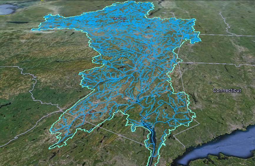
3 Hudson River Watershed Entire watershed ~ 13,500 sq. mi.
4
5 Outline Role of local governments The Natural Resource Summaries Future Climate Conditions How you can use the Summaries Where to go for more information Discussion

6 Local government has a critical role in managing water and wildlife

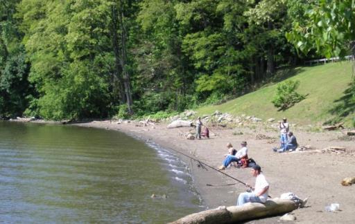
7 How local governments manage water and wildlife Comprehensive plan Open space plan Zoning SEQRA Project review Town ordinances Natural resource inventory Critical environmental areas Stormwater regulations Climate Smart Community Pledge, Certification Mouth of the RoeJan kayaktrippics.us


8 Healthy, natural systems provide benefits to our communities: water quality and quantity flood control clean air carbon storage recreation scenery forest products fisheries ecosystem services

9 Resilience
10 Images courtesy Dodson Associates, Ltd. And Behan Planning Associates, Inc A small town in upstate New York
11 Images courtesy Dodson Associates, Ltd. And Behan Planning Associates, Inc Buildout under current zoning

12 More roads, roofs, and driveways mean more runoff Changes the way water moves across the landscape More stream crossings, barriers to fish, flooding risk More road salt degrades water quality More pressure on groundwater, impact from septics Less wildlife habitat, more fragmentation Loss of streamside vegetation Changes habitat promotes weedy species Limit animal migrations More negative wildlife-human interactions Reduce hunting and recreation opportunities Images courtesy Dodson Associates, Ltd. And Behan Planning Associates, Inc Many impacts on water and wildlife
13 Rivers and Streams Wetlands & stream corridors Forests and natural area connections Working Landscapes Identify important resources Cultural & Historic Resources Trails and Greenways Images courtesy Dodson Associates, Ltd. And Behan Planning Associates, Inc

14 Images courtesy Dodson Associates, Ltd. And Behan Planning Associates, Inc A buildout that reduces pressure
15 Note: this is an idealized cartoon. By working toward this ideal, you can reduce pressure. Images courtesy Dodson Associates, Ltd. And Behan Planning Associates, Inc A buildout that reduces pressure
16 Outline Role of local governments The Natural Resource Summaries Future Climate Conditions How you can use the Summaries Where to go for more information Discussion
")
17 What is a Natural Resource Summary? Local data from Farmscape Ecology at Hawthorne Valley Farm Summarizes existing information gleaned from (mostly) state data Descriptions Tables Maps General conservation principles References

18 Please Note! Primarily for planning purposes Maps have limitations (e.g., scale) Raise questions for project review Will not tell you if a permit from NYSDEC is needed

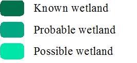
 Wetlands Grasslands (text only)")
19 What is in a Habitat Summary? Regional Context Major Ecological Features Coastal and Shoreline Habitat Streams and Watersheds Large Forests (200+ acres) Wetlands Grasslands (text only) Young Forests (text only)
20 What is in a Habitat Summary? Tables and Links

21 What is in a Water Resources Summary? Land Cover Aquifers Floodplains and Riparian Buffers Waterbody Classification, Assessments, and Impairment Stormwater Management SPDES Permits and Wastewater Aquatic Barriers

22 What is in a Water Resources Summary? Background information Germantown Details Tables Maps References and Resources
23 What is in a Water Resources Summary? Background information Germantown Details Tables Maps References and Resources

24 What is in a Climate Summary? Introduction to climate resilience Climate hazards in NYS Projections for Germantown Climate risks and opportunities How to get involved
25 Outline Role of local governments The Natural Resource Summaries Future Climate Conditions How you can use the Summaries Where to go for more information Discussion

26 Plan for future, not the past
27 Climate hazards and risks that could impact Germantown Hazards Increasing temperatures Rising sea level Changing precipitation patterns Risks Heat waves Flooding Short term drought

28 Hazard #1: Increasing temperatures Since 1970: Global annual average temperature up 1 F US annual average temperature up 1.8 F New York annual average temperature up 2 F New York winter average temperature up 5 F
29 Projections: Increasing temperatures
30 Hazard #2: Changing precipitation patterns More variability and volatility 74% Increase in heavy downpours between and NYS Department of Environmental Conservation


31 Hazard #3: Sea level rise Historic: 15 in NY Harbor in the past 150 years NYS Department of Environmental Conservation
32 Climate risks: how hazards affect our communities Heat waves Short-term drought Flooding

33 Opportunity: become climate resilient
34 Outline Role of local governments The Natural Resource Summaries Future Climate Conditions How you can use the Summaries Where to go for more information Discussion
35 Area of concern

36 What is the watershed context?


37 comely shiner shad Species and habitats of concern?


38 Large forests that could remain connected?

39 Wetlands present?

40 Local water quality?


41 Compatible with protection of our groundwater? More detailed information?


42 Sea Level Rise Mapper Future shoreline and floodplains?
43 What did we learn? Important habitats? tidal wetlands and forest connection
44 What did we learn? Important habitats? tidal wetlands and forest connection Good quality streams? RoeJan, tribs and mouth maintain its quality
45 What did we learn? Important habitats? tidal wetlands and forest connection Good quality streams? RoeJan, tribs and mouth, maintain its quality Aquifer concerns? compatible land uses, NY Rural Water Association
46 What did we learn? Important habitats? tidal wetlands and forest connection Good quality streams? RoeJan, tribs and mouth maintain its quality Aquifer concerns? compatible land uses, NY Rural Water Association Sea level rise impacts? plan for a 6 foot rise along the Hudson
47 How can a town use the Summaries? Comprehensive Plan Open Space Plan Zoning Town ordinances Natural Resource Inventory SEQRA Environmental Assessment Forms Critical Environmental Areas Conservation Advisory Councils Project review Use future climate conditions for town planning

48 SEQRA Environmental Assessment Forms Online Workbook

49 Critical Environmental Areas A specific geographic area designated by a state or local agency because it has exceptional or unique environmental or cultural characteristics valued by the community. Hogback Hill CEA, Hyde Park


50 In Rosendale, the Conservation Advisory Council prepared a Natural Resource Inventory


51 In Rhinebeck, the Conservation Advisory Council helps the Planning Board


52 Recommended Conservation Guidelines Identify natural areas early in the planning process. Avoid and minimize disturbance to natural areas. Preserve links between natural areas with broad connections. Direct development toward altered or least sensitive areas. Preserve farmland potential and working forests. From Hudsonia, Biodiversity Assessment Manual
53 Outline Role of local governments The Natural Resource Summaries Future Climate Conditions How you can use the Summaries Where to go for more information Discussion
54 Where can I get more information? Printed versions CDs Town website

55 Where can I get more information? Tables and Links

56 Where can I get more information?


57 Where can I get more information? Become a Climate Smart Community 116 CSC Communities in NYS


58 Where can I get more information? Climate Smart Communities: Examples of Certification Actions Create an internal green team Incentivize employee alternative commute Establish a residential energy efficiency financing program Conduct a climate vulnerability assessment Promote residential flood prevention strategies
59 Where can I get more information? Climate resiliency: next steps Become a Climate Smart Community Sign up for our Climate Resiliency in the Hudson River Estuary Newsletter


60 Questions? Ingrid Haeckel Conservation & Land Use Specialist Andrew Meyer Shoreline Conservation Specialist Libby Murphy Helping people enjoy, protect, and revitalize the Hudson River Estuary and its Valley Climate Specialist
61
62


63 Interesting FEP Finds in Germantown Conrad Vispo mocha emerald Kyle Bradford Lasius murphyii Conrad Vispo field milkwort
64 SEQR (State Environmental Quality Review) & Biodiversity Conservation
65 SEQR (State Environmental Quality Review) Short Environmental Assessment Form Part 1 13a. Does any portion of the site of the proposed action, or lands adjoining the proposed action, contain wetlands or other waterbodies regulated by a federal, state or local agency?
66 SEQR (State Environmental Quality Review) Short Environmental Assessment Form Part 1 13b. Would the proposed action physically alter, or encroach into, any existing wetland or waterbody?
67 SEQR (State Environmental Quality Review) Short Environmental Assessment Form Part Does the site of the proposed action contain any species of animal, or associated habitats, listed by the State or Federal government as threatened or endangered?
68 SEQR (State Environmental Quality Review) Short Environmental Assessment Form Part Will the proposed action create storm water discharge, either from point or nonpoint sources? a. Will storm water discharges flow to adjacent properties?
69 SEQR (State Environmental Quality Review) Short Environmental Assessment Form Part 2 4. Will the proposed action have an impact on the environmental characteristics that caused the establishment of a Critical Environmental Area (CEA)?
70 SEQR (State Environmental Quality Review) Short Environmental Assessment Form Part 2 9. Will the proposed action result in an adverse change to natural resources (e.g., wetlands, waterbodies, groundwater, air quality, flora and fauna)?
71 SEQR (State Environmental Quality Review) Short Environmental Assessment Form Part Will the proposed action result in an increase in the potential for erosion, flooding, or drainage problems?
72 SEQR (State Environmental Quality Review) Short Environmental Assessment Form Part Will the proposed action create a hazard to environmental resources or human health?
Natural Resources of Chatham
 Natural Resources of Chatham Andrew Meyer, Beth Roessler, Karen Strong, and Emily Vail NYSDEC Hudson River Estuary Program and Cornell University Presentation to Town of Chatham, December 6, 2012 The Hudson
How climate change impacts our region and what local leaders are doing to adapt
 How climate change impacts our region and what local leaders are doing to adapt 1 Libby Zemaitis, Hudson River Estuary Program Climate Smart Communities June 24, 2017 2 Roadmap Hudson River Estuary Program
Prioritizing Climate Change Impacts and Action Strategies
 Prioritizing Climate Change Impacts and Action Strategies Chesapeake Bay Program STAC December 8, 2015 2014 Chesapeake Bay Agreement CLIMATE RESILIENCY GOAL: Increase the resiliency of the Chesapeake Bay
WORKING TOWARD CLIMATE RESILIENCE General climate information prepared for Hudson Valley communities March 2018
 WORKING TOWARD CLIMATE RESILIENCE General climate information prepared for Hudson Valley communities March 2018 The Hudson River Estuary program prepared this summary of climate land-use planning and decision
ANCR INDIVIDUAL RESPONSES SUMMARY: 2/11/04 WATER RESOURCES GOALS AND OBJECTIVES
 ANCR INDIVIDUAL RESPONSES SUMMARY: 2/11/04 WATER RESOURCES GOALS AND OBJECTIVES Goal 1: Protect the health and safety of the Dane County population. a. Prevent development that may have an adverse effect
Chapter 4 Watershed Goals and Objectives
 Chapter 4 Watershed Goals and Objectives Eight (8) long-term watershed goals have been developed by the NEW Watershed Advisory Group (WAG) after consideration of discussions held during monthly watershed
VEGETATIVE, WATER, FISH AND WILDLIFE RESOURCES POLICIES
 VEGETATIVE, WATER, FISH AND WILDLIFE RESOURCES POLICIES The County will: GOALS AND OBJECTIVES 1.1 Conserve, Enhance, Protect, Maintain and Manage Vegetative, Water, Fish and Wildlife Resources Promote
STREAM AND BUFFER AREA PROTECTION/RESTORATION
 STREAM AND BUFFER AREA PROTECTION/RESTORATION AMENDMENT OPTIONS TO STRENGTHEN POLICY IN HEADWATERS AREAS DRAFT SUBSEQUENT TO THE JANUARY 25, 2007 MEETING OF THE PLANNING COMMISSION ENVIRONMENT COMMITTEE
Community Benefits of Land Restoration
 Community Benefits of Land Restoration Introducing Green Infrastructure for Coastal Resilience Matt Fulda, Acting Director Monroe May 23 rd, 2017 Avery Point Campus, University of Connecticut Easton Trumbull
SECTION 3: Water, Wetlands and Waterways
 SECTION 3: Water, Wetlands and Waterways KEY PRIORITY To ensure protection of water quality and quantity for use by residents, the commercial sector and ecosystems, through integrated consultation, planning,
Environmental Check List Georgia Environmental Policy Act
 Environmental Check List Georgia Environmental Policy Act Project No. : Project Name: GEORGIA IS AREA AFFECTED? IF AFFECTED, HOW SEVERELY? AREA/CATEGORY NO YES UNKNOWN MINOR MEDIAN MAJOR UNKNOWN 1. Wetlands
Testimony of Shari T. Wilson, Secretary Maryland Department of the Environment. Before. The Senate Committee on Environment and Public Works
 Testimony of Shari T. Wilson, Secretary Maryland Department of the Environment Before The Senate Committee on Environment and Public Works The Clean Energy Jobs and American Power Act (S. 1733) Wednesday,
Hudson River Watershed Management and Issues: A Watershed Dinner Story
 Hudson River Watershed Management and Issues: A Watershed Dinner Story Westchester Water Works Conference October 7, 2013 Outline Quick Estuary Program Overview Watershed Observations and Characterization
Biodiversity Conservation
 SITE PLAN REVIEW & BIODIVERSITY CONSERVATION Hudsonia Ltd. Session 3 of a workshop series sponsored by the Teatown Lake Reservation Site Plan Review & Biodiversity Conservation Biodiversity and Ecosystem
Environmental Resource Inventories. What are ERIs? Significance of information How to use them
 Environmental Resource Inventories What are ERIs? Significance of information How to use them Environmental Resource Inventory - ERI Compiled by the environmental commission Information about the natural
Hudson River Comprehensive Restoration Plan A Plan to Restore and Revitalize the Hudson River
 Hudson River Comprehensive Restoration Plan A Plan to Restore and Revitalize the Hudson River Bear Mountain State Park Carl Heilman II January 2015 Regional Information Sessions Welcome Andy Peck Freshwater
Water and Watersheds. Data Maps Action
 Water and Watersheds Data Maps Action What is the Wildlife Action Plan? Restore rare wildlife and habitats. Keep common species common. 2015 Revision: Partners in Conservation Science 2015 Revision Data
Pennichuck Brook Watershed Buildout Analysis December 2003
 INTRODUCTION The Pennichuck Brook watershed (Figure 1) includes approximately 17,700 acres within the communities of Amherst, Hollis, Merrimack, Milford and Nashua and is the primary drinking water supply
Nassau County 2030 Comprehensive Plan. Conservation Element (CS) Goals, Objectives and Policies. Goal
 Goals, Objectives and Policies. Goal") (CS) Goal Conserve, protect and enhance the natural resources that are important to the economy, health, and quality of life of County residents, ensuring that adequate resources are available for future
(CS) Goal Conserve, protect and enhance the natural resources that are important to the economy, health, and quality of life of County residents, ensuring that adequate resources are available for future
Nassau County 2030 Comprehensive Plan. Conservation Element (CS) Goals, Objectives and Policies. Goal
 Goals, Objectives and Policies. Goal") (CS) Goal Conserve, and protect and enhance the natural resources that are important to the economy, health, and quality of life of County residents, ensuring that adequate resources are available for
(CS) Goal Conserve, and protect and enhance the natural resources that are important to the economy, health, and quality of life of County residents, ensuring that adequate resources are available for
Cannon River One Watershed, One Plan. POLICY COMMITTEE MEETING January 10, 2018 Rice County Government Center Faribault, MN
 Cannon River One, One Plan POLICY COMMITTEE MEETING January 10, 2018 Rice County Government Center Faribault, MN TASK Task 1. Aggregate Existing Physical & Spatial Data 1A. Create project maps 1B. Meeting
Goose Creek Watershed Assessment Summary October 2003
 Goose Creek Watershed Assessment Summary October 2003 The Goose Creek Watershed The Goose Creek watershed is 385 square miles, covering nearly half of Loudoun County and one-quarter of Fauquier County
Prioritizing Local Action. Strengthening the Resilience of the Taunton River Watershed
 Prioritizing Local Action Strengthening the Resilience of the Taunton River Watershed No Really, We re Here to Help 6/12/14 Healthy and Resilient Taunton Watershed Project EPA s Healthy Watershed Program
2013 Water and Watershed Conference Plymouth State University March 22, Chris Skoglund
 New Hampshire s Watersheds at a Crossroads Coordinating a Response to Climate Change, Population Growth and Land-Use Change Using the DPSIR Model 2013 Water and Watershed Conference Plymouth State University
Phase III Watershed Implementation Plans
 Phase III Watershed Implementation Plans Including programmatic outcomes in your planning to provide co-benefits for your community and reduce pollution Rachel Felver Chesapeake Bay Program Director of
Local Wetland Protection in a Changing Climate. Michigan Inland Lakes Convention May 1, 2014
 Local Wetland Protection in a Changing Climate Michigan Inland Lakes Convention May 1, 2014 LIAA is a Section 501(c)3 nonprofit corporation created in 1993 to stimulate & support greater civic engagement.
North Carolina s Wetlands
 North Carolina s Wetlands Submitted to: Paul M. Kellermann Submitted by: Erica ***** July 1, 2002 The land along the shore of North Carolina is always at risk of environmental degradation. The coastline
NEW YORK STATE WATER RESOURCES INSTITUTE Department of Earth and Atmospheric Sciences
 NEW YORK STATE WATER RESOURCES INSTITUTE Department of Earth and Atmospheric Sciences 1123 Bradfield Hall, Cornell University Tel: (607) 255-3034 Ithaca, NY 14853-1901 Fax: (607) 255-2016 http://wri.eas.cornell.edu
SECTION 1 - INTRODUCTION
 SECTION 1 - INTRODUCTION 1.1 Watersheds and Their Importance A watershed is an area of land that drains water into a specific pond, stream or river for which it is named. For example the Hudson River watershed
Chapter 10 Natural Environment
 Chapter 10 Natural Environment Existing Conditions The Natural Environment Element addresses the protection, conservation, preservation, and restoration of the natural resources the Bayview Ridge Subarea,
Objective NAT-1.1. Maintain the best possible air quality, meeting or exceeding state and federal air quality standards.
 Vision Statement: Maintain and enhance the natural environment in the City of Coral Gables and surrounding areas through the promotion of environmental protection and sustainability. Goals, Objectives
The Lower Watershed Ecosystem Services in Coastal Areas with a focus on the Courtenay River Floodplain
 The Lower Watershed Ecosystem Services in Coastal Areas with a focus on the Courtenay River Floodplain Jennifer Sutherst Estuary Coordinator and Staff Biologist Comox Valley Project Watershed Society Lower
Watershed Planning Basics
 1 Watershed Planning Basics Emily Vail Hudson River Estuary Program, NYS Department of Environmental Conservation NYS Water Resources Institute at Cornell University May 19, 2016 2 Presentation Outline
The Ins and Outs of the SEQRA Short Environmental Assessment Form. Presented by Nan Stolzenburg, AICP CEP Don Meltz, AICP
 The Ins and Outs of the SEQRA Short Environmental Assessment Form Presented by Nan Stolzenburg, AICP CEP Don Meltz, AICP 1 Community Planning & Environmental Associates/Don Meltz Planning & GIS November
Wood-Pawcatuck Watershed Flood Resiliency Management Plan
 Wood-Pawcatuck Watershed Flood Resiliency Management Plan Project Steering Committee Kickoff Meeting March 26, 2015 Wood-Pawcatuck Watershed Association Meeting Agenda 10:00 10:05 Welcome and Opening Remarks
Climate Smart Resiliency Plans, Policies, and Projects Improvement Plan for: The Town of Caroline
 Climate Smart Resiliency Plans, Policies, and Projects Improvement Plan for: The Town of Caroline Overview This document should serve as a supplement to the Climate Smart Resiliency Planning Evaluation
Appendix H: Climate Change Vulnerability Question Worksheet
 Appendix H: Climate Change Vulnerability Question Worksheet Page Intentionally Left Blank Water Demand Vulnerability / Justification Vulnerability Issue Comments Are there major industries that require
Grand Traverse Bay Watershed Protection Plan:
 Grand Traverse Bay Watershed Protection Plan: An Overview Sarah U Ren Program Director The Watershed Center 231-935-1514, suren@gtbay.org What is a Watershed? A watershed is an area of land that captures
DEC Great Lakes Program and Black River Watershed Updates
 1 DEC Great Lakes Program and Black River Watershed Updates Emily Sheridan, Eastern Great Lakes Watershed Coordinator. NYSDEC/NY Natural Heritage Trust Whetstone Gulf June 2016 2 DEC Great Lakes Program
ELK RAPIDS TOWNSHIP WATER QUALITY ACTION PLAN
 ELK RAPIDS TOWNSHIP WATER QUALITY ACTION PLAN Elk-River-Chain-of-Lakes Gaps Analysis Project The Watershed Center Grand Traverse Bay Tip of the Mitt Watershed Council Michigan Department of Natural Resources
ATTACHMENT 1 GEPA CHECKLIST & Historical Archeological & Natural Heritage Preservation Documents
 ATTACHMENT 1 GEPA CHECKLIST & Historical Archeological & Natural Heritage Preservation Documents INTRODUCTION The 1991 Session of the Georgia General Assembly passed Senate Bill 97, as amended, and it
EXECUTIVE SUMMARY DES PLAINES RIVER WATERSHED-BASED PLAN WHY A WATERSHED-BASED PLAN? WHAT IS A WATERSHED?
 Des Plaines River Watershed-Based Plan EXECUTIVE SUMMARY June 2018 EXECUTIVE SUMMARY DES PLAINES RIVER WATERSHED-BASED PLAN WHY A WATERSHED-BASED PLAN? Water is elemental to our lives. Plants and animals,
Appendix E : Guidelines for Riparian Buffer Areas
 Appendix E : Guidelines for Riparian Buffer Areas This document should be read in conjunction with the CRCA Planning Policy. 1.0 PURPOSE The purpose of this document is to summarize the recommendations
CHAPTER 4 WATERSHED PLAN GOALS & OBJECTIVES
 4.0 Introduction CHAPTER 4 WATERSHED PLAN GOALS & OBJECTIVES After the watershed analysis had been completed, the next step in the planning process followed by the group was to come up with goals and objectives
A. INSTRUCTIONS (Please print or type all answers)
") 1051 Boston Post Road, Rye, New York 10580 Phone: (914) 967-7167 Fax (914) 967-4641 www.ci.rye.ny.us\planning.htm A. INSTRUCTIONS (Please print or type all answers) 1. Applicants or in the case of direct
1051 Boston Post Road, Rye, New York 10580 Phone: (914) 967-7167 Fax (914) 967-4641 www.ci.rye.ny.us\planning.htm A. INSTRUCTIONS (Please print or type all answers) 1. Applicants or in the case of direct
NWI 2007 NEW TOOLS AND TECHNOLOGIES. Ralph Tiner Wetland Ecologist U.S. Fish & Wildlife Service National Wetlands Inventory Program
 NWI 2007 NEW TOOLS AND TECHNOLOGIES Ralph Tiner Wetland Ecologist U.S. Fish & Wildlife Service National Wetlands Inventory Program WHERE WE ARE GOING Improved mapping Expanded wetland classification Preliminary
Site Plan and Subdivision Review
 Site Plan and Subdivision Review Municipal Land Use Framework Environmental Resource Inventory Master Plan Zoning Land Use Regulation Ordinance requirements for each zone Lot size, setbacks parking, cluster
9/4/2013 CHAPTER 4 ECOLOGY AND GEOLOGY. Ecosystem. Ecology & Geology Linkage. Fundamental Ecology Terms. Natural Service Functions of Ecosystems
 CHAPTER 4 ECOLOGY AND GEOLOGY Ecology & Geology Linkage Ecology Study of relationships between living things and their environments; the study of control factors over the distribution, abundance, and health
STANDARDS TO ADDRESS THE ENVIRONMENTAL FACTORS
 94-412 SACO RIVER CORRIDOR COMMISSION Chapter 103: STANDARDS TO ADDRESS THE ENVIRONMENTAL FACTORS SUMMARY: All projects approved must show no unreasonable a) degradation of water and water quality, b)
Lake Creek Watershed Management Plan Public Meeting. Arrowhead Lake May 3, :00 PM
 Lake Creek Watershed Management Plan Public Meeting Arrowhead Lake May 3, 2018 6:00 PM Agenda I. Welcome and Introductions II. III. IV. Watershed Basics Overview of Lake Creek Watershed Elements of a Successful
Yuba County IRWMP 2015 UPDATE APPENDIX 10-1 General Plan Relation to IRWMP
 APPENDIX 10-1 General Plan Relation to IRWMP 1 of 13 Community Development Element Goal CD11: Quality of Life and Local Advantages Provide a high quality of life and take advantage of the County s economic
Water Quality Stewardship Plan (WaQSP)
") Salt Lake Countywide Water Quality Stewardship Plan (WaQSP) Natalie Rees Salt Lake County Flood Control & Engineering Division 2008 Watershed Symposium COUNTY RESPONSIBILITY AND AUTHORITY Salt Lake County
Salt Lake Countywide Water Quality Stewardship Plan (WaQSP) Natalie Rees Salt Lake County Flood Control & Engineering Division 2008 Watershed Symposium COUNTY RESPONSIBILITY AND AUTHORITY Salt Lake County
Restoring the Chesapeake Bay Challenges & Opportunities
 Restoring the Chesapeake Bay Challenges & Opportunities Jeff Corbin Senior Advisor for Chesapeake Bay U.S. EPA May 29, 2014 A few things to talk about History of Bay Restoration How are we doing? What
FEMA s Mitigation Support for Resiliency: Innovative Drought and Flood Mitigation Projects
 FEMA s Mitigation Support for Resiliency: Innovative Drought and Flood Mitigation Projects Jordan Williams, CFM Eric Kenney, PE, CFM May 4, 2017 2 Hazard Mitigation Purpose: Research climate resilient
Osher Course. What Lies Beneath the Inland Bays?
 Osher Course What Lies Beneath the Inland Bays? Objectives for Course Describe the Delaware Inland Bays and their tributaries Illustrate the ecology and importance of estuaries Demonstrate the threats
Contentious Wetlands and Connections to Streams: Using Science to inform Policy and Practice
 Contentious Wetlands and Connections to Streams: Using Science to inform Policy and Practice Riparia - a Center where science informs policy and practice in wetlands ecology, landscape hydrology, and watershed
Applying Ecosystem Services to Collaborative Forest Management Elk River Public Meeting
 Applying Ecosystem Services to Collaborative Forest Management Elk River Public Meeting Nikola Smith Ecologist and Ecosystem Services Specialist U.S. Forest Service Port Orford City Hall February 2, 2017
TAC CHARRETTE WORKBOOK Ecosystem Management and Sustainable Forestry Practices
 For Discussion Purposes TAC CHARRETTE WORKBOOK Ecosystem Management and Sustainable Forestry Practices NEW JERSEY HIGHLANDS COUNCIL March 28, 2006 1 Overview of RMP Goals and Structure NEW JERSEY HIGHLANDS
Building Resilient Communities - Low Impact Development and Green Infrastructure Strategies
 Building Resilient Communities - Low Impact Development and Green Infrastructure Strategies October 24, 2013 Bridgewater State University E. Heidi Ricci Senior Policy Analyst Mass Audubon Shaping the Future
The Association of State Wetland Managers, Inc.
 The, Inc. Dedicated to the Protection and Restoration of the Nation s Wetlands Priorities for State Wetland Programs in the New Administration The (ASWM) was established in 1983 to promote and enhance
WQMP AMENDMENT REVIEW CHECKLIST
 State of New Jersey Highlands Water Protection and Planning Council 100 North Road (Route 513) Chester, New Jersey 07930-2322 (908) 879-6737 (908) 879-4205 (fax) www.highlands.state.nj.us WQMP AMENDMENT
STAFF REPORT FOR POLICY PLAN AMENDMENT S10-CW-1CP
 STAFF REPORT FOR POLICY PLAN AMENDMENT S10-CW-1CP EXECUTIVE SUMMARY This Plan Amendment would serve to clarify policy guidance regarding circumstances under which proposals for disturbances to Environmental
Chapter 5 Goals and Objectives of the Watershed
 Chapter 5 Goals and Objectives of the Watershed 5.1 Goals for the Watershed 5.2 Objectives for the Watershed Goals 5.2.1 Water Quality Impairments 5.2.2 Preserving and Protecting Designated Areas 5.2.3
Five Year Strategic Plan
 Five Year Strategic Plan 2015-2020 November 2015 APCC s Mission The mission of The Association to Preserve Cape Cod (APCC) is to preserve, protect, and enhance the natural resources of Cape Cod. The Vision
Unify efforts to address water resources for the Big Sky area and surrounding zone of influence in three co-equal water resources focus areas:
 EXECUTIVE SUMMARY The Big Sky Sustainable Water Solutions Forum (Water Forum) is a community-based, collaborative approach building a unified vision for future Big Sky water resources management to maintain
COMMUNITY ENVIRONMENTAL MANAGEMENT
 COMMUNITY ENVIRONMENTAL MANAGEMENT TIER 1 SURVEY of COMMUNITY ENVIRONMENTAL CONCERNS INSERT MAP OF PROJECT AREA HERE CONTACT INFORMATION Last Name: First Name: Title: Entity/Organization Name: Name of
DELAWARE CLIMATE CHANGE IMPACT ASSESSMENT
 DELAWARE CLIMATE CHANGE IMPACT ASSESSMENT Jennifer de Mooy Delaware Division of Energy and Climate (DNREC) Partnership for the Delaware Estuary 2015 Delaware Estuary Science & Environmental Summit January
Ecotourism Business Owner
 Local Resident You have been selected to represent your community on this issue. Your community is a beach community. Members of your community enjoy living where they do because they enjoy seeing wildlife
Protecting and Restoring Habitat (Fact Sheet)
") University of Southern Maine USM Digital Commons Publications Casco Bay Estuary Partnership (CBEP) 2014 Protecting and Restoring Habitat (Fact Sheet) Casco Bay Estuary Partnership Follow this and additional
University of Southern Maine USM Digital Commons Publications Casco Bay Estuary Partnership (CBEP) 2014 Protecting and Restoring Habitat (Fact Sheet) Casco Bay Estuary Partnership Follow this and additional
Town of Cortlandt Master Plan Chapter 4 Natural Resources 7/09/04
 TOWN OF CORTLANDT MASTER PLAN CHAPTER 4: NATURAL RESOURCES A. INTRODUCTION GOAL: Protect and preserve environmentally sensitive and critical areas. Cortlandt is blessed with natural resources that are
Support legislation that will protect the quantity of water in Lake Erie
 Specific Regional Priorities Each of Pennsylvania s major drainage basins has an array of individual characteristics that distinguish it from other regions of the state. These include diverse geographic
OurFuture. Protecting. March Ontario Provincial Plans and Conservation Authorities
 Protecting OurFuture Ontario Provincial Plans and Conservation Authorities March 2015 Greenbelt Plan I Niagara Escarpment Plan I Growth Plan for the Greater Golden Horseshoe I Oak Ridges Moraine Conservation
Adapting to Climate Change in the Delaware Estuary
 Adapting to Climate Change in the Delaware Estuary Danielle Kreeger Partnership for the Delaware Estuary Drexel University August 1, 2012 2007 2010 2012 2013 2011 Recognize Problem Track Change Assess
Municipal Stormwater Management Planning
 Municipal Stormwater Management Planning Christopher C. Obropta, Ph.D., P.E. Water Resources Extension Specialist with Rutgers Cooperative Extension Assistant Professor with Department of Environmental
Flood Protection Meets Climate Change
 Flood Protection Meets Climate Change Robin Grossinger, San Francisco Estuary Institute, robin@sfei.org Scott Dusterhoff, San Francisco Estuary Institute Julie Beagle, San Francisco Estuary Institute Climate
Maitland Valley WATERSHED
 Maitland Valley WATERSHED Report Card 2018 Maitland Conservation has prepared this report card as a summary of the state of your forests, wetlands, and water resources. WHERE ARE WE? We are one of 36 Conservation
3 Baseline and Existing Conditions
 1 2 3 4 5 6 7 8 9 10 11 12 13 14 3 Baseline and Existing Conditions The effective date of the VSP legislation is July 22, 2011. This is also the date chosen by the legislature as the applicable baseline
Coastal Wetlands. About Coastal Wetlands. Contact Us. Water: Wetlands. You are here: Water Our Waters Wetlands Coastal Wetlands
 Contact Us Water: Wetlands You are here: Water Our Waters Wetlands Coastal Wetlands Coastal Wetlands About Coastal Wetlands Coastal Wetlands Initiative Managing Stressors Tools & Links About Coastal Wetlands
5. Environmental Stewardship
 5. Environmental Stewardship Introduction Environmental stewardship is a priority for Fort Wayne and Allen County. It is also an overlapping issue that must be dealt with on a variety of policy and planning
How is Water Quality Affected by Land Use?
 Watershed Connections Lesson Les4 3 How is Water Quality Affected by Land Use? Overview What are the benefits of a healthy watershed? What are examples of land uses? What types of pollution can come from
BMP 5.4.2: Protect /Conserve/Enhance Riparian Areas
 BMP 5.4.2: Protect /Conserve/Enhance Riparian Areas The Executive Council of the Chesapeake Bay Program defines a Riparian Forest Buffer as "an area of trees, usually accompanied by shrubs and other vegetation,
COUNTY COMPREHENSIVE PLAN
 86 : Policy Statement Lewis County has an abundance of natural resources, including water, wind, soils, and wildlife. Together with our citizens, they form a unique ecosystem that must be preserved and
Surface Water Management
 Surface Water Management Figure 7: Examples of Nonpoint Source Pollution The water quality leaving the metropolitan area is as good as the water quality entering the metropolitan area, and in compliance
Stormwater Management Tools: Real-Life Solutions for a Resilient Community Riparian Corridor Protection
 Stormwater Management Tools: Real-Life Solutions for a Resilient Community Riparian Corridor Protection Montgomery County Planning Commission October 24, 2013 Eric Jarrell, Assistant Section Chief, Community
NEW JERSEY HIGHLANDS COUNCIL
 NEW JERSEY HIGHLANDS COUNCIL RELEASE OF PRELIMINARY TECHNICAL INFORMATION FOR THE REGIONAL MASTER PLAN June 2006 June 2006 Preliminary Information Release June 2006 Preliminary Information Release DRAFT
Surface Water. Solutions for a better world
 1 Surface Water Solutions for a better world Our Surface Water Services Expertise Growing worldwide awareness of water scarcity has encouraged water preservation programs, better irrigation techniques
Jordan River Basin. Planning for the Future. Salt Lake County Watershed Symposium (August 11, 2011) Todd Stonely Utah Division of Water Resources
 Todd Stonely Utah Division of Water Resources") Jordan River Basin Planning for the Future Todd Stonely Utah Division of Water Resources Salt Lake County Watershed Symposium (August 11, 2011) 8/12/2011 Jordan River Basin Planning for the Future Slide
Jordan River Basin Planning for the Future Todd Stonely Utah Division of Water Resources Salt Lake County Watershed Symposium (August 11, 2011) 8/12/2011 Jordan River Basin Planning for the Future Slide
5.5 NAVIGABLE WATERWAYS AND COASTAL ZONE
 5.5 NAVIGABLE WATERWAYS AND COASTAL ZONE This section discusses the effect of the Proposed Action on navigable waterways, and the Proposed Action s consistency with coastal zone policies. 5.5.1 Navigable
TABLE OF CONTENTS. Introduction. Lower Platte South NRD Past and Present 1. Map of Lower Platte South NRD 2. Vision for the Future 3.
 TABLE OF CONTENTS Introduction ii Lower Platte South NRD Past and Present 1 Map of Lower Platte South NRD 2 Vision for the Future 3 Vision Table 5 i INTRODUCTION The Master Plan is the document that expresses
Atlantic Coast of NY, East Rockaway Inlet to Rockaway Inlet and Jamaica Bay APPENDIX N COASTAL ZONE MANAGEMENT
 Atlantic Coast of NY, East Rockaway Inlet to Rockaway Inlet and Jamaica Bay APPENDIX N COASTAL ZONE MANAGEMENT Hurricane Sandy General Reevaluation Report August 2016 New York (and New York City Local
BANKS TOWNSHIP WATER QUALITY ACTION PLAN
 BANKS TOWNSHIP WATER QUALITY ACTION PLAN Elk-River-Chain-of-Lakes Gaps Analysis Project The Watershed Center Grand Traverse Bay Tip of the Mitt Watershed Council Michigan Department of Natural Resources
Local Waterfront Revitalization Programs: Integrating Resilience through Community Planning
 Local Waterfront Revitalization Programs: Integrating Resilience through Community Planning CaRDI Community Development Institute Cornell University October 12, 2018 2 Presentation Outline What is an LWRP?
CATEGORY a protection of the natural environment, its ecosystems and biodiversity.
 29. ENVIRONMENTAL DEVELOPMENT PERMIT AREA CATEGORY a protection of the natural environment, its ecosystems and biodiversity. The requirement to obtain an environmental development permit is cited in Section
Buffalo Creek Watershed-Based Plan EXECUTIVE SUMMARY
 Buffalo Creek Watershed-Based Plan EXECUTIVE SUMMARY Prepared for Buffalo Creek Clean Water Partnership By Cardno August 2015 What you will find inside this Executive Summary 1. Introduction 2. Purpose
INDICATOR: DETROIT RIVER COASTAL WETLANDS
 INDICATOR: DETROIT RIVER COASTAL WETLANDS Background Wetlands are characterized by water saturation, which is the dominant factor determining the nature of soil development and the types of plant and animal
APPENDIX P EL DORADO COUNTY GENERAL PLAN: APPLICABLE SECTIONS FROM CONSERVATION AND OPEN SPACE ELEMENT
 APPENDIX P EL DORADO COUNTY GENERAL PLAN: APPLICABLE SECTIONS FROM CONSERVATION AND OPEN SPACE ELEMENT SOIL CONSERVATION OBJECTIVE 7.1.2: EROSION/SEDIMENTATION Minimize soil erosion and sedimentation.
Day 1 Workshop Activities 1 & 2: Habitats and Species/Species Groups
 Day 1 Workshop Activities 1 & 2: Habitats and Species/Species Groups Instructions for Small Group Discussions Divide up into umbrella habitats groups A & B Upland Desert/Grassland Wetland Riparian/Riverine
SHORELINE INVENTORY AND RESTORATION PLANNING
 CHAPTER 3 SHORELINE INVENTORY AND RESTORATION PLANNING A. PURPOSE OF THE SHORELINE INVENTORY AND CHARACTERIZATION A first step in the comprehensive Master Program update process is development of a shoreline
TORCH LAKE TOWNSHIP WATER QUALITY ACTION PLAN
 TORCH LAKE TOWNSHIP WATER QUALITY ACTION PLAN Elk-River-Chain-of-Lakes Gaps Analysis Project The Watershed Center Grand Traverse Bay Tip of the Mitt Watershed Council Michigan Department of Natural Resources
Wetland and Watershed Management Planning FAQ
 Wetland and Watershed Management Planning FAQ Jon Kusler, Ph.D., Esq., Jennifer Brady-Connor, Nan Stolzenburg Association of State Wetland Managers 2001 This summary was prepared for the Institute for