Peter H. Linderoth. Save the Sound Western LIS Programs. Peter H. Linderoth Save the Sound, Western LIS Programs. Peter H.
|
|
|
- Deirdre Wilson
- 6 years ago
- Views:
Transcription

1 Peter H. Linderoth Save the Sound Western LIS Programs Peter H. Linderoth Save the Sound, Western LIS Programs Peter H. Linderoth Water Quality Program Manager ://
2 Discussion Overview - Unified Water Study: Long Island Sound Embayment Research (UWS) - Open-Sound Data and Report Card - Embayment Data Collection and Report Card - Data Integrity - UWS Parameters & Procedures - Sample Site Selection - Why you should get involved!

3 What is the UWS? - Unified Study Designed to Assess the Ecological Health of our Bays and Harbors - Achievable Outcomes for Community Monitoring Groups (Vaudrey et al., 2013)

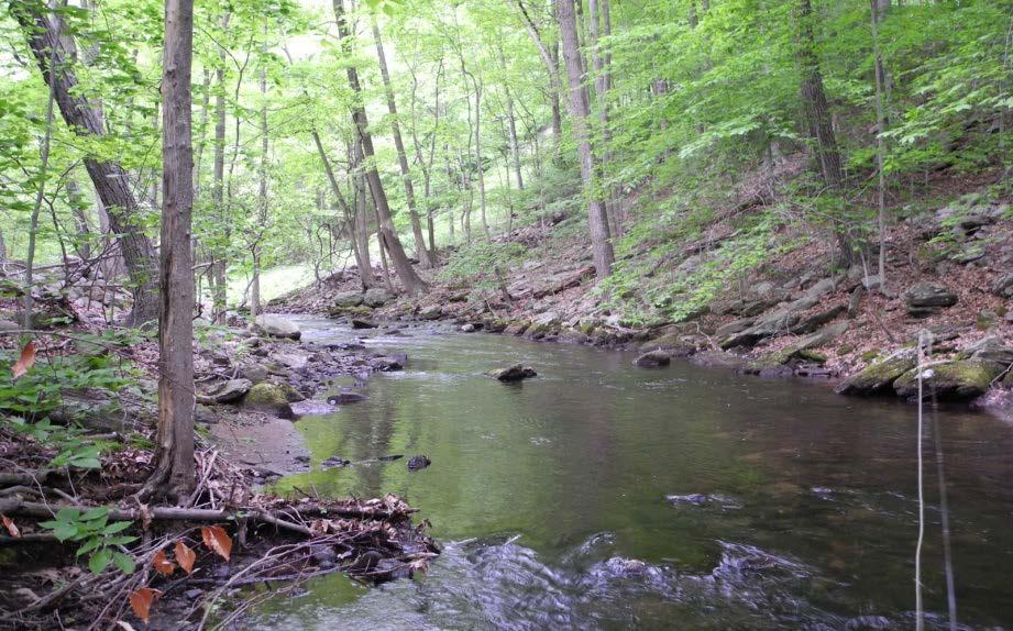
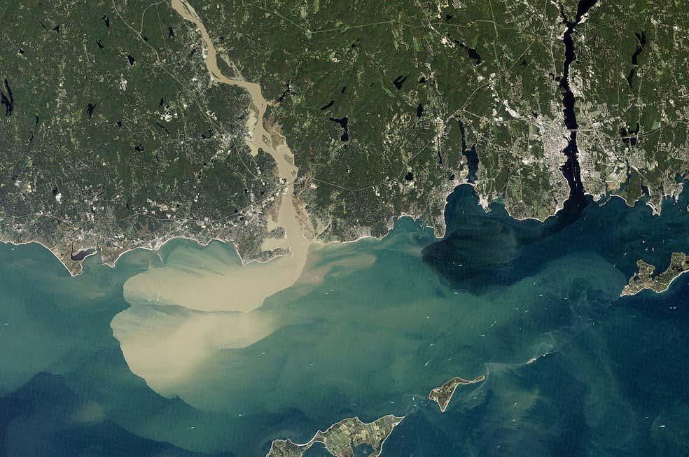
4 Source: Dr. Jamie Vaudrey Long Island Sound Coastal Watersheds


5 What is the UWS? - Designed to Support EPA Nitrogen Reduction Strategy and State efforts such as NYSDEC LINAP & CTDEEP IWRM - Data can Assist in Assessments and Prioritization Efforts Undertaken by Regulatory Agencies


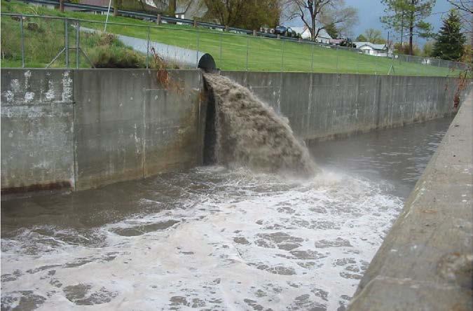
6 Reduce Nitrogen Pollution & Hypoxia Algae blooms Oxygen Nitrogen Hypoxic conditions Fish and other animal Die-offs, Salt marsh loss, Acidification

7 Source: Long Island Sound Study Long Island Sound Hypoxia


8 Sound-Wide Report Card Long Island Sound Report Card East to West Trend in Deteriorating WQ But what about bays and harbors?

9 2015 LIS Embayment Report Cards

10 Engage Community Groups and Management - Standardize Procedures for a Unified Water Study - Bring together Stakeholders Regulatory and Community Sampling - Consensus on Achievable Parameters Tier 1 DO, Chl-a, Temp, Salinity, Macroalgae, Clarity Tier 2 Continuous DO, Nutrients, Advanced Macroalgae Surveys

11 Data in Action - Standard Operating Procedures are Available - Quality Assurance Project Plan - QAPP Template is Available - Following SOPs Facilitates the Comparability of our Data for Sound-Wide Comparisons - Data Integrity Associated with QAPP Strengthens Data for Municipal and Regulatory Review


12 Tier I Dissolved Oxygen (DO) - DO is Oxygen that is Dissolved in Water via Ambient Air Diffusion or from Photosynethetic Release of O 2 - Recorded in mg/l (ppm) and as Percent Saturation

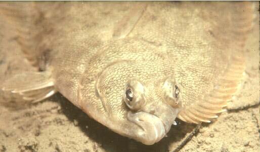
13 Tier I Dissolved Oxygen (DO) DO < 5 mg/l Causes Stress to many Aerobic Organisms DO < 3 mg/l is Defined as Hypoxic and Increases Likelihood Mortality DO = 0 mg/l is Anoxic and Very Harmful to most Organisms

 - (0.5 m, mid, 0.")
14 Tier I Dissolved Oxygen (DO) - Two Comparable Options for Analyses - LaMotte Winkler Titration and Sonde - Depth Consistent for all Samples (Surface, Mid, Bottom) - (0.5 m, mid, 0.5 m off the bottom)


15 Tier I Dissolved Oxygen (DO) DO Time Criteria is 6 AM 9 AM No, we are not Trying to Impede on Anyone's Beauty Rest!

16 Bays are panting. Big swings between highs and lows are hard on marine life. July 28 August 9, 2014 Oxygen recorded every 15 minutes. protective of marine life OK hypoxia anoxia = 0 Source: Dr. Jamie Vaudrey

17 Tier 1 - Water Clarity

18 Tier 1 - Water Clarity Dec.gov

19 Clarity and Turbidity

20 Clarity Secchi Depth Fr. Pietro Angelo Secchi achieved some Remarkable Feats.and in his Free Time, he Developed one of the most Frequently used Measures of Water clarity: Secchi Depth EPA.gov
21 Clarity Secchi Disk

22 Clarity Secchi Depth - Water Clarity measured by Secchi depth - Three Repetitions of Finding the Vanishing Point then averaging Epa.gov


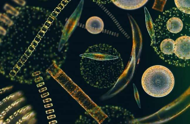
23 Clarity Secchi Disk A Few do nots, Refer to SOPs or Field Manual for more Details


24 Clarity Turbidity Sonde - Turbidity is recorded in NTU and Converted to Secchi Depth - 0 & 100 NTU YSI Standards


25 Clarity Turbidity Instrument Condition of Cuvette Critical to Accurate Readings

26 Tier 1 - Salinity Measurement of all the salts dissolved in water LIS Salinity Salinity range at the western end 23 parts per thousand Salinity range at the eastern end 35 parts per thousand


27 Salinity - Refractometer Refractometer Measures Refractive Index to obtain Salinity and Specific Gravity Important to Calibrate and Ensure Instrument is NIST Traceable!


28 Salinity - Sonde Sonde Records salinity using an algorithm of temperature and conductivity Full algorithm can be seen in Standard Methods for the Examination of Water and Wastewater


29 Temperature - Sonde This one is pretty self explanatory Take good care of your sonde and it will take good care of you!

30 Temperature - Thermometer Digital and Analog Options NIST certified Procedures Similar for Either Important to use within NIST Certified Interval

31 Tier 1 Chlorophyll a - Chl - a is a green pigment found in the chloroplasts of plants which makes photosynthesis possible - Used as a Measure of Phytoplankton Density


32 - Chl - a is measured in µgl -1 Tier 1 Chlorophyll a - Two methods in SOPs both end with Fluorometric Lab Analysis oad_3_pump_head_600_rpm_115_230_vac_77921_60/hv

 is Present http://www.habitat.noaa.")
33 Tier 1- Macroalgae - Use what is Present on the Beach or Pulled up by a Rake to Identify if Macroalgae is a Problem - Large Amounts of Certain Nutrient-Loving Species and if Eelgrass (Zostera marina) is Present

34 Tier 1 - Macroalgae Cladophora sp. in Little Narragansett Bay, June 2014 Biomass g m -2 CT Wequetequock Cove 3 ft thick Pawcatuck River 1 ft thick RI 1 in thick patchy Source: Dr. Jamie Vaudrey


35 Ulva sp., blade form Cold Spring Harbor, NY 7/31/12 Charlie Yarish, UConn Gracilaria sp. Holly Pond, CT 8/6/12 Source: Dr. Jamie Vaudrey


36 Tier 1- Wrack Macroalgae Macroalgae Survey Qualitative Seagrass! Awesome!! Not much here. This could be a problem SOS! (Save our Shore) racklines/fallwinter07/eelgrass.pdf ouryearoutdoors.blogspot.com/2012_12_01_archive.html


37 Tier 1- Hardened Shoreline Macroalgae Macroalgae Survey Qualitative

38 Site Selection Process New Sites Collaborative Process

39 Site Selection Process New Sites Water Quality: dissolved oxygen, salinity, temperature, turbidity, and chlorophyll a minimum of 4 stations per embayment; 3 stations per reporting area example Mamaroneck River should have 3 stations, based on hexagons, must have 4 Source: Dr. Jamie Vaudrey


40 Site Selection Process Save the Sound
41 Site Selection Process Secchi Disk Ideally conducted at all water quality stations 1 reporting region minimum of 4 stations per embayment; 3 stations per reporting area
42 Site Selection Process Secchi Disk outer inner Ideally conducted at all water quality stations minimum of 4 stations per embayment; 3 stations per reporting area


43 Site Selection Process Established Sites METHOD FOR ASSESSING ESTABLISHED STATIONS 1. Overlay Hexagonal Grid 2. Assess Station Distribution 3. Avoid Biases (targeted sampling of nutrient inputs, oversampling of beaches) 4. Choose a Station in a Hexagon Representative of the Local Area 5. Add and Omit stations as needed


44 - Ideally 4 sites Site Selection Process Macroalgae - 2 on each the western and eastern shore - 2 in each the Inner and Outer Portion of Embayment - Will Depend upon Access to the Shoreline

45 Benefits of the Study
46 Benefits of the Study

47 Thank you! Questions/Comments? (914)
Long Island Sound Nitrogen Reduction Strategy Overview Public Webinar November 8, 2017
 Long Island Sound Nitrogen Reduction Strategy Overview Public Webinar November 8, 2017 Photo Credit: CTDEEP/Hammonasset Beach State Park, CT Presentation Overview Nitrogen strategy overview Outline technical
Tier Assessment of Current Monitoring Groups
 Integrated Monitoring Network Meeting May 18, 2016, 1 3 PM Integration of Citizen-based and ntraditional Monitoring into the Chesapeake Bay Program Partnership Assessing current monitoring groups for integration
EVOLVING THE LONG ISLAND SOUND NITROGEN REDUCTION STRATEGY DECEMBER Overview
 Overview Background Hypoxia, defined as dissolved oxygen (DO) levels of less than mg/l, is a common occurrence in Long Island Sound (LIS) bottom waters during the summer, affecting up to half of its area
Introduction and Methods Overview
 Subtask D. Summary of Existing Water Quality Data Introduction and Methods Overview Tetra Tech contacted EPA-provided water quality monitoring organizations, local monitoring organizations with established
CONNECTICUT SEA GRANT PROJECT REPORT
 1 CONNECTICUT SEA GRANT PROJECT REPORT Please complete this progress or final report form and return by the date indicated in the emailed progress report request from the Connecticut Sea Grant College
HYPOXIA IN FAR WESTERN LONG ISLAND SOUND AND UPPER EAST RIVER
 HYPOXIA IN FAR WESTERN LONG ISLAND SOUND AND UPPER EAST RIVER 2014 NEW ENGLAND INTERSTATE WATER POLLUTION CONTROL COMMISSION INTERSTATE ENVIRONMENTAL COMMISSION DISTRICT Overview of IEC District s Monitoring
Water Quality Monitoring Stations
 Water Quality Monitoring Stations Eastern Basin Race Narrows Western Basin Central Basin The CT Department of Environmental Protection (CT DEP) conducts a water quality CT DEP monitoring program for the
Little Bay Water Quality Report Card Spring 2014
 Little Bay Water Quality Report Card Spring 2014 Little Bay is a small, semi-enclosed estuary located in the heart of Rockport, Texas. Estuaries, where freshwater from rivers and streams mixes with salt
Impacts of ocean acidification on marine life in Long Island Sound. Christopher J. Gobler, PhD
 Impacts of ocean acidification on marine life in Long Island Sound Christopher J. Gobler, PhD Ocean acidification Lower ph, acidification Calcifying shellfish potentially vulnerable to ocean acidification
Water Monitoring in Spa Creek: A Summary
 Water Monitoring in Spa Creek: A Summary Written by: Alexis Jones & Blake Harden Edited by: Hannah Krauss Water monitoring is very important in order to determine the health of the Chesapeake Bay and its
CBF Water Quality Interactive Map
 CBF Water Quality Interactive Map Student and adult groups that take part Often, they measure the water chemistry to evaluate the be doing it when you come out with us! By compiling these points on a map
Drones: A New Tool for Water Monitoring
 Drones: A New Tool for Water Monitoring Donglai Gong Carl Friedrichs, Ryan Carnegie Outline What are the goals of water monitoring (from marine scientist s perspective)? Healthy ecosystem? Fisheries /
Redwood Shores Lagoon August Monthly Water Quality Monitoring Report
 Redwood Shores Lagoon August Monthly Water Quality Monitoring Report Prepared for Redwood City Public Works Services Department 1400 Broadway Redwood City, CA 94063-2594 Prepared by Clean Lakes, Inc. P.
A multi-tiered monitoring approach to address management-driven research questions
 A multi-tiered monitoring approach to address management-driven research questions Amanda Kahn Dickens, Ph.D. & Christopher Buzzelli, Ph.D. Senior Scientist, Coastal Ecosystem Section Applied Science Bureau
Long Island Sound Study (LISS) Science & Technical Advisory Committee (STAC) 11/17/2017
 Science & Technical Advisory Committee (STAC) 11/17/2017") Presentations Shellfish Aquaculture and Nutrient Management Science and Policy (Rose) Economic Valuation of Nitrogen Bioextraction (Dvarskas) LIS Report Card Update Revisiting Nutrient Criteria (Vaudrey)
Presentations Shellfish Aquaculture and Nutrient Management Science and Policy (Rose) Economic Valuation of Nitrogen Bioextraction (Dvarskas) LIS Report Card Update Revisiting Nutrient Criteria (Vaudrey)
Factsheet: Town of Hamden Water Quality and Stormwater Summary
 79 Elm Street Hartford, CT 06106-5127 www.ct.gov/deep Affirmative Action/Equal Opportunity Employer Factsheet: Town of Hamden Water Quality and Stormwater Summary This document was created for each town
Factsheet: City of West Haven Water Quality and Stormwater Summary
 79 Elm Street Hartford, CT 06106-5127 www.ct.gov/deep Affirmative Action/Equal Opportunity Employer Factsheet: City of West Haven Water Quality and Stormwater Summary This document was created for each
Mr. Leach Science Burrillville High School
 Mr. Leach Science Burrillville High School The Clear River subwatershed, is located in northwestern Rhode Island. This subwatershed is a component of the Lower Blackstone River Watershed, the Blackstone
KILROY TERMINOLOGY KILROY TERMINOLOGY DEFINITION UNITS NORMAL RANGE. Meter Feet Fathom = 6 feet (nautical) N/A. Page 1 of 7
 N/A. Page 1 of 7") KILROY TERMINOLOGY BACKGROUND: Kilroy is a water-quality system unlike any other. Kilroy systems monitor the physical, chemical and biological indicators of health in a particular body of water and it
KILROY TERMINOLOGY BACKGROUND: Kilroy is a water-quality system unlike any other. Kilroy systems monitor the physical, chemical and biological indicators of health in a particular body of water and it
Ecosystem Consulting Service, Inc. July 15, P a g e
 Prepared for: Normanoch Association Prepared by: Robert W. Kortmann, Ph.D. Ecosystem Consulting Service, Inc. July 17, 2014 Culver Lake Status 2014 (a brief mid-summer report) Cold water fish need water
Gunston Cove Study Overview. R. Christian Jones, Director Potomac Environmental Research and Education Center George Mason University
 Gunston Cove Study Overview R. Christian Jones, Director Potomac Environmental Research and Education Center George Mason University General Location Gunston Cove is a yshaped embayment in Fairfax Co,
What Characterizes the Taninim Estuary in Relation to Other Mediterranean Microestuaries in Israel and Implications for the River rehabilitation
 What Characterizes the Taninim Estuary in Relation to Other Mediterranean Microestuaries in Israel and Implications for the River rehabilitation Sarig Gafny (sarig@ruppin.ac.il) The RIME team: Gitai Yahel,
Documenting the Cause of a Fish Kill on the Neuse River Estuary
 Documenting the Cause of a Fish Kill on the Neuse River Estuary On October 23, 2006, a resident living on Upper Broad Creek noticed fish gulping for air at the surface. The next day, October 24 th, the
Factsheet: Town of Deep River Water Quality and Stormwater Summary
 79 Elm Street Hartford, CT 06106-5127 www.ct.gov/deep Affirmative Action/Equal Opportunity Employer Factsheet: Town of Deep River Water Quality and Stormwater Summary This document was created for each
Jim Nickels Marine Scientist Urban Coast Institute Monmouth University May 25, NJ Water Monitoring Council Meeting
 Jim Nickels Marine Scientist Urban Coast Institute Monmouth University May 25, 2011 NJ Water Monitoring Council Meeting Program and Research Areas Real Time Water Quality Monitoring Network Shrewsbury
Update on Straits Pond
 Update on Straits Pond Presented to the Board of Selectmen July 27, 2017 Issues of Concern raised by citizens along Straits Pond: Midges (?) Offensive odor Excessive Algae Background: Straits Pond is a
Factsheet: Town of Trumbull Water Quality and Stormwater Summary
 79 Elm Street Hartford, CT 06106-5127 www.ct.gov/deep Affirmative Action/Equal Opportunity Employer Factsheet: Town of Trumbull Water Quality and Stormwater Summary This document was created for each town
Potential Effects of Reclaimed Water options on Nitrogen Loading to Tampa Bay. Tampa Bay in the 1970s
 Potential Effects of Reclaimed Water options on Nitrogen Loading to Tampa Bay Holly Greening, Tampa Bay Estuary Program February 15, 2010 1 Tampa Bay in the 1970s Phytoplankton and macroalgae dominated
FILLING THE GAP: DISSOLVED OXYGEN MONITORING IN NARRAGANSETT BAY
 FILLING THE GAP: DISSOLVED OXYGEN MONITORING IN NARRAGANSETT BAY Christopher F. Deacutis, Narragansett Bay Estuary Program, URI Coastal Institute Keywords: Narragansett Bay, intermittent hypoxia, volunteer
Factsheet: Town of East Lyme Water Quality and Stormwater Summary
 79 Elm Street Hartford, CT 06106-5127 www.ct.gov/deep Affirmative Action/Equal Opportunity Employer Factsheet: Town of East Lyme Water Quality and Stormwater Summary This document was created for each
Part I: Salish Sea Introduction. Review:
 Part I: Salish Sea Introduction Review: The Salish Sea The Salish Sea was formed about 20,000 years ago during the last ice age by the carving action of glaciers. There are 3 major parts of the Salish
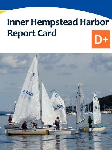
Inner Hempstead Harbor Report Card
 Inner Hempstead Report Card D+ What makes up Hempstead? Key geographic features Matinecock Pt Long Island Sound Outer Glen Cove Prospect Pt Middle The Lower, looking at the western shore towards the viaduct.
Subtasks F/G. Draft Summary of Empirical Modeling and Nitrogen Endpoints. Tetra Tech, Inc.
 Establishing Nitrogen s for Three Long Island Sound Watershed Groupings: Embayments, Large Riverine Systems, and Western Long Island Sound Open Water Subtasks F/G. Draft Summary of Empirical Modeling and
Chemical and Physical Analysis of the Cape Fear Estuary
 The Cape Fear River Chemical and Physical Analysis of the Cape Fear Estuary The Cape Fear River (CFR), the most industrialized of all North Carolina s rivers, winds for over miles through the heart of
Long-Term Volunteer Lake Monitoring in the Upper Woonasquatucket Watershed
 Long-Term Volunteer Lake Monitoring in the Upper Woonasquatucket Watershed Linda Green URI Watershed Watch 1-87-95, lgreen@uri.edu WATER QUALITY IS A REFLECTION OF THE ACTIVITIES IN THE LANDS AND WATERS
NUTRIENTS AND BIODIVERSITY AT ELKHORN SLOUGH
 NUTRIENTS AND BIODIVERSITY AT ELKHORN SLOUGH Elkhorn Slough Plants Elkhorn Slough Invertebrates Elkhorn Slough Fish Elkhorn Slough Birds Elkhorn Slough Marine Mammals Kerstin Wasson, PhD, presenter 1 How
A Review of the EcoGEM Modeling Approach as applied to Narragansett Bay, RI
 A Review of the EcoGEM Modeling Approach as applied to Narragansett Bay, RI Jason Krumholz Jamie Vaudrey (UConn), Mark Brush (VIMS) Dave Ullman (URI) Long Island Sound Water Quality Workshop July 14 15,
URI Watershed Watch: 25 Years of Documenting RI s Waters
 URI Watershed Watch: 25 Years of Documenting RI s Waters Linda Green & Elizabeth Herron lgreen@uri.edu 401-874-2905 www.uri.edu/ce/wq/ww July 12, 2013 University of Rhode Island Natural Resources Science
Rocky River Monitoring Study, Division of Water Resources- Water Sciences Intensive Survey Branch
 Rocky River Monitoring Study, 2016 Division of Water Resources- Water Sciences Intensive Survey Branch Thank You Tim Sweeny Town of Siler City Area of Study 6.7 mile stretch of River located in Chatham
Low Dissolved Oxygen HYPOXIA. What is Hypoxia?
 HYPOXIA Low Dissolved Oxygen What is Hypoxia? Hypoxia or low dissolved oxygen has been identified as the most critical issue facing the Sound. Just as we breathe oxygen, the fish and other marine life
Comprehensive Conservation and Management Plan Actions Nutrients
 Comprehensive Conservation and Management Plan Actions N-1. Upgrade municipal sewage treatment plants to achieve full secondary treatment Key Elements: Ongoing sewerage treatment plant (STP) upgrades are
Figure 1. Platte River Sub-Watersheds and Monitoring Locations.
 Figure 1. Platte River Sub-Watersheds and Monitoring Locations. 10 2 1 9 7 BL Pond 8 Hatchery 6 3 5 4 1 Platte River at Fewins Rd 6 B. Creek to Hatchery Spring 2 Platte River at Stone Bridge 7 Platte River
COUPLED PHYSICAL BIOGEOCHEMICAL MODELS
 COUPLED PHYSICAL BIOGEOCHEMICAL MODELS Upwelling CONCEPTUAL MODEL OF EUTROPHICATION IN THE COASTAL OCEAN Nutrient/ Acid Deposition Local Emissions HABs! Phytoplankton Blooms Senesce and Settling Respiration:
Water Chemistry. Water 101
 Water Chemistry Water 101 I. Introduction A. Water is not pure Many different kinds of chemicals dissolved in it Ions, organic chemicals, organic matter, particulate matter, and gases can all be in water
Ocean Water Buoyancy and Hypoxia in the Gulf of Mexico. Definitions. Hypoxia in the Headlines. Joe Smith. ExxonMobil Upstream Research Company
 Ocean Water Buoyancy and Hypoxia in the Gulf of Mexico Joe Smith ExxonMobil Upstream Research Company Joe Smith 2004 Hypoxia NOAA Coastal Data Development Center Definitions Hypoxia is a term meaning low
Captiva Water Quality Assessment Project Update Supported by TDC s Beach & Shoreline Program through the Captiva Community Panel
 Captiva Water Quality Assessment Project Update Supported by TDC s Beach & Shoreline Program through the Captiva Community Panel Mark Thompson & Loren Coen Marine Laboratory, Sanibel-Captiva Conservation
BACKGROUND: The following is adapted from the Watershed Cruzin Guide:
 GOALS: To introduce students to the Watsonville Wetlands water system To help students identify sources of water pollution and learn how they can avoid polluting the environment To discuss the importance
Water Quality. Report for State of the Bay Casco Bay Water Quality Report for State of the Bay 2010 Friends of Casco Bay, 2009
 Water Quality Report for State of the Bay 2010 Casco Bay Water Quality Report for State of the Bay 2010 Friends of Casco Bay, 2009 Muskie School of Public Service University of Southern Maine www.cascobayestuary.org
Section Submerged Aquatic Vegetation and Aquatic Habitats of Particular Concern
 Section 300.18 Submerged Aquatic Vegetation and Aquatic Habitats of Particular Concern A. Definitions 1. Submerged Aquatic Vegetation (SAV) refers to rooted, vascular, flowering plants that, except for
Interpreting Lake Data
 Interpreting Lake Data Indiana Clean Lakes Program The Indiana Clean Lakes Program was created in 1989 as a program within the Indiana Department of Environmental Management's (IDEM) Office of Water Management.
An Evaluation of Nitrogen Loading into Upper Narragansett Bay
 An Evaluation of Nitrogen Loading into Upper Narragansett Bay NEWEA Conference January 26, 2010 Catherine Walker & Christine Comeau Narragansett Bay Commission Providence, RI Narragansett Bay Commission
Assessing impacts of shellfish aquaculture on eelgrass (Zostera marina) populations in Eastern Long Island Sound.
 populations in Eastern Long Island Sound.") Assessing impacts of shellfish aquaculture on eelgrass (Zostera marina) populations in Eastern Long Island Sound. Jamie M.P. Vaudrey Department of Marine Sciences, UCONN Tessa Getchis Connecticut Sea Grant
Assessing impacts of shellfish aquaculture on eelgrass (Zostera marina) populations in Eastern Long Island Sound. Jamie M.P. Vaudrey Department of Marine Sciences, UCONN Tessa Getchis Connecticut Sea Grant
Lake Ogallala Water Quality Report October 11, Prepared by. Mark Peyton Senior Biologist
 Lake Ogallala Water Quality Report 2012 October 11, 2012 Prepared by Mark Peyton Senior Biologist The Central Nebraska Public Power And Irrigation District INTRODUCTION Since 1986, The Central Nebraska
Interpreting Lake Data
 Interpreting Lake Data Indiana Clean Lakes Program The Indiana Clean Lakes Program was created in 1989 as a program within the Indiana Department of Environmental Management's (IDEM) Office of Water Management.
Southern New England and New York Seagrass Research Towards Restoration Phase II
 Southern New England and New York Seagrass Research Towards Restoration Phase II Prepared For: 250 Lawrence Hill Road Cold Spring Harbor, NY 11724 Prepared By: 81 Technology Park Drive East Falmouth, MA
Southern New England and New York Seagrass Research Towards Restoration Phase II
 Southern New England and New York Seagrass Research Towards Restoration Phase II Prepared For: 250 Lawrence Hill Road Cold Spring Harbor, NY 11724 Prepared By: Woods Hole Group, Inc. 81 Technology Park
Georgica Pond Progress: Executing a Sustainable Plan for Remediation. Christopher J. Gobler, PhD
 Georgica Pond Progress: Executing a Sustainable Plan for Remediation Christopher J. Gobler, PhD Outline of presentation Background on Georgica Pond 2016 status and trends Options for improving the conditions
Chesapeake Bay Report Card 2016
 hesapeake Bay Report ard 216 University of Maryland enter for Environmental Science Fun for you and your family Stewardship is defined as the responsible oversight and protection of something considered
The Environmental Protection Agency and the Massachusetts Executive Office of Environmental Affairs. Designate. to the. National Estuary Program
 The Environmental Protection Agency and the Massachusetts Executive Office of Environmental Affairs Designate BUZZARDS to the BAY National Estuary Program January 29, 1988 Designation of Buzzards Bay to
St. Lucie Estuary: Analysis of Annual Cycles and Integrated Water Column Productivity
 St. Lucie Estuary: Analysis of Annual Cycles and Integrated Water Column Productivity Tom Gallo, Malcolm Pirnie Inc. Clifton Bell, Malcolm Pirnie Inc. Peter Doering, South Florida Water Management District
PRESS RELEASE. LOUISIANA UNIVERSITIES MARINE CONSORTIUM August 4, 2013
 PRESS RELEASE LOUISIANA UNIVERSITIES MARINE CONSORTIUM August 4, 2013 The 2014 area of low oxygen, commonly known as the Dead Zone, measured 13,080 square kilometers (= 5,052 square miles) as of Aug 1,
NC Ambient Lake Assessment Program Overview including Coastal Lakes
 NC Ambient Lake Assessment Program Overview including Coastal Lakes Danielle Mir NC Division of Water Quality Environmental Sciences Section, Intensive Survey Unit Intensive Survey Unit Within the Environmental
Note: Slide numbers refer to the PowerPoint presentation which accompanies the lecture.
 LECTURE 13 - HYPOXIA Note: Slide numbers refer to the PowerPoint presentation which accompanies the lecture. Hypoxia, slide 1 here One of the more important chemicals parameters in natural waters is the
Analysis of Seekonk River Water Quality Following the Fish Kill of May 2015
 Analysis of Seekonk River Water Quality Following the Fish Kill of May 2015 On May 25 th, 2015, the Rhode Island DEM began to receive notifications of a moderate fish kill of Atlantic menhaden (Brevoortia
Choptank Monitoring Snapshot
 Choptank Monitoring Snapshot Cooperative Oxford Laboratory Parameters/Frequency Measured: At the water quality sites, physical (YSI) and chemical (nutrients) are measured seasonally (May, July, Sep).
A Successful Lake Management Program for Lake Mitchell PROFESSIONAL ENGINEERS AND SCIENTISTS SPECIALIZING IN WATER RESOURCES
 A Successful Lake Management Program for Lake Mitchell PROFESSIONAL ENGINEERS AND SCIENTISTS SPECIALIZING IN WATER RESOURCES Tonight s Agenda 1. General Review of FYRA Engineering and Qualifications 2.
Models, Muddles, & Management in Narragansett Bay, RI. Chris Deacutis NBEP, URI Coastal Institute May 18, 2011
 Models, Muddles, & Management in Narragansett Bay, RI Chris Deacutis NBEP, URI Coastal Institute May 18, 2011 http://www.nbep.org/ Narragansett Bay Watershed Watershed Area = 4,421 km 2 Bay Surface Area
WALTON COUNTY COASTAL DUNE LAKES WATER CHEMISTRY SUMMARY 2016
 WALTON COUNTY COASTAL DUNE LAKES WATER CHEMISTRY SUMMARY 2016 Prepared by Choctawhatchee Basin Alliance in partnership with Mattie Kelly Environmental Institute Contents Overview Northwest Florida Coastal
CHAPTER 15 WATER POLLUTION. INTO THE GULF Researchers try to pin down what s choking the Gulf of Mexico
 CHAPTER 15 WATER POLLUTION INTO THE GULF Researchers try to pin down what s choking the Gulf of Mexico SAVING THE BAY Teams of researchers try to pin down what s choking the Chesapeake Water pollution
dissolved oxygen Case Studies & Solutions for long-term water quality monitoring with ROX optical DO sensor
 dissolved oxygen Case Studies & Solutions for long-term water quality monitoring with ROX optical DO sensor ROX Luminescent Dissolved Oxygen Sensor Optical sensing technology has replaced the stretched
Water Quality Monitoring for Lake Erie and the Great Lakes Nutrient Initiative (GLNI)
") Water Quality Monitoring for Lake Erie and the Great Lakes Nutrient Initiative (GLNI) 2011-2016 Water Quality Monitoring and Surveillance Division Alice Dove, Sean Backus, Vi Richardson Issues Facing the
Water Quality Monitoring for Lake Erie and the Great Lakes Nutrient Initiative (GLNI) 2011-2016 Water Quality Monitoring and Surveillance Division Alice Dove, Sean Backus, Vi Richardson Issues Facing the
SWEM QUESTIONS FOR MODEL WORKSHOP
 SWEM QUESTIONS FOR MODEL WORKSHOP A. Management Overview What is the purpose (i.e., heuristic or predictive?) of the model as a management tool? In principle, SWEM is meant to be a predictive tool, although
Lake Washington. Water Quality Assessment Report. Copyright 2012 PLM Lake & Land Management Corp.
 Lake Washington 2012 Water Quality Assessment Report Copyright 2012 PLM Lake & Land Management Corp. Water Quality Report On May 22nd, June 18th, July 30th, August 29th, and September 27 th, 2012, PLM
The Dead Zone. Use the notes provided (attached to this sheet) to answer the following questions.
 to answer the following questions.") The Dead Zone Use the notes provided (attached to this sheet) to answer the following questions. 1. Re-define Eutrophication: 2. What are the risks associated with an excess of Nitrogen? 3. What is a Dead
The Dead Zone Use the notes provided (attached to this sheet) to answer the following questions. 1. Re-define Eutrophication: 2. What are the risks associated with an excess of Nitrogen? 3. What is a Dead
Dead-Zones and Coastal Eutrophication: Case- Study of Chesapeake Bay W. M. Kemp University of Maryland CES Horn Point Laboratory Cambridge, MD
 Dead-Zones and Coastal Eutrophication: Case- Study of Chesapeake Bay W. M. Kemp University of Maryland CES Horn Point Laboratory Cambridge, MD Presentation to COSEE Trends Orientation at UMCES HPL 4 August
Big Bend Model. Wayne Magley Watershed Evaluation and TMDL Section FDEP. March 7, 2016
 Big Bend Model Wayne Magley Watershed Evaluation and TMDL Section FDEP March 7, 2016 BACKGROUND As outlined in the EPA November 30, 2012 document Methods and Approaches for Deriving Numeric Criteria for
Jackson Lake Analysis
 Jackson Lake Analysis Lake Zones Lake Zones Limnetic Zone- open water far from shore Light penetrates shallow, allowing photosynthesis Supports phytoplankton (algae, protists, cyanobacteria) which then
Research Project Summary
 Environmental Assessment and Risk Analysis Element Research Project Summary October, 00 Linking Science to New Jersey s Environmental Decision Making Brown Tide Bloom Assessment Project in NJ Coastal Waters:
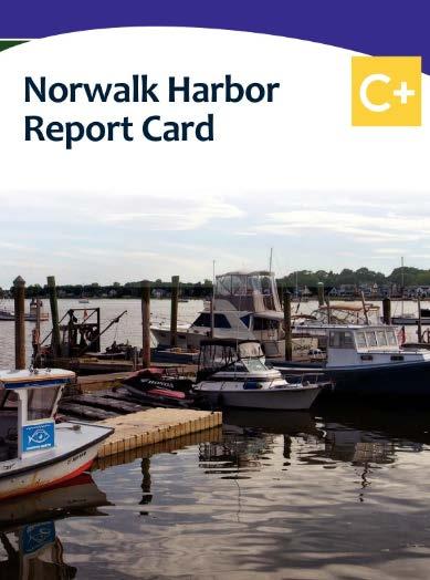
Norwalk Harbor Report Card
 Norwalk Harbor Report Card C+ Following the water s trail from your house, into the river, and to the Harbor The way land is used in a watershed has a significant effect on water quality. In areas where
Water Quality Testing
 Field Experience Water Quality Testing How s the Water? Overview Students will use chemical tests to determine the water quality of a local pond. Teacher Background: Water Quality In 1972 the Clean Water
The Hypoxic Zone in the Gulf of Mexico
 The Hypoxic Zone in the Gulf of Mexico References Council Committee on Environmental and Natural Resources. 2003. An Assessment of Coastal Hypoxia and Eutrophication in U.S. Water. National Science and
CBEP Water Quality Monitoring Equipment Loaner Program
 CBEP Water Quality Monitoring Equipment Loaner Program Request for Proposals 2012 Background Casco Bay Estuary Partnership (CBEP) invites requests from municipalities, watershed groups, and other local
2010 DEAD ZONE ONE OF THE LARGEST EVER. 1 August 2010, from Cocodrie, Louisiana
 2010 DEAD ZONE ONE OF THE LARGEST EVER 1 August 2010, from Cocodrie, Louisiana The area of hypoxia, or low oxygen, in the northern Gulf of Mexico west of the Mississippi River delta covered 20,000 square
Nutrients, Algal Blooms and Red Tides in Hong Kong Waters. Paul J. Harrison and Jie XU
 Nutrients, Algal Blooms and Red Tides in Hong Kong Waters Paul J. Harrison and Jie XU Division of Environment, Hong Kong University of Science & Technology 1. Introduction The Pearl River is China's second
Background on Water Quality Parameters Shown in the Graphs: Coastal Pond Water Quality- A Brief Primer
 Background on Water Quality Parameters Shown in the Graphs: Coastal Pond Water Quality- A Brief Primer The term eutrophication carries a wide range of meaning. It is generally associated with an increase
ARKANSAS NUTRIENT CRITERIA DEVELOPMENT. EPA Region 6 Nutrient RTAG Dallas, Texas April 14, 2015
 ARKANSAS NUTRIENT CRITERIA DEVELOPMENT EPA Region 6 Nutrient RTAG Dallas, Texas April 14, 2015 CRITERIA DEVELOPMENT MILESTONES Assessment Methodology Beaver Lake Wadeable Streams Nutrient Trading-Act 335
IEc. Nitrogen Loading and Water Quality on Cape Cod: Modeling the Costs of Inaction. Presentation by Industrial Economics, Incorporated
 IEc Nitrogen Loading and Water Quality on Cape Cod: Modeling the Costs of Inaction Presentation by Industrial Economics, Incorporated February 6, 2013 Systems Thinking as a Sustainability Tool Sustainable
How global warming and climate change may be accelerating losses of Chesapeake Bay seagrasses.
 How global warming and climate change may be accelerating losses of Chesapeake Bay seagrasses. Dr. Ken Moore The Virginia Institute of Marine Science School of Marine Science College of William and Mary
Smithville Lake 2000 Water Quality Report
 Smithville Lake 2 Water Quality Report 1. General. a. Project location. The dam is located at river mile 12.9 on the Little Platte River, a tributary of the Platte River. The drainage area above the dam
TIEE Teaching Issues and Experiments in Ecology - Volume 1, January 2004
 TIEE Teaching Issues and Experiments in Ecology - Volume 1, January 2004 ISSUES FIGURE SET What's Killing the Coral Reefs and Seagrasses? Charlene D'Avanzo 1 and Susan Musante 2 1 - School of Natural Sciences,
Redwood Shores Lagoon November 2016 Monthly Water Quality Monitoring Report
 Redwood Shores Lagoon November 2016 Monthly Water Quality Monitoring Report Prepared for Redwood City Public Works Services Department 1400 Broadway Redwood City, CA 94063-2594 Prepared by Clean Lakes,
Redwood Shores Lagoon February 2019 Monthly Water Quality Monitoring Report
 Redwood Shores Lagoon February 2019 Monthly Water Quality Monitoring Report Prepared for Redwood City Public Works Services Department 1400 Broadway Redwood City, CA 94063-2594 Prepared by Clean Lakes,
8 LITTLE CROSBY LAKE RESULTS
 8 LITTLE CROSBY LAKE RESULTS 8.1 LITTLE CROSBY LAKE BACKGROUND Figure 8-1: View of the south shoreline of. is 8 acres with an average depth of 7 ft and a maximum depth of 34 ft. Little Crosby Lake is a
OKLAHOMA CLEAN LAKES AND WATERSHEDS 23rd ANNUAL CONFERENCE AGENDA. SUCCESS STORY: 20 YEARS of HYPOLIMNETIC OXYGENATION of a RESERVOIR
 OKLAHOMA CLEAN LAKES AND WATERSHEDS 23rd ANNUAL CONFERENCE AGENDA SUCCESS STORY: 20 YEARS of HYPOLIMNETIC OXYGENATION of a RESERVOIR Agenda EBMUD & Camanche Reservoir Water Quality Challenges Speece Cone
Restoring the Long Island Sound While Saving Money
 in Connecticut and New York TMDL at a Glance Long Island Sound Nitrogen TMDL (approved April 2001) www.longislandsoundstudy.net/pubs/reports/tmdl.pdf Factors causing impairment Aesthetics, fishing, and
URI Watershed Watch: 25 Years of Documenting RI s Waters
 URI Watershed Watch: 25 Years of Documenting RI s Waters Elizabeth Herron Linda Green Arthur Gold University of Rhode Island - Natural Resources Science URI Cooperative Extension Annual Monitoring Data
Dissolved Oxygen and Aquatic Primary Productivity Analyzing Dissolved Oxygen in an Aquatic Ecosystem over Time
 Dissolved Oxygen and Aquatic Primary Productivity Analyzing Dissolved Oxygen in an Aquatic Ecosystem over Time Background Information: Oxygen, found in both aquatic and terrestrial environments, is necessary
Coastal acidification monitoring as part of the monitoring network in Casco Bay
 Coastal acidification monitoring as part of the monitoring network in Casco Bay National Estuary Program Tech Transfer meeting Boston, MA November 3, 2017 Matthew Liebman, US EPA Region 1 Curtis Bohlen,
Redwood Shores Lagoon May 2017 Monthly Water Quality Monitoring Report
 Redwood Shores Lagoon May 2017 Monthly Water Quality Monitoring Report Prepared for Redwood City Public Works Services Department 1400 Broadway Redwood City, CA 94063-2594 Prepared by Clean Lakes, Inc.
a) Temperature b) Light c) Decomposition d) Mixing/Turbulence e) Salinity
 Temperature b) Light c) Decomposition d) Mixing/Turbulence e) Salinity") Dissolved Oxygen and Primary Productivity Activity Introduction: DO is often used as an indicator of water quality. You have probably read or seen news reports of fish kills that have been linked to sewage
Dissolved Oxygen and Primary Productivity Activity Introduction: DO is often used as an indicator of water quality. You have probably read or seen news reports of fish kills that have been linked to sewage