Hydrology: Soil moisture, Rainfall, and Evapotranspiration. Tarendra Lakhankar NOAA-CREST Center, The City University of New York
|
|
|
- Lambert Hodges
- 6 years ago
- Views:
Transcription
1 Hydrology: Soil moisture, Rainfall, and Evapotranspiration Tarendra Lakhankar NOAA-CREST Center, The City University of New York
2 Overview Hydrology Rainfall Soil moisture Evapotranspiration Experiments Math Examples Soil moisture experiment using moisture meter (Postponed to next week due to cold weather)
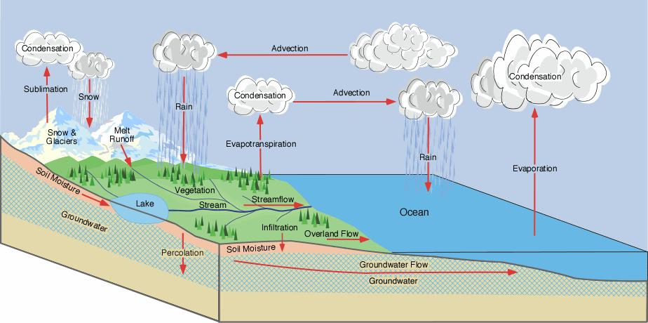
3 The Hydrologic Cycle
4
5 Rainfall
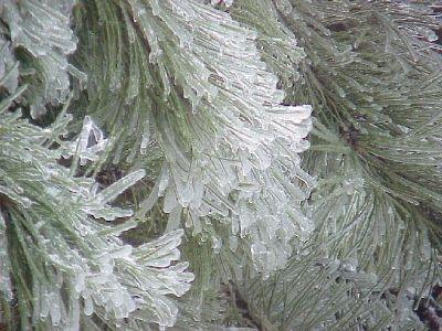
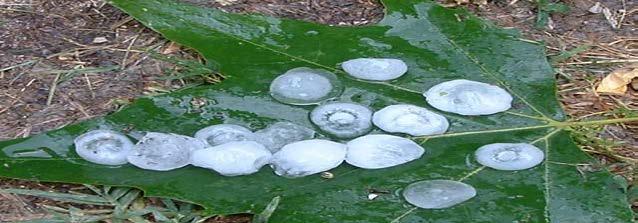
6 Precipitation Single strongest variable driving hydrologic processes Formed water vapor in the atmosphere rain snow sleet graupel freezing rain hail
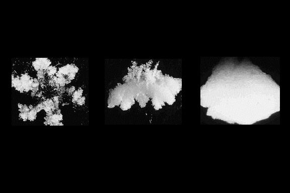
7 Droplets become heavy enough to fall Evaporation decreases size of many droplets Droplets increase in size by condensation Droplets form by nucleation Larger drops break up Some droplets increase in size by impact and aggregation Water vapor Rain Drops
8 Point Measurement Rainfall Gauges Network of Rainfall Gauges The number of stations depend on precipitation and its variability Area Measurement Radar, Satellites Source of Data Precipitation Measurements Many other publications, Universities, etc.
9 Rational Method for Watershed Discharge Q = ica Q = Peak discharge, cfs C = Rational method runoff coefficient i = Rainfall intensity, inch/hour A = Drainage area, acre If Q = cubic feet per second, P = inches/hour and A= Acres, Then Q = 1.008CiA Simplified Table of Rational Method Runoff Coefficients (see references below) Ground Cover Runoff Coefficient, C Lawns Forest Cultivated land Meadow Parks, cemeteries Unimproved areas Pasture Residential areas Business areas Industrial areas Asphalt streets Brick streets Roofs Concrete streets
10 Precipitation Measurement
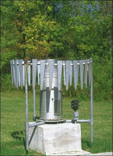
11 Precipitation Measurement
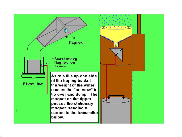
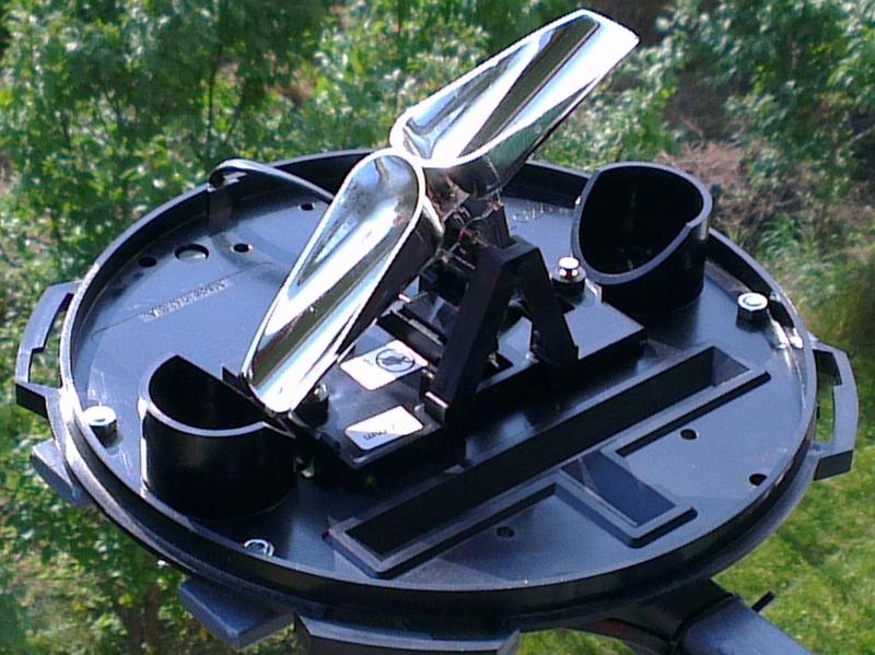
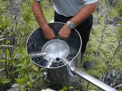
12 Tipping-Bucket: Demonstration

 is a type of")


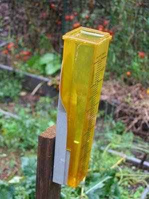
13 Pluviometer A rain gauge (also known as an udometer, pluviometer, or an ombrometer) is a type of instrument used by meteorologists and hydrologists to gather and measure the amount of liquid precipitation over a set period of time.

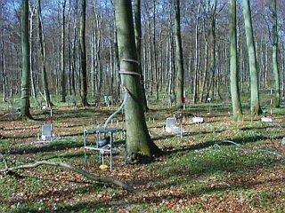
14 Precipitation Measurement Under Canopy Outside Canopy
15
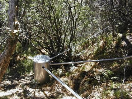
16 Precipitation Measurement
17 Precipitation Measurement

18 Ideal rain gage for rainfall with egg-crate Structure (Dingman, 2002)
19 Rainfall Interception Conifer forests in North America I c = 15-40% of P g Natural teak forests in Thailand I c = 65% of P g Is influenced by rain: amount, duration, intensity, and pattern
20 Simplest method for determining areal average Arithmetic Mean Method P 1 = 10 mm P 2 = 20 mm P 3 = 30 mm 1 P = N N i= 1 P i P 2 P P = = 20 3 mm P 3 Gages must be uniformly distributed Gage measurements should not vary greatly about the mean
21 Isohyetal method Steps Construct isohyets (rainfall contours) Compute area between each pair of adjacent isohyets (A i ) Compute average precipitation for each pair of adjacent isohyets (p i ) Compute areal average using the following formula P 2 P 1 A 1 =5, p 1 = 5 A 2 =18, p 2 = 15 A 3 =12, p 3 = 25 M P = ia = 1 P 1 N A i p i i= 1 A i P i 30 P 3 A 4 =12, p 3 = P = = mm
22 Inverse distance weighting Prediction at a point is more influenced by nearby measurements than that by distant measurements The prediction at an ungaged point is inversely proportional to the distance to the measurement points Steps Compute distance (d i ) from ungaged point to all measurement points. P 2 = 20 d 2 =15 p P 1 =10 d 1 =25 d 3 =10 P 3 =30 Compute the precipitation at the ungaged point using the following formula d 2 ( x x ) + ( y ) 2 12 = y2 Pˆ N i= 1 = N i= 1 P i di 1 di Pˆ = = mm
23 Thiessen polygon method Any point in the watershed receives the same amount of rainfall as that at the nearest gage Rainfall recorded at a gage can be applied to any point at a distance halfway to the next station in any direction Steps in Thiessen polygon method 1. Draw lines joining adjacent gages 2. Draw perpendicular bisectors to the lines created in step 1 3. Extend the lines created in step 2 in both directions to form representative areas for gages 4. Compute representative area for each gage 5. Compute the areal average using the following formula P = 1 A N i= 1 A i P i P = = mm P 2 A 2 P 1 A 1 P 3 A 3 P 1 = 10 mm, A 1 = 12 Km 2 P 2 = 20 mm, A 2 = 15 Km 2 P 3 = 30 mm, A 3 = 20 km 2

24 Rainfall interpolation in GIS Data are generally available as points with precipitation stored in attribute table.


25 Rainfall maps in GIS Nearest Neighbor Thiessen Polygon Interpolation Spline Interpolation

26 Figure 2.14 Storm Patterns (Histograms)
27 Lets do some calculation Estimate Average precipitation
28 Soil Moisture


29 Meteorological and weather prediction modeling Hydrological modeling Runoff prediction and flood control Reservoir management Soil erosion and mud slide Agriculture applications Improving crop yield Irrigation scheduling Soil Moisture
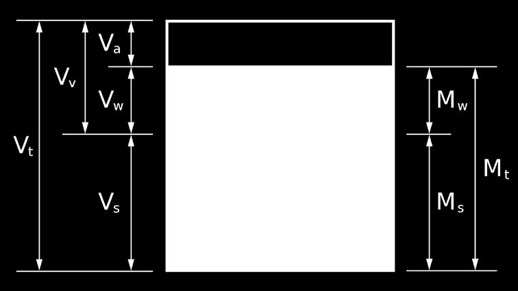
30 Volumetric vs. Gravimetric Water Content Volumetric Water Content (VWC) Symbol θ Water volume per unit total volume Air 15% Gravimetric Water Content (GWC) Symbol w Water weight per unit dry soil weight Water 35% Soil 50% In situ field measurement methods only measure volumetric water content
31
32 Direct Water Content Measurements Gravimetric (w) Technique Sample representative weight of soil Take care to limit water draining/evaporating from soil Weigh sample on balance with adequate accuracy/precision Dry sample at 105 o C for 24 h Allow to cool in desiccators Obtain dry sample weight and take weight Generate volumetric water content Same as gravimetric except soil is sampled with known volume
33 Advantages Simple Direct measurement Can be inexpensive Direct Water Content Measurements Disadvantages Destructive does not account for temporal variability Time consuming Requires precision balance & oven

34 On field how to take sample
35 Measuring in situ Water Content (indirect) Neutron thermalization Neutron probes Dielectric measurement Capacitance/Frequency Domain Reflectometry (FDR) Time Domain Reflectometry (TDR)


36 Neutron Thermalization Probe: How They Work Radioactive source High-energy epithermal neutrons Releases neutrons into soil Interact with H atoms in the soil slowing them down Other common atoms Absorb little energy from neutrons Low-energy detector Slowed neutrons collected thermal neutrons Thermal neutrons directly related to H atoms, water content The probe contains a source of fast neutrons, and the gauge monitors the flux of slow neutrons scattered by the soil. In using the neutron meter, a cased hole in the ground is necessary for lowering the probe to obtain readings.
37 Dielectric Theory: How it works In a heterogeneous medium: Volume fraction of any constituent is related to the total dielectric permittivity Changing any constituent volume changes the total dielectric Because of its high dielectric permittivity, changes in water volume have the most significant effect on the total dielectric Material Dielectric Permittivity Air 1 Soil Minerals 3-7 Organic Matter 2-5 Ice 5 Water 80 Influencing Factors Water Content Water Content Soil Temperature Soil Porosity and Bulk Density Minerals (2:1 clays) Measurement Frequency Air Gaps (Installation swelling soils)
38 Dielectric Mixing Model: FYI The total dielectric of soil is made up of the dielectric of each individual constituent The volume fractions, V x, are weighting factors that add to unity V V b b b b b ε = ε m m + ε a a + ε wθ + ε om om + t V ε V b i i Where ε is dielectric permittivity, b is a constant around 0.5, and subscripts t, m, a, om, i, and w represent total, mineral soil, air, organic matter, ice, and water.
39 Volumetric Water Content and Dielectric Permittivity Rearranging the equation shows water content, θ, is directly related to the total dielectric by θ = 1 ε 0.5 w ε 0.5 t ( ε 0.5 m V m + ε 0.5 a V + ε ε a 0.5 w 0.5 om V om + ε 0.5 i V i ) Take home points Ideally, water content is a simple first-order function of dielectric permittivity Generally, relationship is second-order in the real world Therefore, instruments that measure dielectric permittivity of media can be calibrated to read water content
40 Dielectric Instruments: Time Domain Reflectometry TDR sensors propagate a pulse down a line into the soil, which is terminated at the end by a probe with wave guides. TDR systems measure the determine the water content of the soil by measuring how long it takes the pulse to come back.
 field is produced between the positive and negative")
41 Dielectric Instruments: Capacitor/FDR Sensor Basics Sensor probes form a large capacitor Steel needles or copper traces in circuit board are capacitor plates Surrounding medium is dielectric material Electromagnetic (EM) field is produced between the positive and negative plates
42 Typical Capacitor Capacitor Dielectric Material Positive Plate Negative Plate Electromagnetic Field
43 Example: How Capacitance Sensors Function 2 cm Sensor (Side View) 1 cm 0 cm EM Field
44 Question: What Technique is Best for My Research? Answer: It depends on what you want. Every technique has advantages and disadvantages All techniques will give you some information about water content So what are the important considerations? Experimental needs How many sites? How many probes at each site? Current inventory of equipment What instruments are available or can by borrowed Budget How much money can be spent to get the data? Required accuracy/precision Manpower available to work Certification People available certified to work with radioactive equipment
45

46 Examples: Applying Techniques to Field Measurement Case: Irrigation scheduling/monitoring Details 20+ sites, measurements from.25 m to 2 m Spread over field system Continuous data collection is desirable Money available for instrumentation Eventually moving to controlling irrigation water Choice Capacitance sensors Good accuracy Inexpensive Easy to deploy and monitor Radio telemetry available to simplify data collection
47 Permanent installation Horizontal insertion Purpose Measure at specific depths Useful to see infiltration fronts, drying depths Technique Dig trench Sensor Installation Install probes into side wall» Installation tools are helpful (see manufacturer)» Ensure NO air gaps between probes and soil Refill trench

48 Push-in and Read Sensors Purpose Spot measurements of VWC Many measurements over large area No need for data on changes in VWC over time Technique Push probe into soil Ensure adequate soil to probe contact Take reading from on-board display Sensor Installation
49
50 With Replicates
51
52
53 U.S. Climate Reference Network (USCRN) All 114 Stations Installed/Operational End of FY 08 Installed 7 Pairs (14) Installed Single (92) Awaiting Installation (8)
54 What can I expect to see in the field? Volumetric water Content (%) Rainfall (mm) 0 8/1 8/4 8/7 8/10 8/13 8/16 8/19 8/22 8/25 8/28 8/31 August EC-5 15cm EC-5 30cm EC-5 45cm EC-5 90cm TE-5(WC) 15cm Rain (mm) 0 Data courtesy of W. Bandaranayake and L. Parsons, Univ. of Florida Citrus Research and Education Center

55 USDA Soil Climate Analysis Network (SCAN)

 Soil Moisture Sensing")


56 Soil Moisture - Microwave Remote Sensing Evolution Active Microwave own energy (Reflection) Passive Microwave Earth energy (Emission) Soil Moisture Sensing Technology High (10 s meter) Regional modeling Field Experiments SEASAT, PBMR, SMMR Low ( Km) Global modeling SIR-C/X-SAR JERS-1, ERS-1 ESTAR, SSM/I RADARSAT-1 ERS-2, ENVISAT AMSR-E 1970s 1980s 1990s 2000 RADARSAT-2 SMOS, METOP 2010 Common wavelength L and C band, which penetrate cloud, rain, and vegetation canopies NPOESS CMIS/VIIRS AQUARIUS SMAP SAOCOM GCOM-W Ground truth SM Missions: FIFE Mansoon 90 OXSOME 90 MACHYDRO 90 HAPEX WASHITA 92 WASHITA 94 SGP 97 SGP 99 SMEX 02 SMEX 03 SMEX 04 SMEX 05


57 Advanced Microwave Scanning Radiometer (AMSR-E) AMSR-E is Advanced Microwave Scanning Radiometer for NASA s Earth Observing System and JAXA of Japan. It s onboard the Aqua satellite of EOS that was successfully launched in May Mission Operational begin Instrument concept AMSR-E Launched December, 2002 Passive microwave radiometer Frequency 6.92, 10.65, 18.7, 23.8, 36.5, 89 GHz Polarization Dual polarization Channels Foot print Angular range Swath 12 channels 5 to 60 km 55 degrees 1445 km
.")
58 SMOS (Soil Moisture and Ocean Salinity) Mission ESA's Soil Moisture and Ocean Salinity (SMOS) mission has been designed to observe soil moisture over the Earth's landmasses and salinity over the oceans. The goal of the SMOS mission is to monitor surface soil moisture with an accuracy of 4% (at km spatial resolution). Mission SMOS Launch November, 2009 Duration Instrument Instrument concept Frequency Number of receivers 69 Receiver spacing Polarization Radiometric resolution Angular range Temporal resolution Minimum 3 years Microwave Imaging Radiometer using Aperture Synthesis - MIRAS Passive microwave 2D-interferometer L-band (21 cm, 1.4 GHz) lambda = cm H & V 35 km at center of field of view 0-55 degrees 3 days revisit at Equator
 with participation by the Goddard Space Flight Center (GSFC).")
59 SMAP ( Soil Moisture Active Passive) Mission SMAP is implemented as a directed mission within the NASA Earth Systematic Mission Program. The SMAP project is managed by the Jet Propulsion Laboratory (JPL) with participation by the Goddard Space Flight Center (GSFC). SMAP will use a combined radiometer and high-resolution radar to measure surface soil moisture and freeze-thaw state, providing new opportunities to enable improvements to weather and climate forecasts, flood prediction and drought monitoring. Mission SMAP Launch March, 2013 Duration Instrument concept 3 years Active microwave - Synthetic Aperture Radar Passive microwave - Radiometer Frequency L-band :1.26 GHz (H) 1.29 GHz (V) Polarization HH, VV,HV H, V, U Radiometric resolution 1-3 km 40 km Angular range Swath width Temporal resolution 40 degrees 1000 km L-band :1.41 GHz global coverage within 3 days at the equator and 2 days at boreal latitudes (>45 N)
. Accuracy: The average RMS error of the soil moisture index is about 25%, which corresponds to about 0.03-0.")
60 ASCAT (Advanced SCATterometer) Level 2 Soil Moisture Product The ASCAT soil moisture product is produced by EUMETSAT, using the WARPNRT software originally developed by IPF/TU Wien (Institute of Photogrammetry and Remote Sensing, Vienna University of Technology). Accuracy: The average RMS error of the soil moisture index is about 25%, which corresponds to about m 3 water per m 3 soil, depending on soil type. The ASCAT soil moisture service has been set up to meet the requirements of Numerical Weather Prediction (NWP) applications. Value-added soil moisture products for hydrological users in Europe are currently under development within the Satellite Application Facility in Support to Operational Hydrology and Water Management. Mission ASCAT Operational begins 11 December, 2008 Instrument concept Frequency Polarization Spatial Resolution Active microwave Real aperture radar Radar C-band (5.255 GHz) VV polarization Angular range 25º - 65 º Swath Width 50 km (25 km grid spacing) 550 km Source: km (12.5 km grid spacing)

61 NOAA-CREST Microwave Radiometer Specification: L-Band Radiometer Frequency: 1.40 to 1.55 GHz (SMAP Frequency) polarization : Dual (H, V) Antenna System: 1.5 x 0.7 meters Delivery date: September 2009 Manufacturer: Radiometrics Corporation, Boulder CO. High frequency Radiometers 37, 89 GHz radiometer for snow related research. Research Objective: Improve our understanding of scattering and emission. Evaluate the vegetation (NDVI, VWC) effect on soil moisture. Evaluate spatial and temporal variability of soil moisture. We looking for suitable field location for radiometer.
62 Evaporation
63 Process by which the phase of water is changed from liquid to a vapor. It occurs at the evaporating surface, the contact between water body and overlaying air. Evaporation
64 Evaporation rate is a function of several meteorological and environmental factors The two main factors from an engineering standpoint are: Solar energy: it provides latent heat of vapor Advective energy: it is the ability to transport Evaporation
65 Evaporation Measures Pan evaporation Water budget Correlations to climate data (empirical)
66 Evaporation Pan evaporation method An evaporation pan is a device designed to measure evaporation by monitoring the loss of water in the pan during a given time period, usually one (1) day. Pan coefficient = 0.60 to 0.85 on an annual basis E = pe L c p


67 Standard 4 foot diameter pan
68 Evaporation Correlations to Climate Data General Empirical Formula E= f( eu, ) General Theoretical Formula
69 Empirical Formula for Lake Hefner E = ( e e ) U L o a E L = evaporation rate in inches per day 2. e o = saturation vapor pressure at the water surface in inches of mercury 3. e o8 = vapor pressure in air over the lake at an elevation of 8 m, in inches of mercury 4. U 8 = wind speed over the lake at an elevation of 8 m, in miles per day As an engineer, you have to find an empirical formula for surface waters in your area of interest
70 Empirical Formula for Class A pan E = ( e e )( m + bu ) p o a 1. E p = daily pan evaporation, (in./day) 2. e o = saturation vapor pressure at the water surface, (in. of mercury) 3. e o = atmospheric vapor pressure at air temperature, (in. of mercury) 4. U = wind speed at 6 inches above pan rim, (mpd) 5. n, m, and b = 0.88, 0.37, , respectively. Note: saturated vapor pressure is a function of temperature. n
71 Transpiration Transpiration is the process by which plants transfer water from the root zone to the leaf surface, where it eventually evaporates into atmosphere. The process by which transpiration takes place can be described as follows: Water is extracted by a plants roots, transported upward through its stem and diffused into the atmosphere through stoma.
72 Transpiration Contributing factors: a. Moisture available b. Vegetation type c. Vegetation density d. Vegetation health
73 Transpiration Measured with phytometer (plant used as a measuring device) Phytometer is a device for measuring transpiration, consisting of a vessel containing soil in which one or more plants are rooted and sealed so that water can escape only by transpiration from the plant. Based on monthly consumptive use (if available) and monthly evaporation T = ET E 1. T = transpiration rate (mm/time) 2. ET = evapotransipiration rate (mm/time) 3. E = Evaporation rate (mm/time)
74


75 Evapotranspiration ET = evaporation from soils, plant surfaces, and water bodies combined with water losses through plant leaves Evaporation: net loss of water from a surface resulting from a change in state from liquid to vapor and the net transfer of vapor to the atmosphere Transpiration: net loss of water from plant leaves by evaporation through plant stomata
76 Impacts on Hydrology > 70% of annual PPT in US > 95% in semi-arid and arid regions For dry areas, ET/P ~ 1 Q/P is very small ET is limited by plant water availability For humid areas, ET/P is smaller Q/P is higher ET is limited by energy
77 Evapotranspiration Mass balance S= P R F ET Based on Pan Evaporation ET = ke p k = 0.35 to 0.85 = f(soil/plant condition, location of the pan, wind speed, upwind fetch, and humidity) For example, k = 0.7 if wind speed = km/day, upwind fetch of green crop = 1,000 m, and low relative humidity = percent.
78 Example Assume the following situations for a small watershed in northern Indiana. The six-month seasonal precipitation is 70 cm, runoff is 20 cm, and the change in groundwater storage is 15 cm. What are the monthly evapotransipiration rates? S= P R ET 15= ET ET = = 35 cm/6 month = 5.83 cm/ month
79 Evapotranspiration Irrigation needs based on evapotranspiration 0 Known 0 0 Known S= P+ I R F ET I = ET P
80 Evapotranspiration Potential Evapotranspiration (PET) is the amount of evapotranspiration that would take place under the assumption of an ample supply of moisture at all times. PET is an indication of optimum crop water requirements.
81 Combination Approach Evaporation and Evapotranspiration Can be measured using - evaporation pan - weighing lysimeter Allows for estimation of E from measurements of - Global radiation - Wind speed - Air temperature - Relative humidity
 Radiation Temperature Well watered Wind speed grass Humidity Well watered crop optimal agronomic comditions")
82 Evaporation and Evapotranspiration Reference Evapotranspiration ET 0 Crop evapotranspiration under standard conditions ET KcET 0 For ryegrass Kc mid=1.65 c = Crop evapotranspiration under non-standard conditions(actual evapotranspiration) Radiation Temperature Well watered Wind speed grass Humidity Well watered crop optimal agronomic comditions ET = actual K s ET c Water & environmental stress

83 Evaporation and Evapotranspiration Crop growth stages initial stage. development stage Mid-season stage Late season stage
84 Evaporation and Evapotranspiration Crop Coefficient Crop growth stages Single crop coefficient approaches (K c ) Dual crop coefficient approaches (Kcb+ Ke ) basal crop coefficient (Kcb) soil water evaporation coefficient (K e ) K c =K cb +K e
85 Drought Videos
86 Drought Videos to Watch Western U.S. drought puts big strain on reservoirs (2.56 min) NASA Mega-droughts Projected for American West (2.40 min) NASA launches Earth-observing satellite helps Measuring Soil Moisture Cycle and floods conditions (3.00 min) California's Extreme Drought, Explained The New York Times (3.36 min) Real World: What Is Soil Moisture? (5.28 min)
87 Experiment

88 National Weather Stations in New York
89 Thiessen Method for Average Rain Step 1
90 Thiessen Method for Average Rain Step 2
91 Thiessen Method for Average Rain Step 3
92 Thiessen Method for Average Rain Step 4
93 Soil Moisture Experiment Mark the glass 5 levels. Fill soil in plastic glass 50% Pour the ¼ glass of water in soil. Allow water to infiltrate to soil. Take a moisture meter Check the video how this moisture meter works (Earth Battery) Measure wetness of soil on scale of Pour more water slowly to make soil completely saturate. Estimate approx. how much water you poured to soil get saturate?
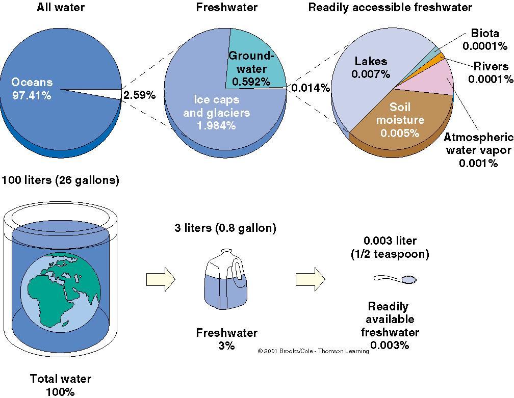
Hydrologic Cycle. Water Availabilty. Surface Water. Groundwater
 Hydrologic Cycle Hydrologic ydoogccyce cycle Surface Water Groundwater Water Availabilty 1 Hydrologic Cycle Constant movement of water above, on, and, below the earth s surface (Heath) Endless circulation
Soil moisture measurements
 Soil moisture measurements Climatological and hydrological field work - FS2017 1 Introduction Soil moisture is a key variable in the climate system. By controlling evapotranspiration, soil moisture impacts
Water Science and the Environment
 Water Science and the Environment HWRS 201 Dr. Zreda Mr. Ghasemian Fall 2015 Surface Evaporation: Overview Evaporation is a process that transfers energy from the Earth s surface to the atmosphere. Some
FELIX JARIA Soil Moisture measurement
 FELIX JARIA Soil Moisture measurement PRESENTATION OUTLINE Introduction Direct soil moisture measurements Feel Gravimetric Volumetric Advantages and Disadvantages Indirect soil moisture measurements Dielectric
Using capacitance sensors to monitor soil moisture. Interpreting the numbers
 Using capacitance sensors to monitor soil moisture Interpreting the numbers Terry Prichard Water Management Specialist Dept. Land, Air, and Water Resources UC Davis MEASURES OF SOIL WATER STATUS There
3/1/18 USING RADAR FOR WETLAND MAPPING IMPORTANCE OF SOIL MOISTURE TRADITIONAL METHODS TO MEASURE SOIL MOISTURE. Feel method Electrical resistance
 3/1/18 USING RADAR FOR WETLAND MAPPING SOIL MOISTURE AND WETLAND CLASSIFICATION Slides modified from a presentation by Charlotte Gabrielsen for this class. Southeast Arizona: Winter wet period From C.
SCIE 4104E - Environmental Systems Science. Tarendra Lakhankar NOAA-CREST Center, The City University of New York
 SCIE 4104E - Environmental Systems Science Tarendra Lakhankar NOAA-CREST Center, The City University of New York About Class This course focuses on Earth as a system and explores the interdependent relationships
Soil Moisture Validation in the U.S.
 Soil Moisture Validation in the U.S. T. J. Jackson, R. Bindlish, I. Mladenova, and M. Cosh USDA ARS Hydrology and Remote Sensing Lab January 16, 2014 Outline Project Overview GCOM-W AMSR2 Brightness Temperature
Unit 2: Geomorphologic and Hydrologic Characteristics of Watersheds. ENVS 435: Watershed Management INSTR.: Dr. R.M. Bajracharya
 Unit 2: Geomorphologic and Hydrologic Characteristics of Watersheds ENVS 435: Watershed Management INSTR.: Dr. R.M. Bajracharya Watersheds are hydro-geologic units Water flow and cycling are basic and
Introduction. Welcome to the Belgium Study Abroad Program. Courses:
 Introduction Welcome to the Belgium Study Abroad Program Courses: AGSM 335: Soil and Water Management BAEN 460: Principals of Environmental Hydrology BAEN 460 / AGSM 335 Combined lecture and HW sessions
Lesson 2 - Stationary Sensors (Part 2)
") Lesson 2 - Stationary Sensors (Part 2) Water pressure, hydraulics, and other water storages (soil, snow ) The meteorology sensors (precipitation) are important because they tell us how much water our climate
Lesson 2 - Stationary Sensors (Part 2) Water pressure, hydraulics, and other water storages (soil, snow ) The meteorology sensors (precipitation) are important because they tell us how much water our climate
The NASA Soil Moisture Active Passive (SMAP) mission: Overview
 mission: Overview") The NASA Soil Moisture Active Passive (SMAP) mission: Overview The MIT Faculty has made this article openly available. Please share how this access benefits you. Your story matters. Citation As Published
The NASA Soil Moisture Active Passive (SMAP) mission: Overview The MIT Faculty has made this article openly available. Please share how this access benefits you. Your story matters. Citation As Published
Remote Sensing of Soil Moisture. Lecture 20 Nov. 7, 2005
 Remote Sensing of Soil Moisture Lecture 20 Nov. 7, 2005 What is soil moisture? Is defined as the ratio of liquid water content to the soil in percentage of volume or weight, is an inheritage and memory
BAEN 673 / February 18, 2016 Hydrologic Processes
 BAEN 673 / February 18, 2016 Hydrologic Processes Assignment: HW#7 Next class lecture in AEPM 104 Today s topics SWAT exercise #2 The SWAT model review paper Hydrologic processes The Hydrologic Processes
TD 603. Water Resources Milind Sohoni sohoni/ Lecture 2: Water cycle, stocks and flows. () July 28, / 30
 July 28, / 30") TD 603 Water Resources Milind Sohoni www.cse.iitb.ac.in/ sohoni/ Lecture 2: Water cycle, stocks and flows () July 28, 2013 1 / 30 The basic movement of water source: USGS. () July 28, 2013 2 / 30 The basic
TD 603 Water Resources Milind Sohoni www.cse.iitb.ac.in/ sohoni/ Lecture 2: Water cycle, stocks and flows () July 28, 2013 1 / 30 The basic movement of water source: USGS. () July 28, 2013 2 / 30 The basic
RSMN 4 Years of in-situ and satellite soil moisture observations in Romania
 RSMN 4 Years of in-situ and satellite soil moisture observations in Romania A. Diamandi, E. Mateescu, O. Nicola, E. Luca, R. Chiritescu National Meteorological Administration (NMA) Satellite Soil Moisture
DEPARTMENT OF GEOGRAPHY POST GRADUATE GOVT. COLLEGE FOR GIRLS.SECTOR-11 CHANDIGARH CLASS-B.A.II PAPER-A RESOURCES AND ENVIRONMENT: WORLD PATTERNS
 DEPARTMENT OF GEOGRAPHY POST GRADUATE GOVT. COLLEGE FOR GIRLS.SECTOR-11 CHANDIGARH CLASS-B.A.II PAPER-A RESOURCES AND ENVIRONMENT: WORLD PATTERNS Hydrological cycle The sun, which drives the water cycle,
Lecture 6: Soil Water
 6-1 GEOG415 Lecture 6: Soil Water Infiltration Movement of water into soil. Importance? - flood prediction -erosion -agriculture - water resources Infiltration capacity Expressed in the same unit as rainfall
Role of Remote Sensing in Flood Management
 Role of Remote Sensing in Flood Management Presented by: Victor Veiga (M.Sc Candidate) Supervisors: Dr. Quazi Hassan 1, and Dr. Jianxun He 2 1 Department of Geomatics Engineering, University of Calgary
Water balance in soil
 Technische Universität München Water balance Water balance in soil Arno Rein Infiltration = + precipitation P evapotranspiration ET surface runoff Summer course Modeling of Plant Uptake, DTU Wednesday,
Module 5 Measurement and Processing of Meteorological Data
 Module 5 Measurement and Processing of Meteorological Data 5.1 Evaporation and Evapotranspiration 5.1.1 Measurement of Evaporation 5.1.2 Pan Evaporimeters 5.1.3 Processing of Pan Evaporation Data 5.1.4
Hydrology and Water Resources Engineering
 Hydrology and Water Resources Engineering SUB GSttingen 214 868 613 K.C. Patra 't'v Mai Narosa Publishing House New Delhi Chennai Mumbai Calcutta CONTENTS Preface vii 1. Introduction 1 1.1 General 1 1.2
Remotely-Sensed Fire Danger Rating System to Support Forest/Land Fire Management in Indonesia
 Remotely-Sensed Fire Danger Rating System to Support Forest/Land Fire Management in Indonesia Orbita Roswintiarti Indonesian National Institute of Aeronautics and Space (LAPAN) SE Asia Regional Research
Water Resources Engineering. Prof. R. Srivastava. Department of Water Resources Engineering. Indian Institute of Technology, Kanpur.
 Water Resources Engineering Prof. R. Srivastava Department of Water Resources Engineering Indian Institute of Technology, Kanpur Lecture # 13 Today we will continue to discuss some of the abstractions
FY24 28 JAXA. Big BCG
 RESTEC 26 1 31 2 FY24 28 JAXA 37 3 Big BCG 4 ( + + ) National Spatial Data Infrastructure Theme Maps (1/5,000, 1/10,000,1/25,000, 1/50,000) ( ) GIS ADB GSMaP Input Rain gage Improved Flood prediction model
CHAPTER ONE : INTRODUCTION
 CHAPTER ONE : INTRODUCTION WHAT IS THE HYDROLOGY? The Hydrology means the science of water. It is the science that deals with the occurrence, circulation and distribution of water of the earth and earth
Soil Moisture Mapping
 Soil Moisture Mapping with UAS an Advanced UAS for Environmental Monitoring info@blackswifttech.com Figure 1: The Black Swift Technologies S2TM and its soil moisture monitoring payload. Introduction ter
Soil moisture (and vegetation?) remote sensing products in Oklahoma
 remote sensing products in Oklahoma") Soil moisture (and vegetation?) remote sensing products in Oklahoma Jason Patton Plant and Soil Sciences, Oklahoma State University Wednesday, November 12, 2014 Oklahoma Workshop on Remote Sensing Technology
Soil moisture (and vegetation?) remote sensing products in Oklahoma Jason Patton Plant and Soil Sciences, Oklahoma State University Wednesday, November 12, 2014 Oklahoma Workshop on Remote Sensing Technology
The Science Behind Measuring Depletions
 The Science Behind Measuring Depletions 1 The Science Behind Measuring Depletions Salim Bawazir, New Mexico State University Salim Bawazir is Associate Professor in the Civil Engineering (CE) Department
Soil Moisture Monitoring for Agricultural Risk Assessment in Canada
 Soil Moisture Monitoring for Agricultural Risk Assessment in Canada Catherine Champagne, Patrick Cherneski, Trevor Hadwen, Antoun El Khoury National Agroclimate Information Service Science and Technology
NASA Assets that Support of the Water- Energy-Food Nexus
 NASA Assets that Support of the Water- Energy-Food Nexus Richard Lawford 4 th Regional WEF Nexus Workshop Hilton, Pietermaritzburg, South Africa November 21, 2016 Observation Strategy for the Water Cycle
Southern Sierra Headwaters Tour
 Southern Sierra Headwaters Tour Introduction The headwaters of the Sierra Nevada support the needs of California s diverse downstream communities, economies, and environments. On this tour and in our research,
CROP STATE MONITORING USING SATELLITE REMOTE SENSING IN ROMANIA
 CROP STATE MONITORING USING SATELLITE REMOTE SENSING IN ROMANIA Dr. Gheorghe Stancalie National Meteorological Administration Bucharest, Romania Content Introduction Earth Observation (EO) data Drought
Instrumentation for Soil Measurement: Progress and Hurdles
 Instrumentation for Soil Measurement: Progress and Hurdles Colin S. Campbell, Ph.D. 1 Outline Soil moisture sensors Soil water potential Mars update Introduction 2 1 Water Content Measurement ECH 2 O high
Introduction to Hydrological Models. University of Oklahoma/HyDROS Module 1.2
 Introduction to Hydrological Models University of Oklahoma/HyDROS Module 1.2 Outline Day 1 WELCOME INTRODUCTION TO HYDROLOGICAL MODELS The water cycle Defining hydrological processes Modeling hydrological
Names: ESS 315. Lab #6, Floods and Runoff Part I Flood frequency
 Names: ESS 315 Lab #6, Floods and Runoff Part I Flood frequency A flood is any relatively high flow of water over land that is not normally under water. Floods occur at streams and rivers but can also
Chief, Hydrological Sciences Laboratory NASA Goddard Space Flight Center
 Detection of Extreme Events with GRACE and Data Assimilation, Ph.D. Chief, Hydrological Sciences Laboratory NASA Goddard Space Flight Center Gravity Recovery and Climate Experiment (GRACE) Soil Moisture
LARGE SCALE SOIL MOISTURE MODELLING
 Soil Moisture Workshop LARGE SCALE SOIL MOISTURE MODELLING Giuseppe Formetta, Vicky Bell, and Eleanor Blyth giufor@nerc.ac.uk Centre for Ecology and Hydrology, Wallingford, UK Wednesday 25 th January 2017
MODULE 1 RUNOFF HYDROGRAPHS WORKSHEET 1. Precipitation
 Watershed MODULE 1 RUNOFF HYDROGRAPHS WORKSHEET 1 A watershed is an area of land thaaptures rainfall and other precipitation and funnels it to a lake or stream or wetland. The area within the watershed
Water Cycle Observation Mission (WCOM) and Its Potentials for Ocean Surface Wind Vector Measurement
 and Its Potentials for Ocean Surface Wind Vector Measurement") Water Cycle Observation Mission (WCOM) and Its Potentials for Ocean Surface Wind Vector Measurement Xiaolong DONG CAS Key Laboratory of Microwave Remote Sensing National Space Science Center Chinese Academy
Water Cycle Observation Mission (WCOM) and Its Potentials for Ocean Surface Wind Vector Measurement Xiaolong DONG CAS Key Laboratory of Microwave Remote Sensing National Space Science Center Chinese Academy
Sixth Semester B. E. (R)/ First Semester B. E. (PTDP) Civil Engineering Examination
/ First Semester B. E. (PTDP) Civil Engineering Examination") CAB/2KTF/EET 1221/1413 Sixth Semester B. E. (R)/ First Semester B. E. (PTDP) Civil Engineering Examination Course Code : CV 312 / CV 507 Course Name : Engineering Hydrology Time : 3 Hours ] [ Max. Marks
CAB/2KTF/EET 1221/1413 Sixth Semester B. E. (R)/ First Semester B. E. (PTDP) Civil Engineering Examination Course Code : CV 312 / CV 507 Course Name : Engineering Hydrology Time : 3 Hours ] [ Max. Marks
Ground-based measurements of soil water storage in Texas
 Texas drought and beyond 22-23 October 2012 Ground-based measurements of soil water storage in Texas Todd Caldwell Bridget Scanlon Di Long Michael Young Ground-based soil Max T moisture Why do we need
Directed Reading. Section: The Water Cycle. what did they discover? question remained? MOVEMENT OF WATER ON EARTH.
 Skills Worksheet Directed Reading Section: The Water Cycle 1. What question has puzzled people for centuries? 2. Once people were able to measure the amount of water that falls to Earth, what did they
I. SOIL MOISTURE, CROP AND VEGETATION STUDY USING AIRSAR DATA
 I. SOIL MOISTURE, CROP AND VEGETATION STUDY USING AIRSAR DATA Dr. Flaviana Hilario (1) and Dr. Juliet Mangera (2) (1) PAGASA (Weather Bureau), ATB 1424 Quezon Ave, Quezon City, Philippines, 1100, Philippines
SOIL AND THE HYDROLOGIC CYCLE
 GEOLOGY 408/508 SOIL AND THE HYDROLOGIC CYCLE CHAPTER 6 Brady & Weil, Rev. 14th ed. THE HYDROLOGIC CYCLE (FIGURE 6.2) WATER BALANCE EQUATION Watershed - an area of land drained by a single stream system
5.5 Improving Water Use Efficiency of Irrigated Crops in the North China Plain Measurements and Modelling
 183 5.5 Improving Water Use Efficiency of Irrigated Crops in the North China Plain Measurements and Modelling H.X. Wang, L. Zhang, W.R. Dawes, C.M. Liu Abstract High crop productivity in the North China
Hydrological Applications of LST Derived from AVHRR
 Hydrological Applications of LST Derived from AVHRR By Balaji Narasimhan Research Assistant Department of Agricultural Engineering Texas A&M University Outline Introduction All about LST Model Development
Module 8: Weathering, Erosion, and Groundwater Topic 5 Content: The Water Cycle Presentation Notes. The Water Cycle
 The Water Cycle 1 Imagine taking a trip around the water cycle as a single drop of water. This cycle has no beginning or ending point, so it does not matter where the trip starts. Since over 70% of the
Lecture 5: Transpiration
 5-1 GEOG415 Lecture 5: Transpiration Transpiration loss of water from stomatal opening substomatal cavity chloroplasts cuticle epidermis mesophyll cells CO 2 H 2 O guard cell Evaporation + Transpiration
Module 2 Measurement and Processing of Hydrologic Data
 Module 2 Measurement and Processing of Hydrologic Data 2.1 Introduction 2.1.1 Methods of Collection of Hydrologic Data 2.2 Classification of Hydrologic Data 2.2.1 Time-Oriented Data 2.2.2 Space-Oriented
Calibration of Soil Moisture Measurement Using Pr2 Moisture Meter and Gravimetric-Based Approaches
 ANALELE UNIVERSITĂŢII EFTIMIE MURGU REŞIŢA ANUL XXIII, NR. 1, 2016, ISSN 1453-7397 Calibration of Soil Moisture Measurement Using Pr2 Moisture Meter and Gravimetric-Based Approaches Olotu Yahaya, Omoregie
1 THE USGS MODULAR MODELING SYSTEM MODEL OF THE UPPER COSUMNES RIVER
 1 THE USGS MODULAR MODELING SYSTEM MODEL OF THE UPPER COSUMNES RIVER 1.1 Introduction The Hydrologic Model of the Upper Cosumnes River Basin (HMCRB) under the USGS Modular Modeling System (MMS) uses a
Akiko Suzuki. The Coordination Group for Meteorological Satellites CGMS-45 Plenary 15 June 2017
 The Coordination Group for Meteorological Satellites CGMS-45 Plenary 15 June 2017 Akiko Suzuki Associate Senior Chief Officer of Satellite Applications JAXA Activities Space Transportation Human Space
Texas Soil Observation Network: TxSON Linking Soil Moisture to Water Resources in the Texas Hill Country. Todd Caldwell
 Texas Soil Observation Network: TxSON Linking Soil Moisture to Water Resources in the Texas Hill Country Todd Caldwell Michael Young and Bridget Scanlon CAHMDA/DAFOH 10 September 2014, Austin, TX Soil
The Hydrosphere: Lecture 7: Evapotranspiration. Paul R. Houser,27 March 2012, Page 1
 The Hydrosphere: Lecture 7: Evapotranspiration Paul R. Houser,27 March 2012, Page 1 Evapotranspiration evapotranspiration summarizes all processes that return liquid water back into water vapor evaporation
APPENDIX E APPENDIX E ESTIMATING RUNOFF FOR SMALL WATERSHEDS
 APPENDIX E ESTIMATING RUNOFF FOR SMALL WATERSHEDS March 18, 2003 This page left blank intentionally. March 18, 2003 TABLES Table E.1 Table E.2 Return Frequencies for Roadway Drainage Design Rational Method
The Islamic University of Gaza- Civil Engineering Department Sanitary Engineering- ECIV 4325 L5. Storm water Management
 The Islamic University of Gaza- Civil Engineering Department Sanitary Engineering- ECIV 4325 L5. Storm water Management Husam Al-Najar Storm water management : Collection System Design principles The Objectives
SOIL MOISTURE SENSING FROM LOCAL TO GLOBAL
 Lublin, 10/05/2018 SOIL MOISTURE SENSING FROM LOCAL TO GLOBAL Mateusz Łukowski, Radosław Szlązak, Łukasz Gluba, Bogusław Usowicz, Jan Słominski, Jerzy Usowicz, Helena Łoś, Kamil Szewczak Why soil moisture
APPENDIX E ESTIMATING RUNOFF FROM SMALL WATERSHEDS
 ESTIMATING RUNOFF FROM SMALL WATERSHEDS June 2011 THIS PAGE LEFT BLANK INTENTIONALLY. June 2011 TABLES Table E.1 Table E.2 Return Frequencies for Roadway Drainage Design Rational Method Values June 2011
Drought Indicators for the SADC
 Drought Indicators for the SADC Bruce Eady DHI-SA Annual Conference Coping with Drought: Adaptions to Water Stress in the Face of Climate Change Agenda Introduction Satellite Data Drought and Flood Portal
LECTURE NOTES - V. Prof. Dr. Atıl BULU
 LECTURE NOTES - V «WATER RESOURCES» Prof. Dr. Atıl BULU Istanbul Technical University College of Civil Engineering Civil Engineering Department Hydraulics Division CHAPTER 5 HYDROLOGY 5.1. HYDROLOGIC CYCLE
Issues include coverage gaps, delays, measurement continuity and consistency, data format and QC, political restrictions
 Satellite-based Estimates of Groundwater Depletion, Ph.D. Chief, Hydrological Sciences Laboratory NASA Goddard Space Flight Center Greenbelt, MD Groundwater Monitoring Inadequacy of Surface Observations
Lecture 11: Water Flow; Soils and the Hydrologic Cycle
 Lecture 11: Water Flow; Soils and the Hydrologic Cycle Water Flow in Soils Types of Water Flow in Soil Saturated flow: Soil pores completely filled with water; controlled by the hydrostatic potential After
CMS and Decision Support Discussion Forum: Current and Near-term Satellite Assets
 CMS and Decision Support Discussion Forum: Current and Near-term Satellite Assets February 6, 2013 Diane E. Wickland 1 and Marc L. Imhoff 2 1 - NASA HQ, Science Mission Directorate, Earth Science Division
Extending the societal and economic benefits of Earth science research, information, and technology
 NASA WATER SCIENCE & APPLICATIONS NASA S APPLIED SCIENCES PROGRAM Steven Ambrose 1, Jared Entin 2, David Toll 3 and Ted Engman 4 1- Applied Sciences Program, NASA/HQ 2-TerrestrialHydrology Program & NASA
CHARACTERISTICS & PROCESSES OF SCIENCE raindrops keep falling the water cycle
 CHARACTERISTICS & PROCESSES OF SCIENCE the water cycle Frameworks SCIENCE ESS 8.7.16 Conduct investigations demonstrating the water cycle. LS 4.6.2 Conduct simulations demonstrating competition for resources
Nutrition of Horticultural Crops Measurements for Irrigation. Lincoln Zotarelli Horticultural Sciences Department University of Florida Spring 2015
 Nutrition of Horticultural Crops Measurements for Irrigation Lincoln Zotarelli Horticultural Sciences Department University of Florida Spring 2015 Principles of plant nutrition Principle 1. Plants take
Estimating Groundwater Recharge within Wisconsin s Central Sands
 Estimating Groundwater Recharge within Wisconsin s Central Sands Adam Freihoefer and Robert Smail Wisconsin Department of Natural Resources [study objective] Identify a defensible approach to quantify
A Short Review about Soil Moisture -importance, measurements and scale issues
 CEE 587: Ecohydrology A Short Review about Soil Moisture -importance, measurements and scale issues Haibin Li Department of Environmental Sciences Rutgers University Dec 15, 2003 A Short Review about Soil
SMAP Mission. SMAP Project Status Soil Moisture Active Passive. Weather Focus Session ILSW meeting July 18-20, 2017
 SMAP Project Status Soil Moisture Active Passive Simon Yueh, SMAP Project Scientist Dara Entekhabi, Science Team Lead Peggy O Neill, Deputy Project Scientist Han You, Project Manager Jared Entin, Program
Hydrology and Water Management. Dr. Mujahid Khan, UET Peshawar
 Hydrology and Water Management Dr. Mujahid Khan, UET Peshawar Course Outline Hydrologic Cycle and its Processes Water Balance Approach Estimation and Analysis of Precipitation Data Infiltration and Runoff
Stormwater: Too Simple?
 Stormwater: Too Simple? Getting Closer to Advertised Level of Service Brandon Klenzendorf, Ph.D., P.E. 13 December 2017 - CWEA Fall Seminar Introduction Traditional approaches to solving stormwater problems
Remote Sensing of Water Resources
 Remote Sensing of Water Resources National Disaster Management Institute Yoomi Hur Climate Change Hydrologic Cycle Hydrologic Indices Soil Moisture Evaportranspiration Drought Conclusions 3 The water cycle
A Review of Various Soil Moisture Measurement Techniques
 A Review of Various Soil Moisture Measurement Techniques Kirandeep Kaur 1, Rita Mahajan 2, Deepak Bagai 3 M.E. Student, Department of Electronics and Communication, PEC University of Technology, Chandigarh,
Soil Moisture Active Passive Mission
 Soil Moisture Active Passive Mission Sensing Global Surface Soil Moisture Using NASA s SMAP Mission and its Applications to Terrestrial Water, Energy and Carbon Cycles Dara Entekhabi (MIT) SMAP Science
Energy Balance and Evapotranspiration Measurement
 Energy Balance and Evapotranspiration Measurement Yu-Jun Cui Ecole Nationale des Ponts et Chaussée, Paris, France Jorge G. Zornberg The University of Texas at Austin, USA ABOUT THIS TOPIC - Multi-disciplinary
USDA-NRCS, Portland, Oregon
 Hydrologic Simulation Modeling for Streamflow Forecasting and Evaluation of Land and Water Management Practices in the Sprague River, Upper Klamath Basin, Oregon, USA David Garen John Risley Jolyne Lea
ASSIMILATION OF REMOTE SENSING- DERIVED FLOOD EXTENT AND SOIL MOISTURE DATA INTO COUPLED HYDROLOGICAL-HYDRAULIC MODELS
 Patrick Matgen Giovanni Corato Laura Giustarini Renaud Hostache Stefan Schlaffer ASSIMILATION OF REMOTE SENSING- DERIVED FLOOD EXTENT AND SOIL MOISTURE DATA INTO COUPLED HYDROLOGICAL-HYDRAULIC MODELS Purpose
NAME: Log onto YouTube and search for jocrisci channel.
 NAME: Log onto YouTube and search for jocrisci channel. ENERGY (Videos 7.1 & 7.2 ESRT 1e, 14c) 1. You must know the differences between the three ways energy is transferred: a. What is conduction? i. Give
Watershed Hydrology. a) Water Balance Studies in Small Experimental Watersheds
 Water Balance Studies in Small Experimental Watersheds") Watershed Hydrology a) Water Balance Studies in Small Experimental Watersheds In order to characterize the geometry of the regolith as well as the directions of the fractures or fissures in the protolith,
Watershed Hydrology a) Water Balance Studies in Small Experimental Watersheds In order to characterize the geometry of the regolith as well as the directions of the fractures or fissures in the protolith,
Monitoring Crop Leaf Area Index (LAI) and Biomass Using Synthetic Aperture Radar (SAR)
 and Biomass Using Synthetic Aperture Radar (SAR)") Monitoring Crop Leaf Area Index (LAI) and Biomass Using Synthetic Aperture Radar (SAR) Mehdi Hosseini, Heather McNairn, Andrew Davidson, Laura Dingle-Robertson *Agriculture and Agri-Food Canada JECAM SAR
Monitoring Crop Leaf Area Index (LAI) and Biomass Using Synthetic Aperture Radar (SAR) Mehdi Hosseini, Heather McNairn, Andrew Davidson, Laura Dingle-Robertson *Agriculture and Agri-Food Canada JECAM SAR
Ms. Le Thi Quy Nien Agriculture Solutions Sales and Distribution IBM Vietnam Smarter Agriculture
 Ms. Le Thi Quy Nien Agriculture Solutions Sales and Distribution IBM Vietnam nienlq@vn.ibm.com Smarter Agriculture Cognitive IOT Solutions: Digital Precision Forestry Agricultural, Industrial & Infrastructure
Stormwater Management in Your Backyard: Stormwater 101
 Stormwater Management in Your Backyard: Stormwater 101 Gregory Rusciano Program Associate, Water Resources Rutgers Cooperative Extension New Jersey Sea Grant Extension Program How much water do we have?
Inputs. Outputs. Component/store. Section of a system where material or energy is held. Something that enters the system (material or energy)
") .. Inputs Something that enters the system (material or energy) Outputs Something that leaves the system (material or energy) Component/store Section of a system where material or energy is held Transfer/flow
.. Inputs Something that enters the system (material or energy) Outputs Something that leaves the system (material or energy) Component/store Section of a system where material or energy is held Transfer/flow
HYDROLOGY WORKSHEET 1 PRECIPITATION
 HYDROLOGY WORKSHEET 1 PRECIPITATION A watershed is an area of land that captures rainfall and other precipitation and funnels it to a lake or stream or wetland. The area within the watershed where the
What is runoff? Runoff. Runoff is often defined as the portion of rainfall, that runs over and under the soil surface toward the stream
 What is runoff? Runoff Runoff is often defined as the portion of rainfall, that runs over and under the soil surface toward the stream 1 COMPONENTS OF Runoff or STREAM FLOW 2 Cont. The types of runoff
Figure 1: Schematic of water fluxes and various hydrologic components in the vadose zone (Šimůnek and van Genuchten, 2006).
.") The evapotranspiration process Evapotranspiration (ET) is the process by which water is transported from the earth surface (i.e., the plant-soil system) to the atmosphere by evaporation (E) from surfaces
The evapotranspiration process Evapotranspiration (ET) is the process by which water is transported from the earth surface (i.e., the plant-soil system) to the atmosphere by evaporation (E) from surfaces
PROGRESS WITH MEASURING AND UTILIZING CROP EVAPOTRANSPIRATION (ETc) IN WALNUT
 IN WALNUT") PROGRESS WITH MEASURING AND UTILIZING CROP EVAPOTRANSPIRATION (ETc) IN WALNUT Allan Fulton, Cayle Little, Richard Snyder, Richard Buchner, Bruce Lampinen, and Sam Metcalf ABSTRACT Since 1982 when the California
PROGRESS WITH MEASURING AND UTILIZING CROP EVAPOTRANSPIRATION (ETc) IN WALNUT Allan Fulton, Cayle Little, Richard Snyder, Richard Buchner, Bruce Lampinen, and Sam Metcalf ABSTRACT Since 1982 when the California
The role of Remote Sensing in Irrigation Monitoring and Management. Mutlu Ozdogan
 The role of Remote Sensing in Irrigation Monitoring and Management Mutlu Ozdogan Outline Why do we care about irrigation? Remote sensing for irrigated agriculture What are the needs of irrigators? Future
UCS Mi-STAR Science 7 Semester 1 Midterm Exam Review Guide
 Name Date Hour 2018-2019 UCS Mi-STAR Science 7 Semester 1 Midterm Exam Review Guide Question How does cold air compare to warm air? Cold air weighs more than hot air. When a 9-centimeter balloon is filled
AquaCrop theoretical and practical training
 AquaCrop theoretical and practical training Day 2 - Climate Johannes Hunink (j.hunink@futurewater.es) Peter Droogers 17-21 Oct-2016, Yerevan, Armenia AquaCrop Conceptual Framework Atmosphere CLIMATE Rain
The Texas A&M University and U.S. Bureau of Reclamation Hydrologic Modeling Inventory (HMI) Questionnaire
 Questionnaire") The Texas A&M University and U.S. Bureau of Reclamation Hydrologic Modeling Inventory (HMI) Questionnaire May 4, 2010 Name of Model, Date, Version Number Dynamic Watershed Simulation Model (DWSM) 2002
The Texas A&M University and U.S. Bureau of Reclamation Hydrologic Modeling Inventory (HMI) Questionnaire May 4, 2010 Name of Model, Date, Version Number Dynamic Watershed Simulation Model (DWSM) 2002
Soil moisture observations and remote sensing at Brightwater Creek, Scotty Creek and Trail Valley Creek
 Soil moisture observations and remote sensing at Brightwater Creek, Scotty Creek and Trail Valley Creek Aaron Berg, Tracy Rowlandson, Travis Burns, Rachel Humphrey, Rebecca Warren, Allan Merchant, Matthew
Factors affecting evaporation 3/16/2010. GG22A: GEOSPHERE & HYDROSPHERE Hydrology. Several factors affect the rate of evaporation from surfaces:
 GG22A: GEOSPHERE & HYDROSPHERE Hydrology Some definitions Evaporation conversion of a liquid to a vapour Transpiration that part of evaporation which enters the atmosphere through plants Total Evaporation
A Water Cycle Observation Mission (WCOM)
") A Water Cycle Observation Mission (WCOM) Jiancheng Shi Xiaolong Dong, Tianjie Zhao, Jiyang Du, Lingmei Jiang, Hao Liu, Zhenzhan Wang, Dabin Ji, and Chuan Xiong The 29 th SSG meeting of the WCRP/GEWEX Feb.
A Water Cycle Observation Mission (WCOM) Jiancheng Shi Xiaolong Dong, Tianjie Zhao, Jiyang Du, Lingmei Jiang, Hao Liu, Zhenzhan Wang, Dabin Ji, and Chuan Xiong The 29 th SSG meeting of the WCRP/GEWEX Feb.
MEASURING REFERENCE EVAPOTRANSPIRATION. (ET r ) THE COCORAHS GUIDE
 THE COCORAHS GUIDE") MEASURING REFERENCE EVAPOTRANSPIRATION (ET r ) THE COCORAHS GUIDE What is Evapotranspiration? ET (evapotranspiration) is the water evaporated from the ground back to the atmosphere both as transpiration
MEASURING REFERENCE EVAPOTRANSPIRATION (ET r ) THE COCORAHS GUIDE What is Evapotranspiration? ET (evapotranspiration) is the water evaporated from the ground back to the atmosphere both as transpiration
The Western States Water Mission CUAHSI Hydroinformatics meeting 16 July 2015
 Jet Propulsion Laboratory, California Institute of Technology The Western States Water Mission CUAHSI Hydroinformatics meeting 16 July 2015 Water Cycle and Freshwater Availability Next Challenge : Adding
Root zone soil moisture and drought indices
 Root zone soil moisture and drought indices Yann H. Kerr, Ahmad AlBitar Jean Pierre Wigneron, Thierry Pellarin and the SMOS team CESBIO, INRA-ISPA, TVU, ECMWF, WSL, LTHE, SMOS Mission Launched in 2009
Computation of excess stormflow at the basin scale. Prof. Pierluigi Claps. Dept. DIATI, Politecnico di Torino
 Computation of excess stormflow at the basin scale Prof. Pierluigi Claps Dept. DIATI, Politecnico di Torino Pierluigi.claps@polito.it losses include: interception, evapotranspiration, storage infiltration,
2.7 Calibrating soil water monitoring devices
 Phil Goyne formerly Qld DPI&F, Warwick David Williams formerly NSW Agriculture, Dubbo Lance Pendergast DAFF Queensland, Emerald Jenelle Hare formerly DAFF Queensland, Dalby Key points Calibration of soil