Northland Regional Council. Awanui Flood Scheme Preliminary Design
|
|
|
- Egbert Pierce
- 6 years ago
- Views:
Transcription

1 REPORT Northland Regional Council Awanui Flood Scheme Preliminary Design
2 REPORT Northland Regional Council Awanui Flood Scheme Preliminary Design Report prepared for: NORTHLAND REGIONAL COUNCIL Report prepared by: Tonkin & Taylor Ltd Distribution: NORTHLAND REGIONAL COUNCIL Tonkin & Taylor Ltd (FILE) 1 copy 1 copy September 2014 T&T Ref:
3 Table of contents 1 Introduction 1 2 Design parameters Topographic information Topographic data confidence limits Flood hydrograph Flood hydrograph confidence limits Flood levels Flood level confidence limits Site visit and geotechnical investigations 8 3 Design Urban Kaitaia flood protection Whangatane Spillway flood flows Overtopping of the Whangatane Spillway left bank Stability of river banks and associated stopbanks Price Schedule 14 5 Issues for Detailed Design 16 6 Applicability 17 Appendix A: Appendix B: Appendix C: Appendix D: Design flows Rainfall and flow data Site visit and geotechnical investigations Price Schedule breakdown Awanui Flood Scheme Preliminary Design T&T Ref Northland Regional Council September 2014
4 Executive summary In April 2013 Tonkin & Taylor (T&T) was appointed by Northland Regional Council (NRC) to develop a preliminary design for the Awanui Flood Scheme Upgrade. The objectives of the Upgrade were that it: 1. Improves the scheme to protect urban Kaitaia from river flooding to a design standard that is equivalent to a 1% Annual Exceedance Probability (AEP), with an allowance for climate change (based on peak flows) and an appropriate level of freeboard 2. Improves safety of river banks against slope failure (i.e. improves stability of river banks and associated stopbanks). A 1% AEP design flood hydrograph for the Preliminary Design was developed following consideration of a range of hydrological studies. The hydrograph is based on a peak flow of 400 m 3 /s and a temporal profile established by NIWA (2005). A precautionary approach was taken for the design flood hydrograph. This is appropriate due to some uncertainty relating to the bifurcation of Awanui River flood flows into the Tarawhataroa at State Highway 1 upstream of Kaitaia, and the range in peak flow estimates from earlier studies. Design flood levels were determined using a simplified version of a MIKE-FLOOD Awanui catchment model developed earlier by GHD (2012). Changes were made to the model to ensure its appropriateness as a design tool. These included revised hydrology, changes in extents, and amended cross sections. The design philosophy adopted for the project is as follows: i. To contain flood flows within Awanui River channel in urban Kaitaia up to a 1% AEP flood level with a 500mm of freeboard ii. iii. iv. To make more frequent use of the Whangatane Spillway for conveying flood flows To prevent overtopping of the Whangatane Spillway left bank in a 1% AEP flood with an allowance for freeboard To improve stability of river banks and associated stopbanks. A number of project risks have been identified, which will require further consideration during Detailed Design. In particular, there are data uncertainties relating to LiDAR survey data and therefore the required ground level raising for the Preliminary Design may have been underestimated. The construction cost estimate provided in the Price Schedule allows for some uncertainty relating to cut and fill volumes, but does not make allowance for changes in design approach that may be required. In order to address existing bank stability issues, the Preliminary Design incorporates a rock revetment to increase slope stability and provide toe protection. This will reduce operational expenditure, however, it comes with a high capital expense. Alternative solutions may decrease capital expense but will increase the operational expenses. Opportunities to optimise the slope stability requirements within constrained operational and capital budgets shuld be further investigated during Detailed Design. The cost estimate to consent, design, construct and project manage the works identified in the Preliminary Design is $18.5 million, reducing to $7.05 million if the slope stability works are not incorporated. Awanui Flood Scheme Preliminary Design T&T Ref Northland Regional Council September 2014
5 1 1 Introduction Tonkin & Taylor (T&T) was appointed by Northland Regional Council (NRC) to develop a preliminary design for the Awanui Flood Scheme Upgrade in April The primary objectives for the Awanui Flood Scheme Upgrade, as set out in NRC s Request for Proposal (March, 2013) are as follows: Improve the design standard of the flood scheme to protect urban Kaitaia from river flooding to a design standard that is equivalent to a 1% Annual Exceedance Probability (AEP) with an allowance for climate change (based on peak flows) and an appropriate level of freeboard Improve safety of river banks against slope failure (improve stability) of river banks and associated stopbanks. This report represents the Preliminary Design report for the proposed upgrade of the Awanui Flood Scheme. Awanui Flood Scheme Preliminary Design T&T Ref Northland Regional Council September 2014
6 2 2 Design parameters The design inputs parameters for the Preliminary Design have been developed from the following information, which is discussed further in this section: i. Topographic information ii. iii. iv. Design flood flow hydrograph Design flood levels Geotechnical investigation and site walkover. 2.1 Topographic information Topographic data were available from three main sources: i. LiDAR ii. Cato Bolam cross section survey (2010) iii. Cato Bolam top of stopbank survey (2010). The Cato Bolam cross section survey (2010) was used, where available, to develop the cross sections in the open channel model. It was also used to assist with determining locations where channel widening works and/or slope stability works were required. The LiDAR data were used to determine the existing ground topography in the floodplain and the extents of the stopbanks. This information was used to: i. Identify required changes in ground level due to: ii. iii. iv. Stopbank raising Spillway excavation Identify the increase in extents of the stopbanks caused by raising Determine the cut and fill volumes for stopbank raising Determine appropriate design for slope stability works. The Cato Bolam cross section survey and top of bank survey were not sufficiently extensive to support volume calculations. For example, the survey data may indicate the top of bank level and location, but the side slopes and surrounding ground level may not be available. Therefore it was not possible to determine the volume of material needed to increase the height of the stopbank. The volume of material that was required for cut or fill volumes is an essential parameter to estimate the likely cost of the works. The Cato Bolam (2010) top of bank survey was used to identify uncertainty in ground levels from the LiDAR data Topographic data confidence limits There is high confidence in survey obtained through registered surveyors (Cato Bolam, 2010). The Cato Bolam top of bank survey was therefore used to identify uncertainty in ground levels from the LiDAR data. As discussed in the previous sub-section, the LiDAR data were an essential input parameter for many of the projects objectives. Figure 2-1 compares the ground levels from the Cato Bolam top of stopbank survey with the LiDAR levels at the same location. Awanui Flood Scheme Preliminary Design T&T Ref Northland Regional Council September 2014
7 3 Cato Bolam survey/lidar difference Frequency Ground level differences (Cato Bolam ground level minus LiDAR ground level) Figure 2-1 Top of bank level difference Due to inconsistencies between surveyed levels and LiDAR levels, there is uncertainty and lower confidence in the accuracy of the LiDAR data. Allowances for this uncertainty have been made in the contingency included in the cost estimate included in this report. It is strongly recommended that a more detailed terrain survey is carried out for the Detailed Design. The implications of the survey data uncertainty are discussed as relevant throughout this report. 2.2 Flood hydrograph The peak 1% AEP flows in the Awanui River upstream of the overflow across State Highway 1 have been assessed using a variety of different methodologies and techniques. The various peak flows derived by different methods are presented in Table 2-1. The rationale for assessing the different flow methods is provided in Appendix A, and analysis of rain gauge data is provided in Appendix B 1. 1 The content of the two appendices was provided to NRC in an unpublished memo in October It was used to agree on the design parameters for the Preliminary Design of the Awanui Flood Scheme. Awanui Flood Scheme Preliminary Design T&T Ref Northland Regional Council September 2014
8 4 Table 2-1 Awanui River upstream of State Highway 1 overflow summary of 1% AEP peak flood flows Method Estimated peak discharge (m 3 /s) Lower Upper Frequency analysis Catchment model (GHD, 2013) 882 Rational method Clark Unit Hydrograph McKerchar & Pearson TM NIWA In accordance with the primary objectives of the Awanui Flood Scheme, the comparison of flood frequency analysis and model results is based on 1% AEP flows excluding any allowances for climate change. Based on the hydrological analyses shown in Appendix A, the 1% AEP flood flows from the GHD catchment model were neglected because they are approximately double the peak flows that were determined using different flow estimates. Together with input from NRC, a review of the analyses was carried out. The results of the discussions was that 400 m 3 /s was adopted as the peak flow for the design of the Awanui Flood Scheme. The NIWA (2005) design hydrograph was adopted for the temporal flow profile of the design event. The NIWA hydrograph was scaled by 8.1% to match the adopted peak flow of 400 m 3 /s. Figure 2-2 presents the adopted Awanui Flood Scheme design hydrograph. Awanui Flood Scheme Preliminary Design T&T Ref Northland Regional Council September 2014
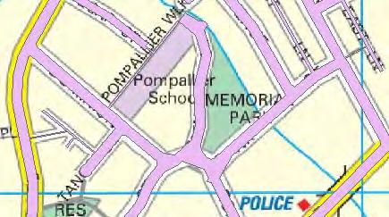
9 5 Figure 2-2 Awanui Flood Scheme 1% AEP design hydrograph Flood hydrograph confidence limits A precautionary approach for the design flood hydrograph has been applied for the Preliminary Design of the Awanui Flood Scheme. The adopted peak flow estimate is well founded based on application of a number of methods, and is considered to be on the upper side of the range of credible flows. By applying the NIWA hydrograph to the peak flow estimate, it is considered that there is also a conservative estimate of flood volume given that significant historical flood events have been typically shorter in duration. The overflow of flood flows from the Awanui River across State Highway 1 and into the Tarawhataroa stream are included in the model. However there is a general acceptance that the model results (GHD catchment model and T&T revised model) do not compare well with observed flood flows. It is uncertain whether the inaccuracies relate to the rating curves in the Tarawahatroa, observed levels or the model results. The T&T revised model under-predicts diverted flood flows to the Tarawhataroa in comparison with observations, therefore the flood flows passing downstream in the Awanui may be conservatively overestimated. 2.3 Flood levels The flood levels were modelled using a model developed from the existing MIKE-FLOOD Awanui catchment model (GHD, 2012). The design objective was to determine peak 1% AEP flood levels from the State Highway 1 overflow to Waikuriki Bridge and down the Whangatane Spillway. The design concept was to contain all flood flows within the stopbanks along the Scheme. Awanui Flood Scheme Preliminary Design T&T Ref Northland Regional Council September 2014

10 6 The following changes were made to the GHD Awanui catchment model to ensure that the model was an appropriate design tool for the Awanui Flood Scheme Upgrade design: 1. The catchment hydrology was replaced using the design hydrograph identified in Section The model extent was modified: a. The 2D model extent were significantly reduced to represent only the area around the overflow to the Tarawhataroa. The 2D extent is shown in Figure 2-2. b. The 1D model extent was reduced to represent the Awanui River from approximately 1 km upstream of the Tarawatatora overflow to Waikuriki Bridge which is the State Highway 1 Bridge downstream from the bifurcation to the Whangatane Spillway. The rating curve at Waikuriki Bridge was used as the downstream model boundary 2. The Whangatane Spillway was represented all the way to the coast. 3. The open channel section of the model was represented using only the 1D model to the top of stopbanks. This required modification of the cross sections based on surveyed data from Cato Bolam (2010). It was appropriate to use only the 1D model to represent the open channels since a design objective was to contain flood flows within the channel stopbanks. Therefore the 2D model extents were not required to represent the area of interest. It is important to note that the model may not be suitable for assessing areas outside of this project s area of interest, or for other reasons beyond the purposes for which it was created. 4. Additional cross sections in the Whangatane Spillway based on LiDAR survey data. Whangatane Spillway 2D Model extent School Cut Tarawhataroa Figure 2-3 2D model extent for design tool 2 The rating curve was established in 1990 based on gaugings taken between 1959 and 1990 for flows up to 110 m 3 /s. The confidence limits in the rating curve appears to be ±10% at higher flows (or ±10 m 3 /s in absolute terms). This is based on a comparison between individual flow gauge records and the fitted rating curve. Awanui Flood Scheme Preliminary Design T&T Ref Northland Regional Council September 2014
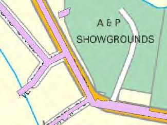
11 7 The model was used to determine peak 1% AEP flood levels in the Awanui River and to determine appropriate stopbank levels Flood level confidence limits Confidence in the flood levels are based on the confidence limits in the flood hydrology (see section 2.1) and the flood hydraulics. The flood hydraulics are largely controlled by the model schemetisation, topographic survey information and model parameters. The model schematisation is appropriate for a design objective that keeps 1% AEP flood flows within stopbanks. The model schematisation may need to be changed for scenarios that allow for overtopping of stopbanks. The 1D elements of the model were represented using channel cross sections that were typically generated from Cato Bolam survey data extending from the river invert level to the top of bank (or top of stopbank where appropriate). In some areas only the stopbank survey information was available (i.e. no channel cross section) and the channel sections were determined from interpolation between upstream and downstream cross sections. In contrast with the general rule that cross sections were used to represent the channel cross section, LiDAR data was used in the Whangatane Spillway to supplement the cross section data, despite the concerns regarding the quality of the LiDAR data (refer Section 2.1). In order to allay concerns relating to the use of LiDAR generated cross sections in the Whangatane Spillway upstream from Donald Road Bridge, a sensitivity assessment was carried out to ensure that the Preliminary Design was appropriate in the range for the range of invert elevations. Since the public meetings conducted by NRC, some changes have been incorporated in the design, but not modelled. Thus the flood levels shown on the Preliminary Design Drawings may reduce in the following areas: 1. Between Whangatane Spillway and Donald Road Bridge. The channel invert level in this area has been reduced and widened from what was originally included in the model. This will increase the available cross sectional area and therefore the changes will not increase flood levels and may lead to a small reduction for more frequent flood events. We do not expect to see a noticeable change in flood level for the 1% AEP design storm since the flows are tailwater level controlled and the hydraulic gradient is likely to remain similar to what is represented in the model. 2. Area adjacent to A&P Showgrounds. The hydraulic model includes stopbanks along the true right bank adjacent to the A&P Showgrounds which have been removed from the Preliminary Design. The stopbanks were removed from the Preliminary Design following NRC and public feedback that the floodplain on the true right bank did not need protecting. We do not expect to see a noticeable change in flood level for the 1% AEP design storm since the flows are tailwater level controlled and the hydraulic gradient is likely to remain similar to what is represented in the model However these scenarios were not reassessed with the model because the water levels may not reduce or only reduce by a small amount for the 1% AEP design storm. However we are confident that the water levels will not increase. Overall we consider that the MIKE-FLOOD model results are appropriate as a basis for Preliminary Design purposes. Awanui Flood Scheme Preliminary Design T&T Ref Northland Regional Council September 2014
12 8 2.4 Site visit and geotechnical investigations T&T geotechnical staff visited the Awanui Flood Scheme area on two occasions as part of the Preliminary Design investigations. An initial site visit was in July 2013, and the second visit was after the initial Preliminary Design concept was developed, in May The first visit identified borehole locations for investigation, and carried out a general inspection of channels and stopbanks with NRC staff (Neville Wilson and Ron Fenwick). The observations for four different reaches of the Scheme are provided in Appendix C. The overall conclusion was that there are variable conditions along the length of the Awanui Scheme. In the urban areas of Kaitaia, there are space constraints with limited access for maintenance works, and which will restrict access and space for upgrading of existing stopbanks. Also in the urban areas, there are widespread bank stability issues readily observed through localised bank slumping and landslips. It was noted that the local soils profile consists generally of sedimentary clays over softer marine deposits. This has implications if excavating through the top layer and for stability of the exposed slope. Past maintenance works have probably exposed this layer and led to some of the existing bank stability issues. The second site visit (May 2014) was carried out for the purposes of checking and amending as necessary the initial Preliminary Design concept. Feedback from the site visit was incorporated into the final Preliminary Design and cost estimate prepared for NRC. Thirty boreholes were investigated by hand auger to provide data for the geotechnical design. The locations of the boreholes and the logs are included in Appendix C. Awanui Flood Scheme Preliminary Design T&T Ref Northland Regional Council September 2014
13 9 3 Design The Preliminary Design has been developed to meet the primary objectives of the Awanui Flood Scheme Upgrade. The design is shown on the Preliminary Design Drawings that are issued with this report. The design philosophy for the project, discussed further in this section, is as follows: v. To contain flood flows within Awanui River channel in urban Kaitaia to a 1% AEP flood level with a 500mm of freeboard vi. vii. viii. To make more frequent use of the Whangatane Spillway for conveying flood flows To prevent overtopping of the Whangatane Spillway left bank in a 1% AEP flood with an allowance for freeboard To improve stability of river banks and associated stopbanks. Areas outside of urban Kaitaia are also discussed below. 3.1 Urban Kaitaia flood protection The Scheme Upgrade has been designed to contain 1% AEP flood flows through urban Kaitaia within the river channel, by increasing channel capacity in three ways: 1. Channel widening 2. Adding spillways within the flood channel 3. Raising stopbanks. There is only limited opportunity to increase the channel width of the river in the urban area because the widened channel would encroach on neighbouring private properties. However, there are some areas (identified on the Preliminary Design Drawings) where channel widening is feasible and has been adopted as part of the design, although this has typically been carried out as a measure to improve bank stability rather than for increased channel capacity (refer Section 3.4). The increase in channel width in these areas may reduce flood levels for more frequent events 3, although model results indicate that increased channel width does not have a significant impact on reducing 1% AEP flood levels. There are six new spillways within the flood channel proposed for the Preliminary Design, which were identified in the Haigh Workman Concept Design report for the Awanui Flood Scheme (2012). The spillways increase the flood channel capacity of the Awanui River by providing additional cross section area and reducing hydraulic head losses by straightening the channel. This has the impact of increasing conveyance and reducing velocity around the channel bends adjacent to State Highway 1. Note that the slope stability issues associated with the bends adjacent to State Highway 1 are beyond the scope of this work. Options to stabilise the river adjacent banks adjacent to State Highway 1 could be considered as part of the Detailed Design. Raising existing stopbanks and constructing additional stopbanks through urban Kaitaia also increases the channel capacity of the Awanui River. It is proposed to raise the stopbanks to provide 500 mm freeboard above the 1% AEP design flood levels. The typical cross section for stopbank raising and the extent of works are shown on the Preliminary Design Drawings. Where the stopbank can be raised using earthfill alone, the typical cross section incorporates a 3 m wide crest and 2:1 (horizontal : vertical) side slopes. There are 3 Reducing flood levels for more frequent events than a 1% AEP is not a project objective, but is included as a secondary benefit. Awanui Flood Scheme Preliminary Design T&T Ref Northland Regional Council September 2014
14 10 areas where the increase in stopbank height and extents will require works on private property, as shown on the drawings. There are a number of areas where the increase in stopbank extents was considered unsatisfactory due to the impact on private land. A mass block wall approach has been adopted in these areas to reduce the land required, and a typical section is included in the drawings. Alternative typical sections for mass block or key stone wall options are shown in the drawings and can be considered further during Detailed Design. The topographic data uncertainties discussed earlier in this report present a project risk for areas where the required ground level increases for the design may have been underestimated, so that a change in stopbank raising approach may be required. For example, if stopbank raising needs to change from earthfill to mass block wall then there will be additional design and construction costs. The cost estimate contingency includes for changes in cut and fill volumes, but does not make allowance for changes in design approach. There is an active landslip located on the true right bank at the sharp left bend located near to Rongopai Place (Awanui River chainage 9570 m) which will require specific consideration during Detailed Design. Bank stabilisation works in this area have been excluded from the Preliminary Design in agreement with NRC. Specific features of the Preliminary Design to note: 1. It has been agreed, following NRC and public feedback that the reserve area adjacent to the A&P Showgrounds on the true right bank can be allowed to flood and therefore does not need flood protection. 2. Three stopbank alignment options were presented to NRC around Remembrance Park. The options either provide flood protection to the park without providing flood storage for the wider community; or provide no flood protection to the park but increase the flood storage benefits to the wider community. An option that allows Remembrance Park to flood was selected as the preferred option. The frequency of flooding has not been evaluated, but would be expected to be similar to the current scenario. 3. Model results indicate that there are no bridges in the Awanui River that overtop during the 1% AEP design storm 4. However, the freeboard allowance that has been allowed for elsewhere in the design (i.e. stopbanks) has not been applied to bridge soffit and access roads. Bridge access road levels may be lower than the adjacent stopbanks. The risks and potential mitigation options associated with this should be investigated further during Detailed Design. 4. Where ground levels/stopbanks are to be increased in elevation, care should be taken during Detailed Design to ensure that stormwater drainage can still pass to the Awanui River. This may require flap gates to be incorporated on existing outfalls. 5 By increasing the conveyance capacity of the Awanui River, we expect the channel capacity to increase to approximately 375 m 3 /s, downstream of School Cut Creek. 6 The 375 m 3 /s is the modelled peak flows in the Awanui River downstream of the State Highway 1 overflow (noting that this is likely to be conservative, based on comments made in Section 2.2.1). 4 Does not include Donald Road Bridge in the Whangatane Spillway. 5 The stormwater drainage information provided by Far North District Council was not suitable for design purposes. Further information will be required for Detailed Design. 6 The model was not developed to assess the existing channel capacity, although our estimate would be that the capacity of the existing channel is likely to be in the order of m 3 /s. Awanui Flood Scheme Preliminary Design T&T Ref Northland Regional Council September 2014

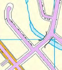
15 Whangatane Spillway flood flows The invert level of the Whangatane Spillway overflow channel controls the bifurcation of river flows between the Lower Awanui River and the Whangatane Spillway channels. Currently the channel invert level has an approximate elevation of 10.9 m. Anecdotal information suggests that there may be a hard wooden weir structure submerged beneath the vegetation, however, no evidence of this was observed during the site visits. A photograph of the area is shown in Figure 3-1. Awanui River upstream Awanui River downstream Whangatane Spillway inlet Whangatane Spillway downstream Figure 3-1 Photograph of Whangatane Spillway overflow channel and Awanui River The concept to lower the Whangatane Spillway to pass flood flows earlier in the event was developed for the following reasons: 1. The Whangatane Spillway is more efficient at passing flood flows away from the urban centre than the Lower Awanui River channel (i.e. it has greater channel capacity). 2. To make more frequent use of the Whangatane Spillway 3. To reduce flood flows and flood extents in the Lower Awanui River 4. To pass increased flood volume down the Whangatane Spillway. It is noted that lowering the level of the Whangatane Spillway inlet may cause an increase in flood risk down the Whangatane Spillway channel. NRC has indicated a preference for flood flows to start flowing to the Whangatane Spillway when flows in the Awanui exceed approximately 20 m 3 /s. Although the specific frequency of flows exceeding 20 m 3 /s has not been assessed as part of this study, we note that the lowest annual maximum flow recorded at School Cut flow gauge since 1958 was 54 m 3 /s (in 1983). Therefore, it can be expected that river flows would exceed 20 m 3 /s several times every year. To direct flows into the Whangatane Spillway when river flows exceed 20 m 3 /s, a modified inlet weir is proposed at m RL (Unahi datum). This level is based on a flow versus elevation relationship in the Awanui River immediately upstream of the bifurcation determined from the hydraulic model results. The Preliminary Design for the Whangatane Spillway inlet is shown in the Preliminary Design Drawings and incorporates the following features: An inlet weir set at m RL Gabion basket slope protection for The upstream face The side slopes Awanui Flood Scheme Preliminary Design T&T Ref Northland Regional Council September 2014
16 12 Inlet weir crest Lowering the Whangatane Spillway channel invert between the inlet weir and Donald Road, to approximately 9 m RL on the downstream end of the weir structure, and to approximately 8 m near the Donald Road Bridge Erosion protection for the slope from the inlet weir to the new channel invert level. We note that NRC has had some poor experiences with gabion basket protection, and therefore alternative options such as mass block walls, concrete and rock should be considered in Detailed Design. Lowering the channel on the downstream side of the inlet weir will help to reduce flood levels in the Whangatane Spillway during more frequent events, by reducing downstream water levels. However, the hydraulic grade line will not change significantly during 1% AEP flood flows, therefore 1% AEP flood levels will be similar to the existing situation. Current (i.e. existing) peak flows passing into the Whangatane Spillway during a 1% AEP design storm event would be approximately 226 m 3 /s. As a result of lowering the spillway inlet and increasing the upstream channel conveyance, bifurcation flows are likely to increase to approximately 256 m 3 /s. Approximately 10 m 3 /s (of the 30 m 3 /s increase) is due to increased channel conveyance upstream in the Awanui River and 20 m 3 /s is due to lowering the channel inlet. 3.3 Overtopping of the Whangatane Spillway left bank Increasing 1% AEP flood flows in the Whangatane Spillway results in greater flood risk to properties located within the existing flood extents when the Whangatane Spillway stopbanks overtop. In particular, there are a large number of buildings identified in the floodplain adjacent to the true left bank of the Whangatane Spillway. The Preliminary Design includes stopbank measures to protect buildings and property on the true left bank from the increased flood flows passing along the Whangatane Spillway. In agreement with NRC, options to provide similar protection for buildings and property on the right bank were not developed further at this stage because the benefits of protection were considered likely to be small in comparison with the estimated costs. Measures to manage the additional flood risk, particularly to a small number of buildings located adjacent to the true right bank, should be considered further as part of the Detailed Design. The Preliminary Design Drawings indicate the extent of stopbank raising required to provide 1% AEP level protection with 500 mm freeboard. The stopbank assessment considers the area from the Whangatane Spillway inlet weir to a location approximately 8 km downstream, beyond which the flood risk to buildings is considered low. Previously stated concerns regarding the quality of the LiDAR data is likely to impact the extent of works and volume of earthworks required. 3.4 Stability of river banks and associated stopbanks. The site visits and associated geotechnical investigations identified that there are widespread bank stability issues readily observed through localised bank slumping and landslips. Two general options to improve slope stability were considered as part of development of the Preliminary Design: 1. Reducing the gradient of the bank slopes 2. Structural methods to increase the shear strength of the slope. Awanui Flood Scheme Preliminary Design T&T Ref Northland Regional Council September 2014
17 13 The Preliminary Design Drawings indicate areas where there can be some reduction in the gradient of the bank slope which will increase stability and reduce the probability of slope failure. However, the geological investigations and site walkover suggest that in places the banks will remain relatively unstable after the gradient is reduced due to the geological profile of the area (sedimentary clays over softer marine deposits). In order to have confidence in a design solution that stabilises the banks and provides protection for the toe of the bank, passive structural methods (e.g. rock revetment, gabion baskets or mass blocks) would be required along the entire length of the Awanui River, but are not required along the Whangatane Spillway channel. The Preliminary Design incorporates a rock revetment approach, although gabion baskets or mass blocks could be considered as alternatives within the Detailed Design. The rock revetment preliminary design has primarily been developed to provide a slope stability solution that reduces operational expenditure. However, it will come with a high capital expense. Alternative solutions (e.g. through soft engineering measures) may decrease capital expense but will increase the required operational expenses due to more frequent bank stability related issues. Opportunities to balance the slope stability requirements with operational costs in an ecologically sensitive way should be investigated further during Detailed Design. The median rock size for a rock revetment determined for the Preliminary Design is approximately 800 mm, to resist peak flow velocities in the channel up to 4.5 m/s and a Froude number of 0.5. This should be confirmed as part of Detailed Design. We also note that the rock revetment presently proposed does not extend up to the 1% AEP flood level. To provide protection to the 1% AEP flood level would significantly increase the cost of the works further. The active slip identified earlier in the report (near Rongopai Place) will require some detailed consideration during Detailed Design. This may involve more complex solutions than the passive solutions identified above. Awanui Flood Scheme Preliminary Design T&T Ref Northland Regional Council September 2014
18 14 4 Price Schedule Table 4-1 summarises the cost estimate for the Awanui Flood Scheme Upgrade based on the elements shown on the Preliminary Design Drawings. Due to the high cost of bank stabilisation works, two estimates have been prepared, including and excluding bank stabilisation works. A detailed breakdown of the estimate is provided in Appendix D. A contingency has been included in each of the construction cost estimate line items (as shown in detailed breakdown in Appendix D). The contingency amount includes for the uncertainty in cut and fill volumes due to the survey data uncertainty. However, as previously noted, changes in stopbank raising approach as a result of topographic uncertainty are not represented in the contingency, for example where stopbank raising changes from additional earthfill to a mass block wall. Table 4-1 Price schedule summary Cost Estimate Spillways 1 5 $870,500 Stopbank 1: 0 m 750 m Farm to Panakareo Street $365,500 Stopbank 2: 0 m 745 m Church Road to Church Road drain $285,850 Stopbank 3: 0 m 830 m Allen Bell Drive to Spillway $249,800 Stopbank 4/1: 0 m 940 m Sports Ground to Church Road $155,700 Stopbank 4/2: 940 m 2000 m Church Road to Allen Bell Drive $451,500 Stopbank 4/3: 2000 m 2877 m Allen Bell Drive to Mathews Park $513,400 Whangatane Spillway Weir $911,700 Stopbank 5/1: 0 m 5290 m Weir to Quarry Road $572,500 Stopbank 5/2: 5290 m 6940 m Quarry Road to SH10 $70,250 Stopbank 5/3: 6940 m 7950 m SH10 to end $356,000 Stream bank protection works N/A $8,593,750 Construction Cost Estimate $4,802,700 $13,395,950 Detailed design (7% of works) $336,154 $937,716 Consultation and consenting (10% of works) $480,220 $1,339,595 Project management, construction supervision, contract administration (7% of works) $336,154 $937,716 Planting/landscaping for aesthetic purposes (5%) $240,110 $669,797 Whangatane Spillway - two stock crossing bridges* $400,000 $400,000 Sub-total (excluding Construction Cost Estimate) $1,792,638 $4,284,825 25% contingency $448,159 $1,071,206 Total Estimate $7,042,997 $18,751,982 *Item added at request of NRC. Prices previously supplied to NRC were $150k per bridge, which was considered low (by NRC). Awanui Flood Scheme Preliminary Design T&T Ref Northland Regional Council September 2014
19 15 The following items are not included in the Price Schedule: a. Additional survey b. Land and property acquisition c. Road alignment modifications d. Slope stability improvements and landslip remediation in the Awanui River around Rongopai Place e. Bank stability measures adjacent to State Highway 1 upstream of the Kaitaia urban area. Awanui Flood Scheme Preliminary Design T&T Ref Northland Regional Council September 2014
20 16 5 Issues for Detailed Design This Preliminary Design Report has highlighted a number of issues to be considered for Detailed Design. The following points summarise recommendations made elsewhere in the report: i. Detailed survey is recommended for the Detailed Design to properly determine the extents of stopbanks and volumes. Survey of existing stormwater infrastructure may also be necessary. ii. iii. iv. Options to stabilise the river banks adjacent to State Highway 1 could be considered as part of the Detailed Design scope of works. A mass block wall approach has been adopted in some areas to reduce the land required to raise flood protection levels. Alternative typical sections for mass block or key stone wall options are shown in the drawings and can be considered further during detailed design. The risks associated with having lower road levels than the adjacent stopbanks should be considered further. v. The ability of stormwater to drain to the Awanui River will require further consideration at Detailed Design, for example using flap gates on drainage outfalls passing through stopbanks. vi. vii. viii. NRC has indicated that it has had poor experience using gabion baskets and may wish to change the design of the Whangatane Spillway inlet protection works to a mass block approach during Detailed Design. The additional flood risk to buildings and property located on the true right bank of the Whangatane Spillway needs to be considered further during Detailed Design. It is noted that these areas already flood, but the increase in flood risk may require mitigation. Alternative options to the rock revetment approach for addressing the slope stability issues in the Awanui should be considered at Detailed Design. The alternative options may consider reducing the capital expenditure but accepting a lower level of service which will result in longer term operational costs than the approach currently proposed. Awanui Flood Scheme Preliminary Design T&T Ref Northland Regional Council September 2014

21 17 6 Applicability This report has been prepared for the benefit of Northland Regional Council with respect to the particular brief given to us and it may not be relied upon in other contexts or for any other purpose without our prior review and agreement. Tonkin & Taylor Ltd Environmental and Engineering Consultants Report prepared by: Authorised for Tonkin & Taylor Ltd by: Jon Rix Water Resources Engineer Project Director Tim Fisher JRRR \\ttgroup.local\corporate\auckland\projects\29154\ \workingmaterial\reporting\preliminary Design Report\ Preliminary Design Report.Final.docx Awanui Flood Scheme Preliminary Design T&T Ref Northland Regional Council September 2014
22 Appendix A: Design flows

23 A Design Flows The 1% AEP peak flow and temporal flow pattern are critical design aspects for the Awanui Flood Scheme. It was agreed early on in the project that the 1% AEP flows upstream of the State Highway 1 overflow to the Tarawhataroa Stream is the appropriate location for the design flows so that the overflow can be considered as part of the project. This chapter presents the results from a number of previous hydrological and hydraulic studies, and some additional deterministic studies carried out by T&T for the purposes of this study. Many of the approaches provide use an approach that convert peak flows recorded at School Cut to flows upstream of the Tarawhataroa overflow. Therefore this section has been organised in the following way: 1. Annual peak flows at School Cut 2. Diversion relationship between Awanui River and Tarawhataroa Stream a. Previous studies b. Catchment model 3. Flood frequency analysis 4. Additional studies carried out by T&T 5. Discussion of results and selection of 1% AEP design hydrograph. A.1 Annual peak flows at School Cut The annual maxima from 1958 to 2012 are provided in Figure A-1. The different colour lines reflect different sources of information and the difference between the highest and lowest estimate is highlighted. The adopted peak flow is shown in red on the graph. Figure A-1 Annual maximum flows at School Cut
24 We note the following adjustments: 1. The differences between the annual maximum from 2000 to 2005 reflect an observed difference between maximum values recorded in the NIWA (2005) report and the annual maxima derived from a hydrometric database file (Tideda) provided to T&T as part of the study. We understand that the annual maximum flows included in the NIWA report applied an earlier rating curve from November 1999 to annual maxima up to It is understood from NIWA that School Cut gaugings in 2006 and 2007 led to a revision of the rating in 2007 which was applied retrospectively to all site data (Tideda) from June For the purposes of this report, we have assumed that the Tideda database provided to T&T is correct, however there is some evidence to indicate that the rating shift established in 2007 should not have been retrospectively applied at June 2000, but at a later time after It is also noted that significant channel works, including vegetation clearance, were carried out by NRC in the vicinity of the School Cut site in early v. The maximum flow recorded for 2007 (226 m 3 /s) was based on surveyed debris level of 10 July 2007 flood because the flow gauge failed during that storm event. The July 2007 event occurred subsequent to the shift in site rating that was supported by gaugings in 2006 and There is therefore reasonable confidence in the figure of 226 m 3 /s adopted for 2007 in this report. vi. vii. We note that only 12 days of records were available for 1970 according to the Tideda data. NRC (personal correspondence) has provided an annual maximum flow for 1970 of 112 m 3 /s, the origins of which are in the NCC (1986) report, Table 6.2. It is not known why the NCC (1986) annual maxima for 1970 is different from the Tideda data. The 1971 flow of 216 m3/s was modified to reflect a flow at School Cut recorded in the NCC (1986) report (Table 6.1). The NIWA Tideda database records the peak 1971 flow as 186 m 3 /s, which is approximately 30 m 3 /s less than the modified flow (NCC, 1986). The reason for the modification is a gauging of 207 m 3 /s for School Cut made on 24 February 1971, which is close to the value given in the NCC report. We note other differences between flows that were modified in 1986 and the current record, however they are generally considered insignificant for flood frequency analysis purposes. A.2 Diversion relationship between Awanui River and Tarawhataroa Stream The diversion relationship for flows passing along the Awanui River and the flows passing over SH1 into the Tarawhatatora provides the basis for modifying the annual peak flows recorded at School Cut. Once the School Cut annual peak flows are revised, a flood frequency analysis of the revised peak flows can be carried out. A.2.1 Previous studies Historically, there have been three approaches to assessing Tarawhataroa overflows 1. Deterministic, based on School Cut flows: a) Overflow = x (SCF 170) 1.41 (NIWA, 2005; Macky, 1996) b) Overflow = 0.7 x (SCF-170) 1.33 (NRC, 2013)
25 2. Modelling A catchment model was used by NCC (1986) to determine Tarawhataroa overflows based on known flows at School Cut, and cross sectional area calculation of the SH1 overflow. The derived rating for the overflow is given in NCC (1986) figure Independent assessment The deterministic methods presented above were derived following analysis of a large number of storm events. In particular, NRC (2013) revised the overflow estimates from the Awanui into the Tarawhataroa for 11 events. The results of the different assessment are shown in Figure A-2. Figure A-2 Flow diversion relationship for Tarawhataroa overflow and Awanui River downstream of overflow A.2.2 Catchment model T&T carried out a review of the Awanui catchment model (GHD, 2013) results for Northland Regional Council as part of this study. The model results were assessed to provide peak flows upstream of the SH1 overflow and to provide a method of assessing the overflow characteristics of SH1, so that if one flow was known (e.g. School Cut), the other two flows could be approximated (e.g. Tarawhataroa Stream and Awanui River upstream of the SH1 overflow). This approach allows the hydraulic model representation of the catchment model to be used to estimate diversion flows for a range of flows not necessarily predicted by the model (e.g. if an alternative hydrological approach to the catchment model was preferred). A Peak flow estimate Figure A-3 provides the results of the 100 year ARI ED flows upstream of the overflow to the Tarawhataroa. The hydrograph comprises the inflow hydrograph, represented by the
26 Mike 11 model and the out of channel flows in the Mike 21 floodplain. The combination of the two provides the overall 100 year ARI ED hydrograph. Figure A3 100 year ARI Existing Development hydrograph upstream of the overflow to the Tarawhataroa The results indicate that the peak flows from the Catchment Model (GHD, 2013) are approximately 882 m 3 /s. A Flow diversion characteristics A results hydrograph was extracted from three locations in the catchment model: 1. Upstream of the SH1 overflow in the Awanui River 2. Tarawhataroa Stream (downstream of the SH1 overflow) 3. Downstream of the SH1 overflow in the Awanui River. In order to calculate only the overflow component of the flows in the Tarawhataroa River, the Tarawhataroa catchment flows were excluded, as shown in Figure A-4.
27 Flow (m 3 /s) Tarawhataroa flow (inc. overflow) Tarawhataroa catchment flows (adjusted time) Awanui overflow to Tarawhataroa (adjusted time) Figure A-4 Tarawhataroa flows A relationship between the three hydrographs was then calculated so that if one flow was known, the other two flows could be approximated. An important assumption is that the peak flow in the Tarawhataroa and Awanui River at School Cut both occurred at the same time, which was a reasonable assumption because the distances downstream of the SH1 were similar in both the Awanui River and Tarawhataroa Stream. The relationship between Awanui Catchment flows upstream of the Tarawhataroa overflow, School Cut flow and the overflow into the Tarawhataroa can be seen in Figure A-5.
28 Figure A-5 Relationship of School Cut flows to upstream flows and the overflow to the Tarawhataroa 100 year ARI ED Figure A-6 provides a representation of the relationship between Awanui flows at School Cut and the overflows from the Awanui to the Tarawhataroa as determined by the catchment model (GHD, 2013). The figure reproduces the results of the historical studies. Figure A-6 Estimates of overflows diversion relationship between Awanui River and Tarawhataroa
29 A.3 Flood frequency analysis In order to carry out a flood frequency analysis for the Awanui River upstream of the SH1 overflow catchment flows, the annual maximum School Cut flows (shown in Figure A-5) have been modified using all the diversion relationships identified in Section A A flood frequency analysis for each of the diversion assessment methodologies has been carried out using a range of distributions (Ev1, Log Normal and GEV). The results are available in Appendix B. A comparison of the different results has been made in Figure A-7 using the EV1 distribution. The EV1 distribution provides the best fit for the different overflow assessment methods, and therefore provides the most representative distribution for comparative purposes. Figure A-7 Comparison of flood frequency analysis using alternative methodologies EV1 distribution Table A-1 provides a summary of the range in 1% AEP flows for different methods. Generally the EV1 distribution provides a 1% AEP estimate at the lower end of the range for different distributions, however based on the analysis of the different distributions we recommend that the EV1 distribution is appropriate.
30 Table A-1 Flood frequency analysis results Method Estimated peak discharge (m 3 /s) EV1 Log normal GEV Modelled relationship NRC, 2013 v NRC, 2013 v NCC, Macky, 1996 & NIWA, The results shown in Figure A-7 indicate that the 100 year ARI catchment flow upstream of the Tarawhataroa overflow is likely to be between 380 m 3 /s and 440 m 3 /s. The results of the flood frequency analysis have been compared with the 100 year ARI flows predicted from the catchment model (GHD, 2013). The catchment model peak flows upstream of the Tarawhataroa overflow are approximately 882 m 3 /s. This is shown in comparison to the flood frequency analysis results in Figure A-8. Figure A-8 Comparison of flood frequency analysis results with the catchment model (GHD, 2013) prediction of 100 year ARI flow A.4 Additional studies carried out by T&T A range of alternative hydrological approaches were assessed by T&T to provide additional 1% AEP estimates. The additional approaches included deterministic and regional hydrology approaches. The Rational method and Clark Unit Hydrograph with SCS loss function were used to estimate the flood peak and hydrograph for a 1% AEP storm in the catchment. The quality
31 of results obtained using these methods depend on selection of appropriate rainfall, loss parameters and, in the case of the Clark Unit hydrograph, the storage coefficient. A.4.1 Time of concentration The time of concentration (Tc) for the catchment is required for deterministic flood analysis. This was calculated using the SCS formula that includes the Curve Number for the loss function in the calculation of Tc. The CN for the catchment was estimated at 70, based on vegetation and soil type and Tc was calculated as 9 hours using the SCS formula: Where 0.55 Tc = 0.14 C L 0.66 CN ( 200 CN ) S 0.30 Tc Time of concentration (hours) C Channelization factor (1) 1 L Length of longest water course (km) CN SCS curve number km S Equal area channel slope (m/m) A.4.2 Catchment rainfall Catchment rainfall was estimated as 82% of the HIRDS V3 storm rainfall depths for the approximate centroid of the catchment because analysis of recorded data and HIRDS data showed that the HIRDS database over estimates rainfall in the region. More information on the analyses is provided in Appendix B. An areal reduction factor of 0.94, which is in accordance with the areal reduction factors proposed for the new Auckland Council guideline (GD02) was applied to the storm rainfall to take account of the size of the catchment. The rainfall data used in the analyses are summarised in Table A-2. Table A-2 Storm rainfall for the Awanui Catchment Storm duration (hours) HIRDS rainfall (mm) HIRDS (mm) Areal reduction (0.94) (mm) Average intensity (mm/h) NOTE: Rainfall depths for 3 hours and 9.1 hours are interpolated. A.4.3 Rational method It is generally accepted that the Rational method should only be used for small catchments with the recommended upper bound ranging from 15 km 2 to 50 km 2, depending on the authority. However, experience in some countries such as South Africa (DWAF 2004), has shown that good results can be obtained for much larger catchments.
32 The Rational method flood peak is calculated using the formula: Where Q = C I A Q C I Hydrograph peak discharge (m 3 /s) Runoff coefficient Average rainfall intensity for AEP and Tc (mm/hour) A Catchment area (km 2 ) Factor to convert units to (m 3 /s) The runoff coefficient is estimated on the basis of the catchment characteristics such as average slope, land use and soil type. For the Awanui Catchment the runoff coefficient was estimated following the component method, included in Appendix B, as between 0.30 and Following the guidelines of the New Zealand Institute of Engineers stormwater design publication a runoff coefficient of 0.31 was estimated for the catchment. Accordingly the lower and upper bounds of 0.30 and 0.35 are considered reasonable runoff coefficients for the catchment. In the Rational method the flood peak discharge is estimated using average rainfall intensity over the time of concentration for the catchment. For a time of concentration of 9.1 hours the average rainfall intensity for a 1% AEP storm is 14.5 mm/h and the 1% AEP flood peak for the catchment is estimated between 270 m 3 /s and 312 m 3 /s for runoff coefficients of 0.30 and 0.35 respectively. A.4.4 Unit hydrograph method The Clark unit hydrograph with SCS loss function, as implemented in HEC-HMS was used to estimate 1% AEP flood hydrographs for the Awanui Catchment. Storm rainfall, as listed in Error! Reference source not found., were used in the analysis. The primary parameters input to the hydrograph calculation are the time of concentration (Tc) and a storage coefficient (R). The storage coefficient is best determined by calibration, which requires streamflow data at the gauge and catchment rainfall for historic storm events. Streamflow and rainfall data also need to be at sufficient resolution to define the hydrograph. Rainfall data for the catchment are only available at daily time step, which are not suitable for estimating the storage coefficient by calibration. Experience has shown that the storage coefficient is usually between Tc and 2.5 times Tc, but can be significantly longer in some catchments. An initial value for the storage coefficient was estimated using a formula from the Arizona manual on road drainage: Where S Tc R = Tc 1.11 L 0.8 A 0.57 Storage coefficient (hours) Time of concentration (hours) L Length of catchment (km) A Catchment area (km 2 ) Factor to convert units Applying this formula the storage coefficient for a time of concentration of 9 hours is estimated at 9.5 hours (i.e times Tc) resulting in a 1% AEP hydrograph peak for the
33 catchment of 328 m 3 /s. Increasing the storage coefficient reduces the hydrograph peak discharge. Increasing the storage coefficient to 11.5 hours (i.e times Tc) reduces the hydrograph peak to 295 m 3 /s. Based on the above results the 1% AEP hydrograph peak discharge at School Cut is estimated between 295 m 3 /s and 328 m 3 /s. A.4.5 Regional methods The flood peak for the 222 km 2 Awanui Catchment was estimated in accordance with the publication Flood frequency in New Zealand, McKerchar and Pearson, 1989 and Methods for estimating design peak discharge, TM61. A McKerchar and Pearson method McKerchar and Pearson method developed maps for the whole country that can be used to estimate the mean annual flood (MAF) and the 1% AEP flood peak for a catchment. The MAF at School Cut was estimated from their map showing contours of MAF/A 0.8 (Figure 3.4 in their publication) at 157 m 3 /s. This compares well with the MAF estimated by frequency analysis of the observed flow record of between 150 m 3 /s and 160 m 3 /s depending on the adjustments made to the dataset to compensate for spills at the SH1 overflow to the Tarawhataroa. Figure 4.8 in their publication presents contours of the ratio between 1% AEP flood peak and MAF. The factor for the School Cut catchment is 2.4, giving a 1% AEP flood peak of 377 m 3 /s. Using the range of MAF determined from the frequency analysis results the 1% AEP flood peak is between 360 m 3 /s and 380 m 3 /s. A TM61 method The TM61 method relates the peak discharge to AEP rainfall, the shape of the catchment and catchment area using the following formula: Qp = C R S A 0.75 The input parameters and their descriptions are summarised in Table A-3 together with the estimated peak discharge at School Cut. Table A-3 ATM61 parameters for School Cut in the Awanui catchment Value Parameter Description Lower estimate Upper estimate C Catchment physiography coefficient Rainfall 1% AEP rainfall depth (mm) R 1% AEP rainfall / standard rainfall S Shape factor A Catchment area (km 2 ) Qp Peak discharge for 1% AEP storm rainfall
34 Appendix B: Rainfall and flow data
35 B.1 Rainfall and flow data Rainfall and streamflow data were obtained from NRC and NIWA databases to compare storm rainfall depths at selected locations, to estimate the 1% AEP flood discharge at School Cut and to evaluate the AEP of observed storm rainfall for selected events. B.1.2 Rainfall data Rainfall data were obtained from NRC and the NIWA CliFlo database. The rainfall data selected from the Hilltop database provided by NRC are summarised in Table B-1. Table B-1 Rainfall data selected from data provided by NRC in a Hilltop database Name Location Period of record Years of record Latitude Longitude Start End Resolution Takahue at Te Rore /12/ /09/ minute Te Rore at Wallace /09/ /01/ Daily Te Puhi at Mangakawakawa Trig /10/ /08/ minute The records for the stations Takahue at Te Rore and Te Puhi at Mangakawakawa were selected because their data is recorded at 5-minute and 15-minute intervals respectively, which enables 24-hour rainfall depths to be determined that are not bound by the standard day used to record daily data and also permits calculation of rainfall depths for durations less than one day. The Te Rore at Wallace record was selected even though it is a daily record because the record spans 40 years. Annual maxima for storm durations of 6-hours, 12-hours and 24-hours and daily were extracted from the Hilltop database for input to frequency analysis. Hourly and daily rainfall data were also obtained from the NIWA CliFlo database for rainfall stations listed in Table B-2 and VCSN sites listed in Table B-3. The VCSN sites have daily rainfall from 1960 to Table B-2 Rainfall data selected from NIWA CliFlo database Agent No Name Location Period of record Years of record Latitude Longitude Start End 1037 Kaitaia /01/ /12/ Daily Resolution 1041 Kaitaia Observatory /05/ /07/ Hourly Kaitaia Ews /12/ /07/ Hourly 1024 Kaitaia Aero /12/ /04/ Daily Kaitaia Aero Ews /07/ /07/ Hourly 1018 Waiharara /06/ /06/ Daily
36 Table B-3 Rainfall data selected from NIWA VCSN database Agent No Location Period of record Years of Latitude Longitude Start End record Daily Daily Daily Resolution Hourly and daily rainfall time series were downloaded from the CliFlo database. The hourly data were accumulated into 6-hour, 12-hour and 24-hour rainfall depths using the method of running totals. The annual maxima for each duration were extracted for input to the frequency analysis. Daily rainfall depths were extracted from the CliFlo database and annual maxima extracted for input to the frequency analysis. Storm rainfall data were obtained from the NIWA HIRDS V3 site for the location of each of the rainfall station and VCSN sites. B.1.3 Streamflow data Annual peak discharges in the Awanui River at School Cut, from 1958 to 2012, adjusted according to the method used in the Information Review (refer Figure 2.1, T&T, 2013 Draft). These data were input to frequency analyses and the results compared to peak discharges determined using other methods. B.2 Storm rainfall analysis B.2.1 HIRDS V3 database The HIRDS V3 database provides storm rainfall depths for storm durations from 10-minutes to 72-hours and for AEP from 63% to 1% for the whole of New Zealand. According to the HIRDS V3: High Intensity Rainfall Design System The method underpinning the development of regional frequency analysis of extreme rainfalls in New Zealand, (Thompson, 2010) data used in the analysis are from the following sources: NIWA Climate database (data to end 2008) Water Resources Archive (data to end 2005) Regional Council Archives (data to end 2005). The records for sites were combined where the sites are within 500 m of each other with the maximum values used for periods of overlapping data. This reduced the number of sites from 3,213 to 2,697. Regional frequency analyses were carried out using annual maxima for years with at least ten months of record and a record length of at least six years. Experience in other studies has shown that storm rainfall depths obtained for a site from the HIRDS V3 database can differ significantly from single station analysis results using observed data for the same location and that the differences are not consistent across the country. The comparison between HIRDS V3 data and observed data for selected stations in the Awanui Catchment is discussed in the following section.
37 B.2.2 Comparison of HIRDS V3 to single station analysis storm rainfall depths Comparisons between HIRDS V3 data and the results from single station frequency analysis of observed data were carried out to assess the differences to determine whether HIRDS data should be adjusted to be more representative of rainfall on the Awanui River catchment. Frequency analyses were carried out using the data from the rainfall stations listed in Section B1 and the results were compared to the corresponding HIRDS V3 data. The frequency analysis results for the General Extreme Value (GEV), Extreme Value Type 1 (EV1), Normal and Log Normal distributions were tabulated together with the HIRDS V3 and factored HIRDS data. Factors were selected so that the 1% AEP HIRDS storm rainfall depth (i.e. the AEP of interest in this study) corresponded with the frequency analysis results. The analysis results show significant variability in the relationship between HIRDS data at the rainfall station sites and the storm depths determined from frequency analysis as shown in the range of factors to adjust the HIRDS 1% AEP storm depths to conform to the observed data results for 6-hour, 12-hour and 24-hour storms summarised in Table B-4. Table B-4 Factors to adjust HIRDS storm data to storm depths determined by frequency analysis for the stations with sub-daily data Station name Years of record Storm duration (hours) Ratio of 1% AEP at site depths to HIRDS depths Takahue at Te Rore 9 years Te Puhi at Mangakawakawa 10 years Kaitaia Aero Ews 13 years Kaitaia Observatory 27 years Kaitaia Ews 14 years The summary shows that generally the HIRDS storm depths are approximately 10% higher than determined from the station data. The exception is the results for the longest dataset that show good agreement for the 6-hour and 12-hour storm durations (factors of 1.05 and 1.00 respectively) but a factor of 0.85 for the 24-hour storm depth, indicating that the 24-hour storm depths may be overestimated in the HIRDS database. However, this factor
38 cannot be adopted without the support of additional analysis results. Accordingly analyses were also carried out using daily rainfall data. Daily rainfall records are available for rainfall stations and virtual climate stations in and around the Awanui Catchment. These data are only collected once a day, usually at 9 am and does not necessarily capture the 24-hour maxima, which can occur over two consecutive days. NIWA has determined appropriate factors that can be applied to fixed duration data to estimate 24-hour, 48-hour and 72-hour rainfall of 1.14, 1.07 and 1.04 respectively, which were used in analyses for the HIRDS V3 database (Thompson 2010). Experience gained in other studies with adjustment factors for converting daily data to 24-hour, 48-hour and 72-hour annual maxima confirms that these factors are suitable. Frequency analyses were carried out using observed daily rainfall from six sites and three VCSN sites to determine the relationship between the 1% AEP daily rainfall depths and the HIRDS V3 depths. The ratio between the 1% AEP depths and the HIRDS V3 1% AEP depths are summarised in Table B-5 together with the number of years in each record. These ratios account for both differences in HIRDS data and at site data as well as the conversion from 24-hour depths to daily depths. Table B-5 storm depths Ratios of at site 1% AEP daily storm depths to HIRDS 24-hour Station name Years of record Ratio of 1% AEP at site daily depths to HIRDS 24-hour depths Kaitaia Kaitaia Ews Kaitaia Aero Kaitaia Aero Ews Kaitaia Observatory Waiharara VCSN VCSN VCSN Average ratios for adjusting the HIRDS V3 24-hour storm depths to daily storm depths were calculated by weighting the ratios from the stations by the length of record. The weighted average using all the data is and and for the rainfall station data and VCSN sites respectively. These ratios were factored by 1.14 (the factor for converting daily storm depths to 24-hour depths) giving a factor of 0.82, which compares well with the factor of 0.85 determined by analysis of the short datasets for stations with hourly rainfall data. The results from Table B-5 indicate that the HIRDS V3 database may overestimate storm rainfall in the Awanui Catchment for all storm durations. On the basis of the longer records and location of rainfall stations used in the daily analysis it is recommended that a factor of 0.82 is applied to HIRDS V3 data.
39 B3 Assessment of historic storm rainfall Significant storms in the region occurred in March 2003, July 2004 and January The rainfall recorded by the gauges at Te Rore, Kaitaia Ews, Kaitaia Aero Ews and Mangakawakawa during these events was accumulated to determine the 6 hour, 12-hour and 24-hour storm rainfall during these months. These rainfall depths together with the AEP estimated from the HIRDS V3 database and from analysis of the observed data at the gauges are summarised in Table B-6. The summary results show the AEP estimated from the HIRDS database and from the at station analysis are generally similar for more frequent events even though the difference is significant at 1% AEP as shown in Section 3.2. The AEP of these events varies with storm duration and location, which is as expected. The AEP of these storms varies from 5% to over 30%, which is much higher than the AEP of the largest flood recorded at School Cut that approached 1% AEP. This difference may be partly due to higher rainfall over the catchment than recorded at the rainfall station that are clustered around Kaitaia, but also demonstrates the low correlation between AEP of rainfall and runoff. Table B-6 Summary of storm rainfall depths together with AEP from HIRDS and at station analysis Storm duration (hours) Station Te Rore Kaitaia Ews Kaitaia Aero Ews Mangakawakawa Storm Date Depth (mm) AEP (%) Depth AEP (%) Depth AEP (%) HIRDS Gauge (mm) HIRDS Gauge (mm) HIRDS Gauge Mar Jul % 20% % 25% % 20% Jan % 9% % 10% % 20% Mar % 25% % 33% % 6% Jul % 20% % 33% % 25% Jan % 5% % 8% % 20% Mar % 25% % 33% % 10% Jul % 67% % 67% % 67% Jan % 13% % 14% % 10% Mar % 33% % 33% % 56% Jul % 20% % 5% % 7% Jan % 20% % 11% % 33% The analysis results show that the AEP of these historic storms did not exceed 5%.
40 Appendix C: Site visit and geotechnical investigations
41 C1 Site visit notes Here are the notes from the site visit to Kaitaia 16 July The purpose of the visit was twofold: To confirm BH locations To undertake general inspection of channels and stopbanks with NRC staff. The inspection walkover was carried out in the company of Neville Wilson and Ron Fenwick from Northland Regional Council. I have set out the observations for four different reaches of the river: Awanui Whangatane Spillway Tarawhataroa Waihoe Channel/Control Gate. C1.1 Borehole Locations Borehole locations were marked up based on observed bank conditions, and also ease of access for the drilling rigs. Overall we were seeking to get data from representative site across the whole scheme. These were discussed with Joe Camuso and Toby Kay from NRC, and agreed for these investigations. Data from these are included elsewhere. Boreholes were drilled and logged by Geotechnics from 22 to 24 July A map of locations and the borehole logs are attached to these notes, together with site notes from the drilling team. C1.2.1 Awanui A much modified river as a result on many years of works in efforts to increase the hydraulic capacity to convey flood flows. The stream banks are mostly modified and appear to be over steepened. The more recently modified banks being mainly grass covered and the older, perhaps original stream banks being vegetated with trees, some quite large. Areas, mostly to the west of the river (town site), have added stopbanks of varying size and quality at the top of the bank. Some of the stopbanks are situated directly on top of the channel bank, whilst others are set further back. There is a substantial base flow in the channel bed. This base flow appears to scour the toe of the channel banks and as a result general slumping of the banks is occurring. There are more specific areas where more significant bed/toe scouring has occurred and resulted in minor land slips occurring in the bank. Bends in the channel at the outside of meanders are also suffering from scouring with the resulting bank damage. Most of the bed/toe scouring is treated with the placement of rock spalls. In several locations a bench has been constructed mid-way down the banks, presumably seeking to buttress the slopes, but generally it appears that this has not been effective to reduce bank slumping and minor landslips.
42 The stopbanks appear to be constructed from local material (and probably sourced from stream bank excavation). Access to the stopbanks is restricted/difficult in a number of places where they have been constructed directly against urban property boundaries. The section of stream both up and down stream of the SH No 1 bridge is in poor condition and likely represents the original stream condition with little channel stabilisation work carried out over the years. Banks are near vertical in places, have significant erosion and slumping and are covered with significant amounts and sized vegetation. This gives poor hydraulic entry and exit conditions from this bridge reach. The channel returns more to more stable natural stream below SH No 1 and through general farm land. Only a small section of this was inspected. Overall the banks appear to be over steepened with a result of the general slumping and minor landslips. There was no sign of any larger global instability as a result of the stream banks slope other than the known issues at the School Cut/Bells Hill reach east of the channel. NRC staff advises that in most places the bed of the channel is close to a transition from clayey silts to soft grey weak silts and that is often where the bank failure starts. Extreme care is required when channel cleaning is being undertaken and does not provide good foundation conditions for walls, etc. The Geotechnical investigation will establish depths and strengths to the different soil layers. C1.2.2 Whangatane Spillway An open and wide man-made channel at the top end, at the distributary confluence with the Awanui River man channel. Channel invert is significantly higher than that of the Awanui main channel, and the reach at the top end is dry under normal flow conditions. Bank slopes are flat and grass covered, most of the channel is farmed. There are small stopbanks on the western side which are mostly located on the adjoining farm land and farmed. No slumping or land slips were observed. The section of stopbank at the rear of the tri-board mill is very close to the rear of the building and work areas. However, this can be accessed from the channel side. The lower sections of the stopbank forms part of farm land and has general deterioration from cattle access and isolated farm access points for plant and tractors etc. I understand channel bank slopes do steepen up towards the outfall end. Overall in good condition, with a conservative channel profiles and good hydraulic conditions and expected to be mostly easy to modify stopbank levels. C1.2.3 Tarawhataroa Very similar to the Awanui, being a much modified stream. Stream banks and stopbanks are mainly grass.
43 Sections of the true right bank stream/stopbank close to SH No1 has recently been repaired with a tied back retaining structure. There are other isolated areas of bank damage on this stretch of the stream. Major instability was observed on the slope up past the police station and adjoining residential flats. Recent stream work has been undertaken in this area and NRC staff advised that the work may have extended into the softer weak grey silts. Apart from the above no other significant bank damage was observed. Access to undertake any works in the lower reaches through the urban area is significantly restricted. Urban services (sewer??) do cross the stream in places. C1.2.4 No much to observe here. Area is likely swamp/ peat area. Waihoe Channel/Control Gate Channel banks upstream of the gate appear to be in reasonable condition and stable. C1.3 Conclusions Overall there are variable conditions throughout the sections of the Awanui Scheme. In the urban areas of Kaitaia there are space constraints which have probably limited scope for maintenance works in the past, and which will restrict access and space for upgrading of existing stopbanks. Also in the urban areas, there are widespread bank stability issues readily observed through localised bank slumping and landslips. I noted that the general profile of the soils consists of sedimentary clays over softer marine deposits, and this has implications for excavating through the top layer and stability of the exposed slope. Past maintenance works have probably exposed this layer and led to some of the bank stability issues.
44 C2 Borehole locations


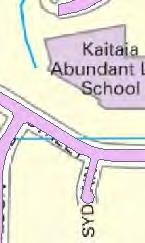
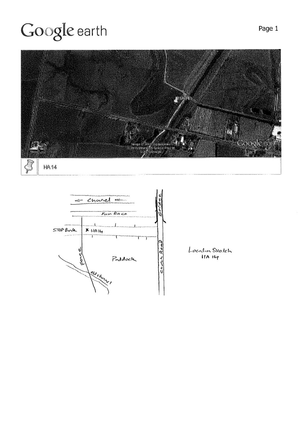
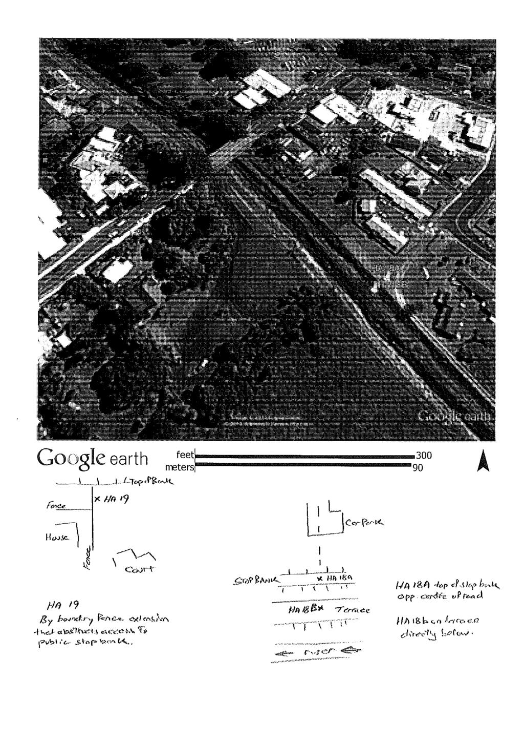
45 Path: P:\29154\ \WorkingMaterial\GIS\29154.Awanui.Overview.mxd Date: 9/04/2014 Time: 5:14:27 p.m. LEGEND! HA12A HA12 (!! (! ( Hand Auger Locations HA11A HA11! (! ( HA10! ( HA09 HA22! ( HA23! (! ( HA08! ( HA07! ( HA06! ( HA05A HA05!!( ( HA21! ( HA20! ( HA04 HA19! (! ( HA03A HA03! (! ( HA18A HA18B! (! ( HA02! ( HA17! (! ( DRAWN CHECKED Notes: Topo maps sourced from Terralink International (Copyright Terralink International Limited and its licensors APPROVED Tonkin & Taylor A3 SCALE 1:14,000 Environmental and Engineering Consultants 1 (km) SSKK Apr Carlton Gore Road, Auckland ARCFILE Awanui.Overview.mxd SCALE (AT A3 SIZE) 1:14,000 PROJECT No HA16 HA15! (! ( HA15A! ( NORTHLAND REGIONAL COUNCIL AWANUI FLOOD SCHEME UPGRADE GEOTECHNICAL INVESTIGATIONS Hand Auger Locations FIGURE No. Figure 1 Rev. 0
46 C3 Borehole log
47
48
49
50
51
52
53
54
55
56
57
58
59
60
61
62
63
64
65
66
67
68
69
70
71
72
73
74
75
76
77
78
79
80
81
82
83
84
85
86
87
88
89
90
91 Appendix D: Price Schedule breakdown
92 Items not included in the Price Schedule Additional survey Land and property acquisition Road shape modifications where roads are low at bridges Specific design Stopbank 1 Spillways 1-5 Item Description Unit Rate Quantity Amount 1.0 Establishment on site, set out, LS $30,000 1 $30,000 supervision, clean up on completion, location and protection of existing services permits, As Built plans, consent compliance and insurances. 2.0 Environmental control LS $15,000 1 $15, Modify existing services (lift MH's and extent SW outfalls) LS $5,000 1 $5, Earthworks $0 4.1 Remove vegetation to waste from LS $3,000 1 $3,000 works footprint 4.2 Strip top soil and stock pile for reuse m2 $ $60, Excavate to waste, dispose off site to m3 $ $420,000 form new spill ways. 4.4 Uplift topsoil from stockpile and re spread min 100mm depth on stopbank. 4.5 Grass all new surfaces, hydro seed/hay mulch. 5.0 Remove existing fences in work zone before works and reinstate after completion of works. m3 $ $155,000 m2 $ $60,000 m $ $12, Contingency LS $110,000 1 $110,000 Total $870,500 Stopbank 1: 0 m 1190 m Farm to Church Road Item Description Unit Rate Quantity Amount 1 Establishment on site, set out, LS $30,000 1 $30,000 supervision, clean up on completion, location and protection of existing services permits, As Built plans, consent compliance and insurances. 2 Environmental control LS $15,000 1 $15,000 3 Modify existing services (lift MH's and extent SW outfalls) LS $15,000 1 $15,000 4 Supply and construct mass block walls (to form inner or outer stopbank edge) m high m2 $180 0 $0 $0
93 m high m2 $ $30,000 5 Earthworks $0 5.1 Remove vegetation to waste from works footprint LS $10,000 1 $10, Strip top soil and stock pile for reuse m2 $ $5, Supply hard fill, bench, key into existing ground place compact, test and trim to shape stopbank. m3 $ $75, Uplift topsoil from stockpile and re spread min 100mm depth on stopbank. 5.5 Grass all new surfaces, hydro seed/hay mulch. 6 Remove existing fences in work zone before works and reinstate after completion of works. m2 $ $25,000 m2 $ $5,000 m $ $25,000 7 Stream works $0 7.1 Supply and construct rock grade control LS $0 structures 7.2 Supply and place rock rip rap stream bed/toe protection where instructed. m3 $0 8 Contingency LS $130,000 1 $130,000 Total $365,000 Stopbank 2: 0 m 630 m Church Road to Church Road drain Item Description Unit Rate Quantity Amount 1.0 Establishment on site, set out, LS $30,000 1 $30,000 supervision, clean up on completion, location and protection of existing services permits, As Built plans, consent compliance and insurances. 2.0 Environmental control LS $15,000 1 $15, Modify existing services (lift MH's and extent SW outfalls) LS $15,000 1 $15, Supply and construct mass block walls (to form inner or outer stopbank edge) m high m2 $180 0 $ m high m2 $ $18, Earthworks $0 5.1 Remove vegetation to waste from works footprint LS $5,000 1 $5, Strip top soil and stock pile for reuse m2 $ $6, Cut to fill of existing stopbank along edge of stream, bench, key into existing ground, compact, test and trim to shape new stopbank. m3 $ $12,000 $0
94 5.4 Supply hard fill, bench, key into existing ground place compact, test and trim to shape stopbank. 5.5 Uplift topsoil from stockpile and re spread min 100mm depth on stopbank. 5.6 Grass all new surfaces, hydro seed/hay mulch. 6.0 Remove existing fences in work zone before works and reinstate after completion of works. m3 $ $23,250 m2 $ $30,000 m2 $ $6, Stream works $0 7.1 Supply and construct rock grade control LS $0 structures 7.2 Supply and place rock rip rap stream bed/toe protection where instructed. 8.0 Supply and construct new sealed access way with kerb and channel - (allow 300mm depth pavement) m3 $0 m2 $ $60, Contingency LS $65,000 1 $65,000 Total $285,850 $0 Stopbank 3: 0 m 830 m Allen Bell Drive to Spillway Item Description Unit Rate Quantity Amount 1.0 Establishment on site, set out, LS $30,000 1 $30,000 supervision, clean up on completion, location and protection of existing services permits, As Built plans, consent compliance and insurances. 2.0 Environmental control LS $15,000 1 $15, Modify existing services (lift MH's and extent SW outfalls) LS $20,000 1 $20, Supply and construct mass block walls (to form inner or outer stopbank edge) m high m2 $ $10, m high m2 $0 5.0 Earthworks $0 5.1 Remove vegetation to waste from works footprint LS $5,000 1 $5, Strip top soil and stock pile for reuse m2 $ $8, Cut to fill from stream bank, bench, key into existing ground, compact, test and trim to shape new stopbank. m3 $ $28, Excavate to waste from channel bank. m3 $ $11, Uplift topsoil from stockpile and re m2 $ $42,500 spread min 100mm depth on stopbank. $0
95 5.6 Grass all new surfaces, hydro seed/hay mulch. 6.0 Remove existing fences in work zone before works and reinstate after completion of works. m2 $ $8,500 m $ $5, Stream works $0 7.1 Supply and construct rock grade control LS $0 structures 7.2 Supply and place rock rip rap stream bed/toe protection where instructed. m3 $0 8.0 Contingency LS $65,000 1 $65,000 Total $249,800 Stopbank 4/1: 0 m 940 m Sports Ground to Church Road Item Description Unit Rate Quantity Amount Establishment on site, set out, supervision, clean up on completion, location and protection of existing services permits, As Built plans, consent 1 compliance and insurances. LS $30,000 1 $30,000 2 Environmental control LS $15,000 1 $15,000 3 Modify existing services (lift MH's and extent SW outfalls) LS $15,000 1 $15,000 4 Supply and construct mass block walls (to form inner or outer stopbank edge) $ m high m2 $ m high m2 $0 5 Earthworks $0 Remove vegetation to waste from 5.1 works footprint LS $5,000 1 $5, Strip top soil and stock pile for reuse m2 $ $3, Supply hard fill, bench, key into existing ground place compact, test and trim to shape stopbank. m3 $ $19,500 Uplift topsoil from stockpile and re spread min 100mm depth on stopbank. m2 $ $18,000 Grass all new surfaces, hydro seed/hay mulch. m2 $ $3,600 6 Remove existing fences in work zone before works and reinstate after completion of works. m $20 50 $1,000 7 Stream works $ Supply and construct rock grade control structures LS $0 Supply and place rock rip rap stream bed/toe protection where instructed. m3 $0
96 8 Contingency LS $45,000 1 $45,000 Total $155,700 Stopbank 4/2: 940 m 2000 m Church Road to Allen Bell Drive Item Description Unit Rate Quantity Amount 1.0 Establishment on site, set out, supervision, clean up on completion, location and protection of existing services permits, As Built plans, consent compliance and insurances. LS $30,000 1 $30, Environmental control LS $15,000 1 $15, Modify existing services (lift MH's and extent SW outfalls) LS $25,000 1 $25, Supply and construct mass block walls (to form inner or outer stopbank edge) $ m high m2 $ $18, m high m2 $0 5.0 Earthworks $0 5.1 Remove vegetation to waste from works footprint LS $5,000 1 $5, Strip top soil and stock pile for reuse m2 $ $6, Cut to fill from stream banks, bench, key into existing ground, compact, test and trim to shape new stopbank. m3 $ $41, Excavate to waste channel bank. m3 $ $155, Uplift topsoil from stockpile and re spread min 100mm depth on stopbank. m2 $ $30, Grass all new surfaces, hydro seed/hay mulch. m2 $ $6, Remove existing fences in work zone before works and reinstate after completion of works. m $ $10, Stream works $0 7.1 Supply and construct rock grade control structures LS $0 7.2 Supply and place rock rip rap stream bed/toe protection where instructed. m3 $0 8.0 Contingency LS $110,000 1 $110,000 Total $451,500
97 Stopbank 4/3: 2000 m 2877 m Allen Bell Drive to Mathews Park Item Description Unit Rate Quantity Amount Establishment on site, set out, supervision, clean up on completion, location and protection of existing services permits, As Built plans, consent 1 compliance and insurances. LS $40,000 1 $40,000 2 Environmental control LS $15,000 1 $15,000 3 Modify existing services (lift MH's and extent SW outfalls) LS $25,000 1 $25,000 4 Supply and construct mass block walls (to form inner or outer stopbank edge) $ m high m2 $ $5, m high m2 $ $96,000 5 Earthworks $0 Remove vegetation to waste from 5.1 works footprint LS $5,000 1 $5, Strip top soil and stock pile for reuse m2 $ $5, Cut to fill from stream banks, bench, key into existing ground, compact, test and trim to shape new stopbank. m3 $ $53, Excavate to waste channel bank. m3 $ $90, Uplift topsoil from stockpile and re spread min 100mm depth on stopbank. m2 $ $27,500 Grass all new surfaces, hydro seed/hay mulch. m2 $ $5,500 6 Remove existing fences in work zone before works and reinstate after completion of works. m $ $10,000 7 Stream works $0 7.1 Supply and construct rock grade control structures LS $0 Supply and place rock rip rap stream 7.2 bed/toe protection where instructed. m3 $0 8 Contingency LS $135,000 1 $135,000 Total $513,400 Whangatane Spillway Weir Item Description Unit Rate Quantity Amount 1.0 Establishment on site, set out, LS $20,000 1 $20,000 supervision, clean up on completion, location and protection of existing services permits, As Built plans, consent compliance and insurances. 2.0 Environmental control LS $15,000 1 $15,000
98 3.0 Modify existing services (lift MH's and extent SW outfalls) LS $5,000 1 $5, Earthworks $0 4.1 Remove vegetation to waste from LS $3,000 1 $3,000 works footprint 4.2 Strip top soil from works footprint and stock pile for reuse 4.3 Cut to waste spill way invert 0-300m to new invert level 4.4 Uplift topsoil from stockpile and re spread min 100mm depth. 4.5 Grass all new surfaces, hydro seed/hay mulch. m2 $ $16,000 m3 $ $372,000 m2 $ $80,000 m2 $ $16, Weir $0 5.1 Excavate supply all materials and labour to construct gabion baskets on approved geotextile to form weir crest. m3 $ $142, Excavate supply all materials and labour to construct gabion baskets on approved geotextile to form weir abutments. 5.3 Excavate supply all materials and labour to construct reno mattress on approved geotextile to form weir crest. m3 $ $89,700 m2 $ $17, Contingency LS $135,000 1 $135,000 Total $911,700 Stopbank 5/1: 0 m 5290 m Weir to Quarry Road Item Description Unit Rate Quantity Amount 1.0 Establishment on site, set out, supervision, clean up on completion, location and protection of existing services permits, As Built plans, consent compliance and insurances. LS $20,000 1 $20, Environmental control LS $15,000 1 $15, Modify existing services (lift MH's and extent SW outfalls) LS $5,000 1 $5, Earthworks $0 4.1 Remove vegetation to waste from works footprint LS $10,000 1 $10, Strip top soil from works footprint and stock pile for reuse m2 $ $25, Cut to fill from adjoining land, bench, key into existing banks, compact, test and trim to shape new stopbank. m3 $ $270,000
99 4.4 Uplift topsoil from stockpile and re spread min 100mm depth on stopbank. m2 $ $125, Grass all new surfaces, hydro seed/hay mulch. m2 $ $25, Reinstate borrow area LS $5,000 1 $5, Fencing $0 5.1 Remove before works and reinstate after works fences in the work zone. m $ $7, Contingency LS $65,000 1 $65,000 Total $572,500 Stopbank 5/2: 5290 m 6940 m Quarry Road to SH10 Item Description Unit Rate Quantity Amount 1.0 Establishment on site, set out, supervision, clean up on completion, location and protection of existing services permits, As Built plans, consent compliance and insurances. LS $20,000 1 $20, Environmental control LS $5,000 1 $5, Modify existing services (lift MH's and extent SW outfalls) LS $2,000 1 $2, Earthworks $0 4.1 Remove vegetation to waste from works footprint LS $2,000 1 $2, Strip top soil from works footprint and stock pile for reuse m2 $1 500 $ Cut to fill from adjoining land, bench, key into existing banks, compact, test and trim to shape new stopbank. m3 $ $10, Uplift topsoil from stockpile and re spread min 100mm depth on stopbank. m2 $5 500 $2, Grass all new surfaces, hydro seed/hay mulch. m2 $1 500 $ Reinstate borrow area LS $1,000 1 $1, Fencing 5.1 Remove before works and reinstate after works fences in the work zone. m $25 50 $1, Contingency LS $25,000 1 $25,000 Total $70,250
100 Stopbank 5/3: 6940 m 7950 m SH10 to end Item Description Unit Rate Quantity Amount 1.0 Establishment on site, set out, supervision, clean up on completion, location and protection of existing services permits, As Built plans, consent compliance and insurances. LS $20,000 1 $20, Environmental control LS $15,000 1 $15, Modify existing services (lift MH's and extent SW outfalls) LS $5,000 1 $5, Earthworks $0 4.1 Remove vegetation to waste from works footprint LS $7,000 1 $7, Strip top soil from works footprint and stock pile for reuse m2 $ $6, Cut to fill from adjoining land, bench, key into existing banks, compact, test and trim to shape new stopbank. m3 $ $192, Uplift topsoil from stockpile and re spread min 100mm depth on stopbank. m2 $ $30, Grass all new surfaces, hydro seed/hay mulch. m2 $ $6, Reinstate borrow area LS $5,000 1 $5, Fencing $0 5.1 Remove before works and reinstate after works fences in the work zone. m $ $5, Contingency LS $65,000 1 $65,000 Total $356,000 Stream bank protection works Item Description Unit Rate Quantity Amount 1.0 Establishment on site, set out, supervision, clean up on completion, location and protection of existing services permits, As Built plans, consent compliance and insurances. (5%) LS $100,000 1 $312, Environmental controls (5%) LS $15,000 1 $312, Earthworks m $ $625, Bank toe protection & bank stabilisation works (including excavation of material, laying of fileter fabric, supply and placement of rock to design levels) - HIGH priority areas m $ $495, Bank toe protection & bank stabilisation works (including excavation of material, laying of fileter m $ $540,000
101 fabric, supply and placement of rock to design levels) - MEDIUM priority areas 3.3 Bank toe protection & bank stabilisation works (including excavation of material, laying of fileter fabric, supply and placement of rock to design levels) - LOWER priority areas m $ $4,590, Contingency (25%) LS $1,718,750 1 $1,718,750 Total $8,593,750

102
Flood Hazard Assessment of Potential Growth Areas Palmerston North City: Ashhurst
 Flood Hazard Assessment of Potential Growth Areas Palmerston North City: Ashhurst Report prepared for Palmerston North City Council by Philip Wallace River Edge Consulting Limited May 2013 Table of Contents
Hydraulic Capacity Review of the Waioho Stream and Canal
 Hydraulic Capacity Review of the Waioho Stream and Canal Prepared by Ingrid Pak, Environmental Engineer Environment Bay of Plenty October 2006 5 Quay Street P O Box 364 Whakatane NEW ZEALAND ISSN 1176-5550
COACHELLA VALLEY WATER DISTRICT GUIDELINE K-2 SLOPE (BANK) PROTECTION DESIGN GUIDANCE
 PROTECTION DESIGN GUIDANCE") COACHELLA VALLEY WATER DISTRICT GUIDELINE K-2 SLOPE (BANK) PROTECTION DESIGN GUIDANCE K.2.1 General Requirements The design and construction of slope protection works may be required for several types
COACHELLA VALLEY WATER DISTRICT GUIDELINE K-2 SLOPE (BANK) PROTECTION DESIGN GUIDANCE K.2.1 General Requirements The design and construction of slope protection works may be required for several types
Chapter 4. Drainage Report and Construction Drawing Submittal Requirements
 4.0 Introduction The requirements presented in this section shall be used to aid the design engineer or applicant in the preparation of drainage reports, drainage studies, and construction drawings for
Report. Inflow Design Flood Control System Plan Belle River Power Plant East China, Michigan. DTE Energy Company One Energy Plaza, Detroit, MI
 Report Inflow Design Flood Control System Plan Belle River Power Plant East China, Michigan DTE Energy Company One Energy Plaza, Detroit, MI October 14, 2016 NTH Project No. 62-160047-04 NTH Consultants,
Hydraulic Capacity Review Rangitaiki River and Reids Floodway
 Hydraulic Capacity Review Rangitaiki River and Reids Floodway February 2011 Contents Executive Summary... 1 1 Introduction... 2 2 Hydrology and Sea Levels... 2 2.1 Design Hydrographs... 2 2.2 Sea Level...
Report. Inflow Design Flood Control System Plan St. Clair Power Plant St. Clair, Michigan. DTE Energy Company One Energy Plaza, Detroit, MI
 Report Inflow Design Flood Control System Plan St. Clair Power Plant St. Clair, Michigan DTE Energy Company One Energy Plaza, Detroit, MI October 14, 2016 NTH Project No. 62-160047-04 NTH Consultants,
INFLOW DESIGN FLOOD CONTROL SYSTEM PLAN 40 C.F.R. PART PLANT YATES ASH POND 3 (AP-3) GEORGIA POWER COMPANY
 GEORGIA POWER COMPANY") INFLOW DESIGN FLOOD CONTROL SYSTEM PLAN 40 C.F.R. PART 257.82 PLANT YATES ASH POND 3 (AP-3) GEORGIA POWER COMPANY EPA s Disposal of Coal Combustion Residuals from Electric Utilities Final Rule (40 C.F.R.
INFLOW DESIGN FLOOD CONTROL SYSTEM PLAN 40 C.F.R. PART 257.82 PLANT YATES ASH POND 3 (AP-3) GEORGIA POWER COMPANY EPA s Disposal of Coal Combustion Residuals from Electric Utilities Final Rule (40 C.F.R.
Effects on Flood Levels from the Proposed Whakatane Marina
 Effects on Flood Levels from the Proposed Whakatane Marina Peter West, Graduate Engineer Environment Bay of Plenty September 2004 5 Quay Street P O Box 364 Whakatane NEW ZEALAND ISSN 1176-5550 Working
PEARCE CREEK CONFINED DISPOSAL AREA MODIFICATION
 US Army Corps of Engineers Philadelphia District PEARCE CREEK CONFINED DISPOSAL AREA MODIFICATION CECIL COUNTY MARYLAND STORMWATER MANAGEMENT PLAN NARRATIVE INITIAL SUBMISSION JUNE 2014 1 PEARCE CREEK
3.3 Acceptable Downstream Conditions
 iswm TM Criteria Manual - = Not typically used or able to meet design criterion. 1 = The application and performance of proprietary commercial devices and systems must be provided by the manufacturer and
Appendix E: Bridge Site Information Summary
 BRIDGE MANUAL E - 1 APPENDIX E: BRIDGE SITE INFORMATION SUMMARY Appendix E: Bridge Site Information Summary Table of Contents Notes..E 3 Section 1: Basic Information..E 4 Section 2: River Data..E 8 Section
INFLOW DESIGN FLOOD CONTROL SYSTEM PLAN PLANT GREENE COUNTY ASH POND ALABMA POWER COMPANY
 INFLOW DESIGN FLOOD CONTROL SYSTEM PLAN PLANT GREENE COUNTY ASH POND ALABMA POWER COMPANY Section 257.82 of EPA s regulations requires the owner or operator of an existing or new CCR surface impoundment
TULLAMORE FLOOD RISK ASSESSMENT AND MANAGEMENT STUDY
 TULLAMORE FLOOD RISK ASSESSMENT AND MANAGEMENT STUDY FINAL HYDRAULICS REPORT 1794/RP/004/C June 2008 FRAM Section Engineering Services Office of Public Works Doc. No. 1794/RP/004/C ii June 2008 INDEX OF
APPENDIX E APPENDIX E ESTIMATING RUNOFF FOR SMALL WATERSHEDS
 APPENDIX E ESTIMATING RUNOFF FOR SMALL WATERSHEDS March 18, 2003 This page left blank intentionally. March 18, 2003 TABLES Table E.1 Table E.2 Return Frequencies for Roadway Drainage Design Rational Method
STORM DRAINAGE DESIGN MANUAL
 Appendix I STORM DRAINAGE DESIGN MANUAL by: SUNGATE DESIGN GROUP, P.A. GEN ERAL DESIGN STAN DARDS AN D POLICIES 1. STREET AND LOCAL DRAINAGE Discharge estimates for specified design storms shall be calculated
INITIAL RUN-ON AND RUN-OFF CONTROL PLAN 40 C.F.R. PART 257
 INITIAL RUN-ON AND RUN-OFF CONTROL PLAN 40 C.F.R. PART 257.81 HUFFAKER ROAD (PLANT HAMMOND) PRIVATE INDUSTRIAL LANDFILL (HUFFAKER ROAD LANDFILL) GEORGIA POWER COMPANY EPA s Disposal of Coal Combustion
FORM B: DAMMING AND DIVERSION OF WATER
 APPLICATION FOR RESOURCE CONSENT FORM B: DAMMING AND DIVERSION OF WATER NOTES Resource use activities must meet all the conditions of any relevant Permitted Activity Rules in the Waikato Regional Plan
REVIEW OF THE BENEFITS OF THE OKERE GATES CONTROL STRUCTURE LAKE ROTOITI
 REVIEW OF THE BENEFITS OF THE OKERE GATES CONTROL STRUCTURE LAKE ROTOITI Robert Kelly (Aurecon) ABSTRACT Human intervention to our lakes and channels can take many turns and result in profound immediate
Stormwater Erosion Control & Post-Construction Plans (Stormwater Quality Plans)
") Stormwater Erosion Control & Post-Construction Plans (Stormwater Quality Plans) Allen County Stormwater Plan Submittal Checklist The following items must be provided when applying for an Allen County Stormwater
Stormwater Erosion Control & Post-Construction Plans (Stormwater Quality Plans) Allen County Stormwater Plan Submittal Checklist The following items must be provided when applying for an Allen County Stormwater
Bridge Planning Updates. Bridge Planning Practitioners Workshop April 2012
 Bridge Planning Updates Bridge Planning Practitioners Workshop April 2012 Bridge Website Bridge Website Bridge Website Bridge Website BPG 11 Stormwater Management at Rural Bridges Released July 2010 Documents
Learning objectives. Upon successful completion of this lecture, the participants will be able to:
 Solomon Seyoum Learning objectives Upon successful completion of this lecture, the participants will be able to: Describe and perform the required step for designing sewer system networks Outline Design
Waikato Regional Council Technical Report 2013/42 Te Puru flood protection scheme design report
 Waikato Regional Council Technical Report 2013/42 Te Puru flood protection scheme design report www.waikatoregion.govt.nz ISSN 2230-4355 (Print) ISSN 2230-4363 (Online) Prepared by: Megan Wood (Wainui
INFLOW DESIGN FLOOD CONTROL SYSTEM PLAN 40 C.F.R. Part PLANT MCINTOSH ASH POND 1 GEORGIA POWER COMPANY
 INFLOW DESIGN FLOOD CONTROL SYSTEM PLAN 40 C.F.R. Part 257.82 PLANT MCINTOSH ASH POND 1 GEORGIA POWER COMPANY EPA s Disposal of Coal Combustion Residuals from Electric Utilities Final Rule (40 C.F.R. Part
APPENDIX E ESTIMATING RUNOFF FROM SMALL WATERSHEDS
 ESTIMATING RUNOFF FROM SMALL WATERSHEDS June 2011 THIS PAGE LEFT BLANK INTENTIONALLY. June 2011 TABLES Table E.1 Table E.2 Return Frequencies for Roadway Drainage Design Rational Method Values June 2011
Chapter 4. Drainage Report and Construction Drawing Submittal Requirements
 4.0 Introduction The requirements presented in this section shall be used to aid the design engineer or applicant in the preparation of drainage reports, drainage studies, and construction drawings for
Low Gradient Velocity Control Short Term Steep Gradient Channel Lining Medium-Long Term Outlet Control Soil Treatment Permanent [1]
![Low Gradient Velocity Control Short Term Steep Gradient Channel Lining Medium-Long Term Outlet Control Soil Treatment Permanent [1]](/thumbs/83/88729038.jpg "Low Gradient Velocity Control Short Term Steep Gradient Channel Lining Medium-Long Term Outlet Control Soil Treatment Permanent [1]") Diversion Channels DRAINAGE CONTROL TECHNIQUE Low Gradient Velocity Control Short Term Steep Gradient Channel Lining Medium-Long Term Outlet Control Soil Treatment Permanent [1] [1] The design of permanent
Diversion Channels DRAINAGE CONTROL TECHNIQUE Low Gradient Velocity Control Short Term Steep Gradient Channel Lining Medium-Long Term Outlet Control Soil Treatment Permanent [1] [1] The design of permanent
Modernization of High Hazard Dams in Austin, Texas. TFMA Spring Conference May 23, 2007
 Modernization of High Hazard Dams in Austin, Texas TFMA Spring Conference May 23, 2007 Modernization of High Hazard Dams in Austin, Texas City of Austin Glen Taffinder, P.E. Stormwater Pond Dam Safety
3.5 Hydrology & Hydraulics
 3.5 Hydrology & Hydraulics 3.5.1 Purpose The purpose of this section is to provide results from the analysis and assessment of the impact of the proposed Carmichael Rail Alignment (Option 11 Revision 1)
Appendix 11. Erosion and Sediment Control Management Plan. Appendix 11
 Appendix 11 Erosion and Sediment Control Management Plan Appendix 11 OTAIKA QUARRY - PROPOSED OVERBURDEN DISPOSAL AREA Application for Land Use Consent and Assessment of Environmental Effects Otaika Quarry
DRAINAGE SUBMITTAL CHECKLIST
 Project Name: Firm Name: Map ID: Engineer: Address: City: State: Zip: Phone Number: Fax Number: Property Owner: Address: City: State: Zip: Reviewed By: Date Received: Date Accepted for Review: The following
Chapter 7. Street Drainage. 7.0 Introduction. 7.1 Function of Streets in the Drainage System. 7.2 Street Classification
 7. Introduction This chapter summarizes methods to evaluate runoff conveyance in various street cross sections and curb types in the Town of Castle Rock and identifies acceptable upper limits of street
Appendix K Civil Engineering
 Appendix K Civil Engineering Fargo-Moorhead Metropolitan Area Flood Risk Management Final Feasibility Report and Environmental Impact Statement Prepared by: U.S. Army Corps of Engineers St. Paul District
Prepared for: City of Jeffersonville. November Prepared by
 JEFFERSONVILLE STORMWATER MASTER PLAN HYDRAULICS APPENDIX JEFFERSONVILLE, INDIANA Prepared for: City of Jeffersonville November 2011 Prepared by Christopher B. Burke Engineering, Ltd. 115 W. Washington
INITIAL INFLOW DESIGN FLOOD CONTROL SYSTEM PLAN PLANT MCMANUS ASH POND A (AP-1) 40 CFR
 40 CFR") INITIAL INFLOW DESIGN FLOOD CONTROL SYSTEM PLAN PLANT MCMANUS ASH POND A (AP-1) 40 CFR 257.82 EPA s Disposal of Coal Combustion Residuals from Electric Utilities Final Rule (40 C.F.R. Part 257 and Part
INITIAL INFLOW DESIGN FLOOD CONTROL SYSTEM PLAN PLANT MCMANUS ASH POND A (AP-1) 40 CFR 257.82 EPA s Disposal of Coal Combustion Residuals from Electric Utilities Final Rule (40 C.F.R. Part 257 and Part
CLAY STREET BRIDGE REPLACEMENT
 HYDROLOGY /HYDRAULICS REPORT. EL DORADO COUNTY CLAY STREET BRIDGE REPLACEMENT Prepared by: Joseph Domenichelli Domenichelli & Associates 1107 Investment Blvd., Suite 145 El Dorado Hills, California 95762
CONSTRUCTION PLAN CHECKLIST
 CONSTRUCTION PLAN CHECKLIST The design engineer is responsible for ensuring that plans submitted for city review are in accordance with this checklist. It is requested that the executed checklist be submitted
INFLOW DESIGN FLOOD CONTROL SYSTEM PLAN PLANT GASTON GYPSUM POND ALABAMA POWER COMPANY
 INFLOW DESIGN FLOOD CONTROL SYSTEM PLAN PLANT GASTON GYPSUM POND ALABAMA POWER COMPANY Section 257.82 of EPA s regulations requires the owner or operator of an existing or new CCR surface impoundment or
Bridge Replacement Project. Preliminary Hydraulic Study. Lincoln, California BRLS-5089 (021) BRIDGE 19C Mcbean Park Drive at Auburn Ravine
 BRIDGE 19C Mcbean Park Drive at Auburn Ravine") Bridge Replacement Project Preliminary Hydraulic Study Lincoln, California BRLS-5089 (021) BRIDGE 19C 0059 Mcbean Park Drive at Auburn Ravine Prepared By: Prepared By: Date 11/25/2014 Thomas S. Plummer
Bridge Replacement Project Preliminary Hydraulic Study Lincoln, California BRLS-5089 (021) BRIDGE 19C 0059 Mcbean Park Drive at Auburn Ravine Prepared By: Prepared By: Date 11/25/2014 Thomas S. Plummer
INFLOW DESIGN FLOOD CONTROL SYSTEM PLAN PLANT BARRY ASH POND ALABAMA POWER COMPANY
 INFLOW DESIGN FLOOD CONTROL SYSTEM PLAN PLANT BARRY ASH POND ALABAMA POWER COMPANY Section 257.82 of EPA s regulations requires the owner or operator of an existing or new CCR surface impoundment or any
HISTORY OF CONSTRUCTION 40 CFR (c)(1)(i)-(xii) PLANT WANSLEY ASH POND (AP-1) GEORGIA POWER COMPANY. Carrollton, Georgia 30116
(1)(i)-(xii) PLANT WANSLEY ASH POND (AP-1) GEORGIA POWER COMPANY. Carrollton, Georgia 30116") (i) Site Name and Ownership Information: HISTORY OF CONSTRUCTION 40 CFR 257.73(c)(1)(i)-(xii) PLANT WANSLEY ASH POND (AP-1) GEORGIA POWER COMPANY Site Name: Site Location: Site Address: Owner: Owner Address:
(i) Site Name and Ownership Information: HISTORY OF CONSTRUCTION 40 CFR 257.73(c)(1)(i)-(xii) PLANT WANSLEY ASH POND (AP-1) GEORGIA POWER COMPANY Site Name: Site Location: Site Address: Owner: Owner Address:
Application for resource consent Form B Damming and diversion of water
 Application for resource consent Form B Damming and diversion of water Notes Resource use activities must meet all the conditions of any relevant Permitted Activity Rules in the Waikato Regional Plan or
HISTORY OF CONSTRUCTION 40 CFR (c)(1)(i) (xii) PLANT HAMMOND ASH POND (AP 2) GEEORGIA POWER COMPANY
(1)(i) (xii) PLANT HAMMOND ASH POND (AP 2) GEEORGIA POWER COMPANY") HISTORY OF CONSTRUCTION 40 CFR 257.73(c)(1)(i) (xii) PLANT HAMMOND ASH POND (AP 2) GEEORGIA POWER COMPANY (i) Site Name and Ownership Information: Site Name: Plant Hammond Site Location: Site Address:
HISTORY OF CONSTRUCTION 40 CFR 257.73(c)(1)(i) (xii) PLANT HAMMOND ASH POND (AP 2) GEEORGIA POWER COMPANY (i) Site Name and Ownership Information: Site Name: Plant Hammond Site Location: Site Address:
Appendix D Flood Assessment
 Appendix D Flood Assessment Mount Pleasant Operation Rail Modification Flood Assessment MACH Energy Australia Pty Ltd 0744-09-B3, 19 December 2017 Report Title Client Report Number Mount Pleasant Operation
Jacobi, Toombs, and Lanz, Inc.
 Area 5: Blackiston Mill Road at Dead Man's Hollow Flooding Assessment Jacobi, Toombs, and Lanz, Inc. This document summarizes an assessment of drainage and flooding concerns and provides recommendations
Section 6: Stormwater Improvements
 Section 6: Stormwater Improvements A major objective of this study was to identify opportunities for improvements to address the widespread water quality impairments caused by stormwater runoff in the
Project Drainage Report
 Design Manual Chapter 2 - Stormwater 2A - General Information 2A-4 Project Drainage Report A. Purpose The purpose of the project drainage report is to identify and propose specific solutions to stormwater
Pakenham East Precinct Structure Plan. Deep Creek Corridor Proposals
 Hydrological and Environmental Engineering Pakenham East Precinct Structure Plan Deep Creek Corridor Proposals 5 October 2014 Report by: Valerie Mag BE Civil (Hons), M Eng Sci Stormy Water Solutions stormywater@optusnet.com.au
USE OF GABIONS IN SMALL HYDRAULIC WORKS
 USE OF GABIONS IN SMALL HYDRAULIC WORKS SECTION 1 SITE SELECTION FOR SMALL DAMS Table of Contents 1.1 CLASSIFICATION ACCORDING TO USE... 2 1.2 CLASSIFICATION BY HYDRAULIC DESIGN (site and basin requirements)...2
Review of the Flood Carrying Capacity of the Tarawera River below State Highway 30
 Review of the Flood Carrying Capacity of the Tarawera River below State Highway 30 Prepared by Verna Arts, Engineering Hydrologist Environment Bay of Plenty April 2005 5 Quay Street P O Box 364 Whakatane
DRAINAGE REVIEW: Berwick Health and Education Precinct. for. Victorian Planning Authority
 DRAINAGE REVIEW: Berwick Health and Education Precinct for Victorian Planning Authority April 2017 Document history Revision: Revision no. 03 Author/s Jonathon McLean Approved Jonathon McLean Distribution:
RETENTION BASIN EXAMPLE
 -7 Given: Total Tributary Area = 7.5 ac o Tributary Area within Existing R/W = 5.8 ac o Tributary Area, Impervious, Outside of R/W = 0.0 ac o Tributary Area, Pervious, Outside of R/W = 1.7 ac o Tributary
Lyon Creek Cedar Way Stormwater Detention Dam Operation and Maintenance Manual
 Lyon Creek Cedar Way Stormwater Detention Dam Operation and Maintenance Manual Prepared by: Mike Shaw Stormwater Program Manager City of Mountlake Terrace January 2010 Section I General Information This
Water Control Structures Selected Design Guidelines Alberta Environment Page 13-1
 Alberta Environment Page 13-1 13.0 DROP INLET SPILLWAYS 13.1 General The drop inlet spillway is commonly used for providing flood protection for earth dams which have smaller reservoirs and/or smaller
Water Resources Management Plan
 P L Y M O U T H M I N N E S O T A Appendix D: The developed a to analyze and minimize the impact of existing and future development on the City s natural resources. It is important to the City to have
Informational Meeting- March 31, Boxelder B-2/B-3 Watershed Planning Study
 Informational Meeting- March 31, 2016 Boxelder B-2/B-3 Watershed Planning Study Agenda Introductions Work Completed to Date Phase 1 Evaluations Alternatives Evaluations Economic Evaluations Draft Watershed
CHECKLIST FOR STREETS, INLETS, AND STORM SEWER DESIGN
 CHECKLIST FOR STREETS, INLETS, I. STREET CLASSIFICATION AND DESIGN CRITERIA A. Determine drainage classification for the roadway section using Table 7-1 or Table 7-2. B. Determine the allowable flow depth
DESIGN BULLETIN #16/2003 (Revised July 2007) Drainage Guidelines for Highways Under Provincial Jurisdiction in Urban Areas.
 Drainage Guidelines for Highways Under Provincial Jurisdiction in Urban Areas.") Drainage Guidelines for Highways Under Provincial Jurisdiction in Urban Areas. July 2007 Update to Design Bulletin #16/2003: Added under Design Criteria Culverts of 600mm diameter are commonly used to
Drainage Guidelines for Highways Under Provincial Jurisdiction in Urban Areas. July 2007 Update to Design Bulletin #16/2003: Added under Design Criteria Culverts of 600mm diameter are commonly used to
NOT-MODELLING FOR STORMWATER AROUND THE KAIKOURA ALLUVIAL FANS
 NOT-MODELLING FOR STORMWATER AROUND THE KAIKOURA ALLUVIAL FANS Mark Pennington Pattle Delamore Partners Limited, Kaikoura, New Zealand ABSTRACT The Kaikoura plains are formed by a process of coalescing
Context of Extreme Alberta Floods
 Context of Extreme Alberta Floods Introduction Design of water management and stream crossing infrastructure requires determination of hydrotechnical design parameters. These parameters often consist of
APPENDIX A HYDROLOGIC AND HYDRAULIC ANALYSIS
 APPENDIX A HYDROLOGIC AND HYDRAULIC ANALYSIS GENERAL The Hydrologic and Hydraulic information presented in this appendix is provided as a supplement to the Dallas Floodway Extension General Re-evaluation
Chapter 11 Culverts and Bridges
 Chapter 11 Table of Contents 11-1 Introduction... 1 11-2 General Design... 1 11-2-1 Design Criteria... 1 11-2-2 Design Flows... 1 11-2-3 Permitting and Regulations... 2 11-2-4 Aesthetics and Safety...
Chapter 11 Culverts and Bridges
 Chapter 11 Table of Contents 11-1 Introduction... 1 11-2 General Design... 1 11-2-1 Design Criteria... 1 11-2-2 Design Flows... 1 11-2-3 Permitting and Regulations... 2 11-2-4 Aesthetics and Safety...
Standards for Soil Erosion and Sediment Control in New Jersey May 2012 STANDARD FOR SLOPE PROTECTION STRUCTURES. Definition
 STANDARD FOR SLOPE PROTECTION STRUCTURES Definition Structures to safely conduct surface runoff from the top of a slope to the bottom of the slope. Purpose The purpose of this practice is to convey storm
Distribution Restriction Statement Approved for public release; distribution is unlimited.
 CECW-EH-Y Regulation No. 1110-2-1464 Department of the Army U.S. Army Corps of Engineers Washington, DC 20314-1000 Engineering and Design HYDROLOGIC ANALYSIS OF WATERSHED RUNOFF Distribution Restriction
THE IMPORTANCE OF DETAILED FLOOD IMFORMATION FOR LEVEE DESIGN AND UPGRADE
 THE IMPORTANCE OF DETAILED FLOOD IMFORMATION FOR LEVEE DESIGN AND UPGRADE Felix Taaffe 1, Erin Askew 1, Mark Babister 1, Julie Rogers 2, 1 WMAwater, Sydney, NSW 2 Deniliquin Council, NSW Abstract The use
Environment People Economy Mobility Living
 Activity: Flood Protection and Control Works How this Activity Contributes to Related Community Outcomes This Activity contributes primarily to the Community Outcomes of Environment, People, Economy, Mobility
DRAINAGE DESIGN DOCUMENTATION
 June, 2017 DRAINAGE DESIGN DOCUMENTATION (An expansion of the Stormwater Management Design Report) Note: This report outline is not all-inclusive. There may be situations when information not included
498 AVE BRIDGE HYDRAULICS INVESTIGATION OF IMPACTS RELATED TO TOWN OF HIGH RIVER FLOOD MITIGATION WORKS
 498 AVE BRIDGE HYDRAULICS INVESTIGATION OF IMPACTS RELATED TO TOWN OF HIGH RIVER FLOOD MITIGATION WORKS Submitted to: M.D. of Foothills No. 31 High River, Alberta Submitted by: Amec Foster Wheeler Environment
PRELIMINARY DRAINAGE STUDY
 PRELIMINARY DRAINAGE STUDY For 34 th & J Residences 3402 J St. San Diego, CA 92102 A.P.N 545-250-08 Prepared By: Kenneth J. Discenza, P.E. Site Design Associates, Inc. 1016 Broadway, Suite A El Cajon,
Stream Reaches and Hydrologic Units
 Chapter United States 6 Department of Agriculture Natural Resources Conservation Service Chapter 6 Stream Reaches and Hydrologic Units Rain clouds Cloud formation Precipitation Surface runoff Evaporation
Considerations In Estimating Tailwater Elevations
 Considerations In Estimating Tailwater Elevations by Alphonse (Al) J. Stewart, P.E., President www.suncam.com Page 1 of 39 ************************************************************************ This
ZONING ORDINANCE FOR THE ZONED UNINCORPORATED AREAS ARTICLE 1500 OF PUTNAM COUNTY, WEST VIRGINIA Page 149 ARTICLE 1500 DRAINAGE AND STORM SEWERS
 OF PUTNAM COUNTY, WEST VIRGINIA Page 149 ARTICLE 1500 DRAINAGE AND STORM SEWERS 1500.01 GENERAL REQUIREMENTS 1500.02 NATURE OF STORM WATER FACILITIES 1500.03 DRAINAGE EASEMENTS 1500.04 STORM WATER MANAGEMENT
MCKAYS CREEK HYDRO-ELECTRIC POWER SCHEME ENHANCEMENT FEASIBILITY AND SCOPING REPORT PREPARED FOR SCHEME RECONSENTING
 i MCKAYS CREEK HYDRO-ELECTRIC POWER SCHEME ENHANCEMENT FEASIBILITY AND SCOPING REPORT PREPARED FOR SCHEME RECONSENTING ii Table of contents 1 Enhancement Scope of Work 1 1.1 Introduction 1 2 McKays Intake
Chapter 11 Culverts and Bridges
 Chapter 11 Culverts and Bridges Contents 1.0 Introduction... 1 2.0 General Design... 1 2.1 Design Criteria... 1 2.2 Design Flows... 1 2.3 Permitting and Regulations... 1 2.4 Aesthetics and Safety... 2
of the Crump weir Modelling of composite type variation
 Modelling of composite type variation of the Crump weir Ashley Maritz BEng Honours Student Department of Civil Engineering University of Pretoria aamaritz9@gmail.com Dr Pieter Wessels Specialist Engineer
4. Present Activities and Roles
 4. Present Activities and Roles The present missions, authorities, activities and roles of the various agencies involved with flood protection, floodplain management and flood-damage reduction are identified
Hydrotechnical Design Guidelines for Stream Crossings
 Hydrotechnical Design Guidelines for Stream Crossings Introduction Design of stream crossings and other in-stream highway facilities requires estimation of design highwater elevation and mean channel velocity.
FIRM NAME DESIGNER: CHECKER: DATE: FPID #: DESCRIPTION: COUNTY: DRAINAGE DESIGN CHECKLIST. Designers Initials. Checkers Initials.
 I. Drainage Report A. Executive Summary - Brief Overview of Project Drainage Design B. Project Description 1. Existing Conditions 2. Proposed Project Conditions 3. Project Justification Narrative - Basin
Hydrology of the November 2005 Floods Dr David Kemp Senior Stormwater Engineer Department for Transport, Energy & Infrastructure
 Hydrology of the November 2005 Floods Dr David Kemp Senior Stormwater Engineer Department for Transport, Energy & Infrastructure Introduction The floods of November 2005 were significant in that the effects
SECTION IV WATERSHED TECHNICAL ANALYSIS
 A. Watershed Modeling SECTION IV WATERSHED TECHNICAL ANALYSIS An initial step in the preparation of this stormwater management plan was the selection of a stormwater simulation model to be utilized. It
Low Gradient Velocity Control Short Term Steep Gradient Channel Lining Medium-Long Term Outlet Control [1] Soil Treatment Permanent
![Low Gradient Velocity Control Short Term Steep Gradient Channel Lining Medium-Long Term Outlet Control [1] Soil Treatment Permanent](/thumbs/86/94770055.jpg "Low Gradient Velocity Control Short Term Steep Gradient Channel Lining Medium-Long Term Outlet Control [1] Soil Treatment Permanent") Slope Drains DRAINAGE CONTROL TECHNIQUE Low Gradient Velocity Control Short Term Steep Gradient Channel Lining Medium-Long Term Outlet Control [1] Soil Treatment Permanent [1] Slope drains can act as outlet
Slope Drains DRAINAGE CONTROL TECHNIQUE Low Gradient Velocity Control Short Term Steep Gradient Channel Lining Medium-Long Term Outlet Control [1] Soil Treatment Permanent [1] Slope drains can act as outlet
Low Gradient Velocity Control Short Term Steep Gradient Channel Lining Medium-Long Term Outlet Control [1] Soil Treatment Permanent
![Low Gradient Velocity Control Short Term Steep Gradient Channel Lining Medium-Long Term Outlet Control [1] Soil Treatment Permanent](/thumbs/87/96161482.jpg "Low Gradient Velocity Control Short Term Steep Gradient Channel Lining Medium-Long Term Outlet Control [1] Soil Treatment Permanent") Slope Drains DRAINAGE CONTROL TECHNIQUE Low Gradient Velocity Control Short Term Steep Gradient Channel Lining Medium-Long Term Outlet Control [1] Soil Treatment Permanent [1] Slope drains can act as outlet
Slope Drains DRAINAGE CONTROL TECHNIQUE Low Gradient Velocity Control Short Term Steep Gradient Channel Lining Medium-Long Term Outlet Control [1] Soil Treatment Permanent [1] Slope drains can act as outlet
A part of BMT in Energy and Environment Kosciusko Avenue Main Drain Catchment Drainage / Flood Study Draft Report
 A part of BMT in Energy and Environment Kosciusko Avenue Main Drain Catchment Drainage / Flood Study Draft Report R.M7299.003.00.DraftReport January 2011 Kosciusko Avenue Main Drain Catchment Drainage
10(a) Bridge and culvert design information
 Bridge and culvert design information") 10(a) Bridge and culvert design information The following information is required to accompany resource consent applications for bridges or culverts on waterways. Please answer all questions if possible.
10(a) Bridge and culvert design information The following information is required to accompany resource consent applications for bridges or culverts on waterways. Please answer all questions if possible.
PART 5D - NATURAL HAZARDS
 CONTENTS...PAGE 5D.1 CONTENT AND STRUCTURE...3 5D.2 RESOURCE MANAGEMENT ISSUES...3 5D.3 RESOURCE MANAGEMENT OBJECTIVE AND POLICIES...4 5D.4 RESOURCE MANAGEMENT STRATEGY...4 5D.5 IMPLEMENTATION...4 5D.6.RULES
Filter Tube Barriers (Instream)
") Filter Tube Barriers (Instream) INSTREAM PRACTICES Flow Control No Channel Flow Dry Channels Erosion Control Low Channel Flows Shallow Water Sediment Control High Channel Flows Deep Water Symbol Photo
Filter Tube Barriers (Instream) INSTREAM PRACTICES Flow Control No Channel Flow Dry Channels Erosion Control Low Channel Flows Shallow Water Sediment Control High Channel Flows Deep Water Symbol Photo
PART V - STORM DRAIN DESIGN CRITERIA
 PART V - STORM DRAIN DESIGN CRITERIA A. Hydrology Studies and Hydraulic Analyses 1. Drainage area master plans and calculations are to be submitted with all subdivision improvement plans, permit improvement
PART V - STORM DRAIN DESIGN CRITERIA
 PART V - STORM DRAIN DESIGN CRITERIA A. Hydrology Studies and Hydraulic Analyses 1. Drainage area master plans and calculations are to be submitted with all subdivision improvement plans, permit improvement
Chapter 8. Inlets. 8.0 Introduction. 8.1 General
 . Introduction This chapter provides criteria and design guides for evaluating and designing storm sewer inlets in the City of Centennial. The review of all planning submittals will be based on the criteria
3.0 Planning and Submittal Requirements
 October 2003, Revised February 2005 Chapter 3.0, Planning and Submittal Requirements Page 1 3.0 Planning and Submittal Requirements 3.1 Drainage Studies and Drawings The City of Greenwood Village (Village)
ILLINOIS URBAN MANUAL PRACTICE STANDARD TEMPORARY STREAM CROSSING (no.) CODE 975. Source: Hey and Associates, Inc.
 CODE 975. Source: Hey and Associates, Inc.") ILLINOIS URBAN MANUAL PRACTICE STANDARD TEMPORARY STREAM CROSSING (no.) CODE 975 Source: Hey and Associates, Inc. DEFINITION A bridge or culvert crossing installed across a stream or watercourse for short-term
ILLINOIS URBAN MANUAL PRACTICE STANDARD TEMPORARY STREAM CROSSING (no.) CODE 975 Source: Hey and Associates, Inc. DEFINITION A bridge or culvert crossing installed across a stream or watercourse for short-term
Appendix B Stormwater Site Plan Submittal Requirements Checklist
 Stormwater Site Plan Submittal Requirements Checklist The Submittal Requirements Checklist is intended to aid the design engineer in preparing a Stormwater Site Plan. All items included in the following
THE STUDY ON INTEGRATED URBAN DRAINAGE IMPROVEMENT FOR MELAKA AND SUNGAI PETANI IN MALAYSIA FINAL REPORT
 THE GOVERNMENT OF MALAYSIA PRIME MINISTER S DEPARTMENT ECONOMIC PLANNING UNIT THE STUDY ON INTEGRATED URBAN DRAINAGE IMPROVEMENT FOR MELAKA AND SUNGAI PETANI IN MALAYSIA FINAL REPORT VOL. 5: TECHNICAL
SC-01 Surface Outlet and Baffle Sediment Basin
 Greenville County Technical Specification for: SC-01 Surface Outlet and Baffle Sediment Basin 1.0 Surface Outlet and Baffle Sediment Basin This Specification contains requirements for the design and construction
Water Control Structures Selected Design Guidelines Alberta Environment Page 17-1
 Alberta Transportation Water Control Structures Selected Design Guidelines Alberta Environment Page 17-1 17.0 MAIN CANAL CONVEYANCE STRUCTURES 17.1 General Conveyance structures typically employed on main
Flow Diversion Banks: General
 Flow Diversion Banks: General DRAINAGE CONTROL TECHNIQUE Low Gradient Velocity Control Short Term Steep Gradient Channel Lining Medium-Long Term Outlet Control Soil Treatment Permanent [1] [1] Flow diversion
LDS Technical Guidance
 May 21, 2008 The following was provided to County staff as internal guidance for reviewers in applying the adequate outfall requirements of the Public Facilities Manual (PFM). A number of private sector
TABLE OF CONTENTS PART III - MINIMUM DESIGN STANDARDS Section 105 DRAINAGE SYSTEM DESIGN SPECIFICATIONS AND SCOPE 105.1
 TABLE OF CONTENTS PART III - MINIMUM DESIGN STANDARDS Section 105 DRAINAGE SYSTEM DESIGN SECTION TITLE PAGE 105.1. SPECIFICATIONS AND SCOPE 105.1 105.2. METHODS OF ANALYSIS 105.1 105.2.1. Rational Method
NEW CASTLE CONSERVATION DISTRICT. through. (Name of Municipality) PLAN REVIEW APPLICATION DRAINAGE, STORMWATER MANAGEMENT, EROSION & SEDIMENT CONTROL
 PLAN REVIEW APPLICATION DRAINAGE, STORMWATER MANAGEMENT, EROSION & SEDIMENT CONTROL") NEW CASTLE CONSERVATION DISTRICT through (Name of Municipality) PLAN REVIEW APPLICATION DRAINAGE, STORMWATER MANAGEMENT, EROSION & SEDIMENT CONTROL Office use only: Received by Municipality: Received by
NEW CASTLE CONSERVATION DISTRICT through (Name of Municipality) PLAN REVIEW APPLICATION DRAINAGE, STORMWATER MANAGEMENT, EROSION & SEDIMENT CONTROL Office use only: Received by Municipality: Received by