Decatur Area Metropolitan Planning Organization (MPO) 2040 Long-Range Transportation Plan (LRTP) For the Decatur Metropolitan Planning Area
|
|
|
- Ariel Stone
- 6 years ago
- Views:
Transcription
 For the")

1 Decatur Area Metropolitan Planning Organization (MPO) 2040 Long-Range Transportation Plan (LRTP) For the Decatur Metropolitan Planning Area Prepared by the Staff of the Decatur Area Metropolitan Planning Organization October 2015
2 Decatur Area Metropolitan Planning Organization (MPO) 2040 Long-Range Transportation Plan (LRTP) Final For further information please contact: Dewayne Hellums, Director of Transportation Planning Decatur Area Metropolitan Planning Organization P.O. Box 488 Decatur, AL Phone (256) Fax (256) Website address: http// Date Adopted: October 27, 2015 Date Amended: This document was prepared as a cooperative effort of the U.S. Department of Transportation (USDOT), the Federal Highway Administration (FHWA), the Federal Transit Administration (FTA), the Alabama Department of Transportation (ALDOT), and local governments, in fulfillment of requirements set forth in 23 USC 134 and 135, amended by MAP-21 Sections 1201 and 1202, July The contents of this document do not necessarily reflect the official views or polices of the U.S. Department of Transportation. i
3 Decatur Area Metropolitan Planning Organization (MPO) MPO Policy Board and Advisory Committee Members Fiscal Year 2016 Decatur Area Metropolitan Planning Organization (MPO) Policy Board Voting Members Melvin Duran, Chairman Don Kyle, Vice Chairman Ray Long Bill Smelser Vaughn Goodwin Mark Yarbrough Johnny Harris Roger Anders Chuck Ard Gary Hammon Charles Kirby Mayor, Town of Priceville Mayor, City of Decatur Chairman, Morgan County Commission Mayor, City of Hartselle Mayor, Town of Trinity Chairman, Limestone County Commission ALDOT, North Region Engineer Councilman, City of Decatur Councilman, City of Decatur Councilman, City of Decatur Councilman, City of Decatur Non-Voting Members Mark Bartlett Robert J. Jilla Bobby Burch FHWA, Alabama Division Administrator ALDOT, Transportation Planning / Modal Programs Engineer Lawrence County Commission Decatur Area Technical Coordinating Committee (TCC) Voting Members Jeff Johnson, Chairman Wally Terry, Vice Chairman Greg Bodley Mark Petersohn Roger Huntzinger Jeremy Griffith Gary Borden Jeremy Nails Tom Hill Steve Kelso Sonny Wright John Seymour City of Hartselle City of Decatur Morgan County City of Decatur City of Decatur City of Hartselle Decatur Utilities Morgan County Economic Development Limestone County Economic Development City of Decatur Town of Priceville and Town of Trinity Decatur Morgan County Chamber ii
4 Butch Roberts Debra Gardner Dwight Cooley Les Hopson Huntsville International Airport Morgan County Transit U.S. Fish and Wildlife ALDOT Non-Voting Members Clint Andrews Emmanuel Oranika FHWA ALDOT Decatur Area Citizens Advisory Committee (CAC) Officers Blake McAnally, Co-Chairman John Seymour, Co-Chairman Decatur Area Bicycle and Pedestrian Advisory Committee (BPAC) Melinda Dunn Rick Paler Paul Thomas Gayla Burgess Linda Chapman Kim Owens Greg Bodley Mark Petersohn Wally Terry John Seymour Roger Huntzinger Jeremy Griffith Decatur/Morgan County Convention and Visitors Bureau Decatur Downtown Redevelopment Authority City of Decatur City of Hartselle Town of Priceville Town of Trinity Morgan County City of Decatur City of Decatur Decatur/Morgan County Chamber of Commerce Decatur Police Department City of Hartselle Decatur Area MPO Staff Dewayne Hellums, Director of Transportation Planning Lee Terry, Transportation Planner iii
5
6 Table of Contents 2040 Long-Range Transportation Plan (LRTP)... i MPO Policy Board and Advisory Committee Members... ii RESOLUTION iv Table of Contents... v List of Figures... viii List of Tables... ix Executive Summary Introduction Overview and Purpose Federal Guidance (Laws and Regulations) Scope of the Planning Process Planning Emphasis Areas (PEAs) Goals, Performance Measures, and Targets Consistency with Other Agencies and Plans Amendment Process The Transportation Planning Process MPO Structure MPO Organization and Management MPO Area Boundaries Public Participation Documentation Process Title VI in the Preparation of the LRTP Environmental Justice (EJ) Americans with Disabilities Act (ADA) Limited English Proficiency (LEP) and Language Assistance Plan Environmental Mitigation Climate Change Air Quality Planning Safety Livability Principles and Indicators Plan Adoption Plan Implementation Vision Statement, Goals, and Objectives Vision Statement Goals Objectives Existing Transportation System Geographic Area Urban and Planning Area Boundaries v
7 3.3 Traffic Analysis Zones Land Use Existing Transportation System Roadway Classification and Descriptions Public Transit System Bicycle and Pedestrian Facilities On-Road Facilities Off-Road Facilities Freight Planning Rail Service Air Service Intermodal Connectors Motor Carrier (Truck) Freight Pipelines Other Modes of Transportation (Taxi and Intercity Bus) Base Year 2010 Socio-Economic Description and Conditions Base Year 2010 Data Collection and Sources Existing Traffic Analysis Highway Network Development Transportation Modeling Process Future Transportation System Metropolitan Planning Area Review Land Use Socio Economic Data Projections Future Traffic Analysis Existing Plus Committed Network (E+C) Descriptions, Needs, and Strategies for each Transportation Mode Air Bicycle Pedestrian Railroads Freight Public Transit Highways Financial Plan Revenue Forecasts Estimated LRTP Project Costs Financial Constrained Planning Requirement Other Revenue Transportation Improvements Project Selection (Financially Constrained) Project Descriptions and Balance Sheet vi
8 Future Network Visionary Plan Visionary Network Public Participation and Continuing Efforts Public Participation Planning Process Conclusion and Continuing Efforts Appendixes Abbreviations and Acronyms Planning Area Map Livability Principles and Indicators Existing Bicycle and Pedestrian Facilities Maps Bicycle and Pedestrian Project Listing Base Year Socio-Economic Data Totals by TAZ Zone Future Year Socio-Economic Data Totals by TAZ Zone Public Participation vii
9 List of Figures Figure 1 Decatur Area MPO Urbanized and Metropolitan Planning Areas Figure 2 Traffic Analysis Zones (TAZ) Figure Occupied Housing Units by Traffic Analysis Zone (TAZ) Figure Median Household Income by Traffic Analysis Zone (TAZ) Figure Retail Employment by Traffic Analysis Zone (TAZ) Figure Non-Retail Employment by Traffic Analysis Zone (TAZ) Figure School Enrollment by Traffic Analysis Zone (TAZ) Figure 8 Functionally Classified Roadways Figure 9 Rail Yards Located within the Metropolitan Planning Area Figure 10 Transportation Center Locations Serving the Metropolitan Planning Area Figure 11 Components of the Transportation Model Figure 12 Four Step Travel Demand Modeling Process Figure Traffic Assignment Network Figure 14 R 2 Values for the 2010 Base Year Model Figure Average Daily Traffic Counts and Stations Figure 16 Level of Service (LOS) Descriptions Figure 17 Unacceptable Level of Service Roadways Figure Occupied Housing Units by Traffic Analysis Zone (TAZ) Figure Median Household Income by Traffic Analysis Zone (TAZ) Figure Retail Employment by Traffic Analysis Zone (TAZ) Figure Non Retail Employment by Traffic Analysis Zone (TAZ) Figure School Enrollment by Traffic Analysis Zone (TAZ) Figure Existing Plus Committed Transportation Network Level of Service Figure Long-Range Capacity Projects (Financially Constrained) Figure Long-Range Maintenance and Operations Projects Figure Future Transportation Network Level of Service Figure Visionary Projects Figure Visionary Network Level of Service Figure 29 Decatur Area MPO Planning Area Figure 30 Decatur Existing Bicycle and Pedestrian Facilities Figure 31 Hartselle Existing Bicycle and Pedestrian Facilities Figure 32 Priceville Existing Bicycle and Pedestrian Facilities Figure 33 Trinity Existing Bicycle and Pedestrian Facilities viii
10 List of Tables Table Socio - Economic Data Totals Table 2 Roadway Classification and Inventory Table 3 Airlines and Destinations served by the Huntsville International Airport Table 4 Base Year Datasets and Sources Table Base Year Socio-Economic Data Totals Table 6 Functional Classification and Capacity Table Table Trip Generation Totals by Purpose Table 8 Model Performance by Traffic Volume Groups Table 9 Model Performance by Functional Classification Table 10 Root Mean Squared % Error by Facility Type Table 11 Root Mean Squared % Error by Volume Groups Table 12 Vehicle Miles Traveled and Vehicle Hours Traveled by Functional Classification.. 47 Table Average Daily Traffic Counts and Stations Table 14 Unacceptable Level of Service Roadways Table Table Socio Economic Data Projections Table 16 Existing Plus Committed Network Transportation Projects Table Existing Plus Committed Transportation Network Level of Service Table Projected Federal Capacity, Maintenance/Operations, and Transit Funding Table 19 Allocations Total Projected Capacity, Maintenance/Operations, and Transit Funding Allocations Table 20 Description of Funding Categories Table Long-Range Capacity Projects (Financially Constrained) Table Long-Range Maintenance and Operations Projects (Financially Constrained). 79 Table Future Network Capacity Projects Table Future Transportation Network Level of Service Table Visionary Plan Projects Table Visionary Network Level of Service ix
11 Executive Summary This Long-Range Transportation Plan (LRTP) is intended to serve as a vision of current and future transportation needs within the Decatur Metropolitan Planning Area (MPA). Every five (5) years, the Decatur Area Metropolitan Planning Organization (MPO), in accordance with the Code of Federal Regulations (CFR) Title 23, Section 134 and Title 49, Section 5303 and the Moving Ahead for Progress in the 21 st Century Act (MAP-21) (Pub L , July 6, 2012), is tasked with updating the Long-Range Plan for a twenty-five (25) year planning horizon. This Long-Range Plan updates the previous LRTP from a horizon year of 2035 to a horizon year of The goals of this, and every update of the LRTP, is to: 1) identify current transportation needs, 2) forecast future transportation needs, and 3) establish strategies and projects that address these needs. The staff of the Decatur Area MPO, in cooperation with the Alabama Department of Transportation (ALDOT), Federal Highway Administration (FHWA), and the Federal Transit Administration (FTA), has spent the past five (5) years developing and analyzing a Travel Demand Model (TDM) that mimics current traffic volumes and patterns and projects what these volumes and patterns will be twenty-five (25) years in the future. In cooperation with ALDOT Bureau of Transportation and Modal Programs Planning staff, the MPO Policy Board, MPO advisory committees, and the general public, the Decatur Area MPO staff has identified projects, both funded and visionary, that are intended to address the current and future transportation needs within the Decatur MPA. The projects identified will serve as a guide for the future transportation planning efforts of the Decatur Area MPO. An important addition to this update of the LRTP is the inclusion of a listing of bicycle and pedestrian projects. These projects were identified as a part of the development of a comprehensive Bicycle and Pedestrian Plan (BPP) for the Decatur MPA. In recent years, ALDOT, FHWA, and FTA have placed more importance on the inclusion of bicyclists and pedestrians in transportation planning efforts. The inclusion of these projects in this plan indicates the commitment of the Decatur Area MPO to a truly multi-modal transportation system for all users. The following pages will describe, in detail, the steps taken by the Decatur Area MPO in order to complete this update of the LRTP, as well as listings of projects intended to keep the Decatur MPA s roadway network healthy and congestion free, now and into the future. This is by no means a static document and will be updated if, and when, new projects are identified or new sources of funding become available. The Decatur Area MPO and its advisory committees will continue to carry out the transportation planning process for the Decatur MPA and will continually evaluate the performance of this document in order to serve the general public in the best way possible. 1
12 1.1 Overview and Purpose 1.0 Introduction The Long-Range Transportation Plan (LRTP) is a document and guide used to plan transportation improvements that will be needed over the next twenty-five (25) years to enhance the movement of people, goods, and services throughout the Metropolitan Planning Area (MPA), as well as the North Alabama Region. The LRTP is developed through a public participation process that includes all modes of transportation and a broad array of stakeholders and citizens concerned with the future transportation system and the effects it has on congestion, safety, economic development, the environment, and the quality of life for the people living in the planning area. The Decatur Area Metropolitan Planning Organization (MPO) updates and maintains the Long- Range Transportation Plan (LRTP) for the Decatur Metropolitan Planning Area (MPA). Major updates of the LRTP have occurred approximately every five (5) years since The MPO staff develops and evaluates data and information from public participation meetings, stakeholder groups, and the development of a computer based travel demand model to evaluate the future comprehensive transportation needs of the MPA. 1.2 Federal Guidance (Laws and Regulations) In 1981, the United States Department of Commerce designated the City of Decatur and the adjacent areas of Hartselle, Trinity, Priceville, and Flint City (now incorporated into the City of Decatur) as the Decatur Urbanized Area. Federal Law (Section 134, Title 23) of the United States Code, as amended, requires that all urbanized areas must conduct a comprehensive, cooperative, and continuing transportation planning process. This planning process is often referred to as the 3C process. The Long-Range Transportation Plan is a document required by the Federal Highway Administration (FHWA) and the Federal Transit Administration (FTA) according to the Code of Federal Regulations (CFR) Title 23, Section 134, and Title 49, Section The basis for this requirement arises from the passage of the Moving Ahead for Progress in the 21 st Century Act (MAP-21) (Pub L , July 6, 2012). The Long-Range Transportation Plan (LRTP) addresses a twenty-five (25) year planning horizon through the year However, according to federal regulations, this plan must be updated every five (5) years. The LRTP addresses the multi-modal aspects of the transportation system in the planning area to effectively enhance the movement of people, goods, and services. This Long-Range Transportation Plan (LRTP) is comprehensive in its coverage, and coordinates the efforts of all member governments in their transportation planning strategies while paying special attention to requirements and factors specified in MAP-21 legislation. The LRTP is consistent with other comprehensive plans and land use documents developed in the planning area, as well as statewide plans concerning transportation related issues. 2
13 1.2.1 Scope of the Planning Process The Safe, Accountable, Flexible, Efficient Transportation Equity Act: A Legacy for Users (SAFETEA-LU) listed eight (8) planning factors that must be considered as part of the planning process for all metropolitan areas. Under MAP-21, these planning factors remain unchanged. The MPO must consider these planning factors in the development of the Long-Range Transportation Plan (LRTP) and the Transportation Improvement Program (TIP). These planning factors are listed below: 1) Support the economic vitality of the metropolitan area, especially by enabling global competitiveness, productivity, and efficiency; 2) Increase the safety of the transportation system for motorized and non-motorized users; 3) Increase the security of the transportation system for motorized and non-motorized users; 4) Increase the accessibility and mobility of people and for freight; 5) Protect and enhance the environment, promote energy conservation, improve quality of life, and promote consistency between transportation improvements and state and local planned growth and economic development patterns; 6) Enhance the integration and connectivity of the transportation system, across and between modes, for people and freight; 7) Promote efficient system management and operation; and 8) Emphasize the preservation of the existing transportation system Planning Emphasis Areas (PEAs) The Federal Highway Administration (FHWA) and the Federal Transit Administration (FTA) identifies Planning Emphasis Areas (PEAs) annually to promote priority themes for consideration in the transportation planning process. For fiscal year 2015, the following three (3) key planning themes are: 1) MAP-21 Implementation Transition to Performance Based Planning and Programming. The development and implementation of a performance management approach to transportation planning and programming that supports the achievement of transportation system performance outcomes. 2) Models of Regional Planning Cooperation Promote cooperation and coordination across MPO boundaries and across State boundaries, where appropriate, to ensure a regional approach to transportation planning. This is particularly important where more than one MPO or state serves an urbanized area or adjacent urbanized areas. This cooperation could occur through the metropolitan planning agreements that identify how the planning process and planning products will be coordinated, through the development of joint planning products, and/or by other locally determined means. Coordination across MPO and across state boundaries includes the coordination of transportation plans and programs, corridor studies, and projects across adjacent MPO and state boundaries. It also includes collaboration among state DOT(s), MPOs, and operators of public transportation on activities such as: data collection, data storage and analysis, analytical tools, and performance based planning. 3) Ladders of Opportunity Access to essential services as part of the transportation planning process, identify transportation connectivity gaps in access to essential services. 3
14 Essential services include housing, employment, health care, schools/education, and recreation. This emphasis area could include MPO and state identification of performance measures and analytical methods to measure the transportation system s connectivity to essential services and the use of this information to identify gaps in transportation system connectivity that preclude access of the public, including traditionally underserved populations, to essential services. It could also involve the identification of solutions to address those gaps Goals, Performance Measures, and Targets Goals The national performance goals for the federal highway programs as established in MAP-21 (23USC 150(b)) are as follows: Safety - To achieve a significant reduction in traffic fatalities and serious injuries on all public roads. Infrastructure Condition - To maintain the highway infrastructure asset system in a state of good repair Congestion Reduction - To achieve a significant reduction in congestion on the National Highway System System Reliability - To improve the efficiency of the surface transportation system Freight Movement and Economic Vitality - To improve the national freight network, strengthen the ability of rural communities to access national and international trade markets, and support regional economic development. Environmental Sustainability - To enhance the performance of the transportation system while protecting and enhancing the natural environment. Reduced Project Delivery Delays - To reduce project costs, promote jobs and the economy, and expedite the movement of people and goods by accelerating project completion through eliminating delays in the project development and delivery process, including reducing regulatory burdens and improving agencies' work practices Performance Measures MAP-21 requires the U.S. Department of Transportation (USDOT) to develop performance measures for four areas: national highway performance program, highway safety improvement program, congestion mitigation and air quality program, and national freight movement. It also requires that the USDOT develop standards for the performance measures. Final standards for the performance measures are expected to be released by the USDOT in When finalized, the MPO staff will incorporate the final performance measures into the plan by amendment. Performance Targets As part of the MAP-21 performance measure requirements, the state Departments of Transportation (DOTs), transit agencies, and the MPOs are required to develop targets related to the adopted performance measures. The state DOTs and transit agencies have one (1) year after the final rulemaking is published to select the performance targets. If the USDOT follows its 4
15 performance measure schedule, the states and transit agencies will have until the spring of 2016 to adopt them. Subsequently, the MPO will have one hundred-eighty (180) days after this date to adopt the local targets. MPOs are advised to select performance targets which are consistent with those chosen by the state DOT and transit agencies. When the state and transit agency targets are finalized, the MPO will incorporate performance targets into the plan by amendment Consistency with Other Agencies and Plans The development of the LRTP included involvement and coordination between several different agencies and organizations. Significant contributions were made toward this plan by the Federal Highway Administration (FHWA); the Federal Transit Administration (FTA); the Alabama Department of Transportation (ALDOT); the municipalities of Decatur, Hartselle, Priceville, and Trinity; the Counties of Morgan, Limestone, and Lawrence; the Decatur/Morgan County Chamber of Commerce; the Hartselle Chamber of Commerce; the Morgan County Economic Development Association (MCEDA); the Limestone County Economic Development Association (LCEDA); the Morgan County Commission; and several employers and civic groups located in the planning area. The LRTP is consistent and supportive of land use plans, growth management plans, safety studies, environmental studies, and other plans and studies developed by other agencies and municipalities concerning transportation related issues in the planning area. This includes the Transportation Improvement Program (TIP), the State Transportation Improvement Program (STIP), and the Decatur Comprehensive Plan Amendment Process The LRTP will be amended periodically to adjust funding, time frames, or other factors relevant to the projects. New projects will be added if appropriate and if funding is available. Other projects may be moved into the Transportation Improvement Program (TIP) if funding is available, or deleted if funding is not available. If Morgan County is designated nonattainment, based on the current National Ambient Air Quality Standards (NAAQS), the LRTP would have to be amended. An air quality conformity determination report would have to be added to the LRTP. In addition the LRTP project list might have to be adjusted in order to demonstrate conformity. After the LRTP has met the conformity requirement, any future LRTP amendments would have to prove conformity before adoption. 1.3 The Transportation Planning Process The 3C transportation planning process is a cooperative, continuous, and comprehensive planning process that allows involvement of all users of the transportation system. This planning process follows a formal public involvement process that includes input from the business community, civic groups, environmental groups, freight operators, transit operators, and the general public for inclusion into plans and programs conducted by the Decatur Area Metropolitan Planning Organization (MPO) and the Alabama Department of Transportation (ALDOT). 5
16 1.3.1 MPO Structure The overall decision-making responsibility for the 3C transportation planning process within the Decatur Metropolitan Planning Area (MPA) falls under the auspices of the Decatur Area Metropolitan Planning Organization (MPO) Policy Board. The Decatur Area Metropolitan Planning Organization was created in 1982 upon execution of an agreement between the municipalities of Decatur, Hartselle, Priceville, Trinity, and Flint City (now part of the City of Decatur); the North Central Alabama Regional Council of Governments (NARCOG); the Top of Alabama Regional Council of Governments (TARCOG); and the State of Alabama Highway Department (now the Alabama Department of Transportation). The Decatur Area MPO is now housed as a department of the City of Decatur, while remaining under the auspices of the MPO Policy Board MPO Organization and Management MPO Policy Board The organization which is responsible for the overall efforts of the transportation planning process is the Decatur Area Metropolitan Planning Organization (MPO). The central unit of the MPO is the Policy Board, which consists of elected officials from the cities, towns, and counties within the designated planning area, as well as designated officials of pertinent state and federal agencies who interface with the transportation planning staff at the MPO. The Decatur Area MPO Policy Board includes the following eleven (11) voting members: The Mayor and four council members from the City of Decatur The Mayor of the City of Hartselle The Mayor of the Town of Priceville The Mayor of the Town of Trinity The Chairman of the Morgan County Commission The Chairman of the Limestone County Commission North Region Engineer from the Alabama Department of Transportation The Policy Board also includes the following three (3) non-voting members: A representative of the Transportation Planning and Modal Programs Bureau of the State of Alabama Department of Transportation A representative of the Federal Highway Administration (Alabama Division) A representative of the Lawrence County Commission Executive Board The Executive Board, subject to the will of the Policy Board, is charged with the general management of the affairs and business of the MPO including, without limitation, all matters relating to the employees of the City of Decatur, whose duties are dedicated to the business of the MPO, and whose compensation is paid by the City of Decatur with funds provided by the 6
17 MPO. The Executive Board develops job descriptions for the employees, exercises control over their duties, and otherwise manages said employees, subject to the terms of the employment agreement with the City of Decatur. The Executive Board also exercises authority over employee disciplinary matters and, in the event of hiring new or replacement employees, is charged with recruiting and screening of applicants, from whom the Executive Board recommends job candidates for employment to the Policy Board. The Executive Board serves as the administrative arm of the MPO and administers the policies of the MPO as set by the Policy Board, as well as conducts and administers the general business of the MPO, subject to the ultimate authority of the Policy Board. The Decatur Area MPO Executive Board includes the following members: The Mayor of the City of Decatur The Mayor of the City of Hartselle The Mayor of the Town of Priceville The Mayor of the Town of Trinity The Chairman of the Morgan County Commission Technical Coordinating Committee (TCC) Serving the Policy Board, in an advisory capacity, is the Technical Coordinating Committee (TCC). This committee includes planners, engineers, and other designated representatives who have a direct relationship to the transportation planning process within a specific jurisdiction on the federal, state, or local level. The actions of the TCC are that of advising, reviewing, and supporting the Policy Board through analysis and evaluation of transportation projects, plans, and studies. This includes review and recommendations concerning the Unified Planning Work Program (UPWP), the Transportation Improvement Program (TIP), and the Long-Range Transportation Plan (LRTP). The everyday working knowledge and input of the people on this committee is invaluable to the transportation planning process for the planning area. The Decatur Area MPO Technical Coordinating Committee (TCC) includes the following members: Voting Members Planner, City of Decatur Engineer, City of Decatur Director of General Services, City of Decatur Engineer, Town of Priceville Engineer, Town of Trinity Planner, City of Hartselle Department of Development Director, City of Hartselle Engineer, Morgan County Director, Morgan County Area Transit System 7
18 President, Decatur/Morgan County Chamber of Commerce President, Morgan County Economic Development Association President, Limestone County Economic Development Association A representative of the U.S. Fish and Wildlife Service A representative of the Port of Huntsville A representative of Decatur Utilities A representative of the City of Decatur Police Department Non-Voting Members A representative of the Transportation Planning and Modal Programs Bureau of the State of Alabama Department of Transportation A representative of the North Region of the State of Alabama Department of Transportation Citizens Advisory Committee (CAC) Also serving in a participatory/advisory role is the Citizens Advisory Committee (CAC). The CAC is comprised of members from the transportation committee of the Decatur/Morgan County Chamber of Commerce, as well as members from the general public. The committee meets on a regular basis and is very much involved in the transportation planning process as a grass roots type organization that is capable and willing to explore new possibilities and options relative to all modes of transportation. The CAC serves in a general interest capacity. Its major function is that of representing the interest of the public and staying abreast of what is occurring in the transportation arena, while offering its opinion and suggestions on these issues. Other involvement includes: Reviewing and commenting on transportation plans prepared for the planning area Expressing transportation needs and concerns as perceived by local residents Responding to social, economic, and environmental impacts of transportation projects planned for the planning area Assisting the transportation staff in the development of specific solutions to area-wide transportation needs Bicycle and Pedestrian Advisory Committee (BPAC) The Bicycle and Pedestrian Advisory Committee (BPAC) was formed to assist in the development of the Bicycle and Pedestrian Plan (BPP). The BPAC is made up of members of the TCC, as well as members of the general public who have shown an interest in developing the region s bicycle and pedestrian facilities for transportation purposes. 8
19 The Decatur Area MPO Bicycle and Pedestrian Advisory Committee (BPAC) includes the following members: President, Decatur/Morgan County Convention and Visitors Bureau Director, Decatur Downtown Redevelopment Authority Citizen Representative, City of Decatur Citizen Representative, City of Hartselle Citizen Representative, Town of Priceville Citizen Representative, Town of Trinity Engineer, Morgan County Engineer, City of Decatur Director of General Services, City of Decatur President, Decatur/Morgan County Chamber of Commerce Representative, Decatur Police Department Planner, City of Hartselle Director of Transportation Planning, Decatur Area MPO Transportation Planner, Decatur Area MPO Additional Committees The Policy Board may seek input from additional committees at its discretion. Committee members may be comprised of persons with technical knowledge of projects, studies, and plans, as well as citizens from neighborhoods and communities throughout the planning area, to provide advice and recommendations to the Policy Board, TCC, CAC, and BPAC. All MPO Policy Board and Advisory Committee Meetings are subject to the Alabama Open Meetings Act, Alabama Code 36-25A. For additional information, please contact the Decatur Area MPO staff. MPO Staff The MPO staff is responsible for the day-to-day activities of the Decatur Area MPO. The staff works closely with the MPO membership concerning the transportation planning process. The MPO staff provides expertise and guidance on all transportation related activities concerning federal, state, and local transportation projects. The MPO staff is housed within the City of Decatur as a stand-alone department. The MPO staff is under the day-to-day guidance of the Mayor of Decatur, and follows the personnel procedures laid out by the personnel board of the City of Decatur, though general management is carried out by the Decatur Area MPO Executive Board, as mentioned above. 9
20 1.4 MPO Area Boundaries The Decatur Area MPO Metropolitan Planning Area (MPA) includes the municipalities of Decatur, Hartselle, Priceville, and Trinity, as well as the adjacent urban area located in Morgan County, eastern Lawrence County, and southern Limestone County in North Central Alabama. There are three (3) boundaries that are defined in the planning area (Figure 1). Urbanized Area (UA) According to the Bureau of the Census, and published in the Federal Register on March 27, 2012 (77 FR 18652), urbanized areas are delineated based on residential population density at the tract and block levels. The criteria for this delineation for the 2010 Census were published in the Federal Register on August 24, 2011 (76 FR 53030). An urbanized area is considered to be a densely populated area of more than 50,000 people. The Decatur, AL Urbanized Area (UA) boundary was defined in 2010 by the United States Census Bureau with a population of 70,436. The Urban Area covers square miles. Urban Cluster (UC) Urban clusters are similarly defined by the Census Bureau in the above mentioned entries into the Federal Register (76 FR and 77 FR 18652). Unlike urbanized areas (UAs), urban clusters are densely populated areas of between 2,500 and 50,000 people. The Priceville, AL Urban Cluster (UC) was defined in 2010 by the United States Census Bureau with a population of 3,006. The Priceville, AL Urban Cluster (UC) is adjacent to the defined Urbanized Area and covers 3.75 square miles. Metropolitan Planning Area (MPA) The Metropolitan Planning Area (MPA) boundary is defined by the Metropolitan Planning Organization (MPO) in cooperation with the Alabama Department of Transportation (ALDOT), and had a 2010 population of 91,009. The Planning Area is defined as the Urban Area boundary plus the area that is projected to become urbanized in the next twenty years. The Metropolitan Planning Area covers square miles and is located along the Tennessee River in North Central Alabama 10
21 Figure 1 Decatur Area MPO Urbanized and Metropolitan Planning Areas 11
22 1.5 Public Participation The process of preparing the LRTP included several opportunities for the input of comments by local elected officials, stakeholders, and the general public. The planning process included input by these groups early in the development of the plan. Public meetings and presentations were made to various groups and organizations concerning the development of the plan; this included MPO meetings, city and county work sessions, civic organizations, newspaper articles, and public meetings held in many locations in the planning area. A detailed Public Participation Process for the development of the LRTP is included in Section 9.8 of this document. Additional information on the public participation procedures employed by the Decatur Area MPO may be obtained by viewing the 2013 Public Participation Plan (PPP) found on the Decatur Area MPO website at: Documentation Process This plan is an update of the current Long-Range Transportation Plan (LRTP) for the Decatur Metropolitan Planning Area (MPA). The current 2035 Long-Range Transportation Plan (LRTP) was adopted by the Decatur Area MPO Policy Board in July The base year of the current LRTP was 2005, with a horizon year of This update moves the base year forward to 2010, with a horizon year of The MPO Policy Board is responsible for the Transportation Planning Process for the MPA, to be carried out by the Director of Transportation Planning of the MPO. 1.7 Title VI in the Preparation of the LRTP The Decatur Area Metropolitan Planning Organization (MPO) is committed to ensuring public participation in the development of all transportation plans and programs. It is the overall goal of the MPO that the transportation planning process be open, accessible, transparent, inclusive, and responsive. As a continuing effort by the MPO to provide public access and the means by which to engage in the planning process, the MPO has established the following public participation goals for all documents and programs: 1) An Open Process To have an open process that encourages early and continued public participation. All MPO Policy Board and committee meetings are open to the public. 2) Easy Information Access To provide complete and timely information regarding plans, programs, procedures, policies, and technical data produced or used during the planning process to the general public and the media. All MPO meeting announcements, documents, maps, and plans can be viewed at 3) Notice of Activities To provide timely and adequate public notice of hearings, meetings, reviews, and availability of documents. 4) Public Input and Organizational Response To demonstrate consideration and recognition of public input and comments, and to provide appropriate responses to public input. 12
23 5) An Inclusive Process To encourage participation in the planning process by traditionally under represented segments of the community; low-income groups, minorities, persons with disabilities, and the elderly; and to consider the needs of these groups when developing programs, projects, or plans. Additionally, the Decatur Area MPO will be compliant with the Rehabilitation Act of 1973 (Section 504) and the Americans with Disabilities Act of 1990 in July The MPO is and will be compliant with the following Title VI programs, processes, and procedures: Civil Rights Act of 1964, 42 USC 2000d, et seq. which prohibits exclusion from participation in any federal program on the basis of race, color, or national origin. 23 USC 324 which prohibits discrimination on the basis of sexual orientation, adding to the landmark significance of 2000d. This requirement is found in 23 CFR (1). Rehabilitation Act of 1973, 29 USC 701 Section 504, which prohibits discrimination on the basis of a disability, and in terms of access to the transportation planning process. Americans with Disabilities Act of 1990 which prohibits discrimination based solely on disability. ADA encourages the participation of people with disabilities in the development of transportation and para-transit plans and services. In accordance with ADA guidelines, all meetings conducted by the MPO will take place in locations which are accessible by persons with mobility limitations or other impairments. Executive Order 12898, or referred to as Environmental Justice, which requires that federal programs, policies, and activities affecting human health or the environment will identify and avoid disproportionately high and adverse effects on minority or lowincome populations. The intent was to ensure that no racial, ethnic, or socioeconomic group bears a disproportionate share of negative environmental consequences resulting from government programs and policies. Limited English Proficiency (LEP) Plan which is required by Title VI of the Civil Rights Act of 1964, Executive Order 13166, and FTA Circular C B, October The Decatur Area MPO has completed a Four Factor Analysis of the Decatur Area Metropolitan Planning Area (MPA) to determine requirements for compliance with the Limited English Proficiency (LEP) provisions. Based on the analysis, the MPO has identified a population within the MPA that may require MPO assistance in participating in the planning process. A Limited English Proficiency (LEP) Plan has been adopted and can be found at In order to further support the public participation goals of the Decatur Area MPO, the public is encouraged to participate in the development of the LRTP. The 2040 LRTP process will include two public involvement meetings designed to obtain input from the public concerning the LRTP process in the Decatur Area Metropolitan Planning Area (MPA). In addition, once the draft LRTP is approved, it will be subject to a 30-day public comment period before adoption of the final document. A summary of the public outreach activities and results are included in the Appendices. All Decatur Area MPO meetings are open to the public. At these meetings, the MPO committees review and approve the draft and final TIP documents. Interested individuals may also review and comment upon these documents in tandem with the MPO committees. Individuals may address their concerns to the MPO committees directly at any meetings they 13
24 attend. The transportation planning staff at the Decatur Area MPO should be contacted to coordinate an address to the MPO committees and to obtain draft and final documents. Detailed public participation procedures are outlined in the 2013 Public Participation Plan (PPP) which can be found at Environmental Justice (EJ) In 1994, Executive Order 12898: Federal Actions to Address Environmental Justice in Minority Populations and Low-Income Populations was signed by the President. This Executive Order requires that programs, policies, and activities that affect human health or the environment should identify and avoid disproportionately high and adverse effects on minority and lowincome populations. Environmental Justice aims to ensure that no racial, ethnic, or socioeconomic group bears a disproportionate share of negative environmental consequences resulting from government programs and policies. The Decatur MPO makes a point to seek out and consider the needs of those traditionally underserved by existing transportation systems, such as low-income and minority households, who may face challenges accessing employment or services. This is of primary concern when considering adverse community impacts at the project level. All projects are reviewed by the Decatur Area MPO Policy Board, advisory committees, and staff for possible community impacts prior to inclusion into the LRTP. 1.9 Americans with Disabilities Act (ADA) The Americans with Disabilities Act of 1990 encourages the participation of people with disabilities in the development of transportation and para-transit plans and services. In accordance with ADA guidelines, all meetings conducted by the MPO will take place in locations which are accessible by persons with mobility limitations or other impairments. Further, all states and local governments are required to be compliant with Section 504 of the Rehabilitation Act of 1973 and the 1990 Act Limited English Proficiency (LEP) and Language Assistance Plan In accordance with Title VI of the Civil Rights Act of 1964, 42 USC 2000d, et seq., and Executive Order 13166, titled Improving Access to Services for Persons with Limited English Proficiency, the Decatur Area MPO developed a Limited English Proficiency (LEP) Plan. Title VI states that, no person in the United States shall, on the grounds of race, color, or national origin, be excluded from participation in, be denied the benefits of, or be subjected to discrimination under any program or activity receiving federal financial assistance. Executive Order expands Title VI by indicating that differing treatment based upon a person s inability to speak, read, write, or understand English is a type of national origin discrimination. All federal agencies publish guidelines for its funding recipients to clarify their obligations to ensure that this discrimination does not take place. As a recipient of federal funds through the United States Department of Transportation (USDOT), the Decatur Area Metropolitan Planning Organization (MPO) must comply with these guidelines. 14
25 Additional information on the LEP procedures employed by the Decatur Area MPO may be obtained by viewing the Limited English Proficiency (LEP) Plan found on the Decatur Area MPO website at: Environmental Mitigation The current federal legislation contains a requirement that the Long-Range Transportation Plan (LRTP) includes a discussion of types of potential environmental mitigation activities and potential areas to carry out these activities, including activities that may have the greatest potential to restore and maintain the environmental functions affected by the metropolitan transportation plan. -23USC 134(i)(2)(D)(i). This discussion shall be developed in consultation with Federal, State, and Tribal land management, wildlife, and regulatory agencies. -23USC 134(i)(2)(D)(ii). A three-step process was used to help address this MAP-21 requirement: 1) Define and inventory the environmentally sensitive species and resources 2) Identify and assess likely impacts on these species and areas from transportation projects 3) Address possible mitigation at the system-wide level through consultation with other agencies 1.12 Climate Change According to the FHWA report Integrating Climate Change into the Transportation Planning Process, there is general scientific consensus that the earth is experiencing a long-term warming trend and that human-induced increases in atmospheric greenhouse gases (GHGs) may be the predominant cause. The combustion of fossil fuels is by far the biggest source of GHG emissions. In the United States, transportation is the largest source of GHG emissions, after electricity generation. Within the transportation sector, cars and trucks account for a majority of emissions. Opportunities to reduce GHG emissions from transportation include switching to alternative fuels, using more fuel efficient vehicles, and reducing the total number of miles driven. Each of these options requires a mixture of public and private sector involvement. Transportation planning activities, which influence how transportation systems are built and operated, can contribute to these strategies. In addition to contributing to climate change, transportation will likely also be affected by climate change. Transportation infrastructure is vulnerable to predicted changes in sea level and increases in severe weather and extreme high temperatures. Long-term transportation planning will need to respond to these threats. Introduction to Integrating Climate Change into the Transportation Planning Process - Federal Highway Administration, Final Report, July
26 1.13 Air Quality Planning The Clean Air Act (CAA) was originally adopted in 1963 and most recently amended in The purpose of the Clean Air Act (CAA) is to improve air quality and to protect human health. The Clean Air Act requires the Environmental Protection Agency (EPA) to establish tolerance limits on ground level and atmospheric pollutant concentrations through enactment of the National Ambient Air Quality Standards (NAAQS). In 2008, the Environmental Protection Agency (EPA) lowered the National Ambient Air Quality Standards (NAAQS) for ground level ozone from 84 to 75 parts per billion (ppb). On December 17, 2014, the EPA entered a proposed rule into the Federal Register (FR) to lower the ground level ozone standard to between 65 and 70 parts per billion (ppb). This lower standard could potentially affect the Decatur Metropolitan Planning Area (MPA). After a public comment period has been completed and the final rule is signed into the Federal Register (FR), the Environmental Protection Agency (EPA) will decide if Morgan and Limestone counties will be designated as non-attainment for ground level ozone. Non-attainment status will place additional requirements on the MPO. Most importantly among these will be air quality determination of the Long-Range Transportation Plan (LRTP), the Transportation Improvement Program (TIP), and all transportation projects. Conformity is achieved when new NAAQS violations are not created, the frequency or severity of NAAQS violations are not increased, and attainment of the NAAQS is not delayed. These conditions, if not met, could prevent the inclusion of some capacity projects in the LRTP. The MPO will have one (1) year to complete the Conformity Process for the MPA. This Conformity Process is demonstrated by estimating and projecting regional emissions, using MOVES 2014 (or latest version of MOVES) software, against emissions limits or budgets, established in a Statewide Implementation Plan (SIP) issued by the Alabama Department of Environmental Management (ADEM) Safety The Safe, Accountable, Flexible, Efficient Transportation Equity Act: A Legacy for Users (SAFETEA-LU) required every state to develop a Strategic Highway Safety Plan (SHSP) in order to improve highway safety. In 2006, Alabama adopted a SHSP (updated in 2010 with 2 nd edition) that was based on an analysis of fatal automobile crashes in the state. The SHSP includes five (5) emphasis areas: Emergency Medical Service, Legislation, Older or At-Risk Drivers, Risky Driving, and Lane Departures. Countermeasures for each emphasis area were developed as part of the safety plan. While the countermeasures apply to the entire state, no specific projects are listed. Most of the counter measures fall outside of the MPOs specialization and area of control and are related to driver behavior. The exceptions are proposed roadway improvements that are related to older or at-risk drivers and lane departure crashes. These countermeasures either propose blanket improvement to signage, signals, and markings or site specific improvements to address issues at high crash sites. 16
27 1.15 Livability Principles and Indicators Increasingly, federal and state agencies are using Performance Measures as a way of ensuring greater accountability for the expenditure of public funds in an ever-growing number of programs and activities across a variety of disciplines. Within the transportation sector, and the planning processes associated with transportation infrastructure development, ALDOT has adopted the Livability Principles and Indicators as a sustainability measurement against future actions. All planning tasks must be measured against these Livability Principles: 1) Provide more transportation choices 2) Promote equitable affordable housing 3) Enhanced economic competitiveness 4) Support existing communities 5) Coordinate policies and leverage investment 6) Value communities and neighborhoods As a measure of sustainability of these principles, the MPO will provide the following Livability Indicators (Livability Indicators numbering relates to corresponding Livability Principles): 1) Percent of transit ridership of workers 1) Percent of workers using other means of transportation to work (transit, walk, bicycle, etc.) 2) Percent of household income spent on housing and transportation 3) Percent of housing units located within one (1) mile of the Central Business District (CBD) 4) Number of projects contained in the current Transportation Improvement Program that enhances or supports existing communities (non-roadway projects) 5) Number of projects contained in the current Transportation Improvement Program that includes Public and Private Collaboration and funding 6) Number of housing units within ½ mile of a Regional Trail System The Indicators can be found in Section 9.3 on page 102 of this document Plan Adoption Adoption of the 2040 Decatur Area Long-Range Transportation Plan (LRTP) is subject to the review and approval of the Policy Board of the Metropolitan Planning Organization (MPO). The review process includes public involvement meetings and a comment period to allow the public input into the development of the LRTP. At the conclusion of the public meetings and comment period, the MPO staff reviews and summarizes all submitted comments and presents the findings to the Policy Board for consideration of input into the LRTP. Once approved, the Decatur Area MPO submits the Final 2040 LRTP to the Alabama Department of Transportation (ALDOT), the Federal Highway Administration (FHWA), and the Federal Transit Administration (FTA). These agencies then review the plan to ensure compliance with federal and state regulations. 17
28 1.17 Plan Implementation Implementation of the LRTP occurs through a series of short and long-range plans and programs. The Unified Planning Work Program (UPWP) identifies annual work tasks and work products that guide the planning activities for the transportation planning process. The Transportation Improvement Program (TIP) is a short range program that prioritizes a list of transportation projects scheduled for project design and engineering, right-of-way acquisition, utility relocation, or construction for the next four (4) years. The projects included in the TIP are taken from the LRTP. 18
29 2.0 Vision Statement, Goals, and Objectives 2.1 Vision Statement The vision of the Decatur Metropolitan Planning Organization (MPO) is to promote, enhance, and maintain a safe, efficient, and environmentally friendly transportation system that enhances the quality of life and economic prosperity throughout the planning area. 2.2 Goals The following goals were developed to help define the vision statement and to help guide the MPO in the project selection process for the 2040 Long-Range Transportation Plan (LRTP): Provide a safe and efficient transportation system Improve the accessibility, connectivity, and mobility of the transportation system for the movement of people, goods, and services for all modes in and throughout the planning area Provide a transportation system that will preserve, protect, and enhance the natural and human environment Maintain quality performance of the transportation system through efficient congestion management and operations Provide meaningful opportunities for public involvement in the transportation planning process 2.3 Objectives Contrary to goals, objectives are more precise intentions that are measurable. The Decatur Area MPO developed the following objectives for the each mode of the transportation system: Highway and Streets (collector and above) Development of highways and streets that are consistent with local land use and development plans Increase the connectivity of the existing network, locally and regionally Development of highways and streets that relieve traffic congestion and travel times Development of highways and streets that reduce accident potential and severity Include sidewalks and bicycle facilities in the design of highways and streets to accommodate and encourage pedestrian and bicycle travel Develop visually attractive highways and streets Public Transit Establish programs and services that encourage transit ridership Serve the elderly, low income, and populations at a disadvantage to reasonable access of needed services 19
30 Maximize transit s coverage area to the extent feasible Facilitate the integration and coordination of transit services by all transit service providers Operate safe and efficient transit services that minimize costs, travel times, and travel distances Implement land use strategies that promote transit participation and coverage Bicycle and Pedestrian Improve the transportation system to accommodate pedestrian and bicycle access along roadways through design and facility standards Increase pedestrian and bicycle safety through public education programs Provide access for pedestrians and bicycles between neighborhoods, schools, employment centers, retail areas, central business districts, churches, and cultural centers Promote the use of pedestrian and bicycle facilities to relieve traffic congestion Intermodal System including Rail Transportation, Air Transportation, and Freight Movements Develop a transportation system that reduces travel times and congestion on the transportation network Improve the transportation system to increase accessibility and provide compatibility with multiple modes of transportation Identify opportunities to expand intermodal facilities in the planning area Designate truck routes that minimize exposure to neighborhoods, historic, and cultural resources Work with officials from all modes of transportation to enhance, promote, and safely move people goods and services in and through the planning area Environment Develop transportation systems that maintain or improve air quality Develop transportation systems that preserve and complement the area s natural features Plan, design, and develop transportation systems that protect cultural and historic resources Develop and educate public officials and the general public on environmental policies involving transportation projects in the planning area Financial Minimize implementation and operation costs of transportation projects Develop transportation projects that enhance state, local, and regional economies Actively explore new sources of revenue 20
31 3.1 Geographic Area 3.0 Existing Transportation System The Decatur Area MPO is located in the North Central section of North Alabama (Figure 1 on page 11). The MPO Area is comprised of the municipalities of Decatur, Hartselle, Trinity, and Priceville and portions of Morgan, Limestone, and Lawrence Counties. The Decatur MPO Area is included in the Decatur Metropolitan Statistical Area (MSA) with a 2010 estimated population of 153, Urban and Planning Area Boundaries The Decatur Metropolitan Planning Organization (MPO) is defined by two boundaries. The Urban Area (UA) boundary was defined by the U.S. Census Bureau in This Urban Boundary is updated during each decennial census, and had a population of 70,436 in The Metropolitan Planning Area (MPA) boundary is defined as the Urban Area Boundary plus the area that is projected to become urbanized over the next twenty (20) years. The Metropolitan Planning Area (MPA) had a 2010 population of approximately 91,009. The Urban Area and Planning Area Boundaries are shown in Figure 1 on page Traffic Analysis Zones The Metropolitan Planning Area (MPA) is divided into smaller areas called Traffic Analysis Zones (TAZ). A traffic analysis zone is defined as a subdivision of the planning area consisting of homogeneous land use within a distinct border for the compilation of land use and traffic generation data. The TAZ system was developed from 2010 census data including tract, block group, and block level geography. A total of 286 TAZ zones are included within the Metropolitan Planning Area (MPA) boundary, as shown in Figure 2. 21

32 Figure 2 Traffic Analysis Zones (TAZ) 22
33 3.4 Land Use The interrelationship between land use and the transportation system is used to identify the demand for travel on the highway network. Each land use (residential, retail, non-retail, etc.) generates and attracts traffic dependent on the nature of the development and the amount of land developed. In order to identify this demand for travel, inventories of existing land uses must be accomplished. This information is used in conjunction with physical location, constraints of the roadway network, and other related factors to develop the interrelationship between land use and the transportation system. Each traffic analysis zone (TAZ) within the planning area was inventoried to determine the existing primary land use within its boundary. Factors used to characterize land use within each TAZ are listed below: Occupied Housing Units (Figure 3) Median Household Income (Figure 4) Retail Employment (Figure 5) Non-Retail Employment (Figure 6) School Enrollment (Figure 7) Dorm Rooms Each primary land use noted above and its corresponding total quantity within the planning area is listed in Table 1 below. Table Socio - Economic Data Totals Land Use Total 2010 Occupied Housing Units 39,049 Median Household Income $45,255 Retail Employment 6,088 Non-Retail Employment 45,112 School Enrollment 19,997 Dorm Rooms 0 The land use data was inventoried by using the following data sources: 2010 U.S. Census Data Census Transportation Planning Package (CTPP) American Community Survey (ACS) InfoGroup (employment data) Morgan County Aerial Photography (2010) Local Building Permits Decatur Morgan County Chamber of Commence Morgan County Economic Development Association (MCEDA) Local Boards of Education Hartselle Chamber of Commerce Yellow Pages It should be noted that the household and median income data is collected at the home end of a trip, the employment data is collected at the work site, and school enrollment is collected at the school site. 23
34 Figure Occupied Housing Units by Traffic Analysis Zone (TAZ) 24
35 Figure Median Household Income by Traffic Analysis Zone (TAZ) 25
36 Figure Retail Employment by Traffic Analysis Zone (TAZ) 26

37 Figure Non-Retail Employment by Traffic Analysis Zone (TAZ) 27
")
38 Figure School Enrollment by Traffic Analysis Zone (TAZ) 28
39 3.5 Existing Transportation System The existing conditions analysis of the transportation system for the LRTP was developed based on factors such as roadway classifications and physical descriptions, regional access routes, roadway traffic volumes, link analysis, bicycle and pedestrian facilities, and an analysis of the public transit system. These factors were used to analyze the Decatur Metropolitan Planning Area (MPA) transportation network in order to determine deficiencies in the existing system. 3.6 Roadway Classification and Descriptions All transportation networks have some form of functional classification (Figure 8) to categorize the hierarchy of the traffic movement in the system. The functional classification for the planning area is defined by following four types of roadways, interstate, principal arterials, minor arterials, and collectors. An inventory of the functionally classified road system including unclassified local roads is listed in Table 2 below. Table 2 Roadway Classification and Inventory Functional Classification Interstate Freeway and Expressway Principal Arterial Minor Arterial Major Collector Minor Collector Un-Classified Local Roadways Total Miles of Roadway miles 0 miles miles miles miles 4.29 miles miles 1, miles 29
40 Figure 8 Functionally Classified Roadways 30
41 3.7 Public Transit System Public transit service is available to all of the planning area. This service is managed and operated by the Morgan County Area Transportation System (MCATS), under the auspices of the Morgan County Commission. MCATS operates two (2) major programs of public transit, the 5307 urban program and the 5311 rural program. The 5307 urban transit service is a demand-response passenger pick-up service and has Americans with Disabilities Act (ADA) equipped vehicles available. The urban transit service is available Monday through Friday from 7:00 am to 5:00 pm, with reservations made one (1) day in advance. MCATS provides subscription service to the Morgan County Commission on Aging and the North Central Alabama Community Action Agency s Foster Grandparent and Senior Companion Program. The 5311 rural program is also a demand-response passenger pick-up service and has ADAequipped vehicles available. The service is also operated Monday through Friday from 7:00 am to 5:00 pm. MCATS offers rural program subscription services to human resource clients into non-urban areas, as well as from the non-urban area to the urban area. The cost to ride MCATS is $2.00 each way inside the service area and $2.00 from Hartselle to Decatur. A fee of $13.00 per hour and $1.97 a mile is charged for outside the service area. The 5307 and 5311 services are provided by thirty-four (34) vehicles, two (2) of which serve as relief vehicles in case of breakdowns in the regular fleet. The combined ridership on the urban and rural systems in fiscal year 2014 was 136,965 trips traveling approximately 598,173 miles. Approximately twenty-five (25) percent of this ridership was from subscription services mentioned above. The current Transportation Improvement Program (TIP) indicates that the 5307 urban program funding level for FY 2015 is $1,131,732 in operational expenses and administrative costs. Federal funds account for $660,913 of the total funds and the remaining $470,819 are provided by local funding. The 5311 rural program for FY 2015 has $433,415 in administrative costs and operational expenses, with $241,884 in federal funds and $191,531 of local matching funds. Federal sources fund eighty (80) percent of the capital funding with the remaining twenty (20) percent coming from local matching funds. The operational expenses are split fifty (50) percent federal and fifty (50) percent local matching funds after the fare box revenues are subtracted. At the present time there is no fixed route system running in the planning area. Current short- and long-term goals of the area transit system include: Improved Safety Increased Bicycle Accommodation Downtown Fixed Route Feasibility College Campus Shuttle Service (Calhoun Main Campus to Downtown Arts Center) 31
42 3.8 Bicycle and Pedestrian Facilities The MPO bicycle and pedestrian transportation system is comprised of a combination of on-road facilities (bicycle lanes, paved shoulders, shared lanes, and crosswalks) and off-road facilities (multi-use trails, side-paths, and sidewalks). In certain cases in the planning area both on- and off-road facilities come together to form bikeways that connect important recreational facilities. Maps of the existing bicycle and pedestrian facilities within each city inside the Metropolitan Planning Area (MPA) can be found in Section 9.4. A detailed listing of the on- and off-road facilities found within the MPA is provided below On-Road Facilities Bicycle Lanes Designated bicycle lanes can be found on a limited number of streets within the City of Decatur. They have been included as a part of the Decatur bikeway system and where it was deemed appropriate to provide pavement markings dedicating lanes for exclusive use by bicycles. Typically bicycle lanes are located to the outside of travel lanes and are marked with a bicycle symbol or written communication denoting use for bicycles only. Examples of this can be found on Modaus Road, between Danville Road and SR-67, and on 10th Avenue NE, between Market Street and Church Street. Pavement markings for designated bicycle lanes conform to guidelines from the Manual on Uniform Traffic Control Devices (MUTCD), as well as in publications by the American Association of State Highway and Transportation Officials (AASHTO). Dedicated bicycle lanes are shown on the existing bicycle and pedestrian facilities maps in Section 9.4. Paved Shoulders Some roads in the planning area have wide shoulders that meet bicycle lane criteria, but are not specifically designated as bicycle lanes. These lanes are not striped or marked in any way to designate a bicycle facility and do not continue through intersections. In these cases, bicycles are expected to merge through the travel lanes shared with motor vehicle traffic. An example of a road with paved shoulders capable of accommodating bicycles is Beltline Road whose widening project included wide paved shoulders. The roads with these paved shoulders can be found on the existing bicycle and pedestrian facilities maps in Section 9.4. Shared Lanes While bicycles are permitted on all roadways within the planning area, most streets do not have separate on-road facilities designated specifically for bicycles. In these cases bicycles and motor vehicle traffic share the travel lanes. On most low-speed local streets this arrangement works well and provides few conflicts. Where these shared lanes are significant as a part of the Decatur bikeway system, they are shown on the existing bicycle and pedestrian facilities maps in Section 9.4. Some shared lanes in the planning area are wide enough for motorists to pass bicycle traffic without crossing the center line. This arrangement is known as a wide shared lane. AASHTO specifies a minimum of 14 foot lane width for wide shared lane designation. 32
43 Crosswalks Crosswalks are provided across the planning area as a means for safe pedestrian travel across motor vehicle travel lanes. There are over 200 individual crosswalks in the planning area serving a wide range of pedestrian travel purposes. The largest concentration of pedestrian crosswalks can be found in the downtown areas of the cities of Decatur and Hartselle. These facilities provide safe access to the commercial opportunities within the downtown areas such as restaurants and shopping. Crosswalks can also be found near the area schools to provide an alternative means of travel to and from school. These crosswalks conform to Safe Routes to Schools (SRTS) standards and guidelines Off-Road Facilities Multi-Use Trails Multi-use trails are similar in function to the on-road facilities in the planning area, in that they provide for alternative transportation choices and recreational usage. Multi-use trails are open to both bicycle and pedestrian access while prohibiting motorized vehicle access. They provide for safe travel with limited crossings of major roads. Most multi-use trails within the planning area are ADA compliant with the only exceptions being those seasonal multi-use trails maintained by the US Fish and Wildlife Service located on the Wheeler National Wildlife Refuge. These trails are unpaved so as to impact the wildlife habitats as little as possible, but still provide access to refuge staff and the general public. Most of these trails are open year round for bicycle and pedestrian access with the exception of those surrounding the visitor center, which close during peak waterfowl seasons. The multi-use trails can be found on the existing bicycle and pedestrian facilities maps in Section 9.4. Side-paths Side-paths are similar to multi-use trails. They share the same characteristics, except that sidepaths follow alongside of roadways. They are made to accommodate both bicycle and pedestrian travel. Side-paths serve as a good pedestrian facility but are marginal as a bicycle facility. AASHTO points out that there are operational difficulties presented to bicycles on side-paths. These difficulties mainly arise in association with driveway crossings and at intersections. For these reasons AASHTO discourages the use of side-paths as a rational to forgo on-road bicycle facilities. The side-paths in the planning area are shown on the existing bicycle and pedestrian facilities maps in Section 9.4. Sidewalks Sidewalks are an integral part of the pedestrian transportation system within the MPO. They are the primary means of pedestrian travel within the planning area. The largest concentration of sidewalks can be found within the downtown areas of the cities of Hartselle and Decatur and, thanks to new subdivision regulations, they are increasingly being implemented within the newly built subdivisions across the area. Sidewalks in the MPA are intended primarily for pedestrian foot traffic with bicyclists being encouraged to use the roadways. The sidewalk network can be seen represented on the existing bicycle and pedestrian facilities maps in Section

44 3.9 Freight Planning The efficient movement of goods is vital to our communities quality of life, their economy, and to local industries that rely significantly on freight, including manufacturers, distributors, retailers, and agriculture. Therefore, planning for the efficient transport of goods is a key component of this Long-Range Transportation Plan Rail Service Included in the existing transportation system are two (2) Class I railroads. CSX Corporation and Norfolk-Southern Corporation both have rail yard facilities (Figure 9) in the Metropolitan Planning Area. The CSX rail yard facility is located near downtown Decatur. The CSX rail line is one of the primary north-south lines in the Nashville Division. The line originates near Panama City, Florida and passes into the Chicago Division just north of Nashville, Tennessee. According to ALDOT Bureau of Transportation Planning and Modal Programs Alabama Rail Plan; CSX moves 10 to 20 million gross tons of freight through the planning area annually. The Norfolk- Southern rail yard is located near downtown Decatur as well. The Norfolk-Southern line is a major east-west line that connects to Memphis, Tennessee and Chattanooga, Tennessee. According to the Alabama Rail Plan, Norfolk-Southern moves more than 40 million gross tons of freight through the planning area annually. It should be noted that there is no passenger rail service in the planning area. Figure 9 Rail Yards Located within the Metropolitan Planning Area 34
45 3.9.2 Air Service The Metropolitan Planning Area (MPA) is served by three (3) airports (Figure 10). Two (2) of the airports, Pryor Field in Limestone County and Hartselle-Morgan County Regional Airport in Hartselle, are general aviation airports. The planning area is also served by the Huntsville International Airport (HSV) located on Interstate 565 near Madison, Alabama. Below is a description of each airport: Pryor Field Regional Airport (DCU) Pryor Field is a general aviation airport located three (3) miles northeast of downtown Decatur and adjacent to Calhoun Community College in Limestone County. The airport has one (1) paved runway that is 6,107 x 100 ft. with pilot controlled lights. There were 83 aircraft based at the airport as of January Average air traffic per day is estimated to be around thirty (30) flights. Average passenger traffic per day is estimated to be around ten (10) passengers on an average of six (6) flights (cargo and passenger flights). Hartselle-Morgan County Regional Airport (5M0) Hartselle Regional is a general aviation airport located in southwest Hartselle approximately one mile from U.S. Highway 31. The airport has one paved runway that is 3599 x 75 ft. There were 23 aircraft based at the airport as of January Average air traffic per day is estimated to be around ten (10) flights. Huntsville International Airport (HSV) The Huntsville International Airport serves as a general aviation, commercial passenger air service, and cargo operations airport for north Alabama and southern Tennessee. In 2014, the Huntsville Airport Authority reported that 1,075,713 passengers were served at the airport. The airport has two paved runways that are 12,600 x 150 ft. and 10,006 x 150 ft. There were 76 aircraft based at the airport as of January Huntsville International Airport has 35 scheduled daily outbound flights. Average air traffic per day is estimated to be 163 flights. Table 4 below lists airlines that provide passenger service at the airport and also the non-stop destinations served as of March Table 3 Airlines and Destinations served by the Huntsville International Airport American Airlines Delta Airlines United Airlines U.S. Airways Airline Non-Stop Destinations Dallas/Ft. Worth Chicago (O Hare) Atlanta Detroit Denver Washington D.C. (Dulles) Chicago (O Hare) Houston Charlotte Washington D.C. (National) Source: Huntsville International Airport 35
46 3.9.3 Intermodal Connectors Air The Huntsville International Airport is noted for its major intermodal cargo facility called the International Intermodal Center (IIC). The Intermodal Center is an inland port which provides a single hub location for freight movements. The Intermodal Center offers a broad range of services which includes receiving, transferring, storing, and distributing cargo by air, rail, and highway. The Intermodal Center is a global air cargo hub with over 1 million square feet of cargo ramp space and has service to multiple cities in Europe and Mexico, as well as Brazil and Hong Kong. The Intermodal Center is also served by a spur off of the Norfolk-Southern main rail line. The intermodal rail yard is approximately forty-five acres has six miles of tracks and parking for 1,700 wheeled units. The International Intermodal Center is located approximately twelve miles from downtown Decatur along Interstate 565 (Figure 10). The International Intermodal Center is designated as a U.S. Customs Port of Entry which is home to 24 hour U.S. Customs, U.S. Department of Agriculture inspectors, and is part of Foreign Trade Zone 83. The Intermodal Center is used by industries, freight providers, etc. in the Metropolitan Planning Area (MPA). Approximately sixteen (16) percent of intermodal rail service originates in Morgan County. Ports The planning area is also served by a navigable waterway, the Tennessee River. There are three (3) port terminals located along the Tennessee River in Decatur (Figure 10). Mallard-Fox Creek, the Morgan County Port Authority State Docks, and the Port of Decatur provide a year-round nine (9) foot navigable channel. The ports serve as an intermodal connector, with services including barge to truck, barge to rail, rail to barge, and truck to barge. The ports also provide crushing, screen, and packing services. The ports link the area with the Tennessee-Tombigbee Waterway and the Ohio River system which gives the region access to thirteen (13) states and the Gulf of Mexico. The terminal at Mallard-Fox Creek is designated a Foreign Trade Zone and a U.S. Customs Port of Entry Motor Carrier (Truck) Freight The planning area has a significant amount of motor carrier (truck) freight movements. There are approximately twenty-one (21) trucking terminals (Figure 10) located in the planning area. The planning area serves as an origin and destination for flatbed trailers, tanker trailers, van trailers (dry and refrigerated), dry bulk trailers, and dump trailers due to the diversity of the local industries and retailers. The largest majority of motor carrier freight movements are along Interstate 65, State Route 20, State Route 67, State Route 36, and U.S. Highway Pipelines There are four (4) pipelines located within the Decatur MPA. They are generally located in a North/South direction. According to the National Pipeline Mapping System (NPMS), there are two (2) major natural gas transmission pipelines operated by Southern Natural Gas Co. of 36
47 Birmingham, AL, and American Midstream (ALATENN), LLC of Houston, TX. There is also a hydrogen pipeline operated by Linde Gas North America, LLC of Houston, TX, as well as a major xylene pipeline operated by BP Pipeline (North America Inc.) of Tulsa, OK. Both natural gas pipelines, as well as the xylene pipeline, have crossings at three (3) separate locations along the Tennessee River between Morgan and Limestone Counties Other Modes of Transportation (Taxi and Intercity Bus) The planning area is also served by two (2) taxi and shuttle services located in the City of Decatur. The area was served by intercity bus service (Greyhound) until the service was discontinued in There are no current plans to restore intercity bus service to the Decatur MPA. 37

48 Figure 10 Transportation Center Locations Serving the Metropolitan Planning Area 38
49 3.10 Base Year 2010 Socio-Economic Description and Conditions The Decatur MPO collected and projected a variety of land use datasets for the Long-Range Transportation Plan (LRTP) base year of By collecting and analyzing socio-economic data, the MPO planning staff identifies where residents live, work, shop, travel, and go to school. This socio-economic data is used for inclusion into a travel demand traffic model, which is used to simulate traffic conditions in Base Year 2010 Data Collection and Sources Table 4 shows the listing of base year 2010 land use datasets collected for use in the Long-Range Transportation Plan along with the source or sources from which the datasets were collected and aggregated. Table 4 Base Year Datasets and Sources Land Use Dataset Occupied Housing Units Retail Employment Non-Retail Employment School Enrollment Dorm Rooms Source 2010 Census Summary File 3; 2010 Census Transportation Planning Package (CTPP) Alabama Department of Industrial Relations; Decatur/Morgan County Chamber of Commerce; Hartselle Area Chamber of Commerce; InfoUSA Business Database; AT&T Yellow Pages Alabama Department of Industrial Relations; Decatur/Morgan County Chamber of Commerce; Hartselle Area Chamber of Commerce; InfoUSA Business Database; Morgan County Economic Development Association; AT&T Yellow Pages Decatur City Schools; Hartselle City Schools; Morgan County Schools; Calhoun Community College; the municipalities of Decatur, Hartselle, Priceville, and Trinity Currently there are no dorm rooms located in the planning area Median Household Income U.S. Department of Labor; 2010 CTPP Data; 2010 Census Summary File 3 The totals for each of these land use datasets are shown below in Table 5. 39
50 Table Base Year Socio-Economic Data Totals Land Use Total Occupied Housing Units 39,049 Retail Employment 6,088 Non-Retail Employment 45,112 Total Employment 51,200 School Enrollment 19,997 Dorm Rooms 0 Median Household Income $45,255 Data Aggregation Once the data was collected and checked for accuracy, it was then aggregated to individual traffic analysis zones (Section 9.6). Using a Geographic Information System (GIS) and a process called address geocoding, each housing unit, retail business, nonretail business, or school was located by address. Once these land uses were located, they were added to the traffic analysis zone database for use in the base year travel demand model Existing Traffic Analysis As part of the development of the Long-Range Transportation Plan (LRTP), the staff of the Metropolitan Planning Organization (MPO) updated the existing validated 2005 Travel Demand Model (TDM) to replicate traffic conditions for the base year of The 2010 base year model was refined, calibrated, validated, and used to evaluate existing traffic conditions for the base year in the planning area. The transportation modeling process is summarized below Highway Network Development The highway network file is an abstract, computerized representation of the actual highway system in the planning area. The highway network file is created using a Geographic Information System (GIS) that creates a database of the current highway network for use in the travel demand model. The highway network database includes all highways that are classified as a collector or above (Figure 8, page 30). At each intersection, node numbers are assigned to defined individual links in the highway network. The classification type, capacity (Table 6, page 41), length, and posted speed limits of each highway link are coded as part of the highway network description. The 286 traffic analysis zones (TAZ) in the planning area are connected to the highway network by imaginary lines called centroid connectors, through which trips, produced or attracted in each TAZ (from the socio-economic data), may gain access to the highway system. The entire abstract description of the actual highway network is coded, entered into the travel demand model, and becomes the highway network database for the planning area. 40
51 Table 6 Functional Classification and Capacity Table Classification Number of Lanes Link Code 1-Way Hourly Capacity 2-Way Hourly Capacity 1-Way Daily Capacity 2-Way Daily Capacity Freeways (Interstate) ,400 6,800 34,000 68, ,100 10,200 51, , ,800 13,600 68, , ,500 17,000 85, ,000 Expressway ,500 5,000 25,000 50, ,750 7,500 37,500 75, ,000 10,000 50, ,000 Divided Principal Arterials ,100 2,200 11,000 22, ,695 3,390 16,950 33, ,500 5,000 25,000 50, ,680 7,360 36,800 73,600 Undivided Principal Arterials ,780 8,900 17, ,550 3,100 15,500 31, ,290 4,580 22,900 45, ,155 6,310 31,550 63,100 Divided Minor Arterials ,050 2,100 10,500 21, ,595 3,190 15,950 31, ,280 4,560 22,800 45,600 Undivided Minor Artertials ,780 8,900 17, ,370 2,740 13,700 27,400 Divided Collectors ,040 2,080 10,400 20, ,425 2,850 14,250 28, ,100 4,200 21,000 42,000 Undivided Collectors ,660 8,300 16, ,310 2,620 13,100 26, ,935 3,870 19,350 38,700 1-Way Principal Arterials ,710 8,550 17, ,280 2,560 12,800 25,600 1-Way Minor Arterials ,410 7,050 14, ,950 9,750 19, ,300 2,600 13,000 26,000 1-Way Collectors ,130 5,650 11, ,560 7,800 15, ,040 2,080 10,400 20,800 1-Way Ramps ,500 9, ,800 9,000 18, ,350 2,700 13,500 27,000 Centroid Connectors ,400 7,000 14,000 41
.")

52 Transportation Modeling Process There are several basic components of the transportation system that form the basis for the transportation modeling process in the Metropolitan Planning Area (Figure 11). The MPA travel demand model incorporates these components into a four step modeling process which includes trip generation, trip distribution, mode choice, and traffic assignment. The interrelationship between these steps within the overall transportation modeling process is summarized below and illustrated in Figure 12. It should be noted that the planning area does not have a large fixed route transit service. Without this transit service the mode choice step of the modeling process is ignored. Figure 11 Components of the Transportation Model 42
53 Figure 12 Four Step Travel Demand Modeling Process Trip Generation (How Many?) Trip Distribution (Where?) Mode Choice (Car, Bus, Subway) Highway Traffic Assignment (Which Route?) Trip Generation (Step 1) Trip generation is the procedure utilized in developing an estimate of the total number of trips that will travel to and from a particular area. Trip generation only addresses the total magnitude of trips in the planning area and not the route they will take. The planning analysis area, generally referred to as a traffic analysis zone (TAZ), could be as small as a census block or as large as several thousand acres. Actual procedures used in making trip generation estimates vary widely, but in all cases the estimate of total number of trips is related to the socio-economic data or land characteristics of the traffic analysis zone, i.e., occupied housing units, retail and nonretail employment, school enrollment, median household income, and dorm rooms. The MPO planning staff used a trip generation software program developed by the Alabama Department of Transportation (ALDOT) to produce a trip generation file for use in the 2010 travel demand model. The following data files were imported into the ALDOT trip generation software to produce a production and attraction file for each traffic analysis zone in the planning area: 1) Automobile Ownership File 2) Household Trip Generation Curve 3) Production Factor Curve 4) Attraction Factor Curve 5) Road Type File 6) Income Range File 7) External Traffic Count File 8) Socio-Economic File 43
54 The trip generation program produces production and attraction data files for six (6) trip purposes. The six (6) trip purposes are: Trip Purpose 1 Trip Purpose 2 Trip Purpose 3 Trip Purpose 4 Trip Purpose 5 Trip Purpose 6 Home Based Work (HBW) Home Based Other (HBO) Non-Home Based (NHB) Truck Taxi (T-T) Internal External (I-E) External External (E-E) Trip Distribution (Step 2) Trip distribution addresses the question of the location of the origin and destination of each trip. This procedure does not address the issue of the individual route the trip will use traveling from the origin or destination. The most widely used procedure for estimating the distribution of trips is the Gravity Model. This model assumes that the trips produced in a traffic analysis zone are attracted to other traffic analysis zones in direct proportion to the attractions in the other traffic analysis zones and inversely proportional to the distance between the traffic analysis zones. Trip distribution establishes the overall travel patterns in the planning area. The output from trip distribution is a set of tables called trip tables that show travel flow between each pair of zones. Traffic Assignment (Step 3) The traffic assignment process determines the actual route each trip will travel between its origin and destination. This process assumes that the trip will be made along the route that will minimize the time required to travel between the origin and destination traffic analysis zones. The traffic assignment process recognizes that as traffic volume increases on a particular route; delays occur which increase the travel time along that particular route. Consequently as congestion on a route increases, alternate routes are selected. The 2010 highway network represented in the Decatur MPA traffic assignment network is shown in Figure

55 Figure Traffic Assignment Network 45
56 Travel Demand Model Validation The objective of the travel demand model validation is to determine if the Trip Generation Model, the Trip Distribution Model, and the Traffic Assignment Model, when applied, accurately reflects the 2010 base year traffic conditions. The model would then provide reliable estimates for traffic conditions associated with changes in the network system, and/or future development. The following validation reports were prepared for the 2010 base year travel demand model. Table Trip Generation Totals by Purpose Trip Purpose Total Productions % of Total Trip Production Home Based Work (HBW) 61, % Home Based Other (HBO) 148, % Non Home Based (NHB) 69, % Truck Taxi (T-T) 43, % Internal External (I E) 83, % External External (E E) 58, % Total 464, % Table 8 Model Performance by Traffic Volume Groups Volume Group 2010 Actual Count 2010 Model Count % Difference FHWA Target* 25,000 to 50, ,396 1,008, % 22% 10,000 to 25,000 1,538,078 1,613, % 25% 5,000 to 10, , , % 29% 2,500 to 5, , , % 26% 1,000 to 2, , , % 47% 0 to 1,000 17,040 12, % 60% *Source: NCHRP Report 255, FHWA Table 9 Model Performance by Functional Classification Functional 2010 Actual 2010 Model Count % Difference FHWA Target* Classification Count Interstate 198, , % 7% Principal Arterial 719, , % 10% Minor Arterial 253, , % 15% Collector 217, , % 25% Total 1,389,022 1,437, % *Source: FHWA, Calibration and Adjustment of System Planning Models,
57 Root Mean Squared Error (RMSE) is an important validation measure that indicates how closely the assigned travel demand model volumes are to the 2010 actual ground counts. The Federal Highway Administration (FHWA) guidelines state an RMSE error of less than thirty (30) percent is acceptable and, as seen in the Tables 10 and 11, the 2010 travel demand model has a total RMSE percentage error of percent by facility type and a RMSE percentage error of percent by volume groups. With these RMSE percentage error rates the travel demand model is performing very well. %RMSE = ((Model - Count) / (Number of Counts - 1)) *100 (Count / Number of Counts) Table 10 Root Mean Squared % Error by Facility Type Facility Type % RMSE Target Interstate % or below Principal Arterial % or below Minor Arterial % or below Collector % or below Total % or below Table 11 Root Mean Squared % Error by Volume Groups Volume Group % RMSE Target 25,000 to 50, ,000 to 25, ,000 to 10, ,500 to 5, ,000 to 2, to 1, Total % or below Table 12 Vehicle Miles Traveled and Vehicle Hours Traveled by Functional Classification Functional Classification VMT VHT Interstate 636,080 9,212 Principal Arterial 1,403,659 30,543 Minor Arterial 351,162 9,427 Collector 375,440 9,666 Total 2,766,341 58,848 The coefficient of determination, or R 2 value, is a statistic that shows how well a regression line represents the assignment model data. The desirable R 2 data is 0.88 or higher. The value of achieved for the 2010 travel demand model illustrates the travel demand model counts have a significant correlation with the actual ground counts for the 2010 base year, as shown in Figure
58 Figure 14 R 2 Values for the 2010 Base Year Model Actual Counts Model Assignment Counts Y-Axis (Vertical) represents a range of traffic volumes. X-Axis (Horizontal) represents individual traffic count stations. Validation Summary Based on the validation process summarized in the previous pages, the 2010 base year network was determined to be validated well within recommended standards. The Alabama Department of Transportation (ALDOT) Metropolitan Planning Section reviewed the validation process for accuracy and gave the notice to proceed to the 2040 future year model on November 21, Existing Network Traffic Analysis The 2010 validated travel demand model is a tool used to analyze and evaluate the existing base year highway network system Average Daily Traffic Counts (AADT) provided by the Alabama Department of Transportation (Figure 15 and Table 13) were used in the validation process as discussed in previous sections. Upon completion of the validation process, the travel demand model was used to determine the general level of service (LOS) conditions for each link included in the highway network (Figure 16). Roadways determined to be level of service E and F are operating at unacceptable levels of service, and level of service D should be monitored on a regular basis to determine when they would begin approaching unacceptable levels. The roadways currently operating at unacceptable levels of service are shown on Figure 17 and listed in Table
59 Figure Average Daily Traffic Counts and Stations 49
60 Table Average Daily Traffic Counts and Stations STATION NUMBER 2010 COUNT STATION NUMBER 2010 COUNT STATION NUMBER 2010 COUNT STATION NUMBER 2010 COUNT A C A R

61 Figure 16 Level of Service (LOS) Descriptions Level of Service (LOS) is a qualitative assessment of a road's operating conditions. For the MPO planning purposes, level of service is an indicator of the extent or degree of service provided by, or proposed to be provided by, a facility based on and related to the operational characteristics of the facility. This term refers to a standard measurement used by transportation officials which reflects the relative ease of traffic flow on a scale of A to F, with free-flow being rated LOS-A and congested conditions rated as LOS-F 51
62 Figure 17 Unacceptable Level of Service Roadways 52
63 Table 14 Unacceptable Level of Service Roadways Table Roadway MAP ID (Figure 17) Level of Service (LOS) Roadway Segment Location U.S. ALT Hwy 72 / State Route 20 from U.S. Hwy 31 to Interstate 65 in Limestone County 1 E U.S. Alt 72 / State Route 20 U.S. ALT 72 / U.S. Hwy 31 / State Route 20 Church Street to State Route 20 in Limestone County 2 F U.S. 31 / 6th Avenue Moulton Street to 4th Avenue NE 3 E 8th Street 6th Avenue to Central Parkway SW 4 E State Route 67 Country Club Road SE to Upper River Road 5 E State Route 36 Main Street in Hartselle from Sparkman Street to Bethel Road 6 E 53
64 4.0 Future Transportation System 23 CFR 450 requires a Metropolitan Planning Organization (MPO) to include a minimum twenty (20) year planning horizon for the Long-Range Transportation Plan (LRTP). This LRTP includes projections and traffic conditions for a thirty (30) year time frame to The same procedures for analyzing the 2010 existing traffic conditions were employed to evaluate and analyze future traffic conditions to the year of In order to evaluate and analyze the future traffic conditions, the travel demand model must be updated to reflect the 2040 socio-economic projections, future land use development, and transportation network system assumptions for the planning area. The following sections discusses future planning efforts and provides socioeconomic data projections used to estimate future travel demand through proposed changes to land use. 4.1 Metropolitan Planning Area Review The Decatur Metropolitan Planning Organization (MPO) reviewed its Metropolitan Planning Area (MPA) Boundary in the initial stages of development of the LRTP. The MPA Boundary is defined by the Policy Board of the MPO along with the Alabama Department of Transportation (ALDOT), and includes areas that are expected to become urban in the next twenty (20) years. During this process the MPO staff analyzed future land use documents, infrastructure improvements (water and sewer), and planned and proposed transportation improvements for potential inclusion into the planning area. 4.2 Land Use The MPO planning staff worked closely with cities, towns, and counties within the planning area and other state and federal agencies to identify existing and future land use in the planning area. This evaluation included the base 2010 data (see Section 3.4), local comprehensive plans, zoning ordinances, growth management plans, building permit data, throughway plans, downtown redevelopment plans, streetscape plans, economic development plans and studies, utility infrastructure plans, annexation plans and studies, environmental studies, other transportation plans and studies, and base realignment and closure plans and studies (BRAC). These plans and studies were used to predict where growth is likely to take place over the next thirty (30) years in the planning area. These plans and studies were also used to help identify which traffic analysis zones would gain or lose occupied housing, retail and non-retail employment, or school enrollment in Socio Economic Data Projections The Metropolitan Planning Organization (MPO) collects and uses projected socio-economic data for the development of the future travel demand in the planning area. By collecting, analyzing, and making future projections with socio-economic data, the MPO staff can estimate where people will live, work, shop, and go to school. This socio-economic data is the basis for the 2040 travel demand model. The travel demand model uses the socio-economic data to simulate future travel patterns and movements which helps to identify future transportation system needs. 54
65 The staff of the Metropolitan Planning Organization (MPO) prepared the Socio-Economic Data Projections using the land use characteristics described in Section 4.2 above. These projections were aggregated to the traffic analysis zones (TAZ) using considerations such as density of development, the suitability of vacant land, and growth experienced in past plans and studies. The following factors were projected for the 2040 future year: Occupied Housing Units (Figure 18) Median Household Income (Figure 19) Retail Employment (Figure 20) Non Retail Employment (Figure 21) School Enrollment (Figure 22) Dorm Rooms Each primary land use noted above and its corresponding quantity within each TAZ in the planning area for 2040 is listed in Table 15 below: Table Socio Economic Data Projections Primary Land Use Total 2040 Occupied Housing Units 49,592 Median Household Income $45,255 Retail Employment 53,935 Non-Retail Employment 11,054 School Enrollment 27,496 Dorm Rooms 0 It should be noted that the median household income was assumed to remain constant over the thirty (30) year period of this plan. It is fully recognized that there will be a significant increase in the income in most, if not all, of the planning area through the forecasted year of However, most of this increase in income will be the result of inflation and not significantly increased buying power. It can be assumed that income growth due to inflation does not yield a corresponding change in the number of trips generated by a household. The trip generation rates used in this planning area are based on 2010 income data. Therefore in order to discount the effects of inflation and eliminate the need for adjustments to the trip generation rates, it was decided to hold the median household income constant for the thirty (30) year period of this plan. 55
66 Figure Occupied Housing Units by Traffic Analysis Zone (TAZ) 56

67 Figure Median Household Income by Traffic Analysis Zone (TAZ) 57
68 Figure Retail Employment by Traffic Analysis Zone (TAZ) 58
69 Figure Non Retail Employment by Traffic Analysis Zone (TAZ) 59
70 Figure School Enrollment by Traffic Analysis Zone (TAZ) 60
71 4.4 Future Traffic Analysis The 2010 validated base year travel demand model was used to forecast and analyze travel patterns, and identify roadway deficiencies in the planning area in In order to analyze travel patterns and identify roadway deficiencies, the 2010 validated base year model was updated to include projected socio-economic data that reflects land use and travel assumptions for the planning area in The 2040 land use and travel assumptions were used to develop three (3) travel demand models: Existing Plus Committed (E+C) Network (Section 4.4.1) 2040 Future Network (Section 7.3) 2040 Visionary Network (Section 7.4.1) Existing Plus Committed Network (E+C) The Existing Plus Committed (E+C) Network includes the 2010 base year network plus any completed transportation projects from 2010 to 2015, or any committed projects in the design phase that are included in the Transportation Improvement Program (TIP) through Fiscal Year Two (2) transportation projects were added to the 2010 base year network to form the E+C network. These projects are listed in Table 16 below: Table 16 Existing Plus Committed Network Transportation Projects Project Description Project Year Additional Lanes on Spring Avenue Additional Lanes on Hudson Memorial Bridge (North Bound Bridge Only) 2015 The Existing Plus Committed (E+C) Transportation Network was used to evaluate and determine traffic conditions in The E+C network identifies future transportation needs based on control measurements such as level of service (LOS) and travel times. A comparison of the existing and future roadway conditions indicates that roadways with existing deficiencies (level of service E and F) will get progressively worse in the future. Figure 16 on page 51 gives a description and definition of level of service. Table 17 gives a detailed description of the congested roadways for the 2040 E+C transportation network. Also, Figure 23 shows the location of congested roadways based on the volume/capacity ratio. 61
72 Figure Existing Plus Committed Transportation Network Level of Service 62
73 Table Existing Plus Committed Transportation Network Level of Service Roadway Roadway Segment Location MAP ID (Figure 23) Level of Service (LOS) U.S. Highway 31 North of Garett Road to U.S Alt 72 / State Route 20 Intersection 1 E, F U.S. ALT 72 / State Route 20 Interstate 65 to Wilson Street 2 F U.S. ALT 72 / State Route 20 / Wilson Street U.S. Highway 31 to North Sennca Drive 3 E, F State Route 24 Western Boundary of the Planning Area to State Route 67 4 E State Route 67 State Route 24 to Spring Avenue 5 E Woodall Road State Route 24 to Old Trinity Road 6 E Modaus Road Old Moulton Road to Danville Road 7 E, F Danville Road Modaus Road to State Route 67 8 E U.S. Highway 31 / 6th Avenue State Highway 67 to U.S. Alt 72 / State Route 20 / Wilson Street 9 E, F Country Club Road State Highway 67 to 8th Streeet 10 E State Route 67 U.S. Highway 31 to Interstate F State Route 67 Skidmore Road to the Eastern Boundary of the Planning Area 12 E, F Interstate 65 Interstate 565 to Southern Boundary of the Planning Area 13 E, F U.S. Highway 31 State Route 67 to State Route E Spring Avenue Day Road to U.S. Highway E State Highway 36 Puckett Road to Interstate E, F Thompson Road U.S. Highway 31 to Interstate F 63
74 5.1 Air 5.0 Descriptions, Needs, and Strategies for each Transportation Mode Description The Planning Area is served by three (3) airports. Two (2) of the airports, Pryor Field in Limestone County and Hartselle/Morgan County Regional Airport, are general aviation airports. The planning area is also served by an international airport. The Huntsville International Airport, located fourteen (14) miles from downtown Decatur, serves general aviation needs, commercial passenger service, and cargo operations for North Alabama and Southern Tennessee. Needs Enhancement of roadways, transit services, and pedestrian/bicycle facilities to and from all airports in the planning area Collaboration with local planning agencies and the airport authorities Strategies to address needs Continue to plan, enhance, and repair roadways that provide access to all airports as funding becomes available Continue to plan, enhance transit services, and pedestrian/bicycle access to all airports as funding becomes available Continue to collaborate with the general public, local planning agencies, and airport authorities on enhancing and improving access to all airports 5.2 Bicycle Description - The Metropolitan Planning Organization (MPO) is working with local committees and organizations to enhance and improve bicycle facilities throughout the planning area. In the past, transportation enhancement grants have been used to construct bicycle facilities in the planning area. The planning area is geographically compact enough to allow people to utilize the bicycle as an alternative mode of transportation. Needs Bicycle educational efforts Roadway suitability analysis Additional and improved bicycle facilities Bicycle ridership promotion Bicycle facility accessibility (including trails and facilities that are linked to each other) 64
75 Strategies to address needs Continue to plan, enhance, build, and repair bicycle facilities as funding becomes available Continue to work with federal, state, and local officials concerning bicycle related solutions and issues in the planning area Encourage local governments and schools to promote bicycle usage in the planning area Encourage bicycle facilities inclusion, when feasible, in all new transportation projects Continue to work with local officials and the general public to update the 2015 Bicycle and Pedestrian Plan (BPP) Continue to seek funding through federal, state, and local sources Encourage and educate the general public concerning bicycle safety 5.3 Pedestrian Description Sidewalks are available in various locations throughout the planning area, with the highest concentration in the downtown central business district (CBD) and historic neighborhoods of Decatur and Hartselle. Many of the new developments in the planning area are requiring sidewalks as part of their overall plan. Several of the schools in the planning area are also pedestrian accessible. Needs Promote pedestrian facilities that link different types of land uses Promote and educate the general public on pedestrian safety Add more pedestrian facilities such as sidewalks, bridges, and walking trails New developments that are pedestrian friendly Strategies to address needs Continue to plan, enhance, build, and repair pedestrian facilities Continue to work with federal, state, and local officials on the promotion of pedestrian facilities Continue to seek funding opportunities for pedestrian facilities Continue to work with federal, state, and local officials on education and safety involving pedestrian movements in the planning area Continue to work with local and the general public on the update of the 2015 Bicycle and Pedestrian Plan (BPP) 65
76 5.4 Railroads Description The Planning Area is served by two (2) major rail lines. CSX Transportation Corporation has the primary north-south line and Norfolk-Southern Corporation has the primary east-west line running through the planning area. Both corporations have major rail yard facilities located in the City of Decatur. The CSX Railroad Bridge located in the planning area is a major crossing for the Tennessee River and on average forty (40) trains a day travel through the planning area. An Intermodal Rail Center is located adjacent to the Huntsville International Airport and is used by local industries to ship both raw materials and finished products throughout the world. A Railroad Quiet Zone is located in the Bank Street area in the City of Decatur. This railroad noise mitigation measure provides local businesses and adjoining neighborhoods a safe corridor by which to cross the rail line. Needs Railroad crossing enhancements and safety measures Railroad noise identification and mitigation Improve data on rail operations in the planning area Improved access for vehicles, bicycles, and pedestrians across rail facilities in the planning area Strategies to address needs Continue to support and enhance Railroad Crossing Safety Programs Continue to encourage and support Railroad Noise Identification and Mitigation programs in the planning area Continue to plan, enhance, and build transportation projects that aid rail operations in the planning area Continue to work with federal, state, and local officials on rail issues in the planning area 5.5 Freight Description - The planning area is served by approximately twenty-one (21) trucking terminals and numerous industries, distribution centers, and shipping providers. The planning area serves as a regional hub for freight operations in North Alabama. The planning area is served by numerous federal, state, and local highways, which are used for freight movement throughout the region, as well as a navigable waterway, the Tennessee River. Needs Safe and efficient transportation network system including roadways and ports Freight movement and management study Enhanced intermodal transportation network including rail, air, trucks, and water 66
77 Strategies to address needs Continue to enhance, build, and maintain transportation projects for the safe and efficient movement of freight in and through the planning area Development and maintenance of a Freight Movement Study Evaluate the existing transportation network system to identify roadway deficiencies Continue to work with federal, state, local officials, and industries on freight issues and solutions 5.6 Public Transit Description The Public Transit service in the planning area is operated and managed by the Morgan County Area Transportation System (MCATS), under the guidance of the Morgan County Commission. MCATS operates two (2) major programs of public transit services, which are the 5307 urban program and the 5311 rural program. Needs More urban and rural transit routes Extended hours of operation (nights/weekends) Increase funding (federal, state, local, fares) Employment based needs (home to work) Van Pools Transit services to and from other regions Downtown Circulars Park and Ride lots Strategies to address needs Promote new and existing transit routes Continue to work with federal, state, and local officials on new funding opportunities Maintain and update the comprehensive transit plan Promote transit related services such as park and ride, van pools, and work related transit operations Enhance transit facilities Maintain and update transit fleet and equipment Promote downtown circulars Work with other services providers on transit related operations 67
78 5.7 Highways Description The transportation network in the planning area includes miles of functionally classified roadways. The Federal Functional Classification is divided into groups that provide vehicle capacity and access to adjacent land uses. Interstates have the greatest vehicle capacity; Principal Arterials have the next highest vehicle capacity while collectors have the greatest access to adjacent land uses. In order to be eligible for federal funding and to be included in this Long-Range Transportation Plan, a roadway must be designated a major collector or above. Needs Capacity and congestion needs Reduce traffic accidents Intelligent Transportation System (ITS) for the Tennessee River bridges Access Management Plan and Procedures Highway safety promotion and education Reduce air emissions Maintenance of the existing highway system Strategies to address needs Continue to plan, maintain, and build new highway projects when funding is available Continue to work with federal, state, local officials, and the general public on capacity and congestion needs in the planning area Continue to work with federal, state, local officials, and the general public on the promotion and education of highway traffic safety Develop and maintain access management plans and procedures Continue to work with local and state law enforcement agencies to reduce traffic accidents in the planning area Continue to work with federal, state, and local officials on funding opportunities for transportation projects in the planning area Continue to work with federal, state, and local officials on reducing air emissions in the planning area Develop an Intelligent Transportation System (ITS) to improve safety in the planning area 68
79 6.0 Financial Plan MAP-21 legislation requires MPOs to include a financial plan as part of the Long-Range Transportation Plan (LRTP). The MPO is expected to provide reasonable project cost estimates to ensure the MPO and local stakeholders have the financial capacity to implement the planned transportation improvements contained in Section 7.0 of this plan. 6.1 Revenue Forecasts The Alabama Department of Transportation (ALDOT) developed the projected revenue forecasts for the 2040 Long-Range Transportation Plan (LRTP). The revenue forecasts were based on ten (10) years of historical funding averages or allotments of funding for roadway projects in the planning area from 2002 to The averages or allotments listed above is further divided into either Capacity projects or Highway Maintenance and Operation projects based on the percentage of these types of projects over the ten year time period. The Alabama Department of Transportation (ALDOT) defines a capacity project as any project that adds a new general purpose lane on existing roadways or adds new roadways to the network system to increase capacity. Highway maintenance and operation projects are defined as projects that add turn lanes on existing roadways, realign existing roadways, add or upgrade traffic signals, add or replace bridges, or resurface/widen secondary roadways in order to improve safety and maintain the existing roadway network system. Based upon the uncertainty of future funding amounts through the Highway Trust Fund (HTF), and a large maintenance effort proposed by the state, the Alabama Department of Transportation (ALDOT) has made a decision to spend more dollars on maintenance and operations projects over the next twenty-five (25) years. Because of this, the Alabama Department of Transportation (ALDOT) will be limiting its spending for the next ten (10) years to capacity projects, while dedicating the remaining funds to maintenance and operations projects. The Decatur MPO will use its own dedicated Surface Transportation Program funds for both capacity and maintenance and operations projects. The Alabama Department of Transportation (ALDOT) also provides projected revenue forecasts for transit projects in the planning area for These revenue forecasts are calculated the same as the roadway revenue forecasts mentioned above. This revenue forecast includes transit operations, preventative maintenance, and capital costs. Table 18 lists the Projected Federal Capacity, Maintenance/Operations, and Transit Funding allocations for This table was developed by ALDOT. Table 19 lists the federal funding amounts and the state or local match for
80 Table Projected Federal Capacity, Maintenance/Operations, and Transit Funding Allocations 2040 Long-Range Transportation Plan Forecast Capacity and Maintenance & Operations Funds in Federal Dollars Funding Category TOTAL COSTS (thousands) 10 YEAR PROJECTION ( ) (thousands) CAPACITY MAINTENANCE & OPERATIONS (3) % COSTS 25 YEAR PROJECTION ( ) (thousands) % COSTS National Highway Performance Program $51,585 $6,560 13% $45,025 87% Surface Transportation Program-Ded. (2) $37,064 $16,213 44% $20,851 56% Surface Transportation Program-Other $38,058 $3,069 8% $34,989 92% Bridge $8,928 $0 0% $8, % Interstate Maintenance $29,795 $0 0% $29, % Transit $20,763 $0 0% $20, % Congestion Mitigation & Air Quality $0 $0 0% $0 0% Highway Safety Improvement Program $5,865 $0 0% $5,865 0% Transportation Alternatives Program (1) $0 $0 0% $0 0% ATRIP $12,278 $4,400 36% $7,878 64% (1) For non-tmas, TAP funding was not projected by ALDOT and is at the discretion of the MPO (2) STP Dedicated - Funding is based of FY-2014 apportionment. There is not a 10 year constraint; projects may be programmed any year in the long range plan. (3) MO Projects - Figures listed do not represent current available MO funding, rather they are subject to ALDOT availability. MPOs should base MO budgets on MPO Portal listings. This does not apply to the MPOs dedicated funding. 70
81 Table Total Projected Capacity, Maintenance/Operations, and Transit Funding Allocations CAPACITY MAINTENACE AND OPERATIONS FUNDING CATEGORY FEDERAL STATE OR LOCAL MATCH TOTAL 25 YEAR FUNDING PROJECTION FEDERAL STATE OR LOCAL MATCH TOTAL 25 YEAR FUNDING PROJECTION SURFACE TRANSPORTATION PROGRAM - DEDICATED (STPOA) $16,213,000 $4,053,250 $20,266,250 $20,851,000 $5,212,750 $26,063,750 SURFACE TRANSPORTATION PROGRAM - OTHER $3,069,000 $767,250 $3,836,250 $34,989,000 $8,747,250 $43,736,250 NATIONAL HIGHWAY PERFORMANCE PROGRAM (NHPP) $6,560,000 $1,640,000 $8,200,000 $45,025,000 $11,256,250 $56,281,250 BRIDGE FUNDING $0 $0 $0 $8,928,000 $2,232,000 $11,160,000 INTERSTATR MAINTENANCE $0 $0 $0 $29,795,000 $7,448,750 $37,243,750 TRANSIT $0 $0 $0 $20,763,000 $5,190,750 $25,953,750 CONGESTION MITGATION & AIR QUALITY (CMAQ) $0 $0 $0 $0 $0 $0 HIGHWAY SAFETY IMPROVEMENT PROGRAM (HSIP) $0 $0 $0 $5,865,000 $1,466,250 $7,331,250 TRANSPORTATION ALTERNATIVES PROGRAM (TAP) $0 $0 $0 $0 $0 $0 ALTRIP $4,400,000 $1,100,000 $5,500,000 $7,878,000 $1,969,500 $9,847,500 TOTAL $30,242,000 $7,560,500 $37,802,500 $174,094,000 $43,523,500 $217,617,500 GRAND TOTAL $255,420,000 71
82 Table 20 Description of Funding Categories Matching Requirements Funding Category Eligibility Requirements Federal State or Local Interstate Maintenance Facitilities located on the Interstate Highway System 90% 10% National Highway System Facilities that are designated that are importatnt to the nation's economy, defense and mobility 80% 20% Surface Transportation (Any Area) Roads Classified as a Major Collector or Above 80% 20% Surface Transportation (Other Area) Roads Classified as a Major Collector or Above 80% 20% Appalachian Must meet ARC requirements and eligiblity for classified routes 80% 20% Bridge Structurally Deficient or Functionally Obsolete Bridge on any Public Roadway 80% 20% Safety Any Public Roadway 90% 10% Congressional Special Projects Roads Classified as a Major Collector or Above 80% 20% Surface Transportation (Other Area) Dedicated Roads Classified as a Major Collector or Above 80% 20% 72
83 6.2 Estimated LRTP Project Costs The estimated project costs were provided, when available, by the projected sponsor. If the estimated project costs were not provided, the MPO staff estimated the total project costs including preliminary engineering, right-of-way acquisition, utilities, and construction as follows: $2.0 to $2.5 million per centerline mile $2.5 to 3.5 million per centerline mile if elevated $3.0 to $4.0 million per centerline mile if the road is in an urban environment (a retrofit) All project costs are adjusted for inflation per MAP-21 requirements. The current inflation rate, according to ALDOT standards, is calculated at one (1) percent annually. 6.3 Financial Constrained Planning Requirement Under the requirements of MAP-21, the MPO must adopt a Financially Constrained Plan showing future transportation projects that can be funded with revenues that are reasonably expected to be available during the planning period. 6.4 Other Revenue The Decatur MPO will continue to look for other forms of revenue to enhance the transportation system in the planning area. This includes public-private partnerships, toll facilities, industrial access funding, impact fees, and bonds to help with shortfalls of funding for transportation projects in the planning area. 73
84 7.0 Transportation Improvements This section identifies transportation projects selected for the 2040 LRTP as a result of the transportation planning process. Included is the listing of financially constrained projects and a visionary project listing. These projects will provide solutions to address the movement of people, goods, and services throughout the planning area in The LRTP is updated every five (5) years to reflect changes in socio-economic data, traffic conditions, and transportation needs in the planning area. 7.1 Project Selection (Financially Constrained) In order to select transportation projects for inclusion into the 2040 Long-Range Transportation Plan, the following project selection and prioritization criteria was used: Safety and Security Roadway Deficiencies, Level of Service (existing and future) Cost Effectiveness Funding Availability Environmental Issues Local Commitment and Support In order to identify roadway deficiencies, two (2) travel demand models were developed to identify future roadway deficiencies in the planning area. The Existing Plus Committed (E+C) network and the 2040 network are summarized below. The Existing Plus Committed (E+C) network represents existing and future roadway projects for which a committed funding source exists. The E+C network also includes projects that have been constructed, or are significantly complete, between the base year of 2010 and the current year of The E+C network was discussed in detail in Section of this document. Figure 23 on page 62 shows the level of service (LOS) for the E+C network. The 2040 network was created using 2040 socio-economic data and included financially constrained projects needed for future travel demand in the planning area. These projects were proposed based on the above mentioned criteria and comments from local governments, stakeholder groups, general public comments, and roadway deficiencies identified in the E+C network. The following section (Section 7.2) details the selected financially constrained projects along with their descriptions and a balance sheet. 74
85 7.2 Project Descriptions and Balance Sheet The projects for the 2040 LRTP were developed using the previous 2035 LRTP, the current transportation improvement plan, the project selection and prioritization criteria (Section 7.1), the travel demand model results and analysis, and the public participation process outlined in this plan (Section 8). Based on the funding estimates for the twenty-five (25) year period of 2015 to 2040, a total of $183,573,000 (federal funds) will be available for capacity and maintenance/operations projects for the planning area. Total federal transit funding for the same time frame will be $20,763,000; this will continue funding for maintenance, operating, and capital costs at the current level of funding. The MPO has control for the selection of projects included in the Surface Transportation Program Dedicated (STPOA) funding category. This funding category has total projected revenue of $37,064,000 for capacity and maintenance/operations projects from 2015 to All projects in other funding categories are selected by ALDOT in conjunction with the MPO. Because of uncertainty of future federal funding, and an emphasis by the state, to have a large maintenance/operations effort, the Alabama Department of Transportation (ALDOT) will be limiting its spending on capacity projects to $150 million over the next ten (10) years. The MPO has also placed an emphasis on maintenance/operations in the selection of projects contained in the Surface Transportation Program Dedicated (STPOA) funding category. Capacity and Maintenance/Operation projects that are identified in the MPO Portal from 2015 to 2025 are included in the constrained funding tables (Table 21 and Table 22). All other capacity and maintenance/operation projects identified but not contained within the financially constrained tables will be shown in the visionary project table (Table 25). Bicycling and walking are viable transportation alternatives throughout many communities within the North Alabama Region. In the project selection process, bicycling and pedestrian facilities will be contained within the scope of all projects unless one of the following exceptional circumstances occurs: If bicyclists and pedestrians are prohibited by law from using the roadway. In this instance, an effort may be necessary to accommodate bicyclists and pedestrians elsewhere within the right-of-way or within the same transportation corridor. If the cost of establishing bikeways or walkways would be excessively disproportionate to the need or probable use. In January, 2015, the Decatur Area MPO Policy Board adopted the 2015 Bicycle and Pedestrian Plan (BPP). The BPP contains a listing of projects that are bicycle and pedestrian specific, without regard to any specific roadway project. This listing can be found in Section 9.5 of this document, as well as in Appendix G of the 2015 Bicycle and Pedestrian Plan which can be obtained from the MPO website: 75
86 Tables 21 and 22 list financially constrained capacity and maintenance and operations projects for the 2040 LRTP, respectively. These tables are divided by funding category and include the following details: Map Reference Number ALDOT Project Number Project Description Project Sponsor Project Status Time Frame Roadway Functional Class Scope Length 2010 Lanes 2040 Lanes Bicycle and Pedestrian Facilities Project Costs Year of Expenditure (federal cost, state or local cost, and total cost) Figure 24 contains map locations of financially constrained capacity projects and Figure 25 contains the maintenance/operations projects in the planning area for the 2040 LRTP. 76
87 Table Long-Range Capacity Projects (Financially Constrained) Surface Transportation Attributable (STPOA-Dedicated Capacity Projects Project Costs - Year of Expenditure (YOE) Map Reference ALDOT Roadway Bicycle and Number Project Project Project Time Functional Length Pedestrian Program State or (figure 24) Number Project Description Sponsor Status Frame Class Scope (miles) Lanes Lanes Facilities * Year Federal Local Total Add Lanes on CR-43 (Spring Avenue) from Day TIP UT 2015 $2,336,256 $584,064 $2,920,320 City of Minor Road to Cedar Lake Road South of State Route 67 Planned Yes Decatur TIP Arterial CN 2016 $4,930,363 $1,232,591 $6,162,953 and West of State Route 3 (US Hwy 31) Thompson Road Improvements from State Route 3 Authorized TIP RW 2015 $856,316 $214,079 $1,070,395 City of Major (US Hwy 31) to Interstate 65 in the City of LRTP UT Yes 2025 $1,946,475 $486,619 $2,433,094 Hartselle Planned Collector Hartselle LRTP CN 2025 $6,143,152 $1,535,788 $7,678, I-565 Extension From SR-3 (US-31) & SR-20 (US- 72) to I-65/I-565 Interchange Protective Purchase Other Surface Transportation Program (STPOA-Other) Capacity Projects State of Alabama Planned TIP Prinicipal Arterial RW Yes Total Cost $16,212,562 $4,053,140 $20,265, Projected Budget $16,213,000 $4,053,250 $20,266,250 Difference $438 $110 $ $2,455,101 $613,775 $3,068,876 Total Cost $2,455,101 $613,775 $3,068, SR-20 (US-72A) Intersection 3 (US-31) Pavement Replacement Resurfacing and Striping from east side of Railroad Bridge MP to SR-3 MP National Highway Performance Program (NHPP) Capacity Projects State of Alabama Authorized TIP Prinicipal Arterial CN Yes 2015 $6,560,472 $1,640,118 $8,200, Additional Lanes on CR-24 (West Moulton Street/Gordon Terry Parkway) From CR-212 (Cockerll Avenue) to CR-61 (Old Moulton Road) Additional Lanes on CR-93 (Central Parkway Southwest) From SR-67 to Wilson Morgan Park Alabama Transportation Rehabilitation and Improvement Program (ALTRIP) City of Decatur City of Decatur Planned Planned TIP TIP Prinicpal Arterial Minor Arterial Funding for all ALTRIP Projects is from Issued Bonds by the State of Alabama Total Cost $6,560,472 $1,640,118 $8,200,590 CN No 2016 $2,400,000 $600,000 $3,000,000 CN No 2016 $2,000,000 $500,000 $2,500,000 Total Cost $4,400,000 $1,100,000 $5,500,000 77
88 Figure Long-Range Capacity Projects (Financially Constrained) 78
89 Table Long-Range Maintenance and Operations Projects (Financially Constrained) Map Reference Number (figure 25) ALDOT Project Number Project Description Bridge Replacement CR-28 (Vaughn Bridge Road) over Flint Creek BIN #6691 (AASHTO) Resurface South Greenway Drive from Old HWY 24 to Gordon Terry Parkway (SR-24) in the Town of Trinity Surface Transportation Attributable (STPOA-Dedicated Operation and Maintenance Projects) Project Sponsor Project Status Morgan County Planned TIP Town of Trinity Planned TIP Roadway Time Functional Frame Class Major Collector Major Collector Scope Length (miles) 2010 Lanes Bicycle and 2040 Pedestrian Lanes Facilities * Program Year Project Costs - Year of Expenditure (YOE) Federal State or Local Total UT No 2015 $1,123,570 $280,892 $1,404,462 CN No 2016 $299,519 $74,880 $374,399 3 Intersection Improvements and Signal on Old Moulton Road and Morgan County Planned LRTP McEntire Lane in Morgan County Major Collector PE,RW, UT and CN No 2020 $130,000 $32,500 $162,500 4 Intersection Improvements and Signal on Modaus Road and Shady Grove Lane City of Decatur Planned LRTP Minor Arterial PE,RW, UT and CN Yes 2020 $560,000 $140,000 $700,000 5 Intersection Improvements and Signal on Old Moulton Road and Shady Grove Lane City of Decatur Planned LRTP Minor Arterial PE,RW, UT and CN Yes 2020 $560,000 $140,000 $700,000 6 Intersection Improvements at the intersection of Skidmore Road and Cave Springs Road Town of Priceville Planned LRTP Major Collector PE,RW, UT and CN Yes 2021 $300,000 $75,000 $375,000 7 Intersection Improvements at the Intersection of Milner Street and Georgia Street City of Hartselle Planned LRTP Major Collector PE,RW, UT and CN Yes 2022 $400,000 $100,000 $500,000 8 Intersection Improvement at the intersection of Old Highway 24 and Woodall Road Town of Trinity Planned LRTP Major Collector PE,RW, UT and CN Yes 2022 $140,000 $35,000 $175,000 9 Resurface Cave Springs Road from Skidmore Road to Bethel Road Town of Priceville Planned LRTP Major Collector PE,RW, UT and CN Yes 2024 $600,000 $150,000 $750, Resurface Mill Road SE from Old Highway 31 to U.S. Hwy 31 City of Decatur Planned LRTP Major Collector PE,RW, UT and CN Yes 2024 $160,000 $40,000 $200, Resurface Gordon Drive SW/SE from West Moulton Street to 4th Avenue SE City of Decatur Planned LRTP Prinicpal Arterial PE,RW, UT and CN Yes 2025 $400,000 $100,000 $500,000 79
90 12 Resurface Cedar Lake Road SW from Spring Avenue to U.S. Hwy 31 City of Decatur Planned LRTP Major Collector PE,RW, UT and CN Yes 2025 $600,000 $150,000 $750, Resurface North Sennca Drive from State Route 20 to Old Highway 24 Town of Trinity Planned LRTP Major Collector PE,RW, UT and CN Yes 2026 $700,000 $175,000 $875, Resurface Milner Street from State Highway 36 to Georgia Street City of Hartselle Planned LRTP Major Collector PE,RW, UT and CN Yes 2026 $400,000 $100,000 $500, Improve Bicycle and Pedestrian Access Along Hwy 67 S from Marco Dr. to Cove Creek Dr. Town of Priceville Planned LRTP Principal Arterial PE,RW, UT and CN Yes 2027 $400,000 $100,000 $500, Intersection Improvements at Indian Hills Road and Red Bank Road City of Decatur Planned LRTP Principal Arterial PE,RW, UT and CN Yes 2028 $560,000 $140,000 $700, Intersection Improvements at State Route 67 and Indian Hills Road City of Decatur Planned LRTP Principal Arterial PE,RW, UT and CN Yes 2029 $1,600,000 $400,000 $2,000, Intersection Improvements at Danville Road and Vestavia Drive City of Decatur Planned LRTP Major Collector PE,RW, UT and CN Yes 2030 $1,200,000 $300,000 $1,500, Resurface Mountain Home Road from North Seneca Drive to Lawrence County Line Town of Trinity Planned LRTP Major Collector PE,RW, UT and CN Yes 2030 $700,000 $175,000 $875, Resurface Nance Ford Road from Salem Road to U.S. Highway 31 City of Hartselle Planned LRTP Major Collector PE,RW, UT and CN Yes 2031 $700,000 $175,000 $875, Intersection Improvements at Danville Road and Chapel Hill Road City of Decatur Planned LRTP Major Collector PE,RW, UT and CN Yes 2032 $2,000,000 $500,000 $2,500, Intersection Improvements at Garner Road and Blue Ridge Road City of Hartselle Planned LRTP Major Collector PE,RW, UT and CN Yes 2034 $250,000 $62,500 $312,500 80
91 23 Intersection Improvements and Signal Upgrade at the intersection of Vaughn Bridge Road and U.S.Highway 31 City of Hartselle Planned LRTP Principal Arterial / Major Collector PE,RW, UT and CN Yes 2035 $400,000 $100,000 $500, Intersection Improvements at State Route 67 and Marsha Avenue Town of Priceville Planned LRTP Principal Arterial PE,RW, UT and CN Yes 2036 $600,000 $125,000 $725, Resurface Central Parkway SW from Gordon Drive to Beltline Road SW City of Decatur Planned LRTP Minor Arterial PE,RW, UT and CN Yes 2036 $1,800,000 $450,000 $2,250, Intersection Improvements at Memorial Drive and Moulton Street City of Decatur Planned LRTP Prinical Arterial PE,RW, UT and CN Yes 2037 $800,000 $200,000 $1,000, Intersection Improvements at Barkley Bridge Road and Groover Road City of Hartselle Planned LRTP Major Collector PE,RW, UT and CN Yes 2037 $400,000 $100,000 $500, Resurface Barkley Bridge Road from Nance Ford Road to Salem Road City of Hartselle Planned LRTP Major Collector PE,RW, UT and CN Yes 2038 $900,000 $225,000 $1,125, Resurface Mount Tabor Road from Thompson Road to State Highway 36 Morgan County Planned LRTP Major Collector PE,RW, UT and CN Yes 2040 $2,160,000 $540,000 $2,700, Adding Curb Ramps to Existing Sidewalks or Repairs to Curb Ramps that are Non-Compliant at Various Locations (District 4) Total Cost $20,843,089 $5,185,772 $26,028, Projected Budget $20,851,000 $5,212,750 $26,063,750 Difference $7,911 $26,978 $34,889 Other Surface Transportation Program (STPOA-Other) Operation and MaintenanceProjects State of Alabama Planned TIP Various Functional Classes National Highway Performance Program (NHPP) Operation and MaintenanceProjects CN Yes 2018 $270,395 $67,599 $337,994 Total Cost $270,395 $67,599 $337, Resurface SR-20 (US-72) From 0.11 Miles East of CR-383 at MP to MP East of Morgan County Line State of Alabama Planned TIP Prinicipal Arterial CN No 2015 $2,234,433 $558,608 $2,793,041 81
92 Replace Bridge, BIN SR- Authorized PE 2015 $314,962 $78,740 $393, (US-31) Over Cedar Creek, State of Planned Prinicipal RW 2016 $66,348 $16,587 $82,935 TIP No North Falkville City Limits & Alabama Planned Arterial UT 2018 $39,641 $9,910 $49, South Hartselle City Limits Planned CN 2019 $1,001,890 $250,473 $1,252,363 Bridge Replacement BIN SR-3 (US-31) Over State of Planned LRTP Prinicipal Norfolk/Southern Railroad in Alabama Arterial CN No 2020 $1,490,986 $372,746 $1,863,732 Limestone County Pavement Rehabilitation on SR- 20 (US-72) From MP East of RR Spur to MP West of Bridge over RR I-65 Resurface From 0.6 Miles South of SR-36 to 1.1 Miles South of I-565 I-65 Bridges over Tennessee River, Paint, Retrofit Bridge Rails, Replace Various Bearing Assembiles and Seal Bridge Deck BIN and De-Icing System for I-65 Bridges over Tennessee River Clear Zone Safety Improvements on I-65 From MP to MP Bridge Replacement CR-125 (Kirby Bridge Road) Over the West Fork of Flint Creek State of Alabama State of Alabama State of Alabama State of Alabama State of Alabama State of Alabama Planned LRTP Prinicipal Arterial CN Yes 2021 $2,547,648 $636,912 $3,184,560 Authorized TIP Interstate CN No 2015 $7,621,844 $846,872 $8,468,716 Planned TIP Interstate CN No 2019 $9,893,098 $1,099,233 $10,992,331 Planned TIP Interstate CN No 2019 $2,945,899 $327,322 $3,273,221 Planned TIP Interstate CN No 2023 $4,510,305 $501,145 $5,011,450 Authorized TIP Pedestrian Access and Streetscape on Lee Street City of Decatur Planned TIP Section 5307 Transit, Decatur (Morgan County Commission) Operating Assistance FY 2015 Section 5307 Transit, Decatur (Morgan County Commission) Preventive Maintenance FY 2015 Section 5307 Transit Decatur Captial Rolling Stock FY 2015 Section 5311 Transit Morgan County Capital Vehicle FY 2015 Bridge Funding (State and Federal) Minor Collector Total Cost $32,667,054 $4,698,548 $37,365,602 CN No 2015 $487,564 $121,891 $609,455 Total Cost $487,564 $121,891 $609,455 Enhnacement Projects Minor Arterial CN Yes 2015 $400,000 $100,000 $500,000 Transit Projects Total Cost $400,000 $100,000 $500,000 Morgan County Authorized TIP N/A TR N/A N/A N/A N/A 2015 $407,454 $407,454 $814,908 Morgan County Authorized TIP N/A N/A N/A N/A N/A N/A 2015 $45,459 $11,365 $56,824 Morgan County Planned TIP N/A N/A N/A N/A N/A N/A 2015 $87,503 $21,875 $109,378 Morgan County Authorized TIP N/A N/A N/A N/A N/A N/A 2015 $158,766 $39,692 $198,458 82
93 Section 5311 Transit Morgan Morgan County Authorized County Operating Assistance FY TIP N/A N/A N/A N/A N/A N/A 2015 $174,747 $174,747 $349, Section 5311 Transit Morgan Morgan County Authorized County Administration Assistance TIP N/A N/A N/A N/A N/A N/A 2015 $36,732 $9,183 $45,915 Center for Developmentall Section 5310 Mental Health Center N Central Alabama Capital Rolling Stock y Disable North Central Alabama Authorized TIP N/A N/A N/A N/A N/A N/A 2015 $157,501 $39,375 $196,876 Section 5307 Transit Decatur Operating FY 2016 Morgan County Planned TIP N/A N/A N/A N/A N/A N/A 2016 $488,339 $488,339 $976,678 Section 5307 Transit Decatur Morgan County Preventive Maintenance FY 2016 Planned TIP N/A N/A N/A N/A N/A N/A 2016 $54,143 $13,536 $67,679 Section 5307 Transit Decatur Capital Rolling Stock FY 2016 Morgan County Planned TIP N/A N/A N/A N/A N/A N/A 2016 $144,000 $36,000 $180,000 Section 5307 Transit Decatur Capital Support Equip/Facilities Morgan County Planned TIP N/A N/A N/A N/A N/A N/A 2016 $40,000 $10,000 $50,000 FY 2016 Section 5311 Transit Morgan County Commission Operating Morgan County Planned TIP N/A N/A N/A N/A N/A N/A 2016 $100,462 $100,462 $200,924 FY 2016 Section 5311 Transit Morgan County Commission Morgan County Planned TIP N/A N/A N/A N/A N/A N/A 2016 $30,050 $7,513 $37,563 Administration FY 2016 Section 5311 Transit Morgan County Commission Capital Morgan County Planned TIP N/A N/A N/A N/A N/A N/A 2016 $115,200 $28,800 $144,000 Rolling Stock FY 2016 Section 5311 Transit Morgan County Commission Capital Morgan County Planned TIP N/A N/A N/A N/A N/A N/A 2016 $40,000 $10,000 $50,000 Support Equip/Facilities Fy 2016 Section 5307 Transit Decatur Operating FY 2017 Morgan County Planned TIP N/A N/A N/A N/A N/A N/A 2017 $487,500 $487,500 $975,000 Section 5307 Transit Decatur Morgan County Preventive Maintenance FY 2017 Planned TIP N/A N/A N/A N/A N/A N/A 2017 $56,000 $14,000 $70,000 Section 5307 Transit Decatur Capital Buses Rolling Stock FY Morgan County Planned TIP N/A N/A N/A N/A N/A N/A 2017 $104,000 $26,000 $130, Section 5307 Transit Decatur Capital Support Equip/Facilities Morgan County Planned TIP N/A N/A N/A N/A N/A N/A 2017 $4,000 $1,000 $5,000 FY 2017 Section 5311 Transit Morgan County Commission Operating Morgan County Planned TIP N/A N/A N/A N/A N/A N/A 2017 $100,500 $100,500 $201,000 FY
94 Section 5311 Transit Morgan County Commission Admiistration FY 2017 Morgan County Planned TIP N/A N/A N/A N/A N/A N/A 2017 $32,000 $8,000 $40,000 Section 5311 Transit Morgan County Commission Capital Morgan County Planned TIP N/A N/A N/A N/A N/A N/A 2017 $116,000 $29,000 $145,000 Buses Rolling Stock FY 2017 Section 5311 Transit Morgan County Commission Capital Morgan County Planned TIP N/A N/A N/A N/A N/A N/A 2017 $4,000 $1,000 $5,000 Support Equip/Facilities Fy Section 5307 Transit Decatur Operating FY 2018 Section 5307 Transit Decatur Preventive Maintenace FY 2018 Morgan County Planned TIP N/A N/A N/A N/A N/A N/A 2018 $487,500 $487,500 $975,000 Morgan County Planned TIP N/A N/A N/A N/A N/A N/A 2018 $56,000 $14,000 $70, Section 5307 Transit Decatur Capital Buses Rolling Stock FY 2018 Morgan County Planned TIP N/A N/A N/A N/A N/A N/A 2018 $104,000 $26,000 $130,000 Section 5307 Transit Decatur Capital Support Equip/Facilities Morgan County Planned TIP N/A N/A N/A N/A N/A N/A 2018 $4,000 $1,000 $5,000 FY 2018 Section 5311 Transit Morgan County Commission Operating Morgan County Planned TIP N/A N/A N/A N/A N/A N/A 2018 $100,500 $100,500 $201,000 FY 2018 Section 5311 Transit Morgan County Commission Morgan County Planned TIP N/A N/A N/A N/A N/A N/A 2018 $32,000 $8,000 $40,000 Administration FY 2018 Section 5311 Transit Morgan County Commission Capital Morgan County Planned TIP N/A N/A N/A N/A N/A N/A 2018 $116,000 $29,000 $145,000 Buses Rolling Stock FY 2018 Section 5311 Transit Morgan County Commission Capital Morgan County Planned TIP N/A N/A N/A N/A N/A N/A 2018 $4,000 $1,000 $5,000 Support Equip/Facilities FY 2018 Section 5307 Transit Decatur Operating FY 2019 Morgan County Planned TIP N/A N/A N/A N/A N/A N/A 2019 $487,500 $487,500 $975,000 Section 5307 Transit Decatur Morgan County Preventive Maintenance FY 2019 Planned TIP N/A N/A N/A N/A N/A N/A 2019 $56,000 $14,000 $70,000 Section 5307 Transit Decatur Capital Buses Rolling Stock FY 2019 Section 5311 Transit Morgan County Commission Operating FY 2019 Morgan County Planned TIP N/A N/A N/A N/A N/A N/A 2019 $104,000 $26,000 $130,000 Morgan County Planned TIP N/A N/A N/A N/A N/A N/A 2019 $10,500 $100,500 $111,000 84
95 Section 5311 Transit Morgan County Commission Morgan County Planned TIP N/A N/A N/A N/A N/A N/A 2019 $32,000 $8,000 $40,000 Administration FY Section 5311 Transit Morgan County Commission Capital Morgan County Planned TIP N/A N/A N/A N/A N/A N/A 2019 $116,000 $29,000 $145,000 Buses Rolling Stock FY Section 5311 Transit Morgan County Commission Capital Morgan County Planned TIP N/A N/A N/A N/A N/A N/A 2019 $4,000 $1,000 $5,000 Support Equip/Facilities FY 2019 Total Cost $4,698,356 $3,398,341 $8,096,697 It is assumed that Transit funding will remain at level funding until horizon year of 2040 Alabama Transportation Rehabilitation and Improvement Program (ALTRIP) Resurface Moulton Street, CR (Old Moulton Road), and 12th Prinicipal City of Decatur Planned TIP Avenue Soutwest in the City of Arterial CN Yes 2016 $516,000 $129,000 $645,000 Decatur Resurface Austinville-Flint Road, Central Avenue SW, and Mill Road in the City of Decatur City of Decatur Planned TIP Minor Arterial / Major Collector CN No 2016 $485,600 $121,400 $607, Bridge Replacement CR-125 Minor (Kirby Bridge Road) over the Morgan County Authorized TIP Collector West Fork of Flint Creek CN No 2015 $2,070,633 $627,178 $2,697, Bridge Replacement CR-28 Major (Vaughn Bridge Road) over Flint Morgan County Planned TIP Collector Creek BIN# 6691 CN No 2016 $3,200,000 $800,000 $4,000,000 Bridge and Approaches on Cedar Creek Road over Cedar Creek BIN#18217 Morgan County Planned TIP Local CN No 2016 $720,000 $180,000 $900,000 Resurface and Strip CR-606 (Old 45 Highway 24) from the West of Minor Town of Trinity Planned TIP Town Limits to CR-204 (Woodall Arterial CN No 2015 $448,000 $112,000 $560,000 Road) Total Cost $7,440,233 $1,969,578 $9,409,811 Funding for all ALTRIP Projects is from Issued Bonds by the State of Alabama 85

96 Figure Long-Range Maintenance and Operations Projects 86
97 Future Network The 2040 Future Network includes the 2010 base year network and E+C network plus any financially constrained capacity transportation projects from 2010 to Three (3) transportation projects were added to the E+C network to form the 2040 Future Network. These projects are listed in Table 23 below: Table Future Network Capacity Projects Project Description Thompson Road Improvements from State Route 3 (US HWY 31) to Interstate 65 in the City of Hartselle Additional Lanes of CR-24 (West Moulton Street/Gordon Terry Parkway) from CR-212 (Cockerll Avenue) to CR-61 (Old Moulton Road) Additional Lanes on CR-93 (Central Parkway Southwest) from SR-67 to Wilson Morgan Park Project Year The 2040 Future Transportation Network was used to evaluate and determine traffic conditions in The 2040 Future Network identifies future transportation needs based on control measurements such as level of service (LOS) and travel times. A comparison of the existing and future roadway conditions indicates that roadways with existing deficiencies (level of service E and F) will get progressively worse in the future. Figure 16 on page 51 gives a description and definition of level of service. Table 24 gives a detailed description of the congested roadways for the 2040 Future Transportation Network. Also, Figure 26 shows the location of congested roadways based on the volume/capacity ratio. 87
98 Figure Future Transportation Network Level of Service 88
99 Table Future Transportation Network Level of Service Roadway Roadway Segment Location MAP ID (Figure 26) Level of Service (LOS) U.S. Highway 31 North of Garett Road to U.S Alt 72 / State Route 20 Intersection 1 E, F U.S. ALT 72 / State Route 20 Interstate 65 to Wilson Street 2 F U.S. ALT 72 / State Route 20 / Wilson Street U.S. Highway 31 to North Sennca Drive 3 E, F State Route 24 Western Boundary of the Planning Area to State Route 67 4 E State Route 67 State Route 24 to Spring Avenue 5 E Woodall Road State Route 24 to Old Trinity Road 6 E Modaus Road Old Moulton Road to Danville Road 7 E, F Danville Road Modaus Road to State Route 67 8 E U.S. Highway 31 / 6th Avenue State Highway 67 to U.S. Alt 72 / State Route 20 / Wilson Street 9 E, F Country Club Road State Highway 67 to 8th Streeet 10 E, F State Route 67 U.S. Highway 31 to Interstate F State Route 67 Skidmore Road to the Eastern Boundary of the Planning Area 12 E, F Interstate 65 Interstate 565 to Southern Boundary of the Planning Area 13 E, F U.S. Highway 31 State Route 67 to State Route E Spring Avenue Day Road to U.S. Highway E State Highway 36 Puckett Road to Interstate E, F 89
100 Visionary Plan The 2040 Visionary Plan includes projects that are needed in the planning area, but could not be included in the Financially Constrained side of the LRTP because adequate funding is not available. The MPO will maintain the visionary plan in hopes of additional funding availability in the future. The visionary plan serves as a source of pre-reviewed projects that could be added to the LRTP if any planned project is completed under cost, or with special funds, or is eliminated. The projects that are included in the 2040 Visionary Plan are included in Table 25 below and shown in Figure 27. Table Visionary Plan Projects Map Reference Number (Figure 27) Project Description Scope Length (miles) Improvement Type Year of Expenditure (YOE) Costs 1 Improve SR-20 from Tennessee River Bridges to I- PE, RW, 3.50 Capacity $40,000, UT, and CN 2 Interchange Improvements over SR-20 from west of PE, RW, 0.70 Maintenance $20,000,000 Buddy Garrett Road to I-65 UT, and CN and Operations 3 Relocation of SR-36 from U.S. Hwy 31 to I-65 PE, RW, 2.75 Capacity $25,000,000 UT, and CN 4 Interchange Improvements at I-65 and SR-36 PE, UT, CN 0.50 Maintenance $5,000,000 and Operations 5 Add lanes to SR-67 from Somerville to 4 lane PE, RW, 6.00 Capacity $45,000,000 section in Priceville UT, and CN 6 Interchange Improvements at I-65 and SR-67 PE, UT, CN 0.50 Maintenance $1,000,000 and Operations 7 Add lanes to I-65 From I-565 Interchange to Urban PE, UT, CN 8.00 Capacity $80,000,000 Area boundary South of Thompson Road 8 Add lanes to U.S. Highway 31 from SR-20 to PE, RW, 1.75 Capacity $10,000,000 Thomas Hammons Road UT, and CN 9 Add lanes to SR-20 from SR-67 (Beltline Road) to PE, RW, 3.25 Capacity $25,000,000 North Seneca Drive UT, and CN 10 Add lanes to SR-67 from U.S. Highway 31 to I-65 PE, RW, 4.00 Capacity $20,000,000 UT, and CN 11 Relocation of SR-36 from U.S. Hwy 31 to SR-36 PE, RW, 2.00 Capacity $10,000,000 West of the City of Hartselle UT, and CN 12 Add lanes to Spring Avenue from Day Road to U.S. PE, RW, 1.25 Capacity $10,000,000 Hwy 31 UT, and CN 13 Add lanes to Modaus Road from Lexington Avenue PE, RW, 2.50 Capacity $10,000,000 to Old Moulton Road UT, and CN 14 Add lanes to Old Moulton from SR-67 to Woodall PE, RW, 1.50 Capacity $8,000,000 Road UT, and CN 15 Add lanes to Shady Grove Lane from Modaus Road PE, RW, 1.00 Capacity $7,000,000 to Old Moulton Road UT, and CN 16 Add lanes to Woodall Road from Old Moulton Road PE, RW, 1.25 Capacity $13,000,000 to SR-24 UT, and CN 17 Construct Judge Crow Boulevard from Auburn Road PE, RW, 1.00 Capacity $5,000,000 to Modaus Road UT, and CN 18 Add lanes to U.S. Hwy 31 from SR-67 to Stratford Road PE, RW, UT, and CN 0.75 Capacity $10,000, Intersection Improvements on SR-67 at Marco Drive, Robinson Street and Pleasant Acres Road PE, RW, UT, and CN 0.50 Maintenance and Operations $3,000,000 90
101 20 Intersection Improvements on SR-67 at Bethel Road PE, RW, UT, and CN 0.50 Maintenance and Operations 21 Intersection Improvements at SR-24 and South PE, RW, 0.50 Maintenance Greenway Drive UT, and CN and Operations 22 Resurface John Johnson Road from North Sennca PE and CN 0.75 Maintenance Drive to Lawrence County Line and Operations 23 Intelligent Transportation System (ITS) for Hudson PE, UT and 0.75 Maintenance Memorial Bridge and Interstate 65 Bridge CN and Operations 24 Parking Deck Downtown Decatur PE, RW, 0.25 Maintenance UT, and CN and Operations 25 Pedestrian Bridge over SR-20 connecting PE, RW, 0.25 Maintenance Downtown Decatur to Rhodes Ferry Park UT, and CN and Operations 26 Pedestrian Bridge over U.S. Hwy 31 connecting PE, RW, 0.25 Maintenance Calhoun Community College to the Robotics Center UT, and CN and Operations 27 Bridge Replacement on Cedar Creek Road over PE, RW, 0.50 Maintenance Cedar Creek UT, and CN and Operations 28 Huckaby Bridge Road, Bridge Replacement PE, RW, UT, and CN 29 Resurface Old Moulton Road from West Morgan PE, RW, Road to Lawrence County Line UT, and CN 30 Resurface Finley Island Road from SR-20 to PE, RW, Tennessee River UT, and CN 31 Resurface Woodall Road from SR-24 to SR-20 PE, RW, UT, and CN 32 Intersection Improvements at Norris Mill Road and Bowles Bridge Road PE, RW, UT, and CN 0.5 Maintenance and Operations 4.9 Maintenance and Operations 1.8 Maintenance and Operations 1.7 Maintenance and Operations 0.5 Maintenance and Operations $1,500,000 $700,000 $400,000 $5,000,000 $10,000,000 $600,000 $600,000 $1,000,000 $1,700,000 $2,565,000 $1,270,000 $820,000 $400,000 The planning area currently has two (2)bridges that cross the Tennessee River. These bridges will be over capacity before 2040, and the planning area will need another bridge to relieve congestion. Currently no funding or location has been identified for construction of a third bridge. Because of these factors, a bridge is not listed in the above table. The MPO will continue to work with federal, state, and local officials to identify funds for a new river crossing. 91
102 Figure Visionary Projects 92
103 Visionary Network The 2040 Visionary Network includes the 2040 future year network plus any visionary capacity projects from 2010 to Fifteen (15) transportation projects were added to the 2040 future year network to form the 2040 Visionary Network. These projects are listed in Table 25 on page 89. The 2040 Visionary Transportation Network was used to evaluate and determine traffic conditions in The 2040 Future Network identifies future transportation needs based on control measurements such as level of service (LOS) and travel times. A comparison of the existing and future roadway conditions indicates that roadways with existing deficiencies (level of service E and F) will get progressively worse in the future. Figure 16 on page 51 gives a description and definition of level of service. Table 26 gives a detailed description of the congested roadways for the 2040 Future Transportation Network. Also, Figure 28 shows the location of congested roadways based on the volume/capacity ratio. 93

104 Figure Visionary Network Level of Service 94
105 Table Visionary Network Level of Service Roadway Roadway Segment Location MAP ID (Figure 26) Level of Service (LOS) U.S. Highway 31 Sparkman Street NW to Griffin Road NW 1 F U.S. Highway 31/U.S. ALT 72 / State Route 20 Gordon Drive SE to U.S. 31/S.R. 20 Interchange 2 F Church Street NE Somerville Road NE to U.S. Highway 31 3 F State Route 67 U.S. Highway 31 to Interstate 65 4 F U.S. Highway 31 Stratford Road SE to 8th Street SE 5 F Somerville Road SE Magnolia Street SE to Locust Street SE 6 F 95
106 8.0 Public Participation and Continuing Efforts 8.1 Public Participation Planning Process MPO Committee Meetings All meetings of the MPO Policy Board are preceded by meeting notices and agendas indicating the time, date, and place of the meeting. The meeting notice and agenda are circulated at least ten (10) days before a meeting. People that need special assistance to attend meetings may contact the MPO staff forty-eight (48) hours prior to the meetings to arrange for assistance to the meeting. Meeting details are also posted on the MPO website ( ten (10) days before a meeting. Copies of meeting notices, news releases, comment forms and news articles are located in the Section 9.8. Any person who attends any of the MPO committee meetings is given an opportunity to participate in the planning process. A non-committee member may participate during any item included on the agenda. In addition, the committee chairman recognizes non-members during every meeting and affords them the opportunity to speak on items not addressed on the agenda. Public Meetings and Reviews - In order to facilitate public participation, the MPO held a public comment period as well as public meetings in the planning area. The public comment period was held after the Draft 2040 LRTP was adopted by the MPO on September 24 th, 2015 until October 26 th, The review period and all public meetings were advertised, and News Releases were provided to the local media prior to the public meetings. The Draft 2040 LRTP was also available at the following locations: Morgan County Courthouse Limestone County Courthouse City of Decatur City of Hartselle Town of Priceville Town of Trinity MPO Staff Office Decatur/Morgan County Chamber of Commerce Morgan County Area Transit Office Alabama Department of Transportation, Metropolitan Planning Section, Montgomery, Alabama Alabama Department of Transportation, North Region Office (Huntsville) Alabama Department of Transportation, Tuscumbia Area Office 96
107 Public Meetings In order to receive public comments on the Draft 2040 LRTP, as well as to comply with requirements laid out in the 2013 Public Participation Plan (PPP), the following public meetings were held within the MPO Planning Area: September 24, :00 pm to 4:00 pm Decatur City Hall October 7, :00 pm to 6:00 pm Decatur City Hall Annex October 15, :30 am to 8:30 am Decatur/Morgan County Chamber of Commerce October 27, :00 pm to 4:00 pm Decatur City Hall Annex Announcements and sign-in sheets relating to these public meetings are attached in Section 9.8 on page 125 of this document. 8.2 Conclusion and Continuing Efforts The Decatur Planning Area 2040 Long-Range Transportation Plan has been carefully designed to accommodate existing as well as future transportation needs. In order to make this plan a viable document, the transportation system will be monitored carefully. This will involve regularly checking the plan contents to catch any miscalculations and make corrections. It also involves paying close attention to developing needs of unexpected changes in the planning area (new developments, changes in travel patterns, etc.). Any changes not predicted by this plan may call for addition, deletion, and/or shifting of projects. These alterations can be made by MPO amendments through the planning process. Continuing Efforts involves preparation for the next Long-Range Transportation Plan. The MPO will begin the process of developing the 2045 LRTP in The MPO anticipates the 2045 LRTP will be completed and adopted in Another Continuing Effort is updating the 2040 LRTP to conform to Air Quality issues. Currently the MPO planning area is classified as an Attainment Area by the EPA. If the planning area becomes Non-Attainment the current LRTP will need to be updated to meet regulations. The transportation planning process involves more than the production of this plan. The process is intended to be continuous, comprehensive, and cooperative. These adjectives are used to define the 3C planning process that all MPOs are required to follow. The MPO and its committees meet on a regular basis to ensure that all requirements and needs of the 3C process are met, including the production of the Transportation Improvement Program (TIP) and the Unified Planning Work Program (UPWP). The meetings allow important transportation issues to be discussed and offer the public an opportunity to voice their concerns. The meetings also keep the key people in the process in touch with one another. All of these features help to ensure that the requirements of the 3C planning process are being met. 97
108 9.1 Abbreviations and Acronyms 9.0 Appendixes AADT AASHTO ADA ADEM ALDOT ATRIP ARC BIN BPAC BPP BRAC CAA CAC CBD CFR CMAQ CN CR CTPP DBE DCU DOT E+C E-E EJ EPA FedEx FHWA FR FTA FY GHG GIS HBO HBW HSIP HSV HTF HWY I-E IIC ITS Average Annual Daily Traffic Count American Association of State Highway and Transportation Officials Americans with Disabilities Act Alabama Department of Environmental Management Alabama Department of Transportation Alabama Transportation Rehabilitation and Improvement Program Appalachian Regional Commission Bridge Identification Number Bicycle and Pedestrian Advisory Committee Bicycle and Pedestrian Plan Base Realignment and Closure Clean Air Act Citizens Advisory Committee Central Business District Code of Federal Regulations Congestion Mitigation and Air Quality Construction County Road Census Transportation Planning Package Disadvantaged Business Enterprise Pryor Field Regional Airport Department of Transportation Existing-Plus Committed External-External Environmental Justice Environmental Protection Agency Federal Express Federal Highway Administration Federal Register Federal Transit Administration Fiscal Year Greenhouse Gas Geographic Information System Home Based Other Home Based Work Highway Safety Improvement Program Huntsville International Airport Highway Trust Fund Highway Internal-External International Intermodal Center Intelligent Transportation System 98
109 LCEDA LEP LLC LOS LRTP MAP-21 MCATS MCEDA MO MP MPA MPO MSA MUTCD NAAQS NARCOG NCHRP NHB NHPP NPMS PE PEAs PPB PPP RMSE RW SAFETEA-LU SHSP SIP SR STIP STPOA STP STPAA TAP TARCOG TAZ TCC TDM TIP TMA T-T TR UA UC Limestone County Economic Development Association Limited English Proficiency Limited Liability Corporation Level of Service Long-Range Transportation Plan Moving Ahead for Progress in the 21 st Century Act Morgan County Area Transportation System Morgan County Economic Development Association Maintenance and Operations Mile Post Metropolitan Planning Area Metropolitan Planning Organization Metropolitan Statistical Area Manual on Uniform Traffic Control Devices National Ambient Air Quality Standards North Central Alabama Regional Council of Governments National Cooperative Highway Research Program Non-Home Based National Highway Performance Program National Pipeline Mapping System Preliminary Engineering Planning Emphasis Areas Parts Per Billion Public Participation Plan Root Mean Squared Error Right-of-Way Safe, Accountable, Flexible, Efficient Transportation Equity Act: A Legacy for Users Strategic Highway Safety Plan Statewide Implementation Plan State Route State Transportation Improvement Program Surface Transportation Program Other Area Surface Transportation Program Surface Transportation Program Any Area Transportation Alternatives Program Top of Alabama Regional Council of Governments Traffic Analysis Zone Technical Coordinating Committee Travel Demand Model Transportation Improvement Program Transportation Management Area Truck-Taxi Transit Urbanized Area Urban Cluster 99
110 UPS UPWP US USC USDOT UT VHT VMT YOE 5MO United Parcel Service Unified Planning Work Program United States United States Code United States Department of Transportation Utilities Vehicle Hours Travelled Vehicle Miles Travelled Year-of-Expenditure Hartselle-Morgan County Regional Airport 100

111 9.2 Planning Area Map Figure 29 Decatur Area MPO Planning Area 101
112 9.3 Livability Principles and Indicators 1. Provide more transportation choices Develop safe, reliable, and economical transportation choices to decrease household transportation costs, reduce our nation s dependence on foreign oil, improve air quality, reduce greenhouse emissions, and promote public health. Indicators Percentage of Transit Ridership in the Planning Area = 1.0%** Percentage of workers using other means of transportation to work (transit, walk, bicycle etc...) = 1.28% **** 2. Promote equitable, affordable housing Expand location and energy efficient housing choices for people of all ages, incomes, races, and ethnicities to increase mobility, and lower the combined cost of housing and transportation. Percentage of Household Income spent on housing and transportation = 57%** 3. Enhance economic competitiveness Improve economic competitiveness through reliable and timely access to employment centers, educational opportunities, services, and other basic needs by workers, as well as expanded business access to markets Percentage of housing units located within one (1) mile of a Central Business District (CBD) = 20.98%*** 4. Support existing communities Target federal funding toward existing communities through such strategies as transitoriented mixed use development and land recycling to increase community revitalization, improve the efficiency of public works investments, and safeguard rural landscapes. Number of projects contained in the current Transportation Improvement Program that enhances or supports existing communities. (non-highway projects) = 9**** 5. Coordinate policies and leverage investment Align federal policies and funding to remove barriers to collaboration, leverage funding, and increase the accountability and effectiveness of all levels of government to plan for future growth, including making smart energy choices such as locally generated renewable energy. 102
113 Number of projects in the current Transportation Improvement Program that includes Public and Private collaboration and funding = 2***** 6. Value communities and neighborhoods Enhance the unique characteristics of all communities by investing in healthy, safe, and walkable neighborhoods rural, urban or suburban Number of house within ½ mile of a regional trail system = 3,853* Source 2010 U.S. Census Block data, MPO GIS Sidewalk, Bicycle Trail Inventory * Source The Affordability and Location Efficiency H+T Affordability Index ** Source 2010 U.S. Census Block data and Tiger Files *** Source American Community Survey 3-Year Estimates **** Source Decatur Transportation Improvement Program ***** 103
114 9.4 Existing Bicycle and Pedestrian Facilities Maps 104

115 Figure 30 Decatur Existing Bicycle and Pedestrian Facilities 105

116 Figure 31 Hartselle Existing Bicycle and Pedestrian Facilities 106

117 Figure 32 Priceville Existing Bicycle and Pedestrian Facilities 107

118 Figure 33 Trinity Existing Bicycle and Pedestrian Facilities 108
119 9.5 Bicycle and Pedestrian Project Listing Proposed Bicycle and Pedestrian Improvements Project Number Description Municipality 1 Improve Bicycle and Pedestrian Access Along 8th St. SE from Point Mallard Dr. SE to 4th Ave. SE Decatur 2 Improve Bicycle and Pedestrian Access Along Moulton St. from Trinity Ln. to Somerville Rd. Decatur 3 Improve Bicycle and Pedestrian Access Along Danville Rd. and Memorial Dr. from Vestavia Dr. SW to Washington St. NW Decatur 4 Upgrade Crosswalks and Repair Pedestrian Facilities Along 6th Ave. from Beltline Rd. to Wilson St. NE Decatur 5 Improve Bicycle and Pedestrian Access Along Somerville Rd. and Country Club Rd. from Point Mallard Pkwy. to Church St. NE Decatur 6 Improve Bicycle and Pedestrian Access Along Woodall Rd. SW and Shady Grove Ln. SW from Modaus Rd. SW to Old Hwy. 24 Decatur 7 Restripe, Add Directional Signage, and Make General Repairs to the Dr. Bill Sims Bikeway Decatur 8 Connect the Dr. Bill Sims Bikeway from Wilson Morgan Park to Existing Bicycle Lanes and Sidewalks on Modaus Rd. SW at Fairground Rd. SW Decatur 9 Continue Bicycle and Pedestrian Facilities Along Modaus Rd. SW from Danville Rd. SW to Shady Grove LN. SW Decatur 10 Improve Bicycle and Pedestrian Access Along Gordon Dr. from W Moulton St. to Somerville Rd. SE Decatur 11 Improve Bicycle and Pedestrian Access Along Vestavia Dr. SW from Danville Rd. SW to Spring Ave. SW Decatur 12 Improve Bicycle and Pedestrian Access Along Cedar Lake Rd. from Spring Ave. SW to Hwy. 31 S Decatur 13 Improve Bicycle and Pedestrian Access Along Austinville Flint Rd. and Mill Rd. from Day Rd. SW to Hwy. 31 S Decatur 14 Improve Bicycle and Pedestrian Access Along Spring Ave. SW from Cedar Lake Rd. SW to Beltline Rd. Decatur 15 Improve Bicycle and Pedestrian Access Along Sandlin Rd. SW from Tammy St. SW to Beltline Rd. Decatur 16 Connect the Dr. Bill Sims Bikeway from Shodes Ferry Park to Ingalls Harbor Decatur 17 Improve Bicycle and Pedestrian Access Along Old Moulton Rd. from Woodall Rd. SW to W Moulton St. Decatur 18 Improve Bicycle and Pedestrian Access Along 14th St. SE from Central Pkwy. SW to 6th Ave. SE Decatur 19 Improve Bicycle and Pedestrian Access Along 4th Ave. From 14th St. SE to Lee St. NE Decatur 20 Improve Bicycle and Pedestrian Access Along Indian Hills Rd. SE from Hwy 67 S to Red Bank Rd. Decatur 21 Restripe Beltline Rd. to Include Bicycle Lanes from Hwy 20 to 6th Ave. SE Decatur 22 Improve Bicycle and Pedestrian Access Along Lee St. NE and Bank St. NE from 6th Ave. NE to Church St. NE Decatur 23 Improve Bicycle and Pedestrian Access Along 2nd St. SW from Old Moulton Rd. to Gordon Dr. SE Decatur 24 Improve Bicycla and Pedestrian Access Along Washington St. NW from Memorial Dr. NW to Vine St. NW Decatur 25 Improve Bicycle and Pedestrian Access Along Vine St. NW from Davis St. NW to Bank St. NE Decatur 26 Connect Dr. Bill Sims Bikeway Under Wilson St. NW at Railroad Bridge Along Railroad St. NW and Sycamore St. NW to Vine St. NW Decatur 27 Improve Bicycle and Pedestrian Access Along Davis St. NW and Grove St. NW from Wilson St. NW to Vine St. NW Decatur 28 Improve Bicycle and Pedestrian Access Along Tammy St. SW from Spring Ave. SW to Sandlin Rd. SW Decatur 29 Improve Bicycle and Pedestrian Access Along Auburn Dr. SW from Grissom Ave. SW to Westmead Dr. SW Decatur 30 Improve Bicycle and Pedestrian Access Along Westmead Dr. SW from Auburn Dr. SW to Danville Rd. SW Decatur 31 Improve Bicycle and Pedestrian Access Along Magnolia St. SE from Somerville Rd. SE to Pennylane SE Decatur 32 Improve Bicycle and Pedestrian Access Along Pennylane SE from Magnolia ST. SE to Stratford Rd. SE Decatur 33 Improve Bicycle and Pedestrian Access Along Stratford Rd. SE from Country Club Rd. SE to Palmetto Dr. SE Decatur 34 Improve Bicycle and Pedestrian Access Along US Hwy 31 N from Hwy 31/Hwy 20 Interchange to Thomas L. Hammonds Rd. Decatur 35 Improve Bicycle and Pedestrian Access Along Hwy 67 S from Beltline Rd. to Marco Dr. Decatur/Priceville 36 Improve Bicycle and Pedestrian Access Along Patillo St. SW from Hwy. 31 SW to Nance Ford Rd. SW Hartselle 37 Improve Bicycle and Pedestrian Access Along Nance Ford Rd. SW from Hwy 31 SW to Mitwede St. SW Hartselle 38 Improve Bicycle and Pedestrian Access Along Barkley Bridge Rd. SW from Nance Ford Rd. SW to Groover Rd. SW Hartselle 39 Improve Bicycle and Pedestrian Access Along Barkley Bridge Rd. SW from Groover Rd. SW to Salem Rd. SW Hartselle 40 Improve Bicycle and Pedestrian Access Along Groover Rd. SW, Madison St. SW and Adams St. SW Hartselle 41 Improve Bicycle and Pedestrian Access Along Garner Rd. SW from Groover Rd. SW to Blue Ridge Rd. Hartselle 42 Improve Bicycle and Pedestrian Access Along Sparkman St. SW from Karl Prince Dr. SW to Main St. Hartselle 43 Improve Bicycle and Pedestrian Access Along Bethel Rd. NE from Main St. E to Meadowview Dr. NE Hartselle 109
120 Proposed Bicycle and Pedestrian Improvements Continued Project Number Description Municipality 44 Improve Bicycle and Pedestrian Access Along Bethel Rd. NE from Meadowview Dr. NE to Kyle Rd. NE Hartselle 45 Improve Bicycle and Pedestrian Access Along Main St. E from Railroad St. to Bethel Rd. NE Hartselle 46 Improve Bicycle and Pedestrian Access Along Nance Ford Rd. SW and Karl Prince Dr. SW from Corsbie St. SW to Sparkman St. SW Hartselle 47 Improve Bicycle and Pedestrian Access Along Thompson Rd. from Hwy 31 SW to I-65 Hartselle 48 Future Addition to Sparkman Park Multi-Use Trail Hartselle 49 Improve Bicycle and Pedestrian Access Along Cave Springs Rd. from N Bethel Rd. to Bridge over Ginhouse Branch Priceville 50 Improve Bicycle and Pedestrian Access Along N Bethel Rd. from Hwy 67 S to E Upper River Rd. Priceville 51 Improve Bicycle and Pedestrian Access Along Hwy 67 S from Marco Dr. to Cove Creek Dr. Priceville 52 Improve Bicycle and Pedestrian Access Along Skidmore Rd. from Hwy 67 S to Cave Springs Rd. Priceville 53 Improve Bicycle and Pedestrian Access Along Greenway Dr. and West Morgan Rd. from Barxton Ct. to N Seneca Dr. Trinity 54 Improve Bicycle and Pedestrian Access Along Old Hwy 24 from West Town Limits to Gordon Terry Pkwy. Trinity 55 Improve Bicycle and Pedestrian Access Along N Seneca Dr. from N Greenway Dr. to Hwy 20 Trinity 56 Improve Bicycle and Pedestrian Access Along Mountain Home Rd. from N Seneca Dr. to West Town Limits Trinity Proposed Crosswalk Improvements Project Number Description Municipality 1 Upgrade Crosswalks at 6th Ave. SE and 8th St. SE Decatur 2 Pedestrian Bridge Across Beltline Rd. at Wilson Morgan Park Decatur 3 Pedestrian Bridge Across Wilson St. NE Connceting Founders Park and Rhodes Ferry Park Decatur 4 Upgrade Corsswalks at 6th Ave. SE and Gordon Dr. SE and 6th Ave. SE and Prospect Dr. SE Decatur 5 Upgrade Crosswalks at Railroad St. SW and Hickroy St. SW Hartselle 6 Pedestrian crosswalk with Protected Median Shelters Across Hwy 31 SW at Nance Ford Rd. SW Hartselle 7 Upgrade Crosswalks at Railroad St. and Main St. E Hartselle 8 Upgrade Crosswalks at Sparkman St. and Main St. Hartselle 9 Upgrade Crosswalks at Sycamore St. and Main St. W Hartselle Bicycle and Pedestrian Improvements Currently Under Construction Project Number Description Municipality 1 Multi-Use Trail Along Spring Ave. SW from Cedar Lake Rd. SW to Day Rd. SW Decatur 2 Pedestrian Improvements Along Wilson St. NE from Railroad Bridge to Intersection of Wilson St. NE and 6th Ave. NE With Connection to Dr. Bill Sims Bikeway Decatur 3 Multi-Use Trail Inside Sparkman Park Hartselle 110
121 9.6 Base Year Socio-Economic Data Totals by TAZ Zone TAZ Housing Units Median Income Retail Employment Non-Retail Employment School Enrollment Dorm Rooms
122 TAZ Housing Units Median Income Retail Employment Non-Retail Employment School Enrollment Dorm Rooms
123 TAZ Housing Units Median Income Retail Employment Non-Retail Employment School Enrollment Dorm Rooms
124 TAZ Housing Units Median Income Retail Employment Non-Retail Employment School Enrollment Dorm Rooms
125 TAZ Housing Units Median Income Retail Employment Non-Retail Employment School Enrollment Dorm Rooms
126 TAZ Housing Units Median Income Retail Employment Non-Retail Employment School Enrollment Dorm Rooms
127 TAZ Housing Units Median Income Retail Employment Non-Retail Employment School Enrollment Dorm Rooms Totals 39,049 $ 45,255 6,088 45,112 19,
128 9.7 Future Year Socio-Economic Data Totals by TAZ Zone TAZ Housing Units Median Income Retail Employment Non-Retail Employment School Enrollment Dorm Rooms
129 TAZ Housing Units Median Income Retail Employment Non-Retail Employment School Enrollment Dorm Rooms
130 TAZ Housing Units Median Income Retail Employment Non-Retail Employment School Enrollment Dorm Rooms
131 TAZ Housing Units Median Income Retail Employment Non-Retail Employment School Enrollment Dorm Rooms
132 TAZ Housing Units Median Income Retail Employment Non-Retail Employment School Enrollment Dorm Rooms
133 TAZ Housing Units Median Income Retail Employment Non-Retail Employment School Enrollment Dorm Rooms
134 TAZ Housing Units Median Income Retail Employment Non-Retail Employment School Enrollment Dorm Rooms Totals 49,592 $ 45,255 53,935 11,054 27,
135 9.8 Public Participation Announcements and sign-in sheets relating to the public meetings held to receive public comments on this document are attached on the following pages. 125
136 126
137 127
138 128
139 129
140 130
141 131
142 132
143 133
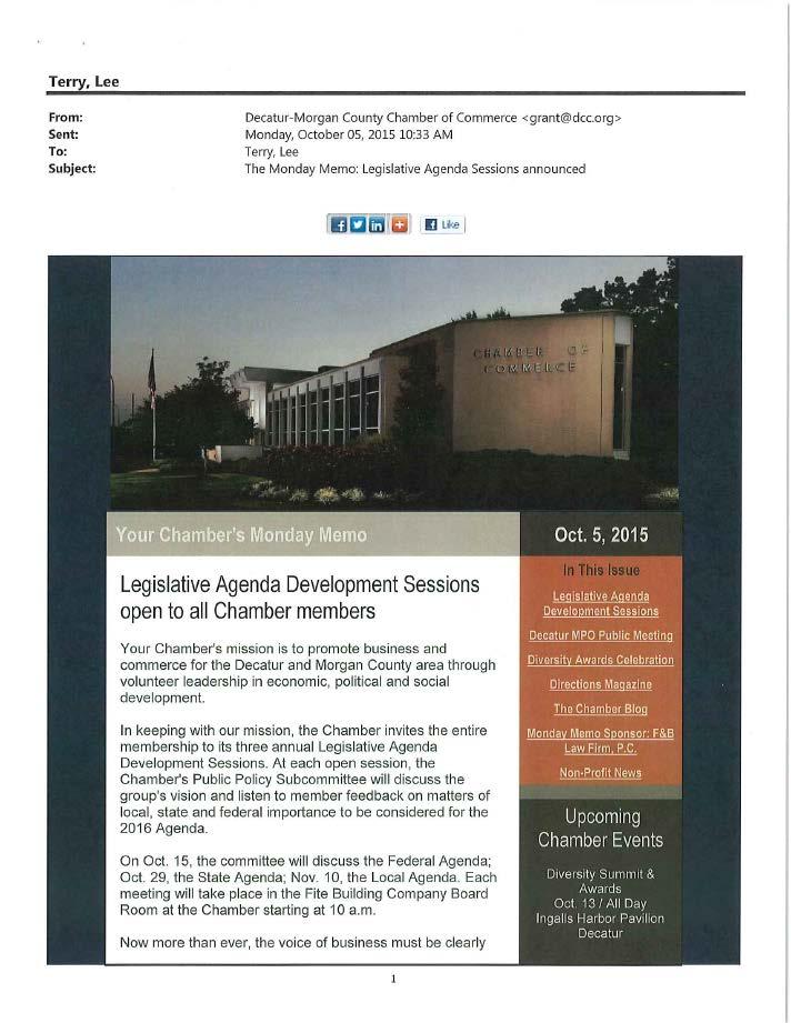
144 134
145 135
146 136
147 137
148 138
149 139
Rapid City Area Metropolitan Planning Organization OPERATIONS PLAN
 Rapid City Area Metropolitan Planning Organization OPERATIONS PLAN Prepared for the Rapid City Area Metropolitan Planning Organization Endorsed by the Executive Policy Committee of the Rapid City Area
S H O A L S A R E A M E T R O P O L I T A N P L A N N I N G O R G A N I Z A T I O N
 S H O A L S A R E A M E T R O P O L I T A N P L A N N I N G O R G A N I Z A T I O N DRAFT UNIFIED PLANNING WORK PROGRAM FISCAL YEAR 2019 10/01/2018 09/30/2019 June 2018 Shoals Area Metropolitan Planning
Rapid City Area Metropolitan Planning Organization OPERATIONS PLAN
 Rapid City Area Metropolitan Planning Organization OPERATIONS PLAN Prepared for the Rapid City Area Metropolitan Planning Organization Endorsed by the Executive Policy Committee of the Rapid City Area
2040 LONG RANGE TRANSPORTATION PLAN. Prepared by the Northwest Alabama Council of Local Governments (NACOLG)
") S H O A L S A R E A M E T R O P O L I T A N P L A N N I N G O R G A N I Z A T I O N 2040 LONG RANGE TRANSPORTATION PLAN Prepared by the Northwest Alabama Council of Local Governments (NACOLG) October 2015
S H O A L S A R E A M E T R O P O L I T A N P L A N N I N G O R G A N I Z A T I O N 2040 LONG RANGE TRANSPORTATION PLAN Prepared by the Northwest Alabama Council of Local Governments (NACOLG) October 2015
Appendix E-1. FDOT MPO Program Management Handbook. (Excerpts)
") Appendix E-1 FDOT MPO Program Management Handbook (Excerpts) TABLE OF CONTENTS Chapter 4 Long-Range Transportation Plan Section Page 4.1 PURPOSE... 4-2 4.2 AUTHORITY... 4-2 4.3 SCOPE... 4-2 4.4 REFERENCES...
Appendix E-1 FDOT MPO Program Management Handbook (Excerpts) TABLE OF CONTENTS Chapter 4 Long-Range Transportation Plan Section Page 4.1 PURPOSE... 4-2 4.2 AUTHORITY... 4-2 4.3 SCOPE... 4-2 4.4 REFERENCES...
Alabama Metropolitan Planning Organization Planners Handbook
 Alabama Metropolitan Planning Organization Planners Handbook Table of Contents Preface 1 Section 1: Introduction to Metropolitan Planning Organizations (MPO) 2 Organization 2 Metropolitan Planning Area
Rapid City Area Metropolitan Planning Organization 2018 UNIFIED PLANNING WORK PROGRAM
 Rapid City Area Metropolitan Planning Organization 2018 UNIFIED PLANNING WORK PROGRAM Prepared by the City of Rapid City, City of Box Elder, City of Summerset, City of Piedmont, Pennington County, Meade
MOBILITY 2045: A FOCUS ON TRANSPORTATION CHOICE:
 Mobility 2045: The Metropolitan Transportation Plan for North Central Texas is the defining vision for the multimodal transportation system in the Dallas- Fort Worth Metropolitan Planning Area. The plan,
PURPOSE OF THE TRANSPORTATION IMPROVEMENT PROGRAM (TIP)
") INTRODUCTION PURPOSE OF THE TRANSPORTATION IMPROVEMENT PROGRAM (TIP) The Transportation Improvement program (TIP) is a staged, four-year program of projects proposed for funding by federal, State, and
INTRODUCTION PURPOSE OF THE TRANSPORTATION IMPROVEMENT PROGRAM (TIP) The Transportation Improvement program (TIP) is a staged, four-year program of projects proposed for funding by federal, State, and
CHAPTER 1 INTRODUCTION
 CHAPTER 1 INTRODUCTION 1.1 ABOUT THE FREDERICKSBURG AREA METROPOLITAN PLANNING ORGANIZATION Established in 1992, the Fredericksburg Area Metropolitan Planning Organization (FAMPO) is the federally designated
PERFORMANCE-BASED PLANNING AND PROGRAMMING
 February 2017 performance-based planning and programming Boston Region MPO PERFORMANCE-BASED PLANNING AND PROGRAMMING WHAT IS PERFORMANCE-BASED PLANNING AND PROGRAMMING? Performance-based planning and
MADISON ATHENS-CLARKE OCONEE REGIONAL TRANSPORTATION STUDY UNIFIED PLANNING WORK PROGRAM FY
 MADISON ATHENS-CLARKE OCONEE REGIONAL TRANSPORTATION STUDY UNIFIED PLANNING WORK PROGRAM FY - 2018 Final April 12, 2017 Amended November 8, 2017 Prepared by: Athens-Clarke County Planning Department In
PERFORMANCE-BASED PLANNING AND PROGRAMMING
 February 2017 performance-based planning and programming Boston Region MPO PERFORMANCE-BASED PLANNING AND PROGRAMMING WHAT IS PERFORMANCE-BASED PLANNING AND PROGRAMMING? Performance-based planning and
PERFORMANCE-BASED PLANNING AND PROGRAMMING
 September 2018 performance-based planning and programming Boston Region Metropolitan Planning Organization: PERFORMANCE-BASED PLANNING AND PROGRAMMING WHAT IS PERFORMANCE-BASED PLANNING AND PROGRAMMING?
2040 Addendum Performance-Based Planning November 2018
 2040 Long Range Transportation Plan 2040 Addendum Performance-Based Planning November 2018 Adopted June 13, 2018 250 S. Orange Ave, Suite 200, Orlando, FL 32801 407-481-5672 www.metroplanorlando.org MetroPlan
Summary of transportation-related goals and objectives from existing regional plans
 SMTC 2050 Long Range Transportation Plan Appendix A: Summary of transportation-related goals and objectives from existing regional plans SMTC 2050 Long Range Transportation Plan Summary of transportation-related
FISCAL YEAR UNIFIED PLANNING WORK PROGRAM
 FISCAL YEAR 20162017 UNIFIED PLANNING WORK PROGRAM TITLE VI NONDISCRIMINATION STATEMENT THE BRISTOL METROPOLITAN PLANNING ORGANIZATION ENSURES COMPLIANCE WITH TITLE VI OF THE CIVIL RIGHTS ACT OF 1964;
APPENDIX MPO 101: HISTORY, CONTEXT AND EVOLUTION OF METROPOLITAN TRANSPORTATION PLANNING
 A GUIDEBOOK FOR METROPOLITAN TRANSPORTATION PLANNING APPENDIX MPO 101: HISTORY, CONTEXT AND EVOLUTION OF METROPOLITAN TRANSPORTATION PLANNING In order to understand the ways that metropolitan planning
Williamsport Area Transportation Study Metropolitan Planning Organization
 Williamsport Area Transportation Study Metropolitan Planning Organization LONG RANGE TRANSPORTATION PLAN 2018-2038 CHAPTER 1 INTRODUCTION Purpose of a Long Range Transportation Plan Transportation infrastructure
Addendum #3 to the Regional Transportation Plan
 Nashville Area Metropolitan Planning Organization Addendum #3 to the Regional Transportation Plan Effective November 21, 2018 Nashville Area Metropolitan Planning Organization 138 Second Avenue North Nashville,
Under recently updated FHWA guidelines, the LRTP must be updated every four (4) years. The most recent LRTP is the 2035 Plan, adopted in early 2009.
 years. The most recent LRTP is the 2035 Plan, adopted in early 2009.") PLANS, POLICIES AND PROCESSES OF THE MPO The Winston-Salem Urban Area MPO is responsible for creating and maintaining many documents essential to the on-going transportation planning effort. These documents
PLANS, POLICIES AND PROCESSES OF THE MPO The Winston-Salem Urban Area MPO is responsible for creating and maintaining many documents essential to the on-going transportation planning effort. These documents
2. Guiding Principles, Objectives, and Policies
 2. Guiding Principles, Objectives, and Policies INTRODUCTION The guiding principles for the 2040 MTP Update establish the vision and key focus areas for this planning effort. They combine the guidance
GUIDING PRINCIPLES MEMORANDUM
 M E T R O P O L I TAN TRA NS P O RTATI O N PLAN GUIDING PRINCIPLES MEMORANDUM El Paso Metropolitan Planning Organization INTRODUCTION The guiding principles for development of the El Paso MPO s Destino
Public Participation
 Purpose Dubuque Metropolitan Area Transportation Study (DMATS) Public Involvement Policy (PIP) was developed due to a need for proactive citizen involvement in the long-range transportation plan (LRTP)
MONITORING IMPLEMENTATION AND PERFORMANCE
 12 MONITORING IMPLEMENTATION AND PERFORMANCE The FAST Act continues the legislation authorized under MAP-21, which created a data-driven, performance-based multimodal program to address the many challenges
Unified Planning Work Program
 FY 2017 Unified Planning Work Program In accordance with Title VI of the Civil Rights Act of 1964 and other nondiscrimination laws, public participation is solicited without regard to race, color, national
CRTPA Regional Mobility Plan Attachment 1 Agenda Item 4E Page 1 of 11
 CRTPA Regional Mobility Plan Attachment 1 Page 1 of 11 INTRODUCTION Everyone wants to have the ability to move around the city, county, region, country and world in the way that they see fit, when they
FY 2017 Unified Planning Work Program
 FY 2017 Unified Planning Work Program This report was prepared by the Lawton Metropolitan Planning Organization (LMPO) and was financed in part through the United States Department of Transportation funds
1 I N T R O D U C T I O N
 THE 2040 OKI REGIONAL TRANSPORTATION PLAN This is the metropolitan transportation plan for the Ohio-Kentucky-Indiana Regional Council of Governments (OKI). OKI is the federally designated regional transportation
CITY OF JACKSONVILLE 2030 MOBILITY PLAN STUDY UPDATE GOALS, OBJECTIVES, AND PERFORMANCE MEASURES PREPARED FOR: CITY OF JACKSONVILLE
 CITY OF JACKSONVILLE 2030 MOBILITY PLAN STUDY UPDATE GOALS, OBJECTIVES, AND PERFORMANCE MEASURES 3.20.2017 PREPARED FOR: CITY OF JACKSONVILLE 55 Railroad Row White River Junction, VT 05001 802.295.4999
METROPOLITAN PLANNING ORGANIZATION MEMORANDUM OF UNDERSTANDING FOR THE COASTAL REGION METROPOLITAN PLANNING ORGANIZATION BETWEEN
 METROPOLITAN PLANNING ORGANIZATION MEMORANDUM OF UNDERSTANDING FOR THE COASTAL REGION METROPOLITAN PLANNING ORGANIZATION BETWEEN The Counties of Chatham and Effingham, the municipalities of Bloomingdale,
CHAPTER 1: INTRODUCTION/ GOALS AND OBJECTIVES
 CHAPTER 1: INTRODUCTION/ GOALS AND OBJECTIVES 1.1: INTRODUCTION ABOUT THE FREDERICKSBURG AREA METROPOLITAN PLANNING ORGANIZATION (FAMPO) Established in 1992, the Fredericksburg Area Metropolitan Planning
FY 2018 Unified Planning Work Program
 FY 2018 Unified Planning Work Program This report was prepared by the Lawton Metropolitan Planning Organization (LMPO) and was financed in part through the United States Department of Transportation funds
FY 2019 Unified Planning Work Program FINAL. Regional Intergovernmental Council. June 14, Kanawha Putnam Metropolitan Planning Organization
 FY 2019 Unified Planning Work Program FINAL Regional Intergovernmental Council Kanawha Putnam Metropolitan Planning Organization June 14, 2018 315 D Street. South Charleston, WV. 25303 The Unified Planning
AICP EXAM REVIEW. Transportation Planning. February 19, 2016
 AICP EXAM REVIEW Transportation Planning February 19, 2016 Agenda Defining transportation planning Transportation stakeholders Transportation plan development Transportation funding Project development
MTP VISIONS, GOALS, AND OBJECTIVES
 2 MTP VISIONS, GOALS, AND OBJECTIVES El Paso MPO 2045 Metropolitan Transportation Plan 2. GUIDING PRINCIPLES This chapter describes the process by which the vision and goals of the planning process were
Addendum 1: Performance Measures
 Addendum 1: 2 Addendum Livability 2040 Regional Transportation Plan Table of Contents 1.0 Introduction... 3 Federal Requirements... 3 MPO Measure Targets... 4 2.0 Safety Measure Targets... 9 3.0 Transit
Introduction. CHAPTER 2: Introduction 13
 02 Introduction CHAPTER 2: Introduction 13 14 2018 Draft Regional Transportation Plan/Sustainable Communities Strategy 2 INTRODUCTION The Stanislaus Council of Government s 2018 Regional Transportation
1.0 Introduction to Transportation Planning
 1.0 Introduction to Transportation Planning A good plan is like a road map: it shows the final destination and usually the best way to get there. H. Stanley Judd 1.1 Purpose Why is Transportation Planning
Rural Transportation Planning Work Program. Fiscal Years &
 Catawba Regional Council of Governments Rural Transportation Planning Work Program Fiscal Years 2015-16 & 2016-17 July 1, 2015 June 30, 2017 www.catawbacog.org Catawba Regional Council of Governments P.O.
Transportation Improvement Program (TIP) Relationship to 2040 Metropolitan Transportation Plan (MTP) - Goals and Performance Measures
 Relationship to 2040 Metropolitan Transportation Plan (MTP) - Goals and Performance Measures") Mid-Region Metropolitan Planning Organization Mid-Region Council of Governments 809 Copper Avenue NW Albuquerque, New Mexico 87102 (505) 247-1750-tel. (505) 247-1753-fax www.mrcog-nm.gov Transportation
Mid-Region Metropolitan Planning Organization Mid-Region Council of Governments 809 Copper Avenue NW Albuquerque, New Mexico 87102 (505) 247-1750-tel. (505) 247-1753-fax www.mrcog-nm.gov Transportation
The Policies section will also provide guidance and short range policies in order to accomplish the goals and objectives.
 4 Goals & Objectives INTRODUCTION The 2015-2040 MTP preserves and promotes the quality of life and economic prosperity of the MAB by providing a transportation system consistent with the regional goals.
Chapter 3 - Goals, Objectives, & Strategies
 Chapter 3 - This chapter presents goals, objectives, and strategies that have been developed as part of the Richmond Area MPO 2026 Long-Range Transportation Plan (LRTP) update. Strategies have been developed
Certification Review. Department of Transportation. United States. Final REPORT. Huntsville Metropolitan Area Planning Process.
 Certification Review United States Department of Transportation Huntsville Metropolitan Area Planning Process Conducted by: Federal Highway Administration Alabama Division Federal Transit Administration
Going Forward The Plan to Maintain & Improve Mobility Frequently Asked Questions (FAQs)
") Going Forward The Plan to Maintain & Improve Mobility Frequently Asked Questions (FAQs) What is Going Forward The Plan to Maintain & Improve Mobility (Plan) and why does the region need a Long Range Transportation
Going Forward The Plan to Maintain & Improve Mobility Frequently Asked Questions (FAQs) What is Going Forward The Plan to Maintain & Improve Mobility (Plan) and why does the region need a Long Range Transportation
Tri-County Regional Planning Commission 2045 Regional Metropolitan Transportation Plan Goals and Objectives Adopted March 22, 2017
 Tri-County Regional Planning Commission 2045 Regional Metropolitan Transportation Plan Goals and Objectives Adopted March 22, 2017 One of the initial steps in the development of the TCRPC 2045 Metropolitan
2040 Long Range Transportation Plan
 2040 Long Range Transportation Plan Presented by Iowa Northland Regional Council of Governments October 22, 23, and 24, 2013 Liaison for federal transportation funding that goes to local cities and counties
Long Range Transportation Plan
 Charlotte County-Punta Gorda Metropolitan Planning Organization Long Range Transportation Plan Adopted October 2015 Board Charlotte County Commissioner Christopher G. Constance (Chair) Commissioner Stephen
BRUNSWICK AREA TRANSPORTATION STUDY UNIFIED PLANNING WORK PROGRAM. For Fiscal Year July 1, 2014 through June 30, 2015
 BRUNSWICK AREA TRANSPORTATION STUDY UNIFIED PLANNING WORK PROGRAM For Fiscal Year 2015 July 1, 2014 through June 30, 2015 Prepared by: Brunswick Area Transportation Study In Cooperation With: Georgia Department
Partnership for Sustainable Communities: Summary of Relevant Federal Planning Requirements and Options for Improved Coordination.
 Partnership for Sustainable Communities: Summary of Relevant Federal Planning Requirements and Options for Improved Coordination White Paper Prepared for: Development, Community, and Environment Division
Freight and Rail Stakeholder Webinar. January 7, 2014
 Freight and Rail Stakeholder Webinar January 7, 2014 Agenda Modal Needs Baseline Revenue Modal Scenarios Website Statewide Freight Plan Statewide Rail Plan Jeff Carroll MULTIMODAL TRANSPORTATION NEEDS
Moving Ahead for Progress in the 21 st Century MAP-21
 Moving Ahead for Progress in the 21 st Century MAP-21 Mark Newland Transportation Finance Manager FHWA Indiana Division Purdue Road School March 6, 2013 Agenda Review changes between SAFETEA-LU and MAP-21.
Public Participation Plan. Long Range Transportation Plan. Prepared for: Oklahoma Department of Transportation. Prepared by:
 Long Range Transportation Plan Prepared for: Oklahoma Department of Transportation Prepared by: June 16, 2014 Technical Memorandum The Technical Memos were written to document early research for the 2015
HUNTSVILLE AREA TRANSPORTATION STUDY METROPOLITAN PLANNING ORGANIZATION (MPO)
") HUNTSVILLE AREA TRANSPORTATION STUDY METROPOLITAN PLANNING ORGANIZATION (MPO) (FINAL) UNIFIED PLANNING WORK PROGRAM FISCAL YEAR 2015 This document is posted at http://www.hsvcity.com/planning/mpo/index.php
HUNTSVILLE AREA TRANSPORTATION STUDY METROPOLITAN PLANNING ORGANIZATION (MPO) (FINAL) UNIFIED PLANNING WORK PROGRAM FISCAL YEAR 2015 This document is posted at http://www.hsvcity.com/planning/mpo/index.php
PennDOT Office of Planning
 Every Voice Counts PennDOT Office of Planning Environmental Justice Plan Executive Summary Developed for: Pennsylvania Department of Transportation Office of Planning Center for Program Development and
GOALS AND PERFORMANCE MEASURES
 PLANNING FRAMEWORK The planning framework guides the development of the Regional Transportation Plan, articulating what the region is trying to achieve. This chapter establishes a foundation to focus data-gathering
FY The Brunswick Area Transportation Study s Unified Planning Work Program. July 1, 2017 through June 30, 2018
 FY 2018 The Brunswick Area Transportation Study s Unified Planning Work Program July 1, 2017 through June 30, 2018 Prepared by: The Brunswick Area Transportation Study In Cooperation with: Administrative
- FACT SHEET - THE GUIDING PRINCIPLES
 THE GUIDING PRINCIPLES The General Plan begins with seven ideas that together create a vision for the City s future. When the City approved the General Plan in 1994, these idea were dubbed the Seven Guiding
Technical Memorandum#1A
 Technical Memorandum#1A Goals, Objectives, and Performance Measures AMATS 2040 Metropolitan Transportation Plan Prepared for: AMATS Prepared by: HDR Approved by AMATS PC September 28, 2017 This page intentionally
RESOLUTION NO
 RESOLUTION NO. 2018-12 RESOLUTION OF THE SOUTHEASTERN WISCONSIN REGIONAL PLANNING COMMISSION AMENDING THE TRANSPORTATION IMPROVEMENT PROGRAM FOR SOUTHEASTERN WISCONSIN: 2017-2020 WHEREAS, the Southeastern
CHAPTER 1. A New Transportation Plan
 Chapter 1. A New Transportation Plan 1 CHAPTER 1. A New Transportation Plan Why develop a new plan? The year 2005 marks 90 years since Anchorage emerged as a community serving as headquarters for railroad
TABLE OF CONTENTS. MnDOT MPO TIP Check List. Section 1 INTRO & Public Involvement 2 Public Participation Activities 6 Annual Resolutions 9
 TABLE OF CONTENTS MnDOT MPO TIP Check List A-E Section 1 INTRO & Public Involvement 2 Public Participation Activities 6 Annual Resolutions 9 Section 2: ANNUAL LISTING 15 Section 3: PROGRAM OF PROJECTS
connections 2040 the waco metropolitan transportation plan
 connections 2040 the waco metropolitan transportation plan developed by the waco metropolitan planning organization in cooperation with the following agencies: adopted by the waco MPO policy board: january
Chapter 12: Transportation Safety & Security CHARLOTTE COUNTY PUNTA GORDA MPO 2035 LONG RANGE TRANSPORTATION PLAN
 Chapter 12: Transportation Safety & Security CHARLOTTE COUNTY PUNTA GORDA MPO 2035 LONG RANGE TRANSPORTATION PLAN CHARLOTTE COUNTY PUNTA GORDA MPO 2035 LONG RANGE TRANSPORTATION PLAN Transportation Safety
Limited English Proficiency (LEP) Plan PALM BEACH METROPOLITAN PLANNING ORGANIZATION
 Plan PALM BEACH METROPOLITAN PLANNING ORGANIZATION") Limited English Proficiency (LEP) Plan PALM BEACH METROPOLITAN PLANNING ORGANIZATION JUNE 2011 Limited English Proficiency (LEP)Plan PALM BEACH METROPOLITAN PLANNING ORGANIZATION Prepared by Office of
Limited English Proficiency (LEP) Plan PALM BEACH METROPOLITAN PLANNING ORGANIZATION JUNE 2011 Limited English Proficiency (LEP)Plan PALM BEACH METROPOLITAN PLANNING ORGANIZATION Prepared by Office of
Chapter #9 TRAVEL DEMAND MODEL
 Chapter #9 TRAVEL DEMAND MODEL TABLE OF CONTENTS 9.0 Travel Demand Model...9-1 9.1 Introduction...9-1 9.2 Overview...9-1 9.2.1 Study Area...9-1 9.2.2 Travel Demand Modeling Process...9-3 9.3 The Memphis
Public Participation Plan
 RURAL PLANNING ORGANIZATION 2018 Page 1 of 9 TABLE OF CONTENTS INTRODUCTION... 3 PURPOSE... 4 COG REGIONAL TRANSPORTATION PLANNING BACKGROUND... 5 GOALS AND OBJECTIVES FOR PUBLIC PARTICIPATION... 5 PUBLIC
LIMITED ENGLISH PROFICIENCY PLAN
 LIMITED ENGLISH PROFICIENCY PLAN Approved by the BMTS Policy Committee Resolution 2011-11, December 15, 2011 LIMITED ENGLISH PROFICIENCY PLAN On August 11, 2000, the President issued Executive Order 13166,
Mobility and System Reliability Goal
 Mobility and System Reliability Goal Provide surface transportation infrastructure and services that will advance the efficient and reliable movement of people and goods throughout the state. Background:
Atlanta Transportation Management Area 2015 MPO Certification Questionnaire INDEX
 Section INDEX Page A. Status of follow-up actions from last Federal TMA Certification Review. 2 B. Description of Planning Area 3 C. MPO Boundaries 3 D. Organization/Structure 3 E. Agreements and Contracts
Transportation Management Area Planning Certification Review Primer
 Transportation Management Area Planning Certification Review Primer Revised January 18, 2018 Notice This document is disseminated under the sponsorship of the U.S. Department of Transportation (USDOT)
CHAPTER IV REQUIREMENTS AND GUIDELINES FOR FIXED ROUTE TRANSIT PROVIDERS
 Chap. IV-1 CHAPTER IV REQUIREMENTS AND GUIDELINES FOR FIXED ROUTE TRANSIT PROVIDERS 1. INTRODUCTION. The requirements described in this chapter apply to all providers of fixed route public transportation
Chapter 5 Transportation Draft
 Chapter 5 Transportation Draft Discussion Similar to the other elements in the Comprehensive Plan, the transportation element impacts the quality of life, economic development and public safety of the
ISTEA Reauthorization Principles
 ISTEA Reauthorization Principles POLICY PRINCIPLES OF THE STATE AND TERRITORIAL AIR POLLUTION PROGRAM ADMINISTRATORS AND THE ASSOCIATION OF LOCAL AIR POLLUTION CONTROL OFFICIALS ON THE REAUTHORIZATION
2040 U P DAT E TO THE STREET/HIGH WAY ELEMENT
 2040 U P DAT E TO THE STREET/HIGH WAY ELEMENT 2040 UPDATE TO THE STREET/HIGHWAY ELEMENT Grand Forks-East Grand Forks Metropolitan Planning Organization (GF-EGF MPO) Grand Forks Office 255 North 4 th Street
Winston-Salem Urban Area Metropolitan Planning Organization Transportation Advisory Committee Action Request
 Winston-Salem Urban Area Metropolitan Planning Organization Transportation Advisory Committee Action Request Meeting Date: May 17, 2018 Agenda Item Number: 6 Action Requested: Consideration of an Appendix
Limited English Proficiency Plan
 Limited English Proficiency Plan Lake~Sumter Metropolitan Planning Organization Draft for Advisory Committee & Board Review January 2018 www.lakesumtermpo.com Contents About the MPO... 1 Introduction...
Introduction. Performance Measurement. Pg. 01
 Pg. 01 Introduction The Alamo Area recognizes the importance of transportation performance tracking, goal setting and measurement to provide greater accountability and transparency and to achieve a more
2017 TRANSPORTATION POLICY STATEMENT
 0 TRANSPORTATION POLICY STATEMENT 1 1 1 1 1 1 0 1 0 1 0 1 Critical investments are needed to maintain and improve Virginia s transportation network. The structural imbalance between critical needs and
Metropolitan Council PUBLIC PARTICIPATION PLAN. for Transportation Planning and Programming
 Metropolitan Council PUBLIC PARTICIPATION PLAN for Transportation Planning and Programming Introduction and Federal Requirement Public participation is an essential element of planning in the Twin Cities
VISION STATEMENT, MISSION STATEMENT, AND GOALS AND OBJECTIVES
 VISION STATEMENT, MISSION STATEMENT, AND GOALS AND OBJECTIVES Vision Statement: Our vision is to provide a high quality, safe, efficient, and cost-effective multi-modal transportation system that supports
FLORENCE AREA TRANSPORTATION STUDY. Metropolitan Planning Organization (MPO) Federal ID #
 Federal ID #") UNIFIED PLANNING WORK PROGRAM FISCAL YEARS 2016 AND 2017 FLORENCE AREA TRANSPORTATION STUDY Metropolitan Planning Organization (MPO) Federal ID #57-6000351 Funding Agencies: Florence County and The Federal
UNIFIED PLANNING WORK PROGRAM FISCAL YEARS 2016 AND 2017 FLORENCE AREA TRANSPORTATION STUDY Metropolitan Planning Organization (MPO) Federal ID #57-6000351 Funding Agencies: Florence County and The Federal
WTP Phase 2 Implementation & Freight System Plan
 WTP Phase 2 Implementation & Freight System Plan Tribal Transportation Planning Organization Kathy Murray Planning Studies Group; Multimodal Planning Division Jason Beloso, Strategic Planning Manager;
Who Does What. Susan Handy TTP282 October 2017
 Who Does What Susan Handy TTP282 October 2017 So who does the supplying? Who is involved in deciding what kind of transportation system we will have? Players Government Industry Citizens/ Consumers Players
MAP 21 Freight Provisions and Seaports
 MAP 21 Freight Provisions and Seaports September 20, 2012 American Association of Port Authorities 703.684.5700 www.aapa-ports.org 3 New Freight Eligibility in Core Highway Formula Programs Surface Transportation
Final Regional 2035 Transportation Plan Adopted: January 21, 2010
 Final Regional 2035 Transportation Plan Adopted: January 21, 2010 Paul T. Hamilton, Chief Planner Tri-County Regional Planning Commission Federal Requirement Safe Accountable Fair and Efficient Transportation
ROCOG TRANSPORTATION PLANNING WORK PROGRAM
 ROCOG TRANSPORTATION PLANNING WORK PROGRAM 2018-2019 SEPTEMBER 2017 Preparation of this document is financed in part by the U.S. DOT as referenced in the ROCOG 2017 Transportation Work Program under Work
Proposed Comprehensive Update to the State of Rhode Island s Congestion Management Process
 Proposed Comprehensive Update to the State of Rhode Island s Statewide Planning Program January 2018 Summary Outline of of Action Steps 1. Develop Objectives for Congestion Management What is the desired
APPENDIX A PLANNING PROCESS FOR RURAL AREAS OF THE STATE
 APPENDIX A PLANNING PROCESS FOR RURAL AREAS OF THE STATE Background SCDOT Statewide Transportation Planning Process Consultation Cooperation with Local Officials in Non-Metropolitan (Rural) Areas SCDOT
SCS Scenario Planning
 E SCS Scenario Planning Introduction As part of the 2035 MTP/SCS process, AMBAG developed a series of land use and transportation alternative scenarios for evaluation and testing to demonstrate how the
MEETING SUMMARY FOR APRIL 13, 2017
 SARASOTA/MANATEE METROPOLITAN PLANNING ORGANIZATION Performance Measures/Project Prioritization Process Ad Hoc Committee 7632 15 th Street East Sarasota, Florida 34243 3:00-5:00 PM MEETING SUMMARY FOR
Regional Transportation Commission of Southern Nevada
 Regional Transportation Commission of Southern Nevada Federal Certification Report FINAL- March 2017 Federal Highway Administration Nevada Division Federal Transit Administration Region IX Contents Introduction...
CHAPTER 1 Introduction
 CHAPTER 1 Introduction The Charlotte region is demographically diverse, economically dynamic, and rapidly growing. These circumstances present new challenges and opportunities, including the critical expansion
Harris County Community Services Department Office of Transit Services TITLE VI "STATEMENT OF POLICY"
 Harris County Community Services Department Office of Transit Services TITLE VI "STATEMENT OF POLICY" Harris County Community Services Department, Office of Transit Services is committed to a policy of
MARC Congestion Management Process Policy
 MARC Congestion Management Process Policy Adopted by the MARC Board of Directors on May 24, 2011 Background Traffic congestion can be generally defined as a condition where the volume of users on a transportation
PUBLIC PARTICIPATION PLAN
 PUBLIC PARTICIPATION PLAN INTRODUCTION The purpose of the Public Participation Plan (PPP) is to outline methods for encouraging citizens, affected organizations and other interested parties to be involved
Chapter 3 Public Participation & Consultation
 Chapter 3 Public Participation & Consultation Public Participation Plan Introduction & Purpose Public participation is a critical part of the planning process. Without the involvement of local citizens,
BOARD POLICY NO. 025 PUBLIC PARTICIPATION PLAN POLICY. Purpose
 BOARD POLICY NO. 025 PUBLIC PARTICIPATION PLAN POLICY Purpose This policy establishes a process for obtaining input from and providing information to the public concerning agency programs, projects, and
SCOPE OF SERVICES FLORIDA ALABAMA 2045 LONG RANGE TRANSPORTATION PLAN (LRTP) UPDATE
 UPDATE") SCOPE OF SERVICES FLORIDA ALABAMA 2045 LONG RANGE TRANSPORTATION PLAN (LRTP) UPDATE I. Background II. III. IV. Work Tasks A. TASK 1: PUBLIC PARTICIPATION B. TASK 2: CONGESTION MANAGEMENT PROCESS UPDATE
SCOPE OF SERVICES FLORIDA ALABAMA 2045 LONG RANGE TRANSPORTATION PLAN (LRTP) UPDATE I. Background II. III. IV. Work Tasks A. TASK 1: PUBLIC PARTICIPATION B. TASK 2: CONGESTION MANAGEMENT PROCESS UPDATE
Planning. i.e. the Regional Transportation Plan. TTP220 S. Handy 4/18/16
 Planning i.e. the Regional Transportation Plan TTP220 S. Handy 4/18/16 In the news today Authorization bills: intended $ Appropriations bills: actual $ The Senate Appropriations Committee will review transportation