|
|
|
- Leonard Hardy
- 6 years ago
- Views:
Transcription

1 Good Morning!

2 Bruce Gilman Department of Environmental Conservation and Horticulture Finger Lakes Community College 3325 Marvin Sands Drive Canandaigua, New York


3 Northern New York alvars Lake Ontario dunes and wetlands


4 Ontario County Botanist Muller Field Station Director
5 Outline What is a watershed? How might the watershed landscape influence stream quality? Why are some stream characteristics tested and others are not? What can you do prior to your stream visit?

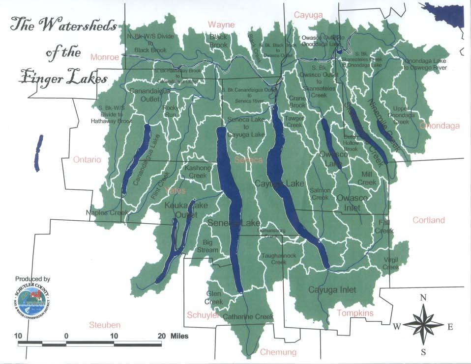
6 Just as a town, city, county or state has boundaries, so does a watershed. Think of this as a line that connects all of the highest points in an area. No matter where you live, you re in a watershed.

7 Precipitation falling inside a watershed boundary may: 1. fall directly into streams and lakes 2. travel across the landscape 3. infiltrate the soil and flow underground
: the geological and geographical area of land that contributes or drains water through its springs, seeps, ditches, pools, culverts,")
8 wä- ter- shed (n.): the geological and geographical area of land that contributes or drains water through its springs, seeps, ditches, pools, culverts, marshes, swamps, and streams to the same body of water. Canandaigua Lake Watershed Management Plan

9 Watershed Size - A Question of Scale Watersheds can be large or small. Every stream, tributary, or river has an associated watershed, and small watersheds aggregate together to become larger watersheds.

10 New York State Department of Environmental Conservation New York State Watersheds

11 United States Geological Survey Hydrological Unit Code Number (HUC)
12
13
14
15
 Six major systems present in New York Each system is broken into sub- systems, each sub- system is furthered broken into cover types (the")
16 Natural Community Classification New York State Natural Heritage Classification (Edinger et al. 2002) Six major systems present in New York Each system is broken into sub- systems, each sub- system is furthered broken into cover types (the name we use to describe natural communities) NYS DEC
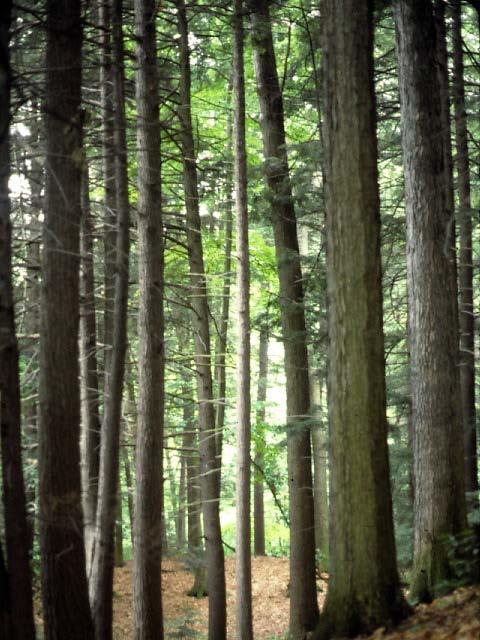
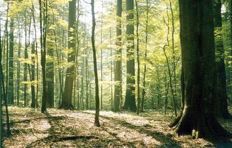
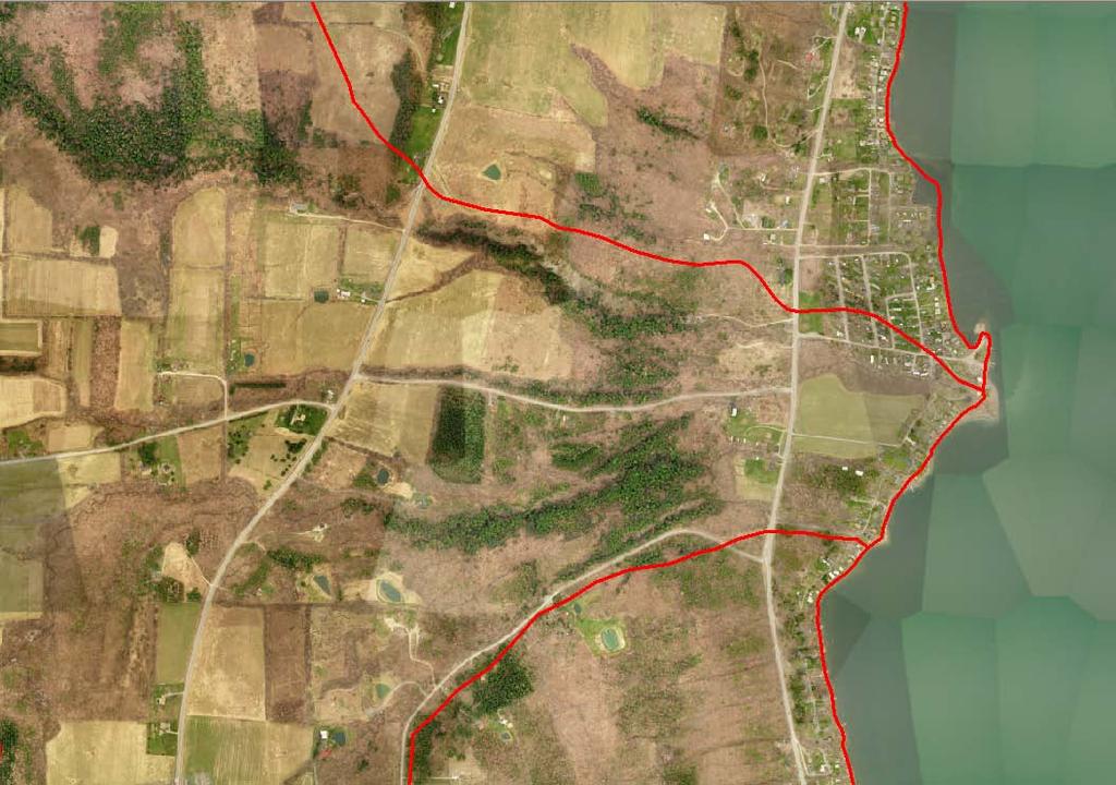
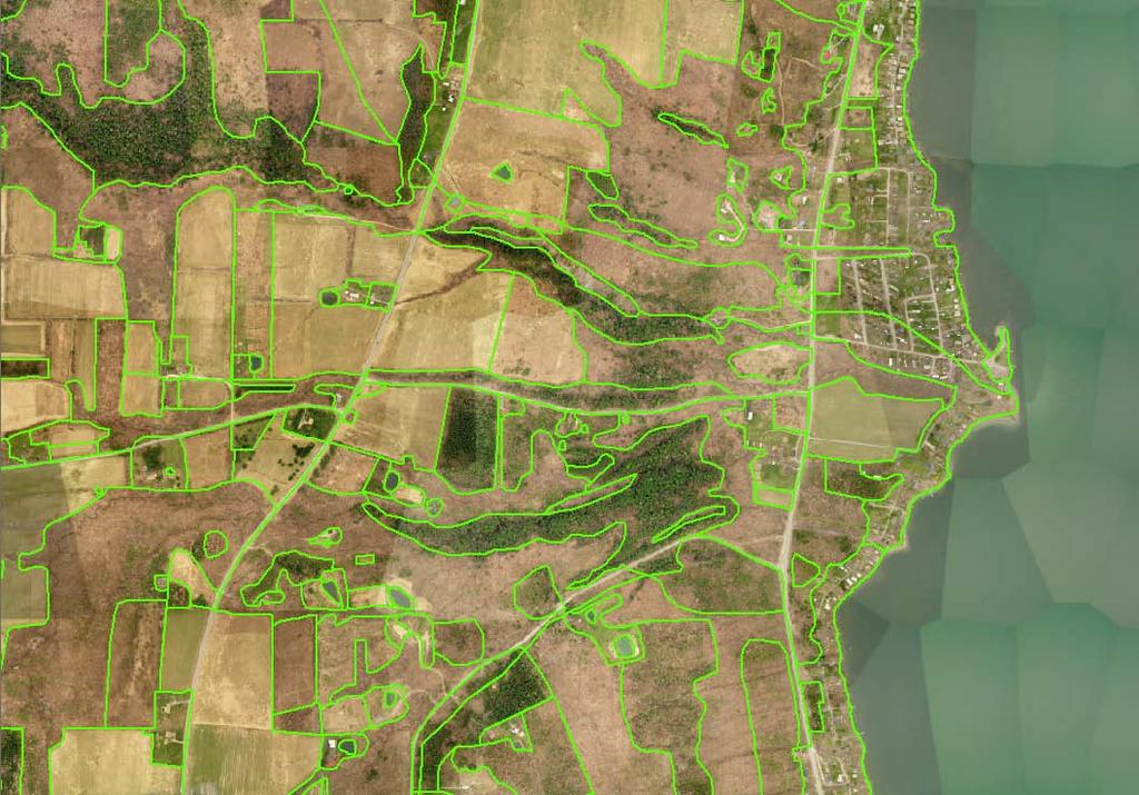
17 Land Use/Land Cover Mapping Initial assessment based on air photo interpretation (Pictometry imagery) Extensive field investigations reveal errors in initial assessment Modify polygons to create truth image Attribute polygons
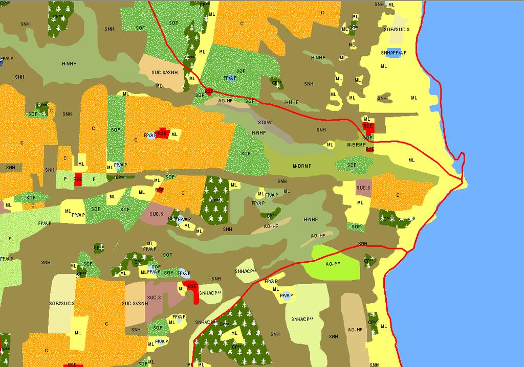
18
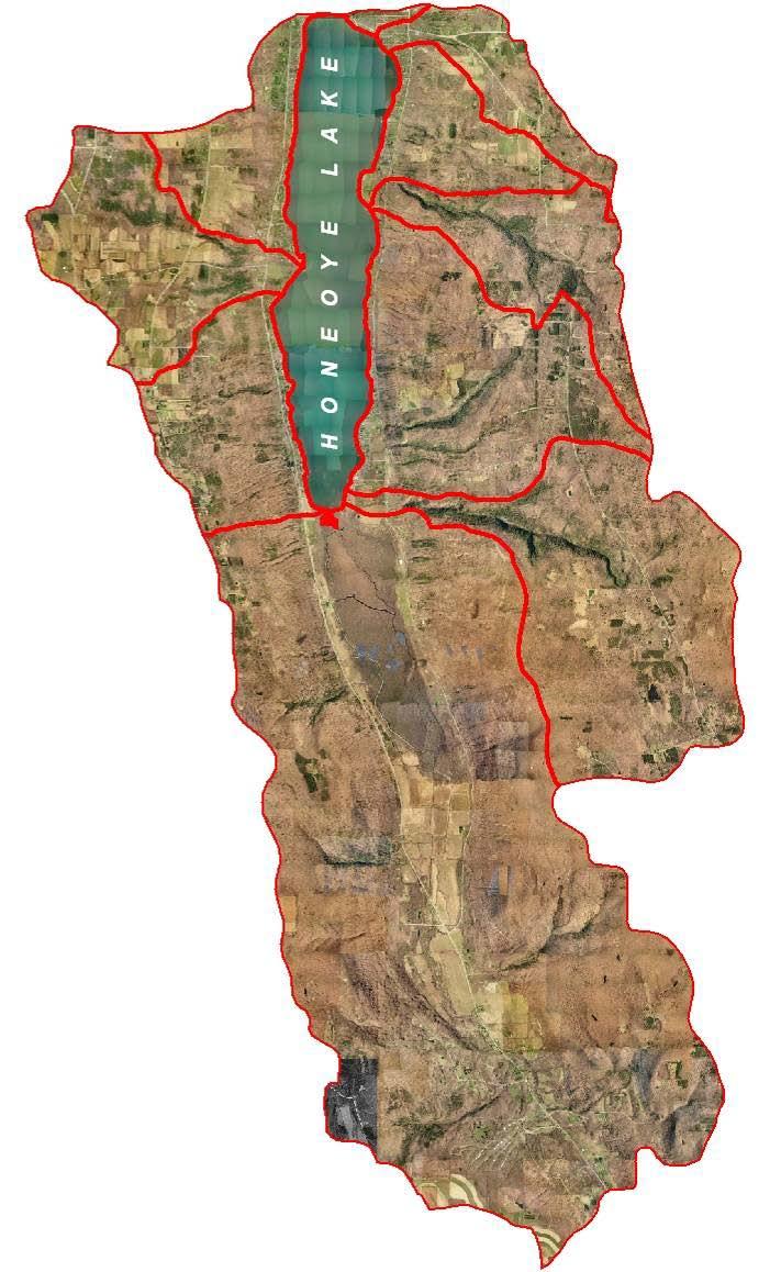
19 Honeoye Lake Watershed 4 major ecological systems: riverine, lacustrine, palustrine and terrestrial 10 subsystems: natural and cultural categories 36 community cover types and numerous linear and point features 5 natural communities with significant state- wide ranking: winter stratified monomictic lake, floodplain forest, silver maple- ash swamp, shale talus slope woodland and maple- basswood rich mesic forest
20 For Tier 1 and Tier 2 we have simplified the land use assessment by providing the most common cover types in a check- off format! The other category allows you to record unique land uses bordering your stream.
21 Problems created by land- use activities Increased sediment loading Altered stream temperature Nutrient enrichment Toxic and hazardous substances Pathogens Invasive species introductions These problems may be caused by point and/or non- point sources of pollution. These problems impact fish habitat, water supply, water quality, as well as recreational and economic uses of the water.

22 Commercial/Industrial and Residential land uses increase impervious surfaces

23 Residential development can also create impacts when riparian vegetation is removed

24 Cropland, Pasture, Orchard, Vineyard and Nursery increase nutrients in runoff

25 Natural Forest, Old Fields and Wetlands are desirable land uses but non- sustainable practices can create problems in streams
26
27 Total Watershed Sub- watershed Direct Drainage Basin

28 T- 34 Lincoln Hill Direct Drainage T-34E T-34D T-34C T-34B T-34A
29 Direct drainage work Sampling dates: April 3, 2002 (0.93 rain) April 15, 2002 (0.63 rain) May 2, 2002 (0.14 rain) November 23, 2002 (0.64 rain) March 17, 2003 (0.00 rain, a snowmelt event) Several intermittent streams sampled within the direct drainage sub- basin

30 T-34E T-34D T-34C T-34B T-34A

31 From East Lake Road looking west
32 Mean Phosphorus Concentrations Direct Drainages ug/l T-22A T-22B T-22C T-22D T-22E T-22F T-31A T-32A T-32B T-33A T-33B T-33C T-34A T-34B T-34C T-34D T-34E sampling locations
33 Why we are not sampling Total Phosphorus concentrations in our stream monitoring Most field test kits do not have the sensitivity to accurately measure extremely small quantities of total phosphorus Standard Methods for phosphorus analysis requires sample preservation with strong H 2 SO 4, a potential safety issue with your students Biological productivity in streams most likely is limited by conditions other than total phosphorus concentrations
34 Mean Nitrite and Nitrate Direct Drainages mg N/L T-22A T-22B T-22C T-22D T-22E T-22F T-31A T-32A T-32B T-33A T-33B T-33C T-34A T-34B T-34C T-34D T-34E sample locations
35 Comments on Nitrite and Nitrate Concentrations Rainfall intensity and antecedent soil moisture conditions strongly influence overland flow to streams Livestock operations increase environmental nitrogen levels Concentrations exceeding 10 mg NO 3 - N/L suggest polluted stream conditions
36 EPA Water Pollution Categories Oxygen demanding wastes Heavy metals Radioactive substances Carcinogenic and teratogenic agents Corrosive materials Chloride (Cl - ) is considered a corrosive material
37 Sources of Chloride Bedrocks Agricultural runoff Industrial wastewater Sewage treatment plant effulent Oil well and gas well wastes especially those produced by hydrofracking Road de- icing materials
38 Recent Trends Winter road safety is adding salt pollution to Great Lakes streams. Urban streams carried 88 tons of chloride per square mile of watershed area. Forest streams carried about 6 tons per square mile. Monitoring chloride effectively gauges increasing development trends and the risk of other stream pollutants. U.S.G.S. research report, September 2009
39 FLCC road salt monitoring Streams studied during February Grab samples collected downstream of major highway bridges Period of record: 1990 to 2010 Lab procedure: argentometric titration Data expressed as mg/l chloride Safe level: concentrations less than 250 mg/l
40 Mean Tributary Chloride Canandaigua Lake and Honeoye Lake (Years of Record) chloride (mg/l) year Canandaigua Honeoye
41 Tributary Chloride Honeoye Lake, chloride (mg/l) T1 T2 T5 T6 T7 T8 T9a T10 T10 T10 T10k T11 T12 T16 out tributary code
42 Tributary Chloride Honeoye Lake, chloride (mg/l) T1 T2 T5 T6 T7 T8 T9a T10 T10 T10 T10k T11 T12 T16 out tributary code
43 Tributary Chloride Honeoye Lake, chloride (mg/l) T1 T2 T5 T6 T7 T8 T9a T10 T10 T10 T10k T11 T12 T16 out tributary code
44 Tributary Chloride Honeoye Lake, chloride (mg/l) T1 T2 T5 T6 T7 T8 T9a T10 T10 T10 T10k T11 T12 T16 out tributary code
45 Tributary Chloride Canandaigua Lake, chloride (mg/l) T21 T20 T19 T18 T17 T17 T14 T13 T16 T11 T12 T12 T27 T10 T9 T8 T6 T5 T4 T3 T2 T1 T1 out tributary code
46 Tributary Chloride Canandaigua Lake, chloride (mg/l) T21 T20 T19 T18 T17 T17 T14 T13 T16 T11 T12 T12 T27 T10 T9 T8 T6 T5 T4 T3 T2 T1 T1 out tributary code
47 Tributary Chloride Canandaigua Lake, chloride (mg/l) T21 T20 T19 T18 T17 T17 T14 T13 T16 T11 T12 T12 T27 T10 T9 T8 T6 T5 T4 T3 T2 T1 T1 out tributary code
48 Tributary Chloride Canandaigua Lake, chloride (mg/l) T21 T20 T19 T18 T17 T17 T14 T13 T16 T11 T12 T12 T27 T10 T9 T8 T6 T5 T4 T3 T2 T1 T1 out tributary code

49 Doing Your Homework! Activities prior to the stream visit. Check for existing water quality information Obtain maps and aerial photographs Make a site visit before you bring your class on the field trip
50 Examples of existing water quality information NYS DEC assessments, their reports are available at the regional office and often on- line as a pdf file. Local lake associations may have sampling and monitoring programs, summary data could be available from their watershed manager. College and University aquatic research, reports available from participating scientists.
51
52
53
54
Regional Watershed Planning. Calumet Summit 2010: A Call to Connect Calumet Conference Center April 27, 2010
 Regional Watershed Planning Calumet Summit 2010: A Call to Connect Calumet Conference Center April 27, 2010 Basins The Calumet Region Watershed Communities Land Cover- 2006 Impervious Cover 303d Listed
The Snapshot CONODOGUINET CREEK WATERSHED SNAPSHOT
 CONODOGUINET CREEK WATERSHED SNAPSHOT ABOVE: CONODOGUINET CREEK AT RT 74 BRIDGE FACING DOWNSTREAM The Snapshot The Conodoguinet Watershed Snapshot was a collaborative effort to engage local citizens in
WATERSHED. Maitland Valley. Report Card 201
 Maitland Valley WATERSHED Report Card 201 The Maitland Valley Conservation Authority has prepared this report card as a summary on the state of our forests, wetlands, surface water, and ground water resources.
Watershed Response to Water Storage. 8/1/2012 Paul Wymar Scientist Chippewa River Watershed Project
 Watershed Response to Water Storage 8/1/2012 Paul Wymar Scientist Chippewa River Watershed Project Chippewa River Watershed 1.3 Million Acres Largest tributary watershed in the Minnesota River Basin 7
Acidity and Alkalinity:
 Evaluation of Pollution Sources to Lake Glenville Quarterly Report December 2018 Kimberlee K Hall, PhD Environmental Health Program, Western Carolina University Summary Chemical and microbial analysis
Maitland Valley WATERSHED
 Maitland Valley WATERSHED Report Card 2018 Maitland Conservation has prepared this report card as a summary of the state of your forests, wetlands, and water resources. WHERE ARE WE? We are one of 36 Conservation
CLMP+ Report on Grass Lake (Anoka County) Lake ID# CLMP+ Data Summary
 Lake ID# CLMP+ Data Summary") CLMP+ Report on Grass Lake (Anoka County) Lake ID# 02-0113-00 2012-2013 CLMP+ Data Summary October 2014 Authors Shannon Martin, MPCA Editing and graphic design Public Information Office Staff The (MPCA)
CLMP+ Report on Grass Lake (Anoka County) Lake ID# 02-0113-00 2012-2013 CLMP+ Data Summary October 2014 Authors Shannon Martin, MPCA Editing and graphic design Public Information Office Staff The (MPCA)
EXECUTIVE SUMMARY DES PLAINES RIVER WATERSHED-BASED PLAN WHY A WATERSHED-BASED PLAN? WHAT IS A WATERSHED?
 Des Plaines River Watershed-Based Plan EXECUTIVE SUMMARY June 2018 EXECUTIVE SUMMARY DES PLAINES RIVER WATERSHED-BASED PLAN WHY A WATERSHED-BASED PLAN? Water is elemental to our lives. Plants and animals,
Little Cuyahoga River
 Little Cuyahoga River Little Cuyahoga River Balanced Growth Meeting Friday, February 15, 2013 Little Cuyahoga River Watershed Plan Phase I Preliminary Report Completed October 2010 www.nefcoplanning.org
How is Water Quality Affected by Land Use?
 Watershed Connections Lesson Les4 3 How is Water Quality Affected by Land Use? Overview What are the benefits of a healthy watershed? What are examples of land uses? What types of pollution can come from
Scientific overview: Water quality functions of coastal buffers
 Scientific overview: Water quality functions of coastal buffers Caitlin Chaffee, Coastal Policy Analyst RI Coastal Resources Management Council November 21, 2013 Buffer Zone Setback = Minimum Distance
Appendix X: Non-Point Source Pollution
 Appendix X: Non-Point Source Pollution Sources Nonpoint source of pollution, unlike pollution from industrial and sewage treatment plants, comes from many different sources. Nonpoint source pollution is
Appendix E : Guidelines for Riparian Buffer Areas
 Appendix E : Guidelines for Riparian Buffer Areas This document should be read in conjunction with the CRCA Planning Policy. 1.0 PURPOSE The purpose of this document is to summarize the recommendations
WASA Quiz Review. Chapter 2
 WASA Quiz Review Chapter 2 Question#1 What is surface runoff? part of the water cycle that flows over land as surface water instead of being absorbed into groundwater or evaporating Question #2 What are
Water Quality Study In the Streams of Flint Creek and Flint River Watersheds For TMDL Development
 Water Quality Study In the Streams of Flint Creek and Flint River Watersheds For TMDL Development Idris Abdi Doctoral Dissertation Presentation Major Advisor: Dr. Teferi Tsegaye April 18, 2005 Alabama
July 2009 WATER QUALITY SAMPLING, ANALYSIS AND ANNUAL LOAD DETERMINATIONS FOR THE ILLINOIS RIVER AT ARKANSAS HIGHWAY 59 BRIDGE, 2008
 July 29 WATER QUALITY SAMPLING, ANALYSIS AND ANNUAL LOAD DETERMINATIONS FOR THE ILLINOIS RIVER AT ARKANSAS HIGHWAY 59 BRIDGE, 28 LESLIE B. MASSEY, WADE CASH, AND BRIAN E. HAGGARD Submitted to Arkansas
Mud Lake Lakeshed Assessment
 Mud Lake Lakeshed Assessment The lakeshed vitals table identifies where to focus organizational and management efforts for each lake. Criteria were developed using limnological concepts to determine the
The Town of Chester Stormwater Mapping Report
 The Town of Chester Stormwater Mapping Report Prepared by the Warren County Soil & Water Conservation District December 2013 Table of Contents Introduction and Location 3 Stormwater Runoff 3 Assessment
Nonpoint Source Pollution A Challenge to Control
 Nonpoint Source Pollution A Challenge to Control Connecticut Envirothon Aquatics Workshop January 14, 2017 Presented by Denise Savageau Conservation Director, Town of Greenwich Point Source Pollution is
Cayuga Lake is not forever. We need to protect it better.
 Cayuga Lake is not forever. We need to protect it better. September 26, 2016 Sustainability Perspectives Wells College, Aurora NY Hilary Lambert Cayuga Lake Watershed Network Mission Statement The Cayuga
Primer introduction to watershed management Plan Process highlight the major steps of plan development Project types look at some examples of common
 1 Primer introduction to watershed management Plan Process highlight the major steps of plan development Project types look at some examples of common projects Plan Organization how to read the plan Next
Chapter 2: Conditions in the Spring Lake Watershed related to Stormwater Pollution
 Chapter 2: Conditions in the Spring Lake Watershed related to Stormwater Pollution To identify the primary causes and consequences of stormwater discharges to Spring Lake and its adjoining waterbodies,
NAR Fact Sheet Proposed Changes to Clean Water Act Regulations
 On April 21, 2014, the Environmental Protection Agency and Army Corps of Engineers proposed these changes to their interpretation of which waters are automatically subject to Clean Water Act regulations
Pennsylvania Pequea and Mill Creek Watershed Section 319 National Monitoring Program Project
 Pennsylvania Pequea and Mill Creek Watershed Section 319 National Monitoring Program Project Figure 36: Pequea and Mill Creek (Pennsylvania) Watershed Project Location 231 T-1 C-1 T1-3 T-4 C1-2 T2-3 T-2
Water Quality Analysis of Eutrophication. Youghiogheny River Main Stem (Maryland Portion) Prepared by:
 Prepared by:") Water Quality Analysis of Eutrophication Youghiogheny River Main Stem (Maryland Portion) Prepared by: Maryland Department of the Environment 2500 Broening Highway Baltimore, MD 21224 Submitted to: Watershed
Water Quality Analysis of Eutrophication Youghiogheny River Main Stem (Maryland Portion) Prepared by: Maryland Department of the Environment 2500 Broening Highway Baltimore, MD 21224 Submitted to: Watershed
BIG ROCHE A CRI LAKE CHARACTERISTICS
 BIG ROCHE A CRI LAKE CHARACTERISTICS Lake Description Big Roche Cri Lake is located in north central Adams County and has a surface area of 205 acres, a shoreline length of 6.1 mile, a volume of 6,993
ELK RAPIDS TOWNSHIP WATER QUALITY ACTION PLAN
 ELK RAPIDS TOWNSHIP WATER QUALITY ACTION PLAN Elk-River-Chain-of-Lakes Gaps Analysis Project The Watershed Center Grand Traverse Bay Tip of the Mitt Watershed Council Michigan Department of Natural Resources
West Fork White River Watershed Conservation Map Summaries. Prepared for the Beaver Watershed Alliance. By the Watershed Conservation Resource Center
 West Fork White River Watershed Conservation Map Summaries Prepared for the Beaver Watershed Alliance By the Watershed Conservation Resource Center November 2014 The Watershed Conservation Resource Center
Stormwater Management in Your Backyard: Stormwater 101
 Stormwater Management in Your Backyard: Stormwater 101 Gregory Rusciano Program Associate, Water Resources Rutgers Cooperative Extension New Jersey Sea Grant Extension Program How much water do we have?
Water for Virginia Master Naturalists. What are the types What is important to know about: Functions Values Issues
 Water for Virginia Master Naturalists What are the types What is important to know about: Functions Values Issues Francis J. Reilly, Jr. http://advancedmastergardener.org/water.htm Frank@TheReillyGroup.net
Long Prairie River Watershed Restoration and Protection Strategies (WRAPS) Report Summary
 Report Summary") Long Prairie River Watershed Restoration and Protection Strategies (WRAPS) Report Summary Minnesota has adopted a watershed approach to address the state s 80 major watersheds (denoted by 8-digit hydrologic
Long Prairie River Watershed Restoration and Protection Strategies (WRAPS) Report Summary Minnesota has adopted a watershed approach to address the state s 80 major watersheds (denoted by 8-digit hydrologic
Buffer Zone = Area of Undisturbed Vegetation
 Scientific overview: Water quality functions of coastal buffers Caitlin Chaffee, Coastal Policy Analyst RI Coastal Resources Management Council November 29, 2012 Buffer Zone Setback = Minimum i Distance
CLEARWATER TOWNSHIP WATER QUALITY ACTION PLAN
 CLEARWATER TOWNSHIP WATER QUALITY ACTION PLAN Elk-River-Chain-of-Lakes Gaps Analysis Project The Watershed Center Grand Traverse Bay Michigan Department of Environmental Quality July 2011 Purpose The Grand
Bronx River Pollutant Loading Model Summary
 Bronx River Pollutant Loading Model Summary Section of River Located in Bronx County Table of Contents Drainage Areas...2 Data Sets Used for Analysis...2 Land Use Statistics...3 Model Calculations...3
Municipal Stormwater Management Plan Prepared For The Borough of Cape May Point By Van Note-Harvey Associates VNH File No.
 Municipal Stormwater Management Plan Prepared For The Borough of Cape May Point By Van Note-Harvey Associates 2005 VNH File No. 35317-210-21 Table of Contents Introduction... 3 Goals... 3 Storm water Discussion...
CROSBY BROOK RESTORATION STUDY BRATTLEBORO, VT
 Key Stakeholders: CROSBY BROOK RESTORATION STUDY BRATTLEBORO, VT Funded By: VT Dept. of Environmental Conservation VT Agency of Transportation (VTrans) Town of Brattleboro NEWEA Spring Meeting Omni Mt.
July 2009 WATER QUALITY SAMPLING, ANALYSIS AND ANNUAL LOAD DETERMINATIONS FOR NUTRIENTS AND SOLIDS ON
 July 2009 WATER QUALITY SAMPLING, ANALYSIS AND ANNUAL LOAD DETERMINATIONS FOR NUTRIENTS AND SOLIDS ON THE BALLARD CREEK, 2008 LESLIE B. MASSEY, WADE CASH, AND BRIAN E. HAGGARD Submitted to Arkansas Natural
Water Quality indicators and How Human Activities Affect Water Quality
 Water Quality indicators and How Human Activities Affect Water Quality Name: Online Assignment: Period: Date: Purpose: to learn how to evaluate water quality and how pollution can make water unavailable
Aquatic Science Unit 1. Introduction to Freshwater Ecology
 Aquatic Science Unit 1 Introduction to Freshwater Ecology Water is essential to life Water is essential to the survival of all living things No living organism can survive without water Humans cannot go
Wetland Resources Cultural, Historical and Environmental Significance
 Wetland Resources Cultural, Historical and Environmental Significance Maryann McGraw Wetlands Program Coordinator New Mexico Environment Department Wetlands Program What is a wetland? (What is a mountain?
TAC CHARRETTE WORKBOOK Ecosystem Management and Sustainable Forestry Practices
 For Discussion Purposes TAC CHARRETTE WORKBOOK Ecosystem Management and Sustainable Forestry Practices NEW JERSEY HIGHLANDS COUNCIL March 28, 2006 1 Overview of RMP Goals and Structure NEW JERSEY HIGHLANDS
Status of Water Quality in Ohio: The 2018 Integrated Report. April 25, 2018
 Status of Water Quality in Ohio: The 2018 Integrated Report April 25, 2018 Today s Topics Overview of the 2018 Integrated Report Purpose and requirements Assessment overview Differences from the 2016 Integrated
Watershed Health and Water Management in the Porcupine Hills
 Watershed Health and Water Management in the Porcupine Hills In Alberta, our quality of life is tied to healthy and sustainable water supplies for the environment, for our communities, and for our economic
Environmental Resource Inventories. What are ERIs? Significance of information How to use them
 Environmental Resource Inventories What are ERIs? Significance of information How to use them Environmental Resource Inventory - ERI Compiled by the environmental commission Information about the natural
Hydrology Attribute 1/15/2016. California Rapid Assessment Method for Wetlands. Hydrology. Precipitation Increases the Extent of Wetlands
 California Rapid Assessment Method for Wetlands Hydrology Attribute Hydrology Determines existence of wetlands, drives primary physical and ecological processes: Establishment of reducing conditions Nutrient
MARK CREEK DEMONSTRATION PROJECT
 MARK CREEK DEMONSTRATION PROJECT OCC Tasks 20 and 21 FY 1990 319(h) Task 210 EPA Grant # C9-006704-90-0 Submitted by: Oklahoma Conservation Commission Water Quality Division 413 NW 12 th Oklahoma City,
Gray s Creek. Gray s Creek
 Gray s Creek 1 Grades F + Forest Conditions B Wetland Conditions C - Surface Water Quality This Watershed Report Card outlines the environmental information for the Gray s Creek watershed as of 2017. The
SECTION IV WATERSHED TECHNICAL ANALYSIS
 A. Watershed Modeling SECTION IV WATERSHED TECHNICAL ANALYSIS An initial step in the preparation of this stormwater management plan was the selection of a stormwater simulation model to be utilized. It
Jean Unmuth Wisconsin DNR
 Spring Creek Watershed Project Jean Unmuth Wisconsin DNR Cooperators Friends of Scenic Lodi Valley Lodi Public High School Columbia County LWCD UWSP CWS City of Lodi Wisconsin DNR Spring Cr. Watershed
Otonabee Region WATERSHED
 Otonabee Region WATERSHED Report Card 2018 Otonabee Conservation has prepared this report card as a summary of the state of your forests, wetlands, and water resources using data from 2012 to 2016. WHERE
Understanding Agriculture And Clean Water
 1 IOWA CHAPTER Understanding Agriculture And Clean Water Clean Water Act Established in 1972, the Clean Water Act (CWA) created the basic structure for regulating discharges of pollutants into water bodies
Canandaigua Lake Watershed Program Partners in Watershed Protection
 Canandaigua Lake Watershed Program Partners in Watershed Protection 5 PROTECTION THEMES Research Education Restoration Open Space Protection Regulation Canandaigua Lake Watershed Association Canandaigua
New Approaches to Watershed Modelling Using STELLA. WeSMART Conference, December 11, 2014 Heather Cray & Michael McTavish
 New Approaches to Watershed Modelling Using STELLA WeSMART Conference, December 11, 2014 Heather Cray & Michael McTavish Ecosystem Modelling What are models and ecosystem models? Broadly, a model is a
Surface Water. Solutions for a better world
 1 Surface Water Solutions for a better world Our Surface Water Services Expertise Growing worldwide awareness of water scarcity has encouraged water preservation programs, better irrigation techniques
Water Resources/Water Quality
 Water Resources/Water Quality From where does your drinking water come? How much land should be set aside for aquifer protection? Why should we care about Barton Springs? What are the effects (if any!)
CITY OF NEW WESTMINSTER. Bylaw No. 7033, 2005 RIPARIAN AREAS PROTECTION BYLAW
 CITY OF NEW WESTMINSTER Bylaw No. 7033, 2005 RIPARIAN AREAS PROTECTION BYLAW WHEREAS the City may preserve, protect, restore and enhance the natural environment near streams that support fish habitat from
CLMP+ Report on Fleming Lake (Aitkin County)
") CLMP+ Report on Fleming Lake (Aitkin County) Lake ID# -5-5-6 CLMP+ Data Summary July 7 Authors Shannon Martin Contributors/acknowledgements Terry Dahlberg Sandy Dahlberg Pam Anderson For questions regarding
CLMP+ Report on Fleming Lake (Aitkin County) Lake ID# -5-5-6 CLMP+ Data Summary July 7 Authors Shannon Martin Contributors/acknowledgements Terry Dahlberg Sandy Dahlberg Pam Anderson For questions regarding
From Here to There. Investigating Point and Non-Point Source Pollution. WE care about WaTEr. it s WHaT WE do.
 WE care about WaTEr. it s WHaT WE do. From Here to There Investigating Point and Non-Point Source Pollution grade level: 5-12 Objective: Students will gain an understanding of the types of pollutants that
Septic System Impacts on Stormwater and Impaired Waterbodies. December 8, 2016 Tim Denison, Johnson Engineering Marcy Frick, Tetra Tech
 Septic System Impacts on Stormwater and Impaired Waterbodies December 8, 2016 Tim Denison, Johnson Engineering Marcy Frick, Tetra Tech Presentation Overview Charlotte County: Many areas adjacent to impaired
Little River Watershed Restoration Project. Mark Powell, Consultant Natural Resources Management
 Little River Watershed Restoration Project Mark Powell, Consultant Natural Resources Management Lessons Learned Strong partnerships RC&D, Soil and Water, 2 counties, Albemarle Commission, Universities,
Monitoring Stormwater Best Management Practices: Why Is It Important and What To Monitor
 Monitoring Stormwater Best Management Practices: Why Is It Important and What To Monitor Scott D. Struck, Ph.D. US EPA, Urban Watershed Management Branch New Jersey Water Monitoring Workshop 4/20/2006
Which Data Are Important And Why? Barry Tonning Tetra Tech
 Which Data Are Important And Why? Barry Tonning Tetra Tech Last week... In-stream monitoring parameters Chemical, physical, biological Including in-stream habitat parameters Bank area assessment Vegetation,
Norwalk Harbor Report Card
 Norwalk Harbor Report Card C+ Following the water s trail from your house, into the river, and to the Harbor The way land is used in a watershed has a significant effect on water quality. In areas where
Sustainable Water Resource Practices
 Sustainable Water Resource Practices This section is related to and shoudl be read in conjunction with the Land Use Element, and Conservation Element. Implementing sustainable water resource practices
RIPARIAN CORRIDOR STUDY FINAL CITY CREEK MANAGEMENT PLAN TABLE OF CONTENTS
 TABLE OF CONTENTS 1.0 INTRODUCTION... 1-1 Riparian Corridor Study and Management Plan Goals... 1-1 Study Area... 1-2 Importance and Functions of Riparian Corridors... 1-2 Habitat for Mammals, Birds, and
Water Quality Assessment in the Thames River Watershed
 Water Quality Assessment in the Thames River Watershed Nutrient Trends Karen Maaskant, Upper Thames River Conservation Authority 2015 Lake St. Clair Conference October 21, 2015 Outline Thames River watershed,
TORCH LAKE TOWNSHIP WATER QUALITY ACTION PLAN
 TORCH LAKE TOWNSHIP WATER QUALITY ACTION PLAN Elk-River-Chain-of-Lakes Gaps Analysis Project The Watershed Center Grand Traverse Bay Tip of the Mitt Watershed Council Michigan Department of Natural Resources
DOG RIVER AND GARROW S BEND STEERING COMMITTEE MEETING. Dog River Garrow s Bend Watershed Management Plan
 DOG RIVER AND GARROW S BEND STEERING COMMITTEE MEETING Dog River Garrow s Bend Watershed Management Plan DOG RIVER GARROW S BEND www.makingwatershedswork.org Plan Development & Ongoing Efforts DOG RIVER
River Monitoring and Water Resource Terms
 River Monitoring and Water Resource Terms Baseflow: River discharge or flow composed of ground water drainage and delayed surface drainage. Baseflow is typically characterized as that portion of river
Owasco Lake Watershed Management Plan: Incorporation of the EPA Nine Key Elements. Community Meeting August 13, 2018
 Owasco Lake Watershed Management Plan: Incorporation of the EPA Nine Key Elements Community Meeting August 13, 2018 Acknowledgments FUNDING This watershed planning effort is funded through a Title 11 Environmental
Eutrophication: Tracing Nutrient Pollution Back to Penns Creek
 Eutrophication: Tracing Nutrient Pollution Back to Penns Creek Nutrients are substances that life depends on for growth and reproduction. However, when these nutrients enter our planets waterways in excess,
15A NCAC 02B.0238 NEUSE RIVER BASIN-NUTRIENT SENSITIVE WATERS MANAGEMENT STRATEGY: AGRICULTURAL NITROGEN REDUCTION STRATEGY The following
 15A NCAC 02B.0238 NEUSE RIVER BASIN-NUTRIENT SENSITIVE WATERS MANAGEMENT STRATEGY: AGRICULTURAL NITROGEN REDUCTION STRATEGY The following requirements apply to all persons in the Neuse River Basin who
Taunton River Watershed Study Presentation - part 1 ( June 13, 2007 Public Meeting)
") Bridgewater State University Virtual Commons - Bridgewater State University Public Meetings Taunton River Watershed Project 2007 Taunton River Watershed Study Presentation - part 1 ( June 13, 2007 Public
Bridgewater State University Virtual Commons - Bridgewater State University Public Meetings Taunton River Watershed Project 2007 Taunton River Watershed Study Presentation - part 1 ( June 13, 2007 Public
Existing Land Use. Proposed
 May 31, 2018 Staff Analysis of a Proposed Amendment to the Dane County Water Quality Plan Revising the Sewer Service Area Boundary in the Waunakee Urban Service Area 1) Existing Conditions a) Land Use
Making Watersheds More Resilient to Climate Change A Response in the Grand River Watershed, Ontario Canada:
 Making Watersheds More Resilient to Climate Change A Response in the Grand River Watershed, Ontario Canada: Joe Farwell 1 Dwight Boyd 2 Tracey Ryan 3 1 Assistant Chief Administrative Officer/Resource Management
Reservoir age, increasing human population,
 B-6249 02/12 Eagle Mountain Watershed Management Brent Clayton, Justin Mechell, David Waidler and Clint Wolfe* Reservoir age, increasing human population, and changing land uses have prompted the development
Little Cypress Bayou Special Study - Subwatershed 1.10
 - Subwatershed 1.1 Sabine River Authority of Texas August 31, 21 Prepared in Cooperation with the Texas Natural Resource Conservation Commission Under the Authorization of the Texas Clean Rivers Act Table
Continuous records for the Chariton River indicate that 2004 was an average water year, with total flow approximately equal to the average annual
 2004 Rathbun Report Iowa State University Limnology Laboratory John A. Downing, Ph.D. George Antoniou, Assistant Scientist For Rathbun Land and Water Alliance August 31, 2005 A. Tributaries Personnel of
Maintaining Riparian Areas and Wetlands
 Maintaining Riparian Areas and Wetlands Riparian areas are the lands along the banks of our rivers, lakes, and tidal waters. Many riparian areas not only border surface waters, but they are often adjacent
Sandies Creek Watershed
 SH 97 Sandies Creek Watershed Gonzales De Witt FM 1116 Sandies Creek SH 72 FM 240 FM 466 Sandies Creek Karnes Smiley Elm Creek FM 108 US 87 SH 80 FM 1117 Guadalupe FM 1681 Wilson Nixon 13657 1803B 1803B
Jason R. Vogel, Ph.D., P.E. Biosystems and Agricultural Engineering Oklahoma State University
 Stormwater 101 OKLAHOMA STATE UNIVERSITY Biosystems and Agricultural Engineering Department Jason R. Vogel, Ph.D., P.E. Biosystems and Agricultural Engineering Oklahoma State University Stormwater is excess
Stormwater Management - Basic Overview for Municipal Employees
 Stormwater Management - Basic Overview for Municipal Employees October 13 th, 2011 Scott D. Cook Environmental Program Specialist 2 NYSDEC - Region 7 Syracuse Division of Water 315-426-7502 sdcook@gw.dec.state.ny.us
RECOGNIZED AQUATIC AND WETLAND RESOURCES
 RECOGNIZED AQUATIC AND WETLAND RESOURCES IN WESTERN PLACER COUNTY, CALIFORNIA Prepared for: Placer County Planning Department 11414 'B' Avenue Auburn, California 95603 Prepared by: 110 Maple Street, Suite
Lake Fork of the Gunnison Watershed: Status and Stewardship. Camille Richard, Project Director
 Lake Fork of the Gunnison Watershed: Status and Stewardship Camille Richard, Project Director Upper Gunnison Basin Lake Fork Watershed 7,500 14,309 ft Sagebrush to alpine 432 square miles Population 900
Municipal Stormwater Management Planning
 Municipal Stormwater Management Planning Christopher C. Obropta, Ph.D., P.E. Water Resources Extension Specialist with Rutgers Cooperative Extension Assistant Professor with Department of Environmental
Total Suspended Solids: The Hows & Whys of Controlling Runoff Pollution
 New State Storm Water Rules: WHAT MUNICIPALITIES NEED TO KNOW Total Suspended Solids: The Hows & Whys of Controlling Runoff Pollution Stormwater management by Wisconsin municipalities is under scrutiny.
Fountain Creek Watershed Water Quality Overview. Fountain Creek Watershed Citizen Advisory Committee June 12, 2015
 Fountain Creek Watershed Water Quality Overview Fountain Creek Watershed Citizen Advisory Committee June 12, 2015 Outline Fountain Creek Watershed Strategic Plan - 2009 Regulatory standards and classifications
D Olive Watershed. Path Toward Restoration
 D Olive Watershed Path Toward Restoration Water is the most critical resource issues of our lifetime and our children s lifetime. The health of our waters is the principal measure of how we live on the
Hoosier Creek Watershed All of Ely drains into Hoosier Creek, which runs north to south along the west side of Ely. Hoosier Creek, Hydrologic Unit Cod
 Hoosier Creek Watershed All of Ely drains into Hoosier Creek, which runs north to south along the west side of Ely. Hoosier Creek, Hydrologic Unit Code (HUC) 8 07080208, drains into the Coralville Reservoir,
Our Eastern Shore Groundwater Part IV Groundwater Quality on the Eastern Shore: How safe is our groundwater and are there ways we can protect it?
 Our Eastern Shore Groundwater Part IV Groundwater Quality on the Eastern Shore: How safe is our groundwater and are there ways we can protect it? Britt McMillan, Malcolm Pirnie, Inc. Mercury Venus Mars
Quittapahilla Creek Watershed Implementation Plan
 Quittapahilla Creek Watershed Implementation Plan Introduction Founded in 1997, the Quittapahilla Creek Watershed Association has been working with landowners, private organizations and public agencies
Land-Use Survey and Impact Study of Plymouth Beach Residential Canal. Rachel Weston
 Land-Use Survey and Impact Study of Plymouth Beach Residential Canal University of Michigan Biological Station Biology 482 Limnology Tuesday, August 16th 2011 Prof. Paul Moore Abstract A full examination
Resource Protection Areas: Nontidal Wetlands Guidance on the Chesapeake Bay Preservation Area Designation and Management Regulations June 18, 2007
 Resource Protection Areas: Nontidal Wetlands Guidance on the Chesapeake Bay Preservation Area Designation and Management Regulations June 18, 2007 Purpose: This document provides guidance on requirements
L-THIA Online and LID in a watershed investigation
 L-THIA Online and LID in a watershed investigation Larry Theller Agricultural and Biological Engineering, Purdue University Great Lakes Sedimentation Workshop Ann Arbor Mi. L-THIA On-line watershed delineation
ANCR INDIVIDUAL RESPONSES SUMMARY: 2/11/04 WATER RESOURCES GOALS AND OBJECTIVES
 ANCR INDIVIDUAL RESPONSES SUMMARY: 2/11/04 WATER RESOURCES GOALS AND OBJECTIVES Goal 1: Protect the health and safety of the Dane County population. a. Prevent development that may have an adverse effect
SECTION 3 NATURAL RESOURCES
 SECTION 3 NATURAL RESOURCES The natural environment plays a large role in planning for future development. Environmental conditions, such as topography, wetlands, floodplains, and water bodies, can often
Stream Water Quality Assessment of Long Point Gully, Graywood Gully, and Sutton Point: Conesus Lake Tributaries 2015
 Stream Water Quality Assessment of Long Point Gully, Graywood Gully, and Sutton Point: Conesus Lake Tributaries 2015 Theodore W. Lewis and Joseph C. Makarewicz The Department of Environmental Science and
TABLE OF CONTENTS. TOC-i
 TOC-i TABLE OF CONTENTS 1.0 INTRODUCTION... 1-1 Riparian Corridor Study and Management Plan Goals... 1-1 Study Area... 1-2 Importance and Functions of Riparian Corridors... 1-2 Habitat for Mammals, Birds,
Watershed Hydrology: Go with the flow. Greg Jennings, PhD, PE
 Watershed Hydrology: Go with the flow Greg Jennings, PhD, PE jenningsenv@gmail.com Streams What are your CHALLENGES? Hydrology too much water Pollutants upstream and on-site Vegetation wrong plants, wrong
BANKS TOWNSHIP WATER QUALITY ACTION PLAN
 BANKS TOWNSHIP WATER QUALITY ACTION PLAN Elk-River-Chain-of-Lakes Gaps Analysis Project The Watershed Center Grand Traverse Bay Tip of the Mitt Watershed Council Michigan Department of Natural Resources