TYPE 2 CATEGORICAL EXCLUSION DETERMINATION FORM
|
|
|
- Helena Wilcox
- 6 years ago
- Views:
Transcription
1 1. GENERAL INFORMATION County: Project Name: Project Limits STATE OF FLORIDA DEPARTMENT OF TRANSPORTATION TYPE 2 CATEGORICAL EXCLUSION DETERMINATION FORM Collier I-75 at SR 951 Interchange Improvement Interchange modification Project Numbers I ETDM Financial Management Federal Aid 2. a. PURPOSE AND NEED - The greater Naples metropolitan area is accessible from Fort Lauderdale and east coast of Florida via I-75 and two arterials, Collier Boulevard (SR 951 and CR 951), and Davis Boulevard (SR 84). Collier Boulevard connects large residential centers north and south of I-75, such as Golden Gate unincorporated community and Marco Island. Davis Boulevard begins at US 41 near the heart of Naples, connecting commercial and industrial uses surrounding the Naples Municipal Airport to residential areas northeast of the interchange. Interchange area traffic patterns indicate a strong desire for Collier Boulevard travelers from locations south of I-75 to access the interstate and drive north. License plate surveys indicate a strong desire for eastbound travelers on Davis Boulevard to drive north along Collier Boulevard to destinations in the northeast residential areas of the county. The multi-directional travel needs within the interchange area are increasing the traffic operation strain on the Collier Boulevard and Davis Boulevard intersection as well as the I-75 ramp terminal intersections. The purpose of this project is to enhance 2035 design year traffic operations by maintaining an acceptable level of service at the interchange ramp terminals and the Collier Boulevard and Davis Boulevard major intersection. The need for the project is based on the primary criteria of adverse impacts to the I-75 mainline and interchange operations and the secondary criteria of safety, and freight mobility created by poor interchange traffic operations. PRIMARY CRITERIA CAPACITY/TRANSPORTATION DEMAND: Improve Level of Service Daily traffic volumes along all facilities within the I-75 and Collier Boulevard interchange vicinity are expected to increase over the next 23 years at an average of 12% per year. Table 1 summarizes the average annual daily traffic (AADT) volumes and growth forecast for each facility. On average, I-75 mainline traffic volumes are anticipated to increase at rates between 11- and 17-percent per year. With this in mind, Collier County and FDOT have recently completed construction projects to increase capacity on both I-75 off-ramps and the northbound on-ramp at Collier Boulevard, widen Collier Boulevard between Davis Boulevard and the Golden Gate Canal Bridge from 4 to 8 lanes, and widen Davis Boulevard between Radio Road to Collier Boulevard from 2 to 6 lanes. FDOT is also designing the 1
2 I-75 mainline 6-lane widening from west of the Collier Boulevard to the Golden Gate Parkway interchange. The completed and planned improvements outlined above will be considered as the Nobuild condition and will increase operational capacity; however, even with these improvements the interchange configuration will not adequately serve the 2035 design year forecasted traffic. Table 2 summarizes the existing and future LOS operations for the three main signalized intersections along Collier Boulevard at Davis Boulevard, the I-75 southbound ramps terminal, and the I-75 northbound ramps terminal. Table 1 No-Build Scenario Daily Traffic Volumes Comparison Roadway Segment 2011 AADT Count 2035 AADT Forecast Overall Growth Average Annualized Growth 2011 to 2035 I-75 west of Collier Blvd 30,000 78, % 11% I-75 east of Collier Blvd 14,500 57, % 17% I-75 SB Off-ramp 10,000 18, % 8% I-75 SB On-ramp 1,700 7, % 19% I-75 NB Off-ramp 1,800 9, % 21% I-75 NB On-ramp 9,900 19, % 8% Collier Blvd south of Davis Blvd 30,000 49, % 7% Collier Blvd between Davis Blvd and I-75 41,500 75, % 8% Collier Blvd north of I-75 22,500 53, % 10% Davis Blvd west of Collier Blvd 21,500 37, % 7% Davis Blvd east of Collier Blvd 5,900 17, % 12% SB = southbound, NB = northbound Table 2 Intersection No-Build Scenario Traffic Operations Comparison 2011 AM Peak Hour* 2011 PM Peak Hour* 2035 AM Peak Hour 2035 PM Peak Hour Collier Blvd at Davis Blvd C C F F Collier Blvd at I-75 SB Ramps B B F F Collier Blvd at I-75 NB Ramps A B D C * - traffic operations are based on 2011 counts and recently completed improvements. As outlined in Table 2, the Collier Boulevard intersections at Davis Boulevard and the two I-75 ramp terminals presently operate better than the locally adopted LOS D standard. The forecasted traffic increase will result in 2035 peak hour operations at the Collier Boulevard intersections with Davis Boulevard and the southern I-75 ramp terminal at LOS F, if no additional roadway improvements are made. SECONDARY CRITERIA SAFETY: Enhance Safety Conditions Crash statistics between 2006 and 2011 were obtained from the FDOT Safety Office. The 2011 data is a partial year as reconstruction of this area commenced in the second half of 2011 and was completed in early An analysis of mainline I-75 (between milepost and milepost ) and the three 2
3 signalized intersections along Collier Boulevard within the interchange vicinity includes 175 total crashes of which 95 resulted in injuries. Two fatalities were reported along I-75 during the analysis period. Neither fatal crash data indicates a specific contributing factor that led to the incident. Nearly 42% of the intersection incidents were rear-end collisions. High traffic congestion and close spacing of signalized intersections along Collier Boulevard leads to long delays and vehicle queues contributing to the rear-end crash rate. I-75 mainline crashes were split between approximately 30% rear-end collisions and 17% collisions with fixed objects. The Collier Boulevard and Davis Boulevard intersection crash activity exceeded the state average for similar facilities during 2007 and The years of 2006, 2009 and 2010 were below the state average for similar facilities at this intersection. The Collier Boulevard and I-75 northbound ramps terminal intersection crash activity exceeds the state averages for similar facilities during 2007 while the other four years were below the average. I-75 transitions as a facility from an urban to a rural environment just east of the interchange with Collier Boulevard. The crash statistics along I-75 mainline are lower than similar urban facilities for all years analyzed; however, if compared with rural facilities, the statistics for years 2006, 2007, and 2009 exceed the state average. Given the transitional nature of the interchange location, no definitive significant crash activity can be noted along I-75 mainline. The completed capacity improvements along Collier Boulevard will increase operational capacity and reduce congestion, which in turn is anticipated to improve safety conditions at the interchange terminals and the adjacent Davis Boulevard intersection. However, an increase in traffic volumes at these locations brings a reciprocal increase in potential crashes. The proposed ultimate I-75 interchange configuration at Collier Boulevard would reduce congestion, reduce vehicular conflict thru enhanced channelization, and contribute to a safer environment for all roadway users. SOCIAL DEMANDS OR ECONOMIC DEVELOPMENT: Enhance Freight Mobility and Enhance Economic Competitiveness The segments of Collier Boulevard from Davis Boulevard to I-75 and Davis Boulevard from Radio Road to Collier Boulevard, including the I-75 and Collier Boulevard interchange, are currently identified as freight mobility hot spots in the Collier Metropolitan Planning Organization's (MPO) 2035 Long Range Transportation Plan (LRTP). The proposed interchange improvement is anticipated to enhance the mobility of goods by alleviating future congestion at the interchange and surrounding freight network. The 2035 LRTP designates I-75 (a major north-south and east-west arterial on the SIS) as a Tier One regional freight corridor. Both Collier and Davis Boulevards are designated as Tier Two regional freight connectors by the virtue of connecting major freight activity centers to I-75. All three facilities studied as part of the ultimate I-75 and Collier Boulevard interchange configuration are located within the Gateway Freight Activity Center. The adopted Collier County Future Land Use Map information and data obtained from the Lee-Collier Regional Transportation Model traffic analysis zones (TAZ) forecast high employment growth in the study interchange s vicinity. Employment activity for the TAZs located within a quarter mile of the study interchange is estimated to grow at an annualized average of 14.4% per year for the period between 2007 and Examples of future employment generators adjacent to the interchange are the City Gate Development of Regional Impact (DRI), a future industrial park that 3
4 recently (2011) built its internal roadway system in the northeast quadrant of the interchange, and Collier Consumer Square, with side grading and infrastructure improvements for new commercial retail areas north and south of Magnolia Pond Drive. The proposed ultimate interchange improvement would facilitate access to a Tier One regional SIS facility I-75 and enhance the local freight mobility between the planned industrial and commercial developments in the interchange vicinity. b. PROPOSED IMPROVEMENTS The recommended preferred alternative for the I-75 at SR 951 (Collier Boulevard) interchange proposes to reconstruct the I-75 southbound on- and off-ramp connections and the northbound on-ramp connection to the mainline lanes. The southbound and northbound off-ramps would be reconstructed to create additional infield space to install single-lane, 200-foot radius loop ramps in the southwest and northeast quadrants. The northeast quadrant loop ramp would be connected to and accessible only by a direct flyover ramp from northbound Collier Boulevard with a starting point south of the Davis Boulevard intersection. This single-lane flyover ramp would carry traffic over Beck Boulevard and a reconstructed I-75 southbound onramp. A single-lane flyover ramp extension would carry I-75 southbound traffic over Davis Boulevard to a new signalized intersection at Collier Boulevard and Business Circle South. This ramp would extend along the western side of Collier Boulevard. c. PROJECT PLANNING CONSISTENCY - Tables 3 and 4 summarize planning consistency for this project. Planning consistency documents and the concurrency letter from the Collier MPO are included in the Appendix. PHASE Table 3: Currently Approved TIP Currently Approved STIP STIP and TIP Consistency TIP/STIP $ TIP/STIP FY COMMENTS PE (Final Design) Y Y $5,575,120 FY 2014/15 Project shown in Collier MPO FY TIP and FDOT 5-year work program R/W Y Y $7,898,656 FY 2018/19 Project shown in Collier MPO FY TIP and FDOT 5-year work program Construction N N $0 N/A Project shown in LRTP Cost Feasible Plan in fiscal years 2030/ /2035 at $ million. 4
5 Project Funding The project is currently funded for the preliminary engineering phase using a combination of state and federal funds. The construction phase is not currently funded in the FDOT s Adopted Five Year Work Program. Documentation of funding can be found in the adopted Collier County TPO s Fiscal Year TIP, the FDOT STIP for FY and the Collier MPO s 2035 LRTP. The right-of-way phase is currently funded in the FDOT s Tentative Five-Year Work Program in FY The TIP and STIP will be updated to include this funding in October 2014 subsequent to the adoption of the Five-Year Work Program. Although construction is not yet funded in the FDOT s Adopted Five-Year Work Program, the Collier MPO 2035 LRTP was amended to include construction in FY Based on recent guidance by FHWA dated January 2013, Planning Consistency Requirements have been met for this project as the next phase for the entire PD&E project limits are reflected in the STIP/TIP, i.e. design. This project is also funded in the TPO s 2035 LRTP CFP with the exception of right-of-way. District One Planning Office staff will coordinate the needed LRTP amendments when appropriate. Table 4 summarizes the planned implementation schedule of this project. Table 4: Funding Summary Phase Estimate Cost Time Frame Funding Source (Fiscal Year) Preliminary Engineering $5,575, State and Federal (Final Design) Right-of-Way $7,898, State and Federal Construction $82,280, State and Federal TOTAL $95,753,776 Sources: Adopted Collier TPO 2013/ /18 TIP, Approved FDOT STIP, Adopted Collier MPO 2035 LRTP and FDOT s Five-Year Work Program. 3. CLASS OF ACTION a. Class of Action: b. Other Actions: [ x ] Type 2 Categorical Exclusion [ ] Section 4(f) Evaluation [ ] Section 106 Consultation [ ] Endangered Species Biological Assessment c. Public Involvement: 1. [ ] A public hearing is not required, therefore, approval of this Type 2 Categorical Exclusion constitutes acceptance of the location and design concepts for this project. 2. [X] A public hearing was held on December 10th, 2013 and a transcript is included. Approval of this determination constitutes location and design concept acceptance for this project. [ ] An opportunity for a public hearing was afforded and a certification of opportunity is included. Approval of this determination constitutes acceptance of the project s location and design concepts. 3. [ ] A public hearing will be held and the public hearing transcript will be provided at a later date. Approval of this determination DOES NOT constitute acceptance of the project s location and design concepts. [ ] An opportunity for a public hearing will be afforded and a certification of opportunity will be provided at a later date. Approval of this determination DOES NOT constitute acceptance of the project s location and design concepts. 5
6
7 6. IMPACT EVALUATION Topical Categories Sig Not Sig None No Inv Basis for Decision A. SOCIAL AND ECONOMIC 1. Land Use Changes [ ] [X] [ ] [ ] Refer to Page Community Cohesion [ ] [ ] [X] [ ] Refer to Page Relocation Potential [ ] [ ] [X] [ ] Refer to Page Community Services [ ] [ ] [ ] [X] 5. Nondiscrimination Considerations [ ] [ ] [X] [ ] Refer to Page Controversy Potential [ ] [ ] [X] [ ] Refer to Page Scenic Highways [ ] [ ] [ ] [X] 8. Farmlands [ ] [ ] [ ] [X] B. CULTURAL 1. Section 4(f) [ ] [ ] [X] [ ] Refer to Page 21 2.Historic Sites/District [ ] [ ] [X] [ ] Refer to Page 21 3.Archaeological Sites [ ] [ ] [X] [ ] Refer to Page 23 4.Recreation Areas [ ] [ ] [X] [ ] Refer to Page 23 C. NATURAL 1.Wetlands [ ] [X] [ ] [ ] Refer to Page Aquatic Preserves [ ] [ ] [ ] [X] 3. Water Quality [ ] [ ] [X] [ ] Refer to Page Outstanding FL Waters [ ] [ ] [ ] [X] 5. Wild and Scenic Rivers [ ] [ ] [ ] [X] 6. Floodplains [ ] [X] [ ] [ ] Refer to Page Coastal Zone Consistency [ ] [ ] [X] [ ] Refer to Page Coastal Barrier Resources [ ] [ ] [ ] [X] 9. Wildlife and Habitat [ ] [X] [ ] [ ] Refer to Page Essential Fish Habitat [ ] [ ] [ ] [X] D. PHYSICAL 1.Noise [ ] [X] [ ] [ ] Refer to Page Air [ ] [ ] [X] [ ] Refer to Page Construction [ ] [X] [ ] [ ] Refer to Page Contamination [ ] [X] [ ] [ ] Refer to Page Aesthetic Effects [ ] [ ] [X] [ ] Refer to Page Bicycles and Pedestrians [ ] [ ] [X] [ ] Refer to Page Utilities and Railroads [ ] [X] [ ] [ ] Refer to Page Navigation [ ] [ ] [ ] [X] * Impact Determination: Sig = Significant; Not Sig = Not significant; None = Issue present, no impact; NoInv = Issue absent, no involvement. Basis of decision is documented in the referenced attachment(s). 7
8 E. PERMITS REQUIRED 1. Individual Environmental Resource Permit SFWMD (permanent wetland impacts greater than 1.0 acres) 2. Permit Modification of Permit S SFWMD (assuming permanent wetland impacts to W6) 3. Permit Modification of Permit P SFWMD 4. Section 404 Individual Dredge and Fill Permit ACOE (wetland fill impacts greater than 0.5 acres) 5. National Pollutant Discharge Elimination System Permit FDEP 7. COMMITMENTS AND RECOMMENDATIONS COMMITMENTS Florida Department of Transportation (FDOT or Department) is committed to appropriate design standards and specifications in the conduct of this PD&E Study and development of design concepts documented herein. In addition to following the provisions detailed in the Standard Specifications for Road and Bridge Construction, FDOT is committed to the following measures: 1. The Florida Department of Transportation is committed to the construction of feasible and reasonable noise abatement measures at the Tuscan Isles community contingent upon the following conditions: a. Detailed noise analyses during the final design process supports the need, feasibility and reasonableness of providing abatement; b. Cost analysis indicates that the cost of the noise barrier will not exceed the cost reasonable criterion; c. Community input supporting types, heights, and locations of the noise barrier is provided to the District Office; and d. Safety and engineering aspects as related to the roadway user and the adjacent property owner have been reviewed and any conflicts or issues resolved 2. Wetland impacts which will result from the construction of this project will be mitigated pursuant to Section , F.S. to satisfy all mitigation requirements of Part IV. Chapter 373, F.S. and 33 U.S.C. s During construction, the Department will consider the following avoidance measurement associated with threatened or endangered species: a. Eastern indigo snake: USFWS s most current version of the Standard Protection Measures for Eastern Indigo Snake will be adhered to during construction of the project. 8
9 RECOMMENDATION b. Gopher tortoise: Due to the presence of gopher tortoise habitat within the project footprint, a gopher tortoise survey in appropriate habitat within construction limits (including roadway footprint and stormwater management sites) will be performed prior to construction. FDOT will secure any relocation permits needed for this species during the design and construction phases of the project. c. Wood stork: FDOT is committed to providing mitigation for the wood stork that is acceptable to the USFWS and FDOT. The details of this mitigation will be finalized during the final design and permitting phase of the project. The Department recommends the following improvements to the I-75 interchange access to SR 951 (Collier Boulevard) in Collier County. These improvements have been identified through the conduct of a public involvement program, interagency coordination, environmental studies, and engineering evaluation: 1. Reconstruct the existing diamond ramps to configure a Partial Cloverleaf interchange with 200-foot radii loop ramps in the southwest and northeast quadrants. 2. Construct a new ramp connection from Collier Boulevard northbound to the proposed northeast quadrant loop ramp with a flyover structure at Beck Boulevard and the new I-75 southbound on-ramp in the southeast quadrant. 3. Construct a new ramp connection from I-75 southbound off-ramp to the intersection of Collier Boulevard and Business Circle South. The proposed ramp would include a structure over Davis Boulevard. 9
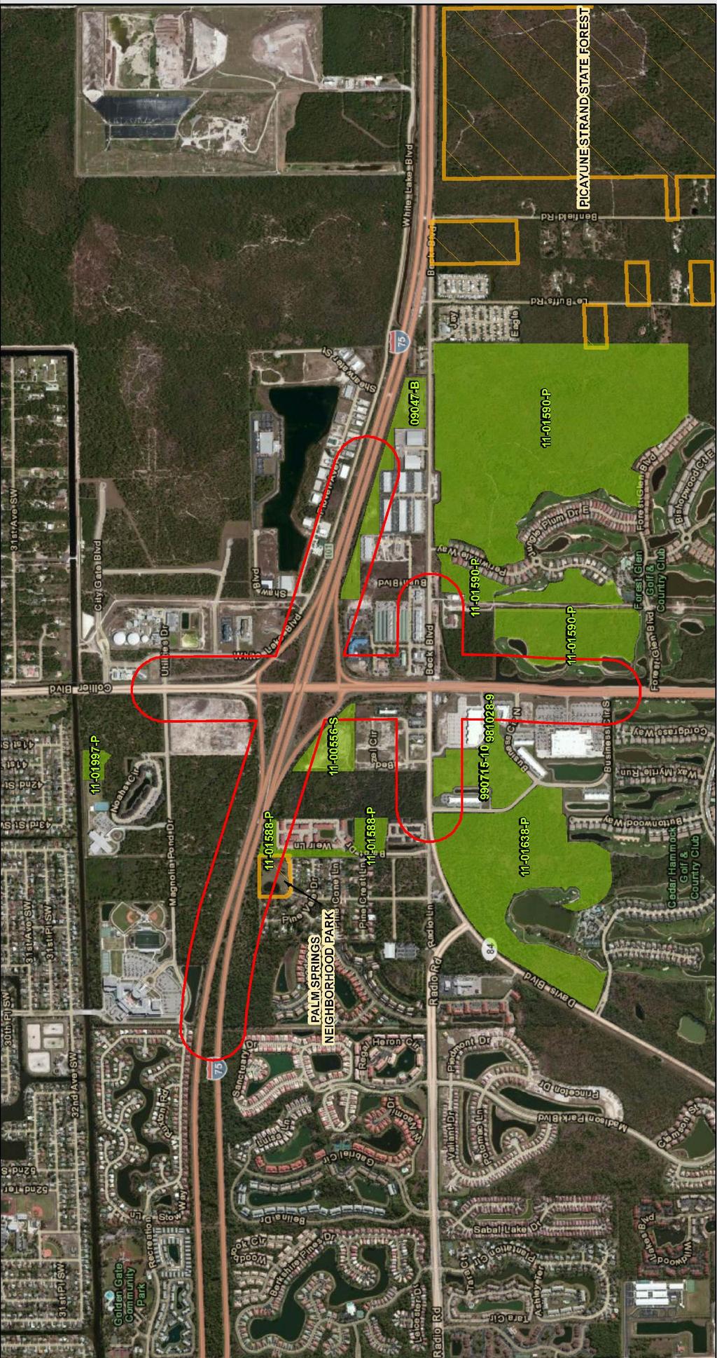
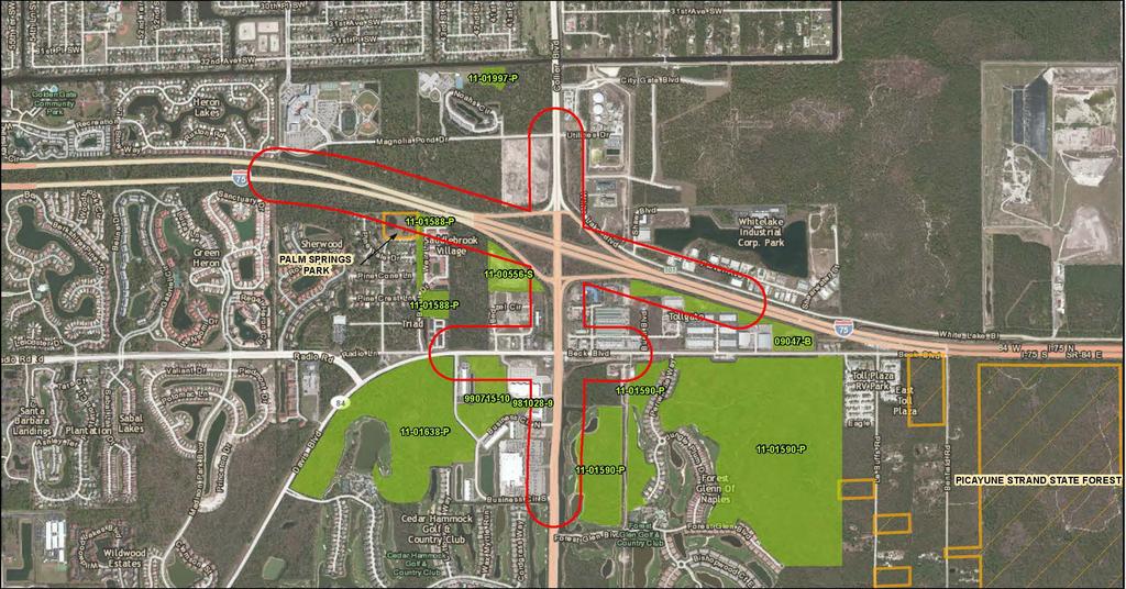
10 ATTACHMENT 1 PROJECT DESCRIPTION The I-75 interchange at SR 951 is located at the eastern edge of the Naples metropolitan urban area in Collier County, Florida, as illustrated Figure 1. This interchange is the last eastbound exit off I-75 prior to the toll plaza for Alligator Alley. The I-75 at SR 951 Ultimate Interchange PD&E Study extends along Collier Boulevard between the intersections with Business Circle South and Magnolia Pond Drive, approximately 6,800 feet. The I-75 ramp tie-in locations were evaluated approximately 3,000 feet west and east of existing ramp gore areas. Figure 2 illustrates the project location and termini. A. Existing Conditions I-75 is a limited access freeway designated as a Rural Primary Arterial-Interstate up to milepost , east of Collier Boulevard and as an Urban Primary Arterial-Interstate thereon. I-75 is two-lanes wide in each travel direction. I-75 is part of the National Highway System, Strategic Intermodal System (SIS), and State Highway System. I-75 is an emergency evacuation route, which can also be operated as a one-way facility, either in the southbound direction from Fort Myers or northbound from Fort Lauderdale. Along I- 75 tangents, the limited access right-of-way is approximately 322 feet wide. SR 951 (Collier Boulevard) between the SR 84 (Davis Boulevard) intersection and approximately 700 feet north of the I-75 northbound ramp terminal is designated as an Urban Other Principal Arterial and is part of the State Highway System. SR 951 features four through lanes in each travel direction through the interchange area. CR 951 (Collier Boulevard) is a Collier County facility outside those limits and features three through lanes in each travel direction. The local name of Collier Boulevard will be used within this report when referring to either SR 951 or CR 951. The right-of-way width along Collier Boulevard varies between 225 and 200 feet. SR 84 (Davis Boulevard) is designated as an Urban Minor Arterial and is part of the State Highway System. The local name of Davis Boulevard will be used in this report when referring to SR 84. The eastern leg of the Collier Boulevard and Davis Boulevard intersection is Beck Boulevard. West of the intersection with Collier Boulevard the typical right-of-way width along Davis Boulevard is 150-foot wide. Davis Boulevard typically features three through lanes in each travel direction. Beck Boulevard is twolanes wide in each travel direction. Three capacity improvement projects were recently completed on Collier Boulevard, Davis Boulevard, and three of the four I-75 ramps. These improvements are considered to be part of the study s No-Build interchange condition. Collier Boulevard was widened to eight lanes, four in each direction of travel, between the intersection with Davis Boulevard and City Gate Boulevard. Davis Boulevard was widened to six lanes from west of Radio Road to Collier Boulevard. Collier Boulevard and Davis Boulevard intersection turn lane improvements include: 10
11 A second southbound left-turn lane A third eastbound left-turn lane An eastbound right-turn bypass lane to southbound Collier Boulevard A second westbound left-turn lane The Collier Boulevard south intersection leg with the I-75 northbound on-ramp was widened to include a third northbound left-turn lane. Both I-75 off-ramps at Collier Boulevard were widened to make full use of the additional capacity being added along the arterial. As such, the southbound off-ramp is five lanes wide with three right-turn lanes toward southbound Collier Boulevard and two northbound left-turn lanes. The I-75 northbound off-ramp was widened to four lanes, two per turning direction, at the Collier Boulevard intersection. The northbound I-75 on-ramp was widened to three lanes for consistency with the new three left-turn lanes off Collier Boulevard. B. Proposed Improvements The need for the proposed improvements is supported by traffic analysis conducted during the PD&E study. As previously shown in Tables 1 and 2, tremendous growth is anticipated in the study area causing the intersections of Collier and Davis Boulevards and I-75 and the Southbound Exit Ramp to operate at LOS F in the 2035 design year. The Interchange area traffic patterns indicate a strong desire for Collier Boulevard travelers from locations south of I-75 to access the interstate and drive north. License plate surveys conducted for this project further indicate a strong desire for eastbound travelers on Davis Boulevard to drive north along Collier Boulevard to destinations in the northeast residential areas of the county. The multi-directional travel needs within the interchange area are increasing the traffic operation strain on the Collier Boulevard and Davis Boulevard intersection as well as the I-75 ramp terminal intersections. This project enhanced the 2035 design year traffic operations by maintaining an acceptable LOS at the interchange ramp terminals and the Collier Boulevard and Davis Boulevard major intersection. The anticipated 2035 average vehicle delay with the proposed improvement is 20.5 seconds/vehicle or less (LOS B/C) at the ramp terminal intersections and reduces the 2035 average vehicle delay at the Collier and Davis Boulevards intersection from 86.4 seconds/vehicle (LOS F) to 46.2 seconds/vehicle (LOS D). The preferred alternative, shown in Figure 3, combines a classic Partial Cloverleaf (ParClo) interchange form with two flyover ramp connections to and from Collier Boulevard south of the Davis Boulevard intersection. As such, the highest volume traffic movement to and from I-75 does not have to travel through the Collier Boulevard and Davis Boulevard signalized intersection, extending this busy location s design life. A separated exit lane would be added to northbound Collier Boulevard under the I-75 overpasses and could be constructed within the existing bridge span width. 11
12 The proposed ParClo A interchange would include two new loop ramps in the southwest and northeast quadrants. Two new bridges would provide acceleration lanes to I 75 and would be built south and north of the existing I 75 overpasses. The I 75 southbound onramps from southbound and northbound Collier Boulevard first merge to one lane joining the I 75 mainline southeast of the current interchange gore. The proposed I 75 northbound on ramp gore will be rebuilt in the approximate same location as the existing gore and will provide a parallel merge auxiliary lane to mainline I 75. The southbound off ramp gore would be rebuilt to provide a parallel two lane exit. Both southbound and northbound off ramps would be relocated to accommodate the new loop ramps. Two flyovers would convey Collier Boulevard traffic over Beck Boulevard and Davis Boulevard to the proposed northbound loop on ramp and from the southbound offramp respectively. These flyovers would connect with Collier Boulevard at the Business Circle North intersection, south of Davis Boulevard. An Interchange Modification Report (IMR) has been approved by Federal Highway Administration (FHWA) on October 6, 2013 based upon the preferred alternative discussed above. 12
13 Figure 1 Study Area Vicinity 13

14 Figure 2 Project Location and Termini 14

15 Figure 3 Preferred Alternative 15
16 A.1 LAND USE CHANGES ATTACHMENT A SOCIAL AND ECONOMIC The existing land use (Figure 4) in the immediate vicinity of the proposed interchange is designated primarily for commercial uses; pockets of light industrial uses also occur in the area as the interchange is located within a designated freight activity center of Collier County. The zoning map for Collier County indicates land use consists of a combination of commercial (C-2, C-3, C-4), industrial (I), planned unit development (PUD) and residential. According to the Collier County Future Land Use Map (Figure 5), the project area is targeted for growth and reinvestment and is intended to continue to support notable commercial and industrial development. The interchange lies within a commercial mixed-use zoning overlay designated by Collier County. While minimal impacts to surrounding land uses (particularly vacant commercial properties) could occur as a result of the proposed interchange improvement, the project is ultimately intended to accommodate the projected population and employment growth in the area by increasing operational capacity and enhancing overall traffic operations. The overall effects on the area's character resulting from the improvement are expected to be minimal as the project supports the land use vision depicted through the Collier County Future Land Use Map. The project is consistent with the adopted Collier County Growth Management Plan, as well as Collier Metropolitan Planning Organization's 2035 Long Range Transportation Plan and FY 2012/ FY 2016/2017 Transportation Improvement Program. A.2 COMMUNITY COHESION Construction of a new highway or improvements to an existing facility can impact community cohesion in several ways and can be either beneficial or adverse. Since the proposed project consists of improving an existing interchange and no residential properties will be acquired, no impacts on community cohesion are anticipated. 16

17 Figure 4 Existing Land Use Map 17

18 Figure 5 Future Land Use Map 18
19 A.3 RELOCATION POTENTIAL As part of the evaluation, an assessment was completed in accordance with FDOT s Project Development & Environment Manual (commonly referred to as the PD&E Manual), Part 2, Chapter 9. Current roadway improvements are developed primarily within the existing right-of-way, with small easements and right-of-way additions around the Collier and Davis Boulevards intersection. The proposed project, as presently conceived, will require 1.79 acres of right-of-way impacting 8 parcels but will not displace any residences or businesses within the community. Should this change over the course of the project, the Florida Department of Transportation will carry out a Right of Way and relocation program in accordance with Florida Statute and the Uniform Relocation Assistance and Real Property Acquisition Policies Act of 1970 (Public Law as amended by Public Law ). The brochures that describe in detail the Department s relocation assistance program and right of Way Acquisition Program are Your Relocation: Residential, Your Relocation: Business, Farms and Nonprofit Organizations, Your Relocation: Signs and The Real Estate Acquisition Process. All of these brochures are distributed at all public hearings and made available upon request to any interested persons. A.4 NON-DISCRIMINATION CONSIDERATIONS This project has been developed in accordance with the Civil Rights Act of 1964, as amended. A.5 CONTROVERSY POTENTIAL The project was reviewed through the Efficient Transportation Decision Making (ETDM) screening in 2009, in accordance with FHWA requirements. As a result of this review process, comments were submitted to FDOT via the Environmental Screening Tool (EST). The responses to the ETDM Screening were reviewed and none were controversial in nature. Advance Notification On December 3, 2010 an Advance Notification (AN) package was distributed in accordance with FHWA requirements, to initiate coordination with federal, state, and local government agencies as part of the Efficient Transportation Decision Making (ETDM) process. The process allows the agencies to review the proposed project and provide comments that are incorporated into the ETDM Summary Report. Concerns or issues identified as a result of the Advance Notification and ETDM process were evaluated during the PD&E Study. Project newsletter - A public kickoff newsletter announcing the study was mailed in November 2011 to approximately 200 property owners / tenants. This newsletter served to introduce the project and the study to the public and to solicit questions, comments, and suggestions. 19
20 Collier Metropolitan Planning Organization (MPO) presentations In June 2012 and December 2013, presentations providing project updates, an explanation of the project purpose and need, an explanation of the project alternatives, environmental evaluations, opportunities for public involvement, and contact information was given to each of the following: Technical Advisory Committee, Citizens Advisory Committee, Pathways Advisory Committee and the Metropolitan Planning Organization Board. Public information workshop a public information workshop was held on October 25, Notifications were sent to property owners, local elected officials and other interested parties. The workshop was held in an open-house format and members of the study team were available to answer questions and discuss the project one-on one with attendees. Approximately 35 citizens attended the workshop with 8 comments received. Responses to the comments were prepared and mailed to each correspondent. None of the comments received were controversial in nature. A public hearing was held on December 10, Notifications were sent to property owners, local elected officials and other interested parties. The hearing was held in an open-house format with members of the study team available to answer questions and discuss the project one-on one with attendees. A formal hearing presentation was provided along with a period for public testimony. Approximately 34 citizens attended the hearing with 2 comments received. Responses to the comments were prepared and mailed to each correspondent. None of the comments received were controversial in nature. A transcript of the public hearing and the Transcript Coordination Package can be found in Appendix C. 20
21 B.1 SECTION 4(f) LANDS ATTACHMENT B CULTURAL IMPACTS In accordance with Section 4(f) of the US Department of Transportation Act of 1966, as set forth in the Title 49, USC Section 1653 (f), amended and re-codified in Title 49, USC, Section 303, and expanded in Title 23, USC, Section 138, the project study area was evaluated for potential Section 4(f) resources and effects. Only one public land exists within the study limits (Figure 6). Palm Springs Public Park is located west of the I-75/SR 951 interchange, and between I-75 and Palm Lake Drive. This recreational facility is owned and operated by the Collier County Department of Parks and Recreation. The park is geared toward the immediate community and offers few amenities. No right-of-way is required from the park for construction of the proposed improvement. All access and functionality is maintained and aesthetics are not altered. Therefore, no constructive use of the park is anticipated. On October 21, 2013, a Section 4(f) Determination of Applicability (DOA) was submitted to FHWA for review, requesting concurrence that Section 4(f) would not apply to the Palm Springs Park. On November 7, 2013, FHWA provided concurrence (Appendix D) that the Palm Springs Park is protected as a Section 4(f) property, however, the project does not incorporate any portion of this park permanently or temporarily into a transportation use. Therefore, the proposed project will not use property from the Palm Springs Park and Section 4(f) does not apply. There is a former conservation easement (Figure S) created for wetland mitigation. This mitigation was not successful and the South Florida Water Management District has required alternate mitigation measures and returned the easement to the property owner. Since the property is no longer publicly owned and encumbered with a conservation easement, a Section 4(f) DOA is not warranted for this parcel. B.2 HISTORIC SITES/DISTRICTS A Cultural Resource Assessment Technical Memorandum prepared in accordance with the procedures contained in 36 CFR Part 800, including background research and a field survey coordinated with FHWA and the State Historic Preservation Officer (SHPO), was performed for the project. As the result of background research and archaeological and historical field survey, no new historic sites were identified within the pond sites for the I-75 at SR 951 Ultimate Interchange project. A full record of the archaeological and historical evaluation can be found in the Cultural Resource Assessment Survey Technical Memorandum. Concurrence of this report was received from FHWA and the State Historic Preservation Officer (SHPO) on March 7, 2013 and can be found in Appendix D. 21
22 Figure 6 Conservation Lands 22
23 B.3 ARCHAEOLOGICAL SITES A Cultural Resource Assessment Technical Memorandum prepared in accordance with the procedures contained in 36 CFR Part 800, including background research and a field survey coordinated with FHWA and the State Historic Preservation Officer (SHPO), was performed for the project. As the result of background research and archaeological and historical field survey, no new cultural resources were identified within the pond sites for the I-75 at SR 951 Ultimate Interchange project. A full record of the archaeological and historical evaluation can be found in the Cultural Resource Assessment Survey Technical Memorandum. Concurrence of this report was received from FHWA and the State Historic Preservation Officer (SHPO) on March 7, 2013 and can be found in Appendix D. B.4 RECREATION AREAS Only one public land exists within the study limits. Palm Springs Public Park is located within the study limits, west of the I-75/SR 951 interchange, and between I-75 and Palm Lake Drive. This recreational park is owned and operated by the Collier County Department of Parks and Recreation. The preferred alternative will not impact these public lands. 23
24 ATTACHMENT C NATURAL ENVIRONMENT C.1 WETLANDS In accordance with Executive Order 11990, Protection of Wetlands, dated May 23, 1977, and US Department of Transportation order A, Preservation of the Nation s Wetlands, dated August 24, 1978, a Wetland Evaluation Report (WER) was completed as part of this PD&E study. The report was prepared using assessment methodology, evaluation procedures, and document preparation guidance found in Part 2, Chapter 18 ( ) of the FDOT s PD&E Manual. The purpose of this evaluation was to assure the protection, preservation, and enhancement of wetlands to the fullest extent possible. Fifteen wetlands and seven surface waters were identified within the study area. These wetlands were classified, and characterized utilizing FLUCFCS codes, and USFWS National Wetland Inventory (NWI) codes. As a result of this study, the project team determined there are no practicable alternatives to completely avoid wetland impacts. Impacts to six wetland systems W6, W7, W8, W16, W17 and W18 are anticipated to incur as a result of the proposed roadway construction. These wetlands are either located adjacent to the existing roadway (W6) or within the existing interchange infields (W7, W8, W16, W17 & W18) and have been previously disturbed by highway construction, maintenance activities, and the invasion of opportunistic nuisance and exotic species. Wetland W6 is classified by FLUCFCS as a wet prairie and it is located adjacent to the existing Interstate 75 southbound off-ramp. Wetlands W7, W8, W16, W17 and W18 are classified by FLUCFCS as hydric pine flatwoods and are located within the existing infields. Figure 7 depicts the locations of the anticipated wetlands and surface waters impacts within the study limits. Impact acres to each wetland system can be found in Table 3. 24

25 Figure 7 Wetlands and Surface Waters 25
26 Table 3. Summary of wetland impacts within study limits System ID FLUCFCS Impact Acres Location W6 643, Wet Prairie 2.06 Proposed ROW W6 643, Wet Prairie 0.07 Pond 1C W6 Subtotal 2.13 W7 625, Hydric Pine Flatwoods 0.94 Proposed ROW W7 625, Hydric Pine Flatwoods 1.66 Pond 1A W7 Subtotal 2.60 W8 625, Hydric Pine Flatwoods 1.71 Proposed ROW W8 625, Hydric Pine Flatwoods 0.40 Pond 2 W8 625, Hydric Pine Flatwoods 1.90 Pond 4S W8 Subtotal 4.01 W16 625, Hydric Pine Flatwoods 0.57 Proposed ROW W16 625, Hydric Pine Flatwoods 0.30 Pond 4N-C W16 625, Hydric Pine Flatwoods 0.56 Pond 4N-B W16 Subtotal 1.43 W17 625, Hydric Pine Flatwoods 0.28 Proposed ROW W17 625, Hydric Pine Flatwoods 0.49 Pond 4N-B W17 Subtotal 0.77 W18 625, Hydric Pine Flatwoods 0.06 Pond 4N-A W18 Subtotal 0.06 TOTAL Wetland W6 is part of a man-made enhancement area created to satisfy past mitigation requirements from the state. Correspondence was initiated with Karyn Allman of SFWMD on [DATE] to provide comment regarding impacts to wetland W6 (provided in Appendix D). It was determined that wetland W6 has since been deemed as failing as an enhancement area, and the SFWMD and FDEP agreed that mitigation areas would be provided through the purchase of credits at the Big Cypress Mitigation Bank instead. FDEP released the conservation easement originally recorded for the mitigation area. However, the northern portion remains platted as a preserve under Collier County. The platted area totals 6.12 acres and encompasses a portion of wetland W6, wetland W5, and areas outside the study limits. The portion of wetland W6 proposed for impact that falls within the preserve totals 0.20 acres, which is approximately three percent of the total area. Collier County s Land Development code Section (D)(2)(c) allows for the development of this preserve so long as the amount reduced does not exceed ten (10) percent of the total preserve area. 26
27 These wetlands have a moderate Uniform Mitigation Assessment Method (UMAM) score, which reflects the disturbed nature of the wetland. The FDEP and Water Management Districts involved in the Environmental Resource Permitting (ERP) Program developed the Uniform Wetland Mitigation Assessment Method (UMAM; Chapter FAC). It has since been adopted by the US Army Corps of Engineers (ACOE). The onsite wetlands have a moderate UMAM score, which reflects the disturbed nature of the wetland. UMAM was performed on the wetlands (Table 4) proposed for impact resulting in 4.48 units of Functional Loss (FL) for an estimated acres of impact. Other wetlands, some of higher quality, are located within the project study limits but will not be impacted by the proposed project. Additionally, temporary impacts to one surface water, the Henderson Creek Canal, will occur as a result of the proposed project. Table 4. Summary of UMAM analysis for wetland impacts within study limits System ID FLUCFCS Impact Acres UMAM FL units W6 643, Wet Prairie W7 625, Hydric Pine Flatwoods W8 625, Hydric Pine Flatwoods W16 625, Hydric Pine Flatwoods W17 625, Hydric Pine Flatwoods W18 625, Hydric Pine Flatwoods TOTAL Temporary Wetland Impacts The Henderson Creek Canal falls within the limits of FDOT property; however, as a surface water tributary into Rookery Bay, it is maintained by the Big Cypress Basin, SFWMD. A portion of this canal proposed to be re-aligned. As a result, the Henderson Creek Canal is anticipated to incur 0.80 acres of temporary impact. This portion of the Henderson Creek Canal is within three USFWS Core Foraging Areas (18.6 miles) and is suitable foraging habitat for the wood stork. Mitigation is to be expected for impacts to surface waters utilized by listed wildlife species. However, in the area of re alignment, the existing canal will be filled in, then reconstructed and shifted east approximately 50 feet. The shifted canal will return to existing habitat conditions and no net loss of suitable foraging habitat will occur. As existing habitat conditions will be replaced in kind, mitigation for this surface water impact is not expected to be required. Anticipated direct wetland impacts associated with this project total 11.0 acres. UMAM assessment to determine functional loss has been calculated to be 4.84 units of Functional Loss. All wetland impacts resulting from the construction of this project will be mitigated pursuant to mitigation requirements of Part IV, Chapter 373 F.S. and 33 U.S.C. s Preliminary mitigation alternatives have been explored. These options 27
28 are described below. Final wetland impacts and mitigation requirements will be determined during the permitting phase of this project. Currently the project lies within the mitigation service area of Panther Island, Big Cypress, and Corkscrew Regional Mitigation Banks. The Panther Island Mitigation Bank is the only one of these three banks occurring within the same drainage basin as the project area, within the West Collier drainage basin. The number of credits required to offset adverse impacts is determined during the permitting process using a functional assessment. Impacts are evaluated using the UMAM or ratios per SFWMD Basis of Review. The relation of the project and the mitigation bank with respect to the drainage basin may also be a criterion in determining the number of mitigation credits needed. Under current Environmental Resource Permit (ERP) regulations, mitigation for wetland impacts may be accomplished through preservation of upland or wetland habitats. The amount of land to be placed into preservation varies on a case by case basis and is dependent upon the Functional Loss due to wetland impacts versus the Relative Functional Gain of the habitat to be placed into conservation, according to UMAM. This method of mitigation will require the purchase of land by the Florida Department of Transportation and placement into a perpetual conservation easement. However, the USACOE does not view preservation as an effective wetland mitigation strategy and alternative mitigation options may be necessary. Wetland restoration entails restoring hydrology and perhaps re vegetation of an area where normal wetland hydrologic and wildlife habitat functions have been altered due to previous disturbance. Enhancement activities involve distinct improvement to an existing wetland and often entail the eradication of exotic and nuisance species, or removal of unnatural topography (spoil and fills). Wetland creation requires that upland areas be excavated (or flooded) to create wetlands by establishing appropriate hydrology. Hydrophytic vegetation planting efforts are usually conducted in conjunction with excavation or re hydration. Mitigation plans including wetland restoration, enhancement, or creation also require monitoring and maintenance, typically for five years. Final determination of jurisdictional wetlands areas and mitigation requirements will occur between the FDOT and the regulatory agencies during the final design phase of this project. It is anticipated that mitigation to offset wetland impacts resulting from construction of this project, will satisfy all mitigation requirements of Part IV, Chapter 373, F.S. and 33 U.S.C. s C.2 WATER QUALITY The proposed project was evaluated for potential impacts to surface water and groundwater resources within the project study area. As part of the evaluation, a Water Quality Impact Evaluation (WQIE) was completed in accordance with FDOT s Project Development and Environment Manual, Part 2, Chapter 20 ( ). The proposed stormwater facility design will include, at a minimum, the water quantity requirements 28
29 for water quality impacts as required by SFWMD in Chapter 40E-4, F.A.C. The Water Quality Impact Evaluation (WQIE) Checklist is provided in Appendix E. Therefore, no further mitigation for water quality impacts will be required. C.3 FLOODPLAINS In accordance with Executive Order 11988, Floodplain Management, US DOT Order , and Chapter 23, CFR 650A, the project corridor was evaluated for possible impacts to floodplains. Floodplain areas were identified within the study corridor (Figure 8) using the Federal Emergency Management Agency (FEMA) Digital Flood Insurance Rate Maps (DFIRM) GIS data dated 2011 obtained from Collier County GIS database. The FEMA DFIRM maps indicate the four interchange infields are classified as Special Flood Zone AH and many adjacent areas surrounding the interchange are also classified as Special Flood Zone AH which include portions of Toll Gate Commerce Center and City Gate. Special Flood Zone AH is defined by FEMA as areas with a 1% annual chance of shallow flooding (100 year), usually in the form of a pond, with an average depth ranging from 1 to 3 feet. The DFIRM maps also indicate all pavement areas associated with Collier Boulevard and I-75, and interchange entrance/exit ramps are classified as Special Flood Zone X which is defined by FEMA as area of minimal flood hazard, usually depicted as above the 500 year flood level. The proposed project will not require any floodplain compensation since sufficient floodplain storage will be provided in the interchange stormwater ponds as demonstrated in the floodplain impact analysis documented in Location Hydraulics Report. The proposed project will also not require any additional cross-drains or box culverts as all drainage flows will be accommodated by the proposed condition. Extensions of several existing cross-drains under the interchange ramps and two box-culverts under mainline I-75 will be necessary to accommodate the proposed project. The Collier Boulevard northbound fly-over ramp over Davis Boulevard will require realignment of approximately 600 linear feet of the Henderson Creek Canal eastward to accommodate the ramp requiring 0.27 acres of additional right-of-way. 29

30 Figure 8 Floodplains Map 30
31 C.4 COASTAL ZONE CONSISTENCY Through the ETDM process, it was determined on 1/26/2011 that this project is consistent with the Coastal Zone Management Act. This determination can be found on Page 8 of the ETDM Summary Report in Appendix B. C.5 WILDLIFE AND HABITAT In compliance with Section 7 of the Endangered Species Act (ESA) of 1973, as amended, using assessment methodology, evaluation procedures, and document preparation guidance found in Part 2, Chapter 27 ( ) of the FDOT s PD&E Manual the proposed project has been evaluated for potential impacts to threatened and endangered plant and animal species. An Endangered Species Biological Assessment (ESBA) has been prepared to aid in determining the preferred alternative and to evaluate the impacts to endangered or threatened species, if any, associated with the proposed project. A threatened and endangered species survey was conducted to qualitatively assess the potential for wildlife usage, or rare plant occurrences within the project study area. Based on the findings obtained during corridor survey efforts, no listed floral or faunal species were observed within the project corridor. While no protected species were observed, listed species were reported to occur within close proximity of the study limits, according to database and literature research or have United States Fish and Wildlife Service (USFWS) Consultation Areas (CAs) overlapping the study limits. Figure 9 shows the approximate location of historically documented listed species occurrences within the vicinity of the study limits. The potential for occurrence of listed species within the study limits was based on federal and state protected species lists (Table 5), the vegetative communities present and surrounding land uses. Many species previously documented to occur in Collier County were excluded as having potential to occur within the study limits, due to lack of suitable habitat, hydrology, or geology. Literature research indicates one (1) amphibian, three (3) reptile, ten (10) avian, four (4) mammal, and six (6) plant species may occur within the study limits. The likelihood of occurrence for each of the listed species potentially in the project vicinity was evaluated. The likelihood of impacting threatened species habitat was ranked as medium for the preferred alternative. The potential for habitat impacts reflects the documented presence of protected species in the project vicinity. The ESBA notes that the project may affect, but is not likely to adversely affect the following federallylisted species: Florida panther, Florida scrub jay, wood stork, American alligator, eastern indigo snake, red cockaded woodpecker, Florida bonneted bat. This project will have no effect on the federally listed snail kite. 31

32 Figure 9 Listed Species Map 32
33 Amphibians Table 5. Protected Species with Potential to Utilize Habitat within the Study limits Species USFWS FFWCC/ FDACS Habitat Preference Likelihood of Occurrence Gopher frog Rana capito None SSC Dry uplands that include isolated wetlands, gopher frog burrows Low Reptiles American alligator Alligator mississippiensis T (S/A) SSC Most permanent bodies of freshwater Moderate Eastern indigo snake Drymarchon couperi T T Upland and wetland habitat, hydric ecotonal areas, gopher tortoise burrows Low Gopher tortoise Gopherus polyphemus None T Xeric uplands, pine flatwoods, pastures, and open, ruderal habitat Low Birds Florida scrub jay Aphelocoma coerulescens T T Fire-maintained low growing oak scrub on sandy soils Low Limpkin Aramus quarauna None SSC Mangroves, freshwater wetlands, streams, lakes, swamps, manmade impoundments and ditches Moderate Florida burrowing owl Athene cunicularia floridana None SSC High sparsely vegetated sandy ground, extensive use of pastures, ball fields, parks, airports Low Snowy egret Egretta thula None SSC Wetlands, streams, lakes, swamps, manmade impoundments and ditches Moderate White ibis Eudocimus albus None SSC Wetlands, streams, lakes, swamps, manmade impoundments and ditches Moderate Bald Eagle* Haliaeetus leucocephalus BGEPA & MBTA FAC 68A Areas close to bays, rivers, lakes, or other bodies of water that provide concentrations of food sources. Low Wood stork Mycteria americana E E Nests in forested wetland and mangroves, utilizes shallow wetlands, ditches, and lakes for foraging Documented White-crowned pigeon Patagioenas leucocephala None T Nests in mangrove islands, forages in tropical hardwood hammocks Low 33
34 Species Birds (cont.) Red-cockaded woodpecker Picoides borealis Snail kite Rostrhamus sociabilis plumbeus Mammals Florida black bear** Ursus americanus floridanus Florida bonneted bat Eumops floridanus USFWS FFWCC/ FDACS Habitat Preference Likelihood of Occurrence E E Open, mature pine woodlands Documented E None E E FAC 68A T Forages in large, open freshwater marshes and lakes with shallow water, and a low density of emergent vegetation. Usually nests over water in low shrub/tree Large continuous tracks of various forested communities, particularly forested wetlands for diurnal cover Roosts in palms, hollow trees and buildings. Moderate Documented Moderate Florida panther Puma concolor coryi E E Extensive blocks of mostly forested communities, large wetlands for refuge Documented Big Cypress fox squirrel Sciurus niger avicennia Plants Pine-woods bluestem Andropogon arctatus Nodding pinweed Lechea cernua Small's flax Linum carteri var. smallii Celestial lily Nemastylis floridana Ghost orchid Polyrrhiza lindenii Florida royal palm Roystonea elata None None None None None None T T T E E E Forested habitats with open to moderately dense understory and shrub cover Wet pine flatwoods subjected to recurring fires Deep sands, usually ancient dunes, forest of evergreen scrub oaks Pine rocklands, pine flatwoods, adjacent distrubed areas Wet flatwoods, prairies, marshes, cabbage palm hammocks edges Dense, wet subtropical to tropical forests and hammocks Documented Moderate Low Moderate Low Low None E Tropical hammocks Low USFWS = United States Fish and Wildlife Service FFWCC = Florida Fish and Wildlife Conservation Commission FDACS = Florida Department of Agriculture and Consumer Services E = Endangered, T = Threatened, SSC = Species of Special Concern, T(S/A) = Threatened due to Similarity of Appearance * Removed from the both the USFWS and FFWCC Endangered and Threatened Species List in 2008, but is still protected under the Bald and Golden Eagle Protection Act (BGEPA), Migratory Bird Treaty Act (MBTA), and Florida Administrative Code (FAC) ** Removed from the FFWCC Endangered and Threatened Species List in 2012, but still protected under the FAC 34
35 Florida Panther PROTECTED SPECIES WITH BOTH FEDERAL AND STATE DESIGNATION The Florida panther is listed as endangered by the USFWS and FFWCC. The study limits lies just west of the USFWS Florida panther consultation area (Figure 9) and minimal panther habitat exists within the study limits due to the urban nature of the roadway interchange. Panther telemetry data displays panther occurrence within the study limits and within the nearby vicinity (800 feet east). One panther telemetry point from 1995 of panther TX101 occurs within the study limits. Telemetry data of panther FP148 and panther FP149 documented presence of Florida panthers in 2006 and 2007 respectively within the 178 acre Forest Glen mitigation preservation area located at the southwest quadrant of the intersection of Beck Boulevard and Collier Boulevard. As of 2011, the study limits is within the westernmost limits of the minimum home range of FP148 (FFWCC Annual Panther Report). Due to the study limits being outside of the USFWS Florida panther consultation area and that the proposed project is not likely to contribute to additional urban sprawl by simply reconfiguring the interchange, it is anticipated that this project may affect, but is not likely to adversely affect the Florida panther. Florida Scrub Jay The Florida scrub jay is listed as threatened by the USFWS and FFWCC due to loss of its preferred habitat. Suitable scrub jay habitat was not located within the study limits. General wildlife field surveys conducted did not detect signs of scrub jays. The nearest historically documented scrub jay cluster is approximately 8.6 miles south of the study limits. While the project study limits is wholly located within the USFWS Florida scrub jay consultation area, based on lack of suitable habitat, it is anticipated that this project may affect, but is not likely to adversely affect on the Florida scrub jay. Wood Stork Because all of the build alternatives will result in impacts to wood stork foraging habitat, the FDOT is committed to providing mitigation that is acceptable to the USFWS and FDOT. The details of this mitigation will be finalized during the design and permitting process of the project. Using the Wood Stork Effect Determination Key (USFWS 2010), it is anticipated that this project may affect, but is not likely to adversely affect the wood stork. American alligator The American alligator is listed by the USFWS and FFWCC as a federally threatened species based on similarity of appearance to the endangered American crocodile. During general wildlife surveys, the American alligator was not observed. Any wetland impacts to habitats potentially utilized by alligators will be mitigated for pursuant to Part IV, Chapter 373, F.S. and 33 U.S.C It is anticipated that this project may affect, but is not likely to adversely affect the American alligator. 35
36 Eastern Indigo Snake The Eastern indigo snake (Drymarchon corais couperi) is listed as threatened by the USFWS and FFWCC. No indigo snakes were observed during general wildlife surveys and no indigo snakes are documented within three miles of the study limits. Suitable habitat is available within the study limits, however, due to fragmentation of the natural areas within the study limits and lack of large tracts of suitable habitat, viable populations of the indigo snake is not likely. To minimize the potential for inadvertent impact to an indigo snake, the FDOT has developed standard Construction Precautions for the Eastern indigo snake, which will be adhered to during the construction of the project. It is anticipated that this project may affect, but is not likely to adversely affect the Eastern indigo snake. To avoid any potential impacts to the eastern indigo snake, the standard FDOT Construction Precautions for the Eastern Indigo Snake will be adhered during the construction of the project (Appendix F). Red Cockaded Woodpecker The red cockaded woodpecker (RCW) (Picodeas borealis) is listed as endangered by the USFWS and FFWCC. There is suitable habitat for red cockaded woodpeckers within the regional area, but minimal suitable habitat within and adjacent to the existing ROW. A cavity tree survey was conducted in February of 2013 which yielded the observation of two potential cavity trees. However, only one potential cavity tree was located within the half mile survey buffer, approximately 0.44 miles to the southwest of the project area. This cavity tree is unlikely to be active due to the vegetation growing around the tree trunk. The second potential red cockaded woodpecker cavity tree was located outside the half mile survey buffer approximately 0.51 miles to the northeast of the project area. There are multiple red cockaded woodpecker observations historically documented within a half mile of the project area. However, no red cockaded woodpeckers or evidence of these occurrences were observed during the cavity tree survey. Given the distance of the potential observations and the minimal suitable habitat within the project area, it is anticipated that this project may affect, but is not likely to adversely affect red cockaded woodpecker. Florida Bonneted Bat The Florida bonneted bat (Eumops floridanus) is listed as endangered by the USFWS and FFWCC. The study limits fall entirely within the USFWS Florida bonneted bat consultation area. A specific survey was conducted on January 14, 2014 to confirm the presence or absence of Florida bonneted bat roosts within the study area. Potential roost areas, including trees containing cavities, abandoned structures, and bridges, were inspected for bat occupancy and presence of guano. No bat houses, bats or evidence thereof were observed within the study area. Therefore, based on the surrounding development, lack of species observations, and no proposed impacts to bat houses, it is anticipated that this project may affect, but is not likely to adversely affect the Florida bonneted bat. 36
37 Snail Kite The snail kite is listed as endangered by the USFWS and FFWCC. General wildlife field surveys conducted did not detect signs of snail kite within the study limits. No documented occurrences of snail kite exist within the data available and the study limits are approximately a quarter-mile west of the USFWS snail kite consultation area. Due to lack of suitable foraging and nesting habitat, it is anticipated that this project, beyond the snail kite consultation area, will have no effect on the snail kite. Wading Birds PROTECTED SPECIES WITH STATE DESIGNATION ONLY This category includes all wetland-dependent birds that are listed by the FFWCC as threatened or a species of special concern. These species utilize a wide variety of natural and artificial wetland habitats. Collectively wading birds include Florida sandhill crane (T), limpkin (SSC), little blue heron (SSC), snowy egret (SSC), and white ibis (SSC). Suitable habitat for wading birds exists within the study limits, however no wading birds were observed during general wildlife surveys. GIS databases indicate no wading bird occurrences within the study limits and the nearest documented wading bird rookery is located more than eight miles southwest of the study limits. Wetland impacts to habitats potentially utilized by wading birds will be mitigated pursuant to Part IV, Chapter 373, F.S. and U.S.C It is anticipated that the project will not result in any adverse effects to these species. Big Cypress Fox Squirrel The Big Cypress fox squirrel is listed by the FFWCC as threatened. Marginal habitat for the Big Cypress fox squirrel exists within the study limits though it is fragmented by roads and ramps. Past SFWMD permits issued within the area mention potential for Big Cypress fox squirrels to inhabit the transitional and slash pine dominated habitats. Available databases indicate no historical occurrences of Big Cypress fox squirrel within the study limits, nor were any observed during general wildlife surveys. It is anticipated that the project will not likely result in any adverse effects to this species. Gopher Tortoise The gopher tortoise is listed by the FFWCC as state-designated threatened. Minimal suitable gopher tortoise habitat is present within and adjacent to the existing ROW. In addition, no gopher tortoise burrows were observed within the study area. No impacts to gopher tortoises are anticipated. However, if any new burrows are found during the design and permitting phase of the project, the FDOT will secure a FFWCC relocation permit if needed for this species. It is anticipated that the project will not likely result in any adverse effects to this species. 37
38 CONCLUSIONS ABOUT PROTECTED ANIMAL SPECIES WITH STATE DESIGNATIONS ONLY Each potentially occurring species was evaluated based on existing data and current surveys to determine any effect the proposed project may have. This information has aided the project engineers in designating a preferred alignment alternative that will minimize environmental effects to the project corridor. The proposed project is not likely to adversely affect any state-listed species, including wading birds, Big Cypress fox squirrel, and gopher tortoise, or any other protected species, including the bald eagle and Florida black bear. PLANTS No state or federally protected plant species were observed within the study limits during general field surveys. Many federal plant species are documented to occur within Collier County, however, a project specific Florida Natural Areas Inventory (FNAI) data search resulted in zero federally listed plant species occurring within the study limits. This project should have a finding of no effect on federally listed plant species. If state protected plant species are observed within the proposed impact limits during the design phase, the Florida Department of Agriculture and Consumer Services (FDACS) only regulates the harvest of protected species for commercial purposes, and does not restrict individual landowners from destruction of protected plants on their property. 38
39 OTHER PROTECTED SPECIES Bald Eagle In 2008, the USFWS removed the bald eagle from the list of species protected by the Endangered Species Act. The FFWCC followed suit in the same year, removing the bald eagle from Florida s list of imperiled species. Despite the delisting of the bald eagle by both agencies, it remains protected by two federal acts: the Bald and Golden Eagle Protection Act (BGEPA) and the Migratory Bird Treaty Act (MBTA). In accordance with these remaining protections, the FFWCC adopted the Bald Eagle Management Guidelines in April 2008 (F.A.C. 68A ). Review of the FFWCC bald eagle nest location data revealed that no bald eagle nests are located within the study area, nor within 660 feet of the study area. The nearest two known nest locations are over two miles from the study area, one occurring to the southeast and the other occurring to the southwest. During the field visit, no eagles or evidence of a nest, were observed within or near the study area. Therefore, this project is not likely to adversely affect the bald eagle. Florida Black Bear The Florida black bear was removed from the Florida s Endangered and Threatened Species List on August 23, 2012 after approval by the Commission at the June 2012 Commission meeting, however the Florida black bear remains protected under the Florida Administrative Code 68A-4.009, which gives the FFWCC the right to review and provide comments to permitting agencies in order to meet the goals of the approved Florida Black Bear Management Plan. Primary Florida black bear habitat includes bottomland and upland hardwoods, mixed forest, scrub, flatwoods, and swamps. The ideal habitat is a mixture of these types. Within the study limits, there have been three historical occurrences of Florida black bears: two vehicular collisions dated 1986 and 2000, and one in yard nuisance report in Fairly recent bear nuisance activity from 2007 is documented within approximately 500 feet of the study limits. During general wildlife surveys, no evidence of bears was observed. While marginal habitat exists within the study limits, large contiguous tracts of natural area, imperative for a Florida black bear s home range, do not exist. It is anticipated that the project will not likely result in any adverse effects to this species. CONCLUSION ABOUT WILDLIFE AND HABITAT Coordination with USFWS regarding the proposed improvements has occurred. On May 8, 2013 the USFWS concurred with the FDOT s determination that the proposed project may affect but is not likely to adversely affect any resources protected under the Endangered Species Act of 1973, as amended. The documentation can be found in Appendix D. 39
40 In summary, the proposed project may affect, but is not likely to adversely affect the following federally listed species: Florida panther Florida scrub jay Wood stork American alligator Eastern indigo snake Red cockaded woodpecker Florida bonneted bat The proposed project will have no effect on the following federally listed species: Snail kite In summary, the proposed project is not likely to adversely affect any state listed species, including wading birds, Big Cypress fox squirrel, and gopher tortoise, or any other protected species, including the bald eagle and Florida black bear. 40
41 ATTACHMENT D PHYSICAL IMPACTS D.1 NOISE An assessment of noise impacts was conducted for this project according to Title 23, Code of Federal Regulations (C.F.R.), Section 772: Procedures for Abatement of Highway Traffic Noise and Construction Noise (July 13, 2010), Part 2, Chapter 17 of FDOT s PD&E Manual (May 24, 2011) and Chapter , Florida Statutes. This assessment also adheres to current FHWA traffic noise analysis guidelines contained in FHWA-HEP : Highway Traffic Noise: Analysis and Abatement Guidance (December 2011). Three capacity improvement projects were recently completed to improve Collier Boulevard, Davis Boulevard, and three of the four I-75 ramps. These improvements are considered to be part of the study s No-Build Alternative. As a result of these projects, Collier Boulevard will be widened to eight lanes, Davis Boulevard is being widened to six lanes and both I-75 off-ramps at Collier Boulevard are being widened to make full use of the additional capacity being added along the arterial. Overall, traffic noise levels throughout the project study area are below the FHWA Noise Abatement Criteria. One exception is at the Tuscan Isles apartment complex (Figure 10) where one end unit is currently affected by traffic noise. Since construction is completed on the No-Build Alternative, more noise sensitive sites may be affected by traffic noise. The majority of impacts will occur at the Tuscan Isles complex, where a total of 16 units will meet or exceed the NAC, and in the adjacent Palm Springs neighborhood and park (Figure 11). Additionally, increased noise levels are also predicted for businesses with outside eating areas near the Collier Boulevard/Davis Boulevard intersection. The proposed project studied in this document (the Build Alternative) is predicted to have similar impacts as the No-Build Alternative. Compared to existing conditions, noise levels under the proposed project will increase between 1.0 db(a) along Collier Boulevard to 8.5 db(a) at noise sensitive sites located closer to the I-75 mainline. Compared to the recently completed No-Build conditions, noise levels under the proposed project will have an average increase of 1.54 db(a) with a levels ranging between 55.1 db(a) along Collier Boulevard to 73.7 db(a) at noise sensitive sites located closer to the I-75 mainline. 41

42 Figure 10 Proposed Noise Barrier locations for Tuscan Isles Figure 4 from Noise Study Report 42

43 Figure 11 Proposed Noise Barrier locations for Palm Springs Park 43
44 While this range of increase is not considered substantial (less than 15 db(a) increase), 34 noise sensitive site are predicted to experience noise levels that either approach or exceed the FHWA NAC. Consequently, abatement measures were evaluated for the Palm Springs Subdivision and Tuscan Isles, the Palm Springs Park, and at the unoccupied Buddy s Burgers at the intersection of Collier Boulevard and Beck Boulevard (NE corner). Palm Springs/Tuscan Isles - Because of proximity, noise barriers of multiple heights and lengths were initially analyzed along the FDOT limited access right of way to provide noise reduction for the two impacted Palm Springs residences and the 29 Tuscan Isles apartments. At heights above 18 feet, the barrier meets both the FDOT s 5.0 db(a) minimum insertion loss requirement and 7.0 db(a) abatement design goal. However, the cost to construct a barrier at this location exceeds the $42,000 cost per benefited receptor reasonableness factor. Consequently, the barrier is not cost reasonable. Even though Palm Springs Park is also behind the analyzed barrier, it is considered a different activity category/common noise environment; thus it was evaluated independently and discussed separately. A subsequent analysis was conducted to determine if two separate noise barriers would meet the cost-reasonableness factor; one barrier for the two impacted Palm Springs residences and one barrier for the 29 impacted Tuscan Isles apartments. The analyzed barrier for the Palm Springs neighborhood fails to meet either the feasibility or reasonableness requirements. However, providing a separate 1,931-foot long, 22-foot high noise barrier to abate traffic noise solely for the Tuscan Isles complex was more effective. The barrier meets both the feasibility and reasonableness requirements. Palm Springs Park - Palm Springs Park is considered a Special Use site requiring a multi-phased approach to noise barrier analysis. The first step in the analysis is to determine the most effective barrier dimensions. A 20-foot high barrier achieves the feasibility requirement. Consequently, the barrier was carried forward to the next phase of evaluation the cost-reasonableness analysis. Without knowing the exact number of visitors using the park facilities on a daily basis, FDOT s Special Use Reasonableness Matrix was used to calculate the average number of daily visitors needed for a sound barrier to be considered cost reasonable. This number was determined to be an average of 769 per day which is an unrealistic expectation given the limited activities this park offers. Hence, a noise barrier at this location is not reasonable. Buddy s Burgers - A sound barrier was considered at the Buddy s Burgers location, however, the ability to construct an effective sound barrier within FDOT right-of-way is hindered by the Collier Boulevard/Beck Boulevard intersection. Consequently, the 44
45 FHWA minimum-required noise reduction of 5.0 db(a) cannot be attained and a barrier at this location is not considered feasible. Of the four barriers that were evaluated, only one meets the reasonableness and feasibility requirements, the Tuscan Isles sound barrier. Based on the noise analysis performed for and documented in the Noise Study Report, there appears to be no solutions available to mitigate the noise impacts at two impacted residences in the Palm Springs Neighborhood nor at four units in the Tuscan Isle Apartment complex. Abatement is also not reasonable at the Palm Springs Park nor is it feasible at the former Buddy s Burgers site. The Florida Department of Transportation is committed to the construction of feasible and reasonable noise abatement measures at the Tuscan Isles community as summarized in Table 6 contingent upon the following conditions: Detailed noise analyses during the final design process supports the need, feasibility and reasonableness of providing abatement; Cost analysis indicates that the cost of the noise barrier will not exceed the cost reasonable criterion; Community input supporting types, heights, and locations of the noise barrier is provided to the District Office; and Safety and engineering aspects as related to the roadway user and the adjacent property owner have been reviewed and any conflicts or issues resolved. Table 6 Noise Barrier Number of Impacted Sites Feasible and Reasonable Sound Barrier Summary Number of Benefited Noise Sites Avg. Noise Reduction (db(a)) Total System Wall Length (ft.) Feasible Wall Height (ft.) Estimated Barrier Cost Tuscan Isles , $1,274,460 More details regarding the noise analysis can be found in the Noise Study Report (NSR) available at the FDOT District One office. 45
46 D.2 AIR QUALITY The proposed project is located in Collier County, an area designated as being in attainment for the following National Ambient Air Quality Standards (NAAQS) established by the Clean Air Act of 1990: ozone, nitrogen dioxide, particulate matter (2.5 microns in size and 10 microns in size), sulfur dioxide, carbon monoxide (CO), and lead. Because the County is in attainment, the Clean Air Act conformity requirements do not apply to the project. This document does not incorporate an analysis of the Green House Gas (GHG) emissions or climate change effects of each of the alternatives because the potential change in GHG emissions is very small in the context of the affected environment. Because of the insignificance of the GHG impacts, those local impacts will not be meaningful to a decision on the environmentally preferable alternative or to a choice among alternatives. For these reasons, no alternatives-level GHG analysis has been performed for this project. D.3 CONSTRUCTION Construction activities for the proposed alternatives will have unavoidable minimal and temporary air, noise, vibration, water quality, traffic flow, and visual impacts for those residents and travelers within the immediate vicinity of the project area. These impacts will be minimized or controlled by FDOT s Standard Specifications for Road and Bridge Construction, and through the use of Best Management Practices. Air quality impacts will be temporary and due to emissions from construction vehicles and dust from earth moving and haul road areas. Air pollution from airborne particles can be effectively controlled through the use of watering or application of other controlling materials in accordance with FDOT s Standard Specifications for Road and Bridge Construction. Noise and vibration impacts can be expected due to heavy equipment operations and construction activities such as pile driving and vibratory embankment compaction. Noise impacts will be minimized through methods outlined in FDOT s Standard Specifications for Road and Bridge Construction. Water quality impacts resulting from erosion and sedimentation will be controlled in accordance with the most current edition of the FDOT Standard Specifications for Road and Bridge Construction, Prevention, Control, and Abatement of Erosion and Water Pollution, and through the use of Best Management Practices. All oil, chemicals, fuel, etc., used in construction must be disposed of in an acceptable manner and be consistent with local, state, or federal regulations, and must not be dumped on the ground in drainage ways. Maintenance of traffic and sequence of construction will be planned and scheduled so as to minimize traffic delays throughout the project. Signage will be used as appropriate to provide pertinent information to the traveling public. The local news 46
47 media will be notified in advance of road closings and other construction related activities that would excessively inconvenience the community so that motorists, residents, and business persons can plan for delays or alternative travel routes accordingly. All provisions of the most current edition of FDOT Standard Specifications for Road and Bridge Construction will be followed. During the construction phase, borrow and waste sites, staging areas, and water for construction will be needed. These related activities can cause temporary disturbance to the land and in most cases are located outside the project limits. These sites would cause impacts to the ecosystem and may require additional analysis due to impacts to the wildlife and fish resources. The identification of these sites may be determined by the contractor with associated property owners. D.4 CONTAMINATION A Contamination Screening Evaluation Report (CSER) was prepared as part of the PD&E Study, in accordance with FHWA s Technical Advisory T A, dated October 30, 1987, and in accordance with the FDOT s PD&E Manual, Part 2, Chapter 22. Based on the observations of the properties within and adjacent to the project corridor and review of regulatory records available at the time of the review, a rating was assigned to the properties within and adjacent to the project corridor based on the criteria set forth in Chapter 22 of FDOT s PD&E Manual. Ratings that reflect the contamination risk potential were assigned to each site, which included No Risk, Low Risk, Medium Risk, or High Risk designations. Thirty-two (32) mainline locations (Figure 12) were investigated for sites that may present the potential for finding petroleum contamination or hazardous materials, and therefore may impact the proposed improvements for this project. Of the thirty-two (32) mainline sites the following risk rankings have been applied: two (2) High ranking sites, three (3) Medium ranking sites, fourteen (14) Low ranking sites, and thirteen (13) sites ranked No for potential contamination. A summary of the potential contamination sites identified is provided in Table 7. The proposed project could potentially impact one High ranked site and two Medium ranked sites. Further detail about potential contamination sites and mitigation measures can be found in the Level I Contamination Screening Evaluation Report. For sites ranked Low for potential contamination, no further action is required at this time. These sites/facilities have potential to impact the study area, but based on select variables have been determined to have low risk to the corridor at this time. Variables that may change the risk ranking include a facility s non-compliance with environmental regulations, new discharges to the soil or groundwater, and modifications to current permits. Should any of these variables change, additional screening of the facilities should be conducted. For those locations with a risk ranking of Medium or High, Level II field screening should be conducted. These sites have been determined to have potential contaminants, which may impact the I-75 at SR 951 Ultimate Interchange study area. A soil and groundwater sampling plan should be developed for each site. The sampling plan should provide sufficient detail as to the number of soil and groundwater samples to be 47
48 obtained and the specific analytical test to be performed. A site location sketch for each facility showing all proposed boring locations and groundwater monitoring wells should be prepared. This proposed project contains no known significant contamination. D.5 AESTHETIC EFFECTS An assessment was completed in accordance with FDOT s PD&E Manual, Part 2, Chapter 15. No aesthetic impacts to scenic view and focal points are anticipated. Aesthetics and landscaping along the project corridor will be evaluated to offset visual impacts as part of the final design phase of this project. D.6 BICYCLES AND PEDESTRIANS An assessment was completed in accordance with FDOT s PD&E Manual, Part 2, Chapter 14. The recommended preferred interchange alternative would maintain pedestrian and bicycle connectivity through the project length by reconstructing the multi-use path as necessary. Signalized crosswalks would be installed at intersections with side-streets and ramps. In addition to the multi-use path, cyclists would be able to use bike lanes along Collier Boulevard. D.7 UTILITIES Underground communication facilities are impacted by the southwest loop construction and the southbound flyover ramp abutment along Collier Boulevard. A list of major known utility facilities potentially affected by these roadway elements are listed in Table 8. 48


49 Figure 12 Potential Contamination Sites Listed in Table 7 49
50 Table 7 Potential Contamination Sites Map I.D. in Figure 12 Business Name Risk of Contamination 1 City Gate BP Low 2 Car Wash Low 3 Collier County WTP Low Petroleum High 5 Mobil Alligator Alley High 6 Circle K # Medium 7 WalMart Auto Center Low 8 Golden Gate Fire and Rescue Low 9 Forest Glen Golf & Country Club Maintenance Area Low 10 Pelican Wire Co. No 11 Miller Well Drilling No 12 Gold Coast Salad No 13 JR s Lawn Service No 14 Communication Tower No 15 Prism Microwave No 16 Terminix Pest Control No 17 Roush Industries No 18 Autotran, Inc. Low 19 Carstar Low 20 Air Conditioning by FL Comfort No 21 Bottoms Up Hull & Prop No 22 Eliots Autowerks Low 23 Bo Tek Auto Repairs Low 24 Mannix Automotive Repair Low 25 Collier Pest Control No 26 Everglades Motorcycle Service Low 27 CNR Air Conditioner No 28 Personalized Pest Control No 29 Paradise Welding & Custom Fabrication No 30 Raymond Building Supply Low 31 Golden Gate Wellfield Protection Zone Medium 32 South Hawthorn Wellfield Extension Medium 50
51 Table 8 Potential Utility Adjustment Costs Utility Facility Estimated Cost COLLIER COUNTY TRAFFIC OPERATIONS FLORIDA POWER & LIGHT COLLIER COUNTY WATER DEPARTMENT COLLIER COUNTY WASTEWATER DEPARTMENT COMCAST CenturyLink ITS underground fiber optic cable ~2,000 of underground electric cables and 7 poles ~1,000 of 20 water main ~500 of 36 water main ~500 of 12 force main Sewer ~3,500 Overhead and underground TV cables Multiple 4 underground fiber optic conduits, ~3,100 Who Pays for Relocation Notes $11,100 Information provided by the operator (Rick Bossert) ~$130,00 0 ~$150,00 0 ~$100,00 0 ~$100,00 0 Cost estimated based on existing utility information and FDOT pay items Information about the 20 main provided by the operator (Nathan Beals). Cost estimate for the 36 main inferred from operator information. Information provided by the operator (Nathan Beals) ~$50,000 Cost estimated based on existing utility information and FDOT pay items ~$50,000 Cost estimated based on existing utility information and FDOT pay items 51
52 APPENDIX Planning Consistency Documents MPO Concurrence Letter April 18, 2014 ETDM Summary Report Advance Notification Package Public Hearing Transcript and Certification Agency Coordination Concurrence from State Historic Preservation Officer March 7, 2013 Concurrence Letters from USFWS May 8, 2013 February 25, 2014 Section 4(f) DOA Response from FHWA November 7, 2013 Water Quality Impact Evaluation (WQIE) Checklist Eastern Indigo Snake Protection Measures
53 APPENDIX A Planning Consistency Documents
54 Planning Requirements for Environmental Document Approvals Document Information: Date: 24 Apr 14 Document Type: Type 2 CE Document Status: Final Project Name: I 75 at SR 951 Interchange Improvement FM #: Project Limits: Interchange modification ETDM #: Are the limits consistent with the plans? Yes The study is consistent with Cost Feasible plan of the Collier MPO and is included in the MPO's Transportation Improvement Plan (TIP) and the FDOT Five Year Work Program for PE and ROW. It is also shown in the State TIP for PE. Identify MPO(s) (if applicable): Collier MPO Original PD&E FAP#: I Currently Adopted CFP LRTP COMMENTS Yes The proposed interchange improvement is consistent with the Collier County MPO's 2035 Long Range Transportation Plan (Cost Feasible Plan amended April 11, 2014) and the MPOs currently adopted Transportation Improvement Plan (TIP Page 50 of 213). PHASE Currently Approved Currently TIP/STIP TIP/STIP TIP Approved STIP $ FY PE (Final Design) Y Y $5,575,120 FY 2014/15 R/W Y Y $7,898,656 FY 2018/19 Construction N N $0 N/A COMMENTS Project shown in Collier MPO currently adopted FY 2013/14 FY 2017/18 TIP and the proposed FY TIP, FDOT 5 year work program and FDOT STIP for FY 2014/15. Project shown in Collier MPO proposed FY TIP and FDOT Tentative 5 year work program Project shown in LRTP Cost Feasible Plan in fiscal years 2030/ /2035 at $ million. Project Segmented: No FDOT Preparer s Name: Date: Phone # Preparer's Signature: *Attach: LRTP, TIP, STIP pages
55 I-75 and SR 951 Interchange Improvement PD&E Study Collier County FPID Planning Consistency Table 1 summarizes planning consistency for the I-75 and SR 951 Interchange Improvement with the FDOT State Transportation Improvement Program (STIP) for fiscal years and the Collier County Metropolitan Planning Organization s (MPO) Transportation Improvement Program (TIP) for fiscal years FDOT The full PD&E project limits are included in the approved FDOT STIP document for preliminary engineering in fiscal year The project is also shown in the FDOT Five Year Work Program for preliminary engineering in fiscal year 2015 and the Tentative Five Year Work Program for rightof-way in fiscal year Collier County MPO The I-75 and SR 951 Interchange Improvement is included in the Cost Feasible Plan (CFP) of the Collier County MPO s 2035 Long Range Transportation Plan (LRTP) for preliminary engineering and construction. The project is included in the currently adopted TIP for preliminary engineering (final design) in fiscal year 2014/15. The project is also included in the proposed FY2014/15 thru FY2018/19 TIP for right-of-way in fiscal year 2018/19. Table 1 PHASE Currently Approved Currently Approved TIP/STIP TIP/STIP TIP STIP $ FY PE (Final Design) Y Y $5,575,120 FY 2014/15 R/W Y Y $7,898,656 FY 2018/19 Construction N N $0 N/A COMMENTS Project shown in Collier MPO currently adopted FY 2013/14 - FY 2017/18 TIP and the proposed FY TIP, FDOT 5-year work program and FDOT STIP for FY 2014/15. Project shown in Collier MPO proposed FY TIP and FDOT Tentative 5-year work program Project shown in LRTP Cost Feasible Plan in fiscal years 2030/ /2035 at $ million. Project Funding The project is currently funded for the preliminary engineering phase using a combination of state and federal funds. The construction phase is not currently funded in the FDOT s Adopted Five Year Work Program. Documentation of funding can be found in the adopted Collier County TPO s Fiscal Year TIP, the FDOT STIP for FY and the Collier MPO s 2035 LRTP. The right-of-way phase is currently funded in the FDOT s Tentative Five-Year Work Program in FY The TIP and STIP will be updated to include this funding in October 2014 subsequent to the adoption of the Five-Year Work Program. Although construction is not yet funded in the FDOT s Adopted Five-Year Work Program, the
56 Collier MPO 2035 LRTP was amended to include construction in FY Based on recent guidance by FHWA dated January 2013, Planning Consistency Requirements have been met for this project as the next phase for the entire PD&E project limits are reflected in the STIP/TIP, i.e. design. This project is also funded in the TPO s 2035 LRTP CFP with the exception of right-of-way. District One Planning Office staff will coordinate the needed LRTP amendments when appropriate. Table 2 summarizes the planned implementation schedule of this project. Table 2 Funding Summary Phase Estimate Cost Time Frame Funding Source (Fiscal Year) Preliminary Engineering $5,575, State and Federal (Final Design) Right-of-Way $7,898, State and Federal Construction $82,280, State and Federal TOTAL $95,753,776 Sources: Adopted Collier TPO 2013/ /18 TIP, Approved FDOT STIP, Adopted Collier MPO 2035 LRTP and FDOT s Five-Year Work Program.

57 Financial Project No Project Vicinity FIGURE 1 April 2014

58 I-75 AT SR 951 ULTIMATE INTERCHANGE PRELIMINARY ENGINEERING REPORT Florida Department of Transportation Financial Project No Project Location and Termini FIGURE 2 February 2014

 Collier County Category:Highways Phase:Preliminary Engineering Item Number:425843-2 Transportation System District Length Type of Work Item Description")
59 FlDOT OWPB - WP Reports; 5 Year Work Program Item Detail Page 1 of 1 4/15/2014 Florida Department of TRANSPORTATION E-Updates FL511 Mobile Site Map Search FDOT... Sub Web Application Home About FDOT Contact Us Offices Maps & Data Performance Projects Office of Work Program and Budget Lisa Saliba - Director Five Year Work Program Selection Criteria District G1 (Updated: 3/5/ :15:01) Collier County Category:Highways Phase:Preliminary Engineering Item Number: Transportation System District Length Type of Work Item Description Fiscal Year: INTRASTATE INTERSTATE District 01 - Collier County PRELIM ENG FOR FUTURE CAPACITY I-75 AT SR 951 SIS Highways /PD & E $95,611 Highways /Preliminary Engineering $108,143 $5,575,120 Highways /Right of Way $7,898,656 This site is maintained by the Office of Work Program and Budget, located at 605 Suwannee Street, MS 21, Tallahassee, Florida For additional information please questions or comments to: (Lisa Saliba: Lisa.Saliba@dot.state.fl.us or call ) View Contact Information for Office of Work Program and Budget Application Home: Work Program Office Home: Office of Work Program and Budget Contact Us Employment MyFlorida.com Performance Statement of Agency Web Policies & Notices Florida Department of Transportation Florida Department of Transportation Consistent, Predictable, Repeatable
60 PAGE 38 FLORIDA DEPARTMENT OF TRANSPORTATION DATE RUN: 07/24/2013 OFFICE OF WORK PROGRAM TIME RUN: STIP REPORT MBRSTIP-1 ================ HIGHWAYS ================ ITEM NUMBER: PROJECT DESCRIPTION:I-75 AT SR 951 *SIS* DISTRICT:01 COUNTY:COLLIER TYPE OF WORK:INTERCHANGE IMPROVEMENT ROADWAY ID: PROJECT LENGTH:.733MI LANES EXIST/IMPROVED/ADDED: 4/ 0/ 0 LESS GREATER FUND THAN THAN ALL CODE YEARS FEDERAL PROJECT NUMBER: <N/A> PHASE: PRELIMINARY ENGINEERING / RESPONSIBLE AGENCY: Managed by FDOT DIH 32, ,959 PHASE: CONSTRUCTION / RESPONSIBLE AGENCY: Managed by FDOT DIH 42, ,218 DS 4, ,068 TOTAL <N/A> 79, ,245 FEDERAL PROJECT NUMBER: SFTL 325 R PHASE: CONSTRUCTION / RESPONSIBLE AGENCY: Managed by FDOT DDR 159, ,920 EB SA 98, ,909 TIMP 2,950, ,950,292 TOTAL SFTL 325 R 3,209, ,209,280 FEDERAL PROJECT NUMBER: TCSP 037 U PHASE: PRELIMINARY ENGINEERING / RESPONSIBLE AGENCY: Managed by FDOT EB 44, ,804 SA 70, ,100 TCSP 533, ,520 PHASE: ENVIRONMENTAL / RESPONSIBLE AGENCY: Managed by FDOT EB 11, ,000 TOTAL TCSP 037 U 659, ,424 TOTAL ,948, ,948,949
61 PAGE 39 FLORIDA DEPARTMENT OF TRANSPORTATION DATE RUN: 07/24/2013 OFFICE OF WORK PROGRAM TIME RUN: STIP REPORT MBRSTIP-1 ================ HIGHWAYS ================ ITEM NUMBER: PROJECT DESCRIPTION:I-75 AT SR 951 *SIS* DISTRICT:01 COUNTY:COLLIER TYPE OF WORK:PRELIM ENG FOR FUTURE CAPACITY ROADWAY ID: PROJECT LENGTH:.651MI LANES EXIST/IMPROVED/ADDED: 4/ 0/ 2 LESS GREATER FUND THAN THAN ALL CODE YEARS FEDERAL PROJECT NUMBER: <N/A> PHASE: P D & E / RESPONSIBLE AGENCY: Managed by FDOT DIH 16, ,806 PHASE: PRELIMINARY ENGINEERING / RESPONSIBLE AGENCY: Managed by FDOT DDR 0 0 2,438, ,438,704 DIH 0 150, ,000 IMD 0 95, ,922 SA 0 0 3,136, ,136,416 PHASE: RIGHT OF WAY / RESPONSIBLE AGENCY: Managed by FDOT ACNP ,112,895 3,112,895 TOTAL <N/A> 16, ,260 5,575, ,112,895 8,950,743 FEDERAL PROJECT NUMBER: I PHASE: P D & E / RESPONSIBLE AGENCY: Managed by FDOT ACSU 35, ,403 IMD 109, ,067 SU 50, ,633 TCSP 754, ,574 TOTAL I 949, ,677 TOTAL , ,260 5,575, ,112,895 9,900,420
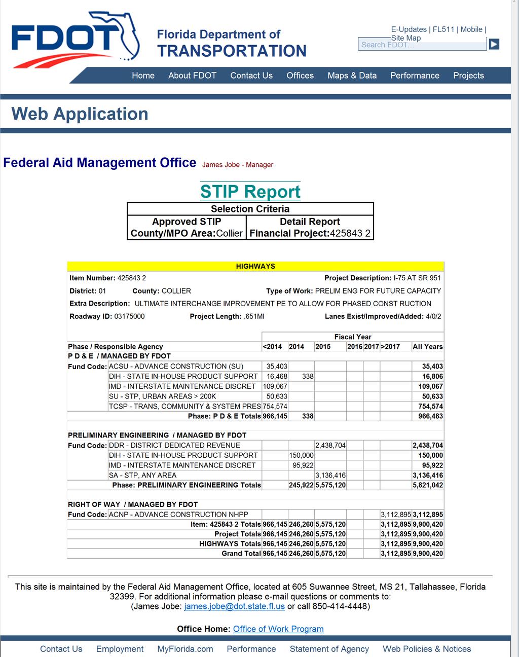
62

63 I-75 FPN # Description: Preliminary Engineering for Future Capacity, SIS Lead Agency: FDOT Project Limits: at Collier Blvd (SR 951) Project Length: miles LRTP Page #: 2035 LRTP Minor Update, SIS, Page 24 Total Project Costs: Prior to FY Costs $ 924,756 Previous PD&E and PE Costs FY Costs $ 5,821,380 After FY Costs $47,112,895 Future ROW and Construction Costs Total Costs $53,859,031 Collier MPO FY2013/14 - FY2017/18 TIP Page 50 of 213


64 Collier MPO Transportation Improvement Program - FY 2014/ /19 I-75 AT SR SIS Project Description: Ultimate Interchange Improvement. This is one segment of a larger project. For total project costs, see Appendix F in the FY2014/15 - FY2018/19 TIP. Work Summary: PRELIM ENG FOR FUTURE CAPACITY From: To: Lead Agency: Managed by FDOT Length:.651 MI Phase Fund Source 2014/ / / / /19 Total PE DDR 2,438, ,438,704 PE SA 713, ,916 PE DS 2,422, ,422,500 ROW ACNP ,898,656 7,898,656 Total 5,575, ,898,656 13,473,776 Prior Year Cost: Future Year Cost: Total Project Cost: LRTP: 1,170,536 7,898,655 22,542,967 Highway Cost Feasible March 5, 2014 Imports Collier MPO's Draft FY2014/15 - FY2018/19 TIP 7 Page 49 of 282
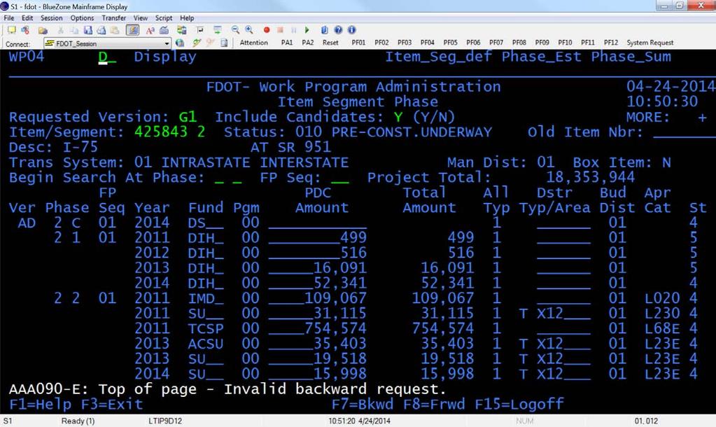
65
66
67
68
69
70

71
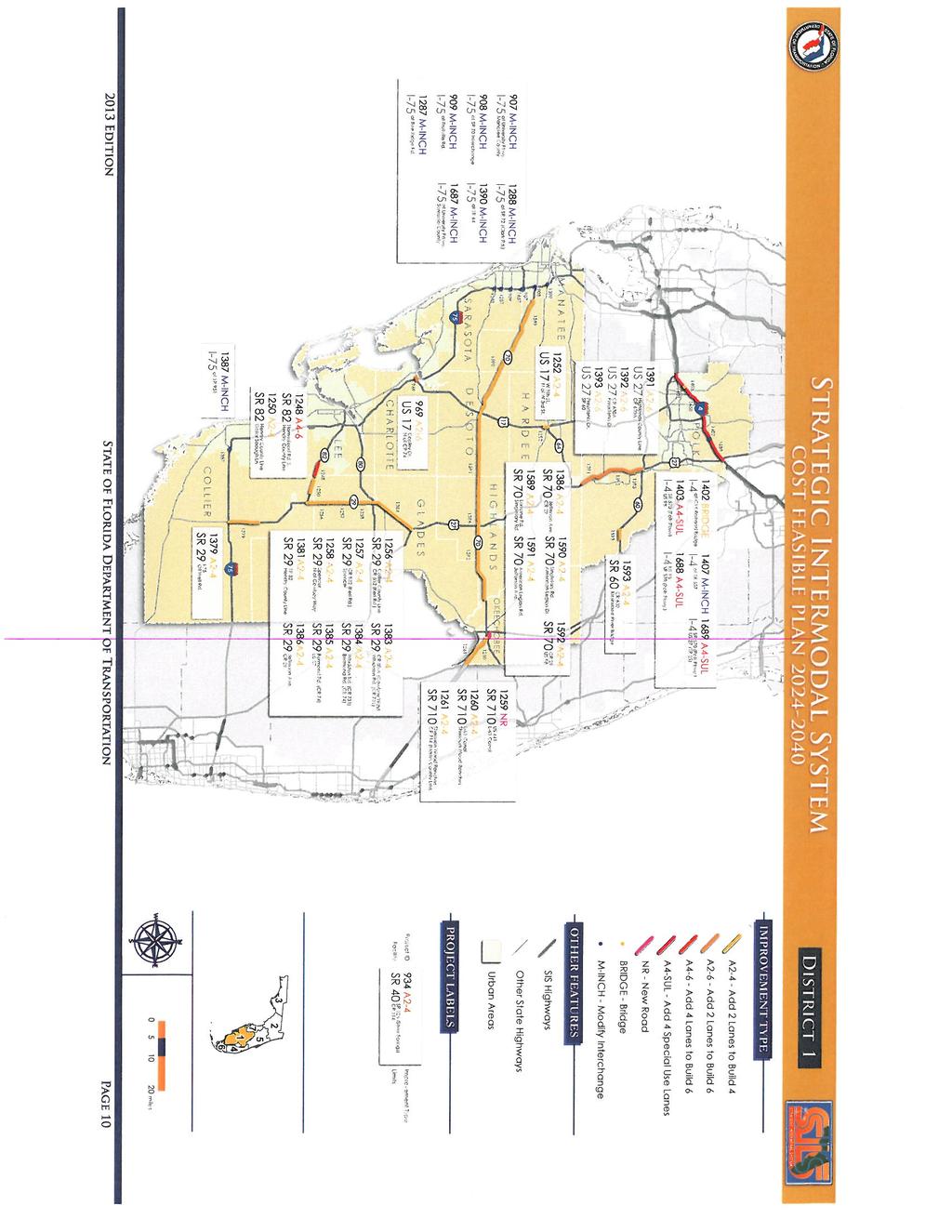
72
73
74 Description of Collier Metropolitan Planning Organization s (MPO s) 2035 Long Range Transportation Plan (LRTP) Amendment for MPO Board Approval on April 11, 2014 The Collier Metropolitan Planning Organization (MPO) has announced a 21-day public comment period for an Amendment to the 2035 Long Range Transportation Plan (LRTP). In order to be consistent with the FDOT s 2040 Strategic Intermodal Systems Plan (SIS) that was recently updated, the following projects must be shown in the Collier MPO s 2035 LRTP Cost Feasible Plan. The MPO Board will consider adoption of this amendment following public comments at their regularly scheduled meeting on April 11, LRTP Projects: 1. SR 29 from I-75 to Oil Well Road: FPN # This proposed project is moving from the adopted Need List to the Cost Feasible Plan. Project Development and Environmental Study (PD&E): Funded in fiscal year 2015/2016 at $2.015 million. Design (PE): Funded in fiscal year 2018/2019 at $ million. Right-of-Way (ROW): Funding identified as $7.986 million for fiscal years 2035/ /2040. This is noted as an informational project in the comments section of the Amended 2035 LRTP Cost Feasible Plan. Construction (CST): Added to the MPO s 2035 LRTP s Unfunded Needs List at an estimated cost of $ million. This phase is currently unfunded in the SIS Cost Feasible Plan. 2. SR 29 from SR 82 to the Hendry County Line: FPN # This proposed project is moving from the adopted Need List to the Cost Feasible Plan. Design (PE): Funded in fiscal year 2018/2019 at $3.150 million. Right-of-Way (ROW): funded in fiscal year 2020/2021 at $0.874 million. Construction (CST): Funded in fiscal year 2022/2023 at $9.072 million 3. I-75 at SR 951 Interchange: FPN # This project is already in the adopted Cost Feasible Plan. With this proposed amendment, it is now listed under the SIS projects section with the following changes to this project. SR 951 name was corrected with this proposed amendment. It was previously shown as CR 951 in the adopted Cost Feasible Plan. Design (PE): Now Funded with SIS funding in fiscal year 2015 at $5.568 million. Construction (CST): Now Funded in fiscal years 2030/ /2035 at $ million. This was previously shown as an unfunded phase. 4. I-75 from north of SR 951 to north of Golden Gate Parkway: FPN # This proposed project is moving from the adopted Need List to the Cost Feasible Plan. Construction (CST): Funded in fiscal year 2015 at $ million.

75


76 16D» Monday, April 7, 2014» NAPLES DAILY NEWS MOTOR HOMES Storage: motorhomes RVs, boat, auto. Covered available. (239) MOTORCYCLES 2009 Bash Scooter 49cc. AS IS. $ HD Heritage Softail K mi. Very clean. $8, HARLEY DAVIDSON 07 Softail Deluxe Tuxedo Black/Pearl White. MINT CONDITION Less than 2500 miles! $14,500. Call Harley Heritage Softtail. Red. 5K mi. $6500 obo. Call Harley-Davidson Sportster Nightster XL 1200N Detachable windshield, luggage rack. Only 2k miles. $ Call PASSENGER 98 Towncar 150K mi. Runs everyday. $500 FIRM , In Naples Star Electric Vehicle 2013 (street legal) AM-FM radio, CD player, blue with saddle interior, 4 passenger. Approx. 300 mi. $8500/obo. Call Martha, Cadillac CTS Coupe ,500 mi. Premium Model. Gorgeous cond. $34, Cadillac CTS Coupe ,500 mi. Premium Model. Gorgeous cond. $34, Cutlass Supreme 95 convertible, 76K mi., looks and runs great, a great condo or beach car. $7300 OBO. Mike, Cadillac Sedan DeVille. Red w/shale hard canvas top. Exc cond. 107K mi. $5, CADILLAC Seville SLS, 97K mi. great cond. $2, GRAND MARQUIS 06 Exc. cond. 50K mi. all the extras. $7500. Call Mercury Sable Sedan. 90K mi. Good cond. New tires. $2, , on Marco Island SERVICE &PARTS TIRES $15. UP, FREE mount/balance Bargain Cars SPORT UTILITY VEHICLES SPORTS &FOREIGN Toyota Solara Conv. 06. V6, SLE, 52K mi. Red, Black top. $12, VW Cabriolet 1985 convertible, in good shape, only 76K mi., runs like a charm with great tires, $4200 OBO. Mike, Classic MG TD 1952 Fiber Glass Replica, on VW Frame and Engine. British racing green. $7, , on Marco Island TRANSPORT/STORAGE LOCALLY OWNED - Enclosed Auto Transport & Auto Storage TRUCKS &TRACTORS 2010 DODGE RAM 1500 SLT BIGHORN CREW CAB 46,2xx Miles, 5.7L V8 Hemi 4X4. Extended Warranty until July 15, Owner no accident clear title. Fully loaded. All power seats, windows, sliding rear window &mirrors. Sirius Satelitte radio, aux inout, CD player, AM/FM radio. The interior is like new. 20 chrome wheels on Nitto Terra Grapplers with only 6,000 miles. Asking $25,000/OBO Ford F Xcab, Lariat. Loaded! Extras! Mint! $9800. GCAS, VANS 95 Ford Aerostar, 105K, Exc. cond. $1,895obo , In Naples Chrysler 02 Handicap Ramp Mini Van. 67K mi. $11,500. Naples VEHICLES WANTED We Buy Cars Local Buyer. Any Make, Year, Mileage. GCAS AFFORDABLE AUTO Consign or sell your car for cash CORVETTES WANTED! Top dollar. Cash today WANTED: STOW & Go type van. late model, $12K cash. Call AAAAA JUNK CARS TOP $$ GUARANTEED LARGEST BUYER IN FL Autos, trucks, RV s, cycles. $1K to $100K. Dave, MOST TRUSTED Buyer Since STEARNS MOTORS All Vehicles wanted Rod or Jim [] Absolutely All Autos Wanted! Dead or Alive Top $ FREE PICK UP NOTICE TO CREDITORS You are hereby notified that an Order of Summary Administration has been entered in the estate of Sara Feldman, deceased, File Number CP, by the Circuit Court for Collier County, Florida, Probate Division, the address of which is 3315 Tamiami Trail East, Suite 102, Naples, Florida ; that the decedent s date of death was November 25, 2013; that the total value of the estate is $53, and that the names of those to whom it has been assigned by such order are: NAME Steven M. Feldman ADDRESS 4051 Gulf Shore Boulevard North, Apartment 303 NAME Stuart L. Feldman ADDRESS Lamp Post Lane Potomac, MD ALL INTEREST PERSONS ARE NOTIFIED THAT: All creditors of the estate of the decedent and persons having claims or demands against the estate of the decedent other than those for whom NOTICE OF MEETING NOTICE TO CREDITORS provision for full payment was made in the Order of Summary Administration must file their claims with this court WITHIN THE TIME PERIODS SET FORTH IN SECTION OF THE FLORIDA PROBATE CODE. ALL CLAIMS AND DEMANDS NOT SO FILED WILL BE FOREVER BARRED. NOTWITHSTANDING ANY OTHER APPLICABLE TIME PERIOD, ANY CLAIM FILED TWO (2) YEARS OR MORE AFTER THE DECEDENT S DATE OF DEATH IS BARRED. The date of first publication of this Notice is 31 March, Attorney for Person Giving Notice: /s/ Lesley A. Moss, Esquire Addresses: Lmoss@oram moss.com Florida Bar No Oram & Moss, Chartered 4600 North Park Avenue, Plaza South Chevy Chase, Maryland Person Giving Notice: /s/ Stuart L. Feldman Lamp Post Lane Potomac, MD NOTICE OF PUBLIC MEETING /s/ Steven M. Feldman 4051 Gulf Shore Boulevard North, Apt. 303 Naples, FL March 31 and April 7, 2014 No NOTICE OF MEETING Notice is hereby given that the Collier Metropolitan Planning Organization (MPO) Board will conduct a roll-call vote to formally adopt the 2035 Long-Range Transportation Plan (LRTP) Amendment on April 11 at 10 a.m. The meeting will be held at Everglades City Hall, 102 Broadway Avenue East, Everglades City, The LRTP identifies highway, transit, pathways and other transportation projects in Collier County that are needed and are expected to be cost-feasible over the next 25 years. The 2035 LRTP Amendment is posted on the Collier MPO s Website at www. colliermpo.com for the public to review prior to the scheduled meeting. To access the amendment, click on the Latest News section on the left side of the web site. Ahard copy of the amendment will be provided upon request by contacting MPO Principal Planner Sue Faulkner at One or more members of the following government bodies may be in attendance at the meeting: Collier County BCC, Naples City Council, Marco Island City Council, Everglades City, and the Florida Department of Transportation (FDOT). The subject matter of this meeting may be an item for discussion and action at a future meeting of those Boards, Councils or agencies. Interested parties are invited to attend and to register to speak. All registered public speakers will be limited to three (3) minutes unless permission for additional time is granted by the chairman. Citizens can also submit their inquiries or comments, in writing, to the MPO staff prior to the meeting The MPO s planning process is conducted in accordance with Title VI of the Civil Rights Act of 1964 and related statutes. Any person or beneficiary who believes that he or she has been discriminated against because of race, color, religion, sex, age, national origin, disability, or familial status may file a complaint with the Collier MPO Title VI Specialist Lorraine Lantz at or by writing to Ms. Lantz at 2885 South Horseshoe Drive, Naples, FL Any person requiring special accommodations at this meeting because of a disability or physical impairment should contact MPO Principal Planner Ms. Lorraine Lantz up to 72 hours prior to the meeting by calling at For more information, call MPO Executive Director, AICP, Lucilla Ayer, at April 7, 2014 No NOTICE OF SALE NOTICE OF PUBLIC SALE NOTICE OF SALE FIBBER MCGEE S CLOSET WILL SELL THE PROPERTY OF THE FOLLOWING PEOPLE ON MONDAY APRIL 21ST, 2014 AT 10:00 AM. SAID PROPERTY IS BELIEVED TO CONSIST OF THE FOLLOWING PERSONAL PROPERTY, EQUIPMENT, MATERIALS, MOTORIZED VEHICLES, AND HOUSEHOLD ITEMS. 1.UNIT ROO37 2.UNIT C UNIT Y UNIT G UNIT X UNIT S UNIT S UNIT W UNIT T UNIT M UNIT W6139 JENNIFER COOPER LEE HOFFMAN BETTY ROBERTSON MAX HOLCHER BARBARA LUNA BRITTANY STREADY CATRINA ARNOLD BENTON WILLIAMS TIMOTHY CYR MICHELE MONIGHETTI BONNIE WOLFE THE SALE WILL TAKE PLACE AT FIBBER MCGEE S CLOSET, 571 AIRPORT ROAD NORTH, NAPLES FL THIS IS PUBLIC SALE. March 31 and April 7, 2014 No Classified CONTACT US Placing Classified Ads has never been easier! Online: naplesnews.com/classified Fax: (239) or classad@naplesnews.com Please be sure to include your name, address and daytime phone number. We will call you to confirm receipt of ad. Phone: General Classified and Real Estate: (239) or Recruitment: (239) Mail: Naples News Classified Dept Immokalee Rd. Naples, FL, Publishers of: Community Papers: In partnership with: JEEP WRANGLER YJ 1993, 119,000 miles - runs great - Perfect for mud! $ SUBARU BAJA 03 rare yellow, autom., 75K miles, new tires, great condition. $12,500. Call (603) SPORTS &FOREIGN 2001 Porche 911 Carerra convertible, Guards Red, 24K mi., auto with manual option, $31,000. In Naples, (937) WE BUY LUXURY CARS TOP DOLLAR PAID Call CORVETTE 2011 Grand Sport Conv. Jet Stream Blue, autom, 3300 mi., Loaded, MSRP $72,000 plus $5,000 in show parts; GM full warranty 2/16; $52,900. No dealers (239) Marco. FERRARI MONDIAL CABRIOLET A/C, garage kept. Owner since Under 18K mi MUSTANG SALLY Like Brand new, 06 Convertible. Black/black. ONLY 7900 Actual mi. V6- Auto, Leather, Power. Impeccable. $16, , In Naples Ford Thunderbird 2002 with hardtop. Red. Premium. One Owner. New tires, 25,500 mi. Always garaged. Excellent cond. $18K. Call HYUNDAI ELANTRA K mi. white. Excellent cond. $2, JAGUAR S K miles. BRG/Tan. Exc. cond. $ Lexus ES350 Black. 23,400 mi. Excellent cond. $24, or LEXUS ES Mica gray with gray leather. Prem. Plus Pkg. Loaded. Nav., parking sensors, etc. 59K mi. MINT. $22, Lexus LS430 34k mi. 2002, local vehicle, well kept, $17, NOTICE DP-EVK IN THE CIRCUIT COURT OF THE TWENTIETH JUDICIAL CIRCUIT IN AND FOR COLLIER COUNTY, FLORIDA. JUVENILE DIVISION CASE NO DP-EVK IN THE INTEREST OF: KAYLA SMITH, DOB: ANTHONY GRECO, DOB: CHILDREN THE STATE OF FLORIDA -TO: Casey Smith, Natural Father Address Unknown NOTICE You are hereby notified that a Petition to Terminate Parental Rights has been filed in the above styled Court in behalf of Kayla Smith, a female child, born on the 22nd day of May, 2008, in Collier County, Naples, Florida, and Anthony Greco, a male child, born on the 27th day of November, 2009, in Collier County, Naples, Florida, by the State of Florida, Department of Children and Families, and you are hereby commanded to be and appear before the Honorable Elizabeth V. Krier, Judge of the Circuit Court in the above Court at: Collier County Courthouse Complex 3315 East Tamiami Trail Naples, Florida at 11:00 a.m. o clock, on the 28th day of April 2014, for an Advisory/ Adjudicatory Hearing, to show cause why said Petition should not be granted. Pursuant to Sections (4)(d) and (6)(g), Florida Statutes, you are hereby informed of the availability of private placement with an adoption entity, as defined in Section (3), Florida Statutes. FAILURE TO PERSONALLY APPEAR AT THIS ADVISORY HEARING CONSTITUTES CONSENT TO THE TERMINATION OF PARENTAL RIGHTS OF THIS CHILD OR THESE CHILDREN. IF YOU FAIL TO APPEAR ON THE DATE AND TIME SPECIFIED, YOU MAY LOSE ALL LEGAL RIGHTS AS A PARENT TO THE CHILD OR CHILDREN NAMED IN THE PETITION ATTACHED TO THIS NOTICE. WITNESS BY HAND as the Clerk of Said Court and the seal thereof, this 07 day March, DWIGHT BROCK CLERK OF THE CIRCUIT COURT BY: Ybana Silva DEPUTY CLERK March 17, 24 &31and April 7, 2014 No NOTICE TO CREDITORS CP IN THE CIRCUIT COURT FOR COLLIER COUNTY, FLORIDA PROBATE DIVISION File No CP IN RE: ESTATE OF SARA FELDMAN Deceased. Division Probate NOTICE TO CREDITORS (Summary Administration) TO ALL PERSONS HAVING CLAIMS OR DEMANDS AGAINST THE ABOVE ESTATE: REQUEST FOR BID REQUEST FOR BID The School Board of Collier County, Florida, will accept Request for Proposals in the Office of the Director of Purchasing until 2:00 p.m. on the date noted below for the following: RFP # TITLE OPEN 93-3/14 Food & Supply Distributor April 25, 2014 RFP Document available at: Default%2Easp%3F%5FRF%3D1&bi= for additional information call The School Board of Collier County, Florida By: /s/ Dr. Kamela Patton Superintendent of Schools Authorized by: Nancy Sirko, Director of Purchasing April 6& 7, 2014 No REQUEST FOR BID REQUEST FOR BID The School Board of Collier County, Florida, will accept Sealed Bids in the Office of the Director of Purchasing until 2:00 p.m. on the date noted below for: BID # TITLE OPEN 98-3/14 Occupational & Physical Therapy April 22, 2014 Scope of work and agency_inc/bid_list.asp?f=search&lp=bb&mi=10202 or call The School Board of Collier County, Florida By: /s/dr. Kamela Patton Superintendent of Schools Authorized by: Nancy Sirko, Director of Purchasing April 6& 7, 2014 No REQUEST FOR BID REQUEST FOR BID The School Board of Collier County, Florida, will accept Sealed Bids in the Office of the Director of Purchasing until 2:00 p.m. on the date noted below for: BID # TITLE OPEN 99-3/14 Interpreters For The Hearing Impaired April 22, 2014 Scope of work and agency_inc/bid_list.asp?f=search&lp=bb&mi=10202 or call The School Board of Collier County, Florida By: /s/dr. Kamela Patton Superintendent of Schools Authorized by: Nancy Sirko, Director of Purchasing April 6& 7, 2014 No REQUEST FOR BID REQUEST FOR BID The School Board of Collier County, Florida, will accept Sealed Bids in the Office of the Director of Purchasing until 2:00 p.m. on the date noted below for: BID # TITLE OPEN 101-3/14 Speech Therapy Services April 22, 2014 Scope of work and agency_inc/bid_list.asp?f=search&lp=bb&mi=10202 or call The School Board of Collier County, Florida By: /s/dr. Kamela Patton Superintendent of Schools Authorized by: Nancy Sirko, Director of Purchasing April 6& 7, 2014 No REQUEST FOR BID REQUEST FOR BID The School Board of Collier County, Florida, will accept Sealed Bids in the Office of the Director of Purchasing until 2:00 p.m. on the date noted below for: BID # TITLE OPEN 102-3/14 Annual Safety Inspections & Consulting Services April 22, 2014 Scope of work and agency_inc/bid_list.asp?f=search&lp=bb&mi=10202 or call The School Board of Collier County, Florida By: /s/dr. Kamela Patton Superintendent of Schools Authorized by: Nancy Sirko, Director of Purchasing April 6& 7, 2014 No Classified Deadlines: Naples Daily News and The Daily News Tuesday through Friday 2PM, one day prior Saturday, Sunday &Monday 5PM Friday Free Merchandise Ads , Fax or Mail. We offer FREE classified ads for non-commercial items less that $500 in value (price must be included in the ad). The ads are up to 3lines and run for 7days one time only. Real Estate For Sale By Owner Special $200 Seven line ads, 14 days in Naples Daily News, all community publications, naplesnews.com and Topads. Policy: Naples Daily News reserves the right to correctly classify and edit all copy or to reject or cancel any advertisement at any time. All ads placed by phone are read back to the advertiser at the time of placement, verification provided to advertisers who provide addresses. Only standard abbreviations are accepted. Classified ads are pre-paid unless prior credit approval is established. Corrections: Please check your ad for errors on the first day it appears. Naples News Media Group will not be responsible for incorrect ads after the first day of publication.
77
78 APPENDIX B ETDM Summary Report and Advance Notification Package
79 ETDM Summary Report Project # I-75 at Collier Boulevard (CR 951) Programming Screen - Published on 06/30/2011 Printed on: 10/22/2013 Table of Contents Chapter 1 Overview 2 Chapter 2 Project Details Purpose and Need Project Description Data 6 Chapter 3 Alternative # Alternative Description 8 Chapter 4 Project Scope General Project Commitments Required Permits Required Technical Studies Class of Action Dispute Resolution Activity Log 32 Chapter 5 Hardcopy Maps: Alternative #1 33 Appendices GIS Analyses Project Attachments Degree of Effect Legend 54 1
80 Screening Summary Reports Introduction to Programming Screen Summary Report The Programming Screen Summary Report shown below is a read-only version of information contained in the Programming Screen Summary Report generated by the ETDM Coordinator for the selected project after completion of the ETAT Programming Screen review. The purpose of the Programming Screen Summary Report is to summarize the results of the ETAT Programming Screen review of the project; provide details concerning agency comments about potential effects to natural, cultural, and community resources; and provide additional documentation of activities related to the Programming Phase for the project. Available information for a Programming Screen Summary Report includes: Screening Summary Report chart Project Description information (including a summary description of the project, a summary of public comments on the project, and community-desired features identified during public involvement activities) Purpose and Need information (including the Purpose and Need Statement and the results of agency reviews of the project Purpose and Need) Alternative-specific information, consisting of descriptions of each alternative and associated road segments; an overview of ETAT Programming Screen reviews for each alternative; and agency comments concerning potential effects and degree of effect, by issue, to natural, cultural, and community resources. Project Scope information, consisting of general project commitments resulting from the ETAT Programming Screen review, permits, and technical studies required (if any) Class of Action determined for the project Dispute Resolution Activity Log (if any) The legend for the Degree of Effect chart is provided in an appendix to the report. For complete documentation of the project record, also see the GIS Analysis Results Report published on the same date as the Programming Screen Summary Report. 2
81 1. Overview #13101 I-75 at Collier Boulevard (CR 951) District: District 1 Phase: Programming Screen County: Collier From: Planning Organization: FDOT District 1 To: Plan ID: Not Available Financial Management No.: Federal Involvement: Federal Action Federal Funding Contact Information: Gwen G. Pipkin (863) x2375 gwen.pipkin@dot.state.fl.us Snapshot Data From: Project Re-Published 6/30/2011 Issues and Categories are reflective of what was in place at the time of the screening event. Natural Cultural Community Air Quality Coastal and Marine Contaminated Sites Farmlands Floodplains Infrastructure Navigation Special Designations Water Quality and Quantity Wetlands Wildlife and Habitat Historic and Archaeological Sites Recreation Areas Section 4(f) Potential Aesthetics Economic Land Use Mobility Relocation Social Secondary and Cumulative Effects Alternative #1 From: To: Re-Published: 06/30/2011 Reviewed from 12/14/2010 to 01/28/2011) N/A
82 2.1. Project Purpose Details and Need Purpose and Need Purpose and Need EXECUTIVE SUMMARY The purpose of this project is to improve operational capacity and enhance overall traffic operations at I-75 and Collier Boulevard/CR 951 and on the surrounding roadway network. The need for the project is based on the following criteria: - Capacity/Transportation Demand: Improve Traffic Operations The interchange improvement will increase operational capacity to meet the current and future traffic demand. Without the proposed improvement, the interchange (including the intersection of Davis Boulevard/SR 84 at Collier Boulevard/CR 951) will continue to experience high delays and queuing and operate below acceptable level of service (LOS) standards. - Safety: Enhance Safety Conditions The Collier Boulevard/CR 951 study corridor experiences average crash rates higher than state-wide average rates for similar facilities. The high congestion and low spacing between signalized intersections along the Collier Boulevard/CR 951 corridor may contribute to the common rear-end type crashes reported. By increasing operational capacity and reducing congestion, the proposed project is anticipated to improve safety conditions (and thus, reduce rear-end type crashes) at the interchange. - Modal Interrelationships: Enhance Freight Mobility and Economic Competiveness The segments of Collier Boulevard/CR 951, from Davis Boulevard/SR 84 to I-75, and Davis Boulevard/SR 84, from Radio Road to Collier Boulevard/CR 951, including the I-75 and Collier Boulevard/CR 951 interchange, are currently identified in the Collier Metropolitan Planning Organization's (MPO) 2035 Long Range Transportation Plan (LRTP) as freight mobility hot spots. The proposed interchange improvement is anticipated to enhance the mobility of goods by alleviating current and future congestion at the interchange and on the surrounding freight network. CAPACITY/TRANSPORTATION DEMAND: Improve Traffic Operations The Collier MPO 2035 LRTP currently identifies Collier Boulevard/CR 951 from Davis Boulevard/SR 84 to I-75 as a Deficient Roadway with a volume-tocapacity (v/c) ratio = This indicates that the roadway segment has exceeded its designated service volume and level of service (LOS) standard. Likewise, the segment of Davis Boulevard/SR 84 from Radio Road to Collier Boulevard/CR 951 (designated as a Deficient Roadway with a v/c ratio = 1.09) and the intersection of Davis Boulevard/SR 84 at Collier Boulevard/CR 951 operate at LOS F. According to data provided in the Interchange Operational Analysis Report (October 2010) prepared for the I-75 at Collier Boulevard/CR 951 interchange and the 2009 FDOT Florida Traffic Information database, the existing traffic conditions for I-75, Collier Boulevard/CR 951, and Davis Boulevard/SR 84 are as follows: I-75 (west of Collier Boulevard/CR 951) Annual Average Daily Traffic (AADT) volume = 36,700 vehicle trips per day / LOS = B - Truck % = (FDOT 2009 Florida Traffic Information) I-75 (east of Collier Boulevard/CR 951) AADT volume = 18,900 vehicle trips per day / LOS = A - Truck % = 9.76 (FDOT 2009 Florida Traffic Information) Highest Volumes for I-75 at Collier Boulevard/CR 951 Interchange (based on 2009 Traffic Counts): I-75 NB off-ramp to CR 951: AADT volume = 2,400 / Freeway volume = 711 / Ramp volume = 179 / LOS = A I-75 NB on-ramp from CR 951: AADT volume = 11,700 / Freeway volume = 532 / Ramp volume = 981 / LOS = B I-75 SB off-ramp to CR 951: AADT volume = 12,000 / Freeway volume = 1,433 / Ramp volume = 936 / LOS = B I-75 SB on-ramp from CR 951: AADT volume = 2,200 / Freeway volume = 516 / Ramp volume = 184 / LOS = A Truck % = 5.97 (FDOT 2009 Florida Traffic Information) Collier Boulevard/CR 951 (I-75 to Magnolia Pond Drive) AADT volume = 23,300 vehicle trips per day / LOS = F - Truck % = 8.94 (FDOT 2009 Florida Traffic Information - north of Golden Gate Parkway) Collier Boulevard/CR 951 (I-75 SB ramps to I-75 NB ramps) AADT volume = 32,900 vehicle trips per day / LOS = C 4
83 Collier Boulevard/CR 951 (Davis Boulevard/SR 84 to I-75) AADT volume = 42,900 vehicle trips per day / LOS = F - Truck % = (FDOT 2009 Florida Traffic Information) Collier Boulevard/CR 951 (south of Davis Boulevard/SR 84) AADT volume = 37,900 vehicle trips per day / LOS = B - Truck % = 6.26 (FDOT 2009 Florida Traffic Information) Davis Boulevard/SR 84 (west of Collier Boulevard/CR 951) AADT volume = 19,500 vehicle trips per day / LOS = F - Truck % = 7.13 (FDOT 2009 Florida Traffic Information) Davis Boulevard/SR 84 (east of Collier Boulevard/CR 951) AADT volume = 5,800 vehicle trips per day / LOS = B - Truck % = 7.13 (FDOT 2009 Florida Traffic Information) It should be noted that Collier Boulevard/CR 951 from Davis Boulevard/SR 84 to I-75 is funded for widening from 4 to 8 lanes. This project includes capacity improvements within one quarter-mile of Davis Boulevard/SR 84 and the I-75 interchange ramps. Similarly, Davis Boulevard/SR 84 from Radio Road to Collier Boulevard/CR 951 is funded for widening from 2 to 6 Lanes. This project includes a bypass ramp for the eastbound to southbound movement at the Davis Boulevard/SR 84 and Collier Boulevard/CR 951 intersection. These roadway improvements will require complementary and supporting geometric improvements at the I-75 and Collier Boulevard/CR 951 interchange to ensure safe operational conditions at the interchange. Accounting for these committed roadway improvements, the future traffic levels on the interchange approaches are expected to increase, as shown below. I-75 (west of Collier Boulevard/CR 951) AADT volume = 76,100 vehicle trips per day (3.8% increase) I-75 (east of Collier Boulevard/CR 951) AADT volume = 36,000 vehicle trips per day (3.2% increase) Highest Volumes for I-75 at Collier Boulevard/CR 951 Interchange (based on 2009 Traffic Counts): I-75 NB off-ramp to CR 951: AADT volume = 4,700 I-75 NB on-ramp from CR 951: AADT volume = 24,400 I-75 SB off-ramp to CR 951: AADT volume = 23,100 I-75 SB on-ramp from CR 951: AADT volume = 2,600 Collier Boulevard/CR 951 (I-75 to Magnolia Pond Drive) AADT volume = 53,700 vehicle trips per day (4.7% increase) Collier Boulevard/CR 951 (I-75 SB ramps to I-75 NB ramps) AADT volume = 65,300 vehicle trips per day (3.5% increase) Collier Boulevard/CR 951 (Davis Boulevard/SR 84 to I-75) AADT volume = 70,700 vehicle trips per day (2.3% increase) Collier Boulevard/CR 951 (south of Davis Boulevard/SR 84) AADT volume = 51,600 vehicle trips per day (1.3% increase) Davis Boulevard/SR 84 (west of Collier Boulevard/CR 951) AADT volume = 32,300 vehicle trips per day (2.3% increase) Davis Boulevard/SR 84 (east of Collier Boulevard/CR 951) AADT volume = 10,500 vehicle trips per day (2.9% increase) 5
84 The interchange improvement will increase operational capacity to meet the local current and future traffic demand. Without the proposed improvement, the interchange (including the intersection of Davis Boulevard/SR 84 at Collier Boulevard/CR 951) will continue to experience high delays and queuing and operate below acceptable LOS standards. SAFETY: Enhance Safety Conditions As part of the Interchange Operational Analysis Report (October 2010) prepared for the I-75 at Collier Boulevard/CR 951 interchange, crash data was collected and analyzed from Collier County and the FDOT Safety Office for the 3-year period The data reported 268 crashes on Collier Boulevard/CR 951 in the vicinity of the interchange; an average of 89.3 crashes per year and a crash rate of crashes per million vehicle miles traveled. The FDOT state-wide average crash rate for similar facilities (4-lane divided urban arterial) is crashes per million vehicle miles traveled. This indicates that the Collier Boulevard/CR 951 study corridor experiences average crash rates higher than state-wide average rates for similar facilities. Rear-end type crashes were the most common crash type recorded at the I-75 at Collier Boulevard/CR 951 interchange. The high congestion and low spacing between signalized intersections along the Collier Boulevard/CR 951 corridor may have contributed to the reported crash type. It should be noted that as the volume of traffic increases at the interchange, the opportunity for vehicle movement conflict is expected to increase. The proposed project is anticipated to improve operational capacity, thus reducing congestion and enhancing overall traffic operations at the interchange. This, in turn, is expected to help reduce rear-end type crashes. MODAL INTERRELATIONSHIPS: Enhance Freight Mobility and Economic Competiveness Collier County's freight transportation system is dominated almost exclusively by its highway network. The 2035 LRTP designates I-75 (a major northsouth and east-west arterial on the Strategic Intermodal System and Florida Intrastate Highway System) as a Tier One regional freight corridor (i.e., highways or regional corridors used to move goods in, out, and through the county and provide connectivity beyond the county boundaries). Providing access to I-75, both Collier Boulevard/CR 951 and Davis Boulevard/SR 84 are designated as Tier Two regional freight connectors (i.e., roads that function as connectors to the major freight activity centers/local distribution facilities or between the regional freight corridors). In addition, both the I-75 at Collier Boulevard/CR 951 interchange and Davis Boulevard/SR 84 at Collier Boulevard/CR 951 intersection are located within the Gateway Freight Activity Center, which is expected to expand, and provide access to the East Naples/Airport Freight Activity Center. As indicated through the Future Land Use Map of the adopted Collier County Growth Management Plan, the area surrounding the interchange is targeted for development given the commercial mixed-use activity center and industrial district designations and the fact that the interchange is located within a designated freight activity center and Transportation Concurrency Management Area. In addition, the I-75 at Collier Boulevard/CR 951 interchange provides access to southwestern Collier County, Naples and Marco Island. Based on data extracted from the traffic analysis zones (TAZ) of the Lee-Collier Transportation Model that encompass the I-75 at Collier Boulevard/CR 951 interchange, population and employment growth figures are forecasted to increase from year 2007 to year 2035: -Population is projected to grow from 3,015 in 2007 to 3,294 in 2035 (0.3% annual growth rate) -Employment is projected to grow from 1,975 in 2007 to 11,177 in 2035 (16.6% annual growth rate) Currently, the Collier Boulevard/CR 951 from Davis Boulevard/SR 84 to I-75 and Davis Boulevard/SR 84 from Radio Road to Collier Boulevard/CR 951 segments (including the I-75 and Collier Boulevard/CR 951 interchange) are identified in the 2035 LRTP as freight mobility hot spots (i.e., locations identified on Strategic Intermodal System and regional goods movement corridors that have operational deficiencies for efficient truck mobility). The proposed interchange improvement is anticipated to enhance the mobility of goods by alleviating current and future congestion at the interchange and on the surrounding freight network. Purpose and Need Reviews FL Department of Agriculture and Consumer Services Acknowledgement Date Reviewed Reviewer Comments Understood 01/28/2011 Michael Weston No Purpose and Need comments found. (michael.weston@freshfro mflorida.com) FL Department of Environmental Protection Acknowledgement Date Reviewed Reviewer Comments Understood 01/26/2011 Lauren Milligan (lauren.milligan@dep.stat e.fl.us) No Purpose and Need comments found. 6
85 2.2. Project Description Data FL Fish and Wildlife Conservation Commission Acknowledgement Date Reviewed Reviewer Comments Understood 01/24/2011 Scott Sanders m) No Purpose and Need comments found. Federal Highway Administration Acknowledgement Date Reviewed Reviewer Comments Accepted 01/20/2011 Linda Anderson No Purpose and Need comments found. National Marine Fisheries Service Acknowledgement Date Reviewed Reviewer Comments Understood 12/20/2010 David Rydene v) No Purpose and Need comments found. Natural Resources Conservation Service Acknowledgement Date Reviewed Reviewer Comments Understood 01/04/2011 Rick Robbins No Purpose and Need comments found. v) US Army Corps of Engineers Acknowledgement Date Reviewed Reviewer Comments Understood 01/28/2011 John Fellows my.mil) No Purpose and Need comments found. US Fish and Wildlife Service Acknowledgement Date Reviewed Reviewer Comments Understood 01/04/2011 John Wrublik No Purpose and Need comments found. Project Description Data Project Description The objective of this project is to enhance operational capacity and overall traffic operations at the I-75 and Collier Boulevard/CR 951 interchange in Collier County. The existing grade-separated, diamond interchange is surrounded by commercial land uses. I-75 is a 4-lane limited access expressway when crossing Collier Boulevard/CR 951. Collier Boulevard/CR 951, from Davis Boulevard/SR 84 to I-75, is a 4-lane divided urban arterial. Currently proposed as a partial cloverleaf interchange with two loop ramps, the interchange improvements will incorporate planned enhancements at the Davis Boulevard/SR 84 and Collier Boulevard/CR 951 intersection, as well as complement and support roadway capacity improvements to Collier/CR 951 and Davis/SR 84 Boulevards that are presently underway. At least three alternatives for the project will be developed and considered as part of the Project Development and Environment (PD&E) Study. The limits of the project will extend along I-75 from 1500 feet west and east of the current ramp terminals at Collier Boulevard/CR 951, 1500 feet north of the ramp terminals along Collier Boulevard/CR 951, 1500 feet west and east of the Davis Boulevard/SR 84 at Collier Boulevard/CR 951 intersection along Davis Boulevard/SR 84, and 1500 feet south of the intersection along Collier Boulevard/CR 951. TRANSPORTATION PLAN CONSISTENCY The interchange is currently identified as a priority FDOT project needed to meet geometric, operational and safety standards. The project will be implemented with state and federal funds. Funding in the amount of $829,574 is programmed for the Preliminary Engineering & Environment (PD&E) Study under Fiscal Year 2011/2012 and $6,575,000 is programmed for the Preliminary Engineering phase in Fiscal Year 2013/2014 of the FDOT Work 7
86 Program. The ultimate interchange configuration could potentially require additional right-of-way; however, the specific right-of-way requirements are not known at this time. Detailed cost estimates and right-of-way requirements will be derived as part of the PD&E Study. The Collier Metropolitan Planning Organization's (MPO) 2035 Long Range Transportation Plan (LRTP) is scheduled to be adopted in December The I-75 at Collier Boulevard/CR 951 interchange improvement is currently identified in the 2035 LRTP as a priority project and is anticipated to be cost feasible (funded through design only). The total project cost is estimated to be $99,670,000 (present day costs ). The interchange is also identified as a contingent financially feasible project in the Collier MPO 2030 LRTP 'Minor Update' (adopted in June 2007) and is included as part of the Joint Lee/Collier MPO Bi-County Regional Transportation Network. In addition, the proposed interchange is reflected on Map TR-1: Financially Feasible Plan and Traffic Circulation Map - Year 2025 of the adopted Collier County Growth Management Plan and is identified in the adopted Collier MPO FY 2010/ /2015 Transportation Improvement Program. Summary of Public Comments Summary of Public Comments is not available at this time. Justification Due to the compressed project schedule, public outreach activities will be conducted during the Project Development phase. Federal Consistency Determination Date: 01/26/2011 Determination: CONSISTENT with Coastal Zone Management Program. Additional Consistency Information Consistent with Air Quality Conformity. Consistent with Local Government Comp Plan. - Consistent with MPO Goals and Objectives. Lead Agency Federal Highway Administration Participating and Cooperating Agencies Participating and Cooperating agencies are not applicable for this class of action. Exempted Agencies Community Desired Features No desired features have been entered into the database. This does not necessarily imply that none have been identified. Communities Within 500 Feet 1734 Berkshire Lakes 1723 Collier Blvd East 1747 Forest Park North Belle Meade Agency Name Justification Date US Coast Guard No navigable waterways are in the vicinity of project. 12/10/2010 Federal Transit Administration No transit facilities are being considered as part of this project. 12/10/2010 Federal Rail Administration No rail facilities are being considered as part of this project. 12/10/2010 8
87 3. Alternative # Alternative Description Alternative #1 Alternative Description Name From To Type Status Total Length Cost Modes SIS Alternative was not named. Traffic Operation Enhancement Project Effects Overview for Alternative #1 Natural ETAT Review Complete? mi. $99,670, Roadway Y Issue Degree of Effect Organization Date Reviewed Coastal and Marine 2 Minimal National Marine Fisheries Service 12/20/2010 Contaminated Sites 0 None Farmlands 2 Minimal FL Department of Environmental Protection Natural Resources Conservation Service 01/26/ /04/2011 Navigation N/A N/A / No Involvement US Army Corps of Engineers 01/28/2011 Water Quality and Quantity 2 Minimal FL Department of Environmental Protection 01/26/2011 Wetlands 3 Moderate US Fish and Wildlife Service 01/04/2011 Wetlands 3 Moderate US Army Corps of Engineers 01/28/2011 Wetlands 2 Minimal National Marine Fisheries Service 12/20/2010 Wetlands 2 Minimal Wildlife and Habitat 2 Minimal FL Department of Environmental Protection FL Fish and Wildlife Conservation Commission 01/26/ /24/2011 Wildlife and Habitat 3 Moderate US Fish and Wildlife Service 01/04/2011 Wildlife and Habitat N/A N/A / No Involvement FL Department of Agriculture and Consumer Services Cultural 01/28/2011 Historic and Archaeological Sites 2 Minimal Seminole Tribe of Florida 01/19/2011 Historic and Archaeological Sites 2 Minimal Federal Highway Administration 01/20/2011 Historic and Archaeological Sites 2 Minimal Miccosukee Tribe of Indians of Florida 12/22/2010 Historic and Archaeological Sites 2 Minimal FL Department of State 01/21/2011 Recreation Areas 0 None FL Department of Environmental Protection 01/26/2011 Section 4(f) Potential 3 Moderate Federal Highway Administration 01/20/2011 Community Aesthetics 2 Minimal FDOT District 1 01/28/2011 Economic 1 Enhanced FDOT District 1 01/28/2011 Land Use 2 Minimal FDOT District 1 01/28/2011 Mobility 1 Enhanced FDOT District 1 01/28/2011 Relocation 3 Moderate Federal Highway Administration 01/20/2011 Relocation 2 Minimal FDOT District 1 01/28/2011 9
88 Social 2 Minimal FDOT District 1 01/28/2011 Social 3 Moderate Federal Highway Administration 01/20/2011 Secondary and Cumulative Secondary and Cumulative Effects N/A N/A / No Involvement FL Department of Agriculture and Consumer Services ETAT Reviews and Coordinator Summary: Natural Air Quality Project Effects Coordinator Summary Degree of Effect: 2 Minimal assigned 03/25/2011 by FDOT District 1 01/28/2011 Comments: No ETAT members commented on this issue. Collier County is not within a designated Air Quality Non-Attainment Area or Maintenance Area for the following pollutants - nitrogen oxides, carbon monoxide, and small particulate matter - specified by the USEPA in National Ambient Air Quality Standards. The project is consistent with air quality conformity. Because temporary impacts to air quality may occur during road construction as a result of fugitive dust and exhaust emissions, a Summary DOE of Minimal has been assigned to the Air Quality issue. Commitments and Responses: An Air Quality Report will not be required for this project. Technical Study: None. None found Coastal and Marine Project Effects Coordinator Summary Degree of Effect: 2 Minimal assigned 03/25/2011 by FDOT District 1 Comments: The NMFS conducted a site inspection of the project study area on 16 December 2010 to assess potential concerns to living estuarine and marine resources within Naples Bay and Rookery Bay. The NMFS reported that adjacent lands are comprised primarily of commercial properties and disturbed palustrine wetlands. The NMFS noted that the project does not appear to directly impact any NMFS trust resources; however, the project's northern terminus occurs less than 0.5 miles from a major drainage canal that eventually flows to Naples Bay and Rookery Bay. The NMFS further stated that these bays contain estuarine habitats utilized by federally managed fish species and their prey; therefore, stormwater systems should be upgraded to prevent degraded water from reaching these habitats. According to the EST GIS analysis results, no coastal or marine resources are located within the 200-foot project buffer. In addition, the project study area is located approximately 5.0 miles from Naples Bay and approximately 10.0 miles from Rookery Bay. The project will also be designed to meet state water quality standards. For these reasons, a Summary DOE of Minimal has been assigned to the Coastal and Marine issue. Commitments and Responses: An Essential Fish Habitat (EFH) Assessment will not be included in the scoping recommendations for this project. Technical Study: None. Degree of Effect: 2 Minimal assigned 12/20/2010 by David A. Rydene, National Marine Fisheries Service Coordination Document: No Selection Direct Effects Identified Resources and Level of Importance: Naples Bay and Rookery Bay, which contain estuarine habitats used by federally-managed fish species and their prey. Comments on Effects to Resources: NOAA's National Marine Fisheries Service (NMFS) has reviewed the information contained in the Environmental Screening Tool for ETDM Project # The Florida Department of Transportation District One proposes interchange improvements at the intersection of I-75 and Collier Boulevard (CR 951) in Collier County, Florida. NMFS staff conducted a site inspection of the project area on December 16, 2010, to assess potential concerns related to living marine resources within Naples Bay and Rookery Bay. The lands adjacent to the proposed project are principally commercial properties and disturbed palustrine wetlands. It does not appear that the project will directly impact any NMFS trust resources. However, the project's northern terminus lies less than 0.5 miles from a major drainage canal (at the southern side of Golden Gate) that empties to estuarine habitats in Naples Bay and Rookery Bay. These systems contain estuarine habitats (e.g. seagrass, salt marsh, mangrove) used by federally-managed fish species and their prey. Therefore, NMFS recommends that stormwater treatment systems be upgraded to prevent degraded water from reaching estuarine habitats within Naples Bay and Rookery Bay. In addition, best management practices should be employed during road construction to prevent siltation of these habitats. Additional Comments (optional): CLC Commitments and Recommendations: 10
89 Contaminated Sites Project Effects Coordinator Summary Degree of Effect: 0 None assigned 03/25/2011 by FDOT District 1 Comments: The FDEP did not identify any contamination issues associated with this project. According to the EST GIS analysis results, there are no geocoded gas stations, geocoded dry cleaners, geocoded petroleum tanks, Brownfield locations, hazardous waste sites, National Priority List sites, nuclear sites, Superfund hazardous waste sites, Toxic Release Inventory sites, or RCRAregulated facilities located within the project's 500-foot buffer. In addition, a Contamination Screening Evaluation Report will be prepared (if deemed necessary) during the project's design and permitting phase. Therefore, a Summary DOE of None has been assigned to the Contaminated Sites issue. Commitments and Responses: If deemed necessary, a Contamination Screening Evaluation Report will be included in the scoping recommendations for this project. Technical Study: Contamination Screening Evaluation Report (potentially). Degree of Effect: 0 None assigned 01/26/2011 by Lauren P. Milligan, FL Department of Environmental Protection Coordination Document: No Selection Direct Effects Identified Resources and Level of Importance: Comments on Effects to Resources: Additional Comments (optional): CLC Commitments and Recommendations: Farmlands Project Effects Coordinator Summary Degree of Effect: 2 Minimal assigned 03/25/2011 by FDOT District 1 Comments: The NRCS commented that while the proposed interchange modification will not impact Locally Important or Unique Farmland map units, the future widening of CR 951 could impact between 26.0 acres and in excess of 72.0 acres of Locally Important Farmland. The NRCS stated, however, that a Minimal DOE is assigned since no land in the area is or has been designated for agricultural uses (cropland, citrus, etc.). The NRCS recommends that impacts to Locally Important Farmland map units be held to a minimum during the widening. According to the EST GIS analysis results, 35.3 acres of Farmland of Local Importance are located within the 200-foot project buffer. The Existing Land Use Map of the adopted Collier County Growth Management Plan shows that the area in the immediate vicinity of the proposed interchange (1,320-foot buffer) is designated primarily for commercial uses; pockets of light industrial uses also occur in the area. The project area also supports (and is intended to continue to support based on the Collier County Future Land Use Map) a commercial mixed-use center and industrial district. For these reasons, a Summary DOE of Minimal has been assigned to the Farmlands issue. Commitments and Responses: A Farmlands Assessment will not be required for this project. Technical Study: None. Degree of Effect: 2 Minimal assigned 01/04/2011 by Rick Allen Robbins, Natural Resources Conservation Service Coordination Document: No Selection Coordination Document Comments:Since map units that have been determined to be Locally Important Farmlands will be converted during the ROW widening, it is recommended that (if possible) impacts to these designated map units be held to a minimum during the process. Direct Effects Identified Resources and Level of Importance: The USDA-NRCS considers soil map units with important soil properties for agricultural uses to be Prime Farmland. In addition, the USDA-NRCS considers any soils with important soil properties and have significant acreages that are used in the production of commodity crops (such as, cotton, citrus, row crops, specialty crops, nuts, etc.) to be considered as Farmlands of Unique Importance. Nationally, there has been a reduction in the overall amount of Prime and Unique Farmlands through conversion to non-farm uses. This trend has the possibility of impacting the nation's food supply and exporting capabilities. Comments on Effects to Resources: The proposed modification of the existing interchange impacts no Locally Important or Unique Farmland map units. Future widening of CR 951 will impact between 26 acres and in excess of 72 acres of Locally Important Farmland. No Unique Farmland will be impacted. Even though, Locally Important Farmland map units will be impacted by this project, it should be noted that there is not currently any land in agricultural (cropland, citrus) land uses. Therefore, we are assigning a minimial degree of effect for this project. Additional Comments (optional): Since map units that have been determined to be Locally Important Farmlands will be converted during the ROW widening, it is recommended that (if possible) impacts to these designated map units be held to a minimum during the process. 11
90 CLC Commitments and Recommendations: Floodplains Project Effects Coordinator Summary Degree of Effect: 2 Minimal assigned 03/25/2011 by FDOT District 1 Comments: No ETAT members commented on this issue. According to the EST GIS analysis results, the 200-foot project buffer is located entirely within FEMA Flood Zone X-500 (an area inundated by 500-year flooding; an area inundated by 100-year flooding with average depths of less than 1 foot or with drainage areas less than 1 square mile; or an area protected by levees from the 100-year flooding); therefore, the project will not impact the 100-year floodplain. For this reason, a Summary DOE of Minimal has been assigned to the Floodplains issue. Commitments and Responses: A Floodplains Assessment will be included in the scoping recommendations for this project. Technical Study: Floodplains Assessment. None found Infrastructure Project Effects Coordinator Summary Degree of Effect: 2 Minimal assigned 03/25/2011 by FDOT District 1 Comments: No ETAT members commented on this issue. According to the EST GIS analysis results, the following infrastructure-related features are present within the 5,280-foot project buffer: one cellular antenna location, one FDEM fire station, two Federal Aviation Administration obstructions (towers), one wastewater facility, and two wireless antenna structure locations. No features were identified within any of the other buffer distances. Due to the limited number of features located within the immediate project vicinity, a Summary DOE of Minimal has been assigned to the Infrastructure issue. Commitments and Responses: None. Technical Study: None. None found Navigation Project Effects Coordinator Summary Degree of Effect: N/A N/A / No Involvement assigned 03/25/2011 by FDOT District 1 Comments: The USACE indicated that there will be no effect to navigation due to the lack of navigable waters within the vicinity of the proposed project. Coordination Document: To Be Determined: Further Coordination Required. The project does not cross any navigable waterways; therefore, a Summary DOE of N/A / No Involvement has been assigned to the Navigation issue. Commitments and Responses: A Navigation Study, Bridge Questionnaire, and USCG Bridge Permit will not be required for this project. Technical Study: None. / Permit: None. Degree of Effect: N/A N/A / No Involvement assigned 01/28/2011 by John Fellows, US Army Corps of Engineers Coordination Document: To Be Determined: Further Coordination Required Direct Effects Identified Resources and Level of Importance: There do not appear to be any navigable waterways in the project vicinity. Comments on Effects to Resources: If there are no navigable waterways, there is no effect on navigation. Additional Comments (optional): CLC Commitments and Recommendations: Special Designations 12
91 Project Effects Coordinator Summary Degree of Effect: 0 None assigned 03/25/2011 by FDOT District 1 Comments: No ETAT members commented on this issue. According to the EST GIS analysis results, there are no resources of special designation located within the project's 200-foot buffer. Therefore, a Summary DOE of None has been assigned to the Special Designations issue. Commitments and Responses: None. Technical Study: None. None found Water Quality and Quantity Project Effects Coordinator Summary Degree of Effect: 2 Minimal assigned 03/25/2011 by FDOT District 1 Comments: The FDEP reported that stormwater runoff from the road surface may alter adjacent wetlands and surface waters through increased pollutant loading; therefore, every effort should be made to maximize the treatment of stormwater runoff to prevent ground and surface water contamination. The FDEP recommends that the PD&E study include an evaluation of the existing stormwater treatment adequacy and details on the future stormwater treatment facilities. Coordination Document: Permit Required. There are no Outstanding Florida Waters or Aquatic Preserves located within the project's 200-foot buffer. In addition, the project will be designed to meet state water quality and quantity standards, and best management practices will be employed during construction of the project. Therefore, a Summary DOE of Minimal has been assigned to the Water Quality and Quantity issue. Commitments and Responses: A Water Quality Impact Evaluation, per FDOT guidance, will be included in the scoping recommendations for this project. Technical Study: Water Quality Impact Evaluation (WQIE). / Permit: Environmental Resource Permit. Degree of Effect: 2 Minimal assigned 01/26/2011 by Lauren P. Milligan, FL Department of Environmental Protection Coordination Document: Permit Required Direct Effects Identified Resources and Level of Importance: Stormwater runoff from the road surface may alter adjacent wetlands and surface waters through increased pollutant loading. Increased runoff carrying oils, greases, metals, sediment, and other pollutants from the increased impervious surface would be of concern. Comments on Effects to Resources: Every effort should be made to maximize the treatment of stormwater runoff from the proposed interchange improvements project to prevent ground and surface water contamination. Stormwater treatment should be designed to maintain the natural predevelopment hydroperiod and water quality, as well as to protect the natural functions of adjacent wetlands. We recommend that the PD&E study include an evaluation of existing stormwater treatment adequacy and details on the future stormwater treatment facilities. Retro-fitting of stormwater conveyance systems would help reduce impacts to water quality. Additional Comments (optional): CLC Commitments and Recommendations: Wetlands Project Effects Coordinator Summary Degree of Effect: 3 Moderate assigned 03/25/2011 by FDOT District 1 Comments: The FDEP reported that, according to National Wetlands Inventory GIS data, there are 22.5 acres of palustrine wetlands within the project's 500-foot buffer. The FDEP stated that if new construction is proposed, then the project will require an Environmental Resource Permit (ERP) from the SFWMD. Coordination Document: Permit Required. The FWS recommends that if wetlands are present within the project study area that they be avoided to the greatest extent practicable. The FWS also stated that unavoidable impacts should be offset through mitigation that fully compensates for the loss of the impacted wetland resources. Coordination Document: To Be Determined: Further Coordination Required. The NMFS restated comments provided for the Coastal and Marine issue. The USACE stated that the National Wetlands Inventory GIS data identifies acres of palustrine wetlands within the 200-foot project buffer, and the SFWMD GIS data indicates the presence of 7.7 acres of scrub-shrub wetlands and 0.3 acre of wet prairie within the same buffer. The USACE noted that a Moderate DOE was assigned based on the acreage of wetlands to potentially be impacted by the project, as well as the location of the project 13
92 within the service areas of multiple mitigation banks. Coordination Document: To Be Determined: Further Coordination Required. According to the National Wetlands Inventory database, 13.9 acres (39.28%) of palustrine wetlands are present within the 200-foot project buffer. The SFWMD Wetlands 2004 database reports 7.7 acres (21.86%) of mixed shrub wetlands and 0.3 acre (0.73%) of wet prairie within the project's 200-foot buffer. Due to the high percentage of wetlands within the project's 200-foot buffer and the potential issues associated with mitigating wetland impacts, a Summary DOE of Moderate has been assigned to the Wetlands issue. Commitments and Responses: Preparation of a Wetlands Evaluation Report will be included in the scoping recommendations for this project. Technical Study: Wetlands Evaluation Report. / Permit: Environmental Resource Permit. Degree of Effect: 3 Moderate assigned 01/04/2011 by John Wrublik, US Fish and Wildlife Service Coordination Document: To Be Determined: Further Coordination Required Direct Effects Identified Resources and Level of Importance: Wetlands Comments on Effects to Resources: Wetlands provide important habitat for fish and wildlife. If wetlands are found within the project area, the Service recommends that these valuable resources be avoided to the greatest extent practicable. If impacts to wetlands are unavoidable, the Service recommends the FDOT provide mitigation that fully compensates for the loss of wetland resources. Additional Comments (optional): CLC Commitments and Recommendations: Degree of Effect: 3 Moderate assigned 01/28/2011 by John Fellows, US Army Corps of Engineers Coordination Document: To Be Determined: Further Coordination Required Coordination Document Comments:All wetland impacts must be avoided and minimized to the greatest extent practicable before considering mitigation to offest remaining impacts. Direct Effects Identified Resources and Level of Importance: There are acres of palustrine wetlands within a 200' buffer according to the NWI GIS data, and 8 acres of wetlands (7.7 acres of scrub-shrub and 0.3 acre of wet prairie) within a 200' buffer according to the SFWMD GIS data. Comments on Effects to Resources: The 'moderate' level of effect was chosed due to the moderate acreage of wetlands potentially impacted by the project and the project being within the service areas of multiple mitigation banks. Additional Comments (optional): All wetland impacts must be avoided and minimized to the greatest extent practicable before considering mitigation to offest remaining impacts. CLC Commitments and Recommendations: Degree of Effect: 2 Minimal assigned 12/20/2010 by David A. Rydene, National Marine Fisheries Service Coordination Document: No Selection Direct Effects Identified Resources and Level of Importance: Naples Bay and Rookery Bay, which contain estuarine habitats used by federally-managed fish species and their prey. Comments on Effects to Resources: NOAA's National Marine Fisheries Service (NMFS) has reviewed the information contained in the Environmental Screening Tool for ETDM Project # The Florida Department of Transportation District One proposes interchange improvements at the intersection of I-75 and Collier Boulevard (CR 951) in Collier County, Florida. NMFS staff conducted a site inspection of the project area on December 16, 2010, to assess potential concerns related to living marine resources within Naples Bay and Rookery Bay. The lands adjacent to the proposed project are principally commercial properties and disturbed palustrine wetlands. It does not appear that the project will directly impact any NMFS trust resources. However, the project's northern terminus lies less than 0.5 miles from a major drainage canal (at the southern side of Golden Gate) that empties to estuarine habitats in Naples Bay and Rookery Bay. These systems contain estuarine habitats (e.g. seagrass, salt marsh, mangrove) used by federally-managed fish species and their prey. Therefore, NMFS recommends that stormwater treatment systems be upgraded to prevent degraded water from reaching estuarine habitats within Naples Bay and Rookery Bay. In addition, best management practices should be employed during road construction to prevent siltation of these habitats. Additional Comments (optional): CLC Commitments and Recommendations: Degree of Effect: 2 Minimal assigned 01/26/2011 by Lauren P. Milligan, FL Department of Environmental Protection Coordination Document: Permit Required Direct Effects Identified Resources and Level of Importance: The National Wetlands Inventory GIS report indicates that there are 22.5 acres of palustrine wetlands within 500 ft. of the project area. 14
93 Comments on Effects to Resources: If new construction is proposed, the interchange improvements project will likely require an environmental resource permit (ERP) from the South Florida Water Management District. The ERP applicant would be required to eliminate or reduce the proposed wetland resource impacts of roadway construction to the greatest extent practicable: - Minimization should emphasize avoidance-oriented corridor alignments, wetland fill reductions via pile bridging and steep/vertically retained side slopes, and median width reductions within safety limits. - Wetlands should not be displaced by the installation of stormwater conveyance and treatment swales; compensatory treatment in adjacent uplands is the preferred alternative. - After avoidance and minimization have been exhausted, mitigation must be proposed to offset the adverse impacts of the project to existing wetland functions and values. Significant attention is given to forested wetland systems, which are difficult to mitigate. - The cumulative impacts of concurrent and future transportation improvements projects in the vicinity of the subject project should also be addressed. Additional Comments (optional): CLC Commitments and Recommendations: Wildlife and Habitat Project Effects Coordinator Summary Degree of Effect: 3 Moderate assigned 03/25/2011 by FDOT District 1 Comments: The FDACS did not identify any wildlife and habitat issues associated with the project and indicated that further involvement would not be necessary. The FWC did not identify any significant wildlife and habitat issues associated with the project. The FWC stated that the improvements are expected to result in minimal impacts to fish and wildlife resources. The FWS reviewed its GIS database for recorded locations of federally listed threatened and endangered species on or adjacent to the project study area and reported that the project is located within the core foraging area (CFA) of an active wood stork nesting colony. To minimize adverse effects to the wood stork, the FWS recommends that any lost foraging habitat resulting from the project be replaced within the CFA of the affected colony. The FWS also stated that for projects that impact five or more acres of wood stork foraging habitat, a functional assessment must be conducted using the FWS' Wood Stork Foraging Analysis Methodology on the foraging habitat to be impacted and the foraging habitat provided as mitigation. The FWS recommends that the FDOT prepare a Biological Assessment during the project's PD&E phase. Coordination Document: To Be Determined: Further Coordination Required. According to the EST GIS analysis results, the project's 200-foot buffer is located within FWS Consultation Areas for the red-cockaded woodpecker and Florida scrub-jay and within the Primary Range of the Big Cypress bear population. Based on the 2004 SFWMD Land Use and Land Cover GIS data, suitable habitat for these species is also present within the 200-foot project buffer (3.6 acres of dry prairie, 7.7 acres of mixed shrubs, and 2.9 acres of pine flatwoods). The project is additionally located within the Core Foraging Areas of three (3) active nesting woodstork colonies and within the Southwest Coast Ecosystem Management Area. For these reasons, a Summary DOE of Moderate has been assigned to the Wildlife and Habitat issue. Commitments and Responses: Preparation of an Endangered Species Biological Assessment will be included in the scoping recommendations for this project. Technical Study: Endangered Species Biological Assessment (ESBA). Degree of Effect: 2 Minimal assigned 01/24/2011 by Scott Sanders, FL Fish and Wildlife Conservation Commission Coordination Document: No Selection Direct Effects Identified Resources and Level of Importance: No significant fish or wildlife resources were identified in the vicinity of the proposed project. Comments on Effects to Resources: Minimal impacts to fish or wildlife resources are expected to result from this proposed project. Additional Comments (optional): CLC Commitments and Recommendations: Degree of Effect: 3 Moderate assigned 01/04/2011 by John Wrublik, US Fish and Wildlife Service Coordination Document: To Be Determined: Further Coordination Required Direct Effects Identified Resources and Level of Importance: Federally-listed species and fish and wildlife resources Comments on Effects to Resources: Federally-Listed Species: The Service has reviewed our Geographic Information Systems (GIS) database for recorded locations of federally listed threatened and endangered species on or adjacent to the project study area. The GIS database is a compilation of data received from several sources. Wood Stork The project corridor is located in the Core Foraging Areas (within 18.6 miles ) of an active nesting colony of the endangered wood stork (Mycteria 15
94 americana). The Service believes that the loss of wetlands within a CFA due to an action could result in the loss of foraging habitat for the wood stork. To minimize adverse effects to the wood stork, we recommend that any lost foraging habitat resulting from the project be replaced within the CFA of the affected nesting colony. Moreover, wetlands provided as mitigation should adequately replace the wetland functions lost as a result of the action. The Service does not consider the preservation of wetlands, by itself, as adequate compensation for impacts to wood stork foraging habitat, because the habitat lost is not replaced. Accordingly, any wetland mitigation plan proposed should include a restoration, enhancement, or creation component. In some cases, the Service accepts wetlands compensation located outside the CFA of the affected wood stork nesting colony. Specifically, wetland credits purchased from a "Service Approved" mitigation bank located outside of the CFA would be acceptable to the Service, provided that the impacted wetlands occur within the permitted service area of the bank. For projects that impact 5 or more acres of wood stork foraging habitat, the Service requires a functional assessment be conducted using our "Wood Stork Foraging Analysis Methodology"(Methodology) on the foraging habitat to be impacted and the foraging habitat provided as mitigation. The Methodology can found in the Service's letter and effect determination key to the U.S. Army Corps of Engineers dated May 18, 2010 (Service Federal Activity Code Number FA-1494, available upon request). The Service believes that the following federally listed species have the potential to occur in or near the project site: wood stork, and eastern indigo snake (Drymarchon corais couperi), as well as the federally protected plants listed at the following link: County3.pdf. Accordingly, the Service recommends that the Florida Department of Transportation (FDOT) prepare a Biological Assessment for the project (as required by 50 CFR ) during the FDOT's Project Development and Environment process. Fish and Wildlife Resources: Wetlands provide important habitat for fish and wildlife. If wetlands are found within the project area, the Service recommends that these valuable resources be avoided to the greatest extent practicable. If impacts to wetlands are unavoidable, the Service recommends the FDOT provide mitigation that fully compensates for the loss of wetland resources. Additional Comments (optional): CLC Commitments and Recommendations: Degree of Effect: N/A N/A / No Involvement assigned 01/28/2011 by Michael Weston, FL Department of Agriculture and Consumer Services Coordination Document: No Selection Direct Effects Identified Resources and Level of Importance: Comments on Effects to Resources: Additional Comments (optional): CLC Commitments and Recommendations: ETAT Reviews and Coordinator Summary: Cultural Historic and Archaeological Sites Project Effects Coordinator Summary Degree of Effect: 2 Minimal assigned 03/25/2011 by FDOT District 1 Comments: The FDOS reported that there no cultural resources within a half-mile of the project area, including no National Register of Historic Places (NRHP) listed or eligible sites. The FDOS further stated that the project area has been sufficiently investigated, and the project is unlikely to have any effect on historic properties. Confidential: Review will not be displayed on Public Access website. The FHWA noted that 15 surveys have been conducted within the one mile project buffer, but it is not known whether these surveys covered the buffer in its entirety. The FHWA also noted that any changes in the historical status of any structure since the surveys were conducted are also unknown. The FHWA stated that site CR00840 (Bottoms Up Cave/Rock Shelter) is located within the one mile project buffer and has not been evaluated for NRHPeligibility due to insufficient information. The opinion of the FHWA is that a Cultural Resource Assessment Survey (CRAS) will be required. Confidential: Review will not be displayed on Public Access website. Coordination Document: PD&E Support Document as per PD&E Manual. The Miccosukee Tribe of Indians of Florida indicated that there are no archaeological sites reported near the project; however, a CRAS will need to be done to determine if there are any within the project boundaries. The Miccosukee Tribe stated that impacts to resources in the project vicinity are unknown until a CRAS is conducted. The Miccosukee Tribe added that further consultation with the Tribe will only be necessary if the CRAS identifies archaeological sites that will be impacted by the project. The Seminole Tribe of Florida stated that while there are no archeological sites reported within the project area, a CRAS will need to be conducted in order to determine the effects, if any, to archaeological sites within the project area. The Seminole Tribe noted that the Seminole Tribe of Florida-Tribal Historic Preservation Officer (THPO) would like to review the CRAS before commenting on possible effects to sites in the project area. Confidential: Review will not be displayed on Public Access website. A review of the Florida Master Site File (FMSF) GIS data revealed that 11 surveys have been conducted within 500 feet of the project area. Most of the surveys took place after the year The most recent survey was conducted by Archaeological Consultants, Inc. (ACI) in 2007 as an addendum to a CRAS conducted by the same company in This addendum survey was conducted south of the interchange and identified no cultural materials. A 16
95 2002 addendum to a CRAS also conducted by ACI (FMSF Survey No. 7133) covered most of the current project area, except for approximately 500 feet of right-of-way to the north. The unsurveyed portion of the project area is located within Sections 34 and 35 of Township 49 South, Range 26 East. An analysis of historic plat maps and surveyors' notes shows the portion of the project area located within Township 49 South, Range 26 East is within areas described as pine, palmetto, and cypress flats. A small portion in the northernmost extent is located within an area described as pine and palmetto. Myrtle and bay are also present in some areas containing palm and cypress flats. A pine island is indicated on the map, but appears to be located outside of the project area. The soils within this portion of the project area are poorly drained. The project area within Township 50 South, Range 26 East is located predominately within areas of level, poor soil with small pine and cypress timber. No hammock vegetation is noted within the vicinity of the project corridor on the plats or in the surveyors' notes. Based on the historic plat maps and soils, the unsurveyed portion of the project corridor is considered to have a low probability for archaeological sites. The 2002 addendum survey identified 8CR840, Bottoms Up, as a redeposited surface lithic scatter on the southeast portion of the project area. Although, the FMSF website lists this site as having insufficient information to determine NHRP-eligibility as of September 11, 2002, the State Historic Preservation Officer (SHPO) concurred that it was ineligible for listing in the NRHP in June of The addendum survey shows that the site is located south and west of the interchange and outside of the I-75 right-of-way. A search of the FMSF GIS data revealed no historic structures, linear resources, bridges, cemeteries or resources groups within or adjacent to the project area. The property appraiser's data, however, show one structure with a historic build date of No physical address is listed in the GIS property appraiser data; the Parcel ID is Based on the foregoing, a Summary DOE of Minimal has been assigned to the Historic and Archaeological Sites issue. Commitments and Responses: During the Project Development phase, the FDOT District 1 will coordinate further with FHWA and the Tribes to clarify the level of effort needed to comply with pertinent legal requirements as the majority of the corridor has been subject to previous surveys. Prior to any coordination, a reconnaissance level survey with judgmental testing will be conducted to refine the scope of work. This survey will also serve to verify the location, integrity, and eligibility of previously unrecorded resources that have recently reached the 50-year historic threshold and confirm the low archaeological potential of the unsurveyed area of the corridor suggested by this analysis. Technical Study: Reconnaissance Survey with judgmental testing. Degree of Effect: 2 Minimal assigned 01/19/2011 by Elliott York, Seminole Tribe of Florida Coordination Document: No Selection Coordination Document Comments:The STOF-THPO would like to review the CRAS before commenting on any possible adverse effects to cultural resources within the proposed project's APE. Direct Effects Identified Resources and Level of Importance: Although no archaeological sites have been discovered in the project's area, a CRAS will need to be conducted in order to determine effects to cultural resources within the project corridor. Comments on Effects to Resources: The STOF-THPO cannot comment on possible adverse effects to cultural resources until the CRAS has been reviewed. Additional Comments (optional): The STOF-THPO would like to review the CRAS before commenting on any possible adverse effects to cultural resources within the proposed project's APE. CLC Commitments and Recommendations: Degree of Effect: 2 Minimal assigned 01/20/2011 by Linda Anderson, Federal Highway Administration Coordination Document: PD&E Support Document As Per PD&E Manual Direct Effects Identified Resources and Level of Importance: Within 1-mile buffer, as advised by Gwen Pipkin: Archaeological Site # CR00840, Bottoms Up Cave/Rock Shelter--not evaluated for NRHP-eligiblity due to insufficient information. Comments on Effects to Resources: 15 surveys have been conducted within the 1-mile buffer. But whether they covered the entire area within the buffer and whether any structures have aged into historical status since the surveys were conducted is unknown. A CRAS will be required. Additional Comments (optional): CLC Commitments and Recommendations: Degree of Effect: 2 Minimal assigned 12/22/2010 by Steve Terry, Miccosukee Tribe of Indians of Florida Coordination Document: No Selection Coordination Document Comments:If the Cultural Resources Survey shows there are no archaeological sites that will be impacted by this project, then no further consultation is necessary. However, if the Cultural Resources Survey does show that archaeological sites will be impacted by this project, then further consultation with the Miccosukee Tribe should be done. Direct Effects 17
96 Identified Resources and Level of Importance: There are no recorded archaeological sites reported near this project. However, a Cultural Resources Survey will need to be done to ascertain if there are any archaeological sites within the project boundaries. Comments on Effects to Resources: Once a Cultural Resources Survey has been done, then effects, if any, to archaeological sites can be ascertained. Additional Comments (optional): If the Cultural Resources Survey shows there are no archaeological sites that will be impacted by this project, then no further consultation is necessary. However, if the Cultural Resources Survey does show that archaeological sites will be impacted by this project, then further consultation with the Miccosukee Tribe should be done. CLC Commitments and Recommendations: Degree of Effect: 2 Minimal assigned 01/21/2011 by Alyssa McManus, FL Department of State Coordination Document: No Selection Direct Effects Identified Resources and Level of Importance: There are no cultural resources within 1/2 mile of this project area. Comments on Effects to Resources: This project area has been sufficiently subjected to cultural resource assessment survey. There are no National Register listed or eligible properties within a 1/2 mile of this project. It is the opinion of this offfice that this project is unlikely to affect historic properties. Additional Comments (optional): CLC Commitments and Recommendations: Recreation Areas Project Effects Coordinator Summary Degree of Effect: 2 Minimal assigned 03/25/2011 by FDOT District 1 Comments: The FDEP did not identify any issues or potential project effects related to recreation areas/features. According to the EST GIS analysis results, the following recreation features are present within the 5,280-foot project buffer: golf courses, Palm Springs Neighborhood Park, recreational facilities of Golden Gate Public High School, and 2,409.2 acres of Ecological Greenways Critical Linkages (539.9 acres are designated as Critical or Priority 1 and 1,869.3 acres are an unknown description). The Existing Land Use Map of the adopted Collier County Growth Management Plan shows that the area in the immediate vicinity of the proposed interchange (1,320-foot buffer) is designated primarily for commercial uses; pockets of light industrial uses also occur in the area as the interchange is located within a designated freight activity center of Collier County. Based on the Collier County Future Land Use Map, the project area is intended to continue to support a commercial mixed-use center and industrial district. For these reasons and due to the limited number of features located within the immediate project vicinity, a Summary DOE of Minimal has been assigned to the Recreation Areas issue. Commitments and Responses: A Section 4(f) Determination of Applicability will be included in the scoping recommendations for this project to confirm that potential impacts to features providing recreational opportunities will be minimized to the greatest extent practicable. Technical Study: Section 4(f) Determination of Applicability. Degree of Effect: 0 None assigned 01/26/2011 by Lauren P. Milligan, FL Department of Environmental Protection Coordination Document: No Selection Direct Effects Identified Resources and Level of Importance: Comments on Effects to Resources: Additional Comments (optional): CLC Commitments and Recommendations: Section 4(f) Potential Project Effects Coordinator Summary Degree of Effect: 3 Moderate assigned 03/25/2011 by FDOT District 1 Comments: The FHWA identified the following features within the 5,280-foot project buffer that may be protected under Section 4(f): golf courses, Palm Springs Neighborhood Park, recreational facilities of Golden Gate Public High School and possibly other schools, and 2,409.2 acres of Ecological Greenways Critical Linkages (539.9 acres are designated as Critical or Priority 1 and 1,869.3 acres are an unknown description). The FHWA stated that evidence of formal designation must be provided to qualify lands for protection under the auspices of Section 4(f); as such, a Section 4(f) Determination of 18
97 Applicability is required. Coordination Document: PD&E Support Document as per PD&E Manual. The Existing Land Use Map of the adopted Collier County Growth Management Plan shows that the area in the immediate vicinity of the proposed interchange (1,320-foot buffer) is designated primarily for commercial uses; pockets of light industrial uses also occur in the area as the interchange is located within a designated freight activity center of Collier County. According to the Collier County Future Land Use Map, the project area is intended to continue to support a commercial mixed-use center and industrial district. For these reasons and due to the limited number of features located within the immediate project vicinity, minimal impacts to Section 4(f) resources are anticipated. However, based on FHWA's concerns regarding potential project-related adverse impacts to protected 4(f) resources in the area and the fact that Section 4(f) impacts to cultural resources are unknown until a reconnaissance level survey of the historic property identified within the property appraiser data is conducted and the property's eligibility is assessed, a Summary DOE of Moderate has been assigned to the Section 4(f) Potential issue. Commitments and Responses: A Section 4(f) Determination of Applicability will be included in the scoping recommendations for this project to confirm that potential impacts to features protected under Section 4(f) will be minimized to the greatest extent practicable. Technical Study: Section 4(f) Determination of Applicability. Degree of Effect: 3 Moderate assigned 01/20/2011 by Linda Anderson, Federal Highway Administration Coordination Document: PD&E Support Document As Per PD&E Manual Direct Effects Identified Resources and Level of Importance: Within 1-mile buffer, as advised by Gwen Pipkin: Golf courses. Palm Springs Neighborhood Park. Golden Gate Public High School and possibly other schools/property. 2,408 acres of Ecological Greenways Critical Linkages. 535 acres of Greenways Ecological Priority Linkages (critical priority!). Comments on Effects to Resources: Impacts to recreation areas such as parks, golf courses, and the recreation areas of schools, if publicly owned, open to the public, and considered to provide a significant recreation function may be Section 4(f) impacts. Likewise, with regard to the Ecological Greenways Critical Linkages and the Greenways Ecological Priority Linkages (assigned a critical priority), publicly owned properties planned for park, recreation area, wildlife refuge, or waterfowl refuge purposes may be Section 4(f) properties when the public agency that owns the property has formally designated and determined it to be significant for park, recreation area, wildlife and waterfowl refuge purposes. Evidence of formal designation would be the inclusion of the publicly owned land, and its function as a 4(f) resource, into a city or county Master Plan. A Section 4(f) DOA is required. Additional Comments (optional): CLC Commitments and Recommendations: ETAT Reviews and Coordinator Summary: Community Aesthetics Project Effects Coordinator Summary Degree of Effect: 2 Minimal assigned 03/25/2011 by FDOT District 1 Comments: The FDOT District 1 reported that while the majority of community features occur within the 5,280-foot buffer of the proposed interchange improvement, the following features exist within the 500-foot buffer that are considered to be sensitive to potential noise and vibration effects: four designated community boundaries, two Developments of Regional Impact, four Planned Unit Developments, five cultural field survey areas, two FDOT RCI bridges, and a critical proposed greenway ecological priority linkage. The FDOT District 1 noted that the area in the immediate vicinity of the proposed interchange (1,320-foot buffer) is designated primarily for commercial uses; pockets of light industrial uses also occur in the area as the interchange is located within a designated freight activity center of Collier County. The FDOT District 1 indicated that, to date, the interchange improvement is only anticipated to impact a small number of vacant properties in the area. The FDOT District 1 stated that despite concerns of potential noise and vibration effects to proximate businesses, the overall impacts on the area's aesthetics are anticipated to be minimal as the project area is intended to continue to support a commercial mixed-use center and industrial district. Based on the foregoing, a Summary DOE of Minimal has been assigned to the Aesthetics issue. Commitments and Responses: During the Project Development phase, FDOT District 1 will conduct public outreach in coordination with Collier County to solicit opinions and preferences from residents and businesses (located within the vicinity of the interchange) on potential project effects and general design concepts related to aesthetics. Technical Study: Noise Study. 19
98 Degree of Effect: 2 Minimal assigned 01/28/2011 by Lauren Brooks, FDOT District 1 Coordination Document: No Selection Direct Effects Identified Resources and Level of Importance: 100-Foot Buffer: Developments of Regional Impacts (1) - CITYGATE COMMERCIAL PARK [ADA NO: ] Acres (1.08%) Cultural Field Survey Areas (4) - HISTORICAL/ARCHITERTURAL SURVEY OF COLLIER COUNTY - A CULTURAL RESOURCE ASSESSMENT SURVEY OF STATE ROAD 84 IN COLLIER COUNTY - A CULTURAL RESOURCE ASSESSMENT SURVEY OF I-75 IN COLLIER COUNTY - ADDENDUM CULTURAL RESOURCE ASSESSMENT SURVEY OF I-75 IN COLLIER COUNTY FDOT RCI Bridges (2) SFWMD FL Land Use and Land Cover / Acres / Percent - HERBACEOUS (DRY PRAIRIE) / 3.2 / 12.25% - MIXED SHRUBS / 6.7 / 2.12% - PINE FLATWOODS / 2.2 / 8.54% - ROADS AND HIGHWAYS / 13.9 / 53.46% Future Land Use 2008 / Acres / Percent - COMMERCIAL, OFFICE, TOURISM, MARINA / 18.3 / 70.29% - MIXED USE, ACTIVITY CTR, URBAN VILLAGE / 7.7 / 29.71% 500-Foot Buffer: Community Boundaries (4) - COLLIER BLVD EAST - BERKSHIRE LAKES - NORTH BELLE MEADE - FOREST PARK Developments of Regional Impact (2) - CITYGATE COMMERCIAL PARK [ADA NO: ] Acres (8.60%) - TOLLGATE COMMERICIAL CENTER [ADA NO: ] Acres (3.58%) Planned Unit Developments (4) - COLLIER BLVD. MIXED USE COMM. CNTR. - PLANNED UNIT DEVELOPMENT (CPUD) - I-75/ALLIGATOR ALLEY - WHITELAKE INDUSTRIAL CORP. PARK Cultural Field Survey Areas (5) - HISTORICAL/ARCHITECTURAL SURVEY OF COLLIER COUNTY - A CULTURAL RESOURCE ASSESSMENT SURVEY OF STATE ROAD 84 IN COLLIER COUNTY - A CULTURAL RESOURCE ASSESSMENT SURVEY OF I-75 IN COLLIER COUNTY - ADDENDUM CULTURAL RESOURCE ASSESSMENT SURVEY OF I-75 IN COLLIER COUNTY - ARCHAEOLOGICAL AND HISTORICAL SURVEY OF CITYGATE COMMERCE PARK IN COLLIER COUNTY FDOT RCI Bridges (2) Greenways Ecological Priority Linkages (Critical Acres / 0.05%) 2004 SFWMD FL Land Use and Land Cover / Acres / Percent - COMMERCIAL AND SERVICES / 2.9 / 3.97% - DISTURBED LAND / 4.0 / 5.59% - FRESHWATER MARSHES/GRAMINOID PRAIRIE-MARSH / 0.8 / 1.06% - HERBACEOUS (DRY PRAIRIE) / 4.0 / 5.54% - MIXED SHRUBS / 8.9 / 12.39% - PINE FLATWOODS / 4.5 / 6.24% - ROADS AND HIGHWAYS / 36.7 / 50.90% - WET MELALEUCA / 2.0 / 2.84% - WET PINELANDS HYDRIC PINE / 1.8 / 2.50% - WET PRAIRIES / 6.5 / 8.97% Future Land Use 2008 / Acres / Percent - COMMERCIAL, OFFICE, TOURISM, MARINA / 44.9 / 62.32% - MIXED USE, ACTIVITY CTR, URBAN VILLAGE / 27.2 / 37.68% Comments on Effects to Resources: The EST GIS analysis results reveal the following community features within the vicinity of the project (500-foot project buffer) that may be sensitive to potential noise and vibration effects: four designated community boundaries, two Developments of Regional Impact, four Planned Unit Developments, 20
99 five cultural field survey areas, two FDOT RCI bridges, and a critical proposed greenway ecological priority linkage. The majority of community features occur in the one mile (5,280-foot) project buffer and include such resources as: Golden Gate (a 2000 Census Designated Place), Forest Glen Golf & Country Club, Palm Springs Neighborhood Park, and Golden Gate High School. As indicated through the EST GIS analysis results, as well as the Existing Land Use Map of the adopted Collier County Growth Management Plan, the area in the immediate vicinity of the proposed interchange (1,320-foot buffer) is designated primarily for commercial uses; pockets of light industrial uses also occur in the area. The project area also supports (and is intended to continue to support according to the Collier County Future Land Use Map) a commercial mixed-use center and industrial district. Consequently, the interchange is located within a designated freight activity center of Collier County. To date, the interchange improvement is anticipated to impact a small number of vacant properties in the area. While the scope of this project is limited, due to potential noise and vibration effects that may be of concern to proximate businesses, the overall effects of the project on the area's aesthetics are anticipated to be minimal. Additional Comments (optional): CLC Commitments and Recommendations: During the Project Development phase, FDOT District 1 will conduct public outreach in coordination with Collier County to solicit opinions and preferences from residents and businesses (located within the vicinity of the project intersection) on potential project effects and general design concepts related to aesthetics. The proposed interchange alternative will be adjusted so as to avoid or minimize impacts to the identified social, cultural, and natural features of the area. Economic Project Effects Coordinator Summary Degree of Effect: 1 Enhanced assigned 03/25/2011 by FDOT District 1 Comments: The FDOT District 1 indicated that the area in the immediate vicinity of the proposed interchange (1,320-foot buffer) is designated primarily for commercial uses; pockets of light industrial uses also occur in the area as the interchange is located within a designated freight activity center of Collier County. The FDOT District 1 noted that the project area is intended to continue to support a commercial mixed-use center and industrial district. The FDOT District 1 added that the interchange lies within a commercial mixed-use zoning overlay designated by Collier County; this designation, coupled by the increased mobility provided through the reconfigured interchange, is anticipated to spur development of proximate vacant land. The FDOT District 1 indicated that while the interchange improvement is anticipated to impact a small number of vacant properties in the area, the improvement is ultimately intended to enhance access to businesses and support local economic development opportunities consistent with local efforts (including improved access for goods movement activities). Based on the foregoing, a Summary DOE of Enhanced has been assigned to the Economic issue. Commitments and Responses: During Project Development, the FDOT District 1 will conduct public outreach in coordination with Collier County to solicit input on the project from the residents and businesses along Collier Boulevard and in the vicinity of the proposed interchange improvement. Technical Study: None. Degree of Effect: 1 Enhanced assigned 01/28/2011 by Lauren Brooks, FDOT District 1 Coordination Document: No Selection Direct Effects Identified Resources and Level of Importance: 100-Foot Buffer: Developments of Regional Impacts (1) - CITYGATE COMMERCIAL PARK [ADA NO: ] Acres (1.08%) 500-Foot Buffer: Community Boundaries (4) - COLLIER BLVD EAST - BERKSHIRE LAKES - NORTH BELLE MEADE - FOREST PARK Developments of Regional Impact (2) - CITYGATE COMMERCIAL PARK [ADA NO: ] Acres (8.60%) - TOLLGATE COMMERICIAL CENTER [ADA NO: ] Acres (3.58%) Planned Unit Developments (4) - COLLIER BLVD. MIXED USE COMM. CNTR. - PLANNED UNIT DEVELOPMENT (CPUD) - I-75/ALLIGATOR ALLEY - WHITELAKE INDUSTRIAL CORP. PARK 1,320-Foot (Quarter-Mile) Buffer: Community Boundaries (4) 21
100 - COLLIER BLVD EAST - BERKSHIRE LAKES - NORTH BELLE MEADE - FOREST PARK Developments of Regional Impact (2) - CITYGATE COMMERCIAL PARK [ADA NO: ] Acres (12.62%) - TOLLGATE COMMERICIAL CENTER [ADA NO: ] Acres (11.21%) Planned Unit Developments (5) - COLLIER BLVD. MIXED USE COMM. CNTR. - PLANNED UNIT DEVELOPMENT (CPUD) - I-75/ALLIGATOR ALLEY - EAST GATEWAY - WHITELAKE INDUSTRIAL CORP. PARK 2004 SFWMD FL Land Use and Land Cover / Acres / Percent - COMMERICAL AND SERVICES / 37.1 / 15.55% - DISTURBED LAND / 17.6 / 7.37% - FRESHWATER MARSHES/GRAMINOID PRAIRIE - MARSH / 2.9 / 1.19% - HERBACEOUS (DRY PRAIRIE) / 4.0 / 1.67% - INACTIVE LAND WITH STREET PATTERN / 4.0 / 1.68% - MIXED SHRUBS / 9.3 / 3.88% - PINE FLATWOODS / 22.9 / 9.59% - RESERVOIRS / 0.0 / 0.01% - ROADS AND HIGHWAYS / 60.1 / 25.16% - WATER SUPPLY PLANTS - INCLUDING PUMP STATIONS / 2.6 / 1.09% - WET MELALEUCA / 20.2 / 8.45% - WET PINELANDS HYDRIC PINE / 29.5 / 12.36% - WET PRAIRIES / 28.7 / 12.00% Future Land Use 2008 / Acres / Percent - COMMERCIAL, OFFICE, TOURISM, MARINA / / 54.66% - INDUSTRIAL, EXTRACTIVE, TRANSPORTATION / 3.5 / 1.45% - MIXED USE, ACTIVITY CTR, URBAN VILLAGE / / 43.27% - RESIDENTIAL HIGH MORE THAN RM AND > 12DU / 1.4 / 0.61% Comments on Effects to Resources: As indicated through the EST GIS analysis results, as well as the Existing Land Use Map of the adopted Collier County Growth Management Plan, the area in the immediate vicinity of the proposed interchange (1,320-foot buffer) is designated primarily for commercial uses; pockets of light industrial uses also occur in the area. In addition, the interchange lies within a commercial mixed-use zoning overlay designated by Collier County. This designation, coupled by the increased mobility provided through the reconfigured interchange, is anticipated to spur development of proximate vacant land. Due to the fact that the interchange is located within Collier County's Gateway Freight Activity Center, the area surrounding the interchange is planned to support notable commercial and industrial development. Based on the EST GIS analysis results and the Collier County Future Land Use Map, areas surrounding the interchange are targeted for growth and reinvestment as implied through the presence of several Developments of Regional Impact and Planned Unit Developments within the various project buffers. It should be noted that the interchange also provides access to southwestern Collier County, including Naples and Marco Island. The interchange improvement is anticipated to increase operational capacity and enhance overall traffic operations, supporting anticipated population and employment growth in these areas. To date, the interchange improvement is anticipated to impact a small number of vacant properties in the area. Since the interchange improvement will ultimately enhance access to businesses and support local economic development opportunities consistent with local efforts (including improved access for goods movement activities), economic enhancements are expected in the area as a result of the project. Additional Comments (optional): CLC Commitments and Recommendations: During Project Development, the FDOT District 1 will conduct public outreach in coordination with Collier County to solicit input on the project from the residents and businesses along Collier Boulevard and in the vicinity of the proposed interchange improvement. Land Use Project Effects Coordinator Summary Degree of Effect: 2 Minimal assigned 03/25/2011 by FDOT District 1 Comments: The FDOT District 1 reported that the area in the immediate vicinity of the proposed interchange (1,320-foot buffer) is designated primarily for commercial uses; pockets of light industrial uses also occur in the area as the interchange is located within a designated freight activity center of Collier County. The FDOT District 1 noted that, according to the Collier County Future Land Use Map, the project area is targeted for growth and reinvestment and is intended to continue to support notable commercial and industrial development. The FDOT District 1 added that the interchange lies within a commercial mixed-use zoning overlay designated by Collier County; this designation, coupled by the increased mobility provided through the reconfigured interchange, is anticipated to spur development of proximate vacant land. The FDOT District 1 indicated that while minimal impacts to surrounding land uses (particularly vacant commercial properties) could occur as a result of the proposed interchange improvement, the project is ultimately intended to accommodate the projected population and employment growth in the area by increasing operational capacity and enhancing overall traffic operations. The FDOT District 1 stated that the overall effects on the area's character resulting from the improvement are expected to be minimal as the project supports the land use vision depicted through the Collier County Future Land Use Map. The FDOT District 1 reiterated that the 22
101 project is consistent with the adopted Collier County Growth Management Plan, as well as Collier Metropolitan Planning Organization's 2035 Long Range Transportation Plan and FY 2010/ FY 2014/2015 Transportation Improvement Program. Based on the foregoing, a Summary DOE of Minimal has been assigned to the Land Use issue. Commitments and Responses: During the Project Development phase, the FDOT District 1 will conduct public outreach in coordination with Collier County to obtain feedback from residents and businesses that may be impacted by the interchange improvement. Technical Study: None. Degree of Effect: 2 Minimal assigned 01/28/2011 by Lauren Brooks, FDOT District 1 Coordination Document: No Selection Direct Effects Identified Resources and Level of Importance: 100-Foot Buffer: Developments of Regional Impacts (1) - CITYGATE COMMERCIAL PARK [ADA NO: ] Acres (1.08%) 2004 SFWMD FL Land Use and Land Cover / Acres / Percent - HERBACEOUS (DRY PRAIRIE) / 3.2 / 12.25% - MIXED SHRUBS / 6.7 / 2.12% - PINE FLATWOODS / 2.2 / 8.54% - ROADS AND HIGHWAYS / 13.9 / 53.46% Future Land Use 2008 / Acres / Percent - COMMERCIAL, OFFICE, TOURISM, MARINA / 18.3 / 70.29% - MIXED USE, ACTIVITY CTR, URBAN VILLAGE / 7.7 / 29.71% 500-Foot Buffer: Community Boundaries (4) - COLLIER BLVD EAST - BERKSHIRE LAKES - NORTH BELLE MEADE - FOREST PARK Developments of Regional Impact (2) - CITYGATE COMMERCIAL PARK [ADA NO: ] Acres (8.60%) - TOLLGATE COMMERICIAL CENTER [ADA NO: ] Acres (3.58%) Planned Unit Developments (4) - COLLIER BLVD. MIXED USE COMM. CNTR. - PLANNED UNIT DEVELOPMENT (CPUD) - I-75/ALLIGATOR ALLEY - WHITELAKE INDUSTRIAL CORP. PARK 2004 SFWMD FL Land Use and Land Cover / Acres / Percent - COMMERCIAL AND SERVICES / 2.9 / 3.97% - DISTURBED LAND / 4.0 / 5.59% - FRESHWATER MARSHES/GRAMINOID PRAIRIE-MARSH / 0.8 / 1.06% - HERBACEOUS (DRY PRAIRIE) / 4.0 / 5.54% - MIXED SHRUBS / 8.9 / 12.39% - PINE FLATWOODS / 4.5 / 6.24% - ROADS AND HIGHWAYS / 36.7 / 50.90% - WET MELALEUCA / 2.0 / 2.84% - WET PINELANDS HYDRIC PINE / 1.8 / 2.50% - WET PRAIRIES / 6.5 / 8.97% Future Land Use 2008 / Acres / Percent - COMMERCIAL, OFFICE, TOURISM, MARINA / 44.9 / 62.32% - MIXED USE, ACTIVITY CTR, URBAN VILLAGE / 27.2 / 37.68% 1,320-Foot (Quarter-Mile) Buffer: Community Boundaries (4) - COLLIER BLVD EAST - BERKSHIRE LAKES - NORTH BELLE MEADE - FOREST PARK Developments of Regional Impact (2) - CITYGATE COMMERCIAL PARK [ADA NO: ] Acres (12.62%) - TOLLGATE COMMERICIAL CENTER [ADA NO: ] Acres (11.21%) Planned Unit Developments (5) 23
102 - COLLIER BLVD. MIXED USE COMM. CNTR. - PLANNED UNIT DEVELOPMENT (CPUD) - I-75/ALLIGATOR ALLEY - EAST GATEWAY - WHITELAKE INDUSTRIAL CORP. PARK 2004 SFWMD FL Land Use and Land Cover / Acres / Percent - COMMERICAL AND SERVICES / 37.1 / 15.55% - DISTURBED LAND / 17.6 / 7.37% - FRESHWATER MARSHES/GRAMINOID PRAIRIE - MARSH / 2.9 / 1.19% - HERBACEOUS (DRY PRAIRIE) / 4.0 / 1.67% - INACTIVE LAND WITH STREET PATTERN / 4.0 / 1.68% - MIXED SHRUBS / 9.3 / 3.88% - PINE FLATWOODS / 22.9 / 9.59% - RESERVOIRS / 0.0 / 0.01% - ROADS AND HIGHWAYS / 60.1 / 25.16% - WATER SUPPLY PLANTS - INCLUDING PUMP STATIONS / 2.6 / 1.09% - WET MELALEUCA / 20.2 / 8.45% - WET PINELANDS HYDRIC PINE / 29.5 / 12.36% - WET PRAIRIES / 28.7 / 12.00% Future Land Use 2008 / Acres / Percent - COMMERCIAL, OFFICE, TOURISM, MARINA / / 54.66% - INDUSTRIAL, EXTRACTIVE, TRANSPORTATION / 3.5 / 1.45% - MIXED USE, ACTIVITY CTR, URBAN VILLAGE / / 43.27% - RESIDENTIAL HIGH MORE THAN RM AND > 12DU / 1.4 / 0.61% Comments on Effects to Resources: As indicated through the EST GIS analysis results, as well as the Existing Land Use Map of the adopted Collier County Growth Management Plan, the area in the immediate vicinity of the proposed interchange (1,320-foot buffer) is designated primarily for commercial uses; pockets of light industrial uses also occur in the area. In addition, the interchange lies within a commercial mixed-use zoning overlay designated by Collier County. This designation, coupled by the increased mobility provided through the reconfigured interchange, is anticipated to spur development of proximate vacant land. Due to the fact that the interchange is located within Collier County's Gateway Freight Activity Center, the area surrounding the interchange is planned to support notable commercial and industrial development. Based on the EST GIS analysis results and the Collier County Future Land Use Map, areas surrounding the interchange are targeted for growth and reinvestment as implied through the presence of several Developments of Regional Impact and Planned Unit Developments within the various project buffers. It should be noted that the interchange also provides access to southwestern Collier County, including Naples and Marco Island. The interchange improvement is anticipated to increase operational capacity and enhance overall traffic operations, supporting anticipated population and employment growth in these areas. While minimal impacts to surrounding land uses (particularly vacant commercial properties) could occur as a result of the proposed improvement, the project is anticipated to support the land use vision depicted through the Collier County Future Land Use Map. The overall effects on the area's character resulting from the improvement are anticipated to be minimal. Transportation Plan Consistency: The proposed I-75 at Collier Boulevard (CR 951) interchange improvement is listed as a priority project in the Collier MPO's 2035 LRTP Cost Feasible Plan (funded through design only). The proposed interchange is also reflected on Map TR-1: Financially Feasible Plan and Traffic Circulation Map - Year 2025 of the adopted Collier County Growth Management Plan and is identified in the adopted Collier MPO FY 2010/ /2015 Transportation Improvement Program. Additional Comments (optional): CLC Commitments and Recommendations: During the Project Development phase, the FDOT District 1 will conduct public outreach in coordination with Collier County to obtain feedback from residents and businesses that may be impacted by the interchange improvement. Mobility Project Effects Coordinator Summary Degree of Effect: 1 Enhanced assigned 03/25/2011 by FDOT District 1 Comments: The FDOT District 1 reported that, based on the Collier-Lee 2035 Draft Cost Feasible Plan model, the volume of vehicles to utilize the interchange will nearly double over the next 25 years. The FDOT District 1 also noted that Collier County's freight transportation system is dominated almost exclusively by its highway network with I-75 and Collier Boulevard/CR 951 serving as two of the most important freight corridors of the network. The FDOT District 1 additionally commented that the Collier Boulevard/CR 951 study corridor experiences average crash rates higher than statewide average rates for similar facilities; as traffic volumes increase at the interchange, the opportunity for vehicle movement conflict is expected to increase. The FDOT District 1 stated that the proposed interchange improvement is anticipated to support the projected growth in traffic, enhance the mobility of goods, and improve safety conditions (and thus, reduce the commonly reported rear-end type crashes) by increasing operational capacity and alleviating current and future congestion at the interchange. Based on the foregoing, a Summary DOE of Enhanced has been assigned to the Mobility issue. Commitments and Responses: During Project Development, the FDOT District 1 will conduct public outreach in coordination with Collier County to 24
103 solicit community opinions and preferences, targeting input from the transportation disadvantaged population, regarding area mobility needs as a result of the interchange improvement. Technical Study: None. Degree of Effect: 1 Enhanced assigned 01/28/2011 by Lauren Brooks, FDOT District 1 Coordination Document: No Selection Direct Effects Identified Resources and Level of Importance: 100-Foot Buffer: FDOT RCI Bridges (2) Florida 5 Year Crash Rates (2008) - SR 93: (Safety Ratio) - SR 951: (Safety Ratio) Nonfatal Crashes On Florida Local and SHS Roadways ( ) : : : Foot Buffer: FDOT RCI Bridges (2) Greenways Ecological Priority Linkages (Critical Acres / 0.05%) Facility Crossings (2) - I-75 - SR 951 Nonfatal Crashes On Florida Local and SHS Roadways ( ) : : : 21 1,320-Foot (Quarter-Mile) Buffer: FDOT RCI Bridges (2) Greenways Ecological Priority Linkages (Critical Acres / 6.64%) Number of Housing Units with No Vehicle Available: 20 (1.1%) Comments on Effects to Resources: According to the Interchange Operational Analysis Report (October 2010) prepared for the I-75 at Collier Boulevard/CR 951 interchange, the existing Annual Average Daily Traffic (AADT) volumes for I-75 (west of Collier Boulevard/CR 951 and east of Collier Boulevard/CR 951) are 36,700 and 18,900 vehicle trips per day. Based on the Collier-Lee 2035 Draft Cost Feasible Plan model, the AADT volumes for I-75 (west of Collier Boulevard/CR 951 and east of Collier Boulevard/CR 951) are expected to increase to 76,100 and 36,000 vehicle trips per day. As indicated through this analysis, the volume of vehicles utilizing the interchange is expected to nearly double over the next 25 years. The modification of the interchange is needed to improve operations to support the projected growth in traffic. Collier County's freight transportation system is dominated almost exclusively by its highway network. Collier MPO's 2035 LRTP designates I-75 as a Tier One Freight Corridor. In addition, Collier Boulevard/CR 951 serves as a regional freight corridor. Due to the fact that the interchange serves as a connector between the two roadways, which support much of the county's freight movement, the proposed interchange improvement is anticipated to enhance the mobility of goods in Collier County by alleviating current and future congestion at the interchange and on the surrounding freight network. As traffic volume increases at the interchange, the opportunity for vehicle movement conflict is expected to increase. The high congestion and low spacing between signalized intersections along the Collier Boulevard/CR 951 corridor may contribute to the common rear-end type crashes reported. It should be noted that the Collier Boulevard/CR 951 study corridor experiences average crash rates higher than statewide average rates for similar facilities. By increasing operational capacity and reducing congestion, the proposed project is anticipated to improve safety conditions (and thus, reduce rear-end type crashes) at the interchange. Based on the foregoing, the interchange improvement is expected to enhance overall mobility (not only at the interchange, but on the surrounding roadway network) in the area. Additional Comments (optional): CLC Commitments and Recommendations: During Project Development, the FDOT District 1 will conduct public outreach in coordination with Collier County to solicit community opinions and preferences, targeting input from the transportation disadvantaged population, regarding area mobility needs as a result of the interchange improvement. 25
104 Relocation Project Effects Coordinator Summary Degree of Effect: 3 Moderate assigned 03/25/2011 by FDOT District 1 Comments: The FDOT District 1 reported that the majority of community features occur within the 5,280-foot buffer of the proposed interchange improvement; features that exist within the 500-foot buffer include: four designated community boundaries, two Developments of Regional Impact, four Planned Unit Developments, five cultural field survey areas, and a critical proposed greenway ecological priority linkage. The FDOT District 1 noted that the area in the immediate vicinity of the proposed interchange (1,320-foot buffer) is designated primarily for commercial uses with pockets of light industrial uses; the project area is intended to continue to support a commercial mixed-use center and industrial district. The FDOT District 1 indicated that while the area is zoned predominantly for commercial, mixed-use, industrial and freight activities, a vast majority of the land adjacent to the interchange remains vacant; as such, potential business and residential relocation effects as a result of the improvement are anticipated to be minimal. The FHWA identified approximately acres of fixed single-family units, approximately acres of low rise multi-family dwelling units, the Golden Gate Public High School, and several other public schools/properties within the 5,280-foot project buffer. The FHWA stated that the effects of the project will depend on the location of the interchange which is unknown at this time; if relocations are required as a result of the project, the process must comply with the Uniform Act. Coordination Document: PD&E Support Document as per PD&E Manual. Based on the foregoing analysis, a Summary DOE of Moderate has been assigned to the Relocation issue. Commitments and Responses: Further assessment of relocation effects will be conducted during Project Development as more detailed and finalized project information regarding right-of-way needs becomes available. The proposed interchange alternative will be adjusted so as to avoid or minimize impacts to identified businesses, as well as social, cultural, and natural features. If relocations are necessary, the process will comply with the Uniform Act. Technical Study: Conceptual Stage Relocation Plan (potentially). Degree of Effect: 3 Moderate assigned 01/20/2011 by Linda Anderson, Federal Highway Administration Coordination Document: PD&E Support Document As Per PD&E Manual Direct Effects Identified Resources and Level of Importance: Within 1-mile buffer (as advised by Gwen Pipkin): Golden Gate Public High School and several other public schools/property. 351 acres of fixed single family units. 184 acres of multiple dwelling units - low rise. Comments on Effects to Resources: Effects depend on location of interchange, which is unknown at this time. If relocations are required, the process must comply with the Uniform Act. Additional Comments (optional): CLC Commitments and Recommendations: Degree of Effect: 2 Minimal assigned 01/28/2011 by Lauren Brooks, FDOT District 1 Coordination Document: No Selection Direct Effects Identified Resources and Level of Importance: 100-Foot Buffer: Developments of Regional Impacts (1) - CITYGATE COMMERCIAL PARK [ADA NO: ] Acres (1.08%) Cultural Field Survey Areas (4) - HISTORICAL/ARCHITERTURAL SURVEY OF COLLIER COUNTY - A CULTURAL RESOURCE ASSESSMENT SURVEY OF STATE ROAD 84 IN COLLIER COUNTY - A CULTURAL RESOURCE ASSESSMENT SURVEY OF I-75 IN COLLIER COUNTY - ADDENDUM CULTURAL RESOURCE ASSESSMENT SURVEY OF I-75 IN COLLIER COUNTY FDOT RCI Bridges (2) SFWMD FL Land Use and Land Cover / Acres / Percent - HERBACEOUS (DRY PRAIRIE) / 3.2 / 12.25% - MIXED SHRUBS / 6.7 / 2.12% - PINE FLATWOODS / 2.2 / 8.54% - ROADS AND HIGHWAYS / 13.9 / 53.46% 26
105 Future Land Use 2008 / Acres / Percent - COMMERCIAL, OFFICE, TOURISM, MARINA / 18.3 / 70.29% - MIXED USE, ACTIVITY CTR, URBAN VILLAGE / 7.7 / 29.71% 500-Foot Buffer: Community Boundaries (4) - COLLIER BLVD EAST - BERKSHIRE LAKES - NORTH BELLE MEADE - FOREST PARK Developments of Regional Impact (2) - CITYGATE COMMERCIAL PARK [ADA NO: ] Acres (8.60%) - TOLLGATE COMMERICIAL CENTER [ADA NO: ] Acres (3.58%) Planned Unit Developments (4) - COLLIER BLVD. MIXED USE COMM. CNTR. - PLANNED UNIT DEVELOPMENT (CPUD) - I-75/ALLIGATOR ALLEY - WHITELAKE INDUSTRIAL CORP. PARK Cultural Field Survey Areas (5) - HISTORICAL/ARCHITECTURAL SURVEY OF COLLIER COUNTY - A CULTURAL RESOURCE ASSESSMENT SURVEY OF STATE ROAD 84 IN COLLIER COUNTY - A CULTURAL RESOURCE ASSESSMENT SURVEY OF I-75 IN COLLIER COUNTY - ADDENDUM CULTURAL RESOURCE ASSESSMENT SURVEY OF I-75 IN COLLIER COUNTY - ARCHAEOLOGICAL AND HISTORICAL SURVEY OF CITYGATE COMMERCE PARK IN COLLIER COUNTY FDOT RCI Bridges (2) Greenways Ecological Priority Linkages (Critical Acres / 0.05%) 2004 SFWMD FL Land Use and Land Cover / Acres / Percent - COMMERCIAL AND SERVICES / 2.9 / 3.97% - DISTURBED LAND / 4.0 / 5.59% - FRESHWATER MARSHES/GRAMINOID PRAIRIE-MARSH / 0.8 / 1.06% - HERBACEOUS (DRY PRAIRIE) / 4.0 / 5.54% - MIXED SHRUBS / 8.9 / 12.39% - PINE FLATWOODS / 4.5 / 6.24% - ROADS AND HIGHWAYS / 36.7 / 50.90% - WET MELALEUCA / 2.0 / 2.84% - WET PINELANDS HYDRIC PINE / 1.8 / 2.50% - WET PRAIRIES / 6.5 / 8.97% Future Land Use 2008 / Acres / Percent - COMMERCIAL, OFFICE, TOURISM, MARINA / 44.9 / 62.32% - MIXED USE, ACTIVITY CTR, URBAN VILLAGE / 27.2 / 37.68% Comments on Effects to Resources: The EST GIS analysis results reveal few community features within the vicinity of the project. Notable features within the 500-foot project buffer include: four designated community boundaries, two Developments of Regional Impact, four Planned Unit Developments, five cultural field survey areas and a critical proposed greenway ecological priority linkage. The majority of community features occur in the one mile (5,280-foot) project buffer and include such resources as: Golden Gate (a 2000 Census Designated Place), Forest Glen Golf & Country Club, Palm Springs Neighborhood Park, and Golden Gate High School. As indicated through the EST GIS analysis results, as well as the Existing Land Use Map of the adopted Collier County Growth Management Plan, the area in the immediate vicinity of the proposed interchange (1,320-foot buffer) is designated primarily for commercial uses; pockets of light industrial uses also occur in the area. The project area also supports (and is intended to continue to support according to the Collier County Future Land Use Map) a commercial mixed-use center and industrial district. Consequently, the interchange is located within a designated freight activity center of Collier County. This project proposes an interchange improvement that will alter the current diamond interchange replacing it with a partial cloverleaf interchange with two loop ramps. The improvement will incorporate planned enhancements at the Davis Boulevard/SR 84 and Collier Boulevard/CR 951 intersection, as well as complement and support roadway capacity improvements to Collier/CR 951 and Davis/SR 84 Boulevards that are presently underway. Though the area is zoned primarily for commercial, mixed-use, industrial and freight activities, a vast majority of the land adjacent to the interchange remains vacant. As such, potential business and residential relocation effects are anticipated to be minimal as a result of the improvement. As more detailed and finalized information regarding right-of-way needs becomes available, the project footprint will be adjusted so as to avoid or minimize impacts to identified businesses, as well as social, cultural, and natural features of the area. Additional Comments (optional): CLC Commitments and Recommendations: It is recommended that further assessment of relocation effects be conducted during the Project Development phase as more detailed and finalized project information regarding right-of-way needs becomes available. The proposed interchange alternative will be adjusted so as to avoid or minimize impacts to identified businesses, as well as social, cultural, and natural features. 27
106 Social Project Effects Coordinator Summary Degree of Effect: 3 Moderate assigned 03/25/2011 by FDOT District 1 Comments: The FDOT District 1 reported that the majority of community features occur within the 5,280-foot buffer of the proposed interchange improvement; features that exist within the 500-foot buffer include: four designated community boundaries, two Developments of Regional Impact, four Planned Unit Developments, five cultural field survey areas, and a critical proposed greenway ecological priority linkage. The FDOT District 1 noted that the area in the immediate vicinity of the proposed interchange (1,320-foot buffer) is designated primarily for commercial uses with pockets of light industrial uses; the project area is intended to continue to support a commercial mixed-use center and industrial district. The FDOT District 1 also reported that the demographics portrayed for the 5,280-foot project buffer are comparable to Collier County as a whole; however, the buffer area contains a slightly higher youth population (3.1% more), a lower elderly population (7.3% less), a lower percentage of housing units with no vehicle available (2.9% less), and a lower median family income ($9,527 less). In addition, no census blocks within the quarter-mile project buffer contain a minority population greater than 40%. The FDOT District 1 further noted that while the 5,280-foot project buffer only contains 366 individuals (2.2%) that do not speak English at all, public outreach activities targeting the Hispanic community will be considered since 18.1% or 811 persons of the total population for the buffer area are of Hispanic ethnicity (per the FDOT PD&E Manual, Part 1, Chapter 11, Section , Limited English Proficiency (LEP) accommodations are required if the demographic data indicates that 5.0% or 1,000 persons or more in a project area speak a language other than English). The FDOT District 1 indicated that, to date, the interchange improvement is only anticipated to impact a small number of vacant properties in the area. The FDOT District 1 stated that despite concerns of potential noise and vibration effects to proximate businesses, the overall impacts on community character and social cohesion are anticipated to be minimal as the project is limited in scope. The FHWA noted that nine census block groups within the 5,280-foot project buffer contain median family incomes ranging from $36,892 to $61,563 (above poverty level); the population percentages range from 0% to 13.73% African American and 4.76% to 37.03% Hispanic. The FHWA also identified approximately acres of fixed single-family units, approximately acres of low rise multi-family dwelling units, the Golden Gate Public High School, several other public schools/properties, and golf courses within the 5,280-foot project buffer. The FHWA stated that the effects of the project will depend on the location of the interchange which is unknown at this time; both a Sociocultural Effects Evaluation and a Noise Study are required. Coordination Document: PD&E Support Document as per PD&E Manual. Based on the foregoing analysis, a Summary DOE of Moderate has been assigned to the Social issue. Commitments and Responses: During Project Development, the FDOT District 1 will conduct public outreach in coordination with Collier County to solicit input from the transportation disadvantaged, elderly, and low income populations to ensure that the social needs of the community and the transportation needs of the residents are not negatively impacted by the project. Public outreach activities targeting the Hispanic community will additionally be conducted in compliance with LEP accommodations of the PD&E Manual. Technical Studies: Sociocultural Effects Evaluation. Degree of Effect: 2 Minimal assigned 01/28/2011 by Lauren Brooks, FDOT District 1 Coordination Document: No Selection Direct Effects Identified Resources and Level of Importance: 100-Foot Buffer: Developments of Regional Impacts (1) - CITYGATE COMMERCIAL PARK [ADA NO: ] Acres (1.08%) Cultural Field Survey Areas (4) - HISTORICAL/ARCHITERTURAL SURVEY OF COLLIER COUNTY - A CULTURAL RESOURCE ASSESSMENT SURVEY OF STATE ROAD 84 IN COLLIER COUNTY - A CULTURAL RESOURCE ASSESSMENT SURVEY OF I-75 IN COLLIER COUNTY - ADDENDUM CULTURAL RESOURCE ASSESSMENT SURVEY OF I-75 IN COLLIER COUNTY 500-Foot Buffer: Community Boundaries (4) - COLLIER BLVD EAST - BERKSHIRE LAKES - NORTH BELLE MEADE - FOREST PARK Developments of Regional Impact (2) - CITYGATE COMMERCIAL PARK [ADA NO: ] Acres (8.60%) - TOLLGATE COMMERICIAL CENTER [ADA NO: ] Acres (3.58%) Planned Unit Developments (4) - COLLIER BLVD. MIXED USE COMM. CNTR. - PLANNED UNIT DEVELOPMENT (CPUD) - I-75/ALLIGATOR ALLEY - WHITELAKE INDUSTRIAL CORP. PARK Cultural Field Survey Areas (5) - HISTORICAL/ARCHITECTURAL SURVEY OF COLLIER COUNTY - A CULTURAL RESOURCE ASSESSMENT SURVEY OF STATE ROAD 84 IN COLLIER COUNTY - A CULTURAL RESOURCE ASSESSMENT SURVEY OF I-75 IN COLLIER COUNTY 28
107 - ADDENDUM CULTURAL RESOURCE ASSESSMENT SURVEY OF I-75 IN COLLIER COUNTY - ARCHAEOLOGICAL AND HISTORICAL SURVEY OF CITYGATE COMMERCE PARK IN COLLIER COUNTY Greenways Ecological Priority Linkages (Critical Acres / 0.05%) 1,320-Foot (Quarter-Mile) Buffer: Community Boundaries (4) - COLLIER BLVD EAST - BERKSHIRE LAKES - NORTH BELLE MEADE - FOREST PARK Developments of Regional Impact (2) - CITYGATE COMMERCIAL PARK [ADA NO: ] Acres (12.62%) - TOLLGATE COMMERICIAL CENTER [ADA NO: ] Acres (11.21%) Planned Unit Developments (5) - COLLIER BLVD. MIXED USE COMM. CNTR. - PLANNED UNIT DEVELOPMENT (CPUD) - I-75/ALLIGATOR ALLEY - EAST GATEWAY - WHITELAKE INDUSTRIAL CORP. PARK Cultural Field Survey Areas (9) Greenways Ecological Priority Linkages (Critical Acres / 6.64%) 2004 SFWMD FL Land Use and Land Cover / Acres / Percent - COMMERICAL AND SERVICES / 37.1 / 15.55% - DISTURBED LAND / 17.6 / 7.37% - FRESHWATER MARSHES/GRAMINOID PRAIRIE - MARSH / 2.9 / 1.19% - HERBACEOUS (DRY PRAIRIE) / 4.0 / 1.67% - INACTIVE LAND WITH STREET PATTERN / 4.0 / 1.68% - MIXED SHRUBS / 9.3 / 3.88% - PINE FLATWOODS / 22.9 / 9.59% - RESERVOIRS / 0.0 / 0.01% - ROADS AND HIGHWAYS / 60.1 / 25.16% - WATER SUPPLY PLANTS - INCLUDING PUMP STATIONS / 2.6 / 1.09% - WET MELALEUCA / 20.2 / 8.45% - WET PINELANDS HYDRIC PINE / 29.5 / 12.36% - WET PRAIRIES / 28.7 / 12.00% Future Land Use 2008 / Acres / Percent - COMMERCIAL, OFFICE, TOURISM, MARINA / / 54.66% - INDUSTRIAL, EXTRACTIVE, TRANSPORTATION / 3.5 / 1.45% - MIXED USE, ACTIVITY CTR, URBAN VILLAGE / / 43.27% - RESIDENTIAL HIGH MORE THAN RM AND > 12DU / 1.4 / 0.61% 5,280-Foot (One Mile) Buffer: 2000 Census Designated Places (1) - GOLDEN GATE Developments of Regional Impact (4) - CITYGATE COMMERCIAL PARK [ADA NO: ] Acres (12.52%) - GREEN HERON [ADA NO: ] Acres (1.04%) - TOLLGATE COMMERICIAL CENTER [ADA NO: ] Acres (3.22%) - TWELVE LAKES [ADA NO: ] Acres (0.01%) Planned Unit Developments (21) FDEM Emergency Medical Services (2) - GOLDEN GATE FIRE CONTROL AND RESCUE DISTRICT STATION 72 - TENDER LOVING CARE NON-EMERGENCY MEDICAL TRANSPORT FDEM Fire Stations (1) - GOLDEN GATE FIRE CONTROL AND RESCUE DISTRICT STATION 72 Geocoded Assisted Housing (2) - SADDLEBROOK VILLAGE APARTMENTS - NOAH'S LANDING APARTMETNS Geocoded Civic Centers (1) - FOREST GLEN GOLF & COUNTRY CLUB Geocoded Community Centers (1) - FOREST GLEN COUNTRY CLUB Geocoded Fire Stations (1) - GOLDEN GATE FIRE CONTROL AND RESCUE DISTRICT STATION 72 Geocoded Law Enforcement Facilities (1) - FLORIDA HIGHWAY PATROL NAPLES - TROOP F Geocoded Parks (1) - PALM SPRINGS NEIGHBORHOOD PARK Geocoded Schools (1) 29
108 - GOLDEN GATE HIGH SCHOOL Geocoded Social Service Facilities (2) - PROFESIONAL COMMUNITY SERVICE - ACT Group Car Facilities (1) - GOLDEN GATE HIGH SCHOOL Comments on Effects to Resources: The EST GIS analysis results reveal few community features within the vicinity of the project. Notable features within the 500-foot project buffer include: four designated community boundaries, two Developments of Regional Impact, four Planned Unit Developments, five cultural field survey areas and a critical proposed greenway ecological priority linkage. The majority of community features occur in the one mile (5,280-foot) project buffer and include such resources as: Golden Gate (a 2000 Census Designated Place), Forest Glen Golf & Country Club, Palm Springs Neighborhood Park, and Golden Gate High School. As indicated through the EST GIS analysis results, as well as the Existing Land Use Map of the adopted Collier County Growth Management Plan, the area in the immediate vicinity of the proposed interchange (1,320-foot buffer) is designated primarily for commercial uses; pockets of light industrial uses also occur in the area. The project area also supports (and is intended to continue to support according to the Collier County Future Land Use Map) a commercial mixed-use center and industrial district. Consequently, the interchange is located within a designated freight activity center of Collier County. The table below presents demographic data for the one mile (5,280-foot) project buffer and Collier County. As indicated through the data, the demographics portrayed for the one mile buffer are comparable to Collier County as a whole. The one mile buffer contains a slightly higher youth population, constituting approximately 23% of the total population within the buffer area. This population is more likely to use a non-motorized form of transportation, like walking or biking. Accordingly, the percentage of housing units with no vehicle available in the one mile buffer (2.0%) is dramatically lower compared to the county average (4.9%). In correlation, the median family income for the buffer area is notably less compared to the county median family income ($9,527 less). Demographic / One Mile Buffer / Collier County White (Race) / 86.6% / 86.1% African-American (Race) / 4.5% / 4.5% "Other" * (Race) / 8.9% / 9.4% Hispanic (Ethnic Group) / 18.1% / 19.6% Age 65+ / 17.2% / 24.5% Under Age 18 / 23.0% / 19.9% Housing Units w/ No Vehicle Available / 2.0% / 4.9% Median Family Income / $45,289 / $54,816 Source: EST (2000 Data - 1,320-Foot Buffer) and US Census Bureau (2000 Data - Collier County) * "Other" includes Asian, Native American, Native Hawaiian & Other Pacific Islander Alone, & Other Race. Minority Population Greater than 40%: No census blocks within the quarter-mile project buffer contain a minority population greater than 40%. Per the FDOT PD&E Manual, Part 1, Chapter 11, Section , Limited English Proficiency (LEP) accommodations are required if the demographic data indicates that 5.0% or 1,000 persons or more in a project area speak a language other than English. The one mile buffer area surrounding the project includes persons of Hispanic ethnicity amounting to 18.1% or 811 persons of the total population for that area. In addition, according to the 2000 US Census Bureau block-level data, 366 persons do not speak English at all within the one mile buffer area. For these reasons, public outreach activities will need to target the Hispanic community. This project proposes an interchange improvement that will alter the current diamond interchange replacing it with a partial cloverleaf interchange with two loop ramps. The improvement will incorporate planned enhancements at the Davis Boulevard/SR 84 and Collier Boulevard/CR 951 intersection, as well as complement and support roadway capacity improvements to Collier/CR 951 and Davis/SR 84 Boulevards that are presently underway. Likewise, the improvement is intended to support commercial, mixed-use, industrial and freight activities of the area. While potential noise and vibration effects may be of concern to proximate businesses, the scope of this project is limited. To date, the interchange improvement is anticipated to impact a small number of vacant properties in the area. Based on the foregoing, the overall impacts on community character and social cohesion as a result of the project are anticipated to be minimal. Additional Comments (optional): CLC Commitments and Recommendations: During Project Development, the FDOT District 1 will conduct public outreach in coordination with Collier County to solicit input from the transportation disadvantaged, elderly, and low income populations to ensure that the social needs of the community and the transportation needs of the residents are not negatively impacted by the project. Public outreach activities targeting the Hispanic community will additionally be conducted in compliance with LEP accommodations of the PD&E Manual. Degree of Effect: 3 Moderate assigned 01/20/2011 by Linda Anderson, Federal Highway Administration Coordination Document: PD&E Support Document As Per PD&E Manual Direct Effects Identified Resources and Level of Importance: Within 1-mile buffer (as advised by Gwen Pipkin): 9 Census Block Groups with median incomes ranging from $36,892-$61,563 (above the poverty level); % African American and % Hispanic. Golden Gate Public High School and several other public schools/property. 30
109 351 acres of fixed single family units. 184 acres of multiple dwelling units - low rise. Golf courses. Comments on Effects to Resources: The effect depends on just where the interchange is placed, which is not known at this time. Median incomes per Census Block Group data are above poverty level, but percentage of population within Block Groups range up to 13.73% African American and 37.03% Hispanic. A Socio-Cultural Effects Study is required. A Noise Study Review is also required. Additional Comments (optional): CLC Commitments and Recommendations: ETAT Reviews and Coordinator Summary: Secondary and Cumulative Secondary and Cumulative Effects Project Effects Coordinator Summary Degree of Effect: 2 Minimal assigned 03/25/2011 by FDOT District 1 Comments: The FDACS did not identify any potential secondary and cumulative effects or issues associated with the project and indicated that further involvement would not be necessary. As stated in the project description, the purpose of this project is to enhance operational capacity, improve traffic circulation, and increase vehicular safety at an existing interchange. This project is not a new alignment. It will incorporate planned enhancements at the Davis Boulevard/SR 84 and Collier Boulevard/CR 951 intersection, as well as complement and support roadway capacity improvements to Collier/CR 951 and Davis/SR 84 Boulevards that are presently underway, to meet current and future traffic demand as a result of increasing growth and approved development in the area. Furthermore, the proposed project has the potential to reduce traffic noise and congestion by enhancing vehicular mobility at the interchange. For these reasons, a Summary DOE of Minimal has been assigned to the Secondary and Cumulative Effects issue. For the above reasons, a Summary DOE of Moderate has been assigned to the Secondary and Cumulative Effects issue. Commitments and Responses: None. Degree of Effect: N/A N/A / No Involvement assigned 01/28/2011 by Michael Weston, FL Department of Agriculture and Consumer Services Coordination Document: None selected 31
110 4. Project Scope 4.1. General Project Commitments 4.2. Required Permits 4.3. Required Technical Studies 4.4. Class of Action Project Scope General Project Commitments There are no general project recommendations identified for this project in the EST. Required Permits Required Technical Studies Class of Action Permit Type Conditions Review Org Review Date Environmental Resource Permit State FDOT District 1 03/25/11 Technical Study Name Type Conditions Review Org Review Date Noise Study Report ENVIRONMENTAL FDOT District 1 03/25/2011 Contamination Screening Evaluation Report Conceptual Stage Relocation Plan Endangered Species Biological Assessment ENVIRONMENTAL (potentially) FDOT District 1 03/25/2011 ENVIRONMENTAL (potentially) FDOT District 1 03/25/2011 ENVIRONMENTAL FDOT District 1 03/25/2011 Wetlands Evaluation Report ENVIRONMENTAL FDOT District 1 03/25/ (f) Determination Other FDOT District 1 03/25/2011 Floodplains Assessment Other FDOT District 1 03/25/2011 Sociocultural Effects Evaluation Water Quality Impact Evaluation (WQIE) Other FDOT District 1 03/25/2011 ENVIRONMENTAL FDOT District 1 03/25/2011 Reconnaissance Survey ENVIRONMENTAL with judgmental testing FDOT District 1 03/25/2011 Class of Action Determination Class of Action Other Actions Lead Agency Cooperating Agencies Participating Agencies Categorical Exclusion None Federal Highway Administration Cooperating agencies are not applicable for this class of action. Participating agencies are not applicable for this class of action. Class of Action Signatures Name Agency Review Status Date ETDM Role Gwen G. Pipkin FDOT District 1 ACCEPTED 06/17/2011 FDOT ETDM Coordinator Comments: Of the 21 issues examined for this project, the following Summary Degrees of Effect (DOE) were assigned: Enhanced - 2 issues N/A / No Involvement - 1 issue None - 2 issues Minimal - 11 issues Moderate - 5 issues No issue received a Summary DOE greater than Moderate. Each of these issues will be evaluated in further detail during the Project Development and Environment (PD&E) phase. The five issues assigned a Summary DOE of Moderate are briefly described below. A statement describing how the issue supports the recommended Class of Action for the project is also included. Wetlands - This issue was assigned a Summary DOE of Moderate due to the quantity of wetlands within the project vicinity (13 acres within the 200 ft. buffer). However, due to the limited scope of the project, and the location at an existing interchange within a moderately developed area, impacts are expected to be minimal. The FDOT will prepare a Wetland Evaluation Report, in coordination with the SFWMD, to further assess the extent of potential wetland impacts. Wildlife and Habitat - This issue was assigned a Summary DOE of Moderate based on the presence of a woodstork core foraging area in the vicinity of the project. Minimal impacts are anticipated as a result of this project due to its limited scope and location within a moderately developed area. FDOT will conduct an Endangered Species Biological Assessment during which any potential impacts to wildlife and habitat resources will be addressed pursuant to Chapter 27 of the FDOT's PD&E Manual. Section 4(f) Potential - This issue was assigned a Summary DOE of Moderate based on potential project-related adverse impacts to protected 4(f) 32
111 4.5. Dispute Resolution Activity Log Name Agency Review Status Date ETDM Role resources in the area and the fact that Section 4(f) impacts to cultural resources are unknown until a reconnaissance level survey is conducted and eligibility is assessed. However, due to the limited scope of the project, and the location at an existing interchange within a moderately developed area, impacts are expected to be minimal. The FDOT will perform a Section 4(f) Determination of Applicability (DOA) to seek formal designation of all identified features. Relocation - This issue was assigned a Summary DOE of Moderate due to agency concerns regarding the potential relocation of residential units and public schools/properties located within the 5,280-foot project buffer. It should be noted that while the area in the immediate vicinity of the project is zoned predominantly for commercial, mixed-use, industrial and freight activities, a vast majority of the land adjacent to the interchange remains vacant based on recent aerial imagery. As such, potential business and residential relocation effects as a result of the project are anticipated to be minimal. The FDOT will further assess potential relocation effects as more detailed project information regarding right-of-way needs becomes available. The project will be adjusted so as to avoid or minimize impacts; if relocations are necessary, the FDOT will conduct a Conceptual Stage Relocation Plan. Social - This issue was assigned a Summary DOE of Moderate due to environmental justice concerns based on the potential for historically disadvantaged populations (located within the 5,280-foot project buffer) to be disproportionately impacted by the project. Public outreach activities targeting the Hispanic community will be considered (and conducted in compliance with Limited English Proficiency (LEP) accommodations of the PD&E Manual). The overall impacts on community character and social cohesion are anticipated to be minimal as the project is limited in scope and is only anticipated to impact a small number of vacant properties in the area. The FDOT will conduct a Sociocultural Effects Evaluation and a Noise Study as more detailed project information regarding right-of-way needs becomes available to further assess potential impacts to disadvantaged populations. The FDOT recommends a Type 2 Categorical Exclusion (Type 2 CE) as the appropriate Class of Action for this project. The project is anticipated to result in minimal direct and indirect impacts to natural, cultural, and community resources. Joseph Sullivan Federal Highway Administration ACCEPTED 06/20/2011 Lead Agency ETAT Member Comments: The Federal Highway Administration approves the Type II Categorical Exclusion Class of Action Determination for I-75 at Collier Boulevard (CR 951) (ETDM #13101). This approval is based on the content of agency comments and the Programming Summary Report which suggest that there will be no significant impacts associated with the project. Six specific comments are noted below which need additional documentation to confirm the level or lack of impacts. Approval is contingent upon provision of the following: 1. Wetland impacts noted on GIS analysis must be quantified and verified via preparation of a Wetlands Evaluation Report. FDOT will need to coordinate with the U.S. Corps of Engineers, South Florida Water Management District, U.S. Environmental Protection Agency, U.S. Fish and Wildlife Service, and FL Department of Environmental Protection during permitting process. Foremost goal during the planning phase should be to avoid and/or minimize, then mitigate for unavoidable wetland impacts. Comments and suggestions provided in ETDM #13101 by these agencies must also be taken into consideration. Any wetland impacts permitted through State and Federal agencies per jurisdiction. 2. Listed threatened or endangered animal species may use the existing project area for forage and/or refuge. A Biological Assessment to identify which species may be using the project area, the presence of critical habitat, and the impact of the project on both will need to be conducted. A firm commitment on the part of FDOT to coordinate with the appropriate State and Federal agencies with jurisdiction is necessary. 3. Although relocations are unlikely given the provided project foot print, an evaluation of potential relocations and impacts to adjacent land owners will need to be provided. Should residents or businesses require relocation a ROW and relocation program in accordance with the Uniform Relocation Assistance an Real Property Acquisition Policies Act of 1970 will need to be carried out. Also, the effect on specific Census Block Groups will depend on the final design of the interchange. Because very little design detail was provided in the Project Summary Report the effects on different socioeconomic groups is unknown. Please provide a Socio-Cultural Effects Study based on proposed interchange format. 4. Multiple cultural resource surveys have been conducted in the area but not specifically for the project area. Please provide a project area specific CRAS. 5. This project area is very close to a wide expanse of adjoining wetlands and State managed lands to its east as well as being near public recreation areas. Ecological Greenways Critical/Priority Linkages, publicly owned properties planned for parks, recreation areas, wildlife refuges, or waterfowl refuges may be Section 4(f) properties when the public agency that owns the property has formally designated and determined it to be significant for park, recreation area, wildlife and waterfowl refuge purposes. Evidence of formal designation would be the inclusion of the publicly owned land, and its function as a 4(f) resource, into a city or county Master Plan. 6. Due to the close proximity of multiple residential and commercial sites that could be affected by increased noise due to increased traffic. Please provide appropriate noise studies. Please note that FHWA cannot sign the environmental document until the project is consistent within the LRTP, TIP, and STIP and, to the extent possible, with the local government comprehensive plan. A description of the entire project's planned funding implementation must appear in the environmental document and the LRTP. Dispute Resolution Activity Log There are no dispute actions identified for this project in the EST. 33
112 5. Hardcopy Maps: Alternative #1 Hardcopy Maps: Alternative #1 34
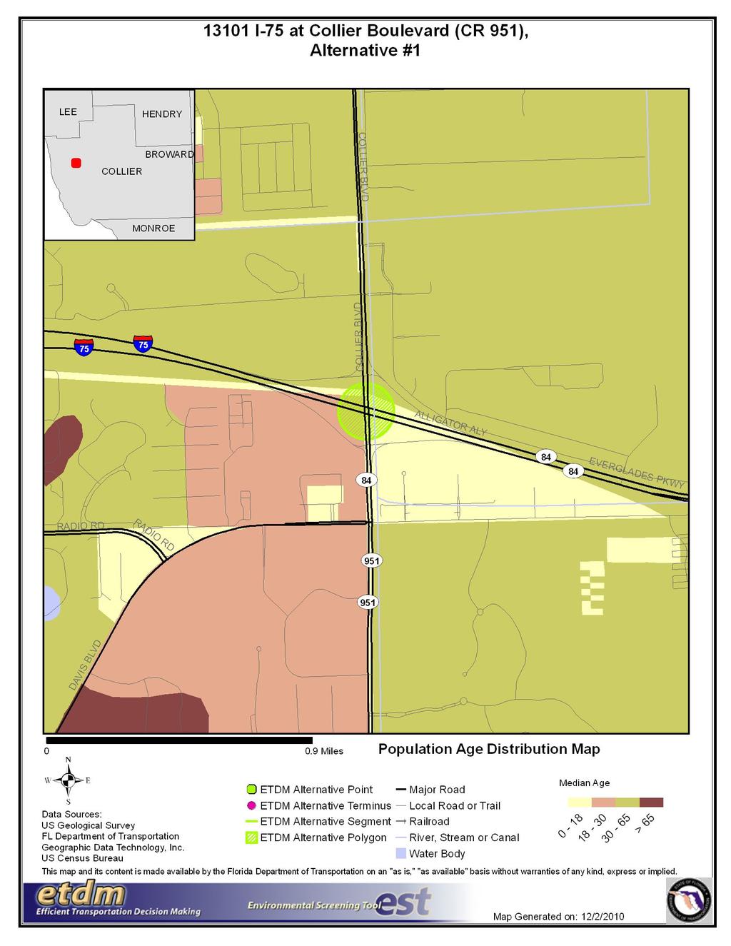
113 35
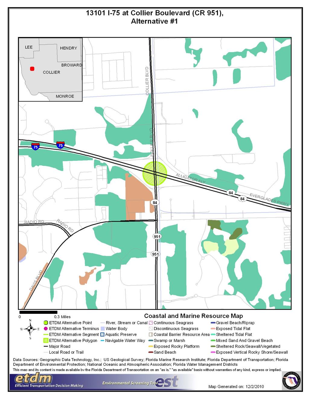
114 36
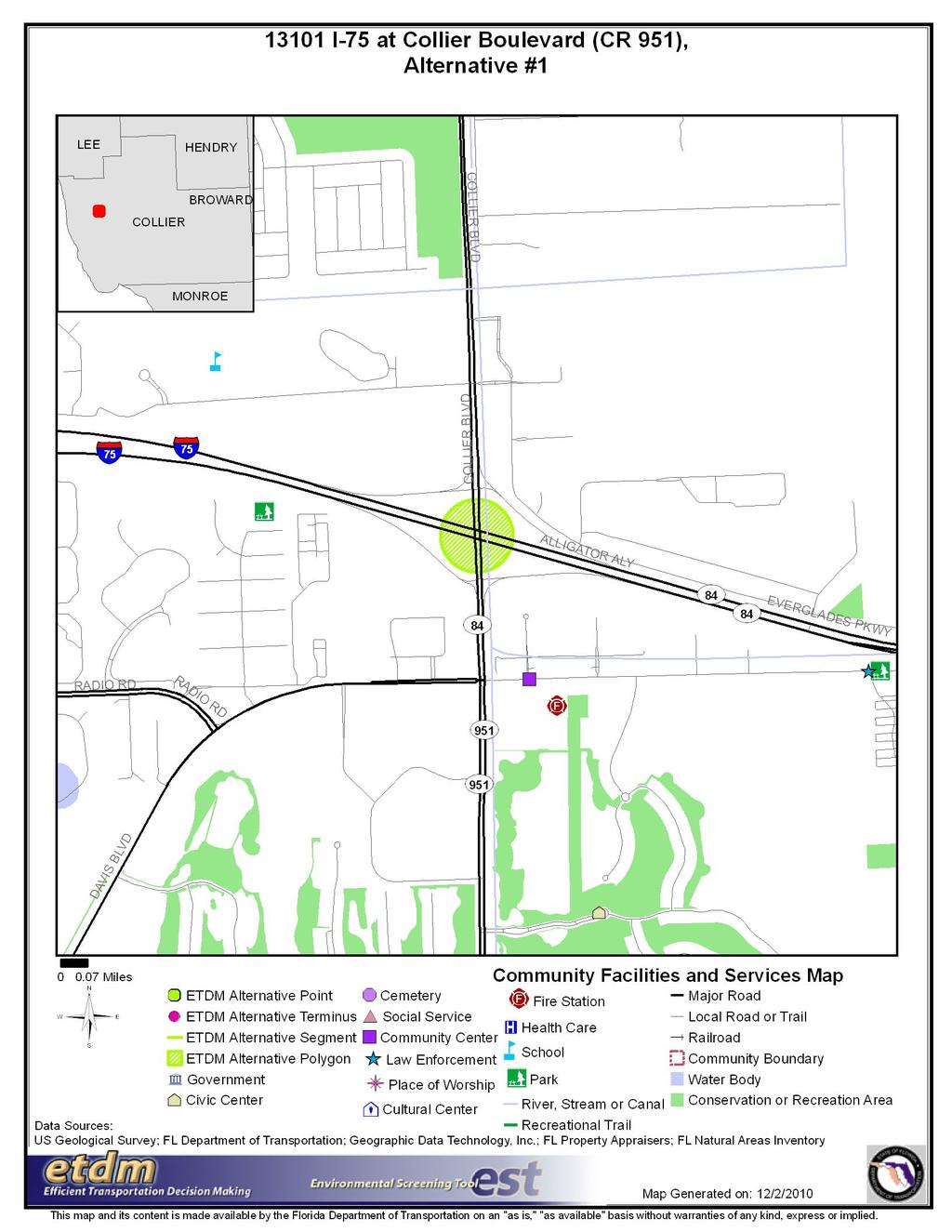
115 37
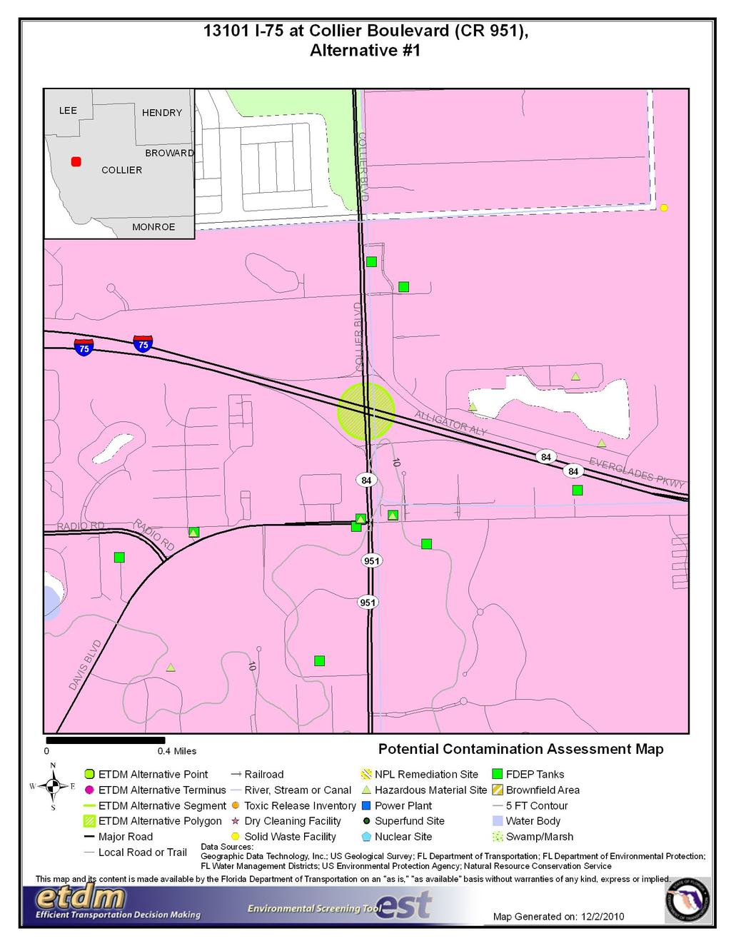
116 38
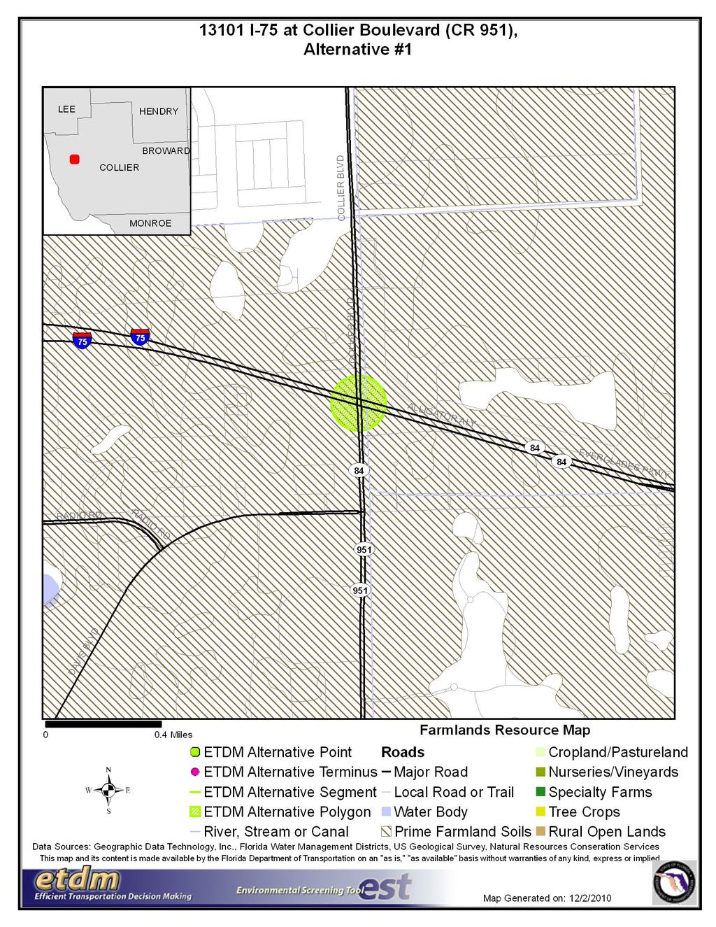
117 39
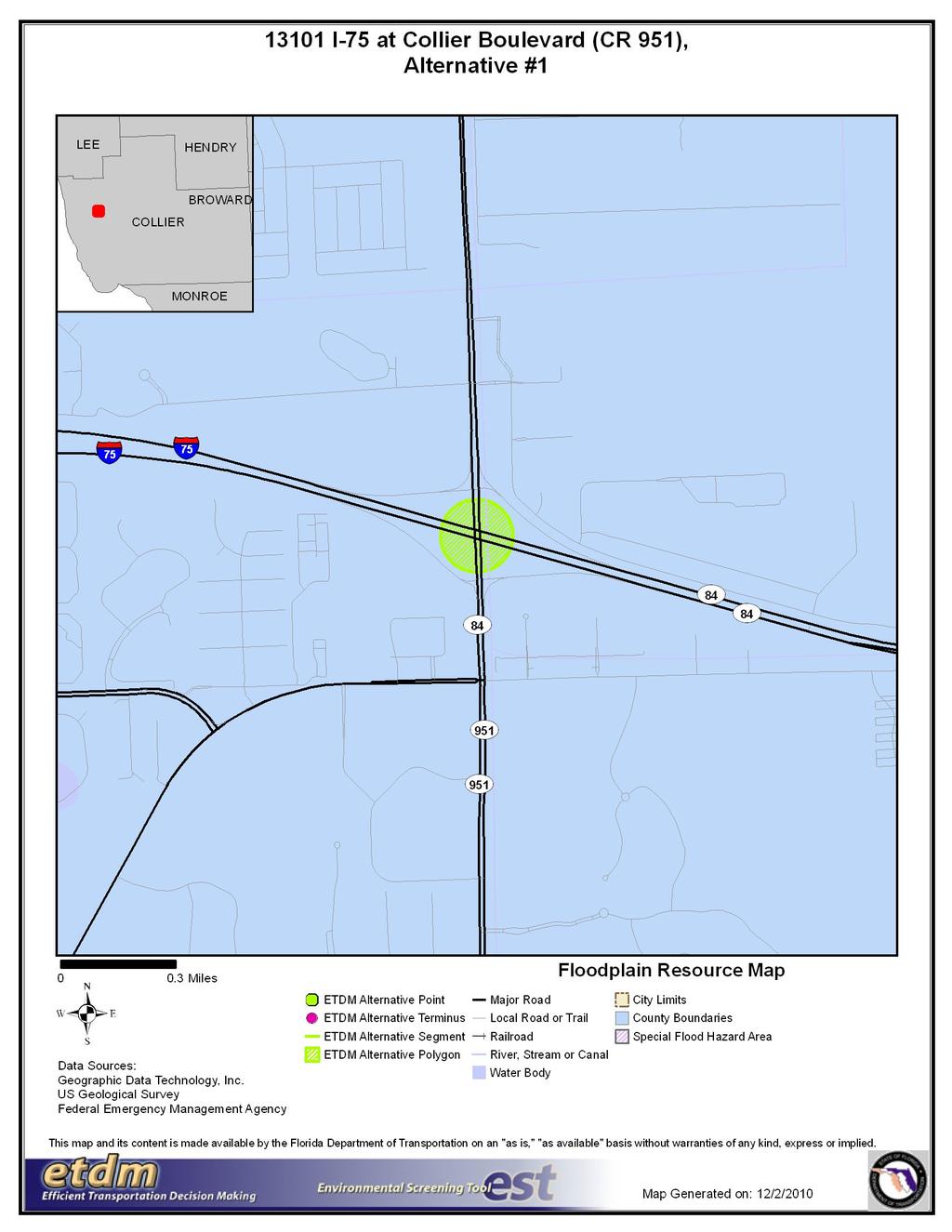
118 40
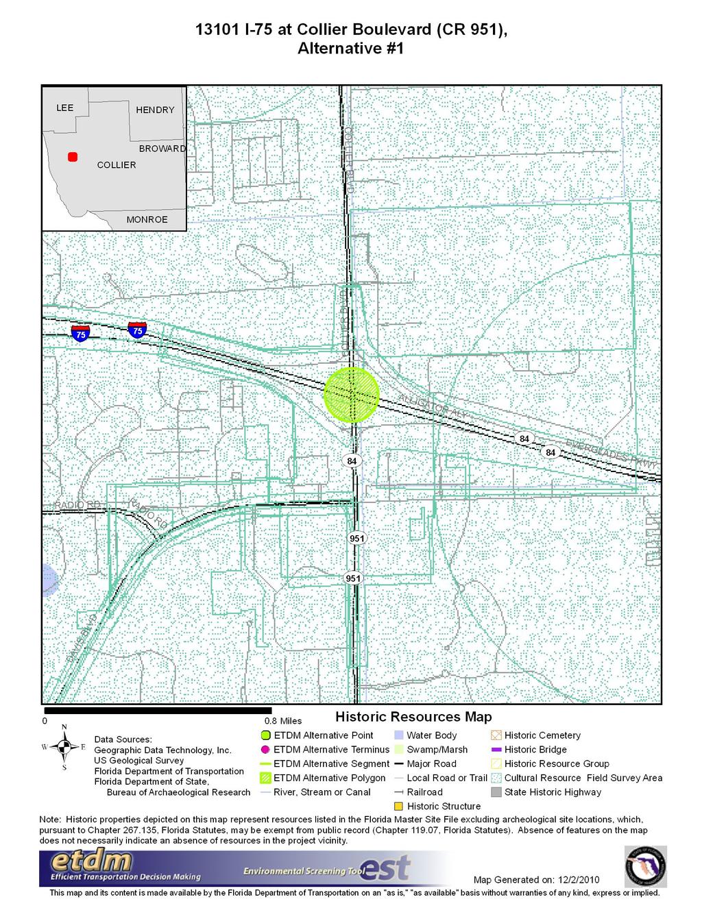
119 41
120 42
121 43
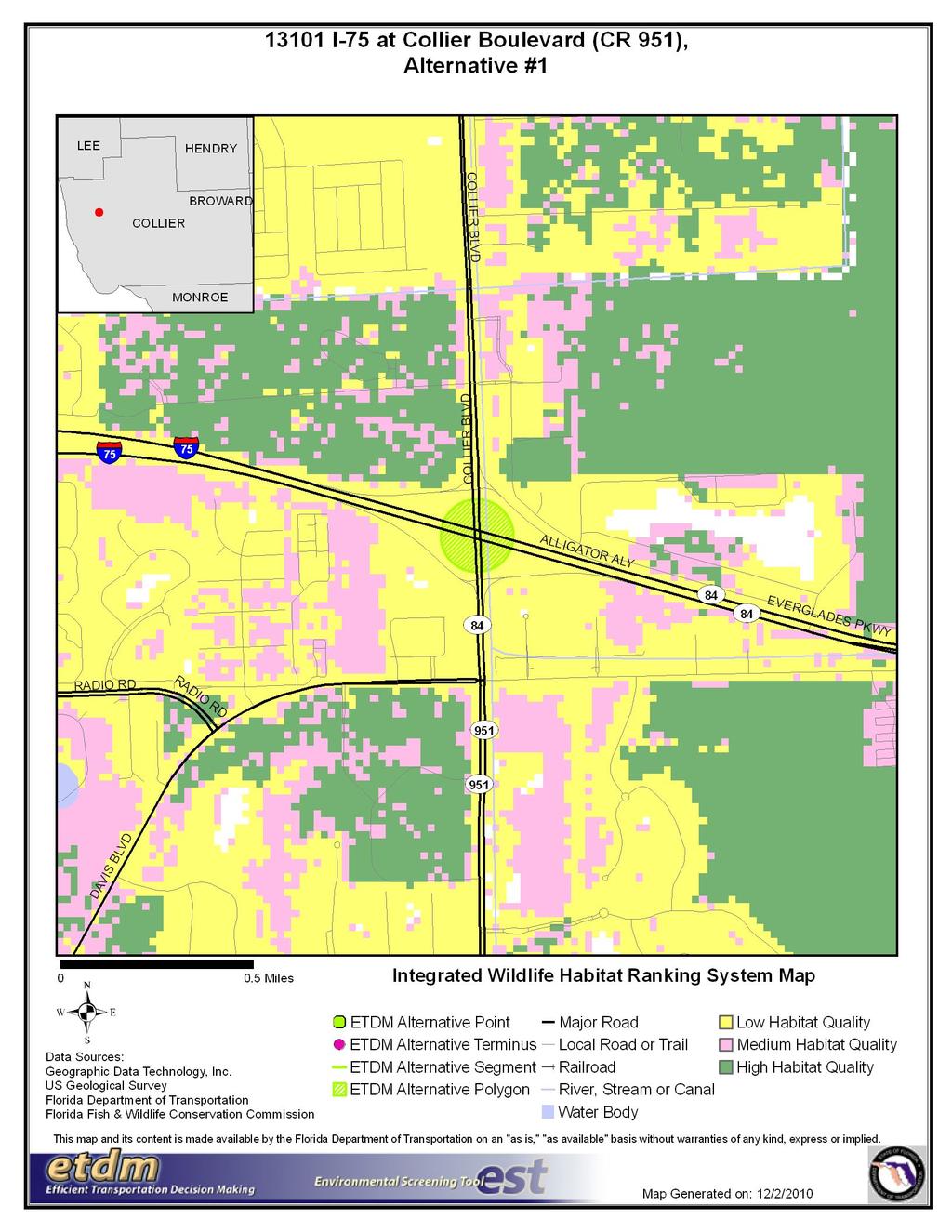
122 44
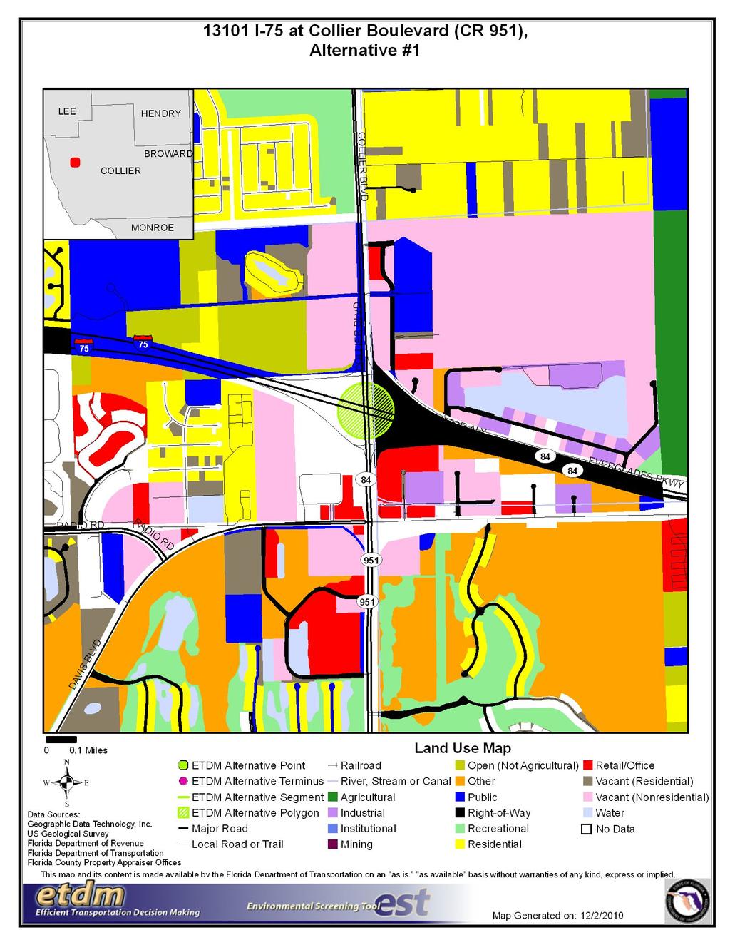
123 45
124 46
125 47
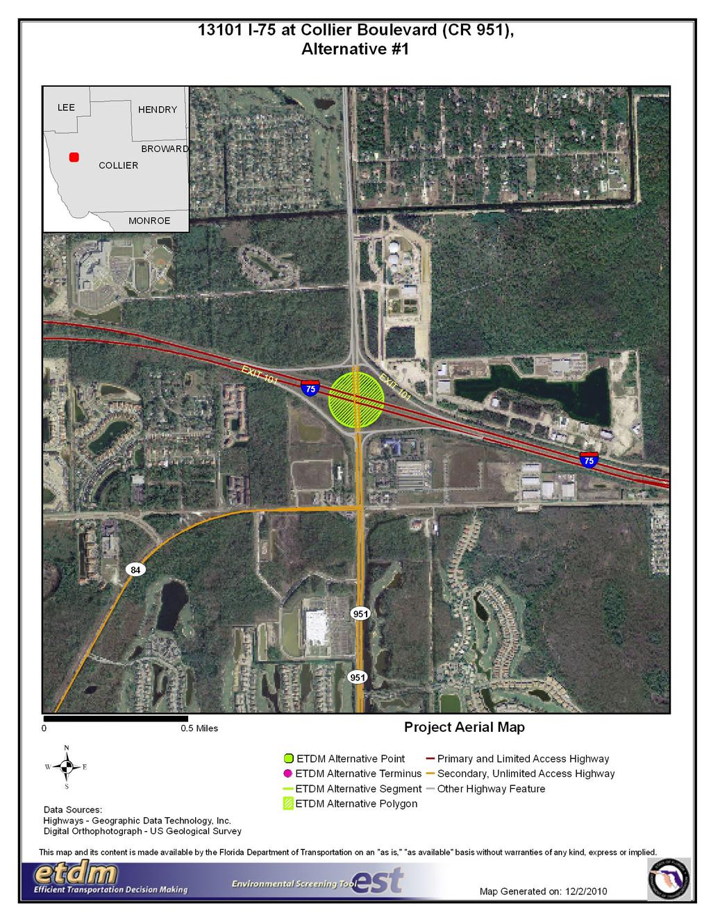
126 48
127 49
128 50
129 51
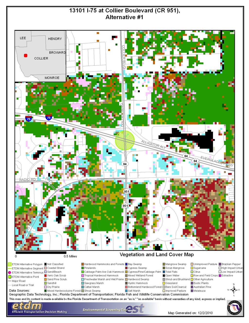
130 52
131 53
132 54
133 6. Appendices 6.1. GIS Analyses 6.2. Project Attachments 6.3. Degree of Effect Legend Appendices Advanced Notification Comments There are no comments for this project. GIS Analyses Since there are so many GIS Analyses available for Project # I-75 at Collier Boulevard (CR 951), they have not been included in this ETDM Summary Report. GIS Analyses, however, are always available for this project on the Public ETDM Website. Please click on the link below (or copy this link into your Web Browser) in order to view detailed GIS tabular information for this project: Special Note: Please be sure that when the GIS Analysis Results page loads, the Project Re-Published 6/30/2011Milestone is selected. GIS Analyses snapshots have been taken for Project #13101 at various points throughout the project's life-cycle, so it is important that you view the correct snapshot. Project Attachments Note: Attachments are not included in this Summary Report, but can be accessed by clicking on the links below: Date Type Size Link / Description 12/09/2010 Form SF-424: Application for Federal Assistance Degree of Effect Legend 621 KB Form SF-424: Application for Federal Assistance Color Code Meaning ETAT Public Involvement N/A 0 Not Applicable / No Involvement None (after 12/5/2005) 1 Enhanced 2 Minimal 2 Minimal to None (assigned prior to 12/5/2005) 3 Moderate 4 Substantial 5 5 Potential Dispute (Planning Screen) Dispute Resolution (Programming Screen) No ETAT Consensus No ETAT Reviews There is no presence of the issue in relationship to the project, or the issue is irrelevant in relationship to the proposed transportation action. The issue is present, but the project will have no impact on the issue; project has no adverse effect on ETAT resources; permit issuance or consultation involves routine interaction with the agency. The None degree of effect is new as of 12/5/2005. Project has positive effect on the ETAT resource or can reverse a previous adverse effect leading to environmental improvement. Project has little adverse effect on ETAT resources. Permit issuance or consultation involves routine interaction with the agency. Low cost options are available to address concerns. Project has little adverse effect on ETAT resources. Permit issuance or consultation involves routine interaction with the agency. Low cost options are available to address concerns. Agency resources are affected by the proposed project, but avoidance and minimization options are available and can be addressed during development with a moderated amount of agency involvement and moderate cost impact. The project has substantial adverse effects but ETAT understands the project need and will be able to seek avoidance and minimization or mitigation options during project development. Substantial interaction will be required during project development and permitting. Project may not conform to agency statutory requirements and may not be permitted. Project modification or evaluation of alternatives is required before advancing to the LRTP Programming Screen. Project does not conform to agency statutory requirements and will not be permitted. Dispute resolution is required before the project proceeds to programming. No community opposition to the planned project. No adverse effect on the community. Affected community supports the proposed project. Project has positive effect. Minimum community opposition to the planned project. Minimum adverse effect on the community. Minimum community opposition to the planned project. Minimum adverse effect on the community. Project has adverse effect on elements of the affected community. Public Involvement is needed to seek alternatives more acceptable to the community. Moderate community interaction will be required during project development. Project has substantial adverse effects on the community and faces substantial community opposition. Intensive community interaction with focused Public Involvement will be required during project development to address community concerns. Community strongly opposes the project. Project is not in conformity with local comprehensive plan and has severe negative impact on the affected community. Community strongly opposes the project. Project is not in conformity with local comprehensive plan and has severe negative impact on the affected community. ETAT members from different agencies assigned a different degree of effect to this project, and the ETDM coordinator has not assigned a summary degree of effect. No ETAT members have reviewed the corresponding issue for this project, and the ETDM coordinator has not assigned a summary degree of effect. 55

134 CHARLIE CRIST GOVERNOR Florida Department of Transportation 801 North Broadway Avenue Bartow, FL STEPHANIE C. KOPELOUSOS SECRETARY December 10, 2010 Ms. Lauren Milligan, Coordinator Florida State Clearinghouse Department of Environmental Protection 3900 Commonwealth Boulevard, MS 47 Tallahassee, FL Subject Advance Notification I-75 at Collier Boulevard (CR 951) ETDM # Federal Aid Project No.: TBD Financial Project ID No.: Collier County, Florida Dear Ms. Milligan: We are sending this Advance Notification (AN) Package to your office for distribution to state agencies that conduct federal consistency reviews (consistency reviewers) in accordance with the Coastal Zone Management Act and Presidential Executive Order We are also distributing the AN Package to the local and Federal agencies contained in the attached mailing list. Although we will request specific comments during the permitting process, we are asking that permitting and permit reviewing agencies (consistency reviewers) review the attached information and provide us with their comments. It should be noted that the AN Package initiates the AN process through the Environmental Screening Tool (EST) as part of the Efficient Transportation Decision Making (ETDM) Programming Screen phase. This is a Federal-aid action and the Florida Department of Transportation, in consultation with the Federal Highway Administration, will determine what degree of environmental documentation will be necessary. The determination will be based upon in-house environmental evaluations and comments received through coordination with other agencies. Please provide a consistency review for this project in accordance with the State's Coastal Zone Management Program.
135
136 Advance Notification Package Project # I-75 at Collier Boulevard (CR 951) Programming Screen - Published on 12/09/2010 Printed on: 12/14/2010 Table of Contents Location Maps Fact Sheet Disclaimer Project Description Community-Desired Features (No Data Available) Purpose and Need Reviews (Not Applicable) Environmental Information Permits Required (No Data Available) Technical Studies Required (No Data Available) Commitments (No Data Available) Screening Summary Overview (Not Applicable) Agency Comments and Summary Degrees of Effect (Not Applicable) Resource Maps Class of Action (No Data Available) Dispute Resolution Activity Log (No Data Available) Ancillary Documentation (No Data Available) Transmittal List Form SF-424: Application for Federal Assistance
137 Location Maps Page 1 of 17 Advance Notification Package for ETDM Project #13101: I-75 at Collier... Printed on: 12/14/2010
138 Page 2 of 17 Advance Notification Package for ETDM Project #13101: I-75 at Collier... Printed on: 12/14/2010
139 Page 3 of 17 Advance Notification Package for ETDM Project #13101: I-75 at Collier... Printed on: 12/14/2010
140 DISCLAIMER: The Fact Sheet data consists of the most up-to-date information available at the time the Advance Notification Package is published. Updates to this information may be found on the ETDM website at Special Note: Please be aware of the selected Milestone date when viewing project data on the ETDM website. Snapshots of project and analysis data have been taken for Project #13101 at various points throughout the project's life-cycle. On the website these Project Milestone Dates are listed in the the project header immediately after the project contact information. Click on any of the dates listed to view the information available on that date. Project Description #13101 I-75 at Collier Boulevard (CR 951) District District 1 Phase Programming Screen County Collier From Planning Organization FDOT District 1 To Plan ID Financial Management No Federal Involvement Contact Information Federal Action Federal Funding Name: Gwen Pipkin Phone: (863) ext gwen.pipkin@dot.state.fl.us Project Description Data Description Statement The objective of this project is to enhance operational capacity and overall traffic operations at the I-75 and Collier Boulevard/CR 951 interchange in Collier County. The existing grade-separated, diamond interchange is surrounded by commercial land uses. I-75 is a 4-lane limited access expressway when crossing Collier Boulevard/CR 951. Collier Boulevard/CR 951, from Davis Boulevard/SR 84 to I-75, is a 4-lane divided urban arterial. Currently proposed as a partial cloverleaf interchange with two loop ramps, the interchange improvements will incorporate planned enhancements at the Davis Boulevard/SR 84 and Collier Boulevard/CR 951 intersection, as well as complement and support roadway capacity improvements to Collier/CR 951 and Davis/SR 84 Boulevards that are presently underway. At least three alternatives for the project will be developed and considered as part of the Project Development and Environment (PD&E) Study. The limits of the project will extend along I-75 from 1500 feet west and east of the current ramp terminals at Collier Boulevard/CR 951, 1500 feet north of the ramp terminals along Collier Boulevard/CR 951, 1500 feet west and east of the Davis Boulevard/SR 84 at Collier Boulevard/CR 951 intersection along Davis Boulevard/SR 84, and 1500 feet south of the intersection along Collier Boulevard/CR 951. TRANSPORTATION PLAN CONSISTENCY The interchange is currently identified as a priority FDOT project needed to meet geometric, operational and safety standards. The project will be implemented with state and federal funds. Funding in the amount of $829,574 is programmed for the Preliminary Engineering & Environment (PD&E) Study under Fiscal Year 2011/2012 and $6,575,000 is programmed for the Preliminary Engineering phase in Fiscal Year 2013/2014 of the FDOT Work Program. The ultimate interchange configuration could potentially require additional right-of-way; however, the specific right-of-way requirements are not known at this time. Detailed cost estimates and right-of-way requirements will be derived as part of the PD&E Study. The Collier Metropolitan Planning Organization's (MPO) 2035 Long Range Transportation Plan (LRTP) is scheduled to be adopted in December The I-75 at Collier Boulevard/CR 951 interchange improvement is currently identified in the 2035 LRTP as a priority project and is anticipated to be cost feasible (funded through design only). The total project cost is estimated to be $99,670,000 (present day costs ). The interchange is also identified as a contingent financially feasible project in the Collier MPO 2030 LRTP 'Minor Update' (adopted in June 2007) and is included as part of the Joint Lee/Collier MPO Bi-County Regional Transportation Network. In addition, the proposed interchange is reflected on Map TR-1: Financially Feasible Plan and Traffic Circulation Map - Year 2025 of the adopted Collier County Growth Management Plan and is identified in the adopted Collier MPO FY 2010/ /2015 Transportation Improvement Program. Purpose and Need Statement EXECUTIVE SUMMARY The purpose of this project is to improve operational capacity and enhance overall traffic operations at I-75 and Collier Boulevard/CR 951 and on the surrounding roadway network. The need for the project is based on the following criteria: - Capacity/Transportation Demand: Improve Traffic Operations The interchange improvement will increase operational capacity to meet the current and future traffic demand. Without the proposed improvement, the interchange (including the intersection of Davis Boulevard/SR 84 at Collier Boulevard/CR 951) will continue to experience high delays and queuing and operate below acceptable level of service (LOS) standards. - Safety: Enhance Safety Conditions The Collier Boulevard/CR 951 study corridor experiences average crash rates higher than state-wide average rates for similar facilities. The high congestion and low spacing between signalized intersections along the Collier Boulevard/CR 951 corridor may contribute to the common rear-end type crashes reported. By increasing operational capacity and reducing congestion, the proposed project is anticipated to improve safety conditions (and thus, reduce rear-end type crashes) at the interchange. - Modal Interrelationships: Enhance Freight Mobility and Economic Competiveness The segments of Collier Boulevard/CR 951, from Davis Boulevard/SR 84 to I-75, and Davis Boulevard/SR 84, from Radio Road to Collier Boulevard/CR 951, including the I-75 and Collier Boulevard/CR 951 interchange, are currently identified in the Collier Metropolitan Planning Organization's (MPO) 2035 Long Range Transportation Plan (LRTP) as freight mobility hot spots. The proposed interchange improvement is Page 4 of 17 Advance Notification Package for ETDM Project #13101: I-75 at Collier... Printed on: 12/14/2010
141 anticipated to enhance the mobility of goods by alleviating current and future congestion at the interchange and on the surrounding freight network. CAPACITY/TRANSPORTATION DEMAND: Improve Traffic Operations The Collier MPO 2035 LRTP currently identifies Collier Boulevard/CR 951 from Davis Boulevard/SR 84 to I-75 as a Deficient Roadway with a volume-to-capacity (v/c) ratio = This indicates that the roadway segment has exceeded its designated service volume and level of service (LOS) standard. Likewise, the segment of Davis Boulevard/SR 84 from Radio Road to Collier Boulevard/CR 951 (designated as a Deficient Roadway with a v/c ratio = 1.09) and the intersection of Davis Boulevard/SR 84 at Collier Boulevard/CR 951 operate at LOS F. According to data provided in the Interchange Operational Analysis Report (October 2010) prepared for the I-75 at Collier Boulevard/CR 951 interchange and the 2009 FDOT Florida Traffic Information database, the existing traffic conditions for I-75, Collier Boulevard/CR 951, and Davis Boulevard/SR 84 are as follows: I-75 (west of Collier Boulevard/CR 951) Annual Average Daily Traffic (AADT) volume = 36,700 vehicle trips per day / LOS = B - Truck % = (FDOT 2009 Florida Traffic Information) I-75 (east of Collier Boulevard/CR 951) AADT volume = 18,900 vehicle trips per day / LOS = A - Truck % = 9.76 (FDOT 2009 Florida Traffic Information) Highest Volumes for I-75 at Collier Boulevard/CR 951 Interchange (based on 2009 Traffic Counts): I-75 NB off-ramp to CR 951: AADT volume = 2,400 / Freeway volume = 711 / Ramp volume = 179 / LOS = A I-75 NB on-ramp from CR 951: AADT volume = 11,700 / Freeway volume = 532 / Ramp volume = 981 / LOS = B I-75 SB off-ramp to CR 951: AADT volume = 12,000 / Freeway volume = 1,433 / Ramp volume = 936 / LOS = B I-75 SB on-ramp from CR 951: AADT volume = 2,200 / Freeway volume = 516 / Ramp volume = 184 / LOS = A Truck % = 5.97 (FDOT 2009 Florida Traffic Information) Collier Boulevard/CR 951 (I-75 to Magnolia Pond Drive) AADT volume = 23,300 vehicle trips per day / LOS = F - Truck % = 8.94 (FDOT 2009 Florida Traffic Information - north of Golden Gate Parkway) Collier Boulevard/CR 951 (I-75 SB ramps to I-75 NB ramps) AADT volume = 32,900 vehicle trips per day / LOS = C Collier Boulevard/CR 951 (Davis Boulevard/SR 84 to I-75) AADT volume = 42,900 vehicle trips per day / LOS = F - Truck % = (FDOT 2009 Florida Traffic Information) Collier Boulevard/CR 951 (south of Davis Boulevard/SR 84) AADT volume = 37,900 vehicle trips per day / LOS = B - Truck % = 6.26 (FDOT 2009 Florida Traffic Information) Davis Boulevard/SR 84 (west of Collier Boulevard/CR 951) AADT volume = 19,500 vehicle trips per day / LOS = F - Truck % = 7.13 (FDOT 2009 Florida Traffic Information) Davis Boulevard/SR 84 (east of Collier Boulevard/CR 951) AADT volume = 5,800 vehicle trips per day / LOS = B - Truck % = 7.13 (FDOT 2009 Florida Traffic Information) It should be noted that Collier Boulevard/CR 951 from Davis Boulevard/SR 84 to I-75 is funded for widening from 4 to 8 lanes. This project includes capacity improvements within one quarter-mile of Davis Boulevard/SR 84 and the I-75 interchange ramps. Similarly, Davis Boulevard/SR 84 from Radio Road to Collier Boulevard/CR 951 is funded for widening from 2 to 6 Lanes. This project includes a bypass ramp for the eastbound to southbound movement at the Davis Boulevard/SR 84 and Collier Boulevard/CR 951 intersection. These roadway improvements will require complementary and supporting geometric improvements at the I-75 and Collier Boulevard/CR 951 interchange to ensure safe operational conditions at the interchange. Accounting for these committed roadway improvements, the future traffic levels on the interchange approaches are expected to increase, as shown below. I-75 (west of Collier Boulevard/CR 951) AADT volume = 76,100 vehicle trips per day (3.8% increase) I-75 (east of Collier Boulevard/CR 951) AADT volume = 36,000 vehicle trips per day (3.2% increase) Highest Volumes for I-75 at Collier Boulevard/CR 951 Interchange (based on 2009 Traffic Counts): I-75 NB off-ramp to CR 951: AADT volume = 4,700 Page 5 of 17 Advance Notification Package for ETDM Project #13101: I-75 at Collier... Printed on: 12/14/2010
142 I-75 NB on-ramp from CR 951: AADT volume = 24,400 I-75 SB off-ramp to CR 951: AADT volume = 23,100 I-75 SB on-ramp from CR 951: AADT volume = 2,600 Collier Boulevard/CR 951 (I-75 to Magnolia Pond Drive) AADT volume = 53,700 vehicle trips per day (4.7% increase) Collier Boulevard/CR 951 (I-75 SB ramps to I-75 NB ramps) AADT volume = 65,300 vehicle trips per day (3.5% increase) Collier Boulevard/CR 951 (Davis Boulevard/SR 84 to I-75) AADT volume = 70,700 vehicle trips per day (2.3% increase) Collier Boulevard/CR 951 (south of Davis Boulevard/SR 84) AADT volume = 51,600 vehicle trips per day (1.3% increase) Davis Boulevard/SR 84 (west of Collier Boulevard/CR 951) AADT volume = 32,300 vehicle trips per day (2.3% increase) Davis Boulevard/SR 84 (east of Collier Boulevard/CR 951) AADT volume = 10,500 vehicle trips per day (2.9% increase) The interchange improvement will increase operational capacity to meet the local current and future traffic demand. Without the proposed improvement, the interchange (including the intersection of Davis Boulevard/SR 84 at Collier Boulevard/CR 951) will continue to experience high delays and queuing and operate below acceptable LOS standards. SAFETY: Enhance Safety Conditions As part of the Interchange Operational Analysis Report (October 2010) prepared for the I-75 at Collier Boulevard/CR 951 interchange, crash data was collected and analyzed from Collier County and the FDOT Safety Office for the 3-year period The data reported 268 crashes on Collier Boulevard/CR 951 in the vicinity of the interchange; an average of 89.3 crashes per year and a crash rate of crashes per million vehicle miles traveled. The FDOT state-wide average crash rate for similar facilities (4-lane divided urban arterial) is crashes per million vehicle miles traveled. This indicates that the Collier Boulevard/CR 951 study corridor experiences average crash rates higher than state-wide average rates for similar facilities. Rear-end type crashes were the most common crash type recorded at the I-75 at Collier Boulevard/CR 951 interchange. The high congestion and low spacing between signalized intersections along the Collier Boulevard/CR 951 corridor may have contributed to the reported crash type. It should be noted that as the volume of traffic increases at the interchange, the opportunity for vehicle movement conflict is expected to increase. The proposed project is anticipated to improve operational capacity, thus reducing congestion and enhancing overall traffic operations at the interchange. This, in turn, is expected to help reduce rear-end type crashes. MODAL INTERRELATIONSHIPS: Enhance Freight Mobility and Economic Competiveness Collier County's freight transportation system is dominated almost exclusively by its highway network. The 2035 LRTP designates I-75 (a major north-south and east-west arterial on the Strategic Intermodal System and Florida Intrastate Highway System) as a Tier One regional freight corridor (i.e., highways or regional corridors used to move goods in, out, and through the county and provide connectivity beyond the county boundaries). Providing access to I-75, both Collier Boulevard/CR 951 and Davis Boulevard/SR 84 are designated as Tier Two regional freight connectors (i.e., roads that function as connectors to the major freight activity centers/local distribution facilities or between the regional freight corridors). In addition, both the I-75 at Collier Boulevard/CR 951 interchange and Davis Boulevard/SR 84 at Collier Boulevard/CR 951 intersection are located within the Gateway Freight Activity Center, which is expected to expand, and provide access to the East Naples/Airport Freight Activity Center. As indicated through the Future Land Use Map of the adopted Collier County Growth Management Plan, the area surrounding the interchange is targeted for development given the commercial mixed-use activity center and industrial district designations and the fact that the interchange is located within a designated freight activity center and Transportation Concurrency Management Area. In addition, the I-75 at Collier Boulevard/CR 951 interchange provides access to southwestern Collier County, Naples and Marco Island. Based on data extracted from the traffic analysis zones (TAZ) of the Lee-Collier Transportation Model that encompass the I-75 at Collier Boulevard/CR 951 interchange, population and employment growth figures are forecasted to increase from year 2007 to year 2035: -Population is projected to grow from 3,015 in 2007 to 3,294 in 2035 (0.3% annual growth rate) -Employment is projected to grow from 1,975 in 2007 to 11,177 in 2035 (16.6% annual growth rate) Currently, the Collier Boulevard/CR 951 from Davis Boulevard/SR 84 to I-75 and Davis Boulevard/SR 84 from Radio Road to Collier Boulevard/CR 951 segments (including the I-75 and Collier Boulevard/CR 951 interchange) are identified in the 2035 LRTP as freight mobility hot spots (i.e., locations identified on Strategic Intermodal System and regional goods movement corridors that have operational deficiencies for efficient truck mobility). The proposed interchange improvement is anticipated to enhance the mobility of goods by alleviating current and future congestion at the interchange and on the surrounding freight network. Summary of Public Comments not available at this time Justification: Due to the compressed project schedule, public outreach activities will be conducted during the Project Development phase. Page 6 of 17 Advance Notification Package for ETDM Project #13101: I-75 at Collier... Printed on: 12/14/2010
143 Consistency Consistent with Air Quality Conformity. Consistency information for Coastal Zone Management Program is not available. Consistent with Local Government Comp Plan. Consistent with MPO Goals and Objectives. Potential Lead Agencies - Federal Highway Administration Exempted Agencies Agency Name Justification Date Federal Transit Administration No transit facilities are being considered as part of this project. 12/10/2010 Federal Rail Administration No rail facilities are being considered as part of this project. 12/10/2010 US Coast Guard No navigable waterways are in the vicinity of project. 12/10/2010 Project Attachments Date Type Size Link / Description 12/09/2010 Form SF-424: 621 KB Application for Form SF-424: Application for Federal Assistance: Form SF-424: Application for Federal Federal Assistance Assistance Alternative #1 Alternative Description From: To: Type: Traffic Operation Enhancement Status: ETDM QA/QC Total Length:? mi. Cost: $99,670, Modes: Roadway SIS: Y Polygon Description(s) Polygon No. Name Beginning Location Polygon #1 Location and Length Ending Location Length (mi.) Roadway Id BMP EMP Jurisdiction and Class Polygon No. Jurisdiction Urban Service Area Functional Class Polygon #1 Base Conditions Polygon No. Year AADT Lanes Config Polygon #1 Interim Plan Polygon No. Year AADT Lanes Config Polygon #1 Needs Plan Polygon No. Year AADT Lanes Config Polygon #1 Cost Feasible Plan Polygon No. Year AADT Lanes Config Polygon #1 No funding sources found. Funding Sources Eliminated Alternatives No eliminated alternatives present. Community-Desired Features No Data Available Purpose and Need Reviews Page 7 of 17 Advance Notification Package for ETDM Project #13101: I-75 at Collier... Printed on: 12/14/2010
144 Not Applicable Environmental Information The following tables show results of standard data analyses that compare the locations of the project alternatives with locations of various environmental resources, as recorded in the ETDM Geographic Information System database. This report provides results for various resources within 500 feet from the center of the planned corridor. Results for additional types of resources and buffer distances may be viewed on the ETDM Environmental Screening Tool web site, or may be requested from the project contact as indicated on the Advance Notification cover letter. Public access to the ETDM Environmental Screening Tool is provided by the Florida Department of Transportation at the following web address: Coastal Zone Consistency Review Is Required? YES Potential Navigable Waterway Crossing Features Found? NO Alternative #1 Alternative #1 Summary 0 ft. 500 ft ft. Analysis Type Date Run Count Count Acres Count Acres Land Uses District 1 Generalized Landuse Wetlands National Wetlands Inventory 12/02/ SFWMD Wetlands /02/ Floodplains DFIRM FLOOD HAZARD ZONES 12/02/ FEMA Flood Insurance Rate Maps /02/ Wildlife and Habitat 2003 FFWCC Habitat and Landcover GRID 12/02/ SFWMD FL Land Use and Land Cover 12/02/ Florida Managed Areas 12/02/ Florida Natural Areas Inventory Managed Lands Strategic Habitat and Conservation Areas Outstanding Florida Waters Other Outstanding Florida Waters 12/02/ Aquatic Preserves List of Aquatic Preserves 12/02/ Cultural Resources Field Survey Project Boundaries 12/02/ Florida Site File Cemeteries 12/02/ Florida Site File Historic Bridges 12/02/ Florida Site File Historic Standing Structures 12/02/ Resource Groups 12/02/ Coastal Barrier Resources Coastal Barrier Resource System 12/02/ Contamination Brownfield Location Boundaries 12/02/ FDEP Off Site Contamination Notices 12/02/ National Priority List Sites 12/02/ Solid Waste Facilities 12/02/ Superfund Hazardous Waste Sites 12/02/ Toxic Release Inventory Sites 12/02/ Sole Source Aquifer Sole Source Aquifers 12/02/ Noise Sensitive Facilities Page 8 of 17 Advance Notification Package for ETDM Project #13101: I-75 at Collier... Printed on: 12/14/2010
145 Geocoded Health Care Facilities 12/02/ Geocoded Laser Facilities 12/02/ Geocoded Schools 12/02/ Essential Fish Habitat Potential Environmentally Sensitive Shorelines 12/02/ Florida Artificial Reefs 12/02/ Florida Reef Locations and Names 12/02/ Florida Sea Grass Bed Scar Damage 12/02/ Mangroves 12/02/ Seagrass Beds (Showing Continuous/Discontinuous) 12/02/ Submerged Lands Act 12/02/ Farmlands Generalized Agricultural Land Use 12/02/ Prime Farm Land 12/02/ Communities Census Data 12/02/ Census data Block Groups - Indicators 12/02/ County Demographics 12/02/ Recreation Areas Existing Recreational Trails /02/ Florida State Parks 12/02/ Geocoded Parks 12/02/ Parcel Derived Parks 12/02/ Wild and Scenic Rivers Wild and Scenic Rivers 12/02/ Navigable Waterway Crossing? Potential Navigable Waterway Crossings National Wetlands Inventory Wetland areas from the National Wetlands Inventory summarized by wetland system type. - analysis run on 12/02/ Ft. 200 Ft. 500 Ft. System Acr Pct Acr Pct Acr Pct PALUSTRINE % % % SFWMD Wetlands SFWMD Wetlands analysis run on 12/02/ Ft. 200 Ft. 500 Ft. Land Use Classification Acr Pct Acr Pct Acr Pct FRESHWATER MARSHES / GRAMINOID PRAIRIE - MARSH % MIXED SHRUBS % % % WET MELALEUCA % WET PINELANDS HYDRIC PINE % WET PRAIRIES % % FEMA Flood Insurance Rate Maps FEMA Flood Insurance Rate Maps 1996 summarized by zone. See metadata for descriptions of zones. - analysis run on 12/02/ Ft. 200 Ft. 500 Ft. Zone Acr Pct Acr Pct Acr Pct X % % % 2003 FFWCC Habitat and Landcover GRID Ft. 200 Ft. 500 Ft. Page 9 of 17 Advance Notification Package for ETDM Project #13101: I-75 at Collier... Printed on: 12/14/2010
146 Description Acr Pct Acr Pct Acr Pct CYPRESS SWAMP % % % DRY PRAIRIES % % % FRESHWATER MARSH AND WET PRAIRIE % % % HARDWOOD SWAMP % % % HIGH IMPACT URBAN % % % LOW IMPACT URBAN % MIXED WETLAND FOREST % % % OPEN WATER % PINELANDS % % % 2004 SFWMD FL Land Use and Land Cover SFWMD FL Land Use and Land Cover - analysis run on 12/02/ Ft. 200 Ft. 500 Ft. Land Use Classification Acr Pct Acr Pct Acr Pct COMMERCIAL AND SERVICES % DISTURBED LAND % % FRESHWATER MARSHES / GRAMINOID PRAIRIE - MARSH % HERBACEOUS (DRY PRAIRIE) % % % MIXED SHRUBS % % % PINE FLATWOODS % % % ROADS AND HIGHWAYS % % % WET MELALEUCA % WET PINELANDS HYDRIC PINE % WET PRAIRIES % % Field Survey Project Boundaries Field Survey Project Boundaries - analysis run on 12/02/2010 Title 100 Ft. 200 Ft. 500 Ft. HISTORICAL/ARCHITECTURAL SURVEY OF COLLIER COUNTY, FLORIDA. A CULTURAL RESOURCE ASSESSMENT SURVEY STATE ROAD 84 (DAVIS BOULEVARD) FROM SANTA BARBARA BOULEVARD TO CR 951/SR 951 COLLIER COUNTY, FLORIDA A CULTURAL RESOURCE ASSESSMENT SURVEY I-75 FROM SR 951 TO SOUTH OF BONITA BEACH ROAD COLLIER COUNTY, FLORIDA ARCHAEOLOGICAL ASSESSMENT SURVEY OF THE CITYGATE COMMERCE PARK, COLLIER COUNTY, FLORIDA ADDENDUM CULTURAL RESOURCE ASSESSMENT SURVEY I-75 PD&E STUDY SR 951 TO THE COLLIER/LEE COUNTY LINE Prime Farm Land Subset of SSOILS data designated as prime farm land. - analysis run on 12/02/ Ft. 200 Ft. 500 Ft. Farmland Classification Acr Pct Acr Pct Acr Pct FARMLAND OF LOCAL IMPORTANCE % % % Census Data US Census Bureau data by block. Detailed information is for each of the entire blocks that intersect an analysis area. - analysis run on 12/02/2010 Males Female s Native Hawaiia n and Other Pacific Islander 2000 Populati on # Househ olds # White # Black # Native Americ an # Asian # Hispani c # Other Race Page 10 of 17 Advance Notification Package for ETDM Project #13101: I-75 at Collier... Printed on: 12/14/2010
147 Alone Totals Census data Block Groups - Indicators Census data Block Groups - Indicators - analysis run on 12/02/2010 Speak English "Not At All" Housing Units With No Vehicle Available Housing Units With 1 Vehicle Available Housing Units With 2 Vehicles Available Housing Units With 3 Vehicles Available Housing Units With 4 vehicles Available Totals Housing Units With 5 or More Vehicles Available County Demographics Census General Demographic Profile by County - analysis run on 12/02/2010 Description # Male # Female Median Age # White # Black or African American # American Indian, Eskimo, or... # Asian # Native Hawaiian and Other P... # Some Other Race # Hispanic or Latino (of any r... Total Number of Households Average Household Size 100 Ft. 200 Ft. 500 Ft Permits Required No Data Available Technical Studies Required No Data Available General Project Commitments No Data Available Screening Summary Overview Not Applicable Agency Comments and Summary Degrees of Effect Not Applicable Resource Maps A hardcopy map series for this project is available on the Public ETDM Website. Please click on the link below (or copy this link into your Web Browser) in order to view a listing of the hardcopy maps available for this project: Page 11 of 17 Advance Notification Package for ETDM Project #13101: I-75 at Collier... Printed on: 12/14/2010
148 Special Note: Please be sure that when the Hardcopy Maps page loads, the Project Milestone Date corresponding to this Advance Notification is selected. Hardcopy map snapshots have been taken for Project #13101 at various points throughout the project's life-cycle, so it is important that you view the correct snapshot. Class of Action No Data Available Dispute Resolution Activity Log No Data Available Ancillary Documentation No Data Available Transmittal List Official Transmittal List Organization Name 1. Bureau of Indian Affairs * Office of Trust Responsibilities - Environmental Services Staff 2. Collier County MPO Lantz, Lorraine 3. Federal Aviation Administration * Airports District Office 4. Federal Emergency Management Agency * Mitigation Division, Chief 5. Federal Highway Administration Anderson, Linda 6. Federal Highway Administration Kendall, Cathy 7. Federal Transit Administration Youngkin, Dale 8. FIHS Central Office Powell, Dusty 9. FL Department of Agriculture and Consumer Services Hardin, Dennis 10. FL Department of Agriculture and Consumer Services Weston, Michael 11. FL Department of Community Affairs Donaldson, Gary 12. FL Department of Community Affairs Penrose, Jo 13. FL Department of Environmental Protection Milligan, Lauren P. 14. FL Department of Environmental Protection Schatzman, Jillian 15. FL Department of Environmental Protection Stahl, Chris 16. FL Department of State Jones, Ginny L. 17. FL Department of State Kammerer, Laura 18. FL Department of State McManus, Alyssa 19. FL Department of Transportation Bixby, Marjorie 20. FL Fish and Wildlife Conservation Commission Gilbert, Terry 21. FL Fish and Wildlife Conservation Commission Poole, MaryAnn 22. FL Fish and Wildlife Conservation Commission Sanders, Scott 23. Florida Inland Navigation District * Mr. David Roach 24. Miccosukee Tribe of Indians of Florida Terry, Steve 25. Miccosukee Tribe of Indians of Florida * The Honorable Mr. Colley Billie, Chairman 26. Mississippi Band of Choctaw Indians * The Honorable Miko Mr. Beasley Denson 27. Muscogee (Creek) Nation * The Honorable Mr. A.D. Ellis, Principal Chief 28. National Marine Fisheries Service Rydene, David A. 29. National Marine Fisheries Service Sramek, Mark 30. National Park Service Barnett, Anita Page 12 of 17 Advance Notification Package for ETDM Project #13101: I-75 at Collier... Printed on: 12/14/2010
149 31. Natural Resources Conservation Service Robbins, Rick A. 32. Poarch Band of Creek Indians * The Honorable Mr. Buford Rolin, Chairman 33. Seminole Nation of Oklahoma * The Honorable Mr. Leonard M. Harjo, Principal Chief 34. Seminole Tribe of Florida Steele, Willard S. 35. Seminole Tribe of Florida * The Honorable Mr. Mitchell Cypress, Chairman 36. Seminole Tribe of Florida York, Elliott 37. South Florida Water Management District de Oca, Laura Montes 38. South Florida Water Management District Golden, Jim 39. South Florida Water Management District Harris, Jewelene 40. Southwest Florida Regional Planning Council Gwinnett, Nichole L. 41. Southwest Florida Regional Planning Council Hutchinson, David L. 42. US Army Corps of Engineers Barron, Robert B. 43. US Army Corps of Engineers Fellows, John 44. US Coast Guard Overton, Randy 45. US Department of Health and Human Services * National Center for Environmental Health Centers for Disease Control and Prevention 46. US Department of Housing and Urban Development * Regional Environmental Officer 47. US Department of Interior * Bureau of Land Management, Eastern States Office 48. US Department of Interior Director, USGS-FISC 49. US Environmental Protection Agency Budeir, Maher 50. US Fish and Wildlife Service Wrublik, John * Hardcopy recipient Page 13 of 17 Advance Notification Package for ETDM Project #13101: I-75 at Collier... Printed on: 12/14/2010
150 Page 14 of 17 Advance Notification Package for ETDM Project #13101: I-75 at Collier... Printed on: 12/14/2010
151 Page 15 of 17 Advance Notification Package for ETDM Project #13101: I-75 at Collier... Printed on: 12/14/2010
152 Page 16 of 17 Advance Notification Package for ETDM Project #13101: I-75 at Collier... Printed on: 12/14/2010
153 Page 17 of 17 Advance Notification Package for ETDM Project #13101: I-75 at Collier... Printed on: 12/14/2010
154 APPENDIX C Public Hearing Transcript and Certification
155
156 Public Hearing Transcript
157 I-75 and STATE ROAD ULTIMATE INTERCHANGE IMPROVEMENTS PUBLIC HEARING 11 Tuesday, December 10, :00 p.m New Hope Ministries 7675 Davis Boulevard 15 Naples, Florida Collier Court Reporting, Inc
158 2 1 ATTENDEES: 2 Aaron Kaster, Project Manager, FDOT 3 Martin Horwitz 4 David C. Turley 5 Ray Fauble 6 Jack Freeman 7 Radu Nan 8 Daniel Doebler 9 Robbin Ossi 10 Greg Moore 11 Nikki Doyle Collier Court Reporting, Inc
159 3 1 MR. KASTER: Good evening, ladies and 2 gentlemen. If you could take your seats. 3 Welcome to the public hearing for the I-75 and 4 State Road 951 Ultimate Interchange study being 5 conducted by the Florida Department of 6 Transportation, District 1, presenting the ultimate 7 interchange improvements in Collier County. 8 This public hearing -- I'm the project 9 development engineer for the Florida Department of 10 Transportation, District The Florida Department of Transportation, 12 First District, covers 12 counties extending from 13 Collier to Polk. The Department's hearings are 14 divided into three parts. 15 During the first part there will be a video 16 presentation concerning the project and the 17 proposed improvements. Following the presentation, 18 I'll introduce members of the project team who 19 developed the proposal and I'll explain how you can 20 register to give testimony for the record. 21 Secondly, we will have an intermission, during 22 which you will have another opportunity to look at 23 the displays and have your questions answered by 24 the people I will introduce. 25 The third part of the hearing, the public Collier Court Reporting, Inc
160 4 1 testimony portion, is the time you can offer 2 comments or exhibits for the record concerning the 3 proposed improvements. These comments should be 4 for or against the proposals. An important part of 5 this testimony is the reason you are for or against 6 the proposals. 7 This public hearing is being conducted by the 8 Florida Department of Transportation. It is being 9 held at the New Hope Ministries Church at Davis Boulevard, Naples, Florida. 11 The Financial Project ID number is This project is described at the Ultimate 14 Interchange Improvements at I-75 and State Road in Collier County. 16 We are here tonight to present to you and to 17 explain the engineering and environmental studies 18 accomplished so far. Also, we are here to give you 19 an opportunity to publicly and officially comment 20 on the project. 21 We bring the proposed improvements to a public 22 hearing to ask for your views and comments and to 23 solicit local knowledge of values and concerns that 24 relate to the proposed improvements. The reason 25 we're doing this is to give interested persons like Collier Court Reporting, Inc
161 5 1 you an opportunity to become fully aware of the 2 proposal. 3 You may express your views, as I said, to the 4 project when the flexibility exists to include 5 those views into the documents which final 6 decisions will be made. 7 When you arrived this evening you were offered 8 a hand-out containing information concerning the 9 project and the proposed improvements. It also 10 contains a brief discussion of what happens next. 11 If you did not receive a hand-out, please see 12 the staff at the registration table. Inside the 13 hand-out is a comments sheet that you may fill out 14 for the record and, once complete, place it in the 15 comment box. You may also mail the comment form to 16 the address shown on the back of the form. 17 Comments must be post-marked by December 20th, This hearing will remain open until December 20 20th, Anyone wishing to make comments to 21 become part of the official transcript of the 22 hearing has ten days to send comments to the 23 Department. Those comments will be the same as if 24 you walked up to the microphone this evening and 25 gave your comments. Collier Court Reporting, Inc
162 6 1 After tonight's public hearing, the Department 2 will take your comments and, together with the 3 engineering and environmental work that has been 4 accomplished, make a final assessment. 5 At this time I would like to introduce any 6 elected officials who may be present. 7 (None noted.) 8 MR. KASTER: Also, I would like to acknowledge 9 any other public officials. 10 (None noted.) 11 MR. KASTER: We will now begin the 12 audio/visual presentation. 13 (Whereupon, the following video presentation 14 was viewed.) 15 "Good evening and welcome to the Florida 16 Department of Transportation's public hearing for 17 the I-75 and State Road 951, Ultimate Interchange 18 Improvements Project Development and Environment, 19 or PD and E, study. We appreciate your attendance 20 and participation. 21 "At tonight's hearing, you'll have the 22 opportunity to ask questions and offer comments 23 about proposed improvements to the I-75 and State 24 Road 951 interchange. Following this presentation, 25 we will take a 15 minute intermission. We will Collier Court Reporting, Inc
163 7 1 begin the public testimony portion of the hearing 2 immediately following the intermission. If you 3 wish to speak during the public testimony portion 4 of the hearing, please fill out a speaker card and 5 provide it to a project team member. 6 "The objectives of this PD and E study are to 7 develop and analyze alternatives and evaluate and 8 document engineering and environmental 9 considerations that will assist the department in 10 reaching a decision about the type and location of 11 necessary improvements to the I-75 and State Road interchange. 13 "As a result of this process, a preferred 14 build alternative has been identified that is 15 compared to the no-build alternative. The 16 department is preparing this study in cooperation 17 with the Federal Highway Administration and Collier 18 County. 19 "The PD and E study is conducted in accordance 20 with requirements of the National Environmental 21 Policy Act of 1969, as amended, and other federal 22 requirements. 23 "The project is located at State Road 951, 24 also known as Collier Boulevard, and Interstate in Collier County. Project limits extend along Collier Court Reporting, Inc
164 8 1 Collier Boulevard from Business Circle South, on 2 the south side of State Road 84, also known as 3 Davis Boulevard, through the I-75 interchange area, 4 extending northward to Magnolia Pond Drive. 5 "Collier Boulevard is an urban other principal 6 arterial and is widened between Davis Boulevard and 7 Magnolia Pond Drive to an eight lane highway. An 8 open drainage system in the interchange area 9 transitions to curb and gutter north and south of 10 the interchange. I-75 is an urban primary 11 arterial-interstate and is also a part of the 12 national highway system and the strategic 13 intermodal system. 14 "Working with interested people like you, 15 environmental agencies and local governments, we 16 have focused on the purpose and need of the PD and 17 E study. There are three factors identified as 18 vital to the successful completion of the project: 19 Traffic operations, traffic safety, and freight 20 traffic. 21 "By 2035, the southbound ramps to and from 22 I-75 and the Davis Boulevard/Collier Boulevard 23 intersection will experience significant delays 24 with a level of service F, or failure. 25 Improvements to the interchange and the Davis Collier Court Reporting, Inc
165 9 1 Boulevard/Collier Boulevard intersection are needed 2 to meet future traffic demands. As traffic 3 congestion increases, the number of crashes will 4 also increase. Improvements to reduce conflicts 5 and enhance traffic flow should in turn reduce cash 6 potential within the project area. This corridor 7 is also highly used by trucks, as this is the last 8 major interchange along I-75 before entering 9 Alligator Alley to the east. ` 10 "There is new development being planned along 11 Collier Boulevard. You may have noticed land has 12 been cleared on the west side of Collier Boulevard 13 in the vicinity of Magnolia Pond Drive. This 14 future development will contribute to the increase 15 in traffic volumes within the interchange area. 16 "We developed the preferred alternative 17 presented tonight based upon a comparative analysis 18 of improvement options, coordination with local 19 officials and comments received during the public 20 information workshop held October 25, "The preferred alternative is a partial 22 cloverleaf interchange. The concept layout shown 23 here is oriented with north upward, I-75 from left 24 to right on the screen, and Collier Boulevard 25 (State Road 951), from top to bottom on the screen. Collier Court Reporting, Inc
166 10 1 The areas shown in white are locations where 2 ongoing construction will not be modified. Shown 3 in darker gray are areas that will be milled and 4 resurfaced with new pavement markings, and areas 5 shown in yellow are total reconstruction or new 6 construction. 7 "The significant features of this interchange 8 alternative are the loop ramps in the northeast and 9 southwest quadrants of the I-75 interchange. These 10 will provide new bridges that convey ramp traffic 11 over Collier Boulevard to the I-75 entrance ramps 12 in either direction. The proposed ultimate 13 intersection improvement is consistent with the 14 adopted Collier County Growth Management Plan, as 15 well as Collier Metropolitan Planning 16 Organization's 2035 Long Range Transportation Plan. 17 "An intersection upgrade concept was elevated 18 at the Davis Boulevard/Collier Boulevard 19 intersection. 20 "This intersection upgrade concept involves an 21 extended ramp system that will accommodate the high 22 volume of traffic along Collier Boulevard south of 23 the study area that is headed for northbound I The graphic depicted here with Collier Boulevard 25 running from left to right across the screen Collier Court Reporting, Inc
167 11 1 highlights the extended ramp system as it appears 2 in the preferred alternative. This concept 3 provides direct ramp connections to and from the 4 northbound I-75 ramps allowing traffic to bypass 5 the Davis Boulevard/Collier Boulevard intersection 6 before merging into Collier Boulevard to the south. 7 "An advantage of this concept is that it 8 maintains the investment in the current 9 construction while keeping the enhanced 10 intersection in place. Additional capacity to 11 handle the increased traffic volumes to and from 12 northbound I-75 is provided by the elevated flyover 13 ramps. Required improvements would be limited to 14 construction of the extended ramp system, shown in 15 yellow. 16 "As illustrated here, traffic traveling 17 northbound along Collier Boulevard headed for 18 northbound I-75 will exit onto the extended ramp 19 prior to the Davis Boulevard intersection. This 20 heavy movement is carried up and over Davis 21 Boulevard and the I-75 southbound ramp, bypassing 22 the signal at Davis Boulevard in a free-flow 23 operation that ties directly to the loop ramp for 24 northbound I "Traffic exiting I-75 traveling south on Collier Court Reporting, Inc
168 12 1 Collier Boulevard will use the extended ramp 2 illustrated here. This movement is carried over 3 the Davis Boulevard intersection before merging 4 into Collier Boulevard in the vicinity of he 5 Walmart. This concept provides a more efficient 6 distribution of traffic within the interchange area 7 by allowing Collier Boulevard traffic to and from 8 the south to bypass the Davis Boulevard 9 intersection. Existing access to Davis Boulevard 10 and Collier Boulevard within the interchange area 11 is maintained. 12 "Note that the southbound flyover requires 13 closure and removal of the new eastbound right turn 14 from Davis Boulevard onto southbound Collier 15 Boulevard. Since the flyovers provide a direct 16 connection between I-75 and Collier Boulevard south 17 of Davis Boulevard, traffic can continue to use the 18 existing ramp connections to I-75 from Collier 19 Boulevard. In the future, these connections 20 remain, but will primarily serve traffic coming 21 from Davis Boulevard and north of the interchange 22 area. 23 "Roadway concepts were evaluated with a focus 24 on avoiding reconstruction of the I-75 bridge over 25 Collier Boulevard. Collier Court Reporting, Inc
169 13 1 "The preferred alternative illustrated here 2 represents Collier Boulevard underneath the I-75 3 bridges. There will be no further reconstruction 4 to the I-75 overpass beyond what is currently 5 underway. The preferred alternative will use a 6 multiuse path being constructed on the west side of 7 Collier Boulevard and will provide bicycle lanes in 8 both directions through the interchange area. 9 "There will be four through lanes in both the 10 northbound and southbound directions. The turn 11 lane to the loop ramp in the northeast interchange 12 quadrant will be separated by a concrete traffic 13 separator from the through lanes. 14 "Throughout this study, a 'no-build' 15 alternative is also considered. 16 "This illustration shows the improvements 17 currently under construction. The 'no-build' 18 alternative assumes that aside from ongoing 19 widening scheduled for completion in 2014, no 20 additional improvements are made to the I-75 and 21 State Road 951 interchange through the year "There are advantages and disadvantages of the 23 'no-build' alternative. Advantages include: No 24 inconvenience to traffic flow due to construction; 25 no right-of-way acquisition, design or construction Collier Court Reporting, Inc
170 14 1 costs and no direct effects to adjacent natural and 2 human environments. 3 "Disadvantages include: Increases in traffic 4 congestion and road user costs; unacceptable 5 traffic delays on the existing roadway network; 6 increased crash potential; increase in air 7 pollutants due to traffic congestion; and the 8 no-build alternative is not consistent with the 9 Collier County Growth Management Plan, or the 10 Collier Metropolitan Planning Organization's Long Range Transportation Plan. 12 "The no-build alternative remains a valid 13 option and we will continue to evaluate it until 14 the completion of this study. 15 "FDOT evaluated environmental and 16 socioeconomic factors relating to proposed 17 interchange improvements in accordance with the 18 National Environmental Policy Act of 1969, as 19 amended, and other federal requirements. 20 "The evaluation considered effects of the 21 interchange improvements on: Threatened and 22 endangered species, wetlands and floodplains, storm 23 water management and permitting, noise, 24 right-of-way requirements and relocations, 25 contamination, cultural and historic resources, Collier Court Reporting, Inc
171 15 1 including Section 4f, land use, air quality, 2 construction effects and aesthetics. 3 "Threatened and endangered species are allowed 4 special protection under the Endangered Species Act 5 of 1973, as amended, and Florida Statutes. FDOT 6 assessed species within the project area, and 7 through ongoing coordination with U.S. Fish and 8 Wildlife Service, determined that the proposed 9 project 'may affect, but is not likely to adversely 10 affect' the existence of certain federally listed 11 threatened or endangered species. 12 "These species include: the Wood Stork, 13 Eastern Indigo Snake, Florida Scrub-Jay, and 14 Red-Cockaded Woodpecker. If the preferred build 15 alternative is selected, the department will 16 continue to work closely with environmental 17 agencies in future phases to meet all environmental 18 permitting requirements. 19 "FDOT evaluated wetlands within the project 20 limits in accordance with Executive Order , 21 'Protection of Wetlands'. The proposed 22 improvements will affect approximately 4.48 acres 23 of wetlands. The team determined there is no 24 practicable alternative to proposed construction in 25 wetlands and that the preferred alternative Collier Court Reporting, Inc
172 16 1 includes all practicable measures to minimize harm 2 to wetlands. The department will mitigate wetland 3 impacts resulting from construction to meet 4 requirements of Florida Statutes and the United 5 States Code. 6 "FDOT also evaluated the project for potential 7 floodplain involvement in accordance with Executive 8 Order 'Floodplain Management.' The 9 preferred alternative will not require any 10 floodplain compensation since sufficient floodplain 11 storage will be provided in the interchange storm 12 water ponds as demonstrated in the floodplain 13 impact analysis. 14 "The study team evaluated effects of traffic 15 noise associated with the proposed improvement. 16 Noise sensitive sites along the project corridor 17 may hear traffic noise levels that approach or 18 exceed noise abatement criteria established by the 19 Federal Highway Administration. 20 "The noise study evaluation determined that a 21 noise barrier is potentially feasible and cost 22 reasonable along the I-75 southbound exit ramp. 23 Further evaluation of this potential noise barrier 24 will occur during the design phase. 25 "For more information about traffic noise, Collier Court Reporting, Inc
173 17 1 please speak with one of our noise specialists here 2 tonight at the noise information table. 3 "The preferred alternative will require FDOT 4 to acquire 1.88 acres of right-of-way impacting 10 5 parcels with no relocations anticipated. In order 6 to minimize unavoidable effects of right-of-way 7 acquisition and displacement of people, the 8 department will carry out a right-of-way and 9 relocation program in accordance with Florida 10 Statute, Section , and the 'Uniform 11 Relocation Assistance and Real Property Acquisition 12 Act of 1970.' 13 "Brochures are available which describe FDOT's 14 right-of-way and relocation assistance program in 15 detail and provide the right-of-way's address and 16 phone number. Staff is also available this evening 17 to assist and discuss the program. 18 "Results of the hazardous materials and 19 petroleum screening showed that two sites have the 20 potential for high contamination involvement and 21 three sites have the potential for medium 22 contamination involvement. The preferred 23 alternative has no direct impacts to any 24 contamination sites. 25 "Project archaeologists and historians Collier Court Reporting, Inc
174 18 1 completed a cultural resource assessment survey of 2 the project corridor in accordance with the 3 National Historic Preservation Act of 1966 and 4 Florida Statutes. As the result of background 5 research and archaeological and historical field 6 survey, no historic sites or cultural resources 7 were identified within the I-75 at State Road Ultimate Interchange project. FDOT received 9 concurrence on its findings from the State Historic 10 Preservation Officer and the Federal Highway 11 Administration. 12 "A Section 4(f) Determination of Applicability 13 was prepared for this project; FHWA has concurred 14 that Section 4(f) does not apply to any resources 15 on this project. 16 "This project is not expected to change future 17 land use patterns within the project area nor 18 result in adverse impacts to water quality and air 19 quality. This project is located in an 'attainment 20 area for air quality standards" provided in the 21 Clean Air Act Amendments of Minimal 22 construction effects are expected. The shared use 23 path along State Road 951 through the interchange 24 area will be maintained during and after 25 construction. Collier Court Reporting, Inc
175 19 1 "FDOT summarized environmental and 2 socioeconomic effects associated with the preferred 3 alternative in an evaluation matrix, which is on 4 display tonight. Department representatives are 5 available this evening to discuss this with you. 6 "The estimated costs for the proposed 7 interchange improvements are $3.7 million for final 8 design, $2.9 million for right-of-way acquisition, 9 and $500,000 for wetland mitigation. Construction 10 costs are estimated to be $36.8 million. The cost 11 for construction engineering and inspection is 12 estimated as 15 percent of the total construction 13 cost, for a total of $5.5 million. The 14 department's preliminary estimate of total project 15 cost is $49.4 million. 16 "The public hearing comment period will remain 17 open until December 20, Once all comments 18 have been received, project documents will be 19 finalized. The department will complete the I and State Road 951 ultimate interchange 21 improvements PD and E study by early "Based on FDOT's Adopted Five-Year Work 23 Program, the design phase for the I-75 and State 24 Road 951 Ultimate Interchange Improvements is fully 25 funded for fiscal year 2014/2015. The right-of-way Collier Court Reporting, Inc
176 20 1 acquisition and construction phases are not 2 currently funded. 3 "We encourage you to review project 4 information while you're at the hearing tonight. 5 This information also is available for review at 6 the Golden Gate Branch Library at 2432 Lucerne Road 7 in Naples through December 20, If you'd like 8 to review these materials at the District Office in 9 Bartow, please make an appointment by contacting 10 FDOT's project manager, Aaron Kaster, using the 11 contact information included in your hand-out. You 12 can also visit the project website at 13 for the latest project 14 information. 15 "In a few minutes, you'll have the opportunity 16 to step up to the microphone and speak about the 17 proposed improvements. If you wish to speak, 18 please fill out a speaker card and hand it to an 19 FDOT representative. Speaker cards are located at 20 the sign-in table. Your verbal comments tonight 21 will become part of the official public hearing 22 transcript. You may also complete one of the 23 comment forms and drop it in the box provided or, 24 if you prefer, you may mail or us your 25 comments. and mailing addresses are provided Collier Court Reporting, Inc
177 21 1 on the comment form. 2 "Please remember, FDOT must receive your 3 s by December 20, 2013, and your letters must 4 be postmarked by December 20, 2013 to become part 5 of the official hearing transcript. 6 Representatives from FDOT also are available to 7 take your comments and answer your questions. 8 "During the upcoming break, we invite you to 9 review the maps and documents on display and to 10 talk with members of the project team. 11 "This public hearing is conducted in 12 accordance with the Federal Highway Act of 1968, as 13 amended; Chapter 23, United States Code 128; Title 14 40, Code of Federal Regulations Part 1500 through ; Title 23, Code of Federal Regulations Part ; Sections and of the Florida 17 Statues; Rule of the Florida Administrative 18 Code and the National Environmental Policy Act of , as amended. 20 "It will also fulfill the requirements of 21 Executive Orders pertaining to protection of 22 wetlands, and floodplain management. 23 "There are no wetland and floodplain impacts 24 associated with this project. 25 "FDOT advertised this hearing consistent with Collier Court Reporting, Inc
178 22 1 federal and state requirements. This hearing is 2 conducted in accordance with the Americans with 3 Disabilities Act of 1990 and with Title VI of the 4 Civil Rights Act of 1964 and related statutes. 5 Anyone who feels he or she has been discriminated 6 against with regard to race, color, national 7 origin, age, sex, religion, disability or family 8 status may complete one of the complaint forms 9 located at the sign-in-table and mail the completed 10 form to the address listed on the poster board. 11 "Thank you for your interest and participation 12 in the I-75 and State Road 951 Ultimate Interchange 13 Improvements Project Development and Environment 14 Study Public Hearing and for taking time to join us 15 this evening." 16 (End of video presentation.) 17 MR. KASTER: We will have the intermission in 18 a minute but before we do I want to introduce you 19 to the people who can assist you with your review 20 of the maps on display. 21 Representatives from the Florida Department of 22 Transportation and consultants who assisted with 23 the study are wearing name tags so you can easily 24 identify them. 25 Now, I would like to describe how you can sign Collier Court Reporting, Inc
179 23 1 up to give your testimony. Nikki Doyle is holding 2 comment cards. If you wish to speak this evening 3 please complete the information on the card by 4 printing neatly, then return the card to Nikki. 5 The order that the cards are returned will be the 6 order that I call you to speak. 7 We will now have a 15-minute intermission to 8 give you an opportunity to review the displays 9 before the testimony period. The time is 6:31. We 10 will reconvene the hearing at 6: Thank you. 12 (Intermission.) 13 MR. KASTER: All right, ladies and gentlemen. 14 We will now begin the testimony portion of the 15 hearing. 16 Now, for the public testimony, the first card 17 I have is Larry Christensen. 18 Please state and spell your name and give your 19 address for the record. 20 MR. CHRISTENSEN: Larry Christensen, 21 C-h-r-i-s-t-e-n-s-e-n Heritage Links Court, MR. KASTER: Your comment? 24 MR. CHRISTENSEN: The -- I'm encouraged by 25 what you have presented today, encouraged from the Collier Court Reporting, Inc
180 24 1 standpoint that you have provided for alternate 2 transportation in the form of bike riding and 3 pedestrian walkways. 4 We have -- I have a couple of suggestions that 5 I'd like to offer. Within our community we have -- 6 I have eight or ten or 12 bikers that ride 7 regularly every week and right now our route is up 8 north on 951 to the Walmart and cross 951 and head 9 south on the trail. The trail along 951, along the 10 canal. And we have had some restrictions on that 11 recently because of the construction that's going 12 on down that -- what's that, Rattlesnake, into that 13 addition, that there's a new addition. 14 So we ride from Walmart to Walmart on that 15 trail. We'd like to have an opportunity to go 16 north on 951, a little better than what it is now. 17 And I'd like to see that path extended north from 18 Business Circle South to that road. That would 19 require some filling in of the waterway there, like 20 they did when they constructed the south portion of 21 that trail. 22 Are you with me? 23 MR. KASTER: Oh, I'm here. I follow you. 24 MR. CHRISTENSEN: And I've talked with Sue 25 about some other options we have to get further Collier Court Reporting, Inc
181 25 1 north on 951 around the golf course. That's a real 2 tough area to ride a bike in and I have elaborated 3 that information with Sue and I'll follow up with a 4 letter to her. 5 That's all I have. Thanks. 6 MR. KASTER: Thank you, Mr. Christensen. 7 There being no other cards, is there anyone 8 who has not spoken who would like to speak? 9 (No response.) 10 MR. KASTER: The transcript of the oral 11 proceedings of this hearing and copies of or 12 references to written statements or exhibits, 13 together with copies of or references to materials 14 made available before the hearing will be made 15 available for public inspection and copying at the 16 Florida Department of Transportation, District 1, 17 at 801 North Broadway Avenue, Bartow, Florida, If anyone wishes to submit written statements 20 they may do so. Within statements and exhibits 21 will be accepted and recorded as part of the 22 hearing if received at district headquarters in 23 Bartow, postmarked by December 20th, Mail 24 these statements to Aaron Kaster, Project Manager, 25 at the Florida Department of Transportation, Post Collier Court Reporting, Inc
182 26 1 Office Box 1249, Bartow, Florida, This is 2 the same address that appears in the comment sheet 3 in the brochure. 4 There being no one else wishing to speak, I 5 hereby close this hearing. Thank you and good 6 night. 7 (The proceedings concluded at 6:51 p.m.) Collier Court Reporting, Inc
183 27 1 CERTIFICATE 2 3 STATE OF FLORIDA ) 4 COUNTY OF COLLIER ) 5 6 I, JACLYN M. OUELLETTE, Court Reporter, Notary 7 Public in and for the State of Florida at Large, do 8 hereby certify that the foregoing proceedings were taken 9 before me at the time and place as stated in the caption 10 hereto at Page 1 hereof; that the foregoing 11 transcription is a true and complete record of my 12 stenographic notes taken at said proceedings. 13 I further certify that I am neither of counsel nor 14 solicitor to any of the parties involved nor interested 15 in the event of the cause. 16 WITNESS my hand and official seal in the State of 17 Florida, County of Collier, this 13th day of December, Jaclyn M. Ouellette, Court Reporter Notary Public 24 State of Florida at Large 25 Collier Court Reporting, Inc
184 Public Hearing Comments

185
186
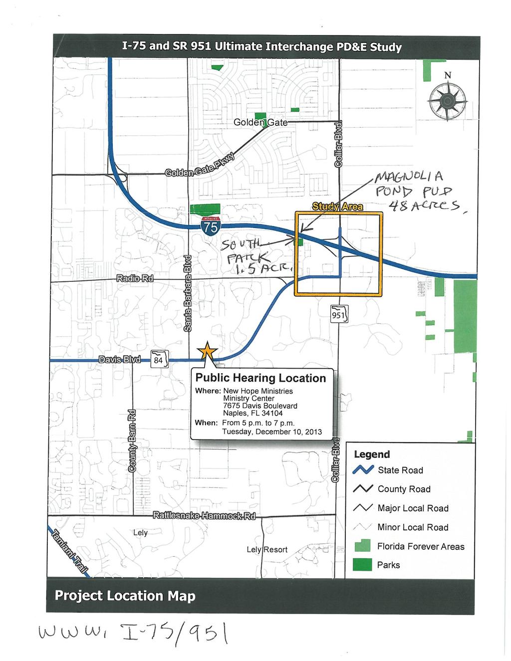
187
188
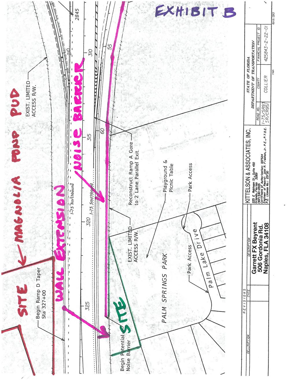
189

190
191
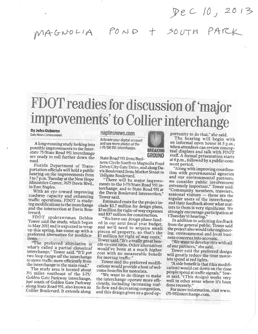
192
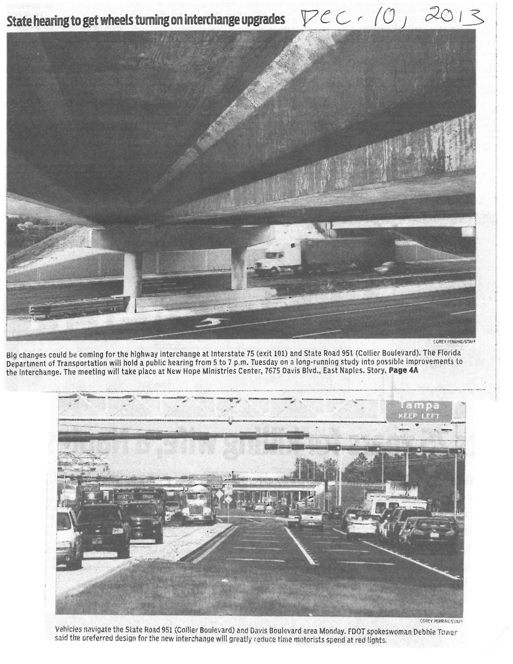
193
194
195 APPENDIX D Agency Coordination
196
197
198
199
200

201
202
203 From: Kendall, Cathy (FHWA) Sent: Thursday, November 07, :24 PM To: Bizerra, Marlon Cc: Kaster, Aaron Cunill, Benito (FHWA); Murthy, BSB (FHWA) Subject: I-75 and SR 951 4(f) DOA This is in response to Martin Horwitz letter of October 21, 2013 requesting an FHWA Section 4(f) determination of applicability. We have reviewed the proposed request and concur with the FDOT recommendation, finding that the Palm Springs Park is protected as a Section 4(f) property, however, the project does not incorporate any portion of this park permanently or temporarily into a transportation use, therefore, there is no Section 4(f) impact to this resource as proposed. If you have any questions concerning this determination, please let me know. Cathy Kendall, AICP Acting Director of Technical Services FHWA - FL, PR and VI 545 John Knox Road, Suite 200 Tallahassee, FL (850) cathy.kendall@dot.gov
204
205
206 APPENDIX E Water Quality Impact Evaluation (WQIE) Checklist


207
208

209
210 APPENDIX F Eastern Indigo Snake Protection Measures
211 Photo: Dirk Stevenson ATTENTION: THREATENED EASTERN INDIGO SNAKES MAY BE PRESENT ON THIS SITE!!! IF YOU SEE A LIVE EASTERN INDIGO SNAKE ON THE SITE: Cease clearing activities and allow the eastern indigo snake sufficient time to move away from the site without interference. Personnel must NOT attempt to touch or handle snake due to protected status. Take photographs of the snake, if possible, for identification and documentation purposes. Immediately notify supervisor or the applicant s designated agent, and the appropriate U.S. Fish and Wildlife Service (USFWS) office, with the location information and condition of the snake. If the snake is located in a vicinity where continuation of the clearing or construction activities will cause harm to the snake, the activities must halt until such time that a representative of the USFWS returns the call (within one day) with further guidance as to when activities may resume. IF YOU SEE A DEAD EASTERN INDIGO SNAKE ON THE SITE: Cease clearing activities and immediately notify supervisor or the applicant s designated agent, and the appropriate USFWS office, with the location information and condition of the snake. Take photographs of the snake, if possible, for identification and documentation purposes. Thoroughly soak the dead snake in water and then freeze the specimen. The appropriate wildlife agency will retrieve the dead snake. USFWS Florida Field Offices to be contacted if a live or dead eastern indigo snake is encountered: North Florida Field Office (904) Panama City Field Office (850) South Florida Field Office (772) Killing, harming, or harassing indigo snakes is strictly prohibited and punishable under State and Federal Law. DESCRIPTION: SIMILAR SNAKES: LIFE HISTORY: PROTECTION: The eastern indigo snake is one of the largest non-venomous snakes in North America, with individuals often reaching up to 8 feet in length. They derive their name from the glossy, blue-black color of their scales above and uniformly slate blue below. Frequently, they have orange to coral reddish coloration in the throat area, yet some specimens have been reported to only have cream coloration on the throat. These snakes are not typically aggressive and will attempt to crawl away when disturbed. Though indigo snakes rarely bite, they should NOT be handled. The black racer is the only other solid black snake resembling the eastern indigo snake. However, black racers have a white or cream chin, thinner bodies, and WILL BITE if handled. The eastern indigo snake occurs in a wide variety of terrestrial habitat types throughout Florida. Although they have a preference for uplands, they also utilize some wetlands and agricultural areas. Eastern indigo snakes will often seek shelter inside gopher tortoise burrows and other below- and aboveground refugia, such as other animal burrows, stumps, roots, and debris piles. Females may lay from 4-12 white eggs as early as April through June, with young hatching in late July through October. The eastern indigo snake is classified as a Threatened species by both the USFWS and the Florida Fish and Wildlife Conservation Commission. Taking of eastern indigo snakes is prohibited by the Endangered Species Act without a permit. Take is defined by the USFWS as an attempt to kill, harm, harass, pursue, hunt, shoot, wound, trap, capture, collect, or engage in any such conduct. Penalties include a maximum fine of $25,000 for civil violations and up to $50,000 and/or imprisonment for criminal offenses, if convicted. Only individuals currently authorized through an issued Incidental Take Statement in association with a USFWS Biological Opinion, or by a Section 10(a)(1)(A) permit issued by the USFWS, to handle an eastern indigo snake are allowed to do so. August 12, 2013
212 STANDARD PROTECTION MEASURES FOR THE EASTERN INDIGO SNAKE U.S. Fish and Wildlife Service August 12, 2013 The eastern indigo snake protection/education plan (Plan) below has been developed by the U.S. Fish and Wildlife Service (USFWS) in Florida for use by applicants and their construction personnel. At least 30 days prior to any clearing/land alteration activities, the applicant shall notify the appropriate USFWS Field Office via that the Plan will be implemented as described below (North Florida Field Office: South Florida Field Office: Panama City Field Office: As long as the signatory of the certifies compliance with the below Plan (including use of the attached poster and brochure), no further written confirmation or approval from the USFWS is needed and the applicant may move forward with the project. If the applicant decides to use an eastern indigo snake protection/education plan other than the approved Plan below, written confirmation or approval from the USFWS that the plan is adequate must be obtained. At least 30 days prior to any clearing/land alteration activities, the applicant shall submit their unique plan for review and approval. The USFWS will respond via e- mail, typically within 30 days of receiving the plan, either concurring that the plan is adequate or requesting additional information. A concurrence from the appropriate USFWS Field Office will fulfill approval requirements. The Plan materials should consist of: 1) a combination of posters and pamphlets (see Poster Information section below); and 2) verbal educational instructions to construction personnel by supervisory or management personnel before any clearing/land alteration activities are initiated (see Pre-Construction Activities and During Construction Activities sections below). POSTER INFORMATION Posters with the following information shall be placed at strategic locations on the construction site and along any proposed access roads (a final poster for Plan compliance, to be printed on 11 x 17 or larger paper and laminated, is attached): DESCRIPTION: The eastern indigo snake is one of the largest non-venomous snakes in North America, with individuals often reaching up to 8 feet in length. They derive their name from the glossy, blue-black color of their scales above and uniformly slate blue below. Frequently, they have orange to coral reddish coloration in the throat area, yet some specimens have been reported to only have cream coloration on the throat. These snakes are not typically aggressive and will attempt to crawl away when disturbed. Though indigo snakes rarely bite, they should NOT be handled. SIMILAR SNAKES: The black racer is the only other solid black snake resembling the eastern indigo snake. However, black racers have a white or cream chin, thinner bodies, and WILL BITE if handled. LIFE HISTORY: The eastern indigo snake occurs in a wide variety of terrestrial habitat types throughout Florida. Although they have a preference for uplands, they also utilize some wetlands 1
213 and agricultural areas. Eastern indigo snakes will often seek shelter inside gopher tortoise burrows and other below- and above-ground refugia, such as other animal burrows, stumps, roots, and debris piles. Females may lay from 4-12 white eggs as early as April through June, with young hatching in late July through October. PROTECTION UNDER FEDERAL AND STATE LAW: The eastern indigo snake is classified as a Threatened species by both the USFWS and the Florida Fish and Wildlife Conservation Commission. Taking of eastern indigo snakes is prohibited by the Endangered Species Act without a permit. Take is defined by the USFWS as an attempt to kill, harm, harass, pursue, hunt, shoot, wound, trap, capture, collect, or engage in any such conduct. Penalties include a maximum fine of $25,000 for civil violations and up to $50,000 and/or imprisonment for criminal offenses, if convicted. Only individuals currently authorized through an issued Incidental Take Statement in association with a USFWS Biological Opinion, or by a Section 10(a)(1)(A) permit issued by the USFWS, to handle an eastern indigo snake are allowed to do so. IF YOU SEE A LIVE EASTERN INDIGO SNAKE ON THE SITE: Cease clearing activities and allow the live eastern indigo snake sufficient time to move away from the site without interference; Personnel must NOT attempt to touch or handle snake due to protected status. Take photographs of the snake, if possible, for identification and documentation purposes. Immediately notify supervisor or the applicant s designated agent, and the appropriate USFWS office, with the location information and condition of the snake. If the snake is located in a vicinity where continuation of the clearing or construction activities will cause harm to the snake, the activities must halt until such time that a representative of the USFWS returns the call (within one day) with further guidance as to when activities may resume. IF YOU SEE A DEAD EASTERN INDIGO SNAKE ON THE SITE: Cease clearing activities and immediately notify supervisor or the applicant s designated agent, and the appropriate USFWS office, with the location information and condition of the snake. Take photographs of the snake, if possible, for identification and documentation purposes. Thoroughly soak the dead snake in water and then freeze the specimen. The appropriate wildlife agency will retrieve the dead snake. Telephone numbers of USFWS Florida Field Offices to be contacted if a live or dead eastern indigo snake is encountered: North Florida Field Office (904) Panama City Field Office (850) South Florida Field Office (772)
214 PRE-CONSTRUCTION ACTIVITIES 1. The applicant or designated agent will post educational posters in the construction office and throughout the construction site, including any access roads. The posters must be clearly visible to all construction staff. A sample poster is attached. 2. Prior to the onset of construction activities, the applicant/designated agent will conduct a meeting with all construction staff (annually for multi-year projects) to discuss identification of the snake, its protected status, what to do if a snake is observed within the project area, and applicable penalties that may be imposed if state and/or federal regulations are violated. An educational brochure including color photographs of the snake will be given to each staff member in attendance and additional copies will be provided to the construction superintendent to make available in the onsite construction office (a final brochure for Plan compliance, to be printed double-sided on 8.5 x 11 paper and then properly folded, is attached). Photos of eastern indigo snakes may be accessed on USFWS and/or FWC websites. 3. Construction staff will be informed that in the event that an eastern indigo snake (live or dead) is observed on the project site during construction activities, all such activities are to cease until the established procedures are implemented according to the Plan, which includes notification of the appropriate USFWS Field Office. The contact information for the USFWS is provided on the referenced posters and brochures. DURING CONSTRUCTION ACTIVITIES 1. During initial site clearing activities, an onsite observer may be utilized to determine whether habitat conditions suggest a reasonable probability of an eastern indigo snake sighting (example: discovery of snake sheds, tracks, lots of refugia and cavities present in the area of clearing activities, and presence of gopher tortoises and burrows). 2. If an eastern indigo snake is discovered during gopher tortoise relocation activities (i.e. burrow excavation), the USFWS shall be contacted within one business day to obtain further guidance which may result in further project consultation. 3. Periodically during construction activities, the applicant s designated agent should visit the project area to observe the condition of the posters and Plan materials, and replace them as needed. Construction personnel should be reminded of the instructions (above) as to what is expected if any eastern indigo snakes are seen. POST CONSTRUCTION ACTIVITIES Whether or not eastern indigo snakes are observed during construction activities, a monitoring report should be submitted to the appropriate USFWS Field Office within 60 days of project completion. The report can be sent electronically to the appropriate USFWS address listed on page one of this Plan. 3
215 IF YOU SEE A LIVE EASTERN INDIGO SNAKE ON THE SITE: Cease clearing activities and allow the eastern indigo snake sufficient time to move away from the site without interference. Personnel must NOT attempt to touch or handle snake due to protected status. Take photographs of the snake, if possible, for identification and documentation purposes. Immediately notify supervisor or the applicant s designated agent, and the appropriate U.S. Fish and Wildlife Service (USFWS) office, with the location information and condition of the snake. If the snake is located in a vicinity where continuation of the clearing or construction activities will cause harm to the snake, the activities must halt until such time that a representative of the USFWS returns the call (within one day) with further guidance as to when activities may resume. IF YOU SEE A DEAD EASTERN INDIGO SNAKE ON THE SITE: Cease clearing activities and immediately notify supervisor or the applicant s designated agent, and the appropriate USFWS office, with the location information and condition of the snake. Take photographs of the snake, if possible, for identification and documentation purposes. Thoroughly soak the dead snake in water and then freeze the specimen. The appropriate wildlife agency will retrieve the dead snake. USFWS Florida Field Offices to be contacted if a live or dead eastern indigo snake is encountered: North Florida ES Office (904) Panama City ES Office (850) South Florida ES Office (772) DESCRIPTION: The eastern indigo snake is one of the largest non-venomous snakes in North America, with individuals often reaching up to 8 feet in length. They derive their name from the glossy, blue-black color of their scales above and uniformly slate blue below. Frequently, they have orange to coral reddish coloration in the throat area, yet some specimens have been reported to only have cream coloration on the throat. These snakes are not typically aggressive and will attempt to crawl away when disturbed. Though indigo snakes rarely bite, they should NOT be handled. SIMILAR SNAKES: The black racer is the only other solid black snake resembling the eastern indigo snake. However, black racers have a white or cream chin, thinner bodies, and WILL BITE if handled. LIFE HISTORY: The eastern indigo snake occurs in a wide variety of terrestrial habitat types throughout Florida. Although they have a preference for uplands, they also utilize some wetlands and agricultural areas. Eastern indigo snakes will often seek shelter inside gopher tortoise burrows and other below- and aboveground refugia, such as other animal burrows, stumps, roots, and debris piles. Females may lay from 4-12 white eggs as early as April through June, with young hatching in late July through October.
(1)(A) permit issued by the USFWS, to handle an")

216 Killing, harming, or harassing indigo snakes is strictly prohibited and punishable under State and Federal Law. Only individuals currently authorized through an issued Incidental Take Statement in association with a USFWS Biological Opinion, or by a Section 10(a)(1)(A) permit issued by the USFWS, to handle an eastern indigo snake are allowed to do so. ATTENTION: THREATENED EASTERN INDIGO SNAKES MAY BE PRESENT ON THIS SITE!!! LEGAL STATUS: The eastern indigo snake is classified as a Threatened species by both the USFWS and the Florida Fish and Wildlife Conservation Commission. Taking of eastern indigo snakes is prohibited by the Endangered Species Act without a permit. Take is defined by the USFWS as an attempt to kill, harm, harass, pursue, hunt, shoot, wound, trap, capture, collect, or engage in any such conduct. Penalties include a maximum fine of $25,000 for civil violations and up to $50,000 and/or imprisonment for criminal offenses, if convicted. August 12, 2013 Photo: Dirk Stevenson Please read the following information provided by the U.S. Fish and Wildlife Service to become familiar with standard protection measures for the eastern indigo snake.
I 75 PD&E STUDIES TABLE OF CONTENTS DTTM, TECHNICAL REPORT No. 2 TABLE OF CONTENTS
 TABLE OF CONTENTS DTTM, TECHNICAL REPORT No. 2 TABLE OF CONTENTS SECTION PAGE NO. SECTION TITLE NO. EXECUTIVE SUMMARY -------------------------------------------------------------------- ES-1 1.0 INTRODUCTION
INTERCHANGE MODIFICATION REPORT
 INTERSTATE 75 AND STATE ROAD 884 (COLONIAL BOULEVARD) INTERCHANGE LEE COUNTY, FLORIDA INTERCHANGE MODIFICATION REPORT Prepared for: Florida Department of Transportation District One May 2017 Interchange
LOCATION HYDRAULIC REPORT
 Draft LOCATION HYDRAULIC REPORT Florida Department of Transportation District One US 41 at Fruitville Road (CR 780) Intersection Improvements - PD&E STUDY Sarasota County, Florida Financial Project ID
FOR INTERSTATE 81 AND ROUTE 37 INTERCHANGE FREDERICK COUNTY, VIRGINIA MILEPOST 310
 INTERCHANGE MODIFICATION REPORT FOR INTERSTATE 81 AND ROUTE 37 INTERCHANGE FREDERICK COUNTY, VIRGINIA MILEPOST 310 PREPARED BY: VIRGINIA DEPARTMENT OF TRANSPORTATION STAUNTON DISTRICT DECEMBER 13, 2006
I-4 Beyond the Ultimate Project Development & Environment (PD&E) Reevaluation Study FROM WEST OF SR 528 (BEACHLINE EXPRESSWAY)
 Reevaluation Study FROM WEST OF SR 528 (BEACHLINE EXPRESSWAY)") I-4 Beyond the Ultimate Project Development & Environment (PD&E) Reevaluation Study FROM WEST OF SR 528 (BEACHLINE EXPRESSWAY) TO WEST OF SR 435 (KIRKMAN ROAD) ORANGE COUNTY, FLORIDA Financial Project
I-4 Beyond the Ultimate Project Development & Environment (PD&E) Reevaluation Study FROM WEST OF SR 528 (BEACHLINE EXPRESSWAY) TO WEST OF SR 435 (KIRKMAN ROAD) ORANGE COUNTY, FLORIDA Financial Project
AIR QUALITY TECHNICAL MEMORANDUM
 AIR QUALITY TECHNICAL MEMORANDUM AIR QUALITY TECHNICAL MEMORANDUM GOLDEN GLADES INTERCHANGE PD&E STUDY Miami-Dade County, Florida Financial Management Number: 428358-1-22-01 Efficient Transportation Decision
5.0 PRELIMINARY ENVIRONMENTAL REVIEW
 5.0 PRELIMINARY ENVIRONMENTAL REVIEW 5.1 INTRODUCTION A preliminary environmental review was performed on the proposed freeway improvements that form Concept C, which encompasses the three freeway corridors
SR 29 Project Development & Environment Study. Presentation to SR 29 Stakeholders Advisory Committee. January 23, 2014
 SR 29 Project Development & Environment Study Presentation to SR 29 Stakeholders Advisory Committee January 23, 2014 Purpose and Need Enhancing Economic Competitiveness Improving Emergency Evacuation Capabilities
APPENDIX A. NEPA Assessment Checklist
 APPENDI A NEPA Assessment Checklist NEPA CHECKLIST DATE: January 12, 2009 PREPARER: Frederick Wells, RLA PIN and Project Title: Surplus Property Request Wilder Balter Partners Marketplace Town of Newburgh,
DRAFT AIR QUALITY TECHNICAL MEMORANDUM
 AIR QUALITY TECHNICAL MEMORANDUM PROJECT DEVELOPMENT AND ENVIRONMENT STUDY STATE ROAD 60 GRADE SEPARATION OVER CSX RAILROAD Polk County, Florida Financial Project ID: 436559-1-22-01 Prepared for: Florida
9.0 I-26 & I-526 Interchange Improvements
 9.0 I-26 & I-526 Interchange Improvements The I-26 & I-526 System-to-System interchange currently consists of a combination of directional and loop ramps providing for all movements from one Interstate
Northwest State Route 138 Corridor Improvement Project
 Northwest State Route 138 Corridor Improvement Project Los Angeles County, CA DISTRICT 7- LA- 138 (PM 0.0/36.8); DISTRICT 7- LA- 05 (PM 79.5/83.1); DISTRICT 7- LA- 14 (PM 73.4/74.4) 265100/ 0700001816
Appendix C - Highway 400 Widening and Interchange Evaluation Summary Tables
 Highway 400 Improvements from 1 km South of Highway 89 to the Junction of Highway 11 Appendix C - Highway 400 Widening and Interchange Tables Prepared for: Ontario Ministry of Transportation Four General
APPENDIX B. Excerpts from the October 2002 Conceptual Alternatives Report
 APPENDIX B Excerpts from the October 2002 Interstate 83 and PA Route 921 The objective for the SR 921 interchange site was to study alternatives for construction of a new interchange. There are no short-term
Florida Department of Transportation STATE ENVIRONMENTAL IMPACT REPORT. Project Name: State Road 951 Project Development and Environment Study
 Florida Department of Transportation STATE ENVIRONMENTAL IMPACT REPORT 1. GENERAL INFORMATION Project Name: State Road 951 Project Development and Environment Study Project Limits: From Manatee Road to
Florida Department of Transportation District Four KICK-OFF MEETING. I-95 at Southern Boulevard (SR 80) Project Development and Environment Study
 Project Development and Environment Study") Florida Department of Transportation District Four KICK-OFF MEETING I-95 at Southern Boulevard (SR 80) Project Development and Environment Study Palm Beach County, Florida Financial Project ID No.: 435516-1-22-02
Florida Department of Transportation District Four KICK-OFF MEETING I-95 at Southern Boulevard (SR 80) Project Development and Environment Study Palm Beach County, Florida Financial Project ID No.: 435516-1-22-02
Work Breakdown Structure Element Dictionary Preliminary Engineering
 Element Name Initiation PE 3.1 Initiation includes the implementation of the project s funding and notification of the consultant or in-house design staff to commence work, the Kickoff Meeting with the
SR 9/I-95 Interchange at 45th Street PD&E Study Palm Beach County, Florida FPID No.: FAP No.: ETDM No.
 Palm Beach County, Florida Palm Beach Metropolitan Planning Organization April 217 Project Study Area LIMITS: SR 9/I-95: from S of 45th Street to N of 45th Street 45th Street: From Village Boulevard to
TRANSPORTATION PROJECT REPORT DRAFT CONCEPTUAL ACCESS MODIFICATION PROPOSAL OCTOBER 2002
 TRANSPORTATION INTERSTATE 87 INTERCHANGE 11A TOWN OF MALTA SARATOGA COUNTY, NY DRAFT CONCEPTUAL ACCESS MODIFICATION PROPOSAL OCTOBER 2002 PROJECT REPORT NEW YORK STATE DEPARTMENT OF TRANSPORTATION JOSEPH
SECONDARY WETLAND IMPACTS ANALYSIS
 SECONDARY WETLAND IMPACTS ANALYSIS USACE File. SWG-2012-00153 During the development of the Grand Parkway (State Highway 99) Segments H and I-1 from United States Highway 59/Interstate Highway 69 N to
SR 50 PD&E Study
 SR50 Project Development & Environment Study Public Hearing November 1, 2011 SR 50 PD&E Study 427056-1-22-01 1 Purpose of the Public Hearing Afford persons the opportunity to express their views about
Technical Memorandum
 An Atkins Company Technical Memorandum To: From: Mac Hatcher, PM Collier County Moris Cabezas, PBS&J Ed Cronyn, PBS&J Date: Re: Watershed Model Update Contract 08-5122, PO 4500106318 Element 4, Task 1,
Summary. Preliminary Alternative Development and Screening. DEIS July 23, 2018
 What is the Carolina Crossroads Project? The South Carolina Department of Transportation (SCDOT), in cooperation with the Federal Highway Administration (FHWA), is proposing to upgrade and redesign a key
FLORIDA DEPARTMENT OF TRANSPORTATION Planning and Environmental Management Office INTERCHANGE MODIFICATION REPORT
 FLORIDA DEPARTMENT OF TRANSPORTATION Planning and Environmental Management Office INTERCHANGE MODIFICATION REPORT District 2 1109 South Marion Avenue Lake City, FL 32025-5874 INTERSTATE 10 (SR 8) / SR
Public Notice ISSUED: 20-JAN-2016 EXPIRES: 19-FEB-2016
 APPLICANT: Shakopee Mdewakanton Sioux Community Public Notice ISSUED: 20-JAN-2016 EXPIRES: 19-FEB-2016 REFER TO: MVP-2015-04726-RMM SECTION: 404 - Clean Water Act 1. APPLICATION FOR PERMIT TO discharge
STATE OF FLORIDA DEPARTMENT OF TRANSPORTATION. Project Commitment. Public Yes Design/ Permitting (Prior to Construction Beginning)
") Project Development & Environment Environmental Document Approval : TBD Robin Rhinesmith FM#: 432734 1 Environmental Document Type: (Type 1 or 2 CE, EA, EIS, SEIR, or NMSA): EA 432734 1 Due to the presence
Project Development & Environment Environmental Document Approval : TBD Robin Rhinesmith FM#: 432734 1 Environmental Document Type: (Type 1 or 2 CE, EA, EIS, SEIR, or NMSA): EA 432734 1 Due to the presence
Environme ntal Assessment Addendum
 FI Improved Interchange at I-71 and Routes 36/37 and Proposed Sunbury Parkway Environme ntal Assessment Addendum DEL-71-7.91 PID 90200 September 20, 2017 The environmental review, consultation, and other
Oklahoma Department of Transportation Environmental Programs Division Office Fax
 Oklahoma Department of Transportation Environmental Programs Division Office 521-3050 Fax 522-5193 Documented Categorical Exclusion (DCE) for I-40: Pavement Reconstruction and Added Lanes from the Douglas
SOUTH FLORIDA WATER MANAGEMENT DISTRICT. Question 13: Wetlands
 SOUTH FLORIDA WATER MANAGEMENT DISTRICT Question 13: Wetlands 1. The wetland responses and topographical data provided in the ADA for the 520- acre project site are conceptual in nature. The referenced
I-15 South, MP 0 to MP 16 Environmental Assessment. Public Hearing. August 7, :00 PM to 7:00 PM
 I-15 South, MP 0 to MP 16 Environmental Assessment Public Hearing August 7, 2012 5:00 PM to 7:00 PM 1 PROJECT OVERVIEW The Federal Highway Administration (FHWA) and the Utah Department of Transportation
Concept, Feasibility & Mobility Studies. Southport Connector Expressway
 Concept, Feasibility & Mobility Studies Southport Connector Expressway Project Background FDOT Alternative Corridor Evaluation (ACE) Study Advanced Notification Package distributed September 2012 ETDM
Alternatives Evaluation Methodology
 Alternatives Evaluation Methodology www.vision54 56.com B 1 Phase 2 Alternatives Evaluation Methodology PASCO COUNTY METROPOLITAN PLANNING ORGANIZATION 8731 Citizens Drive New Port Richey, FL 34654 Ph
THIS IS NOT A PAID ADVERTISEMENT. Public Notice. Public Notice No. CENAP-OP-R October 26, 2018
 THIS IS NOT A PAID ADVERTISEMENT Public Notice Wanamaker Building 100 Penn Square East Philadelphia, PA 19107-3390 ATTN: CENAP-OP-R Public Notice No. Date CENAP-OP-R-2018-822 October 26, 2018 Application
NEPA and Design Public Hearings
 NEPA and Design Public Hearings Monday, December 5, 2016 Washington-Lee High School 1301 N. Stafford Street Arlington, VA 22201 Thursday, December 8, 2016 Mary Ellen Henderson Middle School 7130 Leesburg
Final Air Quality Report
 Florida Department of TRANSPORTATION Final Air Quality Report PD&E Study From East of Babcock Street (SR 507) to US 1 Brevard County, Florida Financial Project ID: 430136-1-22-01 ETDM Project Number: 13026
Final Air Quality Report
 Florida Department of Transportation - District VII County Line Road (C.R. 578) Project Development and Environment Study From U.S. 19 (S.R. 55) to U.S. 41 (S.R. 45) Work Program Item Segment Number: 257298
Section 7 Environmental Constraints
 Section 7 Environmental Constraints i Yakima Valley Metropolitan and Regional Transportation Plan Public Comment DRAFT 1/27/2016 Environmental Constraints Analysis A programmatic-level review of potential
FINDINGS OF FACT and CONCLUSIONS
 FINDINGS OF FACT and CONCLUSIONS I-694/ I-494/ I-94 Interchange Improvements State Project No. 8286-81 Prepared by: Minnesota Department of Transportation July, 2018 CONTENTS STATEMENT OF ISSUE... 2 ADMINISTRATIVE
The Folded Interchange: An Unconventional Design for the Reconstruction of Cloverleaf Interchanges
 The Folded Interchange: An Unconventional Design for the Reconstruction of Cloverleaf Interchanges I. ABSTRACT Keith A. Riniker, PE, PTOE This paper presents the Folded Interchange design and compares
DRAFT. SR-60 7 th Avenue Intersection Control Evaluation (ICE) I-605 Corridor Improvement Project (CIP) I-605/SR-60 EA# 3101U0
 I-605 Corridor Improvement Project (CIP) I-605/SR-60 EA# 3101U0") SR-60 7 th Avenue Intersection Control Evaluation (ICE) I-605/SR-60 EA# 3101U0 October 9, 2017 Contents 1 Purpose of ICE Memo... 1 2 Background... 1 3 Existing Interchange Deficiencies... 1 4 Context Sensitive
SR-60 7 th Avenue Intersection Control Evaluation (ICE) I-605/SR-60 EA# 3101U0 October 9, 2017 Contents 1 Purpose of ICE Memo... 1 2 Background... 1 3 Existing Interchange Deficiencies... 1 4 Context Sensitive
Project Information. Pursuant to Section 404 of the Clean Water Act (33 U.S. Code 1344), notice is hereby given that
, notice is hereby given that") US ARMY Corps Of Engineers Little Rock District JOINT PUBLIC NOTICE CORPS OF ENGINEERS STATE OF ARKANSAS Application Number: 2014-00083-1 Date: December 22, 2014 Comments Due: January 16, 2015 TO WHOM
US ARMY Corps Of Engineers Little Rock District JOINT PUBLIC NOTICE CORPS OF ENGINEERS STATE OF ARKANSAS Application Number: 2014-00083-1 Date: December 22, 2014 Comments Due: January 16, 2015 TO WHOM
Attachment E. Logistics. Ridge Road Extension Alternatives Analysis
 Attachment E Logistics for: Ridge Road Extension Alternatives Analysis PREPARED FOR: Pasco County Engineering Services Department PREPARED BY: NV5, INC. 6989 E. FOWLER AVENUE TAMPA, FLORIDA 33617 April
SUMMARY S.1 PROJECT DESCRIPTION AND LOCATION S.2 PURPOSE AND NEED
 S SUMMARY S.1 PROJECT DESCRIPTION AND LOCATION The Virginia Department of Transportation (VDOT), in cooperation with the Federal Highway Administration (FHWA), is studying alternatives to meet transportation
Military Highway Interchange
 III. Military Highway Interchange Deficiencies Design Challenges Proposed Alternatives III.1.2 Volumes & Operations Figure III.2: Existing Volumes displays the existing volumes for the Military Highway
Alico Road. Connector Study. Lee County Department of Transportation. Prepared by. Lee County, Florida
 Alico Road Connector Study Lee County Department of Transportation Lee County, Florida Prepared by July 2009 TABLE OF CONTENTS SECTION PAGE 1.0 INTRODUCTION... 1 1.1 Project Description and Purpose...
An Overview and Comparison of the Tennessee Department of Transportation s Environmental Evaluation Process
 Introduction This document provides a brief overview of the policy and procedures that govern the environmental evaluation process that the Tennessee Department of Transportation (TDOT) must follow for
On behalf of the Carolina Crossroads project team we thank you for taking the time to attend this meeting.
 On behalf of the Carolina Crossroads project team we thank you for taking the time to attend this meeting. Located in the heart of South Carolina, the I-20/26/126 Corridor is the crossroads of the state
2 Purpose and Need. 2.1 Study Area. I-81 Corridor Improvement Study Tier 1 Draft Environmental Impact Statement
 2 Purpose and Need 2.1 Study Area Interstate 81 (I-81) is relied upon for local and regional travel and interstate travel in the eastern United States. It extends 855 miles from Tennessee to New York at
EXHIBIT A SCOPE OF SERVICES INTERCHANGE JUSTIFICATION REPORT (IJR) FOR INTERSTATE 75 AT OVERPASS ROAD
 FOR INTERSTATE 75 AT OVERPASS ROAD") Scope of Services 12/08/2008 EXHIBIT A SCOPE OF SERVICES INTERCHANGE JUSTIFICATION REPORT (IJR) FOR INTERSTATE 75 AT OVERPASS ROAD TABLE OF CONTENTS Section Pace I. 0 PROJECT DESCRIPTION........................,............................................................
Scope of Services 12/08/2008 EXHIBIT A SCOPE OF SERVICES INTERCHANGE JUSTIFICATION REPORT (IJR) FOR INTERSTATE 75 AT OVERPASS ROAD TABLE OF CONTENTS Section Pace I. 0 PROJECT DESCRIPTION........................,............................................................
MDX Contract #: RFP MDX Work Program #: ETDM #: 11501
 SR 874/Don Shula Expressway Ramp Connector Project Development & Environment (PD&E) Study PUBLIC HEARING December 8, 2011 MDX Contract #: RFP-09-04 MDX Work Program #: 87410.011 ETDM #: 11501 1 This Public
FEDERAL HIGHWAY ADMINISTRATION RECORD OF DECISION FOR THE LYNNWOOD LINK EXTENSION
 FEDERAL HIGHWAY ADMINISTRATION RECORD OF DECISION FOR THE LYNNWOOD LINK EXTENSION AUGUST 2015 Table of Contents 1 Decision... 1 1.1 Project Description... 2 1.2 Basis for the FHWA Decision... 7 1.2.1
St. Francis Drive through the City of Santa Fe Corridor Study
 VIII. ENGINEERING AND ENVIRONMENTAL EVALUATION INTERSECTION IMPROVEMENTS SOUTHERN For the southern end of the corridor, traffic volumes are expected to increase over existing levels. The Phase A Report
TABLE OF CONTENTS 3.0 AFFECTED ENVIRONMENT AND ENVIRONMENTAL CONSEQUENCES
 TABLE OF CONTENTS 1.0 PURPOSE AND NEED -------------------------------------------------------------------------------------------- 1-1 1.1 STUDY AREA -----------------------------------------------------------------------------------------------------
Appendix C. Wetland Impact Assessment and Two-Part Finding. I-94 St. Michael to Albertville Minnesota Department of Transportation
 Appendix C Wetland Impact Assessment and Two-Part Finding I-94 St. Michael to Albertville Minnesota Department of Transportation Office of Environmental Stewardship 395 John Ireland Blvd. St. Paul, MN
TREASURE COAST REGIONAL PLANNING COUNCIL M E M O R A N D U M. To: Council Members AGENDA ITEM 4G. Intergovernmental Coordination and Review Log
 TREASURE COAST REGIONAL PLANNING COUNCIL M E M O R A N D U M To: Council Members AGENDA ITEM 4G From: Date: Subject: Staff May 16, 2008 Council Meeting Intergovernmental Coordination and Review Log The
Public Notice ISSUED: July 13, 2018 EXPIRES: August 13, 2018
 APPLICANT: Sargento Foods Inc. Public Notice ISSUED: July 13, 2018 EXPIRES: August 13, 2018 REFER TO: 2010-2909-RJH SECTION: 404 - Clean Water Act 1. APPLICATION FOR PERMIT TO discharge dredged and fill
January 16, Rhode Island Energy Facilities Siting Board 89 Jefferson Boulevard Warwick, Rhode Island 02888
 INVENERGY 196 January 16, 2019 Rhode Island Energy Facilities Siting Board 89 Jefferson Boulevard Warwick, Rhode Island 02888 Re: Clear River Energy Center Invenergy Docket No. SB-2015-06 When Invenergy
Air Quality Analysis Technical Memorandum
 Air Quality Analysis Technical Memorandum Segment 4: State Road 400 (SR 400)/Interstate 4 (I-4) from East of SR 15-600/US 17-92 (Seminole/Volusia County Line) to ½ Mile East of SR 472 Volusia County (79110),
PUBLIC HEARING LOOP 9
 PUBLIC HEARING LOOP 9 From Interstate (I)-35E to I-45 Dallas and Ellis Counties, Texas CSJ: Loop 2964-10-005 9: I-35E to I-45 Tuesday, June 20, 20, 2017 2017 Public Hearing Introductions ELECTED & PUBLIC
WELCOME IL 47. Community Advisory Group Meeting #5 Waubonsee Community College Wednesday, May 31, 2017
 WELCOME IL 47 Community Advisory Group Meeting #5 Waubonsee Community College Wednesday, May 31, 2017 MEETING PURPOSE MEETING AGENDA 1. Welcome/Introduction 2. Review Previous Public Involvement 3. Process/Schedule
Categorical Exclusion (CE)
") Categorical Exclusion (CE) Project Information Project Name: Federal Project#: Project Number: 0029-002-135, D624, P101 Project Type: Construction UPC: 77383 Charge Number: Route Number: 29 Route Type:
Categorical Exclusion (CE) Project Information Project Name: Federal Project#: Project Number: 0029-002-135, D624, P101 Project Type: Construction UPC: 77383 Charge Number: Route Number: 29 Route Type:
LOCATION HYDRAULICS REPORT. SR 60 GRADE SEPARATION AT CSX RAILROAD PROJECT DEVELOPMENT AND ENVIRONMENT STUDY Polk County, Florida
 LOCATION HYDRAULICS REPORT SR 60 GRADE SEPARATION AT CSX RAILROAD PROJECT DEVELOPMENT AND ENVIRONMENT STUDY Polk County, Florida Financial Project ID: 436559-1-22-01 Prepared for: FLORIDA DEPARTMENT OF
I-10 CORRIDOR IMPROVEMENTS STAGE 0 FEASIBILITY STUDY STATE PROJECT NUMBER H FEDERAL AID PROJECT NUMBER H004100
 JULY 2016 I-10 CORRIDOR IMPROVEMENTS STAGE 0 FEASIBILITY STUDY STATE PROJECT NUMBER H.004100 FEDERAL AID PROJECT NUMBER H004100 EAST BATON ROUGE AND WEST BATON ROUGE PARISHES, LOUISIANA Section TABLE OF
Table Table 7.2 Potential Environmental Impacts and Mitigation Measures
 7.2 Natural Environment/Environmental Planning Executive Summary/Key Points The Environmental Consultation and Mitigation Plan establishes: o A process for consultation with environmental resource agencies
Alternatives Evaluation Report. Appendix C. Alternatives Evaluation Report
 s Evaluation Report Appendix C s Evaluation Report I-35W North Corridor Project EA Minnesota Department of Transportation Final Project s Report I-35W North Corridor Preliminary Design Project Report Version
INFORMATION REQUIRED FOR PROBABLE CATEGORICAL EXCLUSION (SECTION (d))
)") Grant Applicant: Proposed Project: Date: August 03, 2010 Northern Virginia Transportation Commission, Arlington County Government, and Washington Metropolitan Area Transit Authority Crystal City/Potomac
Grant Applicant: Proposed Project: Date: August 03, 2010 Northern Virginia Transportation Commission, Arlington County Government, and Washington Metropolitan Area Transit Authority Crystal City/Potomac
TABLE OF CONTENTS. Section Section 2 Alternative A...7 Section 2 Alternative B...7
 TABLE OF CONTENTS I. General Description...................................................... 3 II. Need for Project.......................................................... 3 III. Adjacent Projects........................................................
MEMORANDUM: INITIAL CONCEPTS SUMMARY
 MEMORANDUM: INITIAL CONCEPTS SUMMARY INTRODUCTION This memo presents a summary of initial concepts that have been identified as development of the project study has progressed, along with a recommendations
CHAPTER 8 TRANSPORTATION ELEMENT
 CHAPTER 8 TRANSPORTATION ELEMENT Section 8.01 Purpose: The purpose of this Chapter (element) is to establish the desired and projected transportation system within Niceville and to plan for future motorized
Willmar Wye Public Open House #4 and Public Hearing
 Willmar Wye Public Open House #4 and Public Hearing February 23, 2017 www.dot.state.mn.us/d8/willmarwye Agenda Time Topic 5:00 pm Open House Opportunity for the public to ask questions of project staff
D R A F T. SECTION 4(f) EVALUATION. INTERSTATE 73 From I-95 to the Myrtle Beach Region
 EVALUATION. INTERSTATE 73 From I-95 to the Myrtle Beach Region") D R A F T SECTION 4(f) EVALUATION INTERSTATE 73 From I-95 to the Myrtle Beach Region INTRODUCTION Section 4(f) of the Department of Transportation Act of 1966, 49 USC 303 requires that prior to the use
D R A F T SECTION 4(f) EVALUATION INTERSTATE 73 From I-95 to the Myrtle Beach Region INTRODUCTION Section 4(f) of the Department of Transportation Act of 1966, 49 USC 303 requires that prior to the use
TRAFFIC STUDY GUIDELINES
 TRAFFIC STUDY GUIDELINES December 2013 The scope of the traffic impact analysis (TIA) should follow these guidelines and the requirements of VMC 11.80.130 and VMC 11.70, transportation concurrency (attached
PUBLIC NOTICE. Section 404 of the Clean Water Act (33 U.S.C. 1344) Section 10 of the Rivers and Harbors Act of 1899 (33 U.S.C.
 Section 10 of the Rivers and Harbors Act of 1899 (33 U.S.C.") US Army Corps Of Engineers Wilmington District PUBLIC NOTICE Issue Date: June 17, 2014 Comment Deadline: July 17, 2014 Corps Action ID#: SAW-2009-00655 NC DOT TIP: R-4903 The Wilmington District, Corps
US Army Corps Of Engineers Wilmington District PUBLIC NOTICE Issue Date: June 17, 2014 Comment Deadline: July 17, 2014 Corps Action ID#: SAW-2009-00655 NC DOT TIP: R-4903 The Wilmington District, Corps
SR 60 Grade Separation over CSX Railroad Traffic Technical Memorandum
 To: Marlon Bizerra, PE From: Thirulokesh Krishnan Email: thirulokesh.krishnan@atkinsglobal.com Phone: 210.321.2019 Date: Nov 25, 2014 Ref: cc: Kim Warren, Doug Reed, PE Subject: SR 60 Grade Separation
NORTHWEST CORRIDOR PROJECT. NOISE TECHNICAL REPORT 2015 Addendum Phase IV
 Noise Technical Report 2015 Addendum NOISE TECHNICAL REPORT 2015 Addendum PREPARED FOR: Federal Highway Administration and Georgia Department of Transportation PREPARED BY: Parsons Brinckerhoff Project
Lee County Artesian Well Abandonment Project
 Lee County Artesian Well Abandonment Project Background Uncontrolled, improperly constructed, deteriorated or abandoned artesian (free-flowing) wells can have an adverse impact on the quantity and quality
Community Advisory Committee Meeting No. 2. June 22, 2006
 Community Advisory Committee Meeting No. 2 June 22, 2006 Introductions The Study Team KDOT Wichita Partners Consultants CAC members Overview Today s Agenda Opinion Survey Study Status Starting Concept
I-35/80 Operations Study: Douglas Avenue to NW 86 th Street FOR
 : Douglas Avenue to NW 86 th Street FOR Iowa Department of Transportation City of Urbandale City of Grimes February 7, 2013 FINAL Prepared by: HR Green, Inc. HR Green Project Number: 40110031 TABLE OF
1.4 Analysis of Alignment Alternatives
 Parkway is 20.94 miles, with 8.16 miles in Orange County, 7.37 miles in Lake County and 5.41 miles in Seminole County. SR 46 Reconstruction and Realignment, which would begin at the SR 46/US 441 interchange
Interchange Workshop Report (August 2004)
") U.S. Highway 14 Corridor Study New Ulm to North Mankato Table of Contents Section Interchange Workshop Report (August 2004) Page 1. Introduction and Next Steps 1 2. Interchange Workshop Participants &
U.S. Highway 14 Corridor Study New Ulm to North Mankato Table of Contents Section Interchange Workshop Report (August 2004) Page 1. Introduction and Next Steps 1 2. Interchange Workshop Participants &
FLORIDA DEPARTMENT OF TRANSPORTATION PROCEDURE DEVELOPMENT OF THE
 FLORIDA DEPARTMENT OF TRANSPORTATION PROCEDURE DEVELOPMENT OF THE FLORIDA INTRASTATE HIGHWAY SYSTEM Topic No.: 525-030-250-f Office: Systems Planning Effective Date: May 16, 2002 DEVELOPMENT OF THE FLORIDA
Winding Cypress. Community Development District. Engineer s Report
 Winding Cypress Community Development District Engineer s Report September 22, 2015 Prepared by: J.R. Evans Engineering, P.A. 9351 Corkscrew Road, Ste. 102 Estero, FL 33928 www.jrevansengineering.com Winding
5/11/2016 SR 15 SECTION 088 CSVT SOUTHERN SECTION SR 15 SECTION 088 CSVT SOUTHERN SECTION AGENDA
 PUBLIC OFFICIALS MEETING MAY 11, 2016 AGENDA I. INTRODUCTIONS V. CURRENT PROJECT STATUS VI. PROJECT SCHEDULE VII. UPCOMING ACTIVITIES VOPEN DISCUSSION & QUESTIONS IX. ACTION ITEMS 1 A. Bridge Lighting
NW La Center Road/I-5 Interchange Improvement Project (MP 16.80)
") FINAL DRAFT - NW La Center Road/I-5 Interchange Improvement Project (MP 16.80) La Center, Washington February 2015 FINAL DRAFT - NW La Center Road/I-5 Interchange Improvement Project (MP 16.80) La Center,
FINAL DRAFT - NW La Center Road/I-5 Interchange Improvement Project (MP 16.80) La Center, Washington February 2015 FINAL DRAFT - NW La Center Road/I-5 Interchange Improvement Project (MP 16.80) La Center,
CHAPTER 4 GRADE SEPARATIONS AND INTERCHANGES
 CHAPTER 4 GRADE SEPARATIONS AND INTERCHANGES 4.0 INTRODUCTION The ability to accommodate high volumes of intersecting traffic safely and efficiently through the arrangement of one or more interconnecting
PROGRAMMATIC AGREEMENT
 PROGRAMMATIC AGREEMENT CATEGORICAL EXCLUSION APPROVALS NEW HAMPSHIRE DEPARTMENT OF TRANSPORTATION & FEDERAL HIGHWAY ADMINISTRATION FEBRUARY 2000 PREAMBLE This Agreement establishes the procedures of the
THE PROJECT. Executive Summary. City of Industry. City of Diamond Bar. 57/60 Confluence.
 THE PROJECT A freeway segment ranked 6th worst in the Nation, with levels of congestion, pollution and accidents that are simply unacceptable and which have Statewide and National implications. Executive
Categorical Exclusion Programmatic Agreement Between the Federal Highway Administration And the Indiana Department of Transportation
 Categorical Exclusion Programmatic Agreement Between the Federal Highway Administration And the Indiana Department of Transportation Introduction The Indiana Department of Transportation (INDOT) and the
Project Alignment Appendix A
 Project Alignment Appendix A Fargo Moorhead Metropolitan Area Flood Risk Management Project EA Document This page is intentionally left blank Project Alignment Appendix A Table of Contents 1 BACKGROUND...
Programmatic Categorical Exclusions
 Memorandum of Agreement for Approval of Categorical Exclusions between the Federal Highway Administration and the Wyoming Department of Transportation. February 12, 2014 The Federal Highway Administration,
Interstate 73 FEIS: I-95 to the Myrtle Beach Region Chapter 4. Public Involvement and Agency Coordination
 4-65 Interstate 73 FEIS: I-95 to the Myrtle Beach Region 4-66 Comment noted. The use of existing roadways was considered during alternative development (refer to Chapter 2, Section 2.1, page 2-1 and the
CHAPTER 5 PARALLEL PARKWAY CORRIDOR IMPROVEMENTS
 HPTER 5 PRLLEL PRKWY ORRIDOR IMPROVEMENTS nother key area within the Village West study area is the Parallel Parkway corridor. This chapter focuses on the segment of Parallel Parkway between 106 th Street
Appendix E-1. FDOT MPO Program Management Handbook. (Excerpts)
") Appendix E-1 FDOT MPO Program Management Handbook (Excerpts) TABLE OF CONTENTS Chapter 4 Long-Range Transportation Plan Section Page 4.1 PURPOSE... 4-2 4.2 AUTHORITY... 4-2 4.3 SCOPE... 4-2 4.4 REFERENCES...
Appendix E-1 FDOT MPO Program Management Handbook (Excerpts) TABLE OF CONTENTS Chapter 4 Long-Range Transportation Plan Section Page 4.1 PURPOSE... 4-2 4.2 AUTHORITY... 4-2 4.3 SCOPE... 4-2 4.4 REFERENCES...
Indirect and Cumulative Effects
 Chapter 21: Indirect and Cumulative Effects 21-1 INTRODUCTION The federal Council on Environmental Quality s (CEQ) regulations implementing the procedural provisions of the National Environmental Policy
Final Recommendations Identification of Improvements, Strategies, and Solutions
 Identification of Improvements, Strategies, and Solutions Prepared by: December 2015 TABLE OF CONTENTS 1. Introduction... 1 1 2. Freight Policy Recommendations... 2 1 3. Freight Infrastructure Recommendations...
SECTION 5: ALTERNATIVES TO THE PROPOSED PROJECT
 City of American Canyon Broadway District Specific Plan Alternatives to the Proposed Project SECTION 5: ALTERNATIVES TO THE PROPOSED PROJECT 5.1 Introduction In accordance with CEQA Guidelines Section
Public Notice ISSUED: April 5, 2019 EXPIRES: May 6, 2019
 APPLICANT: Aitkin County Highway Department Public Notice ISSUED: April 5, 2019 EXPIRES: May 6, 2019 REFER TO: MVP-2019-00387-EJI SECTION: 404 - Clean Water Act 1. APPLICATION FOR PERMIT TO discharge fill
Conceptual Design Report
 Conceptual Design Report I-244/Arkansas River Multimodal Bridge Tulsa, Oklahoma Prepared for the Oklahoma Department of Transportation Prepared by: August 2009 I-244 / ARKANSAS RIVER MULTIMODAL BRIDGE
Interstate 66 Tier 1 Environmental Impact Statement Public Hearing
 Interstate 66 Tier 1 Environmental Impact Statement Public Hearing 1 Project Corridor Study Process / Tiering Approach Tier 1 EIS focuses on broad issues - Purpose and need - Mode / Technology choice -
Table 1 Sterling Highway MP 45 to 60 Facts Summary
 Table 1 Sterling Highway MP 45 to 60 Facts Summary Purpose and Need Criteria Sterling Highway MP 45 to 60 Alternatives PURPOSE AND NEED CRITERIA Capacity & Demand Highway Characteristics Percent of Alternative