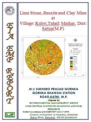
Mine at Village: Kubri,Tahsil: Maihar, Dist: Satna(M.P)
|
|
|
- Austen Ray
- 6 years ago
- Views:
Transcription
1 i i
2 ii CENTRAL INSTITUTE OF MINING RESEARCH, DHANBAD (Council of Scientific & Industrial Research) PROJECT REPORT ON EIA/EMP OF Lime Stone, Bauxite and Clay Mine at Village: Kubri,Tahsil: Maihar, Dist: Satna(M.P) SPONSORED BY M/s SUKHDEO PRASAD GOENKA GOENKA BHAWAN STATION ROAD,KATNI, M.P. May, 2017 (Dr. M.K. Chakraborty) ii Project Leader
3 iii CONTENT DESCRIPTION PAGE NO. CHAPTER INTRODUCTION 1.1 Purpose of the Project Identification of Project & Project Proponent Scope of Environmental Impact Assessment Study Terms of reference 24 CHAPTER 2 PROJECT DESCRIPTION Type of Project Need for the Project Location Access Climate Physiograph & Drainage Size or Magnitude of Operation Mining System Selection of Mining Technology Size or Magnitude of Operation Mining System & Major HEMM Description of Mitigation Measures 40 CHAPTER 3 DESCRIPTION OF THE ENVIRONMENT Study area, Period, Components 3.2 Baseline Environmental Scenario Air Environment Micro-meteorology Air Quality Sampling and Analysis Duration of Sampling iii
4 iv DESCRIPTION Results and Discussions 3.3 Water Environment Water Quality Methods of Sampling and Analysis Results and Discussions 3.4 Hydrogeology of the Area Water Table Behavior in the Area Ground Water Potential of the Study Area Hydraulic Characteristics 3.5 Acoustic Environment Instrument Used and Methodology Noise Standards Assessment of Noise Level Results and Discussions 3.6 Land Environment Land Use Pattern Status of Forest Clearances 3.7 Soil Quality 3.8 Biological Environment Survey Methodology Flora and Fauna Distribution Floral Diversity Fauna 3.9 Socio-économic Environnent Industrialisation Communication Trade and Commerce Electricity and Power Socio-Economic Profile Demographic Pattern Literacy Quality of Life Methodology Quality of life Factor List iv PAGE NO.
5 v DESCRIPTION Socio Economic Profile of PAP/PAF in Core Zone 3.10 Socio Economic Profile in Core Zone Village 3.11 Health Facilities CHAPTER 4 ANTICIPATED ENVIRONMENTAL IMPACT 4.1 Introduction 4.2 Air Environment 4.3 Noise Environnent Day - Night Noise Levels Prediction of Impacts due to Transportation Prediction of Impacts on Occupational Health Prediction of Impact on Community Impact due to Blasting, Ground Vibrations and Noise 4.4 Water Pollution Impact on Banzsloi River due to discharge of mine water 4.5 Land Environment Soil Erosion Mapping Assessment of Soil Erosion Potential of Study Area Assessment of Soil Erosion Potential due to Mining Activity Impact of Diversion of Agriculture Land on the Socio Economic aspect of the area including Land Owner and Land Less Laborers 4.6 Biological Environment 4.7 Socio-economic Environment CHAPTER 5 ANALYSIS OF ALTERNATIVES (TECHNOLOGY & SITE) 5.1 Selection of Site 5.2 Selection of Technology 5.3 Suggested Eco-Friendly Open Cast Mining Technology 5.4 OB Dump Management PAGE NO. 5.5 Calendar Plan of the Mine Development 5.6 Underground Mining v
6 vi DESCRIPTION 5.7 Conclusion CHAPTER 6 ENVIRONMENTAL MONITORING PROGRAMME 6.1 Technical Aspects of Monitoring 6.2 Organization/Environmental Management Cell Laboratory Facility and Equipment Environmental Auditing CHAPTER 7 ADDITIONAL STUDIES 7.1 Public Consultation Proceedings of the Public Hearing Risk Assessment 7.3 Disaster Management In Open Cast Mines 7.4 Social Impact Assessment 7.5 R & R Action Plan Socio economic profile of PAP/PAF in eleven villages Objective of the R&R Policy The Compensation Package Unit of Entitlement Brief description of benefits as per the R&R package Additional Benefits 7.6 Other R&R Benefits 7.7 Special Comments CHAPTER 8 PROJECT BENEFITS 8.1 Improvements in the Physical Infrastructure 8.2 Employment Potential 8.3 Tangible benefits 8.5 Result and Discussion CHAPTER 9 ENVIRONMENTAL COST BENEFIT ANALYSIS CHAPTER 10 ENVIRONMENTAL MANAGEMENT PLAN 10.0 Introduction PAGE NO. vi
7 vii DESCRIPTION 10.1 Air Environment Dust Control Gaseous Pollutants 10.2 Water Environment Water Management Water balance scenario Ground Water Conservation, Recharge and Monitoring Plan Pumping and Drainage Sewage Treatment Plant for Colony & Rehabilitation Site 10.3 Noise Environment 10.4 Land Environment Waste Disposal Technique Stability of Benches Overburdem Management 10.5 Biological Environment Screening of Plants Preservation and amendment of Soil Methods of Revegetation Aftercare and Monitoring Nursery Development Cost of Bio-reclamation Greenbelt Development 10.6 Socio-Economic Measures 10.7 Capital Investment for Environmental Control Measures 10.8 Litigation pending regarding the project CHAPTER 11 SUMMARY & CONCLUSION 11.0 Introduction 11.1 Purpose of the Report 11.2 Identification of Project & Project Proponent 11.3 Scope of Environment Impact Assessment Study 11.4 Project Description Proposed Schedule for Mining Implementation 11.5 Description of Mitigation Measures PAGE NO. vii
8 viii DESCRIPTION 11.6 Description of Environment 11.7 Anticipated Environmental Impact 11.8 Analysis of Alternatives (Technology & Site) 11.9 Risk Analysis Environmental Management Plan CHAPTER 12 CONSULTANTS FOR EIA / EMP PREPARATION PAGE NO NAME OF THE CONSULTANTS 12-1 ANNEXURES Annexure Annexure-I Annexure-II Annexure-III Annexure-IV The copy of the letter received from the Ministry on the TOR prescribed for the project should be attached as an annexure to the final EIA-EMP report. Details of the notices issued in the newspapers Copy of the request letter, proceedings/minutes of public hearing R &R Plan Sanction Letter from Office of the Director, Ground Water Directorate, Jabalpur Madhya Pradesh viii
9 TOR CONTENT POINT NO. PRESCRIBED TOR POINT REFERENCE CHAPTER NO. PAGE NO. PARA NO. i Year-wise production details since 1994 should be given, clearly stating the highest production achieved in any one year prior to It may also be categorically informed whether there had been any increase in production after the EIA Notification 1994 came into force, w.r.t. the highest production achieved prior to1994. Not Applicable New project ii A copy of the document in support of the fact that the Proponent is the rightful lessee of the mine should be given. Lease deed enclosed Annexure. iii All documents including approved mine plan, EIA and Public Hearing should be compatible with one another in terms of the mine lease area, production levels, waste generation and its management, mining technology etc. and should be in the name of the lessee iv All corner coordinates of the mine lease area, superimposed on a High Resolution Imagery/topo sheet, topographic sheet, geomorphology and geology of the area should be provided. Such an Imagery of the proposed area should clearly show the land use and other ecological features of the study area (core and buffer zone). v Information should be provided in Survey of India Toposheet in 1:50,000 scale indicating geological map of the area, geomorphology of land forms of the area, existing minerals and mining history of the area, important water bodies, streams and rivers and soil characteristics.
10 POINT NO. PRESCRIBED TOR POINT REFERENCE CHAPTER NO. PAGE NO. PARA NO. vi Details about the land proposed for mining activities should be given with information as to whether mining conforms to the land use policy of the State; land diversion for mining should have approval from State land use board or the concerned authority. vii It should be clearly stated whether the proponent Company has a well laid down Environment Policy approved by its Board of Directors? If so, it may be spelt out in the EIA Report with description of the prescribed operating process/procedures to bring into focus any infringement/deviation/violation of the environmental or forest norms/ conditions? The hierarchical system or administrative order of the Company to deal with the environmental issues and for ensuring compliance with the EC conditions may also be given. The system of reporting of non-compliances / violations of environmental norms to the Board of Directors of the Company and/or shareholders or stakeholders at large, may also be detailed in the EIA Report. viii Issues relating to Mine Safety, including subsidence study in case of underground mining and slope study in case of open cast mining, blasting study etc. should be detailed. The proposed safeguard measures in each case should also be provided. ix The study area will comprise of 10 km zone around the mine lease from lease periphery and the data contained in the EIA such as waste generation etc. should be for the life of the mine / lease period..
11 POINT NO. PRESCRIBED TOR POINT REFERENCE CHAPTER NO. PAGE NO. PARA NO.. x Land use of the study area delineating forest area, agricultural land, grazing land, wildlife sanctuary, national park, migratory routes of fauna, water bodies, human settlements and other ecological features should be indicated. Land use plan of the mine lease area should be prepared to encompass preoperational, operational and post operational phases and submitted. Impact, if any, of change of land use should begiven. xi Details of the land for any Over Burden Dumps outside the mine lease, such as extent of land area, distance from mine lease, its land use, R&R issues, if any, should be given. xii A Certificate from the Competent Authority in the State Forest Department should be provided, confirming the involvement of forest land, if any, in the project area. In the event of any contrary claim by the Project Proponent regarding the status of forests, the site may be inspected by the State Forest Department along with the Regional Office of the Ministry to ascertain the status of forests, based on which, the Certificate in this regard as mentioned above be issued. In all such cases, it would be desirable for representative of the State Forest Department to assist the Expert Appraisal Committees. xiii Status of forestry clearance for the broken up area and virgin forestland involved in the Project including deposition of net present value (NPV) and compensatory afforestation (CA) should be indicated. A copy of the forestry clearance should also be furnished
12 POINT NO. PRESCRIBED TOR POINT REFERENCE CHAPTER NO. PAGE NO. PARA NO. xiv Implementation status of recognition of forest rights under the Scheduled Tribes and other Traditional Forest Dwellers (Recognition of Forest Rights) Act, 2006 should be indicated. xv The vegetation in the RF / PF areas in the study area, with necessary details, should be given. xvi Impact of mining on hydrology, modification of natural drainage, diversion and channeling of the existing rivers/water courses flowing through the ML and adjoining the lease/project and the impact on the existing users and impacts of mining operations thereon. xvii A study shall be got done to ascertain the impact of the Mining Project on wildlife of the study area and details furnished. Impact of the project on the wildlife in the surrounding and any other protected area and accordingly, detailed mitigative measures required, should be worked out with cost implications and submitted. xviii A detailed biological study of the study area [core zone and buffer zone (10 km radius of the periphery of the mine lease)] shall be carried out. Details of flora and fauna, endangered, endemic and RET Species duly authenticated, separately for core and buffer zone should be furnished based on such primary field survey, clearly indicating the Schedule of the fauna present. In case of any scheduled-i fauna found in the study area, the necessary plan alongwith budgetary provisions for their conservation should be prepared in consultation with State Forest and Wildlife Department and details furnished. Necessary allocation of funds for implementing the same should be made as part of the project cost.
13 POINT NO. PRESCRIBED TOR POINT REFERENCE CHAPTER NO. PAGE NO. PARA NO. xix Proximity to Areas declared as Critically Polluted or the Project areas likely to come under the Aravali Range, (attracting court restrictions for mining operations), should also be indicated and where so required, clearance certifications from the prescribed Authorities, such as the SPCB or State Mining Dept. Should be secured and furnished to the effect that the proposed mining activities could be considered. xx Similarly, for coastal Projects, A CRZ map duly authenticated by one of the authorized agencies demarcating LTL. HTL, CRZ area, location of the mine lease w.r.t CRZ, coastal featuressuchasmangroves,ifany,shouldbefurnish ed.(note:theminingprojects falling under CRZ would also need to obtain approval of the concerned Coastal Zone Management Authority). xxi R&R Plan/compensation details for the Project Affected People (PAP) should be furnished. While preparing the R&R Plan, the relevant State/National Rehabilitation & Resettlement Policy should be kept in view. In respect of SCs /STs and other weaker sections of the society in the study area, a need based sample survey, family-wise, should be undertaken to assess their requirements, and action programmes prepared and submitted accordingly, integrating the sectoral programmes of line departments of the State Government. It may be clearly brought out whether the village(s) located in the mine lease area will be shifted or not. The issues relating to shifting of village(s) including their R&R and socio-economic aspects should be discussed in the Report. xxii One season (non-monsoon) [i.e. March - May (Summer Season); October - December (post monsoon season) ; December - February (winter season)] primary baseline data on ambient air quality as per CPCB Notification of 2009, water
14 POINT NO. PRESCRIBED TOR POINT REFERENCE CHAPTER NO. PAGE NO. PARA NO. quality, noise level, soil and flora and fauna shall be collected and the AAQ and other data so compiled presented date-wise in the EIA and EMP Report. Site-specific meteorological data should also be collected. The location of the monitoring stations should be such as to represent whole of the study area and justified keeping in view the pre-dominant downwind direction and location of sensitive receptors. There should be at least one monitoring station within 500 m of the mine lease in the predominant downwind direction. The mineralogical composition of PM10, particularly for free silica, should be given. Airqualitymodelingshouldbecarriedoutforpredictio nofimpactoftheprojectonthe xxiii air quality of the area. It should also take into account the impact of movement of vehicles for transportation of mineral. The details of the model used and input parameters used for modeling should be provided. The air quality contours may be shown on a location map clearly indicating the location of the site, location of sensitive receptors, if any, and the habitation. The wind roses showing pre-dominant wind direction may also be indicated on the map xxiv The water requirement for the Project, its availability and source should be furnished. A detailed water balance should also be provided. Fresh water requirement for the Project should be indicated xxv Necessary clearance from the Competent Authority for drawl of requisite quantity of water for the Project should be provided. xxvi Description of water conservation measures proposed to be adopted in the Project should be given. Details of rainwater harvesting proposed
15 POINT NO. PRESCRIBED TOR POINT REFERENCE CHAPTER NO. PAGE NO. PARA NO. in the Project, if any, should be provided. xxvii Impact of the Project on the water quality, both surface and groundwater, should be assessed and necessary safeguard measures, if any required, should be provided xxviii Based on actual monitored data, it may clearly be shown whether working will intersect groundwater. Necessary data and documentation in this regard may be provided. In case the working will intersect groundwater table, a detailed Hydro Geological Study should be undertaken and Report furnished. The Report inter-alia, shall include details of the aquifers present and impact of mining activities on these aquifers. Necessary permission from Central Ground Water Authority for working below ground water and for pumping of ground water should also be obtained and copy furnished. xxix Details of any stream, seasonal or otherwise, passing through the lease area and modification / diversion proposed, if any, and the impact of the same on the hydrology should be brought out. xxx Information on site elevation, working depth, groundwater table etc. Should be provided both in AMSL and BGL. A schematic diagram may also be provided for the same xxxi A time bound Progressive Greenbelt Development Plan shall be prepared in a tabular form (indicating the linear and quantitative coverage, plant species and time frame) and submitted, keeping in mind, the same will have to be executed up front on commencement of
16 POINT NO. PRESCRIBED TOR POINT REFERENCE CHAPTER NO. PAGE NO. PARA NO. the Project. Phase-wise plan of plantation and compensatory afforestation should be charted clearly indicating the area to be covered under plantation and the species to be planted. The details of plantation already done should be given. The plant species selected for green belt should have greater ecological value and should be of good utility value to the local population with emphasis on local and native species and the species which are tolerant to pollution. xxxii Impact on local transport infrastructure due to the Project should be indicated. Projected increase in truck traffic as a result of the Project in the present road network (including those outside the Project area) should be worked out, indicating whether it is capable of handling the incremental load. Arrangement for improving the infrastructure, if contemplated (including action to be taken by other agencies such as State Government) should be covered. Project Proponent shall conduct Impact of Transportation study as per Indian Road Congress Guideline xxxiii Details of the onsite shelter and facilities to be provided to the mine workers should be included in the EIA Report. xxxiv Conceptual post mining land use and Reclamation and Restoration of mined out areas (with plans and with adequate number of sections) should be given in the EIA report xxxv Occupational Health impacts of the Project should be anticipated and the proposed preventive measures spelt out in detail. Details of pre-placement medical examination and periodical medical examination schedules should be incorporated in the EMP. The project specific
17 POINT NO. PRESCRIBED TOR POINT REFERENCE CHAPTER NO. PAGE NO. PARA NO. occupational health mitigation measures with required facilities proposed in the mining area may be detailed. xxxvi Public health implications of the Project and related activities for the population in the impact zone should be systematically evaluated and the proposed remedial measures should be detailed along with budgetary allocations xxxvii Measures of socio economic significance and influence to the local community proposed to be provided by the Project Proponent should be indicated. As far as possible, quantitative dimensions may be given with time frames for implementation xxxviii Detailed environmental management plan (EMP) to mitigate the environmental impacts which, should interalia include the impacts of change of land use, loss of agricultural and grazing land, if any, occupational health impacts besides other impacts specific to the proposed Project. xxxvix Public Hearing points raised and commitment of the Project Proponent on the same along with time bound Action Plan with budgetary provisions to implement the same should be provided and also incorporated in the final EIA/EMP Report of the Project. xxxx Details of litigation pending against the project, if any, with direction /order passed by any Court of Law against the Project should be given. xxxxi The cost of the Project (capital cost and recurring cost) as well as the cost towards implementation of EMP should be clearly spelt out.
18 POINT NO. PRESCRIBED TOR POINT REFERENCE CHAPTER NO. PAGE NO. PARA NO. xxxxii A Disaster management Plan shall be prepared and included in the EIA/EMP Report xxxxiii Benefits of the Project if the Project is implemented should be spelt out. The benefits of the Project shall clearly indicate environmental, social, economic, employment potential, etc. Besides the above, the below mentioned general points are also to be followed:- a) All documents to be properly referenced with index and continuous page numbering. b) Where data are presented in the Report especially in Tables, the period in which the data were collected and the sources should beindicated. c)project Proponent shall enclose all the analysis/testing reports of water, air, soil, noise etc. using the MoEF&CC/NABL accredited laboratories. All the original analysis/testing reports should be available during appraisal of the Project. xxxxiv d) Where the documents provided are in a language other than English, an English translation should be provided. e) The Questionnaire for environmental appraisal of mining projects as devised earlier by the Ministry shall also be filled and submitted. f) While preparing the EIA report, the instructions for the Proponents and instructions for the Consultants issued by MoEF vide O.M. No. J-11013/41/2006-IA.II(I) dated 4thAugust, 2009, which are available on the website of this Ministry, should be followed. g) Changes, if any made in the basic scope and project parameters (as submitted in Form-I and the PFR for securing the TOR) should be brought to the attention of MoEF&CC with reasons for such changes and permission
19 POINT NO. PRESCRIBED TOR POINT REFERENCE CHAPTER NO. PAGE NO. PARA NO. should be sought, as the TOR may also have to be altered. Post Public Hearing changes in structure and content of the draft EIA/EMP (other than modifications arising out of the P.H. process) will entail conducting the PH again with the revised documentation. h) As per the circular no. J-11011/618/2010-IA.II(I) dated , certified report of the status of compliance of the conditions stipulated in the environment clearance for the existing operations of the project, should be obtained from the Regional Office of Ministry of Environment, Forest and Climate Change, as may be applicable. i) The EIA report should also include (i) surface plan of the area indicating contours of main topographicfeatures,drainageandminingarea,(ii)geological mapsandsectio nsand (iii) sections of the mine pit and external dumps, if any, clearly showing the land features of the adjoining area.
20 CHAPTER 1 INTRODUCTION 1.1 Purpose of the Report: This is a Mining Lease of mineral Limestone, Clay and Bauxite, near village- Kubri, Tahesail-Maihar, District- Satna, Madhya Pradesh over an area of hectare. GO has been issued in favour of Shri Sukhdeo Prasd goaynka, Station Road Katni vide deed no made on 19 /08/2014. The mine lease area is >50ha. is considered as Category A project as per MOEF Office Memorandum J-13012/12/2013-IA(I) Dated 24th December 2013 hence it come under jurisdiction of Central Environment Impact Assessment Authority (EIAA), MOEF, New Delhi. Lessee applies for Environment Clearance under EIA Notification, Proposed production of from this mine is 2.10,803 tonne/annum. The mine lease located on plot no enclosed, near village- Kubri, Tahsil- Maihar, District- Satna, Madhya Pradesh over an area of hectare. Total land of mining lease comes under barren. No forest land is involved in this area. Topographically the area is barren rocky land. The area lies between Longitude Latitude: N to N, Longitude: E to E and the part of toposheet no- 63D/16.
21 Silent Features of the Project 1. Name of the proj Kubri limestone, Bauxite and Clay 2. Mine lease area Hectare 3. Location of mine Kubri, Tahsil-Maihar, District- Satna Madhya Pradesh. 4 Coordinates Latitude: N to N Longitude: E to E 5 Area Details Plot No. Area Village Tahesil District State Annexure Hectares Kubri M ahiar Satna Madhya Pradesh 5. Toposheet Toposheet No.: 63D/16 6. Mineral Limestone 7. Reserve / life of mines Category Geological Reserves Tonne Proved (111) Prefeassible mineral resource(222) Indicated mineral resource (332) Total Mineable/ Recoverable Reserve
22 Life of mine Life of mine = Total mineable reserve / Annual Production tonne = tonne/ 2.10,803 = 122 Years 8. Proposed Produ 9,84,149 tonne/annum (Including OB and waste) 9. Validity of lease 20 years 10. Ultimate depth 6 meter 11. Method of workinopencast semi- mechanized without blasting 12. Water demand 8.0KLD (2.0KLD for Drinking, 3.0KLD for Dust Suppression, 3.0KLD for Plantation) 13. Man Power 22 requirement 14. Nearest Railway station/air Port Nearest state Railway Station: Mahiar (10 km) Airport: Jabalpur (130 Km) State Highway: 5 KM / national highwa This EIA/EMP Report has been prepared for 9,84,149 tonne/annum rated capacity including OB and waste based on the prescribed Terms of Reference and the generic structure specified in Appendix III of the EIA Notification 2006.
23 1.2 Identification of Project & Project Proponent This is a Mining Lease of mineral Limestone, Clay and Bauxite, near village- Kubri, Tahesail-Maihar, District- Satna, Madhya Pradesh over an area of hectare. GO has been issued in favour of Shri Sukhdeo Prasd goaynka, Station Road Katni vide deed no made on 19 /08/2014. The Mining will be done in this proposed lease by semi-mechanized open cast method. Proposed workings will be systematic by forming proper benches. Due to the globalization and new ventures and faster development of infrastructure project, the requirement for raw material like limeston has been on the rise over the last few years. The excavated mineral will be dispatched to the industries located in the state and different parts in the country. Its strength and quality makes it suitable for a number of purposes. Mining industry play an important role in economic sector in India. The state is endowed with major and minor mineral resources. The project is situated in the Satna district, where number of cement plant and other industries are located. Thus there is no problem of mineral consumption. The economy of the District mostly dependant on agriculture and small industries like cement plant, lime cline. The important benefits accruing from the project to the state in the form of royalty can thus be stated as-boost to local and regional economy. The development of mining in the area provides direct and indirect employment opportunities better infrastructural facilities, communication and socio-economic infrastructure. The project proponent approached the Environmental Management Group of Central Institute of Mining and Fuel Research, Dhanbad to study in detail the different components of environment and suggest the mitigating measures to reduce the impact of the mining project. This project report on EIA-EMP has been prepared as per Ministry of Environment & Forests TOR, which include baseline data generation of different components of environment, scoping and EIA and EMP. 1.3 Scope of Environmental Impact Assessment Study The scope of the study includes detailed characterization of exiting status of environment in the study area with respect to various environmental components, viz. Air, Noise, Water, Land, Biological and Socio-economic components and other parameters of human interest. The envisaged scope of EIA is as follow:
24 To assess the present status of Air, Noise, Water, Land, Biological and Socio-economic components of the environment during different seasons. Identification and quantification of significant impact of mining operations on various components of the environment. Preparation of Environmental Management Plan (EMP) outlining control measures to be adopted for mitigation of adverse impacts during mining. 1.4 Terms of reference (TOR) The project was considered in EAC meeting held on Februrary and approved the TOR. The brief is as fellows: The project pertains to seeking ToR for Limestone, Clay and Bauxite mining near village- Kubri, Tahsil- Maihar, District- Satna, Madhya Pradesh for capacity of 9,84,149 TPA including ob and waste,over an area of hectare by Shri Sukhdeo Prasad Goenka. The ML area comes under barren. No forest land is involved in this area. Topographically the area is barren rocky land. The area lies between Longitude Latitude 24º06 49 N to24º07 38 N, Longitude 80º E to 80º47 44 E and covered under topo sheet no- 63D/16. The PP has provided the KML file which was checked by the EAC through Google earth/ DSS. The Committee during presentation noted that the PP has uploaded its application in the name of Chakraborty Mineral; however, during the presentation PP has informed that the project proponent is Shri Sukhdeo Prasad Goenka and the application was inadvertently uploaded in other name. The Committee noted the same and accepted the change in the name of PP in view of the lease deed and approved mining plan submitted by the PP. The PP has applied for 2,10,803 TPA of minerals, however, during the meeting EAC has clarified to the PP that EC would be given for 2,10,803 TPA of ROM including OB and waste under the instant proposal or PP may revise it accordingly. The proposed water requirement for the project is 8KLD with 2.0KLD for Drinking, 3.0KLD for Dust Suppression and 3.0KLD for Plantation.
25 No ecologically sensitive area such as National park/ Wildlife Sanctuary/ Biosphere Reserve etc. is reported to be located within 10km. radius of the mine lease area. No forest land is involved in the lease area. The area does not Minutes of 15thEAC Meeting held during February 20-21, 2017 Page 25 of 74
26 come under CRZ category. The Committee asked the PP to obtain necessary NOC/ clearance from concerned authority regarding noninvolvement of forest land and a distance certificate from Chief Wildlife Warden, Madhya Pradesh in respect of location of National parks, biospheres, and Wildlife sanctuaries etc. The PP has further informed that the mining plan has been envisaged for ha (refer Pg.65 of approved mining plan). The mining is proposed to be done in by semimechanized opencast method. The committee also noted that Lime Stone and Bauxite are included in the lease deed executed by the State Govt. The lease area in general comprises of a flat topography and the elevation ranges from 386mRL to 394mRL. The PP has presented the tentative plan for baseline data monitoring. The committee deliberated on the plan and asked the PP to stick to the standards methodology and protocols framed by Central Pollution Control Board for baseline data monitoring. The manpower requirement for the proposed mining operation would be around 22 persons. The committee deliberated and discussed the proposal submitted by the Shri Sukhdeo Prasad Goenka and approved the proposal for grant of standard ToR conditions for mining project to the PP for the preparation of EIA/ EMP report. The following Terms Of Reference (TOR) have been prescribed by the Expert Appraisal Committee. 1) Year-wise production details since 1994 should be given, clearly stating the highest production achieved in any one year prior to It may also be categorically informed whether there had been any increase in production after the EIA Notification 1994 came into force, w.r.t. the highest production achieved prior to ) A copy of the document in support of the fact that the Proponent is the rightful lessee of the mine should be given. 3) All documents including approved mine plan, EIA and Public Hearing should be compatible with one another in terms of the mine lease area, production levels, waste generation and its management, mining technology etc. and should be in the name of the lessee. 4) All corner coordinates of the mine lease area, superimposed on a High Resolution Imagery/topo sheet, topographic sheet, geomorphology and geology of the area should be provided. Such an Imagery of the proposed
27 area should clearly show the land use and other ecological features of the study area (core and buffer zone). 5) Information should be provided in Survey of India Toposheet in 1:50,000 scale indicating geological map of the area, geomorphology of land forms of the area, existing minerals and mining history of the area, important water bodies, streams and rivers and soil characteristics. 6) Details about the land proposed for mining activities should be given with information as to whether mining conforms to the land use policy of the State; land diversion for mining should have approval from State land use board or the concerned authority. 7) It should be clearly stated whether the proponent Company has a well laid down Environment Policy approved by its Board of Directors? If so, it may be spelt out in the EIA Report with description of the prescribed operating process/procedures to bring into focus any infringement/deviation/violation of the environmental or forest norms/ conditions? The hierarchical system or administrative order of the Company to deal with the environmental issues and for ensuring compliance with the EC conditions may also be given. The system of reporting of non-compliances / violations of environmental norms to the Board of Directors of the Company and/or shareholders or stakeholders at large, may also be detailed in the EIA Report. 8) Issues relating to Mine Safety, including subsidence study in case of underground mining and slope study in case of open cast mining, blasting study etc. should be detailed. The proposed safeguard measures in each case should also be provided. 9) The study area will comprise of 10 km zone around the mine lease from lease periphery and the data contained in the EIA such as waste generation etc. should be for the life of the mine / lease period. 10) Land use of the study area delineating forest area, agricultural land, grazing land, wildlife sanctuary, national park, migratory routes of fauna, water bodies, human settlements and other ecological features should be indicated. Land use plan of the mine lease area should be prepared to encompass preoperational, operational and post operational phases and submitted. Impact, if any, of change of land use should begiven. 11) Details of the land for any Over Burden Dumps outside the mine lease, such as extent of land area, distance from mine lease, its land use, R&R issues, if any, should be given. 12) A Certificate from the Competent Authority in the State Forest Department should be provided, confirming the involvement of forest land, if any, in the project area. In the event of any contrary claim by the Project Proponent regarding the status of forests, the site may be inspected by the State Forest Department along with the Regional Office of the Ministry to ascertain the status of forests, based on which, the Certificate in this regard as mentioned above be issued. In all such cases, it would be desirable for representative of the State Forest Department to assist the Expert Appraisal Committees. 13) Status of forestry clearance for the broken up area and virgin forestland involved in the Project including deposition of net present value (NPV) and compensatory afforestation (CA) should be indicated. A copy of the forestry clearance should also be furnished.
28 14) Implementation status of recognition of forest rights under the Scheduled Tribes and other Traditional Forest Dwellers (Recognition of Forest Rights) Act, 2006 should be indicated. 15) The vegetation in the RF / PF areas in the study area, with necessary details, should be given. 16) A study shall be got done to ascertain the impact of the Mining Project on wildlife of the study area and details furnished. Impact of the project on the wildlife in the surrounding and any other protected area and accordingly, detailed mitigative measures required, should be worked out with cost implications and submitted. 17) Location of National Parks, Sanctuaries, Biosphere Reserves, Wildlife Corridors, Ramsar site Tiger/Elephant Reserves/(existing as well as proposed), if any, within 10 km of the mine lease should be clearly indicated, supported by a location map duly authenticated by Chief Wildlife Warden. Necessary clearance, as may be applicable to such projects due to proximity of the ecologically sensitive areas as mentioned above, should be obtained from the Standing Committee of National Board of Wildlife and copy furnished. 18) A detailed biological study of the study area [core zone and buffer zone (10 km radius of the periphery of the mine lease)] shall be carried out. Details of flora and fauna, endangered, endemic and RET Species duly authenticated, separately for core and buffer zone should be furnished based on such primary field survey, clearly indicating the Schedule of the fauna present. In case of any scheduled-i fauna found in the study area, the necessary plan along with budgetary provisions for their conservation should be prepared in consultation with State Forest and Wildlife Department and details furnished. Necessary allocation of funds for implementing the same should be made as part of the project cost. 19) Proximity to Areas declared as Critically Polluted or the Project areas likely to come under the Aravali Range, (attracting court restrictions for mining operations), should also be indicated and where so required, clearance certifications from the prescribed Authorities, such as the SPCB or State Mining Dept. Should be secured and furnished to the effect that the proposed mining activities could be considered. 20) Similarly, for coastal Projects, A CRZ map duly authenticated by one of the authorized agencies demarcating LTL. HTL, CRZ area, location of the mine lease w.r.t CRZ, coastal feature such as mangroves, if any, should be furnished 21) R&R Plan/compensation details for the Project Affected People (PAP) should be furnished. While preparing the R&R Plan, the relevant State/National Rehabilitation & Resettlement Policy should be kept in view. In respect of SCs /STs and other weaker sections of the society in the study area, a need based sample survey, family-wise, should be undertaken to assess their requirements, and action programmes prepared and submitted accordingly, integrating the sectoral programmes of line departments of the State Government. It may be clearly brought out whether the village(s) located in the mine lease area will be shifted or not. The issues relating to shifting of village(s) including their R&R and socio-economic aspects should be discussed in the Report.
29 22) One season (non-monsoon) [i.e. March - May (Summer Season); October - December (post monsoon season) ; December - February (winter season)] primary baseline data on ambient air quality as per CPCB Notification of 2009, water quality, noise level, soil and flora and fauna shall be collected and the AAQ and other data so compiled presented date-wise in the EIA and EMP Report. Site-specific meteorological data should also be collected. The location of the monitoring stations should be such as to represent whole of the study area and justified keeping in view the pre-dominant downwind direction and location of sensitive receptors. There should be at least one monitoring station within 500 m of the mine lease in the pre-dominant downwind direction. The mineralogical composition of PM10, particularly for free silica, should be given. 23) Airqualitymodelingshouldbecarriedoutforpredictionofimpactoftheprojectonthe air quality of the area. It should also take into account the impact of movement of vehicles for transportation of mineral. The details of the model used and input parameters used for modeling should be provided. The air quality contours may be shown on a location map clearly indicating the location of the site, location of sensitive receptors, if any, and the habitation. The wind roses showing pre-dominant wind direction may also be indicated on the map. 24) The water requirement for the Project, its availability and source should be furnished. A detailed water balance should also be provided. Fresh water requirement for the Project should be indicated. 25) Necessary clearance from the Competent Authority for drawl of requisite quantity of water for the Project should be provided. 26) Description of water conservation measures proposed to be adopted in the Project should be given. Details of rainwater harvesting proposed in the Project, if any, should be provided. 27) Impact of the Project on the water quality, both surface and groundwater, should be assessed and necessary safeguard measures, if any required, should be provided. 28) Based on actual monitored data, it may clearly be shown whether working will intersect groundwater. Necessary data and documentation in this regard may be provided. In case the working will intersect groundwater table, a detailed Hydro Geological Study should be undertaken and Report furnished. The Report inter-alia, shall include details of the aquifers present and impact of mining activities on these aquifers. Necessary permission from Central Ground Water Authority for working below ground water and for pumping of ground water should also be obtained and copy furnished. 29) Details of any stream, seasonal or otherwise, passing through the lease area and modification / diversion proposed, if any, and the impact of the same on the hydrology should be brought out. 30) Information on site elevation, working depth, groundwater table etc. Should be provided both in AMSL and BGL. A schematic diagram may also be provided for the same. 31) A time bound Progressive Greenbelt Development Plan shall be prepared in a tabular form (indicating the linear and quantitative coverage, plant species
30 and time frame) and submitted, keeping in mind, the same will have to be executed up front on commencement of the Project. Phase-wise plan of plantation and compensatory afforestation should be charted clearly indicating the area to be covered under plantation and the species to be planted. The details of plantation already done should be given. The plant species selected for green belt should have greater ecological value and should be of good utility value to the local population with emphasis on local and native species and the species which are tolerant to pollution. 32) Impact on local transport infrastructure due to the Project should be indicated. Projected increase in truck traffic as a result of the Project in the present road network (including those outside the Project area) should be worked out, indicating whether it is capable of handling the incremental load. Arrangement for improving the infrastructure, if contemplated (including action to be taken by other agencies such as State Government) should be covered. Project Proponent shall conduct Impact of Transportation study as per Indian Road Congress Guidelines. 33) Details of the onsite shelter and facilities to be provided to the mine workers should be included in the EIA Report. 34) Conceptual post mining land use and Reclamation and Restoration of mined out areas (with plans and with adequate number of sections) should be given in the EIA report. 35) Occupational Health impacts of the Project should be anticipated and the proposed preventive measures spelt out in detail. Details of pre-placement medical examination and periodical medical examination schedules should be incorporated in the EMP. The project specific occupational health mitigation measures with required facilities proposed in the mining area may be detailed. 36) Public health implications of the Project and related activities for the population in the impact zone should be systematically evaluated and the proposed remedial measures should be detailed along with budgetary allocations. 37) Measures of socio economic significance and influence to the local community proposed to be provided by the Project Proponent should be indicated. As far as possible, quantitative dimensions may be given with time frames for implementation. 38) Detailed environmental management plan (EMP) to mitigate the environmental impacts which, should inter-alia include the impacts of change of land use, loss of agricultural and grazing land, if any, occupational health impacts besides other impacts specific to the proposed Project. 39) Public Hearing points raised and commitment of the Project Proponent on the same along with time bound Action Plan with budgetary provisions to implement the same should be provided and also incorporated in the final EIA/EMP Report of the Project. 40) Details of litigation pending against the project, if any, with direction /order passed by any Court of Law against the Project should be given 41) The cost of the Project (capital cost and recurring cost) as well as the cost towards implementation of EMP should be clearly spelt out.
31 42) A Disaster management Plan shall be prepared and included in the EIA/EMP Report. 43) Benefits of the Project if the Project is implemented should be spelt out. The benefits of the Project shall clearly indicate environmental, social, economic, employment potential, etc. 44) Besides the above, the below mentioned general points are also to be followed:- a) All documents to be properly referenced with index and continuous page numbering. b) Where data are presented in the Report especially in Tables, the period in which the data were collected and the sources should be indicated. c) Project Proponent shall enclose all the analysis/testing reports of water, air, soil, noise etc. using the MoEF&CC/NABL accredited laboratories. All the original analysis/testing reports should be available during appraisal of the Project. d) Where the documents provided are in a language other than English, an English translation should be provided. e) The Questionnaire for environmental appraisal of mining projects as devised earlier by the Ministry shall also be filled and submitted. f) While preparing the EIA report, the instructions for the Proponents and instructions for the Consultants issued by MoEF vide O.M. No. J /41/2006-IA.II(I) dated 4thAugust, 2009, which are available on the website of this Ministry, should be followed. g) Changes, if any made in the basic scope and project parameters (as submitted in Form-I and the PFR for securing the TOR) should be brought to the attention of MoEF&CC with reasons for such changes and permission should be sought, as the TOR may also have to be altered. Post Public Hearing changes in structure and content of the draft EIA/EMP (other than modifications arising out of the P.H. process) will entail conducting the PH again with the revised documentation. h) As per the circular no. J-11011/618/2010-IA.II(I) dated , certified report of the status of compliance of the conditions stipulated in the environment clearance for the existing operations of the project, should be obtained from the Regional Office of Ministry of Environment, Forest and Climate Change, as may be applicable. (iii) sections of the mine pit and external dumps, if any, clearly showing the land features of the adjoining area.
32 2.1 Type of Project CHAPTER 2 PROJECT DESCRIPTION (i) Brief Description of nature of project: This is a Mining Lease of mineral Limestone, Clay and Bauxite, near village- Kubri, Tahesail-Maihar, District- Satna, Madhya Pradesh over an area of hectare. GO has been issued in favour of Shri Sukhdeo Prasd goaynka, Station Road Katni vide deed no made on 19 /08/2014. The Mining will be done in this proposed lease by semi-mechanized open cast method. Proposed workings will be systematic by forming proper benches. The lease area comprise of about hect., is mostly of agricultural lands. The other units present within the lease are village roads and high tension electricity line passing through the lease area in the central part. Beyond lease area, there are few working pits and abandoned pits, abandoned pits are mostly water filled. 2.2 Need for the Project Due to the globalization and new ventures and faster development of infrastructure project, the requirement for raw material like limeston has been on the rise over the last few years. The excavated mineral will be dispatched to the industries located in the state and different parts in the country. Its strength and quality makes it suitable for a number of purposes. Mining industry play an important role in economic sector in India. The state is endowed with major and minor mineral resources. The project is situated in the Satna district, where number of cement plant and other industries are located. Thus there is no problem of mineral consumption. The economy of the District mostly dependant on agriculture and small industries like cement plant, lime cline. The important benefits accruing from the project to the state in the form of royalty can thus be stated as-boost to local and regional economy. The development of mining in the area provides direct and indirect employment opportunities better infrastructural facilities, communication and socio-economic infrastructure.

. No forest land is involved in this area.")

33 Location The project / mine lease located on plot nos Annexure-I, near village- Kubri, Tahsil Mahiar, District- Satna, Madhya Pradesh over an area of hectare. Total land of mining lease comes under ( waste land and Ha Agriculture land). No forest land is involved in this area. Topographically the area is barren rocky land. The area lies between Longitude and Latitude and the part of toposheet no- 63D/16. Location map of the project is as under. Figure 2.1

34 Figure Access The area is approachable by both rail and road. The nearest Ralway station is Mahiar on howrah Bombay rail route via Allahabad. This can be approached by road Katni, Kymore and Mahihar Climate Climate & Rainfall: Temperature: The winter season starts from December and continues till the end of February, January is the coolest month with the mean daily maximum temperature at 22 0 C and the mean daily minimum temperature at 10 0 C. both the night and day temperatures increase rapidly during the onset of the pre-monsoon season from March to May. During pre-monsoon season, the mean maximum temperature (May) was observed to be C with the mean minimum temperature (March) at 24 0 C. the mean maximum temperature in the monsoon season (Sep.) observed to be 34 0 C whereas the mean minimum temperature was observed to be 18 0 C. By the end of September with the onset of post-monsoon, the day
35 temperatures increase slightly, with the mean maximum temperature at 26 0 C and the mean minimum temperature at 12 0 C. Relative Humidity: The air generally humid in this region during the monsoon when the average relative humidity at 0830 hr. was observed to be with a maximum of 100% and a minimum of 52%. Similarly, at 1730 hr., the average value was observed to be with a maximum of 94% and a minimum of 60%. Generally, the weather during post-monsoon was observed to be with a maximum of 90% and a minimum of 15%. Rainfall: Monsoon in the area comes from southwesterly winds. The rainfall in the area is very erratic. The average annual rainfall based on the last 10 year IMD data, was observed to be 1168 mm. The monsoon sets in the month of June and continues till mid observed in the evening, with clear mornings. During the monsoon season, both in the mornings and evenings, the skies were found to be clouded. Cloud: 30 years average data reveal that maximum cloud cover was observed around 7.0 oktas in the month of July, august. Whereas cloud cover was observed around 2.2 (in oktas) in the month of November, December, January, February and March. Wind Pattern: Generally light to moderate winds prevails throughout the year. Winds were light and moderate particularly during the morning hours. While during the afternoon hours the winds were stronger. A review of the wind rose diagram shows that predominant winds are mostly from S, NW, NNW, SW, NE, N and E directions followed by NW direction Physiography & Drainage The area exhibits undulating topography towards north with elevation ranging from 392 m to 380 m above mean sea level. Some small and large hilly terrain may be observed in the central and eastern parts of the block.
36 The lease area is falling in a water divider zone of two seasonal nalas flowing along the eastern and western boundary of the block to join ultimately to Mahandi River around 8 km south of the area. Mahandi in turn joins Son River flowing further east. Son in part of greater Ganga Basin. (b) Geology of the area: The area in general falls within proterozoic basin of Vindhyan Super Group. This basin is the largest exposed Precambrian basin of India comprise of around 104,000 Sq. KM area. The general Stratigraphic sequence of the area depicts lower and upper group with distinct unconformity between them. The generalized Stratigraphic sequence of the region is furnished below: Group Formation Lithology Upper Vindhyan Bhander Rewa Kaimur Sandstone, Shale & Limestone Sandstone & Shale Sandstone & Shale Unconformity Lower Vindhyan Semri Group Rohtas Bhagwar Shale Rohtas Limestone Kheinjua Rampur Shale Chorhat Sandstone Koldaha Shale Mirzapur Dconar Porcellanite Kajrahat Limestone Basal Shale Deoland Sandstone The Vindhyan Supergroup, in contrary to the event of tectonics found to be least deformed, however, a very minor scale syn-sedimentary deformations are observed by few workers of the area. The geology is also equally important by discovery of trace fossils and presence of stromatolites (algal colony) in the Bhander and Semri group of rocks.
37 (c) Detailed description of geology of the lease area such as shape and size of the mineral/ore deposit, disposition various litho-units indicating structural features if any etc. (Applicable for Mining Plan for grant & renewal and not for Scheme of Mining/Modifications in the approved mining plan/scheme of mining): Local geology of the mineral including drainage pattern: Geology of the lease area predominantly occupied by Top soil, Lateritic soil, shale and limestone if one move from top to bottom. All the lithounit belongs to Bhander limestone. The top soil horizon varying from 1.5 meter 3.5 meter from the ground level. Often the top soil layer is found to be mixed with remnants of lateritic material and can be termed as latosol. The lateritic layer followed by a yellowish clay layer. The witish grey limestone layer is underlain the clay layer. In few boreholes drilled within the area, found shale-limestone intercalation in certain depth range while the most of the drill holes are found to be continuous limestones. However, compositional variations are not mapped in all the boreholes except few check samples are gathered and analysed. A representative schematic di gram of the succession is shown below: Lithounits Depth range Remarks Soil Lateritic soil/clay Weathered meter meter meter Limestone Limestone meter Occasionally found to be intercalated with shale Geological Axis: Influence of mineral Limestone exposed depth under G2 Category. Thus about entire area is considered as mineralized rest area is considered as un-explored area.
38 The lower limit of estimation is being considered as 50 meter below each borehole. The whole exercise of resource estimation is being limited to the northern part of the lease within an area. Lateral influence of the boreholes has been considered 100m in all direction. The lease area is geologically probable from surface RL 394 to m. Bore hole as marked on geological plan and sections for this explored depth assigned G-2 for geological axis of UNFC classification. On the hasis of existing quarry entire area is considerd for mineralized zone. Details of minimization are as follows: Soil Seen in as 1.0 to 4.5m the lease area. Limestone (95%) Below the Soil up to 50m. i.e mrl On this basis reserves have been calculated by cross sectional method up to the depth Mrl m in G-2 category. Pre-Feasibility Axis: As this is a Mechanized mine A Category mine the feasibility study carried out for this area is considered to be of pre-feasibility status. Hence feasibility axis under UNFC for the deposit is F-2. Economic Axis: On the basis of pre-feasibility study economic viability of the deposit has been established presently to Borehole G2=50m depth (Up to Mrl m) thick mineral over the mineable area of the lease. Hence economic axis under UNFC for the deposit is E-1, Note: 332 = 122 probable PFMR PFMR are potential resources blocked in 7.5m boundary, in ultimate pit slope, other block area left as per statute etc. UNFC CATEGORIZATION OF RESERVES
39 Reserves Calculations: 1. Cat A (OTFM) 2. Area hect. 3. Deposit Sedimentary (bedded) Limestone. 4. O.B./soil 1 to 4.5 m. 5. Surface RL 394 to 386m 6. Bulk density Limestone = Recovery Limestone = 95% P1 = Average perimeter along lease boundary considered for loss in 7.5m boundary. Exploration in the area: There are 11 boreholes having depth 50m, upto mrl, observed in Limestone in explored part of the lease area. (Hence reserves have been calculated cross sectional method). No further exploration is carried out. (i) Calculation of Geological Reserve: (Limestone) (G2): The Limestone reserves have been computed by cross sectional method. Equidistant parallel cross sectional line have been drown over surface geological plan to get the area of the mineral and to get the volume the distance between two cross sectional lines is multiplied to the area. This total volume is multiplied to the bulk density of the mineral to get the total tonnage of the lease area as per the practical observation of recovery ratio. Indicated mineral resource = Total tonnage-excavated tonnage. Mineral Reserves/Resources: Mineral Resources: (Mineral resources may be estimated purely based on level of exploration, with reference to the threshold value of minerals declared by IBM): Level of Exploration Resources in Minerable Grade
40 million tons reserve G1-Detailed exploration G2- General Exploration Limestone Limestone Cement Grade G3- Prospecting 436,72,906 (T) 259,18,007(T) G4-Reconnaissance. 2.5 Description of Mitigation Measures To mitigate the adverse impacts caused due to coal mining operation at kubri mines and for overall scientific development of local habitat, the Environmental Management Plan (EMP) has been formulated. The EMP is based on the base line environmental status, mining methodology and environmental impact assessment. The EMP has prescribed environmental monitoring and implementation of environmental protection measures during and after mining operations. In this chapter all technical, biological and socioeconomic aspects are covered and likely control measures are suggested under the headings: Air Environment Water Environment Noise Environment Land and Biological Environment Socio-Economic Measures EMP Implementation and Monitoring Mine Closure Plan and Post Mining Landuse Disaster Management Plan
41 CHAPTER 3 DESCRIPTION OF THE ENVIRONMENT 3.1 Study area The study area covered Kubri block and area of 10 km radius around the block. Period The study was conducted during the summer i.e. March, April 2017 and May Methodology for EIA Study Baseline data have been generated for different components of environment. Various secondary data have been collected from different government offices. On the basis of collected data and information, Environmental Impact Assessment has been evaluated through computer simulation and modeling of different environmental parameters. From the EIA result Environmental Management Plan has been prepared for implementation. Components Air Environment The Reconnaissance survey was undertaken to collect topographical information of the study area. Different air pollutants, namely RPM, SPM, SO2, NOx, Pb and CO have been identified as related to the project activities for representing baseline status of ambient air quality within the study area. Hourly micro-meteorological parameters, viz. wind speed, wind direction, temperature, rainfall, barometric pressure, relative humidity and solar radiation have also been measured. Water Environment Information as well as samples of water resources in the study area have been collected. The collected water samples has been analysed for different physico-chemical parameters to assess the quality of the water. Surface and subsurface samples have been collected at different locations for the physicochemical analysis.
42 Noise Environment Noise survey has been carried out in the study area. Noise levels were measured at several locations in human settlements around proposed mining area during the day and night time. Land Environment Soil samples have been collected randomly from the study area to represent different categories of soil. Physico-chemical properties of the soil have been determined. Information on land use pattern in the study area has also been collected. Biological Environment Data have been collected from various Government Departments. The parameters of prime importance to both biotic and abiotic factors have been selected to estimate the structural and functional changes in the eco-system. Detailed survey has been carried out during the field visits. Socio-economic Environment Secondary data have been collected from Census Report. A field survey has been conducted within the study area. The parameters selected under socioeconomic component were, demographic structure of the study area, availability of basic amenities, welfare facilities, health status and quality of life. Relevant information collected from selected villages has been critically analysed. 3.2 Base line environmental scenario Air Environment Air pollution includes one or more contaminants (pollutants), in the outdoor atmosphere in such quantities and of such duration that may be injurious to human, plant or animal life. Once these contaminants enter in the atmosphere, either in gaseous form or as particulate matter, these cannot escape and keep circulating and deteriorating the air quality. Air pollution effects encompass those that are health related as well as those associated
43 with damage to property or which cause decreases in atmospheric aesthetic feature. Different air pollution parameters like SPM, RPM, SO2 NOX and Pb, CO, Co, Ozone, NH3, C6 H6, Benzopyrene, As, Ni and Pb were identified as related to the project activity for representing baseline status of ambient air quality within the study area. In addition fugitive emission survey was also carried out in nearby mine with special reference to mining operation. Micro-meteorological parameters viz. wind speed, wind direction and ambient temperature were collected from the nearest meteorological studies form Indian Meteorological Department (IMD), Katni. A fugitive dust model based on steady state Gaussian Dispersion Model for multiple areas and line source was used for prediction of impact an air environment Micro-meteorology Micro-meteorological properties of the atmosphere govern the concentration of pollutant and variation with time and location, with respect to the emission source. The severity of the pollutant depends on the various meteorological variables. This includes wind speed and wind direction, temperature and relative humidity (RH). Meteorological data for the study site has been generated by using digital weather instrument. The results are presented in Table 3.1, 3.2 and 3.3 respectively for the summer, monsoon and winter seasons. Typical tropical climate with hot summer prevails over the area with summer lasting from the months of March to June and winter from the months of November to February. During summer, the temperature generally varies from 30 C to 42 C while in the winter it drops down to about 4 C to 5 C. The wind speed is found relatively high in summer and winter seasons ( ms -1, ms -1 ). The relative humidity varies from 45% to 98%, The average annual rainfall is about 1200 mm, the major part of which precipitates
44 during the period from June to October.The annual wind rose diagram for the site is shown in Figure 3.1 Table 3.1: Meteorological Parameter during Summer Months (April 2017) Station Wet 0 F Dry 0 F RH % Wind Direction Wind Speed ms -1 Temperature ( 0 C) Kubri Village NNW Mahiar SSE Kymore NNW Badanpur SW Table 3.2: Meteorological Parameter During Monsoon Months (August 2016) Station Wet 0 F Dry 0 F RH % Wind Direction Wind Speed ms -1 Temperature ( 0 C) Kubri Village SW/NE Mahiar SW/NE Kymore SW/NE Badanpur SW/NE Table 3.3: Meteorological Parameter during Winter Months (November 2016) Station Wet 0 F Dry 0 F RH % Wind Direction Wind Speed ms -1 Temperature ( 0 C)
45 Kubri Village NW/SE Mahiar NW/SE Kymore NW/SE Badanpur NW/SE

46 Figure Air Quality Sampling and Analysis Seven sampling stations have been selected for air quality monitoring on the basis of wind direction and other meteorological parameters. Two air sampling locations have been identified in core zone and five in the buffer zones. Details of sampling stations along with the source of air pollution are given in Table 3.4. The parameters monitored are Respirable Particulate Matters (RPM), Suspended Particulate Matters (SPM), Sulphur Dioxide (SO 2), Nitrogen Oxides (NO x), Carbon Monoxide (CO) and Lead (Pb). The sampling locations of air environment are depicted in Figure 3.2. Methods and instrument used for air pollutant analysis are given in Table 3.5.
47 Table 3.4: Details of Sampling Locations Stn. Code Location Source of Air Pollution Distance of the station from core zone boundary A 1 Kakra Domestic, Background of the pollutants due to agriculture and other domestic works. Within core zone A 2 Bodera Domestic, Background of the pollutants due to agriculture, and other domestic Within core zone works. A 3 Bihara Domestic, Background of the pollutants due to agriculture and other domestic 1.15 Km works. A 4 Ajwain Domestic, Background of the pollutants due to agriculture, and other domestic 4.10 Km works. A 5 Deori Domestic, Background of the pollutants due to agriculture and other domestic 1.80 Km works. Domestic, Background of the pollutants BA 6 Amgar due to agriculture and other domestic 2.80 Km works. Table 3.5: Methodology and Instrument Used for Air Quality Analysis Parameter Method Instrument SPM & RPM IS-5182 Part XIV High Volume Sampler (HVS) with RPM attachment SO 2 NO x IS-5182 Part II (Improved West & Gaeke method) IS-5182 Part II (Jacob Hochheiser modified method) HVS with gaseous attachment HVS with gaseous attachment CO IS-5182 Part X CO Monitor (Non dispersive
48 Pb Standard method for air sampling and analysis APHA method no.315 infrared) HVS with Atomic Absorption Spectrophotometer Duration of Sampling 24 hourly sampling has been done for measuring of RPM, SPM, SO 2, NOx and Pb while 8 hourly sampling has been carried out for CO measurement as per Central Pollution Control Board (CPCB) guidelines for National Ambient Air Quality Standard (NAAQS) Results and Discussions The Level of SPM and RPM in the core zone is moderately high due to the arial diffusion of pollutants of nearby by coal mining activity in and around the site. Concentration of SO2 and NOx are significant in the area falling under the core & buffer zone. The concentration of CO and Pb is found below the detectable limit. The quarterly average concentration of SPM, RPM SO2, NOx of core and buffer zone are shown in Table 3.6 and with maximum, minimum, average values along with standard deviation and 98 percentile are shown in Table 3.7 to In the buffer zone villages, in the north east and west sides, concentration of SPM and RPM are found relatively high due to aerial diffusion of dust from the adjacent traffic and domestic sources. The SO2 and NOx concentration are within limit. National Ambient Air Quality Standards particularly for mining complexes has been shown in Table The value of Free Silica (Table 3.14) is well within the permissible limit at all the sampling stations. The dust fall rate has been monitored in the area is given in (Table 3.15).
49 Table 3.6 Ambient Air Quality Data (Average) in Proposed Sites A 1 A 2 Location Kakra Bodera Parameters (µg/m 3 ) 2.5 µ 10 µ SO 2 NOx A 3 A 4 A 5 Bihara Ajwain Deori A 6 Amgar
50 Table 3.7 Ambient Air Quality in kubri limestone area A1 Kakra (Post-monsoon Season (March2017-May 2017) Period Parameters (µg/m 3 ) Month Weeks 2.5 µ 10 µ SO 2 NOx March st Week nd Week rd Week th Week April st Week nd Week rd Week th Week May st Week nd Week rd Week th Week BDL: Co, Ozone, NH3, C6 H6, Benzopyrene, As, Ni and Pb
51 Table 3.8 Ambient Air Quality in kubri limestone area A2 Bodera (Post-monsoon Season (March2017-May 2017) Period Parameters (µg/m 3 ) Month Weeks 2.5 µ 10 µ SO 2 NOx March st Week nd Week rd Week th Week April st Week nd Week rd Week th Week May st Week nd Week rd Week th Week Co and Pb are found Below Detectable Limit
52 Table 3.9 Ambient Air Quality in kubri limestone area A 3 Bihara (Post-monsoon Season (March2017-May 2017) Period Parameters (µg/m 3 ) Month Weeks 2.5 µ 10 µ SO 2 NOx March st Week nd Week rd Week th Week April st Week nd Week rd Week th Week May st Week nd Week rd Week th Week Co and Pb are found Below Detectable Limit.
53 Ambient Air Quality in kubri limestone area A 4 Ajwain (Post-monsoon Season (March2017-May 2017) Period Parameters (µg/m 3 ) Month Weeks 2.5 µ 10 µ SO 2 NOx March st Week nd Week rd Week th Week April st Week nd Week rd Week th Week May st Week nd Week rd Week th Week Co and Pb are found Below Detectable Limit
54 Table 3.11 Ambient Air Quality in kubri limestone area A 5 Deori (Post-monsoon Season (March2017-May 2017) Period Parameters (µg/m 3 ) Month Weeks 2.5 µ 10 µ SO 2 NOx March st Week nd Week rd Week th Week April st Week nd Week rd Week th Week May st Week nd Week rd Week th Week Co and Pb are found Below Detectable Limit.
55 Table 3.12 Ambient Air Quality in kubri limestone area A 6 Amgar (Post-monsoon Season (March2017-May 2017) Period Parameters (µg/m 3 ) Month Weeks 2.5 µ 10 µ SO 2 NOx March st Week nd Week rd Week th Week April st Week nd Week rd Week th Week May st Week nd Week rd Week th Week Co and Pb are found Below Detectable Limit.
56 Table 3.13 National Ambient Air Quality Standards (As per CPCB Notification) NATIONAL AMBIENT AIR QUALITY STANDARDS 2009 S. No. Pollutant Time Weighted Average Concentration in Ambient Air (1) (2) (3) (4) (5) (6) 1. Sulphur Dioxide (SO 2), µg/m 3 2. Nitrogen Dioxide (NO2), µg/m 3 Annual* 24 hours** Annual* 24 hours** Improved West and Gaeke Ultraviolet fluorescence Modified Jacob & Hochheiser (Na-Arsenate) Chemiluminesce nce 3. Particulate Matter (size less than 10µm) or PM 10 µg/m 3 Annual* 24 hours** Gravimetric TOEM Beta attenuation 4. Particulate Matter (size less than 2.5µm) or PM 2.5 µg/m 3 Annual* 24 hours** Gravimetric TOEM Beta attenuation 5. Ozone (O 3) µg/m 3 24 hours** 1 hour** 6. Lead (Pb) µg/m 3 Annual* 24 hours** ce Method UV photometric Chemilrninescen Chemical AAS/ICP method after sampling on EPM 2000 or equivalent filter paper ED-XRF using Teflon filter 7. Carbon Monoxide(CO) µg/m 3 Annual* Non Dispersive Infra Red (NDIR) Spectroscopy
57 24 hours** Ammonia(NH 2) µg/m 3 9. Benzene(C 6H 6) µg/m Benzo(O) Pyrene (BaP) Particulate phase only µg/m 3 Annual* 24 hours** Chemiluminesce nce Indophenol blue method Annual* Gas chromatography based continuous analyzer Adsorption and Desorption followed by GC analysis Annual* Solvent extraction followed by HPLC/GC analysis 11. Arsenic(As) µg/m 3 Annual* AAS/ICP method after sampling on EPM 2000 or equivalent filter paper 12. Niclel(Ni), µg/m 3 Annual* AAS/ICP method after sampling on EPM 2000 or equivalent filter paper * Annual arithmetic mean of minimum 104 measurements in a year at a particular site taken twice a week 24 hourly at uniform intervals. ** 24 hourly or 08 hourly or 01 hourly monitored values, as applicable, shall be complied with 98% of the time in a year, 2% of the time, they may exceed the limits but not on two consecutive days of monitoring. Frequency of Sampling Air quality monitoring at a frequency of two days in a month at the nearest residential / commercial place any may be carried out. As a result of monthly monitoring, if it is found that the value of the pollutant is less than 50% of the prescribed standards, for three consecutive months, then the sampling frequency may be shifted to two days in a quarter (3 months). In case, the value exceeds the prescribed standard, the Air Quality sampling should be done twice a week. If the results of four consecutive weeks indicate that the concentration of pollutants is within the prescribed standards, then monthly monitoring may be reverted to.
58 Table 3.14: Mineralogical composition of Respirable Particulate Matter (RPM) of kubri limestone area S.N Characteristics Kakra Bodera Bihara Ajwain Deori Period collection of April 2017 April 2017 April 2017 April 2017 April 2017 Respirable Particulate Matter 1. Calcium as Ca Magnesium as Mg Sodium as NA Potassium as K BDL BDL BDL BDL BDL 5. Iron as Fe Aluminum Silica Lead BDL BDL BDL BDL BDL 9. Chromium BDL BDL BDL BDL BDL 10. Nickel BDL BDL BDL BDL BDL 11. Zinc BDL BDL BDL BDL BDL 12. Barium BDL BDL BDL BDL BDL Station Code Table 3.15: Dust Fall Rate of the Area Location Dust Fall (T/Month/Sq. Km.) A 1 Kakra 5.00 A3 Bihara 4.00 A5 Deori 3.52
59 3.3 Water Environment Water Resource of the Study Area Information on water resources in the study area was collected. The water resources in the study area are mainly ponds, small streams and groundwater. The main drainage of the area is controlled by the Mahanadi river passing far away from the block. Hydrogeology of the Study Area Groundwater occurrence and storage in study area are mainly controlled by the geological set up of the area. The ability of geological formation to store and transmit water is dependent on its formation parameters, such as porosity and hydraulic conductivity. The lease area is falling in a water divider zone of two seasonal nalas flowing along the eastern and western boundary of the block to join ultimately to Mahandi River around 8 km south of the area. Mahandi in turn joins Son River flowing further east. Son in part of greater Ganga Basin.. (b) Geology of the area: The area in general falls within proterozoic basin of Vindhyan Super Group. This basin is the largest exposed Precambrian basin of India comprise of around 104,000 Sq. KM area. The general Stratigraphic sequence of the area depicts lower and upper group with distinct unconformity between them. The generalized Stratigraphic sequence of the region is furnished below: Group Formation Lithology Upper Vindhyan Bhander Rewa Kaimur Sandstone, Shale & Limestone Sandstone & Shale Sandstone & Shale Unconformity Lower Semri Rohtas Bhagwar Shale
60 Vindhyan Group Rohtas Limestone Kheinjua Rampur Shale Chorhat Sandstone Koldaha Shale Mirzapur Dconar Porcellanite Kajrahat Limestone Basal Shale Deoland Sandstone The Vindhyan Supergroup, in contrary to the event of tectonics found to be least deformed, however, a very minor scale syn-sedimentary deformations are observed by few workers of the area. The geology is also equally important by discovery of trace fossils and presence of stromatolites (algal colony) in the Bhander and Semri group of rocks. (c) Detailed description of geology of the lease area such as shape and size of the mineral/ore deposit, disposition various litho-units indicating structural features if any etc. (Applicable for Mining Plan for grant & renewal and not for Scheme of Mining/Modifications in the approved mining plan/scheme of mining): Local geology of the mineral including drainage pattern: Geology of the lease area predominantly occupied by Top soil, Lateritic soil, shale and limestone if one move from top to bottom. All the lithounit belongs to Bhander limestone. The top soil horizon varying from 1.5 meter 3.5 meter from the ground level. Often the top soil layer is found to be mixed with remnants of lateritic material and can be termed as latosol. The lateritic layer followed by a yellowish clay layer. The witish grey limestone layer is underlain the clay layer. In few boreholes drilled within the area, found shale-limestone intercalation in certain depth range while the most of the drill holes are found to be continuous limestones. However, compositional variations are not mapped in all the boreholes except few check samples are gathered and analysed. A representative schematic di gram of the succession is shown below:
61 Lithounits Depth range Remarks Soil Lateritic soil/clay Weathered meter meter meter Limestone Limestone meter Occasionally found to be intercalated with shale Geological Axis: Influence of mineral Limestone exposed depth under G2 Category. Thus about entire area is considered as mineralized rest area is considered as un-explored area. The lower limit of estimation is being considered as 50 meter below each borehole. The whole exercise of resource estimation is being limited to the northern part of the lease within an area. Lateral influence of the boreholes has been considered 100m in all direction. The lease area is geologically probable from surface RL 394 to m. Bore hole as marked on geological plan and sections for this explored depth assigned G-2 for geological axis of UNFC classification. On the hasis of existing quarry entire area is considerd for mineralized zone. Details of minimization are as follows: Soil Seen in as 1.0 to 4.5m the lease area. Limestone (95%) Below the Soil up to 50m. i.e mrl Hydrogeological condition together with climate and topography influences the occurrence and movement of ground water in this region. The area lies in the tropical region where climate is characterized by very hot summer and cold winters. The winter season starts from December and continues till the end of February, January is the coolest month with the mean daily maximum temperature at 22 0 C and the mean daily minimum temperature at 10 0 C. both the night and day temperatures
62 increase rapidly during the onset of the pre-monsoon season from March to May. During pre-monsoon season, the mean maximum temperature (May) was observed to be C with the mean minimum temperature (March) at 24 0 C. the mean maximum temperature in the monsoon season (Sep.) observed to be 34 0 C whereas the mean minimum temperature was observed to be 18 0 C. By the end of September with the onset of post-monsoon, the day temperatures increase slightly, with the mean maximum temperature at 26 0 C and the mean minimum temperature at 12 0 C. The south-west monsoon lasts from mid-june to mid September and the area gets more than 85% of the annual rainfall during these four monsoon months. It is proposed to have detailed hydrological investigation of this area based on method suggested by Central ground water board, Government of India Water Quality Methods of Sampling and Analysis To assess the impact of Kubri lime stone mine on water quality, Six water-sampling Area have been selected in which seven drinking water and seven surface water samples (Table 3.16). Locations of sampling points are shown in Figure 3.3 which includes Mahanadi River from the study site. Water samples have been collected in summer season and analysed as per standards method prescribed in APHA (1992).
63 Figure 3.3
64 Table : Details of Water Quality Monitoring Stations Stn. Code Location Remarks Drinking Water (Well) W1 Well Water Deori Within Buffer zone Zone W2 Tube well water Kakra Within Buffer zone Zone W3 W4 W5 W6 Surface Water Well Water Kubri Tube well water Banjaria Well Water Bhomari Tube well water badripur Within Buffer zone Zone Within Buffer zone Zone Within Buffer zone Zone Within Buffer zone Zone SW1 Pond water Deori Within Buffer Zone SW2 Stream water Kakra Within Buffer Zone SW3 Mahanadi river Within Buffer Zone SW4 Stream water Banjaria Within Buffer Zone SW5 Stream water Bhomari Within Buffer Zone SW6 Stream water badripur Within Buffer Zone Sl No 1 Table 3.17: Drinking Water Quality in Kubri limestone Area during Summer Season (April 2017) Parameters Colour (Hazan Unit) IS: W1 W2 W3 W4 W5 W6 colourless colourless colourless colourless colourless colourless unobjectionabl e 2 Odour unobjectionable unobjectionable unobjectionable unobjectionable unobjectionable unobjectionable unobjectionabl e 3 Taste Agreeable Agreeable Agreeable Agreeable Agreeable Agreeable Agreeable
65 4 5 Turbidity NTU (max) Total Dissolved Solid ph Total Hardness (as CaCo3) max Calcium (as Ca) Magnesium (as Mg) Copper (as Cu) Iron (as Fe) Manganese (as Mn)max Chloride (as Cl-) Sulphates (as SO4--) Nitrate (as NO3) Fluorides as (F-) Phenoloic compound (C6H5OH) BDL BDL BDL BDL BDL BDL 0 18 Mercury (as Hg) BDL BDL BDL BDL BDL BDL 0 Sl No Parameters IS : W1 W2 W3 W4 W5 DW7 19 Cadmium (as Cd) BDL BDL BDL BDL BDL BDL Selenium (as Se) BDL BDL BDL BDL BDL BDL 0
66 21 Arsenic (as As) BDL BDL BDL BDL BDL BDL Cyanide (as CN-) Lead (as Pb) Zinc (as Zn) Anioinc detergent (as MBAS) Chromium (as Cr) Polynuclear Aromaic Hydrocarbon (PAH) Not Detected Not Detecte d Not Detected Not Detected Not Detected Not Detected 28 Mineral ion Total Residual Chlorine Pesticides absent absent absent absent absent absent absent Radio active Materials 31 a) Alpha emmiters uc/ml, max b)beta emmiters uc/ml, min absent absent absent absent absent absent absent 32 Coliform organism (MPN/100ml) absent absent absent absent absent absent should be absent 33 Alkalinity Aluminium BDL BDL BDL BDL BDL BDL Boron (as B BDL BDL BDL BDL BDL BDL 1 All parameters are expressed in mg/l except ph.
67 Table 3.19: Surface Water Quality in Kubri limestone Area during Summer Season (April 2017) Sl. No. Parameters SW1 SW2 SW3 SW4 SW5 SW6 IS : Temperature ph Turbidity NTU (max) Total suspended Solid Total Dissolved Solid Alkalinity in M.O (mg CaCo3/l) Alkalinity in Phen (mg CaCo3/l) DO BOD COD Temporary Hardness (mgcaco3/l) Permanent hardness (mg CaCO3/l) Nitrate (as NO3) Sulphates (as SO4--) Ammonia Chloride (as Cl-) Oil & Grease nil nil nil nil nil nil 18 Fluorides as (F-) Phosphate BDL BDL BDL BDL BDL BDL 20 Phenol BDL BDL BDL BDL BDL BDL 21 Iron (as Fe) Manganese (as Mn)
68 23 Micro Organisms (MPN/100ml) All parameters are expressed in mg/l, except ph.
69 Table 3.19: Test Characteristics for Drinking Water As Per IS: S. No. Characteristic Requirement (Desirable Limit) Undesirable Effects Outside The Desirable Limit Desirable/ Essential Remark 1. Colour, Hazen units Unobjectionable Essential May be extended to 50 only if toxic substances are not suspended are not suspended, in absence of alternate sources. 2. Odour Unobjectionable Essential a)test cold and when heated b)test at several dilution 3. Taste Agreeable Essential Test to be conducted only after safety has been established 4. Turbidity NTU Max 10 Above 10, Consumer Essential May be extended upto 25, in absence of alternate sources 5. Dissolved Solids mg/l, Max 500 Beyond this palability decreases and may cause gastro intestinal irritation Desirable May be extended upto 3000, in the absence of alternate sources 6. ph Value 6. 5 to 8. 5 Beyond this palability decreases and may cause gastro intestinal irritation Desirable May be relaxed upto 9.2,in absence of alternate sources 7. Total hardness (as CaCo3) mg/l, Max Encrustation in water supply structure and adverse effects on domestic use Essential May be extended upto 600, in absence of other sources 8. Calcium(as Ca) mg/l, Max 75 Encrustation in water supply structure and adverse effects on domestic use Desirable May be extended upto 200, in the absence of other sources 9. Magnesium (as Mg) mg/l, Max 75 Encrustation in water supply structure and adverse effects on domestic use Desirable May be extended upto 100, in the absence of other sources
70 10. Copper(as Cu) mg/l, Max 0.05 Astringent taste, discoloration and corrosion of pipes, fittings and utensils will be caused beyond this Desirable May be relaxed upto Iron(as Fe) mg/l, Max 0.3 Beyond this limit taste/ appearance are affected, has adverse effect domestic uses and water supply structure and promotes iron bacteria. Essential May be extended upto 1.0 in absence of alternate sources is not available S. No. Characteristic Requirement (Desirable Limit) Undesirable Effects Outside The Desirable Limit Desirable/ Essential Remark 12. Manganese(as Mn)mg/l, Max 0.1 Beyond this limit taste/appearance are affected, has adverse effect on domestic uses and water supply structures and promotes iron bacteria. Desirable May be extended upto 0.5 where alternate sources is not available 13. Chlorides(as Cl) mg/l, Max 250 Beyond this limit taste corrosion and palatability are affected. Essential May be extended upto 1000 in absence of other alternate sources. 14. Sulphate (as SO4) mg/l, Max 150 Beyond this causes gastro intestinal irritation when magnesium or sodium are present. Desirable May be extended upto 400 provided magnesium (as Mg) does not exceed Nitrate(as NO3) 45 Beyond this methnaemoglobinemia takes place No relaxation 16. Fluoride(as F) 0.6 to 1. 2 Low fluoride levels are linked with dental Desirable If the limit is below 0.6 water source
71 mg/l) care. Above 1. 5 it may cause fluorosis. should not be rejected but suitable public health 17. Phenolic Compounds(as C6H5OH) mg/l, Max Beyond this, it may cause objectionable taste and odour Desirable May be relaxed upto Mercury (as Hg) mg/l, Max Beyond this, the water becomes toxic Desirable No relaxation of this limit is allowed to be tested when pollution is suspected 19. Cadmium(as Cd) mg/l, Max 0.01 Beyond this, the water becomes toxic Desirable No relaxation of this limit is allowed. To be tested when pollution is suspected 20. Selenium(as Se mg/l, Max 0.01 Beyond this, the water becomes toxic Desirable No relaxation of this limit is allowed. To be tested when pollution is suspected 21. Arsenic (as As) mg/l, Max 0.05 Beyond this, the water becomes toxic Desirable No relaxation of this limit is allowed. To be tested when pollution is suspected 22. Cyanide (as Cn) mg/l, Max 0.05 Beyond this, the water toxic Desirable No relaxation.to be tested when pollution is suspected S. No. Characteristic Requirement (Desirable Limit) Undesirable Effects Outside The Desirable Limit Desirable/ Essential Remark 23. Lead (As Pb) mg/l, Max 0.1 Beyond this, the water becomes toxic Desirable No relaxation being a health parameter. To be tested when pollution /plumb solvency is
72 suspected 24. Zinc(as Zn) mg/l, Max 5 Beyond this limit it can cause astringent taste and opalescence in water. Desirable May be relaxed upto 15.To be tested when pollution is suspected. 25. Arionic detergents (as MBAS), mg/l, Max 0.2 Beyond this limit it can cause a light froth in water Desirable May be relaxed upto 15.To be tested when pollution is suspected. 26. Chromium (as Cr 6++ ) mg/l, Max 0.05 May be carcinogenic above this limit Desirable No relaxation.to be tested when pollution is suspected 27. Polynuclear aromatic hydrocarbon (PAH) mg/l, Max May be carcinogenic Desirable Mineral Oil mg/l, Max 0.01 Beyond this limit, undesirable taste and odour after chlorination takes place Desirable May be relaxed upto 0.03.To be tested when pollution is suspected 29. Residual, free chlorine, mg/l, Min 0.2 Essential To be applicable only when water is chlorinated. Tested at consumer end. When protection against viral infection is required, it should be min.0.5mg/l 30. Pesticides Absent Toxic Desirable Radioactive materials a) Alpha emitters uc/ml, Max b) Beta emitters uc/ml, Max Desirable Note - Atomic Absorption Spectrometry may be used. +Limit and methods of test are under study
73 Table 3.20:-Classification of Inland Surface Water, CPCB Standard Characteristics A B C D E Dissolved Oxygen (mg/l), min BOD (Mg/l), Min Total Coliform (MPN/100),max Total Coliform (MPN/100ml), max Chloride as Cl (mg/l),max Colour, Hazen Units, max Sodium absorption Ratio, max Boron as B (mg/l), max Sulphates as SO 4 (mg/l) max Nitrates as NO 3 (mg/l) max Free Ammonia as N (mg/l), max. Conductivity at 25 o C (us/cm), max ph Arsenic as As (mg/l), max Iron as Fe (mg/l), max Fluorides as F (mg/l) max Lead as Pb (mg/l), max Copper as Cu (mg/l), max Zinc as Zn (mg/l), max If the Coliform count is found to be more than the prescribed tolerance limit, the criteria for Coliform shall be satisfied if number is more than 20% of samples show more than the tolerance limit specified and not more than 5% of samples show values more than four times the tolerance limits. Further, the faecal coliform should not be more than 20% of the Coliform.
74 A) Drinking water source without conventional treatment but after disinfecting. B) Outdoor bathing organised. C) Drinking water source with conventional treatment followed by disaffection. D) Propagation of wildlife, fisheries. E) Irrigation, industrial cooling, controlled waste disposal. 3.4 Hydrogeology of the Area Introduction Hydro-geological regime of a geometric region is mostly controlled by three major aspects, namely (i) Topography, (ii) Geology and (iii) Climate, besides the ground water and associated phenomena which are Mode of occurrence and movement of water, The direction and velocity of water flow, The rate and magnitude of fluid potential fluctuation, The quantity of water present in the formations i.e. conduit and storage Functions of aquifers, The recharge-discharge process, The infiltration phenomena, The relation/interaction of surface and ground water, The type and change of chemical quality of waters in space and time, etc. Ground water conditions/regime: - Water levels observed in dug wells in the area indicate that the ground water depth varies during summer between 4.0 m. to 6.0 m. and 2.5 to 4.0 m during monsoon. Fluid potential fluctuation between the two extreme climates is around 2.5 m. Recharge to the aquifer is mostly through precipitation, which is around 1200 mm per annum and is around 20 % of the annual rainfall due to loose strata. Detail of rainfall data as recorded during 33 months commencing from January 1986, are as follows: a) Average number of total rainy days in a year 70
75 b) Maximum rainfall recorded on a single day mm c) Average rainfall in a year mm Villages Water Levels (m) Premonsoon (May) Post Monsoon (Oct.) Villages Water Levels (m) Gw Premonsoon (May) Post Monsoon (Oct.) Gw Gw Gw Gw Gw Gw Gw Gw Gw Gw Gw Gw Gw Gw Gw Gw Gw Gw Gw Gw Gw Gw Gw Gw Gw
76 Gw Gw Gw Gw Average rainy day during monsoon mm d) Ave rag e rainf all on a Ground water in entire region is potable with ph ranging between 7 to 7.5 and total dissolved solids (TDS) between 240 to 300 mg/liter. Assessment of Capacity The following assumptions have been made to arrive at the pumping requirement of the mine. Maximum rainfall in a single day during monsoon is 170 mm. Catchments area is considered as the maximum open excavated area. Seepage through backfilled area, strata and surface is 20 % of water inflow due to direct rainfall. Pumping capacity is provided on the basis of pumping the accumulated water of the maximum rainfall/day in 5 days with 20 hrs pumping per day.25 % reserve pumping capacity is kept as standby Water Table Behavior in the Area The common source of water used for domestic and irrigation in the core zone villages include wells, shallow dug well, river and ponds. The other system is tapping deep aquifers in some of the villages by deep tube wells i.e. hand pumps. Total 30 samples from dug wells of more than 30 villages around the buffer zone area were selected as observation points in the core and buffer zone for measuring the water levels in these wells during pre-monsoon and post monsoon seasons. In the core and buffer zone the fluctuation of ground water level is given in Table The ground water monitoring location and water shed map is given in Fig 3.4 and 3.5.

77 Table 3.21: Ground Water Level around Block Average premonsoon 8.27, Average postmonsoon All the water level comprise average value of more than one wells of each village.
78
79 3.4.2 Ground Water Potential of the Study Area The major source of the water in the region is south-west monsoon during summer and very small contribution from the north-east during the winter season. In the study area ground water is withdrawn usually by means of open dug wells and small diameter hand operated tube wells. The tube wells are most often deeper (20m - 40m) than the dug wells and tap the fractures below the weathered mantle. As the area is being located in the hot-tropical belt, the temperature regime is very high, the daily maximum ranging from C to over C. Due to excessive heat, the loss of moisture through evaporation is considerably high. During the wet monsoon seasons, the net evaporation is less than the precipitation, resulting in surplus water which is lost either through surface runoff or being part of the subsurface storage. The surface runoff and subsurface storage of water depends upon various factors including the amount of rainfall, topography of the area, land use pattern, soil type, slope, physiographic, drainage pattern and hydrogeomorphology of the catchment/sub-catchment. The present study area is undulating with small hillocks and vegetative cover. Water collected on the hill slopes and valley areas either gets collected in low lying area and is thus ultimately absorbed in the top soil cover and become part of the ground water flow according the slope to form seasonal streams/nallas. The average annual rainfall is around 1200 mm per annum. The maximum daily rainfall ever recorded at Pachwara was 138 mm. out of which 36% is lost as the surface runoff, 44% is lost through evapotranspiration and only 20% is enter into the subsoil and recharge the aquifer. The water table fluctuation in some of the wells of core and buffer zones have been monitored both for pre-monsoon and post monsoon periods of The average water table in study area during pre-monsoon is m while in post monsoon season, the average water table varied between m. Based on the above study, different ground water parameters were computed, these include aquifer thickness, hydraulic conductivity etc. (i) Computation of total annual replenishable recharge (TARR) (million m 3 /year) a) By ground water table fluctuation method
80 The average water fluctuation in study area is 1.50 m. Specific Yield = P*Rg/Hw*(P-Rs) Where P is the Annual Rainfall, Rg is the annual groundwater runoff, Rs is the annual surface runoff and Hw is the water table fluctuation = 1200*188/1500*( ) = TARR (million m 3 /year) = Area*average water table fluctuation*specific Yield 1265Ha*1.50* million m 3 /year b) By rainfall infiltration factor method (RIF) (million m 3 /year) = Area*average rainfall*infiltration = 1265Ha*1200/1000*18/ *10000*1.220* million m 3 /year Average TARR = million m 3 /year Since the deviation between the above two method is less than 20%, the average of two values has been adopted. Annual draft excluding estimated draft through mine discharge (million m 3 / year) = Population *consumption*days = 300*150*365
81 = million m 3 /year (ii) Estimated draft through mine discharge (million m 3 /year) Average aquifer discharge =0.108 m 3 /min= m 3 /day Porosity of alluvium =20% x 0.6 = m 3 /day pumping out from 4500 sq.m. area for unit area 31100/4500=6.91 litter/day for open area of 500x300 m of mines pumping out=150000x6.91 litter/day = 1036m 3 /day.= 378 mcm/year (iii) Net ground water availability = Average TARR - Estimated draft through mine discharge = million m 3 /year million m 3 /year = 2.518million m 3 /year (iv). Stage of ground water development (in %) = Estimated draft through mine discharge / = 12.13% 1) Total annual replenishable recharge (million m 3 /year) By ground water table fluctuation method (million m 3 /year) By rainfall infiltration factor method (million m 3 /year) 2.73 Average TARR (million m 3 /year)
82 2) Annual draft excluding estimated draft through mine discharge (million m 3 /year) ) Estimated draft through mine discharge (million m 3 /year) ) Net annual ground water availability (million m 3 /year) ) Stage of ground water development in % Radius of Influence Q = K *(h o2 -h w2 )/ln (r o/r w) Where Q is discharge in m 3 /day, K is the hydraulic conductivity (m/day), h o is the thickness of the aquifer, h w is pumping depth and r w is the radius of the discharging well. Q = 3600 m 3 /day, h w = 124. The obtained h o is 40 m and the average K is 0.5 m/day (leaky aquifer due to fractured/blasting), rw = 90m (Assuming 6 pump are in operation) r o = r w exp{k/q * (h o2 -h w2 )} Thus, r o = 135 m Hydraulic Characteristics Aquifer Parameters To determine the aquifer characteristics within the area, total 3 pumping tests were conducted at villages. Aquifer parameters like specific capacity C, coefficient of transmissibility T, coefficient of permeability K, and specific yield S has been computed using field data in conjunction with certain logical assumptions. An attempt has also been made to compute safe distance between two wells and aquifer discharge. The basic data of pumping tests along with the computed values of various parameters are given in Ttable It may also be mentioned here that some wells could sustain longer pumping duration and the recuperation data was taken as the basis of computation of aquifer parameters.
83 From the table it can be observed that specific capacity ranges from to 0.28 and the average value is m3 / min / m. Discharge is to m3/min. Details of pump tests at two sites within the lease area are listed in Table The tube well data reveal that the area is having higher draw down with low yield. 2. The transmissibility and field permeability are very low.
84 Table 3.23: Details of pump test and computed values of aquifer parameters Sr. No. Village Aquifer Location T.D. in m S.W.L. in m Saturated Thicknes s H in m Area of well (A) sq.m DD in m Discha rge in m 3 /min Pump ing time in mint Specific capacity m 3 /min/ mc Transmis sibility (m 2 /day) T Permeab ility (m/day) K Safe distance between two wells (m) 2R from FD Specific yield S 1 Kubri Alluvium Opp.Bus Stop Badanpur Alluvium In PHC H : Thickness of saturated aquifer (m) T : Transmissibility (m 2 /day) SWL : Static water level (m) K : Permeability (m/day) TD : Total depth (m) 2R : Safe distance between two wells (m) A : Area of wells (m2) FD : Safe distance computed from field data DD : Drawdown (m) t : Pumping duration (min) C : Sp. Capacity (m 3 /min/m) R : Radius of influence of pumping (m) Q : Discharge (C*DD) S : Specific yield (Fraction)
85 Table 3.24: Details of pump test and computed values of aquifer parameters Sr. No. Location Aquifer Dia (mm) T.D. in m S.W. L. in m Area of well (A) sq.m DD in m Discharg e in m3/min Q Pumpin g time in min t Specific capacity m3/min/ m Transmissibil ity (m2/day) T Permeabilit y (m/day) K Radius of influenc e Specifi c yield S 1 Lease area Alluvium Lease area Alluvium
86 Specific Capacity C The specific capacity of the unconfined aquifer is an indication of its water yielding property. The specific capacity and the same have been computed by applying slitcher s equation. C = A/ T log (S1/S2) C = Specific Capacity (m3/min/m) T = Time since pumping stopped (min) A = Area of well. S1 = Maximum draw down (m) S2 = Residual draw down (m) Value of (S1/S2) corresponding to time is obtained from (S1/S2) vs. time plot. The specific capacity value is observed from m2/min/m to m3/min/m. Average value of specific capacity is m3/min/m. Coefficient of Transmissibility T The term Transmissibility is defined as the rate of water flow through a vertical section of an aquifer whose height is the thickness of the aquifer and whose width is one foot. When the hydraulic conductivity is 1.00, Transmissibility represents the water transmitting capacity of a unit width of the entire thickness of the aquifers. The coefficient of transmissibility and storage are especially important because they defined the hydraulic characteristic of water bearing formation. The coefficient of transmissibility indicate how much water will move through the formation and the coefficient of storage indicate how much can be removed by pumping or draining. T = 2.303Q/4П S T = Coefficient of transmissibility (m2/day) Q = Discharge (m2/day) S = Residual draw down over one log cycle
87 The transmissibility value ranges from m2/day to m2/day in. Which indicate poor performance of alluvium aquifer due to predominant clay. Average value of transmissibility is Field Permeability K Permeability is defined as the capacity of a porous medium for transmitting water. Movement of water from one point to another point in the material takes place whenever a difference in pressure or head occurs between two points. Permeability depends upon grain size of sand of aquifer and hydraulic gradient. It is computed by using the following equation. K = T/H K = Coefficient of Permeability (m/day) T = Coefficient of transmissibility (m2/day) H = Saturated zone thickness of aquifer (m) The computed values of permeability for alluvial aquifer are ranging from 1.47m/day to 1.08m/day. Average value of permeability is m/day. Specific Yield S Specific Yield is defined as the volume of water released from storage per unit surface by gravity. The part of the water that is not removed by gravity drainage is held against the force of gravity by molecular attraction and capillary action. The quantity that a unit volume retains when subjects to gravity drainage is called its specific retention. Both specific yield and specific retention are expressed as decimal fraction or percentage. Specific yield plus specific retention equals to porosity. Specific Yield S of the aquifer has been computed by Ramsey; formula applying following equation. S = 4Tt/R2 S = Specific Yield (%) T = Co-efficient of Transmissibility (m2/day)
88 T = Pumping duration (min) R = Safe distance constant The specific yield for alluvial aquifers is 3.5%. Average value of specific yield is 6.49%. Safe Distance When water is pumped from a well the quantity discharged initially is derived from aquifer storage immediately surrounding the well. As pumping continues more water must be derived from storage at greater and greater distance from the well. This means that the circular shaped cone of depression must expand so that water can move from greater distance towards well. For individual pumping test data, safe distance between two wells is computed by using Theism s formula K H t / S 2R= 2* Log -1 2 П Ks(2H-s)/Q 2R = Sate distance (m) H = Saturated thickness in m S = Specific Yield (fraction) K = Permeability 9m/hrs) t = Time of pumping in hrs s = Draw down at cone boundary in Q = Discharge in Cubic m/hrs m(assume to be 0.01 m)
89 The safe distance between two wells in alluvial aquifer is worked out to be 36 to 42m. The aquifer are not homogeneous hence their parameters are also not having any type of consistency.
90 3.5 Acoustic Environment Sound is produced due to the vibration of bodies or air molecules and is transmitted as a longitudinal wave motion. Sound wave is characterized by the amplitude of pressure changes, their frequency, and the velocity of propagation. It is therefore a form of mechanical energy. Intensity of sound at a point in space is defined by the rate of flow per unit area, measured in watts per m 3. Intensity is proportional to the mean square of the sound pressure. Sound intensity of practical interest covers a very large range and is therefore measured on a logarithmic scale. The relative intensity level of one sound with respect to another is defined as 10 times the logarithm (to the base of 10) of the ratio of their intensities. Levels defined in this way are expressed in decibels (db). To establish an absolute level, a reference value must be agreed upon. Thus the sound pressure level of a sound with a mean sound pressure p 2 is: Lp = 10 Log 10 (P/Pref) 2 db Where the references pressure ''Pref.'' has an inter-nationally agreed value of 20 micropascals. Because the effects of noise depend strongly upon frequency of sound pressure oscillation, therefore, spectrum analysis is important in noise measurement. The range of audible frequencies generally lies between 20 and 20,000 Hz. It has been found that sounds between 1000 and 4000Hz are normally most easily heard. Loudness of sound is a function of both intensity and frequency. In view of this, sound loudness is measured in terms of Sound Pressure Level (SPL) through a network of filters that represent frequency response of the human ear. Such frequency-weighted measurements are referred to simply as sound level. ''A'' weighted sound pressure level scale is the most accepted. Measurement of sound level may be averaged over two distinctly different periods of time. Steady sound levels and instantaneous levels of variable sound are measured on very short-time scale of 1 sec. or less. Variable sounds can be measured with a much longer time, over period of hours (say 8 hrs which is shift duration) and are expressed in terms of the equivalent continuous pressure level (Leq). Equivalent continuous sound pressure level (Leq) is that level of steady sound, which over the same interval of time contains the same total energy as the fluctuating
91 sound. Thus, Leq is a scale for the measurement of long-term noise exposure. There is large number of noise scales and rating methods based on average or weighted averages derived from the detailed noise characteristics. Equivalent sound level forms a useful measure of noise exposure and forms basis of several noise indicators. It is defined as Leq = 10 Log (1/Tf o t 10 Lp (t)/10 dt) db(a) Where Lp (t) is instantaneous sound pressure level and T is time of averaging normally 8 or 24 hours Instrument Used and Methodology Noise level study has been done for monitoring the ambient noise level in the leasehold area. Mip-oy integrated sound level meter meeting IEC-197A was used to measure the noise level. Average day and night Leq values have been assessed at each location for four hours duration both during day and night time with the interval of 30 minutes Noise Standards Central Pollution Control Board has stipulated some specific standard for ambient noise-level in industrial, commercial, residential and silence zones for both day and night time. These are given in Table Table 3.24: Ambient Noise Standard Sl. No. Location Noise Level [Leq in db(a)] Day Time Night Time 1. Industrial Area Commercial Area Residential Area 55 45
92 4. Silence Zone In addition to this, there are another set of exposure limits laid down by office of Occupation Safety and Health Administration in USA (OSHA), and IS: These are given in Table Table 3.25: Exposure Limit for Different Noise Levels Maximum Duration (hrs./day) Sound Level db (A) OSHA IS: ½ ¼ (OSHA) - Occupational Safety and Health Administration, USA) Assessment of Noise Level Noise level in core Zone and Buffer Zone To assess the ambient noise level, measurements have been carried out at 6(six) as shown in Figure 3.6, which are listed in Table Noise, often defined as unwanted sound, interferes with speech communication, causes annoyance, distracts from work, disturbs sleep thus deteriorating the quality of human environment. Noise levels were measured at several locations in the human settlements around the proposed mining site by using precision noise level meter. Detailed analysis of noise has revealed that there is no noticeable impact of noise in the surrounding environment. All the study sites in the residential areas exhibited a noise level well within the corresponding threshold limit value as prescribed by CPCB, both during the day and night time.
 Day Night N1")
93 Fig 3.6 Noise monitoring location Table 3.26: Noise Monitoring Locations and Level in the Study Area Station Code Monitoring Station Average Leq value in db (A) Day Night N1 Kakra N2 Badera N3 Bihara N4 Ajwain N5 Deori
94 N6 Amgar CPCB Standard (Industrial Area) CPCB Standard (Residential Area) Results and Discussions At post monsoon season the noise level is well witin the limt it is because the area is devoid of any industrial activity.whatever noise is mainly due to the traffic and commercial activity of the area. The resultant noise level in core and buffer zone is given in Table 3.26.
95
96 3.6 Land Environment This is a Mining Lease of mineral Limestone, Clay and Bauxite, near village- Kubri, Tahesail-Maihar, District- Satna, Madhya Pradesh over an area of hectare. GO has been issued in favour of Shri Sukhdeo Prasd goaynka, Station Road Katni vide deed no made on 19 /08/2014. The Mining will be done in this proposed lease by semi-mechanized open cast method. Proposed workings will be systematic by forming proper benches Land Use Pattern For the proposed Mine, the total requirement of land is estimated as 69.03Ha, The total land area (69.03 Ha) includes Agriculture land 30 Ha, Waste land Ha. All the land stated above are under different stages of acquisition.the core zone land use is given below; Fig 3.7 Core zone land use

97 3.8 Land use pattern of 10 Km. Radoous Table 3.27: Land use pattern 10 km. radious, Buffer Zone
2) A copy of the document in support of the fact that the Proponent is the rightful lessee of the mine should be given.
 A copy of the document in support of the fact that the Proponent is the rightful lessee of the mine should be given.") PROPOSED TERMS OF REFERENCES (A) Suggested by the Applicant 1(a): STANDARD TERMS OF REFERENCE FOR CONDUCTING ENVIRONMENT IMPACT ASSESSMENT STUDY FOR NON-COAL MINING PROJECTS AND INFORMATION TO BE INCLUDED
PROPOSED TERMS OF REFERENCES (A) Suggested by the Applicant 1(a): STANDARD TERMS OF REFERENCE FOR CONDUCTING ENVIRONMENT IMPACT ASSESSMENT STUDY FOR NON-COAL MINING PROJECTS AND INFORMATION TO BE INCLUDED
STANDARD TERMS OF REFERENCE (TOR) FOR EIA/EMP REPORT FOR PROJECTS/ACTIVITIES REQUIRING ENVIRONMENT CLEARANCE
 FOR EIA/EMP REPORT FOR PROJECTS/ACTIVITIES REQUIRING ENVIRONMENT CLEARANCE") STANDARD TERMS OF REFERENCE (TOR) FOR EIA/EMP REPORT FOR PROJECTS/ACTIVITIES REQUIRING ENVIRONMENT CLEARANCE Terms of Reference (TOR) for preparation of Environmental Impact Assessment (EIA) and Environmental
STANDARD TERMS OF REFERENCE (TOR) FOR EIA/EMP REPORT FOR PROJECTS/ACTIVITIES REQUIRING ENVIRONMENT CLEARANCE Terms of Reference (TOR) for preparation of Environmental Impact Assessment (EIA) and Environmental
Terms of Reference (ToR) for EIA BUILDING STONE QUARRY OWNED BY LINEJ T.P
 for EIA BUILDING STONE QUARRY OWNED BY LINEJ T.P") Terms of Reference (ToR) for EIA BUILDING STONE QUARRY OWNED BY LINEJ T.P SITUATED AT KAKKUR VILLAGE KOZHIKODE TALUK KOZHIKODE DISTRICT KERALA STATE EXTENT: 2.0437 Ha STANDARD TERMS OF REFERENCE (TOR)
Terms of Reference (ToR) for EIA BUILDING STONE QUARRY OWNED BY LINEJ T.P SITUATED AT KAKKUR VILLAGE KOZHIKODE TALUK KOZHIKODE DISTRICT KERALA STATE EXTENT: 2.0437 Ha STANDARD TERMS OF REFERENCE (TOR)
PROPOSED TERMS OF REFERENCE
 PROPOSED TERMS OF REFERENCE 1 PROPOSED TOR FOR EIA STUDY Kottmeta Limestone Mine, ML Area 801.171 ha, is located in Village Katamater, Tehsil/District Malkangiri, Odisha. Dalmia Cement (Bharat) Limited,
STANDARD TERMS OF REFERENCE (TOR) FOR EIA/EMP REPORT FOR PROJECTS/ACTIVITIES REQUIRING ENVIRONMENT CLEARANCE
 FOR EIA/EMP REPORT FOR PROJECTS/ACTIVITIES REQUIRING ENVIRONMENT CLEARANCE") Terms of Reference (TOR) for preparation of Environmental Impact Assessment (EIA) and Environmental Management Plan (EMP) for "Mining of Minerals" as per the EIA Notification, 2006 has been devised to
Terms of Reference (TOR) for preparation of Environmental Impact Assessment (EIA) and Environmental Management Plan (EMP) for "Mining of Minerals" as per the EIA Notification, 2006 has been devised to
During the discussions, the Committee finalized the following additional TOR for further study:
 Finalization of ToR for development of Visakhapatnam?Kakinada Corridor for the Establishment of Petroleum, Chemicals and Petrochemicals Investment Region (VK- PCPIR), Andhra Pradesh by M/s VK- PCPIR Special
Proposed Draft Terms of Reference for Preparation of EIA & EMP for Louis Pharmaceuticals Pvt Ltd STANDARD TERMS OF REFERENCE
 Proposed Draft Terms of Reference for Preparation of EIA & EMP for Louis Pharmaceuticals Pvt Ltd 1. Executive Summary 2. Introduction STANDARD TERMS OF REFERENCE I. Details of the EIA Consultant including
For PROPOSED IT PARK. By M/s.Balewadi Tech Park Pvt.Ltd. Submitted to State Environment Expert Appraisal Committee III, Maharashtra
 Draft Terms of References (ToR) (Based on the model TOR given in Environmental Impact Assessment Guidance Manual for building construction projects by MoEF & CC) For PROPOSED IT PARK By M/s.Balewadi Tech
No. 138 /PS-MS/MPPCB/SEAC/TOR (75)/2011 Bhopal, dt. 03 /06/2011. Env. Consultant: Créative Enviro Service, Bhopal. (SN-29)
/2011 Bhopal, dt. 03 /06/2011. Env. Consultant: Créative Enviro Service, Bhopal. (SN-29)") 1 By: Speed-Post State Level Expert Appraisal Committee (Formed as per S.O. no. 1533 dated 14 th Sept 2006 of Government of India, Ministry of Environment & Forests) PARYAWARAN PARISAR, E-5, ARERA COLONY,
1 By: Speed-Post State Level Expert Appraisal Committee (Formed as per S.O. no. 1533 dated 14 th Sept 2006 of Government of India, Ministry of Environment & Forests) PARYAWARAN PARISAR, E-5, ARERA COLONY,
Proposed Terms of reference for EIA studies ToR for EIA studies in respect of the isolated storages, which are involved in handling of hazardous
 Proposed Terms of reference for EIA studies ToR for EIA studies in respect of the isolated storages, which are involved in handling of hazardous chemicals may include, but not limited to the following
Tehsil: Vikasnagar,District: Dehradun, State: Uttrakhand. Area: Ha, Proposed Capacity: 2 Lakh TPA
 FINAL ENVIRONMENTAL IMPACT ASSESSMENT AND ENVIRONMENTAL MANAGEMENT PLAN REPORT OF RIVER NOON (LOT NO.. 8//4) SAND,, BAJRI & BOULDER MINING PROJECT Village: Gujrada Karanpur, Gujrada Fulsani & Vilaspur
STATE EXPERT APPRAISAL COMMITTEE, PUNJAB Ministry of Environment and Forests, Government of India
 STATE EXPERT APPRAISAL COMMITTEE, PUNJAB Ministry of Environment and Forests, Government of India O/O PUNJAB POLLUTION CONTROL BOARD, VATAVARAN BHAWAN, NABHA ROAD, PATIALA 147 001 Telefax:- 0175-2215802
STATE EXPERT APPRAISAL COMMITTEE GOVERNMENT OF PUNJAB (Office of the Secretary) Vatavaran Bhawan, Nabha Road, Patiala
 Vatavaran Bhawan, Nabha Road, Patiala") STATE EXPERT APPRAISAL COMMITTEE GOVERNMENT OF PUNJAB (Office of the Secretary) Vatavaran Bhawan, Nabha Road, Patiala-147001. No. SEAC/80/37967 Dated 15/10/2008 Speed Post To M/s Green Planet Energy Pvt.
STATE EXPERT APPRAISAL COMMITTEE GOVERNMENT OF PUNJAB (Office of the Secretary) Vatavaran Bhawan, Nabha Road, Patiala-147001. No. SEAC/80/37967 Dated 15/10/2008 Speed Post To M/s Green Planet Energy Pvt.
STATE EXPERT APPRAISAL COMMITTEE, PUNJAB Ministry of Environment and Forests, Government of India
 STATE EXPERT APPRAISAL COMMITTEE, PUNJAB Ministry of Environment and Forests, Government of India O/O Punjab Pollution Control Board, Vatavaran Bhawan, Nabha Road, Patiala 147 001 Telefax:- 0175-2215802
No.J-11015/307/2006-IA.II(M) Goverment of India Minister of Enviroment,Forest and Climate Change Impact Assessment Division ***
 Goverment of India Minister of Enviroment,Forest and Climate Change Impact Assessment Division ***") No.J-11015/307/2006-IA.II(M) Goverment of India Minister of Enviroment,Forest and Climate Change Impact Assessment Division *** Indira Paryavaran Bhavan, Vayu Wing,3rd Floor,Aliganj, Jor Bagh Road,New
No.J-11015/307/2006-IA.II(M) Goverment of India Minister of Enviroment,Forest and Climate Change Impact Assessment Division *** Indira Paryavaran Bhavan, Vayu Wing,3rd Floor,Aliganj, Jor Bagh Road,New
Pre-Feasibility Report for Girgita Limestone Mine of M/s KJS Cements Ltd.)
") Pre-Feasibility Report for Girgita Limestone Mine of M/s KJS Cements Ltd.) 1) Executive Summary Project Name of Company / Mine Owner Location Village Taluka District State Girgita Limestone Mine M/s KJS
Pre-Feasibility Report for Girgita Limestone Mine of M/s KJS Cements Ltd.) 1) Executive Summary Project Name of Company / Mine Owner Location Village Taluka District State Girgita Limestone Mine M/s KJS
STATE EXPERT APPRAISAL COMMITTEE, PUNJAB MINISTRY OF ENVIRONMENT AND FORESTS, GOVERNMENT OF INDIA
 STATE EXPERT APPRAISAL COMMITTEE, PUNJAB MINISTRY OF ENVIRONMENT AND FORESTS, GOVERNMENT OF INDIA O/O PUNJAB POLLUTION CONTROL BOARD, VATAVARAN BHAWAN, NABHA ROAD, PATIALA 147 001 Telefax:- 0175-2215802
Overburden dumps are stacked separately as per the guidelines and the same will be used for backfilling in mined out area.
 ENVIRONMENT CLEARANCE COMPLIANCE STATUS ENVIRONMENT CLEARANCE No. J-11015/406/2006-IA.II(M) dt. 13/04/2007 DHANGARWADI MINES Sr. CONDITIONS COMPLIANCE No. A) Specific Conditions :- i) Top soil to be stacked
STATE EXPERT APPRAISAL COMMITTEE, PUNJAB MINISTRY OF ENVIRONMENT AND FORESTS, GOVERNMENT OF INDIA
 STATE EXPERT APPRAISAL COMMITTEE, PUNJAB MINISTRY OF ENVIRONMENT AND FORESTS, GOVERNMENT OF INDIA O/O PUNJAB POLLUTION CONTROL BOARD, VATAVARAN BHAWAN, NABHA ROAD, PATIALA 147 001 Telefax:- 0175-2215802
NOC GRANTED FOR THE EXPANSION OF KASHLOG LIMESTONE MINES OF AMBUJA CEMENTS TIMITED
 Sr. STIPULATION ACTION No. 2A. Specific Conditions (i) (ii) All the conditions stipulated by the State Pollution Control Board in their Consent should be effectively implemented. The project proponent
(A govt. of Kerala Undertaking)
") Annexure - 1 Basic Information Important Note: Please send the information by e-mail in word format and a signed & scanned copy to the Member Secretary prior to the EAC meeting. Please also provide a copy
Annexure - 1 Basic Information Important Note: Please send the information by e-mail in word format and a signed & scanned copy to the Member Secretary prior to the EAC meeting. Please also provide a copy
PROPOSED TERMS OF REFERENCE (TOR)
") PROPOSED TERMS OF REFERENCE (TOR) 4(a):STANDARD TERMS OF REFERENCE FOR CONDUCTING ENVIRONMENT IMPACT ASSESSMENT STUDY FOR PETROLEUM REFINING INDUSTRIES PROJECTS AND INFORMATION TO BE INCLUDED IN EIA/EMP
PROPOSED TERMS OF REFERENCE (TOR) 4(a):STANDARD TERMS OF REFERENCE FOR CONDUCTING ENVIRONMENT IMPACT ASSESSMENT STUDY FOR PETROLEUM REFINING INDUSTRIES PROJECTS AND INFORMATION TO BE INCLUDED IN EIA/EMP
Updated after Public Hearing
 Updated after Public Hearing EIA Report for Public Hearing of Proposed Silica sand Mine (38.843 Ha.) with a Production of 2,01,975 TPA at Sy. Nos.: 396,397,398,410,411,412,413,420 & 421 of Chintavaram
State Level Environment Impact Assessment Authority Madhya Pradesh Government of India Ministry of Environment & Forests
 State Level Environment Impact Assessment Authority Madhya Pradesh Government of India Ministry of Environment & Forests Madhya Pradesh Pollution Control Board E 5. Arera Colony Bhopal 4620 16 visit us
Sr.No Condition Status A. SPECIFIC CONDITIONS:
 J.K. CEMENT WORKS, MANGROL (RAJ.) Compliance report of Mangrol Lime stone mine (For the period from April 2011 to September 2011) Sub:- Conditions of Environment Clearance from MOEF, New Delhi Letter No.
PRE FEASIBILITY REPORT. Company of production capacity: 14,40,000 CFT/ Year located at Khasra No near Village:
 PRE FEASIBILITY REPORT 1.0 EXECUTIVE SUMMARY In our Masonry Stone Mining Lease (M.L. No. 15/96, Area: 1.0 ha), Production capacity of masonry stone: 142920 TPA and existing Stone Crusher Unit named M/s.
PRE-FEASIBILITY REPORT. Name of Company / Mine Owner Shri Jayant Kumar Choudhary Location
 1. SUMMARY PRE-FEASIBILITY REPORT Project Stone Quarry Name of Company / Mine Owner Shri Jayant Kumar Choudhary Location Village Taluka District State Rupapali Basna Mahasamund Chhattisgarh 1 Mining Lease
Proposed Terms of Reference for EIA studies
 1 Proposed Terms of Reference for EIA studies Collection of Base line data in any season other than Monsoon season in study area of 10 kms radius from Lease Area. Based on the Meteorological data from
Sh. Amit Kumar, Deputy Manager of M/s Ascenso Enviro Pvt. Ltd., Noida is the Environmental Consultant, presented the case before the SEAC as under:
 Proceedings of the 141st meeting of SEAC held on 27.02.2016 (Online).doc Proceedings of 2nd part of the Agenda (On-line Cases) of 141 st meeting of State Expert Appraisal Committee held on 27.02.2016 at
PROPOSED TERMS OF REFERENCES. Standard Terms of Reference for Pesticides Industry and pesticide specific intermediates (excluding formulations) 5(b):
 5(b):") PROPOSED TERMS OF REFERENCES Standard Terms of Reference for Pesticides Industry and pesticide specific intermediates (excluding formulations) 5(b): ToR Points Details Remarks STANDARAD TERMS OF REFERENCE
PROPOSED TERMS OF REFERENCES Standard Terms of Reference for Pesticides Industry and pesticide specific intermediates (excluding formulations) 5(b): ToR Points Details Remarks STANDARAD TERMS OF REFERENCE
STANDARD TERMS OF REFERENCE (TOR) FOR EIA/EMP REPORT FOR PROJECTS/ACTIVITIES REQUIRING ENVIRONMENT CLEARANCE
 FOR EIA/EMP REPORT FOR PROJECTS/ACTIVITIES REQUIRING ENVIRONMENT CLEARANCE") Terms of Reference (TOR) for preparation of Environmental Impact Assessment (EIA) and Environmental Management Plan (EMP) for "Mining of Minerals" as per the EIA Notification, 2006 has been devised to
Terms of Reference (TOR) for preparation of Environmental Impact Assessment (EIA) and Environmental Management Plan (EMP) for "Mining of Minerals" as per the EIA Notification, 2006 has been devised to
.in Dated 9th August, Sharma ;
 F. No. J-11011/151/2010-IA II (I) Government of India Ministry of Environment and Forests (I.A. Division) Paryavaran Bhawan CGO Complex, Lodhi Road New Delhi -110 003.. To, Ankleshwar E-mail: pb.rastoai@nic.in
APPENDIX I PROPOSED TERMS OF REFERENCE
 APPENDIX I PROPOSED TERMS OF REFERENCE 1. Environment Impact Assessment/Environment Management Plan document shall be in accordance with the provisions & generic structure stipulated in the EIA Notification
Proposed TOR Calix Industries
 1 A tabular with index for point-wise compliance of below mentioned TORs. 2 Executive summary of the project giving a prima facie idea of the objectives of the proposal, use of resources, justification,
STANDARD TERMS OF REFERENCE (TOR) FOR EIA/EMP REPORT FOR PROJECTS/ACTIVITIES REQUIRING ENVIRONMENT CLEARANCE
 FOR EIA/EMP REPORT FOR PROJECTS/ACTIVITIES REQUIRING ENVIRONMENT CLEARANCE") 5(b):STANDARD TERMS OF REFERENCE FOR CONDUCTING ENVIRONMENT IMPACT ASSESSMENT STUDY FOR PESTICIDES INDUSTRY AND PESTICIDE SPECIFIC INTERMEDIATES (EXCLUDING FORMULATIONS)AND INFORMATION TO BE INCLUDED IN
5(b):STANDARD TERMS OF REFERENCE FOR CONDUCTING ENVIRONMENT IMPACT ASSESSMENT STUDY FOR PESTICIDES INDUSTRY AND PESTICIDE SPECIFIC INTERMEDIATES (EXCLUDING FORMULATIONS)AND INFORMATION TO BE INCLUDED IN
PRE FEASIBILITY REPORT
 Page1 PRE FEASIBILITY REPORT KALDA FLAG STONE QUARRY AREA OF -1.55 HACTARE STRICTLY AS PER MOEF GUIDELINE DATE 30/12/2006 IN TERMS OF PROVISIONS OF EIA NOTIFICATION 2006 VILLAGE KALDA TEHSIL PAWAI DISTRICT
2 PROPOSED TERMS OF REFERENCE
 2 Proposed Terms of References (TORs) as prescribed in Chapter 4, Section 4(d), of Standard Terms of Reference for EIA/EMP Report for projects / activities requiring Environment Clearance under EIA Notification,
EIA-EMP REPORT GRAVEL QUARRY (Category-B2)
") EIA-EMP REPORT GRAVEL QUARRY (Category-B2) EXTENT : 4.00.0 Hectares S. F. No : 436/1A (P) VILLAGE TALUK DISTRICT STATE : IYANPAPPAKKUDI : MADURAI : MADURAI : TAMIL NADU PROJECT PROPONENT Thiru P. Ayyanar
EIA-EMP REPORT GRAVEL QUARRY (Category-B2) EXTENT : 4.00.0 Hectares S. F. No : 436/1A (P) VILLAGE TALUK DISTRICT STATE : IYANPAPPAKKUDI : MADURAI : MADURAI : TAMIL NADU PROJECT PROPONENT Thiru P. Ayyanar
 Environmental Impact Assessment for Proposed Relocation and Installation of 1 x 100 Ton per day / 30,000 TPA Sponge Iron manufacturing industry from Village Nayapara-Bodri, PO- Chakrabhata Camp, Bilaspur
Dated: 22 nd June, To The Director, Mjs Vulcan Waste Management Pvt. Ltd., 1046, Sector-31, Gurgaon, Haryana
 F.No.10-12/201S-IA.III Government of India Ministry of Environment, Forest & Climate Change (IA.IIISection) Indira Paryavaran Bhawan, Jor Bagh Road, New Delhi - 110 003. To The Director, Mjs Vulcan Waste
ENVIRONMENTAL IMPACT ASSESSMENT REPORT & ENVIRONMENTAL MANAGEMENT PLAN
 ENVIRONMENTAL IMPACT ASSESSMENT REPORT & ENVIRONMENTAL MANAGEMENT PLAN FOR NATHARA KI PAL - IA SOAPSTONE MINE Near Village Nathara Ki Pal, M. L. Area 97.13 ha. M.L. No. 6/98, Tehsil Sarada, District Udaipur,
STANDARD TERMS OF REFERENCE (TOR) FOR EIA/EMP REPORT FOR PROJECTS/ACTIVITIES REQUIRING ENVIRONMENT CLEARANCE
 FOR EIA/EMP REPORT FOR PROJECTS/ACTIVITIES REQUIRING ENVIRONMENT CLEARANCE") 1(a):STANDARD TERMS OF REFERENCE FOR CONDUCTING ENVIRONMENT IMPACT ASSESSMENT STUDY FOR COAL MINING PROJECTS AND INFORMATION TO BE INCLUDED IN EIA/ EMP REPORT A. STANDARD TOR FOR AN OPENCAST COAL MINING
1(a):STANDARD TERMS OF REFERENCE FOR CONDUCTING ENVIRONMENT IMPACT ASSESSMENT STUDY FOR COAL MINING PROJECTS AND INFORMATION TO BE INCLUDED IN EIA/ EMP REPORT A. STANDARD TOR FOR AN OPENCAST COAL MINING
NMDC Limited Arki Limestone Project, Post: Arki, Tehsil: Arki, District: Solan, H.P.
 NMDC Limited Arki Limestone Project, Post: Arki, Tehsil: Arki, District: Solan, H.P. Sub: Ref: Period: Six Monthly Environmental Progress Report Environmental clearance no: No.J-11015/82/2009-IA.II(M),
EIA REPORT FOR MINING OF STONE ALONG WITH ASSOCIATED MINOR MINERALS AT KHERIBATTAR PLOT-2, TEHSIL- DADRI DISTRICT-BHIWANI, HARYANA
 EIA REPORT FOR MINING OF STONE ALONG WITH ASSOCIATED MINOR MINERALS AT KHERIBATTAR PLOT-2, TEHSIL- DADRI DISTRICT-BHIWANI, HARYANA PROJECT PROPONENT M/s. ASD-RKC J.V. 40, Laxmi Nagar, Near Sub City Centre,
By Speed Post. Dated: 30 th September, 2013
 By Speed Post No. J-11015/349/2009-IA.II (M) Government of India Ministry of Environment and Forests Impact Assessment Division *** Paryavaran Bhavan, C.G.O. Complex, Lodi Road, New Delhi-110 003 Dated:
No. J-l1015/313/2010-IA.II (M) Government of India Ministry of Environment & Forests
 Government of India Ministry of Environment & Forests") No. J-l1015/313/2010-IA.II (M) Government of India Ministry of Environment & Forests Paryavaran Bhavan, C.G.O. Complex, Lodi Road, New Delhi-110 003. Dated the 28th June, 2013 To, M/ s Arbind Kumar Singh
No. J-l1015/313/2010-IA.II (M) Government of India Ministry of Environment & Forests Paryavaran Bhavan, C.G.O. Complex, Lodi Road, New Delhi-110 003. Dated the 28th June, 2013 To, M/ s Arbind Kumar Singh
Pramod S. Kambli. Page 1
 PREFEASIBILITY STUDY FOR SHREE. PRAMOD S. KAMBLI Page 1 Executive summary Shree.., has laterite stone quarry in an area 2.61 Ha in the survey No. 1091 With quarrying capacity of 10259.31 TPA. The major
Limestone Mining Project (Area: ha) at Near Village: Bhod, Taluka Ranavav, District Porbandar (Gujarat) Pre-feasibility Report
 at Near Village: Bhod, Taluka Ranavav, District Porbandar (Gujarat) Pre-feasibility Report") Limestone Mining Project (Area: 16.18 ha) at Near Village: Bhod, Taluka Ranavav, District Porbandar PRE - FEASIBILITY REPORT FOR OBTAINING PRIOR ENVIRONMENT CLEARANCE For MINING ACTIVITY CATEGORY B2 UNDER
Limestone Mining Project (Area: 16.18 ha) at Near Village: Bhod, Taluka Ranavav, District Porbandar PRE - FEASIBILITY REPORT FOR OBTAINING PRIOR ENVIRONMENT CLEARANCE For MINING ACTIVITY CATEGORY B2 UNDER
PROPOSED TERMS OF REFERENCE (TOR) FOR
 FOR") PROPOSED TERMS OF REFERENCE (TOR) FOR ENVIRONMENTAL IMPACT ASSESSMENT (EIA) AND ENVIRONMENTAL MANAGEMENT PLAN (EMP) FOR PROPOSED NEW NATIONAL HIGHWAY -NH-754K GREENFIELD ALIGNMENT SANCHORE-SANTALPUR SECTION
PROPOSED TERMS OF REFERENCE (TOR) FOR ENVIRONMENTAL IMPACT ASSESSMENT (EIA) AND ENVIRONMENTAL MANAGEMENT PLAN (EMP) FOR PROPOSED NEW NATIONAL HIGHWAY -NH-754K GREENFIELD ALIGNMENT SANCHORE-SANTALPUR SECTION
DESCRIPTIVE REPORT ON STATUS OF COMPLIANCE TO THE CONDITIONS OF ENVIRONMENTAL CLEARANCE AND ENVIRONMENTAL MANAGEMENT
 DESCRIPTIVE REPORT ON STATUS OF COMPLIANCE TO THE CONDITIONS OF ENVIRONMENTAL CLEARANCE AND ENVIRONMENTAL MANAGEMENT Subject: Compliance report of Environmental Clearance for CDR & Revamp Reference: J-11011/272/2007-IA,
PRE FEASIBILITY REPORT
 PRE FEASIBILITY REPORT 1. Introduction 1. Identification of project and project proponent The Pahanbarri Sand Quarry area is located in the Tawa River at Village- Pahanbarri, Tehsil- Itarsi & District-
THE RAMCO CEMENTS LIMITED
 1 P a g e 2 P a g e THE RAMCO CEMENTS LIMITED (Formerly Madras Cements Ltd.) COMPLIANCE REPORT FOR ENVIRONMENTAL CLEARANCE JAYANTHIPURAM NORTH BAND MINING LEASE 2.0 MILLION TPA CAPACITY EC Lr. No. : J-11015/377/2006-IA.II
From : April 2015 To : October 2015 Status of conditions stipulated in Environmental and CRZ clearance. Adani Vizag Coal Terminal Private Limited
 Page 1 of 27 Half yearly Compliance report for Environment and CRZ Clearance for development of East quay -1 (EQ-l) by replacing the existing EQ-l berth and part of EQ-2 berth. Sr. No. Conditions Compliance
HINDUSTAN ZINC LIMITED Maton Rock Phosphate Mine (Maton Mine), Tehsil: Girwa District: Udaipur (Rajasthan) PROPOSED TERMS OF REFERENCE FOR EIA STUDIES
, Tehsil: Girwa District: Udaipur (Rajasthan) PROPOSED TERMS OF REFERENCE FOR EIA STUDIES") HINDUSTAN ZINC LIMITED Maton Rock Phosphate Mine (Maton Mine), Tehsil: Girwa District: Udaipur (Rajasthan) PROPOSED TERMS OF REFERENCE FOR EIA STUDIES Maton Rock Phosphate Mine of M/s HZL is proposing
HINDUSTAN ZINC LIMITED Maton Rock Phosphate Mine (Maton Mine), Tehsil: Girwa District: Udaipur (Rajasthan) PROPOSED TERMS OF REFERENCE FOR EIA STUDIES Maton Rock Phosphate Mine of M/s HZL is proposing
M/s.NEERAJ KUMAR JAIN
 EXECUTIVE SUMMARY OF DARSHANI LATERITE AND RED OCHRE DEPOSIT Area : 15.00 Ha. Village Budhanwara, Tahsil Bohriband, Dist. Katni MADHYA PRADESH For M/s.NEERAJ KUMAR JAIN KATNI 1 BUDHANWARA LATERITE AND
STATE LEVEL ENVIRONMENT IMPACT ASSESSMENT AUTHORITY PUNJAB
 STATE LEVEL ENVIRONMENT IMPACT ASSESSMENT AUTHORITY PUNJAB Ministry of Environment and Forests, Government of India O/O Punjab Pollution Control Board, Vatavaran Bhawan, Nabha Road, Patiala 147 001 Telefax:-
Proposed Terms of Reference for EIA studies
 Proposed Terms of Reference for EIA studies M/s Maithan Steel and Power Ltd. is located at: At/PO- Bonra, PS- Neturia in Purulia district of WB with latitude:23 0 37 53.85 Nand longitude 86 0 50 08.10
No.J-11011/177/2016- IA II(I) Goverment of India Minister of Enviroment,Forest and Climate Change Impact Assessment Division ***
 Goverment of India Minister of Enviroment,Forest and Climate Change Impact Assessment Division ***") No.J-11011/177/2016- IA II(I) Goverment of India Minister of Enviroment,Forest and Climate Change Impact Assessment Division *** Indira Paryavaran Bhavan, Vayu Wing,3rd Floor,Aliganj, Jor Bagh Road,New
No.J-11011/177/2016- IA II(I) Goverment of India Minister of Enviroment,Forest and Climate Change Impact Assessment Division *** Indira Paryavaran Bhavan, Vayu Wing,3rd Floor,Aliganj, Jor Bagh Road,New
No.J-11011/132/2010-IA II(I) Goverment of India Minister of Enviroment,Forest and Climate Change Impact Assessment Division ***
 Goverment of India Minister of Enviroment,Forest and Climate Change Impact Assessment Division ***") No.J-11011/132/2010-IA II(I) Goverment of India Minister of Enviroment,Forest and Climate Change Impact Assessment Division *** Indira Paryavaran Bhavan, Vayu Wing,3rd Floor,Aliganj, Jor Bagh Road,New
No.J-11011/132/2010-IA II(I) Goverment of India Minister of Enviroment,Forest and Climate Change Impact Assessment Division *** Indira Paryavaran Bhavan, Vayu Wing,3rd Floor,Aliganj, Jor Bagh Road,New
No.J-11015/42/2006-IA.II (M) Government of India Ministry of Environment & Forests Paryavaran Bhawan, C.G.O. Complex, Lodi Road, New Delhi
 Government of India Ministry of Environment & Forests Paryavaran Bhawan, C.G.O. Complex, Lodi Road, New Delhi") No.J-11015/42/2006-IA.II (M) Government of India Ministry of Environment & Forests Paryavaran Bhawan, C.G.O. Complex, Lodi Road, New Delhi 110 003 To, M/s Rajasthan State Mines and Minerals Ltd. SBU&PC-Limestone,
No.J-11015/42/2006-IA.II (M) Government of India Ministry of Environment & Forests Paryavaran Bhawan, C.G.O. Complex, Lodi Road, New Delhi 110 003 To, M/s Rajasthan State Mines and Minerals Ltd. SBU&PC-Limestone,
STATE LEVEL ENVIRONMENT IMPACT ASSESSMENT AUTHORITY PUNJAB Ministry of Environment and Forests, Government of India
 STATE LEVEL ENVIRONMENT IMPACT ASSESSMENT AUTHORITY PUNJAB Ministry of Environment and Forests, Government of India O/O Punjab Pollution Control Board, Vatavaran Bhawan, Nabha Road, Patiala 147 001 Telefax:-
No.J-11011/436/2005-IA II (I) Goverment of India Minister of Enviroment,Forest and Climate Change Impact Assessment Division ***
 Goverment of India Minister of Enviroment,Forest and Climate Change Impact Assessment Division ***") No.J-11011/436/2005-IA II (I) Goverment of India Minister of Enviroment,Forest and Climate Change Impact Assessment Division *** Indira Paryavaran Bhavan, Vayu Wing,3rd Floor,Aliganj, Jor Bagh Road,New
No.J-11011/436/2005-IA II (I) Goverment of India Minister of Enviroment,Forest and Climate Change Impact Assessment Division *** Indira Paryavaran Bhavan, Vayu Wing,3rd Floor,Aliganj, Jor Bagh Road,New
PRE-FEASIBILITY REPORT
 M/S. VANAS INFRA PROJECTS PVT. LTD SURVEY NO. 598, CHINTALAPALLY VILLAGE, KOLLAPUR MANDAL, NAGARKURNOOL DISTRICT, TELANGANA PRE-FEASIBILITY REPORT SUBMITTED BY M/s. Sri Soma Jitendra H. No. 7-1-397/150,
PREFEASIBILITY REPORT OF EXISTING SILICA SAND MINING PROJECT OF MANGUBEN KANTILAL THAKKAR
 PREFEASIBILITY REPORT OF EXISTING SILICA SAND MINING PROJECT OF MANGUBEN KANTILAL THAKKAR AT VILLAGE:- BRAHMPURI, TALUKA:- Sayla, DIST.:-Surendranagar 1 CONTENTS 1.0 INTRODUCTION 1.1 PREAMBLE 2.0 EXECUTIVE
J.K. Cement WORKS, NIMBAHERA (RAJ)
") A. SPECIFIC CONDITIONS : J.K. Cement WORKS, NIMBAHERA (RAJ) Compliance report of Environment Clearance for Nimbahera - Ahirpura Lime Stone Mine (For the Period from April 2013 to September 2013) Reference
A. SPECIFIC CONDITIONS : J.K. Cement WORKS, NIMBAHERA (RAJ) Compliance report of Environment Clearance for Nimbahera - Ahirpura Lime Stone Mine (For the Period from April 2013 to September 2013) Reference
Site Hadbast No (5-16), 97 (7-16), 102/1 (2-9)
, 97 (7-16), 102/1 (2-9)") STATE LEVEL ENVIRONMENT IMPACT ASSESSMENT AUTHORITY PUNJAB Ministry of Environment and Forests, Government of India O/O Punjab Pollution Control Board, Vatavaran Bhawan, Nabha Road, Patiala 147 001 Telefax:-
STATE LEVEL ENVIRONMENT IMPACT ASSESSMENT AUTHORITY PUNJAB Ministry of Environment and Forests, Government of India O/O Punjab Pollution Control Board, Vatavaran Bhawan, Nabha Road, Patiala 147 001 Telefax:-
V: PROJECT SCOPING & METHODOLOGY
 V: PROJECT SCOPING & METHODOLOGY 5.0 INTRODUCTION The scoping exercise is carried out to define the focus and scope of the EIA Study. The scoping exercise is required to understand the type of activities
No.J-11011/60/2014-IA.II(I) Goverment of India Minister of Enviroment,Forest and Climate Change Impact Assessment Division ***
 Goverment of India Minister of Enviroment,Forest and Climate Change Impact Assessment Division ***") No.J-11011/60/2014-IA.II(I) Goverment of India Minister of Enviroment,Forest and Climate Change Impact Assessment Division *** Indira Paryavaran Bhavan, Vayu Wing,3rd Floor,Aliganj, Jor Bagh Road,New Delhi-110003
No.J-11011/60/2014-IA.II(I) Goverment of India Minister of Enviroment,Forest and Climate Change Impact Assessment Division *** Indira Paryavaran Bhavan, Vayu Wing,3rd Floor,Aliganj, Jor Bagh Road,New Delhi-110003
EXECUTIVE SUMMARY 1.0 PROJECT DESCRIPTION 1.1 INTRODUCTION
 EXECUTIVE SUMMARY 1.0 PROJECT DESCRIPTION 1.1 INTRODUCTION Jaypee Group is a leading Business House of the country with its presence in Core industries and Service Sectors like Cement, Infrastructure development,
No. SEIAA/2015/5519 Dated:
 STATE LEVEL ENVIRONMENT IMPACT ASSESSMENT AUTHORITY PUNJAB Ministry of Environment and Forests, Government of India O/O Punjab Pollution Control Board, Vatavaran Bhawan, Nabha Road, Patiala 147 001 Telefax:-
Project Code: Clearance Letter No. : MoEF vide letter No:- J-11016/202/2003-IA-II(M) Dated 6 th Jan 2005
 Dated 6 th Jan 2005") Name of the Project: Naubasta Limestone Mine ( A Unit of M/s Jaiprakash Associates Limited ) for Expansion of Mining Capacity from 3.3 MTPA to 4.0 MTPA at villages Atrauli, Gadhwa, Kachoor, Naubasta, Kauadhan,
Name of the Project: Naubasta Limestone Mine ( A Unit of M/s Jaiprakash Associates Limited ) for Expansion of Mining Capacity from 3.3 MTPA to 4.0 MTPA at villages Atrauli, Gadhwa, Kachoor, Naubasta, Kauadhan,
STATE LEVEL ENVIRONMENT IMPACT ASSESSMENT AUTHORITY PUNJAB Ministry of Environment and Forests, Government of India
 STATE LEVEL ENVIRONMENT IMPACT ASSESSMENT AUTHORITY PUNJAB Ministry of Environment and Forests, Government of India O/O Punjab Pollution Control Board, Vatavaran Bhawan, Nabha Road, Patiala 147 001 Telefax:-
Name of the Project:- J&K Mineral Development Corporation Limited.
 Name of the Project:- J&K Mineral Development Corporation Limited. Sub:- Six Monthly report of the status of the compliance of the stipulated environment condition of Environment clearance granted vide
STONE QUARRY Survey No. : 57/5, Village : Dhadhade, Tehsil: Vikramgad, District Thane, Maharashtra Area (2.0 Ha)
") Pre Feasibility Report On STONE QUARRY Survey No. : 57/5, Village : Dhadhade, Tehsil: Vikramgad, District Thane, Maharashtra Area (2.0 Ha) Submitted to MINISTRY OF ENVIRONMENT & FOREST STATE LEVEL ENVIRONMENTAL
Pre Feasibility Report On STONE QUARRY Survey No. : 57/5, Village : Dhadhade, Tehsil: Vikramgad, District Thane, Maharashtra Area (2.0 Ha) Submitted to MINISTRY OF ENVIRONMENT & FOREST STATE LEVEL ENVIRONMENTAL
No. SEIAA/M.S./2014/692 Dated M/s Jolly Bricks & Tiles., Vill. Chajalwadi, Tehsil Baba Bakala, Distt. Amritsar.
 STATE LEVEL ENVIRONMENT IMPACT ASSESSMENT AUTHORITY PUNJAB Ministry of Environment and Forests, Government of India O/O Punjab Pollution Control Board, Vatavaran Bhawan, Nabha Road, Patiala 147 001 Telefax:-
Pre- Feasibility RepoRt
 Pre- Feasibility RepoRt AREA- 59.28 ACRE (24.0 HA) FOR KEN RIVER SAND/MORRUM MINING AT BLOCK NO-09 KHAND NO-03 GATA NO-337 VILLAGE- KANWARA TEHSIL-BANDA, DISTRICT- BANDA(U.P) SHRI RAVINDRA NATH SINGH JULY
ENVIRONMENTAL IMPACT ASSESSMENT & ENVIRONMENTAL MANAGEMENT PLAN. Report Upgraded after Public Hearing ROWALE BAUXITE MINE
 ENVIRONMENTAL IMPACT ASSESSMENT & ENVIRONMENTAL MANAGEMENT PLAN Report Upgraded after Public Hearing ROWALE BAUXITE MINE Area: 218.285ha (Non-Forest, Revenue Waste Land) Village: Rowale, Taluka: Dapoli,
PRE FEASIBILITY REPORT
 PRE FEASIBILITY REPORT Of Shri Upendra Suryawanshi At Khasra No. 413/1, 413/3 Vill.-Ambada, Tehsil-Amla, District-Betul (M.P.) Production Capacity: Max 6,320 Cu.mt/year Area 1.00Hectare Proponent Name
State Level Environment Impact Assessment Authority
 State Level Environment Impact Assessment Authority Madhya Pradesh Government of India Ministry of Environment & Forests Research and Development Wing Madhya Pradesh Pollution Control Board Paryavaran
STATE LEVEL ENVIRONMENT IMPACT ASSESSMENT AUTHORITY PUNJAB. Ministry of Environment and Forests, Government of India
 STATE LEVEL ENVIRONMENT IMPACT ASSESSMENT AUTHORITY PUNJAB Ministry of Environment and Forests, Government of India O/O Punjab Pollution Control Board, Vatavaran Bhawan, Nabha Road, Patiala 147 001 Telefax:-
No. SEIAA/M.S./ 8278 Dated
 STATE LEVEL ENVIRONMENT IMPACT ASSESSMENT AUTHORITY PUNJAB Ministry of Environment and Forests, Government of India O/O Punjab Pollution Control Board, Vatavaran Bhawan, Nabha Road, Patiala 147 001 Telefax:-
ENVIRONMENT MANAGEMENT PLAN
 ENVIRONMENT MANAGEMENT PLAN OF ALAMPUR THIKARIYA SAND DEPOSIT QUARRY KHASRA NO. 149, TOTAL AREA- 8.0 Hect. (MALENI RIVER) AT VILLAGE- ALAMPUR THIKARIYA, TEHSIL-JAORA, DISTRICT- RATLAM, STATE-MADHYA PRADESH
STATE LEVEL ENVIRONMENT IMPACT ASSESSMENT AUTHORITY PUNJAB Ministry of Environment and Forests, Government of India
 STATE LEVEL ENVIRONMENT IMPACT ASSESSMENT AUTHORITY PUNJAB Ministry of Environment and Forests, Government of India O/O Punjab Pollution Control Board, Vatavaran Bhawan, Nabha Road, Patiala 147 001 Telefax:-
CMPDI. 4.6 Mine Closure Plan
 4.6 Mine Closure Plan Post-mining Land Use Planning The mine closure planning with regard to for Lekhapani OCP will broadly involve the following aspects: 1. Technical Aspects 2 Environmental Aspects 2.
Project Code: Clearance Letter No. : MoEF vide letter No: - J-11015/423/2005-IA-II (M) Dated 18 th May 2006
 Dated 18 th May 2006") Name of the Project: North North Naubasta Limestone Mine (ML 2) (A unit of M/s Jaiprakash Associates Limited) of Mining Capacity 1.85 MTPA at villages Naubasta, Sumeda, Atrauli and Garhwa Tehsil Huzur
Name of the Project: North North Naubasta Limestone Mine (ML 2) (A unit of M/s Jaiprakash Associates Limited) of Mining Capacity 1.85 MTPA at villages Naubasta, Sumeda, Atrauli and Garhwa Tehsil Huzur
No. SEIAA/2016/859 Dated: To M/s Uggarsain BKO, Sh. Varinder Kumar, Village Kakrala, Tehsil & Distt. Patiala.
 STATE LEVEL ENVIRONMENT IMPACT ASSESSMENT AUTHORITY PUNJAB Ministry of Environment and Forests, Government of India O/O Punjab Pollution Control Board, Vatavaran Bhawan, Nabha Road, Patiala 147 001 Telefax:-
No. SEIAA/M.S./905 Dated To M/s Ganesh Brick Kiln Co. # 702, Model Town, Phase-I, Distt. Bathinda.
 STATE LEVEL ENVIRONMENT IMPACT ASSESSMENT AUTHORITY PUNJAB Ministry of Environment and Forests, Government of India O/O Punjab Pollution Control Board, Vatavaran Bhawan, Nabha Road, Patiala 147 001 Telefax:-
State Environment Impact Assessment Authority, M.P. (Government of India, Ministry of Environment & Forests)
") State Environment Impact Assessment Authority, M.P. (Government of India, Ministry of Environment & Forests) To, Shri Pradeep Jain C/o Jain Medical store, Main Market,Tendukheda, District Narsingpur M.P.
State Environment Impact Assessment Authority, M.P. (Government of India, Ministry of Environment & Forests) To, Shri Pradeep Jain C/o Jain Medical store, Main Market,Tendukheda, District Narsingpur M.P.
STATE LEVEL ENVIRONMENT IMPACT ASSESSMENT AUTHORITY PUNJAB
 STATE LEVEL ENVIRONMENT IMPACT ASSESSMENT AUTHORITY PUNJAB Ministry of Environment and Forests, Government of India O/O Punjab Pollution Control Board, Vatavaran Bhawan, Nabha Road, Patiala 147 001 Telefax:-
AGENDA ITEM NO Particulars of Forests: (iv) Name of Forest Division and Forest area involved. Jhunjhunu Forest Division 95.
 Name of Forest Division and Forest area involved. Jhunjhunu Forest Division 95.") AGENDA ITEM NO. 3 Sub: Renewal of diversion of 95.81 ha of forest land in favour of Hindustan Copper Limited, Jhunjhunu for mining of Copper under Copper Chandmari Project in Jhunjhunu Forest Division
AGENDA ITEM NO. 3 Sub: Renewal of diversion of 95.81 ha of forest land in favour of Hindustan Copper Limited, Jhunjhunu for mining of Copper under Copper Chandmari Project in Jhunjhunu Forest Division
Environment protection measures / technology
 Sr. No. Conditions A. Specific Conditions: i. The gaseous and particulate matter emissions from various units should conform to the standards prescribed by the State Pollution Control Board. At no time,
Environmental Clearance for mining of minor minerals (brick clay) in the revenue estate of Vill. Juglan, Tehsil Budhlada, Distt. Mansa.
 in the revenue estate of Vill. Juglan, Tehsil Budhlada, Distt. Mansa.") STATE LEVEL ENVIRONMENT IMPACT ASSESSMENT AUTHORITY PUNJAB Ministry of Environment and Forests, Government of India O/O Punjab Pollution Control Board, Vatavaran Bhawan, Nabha Road, Patiala 147 001 Telefax:-
STATE LEVEL ENVIRONMENT IMPACT ASSESSMENT AUTHORITY PUNJAB Ministry of Environment and Forests, Government of India O/O Punjab Pollution Control Board, Vatavaran Bhawan, Nabha Road, Patiala 147 001 Telefax:-
Infrastructure Development and Environment
 Infrastructure Development and Environment Few Stories Lift irrigation from Chambal River No Development Zone around Numaligarh Refinery NH - 31 C passing through Jaldapara, Mahananda and Buxa Nh-72 cutting
Deccan Cements Limited, Bhavanipuram Lime stone Mine -2, Mahankaligudam Palakeedu, Suryapet(Dist). Telangana MoEF No: J-11015/497/2007-IA II
. Telangana MoEF No: J-11015/497/2007-IA II") Status of Environmental Clearances received from MOEF vide MoEF No.J- 11015/497/2007-IA II(M) dated 18.10.2007-Bhavanipuram Limestone Mine 2(73.93.11 Ha), as on March 2017 1. Compliance reports are enclosed
Status of Environmental Clearances received from MOEF vide MoEF No.J- 11015/497/2007-IA II(M) dated 18.10.2007-Bhavanipuram Limestone Mine 2(73.93.11 Ha), as on March 2017 1. Compliance reports are enclosed
PRE-FEASIBILTY REPORT SUNATHAR STONE QUARRY. VILLAGE: Sunathar. TAHASIL: Purushottampur. DIST: Ganjam LESSEE SRI KAPILA CHANDRA SAHU
 PRE-FEASIBILTY REPORT OF SUNATHAR STONE QUARRY VILLAGE: Sunathar TAHASIL: Purushottampur DIST: Ganjam LESSEE SRI KAPILA CHANDRA SAHU Vill/Po- Gandala, P.S.- Hinjili, Dist.-Ganjam Odisha. CONTENTS CHAPTER
No. SEIAA/M.S./1805 Dated To M/s Sita Ram & Co., Vill. Ghungrana, Tehsil & Distt. Ludhiana.
 STATE LEVEL ENVIRONMENT IMPACT ASSESSMENT AUTHORITY PUNJAB Ministry of Environment and Forests, Government of India O/O Punjab Pollution Control Board, Vatavaran Bhawan, Nabha Road, Patiala 147 001 Telefax:-