SURREY COASTAL FLOOD ADAPTATION STRATEGY (CFAS) Improving Coastal Flood Adaptation Approaches (ICFAA) Stakeholder Workshop
|
|
|
- Melvyn Riley
- 6 years ago
- Views:
Transcription
1 SURREY COASTAL FLOOD ADAPTATION STRATEGY (CFAS) Improving Coastal Flood Adaptation Approaches (ICFAA) Stakeholder Workshop
2 Workshop Introductions and Opening Remarks
3 Our objectives for the day To explore what impacts selected adaptation options may have on key infrastructure and land-use located in the Mud Bay Study Area. To gain a better understanding of: Sea level rise and its impacts on coastal The Coastal Flood Adaptation Strategy (CFAS) project How to develop and improve adaptation options for the study area including complementary options Next steps and continued engagement in the CFAS project
4 Our objectives for the day Considerations: Large cross section of stakeholders with difference interests, experiences and goals Respectful all discussion (no right or wrong comments) Focus on today's process - don t get lost in the detail Make this a safe discussion Without prejudice No got you comments Be mindful of your technology - breaks will be provided Serious topic but we will try to enjoy the process and our day Video and interviews Thank everyone for their time and commitment
5 Agenda 9:00-9:15 Introductions and Opening Remarks 9:15-10:15 CFAS Update - CFAS Overview - March 2017 PIEVC Vulnerability Workshop - Study Tour Overview - Preliminary Adaptation Options 10:15-10:30 Break 10:30-10:45 PIEVC Engineering and Triple Bottom Line Analysis 10:45-12:15 Adaptation Introduction and Group Exercise 1 - Adaptation Option 1: Costal Realignment to 152nd Street - Group Discussion 12:15-1:00 Lunch 1:00-2:45 Group Exercise 2 - Adaptation Option 2: River Realignment - Group Discussion 2:45-3:00 Break 3:00-3:45 Exercise 3 - Option Evaluation and Next Steps 3:45 4:00 Closing Remarks
6 Disclaimer Please note that this workshop shall not be construed as an acceptance or assumption of risk, responsibility, or liability by or on behalf of the City for the ongoing safe construction, operation, use, and maintenance of infrastructure. The full and complete responsibility and liability to ensure the ongoing safe construction, operation, use, and maintenance of infrastructure has been and continues to remain with infrastructure owners.
7 Workshop CFAS Update

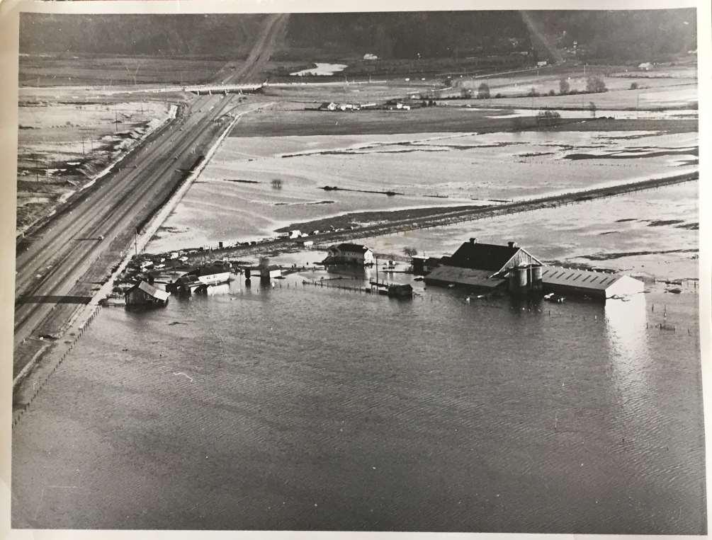
8 Background April R054 Responsibility for the Colebrook Dyking District & Mud Bay Dyking District The report outlined: dissolution of 2 dyking districts; Provincial reports regarding the estimated costs to address the impacts of sea level rise and other coastal hazards in Surrey ($1.6 billion); and change in Provincial dyke design standards (2011).

9 Provincial Recommended Sea Level Rise Curve (2011)

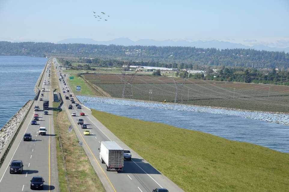
10 City of Surrey Actions Priority Actions: Conduct detailed analysis on Surrey-specific climate impacts, including timelines and extent of sea level rise and its related effects on flood construction levels and floodplain designations Adopted Nov. 2013

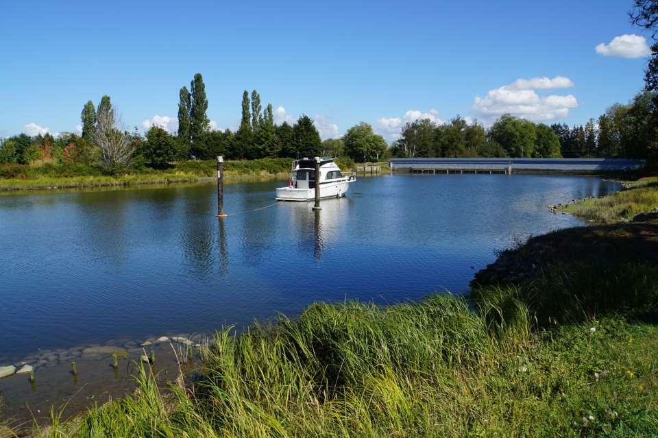
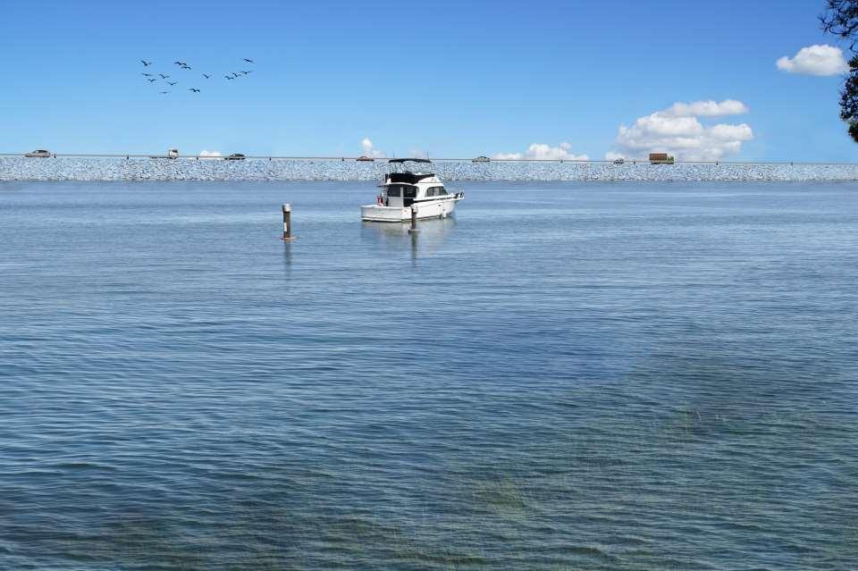
11 ICFAA STUDY AREA CFAS STUDY AREA SURREY COASTAL FLOOD ADAPTATION STRATEGY (CFAS) Mayor & Council adopted recommendations to develop a Coastal Strategy Feb 22, 2016 under Corporate Report No. R034;2016 Continuing commitment to participatory planning CFAS anticipated to be complete by end of 2018 Large study area with many communities, stakeholders and partners
12 Workshop CFAS Overview March 2017 PIEVC Vulnerability Workshop

13 Vulnerability Assessment As part of the CFAS engagement process, Mud Bay infrastructure operators, owners & emergency service providers participated in a one day workshop on March 28, Workshop included 66 participants from 28 organizations Workshop utilized the PIEVC Protocol 43 assets identified & assessed
14 Vulnerability Assessment
15 Vulnerability Assessment Current Dyke Height
16 Vulnerability Assessment Future Dyke Height Current Dyke Height
17 Vulnerability Assessment Future Dyke Height Current Dyke Height
18 Vulnerability Assessment Future Dyke Height Current Dyke Height Current Dyke Height
19 Vulnerability Assessment Future Dyke Height Current Dyke Height Future Dyke Height Current Dyke Height
20 Flood Scenario A Coastal Flood with Dyke Breach

21 Flood Scenario A Coastal Flood with Dyke Breach
22 PIEVC Risk Assessment Risk Summary Flood Scenario A Coastal Flood with Dyke Breach Current risks are mostly low and medium Flood Scenario A - Current Flood Scenario A - Future Flood Scenario B - Current Flood Sce Futu Low Risk Medium Risk High Risk
23 PIEVC Risk Assessment Risk Summary Flood Scenario A Coastal Flood with Dyke Breach Current risks are mostly low and medium Future risks increase to mostly medium and high Flood Scenario A - Current Flood Scenario A - Future Flood Scenario B - Current Flood Sce Futu Low Risk Medium Risk High Risk
24 PIEVC Risk Assessment Risk Summary Flood Scenario B Riverine Flood (dykes remain intact) Flood Scenario A - Current Flood Scenario A - Future Flood Scenario B - Current Flood Sce Futu Low Risk Medium Risk High Risk
25 PIEVC Risk Assessment Risk Summary Flood Scenario B Riverine Flood (dykes remain intact) Current risks are all low Future risks increase to medium and with a few high risks Flood Scenario A - Current Flood Scenario A - Future Flood Scenario B - Current Flood Sce Futu Low Risk Medium Risk High Risk
26 Workshop CFAS Overview Video
27 Workshop Study Tour Overview
 Regional and interjurisdictional coordination is needed Significant costs associated with both options, opportunity for cost-sharing important Need to")
28 Study Area Bus Tour What Did We Hear? (A brief sample) Regional and interjurisdictional coordination is needed Significant costs associated with both options, opportunity for cost-sharing important Need to get regulators on board and have political will Consider overall resilience of solutions to multiple hazards Adaptability over time

29 Regional Flood Strategy The Joint Program Committee of the Fraser Basin Council is developing a regional approach to flood management. Phase 1 investigated the risk, vulnerabilities and consequences of a large flood event including effects of sea level rise. Phase 2 will entail the development of a regional strategy and potential funding.
30 Workshop CFAS Preliminary Options
31 CFAS Preliminary Options
32 Preliminary Options Overview Developed with stakeholder input and in collaboration with UBC-LINT (Dutch Firm) 10,000 ft view: Large area with many possibilities/options Only presenting options that are significantly different from each other Options are preliminary and not public Details and phasing come at a later point
33 Preliminary Options Overview 1. Current Convention 2. Mud Bay Barrier 3. River Realignment 4. Coastal Realignment to Highway Coastal Realignment to 152nd Street 6. Edge Realignment 7. Managed Retreat 8. No Adaptation

34 Preliminary Options Overview Options selected as they affect infrastructure in substantially different ways and will aid in a greater understanding of the implications the options have on infrastructure located in the study area
35 Workshop CFAS Preliminary Options
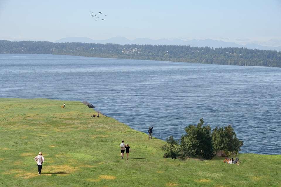
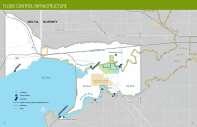
36 Mud Bay No Adaptation
37 Year 2100 No Adaptation
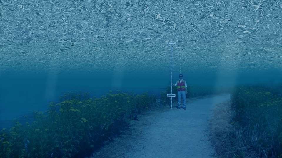
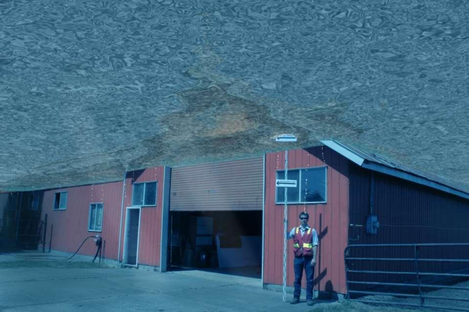
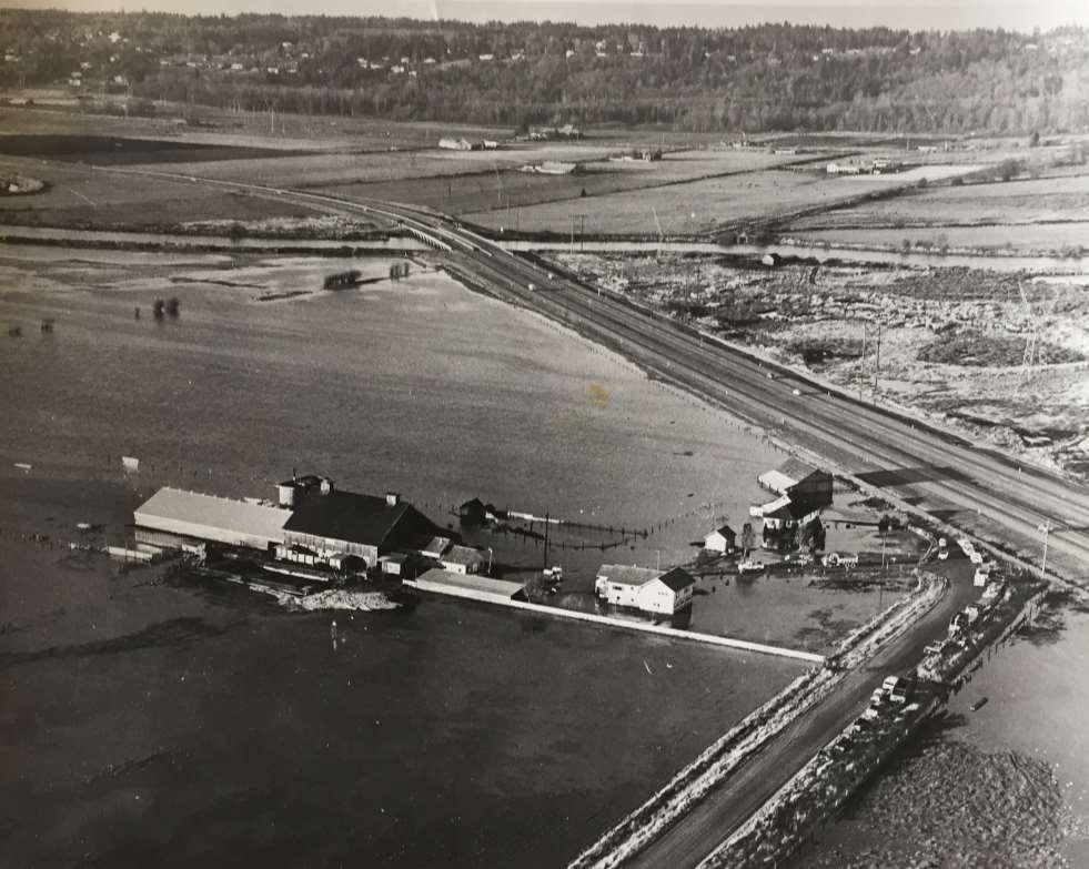
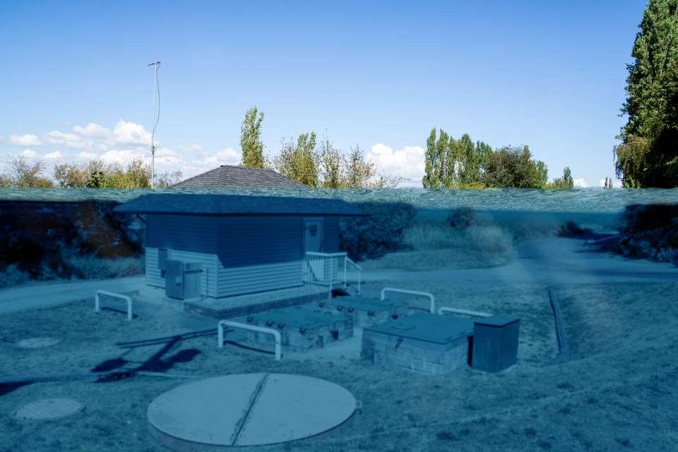
38 Year 2100 No Adaptation Risk of dyke breach increases with sea level rise
39 Year 2100 No Adaptation Risk of dyke breach increases with sea level rise Elevation is currently below mean sea level


40 No Adaptation WHAT THIS COULD LOOK LIKE Removable flood barriers Evacuation routes
41 Year 2100 No Adaptation Colebrook Dyke
42
43
44 Hwy 99 Adapts

45 Hwy 99 Adapts
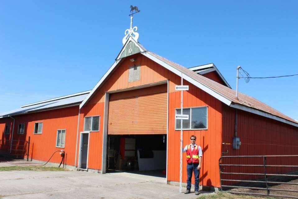
46 Year 2100 No Adaptation Coastal Dairy Farm
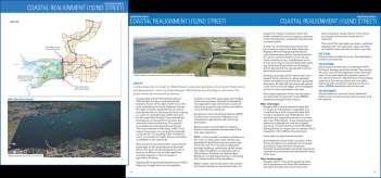
47
48
49

50
51
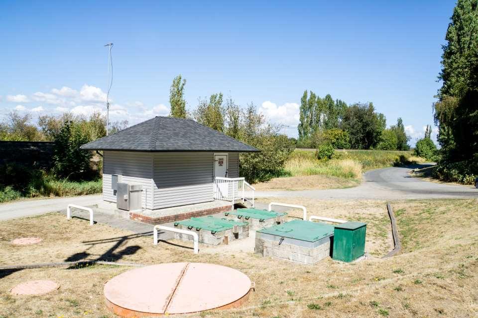
52 Year 2100 No Adaptation Pump Station
53
54
55 Mud Bay Coast realignment to 152nd Street
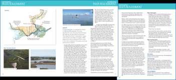
56 Year 2100 Coast Realignment (152 nd St) Hwy 99 retreats behind alignment New alignment at 152 nd Street Agricultural areas transform to marsh and tidal flats Sea dams align with 152nd Street

57 Coast Realignment (152 nd St) WHAT THIS COULD LOOK LIKE Newly created marsh becomes wind and wave buffer for new dyke
58 Coast Realignment (152 nd St) WHAT THIS COULD LOOK LIKE


59 Coast Realignment (152 nd St) WHAT THIS COULD LOOK LIKE

60 Fly Over (circling east to south to west)
 View northwest from Hwy")
61 Year 2100 Coast Realignment (152 nd St) View northwest from Hwy 99
62
63
64 Mud Bay River Realignment
65 Year 2100 River Realignment Setback dyking to protect agricultural lands north of Nicomekl Nicomekl and Serpentine Rivers are connected Sea dam No dykes along the south and east, allowing lands to flood


66 River Realignment WHAT THIS COULD LOOK LIKE Improved Riparian Corridors Inundation of Hunze River, NL

67 River Realignment WHAT THIS COULD LOOK LIKE AT HIGH TIDE
68 Year 2100 River Realignment Nicomekl Dyke
69
70

71 Fly Over (West to East via Hwy 99)
72 Year 2100 River Realignment View northwest from Hwy 99
73
74

75 Preliminary Options Overview Crescent Beach Preliminary options in other study area
76 Workshop PIEVC Engineering and Triple Bottom Line Analysis Orientation
77 PIEVC Engineering and Triple Bottom Line Analysis Adaptation decisions must be made on technical criteria, but also involve social, environmental and economic (triple bottom line - TBL) considerations Engineers Canada incorporated a TBL decision support tool to supplement the PIEVC Engineering Protocol


78 PIEVC Protocol Protocol identifies vulnerabilities Triple Bottom Line analysis develops and assess potential solutions based on criteria

79 TBL Methodology TBL analysis employs multifactor analysis as core analysis framework 1. PIEVC Step 6 Define options to address infrastructure vulnerabilities Consider policies, technical requirements, issues 2. PIEVC Step 7 Define and execute multifactor analysis Introduce and evaluate TBL based factors, weighting 3. PIEVC Step 8 (In later CFAS Steps) Make recommendations Follow-up actions, monitoring Reporting

80 TBL Evaluation Factors
81 TBL Evaluation Factors Environmental Factors Regulatory compliance Effects on biodiversity and habitat Climate change mitigation and adaptation Social Factors Public perception Sense of community involvement Maintenance of an acceptable level of service and public risk Emergency response Agricultural impacts Economic Factors Capital cost Cost-sharing and collaboration between different types of assets Resilience and maintainability Disruption of commerce Risk tolerance around level of service provision and asset lifecycle from economic perspective

82 PIEVC Engineering and Triple Bottom Line Analysis Orientation
83 Workshop Adaptation Introduction and Group Exercise 1
84 Adaptation Introduction Backgrounder

85 Adaptation Introduction Worksheets
86 COAST REALIGNMENT (152 ND ST) OPTION DESCRIPTION: This option sets flood protection back from the ocean. An alignment parallel to 152nd Street would be shorter and less costly than the current alignment. However, Highway 99 and King George Boulevard would need to be raised and/or relocated. The loss of farmland to ocean/salt marsh would be significant (about 16 km 2 ) and include farm residences. A total of about 30 km of dykes along the Serpentine/ Nicomekl Rivers would no longer need to be maintained or upgraded. A form of managed retreat, the option would provide some environmental benefits, while maintaining a portion of land for agricultural uses.
87 Year 2100 Coast Realignment (152 nd St) Hwy 99 retreats behind alignment New alignment at 152 nd Street Agricultural areas transform to marsh and tidal flats Sea dams align with 152nd Street
 / Medium (M) / Low (L) 5.")
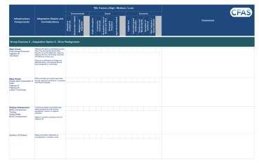
88 Group Exercise 1 Coastal Realignment to 152nd Street Backgrounder 1. Review / Read Adaptation Option Worksheets 2. Review each Infrastructure Component Step 1 3. Review Adaptation Details and Considerations 4. Review TBL Factors 1. Identify which Factor are considered in making a decision. 2. Indicate the degree of importance High (H) / Medium (M) / Low (L) 5. Provide overall comments and on option and identify thresholds Step 2 Step 4 Step 5 Step 3 Table Discussion (75 min) / Group Discussion (15 min)

89 Group Exercise 1 Coastal Realignment to 152nd Street 1. Review / Read Adaptation Option


90 Group Exercise 1 Coastal Realignment to 152nd Street 2. Review each Infrastructure Component

91 Group Exercise 1 Coastal Realignment to 152nd Street 2. Review each Infrastructure Component 3. Review Adaptation Details and Considerations
 / Medium (M) / Low (L) 5. Provide overall comments and on option and identify thresholds")
92 Group Exercise 1 Coastal Realignment to 152nd Street 4. Review TBL Factors 1. Identify which Factor are considered in making a decision. 2. Indicate the degree of importance High (H) / Medium (M) / Low (L) 5. Provide overall comments and on option and identify thresholds
93 Group Exercise 1 Coastal Realignment to 152nd Street
94 Workshop GROUP EXERCISE 2 -
95 RIVER REALIGNMENT OPTION DESCRIPTION: This option would convert the land west of Highway 99 into tidal flats, connect the Serpentine River with the Nicomekl at roughly 168th Street, dyke and protect land between King George Boulevard and the diversion (north of the Nicomekl), and see the conversion of other floodplain lands south and east of the diversion into a lake. The dyked area would be used for agriculture. Only one sea dam would be required (on the Serpentine, in the vicinity of 56th Ave). The mid and upper Serpentine would be unchanged. The total length of dyking required would be significantly reduced. A form of managed retreat, the option would provide some environmental benefits, while maintaining a portion of land for agricultural uses.
96 Year 2100 River Realignment Setback dyking to protect agricultural lands north of Nicomekl Nicomekl and Serpentine Rivers are connected Sea dam No dykes along the south and east, allowing lands to flood

97 Group Exercise 2 River Realignment
98 Group Exercise 2 River Realignment Backgrounder 1. Review / Read Adaptation Option Worksheets 2. Review each Infrastructure Component Step 1 3. Review Adaptation Details and Considerations 4. Review TBL Factors 1. Identify which Factor are considered in making a decision. 2. Indicate the degree of importance High (H) / Medium (M) / Low (L) 5. Provide overall comments and on option and identify thresholds Step 2 Step 4 Step 5 Step 3 Table Discussion (90 min) / Group Discussion (15 min)
99 Workshop GROUP EXERCISE 3 -

100 Exercise 3 - Option Evaluation and Next Steps Considerations: Monitoring Risks Thresholds and Triggers Decision and implementation What factors were of higher importance Collaboration Area solutions / Regional solutions


101 Exercise 3 - Option Evaluation and Next Steps Considerations: Monitoring Risks Thresholds and Triggers Decision and implementation What factors were of higher importance Collaboration Area solutions / Regional solutions

 Group Discussion (25 min) Write down")
102 Exercise 3 - Option Evaluation and Next Steps Work in Groups to please write down your comments into the workbook Table facilitator will summarize comments on flip charts Table Discussion (20 min) Group Discussion (25 min) Write down comments
103 Workshop CLOSING REMARKS AND NEXT STEPS


104 Workshop Next Steps Collect the workbooks and notes Compile the comments of the workshop and complete the workshop report Receive comments from City and Assessment Team Finalize Reporting November 2017 Use the results to inform next steps of the CFAS project.
105 CFAS Phase 2 & 3 Next Steps Regulators Workshop (Oct 17) Land Stewardship and Co-Benefits Workshop Semiahmoo Bay Workshop Other engagement (City committees, stakeholder and partners, broad community engagement, etc.) Additional review (Advisory Group, technical, City, partners & stakeholders)

106 CFAS Phase 2 & 3 Next Steps Regulators Workshop (Oct 17) Land Stewardship and Co-Benefits Workshop Semiahmoo Bay Workshop Other engagement (City committees, stakeholder and partners, broad community engagement, etc.) Additional review (Advisory Group, technical, City, partners & stakeholders)
107 CFAS Next Round of Consultation Purpose of next round of consultation: Validate reviewed options and evaluation of options for Mud Bay, Crescent Beach and Semiahmoo Bay Discuss trade-offs across case study areas, options and sectors Rank options Date November-February Conclude with Open House to present Findings in February 2018


108 Online Story Map under development Summarize the history of the area focusing on transportation infrastructure as an illustrative component. Explain infrastructure vulnerability and potential service area disruption in an interactive way.
109 SURREY COASTAL FLOOD ADAPTATION STRATEGY (CFAS) Thank you!
Projected Sea Level Change
 UBCM 2011 RISING OCEANS & RAISING DIKES A LOCAL GOVERNMENT PERSPECTIVE Carrie Baron, P.Eng. Drainage & Environment Manager Projected Sea Level Change Provincial Government reports predict sea level changes
CHAPTER 7. San Dieguito River Flooding Adaptation
 CHAPTER 7 San Dieguito River Flooding Adaptation This chapter includes a range of adaptation measures to address vulnerabilities from flooding along the San Dieguito River, including the river valley,
(1) Bridge, Road and Railway (Adaptation Project) (2) Bridge, Road and Railway (BAU Development with Adaptation Options)
 Bridge, Road and Railway (Adaptation Project) (2) Bridge, Road and Railway (BAU Development with Adaptation Options)") Sub-sector Guideline: (1) Bridge, Road and Railway (Adaptation Project) (2) Bridge, Road and Railway (BAU Development with Adaptation Options) Basic Concept A. General Concept Climate change will increase
Sub-sector Guideline: (1) Bridge, Road and Railway (Adaptation Project) (2) Bridge, Road and Railway (BAU Development with Adaptation Options) Basic Concept A. General Concept Climate change will increase
Transparent Decision-Making
 ART SUPPLY: GOOD PLANNING GUIDE Design Your Project Steps 1 & 5: Scope & Organize, Shift to Adaptation Transparent Decision-Making ADAPTING TO RISING TIDES PROGRAM This guide helps with Using transparent
Developing Evaluation Criteria
 ART SUPPLY: HOW-TO GUIDE Design Your Project Step 7: Evaluate Responses Developing Evaluation Criteria ADAPTING TO RISING TIDES PROGRAM This guide helps with Developing and using a set of criteria for
SECTION 6: MITIGATION STRATEGY
 SECTION 6: MITIGATION STRATEGY This section describes the process by which the Lehigh Valley Steering Committee and municipal planning partnership performed the update to the county and local mitigation
PRINCESS ANNE DISTRICT STORMWATER PROJECTS
 PRINCESS ANNE DISTRICT STORMWATER PROJECTS Topics o o o o o Sea Level Rise and the Southern Watersheds Ashville Park Sherwood Lakes Kingston Estates Drainage Operations & Maintenance in the Southern Watersheds
Marine Board Spring Meeting April 27, 2011 David M. Kennedy
 Marine Board Spring Meeting April 27, 2011 David M. Kennedy NOS Organization 2 NOAA Next Generation Strategic Plan National Ocean Policy and Coastal Goal NOAA s Coastal Goal Objectives Resilient coastal
CITY OF PORTSMOUTH, NEW HAMPSHIRE
 TIDES TO STORMS PREPARING FOR NEW HAMPSHIRE S FUTURE COAST Assessing Risk and Vulnerability of Coastal Communities to Sea Level Rise and Storm Surge Seabrook - Hampton Falls Hampton - North Hampton Rye
A Climate Change Adaptation Planning Process for Low-Lying, Communities Vulnerable to Sea Level Rise
 Sustainability 2012, 4, 2176-2208; doi:10.3390/su4092176 Article OPEN ACCESS sustainability ISSN 2071-1050 www.mdpi.com/journal/sustainability A Climate Change Adaptation Planning Process for Low-Lying,
Adaptation: Advising Local Governments on Climate Change Vulnerability
 Local Government Commission Building Livable Communities Ahwahnee Hotel Adaptation: Advising Local Governments on Climate Change Vulnerability March 12, 2009 2 Planning for Climate Vulnerability Exec.
Adapting to Rising Tides
 Adapting to Rising Tides A regional program that uses findings, processes, tools and relationships built by ART and its partners to lead and support efforts that increase the resilience of San Francisco
Climate Change Adaptation Tools and Barriers in Newfoundland and Labrador
 Climate Change Adaptation Tools and Barriers in Newfoundland and Labrador Liveable Cities Forum 2016 Halifax, NS 12-September-2016 The Project NL Office of Climate Change and Energy Efficiency (CCEE) lead
Climate Change, Human Activities, and the State of New Jersey. Michael J. Kennish Institute of Marine and Coastal Sciences Rutgers University
 Climate Change, Human Activities, and the State of New Jersey Michael J. Kennish Institute of Marine and Coastal Sciences Rutgers University New Jersey Climate and Environmental Change Conclusions from
Kilbirnie Town Centre Plan Working Paper. Assessing the implications of sea level rise Kilbirnie Town Centre
 Kilbirnie Town Centre Plan Working Paper Assessing the implications of sea level rise Kilbirnie Town Centre September 2009 1 Contents 1. Introduction... 3 2. Objectives of the Study... 3 3. Methodology
Climate Change Vulnerability Assessment Support
 Climate Change Vulnerability Assessment Support Nelson Lee, P.Eng. Green Sky Sustainability 2017 May 11 BC EIA BEST Annual Conference Whistler, BC Walt Kelly Pogo April 22, 1970 we have met the enemy and
Sea Level Rise in New York:
 Sea Level Rise in New York: Vulnerabilities and Methods of Analysis Westchester Municipal Planning Federation 2017 Land Use Training Institute April 5, 2017 Anjali Sauthoff What is Sea Level Rise? Image
CITY OF MOUNTAIN VIEW
 CITY OF MOUNTAIN VIEW Incorporate Climate Change Adaptation in Municipal Scale, Urban Watershed Planning at the City of Mountain View Raymond Wong, PhD, PE, LEED AP Lisa Au, PE Floodplain Management Association
Kaslo / Area D Climate Change Adaptation Project
 Kaslo / Area D Climate Change Adaptation Project September 2010 Executive summary Kaslo/Area D Climate Change Adaptation & You The project timeline ran from October 2009 July 2010, and extended to September
Engineering considerations for coastal adaptation: Recent examples from Atlantic Canada
 Livable Cities Forum Halifax 12 Sep 2016 Climate change in Atlantic Canada: Issues and Responses Engineering considerations for coastal adaptation: Recent examples from Atlantic Canada Vincent Leys, Coastal
Interchange Workshop Report (August 2004)
") U.S. Highway 14 Corridor Study New Ulm to North Mankato Table of Contents Section Interchange Workshop Report (August 2004) Page 1. Introduction and Next Steps 1 2. Interchange Workshop Participants &
U.S. Highway 14 Corridor Study New Ulm to North Mankato Table of Contents Section Interchange Workshop Report (August 2004) Page 1. Introduction and Next Steps 1 2. Interchange Workshop Participants &
Natural and anthropogenic impact at the East Frisian coast - last 1000 years and future perspectives
 Natural and anthropogenic impact at the East Frisian coast - last 1000 years and future perspectives Alexander Bartholomä Senckenberg Institute Past: Present: Future: Past, Present and Future - development
Aboriginal Disaster Resiliency Planning (ADRP) Resource Guide
 Resource Guide") Aboriginal Disaster Resiliency Planning (ADRP) Resource Guide March 30, 2016 Table of Contents Before You Start... 1 Paper Based Resources... 2 Aboriginal Disaster Resilience Planning Guide: Overview and
Aboriginal Disaster Resiliency Planning (ADRP) Resource Guide March 30, 2016 Table of Contents Before You Start... 1 Paper Based Resources... 2 Aboriginal Disaster Resilience Planning Guide: Overview and
CHESAPEAKE BAY COMPREHENSIVE WATER RESOURCES AND RESTORATION PLAN. Habitat GIT Meeting 9 May 2017
 CHESAPEAKE BAY COMPREHENSIVE WATER RESOURCES AND 255 255 255 237 237 237 0 0 0 217 217 217 163 163 163 200 200 200 131 132 122 239 65 53 80 119 27 RESTORATION PLAN 110 135 120 252 174.59 112 92 56 62 102
Atlantic Coast of New York East Rockaway Inlet to Rockaway Inlet and Jamaica Bay, NY
 Atlantic Coast of New York East Rockaway Inlet to Rockaway Inlet and Jamaica Bay, NY Draft Reformulation Public Information October 2016 US Army Corps of Engineers Presentation Outline Project Overview
Sewer System Flood Reduction Measures in the Rockcliffe Area
 PW28.6 REPORT FOR ACTION Sewer System Flood Reduction Measures in the Rockcliffe Area Date: March 26, 2018 To: Public Works and Infrastructure Committee From: General Manager, Toronto Water Wards: Ward
Duwamish Waterway Self Guided Tour: Turning Basin Number Three and Terminal 105 Aquatic Habitat Restoration Sites
 Duwamish Waterway Self Guided Tour: Turning Basin Number Three and Terminal 105 Aquatic Habitat Restoration Sites Text and illustrations in the following pages include: (1) summary information describing
The newly updated and comprehensive SWMP shall:
 RFQ SCOPE OF SERVICES 2.1 Project Purpose The City of Miami, ( City ) is seeking professional engineering services from a qualified firm for the purpose of planning and developing a newly updated and comprehensive
Flooded Bus Barns and Buckled Rails: Public Transportation and Climate Change Adaptation
 Flooded Bus Barns and Buckled Rails: Public Transportation and Climate Change Adaptation Tina Hodges Federal Transit Administration September 22, 2011 Tina.Hodges@dot.gov 1 Key Themes Proactive instead
Climate Change and the Olympic Coast: Interpreting Potential Futures A presentation to the OCNMS Sanctuary Advisory Council 23 Sept 2011
 Climate Change and the Olympic Coast: Interpreting Potential Futures A presentation to the OCNMS Sanctuary Advisory Council 23 Sept 2011 Ian Miller Coastal Hazards Specialist WA Sea Grant Motivation and
PLEASE do not reuse without permission from NYCDEP. [Please notify Pinar Balci and Alan Cohn
 PLEASE do not reuse without permission from NYCDEP. [Please notify Pinar Balci (PBalci@dep.nyc.gov) and Alan Cohn (AlanC@dep.nyc.gov) if you intend to use any of these slides, and indicate where and when
Building Resilient Communities - Low Impact Development and Green Infrastructure Strategies
 Building Resilient Communities - Low Impact Development and Green Infrastructure Strategies October 24, 2013 Bridgewater State University E. Heidi Ricci Senior Policy Analyst Mass Audubon Shaping the Future
Port of Manzanillo. Port of Manzanillo: Climate Risks and Opportunities. IAIA Symposium: Sustainable Mega- Infrastructure and Impact Assessment
 Port of Manzanillo Port of Manzanillo: Climate Risks and Opportunities IAIA Symposium: Sustainable Mega- Infrastructure and Impact Assessment Panama City, December 3, 2015 Vladimir Stenek, IFC, World Bank
Natural Resources and Climate Resiliency in Germantown
 Natural Resources and Climate Resiliency in Germantown Ingrid Haeckel, Andrew Meyer, and Elizabeth Murphy NYSDEC Hudson River Estuary Program and Cornell University Presentation to the Town of Germantown,
CLIMATE CHANGE ADAPTATION IN MASSACHUSETTS
 CLIMATE CHANGE ADAPTATION IN MASSACHUSETTS Kathleen Baskin, Director of Water Policy June 3, 2013 MA Global Warming Solutions Act of 2008 Mitigation Reduce greenhouse gas emissions below 1990 levels by
Climate Change Impacts in Washington State
 Climate Change Impacts in Washington State Lara Whitely Binder Climate Impacts Group College of the Environment University of Washington Evergreen College January 13, 2016 Climate Science in the Public
COASTAL RESILIENCE SYMPOSIUM Mathijs van Ledden & Maarten Kluyver (Haskoning Inc.)
") HURRICANE RISK REDUCTION PROGRAM NEW ORLEANS STRUCTURAL SOLUTIONS AND RESILIENCE Mathijs van Ledden Royal Haskoning COASTAL RESILIENCE SYMPOSIUM Mathijs van Ledden & Maarten Kluyver (Haskoning Inc.) HOUSTON
HURRICANE RISK REDUCTION PROGRAM NEW ORLEANS STRUCTURAL SOLUTIONS AND RESILIENCE Mathijs van Ledden Royal Haskoning COASTAL RESILIENCE SYMPOSIUM Mathijs van Ledden & Maarten Kluyver (Haskoning Inc.) HOUSTON
Sea-level Rise Science and Decision Making in an Uncertain Future. Rob Thieler U.S. Geological Survey Woods Hole, MA
 Sea-level Rise Science and Decision Making in an Uncertain Future Rob Thieler U.S. Geological Survey Woods Hole, MA Concepts Sea-level rise is one of the most certain impacts of climate change. There is
Natural Flood Management. Measures & Multiple Benefits. Steve Rose (JBA)
") Natural Flood Management Measures & Multiple Benefits Steve Rose (JBA) Definitions Natural Flood Management - NFM (SEPA): A range of techniques that aim to reduce flooding by working with natural features
Natural Flood Management Measures & Multiple Benefits Steve Rose (JBA) Definitions Natural Flood Management - NFM (SEPA): A range of techniques that aim to reduce flooding by working with natural features
Toronto Hydro s Climate Adaptation Actions
 s Climate Adaptation Actions Rob McKeown Engineer, Standards & Policy Planning Engineering & Construction Division OCCIAR Webinar March 1, 2017 2 March 1, 2017 3 March 1, 2017 Generation In Ontario, 70%
Challenge 2: Community Resilience in Dania Beach
 University of New Orleans ScholarWorks@UNO Coastal Resilience Workshop Coastal Resilience Workshop 2015 Oct 27th, 1:00 PM - 1:15 PM Challenge 2: Community Resilience in Dania Beach Samantha Danchuk Environmental
International Bank for Reconstruction and Development International Development Association
 International Bank for Reconstruction and Development International Development Association PROGRESS REPORT TO THE BOARD OF EXECUTIVE DIRECTORS ON THE IMPLEMENTATION OF THE MANAGEMENT ACTION PLAN IN RESPONSE
Climate Change Impacts and Adaptation for Coastal Transport Infrastructure in the Caribbean
 UNCTAD Regional Workshop 5 7 December 2017, Bridgetown, Barbados Climate Change Impacts and Adaptation for Coastal Transport Infrastructure in the Caribbean Identifying operational thresholds for vulnerability
Summary. Freshet Flooding & Fraser Valley Agriculture Evaluating Impacts & Options for Resilience
 Summary Freshet Flooding & Fraser Valley Agriculture Evaluating Impacts & Options for Resilience Acknowledgments This report was prepared for the Fraser Valley Regional District in partnership with the
City of Brantford Chapter 3 TABLE OF CONTENTS
 Chapter 3 The Land Use & Transportation Connection TABLE OF CONTENTS 3.1 THE LAND USE & TRANSPORTATION LINK... 1 3.2 POPULATION & EMPLOYMENT GROWTH FORECASTS... 3 3.2.1 Proposed Places to Grow Plan Forecasts
Alaska Climate Change Adaptation Planning Tool
 Alaska Climate Change Adaptation Planning Tool The future ain t what it used to be. Yogi Berra It s no joke. Alaska is changing before our eyes. Spring is coming earlier and freeze up later. Sea ice is
Climate Change Adaptation Strategies for Infrastructure Managers
 Climate Change Adaptation Strategies for Infrastructure Managers Green Streets and Highways Conference November 17, 2010 Butch Wlaschin Office of Asset Management Federal Highway Administration U.S. Department
FLOOD PLAIN STANDARDS AND REQUIREMENTS. Adopted by City Council on September 16, 2014 Effective January 1, 2015
 City of Vancouver Land Use and Development Policies and Guidelines Planning and Development Services, 453 W. 12th Ave Vancouver, BC V5Y 1V4 tel 604.873.7000 fax 604.873.7060 planning@vancouver.ca FLOOD
Hazard Mitigation as an Economic Development Strategy
 Hazard Mitigation as an Economic Development Strategy Linking Water Infrastructure to Community and Economic Development in Smaller Places October 29, 2014 About Us Sustainable Communities Capacity Building
EMERGENCY STORAGE PROJECT
 EMERGENCY STORAGE PROJECT San Vicente Pumping Station/Surge Control Facility Carryover Storage and San Vicente Dam Raise EIR/EIS San Vicente Dam Raise Briefing Summary DATE: Oct. 18, 2006 ORGANIZATION:
Smart and Resilient Cities. Stefan Denig, Center of Competence Cities, London
 Smart and Resilient Cities Stefan Denig, Center of Competence Cities, London siemens.com/answers Why Resilience? The number of natural disasters is increasing Hazard Page 2 Why Resilience? The costs of
ADAPTATION SYMPOSIUM Nicole Legault Environmental Policy Directorate Transport Canada
 ADAPTATION SYMPOSIUM 2016 Nicole Legault Environmental Policy Directorate Transport Canada April 13, 2016 PURPOSE Explore key risks and opportunities for the transportation sector from a changing climate
Climate Change and Chesapeake Bay Habitats
 Climate Change and Chesapeake Bay Habitats Donna Marie Bilkovic STAC Chesapeake Bay Forage Base Workshop 12 November 2014 http://www.chesapeake.org/stac/ Virginia Institute of Marine Science www.ccrm.vims.edu
New Grids for Renewables and the Wadden Sea?
 New Grids for Renewables and the Wadden Sea? Presentation at the Conference New Grids for Renewables! Berlin 10-11 Nov 2011 Dr. Hans-Ulrich Rösner WWF Germany Wadden Sea Office www.wwf.de/watt Oil drilling,
T. Frank, J. Jensen, Ch. Mudersbach, B. Schubert, M. Wörner
 Research Institute for for Water and Environment University of of Siegen Protection of Nuclear Power Plants against Flooding Considerations for the Determination of a 10.000 Years Return Period Flood between
Preparing for Tomorrow s High Tide: Source Water Implications of Sea Level Rise in Delaware
 Preparing for Tomorrow s High Tide: Source Water Implications of Sea Level Rise in Delaware Susan E. Love, Planner IV Delaware Coastal Programs Presentation for the Source Water Assessment and Protection
Conservation Assessment & Prioritization System (CAPS)
") Conservation Assessment & Prioritization System (CAPS) Assessing ecological integrity and supporting decision-making for land conservation, habitat management, project review & permitting to protect biodiversity
Conservation Assessment & Prioritization System (CAPS) Assessing ecological integrity and supporting decision-making for land conservation, habitat management, project review & permitting to protect biodiversity
Nantasket Beach Revitalization Plan Draft Redevelopment Scenario
 Hull, MA Nantasket Beach Revitalization Plan Draft Redevelopment Scenario www.utiledesign.com Town of Hull, MA 12.08.14 1 Nantasket Beach Revitalization Plan Golden Circle of Success www.startwithwhy.com
Causes of Sea Level Rise*
 1. 2. 3. 4. Causes of Sea Level Rise* Warming expands water (~50%) Glacier/ice sheet melt (~50%) 1947 2009 Wilkins Ice Shelf, Antarctica South Cascade Glacier, WA 1960 and 2004 (NAS, 2008) *Percentages
Flood risk management and land use planning in changing climate conditions Mikko Huokuna Finnish Environment Institute, SYKE
 10th International Drainage Workshop of ICID 06.-11. July 2008 Flood risk management and land use planning in changing climate conditions Mikko Huokuna Finnish Environment Institute, SYKE Background hydrological
Presentation for Roads Australia Miller Street, Sydney 3 April creating public Pacific Highway delivering value for money
 Presentation for Roads Australia Miller Street, Sydney 3 April 2014 Legitimacy & Support creating public Pacific Highway delivering value for money Real sustainable development solutions in practice Public
Cedar Mill Creek Flood Remediation Collaborative WORK PLAN / SCHEDULE. Steering Committee Meeting #1. Project Team Meeting #1
 PROJECT START-UP/ ORIENTATION Goals: 1. Organize and Define Project Structure and Participants 2. Orientation of Project Team and TAC 3. Work Plan Development and Approval July - Oct 2017 7/31/17 7/31/17
Mitigation Measures for Natural Hazards
 Mitigation Measures for Natural Hazards Mitigation measures are actions that eliminate or reduce risks from future disaster events, including: Physical construction projects such as replacing a highly
A Freshwater Blueprint for Maritime Canada
 A Freshwater Blueprint for Maritime Canada Union of Nova Scotia Municipalities (UNSM) November 8 th, 2017 William Millar Aquatic Conservation Biologist william.millar@natureconservancy.ca Craig Smith Conservation
SUMMARY REPORT. Environment and Sustainable Resource Development. Watershed Resiliency and Restoration Program Prioritization
 SUMMARY REPORT Environment and Sustainable Resource Development Watershed Resiliency and Restoration Program Prioritization January 2015 CONFIDENTIALITY AND COPYRIGHT This document is for the sole use
CLIMATE INFORMATION IN HAZARD RISK ASSESSMENT JANNEKE ETTEMA, VICTOR JETTEN, DINAND ALKEMA, THEA TURKINGTON
 CLIMATE INFORMATION IN HAZARD RISK ASSESSMENT JANNEKE ETTEMA, VICTOR JETTEN, DINAND ALKEMA, THEA TURKINGTON FIRE ENSCHEDE - YESTERDAY On fire ~100 m ITC building Short rain event made the wind direction
Hampton Roads Climate Impact Quantification Initiative
 David Arthur Chief Energy Analysis and Sustainability The Volpe Center, USDOT Hampton Roads Climate Impact Quantification Initiative Task 1 Briefing Transportation Technical Advisory Committee (TTAC) Hampton
TERMS OF REFERENCE SOUTHWEST INTERLAKE INTEGRATED WATERSHED MANAGEMENT PLAN
 TERMS OF REFERENCE SOUTHWEST INTERLAKE INTEGRATED WATERSHED MANAGEMENT PLAN March 17, 2014 TABLE OF CONTENTS 1.0 INTRODUCTION Page 1 PURPOSE PLANNING PROCESS PRINCIPLES OF INTEGRATED WATERSHED MANAGEMENT
Understanding the State Planning Policy July 2017 Changes to state interest statements, policies and assessment benchmarks
 Understanding the State Planning Policy July 2017 Changes to state statements, policies and assessment benchmarks This fact sheet outlines the key policy changes to the state statements, policies and assessment
Community Disaster Resilience
 Community Disaster Resilience Overview Disaster Management Cycle Community Disaster Resilience Hands on Approach for Increasing Community Disaster Resilience Addressing Weaknesses Planning for the Future
Barriere Area Eco-Depot Siting Analysis. Open House Presentation December 15, 2009
 Barriere Area Eco-Depot Siting Analysis Open House Presentation December 15, 2009 Presentation Outline Introduction Project Background Review of Screening Analysis Identified Sites Next Steps Purpose of
Japan s Urbanization and Growth Processes. Hiroto Arakawa Senior Special Advisor, JICA
 Japan s Urbanization and Growth Processes Hiroto Arakawa Senior Special Advisor, JICA 1 Purpose of Presentation The Growth Report (2008) by Commission on Growth and Development - Discusses urbanization
Bay of Fundy: Tides and Sea Level Rise SC 211, June 2, Gary Oberts
 Bay of Fundy: Tides and Sea Level Rise SC 211, June 2, 2015 - Gary Oberts 1. 2. 3. 4. Causes of Sea Level Rise* Warming expands water (~50%) Glacier/ice sheet melt (~50%) 1947 2009 Wilkins Ice Shelf, Antarctica
DRAFT. Coastal Resilience Index: A Community Self-Assessment. A Guide to Examining How Prepared Your Community Is for a Disaster
 Florida Pilot Test Coastal Resilience Index: A Community Self-Assessment A Guide to Examining How Prepared Your Community Is for a Disaster Rod Emmer, Louisiana Sea Grant LaDon Swann, Melissa Schneider,
2017 Central Valley Flood Protection Plan Update: Overview
 2017 Central Valley Flood Protection Plan Update: Overview 2015 FMA Conference CVFPP Overview- Mike Mierzwa, DWR Basin-wide Feasibility Study Planning Context- Eric Tsai, DWR Technical Tools/Methodologies-
3.0 CUMULATIVE PROJECTS SCENARIO
 3.0 CUMULATIVE PROJECTS SCENARIO The CEQA Guidelines define cumulative impacts as two or more individual effects that, when considered together, are considerable or which compound or increase other environmental
Blue Growth and Blue and Green Infrastructure
 Blue Growth and Blue and Green Infrastructure Angela Carpenter, Rebecca Shellock, Steve Fletcher and Gillian Glegg Centre for Marine and Coastal Policy Research (MarCoPol) Plymouth University Email: angela.carpenter@plymouth.ac.uk
Community Food System Assessment Project Outline
 ! Community Food System Assessment Project Outline Prepared by: Vanessa Sparrow, Food Security Project Coordinator February 18, 2015 Community Food System Assessment Proposal for Working Group!1 Conducting
Climate Risks and Adaptation in Asian Coastal Megacities
 Climate Risks and Adaptation in Asian Coastal Megacities Local Climate Solutions for Africa 2011, ICLEI, Cape Town Poonam Pillai Sr. Environmental Specialist World Bank Presentation based on joint WB,
Lesson 2-2: Riparian Zones
 2-14 Lesson 2-2: Riparian Zones Time of Lesson: 1 hour Rationale: The purpose of this lesson is to define what a riparian zone is and link its importance for fish and other animals, and humans, and the
Adaptation to Extreme Weather Events and Climate Change
 Office of Planning, Environment and Realty Office of Infrastructure Adaptation to Extreme Weather Events and Climate Change SASHTO Meeting Robert Kafalenos, FHWA August 25, 2014 1 Planning for the Future
Preface. MNR # Queen s Printer for Ontario, 2012 ISBN (PRINT) ISBN (PDF)
 ISBN (PDF)") Preface In 2008, the inter-agency Drainage Act & Section 28 Regulations Team (DART) was established by the Ministry of Natural Resources (MNR) and the Ministry of Agriculture, Food and Rural Affairs (OMAFRA)
Preface In 2008, the inter-agency Drainage Act & Section 28 Regulations Team (DART) was established by the Ministry of Natural Resources (MNR) and the Ministry of Agriculture, Food and Rural Affairs (OMAFRA)
Water and Environment. Monterey Peninsula, Carmel Bay and South Monterey Bay Integrated Regional Water Management Draft Plan
 Water and Environment Monterey Peninsula, Carmel Bay and South Monterey Bay Integrated Regional Water Management Draft Plan December 11, 2006 Presentation Outline Purpose of IRWM Planning Status of Plan
TREASURE COAST REGIONAL PLANNING COUNCIL M E M O R A N D U M. To: Council Members AGENDA ITEM 3E
 TREASURE COAST REGIONAL PLANNING COUNCIL M E M O R A N D U M To: Council Members AGENDA ITEM 3E From: Date: Subject: Staff May 19, 2017 Council Meeting Local Government Comprehensive Plan Review Draft
Preliminary study for an Environmental Impact Assessment of Floating Cities
 Presenter: Arch. Barbara Dal Bo Zanon Deltasync, Delft, The Netherlands Preliminary study for an Environmental Impact Assessment of Floating Cities B.Sc. Hannah Härtwich Bachelor thesis 1/18 ROTTERDAM:
Vulnerabilities to Climate Change Impacts and Strengthening Disaster Risk Management in East Asian Cities
 2008 Primer Reducing Vulnerabilities to Climate Change Impacts and Strengthening Disaster Risk Management in East Asian Cities I/ CITY DESCRIPTION New York City comprises five boroughs, each of which is
Future Plan Advisory Committee SWOT Analysis Report
 Cultus Lake Official Community & Park Plan Future Plan Advisory Committee SWOT Analysis Report July 16, 2013 1.0 SWOT Analysis On July 2, 2013, the Cultus Lake Park Board Future Plan Advisory Planning
Jamestown S Klallam Tribe
 Adaptation Plan Addendum: Two additional Key Areas of Concern Jamestown S Klallam Tribe September 2013 Acknowledgements Thank You This project would not have been successful with out the combined efforts
The First Mekong River Commission Summit 2010
 15th Anniversary 5 April 1995 5 April 2010 The First Mekong River Commission Summit 2010 The Mekong Basin as a source of economic prosperity The water resources of the 795,000 square kilometer Mekong Basin
Climate Adaptation & California Native American Tribes
 Climate Adaptation & California Native American Tribes Contact Information Please call or email us if you d like us to walk through this information and if you have questions, comments, or concerns. For
The Don River and Central Waterfront are among the most degraded waterways in the City of Toronto.
 This document was put together following the fourth round of public consultation for the Class Environmental Assessment study for this Project. In June 2011, the Project Team consulted with stakeholders
Building Resilience to Sea Level Rise in SE Florida
 Building Resilience to Sea Level Rise in SE Florida Nichole L. Hefty, Chief Miami-Dade Office of Sustainability Planning Division Dept. of Regulatory and Economic Resources Miami-Dade s Long-Standing Climate