BUILDING LAND IN COASTAL LOUISIANA. Report Summary
|
|
|
- Oswald Lewis
- 6 years ago
- Views:
Transcription


1 BUILDING LAND IN COASTAL LOUISIANA Expert Recommendations for Operating a Successful Sediment Diversion that Balances Ecosystem and Community Needs Page 1 Report Summary
2 WHAT ARE SEDIMENT DIVERSIONS? Sediment diversions are a vital restoration tool needed to confront Louisiana s land loss crisis. A sediment diversion is a structure built into the Mississippi River levee system to allow river water, sediment and nutrients to flow into nearby wetlands to help sustain and rebuild land. By harnessing the power of the Mississippi River, sediment diversions mimic the natural processes that once existed and built the land of coastal Louisiana. They are foundational to Louisiana s coastal restoration efforts needed to help reduce risks from sea level rise, subsidence, hurricanes and other threats. MOVING SEDIMENT DIVERSIONS TO CONSTRUCTION: Sediment diversions have been recognized for decades as critical coastal restoration projects, and they have been included as a principle element of Louisiana s Coastal Master Plan. Louisiana s Coastal Protection and Restoration Authority (CPRA) is currently advancing two sediment diversions south of New Orleans for construction in These diversions are crucial investments in the state s future as they will build and help maintain tens of thousands of acres of land over time and help support other restoration projects needed to protect communities, wildlife and industries across southeastern Louisiana. OPERATING A SEDIMENT DIVERSION: As CPRA studies how to design and construct a diversion, community members are concerned about how the diversion will be operated. To date, the only operation strategies currently being discussed are for modeling and engineering studies that use simplified and standardized operation strategies. These simplified strategies allow consistent comparisons between various scenarios, such as location or size alternatives. However, they are not representative of operations in the real world. For instance, at times these simplified operations result in a diversion flowing at maximum capacity for months on end. The reality is that sediment diversions will be operated only at certain times carefully chosen through a specific operations strategy to maximize land building while also accounting for ecosystem and community needs. CPRA will develop an Operation and Adaptive Management Plan that defines how, when and why the diversion structure will be opened and closed, what factors will be considered, what monitoring is required, what governance will be used to oversee these decisions and what role affected communities and industries will play in the decision-making process. As CPRA develops this operations strategy, understanding the science of how and when a sediment diversion could (or should) be operated, including how to manage for secondary effects, could not be more important. DIVERSION OPERATIONS EXPERT WORKING GROUP: Environmental Defense Fund (EDF), in coordination with Restore the Mississippi River Delta coalition partners, formed a Sediment Diversion Operations Expert Working Group to discuss and advance the latest science regarding how to maximize land building through a sediment diversion while considering other effects. The group, comprised of 12 leading scientists with decades of experience working in coastal Louisiana, along with 42 guest experts, participated in monthly meetings to provide information and recommendations based on experience and knowledge in their respective fields. The group developed and shared operational recommendations with CPRA, the U.S. Army Corps of Engineers Page 1

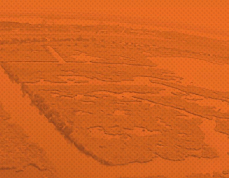
3 (USACE), other state and federal agencies, the larger scientific community and communities and businesses with a stake in the operation of diversions. The full report can be downloaded at They examined a variety of topics related to diversion operations, including: River Hydrodynamics and Sediment Loads Basin Geology and Land Building Water Quality Wetland Health Fish and Wildlife Communities, User Groups and Socio-Economic Effects Operation Strategies Governance, Legal and Stakeholder Involvement The working group used the Mid-Barataria Sediment Diversion as a case study to examine the above factors, with the assumption that a large-scale 50,000 to 75,000 cubic feet per second (cfs) diversion will be constructed into Barataria Basin. The working group selected the Mid-Barataria Sediment Diversion as a case study because it is furthest along in the Engineering & Design process. Location of the Mid-Barataria Sediment Diversion, a structure to deliver fresh water, sediment and nutrients into Barataria Basin. Page 2
4 OVERALL RECOMMENDATIONS 1. The primary goal of operating a sediment diversion should be to build and sustain land. 2. Secondary objectives should be developed in coordination with agencies and stakeholders to consider the needs of the ecosystem and the people who live and work in it. 3. Operations plans should be living documents with robust monitoring and adaptive management that improve over time based on continued learning and knowledge improvement and changing environmental conditions. 4. Operations plans should consider an array of key operations strategies (detailed below). RECOMMENDED KEY OPERATIONS STRATEGIES: 1. Initial operation strategies will differ from long-term operation strategies: a. Initial operation plans should include robust monitoring and flexibility to modify operations as the conditions in the basin change and adjust rapidly. Updates to the plan may be required more frequently based on an integrated and near real-time operations-monitoring feedback loop. b. A sediment diversion cannot be operated at full capacity on Day 1. Gradually opening the diversion over time (an estimated 5-10 years) will facilitate the development of a distributary channel network, reduce the risk of flooding to communities, limit erosion of adjacent marshes, reduce the shock to marsh plants and fish and wildlife species and allow them time to adjust and self-organize around the new conditions. c. To ensure that opening a diversion does not cause unnecessary plant stress and/or wetland loss, start operations during the non-growing season for the first 2-3 years to allow vegetation to adapt to the new conditions. 2. Use high river flows and sediment loads of the river strategically: a. Operation plans should be developed based on the water year (defined as October 1 through September 30). b. Sediment diversions should be operated on a pulse that mimics the natural flood cycle of the Mississippi River. c. Operations should take full advantage of winter flood peaks and operate as much as possible from November through February. d. The river can experience anywhere from one to more than four flood peaks in a given water year. Operations should take full advantage of the first peak of the water year as it carries the largest concentration of sediment. e. Operating a diversion during the rising limb and peak in river flow should be explored, especially in the spring and summer floods. Closing or reducing the flow on the falling limb of the flood peak will limit the duration and quantity of fresh water moving into the basin while maximizing sediment capture. f. Maintain flexibility to operate a diversion when the river is below 600,000 cfs, specifically to capture suspended sediment loads essential to sustaining marshes. Maintenance flows should be considered under an adaptive management plan for specific ecosystem conditions in the basin. These include the potential establishment of freshwater habitats at the outfall that could be damaged by saltwater intrusion, preventing an increase in oyster predation and disease, and preventing waterfowl and alligators from nesting in low-lying areas that will later be flooded during a flood peak. g. Maintain a minimum residual flow of approximately 300,000 cfs in the river to ensure continued navigation and community and industry use. Page 3
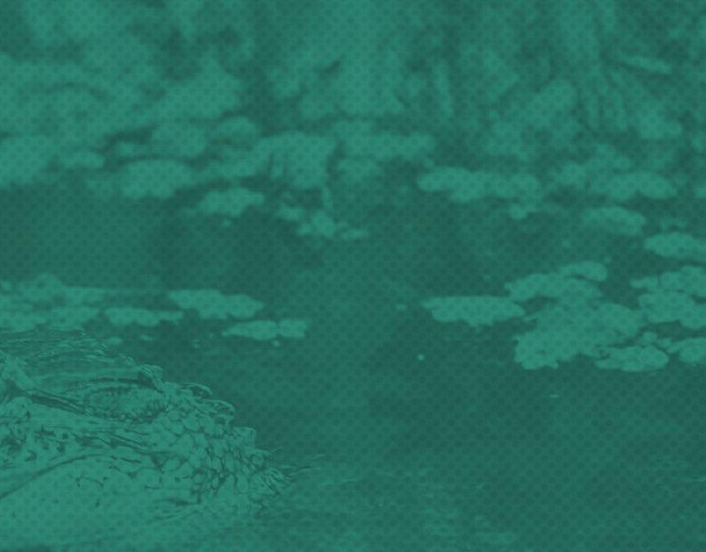
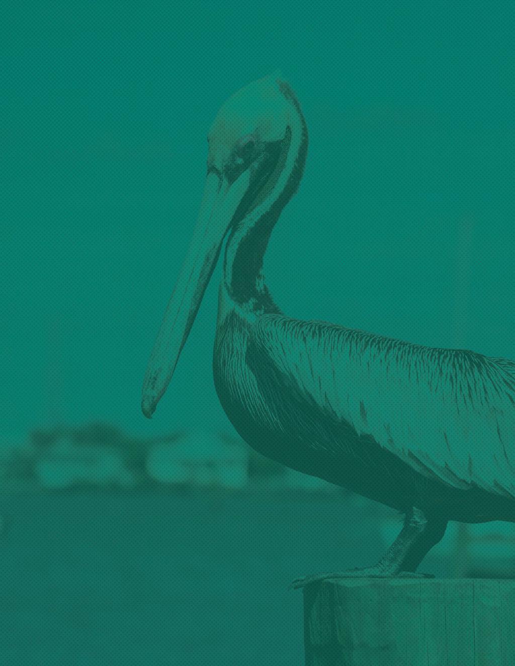
5 h. There are six typical flow patterns of the Mississippi River (termed hydrograph typologies) that vary in the number and timing of flood peaks. These typologies should be used to develop, test and communicate operation strategies. 3. Work with the geology of the receiving basin to build land: a. A sediment retention target area should be defined and a sediment retention rate should be set that maximizes retention based on basin geology and diversion location. b. CPRA should develop an outfall management plan for the diversion receiving basin to manage water flow and maximize sediment retention to meet the project and sediment retention goals. c. Landscape features or actions should be designed and built in the receiving basin to accelerate the land-building process by increasing the sediment retention rate in this specific area (Sediment Retention Enhancement Devices or SREDs). 4. Maintain and improve water quality and wetland health: a. To prevent nutrient-laden water from the river from becoming stagnant and creating favorable conditions for algal bloom formation,a diversion should be shut down gradually rather than abruptly. b. Winter operations of a diversion prior to the passage of a cold front can push nutrient-laden water onto the marsh surface, allowing wetland plants to use those nutrients for growth, also removing the nutrients from the water and increasing water quality. c. Any operations during the growing season should include adequate dry periods to allow vegetation to recover, and operations at the beginning of the growing season (April-May) should be monitored closely. d. Maintain as much intermediate and brackish marsh as possible to prevent episodic loss of freshwater vegetation that can occur from salinity spikes during droughts and to ensure wetlands are more resilient in the face of rising sea levels and increases in daily salinities. 5. Balance the needs of fish and wildlife species: a. Operations should focus on community abundance and productivity rather than an individual species, understanding that some species are going to be affected detrimentally with or without action. The benefits and adverse effects of a sediment diversion on indicator species are important for transparency and expectation management. b. Winter operations will reduce or eliminate affects on fish and wildlife species, especially during initial operations. Closing the diversion in March can facilitate the larval recruitment of blue crab and shrimp into Barataria Basin. c. Spring and summer operations require a more intricate and balanced operation strategy that considers the life cycle needs of indicator species, such as nesting season for alligators (once established), spawning of blue crab and oysters, brown shrimp larvae recruitment and birthing season for dolphins. 6. Analyze potential effects to communities and industries and clearly communicate them: a. Expedite studies on socio-economic effects and mitigation opportunities that will need to be considered when operating a diversion. b. Be transparent about potential effects, use two-way sharing of information and genuine attempts to mitigate socio-economic effects without compromising the effectiveness of the diversion is crucial. c. Begin two-way dialogue with individuals that could be affected by diversion operations. Negotiations should not occur over how to operate the diversion, instead on how to manage and deal with any predicted and unforeseen effects. Page 4
6 d. Visualizations and outreach materials should be developed to help communicate expectations to the public, the processes for building and sustaining land, as well as the positive and negative effects of sediment diversions. e. Once the diversion is operational, outreach tools and technologies (online webinars, easy-tounderstand real-time data, websites and interactive apps) should be used to inform the public when the diversion is operated and communicate basin conditions. 7. Monitor before and after construction, and make the data publicly available: a. Develop a robust, ongoing monitoring program to measure and understand conditions in the river and receiving basin before, during and after sediment diversion construction and operation. Monitoring should incorporate the entire area of interest to understand the full effects of the diversion, both near the diversion site and elsewhere in the basin. b. An active and robust adaptive management program with regular assessments and indicators of projects outcomes is essential to an effective operations plan. 8. Define a clear governance structure supported by federal, state and local government: a. Establish a formal governing structure to determine the roles and responsibilities of all parties and the decision-making process in diversion operations. b. Form advisory councils to provide formal input, and technical and scientific (including social sciences) committees should be formed to provide unbiased analysis of the monitoring data and recommend modifications to the operation plan or adaptive management strategies. By merging all of the recommendations above, an operation strategy can be developed and tested for each hydrograph typology (demonstrated here on a three-peak hydrograph typology) that effectively captures sediment for land building, while balancing the needs of the ecosystem and communities. For this example, the diversion operates throughout the winter flood peak, most of the late winter flood peak (closing by March to allow estuarine recovery), and closes after the peak of the spring flood, focusing on the rising limb of the flood to capture the most sediment and reduce effects to the ecosystem. Note: Although the diversion is depicted as completely opened or closed, each opening and closing could happen gradually over time. Page 5
7 NEXT STEPS The Working Group s hope is that the CPRA will take its recommendations into account and incorporate them into ongoing modeling and planning efforts as it advances proposed sediment diversions toward construction and upon operation of these diversions. The Working Group thinks these carefully researched and documented recommendations will maximize the tremendous land-building opportunity that exists through these restoration projects while minimizing unintended effects to Louisiana s abundant natural resources. OPERATIONS EXPERT WORKING GROUP MEMBERS Name Title Expertise Affiliation Dr. Rex Caffey and Director, Center for Natural Resource Economics & Policy Natural Resource Economics Dr. James Cowan Jr. Fisheries Dr. Dubravko Justic Oceanography Dr. Alex Kolker Associate Sedimentology LUMCON/Tulane Dr. Shirley Laska Social Sciences University of New Orleans Dr. Alex McCorquodale Hydrodynamics University of New Orleans Dr. Earl Melancon Jr. Emeritus/Sea Grant Scholar Oysters/Coastal Shellfish Nicholls State University/ Dr. John Andrew Nyman Wildlife and Fisheries Dr. Robert Twilley Executive Director, Louisiana Sea Grant College Program Estuarine Ecology Dr. Jenneke M. Visser Dr. John White James Wilkins, J.D. Associate and Associate Director, Institute for Coastal and Water Research, Louisiana Sea Grant College Program and Director, Sea Grant Law & Policy Program Vegetation Biogeochemistry Law/Policy University of Louisiana at Lafayette Page 6

8 Page 7 MississippiRiverDelta.org/DiversionOpsReport
Initial Application of a Landscape Evolution Model to a Louisiana Wetland
 Initial Application of a Landscape Evolution Model to a Louisiana Wetland by Carl F. Cerco PURPOSE: Corps planning projects encompass a wide variety of restoration goals. These include wetland restoration,
Diversions Update. committed to our coast. Bren Haase, CPRA. Presentation to Diversions Advisory Panel, Meeting #4 February 12, 2015
 Diversions Update Bren Haase, CPRA Presentation to Diversions Advisory Panel, Meeting #4 February 12, 2015 committed to our coast committed to our coast DIVERSIONS ADVISORY PANEL, DIVERSIONS SUB-COMMITTEE
USING STORMWATER DISCHARGES FOR LEVEE PROTECTION AND WETLANDS ENHANCEMENT IN THE BARATARIA-TERREBONNE ESTUARY, LOUISIANA
 Coasts at the Millennium Proceedings of the 17th International Conference of The Coastal Society, Portland, OR USA USING STORMWATER DISCHARGES FOR LEVEE PROTECTION AND WETLANDS ENHANCEMENT IN THE BARATARIA-TERREBONNE
The Importance of the Pearl River to Mississippi s Estuarine Habitats Jennifer Buchanan Education Coordinator
 The Importance of the Pearl River to Mississippi s Estuarine Habitats Jennifer Buchanan Education Coordinator 2006 Pearl River Basin Symposium May 5-6, 2006 Topics for Discussion What s an estuary? Pearl
Using Coastal Louisiana to Develop Hydrologic Web-based Learning Modules
 1 Using Coastal Louisiana to Develop Hydrologic Web-based Learning Modules Madeleine Bodin, Emad Habib Department of Civil Engineering University of Louisiana at Lafayette mcm9746@louisiana.edu Abstract
3 Objectives 3 Ob jec tives
 3 Objectives 3 Objectives 3 Objectives 3 Objectives contents Objective number Page 3.1 Ki uta ki tai: mountains to the sea O1-O5 37 3.2 Beneficial use and development O6-O13 38 3.3 Māori relationships
Chehalis Basin Strategy Programmatic SEPA Draft EIS
 Chehalis Basin Strategy Programmatic SEPA Draft EIS History of Flooding I-5 closed in 1990, 1996, 2007, 2009 Five largest flood events occurred since 1986 2 History of Habitat Degradation Harvest has been
US Army Corp of Engineers
 US Army Corp of Engineers Each year thousands of construction projects are undertaken in the United States that could potentially impact the nation s rivers, streams, wetlands and other aquatic resources.
Upper Mississippi River Conference 2016 Action Agenda: Raise the Grade
 Upper Mississippi River Conference 2016 Action Agenda: Raise the Grade December 16, 2016 On Oct. 13 14, 2016, a partnership of river stakeholders hosted the ninth annual Upper Mississippi River Conference,
Netley-Libau Nutrient-Bioenergy Project
 Netley-Libau Nutrient-Bioenergy Project Harvesting cattail provides a Lake Friendly biomass source for bioenergy production to displace fossil fuels and reduce greenhouse gas emissions Richard E. Grosshans,
South Atlantic Regional Plan
 South Atlantic Regional Plan Merryl Alber Christine Laporte Georgia Coastal Research Council Dept. of Marine Sciences Univ. of Georgia National Estuarine Eutrophication Assessment (1999) Numeric Change
Coastal Restoration and Protection Projects - SLFPA-East and Vicinity
 Coastal Restoration and Protection Projects - SLFPA-East and Vicinity committed to our coast committed to our coast 2012 Master Plan Project Details 2012 Master Plan Projects in SLFPA-East Projects in
Nitrogen Cycling, Primary Production, and Water Quality in the New River Estuary. Defense Coastal/Estuarine Research Program (DCERP)
") Nitrogen Cycling, Primary Production, and Water Quality in the New River Estuary Defense Coastal/Estuarine Research Program (DCERP) Introduction: A key theme of the ongoing DCERP program is monitoring
Nitrogen Cycling, Primary Production, and Water Quality in the New River Estuary Defense Coastal/Estuarine Research Program (DCERP) Introduction: A key theme of the ongoing DCERP program is monitoring
Criteria for Identifying and Prioritizing Habitat Protection and Restoration Projects on the Lower Columbia River and Estuary*
 Criteria for Identifying and Prioritizing Habitat Protection and Restoration Projects on the Lower Columbia River and Estuary* Ecosystem Criteria 1) Habitat Connectivity (0-10 points) This criterion recognizes
SRCD s Review of Impacts the Proposed Bay Delta Conservation Plan (BDCP) and Companion EIR/EIS on the Suisun Marsh
 and Companion EIR/EIS on the Suisun Marsh") SRCD s Review of Impacts the Proposed Bay Delta Conservation Plan (BDCP) and Companion EIR/EIS on the Suisun Marsh By Steve Chappell, Executive Director Suisun RCD BDCP Document is Extremely Challenging
SRCD s Review of Impacts the Proposed Bay Delta Conservation Plan (BDCP) and Companion EIR/EIS on the Suisun Marsh By Steve Chappell, Executive Director Suisun RCD BDCP Document is Extremely Challenging
Annual Update. Large-Scale Oyster Restoration in Support of the Chesapeake Bay Agreement Oyster Goal. Stephanie Reynolds Westby, NOAA
 Annual Update Large-Scale Oyster Restoration in Support of the Chesapeake Bay Agreement Oyster Goal Stephanie Reynolds Westby, NOAA Susan Conner, USACE- Norfolk District Policy Drivers Executive Order
Hydrologic and Ecologic Impacts from the CERP Indian River Lagoon South Project
 Hydrologic and Ecologic Impacts from the CERP Indian River Lagoon South Project Dr. Gretchen Ehlinger Senior Biologist US Army Corps of Engineers Jacksonville District November 15, 2016 AWRA Conference
Estuary Adventures. Background. Objective
 Estuary Adventures Objective Students will work in groups to understand the concept of estuaries, their importance, and the role that density plays in the mixing of fresh and salt water. Students will
Executive Summary Page
 (*NEPA Required) The 2013 Southwest Coastal Louisiana Draft Integrated Feasibility Report and Programmatic Impact Statement ( 2013 Initial Draft Report ) identified a Tentatively Selected Plan (TSP) for
From the thousands of miles of coastal shoreline
 Water Resources VALUE OF OUR NATION S WATER RESOURCES From the thousands of miles of coastal shoreline and rivers to the lakes and wetlands that dot our nation s landscape, America is fortunate to have
Kristy A. Lewis Curriculum Vitae
 Kristy A. Lewis Curriculum Vitae EDUCATION 2014 Ph.D. Department of Oceanography and Coastal Sciences Louisiana State University, Baton Rouge, LA Official Departmental Minor: Experimental Statistics 2008
U.S. Army Corps of Engineers Reservoir Operations Maria Placht, Institute for Water Resources, USACE 49
 U.S. Army Corps of Engineers Reservoir Operations Maria Placht, Institute for Water Resources, USACE 49 Context The U.S. Army Corps of Engineers (the Corps) is responsible for a variety of water resourcerelated
CALFED Ecosystem Restoration Program (ERP)
") CALFED Ecosystem Restoration Program (ERP) The goal of the Ecosystem Restoration Program is to improve and increase aquatic and terrestrial habitats and improve ecological functions in the Bay-Delta to
CALFED Ecosystem Restoration Program (ERP) The goal of the Ecosystem Restoration Program is to improve and increase aquatic and terrestrial habitats and improve ecological functions in the Bay-Delta to
A DUTCH PERSPECTIVE ON COASTAL LOUISIANA FLOOD RISK REDUCTION AND LANDSCAPE STABILIZATION. Final Report
 A DUTCH PERSPECTIVE ON COASTAL LOUISIANA FLOOD RISK REDUCTION AND LANDSCAPE STABILIZATION Final Report Prepared for: United States Army EUROPEAN RESEARCH OFFICE OF THE U.S. ARMY London, England A DUTCH
A PILOT STUDY FOR ASSESSING FRESHWATER FLOW IMPACTS TO LOUISIANA ESTUARIES
 A PILOT STUDY FOR ASSESSING FRESHWATER FLOW IMPACTS TO LOUISIANA ESTUARIES Ryan Clark, Melissa Baustian, Eric White, Yushi Wang, Andrea Jerabek, and Harris Bienn Louisiana Water Conference March 27, 2018
South Bay Salt Pond Restoration Project Long-Term Restoration Planning
 South Bay Salt Pond Restoration Project Long-Term Restoration Planning State Coastal Conservancy, California Department of Fish and Game, and U.S. Fish and Wildlife Service Response to Summary of Recommendations
The Council Study. Sustainable Management and Development of the Mekong River Including Impacts of Mainstream Hydropower Projects
 The Council Study Sustainable Management and Development of the Mekong River Including Impacts of Mainstream Hydropower Projects Henry Manguerra, Ph.D., P.E. Study Coordinator, MRCS 4 th BDP Forum on the
SUPERSEDED. BDCP Conservation Measure 1: Water Facilities and Operation. BDCP Bay Delta Conservation Plan
 BDCP Bay Delta Conservation Plan March 2013 BDCP Conservation Measure 1: Water Facilities and Operation A cornerstone of the Bay Delta Conservation Plan (BDCP) strategy is to construct and operate a dual-conveyance
CHESAPEAKE BAY COMPREHENSIVE WATER RESOURCES AND RESTORATION PLAN. Habitat GIT Meeting 9 May 2017
 CHESAPEAKE BAY COMPREHENSIVE WATER RESOURCES AND 255 255 255 237 237 237 0 0 0 217 217 217 163 163 163 200 200 200 131 132 122 239 65 53 80 119 27 RESTORATION PLAN 110 135 120 252 174.59 112 92 56 62 102
Flow-ecology relationships. Flow-ecology relationships Susitna case study
 Flow-ecology relationships Flow-ecology relationships Susitna case study Flow regime Ecologically-Relevant Flow Regime Characteristics Seasonal or typical conditions Annual extreme conditions High and
Dead-Zones and Coastal Eutrophication: Case- Study of Chesapeake Bay W. M. Kemp University of Maryland CES Horn Point Laboratory Cambridge, MD
 Dead-Zones and Coastal Eutrophication: Case- Study of Chesapeake Bay W. M. Kemp University of Maryland CES Horn Point Laboratory Cambridge, MD Presentation to COSEE Trends Orientation at UMCES HPL 4 August
Environmental Benefits and Performance Measures: Defining National Ecosystem Restoration and how to measure its achievement.
 Environmental Benefits and Performance Measures: Defining National Ecosystem Restoration and how to measure its achievement. A Discussion Paper Adopted by the Chief of Engineers Environmental Advisory
Lower Columbia River Pile Dike Assessment
 Lower Columbia River Pile Dike Assessment David Gorman, PE August 2, 2011 Credits Hans R. Moritz, US Army Corps of Engineers Portland District Carl Kassebaum, AECOM Project Manager AECOM Coastal and Rivers
Fort Clatsop Restoration Project Summary Report
 Fort Clatsop Restoration Project Summary Report Report written by the Columbia River Estuary Study Taskforce October, 2007 Figure 1: Site Map Fort Clatsop Estuarine Restoration Project Columbia River Estuary
U.S. Army Corps of Engineers Mobile District
 U.S. Army Corps of Engineers Mobile District General Permit for Living Shorelines in Alabama Sandy P. Gibson Regulatory Specialist, Coastal Alabama Regulatory Division, Mobile District US Army Corps of
Sustainable Development 6 and Ecosystem Services
 Sustainable Development 6 and Ecosystem Services 6 28 On Target for People and Planet: Setting and Achieving Water-related Sustainable Development Goals Sustainable Development and Ecosystem Services Lead
The Chesapeake Bay Blueprint:
 PHASE II The Chesapeake Bay Blueprint: THE BEST HOPE FOR RESTORING CLEAN WATER THIS NATION HAS EVER SEEN Peter McGowan/U.S. Fish and Wildlife Service Strategic Plan 2016-2020 The Chesapeake Bay Foundation
Climate-Informed Water Resources in the Southeast United States. Rachel M. Gregg June 2015
 Climate-Informed Water Resources in the Southeast United States Rachel M. Gregg June 2015 Responding to Climate Change Mitigation is what we do to decrease the potential of climate change itself. Adaptation
A Salt Marsh Advancement Zone Assessment of West Haven, Connecticut
 A Salt Marsh Advancement Zone Assessment of West Haven, Connecticut Front cover image: Open space and unprotected parcels critical to the conservation of marsh advancement corridors in West Haven; from
Atlantic Coast of New York East Rockaway Inlet to Rockaway Inlet and Jamaica Bay, NY
 Atlantic Coast of New York East Rockaway Inlet to Rockaway Inlet and Jamaica Bay, NY Draft Reformulation Public Information October 2016 US Army Corps of Engineers Presentation Outline Project Overview
A PROPOSED COAST-WIDE REFERENCE MONITORING SYSTEM FOR EVALUATING WETLAND RESTORATION TRAJECTORIES IN LOUISIANA
 A PROPOSED COAST-WIDE REFERENCE MONITORING SYSTEM FOR EVALUATING WETLAND RESTORATION TRAJECTORIES IN LOUISIANA GREGORY D. STEYER 1*, CHARLES E. SASSER 2, JENNEKE M. VISSER 2 ERICK M. SWENSON 2, JOHN A.
Coastal and Hydraulics Laboratory. US Army Engineer R&D Center
 Coastal and Hydraulics Laboratory Coastal and Hydraulics Laboratory US Army Engineer R&D Center Mission To deliver solutions to our Nation s most challenging water resources problems through research,
Biscayne Bay. A Jewel in Jeopardy? Stephen Blair 1 and Sarah Bellmund 2
 Biscayne Bay A Jewel in Jeopardy? Stephen Blair 1 and Sarah Bellmund 2 1 Department of Regulatory and Economic Resources; Division of Environmental Resources Management (DERM), Miami, FL 2 National Park
Gas Guzzlers. Biological Pump
 Gas Guzzlers Biological Pump Aquatic Biodiversity Chapter 8 Coral Reefs Open Ocean Deep Sea Marine equivalent of tropical rain forests Habitats for one-fourth of all marine species Coral polyps, which
Maria W. Merrill Florida Fish and Wildlife Conservation Commission Aquatic Habitat Conservation and Restoration Section April 12, 2013
 Maria W. Merrill Florida Fish and Wildlife Conservation Commission Aquatic Habitat Conservation and Restoration Section April 12, 2013 Focus Region 16 Coastal counties from Perdido Key east to Anclote
Gulf Coast Ecosystem Restoration Science, Observation, Monitoring, and Technology Program. NOAA RESTORE Act Science Program Science Plan
 Gulf Coast Ecosystem Restoration Science, Observation, Monitoring, and Technology Program NOAA RESTORE Act Science Program Science Plan 2 NOAA RESTORE Act Science Program - Science Plan Table of Contents
Harte Research Institute for Gulf of Mexico Studies
 Harte Research Institute for Gulf of Mexico Studies Gulf of Mexico Ecosystem Services Workshop David W. Yoskowitz, Cristina Carollo, and Carlota Santos Harte Research Institute for Gulf of Mexico Studies
What Are Environmental (Instream) Flows?
 Flows?") 1 What Are Environmental (Instream) Flows? Sustainable water management requires that both human needs and the needs of aquatic and riparian ecosystems be fulfilled. Dams and diversion of water for municipal
1 What Are Environmental (Instream) Flows? Sustainable water management requires that both human needs and the needs of aquatic and riparian ecosystems be fulfilled. Dams and diversion of water for municipal
Environmentally friendly drainage measures The use of two-stage profiles to improve diversity and water quality in agricultural streams
 Environmentally friendly drainage measures The use of two-stage profiles to improve diversity and water quality in agricultural streams European River Restoration Conference 2014, Vienna 27.-29.10.2014,
The Currituck Sound Array: Introducing a new estuarine field site and test bed for Corps research. RSM Webinar, 18 February 2016
 The Currituck Sound Array: Introducing a new estuarine field site and test bed for Corps research. RSM Webinar, 18 February 2016 Heidi M. Wadman, Patrick J. Dickhudt U.S. Army Research and Development
Mark Twain Lake Water Control Manual Update
 Mark Twain Lake Water Control Manual Update Joan Stemler St. Louis District Water Control US Army Corps of Engineers WATER CONTOL PLAN Overall Objectives Project Purposes Flood Control Hydroelectric Power
TRANSBOUNDARY DIALOGUE
 Joint Actions, Joint Solutions TRANSBOUNDARY DIALOGUE under Mekong Integrated Water Resources Management Project Joint Actions, Joint Solutions Mekong Basin China Transboundary Projects Xe Bang Hieng and
IPCC WG II Chapter 3 Freshwater Resources and Their Management
 IPCC WG II Chapter 3 Freshwater Resources and Their Management Impacts increasingly harmful & more costly to adapt as global temperature increases May imperil sustainable development goals Semi-arid /
Long Island s. Environmental Issues. Environmental Issues. Environmental Setting. Environmental Setting. Suburbia and the Environment
 Environmental Issues Long Island s Environmental Issues Copyright 2011 AFG 1 agricultural land air pollution aquifers automobile barrier islands biozones fisheries groundwater recharge invasive species
Coast 2050: Toward a Sustainable Coastal Louisiana, The Appendices. Appendix F & Region 4 Supplemental Information
 Coast 2050: Toward a Sustainable Coastal Louisiana, The Appendices Appendix F & Region 4 Supplemental Information This document is one of three that outline a jointly developed, Federal/State/Local, plan
Sea Level Rise: Impacts, Adaptation and Information Gaps
 University of New Orleans ScholarWorks@UNO Coastal Resilience Workshop Coastal Resilience Workshop 2015 Oct 28th, 10:00 AM - 12:00 PM Sea Level Rise: Impacts, Adaptation and Information Gaps Jeffrey R.
Reorienting the Bureau of Reclamation
 Reorienting the Bureau of Reclamation Eric Meyer When considering restoration programs, The United States Bureau of Reclamation (USBR) is not a typical restoration agency. The USBR has existed for nearly
The Hypoxic Zone in the Gulf of Mexico
 The Hypoxic Zone in the Gulf of Mexico References Council Committee on Environmental and Natural Resources. 2003. An Assessment of Coastal Hypoxia and Eutrophication in U.S. Water. National Science and
LOUISIANA COOPERATIVE FISH AND WILDLIFE RESEARCH UNIT
 LOUISIANA COOPERATIVE FISH AND WILDLIFE RESEARCH UNIT School of Renewable Natural Resources, Louisiana State University Baton Rouge, Louisiana 70803-6202 Email: Cooperating Agencies: Sammy King (225) 578-4184
WONDERFUL, WATERFUL WETLANDS
 WONDERFUL, WATERFUL WETLANDS OBJECTIVES The student will do the following: 1. List characteristics of wetlands. SUBJECTS: Science, Language Arts TIME: 60 minutes 2. Describe the functions of a wetland.
An investment model for large-scale green
 Fargo, ND May 31 2007 An investment model for large-scale green infrastructure: re-mosaicking the prairies 3rd International Sustainable Wetland Plant Management Conference Henry David (Hank) Venema, PhD,
Project sponsors provided a brief presentation on their project(s), followed by comments from the Committee.
, followed by comments from the Committee.") WRIA 14 Salmon Habitat Recovery Committee Meeting April 17, 2014 Summary notes Project sponsors provided a brief presentation on their project(s), followed by comments from the Committee. Allyn Shoreline
WRIA 14 Salmon Habitat Recovery Committee Meeting April 17, 2014 Summary notes Project sponsors provided a brief presentation on their project(s), followed by comments from the Committee. Allyn Shoreline
OUR GOAL IS TO PREVENT SPILLS ENTIRELY
 OUR GOAL IS TO PREVENT SPILLS ENTIRELY OUR GOAL IS TO NEVER HAVE AN OIL SPILL, AND THE INDUSTRY TAKES EXTENSIVE PRECAUTIONS TO PREVENT SPILLS FROM OCCURRING. TOPICS FOR DISCUSSION WHAT ARE OUR PRIMARY
G.B. Sonny Hall, PhD. Veronika Thiebach
 G.B. Sonny Hall, PhD Technical Program Manager Veronika Thiebach Senior Assistant General Counsel St. Johns River Water Management District 1 SJRWMD MFLs Method MFLs Method Premises Case studies Lake Hiawassee
Climate Change Impacts in Washington State
 Climate Change Impacts in Washington State Lara Whitely Binder Climate Impacts Group College of the Environment University of Washington Evergreen College January 13, 2016 Climate Science in the Public
JUNE 20, Collaborative Initiatives: Restoring watersheds and large landscapes across boundaries through State and Federal partnerships
 TESTIMONY of LESLIE WELDON DEPUTY CHIEF, NATIONAL FOREST SYSTEM UNITED STATES DEPARTMENT OF AGRICULTURE FOREST SERVICE BEFORE THE SENATE COMMITTEE ON ENERGY AND NATURAL RESOURCES SUBCOMMITTEE ON PUBLIC
Fisheries and Aquaculture in a Changing Climate
 Fisheries and Aquaculture in a Changing Climate Climate change impacts such as more frequent and severe floods and droughts will affect the food and water security of many people. The impact of climate
Applying Ecosystem Services to Collaborative Forest Management Elk River Public Meeting
 Applying Ecosystem Services to Collaborative Forest Management Elk River Public Meeting Nikola Smith Ecologist and Ecosystem Services Specialist U.S. Forest Service Port Orford City Hall February 2, 2017
Climate Change and Chesapeake Bay Habitats
 Climate Change and Chesapeake Bay Habitats Donna Marie Bilkovic STAC Chesapeake Bay Forage Base Workshop 12 November 2014 http://www.chesapeake.org/stac/ Virginia Institute of Marine Science www.ccrm.vims.edu
The Next Generation of Mitigation: Linking Current and Future Mitigation Programs with State Wildlife Action Plans and Other State and Regional Plans
 : Linking Current and Future Mitigation Programs with State Wildlife Action Plans and Other State and Regional Plans August 4, 2009 Jessica B. Wilkinson, James M. McElfish, Jr., and Rebecca Kihslinger
CHESAPEAKE BAY COMPREHENSIVE WATER RESOURCES AND RESTORATION PLAN
 CHESAPEAKE BAY COMPREHENSIVE WATER RESOURCES AND 255 255 255 237 237 237 0 0 0 217 217 217 163 163 163 200 200 200 131 132 122 239 65 53 80 119 27 RESTORATION PLAN 110 135 120 252 174.59 112 92 56 62 102
Conservation and Management of the Waddensea
 Conservation and Management of the Waddensea Fred van der Vegte Europarc, Sept. 12, 2009 1 Kust - en Zeebescherming 2 4 IUCN WORLD HERITAGE NOMINATION THE WADDEN SEA (GERMANY/THE NETHERLANDS) Criterion
Ocean Water Buoyancy and Hypoxia in the Gulf of Mexico. Definitions. Hypoxia in the Headlines. Joe Smith. ExxonMobil Upstream Research Company
 Ocean Water Buoyancy and Hypoxia in the Gulf of Mexico Joe Smith ExxonMobil Upstream Research Company Joe Smith 2004 Hypoxia NOAA Coastal Data Development Center Definitions Hypoxia is a term meaning low
Climate Change, Marsh Erosion and the Chesapeake Bay TMDL
 Climate Change, Marsh Erosion and the Chesapeake Bay TMDL Rising sea level in Chesapeake Bay is inexorable. One environmental effect associated with sea level rise is marsh erosion. Marsh erosion can impact
Coastal studies in Long Term Ecological Research. Dan Reed Santa Barbara Coastal LTER
 Coastal studies in Long Term Ecological Research Dan Reed Santa Barbara Coastal LTER NSF s Long Term Ecological Research Program 24 sites representing a diverse array of biomes Major focus of research
Mississippi River/Gulf of Mexico Watershed Nutrient Task Force Timeline for Reassessment Revised 9/5/06. Revised 9/5/06. Symposia.
 Hypoxia in the Gulf of Mexico Extent of Hypoxia in the Gulf Reassessment of the Science & Revision of the Action Plan Frequency of Occurrence 1985-1999 Rabalais, et al. Summer Hypoxia Dissolved Oxygen
Environmental Flows: State of the Science and Principles of Bes Practice
 Environmental Flows: State of the Science and Principles of Bes Practice Insert Image Credit Mark Godfrey Brian Richter Co-Director, Global Freshwater Program Key Factors in River Ecosystem Health Connectivity
Developing Ecological Offsets for U.S. Shale Plays: Five Years of Learning(s)
") Developing Ecological Offsets for U.S. Shale Plays: Five Years of Learning(s) Russ Krauss Vice President, Marketing & Analysis Resource Environmental Solutions, LLC Seventh Environmental Issues and Solutions
Developing Ecological Offsets for U.S. Shale Plays: Five Years of Learning(s) Russ Krauss Vice President, Marketing & Analysis Resource Environmental Solutions, LLC Seventh Environmental Issues and Solutions
THE CORPS REGULATORY AUTHORITY
 Regulatory Branch THE CORPS REGULATORY AUTHORITY THE U.S. ARMY CORPS OF ENGINEERS REGULATORY AUTHORITY IS BASED UPON 1. SECTION 10 OF THE RIVERS AND HARBORS ACT OF 1899 (RHA) AND 2. SECTION 404 OF THE
POLICY FOR NATURAL RESOURCE MANAGEMENT AREAS
 POLICY FOR NATURAL RESOURCE MANAGEMENT AREAS I. POLICY STATEMENT Auburn University's (the University's) "Policy for Natural Resource Management Areas" implements the Campus Master Plan Land Use Element
Minnesota River Basin Interagency Study
 650 Minnesota River Basin Interagency Study Agencies collaborate for basin water quality and ecosystem restoration in Minnesota, Iowa, North Dakota, and South Dakota A multi-state effort is underway to
NOAA Chesapeake Bay Office Biennial Report to Congress Fiscal Years
 NOAA Chesapeake Bay Office Biennial Report to Congress Fiscal Years 2013 2014 A Few Highlights from the Biennium (2013 2014) 198. Acres of oyster reef in Virginia and Maryland tributaries restored by NOAA
Tim Hayden, Yurok Tribe Natural Resources Division Mat Millenbach, Western Rivers Conservancy Sarah Beesley, Yurok Tribal Fisheries Program
 BLUE CREEK FOREST SANCTUARY: RESTORING OLD GROWTH FOREST ECOSYSTEM FUNCTION, PROTECTING SALMON, WILDLIFE, AND TRADITIONAL- LIFE WAYS AND CULTURE IN THE FACE OF CLIMATE CHANGE Tim Hayden, Yurok Tribe Natural
South St. Vrain / Hall Meadows Restoration Planning August 20, 2015
 South St. Vrain / Hall Meadows Restoration Planning August 20, 2015 Agenda Introductions Purpose & Goals of Meeting Planning Area Master Plan Restoration Planning: Cost Estimates, Grants, Scope, Timeline
Overview - Institute for for Water Water Resources
 Overview - http://www.iwr.usace.army.mil/ Institute for for Water Water Resources Society of American Military Engineers (SAME) Critical Infrastructure Resiliency Seminar Marriah S. Abellera George W.
Municipal Stadium Wetland
 W A T E R S H E D F A C T S Total watershed area 140 mi 2 Average annual rainfall 38 in Average annual temperature 58 F Elevation Max 1321 ft Min 899 ft C. J. Brown Reservoir controls flow from 83 mi 2
Public Notice. Applicant: City of Dallas Project No.: SWF Date: April 18, Name: Chandler Peter Phone Number:
 Public Notice Applicant: City of Dallas Project No.: SWF- 2014-00151 Date: April 18, 2014 The purpose of this public notice is to inform you of a proposal for work in which you might be interested. It
Hudson Raritan Estuary Comprehensive Restoration Plan and Feasibility Study
 Restoring America s Estuaries 5 th National Conference on Coastal and Estuarine Habitat Restoration 16 November 2010 Hudson Raritan Estuary Comprehensive Restoration Plan and Feasibility Study Lisa Baron
Integrated Watershed Management Plan
 mighty peace watershed alliance Integrated Plan SUMMARY What is the Plan? The Mighty Peace Alliance (MPWA) supports the three goals of Alberta s Water for Life Strategy: safe secure drinking water, healthy
GRowing Outcomes in Watersheds (GROW) A home-grown ecological goods and services program for Manitoba
 A home-grown ecological goods and services program for Manitoba") GRowing Outcomes in Watersheds (GROW) A home-grown ecological goods and services program for Manitoba PUBLIC CONSULTATION DOCUMENT AUGUST 2017 MINISTERS MESSAGE Dear Manitobans, Manitoba s agriculture
GRowing Outcomes in Watersheds (GROW) A home-grown ecological goods and services program for Manitoba PUBLIC CONSULTATION DOCUMENT AUGUST 2017 MINISTERS MESSAGE Dear Manitobans, Manitoba s agriculture
(1)(A)Inventory of the following existing natural resources on the USFSP Campus or within the context area adjacent to the University.
(A)Inventory of the following existing natural resources on the USFSP Campus or within the context area adjacent to the University.") 13. 6C-21.208 CONSERVATION ELEMENT Information Sources George F. Young, Interview notes, June 2002 Sasaki Associates, Inc., interview notes, April, 2000 Interviews between DRMP Staff and USF Staff, May,
13. 6C-21.208 CONSERVATION ELEMENT Information Sources George F. Young, Interview notes, June 2002 Sasaki Associates, Inc., interview notes, April, 2000 Interviews between DRMP Staff and USF Staff, May,
OUR MISSION: To preserve, protect, and restore Delaware s Inland Bays the water that flows into them and the watershed around them.
 OUR MISSION: To preserve, protect, and restore Delaware s Inland Bays the water that flows into them and the watershed around them. OUR In 1988, the Delaware Inland Bays were declared an estuary of national
MISSOURI RIVER RECOVERY PROGRAM
 MISSOURI RIVER RECOVERY PROGRAM ACES Conference 6 December 2010 A Community on Ecosystem Services Conference Teresa Reinig, PMP, LG, LEG Implementation Program Manager Missouri River Recovery Program US
Waterfront Development in NYC
 1 Waterfront Development in NYC Improving Permitting Efficiency and Regulatory Predictability Venetia Lannon, Regional Director New York State Department of Environmental Conservation Region 2 January
Joint Public Notice. LOCATION: In Salmon Bay, Lake Washington Ship Canal, at Seattle, Washington.
 US Army Corps of Engineers Seattle District Joint Public Notice Application for a Department of the Army Permit and a Washington Department of Ecology Water Quality Certification and/or Coastal Zone Management
Causes of Gulf of Mexico Hypoxia
 Causes of Gulf of Mexico Hypoxia Nancy N. Rabalais 1 R. Eugene Turner 2 1 Louisiana Universities Marine Consortium 2 Louisiana State University Center for Sponsored Coastal Ocean Research, Coastal Ocean
Biodiversity. The UNIVERSITY of OKLAHOMA
 Biodiversity The UNIVERSITY of OKLAHOMA Authors Paul Sandifer, PhD Director, Center for Coastal Environmental and Human Health Lee Bundrick Graduate Assistant, Stacey Weinstock Graduate Assistant, Susan