Afternoon Lecture Outline. Northern Prairie Hydrology
|
|
|
- Reynard Logan
- 6 years ago
- Views:
Transcription
1 Afternoon Lecture Outline 1. Northern Prairies watershed hydrology 2. Solute mass balance in lakes and ponds 3. Simple mass balance simulation using MS Excel 4. Effects of sediment-water exchange on lake solute mass balance 5. Closing discussion Northern Prairie Hydrology Calgary St. Denis Northern Prairies Cold winter frozen soil Semi-arid climate Clay-rich glacial till Undulating landscape Internally drained basins These result in the unique seasonality of watershed hydrology. 1


2 Glaciated Landscape of Northern Prairies Clay-rich glacial tills are relatively impermeable. Numerous hydrologically closed depressions trap runoff water, forming northern prairie wetlands. # of Ponds and Ducks in Prairie Pothole Region US Fish and Wildlife Service / Canadian Wildlife Service Air-ground data from traditional survey strata ) pond, duck counts (x Mallard 8 Ponds Data by Bob Clark (Canadian Wildlife Service) 2
 1 5 Jan Feb Mar Apr May Jun Jul Aug Sep Oct Nov Dec Pcp., Strong Seasonality of Pond Water Level pond dept h (m) 1.5 1 1..5. 1994 1995 1996 1997 1998 1999 2 3")
3 Semi-Arid Climate of Calgary Potential evaporation (PE) exceeds precipitation PE = 8 mm/yr Precip. = 42 mm/yr snowmelt is primary source of water 15 precip.potential evap. PE (mm) 1 5 Jan Feb Mar Apr May Jun Jul Aug Sep Oct Nov Dec Pcp., Strong Seasonality of Pond Water Level pond dept h (m)
4 Water Balance of Seasonal Prairie Wetlands precipitation evapotranspiration groundwater exchange spring rise summer recession hydroperiod Spring Pond Depth (h ) in Wetland S19 What controls the amount of snowmelt runoff? Winter precipitation Pre-melt snow water equivalent (SWE) h (m) winter precip. (mm) 5 1 SWE (mm) Many factors affect snowmelt runoff. Implication on water level prediction using climate models? 4


5 Laud use in Northern Prairies Typical crop rotation wheat oil seed Photo: Bob Clark (Can. Wildlife Service) summer fallow dense nesting cover 15 1 Effects of Dense Nesting Cover S19 water depth (cm) Grassed in 1983 S van der Kamp et al. (23. Hydrol. Process., 17: 559) 5


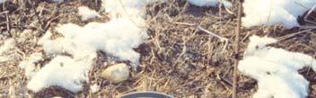
6 Spring of 1997, St. Denis S19 : surrounded by cultivated land S13: surrounded by dense nesting cover Measurements of Soil Infiltration Capacity Summer (unfrozen) Spring (frozen) 6


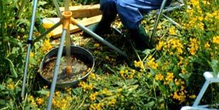
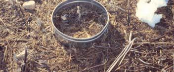
7 Infiltration Capacity of Top Soil Measured by single-ring infiltrometers Average, standard deviation (SD), and # of samples Grassed Cultivated t Avg. SD # Avg SD # Unfrozen Frozen unit : mm/hour Why do grassland soils have higher infiltration capacity? Wetland Drainage near Yorkton, Saskatchewan Implication on large-scale watershed hydrology? Photo by Rhonda McDougal (Ducks Unlimited Canada) 7
.5 1965 197 1975 198 1985 199 1995 2 25 1.5 S19 1.")
8 St. Denis National Wildlife Area 2 m S5 S19 Photo: Canadian Wildlife Service (CWS) S5 appears more permanent. Why? S5 1 water depth (m) S Data by Garth van der Kamp (Environment Canada) 8
9 Hydraulic Conductivity of Glacial Till depth (m) conductivity (m yr -1 ) weathered till sand unweathered till 2 25 soil core piezometer Deep, long-range groundwater flow is a minor component of water balance. Shallow groundwater is important. van der Kamp and Hayashi (29. Hydrogeology J., Eco-hydrology special issue, in press) Effects of Riparian Vegetation For smaller ponds with larger ratio of perimeter to area, riparian plants have a major effect on water balance. rate (mm d -1 ) Water level recession in prairie wetlands near Saskatoon, SK. Miller (1971. J. Hydrol., 14: 259) 15 1 area perimeter recession 5 pond diameter 1 m 3 m.1.2 perimeter / area (m -1 ) 9
10 Hypothetical Water Balance Simulation Assume a 1 m wide tree band around the wetland, taking up water at the same rate as pond evaporation. Pcp.: 1994 data, 27 mm in summer (Apr. Oct.) Evp.: Average year, 6 mm in summer Initial pond depth =.8 m, typical value in St. Denis Initial pond area = A small (S19) large (S5) A = 24 m 2 A = 3 m 2 Water Balance Simulation of S19 and S5 Small wetland dries out, but large wetland keeps water..8 pond depth (m).6 large wetland.4.2 small wetland 4/15 5/15 6/15 7/15 8/15 9/15 1/15 1

. Active exchange with the riparian zone.")

11 Groundwater Exchange and Landscape Setting High K recharge flow through discharge low K inter-till aquifer van der Kamp and Hayashi (29. Hydrogeology J., in press) The regional water table gradient is from high to low. Contrast in hydraulic conductivity (K). Active exchange with the riparian zone. Deep flow is in active, due to low K of deep till. Sand lenses in the till form an inter-till aquifer. Wetland S5 Discharge wetland: Salt accumulation underneath. Wetland S19 Recharge wetland: Salts leached out and transported to uplands. 11
12 Lake Solute Mass Balance Equation Solute mass balance is similar to water balance. Each term is multiplied by the concentration. For example; C P (kg m -3 ) Pcp (m 3 d -1 ) = mass flux (kg d -1 ) in precip. C (kg m -3 ) V (m 3 ) = total t mass (kg) in the lake. Mass balance equation is: [C P Pcp + C IS I S + C IG I G - C(O S + O G ) + R XN ] Δt = Δ(CV) C: Concentration in lake (kg m -3 ) R XN : Reaction rate (kg d -1 ) C IS I S C P Pcp CO S C IG I G CO G Solute Mass Balance [C P Pcp + C IS I S + C IG I G - C(O S + O G ) + R XN ] Δt = Δ(CV) The concentration of outflow terms is equal to C. What is the underlying assumption? Why is ET not in the equation? Reaction term (R XN ) represents all other processes. What are those? - Dissolution/precipitation of minerals - Biological production (e.g. CO 2 2) and uptake (e.g. N and P) - Atmospheric exchange - Diffusive exchange with the sediment 12
13 Dissolved Mass in the Pond in S19 For each species, CV is the total mass dissolved in pond water. Dividing it by the initial value measured on Apr. 12, CV/(C V ) is used to compare the relative behaviours of individual species. Chloride (Cl) is considered non-reactive. How do other species behave? Why? 3 2 / (C V ) alkalinity Cl SO 4 CV Apr. May Jun. Jul. Aug. Sep. Oct. Heagle et al. (27, Wetlands, 27: ) Hypothetical Mass Balance Simulation Based on S5 in St. Denis and Saskatoon Climate 2 th (cm) pond dept
14 See the handout for step-by-step instructions. Water and Mass Balance Simulation Results Cl conc. (g m -3 ) water de epth (m)
15 Water and Mass Balance Simulation Results water de epth (m) m -3 ) Cl conc. (g simulated observed Pond Volume and Chloride Mass Simulated volume matches reasonably with the observed. Major discrepancy between simulated and observed mass. pond volume (m 3 ) 3 volume sim. volume obs. 25 mass sim. 2 mass obs to otal Cl mass (kg)

16 Electrical Resistivity Imaging (ERI) current injection A M N B - Electrical resistance is dependent on salinity - High salinity low resistivity Salinity Distribution under S5 by ERI This figure shows sulfate, but chloride distribution is similar. A very large mass of chloride reserve exists under S5. Salinity in pond water correlates poorly with salinity in sediment pore water. In pond water, SO 4 < 6 g L -1 What does this mean? Sulfate (g L -1 ) Elevation Distance (m) Dru Heagle (Ph.D. thesis) Distance (m) 16
Salt Dynamics in prairie wetlands under changing climate
 Salt Dynamics in prairie wetlands under changing climate Uri Nachshon Andrew Ireson Garth van der Kamp Howard Wheater Ryan Davies GIWS, University of Saskatchewan GIWS, University of Saskatchewan Environment
M.L. Kavvas, Z. Q. Chen, M. Anderson, L. Liang, N. Ohara Hydrologic Research Laboratory, Civil and Environmental Engineering, UC Davis
 Assessment of the Restoration Activities on Water Balance and Water Quality at Last Chance Creek Watershed Using Watershed Environmental Hydrology (WEHY) Model M.L. Kavvas, Z. Q. Chen, M. Anderson, L.
Information Request 11
 Information Request 11 Information Request 11 11-1 Responses to Information Request 11 Response to Information Request 11a Response to Information Request 11b 11-2 11-6 Federal Review Panel Information
Coupling Transport and Transformation Model with Land Surface Scheme SABAE- HW: Application to the Canadian Prairies
 HW-1 Coupling Transport and Transformation Model with Land Surface Scheme SABAE- HW: Application to the Canadian Prairies Allan D. Woodbury, Alireza Hejazi Department of Civil Engineering University of
Lecture 9A: Drainage Basins
 GEOG415 Lecture 9A: Drainage Basins 9-1 Drainage basin (watershed, catchment) -Drains surfacewater to a common outlet Drainage divide - how is it defined? Scale effects? - Represents a hydrologic cycle
Quantification of lake water level influences for Wawasee and Syracuse lakes: Lake and watershed water budgets for 2011, 2012, and 2013
 Quantification of lake water level influences for Wawasee and Syracuse lakes: Lake and watershed water budgets for 2011, 2012, and 2013 Nathan S. Bosch, Joellyn Moine, Margaret Lee, Anna Burke Center for
Climate Change & Urbanization Have Changed River Flows in Ontario
 Climate Change & Urbanization Have Changed River Flows in Ontario by Trevor Dickinson & Ramesh Rudra Water Resources Engineering University of Guelph Acknowledgements Agencies NSERC, OMAF & Environment
Soil Temperature Damping Depth in Boreal Plain Forest Stands and Clear Cuts: Comparison of Measured Depths versus Predicted based upon SWAT Algorithms
 Soil Temperature Damping Depth in Boreal Plain Forest Stands and Clear Cuts: Comparison of Measured Depths versus Predicted based upon SWAT Algorithms G. Putz and B.M. Watson Civil & Geological Engineering,
Hydrologic Analysis Techniques ( 87 Manual Hydrology Tools )
") Hydrologic Analysis Techniques ( 87 Manual Hydrology Tools ) Objectives Know which wetland applies to which technique Define the Wetland Water Budget Locate data Understand the time step Understand Limitations
Hydrologic Analysis Techniques ( 87 Manual Hydrology Tools ) Objectives Know which wetland applies to which technique Define the Wetland Water Budget Locate data Understand the time step Understand Limitations
Water Resources on PEI: an overview and brief discussion of challenges
 Water Resources on PEI: an overview and brief discussion of challenges Components: Components and links Atmospheric water Surface water (including glacial water) Groundwater Links: Precipitation (atm(
New Practices for Nutrient Reduction: STRIPs and Saturated Buffers. Matthew Helmers and Tom Isenhart Iowa State University
 New Practices for Nutrient Reduction: STRIPs and Saturated Buffers Matthew Helmers and Tom Isenhart Iowa State University Situation Increasing concern for local and regional waters Substantial demand for
Modeling Your Water Balance
 Modeling Your Water Balance Purpose To model a soil s water storage over a year Overview Students create a physical model illustrating the soil water balance using glasses to represent the soil column.
Joint Research Centre (JRC)
") Joint Research Centre (JRC) Marco Pastori and Faycal Bouraoui IES - Institute for Environment and Sustainability Ispra - Italy http://ies.jrc.ec.europa.eu/ http://www.jrc.ec.europa.eu/ CONTENT Introduction
Joint Research Centre (JRC) Marco Pastori and Faycal Bouraoui IES - Institute for Environment and Sustainability Ispra - Italy http://ies.jrc.ec.europa.eu/ http://www.jrc.ec.europa.eu/ CONTENT Introduction
The Impacts of Climate Change on Portland s Water Supply
 The Impacts of Climate Change on Portland s Water Supply Richard Palmer and Margaret Hahn University of Washington Department of Civil and Environmental Engineering Joe Dvorak, Dennis Kessler, Azad Mohammadi
Prediction of snowmelt derived streamflow in a wetland dominated prairie basin
 doi:10.5194/hess-14-1-2010 Author(s) 2010. CC Attribution 3.0 License. Hydrology and Earth System Sciences Prediction of snowmelt derived streamflow in a wetland dominated prairie basin X. Fang, J. W.
SALTON SEA SOLAR PONDS PILOT PROJECT
 SALTON SEA SOLAR PONDS PILOT PROJECT Agrarian Research 162 East Line Street Suite E Bishop, CA 93514 Under contract to: Goal of Salinity Management Stabilize (or reduce slightly) the salinity of the Salton
Uncertainty in hydrologic impacts of climate change: A California case study
 Uncertainty in hydrologic impacts of climate change: A California case study Ed Maurer Civil Engineering Dept. Santa Clara University Photos from USGS Motivating Questions What are potential impacts of
Prairie Hydrological Model Study Final Report
 Prairie Hydrological Model Study Final Report Centre for Hydrology Report No. 7 John Pomeroy, Xing Fang, Cherie Westbrook, Adam Minke, Xulin Guo, and Tom Brown Centre for Hydrology University of Saskatchewan
East Maui Watershed Partnership Adapted from Utah State University and University of Wisconsin Ground Water Project Ages 7 th -Adult
 INTRODUCTION What is groundwater? Water contained in saturated soil and rock materials below the surface of the earth. It is not NEW water, but is recycled water through the hydraulic cycle. The source
Lecture 19. Landfill hydrology
 Lecture 19 Landfill hydrology Landfill hydrology Water Pathways Rainfall/Snowfall Transpiration Snow Evaporation Interception Interception Evaporation Runoff Snow Melt Snow Accumulation Plant Growth Infiltration
Fertility management in organic strawberries
 Fertility management in organic strawberries Organic P management : P in composted manure is at least 70% as available as synthetic P fertilizer Using composted manure for N availability often results
Pete Fandel Illinois Central College llinois Council on Best Management Practices
 Pete Fandel Illinois Central College llinois Council on Best Management Practices July 2013 Hypoxic Zone Mississippi River Watershed Nitrogen N Sales in 2012 was 2,293,812,952 pounds Target Reduction
Planning Beyond the Supply/Demand Gap: Water Supply Vulnerabilities in New Mexico Presented by NM Universities Working Group on Drought
 Planning Beyond the Supply/Demand Gap: Water Supply Vulnerabilities in New Mexico Presented by NM Universities Working Group on Drought 1 Janie Chermak, David Gutzler, Peggy Johnson, J. Phillip King, Lee
Leila Talebi and Robert Pitt. Department of Civil, Construction, and Environmental Engineering, The University of Alabama, P.O. Box , Tuscaloosa
 Leila Talebi and Robert Pitt Department of Civil, Construction, and Environmental Engineering, The University of Alabama, P.O. Box 870205, Tuscaloosa May 2012 Global consumption of water increases every
12/28/2016. Air. Surface Water. Ground Water. Soil. 1. Calculate agronomic rate. 2. Identify optimal fields. 3. Determine when to apply
 Air Ground Surface Nichole Embertson, Ph.D. Management Specialist Whatcom Conservation District Far West Agribusiness Kennewick, WA December 13, 2016 Soil Manure Agronomics & Balance Soil s in grain, forage
Eco-hydrological assessment of German lowland catchments experiences and challenges- N. Fohrer, B. Schmalz, G. HörmannH
 Eco-hydrological assessment of German lowland catchments experiences and challenges- N., B. Schmalz, G. HörmannH Dep. Hydrology & Water Resources Management Ecology Centre, CAU Kiel 1 Landscape processes
Crop Water Requirement. Presented by: Felix Jaria:
 Crop Water Requirement Presented by: Felix Jaria: Presentation outline Crop water requirement Irrigation Water requirement Eto Penman Monteith Etcrop Kc factor Ks Factor Total Available water Readily available
United Water Conservation District November 2016 Hydrologic Conditions Report 2017 Water Year. December 6, 2016
 United Water Conservation District November 216 Hydrologic Conditions Report 217 Water Year December 6, 216 Page Intentionally Left Blank PRECIPITATION (INCHES) PRECIPITATION (INCHES) PRECIPITATION (INCHES)
Application of a Basin Scale Hydrological Model for Characterizing flow and Drought Trend
 Application of a Basin Scale Hydrological Model for Characterizing flow and Drought Trend 20 July 2012 International SWAT conference, Delhi INDIA TIPAPORN HOMDEE 1 Ph.D candidate Prof. KOBKIAT PONGPUT
Green Infrastructure BMPs. Hydrologic Performance Small Storms
 Green Infrastructure BMPs Hydrologic Performance Small Storms Clay Emerson, Ph.D. Princeton Hydro Robert G. Traver, Ph.D., PE Department of Civil and Environmental Engineering Villanova University Director,
The Hydrological and Ecological Impacts of Climate Change in a Large Lake Case Study of Lake Saimaa, Finnish Lake District
 Waterpraxis The Hydrological and Ecological Impacts of Climate Change in a Large Lake Case Study of Lake Saimaa, Finnish Lake District Seppo Hellsten Finnish Environment Institute SYKE 19/01/2011-1 Main
Electric Forward Market Report
 Mar-01 Mar-02 Jun-02 Sep-02 Dec-02 Mar-03 Jun-03 Sep-03 Dec-03 Mar-04 Jun-04 Sep-04 Dec-04 Mar-05 May-05 Aug-05 Nov-05 Feb-06 Jun-06 Sep-06 Dec-06 Mar-07 Jun-07 Sep-07 Dec-07 Apr-08 Jun-08 Sep-08 Dec-08
Integrated Watershed Management Plan
 mighty peace watershed alliance Integrated Plan SUMMARY What is the Plan? The Mighty Peace Alliance (MPWA) supports the three goals of Alberta s Water for Life Strategy: safe secure drinking water, healthy
Utilization of the SWAT Model and Remote Sensing to Demonstrate the Effects of Shrub Encroachment on a Small Watershed
 Utilization of the SWAT Model and Remote Sensing to Demonstrate the Effects of Shrub Encroachment on a Small Watershed Jason Afinowicz Department of Biological and Agricultural Engineering Texas A&M University
Preserving Lake Kinneret (Sea of Galilee, Israel) as a strategic water resource in a changing climate
 as a strategic water resource in a changing climate") Preserving Lake Kinneret (Sea of Galilee, Israel) as a strategic water resource in a changing climate Dr. Doron Markel Water Authority of Israel doronm10@water.gov.il Acknowledgment: Prof. Sharon Megdal
Preserving Lake Kinneret (Sea of Galilee, Israel) as a strategic water resource in a changing climate Dr. Doron Markel Water Authority of Israel doronm10@water.gov.il Acknowledgment: Prof. Sharon Megdal
An investment model for large-scale green
 Fargo, ND May 31 2007 An investment model for large-scale green infrastructure: re-mosaicking the prairies 3rd International Sustainable Wetland Plant Management Conference Henry David (Hank) Venema, PhD,
Wetlands in Alberta: Challenges and Opportunities. David Locky, PhD, PWS, PBiol Grant MacEwan University
 Wetlands in Alberta: Challenges and Opportunities David Locky, PhD, PWS, PBiol Grant MacEwan University Overview What & Where Function & Value Alberta s Keystone Ecosystem Losses & Impacts Restoration
Hydrologic Modeling with the Distributed-Hydrology- Soils- Vegetation Model (DHSVM)
") Hydrologic Modeling with the Distributed-Hydrology- Soils- Vegetation Model (DHSVM) DHSVM was developed by researchers at the University of Washington and the Pacific Northwest National Lab 200 Simulated
Hydrologic Modeling with the Distributed-Hydrology- Soils- Vegetation Model (DHSVM) DHSVM was developed by researchers at the University of Washington and the Pacific Northwest National Lab 200 Simulated
Groundwater, Mining and Sustainability in the Tropics :
 Dr Gavin M Mudd Environmental Engineering Groundwater, Mining and Sustainability in the Tropics : Some Research Case Studies PECC Bora Bora Water Resources Seminar 13 November 2007 iswr.eng.monash.edu.au
Rainwater Management. Dr. Iftikhar Ahmad. College of Earth and. University of The Punjab Lahore
 Rainwater Management in Major Cities of Punjab Dr. Iftikhar Ahmad College of Earth and Environmental Sciences. University of The Punjab Lahore Need For Rainfall Harvesting in Urban Areas of Punjab Groundwater
Overview of the Surface Hydrology of Hawai i Watersheds. Ali Fares Associate Professor of Hydrology NREM-CTAHR
 Overview of the Surface Hydrology of Hawai i Watersheds Ali Fares Associate Professor of Hydrology NREM-CTAHR 5/23/2008 Watershed Hydrology Lab 1 What is Hydrology? Hydrology is the water science that
CHAPTER FIVE Runoff. Engineering Hydrology (ECIV 4323) Instructors: Dr. Yunes Mogheir Dr. Ramadan Al Khatib. Overland flow interflow
 Instructors: Dr. Yunes Mogheir Dr. Ramadan Al Khatib. Overland flow interflow") Engineering Hydrology (ECIV 4323) CHAPTER FIVE Runoff Instructors: Dr. Yunes Mogheir Dr. Ramadan Al Khatib Overland flow interflow Base flow Saturated overland flow ١ ٢ 5.1 Introduction To Runoff Runoff
Engineering Hydrology (ECIV 4323) CHAPTER FIVE Runoff Instructors: Dr. Yunes Mogheir Dr. Ramadan Al Khatib Overland flow interflow Base flow Saturated overland flow ١ ٢ 5.1 Introduction To Runoff Runoff
Hood River Water Conservation Strategy: achieving long-term water resource reliability for agriculture & local fish populations
 Hood River Water Conservation Strategy: achieving long-term water resource reliability for agriculture & local fish populations Cindy Thieman Hood River Watershed Group Ed Salminen & Niklas Christensen
NRCS s Soil Health Initiative and its Relationship to Water Quality
 NRCS s Soil Health Initiative and its Relationship to Water Quality Kip Potter, NRCS, Vermont United States Department of Agriculture is an equal opportunity provider and employer. The NRCS Soil Health
NJF Report Vol. 2 No
 NJF Report Vol. 2 No 5 2006 NJF Seminar 373 Transport and retention of pollutants from different production systems. Tartu, Estonia, 11 14 June 2006 NJF Report Vol.2 No 5, 2006 NJF Seminar 373 Transport
Urban Greening and the UHI: Seasonal Trade-offs in Heating and Cooling Energy Consumption in Manchester, UK
 Urban Greening and the UHI: Seasonal Trade-offs in Heating and Cooling Energy Consumption in Manchester, UK T H E R E S E A R C H E R S C y n t h i a S k e l h o r n PhD Physical Geography Post-Doctoral
Issue paper: Aquifer Water Balance
 Issue paper: Aquifer Water Balance 1. Introduction And Background 1.1. Purpose and Scope The population in Kitsap County has grown rapidly in recent years and is expected to increase substantially in the
WATERSHED. Maitland Valley. Report Card 201
 Maitland Valley WATERSHED Report Card 201 The Maitland Valley Conservation Authority has prepared this report card as a summary on the state of our forests, wetlands, surface water, and ground water resources.
Scientific insights on emerging groundwater concerns in Prince Edward Island Atlantic Agrology Workshop, Stanley Bridge Resort, PEI 21 July 2014
 Scientific insights on emerging groundwater concerns in Prince Edward Island Atlantic Agrology Workshop, Stanley Bridge Resort, PEI 21 July 2014 Yefang Jiang Agriculture and Agri-Food Canada Yefang.jiang@agr.gc.ca
EFFECTS OF WATERSHED TOPOGRAPHY, SOILS, LAND USE, AND CLIMATE ON BASEFLOW HYDROLOGY IN HUMID REGIONS: A REVIEW
 PROGRESS IN PHYSICAL GEOGRAPHY EFFECTS OF WATERSHED TOPOGRAPHY, SOILS, LAND USE, AND CLIMATE ON BASEFLOW HYDROLOGY IN HUMID REGIONS: A REVIEW KATIE PRICE 2011 Presented by: Jordan Martin Article Overview
Runoff Risk: A Decision Support Tool for Nutrient Applications
 Runoff Risk: A Decision Support Tool for Nutrient Applications Current & Planned Ecosystem IDSS Utilizing NWS Modeling to Help Improve the Nation s Water Quality Dustin Goering National Weather Service
The Florida Ranchlands Environmental Services Project (FRESP)
") Leonard Shabman Resources for the Future Designing Pay-for Environmental Services Programs The Florida Ranchlands Environmental Services Project (FRESP) FRESP The Florida Ranchlands Environmental Services
Leonard Shabman Resources for the Future Designing Pay-for Environmental Services Programs The Florida Ranchlands Environmental Services Project (FRESP) FRESP The Florida Ranchlands Environmental Services
Comparison of Recharge Estimation Methods Used in Minnesota
 Comparison of Recharge Estimation Methods Used in Minnesota by Geoffrey Delin, Richard Healy, David Lorenz, and John Nimmo Minnesota Ground Water Association Spring Conference Methods for Solving Complex
NATURAL FEATURES, LAND SUITABILITY FOR DEVELOPMENT AND DEVELOPMENT CONCERNS
 East Central Wayne County Comprehensive Plan - Natural Features, Land Suitability Page 170 NATURAL FEATURES, LAND SUITABILITY FOR DEVELOPMENT AND DEVELOPMENT CONCERNS Introduction The residents of East
15. Soil Salinity SUMMARY THE ISSUE
 15. Soil Salinity AUTHORS: B.H. Wiebe, R.G. Eilers, W.D. Eilers and J.A. Brierley INDICATOR NAME: Risk of Soil Salinization STATUS: Provincial coverage (AB, SK, MB), 1981 to 2001 SUMMARY At very low levels,
San Antonio Water System Mitchell Lake Constructed Wetlands Below the Dam Preliminary Hydrologic Analysis
 San Antonio Water System enhancement. This recommendation was based on limited water quality data provided by SAWS and using a free-water surface constructed wetland with approximately 112 acres of wetted
July, International SWAT Conference & Workshops
 Analysis of the impact of water conservation measures on the hydrological response of a medium-sized watershed July, 212 212 International SWAT Conference & Workshops ANALYSIS OF THE IMPACT OF WATER CONSERVATION
Irrigating Efficiently: tools, tips & techniques. Steve Castagnoli, OSU Extension Service
 Irrigating Efficiently: tools, tips & techniques Steve Castagnoli, OSU Extension Service Tonight s class: Why plants need water When plants need water How much water plants need Soil as a reservoir of
Lecture 20: Groundwater Introduction
 Lecture 20: Groundwater Introduction Key Questions for Groundwater 1. What is an aquifer? 2. What is an unconfined aquifer? 3. What is groundwater recharge? 4. What is porosity? What determines the magnitude
Using Paired Edge of Field Data to Assess Impacts of Management on Surface and Subsurface P Loss
 Using Paired Edge of Field Data to Assess Impacts of Management on Surface and Subsurface P Loss Kevin W. King, Mark R. Williams, and Norm R. Fausey USDA ARS Soil Drainage Research Unit Columbus, OH Edge-of-field
Constructed Wetland Use in Nonpoint Source Control
 Constructed Wetland Use in Nonpoint Source Control Description Constructed wetlands are excavated basins with irregular perimeters and undulating bottom contours into which wetland vegetation is purposely
Grazing Management Different Strategies. Dr Jim Russell and Joe Sellers Iowa State University
 Grazing Management Different Strategies Dr Jim Russell and Joe Sellers Iowa State University Cattle are important Keeping land in grasses reduces erosion and improves water quality Productive, well managed
LAKE TRASIMENO BETWEEN PAST AND FUTURE. Alessandro Ludovisi.
 UNIVERSITA DEGLI STUDI DI PERUGIA DIPARTIMENTO DI CHIMICA, BIOLOGIA E BIOTECNOLOGIE LAKE TRASIMENO BETWEEN PAST AND FUTURE Alessandro Ludovisi e-mail : alessandro.ludovisi@unipg.it Lake Trasimeno The past
Urbanization effects on the hydrology of the Atlanta area, Georgia (USA)
") 14/06/01 Impact of Human Activity on Groundwater Dynamics (Proceedings of a symposium held during the Sixth IAHS Scientific Assembly at Maastricht, The Netherlands, July 2001). IAHS Publ. no. 269, 2001.
14/06/01 Impact of Human Activity on Groundwater Dynamics (Proceedings of a symposium held during the Sixth IAHS Scientific Assembly at Maastricht, The Netherlands, July 2001). IAHS Publ. no. 269, 2001.
Stormwater Treatment Wetlands
 Florida Chamber Summer School July, 2014 Stormwater Treatment Wetlands Chris Keller, P.E. Wetland Solutions, Inc. Why Wetlands? Wetlands are the natural stormwater management systems in the landscape Wetlands
Hydrology and Water Management. Dr. Mujahid Khan, UET Peshawar
 Hydrology and Water Management Dr. Mujahid Khan, UET Peshawar Course Outline Hydrologic Cycle and its Processes Water Balance Approach Estimation and Analysis of Precipitation Data Infiltration and Runoff
Comparison of Statistical and Dynamic Downscaling methods for Hydrologic Applications in West Central Florida
 Comparison of Statistical and Dynamic Downscaling methods for Hydrologic Applications in West Central Florida Wendy Graham and Syewoon Hwang, University of Florida Water Institute Alison Adams and Tirusew
Nutrient Management in. A presentation to the West Metro Water Alliance
 Nutrient Management in Developing and Agricultural Areas A presentation to the West Metro Water Alliance Chris Meehan, P.E. May 25, 2011 Agenda Physical Improvements Planning Improvements How to get it
Continuous Simulation Modeling of Stormwater Ponds, Lakes, & Wetlands: A BUILT-IN APPLICATION OF PONDS 3.2
 Continuous Simulation Modeling of Stormwater Ponds, Lakes, & Wetlands: A BUILT-IN APPLICATION OF PONDS 3.2 PRESENTED AT THE SFWMD WORKSHOP PRE-DEVELOPMENT VERSUS POST DEVELOPMENT RUNOFF VOLUME ANALYSIS
EXAMPLE Stormwater Management Plans w/ CSS BMP Sizing Calculator (v2.1)
") 525 Golden Gate Avenue, 11th Floor San Francisco, CA 94102 EXAMPLE Stormwater Management Plans w/ CSS BMP Sizing Calculator (v2.1) The following example Stormwater Management Plans (SMPs) are provided
525 Golden Gate Avenue, 11th Floor San Francisco, CA 94102 EXAMPLE Stormwater Management Plans w/ CSS BMP Sizing Calculator (v2.1) The following example Stormwater Management Plans (SMPs) are provided
Agronomic and soil quality trends after five years of different tillage and crop rotations across Iowa
 21 Integrated Crop Management Conference - Iowa State University 185 Agronomic and soil quality trends after five years of different tillage and crop rotations across Iowa Mahdi Al-Kaisi, associate professor
Runoff Processes. Daene C. McKinney
 CE 374 K Hydrology Runoff Processes Daene C. McKinney Watershed Watershed Area draining to a stream Streamflow generated by water entering surface channels Affected by Physical, vegetative, and climatic
HYDROGEOLOGY OF THE HUMBOLDT RIVER BASIN, IMPACTS OF OPEN-PIT MINE DEWATERING AND PIT LAKE FORMATION
 HYDROGEOLOGY OF THE HUMBOLDT RIVER BASIN, IMPACTS OF OPEN-PIT MINE DEWATERING AND PIT LAKE FORMATION June, 2015 Tom Myers, Ph.D., Hydrologic Consultant, Reno NV tom_myers@charter.net Prepared for: Progressive
Physiographic zones. and water quality
 Southland Physiographic zones Central Plains Technical information Physiographic zones are part of the Water and Land 2020 & Beyond project that aims to maintain and improve water quality in the Southland
Wetland Monitoring. City of Edmonton. Edmonton Wetlands Workshop December 4-5, 2013
 Wetland Monitoring City of Edmonton Edmonton Wetlands Workshop December 4-5, 2013 City of Edmonton Presentation Outline Kennedale Wetland Water Quality Sediment removal Vegetation management Biological
Chapter 2: Aquifers and groundwater
 Chapter 2: Aquifers and groundwater Groundwater movement through aquifers is driven by differences in groundwater levels or pressure and is controlled by how porous the material is that it passes through.
Spring Forecast Based Operations, Folsom Dam, California
 Spring Forecast Based Operations, Folsom Dam, California Paul E. Pugner, P.E. Chief, Water Management Section Sacramento District U.S. Army 1325 J Street, Room 1126 Sacramento, CA 95814-2922 Tel: (916)
Using Weather Forecasting For Decision Tools For Animal Agriculture
 Using Weather Forecasting For Decision Tools For Animal Agriculture Steve Buan National Weather Service Minnkota Agri-Builders and Equipment Suppliers Association 11 March 2016 Cattle Heat Stress Forecast
API SOIL & GROUNDWATER RESEARCH BULLETIN
 American API SOIL & GROUNDWATER RESEARCH BULLETIN A summary of research results from API s Soil and Groundwater Technical Task Force. No. 2 March 1997 Estimation of Infiltration and Recharge for Environmental
The Sustainability of Floods Pond
 The Sustainability of Floods Pond Bangor Water District s Public Water Supply Presented By: Rick Pershken Bangor Water District Overview Brief BWD History Watershed Characteristics Lake Characteristics
Effects of climate change and agricultural adaptation on nitrogen loading from Finnish watersheds simulated by VEMALA model
 Effects of climate change and agricultural adaptation on nitrogen loading from Finnish watersheds simulated by VEMALA model Inese Huttunen 1, Heikki Lehtonen 2, Markus Huttunen 1, Vanamo Piirainen 1, Bertel
Climate Change Challenges faced by Agriculture in Punjab
 Climate Change Challenges faced by Agriculture in Punjab Dr. M. Mohsin Iqbal and Dr. Arshad M. Khan Global Change Impact Studies Centre (GCISC), Islamabad Seminar on Impacts of Climate Change on Agriculture
Opportunities to Re-establish Native Pastures in
 Opportunities to Re-establish Native Pastures in Saskatchewan and Extend our Grazing Season Dr. Alan D. Iwaasa Forage and Grazing Research Program Semiarid-Prairie Agricultural Research Centre 2007 Saskatchewan
EVALUATION OF HYDROLOGIC AND WATER RESOURCES RESPONSE TO METEOROLOGICAL DROUGHT IN THESSALY, GREECE
 EVALUATION OF HYDROLOGIC AND WATER RESOURCES RESPONSE TO METEOROLOGICAL DROUGHT IN THESSALY, GREECE A. LOUKAS*, AND L. VASILIADES Laboratory of Hydrology and Water Systems Analysis,, Volos, Greece *E-mail:
MANAGEMENT OF SMALL-SCALE WATER LOGGING THROUGH SURFACE DRAIN MAINTENANCE
 Sarhad J. Agric. Vol. 23, No. 2, 2007 MANAGEMENT OF SMALL-SCALE WATER LOGGING THROUGH SURFACE DRAIN MAINTENANCE Tahir Sarwar, S. M. Bilal, Naveedullah, M. Jamal Khan and Javaid Tariq ABSTRACT The present
Wetland Compensation Plan
 Wetland Compensation Plan Prepared for Prairie Mines & Royalty ULC Poplar River Mine North Expansion By Ducks Unlimited Canada May 2014 ducks.ca INTRODUCTION In order to compensate for the wetland hectares
Modeling the Managed Aquifer Recharge for Groundwater Salinity Management in the Sokh River Basin
 Modeling the Managed Aquifer Recharge for Groundwater Salinity Management in the Sokh River Basin A. Karimov, 1 I. Gracheva, 2 F. Miryusupov 2 1 International Water Management Institute (IWMI) Central
HYDROLOGICAL IMPACTS OF IRAQI BADUSH DAM ON GROUNDWATER
 HYDROLOGICAL IMPACTS OF IRAQI BADUSH DAM ON GROUNDWATER AQEEL Al-ADILI 1, SALEH KHASAF 2 AND AWS AJAJ 3 1 University of Technology, P.O. Box; 4627, Baghdad, Iraq, e-mail; aqeeladili@hotmail.com 2 University
Geoenvironmental impact assessment of a landfill for solid chemical wastes
 ALOJZY SZYMAŃSKI, ZBIGNIEW LECHOWICZ, KAZIMIERZ GARBULEWSKI Department of Geotechnical Engineering, Warsaw Agricultural University SGGW, Poland Geoenvironmental impact assessment of a landfill for solid
Air. Water. Minerals (rocks)
") Water Needs and Irrigation Timing for Green Peas R. Troy Peters, Ph.D. WSU Extension Irrigation Engineer Composition of Soil Air Water Minerals (rocks) Soil Water Saturation Field Capacity (FC) Excess
Water Needs and Irrigation Timing for Green Peas R. Troy Peters, Ph.D. WSU Extension Irrigation Engineer Composition of Soil Air Water Minerals (rocks) Soil Water Saturation Field Capacity (FC) Excess
Climate change and groundwater resources in Lao PDR
 Journal of Groundwater Science and Engineering Vol.5 Vol.4 No.1 No.2 Mar. Jun. 2016 2017 Climate change and groundwater resources in Lao PDR Khongsab Somphone 1*, OunakoneKone Xayviliya 1 1 Division of
Canada-Ontario Domestic Action Plan for Lake Erie Phosphorus Reduction. Agriculture Sector Working Group April 19, 2017
 Canada-Ontario Domestic Action Plan for Lake Erie Phosphorus Reduction Agriculture Sector Working Group April 19, 2017 Purpose Present an overview of the Canada-Ontario Draft Action Plan for Lake Erie
Managing Scarce Water Resources in Asia: Nature of the Problem and can Remote Sensing help?
 Managing Scarce Water Resources in Asia: Nature of the Problem and can Remote Sensing help? Wim Bastiaanssen (WaterWatch) & Rao Harshadeep (World Bank) Where do people settle? Population distribution in
Aquaculture Effluents and the Environment. CS Tucker, Mississippi State University
 Aquaculture Effluents and the Environment CS Tucker, Mississippi State University Characteristics of catfish pond effluents Impacts of catfish pond effluents Ways to reduce impacts of effluents What is
Definitions 3/16/2010. GG22A: GEOSPHERE & HYDROSPHERE Hydrology
 GG22A: GEOSPHERE & HYDROSPHERE Hydrology Definitions Streamflow volume of water in a river passing a defined point over a specific time period = VxA discharge m 3 s -1 Runoff excess precipitation - precipitation
Potential effects evaluation of dewatering an underground mine on surface water and groundwater located in a rural area
 Potential effects evaluation of dewatering an underground mine on surface water and groundwater located in a rural area ITRODUCTIO Michel Mailloux* Eng. M.Sc, Vincent Boisvert, M.Sc, Denis Millette, Eng.,
Application of SWAT Model in land-use. change in the Nile River Basin: A Review
 Application of SWAT Model in land-use change in the Nile River Basin: A Review By: Marwa Ali, Okke Batelaan and Willy Bauwens 15-6-2011 Application of SWAT Model in land-use 1 change in the Nile River
REGIONAL STORMWATER CAPTURE & USE FEASIBILITY STUDY TAC MEETING #1 - JULY 18, 2017
 REGIONAL STORMWATER CAPTURE & USE FEASIBILITY STUDY TAC MEETING #1 - JULY 18, 2017 Agenda 1. Welcome & Introductions Project Team Technical Advisory Committee (TAC) 2. Study Overview 3. TAC Charter 4.