BIG CHICO CREEK WATERSHED ALLIANCE
|
|
|
- Eugene Lewis
- 6 years ago
- Views:
Transcription
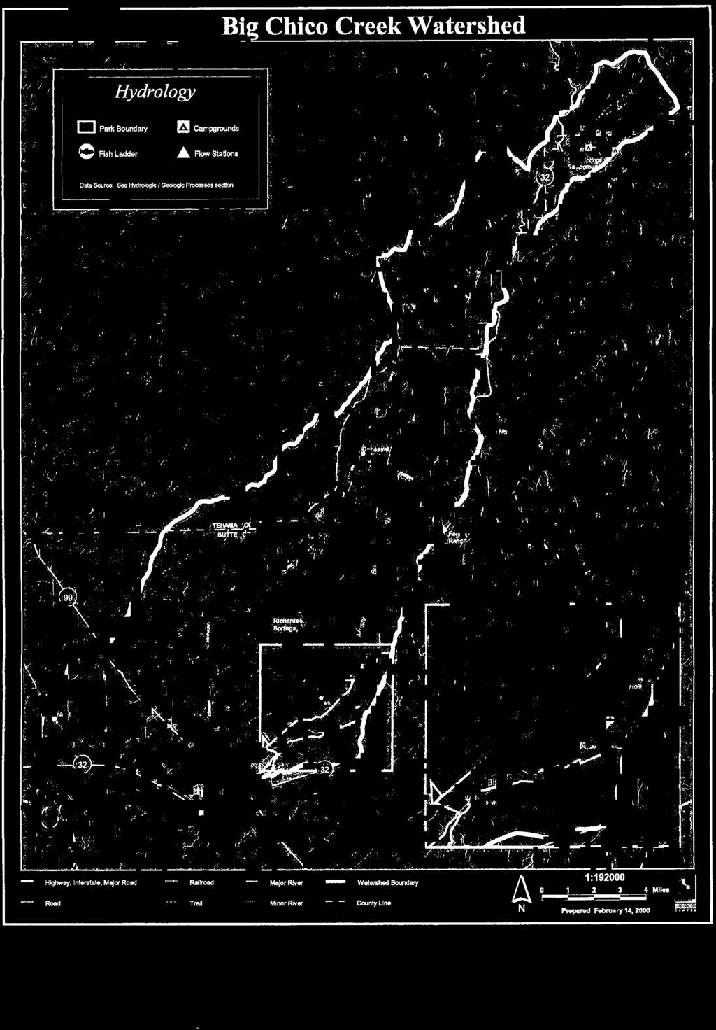
1 BIG CHICO CREEK WATERSHED ALLIANCE Input for County Integrated Water Resources Plan I Description of Organization Contact Person: Susan Strachan, Chair P.O. Box 461 Chico, CA (530) Website: Year Established: 1993 Background History: The Big Chico Creek Watershed Alliance began as the Big Chico Creek Task Force, a subcommittee of the Bidwell Parks and Playground Commission in 1993, in response to declining anadramous fish runs. The first effort of the Task Force was to work with a local ranch to relocate its irrigation pumps from Big Chico Creek to the Sacramento River as the pumps had interfered with salmon migration. The Alliance became an independent watershed group in 1996, and after incorporating as a public benefit corporation, formed a Board of Directors in Membership on the Board is open to any person holding a stake in the Big Chico Creek watershed. Of the 15 seats, five are reserved for landowners in the Big Chico, Sycamore, Lindo, Mud and Rock Creek subwatersheds. The Alliance Board of Directors meets on the second Monday of each month in a Chico City Hall conference room. Description of Watershed: Big Chico Creek drains the western slope of the Sierra Nevada from an elevation of 5400 to the Sacramento River. Typical Land Use: Urban, agriculture, ecological reserve Watercourses: The watershed includes four tributaries: Rock Creek, Mud Creek, Sycamore Creek, and Lindo Channel. Mission Statement: The mission of the Big Chico Creek Watershed Alliance is to protect and enhance the ecological integrity and economic vitality of the Big Chico Creek watershed through cooperative efforts. In partnership with landowners, interested citizens, government agencies and private enterprise, the Alliance works to foster education, understanding, sustainable land management, and ecosystem and water quality restoration and conservation. Additional Description: The watershed includes a wide diversity of habitats, from coniferous forests to blue oak woodlands to open grasslands. Prime orchard land is located in the Rock Creek and Mud Creek subwatersheds. Chico is Big Chico Creek s Butte County Integrated Water Resources Plan 1 emiller\watershed\big Chico Creek
2 largest urbanized areas with the growing communities of Cohasset and Forest Ranch located in the upper watershed. The watershed also includes the Big Chico Creek Ecological Reserve, a 3450 acre located along 4.5 miles of the mainstem. The Reserve drains into Bidwell Park which is owned by the City of Chico and protects 3618 acres and 12 miles of stream channel. II Past Plans & Projects The Alliance has developed partnership projects with the City of Chico, Butte County Resource Conservation District, Streaminders, California State University, Chico and the adjacent watershed groups in Butte County. Other completed projects to date include: Citizen monitoring in conjunction with the USGS National Water Monitoring Day and Earth Science Week Big Chico Creek Watershed Project (Existing Conditions Report, 2000) Purchase of Big Chico Creek Ecological Reserve, partnering with California State University, Chico and the River Network Joint efforts with the City of Chico to remove the invasive species Arundo donax (giant reed) from sites along Big Chico Creek and Lindo Channel without the use of herbicides Training volunteers in aquatic bioassessment Restoration projects with Streaminders in Bidwell Park Co-sponsoring of the annual Creeks of Chico Conferences Sponsorship of local presentations by world-renowned experts in watershed management and restoration III Current Projects With funding from the California Bay Delta Authority Watershed Program, the Alliance is implementing a Citizen Monitoring program for urban runoff in conjunction with broader effort to manage water quality in Chico s urban streams. The project includes public education by the Butte Environmental Council and a water quality study of the Best Management Practices used by the City to reduce runoff peak flows. Citizen volunteers are also monitoring the upper watershed through a Sierra Nevada Alliance grant. The Sierra Nevada Alliance is also funding a joint project with the Big Chico Creek Ecological Reserve to construct a unimproved road rehabilitation demonstration project. Through funding from the Department of Conservation and the California Bay Delta Authority and together with the other watershed groups in Butte County, the Alliance is working with the Butte County Resource Conservation District to develop Memorandums of Understanding, conduct joint workshops and planning documents, assist with disseminating information on farm water quality, and develop fundraising capacity. Butte County Integrated Water Resources Plan 2 emiller\watershed\big Chico Creek
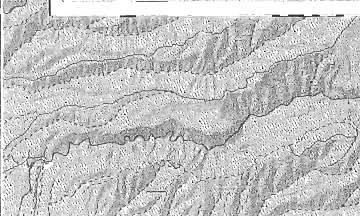
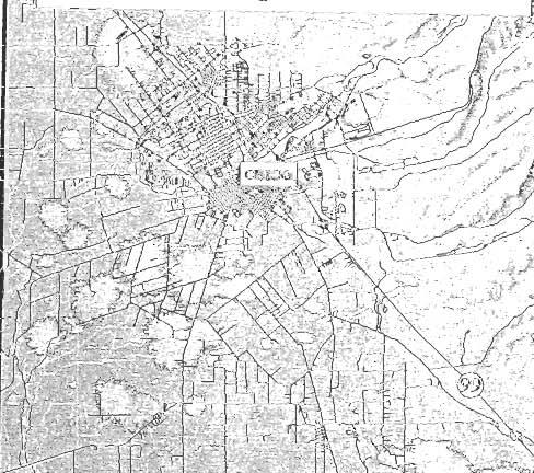
3 IV Specific Interests/Role in Local Water Resource Planning Special interests of the Alliance include the following: a) support with facilitation of stakeholders regarding development of sub-inventory unit basin management objectives (BMOs) b) participation in the development of policies to promote infiltration of stormwater in new development c) support of watershed based water quality monitoring that integrates urban and agricultural monitoring d) develop understanding of relationship of aquifer recharge and surface streams (surface versus groundwater) e) public education (use watershed groups to outreach to stakeholders) f) design standards to manage storm water to support aquifer recharge, reduce pollution and minimize downstream flooding V Maps Refer to the attached map of the Big Chico Creek Watershed excerpted from the Big Chico Creek Watershed Project, Existing Conditions Report (2000). VI Contact Information For additional information contact the Butte County Department of Water and Resource Conservation at (530) Butte County Integrated Water Resources Plan 3 emiller\watershed\big Chico Creek
4
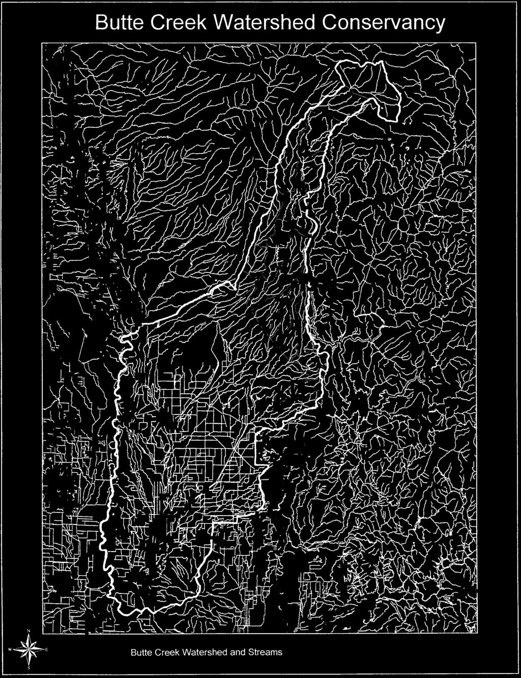
5 BUTTE CREEK WATERSHED CONSERVANCY Input for County Integrated Water Resources Plan I Description of Organization Contact Person: Will Johnson, Coordinator P.O. Box 1611 Chico, CA (530) Web Site: Year Established: 1996 (established as a 501( c)3 organization in 11/96) Background History: The Butte Creek Watershed Conservancy was formed to encourage the preservation and proper management of the Butte Creek Watershed, emphasizing cooperation between landowners, water users, recreational users, conservation groups, and local, state, and federal agencies. The Conservancy was created as a landownerdriven group, and a 12-member Board of Directors directs its policies. Current Board members include community leaders in agriculture, timber, cattle grazing, local industry, and conservation. The Conservancy s formative MOU established a voluntary and cooperative agreement among 24 signatories to work together in a watershed planning process. It is the Conservancy s belief that stakeholders working cooperatively have the greatest potential for streamlining resource management and minimizing conflict between landowners, water users, government agencies, and conservation groups. Description of Watershed: Butte Creek originates in the Jonesville Basin in Lassen National Forest at an elevation of 7,087 feet. Upper Butte Creek is characterized by forest, meadows, and a repeating series of pools and riffles. Butte Creek transitions from Butte Meadows through a steep canyon to a point where it enters the Sacramento Valley floor near Chico. Lower Butte Creek (below Highway 99) is bordered by agricultural lands, several state and federal wildlife areas, and is contained at times by levees. Butte Creek is tributary to the Sacramento River. Typical Land Use: National forest, recreation, timber, private land (ranching), urban influence (near Chico and Durham), agriculture, wildlife reserves Watercourses: Contributing flows into Butte Creek, other than natural tributaries in higher elevations, include flows from the West Branch of the Feather River which is diverted by Pacific Gas & Electric (PGE) for power generation via the Toadtown/Hendricks Canal at the DeSabla powerhouse. Butte County Integrated Water Resource Plan 1 Emiller\watershed\Butte Creek Watershed Conservancy
6 Mission Statement: The Butte Creek Watershed Conservancy was established to protect, restore, and enhance the cultural, economic, and ecological heritage of the Butte Creek Watershed through cooperative landowner action. II Past Plans and Projects In 1996 the Conservancy enlisted the services of the California State University-Chico, Department of Geography and Planning, to apply for State, Federal and private grants for the development of a Watershed Management Strategy. Through the generosity of the US Fish & Wildlife Service, CalFED, National Fish & Wildlife Foundation, Bureau of Reclamation, and the Metropolitan Water District, the Conservancy set in the motion the creation of the Butte Creek Watershed Management Strategy which was completed in A copy of the Butte Creek Watershed Management Strategy Report, which describes Existing Conditions, is on file at the County Department of Water & Resource Conservation. III Current Projects Current programs and projects include the Floodplain Management Plan (FMP) which will list specific recommendations addressing flood, emergency preparedness and means of mitigating the current deficiencies in regard to flood control. Additionally the FMP will provide modeling tools for prediction of inundation and a template style management procedure to be used at other locations/watersheds. Another current endeavor is the Flood Insurance Cost Reduction program (FICR). The FICR focuses on individual properties within the watershed and may be extended to all residents of the county, affected by inclusion in a designated flood zone. The FMP seeks to address communities and the FICR seeks to address individuals. This program is in its first phase (data gathering and testing of premises) and will be 4 to 5 months in development (implementation is anticipated by fall 2004). This program is not funded by grants but is entirely grass roots driven. IV Specific Interests/Role in Local Water Resource Planning Special interests of the Conservancy include: a) development of resource base funding that would allow for annual operations and administrative expenses (of the Conservancy) b) continued inclusion and participation in local planning with regard to water use, water quality, and regional conservation/management efforts c) continued participation with other watershed groups in our area to foster cooperation and mutual commitment Butte County Integrated Water Resource Plan 2 Emiller\watershed\Butte Creek Watershed Conservancy
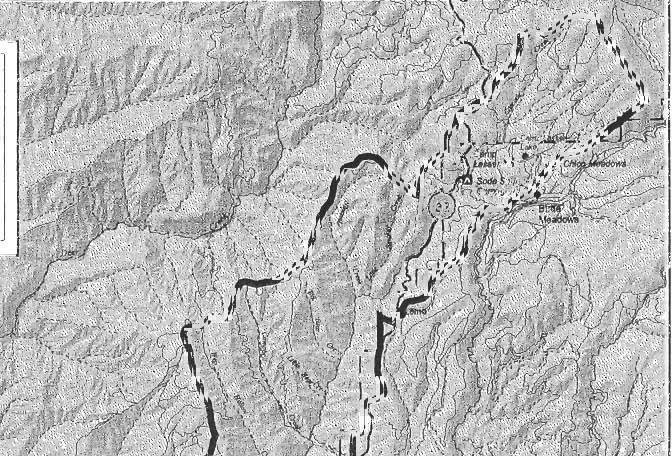
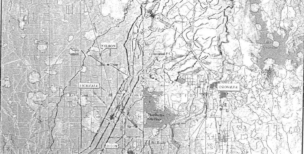
7 d) continue efforts to develop projects and applications that are backed by a well defined need, sound science, and that are most cost effective e) continue efforts to monitor the existing fishery, population growth in the canyon, and recreation demands in the watershed f) continue interest in determining infrastructure needs of the watershed to accommodate pressures from recreation, population, etc.. (i.e. number of game wardens, roads, etc..) g) fuel load and timber management h) road design, construction and maintenance i) groundwater recharge j) water quality and quantity k) Urban run-off and flooding l) Public education m) Continued respect for private property rights within the watershed n) Continued respect and protection of public resources within the watershed o) Good land stewardship practices, conservation, restoration, and sound resource management V Maps Refer to the attached map of the Butte Creek Watershed. VI Contact Information For additional information contact the Butte County Department of Water & Resource Conservation at (530) Butte County Integrated Water Resource Plan 3 Emiller\watershed\Butte Creek Watershed Conservancy


8
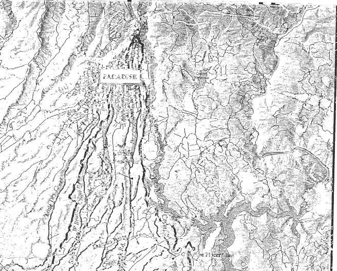
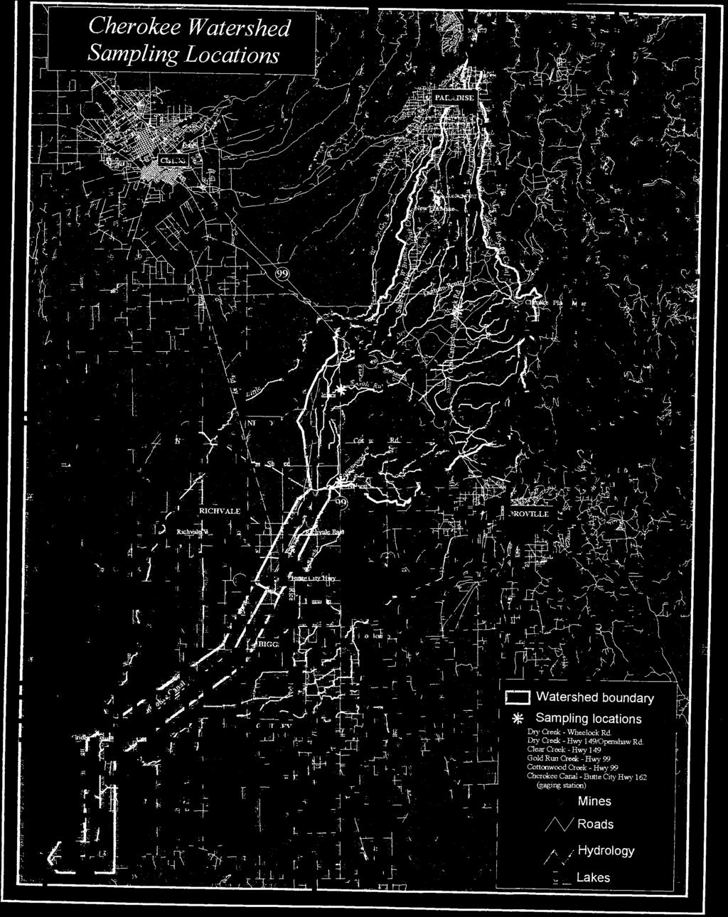
9 CHEROKEE WATERSHED ALLIANCE Input for County Integrated Water Resources Plan I Description of Organization Contact Person: Susan St.Germaine-Morger, Watershed Coordinator Durham, CA Year Established: 1996 Background History: The original Cherokee Watershed Alliance Resource Management Program (CRMP) group consisted roughly of neighbors from Nelson Road in the southern portion of the watershed, the foothills to the east, to Western Canal Water District s borders on the west, and the intersection of Hwy 99 and 149 to the north. After the Drought Water Bank in 1994, local concerned residents observed that patterns of development or resource utilization was a threat to the quite enjoyment of this rural environment. Local property owners (stakeholders) organized themselves to establish a voice to improve communication on projects that are likely to impact watershed stakeholders. Description of Watershed: Foothill (Paradise vicinity) and valley Typical Land Use: Ranching, agriculture (rice, orchard), urban (Paradise), rural parcels Watercourses: Cherokee Canal, Dry Creek, Gold Creek, Cottonwood Creek Mission Statement: To protect the natural resources and environment, local water resources, and economic opportunity of the region. II Past Plans & Projects The current Department of Water Resources (DWR) grant is to build the initial capacity of the Alliance. III Current Projects The Cherokee Watershed Alliance is presently conducting a water quality investigation through California State University-Chico (CSUC) and citizen monitoring efforts. The Butte County Integrated Water Resources Plan 1 emiller\watershed\cherokee\watershed groups
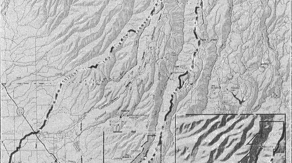
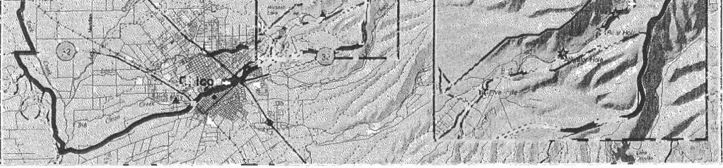
10 project is funded by grants from the State DWR and the Regional Water Quality Control Board, and shall remain in effect through the summer Sampling events are conducted on a monthly basis in local drainages and analyzed for field parameters (ph, electroconductivity, temperature), trace metals, nutrients, minerals, fecal coliform, and other general water quality constituents. The project also includes various outreach programs including a public workshop that addresses groundwater recharge areas located within the watershed. IV Specific Interests/Role in Local Water Resource Planning As a product of capacity building associated with the citizen monitoring grant, a member of the Alliance could help facilitate the Basin Management Objective (BMO) subinventory unit for the Cherokee Watershed. Other interests of the Alliance regarding water resource planning concerns include: a) groundwater reliability and water supply evaluations for new water users (may include water use efficiency, recycling, irrigation methods) b) flood control strategies (capacity, management of flow volumes and quality) c) land use zoning that may affect water supplies, watershed drainage d) development of baseline water quality data (i.e. also monitor environmental effects from historic mining activities) e) economic impacts and long term consequences of water supply and infrastructure developments f) citizen involvement and capacity building with other entities g) public education h) septic problems V Maps Refer to the attached map of the Cherokee Watershed boundary (excerpted from the Cherokee Water Quality Monitoring Report and Quality Assurance Project Plan). VI Contact Information For additional information contact the Butte County Department of Water & Resource Conservation at (530) Butte County Integrated Water Resources Plan 2 emiller\watershed\cherokee\watershed groups
11
Sacramento Valley Groundwater: An Approach to Better Understand and Manage the Lower Tuscan Groundwater Resources for Northern California
 Sacramento Valley Groundwater: An Approach to Better Understand and Manage the Lower Tuscan Groundwater Resources for Northern California The Sacramento Valley is recognized as one of the foremost groundwater
Option 11. Divert Water from Miocene and Hendricks Canal to Supply the Ridge
 Integrated Water Resources Plan Option 11 Divert Water from Miocene and Hendricks Canal to Supply the Ridge This option would use water from the Miocene Canal and/or Hendricks Canal for municipal supplies
State of the Valley Report
 State of the Valley Report An overview of the characteristics and trends of natural resources in the San Joaquin Valley s rural spaces, with an eye on resource sustainability for the future Aerial view
Chapter 13: Wildlife and Vegetation
 Chapter 13: Wildlife and Vegetation Introduction and Setting Nevada County contains an extremely wide range of plants, animals and habitat types. With topographic elevations ranging from 300 feet in the
Corporate Environmental Water Stewardship Go Green. Todd Reeve October 17, 2017
 Corporate Environmental Water Stewardship Go Green Todd Reeve October 17, 2017 Freshwater & Business Risk #1 threat (World Economic Forum 2016) 2/3 rd of companies report water as substantive risk* 44%
West Placer Groundwater Sustainability Agency Community Meeting February 16, 6 to 8 p.m. McBean Pavilion in Lincoln
 West Placer Groundwater Sustainability Agency Community Meeting February 16, 6 to 8 p.m. McBean Pavilion in Lincoln Community meeting overview The West Placer Groundwater Sustainability Agency held its
EFFECT OF UPSTREAM DEVELOPMENT ON THE CLEAR CREEK AREA
 EFFECT OF UPSTREAM DEVELOPMENT ON THE CLEAR CREEK AREA Technical Memorandum Farming in the Floodplain Project Prepared for May 2017 PCC Farmland Trust Photo credit: Google Earth TABLE OF CONTENTS Page
NOTICE OF PREPARATION
 NOTICE OF PREPARATION Date: June 12, 2014 To: From: Subject: Governor s Office of Planning and Research/State Clearinghouse Unit, Responsible Agencies, Trustee Agencies, and Interested Parties Announcement
DAKOTA COUNTY SOIL AND WATER CONSERVATION DISTRICT COMPREHENSIVE PLAN
 DAKOTA COUNTY SOIL AND WATER CONSERVATION DISTRICT COMPREHENSIVE PLAN 2011-2015 4100 220 th Street West, Suite 102 Farmington, MN 55024 651-480-7777 www.dakotacountyswcd.org I. INTRODUCTION A. Purpose
General Plan Update Workshop 6 Agriculture, Conservation, & Open Space February 23, 2005
 General Plan Update Workshop 6 Agriculture, Conservation, & Open Space February 23, 2005 Municipal Services Agency Planning and Community Development Department Workshop Outline GPU Update Background &
EAST TORRANCE SOIL AND WATER CONSERVATION DISTRICT. LONG RANGE PLAN July 1, 2009 June 30, 2019
 EAST TORRANCE SOIL AND WATER CONSERVATION DISTRICT LONG RANGE PLAN July 1, 2009 June 30, 2019 INTRODUCTION The East Torrance Soil and Water Conservation District covers 1,142,028 acres of land in Torrance
Sustainable Ag Lands Conservation (SALC) Stakeholder Kickoff Meeting Agenda (Meeting #1) 1) Welcome and Introductions (10 min)
 Stakeholder Kickoff Meeting Agenda (Meeting #1) 1) Welcome and Introductions (10 min)") Sustainable Ag Lands Conservation (SALC) Stakeholder Kickoff Meeting Agenda (Meeting #1) Thursday, April 28, 2016 10:00 am to Noon Development Services Training Room 7 County Center Drive, Oroville AGENDA
Sustainable Ag Lands Conservation (SALC) Stakeholder Kickoff Meeting Agenda (Meeting #1) Thursday, April 28, 2016 10:00 am to Noon Development Services Training Room 7 County Center Drive, Oroville AGENDA
Chapter 10 Natural Environment
 Chapter 10 Natural Environment Existing Conditions The Natural Environment Element addresses the protection, conservation, preservation, and restoration of the natural resources the Bayview Ridge Subarea,
STREAM RESTORATION PURPOSE, PRACTICE, AND METHODS. By Marcus Rubenstein, CPESC
 STREAM RESTORATION PURPOSE, PRACTICE, AND METHODS By Marcus Rubenstein, CPESC WHAT IS STREAM RESTORATION? The return of a stream s lost natural functions, usually resulting from watershed alterations,
Estimated Annual Cost of Invasive Plant Work in California. Federal agencies $21M
 Invasive Plants Cost California $82 Million Every Year. At least. Estimates of actual impacts reach into the $ billions. $82 million represents current costs of control, monitoring, and outreach. This
Water Supply Water Quality Water Reuse and Conservation Watershed Management Interagency Coordination
 WATER ELEMENT INTRODUCTION Water is one of the most critical resources for the Merced County economy and for the quality of life of its residents. Both surface water and groundwater supplies are an important
BIG ROCHE A CRI LAKE CHARACTERISTICS
 BIG ROCHE A CRI LAKE CHARACTERISTICS Lake Description Big Roche Cri Lake is located in north central Adams County and has a surface area of 205 acres, a shoreline length of 6.1 mile, a volume of 6,993
Confluence Field Station
 National Great Rivers Research and Education Center Introducing the Confluence Field Station Alton, Illinois A Confluence of Great Rivers Earth s majestic landscapes, vast oceans and great rivers inspire
TORCH LAKE TOWNSHIP WATER QUALITY ACTION PLAN
 TORCH LAKE TOWNSHIP WATER QUALITY ACTION PLAN Elk-River-Chain-of-Lakes Gaps Analysis Project The Watershed Center Grand Traverse Bay Tip of the Mitt Watershed Council Michigan Department of Natural Resources
Water and Environment. Monterey Peninsula, Carmel Bay and South Monterey Bay Integrated Regional Water Management Draft Plan
 Water and Environment Monterey Peninsula, Carmel Bay and South Monterey Bay Integrated Regional Water Management Draft Plan December 11, 2006 Presentation Outline Purpose of IRWM Planning Status of Plan
USDA Forest Service Lake Tahoe Basin Management Unit Forest Plan Revision Topics Need for Change
 USDA Forest Service Lake Tahoe Basin Management Unit Forest Plan Revision Topics Need for Change This revised report accompanies the Forest Service Need for Change discussion, and is intended to clarify
The total population of the township is 9,942 (2015 Five-Year American Community Survey [ACS]). The median household income is over $109,000.
![The total population of the township is 9,942 (2015 Five-Year American Community Survey [ACS]). The median household income is over $109,000.](/thumbs/72/67990406.jpg "The total population of the township is 9,942 (2015 Five-Year American Community Survey [ACS]). The median household income is over $109,000.") East Bradford Township, Pennsylvania Motivated by watershed impairment caused by suburban development over the past 30 years, a township with a full slate of water quality improvement programs looks outside
East Bradford Township, Pennsylvania Motivated by watershed impairment caused by suburban development over the past 30 years, a township with a full slate of water quality improvement programs looks outside
Water Quality Conditions & Management on Rangelands
 Water Quality Conditions & Management on Rangelands Ken Tate, Leslie Roche, and Rob Atwill UC Davis and UC Cooperative Extension Grazing Workshop Mariposa County UCCE March 2014 CA Rangelands Safe Water
Integrated Regional. South Tahoe Public Utility District. Water Management Plan. July 2014 K/J Prepared By Kennedy/Jenks Consultants
 Tahoe-Sierra Integrated Regional Water Management Plan July 2014 K/J 1270036 Photo courtesy of Matthew Grimm South Tahoe Public Utility District Prepared By Kennedy/Jenks Consultants 10850 Gold Center
BUDGET AND RESOURCES
 BUDGET AND RESOURCES Introduction NRDs administer multiple programs that focus on the management of water quantity and the improvement of water quality. While NRDs have taxing authorities they use to support
Marysville Levee Commission
 Marysville Levee Commission Outline CVFPP Goals & Objectives Highlights of Draft Feather River RFMP Integration between Flood Protection, Agriculture and Wildlife and Floodplain Uses Proposed Projects
New Castle County, DE. Floodplain Regulations
 New Castle County, DE Floodplain Regulations John J. Gysling, PE CFM Department of Land Use New Castle County, DE February 26, 2009 Today s Presentation Floodplain Protection and Uses Terms and Definitions
SRCD s Review of Impacts the Proposed Bay Delta Conservation Plan (BDCP) and Companion EIR/EIS on the Suisun Marsh
 and Companion EIR/EIS on the Suisun Marsh") SRCD s Review of Impacts the Proposed Bay Delta Conservation Plan (BDCP) and Companion EIR/EIS on the Suisun Marsh By Steve Chappell, Executive Director Suisun RCD BDCP Document is Extremely Challenging
SRCD s Review of Impacts the Proposed Bay Delta Conservation Plan (BDCP) and Companion EIR/EIS on the Suisun Marsh By Steve Chappell, Executive Director Suisun RCD BDCP Document is Extremely Challenging
Revised 8-4. Board of Directors Water Planning and Stewardship Committee. September 11, 2007 Board Meeting. Subject. Description
 Board of Directors Water Planning and Stewardship Committee September 11, 2007 Board Meeting Subject Adopt criteria for conveyance options in implementation of Long Term Delta Plan Description Revised
Walnut Creek Watershed Management Authority. Project Kick Off March 18, 2015
 Walnut Creek Watershed Management Authority Project Kick Off March 18, 2015 Agenda Schedule & Meeting Purpose Meeting Purpose TMDL Raccoon River TMDL Impaired by Nitrate and E.coli Includes Walnut Creek
Tim Hayden, Yurok Tribe Natural Resources Division Mat Millenbach, Western Rivers Conservancy Sarah Beesley, Yurok Tribal Fisheries Program
 BLUE CREEK FOREST SANCTUARY: RESTORING OLD GROWTH FOREST ECOSYSTEM FUNCTION, PROTECTING SALMON, WILDLIFE, AND TRADITIONAL- LIFE WAYS AND CULTURE IN THE FACE OF CLIMATE CHANGE Tim Hayden, Yurok Tribe Natural
FEMA s Mitigation Support for Resiliency: Innovative Drought and Flood Mitigation Projects
 FEMA s Mitigation Support for Resiliency: Innovative Drought and Flood Mitigation Projects Jordan Williams, CFM Eric Kenney, PE, CFM May 4, 2017 2 Hazard Mitigation Purpose: Research climate resilient
Frequently Asked Questions Updated July 17, 2015
 Frequently Asked Questions Updated July 17, 2015 1. What is California WaterFix? California WaterFix is a proposal backed by the administrations of Governor Edmund G. Brown Jr. and President Barack Obama
Good Neighbor Agreement A unique solution for local protection
 Good Neighbor Agreement A unique solution for local protection A project of the Northern Plains Resource Council, and its local affiliates Stillwater Protective Association and Cottonwood Resource Council
(1)(A)Inventory of the following existing natural resources on the USFSP Campus or within the context area adjacent to the University.
(A)Inventory of the following existing natural resources on the USFSP Campus or within the context area adjacent to the University.") 13. 6C-21.208 CONSERVATION ELEMENT Information Sources George F. Young, Interview notes, June 2002 Sasaki Associates, Inc., interview notes, April, 2000 Interviews between DRMP Staff and USF Staff, May,
13. 6C-21.208 CONSERVATION ELEMENT Information Sources George F. Young, Interview notes, June 2002 Sasaki Associates, Inc., interview notes, April, 2000 Interviews between DRMP Staff and USF Staff, May,
STRATEGIC PLAN Introduction II. Mission Statement III. The Challenge Federal Noxious Weed Act of 1974
 VENTURA COUNTY WEED MANAGEMENT AREA (VCWMA) STRATEGIC PLAN 2010 I. Introduction The Ventura County Weed Management Area (VCWMA) is a focused group of individuals, Federal, State and County public agencies,
Solano Multi-Species Habitat Conservation Plan
 Solano Multi-Species Habitat Conservation Plan 580,000 Acres 37 Covered Species 4 Natural Communities 12,000 acres of Proposed Development Approximately 23,000 acres will be Preserved Plan Participants
Hydropower Project License Summary PIT RIVER, CA PIT 1 HYDROELECTRIC PROJECT (P-2687) Pit River below Pit 1 Powerhouse
 Pit River below Pit 1 Powerhouse") Hydropower Project License Summary PIT RIVER, CA PIT 1 HYDROELECTRIC PROJECT (P-2687) Pit River below Pit 1 Powerhouse Photo: Hydropower Reform Coalition This summary was produced by the Hydropower Reform
Hydropower Project License Summary PIT RIVER, CA PIT 1 HYDROELECTRIC PROJECT (P-2687) Pit River below Pit 1 Powerhouse Photo: Hydropower Reform Coalition This summary was produced by the Hydropower Reform
NORTH FORK FEATHER RIVER PLANNING UNIT Feather River Watershed
 Existing Conditions & Uses Overview Historic and scenic North Fork Feather River Canyon with four small reservoirs within a 30-mile river reach 5,614 acres in Plumas and Butte Counties; 5,128 acres outside
California Urban Streams Alliance The Stream Team Big Chico Creek Watershed Citizen Monitoring Program Data Report 2010
 California Urban Streams Alliance The Stream Team Big Chico Creek Watershed Citizen Monitoring Program Data Report 2010 A program of: California Urban Streams Alliance The Stream Team Table of Contents
719 Griswold, Suite 820 Detroit, MI DANVERS POND DAM REMOVAL AND STREAM RESTORATION PROJECT
 Great Lakes Restoration Initiative Grant Final Report US EPA Grant GL 00E006 43 October, 2013 Valley Woods Wetland Southfield Lola Valley Grow Zone Wayne County Parks Venoy Park Grow Zone Wayne County
Environment & Conservation Introduction
 Environment & Conservation Introduction Anacortes is blessed with an abundance of natural beauty. Residents identify marine shorelines, streams, lakes, forested areas, and other natural features as defining
2009 MEMORANDUM OF AGREEMENT for the establishment of the TENNESSEE FARMLAND LEGACY PARTNERSHIP
 2009 MEMORANDUM OF AGREEMENT for the establishment of the TENNESSEE FARMLAND LEGACY PARTNERSHIP PARTIES: Cumberland Region Tomorrow MTSU Center for Historic Preservation Tennessee Department of Agriculture
WATERSHED. Maitland Valley. Report Card 201
 Maitland Valley WATERSHED Report Card 201 The Maitland Valley Conservation Authority has prepared this report card as a summary on the state of our forests, wetlands, surface water, and ground water resources.
Municipal Stormwater Management Planning
 Municipal Stormwater Management Planning Christopher C. Obropta, Ph.D., P.E. Water Resources Extension Specialist with Rutgers Cooperative Extension Assistant Professor with Department of Environmental
VILLAGE OF BELLAIRE WATER QUALITY ACTION PLAN
 VILLAGE OF BELLAIRE WATER QUALITY ACTION PLAN Elk-River-Chain-of-Lakes Gaps Analysis Project The Watershed Center Grand Traverse Bay Tip of the Mitt Watershed Council Michigan Department of Natural Resources
Pennsylvania Stormwater Best Management Practices Manual. Chapter 3. Stormwater Management Principles and Recommended Control Guidelines
 Pennsylvania Stormwater Best Management Practices Manual Chapter 3 Stormwater Management Principles and Recommended Control Guidelines 363-0300-002 / December 30, 2006 Chapter 3 Stormwater Management Principles
Managed Groundwater Recharge to Support Sustainable Water Management. A Sacramento Valley Perspective November 8, 2017
 To advance the economic, social and environmental sustainability of Northern California by enhancing and preserving the water rights, supplies and water quality. Managed Groundwater Recharge to Support
Applying Ecosystem Services to Collaborative Forest Management Elk River Public Meeting
 Applying Ecosystem Services to Collaborative Forest Management Elk River Public Meeting Nikola Smith Ecologist and Ecosystem Services Specialist U.S. Forest Service Port Orford City Hall February 2, 2017
Chapter 1. Introduction
 Chapter 1 Introduction James P. Heaney, Robert Pitt, and Richard Field Introduction Stormwater has traditionally been considered a nuisance, requiring rapid and complete drainage from areas of habitation.
Agricultural/Rural Riparian Buffer Analysis
 Agricultural/Rural Riparian Buffer Analysis December 2014 Executive Summary The Agricultural/Rural Riparian Buffer Analysis was developed from a 2014 analysis of current requirements for the riparian areas
Credit Valley Conservation (CVC) Board of Directors. Chief Administrative Officer (CAO) Watershed Knowledge. Watershed Management
 Board of Directors. Chief Administrative Officer (CAO) Watershed Knowledge. Watershed Management") Credit Valley Conservation (CVC) Board of Directors Chief Administrative Officer (CAO) CVC Foundation Human Resources Corporate Watershed Knowledge Watershed Watershed Transformation Planning and Development
Credit Valley Conservation (CVC) Board of Directors Chief Administrative Officer (CAO) CVC Foundation Human Resources Corporate Watershed Knowledge Watershed Watershed Transformation Planning and Development
Environmental Geography
 Environmental Geography Lecture 13 Water Pollution Lecture 13: Water Pollution I. Water Pollution A. Groundwater B. Surface Water C. Regulation II. Water Use in California 1 I. Water Pollution Types of
APPENDIX A. Project Scoping
 APPENDIX A Project Scoping Notice of Preparation To: From: Agencies and Interested Parties Paul Brunner, Executive Director, Three Rivers Levee Improvement Authority Date: June 13, 2006 Subject: Notice
Developing Metrics & Indicators for the California Water Plan. CA Sustainability Indictors Symposium February 23, 2011
 Developing Metrics & Indicators for the California Water Plan CA Sustainability Indictors Symposium February 23, 2011 1 Update 2009 State s Blueprint Integrated Water Management & Sustainability 2 Update
Our Groundwater Resources in Napa County
 Our Groundwater Resources in Napa County Monitoring for Sustainability Workshop Presentation March 2014 www.countyofnapa.org/bos/grac Background What We Know Importance of Groundwater (GW) What We re Trying
C O M P R E H E N S I V E P R O T E C T I O N & R E S T O R AT I O N P L A N. f or th e
 C O M P R E H E N S I V E P R O T E C T I O N & R E S T O R AT I O N P L A N f or th e R O S S B A R NE T T R E SERV O I R WATERS HED, MI S S I S S I P P I E X E C U T I V E S U M M A R Y O C T O B E R
MEMORANDUM. Purpose: Background:
 MEMORANDUM To: MCWD Board of Managers From: Becky Christopher, Lead Planner CC: James Wisker, Director of Planning Date: January 11, 2016 Re: Mission, Vision, Values, Goals Purpose: At the January 14,
County of Calaveras Department of Planning
 Date: July 18, 2013 To: From: Project: Advisory Agencies Amy Augustine, AICP - Planner County of Calaveras Department of Planning Rebecca L. Willis, AICP ~ Planning Director Phone (209) 754-6394 Fax (209)
KESWICK DAM RED BLUFF REACH
 Chapter 3 KESWICK DAM RED BLUFF REACH The Keswick-Red Bluff Reach of the Sacramento River, the upper-most reach of the Conservation Area, is unique in many ways. The reach extends from Keswick Dam (about
What Are Environmental (Instream) Flows?
 Flows?") 1 What Are Environmental (Instream) Flows? Sustainable water management requires that both human needs and the needs of aquatic and riparian ecosystems be fulfilled. Dams and diversion of water for municipal
1 What Are Environmental (Instream) Flows? Sustainable water management requires that both human needs and the needs of aquatic and riparian ecosystems be fulfilled. Dams and diversion of water for municipal
GOOD NEIGHBOR POLICY
 Regional Open Space MIDPENINSULA REGIONAL OPEN SPACE DISTRICT GOOD NEIGHBOR POLICY Adopted by the Board of Directors October 26, 1988 Amended August 14, 1996 Amended September 26, 2007 Introduction The
RECENT AND ONGOING WATERSHED MANAGEMENT PROGRAMS AND INITIATIVES
 SEWRPC Community Assistance Planning Report No. 316 A WATERSHED RESTORATION PLAN FOR THE ROOT RIVER WATERSHED Chapter III RECENT AND ONGOING WATERSHED MANAGEMENT PROGRAMS AND INITIATIVES The Root River
APPENDIX A NOTICE OF PREPARATION/ NOTICE OF INTENT. Proposed Lower Yuba River Accord June 2007 Draft EIR/EIS
 APPENDIX A NOTICE OF PREPARATION/ NOTICE OF INTENT Proposed Lower Yuba River Accord June 2007 Draft EIR/EIS Proposed Lower Yuba River Accord June 2007 Draft EIR/EIS Interested Parties NOTICE OF PREPARATION
Chapter 4: Natural and Scenic Resources and Environment
 CHAPTER 4: NATURAL AND SCENIC RESOURCES SUMMARY 39. Chapter 4: Natural and Scenic Resources and Environment THEME: SUSTAIN NATURAL AND SCENIC RESOURCES AND ENVIRONMENTAL QUALITY WHY IS THIS THEME IMPORTANT?
PIMA COUNTY COMPREHENSIVE PLAN CO PIMA COUNTY REGIONAL COMPREHENSIVE PLAN POLICY MAJOR PLAN AMENDMENT
 PIMA COUNTY COMPREHENSIVE PLAN CO7-07-04 PIMA COUNTY REGIONAL COMPREHENSIVE PLAN POLICY MAJOR PLAN AMENDMENT Arizona law [A.R.S. 11-821(C)(3)] requires: Planning for water resources that addresses: a)
Chehalis Basin Strategy Programmatic SEPA Draft EIS
 Chehalis Basin Strategy Programmatic SEPA Draft EIS History of Flooding I-5 closed in 1990, 1996, 2007, 2009 Five largest flood events occurred since 1986 2 History of Habitat Degradation Harvest has been
IT S BEAUTIFUL. IRREPLACEABLE. AND SHOULD LAST FOREVER. LET S CONSERVE THIS TOGETHER THE BOW & BEYOND CAMPAIGN
 IT S BEAUTIFUL. IRREPLACEABLE. AND SHOULD LAST FOREVER. LET S CONSERVE THIS TOGETHER The Bow & Beyond Campaign CONSERVING OUR IRREPLACEABLE RIVER VALLEYS This treasured land connects us. But it is disappearing
TWIN PLATTE NATURAL RESOURCES DISTRICT
 TWIN PLATTE NATURAL RESOURCES DISTRICT Twin Platte NRD Multi-Jurisdictional Hazard Mitigation Plan Update Twin Platte NRD Multi-Jurisdictional Hazard Mitigation Plan Update 2016 1 INTRODUCTION This HMP
Lake County Success. support through synergistic local partnerships that not only mitigate, but also produce
 Lake County Success Generating Environmental Gains With Geothermal Power By Mark Dellinger, Administrator, Lake County (CA) Sanitation District, and Eliot Allen, Principal, Criterion/Planners Engineers
3 PROJECT DESCRIPTION
 3.1 PROJECT OVERVIEW 3 PROJECT DESCRIPTION The Rocklin 60 project (proposed project) includes the subdivision of 56.9 acres of land, construction of 179 single-family, detached dwelling units, and installation
Colorado River Challenges Impacts to Southern Arizona
 Colorado River Challenges Impacts to Southern Arizona 2 3 4 5 Colorado River Basics 7 States, 2 Nations Annual Flow 15.0 MAF 40 Million People All of the Major Cities in Southwest 5.5m Irrigated Acres
 The Yolo Natural Heritage Program Interface with the Bay Delta Conservation Plan Background, Summary, and Remaining Issues May 23, 2013 Background The Yolo Natural Heritage Program (Yolo HCP/NCCP) and
Regional Water Study of the Foothill and Mountain Areas of Eastern Fresno County
 Regional Water Study of the Foothill and Mountain Areas of Eastern Fresno County Prepared for: Fresno County Department of Public Works and Planning 2220 Tulare Street, Courtyard Level Fresno, California
WATERSHED MANAGEMENT INITIATIVE: GOALS & IMPLEMENTATION OBJECTIVES, JULY 26, 1999
 WATERSHED MANAGEMENT INITIATIVE: GOALS & IMPLEMENTATION OBJECTIVES, JULY 26, 1999 The following table indicates the draft goals and objectives for the Santa Clara Basin WMI process. The overall objectives
Memorandum of Understanding
 Memorandum of Understanding Between the Federal Emergency Management Agency (FEMA) And the United States Department of Agriculture (USDA) Forest Service -- IA # 00-MU-1130144-158 I. PURPOSE The purpose
A Summary Guide to the. Rifle River WATERSHED MANAGEMENT PLAN. Know Your Watershed Protect Its Resources
 A Summary Guide to the Rifle River WATERSHED MANAGEMENT PLAN Know Your Watershed Protect Its Resources Table of Contents The Watershed... 3 The Management Plan... 4 Designated and Desired Uses... 5 Sources
Polluted Runoff and Land Conservation: What s the Connection?
 Polluted Runoff and Land Conservation: What s the Connection? Caroly Shumway, Ph.D. Executive Director, Merrimack River Watershed Council In partnership with NMCOG Overview Purpose Of This Talk Is To Convey
APPENDIX H Guidance for Preparing/Reviewing CEQA Initial Studies and Environmental Impact Reports
 APPENDIX H H.1 Guidance for Preparing and Reviewing CEQA Initial Studies Step 1: Consider the Project Characteristics as Provided by the Project Applicant Review the project application and draft plan
Integrated Watershed Management Plan
 mighty peace watershed alliance Integrated Plan SUMMARY What is the Plan? The Mighty Peace Alliance (MPWA) supports the three goals of Alberta s Water for Life Strategy: safe secure drinking water, healthy
9. Levee Maintaining Agency Projects
 9. Levee Maintaining Agency Projects 9.1. Overview This chapter summarizes the known deficiencies identified for each local levee maintaining agency (LMA) within the Regions. Note that although the focus
GRASS VALLEY WASTEWATER TREATMENT INQUIRY
 GRASS VALLEY WASTEWATER TREATMENT INQUIRY REASON FOR INVESTIGATION The 2003-2004 Grand Jury investigated the status of wastewater treatment in unincorporated Nevada County. This year, the Grand Jury investigated
Wisconsin Wastewater Operators Association. Protecting Our Water Resources: The Future Bill Hafs - NEW Water 10/2014
 Wisconsin Wastewater Operators Association Protecting Our Water Resources: The Future Bill Hafs - NEW Water 10/2014 The Fox River Contributes 1/3 of All Nutrients to Lake Michigan APRIL 15, 2011 Photo
Paso Robles Groundwater Basin Management Plan A Focus on Voluntary Actions to Improve the Sustainability of Our Water Supply
 Paso Robles Groundwater Basin Management Plan A Focus on Voluntary Actions to Improve the Sustainability of Our Water Supply Why Implement a Groundwater Management Plan? Pumping at or near basin annual
Crow s Foot Conservation Area Feasibility Study
 Crow s Foot Conservation Area Feasibility Study Site Opportunities Presentation Trust For Public Land PRESENTED BY SmithGroup JJR August, 2002 McHenry County Conservation District Boone County Conservation
Questions and Answers about the Water Supply and Water Quality bond act for the November, 2018 ballot. Updated November 17, 2017
 Questions and Answers about the Water Supply and Water Quality bond act for the November, 2018 ballot. Updated November 17, 2017 What is the need for more State investment in water resources? What is the
Community-Based Watershed Management
 Page 1 of 6 Ohio State University Fact Sheet School of Natural Resources 2021 Coffey Road, Columbus, Ohio 43210 Community-Based Watershed Management WS-0001-00 Joe Bonnell Project Coordinator, Ohio Watershed
Introduction Page I-1 INTRODUCTION
 Introduction Page I-1 INTRODUCTION The Arcata General Plan: 2020 will help shape how the city of Arcata will look, function, provide services, and manage resources for the next 20 years. The plan is the
SOURCE WATER ASSESSMENT SUMMARY BROCHURE
 SOURCE WATER ASSESSMENT SUMMARY BROCHURE CITY OF ROGUE PWS # 4100712 WHAT IS A SOURCE WATER ASSESSMENT? The Source Water Assessment was recently completed by the Department of Environmental Quality (DEQ)
Funding Stormwater Services
 Funding Stormwater Services Public Works Officers Institute March 10, 2016 By Mitch Avalon Consultant, County Engineers Association of California Pine Creek Flooding, Concord 1958 Overview Ballot Measure
Los Angeles 3 rd Regional
 Los Angeles 3 rd Regional Investors Conference Los Angeles, California March 31, 2016 Metropolitan Water District of Southern California 1 Metropolitan Water District of of Southern California 2 Metropolitan
June 22, Francis E. Borcalli, P.E.
 CACHE CREEK SETTLING BASIN SYMPOSIUM Managing the Settling Basin Who s Doing What! June 22, 2009 Francis E. Borcalli, P.E. CACHE CREEK SETTLING BASIN SYMPOSIUM Managing the Settling Basin Who s Doing What!
THE CROSSROADS IN WINCHESTER 4. DRAINAGE PLAN. 4. Drainage Plan. a. Drainage Plan Description
 THE CROSSROADS IN WINCHESTER 4. DRAINAGE PLAN 4. Drainage Plan a. Drainage Plan Description The Specific Plan area drains naturally into two separate watersheds: approximately 6 percent of the Specific
ANNUAL PROGRESS REPORT FOR 2014 ROGUE RIVER SPRING CHINOOK SALMON CONSERVATION PLAN ROGUE WATERSHED DISTRICT OREGON DEPARTMENT OF FISH AND WILDLIFE
 ANNUAL PROGRESS REPORT FOR 2014 ROGUE RIVER SPRING CHINOOK SALMON CONSERVATION PLAN ROGUE WATERSHED DISTRICT OREGON DEPARTMENT OF FISH AND WILDLIFE INTRODUCTION In September of 2007, the Oregon Fish and
4.5 WASTEWATER, STORM DRAINAGE, AND FLOODING
 4.5 WASTEWATER, STORM DRAINAGE, AND FLOODING INTRODUCTION This section addresses the potential wastewater, storm drainage, and flooding impacts resulting from development under the Draft General Plan.
Guidelines for Preparing an Alternatives Analysis
 Policy Number: Policy No. 2017-01 Title: Guidelines for Preparing an Alternatives Analysis Effective Date: September 7, 2017 Authority: Policy: Public Law 91-575, 84 Stat. 1509 et seq., Sections 3.1, 3.4(2),
JUNE 20, Collaborative Initiatives: Restoring watersheds and large landscapes across boundaries through State and Federal partnerships
 TESTIMONY of LESLIE WELDON DEPUTY CHIEF, NATIONAL FOREST SYSTEM UNITED STATES DEPARTMENT OF AGRICULTURE FOREST SERVICE BEFORE THE SENATE COMMITTEE ON ENERGY AND NATURAL RESOURCES SUBCOMMITTEE ON PUBLIC
MADERA COUNTY STORM WATER RESOURCE PLAN. TAC Meeting #2. August 30th, 2017
 MADERA COUNTY STORM WATER RESOURCE PLAN TAC Meeting #2 August 30th, 2017 Meeting Agenda 10:30 Introductions (10 mins) Meet the SWRP team and other TAC Members 10:40 Project Prioritization Approach with
Project Goals and Scoping
 Prepared for: Boulder County, Colorado Flood Planning & Preliminary Design Services for South St. Vrain Creek Restoration at Hall Ranch and Scoping May 24, 2016 Meeting with General Public In association