Public Informational Meeting November 8, 2007 Route 110 and 113 Methuen Rotary Interchange Study
|
|
|
- Rodney Stevens
- 6 years ago
- Views:
Transcription


1 Public Informational Meeting November 8, 2007 Route 110 and 113 Methuen Rotary Interchange Study
2 Welcome and Introductions Review of Planning Process Prior Study vs. Current Study Timeline and Implementation of Improvements Intent of the Public Informational Meetings Goals and Objectives of this Study
3 Planning Process in Massachusetts Standardizes the approach Incorporates public participation Promotes context-sensitive design Cost-effectiveness
4 Prior: Route I-93 Corridor Study Large study area (18-20 mile corridor) Examined 6 interchanges along I-93 Included Exit 46: Route 110/113 Rotary 7 Alternatives were developed No recommended alternative due to significant impacts and lack of local public involvement Recommendation: A study which identifies a preferred alternative would be the next step in moving an improvement at Exit 46 forward. Such a study should be undertaken as an immediate priority
5 Current: Route 110/113 Rotary Interchange Study Smaller and more focused study area Very involved Study Advisory Committee» Area Legislators» Methuen and Dracut Public Officials» Regional Planning Agencies» MassHighway» Citizen Advisors» Transit Agencies» Federal Agencies Worked with SAC to minimize impacts (height, visual, right-of-way, environmental) and maintaining or improving quality of life, while achieving study s goals and objectives
6 Goals and Objectives for Study Goals: Improve mobility and safety at the Exit 46: Route 110/113 Rotary Interchange on I-93 Objectives: Reduce traffic congestion at the Exit 46 Interchange, and on Route 110 and Route 113 Reduce queuing of Exit 46 off-ramp traffic into mainline I-93 Reduce the frequency of crashes in the study area Improve air quality through traffic flow improvements Develop cost-effective alternatives Propose alternatives that are generally supported by the Study Advisory Committee and general public, and can proceed into project development
7 Timeline and Implementation of Improvements Short-Term Improvements (Within 5 Years) Non-Highway Initiatives (Transit, TDM, TSM, PnR, ITS) Highway - Work with MassHighway District 4 Long-Term Improvements (5 to 10 Years) Environmental Process Design Process Right-of-Way Process (if necessary) Funding/Programming Construction
8 Intent of Public Informational Meetings First one held in November of 2006 Task 1: Study Framework» Goals and Objectives» Evaluation Criteria» Project/Study Area» Public Participation Task 2: Existing Conditions, Future Conditions, Issues and Constraints Solicit Comments From the Public Next Steps This meeting is intended to present improvement alternatives and solicit input from the general public
9 Consultant Team TranSystems Corporation Prime Fitzgerald and Halliday, Inc. FXM Associates TrafInfo Communications, Inc.
10 Route 110/113 Study Review Identified existing intersection and rotary traffic issues Compared traffic to I-93 Corridor Study Conducted a speed analysis on Route 113 west of the rotary Analyzed existing Transit and Ridership Analyzed existing socio-economics for baseline comparisons in Dracut and Methuen Analyzed existing Environmental Resources Analyzed existing Land Use Solicited Public concerns and viewpoints
11 Evaluation Criteria Evaluation Criteria Mobility Safety Environmental Effects Land Use and Economic Development Community Cohesion Cost and Schedule Measure of Effectiveness Vehicle Delays; Level of Service (LOS); Vehicle Miles Traveled (VMT); Vehicle Hours Traveled (VHT) Crash Rates/High Crash Locations; Public Safety; Pedestrian and Bicycle Access; School Bus Safety Air Quality; Wetlands; Hazardous Material Sites; Archaeological and Historic Sites; Parks and Open Space; Farmland Access to Existing Parcels and Those Planned for Development; Rightof-Way (ROW); Parking Neighborhood Identification; Pedestrian and Bicycle Access Construction Costs; Short-Range Feasibility; Permitting and Construction Timeframe

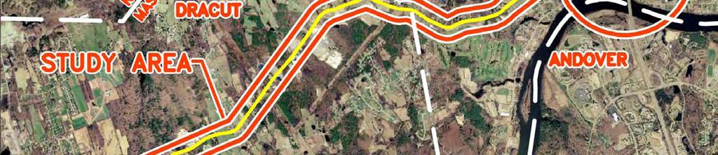
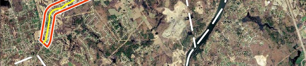
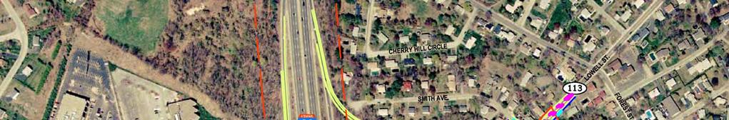
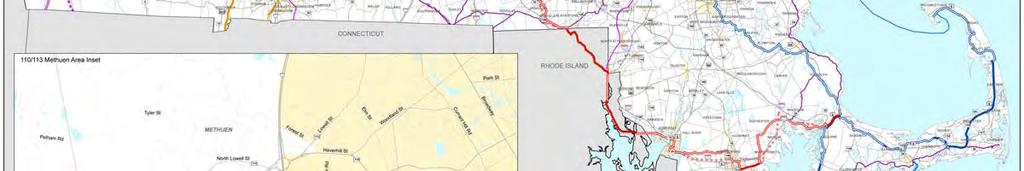
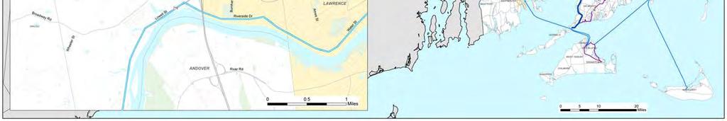
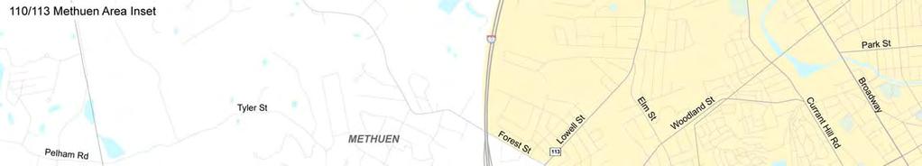
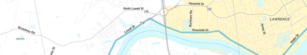
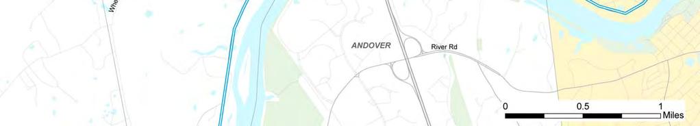
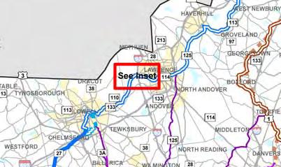
12 Study Area

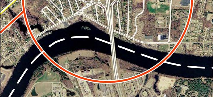
13 Study Area
14 Intersection Data Collection Traffic Count Data was Collected in January 2006 Turning Movement Counts at 5 Intersections 3 Signalized Intersections 2 Unsignalized Intersections Time Periods Weekday AM: 7 AM 9 AM Weekday PM: 4 PM 6 PM
15 2006 Levels of Service & Delays Intersection AM Peak Hour Average Delay LOS (sec/veh) PM Peak Hour Average Delay LOS (Sec) Signalized Intersections Rte 110 and Rte 113 (West of Rotary) C 22 C 22 Rte 110 and Rte 113 (East of Rotary) B 13 E 67 Rte 110 (Haverhill Street) and Burnham Road B 13 C 25 Unsignalized Intersections Rte 110 and Riverside Drive (Riverside Lefts) F 72 F >80 Riverside Drive and Burnham Road (Burnham Lefts) C 17 F 52 Rte 113 and Branch Street (Branch Lefts) F >80 F >80 Rotary Northbound Approach A 6 F >80 Southbound Approach F >80 F >80 Eastbound Approach F >80 A 4 Westbound Approach C 32 F >80

16 2006 Levels of Service
17 Crash Summary ( ) Total Crashes I-93 Rte 110/113
18 Crash History Crash Zone Locations Total 1. I /113 Rotary Lowell St. at N. Lowell St Lowell St. at Haverhill St Lowell St. Between Lois St. and N. Lowell St N. Lowell St. Between Hill St. and Lowell St Lowell St. Between Haverhill St. and Hobson St Haverhill St. Between Lowell St. and Hobson St TOTAL
19 Crash Rates ( ) Location Crash Rate (per MEV) Statewide Average 110/113 Rotary Lowell North Lowell Street Lowell Haverhill Street
20 Projected Traffic Growth Location 2006 ADT Est 2025 ADT Percent Growth I-93 North of Exit , ,270 4% I-93 South of Exit , ,430 3% Rte 110 East of Rotary Rte 113 East of Rotary Rte 110 at Dracut Line Rte 113 at Dracut Line 21,170 21,430 1% 10,170 11,060 9% 18,100 24,050 33% 15,740 20,760 32%
21 LOS Summary Future No-Build Condition (2025) Intersection Signalized Intersections LOS Average Delay (sec/veh) LOS Average Delay (Sec) LOS Average Delay (sec/veh) Rte 110 and Rte 113 (West of Rotary) C 22 C 22 C 35 D 37 Rte 110 and Rte 113 (East of Rotary) B 13 E 67 B 15 F >80 Rte 110 (Haverhill Street) and Burnham Road B 13 C 25 B 16 D 44 Unsignalized Intersections Rte 110 and Riverside Drive (Riverside Lefts) F 72 F >80 F >80 F >80 Riverside Drive and Burnham Road (Burnham Lefts) C 17 F 52 C 20 F >80 Rte 113 and Branch Street (Branch Lefts) F >80 F >80 F >80 F >80 Rotary Existing Condition (2006) AM Peak Hour PM Peak Hour No-Build Condition (2025) AM Peak Hour PM Peak Hour Northbound Approach A 6 F >80 A 7 F >80 Southbound Approach F >80 F >80 F >80 F >80 Eastbound Approach F >80 A 4 F >80 A 5 Westbound Approach C 32 F >80 F >80 F >80 LOS Average Delay (Sec)


22 Overall Intersection Levels of Service Summary Future No-Build Condition (2025)

23 Future Year No-Build AM Peak Hour Congestion Rotary
24 Existing Transit MBTA Lines 4,700 Inbound Riders Daily on MBTA Haverhill Reading Line 1,350 Inbound Riders Daily From Haverhill, Bradford and Lawrence Stations 600 Inbound Riders Daily From Andover 4,700 Inbound Riders on MBTA Lowell Line 1,220 are From Lowell ITS is not Deployed in the Study Area MHD Park-and-Ride Facilities Capacity 73 Cars in the Andover lot on Dascomb Road off I-93 at Exit Cars in the Pelham Street lot, One Exit North of Rte 110 and Rte 113 Rotary at Exit 47 Additionally: McGovern Transportation Center (Lawrence) commuter rail station has parking for 540 commuters using either the commuter rail or the Boston Commuter Bus stops. Additional parking is also provided for commuters at the Boston Commuter Bus stops in Andover.
25 Socio-Economic Characteristics Dracut Residential: 296 Units 341 Broadway Rd. (Rte 113) 34 Homes on Wheeler Rd (Connects to Rte 113) 144 Rental Units (Half 40B) at Civic Village, at Rte 113/Loon Hill 73 Single Family Lots at Wheeler Road Estates (off Rte 113) Under Review 178 Homes Plus a Golf Course (About 45 Built) at Meadow Creek/Rte Additional Homes Planned/Built at 5 Locations near Rte 113
26 Socio-Economic Characteristics Dracut Commercial: 1187 Broadway 19,000 SF Building for Rent 983 Broadway Warehouse Available 1112 Broadway 5,000 SF Rental Space Available for Offices 1330 Broadway Addition to Existing High Business Planning to Double Production and Add 100 Employees End of Silver St off Rte 113 A New Business is Locating There, Involving Trucks (20 Bays) and Some Manufacturing In general the eastern half of the study area is more heavily developed, while the western is less developed with lots of potential for more development.
27 Socio-Economic Characteristics Methuen Planned and Developed Land Use: 240 Condominium Units for Over Age 55 Residents Planned for the Former Zambino Gravel Pit on Wheeler Street Near the Dracut Town Line. 28 Market Rate Condominiums at Park View, Burnham Road at Riverside Drive. 20 Market Rate Condominium Units at Park Place, Burnham Road near Riverside Drive. 89 Over age 55 Single Family Homes in a 40(B) Development at Stone Castle off Tyler Street. 78 Units in 36 Duplex Structures (25% affordable) in a 40(B) Project off Tyler Street Another 377 Units are Expected to be Approved Shortly.
28 Socio-Economic Characteristics Methuen Potential Land Use Changes: 50 Market Rate Condominium Units or an Indoor Sports Complex (Rink/Pool/Soccer Field) are Under Consideration in the Study Area. There are Over 260 Acres Bounded by Rte 110, Rte 113 and Wheeler Street that Could Potentially be Open to Development.
29 Environmental Analysis Conducted: Surface Waters, Floodplains and Wetlands Groundwater, Aquifers and Public Water Supplies Fish and Wildlife Threatened and Endangered Species Areas of Critical Concern Hazardous Waste Sites Cultural, Historical and Archaeological Resources Air and Noise Open Space and Recreation Bedrock and Surface Geology
30 Summary of Issues: Congestion and Delay: At Intersections East and West of the Rotary At Side-Street Approaches at Unsignalized Intersections On the Rotary Causing Backups/Queuing onto I-93 In AM Peak Queues on the Rotary and Route 110 (Lowell Street) at Entrance to I-93 Southbound (by Year 2026 Queues Projected to Fill Entire Rotary) In PM Peak I-93 Northbound Off-Ramp has Extremely Long Queues Extending Back to the Highway (Causes Accidents) Detouring From Route 110 East to Riverside Drive (also Affects Access to Park) Congestion Degrades Air Quality
31 Summary of Issues Continued: Safety: High Travel Speeds on Route 113 West of the Rotary School Bus Access on Route 113 West in the AM and PM Provides Potential Conflicts with Traffic Volumes Truck Usage to and from Facilities in Dracut Rotary has Higher Rate of Crashes than the Statewide Averages for Unsignalized Intersections I-93 South Off-Ramp has Safety Issues with Rotary Traffic Intersections at Lowell Street/N. Lowell Street and at Lowell Street/Haverhill Street have Higher than Average Crash Rates Area Growth: Residential and Business Growth in Dracut will Place Higher Demand on Route 113 West of the Rotary
32 Constraints: Existing Land Development: Residential and Commercial Property Takings Needed Large Commercial Building Near the Southbound I-93 Off-Ramp Limits Possible Changes to Ramp Narrow Rte 113 West Right-of-Way, Small Setbacks of Homes Limit the Ability to Widen Road Without Takings Environmental: 100-Year and 500-Year Floodplains to the southwest of the Rotary Require Permits and fill Analysis for Displacement of Floodwaters if any Alternative Alters the Floodplain Wetlands Permits and Compensation/Mitigation for Drainage for Affected Areas Required Impacts to a Swamp West of the Rotary and to an Emergent Wetland to the Northeast and East of Rotary Possible Elimination of Buffer Areas to Wetland Areas Noise consideration for adjacent residential areas
33 Constraints Continued: Although no listed historic sites exist in the vicinity of the proposed project, several older structures could be eligible for listing on the National Register. Hazardous materials and potential contamination do not appear to pose constraints. The proximity of the Merrimack River and the I-93 bridge over the river to Exit 46 and the 110/113 Rotary represent constraints to alternatives development. Substandard geometry of the Rotary requires that any build alternative reconstruct or replace the rotary with current design standards for safety and mobility.
34 Development of Alternatives Alternatives were developed based on traffic operations analysis, safety considerations, Highway Design Criteria They were developed in consultation with the SAC, MassHighway Highway Design Section and District Office Reviewed by traffic operation, environmental impacts, community impacts, ROW takings, safety analysis and the ability to handle forecasted traffic levels in 2025
35 Development of Alternatives (Short-Term) Based upon: Comments received at the first Public Meeting Input from SAC members Review of existing conditions Field observations Identified short-term improvements that could be implemented in 1 to 5 years Not meant as a replacement of long-term solutions but recognizing that some changes could be made now to provide short-term improvements
36 Short-Term Improvements Clear trees in the northwest quadrant to improve sight lines for vehicles exiting rotary Install warning signs for westbound vehicles exiting the rotary to watch for stopped traffic ahead Install No Jake Brake signs along Route 113 west of rotary


37 Short-term Improvements Rotary Re-striping & Advance Signage Advance Signage Advance Signage Striping Delineate travel paths Improve circulation Signage Aid in lane selection for vehicles entering rotary Provide guidance to rotary traffic patterns Advance Signage Advance Signage
38 Short-term Improvements Bypass Lanes & Signal Installation New Traffic Signal Coordinated Signals Existing Traffic Signal New Traffic Signal
39 2025 Level of Service Summary Study Area Intersections No-Build & Short-Term Improvement Conditions No-Build Short-Term AM Peak Hour PM Peak Hour AM Peak Hour PM Peak Hour LOS LOS LOS LOS Study Area Intersections Route 110 / Route 113 (western split) C D B B Route 113 / Branch Street F F C C Route 110 / Riverside Drive F F A B Route 110 / Route 113 (eastern split) B F B F Route 110 / Burnham Road B D B C Riverside Drive / Burnham Road (Burnham lefts) C F C F
40 Level of Service Summary Short-Term Study Area Intersections Route 110/113 LOS B (F) LOS B (F) Route 113 & Branch Street LOS F (F) LOS C (C) Route 110/113 LOS C (D) LOS B (B) Route 110 & Burnham/Green LOS B (D) LOS B (C) Route 110 & Riverside Drive LOS F (F) LOS A (B) Riverside Drive & Burnham Road LOS C (F) LOS C (F) No-Build: LOS AM Peak (PM Peak) Short-Term: LOS AM Peak (PM Peak)


")
 LOS A (A)")
41 Short-term Improvements Bypass Lanes - Levels of Service Southbound LOS F (F) LOS A (A) Westbound LOS F (F) LOS F (F) Eastbound LOS F (A) LOS A (A) Northbound LOS A (F) LOS A (F)
42 Transit/Park & Ride/ITS Options (ITS = Intelligent Transportation Systems) Intended to: Improve mobility Provide transportation options Reduce environmental impacts Focus on shorter-term options (longer-term options studied in other efforts)
43 Conceptual Transit/Park & Ride/ITS Options 1. New Park & Ride on Rte. 113 west of rotary 2. Signage promoting alt. transportation options 3. Extend MVRTA bus Route 35, LRTA bus Route 1 4. Create new Lawrence-to- Lowell bus route on Add Dynamic Message Signs (DMS) on I-93 promoting Park & Ride

44 Option 1: New Park & Ride on Route 113 west of Rotary Potential location: South side of Route 113 near Youngfarm Road and Hill Street Serve both carpools/vanpools and bus riders Possible elements: Daily parking Passenger pick-up/drop-off Bus stop for MVRTA Route 35 Covered passenger waiting area, public phone, lighting Size to be determined (likely under 100 spaces)


45 Option 2: Add signage promoting alternative transportation options Could be added on Route 110, Route 113, and I-93 Promote commuter rail, bus and ridesharing options Could tie in to Option 1 Park & Ride, or stand alone
46 Option 3: Extend MVRTA Bus Route 35 and LRTA Bus Route 1 MVRTA Route 35 serves Lawrence and Methuen LRTA Route 1 serves Lowell and Dracut Option would extend routes to a new transfer point on Route 113 near Methuen/Dracut line Build on routes with little extra coordination
47 Option 4: Create a new Lawrence-to-Lowell bus route along Route 113 Serve same purpose as Option 3 but with a new route allowing through travel Connect with Lowell and Lawrence rail stations Would require more coordination Precedent already exists with MVRTA Route 41

48 Option 5: Add Dynamic Message Signs on I-93 Promoting Pelham St. Park & Ride Install on I-93 north of the Pelham Street exit Promote Park & Ride and MVRTA express bus service to Boston DMS could: Mention facility location Display next scheduled bus departure Show whether parking is available (would require electronic system or monitoring by personnel) Integrate with Mass. 511
49 Development of Alternatives (Long-Term) Began by reviewing alternatives developed for the I-93 Corridor Study Two alternatives from that study were identified by the SAC as having merit but needing modifications Five modified and six entirely new alternatives were developed (11 total alternatives) Working with the SAC and MassHighway, list of alternatives was narrowed to four and then two Alternatives were developed to: Improve future traffic operations, mobility, LOS Be responsive to the SAC and Community input Minimize impacts to properties and environmental resources

50 Alternative 2B Modified SPUI (Long-term)
51 Alternative 2B Modified SPUI (Long-term)

52 Alternative 2B Modified SPUI (Long-term)
53 Alternative 2B Modified SPUI (Long-term)
54 Alternative 2B Modified SPUI (Long-term)
55 Alternative 2B Modified SPUI (Long-term)
56 Alternative 2B Modified SPUI (Long-term)
57 Alternative 2B Modified SPUI (Long-term)
58 Alternative 2B Modified SPUI (Long-term)
59 Alternative 2B Modified SPUI (Long-term)
60 Alternative 2B Modified SPUI (Long-term)
61 Alternative 2B Modified SPUI (Long-term)
62 2025 Level of Service Summary Ramp Junctions No-Build and Alternative 2B No Build Alternative 2B Ramps AM Peak Hour PM Peak Hour AM Peak Hour PM Peak Hour NB off-ramp B F A C NB on-ramp B B B C SB off-ramp D C C C SB on-ramp F D B A
63 Alternative 2B Study Area Intersections Route 110/113 LOS B (F) LOS B (A) Route 113 & Branch Street LOS F (F) LOS B (B) Route 110/113 LOS C (D) LOS C (C) SPUI LOS C (C) Route 110 & Burnham Road/Green Street LOS B (D) LOS B (C) Route 110 & Riverside Drive LOS F (F) LOS B (B) Riverside Drive & Burnham Road LOS C (F) LOS C (C) No-Build: Overall Intersection LOS AM Peak (PM Peak) Alternative Build: Overall Intersection LOS AM Peak (PM Peak)
64 Alternative 3A Partial Cloverleaf (Long-term)
65 Alternative 3A Partial Cloverleaf (Long-term)
66 Alternative 3A Partial Cloverleaf (Long-term)
67 Alternative 3A Partial Cloverleaf (Long-term)
68 Alternative 3A Partial Cloverleaf (Long-term)
69 Alternative 3A Partial Cloverleaf (Long-term)
")
70 Alternative 3A Partial Cloverleaf (Long-term)
71 Alternative 3A Partial Cloverleaf (Long-term)
")
72 Alternative 3A Partial Cloverleaf (Long-term)
73 Alternative 3A Partial Cloverleaf (Long-term)
74 2025 Level of Service Summary Ramp Junctions No-Build and Alternative 3A No Build Alternative 3A Ramps AM Peak Hour PM Peak Hour AM Peak Hour PM Peak Hour NB off-ramp B F A C NB on-ramp B B B B SB off-ramp D C C C SB on-ramp F D C C
 LOS B (B) Route 110 & Riverside Drive LOS F (F) LOS B (B) Riverside Drive & Burnham Road LOS C (F) LOS C (D) No-Build: Overall Intersection LOS AM Peak (PM Peak)")
75 Alternative 3A Study Area Intersections Route 113 & Branch Street LOS F (F) LOS B (C) Route 110/113 LOS C (D) LOS C (B) Route 110/113 LOS B (F) LOS B (B) Northbound Ramps LOS B (B) Route 110 & Burnham Road/Green Street LOS B (D) LOS B (B) Route 110 & Riverside Drive LOS F (F) LOS B (B) Riverside Drive & Burnham Road LOS C (F) LOS C (D) No-Build: Overall Intersection LOS AM Peak (PM Peak) Alternative Build: Overall Intersection LOS AM Peak (PM Peak)

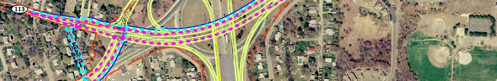
76 Alternative 2B Bicycle/Pedestrian Connections
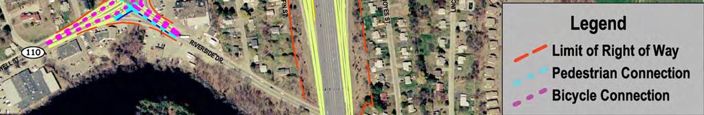
77 Alternative 3A Bicycle/Pedestrian Connections
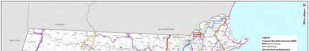
78 Massachusetts Statewide Bicycle Plan Network Map
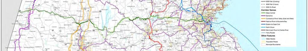
79 Massachusetts Statewide Bicycle Plan Methuen Area

80 CORSIM Modeling by Alternative
81 Comparison of Alternatives Traffic Exposure to Conflict Type Type of Conflict (% ) 100% 80% 60% 40% 20% 0% NB Alt 2B Alt 3A Weave Merge Signalized Alternatives
82 Comparison of Alternatives Crash Potential (No-Build normalized to 100) NB Alt 2B Alt 3A Alternatives
83 Conceptual Construction Cost Estimates Developed Costs for 2 Long-Term and 1 Short- Term Alternatives Based on MassHighway s 2007 Weighted Average Bid Prices Cost of construction only Does not include ROW, design or environmental mitigation
84 Conceptual Construction Cost Estimates Long-Term Alternatives: Alternative 2B: $48,000,000 Alternative 3A: $44,000,000 Short-Term Improvement (Bypass Lanes & Signal Improvements): Rotary Changes: $1,530,000 Traffic Signal Improvements: $900,000 Total: $2,430,000
85 Potential Property Impacts Based upon conceptual level plans May be modified as concepts move through Environmental and Design phases of project Layout lines shown are best-fit from Layout Plans Not located by field survey Similar for both long-term alternatives Primarily limited to strip takings with some full takings

86 Alternative 2B Potential Property Impacts
87 Alternative 3A Potential Property Impacts
88 Evaluation Criteria Criteria Measures 2B 3A Mobility Delays (Overall) Pos Pos+ LOS (Intersections) Pos Pos VMT (Veh. Miles Traveled) Neut Neut VHT (Veh. Hours Traveled) Pos Pos+ Queuing Neut Pos Freight Pos Pos Emergency Vehicle Access Pos Pos Safety Crash rates Pos Pos Crash sites Neut Neut Legend: NA Not Applicable, Low minimal impacts, Med moderate impacts, High substantial impacts, Pos Positive, Neut Neutral, Neg - Negative
89 Evaluation Criteria Criteria Measures 2B 3A Public safety Pos Pos School buses Pos Pos Ped/Bicycle Pos Pos Environmental Wetlands Med Med Recreation Pos Pos Visual/aesthetics Pos Pos Historic/Archeological Med Med Additional Noise Low Low Air Quality Low Low Wildlife Habitat Low Low Legend: NA Not Applicable, Low minimal impacts, Med moderate impacts, High substantial impacts, Pos Positive, Neut Neutral, Neg - Negative
90 Evaluation Criteria Criteria Measures 2B 3A Land Use Right-of-Way Med Med Economic Development Neut Neut Parking Low Low Cohesion Neighborhood Pos Pos Ped/Bicycle Pos Pos Cost Const. Costs Med Med Permits Med Med Legend: NA Not Applicable, Low minimal impacts, Med moderate impacts, High substantial impacts, Pos - Positive, Neut Neutral, Neg - Negative
91 Evaluation of Transit/Park & Ride/ITS Options Mobility: Potential modest shift from Single- Occupant Vehicles (SOV) to alternative modes Environmental: Potential modest reduction in emissions from SOV use Cost and Schedule: Low to moderate costs (capital and operating); feasible in the shorter term Could be pursued as a package or individually
92 Review & Next Steps Next Steps - Review Public Input - Review findings and input with the SAC - Finalize Recommendations - Prepare and release Final Report MPO s and Local Community Review and Prioritize TIP MassHighway advances to NEPA/MEPA Level of Analysis Final Design Construction
93 Route 110 and 113 Methuen Rotary Interchange Study Questions & Answers Comment Forms Thank You
Chapter 4: Alternatives Analysis
 Chapter 4: Alternatives Analysis 4.0 Introduction and Alternatives Analysis Process Detailed analysis and evaluation of the alternatives was a critical step in the development of comprehensive and workable
The Folded Interchange: An Unconventional Design for the Reconstruction of Cloverleaf Interchanges
 The Folded Interchange: An Unconventional Design for the Reconstruction of Cloverleaf Interchanges I. ABSTRACT Keith A. Riniker, PE, PTOE This paper presents the Folded Interchange design and compares
WELCOME IL 47. Community Advisory Group Meeting #5 Waubonsee Community College Wednesday, May 31, 2017
 WELCOME IL 47 Community Advisory Group Meeting #5 Waubonsee Community College Wednesday, May 31, 2017 MEETING PURPOSE MEETING AGENDA 1. Welcome/Introduction 2. Review Previous Public Involvement 3. Process/Schedule
FLORIDA DEPARTMENT OF TRANSPORTATION Planning and Environmental Management Office INTERCHANGE MODIFICATION REPORT
 FLORIDA DEPARTMENT OF TRANSPORTATION Planning and Environmental Management Office INTERCHANGE MODIFICATION REPORT District 2 1109 South Marion Avenue Lake City, FL 32025-5874 INTERSTATE 10 (SR 8) / SR
THE PROJECT. Executive Summary. City of Industry. City of Diamond Bar. 57/60 Confluence.
 THE PROJECT A freeway segment ranked 6th worst in the Nation, with levels of congestion, pollution and accidents that are simply unacceptable and which have Statewide and National implications. Executive
Woodburn Interchange Project Transportation Technical Report
 Final Report Woodburn Interchange Project Transportation Technical Report Prepared for Oregon Department of Transportation April 212 Prepared by DKS Associates Contents Methodologies... 4 Volume Development...
I-10 CORRIDOR IMPROVEMENTS STAGE 0 FEASIBILITY STUDY STATE PROJECT NUMBER H FEDERAL AID PROJECT NUMBER H004100
 JULY 2016 I-10 CORRIDOR IMPROVEMENTS STAGE 0 FEASIBILITY STUDY STATE PROJECT NUMBER H.004100 FEDERAL AID PROJECT NUMBER H004100 EAST BATON ROUGE AND WEST BATON ROUGE PARISHES, LOUISIANA Section TABLE OF
Project Initiation Form
 Meeting Date: The Project Initiation Form should be completed in conjunction with the Level 2 Screening Form. Process Leads and/or Planners should complete the Project Initiation Form to document coordination
I-10 CONNECT. Public Meeting #1
 I-10 CONNECT Public Meeting #1 The environmental review, consultation, and other actions required by applicable Federal environmental laws for this project are being, or have been, carried-out by TxDOT
APPENDIX B. Public Works and Development Engineering Services Division Guidelines for Traffic Impact Studies
 APPENDIX B Public Works and Development Engineering Services Division Guidelines for Traffic Impact Studies Revised December 7, 2010 via Resolution # 100991 Reformatted March 18, 2011 TABLE OF CONTENTS
South Boston. Transportation Plan. Transportation Planning Division. Virginia Department of Transportation
 2020 Transportation Plan Developed by the Transportation Planning Division of the Virginia Department of Transportation in cooperation with the U.S. Department of Transportation, Federal Highway Administration
DEVELOPMENT, ANALYSIS, AND DESIGN OF A NEW PARKWAY AT GRADE INTERSECTION (PAGI)
") 2013 ITE Western District Annual Meeting COCEPT DEVELOPMET, AALYSIS, AD DESIG OF A EW PARKWAY AT GRADE ITERSECTIO (PAGI) Lead Author: James M. Witkowski, PhD Supporting Author: Darrell Truitt, PE The Pima
2013 ITE Western District Annual Meeting COCEPT DEVELOPMET, AALYSIS, AD DESIG OF A EW PARKWAY AT GRADE ITERSECTIO (PAGI) Lead Author: James M. Witkowski, PhD Supporting Author: Darrell Truitt, PE The Pima
HB2 Implementation Policy Guide
 report HB2 Implementation Policy Guide prepared for Commonwealth Transportation Board date August 1, 2015 6.0 Appendix A: Safety Measures Table 6.1 Safety Factor Measures Summary ID Measure Name Weight
FY STATEWIDE TRANSPORTATION IMPROVEMENT PROGRAM New Jersey Department of Transportation Project Descriptions ($ millions)
") FY 2018-2027 WIDE TRANSPORTATION IMPROVEMENT PROGRAM NY Susquehanna and Western Rail Line Bicycle/Pedestrian Path DBNUM: NS9803 / UPC: 058018 The 4.8 mile New York, Susquehanna, and Western Railway (NYS&W)
FY 2018-2027 WIDE TRANSPORTATION IMPROVEMENT PROGRAM NY Susquehanna and Western Rail Line Bicycle/Pedestrian Path DBNUM: NS9803 / UPC: 058018 The 4.8 mile New York, Susquehanna, and Western Railway (NYS&W)
Interchange Workshop Report (August 2004)
") U.S. Highway 14 Corridor Study New Ulm to North Mankato Table of Contents Section Interchange Workshop Report (August 2004) Page 1. Introduction and Next Steps 1 2. Interchange Workshop Participants &
U.S. Highway 14 Corridor Study New Ulm to North Mankato Table of Contents Section Interchange Workshop Report (August 2004) Page 1. Introduction and Next Steps 1 2. Interchange Workshop Participants &
A Unique Application of Railroad Preemption with Queue Mitigation at a Roundabout Interchange
 A Unique Application of Railroad Preemption with Queue Mitigation at a Roundabout Interchange Jeromy Grenard, PE, PTOE American Structurepoint Hardik Shah, PE, PTOE American Structurepoint Roundabouts
Staff Priority and UPWP Committee Priority List 3/25/2016. ID Proposed Study Name Project Category Tentative Project Cost
 Staff and UPWP Committee List 3/25/2016 Projects with Only (No Bottom Non- ) C-2 Safety and Operations at Selected Intersections: FFY 2017 Roadway Network Performance $65,000 Purpose: The purpose of this
1.1 Purpose of the Project
 Chapter 1 Purpose and Need for East Link Project 1.1 Purpose of the Project The purpose of the East Link Project is to expand the Sound Transit Link light rail system from Seattle to Mercer Island, Bellevue
APPENDIX A TIER 1 ANALYSIS
 SPN H.004100 FEASIBILITY STUDY APPENDIX A TIER 1 ANALYSIS 040-012-042AH Appendices Lead Sheets PROVIDENCE STATE PROJECT. H.004100 The following worksheets analyze various project alternatives at various
Scope of Work. Project Approach and Understanding. Task 1: Study Initiation and Administration
 Scope of Work Route 116/Hinesburg Growth Center Corridor Study Town of Hinesburg and CCRPC Project Approach and Understanding Route 116 through Hinesburg had seen substantial changes in the past 15 years,
2040 Transportation Policy Plan Conversion to Performance Based Planning Basis. 25 th Annual CTS Transportation Research Conference May 21, 2014
 2040 Transportation Policy Plan Conversion to Performance Based Planning Basis 25 th Annual CTS Transportation Research Conference May 21, 2014 1 About the plan Long-range transportation plan for the Twin
LONE HILL TO WHITE DOUBLE TRACK STUDY Community Open Houses May 16 & 17
 LONE HILL TO WHITE DOUBLE TRACK STUDY Community Open Houses May 16 & 17 1 PROJECT TEAM & COLLABORATORS 2 OPEN HOUSE SERIES Tuesday, May 16, 2017 6-8:00 pm La Verne City Council Chambers 3660 D Street La
Transportation and Works Department The Regional Municipality of York Yonge Street Newmarket, Ontario L3Y 6Z1
 TRANSPORTATION IMPACT STUDY (TIS) GUIDELINES FOR DEVELOPMENT APPLICATIONS Transportation and Works Department The Regional Municipality of York 17250 Yonge Street Newmarket, Ontario L3Y 6Z1 August, 2007
Appendix B Highway 407 Interchange Review - Cochrane Street Area
 Appendix B Highway 407 Interchange Review - Cochrane Street Area AECOM 300 ater Street hitby, ON, Canada L1N 9J2 www.aecom.com Memorandum To Michael May, P.Eng., Town of hitby Page 1 CC Subject Greg Hardy,
ITEM 8 Action May 17, 2017
 ITEM 8 Action May 17, 2017 Approval of Maryland Department of Transportation (MDOT) Additional Project Submission for the Out-Of-Cycle Air Quality Conformity Analysis for the Amendment to the 2016 CLRP
3 INTERSTATES. The Carolina Crossroads Project Team Welcomes You
 The Carolina Crossroads Project Team Welcomes You 3 INTERSTATES + 12 = KEY INTERCHANGES We re here to: Discuss the Carolina Crossroads I-20/26/126 Corridor Project Gather your input on study issues We
PROJECT SCOPING PHASE ~ SCOPE OF SERVICES MAIN STREET BRIDGE OVER WINOOSKI RIVER CITIES OF BURLINGTON & WINOOSKI VERMONT
 PROJECT SCOPING PHASE ~ SCOPE OF SERVICES MAIN STREET BRIDGE OVER WINOOSKI RIVER CITIES OF BURLINGTON & WINOOSKI VERMONT PROJECT DESCRIPTION McFarland-Johnson, Inc. (MJ) has prepared this proposal to perform
1RUWKZHVW#:LFKLWD 0DMRU#,QYHVWPHQW#6WXG\
 1RUWKZHVW#:LFKLWD 0DMRU#,QYHVWPHQW#6WXG\ Executive Summary 3UHSDUHGýIRUã 3UHSDUHGýE\ã.DQVDVý'HSDUWPHQWýRI 7UDQVSRUWDWLRQ,QýDVVRFLDWLRQýZLWKã (DUWKý7HFKý,QFï EXECUTIVE SUMMARY Introduction This Northwest
HORIZON 2030: Plan Projects November 2005
 Horizon PROJECTS 2030 Projects 10-1 10-2 The Horizon 2030 Project Information section is comprised of individual project information in alphabetical order by project name. The information provided for
NW La Center Road/I-5 Interchange Improvement Project (MP 16.80)
") FINAL DRAFT - NW La Center Road/I-5 Interchange Improvement Project (MP 16.80) La Center, Washington February 2015 FINAL DRAFT - NW La Center Road/I-5 Interchange Improvement Project (MP 16.80) La Center,
FINAL DRAFT - NW La Center Road/I-5 Interchange Improvement Project (MP 16.80) La Center, Washington February 2015 FINAL DRAFT - NW La Center Road/I-5 Interchange Improvement Project (MP 16.80) La Center,
State Route 8 Bridge Replacement Project
 OPEN HOUSE PUBLIC INVOLVEMENT MEETING Celebration Church 688 Dan Street, Akron, Ohio Tuesday, July 14, 2015 5:00 PM to 7:00 PM State Route 8 Bridge Replacement Project Existing Bridge Future Bridges: Steel
Chapter 2: Alternatives
 Chapter 2: Alternatives Introduction An Environmental Impact Statement (EIS) is a procedural document. In other words, the environmental planning process follows a logical sequence of development. Subsequent
ENVIRONMENTAL STUDY REPORT
 Strasburg Road Extension From North of Stauffer Drive To New Dundee Road Class Environmental Assessment ENVIRONMENTAL STUDY REPORT APPENDICES Volume II October 2013 Strasburg Road Extension Environmental
Air Report. Project Information PPTA/LAP. Traffic Data I-495 NORTHERN SECTION SHOULDER USE. Project Number: , C501, P101 UPC:
 Air Report Project Information Project Name: I-495 NORTHERN SECTION SHOULDER USE Project Number: 0495-029-123, C501, P101 UPC: 105130 Route Number: 495 Project Limit - From: South of Old Dominion Drive
MONITORING IMPLEMENTATION AND PERFORMANCE
 12 MONITORING IMPLEMENTATION AND PERFORMANCE The FAST Act continues the legislation authorized under MAP-21, which created a data-driven, performance-based multimodal program to address the many challenges
Table of Contents. Executive Summary. 1.0 Background and Scope of Work. 2.0 Project Definition. 3.0 Traffic Summary. 4.0 Structural Systems
 Final cope Report October 20, 2010 Table of Contents E Executive ummary 1.0 Background and cope of Work 2.0 Project Definition 3.0 Traffic ummary 4.0 tructural ystems 5.0 Proposed chedule 6.0 Project Costs
APPENDIX H: TRAVEL DEMAND MODEL VALIDATION AND ANALYSIS
 APPENDIX H: TRAVEL DEMAND MODEL VALIDATION AND ANALYSIS Travel demand models (TDM) simulate current travel conditions and forecast future travel patterns and conditions based on planned system improvements
SR 417 Extension. June 2003 INTRODUCTION AND HISTORY PROJECT SCOPE AND PURPOSE STUDY OBJECTIVE STUDY PHASES
 Planning Feasibility Study June 2003 INTRODUCTION AND HISTORY The SR 417 Extension Study was a yearlong effort undertaken by Florida s Turnpike Enterprise to investigate the feasibility of a new toll road
The Policies section will also provide guidance and short range policies in order to accomplish the goals and objectives.
 4 Goals & Objectives INTRODUCTION The 2015-2040 MTP preserves and promotes the quality of life and economic prosperity of the MAB by providing a transportation system consistent with the regional goals.
Appendix D: Functional Classification Criteria and Characteristics, and MnDOT Access Guidance
 APPENDICES Appendix D: Functional Classification Criteria and Characteristics, and MnDOT Access Guidance D.1 Functional classification identifies the role a highway or street plays in the transportation
MULTIMODAL TRANSPORTATION IMPACT STUDY GUIDELINES
 MULTIMODAL TRANSPORTATION IMPACT STUDY GUIDELINES 1 st Edition City of San Luis Obispo 2035 Circulation Element 1 Table of Contents Introduction... 2 Process... 2 When Impact Studies Are Required... 3
LAS VEGAS STREET RAILROAD CROSSING RR/PUC CONNECTION AND PRELIMINARY DESIGN
 LAS VEGAS STREET RAILROAD CROSSING RR/PUC CONNECTION AND PRELIMINARY DESIGN Prepared for: City of Colorado Springs Prepared by: Felsburg Holt & Ullevig 508 South Tejon Street Colorado Springs, CO 80903
High-Speed Rail - Chicago to St. Louis Alton Regional Multimodal Transportation Center Project
 High-Speed Rail - Chicago to St. Louis Alton Regional Multimodal May 2012 Draft Report: Alternatives Screening Version 1.0 1.0 Introduction This document outlines the alternatives screening process used
The New Highway Capacity Manual 6 th Edition It s Not Your Father s HCM
 The New Highway Capacity Manual 6 th Edition It s Not Your Father s HCM Tom Creasey, PE, PhD Principal, Stantec Consulting Services Inc. Chair, TRB Highway Capacity and Quality of Service Committee Presented
TRANSPORTATION IMPACT STUDIES
 January 28, 2009 POLICIES AND PROCEDURES FOR TRANSPORTATION IMPACT STUDIES Related to Highway Occupancy Permits Pennsylvania Department of Transportation Bureau of Highway Safety and Traffic Engineering
Transit Service Guidelines
 G R E AT E R VA N CO U V E R T R A N S P O RTAT I O N A U T H O R I T Y Transit Service Guidelines PUBLIC SUMMARY REPORT JUNE 2004 Greater Vancouver Transportation Authority TRANSIT SERVICE GUIDELINES
Maine Turnpike Needs Assessment
 Maine Turnpike Needs Assessment Safety and Capacity Study Prepared for: Maine Turnpike Authority Prepared by: May 2016 ii P age TABLE OF CONTENTS EXECUTIVE SUMMARY... 1 1.1 Purpose and Scope... 1 1.2 Turnpike
CE 452 Traffic Impact Assessment
 CE 452 Traffic Impact Assessment 1 Why Required? New developments Produce/ attract new traffic Production: Residences Attraction: Shops, Offices, Schools, Hospitals etc. etc. Changes in traffic pattern
Executive Summary October 2017
 Executive Summary The King of Prussia Rail Draft Environmental Impact Statement/Draft Section 4(f) Evaluation (DEIS) describes and summarizes the transportation and environmental benefits and impacts of
Congestion Management Process 2013 Update
 OVERVIEW OF THE DALLAS-FORT WORTH CONGESTION MANAGEMENT PROCESS Traffic Congestion In The Dallas-Fort Worth Region With the Dallas-Fort Worth (DFW) urban area as its center, the North Central Texas region
U.S. Department of Transportation Federal Transit Administration and Metropolitan Atlanta Rapid Transit Authority
 ATLANTA BELTLINE CITY OF ATLANTA, FULTON COUNTY, GA TIER 1 DRAFT ENVIRONMENTAL IMPACT STATEMENT/ SECTION 4(F) EVALUATION U.S. Department of Transportation Federal Transit Administration and Metropolitan
Standard Performance Attributes for Transportation Projects
 Standard s for Transportation Projects Mainline Operations Local Operations Maintainability Construction Impacts Environmental Impacts Project Schedule An assessment of traffic operations and safety on
Fairmount Line Feasibility Study
 Executive Summary Wednesday October 16, 2002 Prepared for Massachusetts Bay Transportation Authority Planning Department Prepared by KKO and Associates, L.L.C. Two Dundee Park Andover, Massachusetts 01810
2 Purpose and Need. 2.1 Study Area. I-81 Corridor Improvement Study Tier 1 Draft Environmental Impact Statement
 2 Purpose and Need 2.1 Study Area Interstate 81 (I-81) is relied upon for local and regional travel and interstate travel in the eastern United States. It extends 855 miles from Tennessee to New York at
I-91 Viaduct Public Information Briefing
 I-91 Viaduct Public Information Briefing Project File No. 607731 MassDOT Contract No. 85020 Briefing no. 9 September 13, 2017 Agenda Welcome and Presenter Introductions Update on Construction and Demolition
Shannon Noonan, City of Cambridge Don Drackley, IBI Group Scott Johnson, IBI Group PTSL
 100 175 Galaxy Boulevard Toronto ON M9W 0C9 Canada tel 416 679 1930 fax 416 675 4620 ibigroup.com Memorandum To/Attention From cc Shannon Noonan, City of Cambridge Don Drackley, IBI Group Scott Johnson,
Tier 1 Recommendations October 30, 2017
 Tier 1 Recommendations October 30, 2017 Page Left Intentionally Blank Bristol District B.2 B.9 Need Tier 1 District Needs Need Description Within the Bristol MPO, the I-81 interchanges in Abingdon have
South Sounder Capital Improvements Program
 South Sounder Capital Improvements Program Subarea South King/Pierce Primary Mode Commuter Rail Facility Type Infrastructure Improvement Length Version Draft ST3 Plan Date Last Modified March 28, 2016
Conclusions & Lessons Learned
 What is a DDI Recommended Practices Traffic Operations Analysis Geometric Design FHWA Review Conclusions & Lessons Learned It s not about you, it s about the public Developed by Access Utah County
Executive Summary. Overview
 Executive Summary Overview The Genesee-Finger Lakes Diversion Route Initiative identifies the most suitable diversion routes for Principal Arterial roads in the nine-county Genesee-Finger Lakes Region.
TRANSPORTATION FACTS. OUR CUSTOMERS: Travel Patterns
 OUR CUSTOMERS: Travel Patterns TRANSPORTATION FACTS The more than 6.5 million people in the Commonwealth have many reasons to travel and several ways to get to their destinations. A recent statewide survey
REGIONAL SOLICITATION ROADWAY APPLICATIONS: POTENTIAL CHANGES. TAB September 20, 2017
 REGIONAL SOLICITATION ROADWAY APPLICATIONS: POTENTIAL CHANGES TAB September 20, 2017 2 2016 Application Categories Bridge Incorporate Highway Truck Corridor Study Tiers instead of Freight Project Elements
November 8, RE: Harrah s Station Square Casino Transportation Analysis Detailed Traffic Impact Study Review. Dear Mr. Rowe:
 November 8, 2006 Mr. Glenn Rowe, P.E. Pennsylvania Department of Transportation Bureau of Highway Safety and Traffic Engineering Commonwealth Keystone Building 400 North Street, 6 th Floor Harrisburg,
FUTURE BUS RAPID TRANSIT PLANS
 ATTACHMENT 1 Preferred Configuration Saskatoon Bus Rapid Transit - Preferred Configuration FUTURE BUS RAPID TRANSIT PLANS Plan For Growth Transportation Plan BRT Plan October 2017 saskatoon.ca/engage 1
Welcome to the Public Information Centre. Red Hill Business Park South Transportation Master Plan Addendum. June 25, :00 p.m. to 8:00 p.m.
 Welcome Welcome to the Transportation Master Plan Addendum June 25, 2012 6:00 p.m. to 8:00 p.m. Please sign-in Background In 2006 the City of Hamilton completed the North Glanbrook Industrial Business
AREAWIDE BRIDGE REPLACEMENT AND REHABILITATION
 CECIL COUNTY 2018 TRANSPORTATION IMPROVEMENT PROGRAM AREAWIDE BRIDGE REPLACEMENT AND REHABILITATION DESCRIPTION: On-going program to provide major upgrades to state owned bridges that are structurally
I-15 South, MP 0 to MP 16 Environmental Assessment. Public Hearing. August 7, :00 PM to 7:00 PM
 I-15 South, MP 0 to MP 16 Environmental Assessment Public Hearing August 7, 2012 5:00 PM to 7:00 PM 1 PROJECT OVERVIEW The Federal Highway Administration (FHWA) and the Utah Department of Transportation
KNOXVILLE REGIONAL TRANSIT CORRIDOR STUDY
 KNOXVILLE REGIONAL TRANSIT CORRIDOR STUDY April 2013 Alignments Alignments Magnolia Ave Northeast corridor Knoxville Transit Center Hall of Fame Dr Magnolia Ave Prosser Rd. Corridor contains commercial,
4. ENVIRONMENTAL IMPACT ANALYSIS 11. TRANSPORTATION AND CIRCULATION 1. TRAFFIC
 4. EVIROMETAL IMPACT AALYSIS 11. TRASPORTATIO AD CIRCULATIO 1. TRAFFIC 1. ITRODUCTIO The following section summarizes the information provided in the Traffic Impact Study, SMC Malibu Satellite Campus Project,
Appendix H. Millennium Hollywood Project Trip Cap and Mitigation Triggers
 Appendix H Millennium Hollywood Project Trip Cap and Mitigation Triggers MILLENNIUM HOLLYWOOD PROJECT TRIP CAP AND MITIGATION TRIGGERS Crain and Associates Introduction The Millennium Hollywood Project
Notwithstanding article VII of this chapter, the following conditional uses may be permitted in the planned mixed use development (PMUD) zone:
 zone:") DIVISION 14. - PLANNED MIXED USE DEVELOPMENT (PMUD) Sec. 78-1021. - Purpose. The town is a community with a rich tradition of mixed use neighborhoods and a paucity of land area dedicated for large commercial,
DIVISION 14. - PLANNED MIXED USE DEVELOPMENT (PMUD) Sec. 78-1021. - Purpose. The town is a community with a rich tradition of mixed use neighborhoods and a paucity of land area dedicated for large commercial,
Stage One Reference Design Enhancements. Date: 2 October Cabinet-in-Confidence
 Stage One Reference Design Enhancements Date: 2 October 2013 Introduction This paper provides further information regarding the proposed enhancements to the Reference Design that have been identified since
Construction Alternative Screening with Regional Travel Demand Model
 Construction Alternative Screening with Regional Travel Demand Model By: Marty Milkovits (Corresponding Author) Cambridge Systematics, Inc. 100 CambridgePark Drive, Suite 400 Cambridge, MA 02140 Phone:
AIR QUALITY AND CLIMATE CHANGE EVALUATION GUIDANCE
 AIR QUALITY AND CLIMATE CHANGE EVALUATION GUIDANCE The following guidance provides additional details regarding the process followed by PSRC to evaluate projects for potential air quality benefits. As
APPROVAL TO SUBMIT COMMENTS ON I-45 AND MORE DRAFT ENVIRONMENTAL IMPACT STATEMENT
 TAC Agenda Item 09 Mailout 7/12/17 APPROVAL TO SUBMIT COMMENTS ON I-45 AND MORE DRAFT ENVIRONMENTAL IMPACT STATEMENT Background The Texas Department of Transportation, in cooperation with the Federal Highway
6.0 Indirect Effects and Cumulative Impacts
 6.0 Effects and Impacts 6.1 Introduction This chapter of the Draft EIS addresses potential indirect and cumulative impacts of the Bottineau Transitway project. effects are those that are caused by the
TABLE OF CONTENTS PAGE NUMBER. Executive Summary Why Variable Pricing? What Was Studied? User Surveys Air Quality Analysis User And Equity Analysis
 TABLE OF CONTENTS PAGE NUMBER Executive Summary Why Variable Pricing? What Was Studied? User Surveys Air Quality Analysis User And Equity Analysis Findings Scenario 1 Base Case Scenario 2 Detoll Scenario
TRANSPORTATION TRANSPORTATION 9-1
 TRANSPORTATION Community Vision 2028 Because we place such high value on our natural surroundings, we responsibly plan for, manage, and mitigate the impacts of growth on those surroundings. Kezziah Watkins
Members of the Board of Directors. Laurena Weinert, Clerk of the Board
 COMMITTEE TRANSMITTAL July, 06 To: From: Subject: Members of the Board of Directors Laurena Weinert, Clerk of the Board Update on the State Route Improvement Project Between Interstate 0 and Interstate
CITY OF CLOVIS Traffic Impact Study Guidelines
 CITY OF CLOVIS Traffic Impact Study Guidelines CLOVIS, A WAY OF LIFE Approved August 25, 2014 City Council Resolution 2014-79 Prepared by City of Clovis Engineering Division Steve White, City Engineer
Operations in the 21st Century DOT Meeting Customers Needs and Expectations
 Operations in the 21st Century DOT Meeting Customers Needs and Expectations 1 Purpose of this Meeting: Share Thoughts & Discuss Challenges brought about by the changing transportation environment and public
Route 670 Connector Road
 SMART SCALE Application Route 670 Connector Road Status: Scored ID: F2-0000001167-R02 General Point of Contact Information Point of Contact Name Bart Point of Contact Phone (434) 985-1486 Point of Contact
METRA UP-W LINE. Locally Preferred Alternative Report
 METRA UP-W LINE Cook, Kane, and DuPage Counties Illinois Alternatives Analysis Study Document #9 Locally Preferred Alternative Report August 13, 2007 Prepared by Parsons Alternatives Analysis Documents
CITY OF JACKSONVILLE 2030 MOBILITY PLAN STUDY UPDATE GOALS, OBJECTIVES, AND PERFORMANCE MEASURES PREPARED FOR: CITY OF JACKSONVILLE
 CITY OF JACKSONVILLE 2030 MOBILITY PLAN STUDY UPDATE GOALS, OBJECTIVES, AND PERFORMANCE MEASURES 3.20.2017 PREPARED FOR: CITY OF JACKSONVILLE 55 Railroad Row White River Junction, VT 05001 802.295.4999
SP Old Florida Investment Resources, LLC SMR Aggregates SR 64 Borrow Pit (DTS # )
") H.O. 03/24/14 SP-14-01 Old Florida Investment Resources, LLC SMR Aggregates SR 64 Borrow Pit (DTS #201400001) Request: Approval of a Special Permit for major earthmoving in the A (General Agriculture)
H.O. 03/24/14 SP-14-01 Old Florida Investment Resources, LLC SMR Aggregates SR 64 Borrow Pit (DTS #201400001) Request: Approval of a Special Permit for major earthmoving in the A (General Agriculture)
Categorical Exclusion (CE)
") Categorical Exclusion (CE) Project Information Project Name: Federal Project#: Project Number: 0029-002-135, D624, P101 Project Type: Construction UPC: 77383 Charge Number: Route Number: 29 Route Type:
Categorical Exclusion (CE) Project Information Project Name: Federal Project#: Project Number: 0029-002-135, D624, P101 Project Type: Construction UPC: 77383 Charge Number: Route Number: 29 Route Type:
Northern Intermodal Transit Facility WHAT IS AN INTERMODAL TRANSIT FACILITY?
 WHAT IS AN INTERMODAL TRANSIT FACILITY? An intermodal transit facility gathers many modes of transportation together and is strategically located to increase destination alternatives. Intermodal facilities
BOSTON REGION METROPOLITAN PLANNING ORGANIZATION
 PLANNING ORGANIZATIO BOSTON REGION MPO NMETROPOLITAN BOSTON REGION METROPOLITAN PLANNING ORGANIZATION Stephanie Pollack, MassDOT Secretary and CEO and MPO Chair Karl H. Quackenbush, Executive Director,
Overall project. The $288 million Phase 2 DesignBuild project starts construction. this spring, with completion by December 31, 2016
 Overall project Johnson County Gateway Interchange Project Improvements 87th Street The $288 million Phase 2 DesignBuild project starts construction this spring, with completion by December 31, 2016 Phase
Problem Screening Guideline January, 2016
 Problem Screening Guideline January, 2016 Check the Capital Project Delivery website to ensure this is the current version Table of Contents Purpose... 1 Introduction... 1 The following are the major work
Downtown Estes Loop Project Frequently Asked Questions
 May 15 th, 2015 Project Status 1) Has Alternative 1 already been selected? Is it a done deal? Response: The NEPA process will proceed with environmental analysis of both the No Action and Alternative 1.
Currituck County Moyock Mega-Site Market Feasibility Study March 28, 2016
 Currituck County Moyock Mega-Site Market Feasibility Study March 28, 2016 Presentation Outline Project Background Demographic and Economic Data Review Competitive Market Analysis Feasibility Assessment
Memorandum. 921 SW Washington Street, Suite 468, Portland, OR tel fax
 Date: September 16, 2010 To: I-84/US 395 IAMP Project Team From: Shayna Rehberg, AICP Darci Rudzinski, AICP Re: I-84/US 395 Interchange Area Management Plan Proposed IAMP Policies and Code Amendments L
Sunrise Project South I-205 Corridor Improvement Project
 Sunrise Project South I-205 Corridor Improvement Project January 24, 2007 Sunrise and I-205 Project Summary Conclusions Sunrise Scoping Study Key Results South I-205 Scoping Study Key Results South I-205
Chapter 8 Promote Economic Vitality
 Chapter 8 Promote Economic Vitality Transportation impacts the economic health of the region as a whole and each community, business and household. An efficient and effective, multimodal transportation
Exposition Light Rail Transit Project
 Exposition Light Rail Transit Project Downtown & Mid-Corridor Project Status Update Meeting Holman United Methodist Church Thursday, July 23, 2009 Phase 1 Project Description 8.6 mile corridor from Downtown
A long-term, comprehensive solution
 A long-term, comprehensive solution Nancy Boyd CRC Project Director for Washington Portland State University Transportation Seminar April 15 2011 Frank Green April 15, 2011 CRC Structural Engineering Manager
MITSIMLab: Enhancements and Applications for Urban Networks
 Topic Area: C4 Paper Number: 3453 Authors: Moshe Ben-Akiva Margaret Cortes Angus Davol Haris Koutsopoulos Tomer Toledo Title: MITSIMLab: Enhancements and Applications for Urban Networks Abstract: Urban
Identification and Evaluation of Alternatives Tier 1
 Vanasse Hangen Brustlin, Inc. DRAFT 4 Identification and Evaluation of Alternatives Tier This chapter describes the initial set of alternatives that were identified to address the Purpose and Need of the
Airport Road from 1 km North of Mayfield Road to 0.6 km North of King Street Public Information Centre #1
 Municipal Class Environmental Assessment Airport Road from 1 km North of Mayfield Road to 0.6 km North of King Street Public Information Centre #1 Date: Thursday, June 20, 2013 Time: 6:30 p.m. 8:30 p.m.