Environmental Protection (NJDEP) The Louis Berger Group, Inc.
|
|
|
- Flora Bridges
- 6 years ago
- Views:
Transcription
1 Hydraulic Modeling for Preliminary Evaluation of Potential Flooding Impacts for Various Dredging, Capping and Armoring Scenarios of The Lower Passaic River Restoration Abdulai Fofanah, PE, D.WRE, CFM Murat Utku, PE, PhD Michael Burlingame, PE Steve Rock Stephen Trainor, PE Ellis Byeon, EIT The Louis Berger Group, Inc. The Louis Berger Group, Inc. New Jersey Department of Environmental Protection (NJDEP) The Louis Berger Group, Inc. The Louis Berger Group, Inc. The Louis Berger Group, Inc.

2 Definition of Terms Overview Remedial Scenarios Modeling Methodology Preliminary Results Preliminary Conclusions


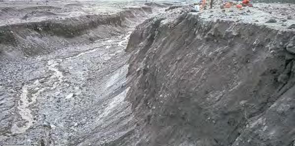
3 Dredging (Environmental): The removal of contaminated sediments from the waterway Capping (In-situ): Leaving contaminated sediments in place and placing a layer of sand and/or other material over it Armoring: Placing a layer of material (gravel, riprap, etc.) over a cap to prevent erosion Armored surface substrate
4 Dredging (Navigational): Removal of sediments from the channel to allow boats to pass FFS: Focused Feasibility Study which presents the remedial alternatives in detail Alternatives from June 2007 DRAFT FFS were grouped and evaluated in 3 remedial scenarios All alternatives have been substantially changed since then, in response to stakeholder comments and additional technical work

5 General purpose of the modeling was to provide a preliminary assessment of potential flooding impacts resulting from various draft 2007 FFS remedial alternatives Seven remedial alternatives for the lower 8 miles of the Passaic River study area were modeled
6 Draft 2007 FFS remedial technologies included various combinations of: Dredging Capping Armoring Each technology could result in activity subject to the NJDEP Flood Hazard Area Control Act Rules (N.J.A.C 7:13) (the Rules) Modeling was performed to determine compliance with substantive requirements of the Rules


7 Evaluating alternatives for compliance with the NJDEP Rules Evaluate potential flooding impacts Flood storage Obstructions to flow Protect public safety Construct new structures above flood hazard area elevation Provide healthy riparian corridors Preserve vegetation Protect habitat
8 All seven alternatives were modeled by NJDEP/Berger using tools that NJDEP typically relies upon (i.e. HEC-RAS, flooding modeling) EPA also performed flood modeling using a hydrodynamic model developed under the CARP program Presentation focuses on three scenarios that are representative of all seven alternatives modeled
9 Dredging to navigational depths
10 Capping and armoring
11 Capping and armoring with dredging less than for navigation
12 Hydrologic Engineering Center River Analysis System (HEC-RAS) model used Model developed by US Army Corps of Engineers The HEC-RAS system contains four onedimensional river analysis components for: Steady flow water surface profile computations Unsteady flow simulation Movable boundary sediment transport computations Water quality analysis Study based on steady flow component to assess potential changes in water surface profiles due to channel modifications associated with each remedial alternative
13 HEC-RAS model input data River and floodplain cross sections


14 HEC-RAS model input data Structures River and floodplain roughness
15 HEC-RAS model input data Upstream boundary conditions Upstream Boundary Fluvial Peak Flows Q 10-YR Q 50-YR Q 100-YR Q 500-YR (cfs) (cfs) (cfs) (cfs) 15,300 25,300 31,800 46,200 Downstream boundary conditions Tidal Elevations Coincident Storm Surge Mean High Water T 10-YR T 50-YR T 100-YR T 500-YR MHW (ft. NGVD29) (ft. NGVD29) (ft. NGVD29) (ft. NGVD29) (ft. NGVD29)
16 Modeling performed for all four upstream boundary conditions with their associated storm surge downstream boundary conditions Modeling also performed for all four upstream boundary conditions with a mean high water downstream boundary condition Modeling was performed assuming a sub-critical flow regime
17 Preliminary results assessment focused on coincident storm surge downstream and upstream peak flow boundary condition

18 Dredging to navigational depths scenario could result in water surface elevation decrease of between 0.0 ft ft Effects of water levels above 8 miles need further study
19 Capping and armoring scenario could result in water surface elevation increases of between 0.0 ft to 1.4 ft
 water surface elevation increases of between 0.0 ft to 0.")
20 Capping and armoring scenario with dredging less than for navigation could result in zero to only minor (i.e. within error band of the model) water surface elevation increases of between 0.0 ft to 0.1 ft
21 Dredging to navigational depths could result in water surface elevation decrease by an estimated 0.7 ft during peak flooding, but further study would be needed to confirm this. Capping and armoring [without dredging] could potentially result in increased water surface elevations during flood events Modeling indicates zero to negligible water surface elevation increases for the capping and armoring with dredging less than for navigation
22 As remedial alternatives for the Lower Passaic River are further developed, additional flood modeling by NJDEP and EPA would appear to be appropriate Although comparison to and reconciliation with more sophisticated modeling efforts may be required, the HEC-RAS modeling conducted for this study was seen as an acceptable means of identifying preliminary order-of-magnitude flooding impacts
23 QUESTIONS?
ABC S OF FRESHWATER WETLAND DESIGN: CONCEPT TO CONSTRUCTION
 ABC S OF FRESHWATER WETLAND DESIGN: CONCEPT TO CONSTRUCTION Michael Mak, P.E. (Design Engineer) Karen Appell, P.E., C.P.E.S.C. (Project Manager) Christopher Benosky, P.E., C.F.M (Engineer of Record) August
Freight Street Development Strategy
 Freight Street Development Strategy Appendix B: Naugatuck River Floodplain Analysis Freight Street Development Strategy DECEMBER 2017 Page B-1 1.0 NAUGATUCK RIVER FLOODPLAIN AT FREIGHT STREET 1.1 Watershed
Geneva Dam. Design of a Steep, Temporary, Riprap Ramp
 Geneva Dam Design of a Steep, Temporary, Riprap Ramp A Run-of of-river Dam Analysis for Geneva Dam Credit to: Yu-Chun Su, Ph.D., P.E., CFM David T. Williams. Ph.D., P.E, CFM Presentation Purpose History
DES MOINES RIVER RESERVOIRS WATER CONTROL PLAN UPDATES IOWA ASCE WATER RESOURCES DESIGN CONFERENCE
 DES MOINES RIVER RESERVOIRS WATER CONTROL PLAN UPDATES 237 237 237 217 217 217 200 200 200 0 0 0 163 163 163 131 132 122 80 119 27 252 174.59 110 135 120 112 92 56 IOWA ASCE WATER RESOURCES DESIGN CONFERENCE
IAFSM 2010 Annual Conference. City of Rockford Keith Creek Greenway Flood Mitigation Project
 IAFSM 2010 Annual Conference City of Rockford Keith Creek Greenway Flood Mitigation Project March 10, 2010 Introduction Problem Overview 1890 s Building of homes along Keith Creek 1920 s Home construction
South St. Vrain / Hall Meadows Restoration Planning August 20, 2015
 South St. Vrain / Hall Meadows Restoration Planning August 20, 2015 Agenda Introductions Purpose & Goals of Meeting Planning Area Master Plan Restoration Planning: Cost Estimates, Grants, Scope, Timeline
Fargo-Moorhead Metropolitan Area Flood Risk Management Project
 Fargo-Moorhead Metropolitan Area Flood Risk Management Project 52ND ANNUAL IOWA ASCE ENVIRONMENTAL & WATER RESOURCES CONFERENCE 03 April 2014 Aaron W. Buesing Senior Hydraulic Engineer Corps of Engineers,
Appendix VI: Illustrative example
 Central Valley Hydrology Study (CVHS) Appendix VI: Illustrative example November 5, 2009 US Army Corps of Engineers, Sacramento District Prepared by: David Ford Consulting Engineers, Inc. Table of contents
PRENTISS CREEK (SUB-E) KENSINGTON PLACE CONCEPT PLAN VILLAGE OF DOWNERS GROVE, ILLINOIS AUGUST, 2011
 KENSINGTON PLACE CONCEPT PLAN VILLAGE OF DOWNERS GROVE, ILLINOIS AUGUST, 2011") PRENTISS CREEK (SUB-E) KENSINGTON PLACE CONCEPT PLAN VILLAGE OF DOWNERS GROVE, ILLINOIS AUGUST, 2011 Submitted to: NATHANIEL HAWK, STAFF ENGINEER VILLAGE OF DOWNERS GROVE 5101 WALNUT AVENUE DOWNERS GROVE,
PRENTISS CREEK (SUB-E) KENSINGTON PLACE CONCEPT PLAN VILLAGE OF DOWNERS GROVE, ILLINOIS AUGUST, 2011 Submitted to: NATHANIEL HAWK, STAFF ENGINEER VILLAGE OF DOWNERS GROVE 5101 WALNUT AVENUE DOWNERS GROVE,
Hydrologic Calibration:
 Hydrologic Calibration: UPDATE OF EFFECTIVE HYDROLOGY FOR MARYS CREEK October 2010 Agenda Background Hydrologic model Calibrated rainfall Hydrologic calibration 100 year discharges, Existing Conditions
Stormwater Management Studies PDS Engineering Services Division ES Policy # 3-01
 Stormwater Management Studies PDS Engineering Services Division Revised Date: 2/28/08 INTRODUCTION The City of Overland Park requires submission of a stormwater management study as part of the development
December 7, Dr. Christine Pomeroy University of Utah Civil and Environmental Engineering MCE Salt Lake City, UT. Dear Dr.
 December 7, 2012 Dr. Christine Pomeroy University of Utah Civil and Environmental Engineering MCE 2042 Salt Lake City, UT 84112 Dear Dr. Pomeroy, The following document is the final report of the Red Butte
Outlet Structure Modeling
 Watershed Modeling using HEC-RAS Outlet Structure Modeling Jeff Wickenkamp, P.E., CFM, D.WRE Patrick Lach, P.E. Hey and Associates, Inc. Water Resources, Wetlands and Ecology Outline of Presentation Why
DRAFT. Jacob Torres, P.E.; Nick Fang, Ph.D., P.E.
 \ Memorandum SSPEED Center at Rice University Department of Civil & Environmental Engineering 6100 Main MS-317 Houston, Texas 77005-1827 sspeed.rice.edu tel: 713-348-4977 To Andy Yung, P.E. CFM; Lane Lease,
Using Dredging Lessons Learned in a Large Contaminated Sediment Feasibility Study. Presented by John Laplante, Carl Stivers, and Clay Patmont
 Using Dredging Lessons Learned in a Large Contaminated Sediment Feasibility Study Presented by John Laplante, Carl Stivers, and Clay Patmont October 24, 2012 Presentation Outline Engineered Barriers Best
ENVIRONMENTAL RESOURCE PERMIT APPLICATION
 ENVIRONMENTAL RESOURCE PERMIT APPLICATION SOUTHWEST FLORIDA WATER MANAGEMENT DISTRICT 2379 BROAD STREET, BROOKSVILLE, FL 34604-6899 (352) 796-7211 OR FLORIDA WATS 1 (800) 423-1476 SECTION E INFORMATION
Climate Change Impacts on Joint Riverine and Coastal Flooding on Calleguas Creek in Ventura County, CA
 Climate Change Impacts on Joint Riverine and Coastal Flooding on Calleguas Creek in Ventura County, CA James Gregory, James Jackson (ESA) Lily Verdone (TNC) FMA, September 8, 2016 Project Overview Coastal
GEOMORPHIC EFECTIVENESS OF FLOODS ON LOWER TAPI RIVER BASIN USING 1-D HYDRODYNAMIC MODEL,HEC-RAS
 GEOMORPHIC EFECTIVENESS OF FLOODS ON LOWER TAPI RIVER BASIN USING 1-D HYDRODYNAMIC MODEL,HEC-RAS Darshan Mehta 1, Raju Karkar 2, Lalji Ahir 3 Assistant Professor, CED, S.S.A.S.I.T, Surat, Gujarat, India
Municipal Class Environmental Assessment for Pottersburg Creek Slope Stability Study South of Hamilton Road, Schedule B
 Municipal Class Environmental Assessment for Pottersburg Creek Slope Stability Study South of Hamilton Road, Schedule B February 13, 2013 Municipal Class EA Process We are here Purpose and Objective of
Note that the Server provides ArcGIS9 applications with Spatial Analyst and 3D Analyst extensions and ArcHydro tools.
 Remote Software This document briefly presents the hydrological and hydraulic modeling software available on the University of Nice Server with Remote Desktop Connection. Note that the Server provides
Lower Columbia River Pile Dike Assessment
 Lower Columbia River Pile Dike Assessment David Gorman, PE August 2, 2011 Credits Hans R. Moritz, US Army Corps of Engineers Portland District Carl Kassebaum, AECOM Project Manager AECOM Coastal and Rivers
Department of the Army Permit Application
 Department of the Army Permit Application DA File Number U.S. Army Corps of Engineers Honolulu District Date Received by CEPOH-RO Send Completed Application to: Honolulu District, U.S. Army Corps of Engineers
Are You Ready for Risk and Uncertainty Analysis?
 Are You Ready for Risk and Uncertainty Analysis? Presented to: Illinois Association for Floodplain And Stormwater Management Presented by: David T. Williams, Ph.D., P.E., P.H., CFM. D.WRE Senior Technical
PUBLIC NOTICE US Army Corps of Engineers, Honolulu District
 PUBLIC NOTICE US Army Corps of Engineers, Honolulu District Regulatory Office (CEPOH-RO) Public Notice Date: March 16, 218 Building 23 Expiration Date: March 3, 218 Fort Shafter, Hawaii 9688-44 Permit
Appendix B HYDROLOGIC AND HYDRAULIC MODELING
 Appendix B HYDROLOGIC AND HYDRAULIC MODELING Memo To: George Hudson, PE and Jeff Robinson, PE, GEC, Inc. From: Stephen Sanborn, PE, Dynamic Solutions, LLC Date: 4/25/ /2014 CC: Chris Wallen, Vice President,
OVERVIEW OF RESERVOIR OPERATIONS AND FLOOD RISK MANAGEMENT
 OVERVIEW OF RESERVOIR OPERATIONS AND FLOOD RISK MANAGEMENT 255 255 255 237 237 237 0 0 0 217 217 217 163 163 163 200 200 200 COLUMBIA RIVER BASIN 131 132 122 239 65 53 80 119 27 110 135 120 252 174.59
PUBLIC NOTICE. REPLY TO: Denver Regulatory Office 9307 South Wadsworth Blvd 30 DAY NOTICE Littleton, CO FAX (303)
") PUBLIC NOTICE US Army Corps of Engineers Omaha District Application No: NWO-2017-01366-DEN Project: Douglas Lane Tributary Stabilization Project Applicant: Town of Castle Rock Waterway: Douglas Lane Tributary
PUBLIC NOTICE US Army Corps of Engineers Omaha District Application No: NWO-2017-01366-DEN Project: Douglas Lane Tributary Stabilization Project Applicant: Town of Castle Rock Waterway: Douglas Lane Tributary
U.S. Army Corps of Engineers Mobile District
 U.S. Army Corps of Engineers Mobile District General Permit for Living Shorelines in Alabama Sandy P. Gibson Regulatory Specialist, Coastal Alabama Regulatory Division, Mobile District US Army Corps of
SEATTLE DISTRICT CIVIL WORKS PROGRAM
 SEATTLE DISTRICT CIVIL WORKS PROGRAM Contents 04 Continuing Authorities Program 05 Section 14 Emergency Streambank Protection Section 103 Beach Protection Section 111 Mitigation of Shore Damage 06 Section
NJDEP Regulations that impact or soon will impact agricultural operations. April 1, 2007 Horses 2007
 NJDEP Regulations that impact or soon will impact agricultural operations. April 1, 2007 Horses 2007 Peter L. Kallin, Ph.D., P.W.S. Phone: 732-499-3600 Ext. 237 E-mail: pkallin@aesop.rutgers.edu www.water.rutgers.edu
HYDRO EUROPE ISIS Report. Team
 HYDRO EUROPE 2011 ISIS Report Team 6 23.02.2011 Team members: Liza ASHTON, Thibault DESPLANQUES, Jens Harold DRASER, Manuel GOMEZ (supervisor), Kyung Tae LEE, Maxime NARDINI, Jieun PARK, Jiyoung PARK &
Municipal Stormwater Management Planning
 Municipal Stormwater Management Planning Christopher C. Obropta, Ph.D., P.E. Water Resources Extension Specialist with Rutgers Cooperative Extension Assistant Professor with Department of Environmental
Mississippi Coastal Improvements Program (MsCIP) Comprehensive Barrier Island Restoration Plan
 Comprehensive Barrier Island Restoration Plan") Mississippi Coastal Improvements Program (MsCIP) Comprehensive Barrier Island Restoration Plan BOEM Gulf of Mexico Sand Management Working Group October, 205 Justin McDonald, P.E. US Army Corps of Engineers
Mississippi Coastal Improvements Program (MsCIP) Comprehensive Barrier Island Restoration Plan BOEM Gulf of Mexico Sand Management Working Group October, 205 Justin McDonald, P.E. US Army Corps of Engineers
Fort Leonard Wood, Missouri. September 2013
 Fort Leonard Wood, Missouri September 2013 1 Presenters Shannon Kelly, Physical Scientist Clean Water Act Program Manager Directorate of Public Works Environmental Division Environmental Compliance Branch
LOCATION AND DESIGN DIVISION
 VIRGINIA DEPARTMENT OF TRANSPORTATION LOCATION AND DESIGN DIVISION INSTRUCTIONAL AND INFORMATIONAL MEMORANDUM GENERAL SUBJECT: CULVERT DESIGN SPECIFIC SUBJECT: COUNTERSINKING AND LOW FLOW CONSIDERATIONS
Alternative Approaches to Water Resource System Simulation
 US Army Corps of Engineers Hydrologic Engineering Center Alternative Approaches to Water Resource System Simulation May 1972 Approved for Public Release. Distribution Unlimited. TP-32 REPORT DOCUMENTATION
San Jacinto River Waste Pits Superfund Site
 San Jacinto River Waste Pits Superfund Site Channelview Highlands Northern Waste Pits Before Cap North Waste Pits After Cap Approximate Limit of Armored Cap Cap Construction Completed July 12, 2011 Old
Suspended Sediment Discharges in Streams
 US Army Corps of Engineers Hydrologic Engineering Center Suspended Sediment Discharges in Streams April 1969 Approved for Public Release. Distribution Unlimited. TP-19 REPORT DOCUMENTATION PAGE Form Approved
Camp Creek: Tackling Erosion and Improving Water Quality in a Recreational Playground Mitchellville, Iowa
 Camp Creek: Tackling Erosion and Improving Water Quality in a Recreational Playground Mitchellville, Iowa Rachel Conrad, PE, CFM IAFSM March 10 th, 2016 Outline Project Background and Goals Modeling Results
Ponds. Pond A water impoundment made by excavating a pit, or constructing a dam or an embankment.
 POND SITE SELECTION AND CONSTRUCTION Uses, Planning, & Design David Krietemeyer Area Engineer USDA-NRCS June 20, 2008 Uses Considerations for Location of Commonly Used Terms Pond A water impoundment made
Technology News from the Ecosystem Management and Restoration Research Program October 1999
 ecosystem MANAGEMENT AND RESTORATION Technology News from the Ecosystem Management and Restoration Research Program October 1999 Overview of stream restoration technology: State of the science by J. Craig
Coal Combustion Facility Assessment Report. October 20, 2010
 Coal Combustion Facility Assessment Report October 20, 2010 Introduction Stantec Consulting Services Inc. North American Consulting Firm 10,000 Engineers, Geologists, Architects, Scientists and Technicians
LEGAL AUTHORITY AND JURISDICTIONS
 CALIFORNIA DEPARTMENT OF FISH AND GAME RIPARIAN RESOURCES AND REGULATORS: The DFG Lake and Streambed Alteration 1600 Process LEGAL AUTHORITY AND JURISDICTIONS Serge Glushkoff CENTRAL COAST REGION YOUNTVILLE
Appendix I Cost Engineering Pigs Eye Lake Ramsey County, MN Section 204 DRAFT. Draft Feasibility Study Report with Integrated Environmental Assessment
 Appendix I Cost Engineering Pigs Eye Lake Ramsey County, MN Section 204 Draft Feasibility Study Report with Integrated Environmental Assessment St. Paul District U.S. Army Corps of Engineers March 2018
FREQUENTLY ASKED QUESTIONS: URBAN STREAM RESTORATION BMP. David Wood Chesapeake Stormwater Network. Lisa Fraley-McNeal Center for Watershed Protection
 FREQUENTLY ASKED QUESTIONS: David Wood Chesapeake Stormwater Network URBAN STREAM RESTORATION BMP Lisa Fraley-McNeal Center for Watershed Protection Bill Stack Center for Watershed Protection FREQUENTLY
CORTE MADERA CREEK FLOOD CONTROL PROJECT UNIT 4 DESIGN ALTERNATIVES
 CORTE MADERA CREEK FLOOD CONTROL PROJECT UNIT 4 DESIGN ALTERNATIVES Final Technical Memorandum October 31, 2006 Prepared for Friends of Corte Madera Creek Watershed Marin County Flood Control and Water
Introduction to Sediment Remediation. Presented to: Lower Passaic River Community Advisory Group July 14, 2011
 Introduction to Sediment Remediation Presented to: Lower Passaic River Community Advisory Group July 14, 2011 Overview Feasibility Considerations Conceptual Site Model Dredging / Capping Dredged Material
PRELIMINARY HYDROLOGY/HYDRAULICS ANALYSES RESULTS
 PRELIMINARY HYDROLOGY/HYDRAULICS ANALYSES RESULTS Coldstream Park Stream Corridor Restoration and Preservation Consent Decree SEP Prepared for Lexington-Fayette Urban County Government Division of Water
Phase II Report on Hydrology, Hydraulics, and Low Water Dams
 Phase II Report on Hydrology, Hydraulics, and Low Water Dams Arkansas River Corridor Tulsa, OK May 2005 Submitted To: U. S. Army Corps of Engineers Tulsa District Prepared by: The GUERNSEY Team 5555 N.
POOL 11 ISLANDS SUNFISH LAKE AND MUD LAKE OPERATION AND MAINTENANCE MANUAL
 MISSISSIPPI RIVER POOL 11 ISLANDS SUNFISH LAKE AND MUD LAKE GRANT COUNTY, WISCONSIN AND DUBUQUE COUNTY, IOWA U.S. ARMY CORPS OF ENGINEERS ENVIRONMENTAL MANAGEMENT PROGRAM HABITAT REHABILITATION AND ENHANCEMENT
Coastal and Hydraulics Laboratory. US Army Engineer R&D Center
 Coastal and Hydraulics Laboratory Coastal and Hydraulics Laboratory US Army Engineer R&D Center Mission To deliver solutions to our Nation s most challenging water resources problems through research,
Good morning, Chairman Yaw, Chairman Yudichak, Chairman Vulakovich, Chairman Costa,
 Testimony of Patrick McDonnell, Secretary Pennsylvania Department of Environmental Protection Joint Hearing on Flooding and Emergency Response Senate Environmental Resources & Energy and Veterans Affairs
Project Goals and Scoping
 Prepared for: Boulder County, Colorado Flood Planning & Preliminary Design Services for South St. Vrain Creek Restoration at Hall Ranch and Scoping May 24, 2016 Meeting with General Public In association
FINDINGS: Olsson used a three-step analysis strategy to develop a benefit cost ratio that would indicate the relative feasibility of this project.
 EXECUTIVE SUMMARY FINDINGS: Based on the results of this feasibility study, the Platte Republican Diversion Project would be cost-effective. With minimal improvements to the channel, and the existing bridge
Analysis of Floodplain Fish Habitat on the San Joaquin for the San Joaquin River Restoration Project (SJRRP)
") Analysis of Floodplain Fish Habitat on the San Joaquin for the San Joaquin River Restoration Project (SJRRP) Daniel Dombroski (ddombroski@usbr.gov), Blair Greimann, Elaina Gordon, Katrina Harrison (Reclamation)
Analysis of Floodplain Fish Habitat on the San Joaquin for the San Joaquin River Restoration Project (SJRRP) Daniel Dombroski (ddombroski@usbr.gov), Blair Greimann, Elaina Gordon, Katrina Harrison (Reclamation)
SECTION 3 NATURAL RESOURCES
 SECTION 3 NATURAL RESOURCES The natural environment plays a large role in planning for future development. Environmental conditions, such as topography, wetlands, floodplains, and water bodies, can often
HYDROLOGIC MODELING CONSISTENCY AND SENSITIVITY TO WATERSHED SIZE
 HYDROLOGIC MODELING CONSISTENCY AND SENSITIVITY TO WATERSHED SIZE by James C.Y. Guo. Professor, Civil Engineering, U. Of Colorado at Denver, James.Guo@cudenver.edu.. And Eric Hsu, Project Engineer, Parson
Hydrologic and Ecologic Impacts from the CERP Indian River Lagoon South Project
 Hydrologic and Ecologic Impacts from the CERP Indian River Lagoon South Project Dr. Gretchen Ehlinger Senior Biologist US Army Corps of Engineers Jacksonville District November 15, 2016 AWRA Conference
Council of Governments
 Metropolitan Washington Council of Governments Anne Arundel County Draft Phase II Watershed Implementation Plan January 18, 2011 Chesapeake Bay TMDL Pollutants of Concern Nitrogen Phosphorus Sediment 2
COON CREEK WATERSHED DISTRICT PERMIT REVIEW. Spring Lake Park Schools Westwood Middle School st Avenue NE, Spring Lake Park, MN 55432
 PAN 16-112, Westwood Middle School, Page 1 of 6 COON CREEK WATERSHED DISTRICT PERMIT REVIEW MEETING DATE: August 22, 2016 AGENDA NUMBER: 10 FILE NUMBER: 16-112 ITEM: Westwood Middle School RECOMMENDATION:
Urban Hydrology Characteristics and their Influence on Urban Stream Restoration Technology. Presented by:
 Urban Hydrology Characteristics and their Influence on Urban Stream Restoration Technology Presented by: Michael Clar Ecosite, Inc. James Gracie Brightwater, Inc. BACKGROUND Many streams in urban areas
Local Flood Hazard Mitigation Program. A framework for hazard mitigation in the NYC West of Hudson Water Supply Watersheds
 Local Flood Hazard Mitigation Program A framework for hazard mitigation in the NYC West of Hudson Water Supply Watersheds Flood Hazard Mitigation Defined 2 2 Presentation Overview Why and how is the NYC
Habitat Grant Projects Clinton River Watershed
 Habitat Grant Projects Clinton River Watershed L Y N N E S E Y M O U R E N V I R O N M E N T A L E N G I N E E R O F F I C E O F T H E M A C O M B C O U N T Y P U B L I C W O R K S C O M M I S S I O N
CHESAPEAKE BAY COMPREHENSIVE WATER RESOURCES AND RESTORATION PLAN. Habitat GIT Meeting 9 May 2017
 CHESAPEAKE BAY COMPREHENSIVE WATER RESOURCES AND 255 255 255 237 237 237 0 0 0 217 217 217 163 163 163 200 200 200 131 132 122 239 65 53 80 119 27 RESTORATION PLAN 110 135 120 252 174.59 112 92 56 62 102
Living Shorelines & Coastal Resiliency: A Consultants Perspective. Presented by: Bethany Bearmore, P.E. Louis Berger
 Living Shorelines & Coastal Resiliency: A Consultants Perspective Presented by: Bethany Bearmore, P.E. Louis Berger Living Shorelines & Coastal Resiliency A Consultants Perspective 1. Why 2. Process 3.
FEMA s Mitigation Support for Resiliency: Innovative Drought and Flood Mitigation Projects
 FEMA s Mitigation Support for Resiliency: Innovative Drought and Flood Mitigation Projects Jordan Williams, CFM Eric Kenney, PE, CFM May 4, 2017 2 Hazard Mitigation Purpose: Research climate resilient
Flow-ecology relationships. Flow-ecology relationships Susitna case study
 Flow-ecology relationships Flow-ecology relationships Susitna case study Flow regime Ecologically-Relevant Flow Regime Characteristics Seasonal or typical conditions Annual extreme conditions High and
2017 Central Valley Flood Protection Plan Update: Overview
 2017 Central Valley Flood Protection Plan Update: Overview 2015 FMA Conference CVFPP Overview- Mike Mierzwa, DWR Basin-wide Feasibility Study Planning Context- Eric Tsai, DWR Technical Tools/Methodologies-
Working in Arid and Semi-Arid Climates with Hydromodification Concerns
 Design Techniques for Stream Restoration: Working in Arid and Semi-Arid Climates with Hydromodification Concerns Presented By: Tory R. Walker, PE, CFM, LEED GA September 30, 2014 Brief Overview Short History
Dredge and Fill Standards on the Highland Lakes
 www.lcra.org Dredge and Fill Standards on the Highland Lakes Lake Buchanan Inks Lake Lake LBJ Lake Marble Falls Lake Travis Introduction The Lower Colorado River Authority (LCRA) no longer requires that
Mark Twain Lake Water Control Manual Update
 Mark Twain Lake Water Control Manual Update Joan Stemler St. Louis District Water Control US Army Corps of Engineers WATER CONTOL PLAN Overall Objectives Project Purposes Flood Control Hydroelectric Power
City of Katy Flood Protection Study (Meeting 3 of 3) October 23, 2017
 October 23, 2017") City of Katy Flood Protection Study (Meeting 3 of 3) October 23, 2017 Phasing of Meetings April Meeting May Meeting October Review of Tax Day Storm Event and Immediate Actions Taken By City Review of Coordination
City of Katy Flood Protection Study (Meeting 3 of 3) October 23, 2017 Phasing of Meetings April Meeting May Meeting October Review of Tax Day Storm Event and Immediate Actions Taken By City Review of Coordination
HEC-RAS 2D Modeling in Support of Ascension Parish Levee Certification
 HEC-RAS 2D Modeling in Support of Ascension Parish Levee Certification OFMA 2017 Annual Conference September 19, 2017 Presented by: Jeff Doudrick, PE, ENV SP Project Manager HNTB Corporation Agenda Project
Functional Uplift Based Stream Assessment & Restoration Design
 Functional Uplift Based Stream Assessment & Restoration Design Darcy K.L. Turner Senior Environmental Scientist, Biohabitats, Inc. (dturner@biohabitats.com) Christopher A. Streb, PE Ecological Engineer,
Riverine Hydraulics TABLE OF CONTENTS
 Chapter 12 Bridge, Structure and Riverine Hydraulics TABLE OF CONTENTS CHAPTER 12 - BRIDGE, STRUCTURE AND RIVERINE HYDRAULICS... 12-1 12.1 Introduction... 12-1 12.1.1 Definition 12-1 12.1.2 Analysis/Design...
Adjusted Flood Prone Acres
 Adjusted Flood Prone Acres The flood prone area is defined as the area adjacent to the stream that is innundated or saturated when the elevation of the water is at twice the maximum depth at bankfull stage
iswm TM Criteria Manual City of Azle Section 14 City of Azle Subdivision Ordinance DRAFT-June Chapter 1
 City of Azle Section 14 City of Azle Subdivision Ordinance DRAFT-June 2010... Chapter 1 i CITY OF AZLE iswm CRITERIA MANUAL FOR SITE DEVELOPMENT AND CONSTRUCTION Incorporating the Regional NCTCOG Integrated
Chapter 11 Culverts and Bridges
 Chapter 11 Culverts and Bridges Contents 1.0 Introduction... 1 2.0 General Design... 1 2.1 Design Criteria... 1 2.2 Design Flows... 1 2.3 Permitting and Regulations... 1 2.4 Aesthetics and Safety... 2
Instream Flow Study for the Proposed Lower Bois d Arc Creek Reservoir, Texas
 450,000 400,000 350,000 300,000 250,000 200,000 150,000 Instream Flow Study for the Proposed Lower Bois d Arc Creek Reservoir, Texas 100,000 50,000 0 Jan-48 Jan-51 Jan-54 Jan-57 Jan-60 Jan-63 Jan-66 Jan-69
Prepared for Urban Drainage and Flood Control District
 BERM FAILURE TECHNICAL ANALYSES SOUTH PLATTE GRAVEL PIT EVALUATION CRITERIA Prepared for Urban Drainage and Flood Control District Wright Water Engineers, Inc. January 2013 121-030.000 TABLE OF CONTENTS
Appendix H: Construction Impacts H-5 Dredged Materials Management Alternatives Analysis
 Appendix H: Construction Impacts H-5 Dredged Materials Management Alternatives Analysis Dredged Material Management Alternatives Analysis A. INTRODUCTION The Tappan Zee Hudson River Crossing Project proposes
Design of CAD Pits in San José Lagoon, San Juan, Puerto Rico
 Second LACCEI International Latin American and Caribbean Conference for Engineering and Technology (LACCEI 2004) Challenges and Opportunities for Engineering Education, Research and Development 2-4 June
SECTION 11: REGULATORY FLOODWAYS
 SECTION 11: REGULATORY FLOODWAYS Contents 11.1. The Floodway... 11-2 11.1.1. The floodway concept... 11-2 11.1.2. Floodway map... 11-2 11.1.3. Floodway permitting... 11-3 11.1.4. Changing the floodway...
THE CORPS REGULATORY AUTHORITY
 Regulatory Branch THE CORPS REGULATORY AUTHORITY THE U.S. ARMY CORPS OF ENGINEERS REGULATORY AUTHORITY IS BASED UPON 1. SECTION 10 OF THE RIVERS AND HARBORS ACT OF 1899 (RHA) AND 2. SECTION 404 OF THE
Duwamish Waterway Self Guided Tour: Turning Basin Number Three and Terminal 105 Aquatic Habitat Restoration Sites
 Duwamish Waterway Self Guided Tour: Turning Basin Number Three and Terminal 105 Aquatic Habitat Restoration Sites Text and illustrations in the following pages include: (1) summary information describing
US Army Corps of Engineers and Stream Restoration Permitting
 US Army Corps of Engineers and Stream Restoration Permitting Jack Dinne US Army Corps of Engineers-Baltimore Maryland Section Northern May 6, 2014 US Army Corps of Engineers Presentation Overview Corps
G.B. Sonny Hall, PhD. Veronika Thiebach
 G.B. Sonny Hall, PhD Technical Program Manager Veronika Thiebach Senior Assistant General Counsel St. Johns River Water Management District 1 SJRWMD MFLs Method MFLs Method Premises Case studies Lake Hiawassee
CESAM-RD-C April 24, 2013 PUBLIC NOTICE NO. SAM AFM JOINT PUBLIC NOTICE SAM AFM U.S. ARMY CORPS OF ENGINEERS
 DEPARTMENT OF THE ARMY U.S. ARMY ENGINEER DISTRICT, MOBILE DISTRICT P.O. BOX 2288 MOBILE, ALABAMA 36628-0001 CESAM-RD-C April 24, 2013 PUBLIC NOTICE NO. SAM-2012-00731-AFM JOINT PUBLIC NOTICE SAM-2012-0731-AFM
Will be modified map from GIS 6/16 EOD
 Middle-Snake-Tamarac Rivers Watershed District Judicial Ditch #19 Watershed Regional Conservation Partnership Program (RCPP) Public Scoping Meeting September 26, 2016 Will be modified map from GIS 6/16
CE Hydraulics. Andrew Kennedy 168 Fitzpatrick
 CE 40450 Hydraulics Andrew Kennedy 168 Fitzpatrick Andrew.kennedy@nd.edu Hydraulics What does hydraulics mean for engineers and what are typical hydraulic engineering problems? How do these interact with
Clean Water Act Regulatory Program
 Clean Water Act Regulatory Program New Mexico Floodplain Managers Association Conference Deanna L. Cummings April 12, 2018 US Army Corps of Engineers Introduction Clean Water Act Section 404 USACE Jurisdiction
STORMWATER RUNOFF AND WATER QUALITY IMPACT REVIEW
 SUBCHAPTER 8 STORMWATER RUNOFF AND WATER QUALITY IMPACT REVIEW 7:45-8.1 Purpose and scope of review Except for those projects expressly exempted by this chapter or waived by the Commission, the Commission
UPRR criteria for sizing waterway openings under bridges and through culverts are as follows:
 UNION PACIFIC RAILROAD SCOPE OF HYDROLOGIC/HYDRAULIC DESIGN ENGINEERING AND PERMITTING SERVICES FOR SIZING WATERWAY OPENINGS AT NEW AND REPLACEMENT STRICTURES These flood passage criteria were developed
APPENDIX F. SECTION 404(B)(1) EVALUATION SHORT VERSION. Herbert Hoover Dike Dam Safety Modification Study
(1) EVALUATION SHORT VERSION. Herbert Hoover Dike Dam Safety Modification Study") Appendix F Section 404(b)(1) APPENDI F. SECTION 404(B)(1) EVALUATION SHORT VERSION Herbert Hoover Dike Dam Safety Modification Study HHD Dam Safety Modification Study EIS June 2016 E i Appendix F Section
Appendix F Section 404(b)(1) APPENDI F. SECTION 404(B)(1) EVALUATION SHORT VERSION Herbert Hoover Dike Dam Safety Modification Study HHD Dam Safety Modification Study EIS June 2016 E i Appendix F Section
ND Detention Project Development Update
 ND Detention Project Development Update Upper Red River Basin Halstad, MN = 8 Upstream Subwatersheds Fargo, ND = 3 Upstream Subwatersheds Halstad, MN Fargo, ND Wild Rice Otter Tail Bois de Sioux Upstream
What Are Environmental (Instream) Flows?
 Flows?") 1 What Are Environmental (Instream) Flows? Sustainable water management requires that both human needs and the needs of aquatic and riparian ecosystems be fulfilled. Dams and diversion of water for municipal
1 What Are Environmental (Instream) Flows? Sustainable water management requires that both human needs and the needs of aquatic and riparian ecosystems be fulfilled. Dams and diversion of water for municipal
Sediment management of hydropower cascade: example of CNR run-of-river developments, French Rhone River, France
 Sediment management of hydropower cascade: example of CNR run-of-river developments, French Rhone River, France Christophe PETEUIL Compagnie Nationale du Rhone Engineering Department, River Systems and