Inland and coastal water quality retrieval Some challenges and new opportunities
|
|
|
- Cecil Warner
- 6 years ago
- Views:
Transcription
1 Inland and coastal water quality retrieval Some challenges and new opportunities Els Knaeps, Dries Raymaekers, Sindy Sterckx (VITO, Belgium) Kevin Ruddick, Bouchra Nechad (MUMM, Belgium) Ana Dogliotti (IAFE, Argentina) David Doxaran (LOV, France) Susanne Kratzer (Stockholm University, Sweden) GloboLakes Scientific Workshop, December, Stirling 21/01/2013 1
 up")
 up to 400 mg l")


 APEX 2010")
2 Scheldt (Belgium) up to 400 mg l -1 Yangtze (China) up to several g l -1 La Plata (Argentina) up to 400 mg l -1 Gironde (France) up to several g l -1 APEX 2009 MODIS-Aqua 2003 MODIS-Aqua Landsat 2000 Wadden Sea (The Netherlands) Molse meren (Belgium) APEX /01/ AHS/CASI 2007
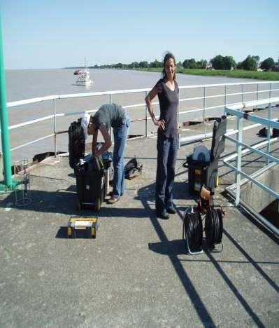
3 Our test sites Dynamic environments Match up difficulties Need for detailed campaign planning 21/01/2013 3


4 Atm. path radiance Adjacency effects Sun glint sky glint air/water interface Absorption and backscattering of light by particles and water Phytoplankton Suspended sediment Dissolved carbon bottom reflectance 21/01/2013 4
5 Rwn/780 Adjacency correction - SIMEC A similarity NIR reflectance spectrum is defined by normalization at 780 nm (Ruddick et al., 2006) wavelength (nm) Sterckx, S., E. Knaeps, K. Ruddick, 2011, Detection and Correction of Adjacency Effects in Hyperspectral Airborne Data of Coastal and Inland Waters: the Use of the Near Infrared Similarity Spectrum, International Journal of REMOTE SENSING, 32(21): Knaeps, E., S. Sterckx, K. Ruddick, C. Giardino, B. Mariano, SIMEC, An Environment Correction For MERIS Based On The NIR Similarity Spectrum, proceedings Ocean Optics -> can be used to detect and correct adjacency effects 21/01/2013 5

6 SIMEC Background: Workflow Atmospheric correction (Modtran based) AOT from land targets or sun photometer readings ignoring adjacency effects Normalization at 780 nm Deviations from the NIR similarity spectrum = measure of the magnitude of the adjacency effect. Iteratively calculate contributing background until agreement with NIR similarity spectrum 21/01/
 Z_C (without adjacency correction) Z_C (with adjacency correction) J_A (with adjacency correction) Z (in-situ) J (in-situ) Sterckx S., Knaeps E., Ruddick K.")
7 Rw SIMEC application to airborne data J_A (without adjacency correction) Z_C (without adjacency correction) Z_C (with adjacency correction) J_A (with adjacency correction) Z (in-situ) J (in-situ) Sterckx S., Knaeps E., Ruddick K. International Journal of Remote Sensing Vol. 32, Iss. 21, wavelength (nm) 21/01/2013 7

8 error Average err(711,780) SIMEC application to airborne data Example : Airborne CASI North Sea + Spuikom Approximate distance from coast (m) Distance from coast (m) 21/01/2013 8
9 SIMEC application to MERIS : Palgrunden Green squares : SIMEC/ICOL + ODESA Black diamonts : in-situ Red crosses : ODESA without SIMEC/ICOL SIMEC ICOL 21/01/2013 9
10 SIMEC application to MERIS : Palgrunden Green squares : SIMEC/ICOL + ODESA Black diamonts : in-situ Red crosses : ODESA without SIMEC/ICOL SIMEC ICOL 21/01/
11 SIMEC application to MERIS : North Sea Green squares : SIMEC/ICOL + ODESA Black diamonts : in-situ Red crosses : ODESA without SIMEC/ICOL SIMEC ICOL 21/01/
12 CONCLUSIONS AND FUTURE WORK (1)» SIMEC = sensor generic» Complementary to the ICOL adjacency correction implemented in BEAM.» focus on the further operationalisation of the algorithm by incorporation of SIMEC in a complete processing chain and linking it with automatic modules to derive AOT from land targets. 21/01/
 Local decrease in pure water absorption SCHELDT 21/01/2013 13 Knaeps, E.")
13 Water leaving reflectance SWIR? SWIR is potentially interesting: Atmospheric transmission windows SWIR spectral bands available in future spaceborne sensors (e.g. Hyspiri, OLCI) Local decrease in pure water absorption SCHELDT 21/01/ Knaeps, E. et al., Remote Sensing of Environment 120 (2012)


 total upwelling radiance")


14 water leaving reflectance SWIR? But: little knowledge available, no suitable instrumentation -> ASD spectrometer and Hydroscat with SWIR wavelengths E d (0+): downwelling irradiance above the surface. L u (a) total upwelling radiance from the water L sky (a) Downwelling sky radiance The water-leaving reflectance (Rw) was calculated using the following equation (Mobley, 1999): Rw = (Lw(a) ras * Lsky(a)) / Ed(a) 21/01/

15 Scheldt river ASD TRIOS 21/01/


16 Scheldt river: Belcolour MICAS heritage Pontoon Sint Anna Knaeps, E., Raymaekers, D., Sterckx, S, Ruddick, K., Dogliotti, A.I In situ evidence of non-zero reflectance in the OLCI 1020nm band for a turbid estuary, Remote Sensing of Environment, Sentinel special issue, 112 Pure water absorption coefficient (Pope & Fry, 1997; Kou et al., 1993) MUMM 21/01/
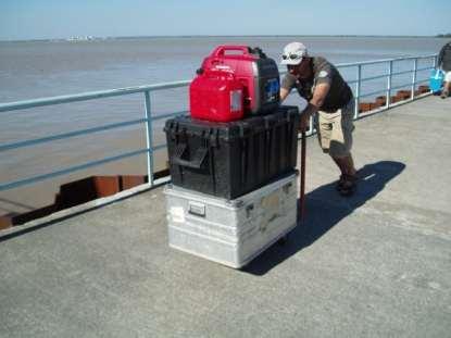
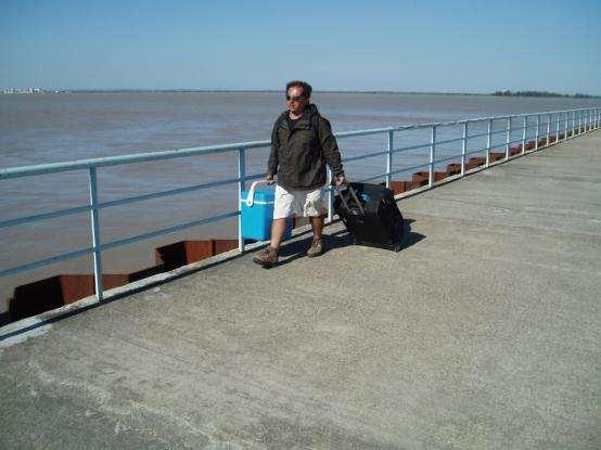
17 Scheldt river: new data collection 21/01/
18 Scheldt river: new data collection 21/01/


19 Gironde river Côte de la Manche Blaye Paulliac 21/01/ Blaye


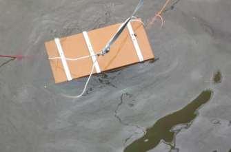
20 Picture taken by APEX operator APEX quicklook 21/01/

21 Gironde river 21/01/

22 Gironde river ASD water reflectance 21/01/
23 Gironde river ASD water reflectance SPM (mg/l) SPM (mg/l) SPM (mg/l) SPM (mg/l) SPM (mg/l) 21/01/


24 La Plata river ASD water reflectance 21/01/
 map of Rw1069 (d) map of Rw1020.")
25 Scheldt APEX flight (a) RBG APEX image of the Scheldt (b) map of Rw711/Rw597 (c) map of Rw1069 (d) map of Rw /01/
26 CONCLUSIONS AND FUTURE WORK (2) black pixel assumption invalid for Scheldt,Gironde and la Plata estuary. A significant increase in reflectance was observed between 950 and 1150 nm where pure water absorption has a local minimum. SNR and atmospheric influences does not seem to alter these findings. WARNING when using the SWIR black pixel assumption for atmospheric correction need for an adjusted atmospheric correction for highly turbid waters. (Incorrect use of the black pixel assumption in atmospheric correction can lead to an overestimation of the aerosol contribution and a significant underestimation of the derived water reflectance! ) correlation of water reflectance with TSM concentration. Suggest that spectral bands beyond 1000 nm contain information on the concentrations of optical constituents. 21/01/
27 CONCLUSIONS AND FUTURE WORK (2) Future work includes:» TRIOS analysis and intercomparison» IOP analysis (including Hydroscat!)» Hydrolight simulations» Image analysis (MODIS, HICO, APEX)» Are there systematic differences between sites or is a single algo appropriate for all 3 sites? 21/01/
28 Thank you 21/01/
USE OF THE NEW OLCI AND SLSTR BANDS FOR ATMOSPHERIC CORRECTION OVER TURBID COASTAL AND INLAND WATERS
 USE OF THE NEW AND SLSTR BANDS FOR ATMOSPHERIC CORRECTION OVER TURBID COASTAL AND INLAND WATERS Kevin Ruddick and Quinten Vanhellemont Royal Belgian Institute for Natural Sciences (RBINS), Operational
EVALUATION OF TWO SITES FOR OCEAN COLOR VALIDATION IN THE TURBID WATERS OF THE RÍO DE LA PLATA (ARGENTINA)
") EVALUATION OF TWO SITES FOR OCEAN COLOR VALIDATION IN THE TURBID WATERS OF THE RÍO DE LA PLATA (ARGENTINA) Dogliotti, A. I. (1), Gossn, J. I. (1), Vanhellemont, Q. (2), Ruddick, K.G. (2) (1) (2) Instituto
EVALUATION OF TWO SITES FOR OCEAN COLOR VALIDATION IN THE TURBID WATERS OF THE RÍO DE LA PLATA (ARGENTINA) Dogliotti, A. I. (1), Gossn, J. I. (1), Vanhellemont, Q. (2), Ruddick, K.G. (2) (1) (2) Instituto
Mapping water constituents concentrations in estuaries using MERIS full resolution satellite data
 Mapping water constituents concentrations in estuaries using MERIS full resolution satellite data David Doxaran, Marcel Babin Laboratoire d Océanographie de Villefranche UMR 7093 CNRS - FRANCE In collaboration
OCEAN COLOR PRODUCTS RETRIEVAL AND VALIDATION AROUND CHINA COAST WITH MODIS
 OCEAN COLOR PRODUCTS RETRIEVAL AND VALIDATION AROUND CHINA COAST WITH MODIS L. Sun a, M. Guo b, X. Wang b a National Satellite Meteorological Center, China Meteorological Administration, No.46 South Avenue
Estimation of chlorophyll-a concentration in estuarine waters:
 Estimation of chlorophyll-a concentration in estuarine waters: case study of the Pearl River estuary Yuanzhi Zhang *, Chuqun Chen #, Hongsheng Zhang *, Xiaofei*, Chen Guiying Chen# *Institute of Space
USING MERIS DATA FOR THE RETRIEVAL OF CHL A, CDOM AND TSS VALUES IN THE GULF OF FINLAND AND LAKE LOHJANJÄRVI
 USING MERIS DATA FOR THE RETRIEVA OF CH A, CDOM AND TSS VAUES IN THE GUF OF FINAND AND AKE OHJANJÄRVI Sampsa Koponen 1, Jenni Vepsäläinen 2, Jouni Pulliainen 1, Kari Kallio 2, Timo Pyhälahti 2, Antti indfors
Appendix A. Proposal Format. HICO Data User s Proposal
 Appendix A. Proposal Format HICO Data User s Proposal Title of Proposal: A hyperspectral atmospheric correction algorithm to retrieve water-leaving radiance signal from HICO data Principal Investigator
METODOLOGIE E APPROCCI PER OSSERVAZIONI IPERSPETTRALI IN ACQUE COSTIERE E INTERNE
 Data Exploitation della missione PRISMA, precursore delle missioni iperspettrali nazionali Roma, 1-3 marzo 2017 METODOLOGIE E APPROCCI PER OSSERVAZIONI IPERSPETTRALI IN ACQUE COSTIERE E INTERNE Federica
Water property monitoring and assessment for China s inland Lake Taihu from
 Water property monitoring and assessment for China s inland Lake Taihu from MODIS-Aqua measurements By Wang M, W Shi and J Tan, Remote Sensing of Environment 115 (2011) 841-854 Wei Wang 9 December 2011
Future remote sensors for chlorophyll a. Dimitry Van der Zande, Quinten Vanhellemont & Kevin Ruddick
 Future remote sensors for chlorophyll a Dimitry Van der Zande, Quinten Vanhellemont & Kevin Ruddick Workshop Scheldt Commission: eutrophication 20 th October 2016 Ocean colour from space ESA MERIS 7 May
Airborne Hyperspectral Potential for Coastal Biogeochemistry of the Scheldt Estuary and Plume
 Airborne Hyperspectral Potential for Coastal Biogeochemistry of the Scheldt Estuary and Plume M. Shimoni & M. Acheroy Signal and Image Centre, Royal Military Academy; D. Sirjacobs & S. Djenidi GeoHydrodynamic
PV-LAC: D-1-A3 Requirements Baseline Document Activity 3
 Delivery report PV-LAC: advances Land, Aerosol and Coastal products for Proba-V PV-LAC: D-1-A3 Requirements Baseline Document Activity 3 Sindy Sterckx, Nitin Bhatia, Els Knaeps May 2016 Distribution List
OPTICAL DETECTION OF A NOCTILUCA SCINTILLANS BLOOM
 EARSeL eproceedings 6, 2/27 13 OPTICAL DETECTION OF A NOCTILUCA SCINTILLANS BLOOM Barbara Van Mol 1, Kevin Ruddick 1, Rosa Astoreca², YoungJe Park 1 and Bouchra Nechad 1 1. Management Unit of the North
Diurnal variability of turbidity and light attenuation in the southern North Sea from the geostationary SEVIRI sensor
 Publication in review in Remote Sensing of the Environment Diurnal variability of turbidity and light attenuation in the southern North Sea from the geostationary SEVIRI sensor Griet Neukermans 1,2 Kevin
Global Lakes Sentinel Services GLASS-S3VT
 www.glass-project.eu Global Lakes Sentinel Services GLASS-S3VT Water Insight (A. Hommersom, S. Peters, K. Poser), SYKE (S. Koponen, K. Kallio), EOMAP (T. Heege, K. Schenk, S. Ohlendorf), VU University
Remote Sensing of Environment
 Remote Sensing of Environment 115 (2011) 1617 1631 Contents lists available at ScienceDirect Remote Sensing of Environment journal homepage: www.elsevier.com/locate/rse Spectral variations in the near-infrared
A Unified Approach to Remote Estimation of Chlorophyll a Concentration in Complex Inland, Estuarine, and Coastal waters
 A Unified Approach to Remote Estimation of Chlorophyll a Concentration in Complex Inland, Estuarine, and Coastal waters Wesley J. Moses 1, *, Anatoly A. Gitelson 1, Alexander A. Gilerson 2, and Daniela
Study of Water Quality using Satellite data
 2nd Workshop on Parameterization of Lakes in Numerical Weather Prediction and Climate Modelling Study of Water Quality using Satellite data M. Potes, M. J. Costa (Évora Geophysics Centre, PORTUGAL) This
Belair Litora. B E L A I R WO R KS H OP J U N E 1 3, G e m bl o u x, B e l g i um
 Belair Litora B E L A I R WO R KS H OP 2 0 1 4 - J U N E 1 3, 2 0 1 4 G e m bl o u x, B e l g i um E l s k n a e ps, D r i e s R ay m a e ke rs, S i v e e C h a w l a, N i t i n B h a t i a, P i e t e
Mapping estuarine turbidity using high and medium resolution time series imagery
 Mapping estuarine turbidity using high and medium resolution time series imagery Virginie Lafon Arthur Robinet Tatiana Donnay David Doxaran Bertrand Lubac Eric Maneux Aldo Sottolichio Olivier Hagolle Alexandra
Zu-Tao Ou-Yang Center for Global Change and Earth Observation Michigan State University
 Zu-Tao Ou-Yang Center for Global Change and Earth Observation Michigan State University Ocean Color: Spectral Visible Radiometry Color of the ocean contains latent information on the water qualitycdom,
Optical classification in contrasted coastal waters for monitoring water masses and improving the assessment of ocean color products
 Optical classification in contrasted coastal waters for monitoring water masses and improving the assessment of ocean color products Vantrepotte V., Loisel H., Mériaux X., and Dessailly D. LOG, CNRS-UMR
Time- and Irradiance-Dependent Behavior of the Quantum Yield of Chlorophyll a Fluorescence
 Time- and Irradiance-Dependent Behavior of the Quantum Yield of Chlorophyll a Fluorescence Bruce Frost University of Washington School of Oceanography MS 35-7940 Seattle WA 98195-7940 phone: (206) 543-7186
Characterization of global ocean turbidity from Moderate Resolution Imaging Spectroradiometer ocean color observations
 JOURNAL OF GEOPHYSICAL RESEARCH, VOL. 115,, doi:10.1029/2010jc006160, 2010 Characterization of global ocean turbidity from Moderate Resolution Imaging Spectroradiometer ocean color observations Wei Shi
Monitoring water quality of the Southeastern Mediterranean sea using remote sensing
 Monitoring water quality of the Southeastern Mediterranean sea using remote sensing Tamir Caras The Remote Sensing Laboratory Jacob Blaustein Institutes for Desert Research Ben-Gurion University of the
Satellite based inland and coastal water quality monitoring
 Satellite based inland and coastal water quality monitoring Harmonized transnational, long-term and near-real time space based solutions. Thomas Heege CEO EOMAP Germany Earth Observation & Mapping Inland
Application of Geostationary Satellite Images to the monitoring of dynamic variations
 The 1 st International Ocean Colour Science Meeting Darmstadt, Germany, 6-8 May 2013 Application of Geostationary Satellite Images to the monitoring of dynamic variations Jong-Kuk Choi, Young Je Park and
Remote sensing of total suspended sediment within lakes Onoke and Wairarapa
 Remote sensing of total suspended sediment within lakes Onoke and Wairarapa Introduction Remote sensing can provide synoptic monitoring of water quality and temperature (e.g., Kloiber et al. 2002, Dekker
7. Requirements for future ocean color satellite sensors. Menghua Wang, IOCCG Lecture Series Atmospheric Correction
 7. Requirements for future ocean color satellite sensors Significant efforts are needed for improvements of water color products in the inland & coastal regions: Turbid Waters (violation of the NIR black
RETRIEVAL OF SUSPENDED PARTICULATE MATTER FROM TURBIDITY MODEL DEVELOPMENT, VALIDATION, AND APPLICATION TO MERIS DATA
 RETRIEVAL OF SUSPENDED PARTICULATE MATTER FROM TURBIDITY MODEL DEVELOPMENT, VALIDATION, AND APPLICATION TO MERIS DATA Elina Kari, José M. Beltrán-Abaunza, E. Therese Harvey, Susanne Kratzer Department
Global Processing and Products from MERIS Full Resolution Data for the Coastal Zone. User Consultation Meeting
 Global Processing and Products from MERIS Full Resolution Data for the Coastal Zone User Consultation Meeting 16-17.11.2010 Frascati CoastColour UCM1 * Frascati * 16.- 17.11.2010 CoastColour is ESAs initiative
Synergy between polar-orbiting and geostationary sensors:
 Synergy between polar-orbiting and geostationary sensors: Remote sensing of the ocean at high spatial and high temporal resolution. Quinten Vanhellemont, Griet Neukermans, Kevin Ruddick Management Unit
MAPPING OF PHOTOSYNTHETIC PIGMENTS IN SPANISH RESERVOIRS
 MAPPING OF PHOTOSYNTHETIC PIGMENTS IN SPANISH RESERVOIRS Ramón Peña-Martínez, José Antonio Domínguez-Gómez, Caridad de Hoyos, Antonio Ruiz-Verdú Centro de Estudios Hidrográficos del CEDEX, Pº Bajo de la
OPTICAL WATER TYPES & LIMNADES
 Global Observatory of Lake Response to Environmental Change Water Quality Information for the Benefit of Society University of Stirling, 29-31 August 2018 OPTICAL WATER TYPES & LIMNADES V. SPYRAKOS, P
From research to applications: monitoring optically complex waters with MERIS/ENVISAT data
 DISSERTATIONES GEOPHYSICALES UNIVERSITATIS TARTUENSIS 27 KRISTA ALIKAS From research to applications: monitoring optically complex waters with MERIS/ENVISAT data DISSERTATIONES GEOPHYSICALES UNIVERSITATIS
Ocean Color - Simultaneous Marine and Aerosol Retrieval Tool (OC-SMART)
") Ocean Color - Simultaneous Marine and Aerosol Retrieval Tool (OC-SMART) Yongzhen Fan, Nan Chen, Wei Li, and Knut Stamnes Light and Life Laboratory, Stevens Institute of Technology, Hoboken, NJ, USA OC-SMART
Ocean Color - Simultaneous Marine and Aerosol Retrieval Tool (OC-SMART) Yongzhen Fan, Nan Chen, Wei Li, and Knut Stamnes Light and Life Laboratory, Stevens Institute of Technology, Hoboken, NJ, USA OC-SMART
Developing the next generation of coastal water quality products and services - the FP7/HIGHROC project
 Developing the next generation of coastal water quality products and services - the FP7/HIGHROC project K. Ruddick, C. Brockmann, E. Capuzzo, K. Collingridge, S. Constantin, V. Créach, L. De Keukelaere,
Future Retrievals of Water Column Bio-Optical Properties using the Hyperspectral Infrared Imager (HyspIRI)
") Remote Sens. 2013, 5, 6812-6837; doi:10.3390/rs5126812 Article OPEN ACCESS Remote Sensing ISSN 2072-4292 www.mdpi.com/journal/remotesensing Future Retrievals of Water Column Bio-Optical Properties using
Remote Sens. 2013, 5, 6812-6837; doi:10.3390/rs5126812 Article OPEN ACCESS Remote Sensing ISSN 2072-4292 www.mdpi.com/journal/remotesensing Future Retrievals of Water Column Bio-Optical Properties using
NASA Workshop for Remote Sensing of Coastal & Inland Waters
 NASA Workshop for Remote Sensing of Coastal & Inland Waters Madison, Wisconsin June 20-22, 2012 Dr. Robert Shuchman, MTRI George Leshkevich, NOAA GLERL Contributors: Michael Sayers, MTRI Colin Brooks,
Note that approval of a data user proposal does not imply Navy S&T financial support.
 HICO Data User Agreement Between the Naval Research Laboratory And The HICO Data User Principal Investigator Issued on: HICO-based water transparency Mapping in Pearl River Estuary (PRE) of South China
Earth Observation & Mapping
 Coastal bathymetry from Wordview-2 satellite data 2012 Thomas Heege EOMAP Germany Magnus Wettle EOMAP Asia Pacific Dave Benson DigitalGlobe London David Chritchley Proteus Abu Dhabi Susanne Lehner German
Spectral relationships for atmospheric correction. II. Improving NASA s standard and MUMM near infra-red modeling schemes.
 Spectral relationships for atmospheric correction. II. Improving NASA s standard and MUMM near infra-red modeling schemes. C. Goyens, 1 C. Jamet, 1 and K. G. Ruddick 2 1 CNRS, UMR 8187, Université Lille
Measuring Ocean Color: The Basics
 Measuring Ocean Color: The Basics Radiation of energy from the Sun and the Earth s surface. Recall from previous lectures that the Sun (6000 K), radiates energy in three portions of the energy spectrum:
DEVELOPMENT OF MERIS LAKE WATER ALGORITHMS: VALIDATION RESULTS FROM EUROPE
 DEVELOPMENT OF MERIS LAKE WATER ALGORITHMS: VALIDATION RESULTS FROM EUROPE Antonio Ruiz-Verdú (1,2), Sampsa Koponen (3), Thomas Heege (4), Roland Doerffer (5), Carsten Brockmann (6), Kari Kallio (7), Timo
PRELIMINARY VALIDATION OF MERIS WATER PRODUCTS FOR BELGIAN COASTAL WATERS
 PRELIMINARY VALIDATION OF MERIS WATER PRODUCTS FOR BELGIAN COASTAL WATERS K. Ruddick (1), V. De Cauwer (1), Y. Park (1), G. Becu (2), J-P. De Blauwe (1), E. De Vreker (1), P-Y. Deschamps (2), M. Knockaert
NASA ocean color processing and data analysis support for SGLI
 NASA ocean color processing and data analysis support for SGLI Bryan Franz Ocean Biology Processing Group NASA Goddard Space Flight Center JAXA GCOM-C PI Workshop. January 2014 Collaborators Ziauddin Ahmad
QUALITATIVE ASSESSMENT OF INLAND AND COASTAL WATERS BY USING REMOTELY SENSED DATA
 QUALITATIVE ASSESSMENT OF INLAND AND COASTAL WATERS BY USING REMOTELY SENSED DATA Asif M. Bhatti a, *, Donald Rundquist b, John Schalles c, Mark Steele d, Masataka Takagi e a,e Department of Infrastructure
A RIGOROUS METHOD TO RETRIEVE TSM CONCENTRATIONS FROM MULTI-TEMPORAL SPOT IMAGES IN HIGHLY - TURBID COASTAL WATERS
 A RIGOROUS METHOD TO RETRIEVE TSM CONCENTRATIONS FROM MULTI-TEMPORAL SPOT IMAGES IN HIGHLY - TURBID COASTAL WATERS Hans van der Woerd and Reinold Pasterkamp Institute for Environmental Studies (IVM), Vrije
TESTING AVAILABLE MERIS IMAGE PROCESSORS FOR LAKES.
 TESTING AVAILABLE MERIS IMAGE PROCESSORS FOR LAKES. Krista Alikas (1), Ilmar Ansko (1), Anu Reinart (1), Evi Lill (2), Kristi Valdmets (1) (1) Tartu Observatory, Tõravere, Tartu County, 61 62, Estonia;
Assessment of Suspended Sediments Concentration in Surface Waters, Using Modis Images
 American Journal of Applied Sciences 5 (7): 798-804, 2008 ISSN 1546-9239 2008 Science Publications Assessment of Suspended Sediments Concentration in Surface Waters, Using Modis Images Mobasheri Mohammad
A bio-optical model based method of estimating total suspended matter of Lake Taihu from near-infrared remote sensing reflectance
 Environ Monit Assess (2008) 145:339 347 DOI 10.1007/s10661-007-0043-2 A bio-optical model based method of estimating total suspended matter of Lake Taihu from near-infrared remote sensing reflectance B.
ASSESSING THE POTENTIAL OF REMOTELY SENSED DATA FOR WATER QUALITY MONITORING OF COASTAL AND INLAND WATERS
 ASSESSING THE POTENTIAL OF REMOTELY SENSED DATA FOR WATER QUALITY MONITORING OF COASTAL AND INLAND WATERS Asif Mumtaz Bhatti, Donald C. Rundquist, Seigo Nasu and Masataka Takagi Research Associate, COE,
An Optical Classification Tool for Global Lake Waters
 remote sensing Article An Optical Classification Tool for Global Lake Waters Marieke A. Eleveld 1,2,,, Ana B. Ruescas 3,4,, Annelies Hommersom 5,, Timothy S. Moore 6,, Steef W. M. Peters 5, and Carsten
Ocean Diurnal Variations Measured by the Korean Geostationary Ocean Color Imager
 Ocean Diurnal Variations Measured by the Korean Geostationary Ocean Color Imager Menghua Wang 1, Lide Jiang 1,2, Seunghyun Son 1,2, & Wei Shi 1,2 1 NOAA/NESDIS Center for Satellite Applications & Research
IEEE GEOSCIENCE AND REMOTE SENSING LETTERS, VOL. 6, NO. 4, OCTOBER X/$ IEEE
 IEEE GEOSCIENCE AND REMOTE SENSING LETTERS, VOL. 6, NO. 4, OCTOBER 2009 845 Satellite Estimation of Chlorophyll-a Concentration Using the Red and NIR Bands of MERIS The Azov Sea Case Study Wesley J. Moses,
INFORM project overview
 INFORM project overview Ils Reusen VITO and all INFORM partners Improved monitoring and forecasting of ecological status of European INland waters by combining Future earth ObseRvation data and Models
MERIS PERFORMANCE IN THE EAST CHINA SEAS: EVALUATION OF ATMOSPHERIC CORRECTION AND OPTICAL INVERSION ALGORITHMS
 MERIS PERFORMANCE IN THE EAST CHINA SEAS: EVALUATION OF ATMOSPHERIC CORRECTION AND OPTICAL INVERSION ALGORITHMS Ming-Xia HE 1, Shuangyan He 1, Lianbo Hu 1, Yunfei Wang 1, Qian Yang 1, Tinglu Zhang 1 Wenzhong
NASA Satellite Ocean Color Timeseries
 NASA Satellite Ocean Color Timeseries Bryan Franz and the NASA Ocean Biology Processing Group International Ocean Color Science Meeting 6-8 May 2013 Ocean Biology Processing Group Multi-mission Ocean Color
Optical Detection and Assessment of the Harmful Alga, Karenia brevis
 Optical Detection and Assessment of the Harmful Alga, Karenia brevis Steven E. Lohrenz Department of Marine Science The University of Southern Mississippi 1020 Balch Boulevard Stennis Space Center, MS
EFFECT OF SUSPENDED SEDIMENT CONCENTRATION ON REMOTE SENSING REFLECTANCE AND LIGHT PENETRATION DEPTH ABSTRACT
 EFFECT OF SUSPENDED SEDIMENT CONCENTRATION ON REMOTE SENSING REFLECTANCE AND LIGHT PENETRATION DEPTH Asif Mumtaz Bhatti 1, Seigo Nasu 2 and Masataka Takagi 3 ABSTRACT The purpose of the research was to
Remote Sensing of Water
 Remote Sensing of Water Carolina Distinguished Professor Department of of Geography University of of South Carolina Columbia, South Carolina 29208 jrjensen@sc.edu sc.edu Earth: The Water Planet 74% of
Ecohab: Hyperspectral Optical Properties of Red-Tide Blooms
 Ecohab: Hyperspectral Optical Properties of Red-Tide Blooms Helmut Maske Center for Hydro-Optics and Remote Sensing San Diego State University 6505 Alvarado Rd., Suite 206 San Diego, CA 92120 phone: (619)
Satellite Estimates of Wide-Range Suspended Sediment Concentrations in Changjiang (Yangtze) Estuary Using MERIS Data
 Estuary Using MERIS Data") Estuaries and Coasts (2010) 33:1420 1429 DOI 10.1007/s12237-010-9313-2 Satellite Estimates of Wide-Range Suspended Sediment Concentrations in Changjiang (Yangtze) Estuary Using MERIS Data Fang Shen & Wouter
Estuaries and Coasts (2010) 33:1420 1429 DOI 10.1007/s12237-010-9313-2 Satellite Estimates of Wide-Range Suspended Sediment Concentrations in Changjiang (Yangtze) Estuary Using MERIS Data Fang Shen & Wouter
Feasibility Study for an Aquatic Ecosystem Earth Observing System
 Feasibility Study for an Aquatic Ecosystem Earth Observing System Version 1.1. 16 November 2017 1 Feasibility Study for an Aquatic Ecosystem Earth Observing System Committee on Earth Observing Satellites
Key words: Turbidity, Total Suspended Solids, Nephelometric Tubidity Unit, Backscattering coefficient, Inherent Optical Properties, Bio-optical Model
 Investigating relationship of nephelometric turbidity unit and total suspended solids with the inherent optical properties paramete derived from spectra reflectance Kai Li KWOH [1], Sai Meng NG [1], Hong
Trophic state assessment of global large inland waters using the MODIS-derived FUI
 August 2018 Stirling Trophic state assessment of global large inland waters using the MODIS-derived FUI Shenglei Wang Junsheng Li & Bing Zhang Evangelis Spyrakos & Andrew N. Tyler RADI, Chinese Academy
Update on NOAA Ocean Color Activities: VIIRS et al.
 Update on NOAA Ocean Color Activities: VIIRS et al. Cara Wilson, NOAA-NMFS Menghua Wang & Paul DiGiacomo, NOAA-NESDIS International Ocean Color Science Meeting Darmstadt, Germany, 6 May 2013 NMFS: National
Modeling Coastal Ocean Optical Properties for Coupled Circulation and Ecosystem Models
 Modeling Coastal Ocean Optical Properties for Coupled Circulation and Ecosystem Models Curtis D. Mobley Sequoia Scientific, Inc. 2700 Richards Road, Suite 107 Bellevue, WA 98005 phone: 425-641-0944 x 109
Potential impacts of nonalgal materials on water-leaving Sun induced chlorophyll fluorescence signals in coastal waters
 Potential impacts of nonalgal materials on water-leaving Sun induced chlorophyll fluorescence signals in coastal waters David McKee,* Alex Cunningham, David Wright, and Lorraine Hay Department of Physics,
How are these equations relevant to remotely sensed data? Source: earthsci.org/rockmin/rockmin.html
 Lecture 3 How does light give us information about environmental features Revision Select a different scoop from last week Post the key points as a reaction to http://www.scoop.it/t/env22-52-w2 (need to
Land surface albedo and downwelling shortwave radiation from MSG: Retrieval, validation and impact assessment in NWP and LSM models
 Land surface albedo and downwelling shortwave radiation from MSG: Retrieval, validation and impact assessment in NWP and LSM models Jean-Louis ROUJEAN, Dominique CARRER, Xavier CEAMANOS, Olivier HAUTECOEUR,
INFORM overview. Ils REUSEN, VITO GEO AquaWatch Meeting June Koblenz, Germany
 INFORM overview Ils REUSEN, VITO (ils.reusen@vito.be) VITO in numbers» 750 employees» 26 nationalities» More than 400 patents worldwide» HQ in Mol, Belgium. Offices in Ostend, Berchem, Ghent, Genk» Subsidiary
BOTH inherent and apparent optical properties (IOPs and
 1136 IEEE GEOSCIENCE AND REMOTE SENSING LETTERS, VOL. 12, NO. 5, MAY 2015 Influence of Particle Composition on Remote Sensing Reflectance and MERIS Maximum Chlorophyll Index Algorithm: Examples From Taihu
HIGHROC Project Final Report
 HIGHROC Project Final Report Version 1.0 9 May 2018 The HIGHROC ( HIGH spatial and temporal Resolution Ocean Colour products and services ) project was funded by the European Community's Seventh Framework
What is Hydrologic Optics? Optics Attentuation Inherent properties Scatter Absorption Apparent properties
 1 of 7 3/22/2006 1:29 PM Water quality research Water quality Hydrologic optics Components of water quality SERC water research projects CISNet program What is Hydrologic Optics? Optics Attentuation Inherent
Satellite ocean color algorithms: a review of applications to the Great Lakes
 Satellite ocean color algorithms: a review of applications to the Great Lakes Barry M. Lesht a,, Richard P. Barbiero b, Glenn J. Warren c a CSC and Department of Earth and Environmental Sciences, University
State of play for a European operational monitoring system for fossil fuel CO 2 emissions
 State of play for a European operational monitoring system for fossil fuel CO 2 emissions Y.J. Meijer, M.R. Drinkwater ESA, Noordwijk, The Netherlands B. Pinty, H. Zunker EC, DG-GROW, Brussels, Belgium
European Forest Fire Information System (EFFIS) - Rapid Damage Assessment: Appraisal of burnt area maps with MODIS data
 - Rapid Damage Assessment: Appraisal of burnt area maps with MODIS data") European Forest Fire Information System (EFFIS) - Rapid Damage Assessment: Appraisal of burnt area maps with MODIS data Paulo Barbosa European Commission, Joint Research Centre, Institute for Environment
European Forest Fire Information System (EFFIS) - Rapid Damage Assessment: Appraisal of burnt area maps with MODIS data Paulo Barbosa European Commission, Joint Research Centre, Institute for Environment
Ocean Color Remote Sensing -Selected Applications
 Ocean Color Remote Sensing -Selected Applications Young-Je Park, Ph.D Korea Ocean Satellite Center(KOSC) Korea Institute of Ocean Science and Technology (KIOST) For the NOWPAP-PICES Joint Tranning Course
ANALYZING THE SPATIAL AND TEMPORAL VARIABILITY OF WATER TURBIDITY IN THE COASTAL AREAS OF THE UAE USING MODIS SATELLITE DATA
 ANALYZING THE SPATIAL AND TEMPORAL VARIABILITY OF WATER TURBIDITY IN THE COASTAL AREAS OF THE UAE USING MODIS SATELLITE DATA Muna R. Al Kaabi, Jacinto Estima and Hosni Ghedira Ocean Color Group - Earth
Water Quality in Landsat OLI Images
 N. 1, M. H. Islam 2, R. Khanam 3 and M. Iqbal 4 1 MS Researcher, Geography and Environment, Jahangirnagar University, Savar, Dhaka-1342. 2 MS Researcher, Geography and Environment, Jahangirnagar University,
APEX Airborne Prism Experiment Operational aspects
 APEX Airborne Prism Experiment Operational aspects Koen Meuleman 1, Sindy Sterckx 1, Bart Bomans 1, Jan Biesemans 1, Dries Raymaeckers 1, Andreas Hüni 2, Michael E. Schaepman 2 1 VITO TAP, Mol, Belgium
RV BELGICA CRUISE 2014/09 CRUISE REPORT
 RV BELGICA CRUISE 2014/09 CRUISE REPORT Subscribers: Institutes: Addresses: Telephones: E-mails: Dr. Kevin Ruddick (KR) Royal Belgian Institute of Natural Sciences, Operational Directorate Natural Environment
AQUAculture USEr driven operational Remote Sensing information services
 AQUAculture USEr driven operational Remote Sensing information services Deliverable 3.1 Regional optical algorithms report WI, PML, NIVA, GRAS, SGM 2015-10 AQUA-USERS is funded under the European Community
Estimation of Water Quality Parameters for Lake Kemp Texas Derived From Remotely Sensed Data.
 Estimation of Water Quality Parameters for Lake Kemp Texas Derived From Remotely Sensed Data. Bassil El-Masri and A. Faiz Rahman Department of Natural Resources Management, Texas Tech University, Box 42125,
CALIBRATION AND VALIDATION OF AN ALGORITHM FOR REMOTE SENSING OF TURBIDITY OVER LA PLATA RIVER ESTUARY, ARGENTINA
 EARSeL eproceedings 10, 2/2011 119 CALIBRATION AND VALIDATION OF AN ALGORITHM FOR REMOTE SENSING OF TURBIDITY OVER LA PLATA RIVER ESTUARY, ARGENTINA Ana I. Dogliotti1'2, Kevin Ruddick1, Bouchra Nechad1,
Remote Sensing of Water Quality in Wisconsin
 Remote Sensing of Water Quality in Wisconsin 1 Steve Greb, UW-Madison Daniela Gurlin, WDNR ----------------------------------- Wisconsin Lakes Convention April 19 th, 218 MODIS Today website are acquired
Measurement of water colour using AVIRIS imagery to assess the potential for an operational monitoring capability in the Pamlico Sound Estuary, USA
 International Journal of Remote Sensing Vol. 30, No. 13, 10 July 2009, 3291 3314 Measurement of water colour using AVIRIS imagery to assess the potential for an operational monitoring capability in the
In situ Requirements for Ocean Color System Vicarious Calibration: A Review
 In situ Requirements for Ocean Color System Vicarious Calibration: A Review Background literature G. Zibordi, Ispra, Italy G.Zibordi, F. Mélin, K.J. Voss, B.C. Johnson, B.A. Franz, E. Kwiatkowska, J.P.
ACOLITE processing for Sentinel-2 and Landsat-8: atmospheric correction and aquatic applications
 ACOLITE processing for Sentinel-2 and Landsat-8: atmospheric correction and aquatic applications Quinten Vanhellemont, Kevin Ruddick Royal Belgian Institute of Natural Sciences, Operational Directorate
Simultaneous atmospheric correction and quantification of suspended particulate matter in the Guadalquivir estuary from Landsat images
 doi:10.5194/piahs-368-15-2015 Remote Sensing and GIS for Hydrology and Water Resources (IAHS Publ. 368, 2015) (Proceedings RSHS14 and ICGRHWE14, Guangzhou, China, August 2014). 15 Simultaneous atmospheric
MERIS PRODUCTS OVER LARGE EUROPEAN LAKES - COMPARISON WITH MEASURED DATA ABOUT AEROSOL AND WATER QUALITY
 MERIS PRODUCTS OVER LARGE EUROPEAN LAKES - COMPARISON WITH MEASURED DATA ABOUT AEROSOL AND WATER QUALITY A. Reinart (1), H. Ohvril (2), K. Alikas (1), P. Ibrus (1), H. Teral (2), K. Valdmets (1), O. Okulov
Beyond the two cases of water
 44 th Intl. Liège Colloquium on Ocean Dynamics 11 May 2012 Beyond the two cases of water Water constituent retrieval algorithms and their validity ranges Odermatt, D. 1,2, Gitelson, A. 3, Brando, V.E.
SGLI/GCOM-C1. Algorithm Theoretical Basic Document. Ocean net primary productivity (ONPP)
") SGLI/GCOM-C1 Algorithm Theoretical Basic Document Ocean net primary productivity (ONPP) Version 3.3 31 March 2016 PI: Toru Hirawake 1* Co-I: Amane Fujiwara 2, Tomonori Isada 3 and Sei-ichi Saitoh 1, 4
SGLI/GCOM-C1 Algorithm Theoretical Basic Document Ocean net primary productivity (ONPP) Version 3.3 31 March 2016 PI: Toru Hirawake 1* Co-I: Amane Fujiwara 2, Tomonori Isada 3 and Sei-ichi Saitoh 1, 4
Accepted refereed manuscript of:
 Accepted refereed manuscript of: Tyler A, Hunter P, Spyrakos E, Groom S, Constantinescu A & Kitchen J (2016) Developments in Earth observation for the assessment and monitoring of inland, transitional,
LSP: using AVHRR NDVI data and from 2003 using MODIS NBAR. Water Quality: using MSS and TM Landsat data and from 2001 using
 Land cover land use change effects on surface water quality: Integrated MODIS and SeaWiFS assessment of the Dnieper and Don River basins and their reservoirs Anatoly A. Gitelson, Wesley Moses & Daniela
SURFACE REFLECTANCE AND UNDERWATER DOWNWELLING IRRADIANCE IN ALQUEVA RESERVOIR, SOUTHEAST PORTUGAL
 SURFACE REFLECTANCE AND UNDERWATER DOWNWELLING IRRADIANCE IN ALQUEVA RESERVOIR, SOUTHEAST PORTUGAL M. Potes, R. Salgado, M. J. Costa, M. Morais, D. Bortoli and I. Kostadinov Institute of Earth Sciences
Remote sensing of water quality: The development and use of water processors available in BEAM
 Remote sensing of water quality: The development and use of water processors available in BEAM Sampsa Koponen, Helsinki University of Technology (TKK) sampsa.koponen@tkk.fi Acknowledgments Roland Doerffer
Developments in Operationalising Earth Observation of Coastal Waters in Australia using MERIS and MODIS
 Developments in Operationalising Earth Observation of Coastal Waters in Australia using MERIS and MODIS Arnold Dekker Based on work by: Vittorio Brando, Thomas Schroeder, Kadija Oubelkheir, Young Je Park,
Determination of water quality parameters using imaging spectrometry. (case study for the Sajó floodplain, Hungary)
") Determination of water quality parameters using imaging spectrometry (case study for the Sajó floodplain, Hungary) Ulanbek Turdukulov March, 2003 by Ulanbek Turdukulov Thesis submitted to the International
Determination of water quality parameters using imaging spectrometry (case study for the Sajó floodplain, Hungary) Ulanbek Turdukulov March, 2003 by Ulanbek Turdukulov Thesis submitted to the International