Groundwater Bodies in the UK
|
|
|
- Gary Walker
- 6 years ago
- Views:
Transcription


1 Groundwater Bodies in the UK Rob Ward Head of Groundwater Science British Geological Survey 15 th December nd Workshop on Groundwater Bodies in Europe

2 Introduction Background Delineation in UK England, Wales, Scotland, NI Implementation process Future developments 2 nd cycle
3 Background (CIS criteria) Management Units to support practical implementation of WFD/GWD. GWBs must enable: - WFD/GWB objectives to be achieved (status, trends, prevent or limit and PoMs ) - Required characterisation, assessment and reporting GWBs are three-dimensional hydrogeological units and size may vary (all dimensions) Grouping and/or sub-division should be considered to enable better management GWB boundaries can be revised on basis of better data and experience of use
4 UK Procedure Step 1 Define aquifer types - Develop aquifer type maps based on geology, GWV etc - Identification of non aquifers / unproductive strata Plus: compilation of supporting data: - Surface water bodies/drainage networks - Catchment boundaries - Identification of key receptors GWDTE, salinity boundaries, abstractions etc - Chemical and quantitative pressures
5 Step 2 Sub-divide aquifers into manageable units - Geological boundaries and/or - Groundwater divides (or SW catchment boundaries where appropriate) - Regional flow lines (groundwater catchments) and/or - Other no-flow boundaries (regional GW models) Key factors to consider: - Must enable calculation of water balance (for quantitative status assessment) - Scale important identification of pressures v management - Recognition of 3D nature but also limitations of map representation (attribution of boreholes) - Upper and lower boundaries - Adjacent aquifers and layered aquifers
6 Step 3 Further sub-division/amalgamation based on pressures, but: - Same rules of delineation must apply to enable consistency in approach - Must be done in combination with risk assessment process Regular review of groundwater body boundaries at key stages river basin cycle and key milestones RA update, classification etc
7 England and Wales RBC GWBs delineated by applying UK and CIS guidance (reported to EC in 2005) Main criteria used: - BGS 250K bedrock geology and CAMS surface water boundaries (reference to 50K geology in some locations) - RBD boundaries - Minimum size 50km 2 (except islands) GIS approach used with some (limited) consultation with regional/local experts review of GWBs ahead of classification - Better data: RA outputs, improved CAMS, familiarisation/feedback - Superficial deposits considered where over UPS - Reduced to 304 GWBs


8 Process (E&W) TRANSMISSIVITY No DOMINANT FLOW MECHANISM HIGH MEDIUM LOW 1 Intergranular/Dual porosity Fast Moderate Slow 2 Fracture/Dual porosity Fast 3a Multi-layered Integranular Fast Moderate Slow 3b Fracture Fast 4a Non Aquifer with Integranular Fast Moderate Slow 4b productive horizons Fracture Fast 5 Non Aquifer N/A N/A N/A Fast Moderate Slow Days Months Years Decades Centuries

9 Next steps
10 Scotland and N. Ireland E&W Environment Agency (EA) Scotland SEPA NI NI Environment Agency (NIEA) Followed UKTAG/CIS rules as far as possible. Did not have CAMS equivalent or same data sources. Common element was BGS geology. Geology hydrogeological properties aquifer type map sub-division (catchments) Ireland transboundary GWBs
11 2011 GWB Review Next generation GWBs for 2 nd RBC Collect feedback from RBC1 and address EC requirements for reporting etc Use improved data better geology (50K) Take into account changes to SW bodies Improvements in 3D characterisation Alignment of GW datasets, management units - future proof
12 Default GWB thicknesses UK and Ireland Generic types of aquifer UK and Ireland examples Formation Type - EU CIS criteria Depth of main part of the GWB* - CIS criteria Default Max. Depth Below Ground* Porous superficial Sand & Gravel Porous aquifer highly productive 0-20 m 40 m Dominantly porous bedrock Sherwood Sandstone Porous aquifer highly productive m 400 m Dual porosity high transmissivity Chalk Porous aquifer highly productive m 400 m Moderate transmissivity bedrock Carboniferous sandstones Fissured aquifer moderately productive m 400 m Low transmissivity bedrock Dalradian Insignificant aquifers local and limited groundwater m 100 m Karst Carboniferous limestones Fissured aquifer highly productive m 400 m
13 GWB conceptualisation Productive Fissured bedrock GWB 1 Horizon in GIS Karstified bedrock GWB Poorly Productive bedrock GWB

14 GWB Scotland (bedrock) SIVH: Significantly Intergranular; Very High Productivity IFVH: Intergranular/Fracture; Very High Productivity SIH: Significantly Intergranular; High Productivity IFH: Intergranular/Fracture; High Productivity IFM: Intergranular/Fracture: Moderate Productivity FM: Fracture; Moderate Productivity IFL: Intergranular/Fracture; Low Productivity FL: Fracture; Low Productivity FVL: Fracture; Very Low Productivity U: Unknown Geology
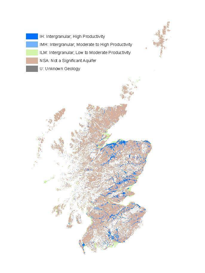
15 GWB Scotland (superficial)
16 Summary GWBs in UK are practical management units based on CIS guidance hydrogeological GWB currently being reviewed and updated based on improved data and feedback from RBC1 Greater consideration being given to third dimension but remains challenging Outcome must be fit for purpose and lead to better management Greater consistency with other GW and geology datasets
17 Further information - UK (and ROI) guidance on WFD implementation
18
19 Scotland/NI rules GWB for both bedrock and superficial material based on DigMap-50 To be subsequently subdivided by SEPA using catchment and pressures criteria. Superficials approach Used BGS productivity map simplified (size exclusion, narrow strips) Low permeability material was removed from map Moderate and high used Polygons removed with areas <1 km 2 Polygons between 0.5 and 1 km 2 which lie closer than 100 m from larger polygons added back in: Stringer < 25 m width removed Deposits < 3 m thick were removed The resulting data are taken to represent significant superficial aquifer deposits which have areas generally in excess of 1 km 2. Midland Valley Coalfields divided as follows: Areas subdivided by main faults, particularly where SEPA groundwater level information suggests hydraulic separation. Futher structural information (e.g. anticlines) used to subdivide central and Fife Coalfields Dykes used to subdivide Central Coalfield area. Main Bedrock bodies Boundaries taken where productivity changes. Inliers and outliers occur these were incorporated into the surrounding groundwater body, unless they were deemed large and hydraulically significant enough to form a separate body.
20 Clarification of definitions Zone Role Terminology Water in unsaturated zone Pore water above the water table. Protect as a vertical pathway to groundwater. Pore water in low permeability deposits. The concept of the zone of saturation is not relevant in these deposits as it is usually not feasible to define a water table where lateral percolation is impeded. The main role of these strata is as a protecting layer for groundwater. Pore water Water in saturation zone Groundwater has a value as a lateral or vertical pathway to other receptors. May be usable, but only for local supplies <10m 3 /day. Groundwater is part of an aquifer and is a receptor as a long term resource that can be exploited for human activities or support surface flows & ecosystems. Groundwater in strata overlying or underlying groundwater bodies Groundwater in a groundwater body Groundwater which has neither pathway nor resource value. For example, where salinity is greater than seawater. Groundwater that is Permanently unsuitable for use
UK Technical Advisory Group on the Water Framework Directive
 UK Technical Advisory Group on the Water Framework Directive Defining & Reporting on Groundwater Bodies This Guidance Paper is a working draft defined by the UKTAG. It documents the principles to be adopted
METHODOLOGY FOR RISK CHARACTERISATION OF IRELAND S GROUNDWATER. Paper by the Working Group on Groundwater
 Water Framework Directive (WFD) River Basin District Management Systems METHODOLOGY FOR RISK CHARACTERISATION OF IRELAND S GROUNDWATER Paper by the Working Group on Groundwater Guidance document no. GW8
UK Technical Advisory Group on the Water Framework Directive
 UK Technical Advisory Group on the Water Framework Directive Derivation of Nitrate Threshold Values for Assessing Risks to Groundwater Drinking Water Resources This Guidance Paper is a working draft defined
The EU Groundwater Directive (2006) (GWD) and the Groundwater Regulations (2010)
 (GWD) and the Groundwater Regulations (2010)") The EU Groundwater Directive (2006) (GWD) and the Groundwater Regulations (2010) Donal Daly Hydrometric & Groundwater Section Environmental Protection Agency Acknowledgement: Colleagues in EPA, DEHLG and
The EU Groundwater Directive (2006) (GWD) and the Groundwater Regulations (2010) Donal Daly Hydrometric & Groundwater Section Environmental Protection Agency Acknowledgement: Colleagues in EPA, DEHLG and
6. Hydrogeological zones and groundwater resources balance baseflow map of the Czech Republic. Jiri Sima
 6. Hydrogeological zones and groundwater resources balance baseflow map of the Czech Republic Jiri Sima General content Regional hydrogeological units Groundwater resources assessment Water balancing background
Sustainability and Groundwater
 Sustainability and Groundwater Implications of Implementation of the EU Water Framework (2000) and Groundwater (2006) Directives Donal Daly, Hydrometric and Groundwater Section, Environmental Protection
Groundwater Management GW-Body delineation/characterisation/risk assessment
 SWIM and Horizon 2020 Support Mechanism Working for a Sustainable Mediterranean, Caring for our Future Groundwater Management GW-Body delineation/characterisation/risk assessment Presented by: Johannes
Oversized quarry sumps can be used to store run-off during
 Oversized quarry sumps can be used to store run-off during large events Paved quarry yard with channels routing run-off to attenuation 3 The Hydrogeology of Quarry Dewatering Extraction below the water
Groundwater Monitoring Requirements
 WATER FRAMEWORK DIRECTIVE Groundwater Monitoring Requirements Rob Ward National Groundwater & Contaminated Land Centre Environment Agency OVERARCHING OBJECTIVES Coherent and comprehensive overview of water
Groundwater basics. Groundwater and surface water: a single resource. Pore Spaces. Simplified View
 Groundwater and surface water: a single resource Santa Cruz River, Tucson Groundwater basics Groundwater is water found within the pore spaces of geologic material beneath the surface of the Earth. It
Hydrogeology of East Anglia An Introduction
 East Land Quality Forum Hydrogeology of East Anglia An Introduction Richard Fry Ely Golf Club November 6 th 2012 1 2 Groundwater systems are complex and difficult to assess; they are based on aquifer systems
Groundwater and surface water: a single resource. Santa Cruz River, Tucson
 Groundwater and surface water: a single resource Santa Cruz River, Tucson 1942 1989 1 Groundwater basics Groundwater is water found within the pore spaces of geologic material beneath the surface of the
Appendix A9.1: Private Water Supply Supplementary Environmental Information
 Appendix A9.1: Private Water Supply Supplementary Environmental Information 1.1 Introduction SEPA objected to the planning application for the Project in their consultation response dated 19 October 2013
The SADC Hydrogeological Map & Atlas: Towards an improved understanding of groundwater regimes in Southern Africa
 The SADC Hydrogeological Map & Atlas: Towards an improved understanding of groundwater regimes in Southern Africa K. Pietersen 1, N. Kellgren 2, O. Katai 3 and M. Roos 4 (1) Water Geosciences Consulting,
III Groundwater characterization
 III 1 Introduction The particularity of the Water Framework Directive is that it does not consider groundwater only as something that can be exploited by man, it also acknowledges the important role played
11 HYDROLOGY, HYDROGEOLOGY AND DRAINAGE
 11 HYDROLOGY, HYDROGEOLOGY AND DRAINAGE 11.1 introduction 11.1.1 The objective of this section and the statements presented is to assess the existing hydrological and hydrogeological conditions to understand
Supplemental Guide II-Delineations
 Supplemental Guide II-Delineations Contents Source Water Protection Area Delineation... 1 Delineation Criteria for Systems Using Groundwater Sources... 2 Time of Travel... 4 Flow Boundaries... 4 Delineation
8 Geology, Hydrology & Hydrogeology
 Inverneill Wind Farm Scoping Report Page 42 8 Geology, Hydrology & Hydrogeology 8.1 Introduction The EIA will consider the potential issues arising from the construction, operation and decommissioning
Common Implementation Strategy for the Water Framework Directive (2000/60/EC)
") Common Implementation Strategy for the Water Framework Directive (2000/60/EC) Groundwater body characterisation - Technical report on groundwater body characterisation issues as discussed at the workshop
Common Implementation Strategy for the Water Framework Directive (2000/60/EC) Groundwater body characterisation - Technical report on groundwater body characterisation issues as discussed at the workshop
Groundwater Vulnerability National Dataset User Guide
 Groundwater Vulnerability National Dataset User Guide Version 2.0.0 1 st January 2009 Contents 1.0 Record of amendment...3 2.0 Introduction...4 2.1 Description of the Groundwater Vulnerability...4 2.2
Groundwater Surface Water Interactions and the Water Framework Directive
 Groundwater Surface Water Interactions and the Water Framework Directive ATV Foundation on Soil and Groundwater annual conference on soil and groundwater contamination, March 8-9, 2011 Dr. Mark Whiteman
D.G.S.W. Pitakumbura Manager (Groundwater Studies) Groundwater Section NWS&DB. Groundwater recharge or deep drainage or
 Groundwater Section NWS&DB. Groundwater recharge or deep drainage or") Groundwater Recharge and Extraction Techniques D.G.S.W. Pitakumbura Manager (Groundwater Studies) Groundwater Section NWS&DB What is Groundwater Recharge Groundwater recharge or deep drainage or deep percolation
Groundwater Recharge and Extraction Techniques D.G.S.W. Pitakumbura Manager (Groundwater Studies) Groundwater Section NWS&DB What is Groundwater Recharge Groundwater recharge or deep drainage or deep percolation
Water Framework Directive. Groundwater Monitoring Programme. Site Information. Knock Airport
 Water Framework Directive Groundwater Monitoring Programme Site Information Knock Airport ImagePath1: Knock Airport\KnockAirport_A_Site_s.jp g This site is a disused sand and gravel quarry in which rainwater
UK Technical Advisory Group on the Water Framework Directive
 UK Technical Advisory Group on the Water Framework Directive Paper 11b(i) Groundwater Chemical Classification for the purposes of the Water Framework Directive and the Groundwater Daughter Directive. This
Charleville WS (BH 3)
") Water Framework Directive Groundwater Monitoring Programme Site Information Charleville WS (BH 3) ImagePath1: Charleville WS (BH 3)\04-008 (a) p.hse_(800_x_600).jpg Charleville WS (BH-3) is a borehole
Water Framework Directive Groundwater Monitoring Programme Site Information Charleville WS (BH 3) ImagePath1: Charleville WS (BH 3)\04-008 (a) p.hse_(800_x_600).jpg Charleville WS (BH-3) is a borehole
Hydrogeology of Prince Edward Island
 Hydrogeology of Prince Edward Island General Characteristics and Groundwater on Prince Edward Island General Characteristics and Key Issues Issues PEI Dept. of Environment, Energy and Forestry 9/29/2009
Water Framework Directive. Groundwater Monitoring Programme. Site Information. Sillogue Well
 Water Framework Directive Groundwater Monitoring Programme Site Information Sillogue Well ImagePath1: Sillogue Well\IE_SH_G_19_014_a_Sampli nglocation.jpg Sillogue Well is a large spring that contributes
Hot Sedimentary Aquifer Heat in Scotland the Guardbridge (Fife) Project
 Project") Hot Sedimentary Aquifer Heat in Scotland the Guardbridge (Fife) Project Dr Ruth Robinson Department of Earth & Environmental Sciences University of St Andrews Phil Townsend (TRE Ltd), Paul Steen (Ramboll
Hot Sedimentary Aquifer Heat in Scotland the Guardbridge (Fife) Project Dr Ruth Robinson Department of Earth & Environmental Sciences University of St Andrews Phil Townsend (TRE Ltd), Paul Steen (Ramboll
A Primer on Groundwater
 Anderson, 2007 A Primer on Groundwater Brian Smerdon, Alberta Geological Survey North Saskatchewan Watershed Alliance Groundwater Forum, 27 February 2019 Groundwater: Part of the water cycle Barker et
G r o u n d w a t e r
 Groundwater is an important natural resource in terms of both water supply and water quality. Groundwater provides approximately 26 per cent of the total drinking water supplied in Ireland. There were
Hydrogeology 101 3/7/2011
 Hydrogeology 101 W. Richard Laton, Ph.D., PG, CPG Associate Professor of Hydrogeology California State University, Fullerton Department of Geological Sciences 1 Hydrogeology 101 The objective is to obtain
Glanworth PWS (Dunmahon BH)
") Water Framework Directive Groundwater Monitoring Programme Site Information Glanworth PWS (Dunmahon BH) ImagePath1: Glanworth PWS (Dunmahon BH)\IE_SW_G_025_04_016_A_( 800_x_600).jpg Glanworth PWS (Dunmahon
Water Framework Directive Groundwater Monitoring Programme Site Information Glanworth PWS (Dunmahon BH) ImagePath1: Glanworth PWS (Dunmahon BH)\IE_SW_G_025_04_016_A_( 800_x_600).jpg Glanworth PWS (Dunmahon
Groundwater Training Course SOPAC, April Island Groundwater Resources
 Groundwater Training Course SOPAC, April 2005 Island Groundwater Resources Outline of Presentation Freshwater resources of islands Water use Factors affecting freshwater resources Water resource management
Issue Record. Revision Change Overview Reason for Change Date. Prepared By: Sarah Longstaff MSc Environmental Engineer.
 Phase I Land off Back Lane Dishforth David Holmes Properties Ltd Clint Harrogate HG3 3DR Sarah Longstaff BSc MSc Neil Taylor BSc CEng MIStructE MICE 10th December 2015 B20946/Phase 1 Issue Record Job Number:
Groundwater. Groundwater Movement. Groundwater Movement Recharge: the infiltration of water into any subsurface formation.
 On March 22, 2014, a major landslide occurred near Oso, Washington. Death toll currently at 30, with 15 still missing. Groundwater Before and After Swipe http://bit.ly/pen1jt N. Fork Stillaguamish River
8 Geology, Hydrology, Hydrogeology
 Camster II Wind Farm Scoping Report 50 8 Geology, Hydrology, Hydrogeology 8.1 Introduction The EIA will consider the potential issues arising from the construction, operation and decommissioning of the
Cullohill GWS (Toberboe Spring)
") Water Framework Directive Groundwater Monitoring Programme Site Information Cullohill GWS (Toberboe Spring) ImagePath1: Cullohill GWS (Toberboe Spring)\IE_SE_G_059_11_004_A _(800_x_600).jpg Cullohill GWS
Water Framework Directive Groundwater Monitoring Programme Site Information Cullohill GWS (Toberboe Spring) ImagePath1: Cullohill GWS (Toberboe Spring)\IE_SE_G_059_11_004_A _(800_x_600).jpg Cullohill GWS
Water Framework Directive (WFD) River Basin District Management Systems. Interim Report of Working Group on Groundwater
 River Basin District Management Systems. Interim Report of Working Group on Groundwater") Water Framework Directive (WFD) River Basin District Management Systems Technical Requirements for Groundwater and Related Aspects Interim Report of Working Group on Groundwater September 2001 Contents
Water Framework Directive (WFD) River Basin District Management Systems Technical Requirements for Groundwater and Related Aspects Interim Report of Working Group on Groundwater September 2001 Contents
STEP-BY-STEP MONITORING METHODOLOGY FOR
 STEP-BY-STEP MONITORING METHODOLOGY FOR INDICATOR 6.5.2 PROPORTION OF TRANSBOUNDARY BASIN AREA WITH AN OPERATIONAL ARRANGEMENT FOR WATER COOPERATION 1. MONITORING CONTEXT 1.1 INTRODUCTION OF THE INDICATOR
OUTLINE OF PRESENTATION
 GROUNDWATER?? OUTLINE OF PRESENTATION What is groundwater? Geologic investigation Definitions: aquifer and aquitard, unconfined and semi-confined Water level and interpretation of water level data Well
INTERNATIONAL JOURNAL OF ENVIRONMENTAL SCIENCES Volume 2, No 3, Copyright 2010 All rights reserved Integrated Publishing Association
 INTERNATIONAL JOURNAL OF ENVIRONMENTAL SCIENCES Volume 2, No 3, 2012 Copyright 2010 All rights reserved Integrated Publishing Association Research article ISSN 0976 4402 Preliminary assessment of optimum
Robert George, P.Geol, Water Policy Branch, Alberta Environment April, Groundwater Classification Overview WATERTECH 2009
 Robert George, P.Geol, Water Policy Branch, Alberta Environment April, 2009 Groundwater Classification Overview WATERTECH 2009 OUTLINE Aquifer Characterization and Classification Groundwater System Policy
Water Framework Directive. Groundwater Monitoring Programme. Site Information. Cregduff Spring
 Water Framework Directive Groundwater Monitoring Programme Site Information Cregduff Spring ImagePath1: Cregduff Spring\IE_WE_G_16_007_a_Spri ng.jpg Cregduff is a spring that is used for a group water
Whitegate PWS (Dower Spring)
") Water Framework Directive Groundwater Monitoring Programme Site Information Whitegate PWS (Dower ) ImagePath1: Whitegate PWS (Dower )\04-026 (b)_(800_x_600).jpg Whitegate PWS (Dower ) is a spring used
Water Framework Directive Groundwater Monitoring Programme Site Information Whitegate PWS (Dower ) ImagePath1: Whitegate PWS (Dower )\04-026 (b)_(800_x_600).jpg Whitegate PWS (Dower ) is a spring used
Water Framework Directive. Groundwater Monitoring Programme. Site Information. Athlacca
 Water Framework Directive Groundwater Monitoring Programme Site Information Athlacca ImagePath1: Athlacca\Athlacca 1_(800_x_600).jpg Athlacca PWS is situated in a Regional Fissured (Rf) Aquifer. The source
Water Framework Directive. Groundwater Monitoring Programme. Site Information. Ahascragh PS
 Water Framework Directive Groundwater Monitoring Programme Site Information PS ImagePath1: PS\Ahascgarg_site_entry_a_(800 _x_600).jpg is a single spring that serves the PWS. The average abstraction rate
Science Olympiad. Mentor Invitational Hydrogeology ANSWER KEY. Name(s): School Name: Point Totals
: School Name: Point Totals") Science Olympiad Mentor Invitational Hydrogeology ANSWER KEY Team Number: Raw Score: Rank: Name(s): School Name: Point Totals Possible Part 1: Groundwater Concepts and Vocabulary 30 Part 2: The Hydrogeology
Science Olympiad Mentor Invitational Hydrogeology ANSWER KEY Team Number: Raw Score: Rank: Name(s): School Name: Point Totals Possible Part 1: Groundwater Concepts and Vocabulary 30 Part 2: The Hydrogeology
Water Framework Directive. Groundwater Monitoring Programme. Site Information. Kinvara Springs
 Water Framework Directive Groundwater Monitoring Programme Site Information Kinvara Springs ImagePath1: Kinvara Springs\IE_WE_G_07_015_a_Sp ring.jpg Kinvara Springs is a set of springs in the intertidal
Water Framework Directive. Groundwater Monitoring Programme. Site Information. New Inn
 Water Framework Directive Groundwater Monitoring Programme Site Information New Inn ImagePath1: New Inn\New_Inn_pump_house_a_(8 00_x_600).jpg The water sampled at New Inn represents pumping from 4 different
General Groundwater Concepts
 General Groundwater Concepts Hydrologic Cycle All water on the surface of the earth and underground are part of the hydrologic cycle (Figure 1), driven by natural processes that constantly transform water
Groundwater Guidance. Document number: IC 141 Version: FINAL Date: 04-Nov-2008
 Groundwater Guidance Document number: IC 141 Version: FINAL Date: 04-Nov-2008 Table of content 1. Task Group Groundwater and Scope of the Guidance 4 1.1.ICPDR Task Group Groundwater 4 1.2.Danube River
Water Framework Directive. Groundwater Monitoring Programme. Site Information. Lanesboro - ESB
 Water Framework Directive Groundwater Monitoring Programme Site Information Lanesboro - ESB ImagePath1: Lanesboro - ESB\Laneboro Borehole.jpg Lanesboro ESB is a borehole that is part of the Lanesboro public
European legislation on CO 2 Geological Storage. Sergio Persoglia. ! OGS Board of Directors! CO2GeoNet Secretary General
 European legislation on CO 2 Geological Storage Sergio Persoglia! OGS Board of Directors! CO2GeoNet Secretary General Directive 2009/31/EC (23 April 2009) on the geological storage of carbon dioxide! Legal
Groundwater Occurrence & Movement: An Introductory Discussion with Application to Northeastern Illinois
 Groundwater Occurrence & Movement: An Introductory Discussion with Application to Northeastern Illinois H. Allen Wehrmann, P.E., Director Center for Groundwater Science Illinois State Water Survey April
Groundwater Flow Evaluation and Spatial Geochemical Analysis of the Queen City Aquifer, Texas
 Groundwater Flow Evaluation and Spatial Geochemical Analysis of the Queen City Aquifer, Texas Abstract The Queen City Aquifer is a saturated sandstone unit in the coastal plain of East Texas. The goals
For inspection purposes only.
 6 INDAVER IRELAND - Carranstown Duleek Statement of Evidence Eur.Geol Teri Hayes B.Sc M.Sc P.Geo, 1.O Experience 1.1 My name is Teri Hayes. I am a Senior Hydrogeologist and Director of White Young Green
Groundwater modelling study for sustainable water management in Town of High River. Han Sang-Yoon WaterTech, April 12, 2013
 Groundwater modelling study for sustainable water management in Town of High River Han Sang-Yoon WaterTech, April 12, 2013 Acknowledgements Town of High River: Reiley McKerracher Jasen Craigie Project
Conceptual Site Models for Environmental Investigations and Remediation
 Remediation Technology Symposium (RemTech) 2012 Conceptual Site Models for Environmental Investigations and Remediation October 18, 2012 Tai T. Wong, P.Eng. Authors and Presenter Authors: James Carss,
Water Framework Directive. Groundwater Monitoring Programme. Site Information. Carrigeen
 Water Framework Directive Groundwater Monitoring Programme Site Information Carrigeen ImagePath1: Carrigeen\Carrigeen 1_(800_x_600).jpg Carrigeen PWS is situated in a Regional Karst (Rkd) Diffuse Aquifer.
Clonaslee Borehole - Forest
 Water Framework Directive Groundwater Monitoring Programme Site Information Clonaslee Borehole - Forest ImagePath1: Clonaslee Borehole - Forest\IE_SH_G_19_002_a_Pum phouse.jpg Clonaslee (Forest) borehole
Water Framework Directive. Groundwater Monitoring Programme. Site Information. Ballygar
 Water Framework Directive Groundwater Monitoring Programme Site Information Ballygar ImagePath1: Ballygar\IE_SH_G_07_002_a_Sit e.jpg Ballygar comprises a spring which provides 600-700 m3/d to the Ballygar
Groundwater Protection in the UK: from source protection to integrated catchment planning
 Groundwater Protection in the UK: from source protection to integrated catchment planning Bob Harris Environment Agency, England and Wales National Groundwater & Contaminated Land Centre www.environment-agency.gov.uk
Changing groundwater priorities over the past 15 years
 2009 Groundwater Forum Conference Changing groundwater priorities over the past 15 years Andrew Skinner Formerly, Chair of the UK Groundwater Forum Formerly, Director at the Environment Agency Overview
Glanworth PWS (Tobermore)
") Water Framework Directive Groundwater Monitoring Programme Site Information Glanworth PWS (Tobermore) ImagePath1: Glanworth PWS (Tobermore)\IE_SW_G_082_04_ 017_B_(800_x_600).jpg Glanworth PWS (Tobermore
Water Framework Directive Groundwater Monitoring Programme Site Information Glanworth PWS (Tobermore) ImagePath1: Glanworth PWS (Tobermore)\IE_SW_G_082_04_ 017_B_(800_x_600).jpg Glanworth PWS (Tobermore
HUNGARIAN NATIONAL REPORT AND THE FOLLOWING IMPLEMENTATION OF EU WFD IN 2005
 HUNGARIAN NATIONAL REPORT AND THE FOLLOWING IMPLEMENTATION OF EU WFD IN 2005 Dr.Perger László OKTVF/ NDENW Budapest Department of River Basin Management Danube River Basin 2005. 10. 04. EU WFD report 2005
Solway-Tweed WFD aquatic monitoring strategy
 Version Comments 1.0 First released version of WFD aquatic monitoring strategy for Solway-Tweed River Basin District Solway-Tweed WFD aquatic monitoring strategy 1.0 Introduction 1.1 Solway Tweed A River
Agall Water Supply Scheme. Groundwater Source Protection Zones
 Agall Water Supply Scheme Groundwater Source Protection Zones (April 2001) Prepared by: Coran Kelly Geological Survey of Ireland In collaboration with: Offaly County Council TABLE OF CONTENTS 1 INTRODUCTION...
William Wilmot Matrix Solutions Inc. 118, Avenue S.W., Calgary, Alberta, Canada
 Hydrogeologic Assessment in Support of the Development of the Peace River Oil Sands Deposit: A Case Study Concerning a Pilot-Scale in-situ SAGD Operation William Wilmot Matrix Solutions Inc. 118, 319-2
Novel Modeling Approach to Understand the Fate of Infiltrated Water at Green Stormwater Infrastructure in Philadelphia, PA
 Novel Modeling Approach to Understand the Fate of Infiltrated Water at Green Stormwater Infrastructure in Philadelphia, PA Matt Gamache 1*, Daniel O Rourke 2, and Mark Maimone 3 1 CDM Smith, Boston, Massachusetts
Movement and Storage of Groundwater The Hydrosphere
 Movement and Storage of Groundwater The Hydrosphere The water on and in Earth s crust makes up the hydrosphere. About 97 percent of the hydrosphere is contained in the oceans. The water contained by landmasses
ENGINEERING HYDROLOGY
 ENGINEERING HYDROLOGY Prof. Rajesh Bhagat Asst. Professor Civil Engineering Department Yeshwantrao Chavan College Of Engineering Nagpur B. E. (Civil Engg.) M. Tech. (Enviro. Engg.) GCOE, Amravati VNIT,
FINN (FERMANAGH) DATA COLLATION FOR INTERREG V
 DATA COLLATION FOR INTERREG V") FINN (FERMANAGH) DATA COLLATION FOR INTERREG V NIEA 2015 CONTENTS Page number Introduction 3 WFD Status and Objectives 3 Managing Freshwater Resources In An Integrated Catchment 4 Groundwater In Integrated
FINN (FERMANAGH) DATA COLLATION FOR INTERREG V NIEA 2015 CONTENTS Page number Introduction 3 WFD Status and Objectives 3 Managing Freshwater Resources In An Integrated Catchment 4 Groundwater In Integrated
Groundwater and Fluid Filled Cables
 Groundwater and Fluid Filled Cables Jenny Thomas Groundwater Quality Technical Specialist, Thames 8 th June 2010 EDF Energy EA Joint FFC Workshop, Bidder Street, London Groundwater What is groundwater?
NUMERICAL MODELLING OF SALTWATER PLUME MOVEMENT IN A FRACTURED AQUIFER ON SUB-REGIONAL SCALE
 NUMERICAL MODELLING OF SALTWATER PLUME MOVEMENT IN A FRACTURED AQUIFER ON SUB-REGIONAL SCALE Sascha E. Oswald (Groundwater Protection and Restoration Group, University of Sheffield, United Kingdom) INTRODUCTION
Africa Groundwater Atlas
 Africa Groundwater Atlas Making African groundwater information more visible and accessible Kirsty Upton, British Geological Survey http://www.bgs.ac.uk/africagroundwateratlas/index.cfm What is the Africa
Assessment of Transboundary Aquifers in Europe (and the rest of the world)
") International Workshop on Groundwater Systems in Europe Berlin 2013 Assessment of Transboundary Aquifers in Europe (and the rest of the world) International Groundwater Resources Assessment Centre Dr Neno
International Workshop on Groundwater Systems in Europe Berlin 2013 Assessment of Transboundary Aquifers in Europe (and the rest of the world) International Groundwater Resources Assessment Centre Dr Neno
Groundwater Classification Methodology Surface Water Chemical
 River Basin Management Plans Groundwater Classification Methodology Surface Water Chemical December 2014 Groundwater Classification Methodology Surface Water Chemical December 2014 Introduction All groundwater
Groundwater Abstraction
 Groundwater Abstraction This module is designed for users proposing to drill a water borehole for the abstraction of groundwater supplies and/or to inject water into an aquifer. It contains an evaluation
UK Technical Advisory Group on the Water Framework Directive
 UK Technical Advisory roup on the Water Framework Directive aper 11b(ii) : roundwater Quantitative Classification for the purposes of the Water Framework Directive. This uidance aper documents the principles
Abstract. Introduction
 Invited Paper The modelling of saline intrusion during the construction of submerged tunnels T. Roberts', J. White, Z. Mohammed' "WJ Engineering Resources Ltd. Civil Engineering, Queen Mary and Westfield
Overview. Students will...
 Overview Students will... Understand the interaction between ground water and surface water. Observe the difference between a permeable layer and an impermeable layer in an aquifer. See how water is stored
EUROPEAN APPROACH IN ASSESSING GROUNDWATER VULNERABILITY OF THE MURÁNSKA PLANINA PLATEAU, SLOVAKIA
 EUROPEAN APPROACH IN ASSESSING GROUNDWATER VULNERABILITY OF THE MURÁNSKA PLANINA PLATEAU, SLOVAKIA P. MALÍK and J. ŠVASTA Geological Survey of Slovak Republic, Mlynska dolina 1, 817 04 Bratislava, Slovak
RISK MANAGEMENT OF A FORMER SALT STORAGE YARD
 RISK MANAGEMENT OF A FORMER SALT STORAGE YARD Robert S. Nichols, B.Sc., P.Eng. and Trent Parks, Ph.D., P.Chem. Abstract A risk management plan was developed by Matrix Solutions Inc. (Matrix) and implemented
Regulatory Method (WAT-RM-26)
") Water Use Regulatory Method (WAT-RM-26) Determination of Aquifer Properties Version: v4.0 Released: Apr 2013 Copyright and Legal Information Copyright 2013 Scottish Environment Protection Agency (SEPA).
Water Use Regulatory Method (WAT-RM-26) Determination of Aquifer Properties Version: v4.0 Released: Apr 2013 Copyright and Legal Information Copyright 2013 Scottish Environment Protection Agency (SEPA).
The Water Catchment Management Plan for the Maltese Islands
 The Water Catchment Management Plan for the Maltese Islands March 2011 The Purpose of this Document The Water Catchment Management Plan represents the most significant milestone in the implementation of
Environmental Effects of Dewatered Open Pit Mines
 Environmental Effects of Dewatered Open Pit Mines By Dr R. Jambrik Associate Professor, Head of the Department of Hydrogeology and Engineering Geology, University ofmiskolc ABSTRACT Before the initial
Cemeteries, Burials & The Water Environment Guidance Notes
 Cemeteries, Burials & The Water Environment Guidance Notes Contents Overview 3 Why is it important to protect groundwater? 4 How can cemeteries contaminate groundwater? 4 What information do NIEA require
2. Assessing the potential risk to Groundwater
 Page no: 1 of 11 1. Introduction 1.1 This document provides guidance on the protection of the water environment from cemetery developments. It is for developers and local authorities intending to expand
Effect of the Underlying Groundwater System on the Rate of Infiltration of Stormwater Infiltration Structures.
 Effect of the Underlying Groundwater System on the Rate of Infiltration of Stormwater Infiltration Structures. Presented at: Storm Water Infiltration & Groundwater Recharge A Conference on Reducing Runoff
WFD Pressures and Impacts Assessment Methodology GUIDANCE ON THE ASSESSMENT OF THE IMPACT OF GROUNDWATER ABSTRACTIONS
 WFD Pressures and Impacts Assessment Methodology GUIDANCE ON THE ASSESSMENT OF THE IMPACT OF GROUNDWATER ABSTRACTIONS Paper by the Working Group on Groundwater Guidance document no. GW5 This is a guidance
Hydrogeology of the Merti Aquifer. Impact of abstractions on drawdown of water level and salinity. Arjen Oord Jan de Leeuw (presenter)
") Hydrogeology of the Merti Aquifer Impact of abstractions on drawdown of water level and salinity Arjen Oord Jan de Leeuw (presenter) Impacts of abstractions? Abstractions have two major geo-hydrological
Hydrogeology of the Merti Aquifer Impact of abstractions on drawdown of water level and salinity Arjen Oord Jan de Leeuw (presenter) Impacts of abstractions? Abstractions have two major geo-hydrological
Advice to decision maker on coal mining project
 . Advice to decision maker on coal mining project IESC 2015-063: West Muswellbrook Project New Development Requesting agency The New South Wales Mining and Petroleum Gateway Panel Date of request 27 January
Estimating recharge in UK catchments
 Impact of Human Activity on Groundwater Dynamics (Proceedings of a symposium held during the Sixth IAHS Scientific Assembly at Maastricht, The Netherlands, July 2001). IAHS Publ. no. 269, 2001. 33 Estimating
Water Framework Directive. Groundwater Monitoring Programme. Site Information. Fermoy PWS
 Water Framework Directive Groundwater Monitoring Programme Site Information Fermoy PWS ImagePath1: Fermoy PWS\IE_SW_G_037_04_015_1.j pg Fermoy PWS is an infiltration gallery and a borehole with an abstraction
Groundwater Earth 9th Edition Chapter 17 Mass wasting: summary in haiku form Importance of groundwater Importance of groundwater
 1 2 3 4 5 6 7 8 9 10 11 Groundwater Earth 9 th Edition Chapter 17 Geology 100 Mass wasting: summary in haiku form The grass is greener over the septic system said Erma Bombeck. Importance of groundwater
13 Water Resources, Drainage and Flood Risk
 Blossom Street Replacement Environmental Statement Volume I Preface Update 2015 This replacement November 2015 Environmental Statement (hereafter referred as the November 2015 Replacement ES or this Replacement
International Groundwater Resources Assessment Centre. Towards a Methodology for Assessment of Internationally Shared Aquifers
 International Groundwater Resources Assessment Centre Towards a Methodology for Assessment of Internationally Shared Aquifers Dr Neno Kukuric Thessaloniki, 2008 Content of the presentation Introduction
FAX
 21335 Signal Hill Plaza Suite 100 Sterling, Virginia 20164 www.geotransinc.com 703-444-7000 FAX 703-444-1685 Mr. William Kutash Florida Department of Environmental Protection Waste Management Division
Interim Classification of Groundwater for the purposes of the EU Water Framework Directive
 Interim Classification of roundwater for the purposes of the EU Water Framework Directive December 2008 Introduction The EU Water Framework Directive (2000/60/EC) (WFD) establishes a framework for the