LOMR/CLOMR (MT-2) Submittal and Review Process
|
|
|
- Oscar Porter
- 6 years ago
- Views:
Transcription

1 LOMR/CLOMR (MT-2) Submittal and Review Process Bosulu Lokulutu Compass Region 6 MT2 Lead August 11, 2017
2 Overview Letter of Map Changes (LOMC) MT-2 Submittal and Review Process FEMA Process Timeline Common Issues Tips for Smooth LOMR Approval Process Compass Region 6 RSC and MT-2 Team Questions 2

3 Letter of Map Change - LOMC MT-1 = No BFE Change MT-2 = Revisions to Flood Modeling 3
4 Letter of Map Change - LOMC A Letter of Map Amendment (LOMA) is an official amendment, by letter, to an effective National Flood Insurance Program (NFIP) map. A LOMA establishes a property's location in relation to the Special Flood Hazard Area (SFHA). LOMAs are usually issued because a property has been inadvertently mapped as being in the floodplain, but is actually on natural high ground above the base flood elevation. A Letter of Map Revision (LOMR) is a document that officially revises a portion of the effective NFIP Map according to requirements and procedures outlined in Part 65 of the NFIP regulations. A LOMR allows FEMA to revise flood hazard information via a letter without physically revising and reprinting the entire FIS and map panel or panels. A Conditional Letter of Map Revision (CLOMR) is FEMA's comment on a proposed project that would, upon construction, affect the hydrologic and/or hydraulic characteristics of a flooding source and thus result in the modification of the existing flood hazards. 4
5 Letter of Map Change - LOMC Amendments: Requires submittal of MT-1 Forms Structures or legally defined parcels Not for properties in alluvial fan areas Not for properties and/or structures that have been elevated by fill placed within the regulatory floodway, channelization projects, bridge/culvert improvement projects, or other flood control improvements Does not typically involve an engineering analysis Does not involve changes in BFE, floodplain, and / or regulatory floodway Revisions: Requires submittal of MT-2 Forms Not usually lot or structure specific Typically involves hydrologic and hydraulic (H&H) analysis Does involve changes in BFE, floodplain, and/or regulatory floodway Bases on existing or as-built conditions for LOMR and proposed conditions for CLOMR 5
6 Letter of Map Change - LOMC When should a LOMR be submitted? New or More Detailed Analyses Updated hydrology Additional hydraulic Information (more cross sections, etc.) New topographic information No previous detailed study (Existing Zone A) Physical Changes Resulting in floodplain modifications Projects (bridge/culvert, channelization, levee, etc.) Physical changes (fill, grading, etc.) Natural changes (erosion, subsidence, bridge/culvert removal, etc.) Error Corrections 6
7 Letter of Map Change - LOMC When should a CLOMR be submitted? Proposed projects modifying the hydrology/hydraulics of the floodplain. Evaluate increases. Increases are determined by comparing pre-project (existing conditions) and post-project (proposed conditions) model If Encroach upon the floodway and cause an increase > 0.00 foot per 44 CFR 60.3 (d)(4) Encroach upon floodplain and cause increase >1.00 foot per 44 CFR 60.3 (c)(13) Then Projects that produce increase in BFE greater than the maximum allowed must fulfill the following requirements per 44 CFR 65.12: Alternatives analysis and feasibility Legal Notice to impacted property owner Certification that no structures impacted 7
8 MT-2 Submittal - Required Items Completed MT-2 Application Forms Hydrologic Computations Hydraulic Computations Topographic work map Annotated FIRM map Certified as-built plans or survey Endangered Species Act (CLOMRs only) Property Owner notifications for Flood Hazard Revisions (if required) Review Fee Payment 8
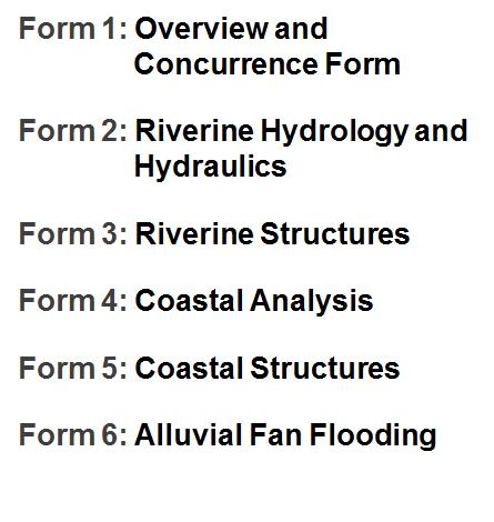
9 MT-2 Application Forms 9
10 Hydrologic Computations Digital Hydrology Models (FEMA Accepted) and All Back Up Information must be submitted FEMA Accepted Models: 10
11 Hydraulic Computations Digital Hydraulic Models (FEMA Accepted) and All Back Up Information must be submitted FEMA Accepted Models: 11

12 Topographic Work Map A topographic work map, certified (signed, stamped and dated) by a Professional Engineer that shows the labeled contours for the entire area to be revised along with the effective and revised floodplain and floodway delineations and the location of all cross-sections within the revised area. August 18,

13 Annotated FIRM An annotated FIRM map where the FIRM map has been annotated to show the area to be revised and the revised floodplain and floodway delineations along with how the revised delineation of the floodplain will tie-in to the effective delineation at the boundaries of the revised area. 13
14 Certified As-Built Plans Certified as-built plans or survey for all hydraulic structures that are new or modified since the effective model, or are being modeled using different geometry than the effective model. 14

15 Certified As-Built Plans 15
16 Endangered Species Act (CLOMRs) Visit U.S. Fish & Wildlife Service Environmental Conservation Online System (ECOS) website at Identify project location and receive an official species list (pursuant to 50 CFR ) of threatened and endangered species that should be considered when evaluating the potential impacts of a project. Obtain no effect or no take statement from the service that proposed project will not have an impact on any endangered species. 16

17 Endangered Species Act (CLOMRs) 17

18 Endangered Species Act (CLOMRs) 18

19 Review Fee Payment 19
20 MT-2 Submittal Process Mail application to the follow address: LOMC Clearinghouse 3601 Eisenhower Avenue, Suite 500 Alexandria, VA Or online submittal by visiting FEMA website at MT-2 Application Forms and Instructions can be accessed by visiting FEMA website at 20

21 MT-2 Review Process 158 Cases Currently in Review in Region Cases in Region 6 since Cases in Region 6 since Cases in Region 6 since
22 MT-2 Review Process Common items checked during initial review: Fees MT-2 Forms (including required signature) Models and backup Maps Notifications Common items checked during detailed review: Technical review of Hydrologic and Hydraulic Analyses (H&H) H&H compliance with guidelines and specifications Map and Model agreement Potential floodplain management violations 22
23 Timeline On Average, map revision takes 6 12 months to be issued Appeal Period conducted (90 days) Becomes Effective 4.5 Months after Issuance 23
24 Common Issues Community Acknowledgement - Multiple community LOMRs - Corporate Limit changes (Annexation) Missing Notifications - Increase in SFHA and/ or BFE - Floodway public notice - Regulation (CLOMR Requirements) Incorrect fees No backup data provided No As-Built provided Incorrect Effective information (Current Effective, Effective LOMR) Unaccepted models/methodology Work map not legible or missing crucial required information listed on the MT-2 Application Form 2, Section C Revised floodplain does not tie-in to effective floodplain and/ or profile 24
25 Common Issues Project built in Special Flood Hazard Areas without CLOMR and/or LOMR approval may jeopardize a community standing with the National Flood Insurance Program (NFIP). Coordination with FEMA Headquarters and Regional Office Coordinate with Floodplain Administrator on submitting no rise analysis. A deficient no rise analysis may result in violation. Violation resolution: Mitigate increase, return to previous condition, probation/suspension of community from NFIP 25
26 Tips for Smooth LOMR Approval Process Encourage the requesters prior to submit applications to: Closely review the MT-2 application instructions Provide project narrative and back-up data Conduct Internal Agreement Checks Encourage communication between MT-2 analysts and requesters via phone or to address issues that can be resolved without sending a formal letter to request additional information MT-2 analysts have to complete their review within 90 days from the date the case is assigned to them. Within those 90 days, they will either have to provide comments by sending a formal letter requesting additional data to the requester or issue the determination document to complete the case. The requester in turn has 90 days to respond to our comments. We limit our formal request for additional data to two letters 26
")
27 Tips for Smooth LOMR Approval Process We are currently working on setting up a LOMR Collaborative Commitment Processing (LCCP) pilot to expedite the review of cases that are not complex and will meet the following criteria: - Zone A - Follow-up to CLOMR - Single flooding source with partial panel(s) 27
28 Facts about Compass MT-2 Team Compass started receiving MT-2 cases on March 1, 2015 Dallas production center has 4 engineers who are fully dedicated to processing Region 6 MT-2 cases and providing support to RSC as needed. Compass MT-2 team closely shares workload across all production centers to ensure timely processing and consistent methods and high quality Summary of cases worked on by Compass between March 1, 2015 and June 30, 2017 MT-2 Reduced Time to Issuance since March

29 Questions? Presenter Contact Information: Bosulu Lokulutu, CFM MT-2 Lead Compass PTS A&E AECOM
Chapter 4. Drainage Report and Construction Drawing Submittal Requirements
 4.0 Introduction The requirements presented in this section shall be used to aid the design engineer or applicant in the preparation of drainage reports, drainage studies, and construction drawings for
Base Level Engineering Elizabeth Savage, RPML, H2O Partners Diane Howe, FEMA Region 6. May 4, 2017
 Base Level Engineering Elizabeth Savage, RPML, H2O Partners Diane Howe, FEMA Region 6 May 4, 2017 What is Base Level Engineering Measuring stick to allow FEMA to assess its current flood maps. Cursory
UNIT 5: THE NFIP FLOODPLAIN MANAGEMENT REQUIREMENTS
 UNIT 5: THE NFIP FLOODPLAIN MANAGEMENT REQUIREMENTS In this unit This unit reviews the NFIP standards for floodplain development, including: What maps, base flood elevations and other flood data must be
SECTION 11: REGULATORY FLOODWAYS
 SECTION 11: REGULATORY FLOODWAYS Contents 11.1. The Floodway... 11-2 11.1.1. The floodway concept... 11-2 11.1.2. Floodway map... 11-2 11.1.3. Floodway permitting... 11-3 11.1.4. Changing the floodway...
Basements and Crawlspaces: What s the Difference, and Who Cares?
 Basements and Crawlspaces: What s the Difference, and Who Cares? Cadastral Consulting, LLC The difference between a basement and a crawlspace seems clear by common perception of what each one is. But when
Chapter 1 General Provisions
 Chapter 1 Chapter 1 Table of Contents 1-1 Introduction... 2 1-2 Authority... 2 1-3 Jurisdiction... 2 1-4 Purpose... 2 1-5 Amendments and Revisions... 3 1-6 Review and Acceptance... 3 1-7 Interpretation...
Flood Insurance Study
 Flood Insurance Study Caddo Parish, Louisiana Kick-Off Meeting May 4, 2010 Presentation Overview Introduction FEMA Risk Map Update Levee Discussion Study Discussion Information Resources Review Contact
The following paragraphs provide a bulleted summary of the items discussed during the meeting:
 minutes Flood Insurance Study Update Meeting City of Vacaville Public Works Conference Room #2 650 Merchant Street Vacaville, California June 22, 2011 10:00 a.m. 12:00 p.m. ATTENDEES: Tim Burke, Public
Stormwater Management Studies PDS Engineering Services Division ES Policy # 3-01
 Stormwater Management Studies PDS Engineering Services Division Revised Date: 2/28/08 INTRODUCTION The City of Overland Park requires submission of a stormwater management study as part of the development
3.0 Planning and Submittal Requirements
 October 2003, Revised February 2005 Chapter 3.0, Planning and Submittal Requirements Page 1 3.0 Planning and Submittal Requirements 3.1 Drainage Studies and Drawings The City of Greenwood Village (Village)
Chapter 1. General Provisions 1.0 Introduction and Purpose 1.1 Enactment Authority 1.2 Jurisdiction 1.3 Applicability 1.4 Amendments and Revisions
 1.0 Introduction and Purpose These Criteria and design standards together with all future amendments shall be known as the Southeast Metro Stormwater Authority (SEMSWA) Stormwater Management Manual (hereafter
Ordinance No Lot Surface Drainage
 Ordinance No. 35-2008 - Lot Surface Drainage The Township has adopted a new Lot Surface Drainage Ordinance which amends Chapter 170, Article IX, Subdivision and Site Plan Review by adding a new Section
ELEVATION CERTIFICATE
 NATIONAL FLOOD INSURANCE PROGRAM ELEVATION CERTIFICATE AND INSTRUCTIONS NATIONAL FLOOD INSURANCE PROGRAM ELEVATION CERTIFICATE PAPERWORK REDUCTION ACT NOTICE Public reporting burden for the Elevation Certificate
IT TAKES A VILLAGE A HISTORY OF CTP PARTNERSHIP IN NORTH CAROLINA. ASFPM Presentation. June 21, Concurrent Session C8 (3:45-5:15pm)
") IT TAKES A VILLAGE A HISTORY OF CTP PARTNERSHIP IN NORTH CAROLINA ASFPM Presentation June 21, 2016 - Concurrent Session C8 (3:45-5:15pm) Tim Trautman, Charlotte-Mecklenburg Stormwater Services Tonda Shelton,
IT TAKES A VILLAGE A HISTORY OF CTP PARTNERSHIP IN NORTH CAROLINA ASFPM Presentation June 21, 2016 - Concurrent Session C8 (3:45-5:15pm) Tim Trautman, Charlotte-Mecklenburg Stormwater Services Tonda Shelton,
Coordinated Hazard Assessment and Mapping Program
 Coordinated Hazard Assessment and Mapping Program Mississippi River flood, 1993 A PREDICTABLE DISASTER Floods are the most common natural disaster in Illinois, accounting for well over 90% of declared
The City of North Las Vegas (CNLV) does not allow valley gutters to be constructed across streets with right-of-way widths of 80 feet or greater.
 does not allow valley gutters to be constructed across streets with right-of-way widths of 80 feet or greater.") Background The City of rth Las Vegas strives to provide the development community with adequate information to ensure the successful completion of any project in the City. To aid in the submittal of a
Background The City of rth Las Vegas strives to provide the development community with adequate information to ensure the successful completion of any project in the City. To aid in the submittal of a
Port of Camas/Washougal Levee Recertification and Engineering Analysis Request for Proposal May 3, 2011
 I. Project Summary As part of their Map Modernization Program, FEMA has initiated a countywide Flood Insurance Study (FIS) and Digital Flood Insurance Rate Map (DFIRM) for the Port of Camas/Washougal.
National Housing Trust Fund Environmental Review and Funding Requirements
 National Housing Trust Fund Environmental Review and Funding Requirements National Housing Trust Fund grants come with their own environmental review requirements that differ slightly from the Part 58
Watershed Management Ordinance DRAFT AMENDMENT
 Watershed Management Ordinance DRAFT AMENDMENT For Public Comment November 7, 2016 to March 31, 2017 Watershed Management Ordinance Effective May 1, 2014 As amended xxxx xx, 2017 [This page is intentionally
421 FLOOD PLAIN AND DRAINAGE HAZARD AREA DEVELOPMENT Lands Subject to Flood Plain and Drainage Hazard Area Standards
 ARTICLE IV: DEVELOPMENT STANDARDS IV-119 421 FLOOD PLAIN AND DRAINAGE HAZARD AREA DEVELOPMENT The county administers and enforces the State of Oregon Specialty Codes pursuant to the requirement established
JACKSON COUNTY, GEORGIA AND INCORPORATED AREAS
 Jackson County JACKSON COUNTY, GEORGIA AND INCORPORATED AREAS COMMUNITY NAME COMMUNITY NUMBER ARCADE, CITY OF 130597 BRASELTON, TOWN OF 130343 COMMERCE, CITY OF 130212 HOSCHTON, CITY OF 130344 JACKSON
Holly Swartz and Jason Shirey
 Chapter 105 General Permits for Stream and Wetland Impacts DEP Ch. 105 CONTACTS FOR BERKS COUNTY: Holly Swartz and Jason Shirey What DEP Regulates Under Chapter 105 Waters of the Commonwealth, which includes
Building Safe Structures in Flood Zones
 Building Safe Structures in Flood Zones Course Description This course is designed to fulfill professional development credits for professional engineers. It will examine the building of safe flood zone
SOLID WASTE DISPOSAL FACILITY CONSTRUCTION/DEMOLITION LANDFILL PERMIT APPLICATION PACKAGE. ADEM Form
 SOLID WASTE DISPOSAL FACILITY CONSTRUCTION/DEMOLITION LANDFILL PERMIT APPLICATION PACKAGE ADEM Form 305 8-02 1 July 10, 2002 M E M O R A N D U M TO: FROM: RE: Applicants Seeking a Permit for Solid Waste
Risk MAP in Louisiana Louisiana Floodplain Management Association. Shona Gibson, PE Risk Analysis FEMA Region VI April 29, 2010
 in Louisiana Louisiana Floodplain Management Association Shona Gibson, PE Risk Analysis FEMA Region VI April 29, 2010 Overview Paradigm Shift Vision Program Goals and Measures Project Selection Process
UPRR criteria for sizing waterway openings under bridges and through culverts are as follows:
 UNION PACIFIC RAILROAD SCOPE OF HYDROLOGIC/HYDRAULIC DESIGN ENGINEERING AND PERMITTING SERVICES FOR SIZING WATERWAY OPENINGS AT NEW AND REPLACEMENT STRICTURES These flood passage criteria were developed
STORMWATER AND EROSION CONTROL PERMIT
 STORMWATER MANAGEMENT AND EROSION CONTROL PERMIT INSTRUCTIONS AND INFORMATION Any project that involves the disturbance of ANY quantity of land requires the applicant to receive approval for the project
Marysville Levee Commission
 Marysville Levee Commission Outline CVFPP Goals & Objectives Highlights of Draft Feather River RFMP Integration between Flood Protection, Agriculture and Wildlife and Floodplain Uses Proposed Projects
Council Agenda Report
 Agenda Item # 7 Council Agenda Report SUBJECT: A RESOLUTION OF THE CITY COUNCIL OF THE CITY OF RIO VISTA APPROVING THE PRELIMINARY ENGINEERING REPORT, CONCEPT PLANS DESIGNS AND FINAL INITIAL STUDY/MITIGATED
Department of the Army Permit Application
 Department of the Army Permit Application DA File Number U.S. Army Corps of Engineers Honolulu District Date Received by CEPOH-RO Send Completed Application to: Honolulu District, U.S. Army Corps of Engineers
NOTICE DATE: May 04, Joint Public Notice U.S. Army Corps of Engineers and State of Arkansas
 US Army Corps of Engineers Memphis District FILE NUMBER: MVM-2017-400 (RDM) Public Notice NOTICE DATE: May 04, 2018 Attn: Postmaster, Please Post Until EXPIRATION DATE: June 04, 2018 Joint Public Notice
New Castle County, DE. Floodplain Regulations
 New Castle County, DE Floodplain Regulations John J. Gysling, PE CFM Department of Land Use New Castle County, DE February 26, 2009 Today s Presentation Floodplain Protection and Uses Terms and Definitions
SOLANO COUNTY, CALIFORNIA, USA AND INCORPORATED AREAS
 VOLUME 1 OF 3 SOLANO COUNTY, CALIFORNIA, USA AND INCORPORATED AREAS COMMUNITY NAME SOLANO COUNTY UNINCORPORATED AREAS COMMUNITY NUMBER 060631 CITY OF BENICIA 060368 CITY OF DIXON 060369 CITY OF FAIRFIELD
Tipton Flood Resilience Plan - Strategies for Smart Growth and Long-Term Flood Risk Reduction
 Tipton Flood Resilience Plan - Strategies for Smart Growth and Long-Term Flood Risk Reduction An Action Discovery Project as part of the Upper White River Watershed Discovery Report Presented by: Siavash
APPLICATION FOR PUBLIC INFRASTRUCTURE PERMIT
 APPLICATION FOR PUBLIC INFRASTRUCTURE PERMIT Engineering Division 550 Landa Street New Braunfels, Texas 78130 (830) 221-4020 1. Subdivision Plat Name: Location Description/ Nearest Intersection: Acreage:
THE CORPS REGULATORY AUTHORITY
 Regulatory Branch THE CORPS REGULATORY AUTHORITY THE U.S. ARMY CORPS OF ENGINEERS REGULATORY AUTHORITY IS BASED UPON 1. SECTION 10 OF THE RIVERS AND HARBORS ACT OF 1899 (RHA) AND 2. SECTION 404 OF THE
MEMO OF REVIEW FOR CORRECTNESS AND COMPLETION
 MONTEREY COUNTY WATER RESOURCES AGENCY CURTIS V WEEKS GENERAL MANAGER ------------------- MEMO OF REVIEW FOR CORRECTNESS AND COMPLETION 893 BLANCO CIRCLE SAliNAS. CA 93901-4-455 In accordance with this
Chapter 2 ADMINISTRATIVE PROCEDURES
 Chapter 2 2.01 General 2.01.1 Application of Chapter 2.01.2 Fees 2.02 Pre-Development Site Certification and Assessment 2.03 Construction Permits 2.03.1 Site Development Permit 2.03.2 Development Permits
Section 17 Flood Hazard Zone
 January 1, 2018 TOWN OF CLINTON 1701 Section 17 Flood Hazard Zone 17.1 Statutory Authorization, Findings of Fact, Purpose and Objective: 17.1.1 Statutory Authorization: The Legislature of the State of
Flood Damage Prevention Ordinance. Town of Hampton - South Carolina
 Flood Damage Prevention Ordinance Town of Hampton - South Carolina ARTICLE I GENERAL Standards 3 Section A Statutory Authorization 3 Section B Findings of Fact 3 Section C Statement of Purpose and Objectives
PAPERWORK REDUCTION ACT A. GENERAL
 U.S. DEPARTMENT OF HOMELAND SECURITY - FEDERAL EMERGENCY MANAGEMENT AGENCY RIVERINE STRUCTURES FORM O.M.B No. 1660-0016 Expires: 12/31/2010 PAPERWORK REDUCTION ACT Public reporting burden for this form
MARQUETTE COUNTY, MICHIGAN
 Marquette County MARQUETTE COUNTY, MICHIGAN (ALL JURISDICTIONS) COMMUNITY NAME COMMUNITY NUMBER COMMUNITY NAME COMMUNITY NUMBER *CHAMPION, TOWNSHIP OF 261285 * NEGAUNEE, CITY OF 261291 CHOCOLAY,CHARTER
8 NATURAL RESOURCES PROTECTION
 .1 GENERAL NATURAL RESOURCES PROTECTION.1 GENERAL.1.1 AUTHORITY AND ENACTMENT A. FLOOD DAMAGE PREVENTION The legislature of the State of South Carolina has in SC Code of Laws, Title 4, Chapters 9 (Article
Application for Commercial Plan Review and Building Permit. Address:
 City of Warrenton 200 West Booneslick Warrenton, MO 63383 : 636-456-3535 Fax: 636-456-1336 www. war r ent o n- mo.org Application for Commercial Plan Review and Building Permit PERMIT# Purpose: Commercial
Coordination of Consultants
 Coordination of Consultants Ontario Association of Architects Practice Tip PT.27 Version 1.0 May 21, 2012 2012 OAA, all rights reserved. Persons who are not members of the OAA must obtain written permission
STAFF REPORT SAUSALITO CITY COUNCIL
 STAFF REPORT SAUSALITO CITY COUNCIL MEETING DATE: June 14, 2016 AGENDA TITLE: Approving a Variance from the Elevation Requirements of the Floodplain Management Section of the Sausalito Building Code for
iswm TM Criteria Manual City of Azle Section 14 City of Azle Subdivision Ordinance DRAFT-June Chapter 1
 City of Azle Section 14 City of Azle Subdivision Ordinance DRAFT-June 2010... Chapter 1 i CITY OF AZLE iswm CRITERIA MANUAL FOR SITE DEVELOPMENT AND CONSTRUCTION Incorporating the Regional NCTCOG Integrated
Floodplain Determination
 Field Inspections Floodplain Determination Posted Permit and Signoff Card Permit Types of Flood Proofing Elevation of grade Flood walls and Levees Dry Flood Proofing Wet Flood Proofing FEMA NFIP Regulation;
SUBSTANTIAL IMPROVEMENT
 SUBSTANTIAL IMPROVEMENT General Discussion The following discussion addresses several of the issues surrounding the NFIP regulations concerning substantial improvement and substantial damage. The attached
Freight Street Development Strategy
 Freight Street Development Strategy Appendix B: Naugatuck River Floodplain Analysis Freight Street Development Strategy DECEMBER 2017 Page B-1 1.0 NAUGATUCK RIVER FLOODPLAIN AT FREIGHT STREET 1.1 Watershed
WASHINGTON COUNTY FLOODPLAIN MANAGEMENT ORDINANCE
 WASHINGTON COUNTY FLOODPLAIN MANAGEMENT ORDINANCE Adopted May 27, 1992 Revision 1 October 19, 2004, effective November 1, 2004 i Table of Contents ARTICLE I PURPOSE AND GENERAL PROVISIONS...II SECTION
DLCD ACKNOWLEDGMENT or DEADLINE TO APPEAL: Monday, November 15, 2010
 Oregon Theodore R KjibngDski, Governor Department of Land Conservation and Development 635 Capitol Street, Suite 150 Salem, OR 97301-2540 (503) 373-0050 Fax (503) 378-5518 www. lcd.state.or.us NOTICE OF
PRESENTATION FOR THE POTENTIAL ADDITION OF SPECIAL FLOOD HAZARD AREAS
 PRESENTATION FOR THE POTENTIAL ADDITION OF SPECIAL FLOOD HAZARD AREAS 1 255 255 255 237 237 237 217 217 217 200 200 200 Part 1: Summary of Floodplain Analysis for Los 0 Angeles 163 131 River239 110 112
Commercial Remodel Permit
 Commercial Remodel Permit Zoning requirements Staff recommends always verifying the zoning requirements for your project before deciding to build. Warrensburg has eleven separate zoning districts, each
Memo to All Licensed Professionals Regarding Requirements for Site Plans & Surveys
 Information and Application Instructions: This application must be completed and submitted in ink or typewritten and submitted together with one original survey or site plan, two complete sets of plans
Division of Surface Water Environmental Mitigation & Special Permitting Section
 GUIDANCE FOR SECTION 401 WATER QUALITY CERTIFICATION AND ISOLATED WETLAND PERMITS THROUGH THE COORDINATED APPLICATION PROCESS FOR SURFACE COAL MINE SITES Division of Surface Water Environmental Mitigation
FLOODPLAIN DEVELOPMENT AND BUILDING ORDINANCE
 Town of Rye 10 Central Road Rye, NH 03870-0429 FLOODPLAIN DEVELOPMENT AND BUILDING ORDINANCE Item I. Definitions of Terms Item II. Permit Requirement Item III. Building Safety Review Item IV. Sanitary
ILLINOIS HOUSING DEVELOPMENT AUTHORITY STANDARDS FOR ENVIRONMENTAL REVIEWS AND PROFESSIONALS
 ILLINOIS HOUSING DEVELOPMENT AUTHORITY STANDARDS FOR ENVIRONMENTAL REVIEWS AND PROFESSIONALS November 2015 As part of the Application for Multifamily Financing, the Illinois Housing Development Authority
Practical Needs and Approaches for Water Resources Adaptation to Climate Uncertainty
 Practical Needs and Approaches for Water Resources Adaptation to Climate Uncertainty Rolf Olsen, PhD Senior Lead, Climate Change Institute for Water Resources U.S. Army Corps of Engineers Alexandria, Virginia
Greg Wilson FEMA Building Science Rebecca Quinn, CFM RCQuinn Consulting, Inc.
 Overview of Training Flood Provisions of the 2012 International Residential Code Greg Wilson FEMA Building Science Gregory.Wilson2@fema.dhs.gov Rebecca Quinn, CFM RCQuinn Consulting, Inc. rcquinn@earthlink.net
NRI/FSD and FOREST CONSERVATION EXEMPTION SUBMISSION REQUIREMENTS
 Detailed description of the submission requirements for the NRI/FSD and forest conservation exemption requests may be found in the MNCPPC Trees Technical Manual. The applicant, applicant s agent, or qualified
SKAGIT COUNTY PLANNING AND DEVELOPMENT SERVICES FINDINGS OF FACT. APPLICATION NUMBER: Shoreline Substantial Development Application PL
 SKAGIT COUNTY PLANNING AND DEVELOPMENT SERVICES FINDINGS OF FACT HEARING AUTHORITY: Skagit County Hearing Examiner HEARING DATE: April 24, 2013 APPLICATION NUMBER: Shoreline Substantial Development Application
Public Notice. Public Notice No. Date: Closing Date: US Army Corps LRL mad 6 Apr May 2018 of Engineers Louisville District
 Public Notice Public Notice No. Date: Closing Date: US Army Corps LRL-2016-1083-mad 6 Apr 2018 7 May 2018 of Engineers Louisville District Please address all comments and inquiries to: U.S. Army Corps
OGLE COUNTY, ILLINOIS AND INCORPORATED AREAS
 OGLE COUNTY, ILLINOIS AND INCORPORATED AREAS COMMUNITY NAME COMMUNITY NUMBER Ogle County ADELINE, VILLAGE OF 170835 BYRON, CITY OF 170526 *CRESTON, VILLAGE OF 171289 *DAVIS JUNCTION, VILLAGE OF 171076
6409(a) Modification Wireless Zoning Clearance Application
 Modification Wireless Zoning Clearance Application") County of Ventura Resource Management Agency Planning Division 800 S. Victoria Avenue, Ventura, CA 93009-1740 (805) 654-2488 plan.counter@ventura.org Applicant s Name: Phone: Cell: Email: Applicant s Address:
County of Ventura Resource Management Agency Planning Division 800 S. Victoria Avenue, Ventura, CA 93009-1740 (805) 654-2488 plan.counter@ventura.org Applicant s Name: Phone: Cell: Email: Applicant s Address:
An Opening Argument: The Controversy Over Floodshields & the Protection of Glass Storefronts & Curtain Walls
 An Opening Argument: The Controversy Over Floodshields & the Protection of Glass Storefronts & Curtain Walls James P Colgate AIA, Esq, CFM Bryan Cave LLP Partner, Land Use Team Real Estate Client Service
ORDINANCE NO. 896 MUNICIPAL FLOODPLAIN DAMAGE PREVENTION ORDINANCE
 ORDINANCE NO. 896 MUNICIPAL FLOODPLAIN DAMAGE PREVENTION ORDINANCE AN ORDINANCE TO REPLACE ORDINANCE NUMBER 889 IN ITS ENTIRETY ADOPTED PURSUANT TO TENNESSEE CODE ANNOTATATED SECTION 6-19-101 FOR THE PURPOSE
MEMORANDUM OF UNDERSTANDING Between UNITED STATES ARMY CORPS OF ENGINEERS And BNSF RAILWAY COMPANY
 MEMORANDUM OF UNDERSTANDING Between UNITED STATES ARMY CORPS OF ENGINEERS And BNSF RAILWAY COMPANY I. Purpose The purpose of this Memorandum of Understanding (MOU) is to establish communication protocols
DAWSON COUNTY, GEORGIA
 DAWSON COUNTY, GEORGIA AND INCORPORATED AREAS Dawson County COMMUNITY NAME COMMUNITY NUMBER DAWSON COUNTY 130304 (UNINCORPORATED AREAS) DAWSONVILLE, CITY OF 130064 SEPTEMBER 26, 2008 FLOOD INSURANCE STUDY
CATOOSA COUNTY, GEORGIA
 CATOOSA COUNTY, GEORGIA AND INCORPORATED AREAS Catoosa County Community Name Community Number Catoosa County 130028 (Unincorporated Areas) Fort Oglethorpe, City of 130248 Ringgold, City of 130029 Effective:
Public Notice. Applicant: City of Dallas Project No.: SWF Date: April 18, Name: Chandler Peter Phone Number:
 Public Notice Applicant: City of Dallas Project No.: SWF- 2014-00151 Date: April 18, 2014 The purpose of this public notice is to inform you of a proposal for work in which you might be interested. It
SECTION 6: MITIGATION STRATEGY
 SECTION 6: MITIGATION STRATEGY This section describes the process by which the Lehigh Valley Steering Committee and municipal planning partnership performed the update to the county and local mitigation
Public Notice. Applicant: Lennar Homes Project No.: SWF Date: October 29, Name: Mr. Darvin Messer Phone Number:
 Public Notice Applicant: Lennar Homes Project No.: SWF-2013-00265 Date: October 29, 2013 The purpose of this public notice is to inform you of a proposal for work in which you might be interested. It is
Part B Guidelines for the Preparation of a Natural Resource Inventory
 Part B Guidelines for the Preparation of a Natural Resource Inventory 1.0 INTRODUCTION A Natural Resources Inventory (NRI), as defined in Subtitles 24 and 27 is: A plan map and supporting documentation
FOOTING DRAIN DISCONNECTION PROGRAM GUIDELINES
 FOOTING DRAIN DISCONNECTION PROGRAM GUIDELINES In September of 2010, the City of Grand Rapids amended its Sewage Disposal System Ordinance by adopting an Article entitled, Footing Drain Disconnection Program
APPENDIX A. NEPA Assessment Checklist
 APPENDI A NEPA Assessment Checklist NEPA CHECKLIST DATE: January 12, 2009 PREPARER: Frederick Wells, RLA PIN and Project Title: Surplus Property Request Wilder Balter Partners Marketplace Town of Newburgh,
TIFT COUNTY, GEORGIA AND INCORPORATED AREAS. Tift County. Revised: September 29, 2010 FLOOD INSURANCE STUDY NUMBER 13277CV000A
 TIFT COUNTY, GEORGIA AND INCORPORATED AREAS Community Name Community Number Tift County OMEGA, CITY OF 130552 TIFT COUNTY (UNINCORPORATED AREAS) 130404 TIFTON, CITY OF 130171 TY TY, CITY OF 130172 Revised:
TxDOT Houston District Permit Requirements (Information contained herein is subject to change)
") Houston District Permit Requirements (Information contained herein is subject to change) Access Driveway for Commercial / Industrial Developments; or Street Tie-In / Drainage-Only 1) Complete the three
Houston District Permit Requirements (Information contained herein is subject to change) Access Driveway for Commercial / Industrial Developments; or Street Tie-In / Drainage-Only 1) Complete the three
POND SITING REPORT TABLE OF CONTENTS LIST OF TABLES LIST OF FIGURES EXECUTIVE SUMMARY SECTION 1.0 INTRODUCTION SECTION 2.0 PROJECT DESCRIPTION
 November, 2014 TABLE OF CONTENTS LIST OF TABLES LIST OF FIGURES EXECUTIVE SUMMARY POND SITING REPORT Summary of section 1.0 & 2.0. Specify datum used in the design calculations and the construction plans.
Florida Department of Environmental Protection
 Memorandum Florida Department of Environmental Protection To: Highlands Ranch Mitigation Bank permit application File No. 10-308703-001 From: Connie Bersok Re: May 9, 2012 status memo On May 8, Tim Rach
Carbon Creek Channel (OCFCD Facility No. B01) from upstream Intersection of Western/Orange to upstream Beach Boulevard.
 from upstream Intersection of Western/Orange to upstream Beach Boulevard.") Carbon Creek Channel (OCFCD Facility. B01) from Lead Agency: Agency: Project Director: Address: Orange County, Public Works, Infrastructure Programs, Capital Programs Sam Ali 300 N. Flower Street Santa
Carbon Creek Channel (OCFCD Facility. B01) from Lead Agency: Agency: Project Director: Address: Orange County, Public Works, Infrastructure Programs, Capital Programs Sam Ali 300 N. Flower Street Santa
DEPARTMENT OF ENVIRONMENTAL PROTECTION Bureau of Water Quality Protection. Design Criteria - Wetlands Replacement/Monitoring
 DEPARTMENT OF ENVIRONMENTAL PROTECTION Bureau of Water Quality Protection DOCUMENT NUMBER: 363-0300-001 TITLE: Design Criteria - Wetlands Replacement/Monitoring EFFECTIVE DATE: February 11, 1997 AUTHORITY:
DEPARTMENT OF ENVIRONMENTAL PROTECTION BUREAU OF MINING AND RECLAMATION. Coal Refuse Disposal - Site Selection
 DEPARTMENT OF ENVIRONMENTAL PROTECTION BUREAU OF MINING AND RECLAMATION DOCUMENT NUMBER: 563-2113-660 TITLE: Coal Refuse Disposal - Site Selection EFFECTIVE DATE: February 8, 1999 AUTHORITY: The Coal Refuse
Addition to Section 4 - Special Use Regulations
 Large-Scale Ground-Mounted Solar Photovoltaic Installations Addition to Section 4 - Special Use Regulations 4.4 Large Scale Ground-Mounted Solar Photovoltaic Installations 4.4.1 Purpose The purpose of
J O I N T P U B L I C N O T I C E
 J O I N T P U B L I C N O T I C E CHARLESTON DISTRICT, CORPS OF ENGINEERS 1949 Industrial Park Road, Room 140 Conway, South Carolina 29526 and THE S.C. DEPARTMENT OF HEALTH AND ENVIRONMENTAL CONTROL Office
RESIDENTIAL BUILDING PERMIT PROCEDURES
 RESIDENTIAL BUILDING PERMIT PROCEDURES Community Development Dept. 9220 Bonita Beach Road, Ste. 111 Bonita Springs, FL 34135 (239) 444-6150 permitting@cityofbonitaspringscd.org THREE (3) SETS OF PLANS
Property Address: Builder: Phone #: Address:
 SEPTIC NEW RESIDENTIAL CONSTRUCTION RESIDENTIAL REMODEL COMMERCIAL REMODEL NEW COMMERCIAL PLAN REVIEW RESPONSE Property Address: Builder: #: Address: REQUIRED DOCUMENTATION FOR SUBMITTALS ORDINANCE SECTION
PARISH OF ASCENSION OFFICE OF PLANNING AND DEVELOPMENT PLANNING DEPARTMENT
 PARISH OF ASCENSION OFFICE OF PLANNING AND DEVELOPMENT PLANNING DEPARTMENT APPENDIX V DRAINAGE Contents: 17-501. Purpose and Intent: 2 17-502. Plan Approval: 2 17-503. Applicability: 2 17-504. Compliance
JOINT PUBLIC NOTICE, 2014
 DEPARTMENT OF THE ARMY NEW ORLEANS DISTRICT CORPS OF ENGINEERS REGULATORY FUNCTIONS BRANCH P.O. BOX 60267 NEW ORLEANS, LA 70160 JOINT PUBLIC NOTICE, 2014 STATE OF LOUISIANA DEPARTMENT OF ENVIRONMENTAL
CARROLL COUNTY, GEORGIA
 CARROLL COUNTY, GEORGIA AND INCORPORATED AREAS Community Name Community Number BOWDON, CITY OF 130244 CARROLL COUNTY 130464 (UNINCORPORATED AREAS) CARROLLTON, CITY OF 130208 MOUNT ZION, CITY OF 130286
The following answers are provided in response to questions received.
 CARLOS PABELLON Director of Administration COUNTY OF DANE DEPARTMENT OF ADMINISTRATION PURCHASING DIVISION Room 425 City-County Building 210 Martin Luther King Jr. Blvd. Madison, WI 53703-3345 608-266-4131
PLANNED UNIT DEVELOPMENT, PLANNING APPROVAL & SUBDIVISION STAFF REPORT Date: June 4, 2015
 PLANNED UNIT DEVELOPMENT, PLANNING APPROVAL & SUBDIVISION STAFF REPORT Date: June 4, 2015 NAME SUBDIVISION NAME CC Williams Plant Subdivision CC Williams Plant Subdivision LOCATION CITY COUNCIL DISTRICT
USING GENETIC ALGORITHMS TO CALCULATE FLOODWAY STATIONS WITH HEC-RAS. Thesis. Submitted to. The School of Engineering of the UNIVERSITY OF DAYTON
 USING GENETIC ALGORITHMS TO CALCULATE FLOODWAY STATIONS WITH HEC-RAS Thesis Submitted to The School of Engineering of the UNIVERSITY OF DAYTON In Partial Fulfillment of the Requirements for The Degree
Protecting Building Utilities From Flood Damage
 Protecting Building Utilities From Flood Damage Principles and Practices for the Design and Construction of Flood Resistant Building Utility Systems FEMA P-348, Edition 1 / FEMA IMPORTANT If you ordered
NEW CASTLE CONSERVATION DISTRICT. through. (Name of Municipality) PLAN REVIEW APPLICATION DRAINAGE, STORMWATER MANAGEMENT, EROSION & SEDIMENT CONTROL
 PLAN REVIEW APPLICATION DRAINAGE, STORMWATER MANAGEMENT, EROSION & SEDIMENT CONTROL") NEW CASTLE CONSERVATION DISTRICT through (Name of Municipality) PLAN REVIEW APPLICATION DRAINAGE, STORMWATER MANAGEMENT, EROSION & SEDIMENT CONTROL Office use only: Received by Municipality: Received by
NEW CASTLE CONSERVATION DISTRICT through (Name of Municipality) PLAN REVIEW APPLICATION DRAINAGE, STORMWATER MANAGEMENT, EROSION & SEDIMENT CONTROL Office use only: Received by Municipality: Received by
ELEVATION CERTIFICATE
 ELEVATION CERTIFICATE u.s. DEPARTMENT OF HOMELAND SECURITY Federal Emergency Management Agency National Flood Insurance Program Important Read the instructions on pages 1-8. OMB No. 1660-0008 Expires Februarv
Modeling a Complex Hydraulic Environment Using a 1-D Approach Supplemented with Simple 2-D Principles Manas Borah Ed Dickson June 5, 2014
 ASFPM 2014 Annual Conference Modeling a Complex Hydraulic Environment Using a 1-D Approach Supplemented with Simple 2-D Principles Manas Borah Ed Dickson June 5, 2014 Agenda Overview and Background Hydrology
ABC S OF FRESHWATER WETLAND DESIGN: CONCEPT TO CONSTRUCTION
 ABC S OF FRESHWATER WETLAND DESIGN: CONCEPT TO CONSTRUCTION Michael Mak, P.E. (Design Engineer) Karen Appell, P.E., C.P.E.S.C. (Project Manager) Christopher Benosky, P.E., C.F.M (Engineer of Record) August
Railyard Enterprise Project (REP) Supplemental Scoping
 Supplemental Scoping") FINAL SCOPE OF WORK DATE: November 11, 2016 PROJECT: PROJECT DESCRIPTION Railyard Enterprise Project (REP) Supplemental Scoping The City of Burlington and VTrans would like to further evaluate the REP
FINAL SCOPE OF WORK DATE: November 11, 2016 PROJECT: PROJECT DESCRIPTION Railyard Enterprise Project (REP) Supplemental Scoping The City of Burlington and VTrans would like to further evaluate the REP